On-board Data Analysis and Real-time Information System (ODARIS) - DLR
←
→
Page content transcription
If your browser does not render page correctly, please read the page content below
Space Operations and Astronaut Training
Portfolio: ODARIS

          On-board Data Analysis and Real-time
          Information System (ODARIS)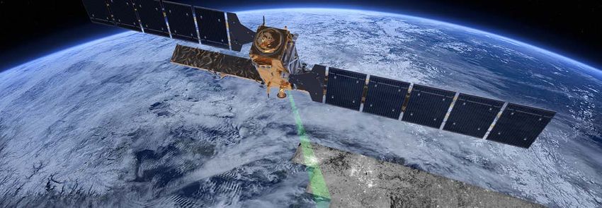
Space Operations and Astronaut Training
                               Portfolio: ODARIS

Page 2          2021-03-05_RB_SP_ODARIS_v01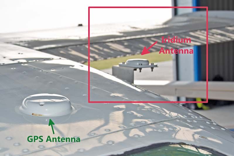
Space Operations and Astronaut Training
Portfolio: ODARIS
1. Introduction and Overview of ODARIS
On-board Data Analysis and Real-time Information
System (ODARIS)
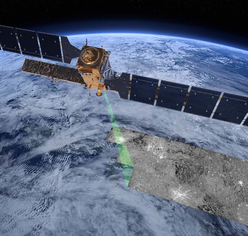
Earth observation with remote sensing technologies is essential for collecting information about our planet. It helps to understand physical
or biological processes, to forecast weather, to track changes such as climate changes or land-use changes and to monitor natural disasters
like fires, floods, landslides, etc. Nowadays, also maritime surveillance becomes more and more important. Earth observation satellite data is
a valuable source of information. With optical and radar satellite images, vessels can be detected, and Earth observation can contribute to
detect illegal maritime activities such as piracy, illegal fishery, ocean dumping or refugee transportation.
Illegal activities by moving maritime objects and natural disasters stricted to the reaction on events detected in Earth observation
require fast detection and fast reaction. However, Earth observation images. ODARIS can be used for any kind of data processing
satellite data is typically analysed long after data acquisition. Many on-board of spacecraft, for detection of anomalies of any payload
remote sensing satellites are located in Low Earth orbit with orbit or in the satellite housekeeping data. ODARIS shortens the time
periods of about 90 minutes with short contact times of about 8 between the occurrence of an event and the reaction on it. Missions
minutes with the ground station. Depending on the amount of mainly in Low Earth Orbit with non-permanent ground contact can
data, sometimes more than one pass is needed for the complete benefit from this technologies. But ODARIS can also be used on
downlink. The delay between image capture and detection of HAPS (high altitude pseudo satellites) that gained importance during
anomalies in the data can take hours or sometimes even days. recent years especially for Earth observation allowing for monitoring
For reducing the time between acquisition of data on-board and a defined region of interest continuously. In contrast to conventional
the delivering of meaningful information to a user on ground like a remote sensing missions, the ODARIS system does not rely on any
maritime safety agency, a system for on-board data analysis and direct link between ground station and Earth observation platform.
real-time information is under development at DLR. The main idea Product information can be communicated to any device on ground
is to perform data processing already on-board of satellites and to with a connection to the internet, independent of the location of
use existing satellite communication services like for example carrier platform and user.
Orbcomm or Iridium for transmission of the result to users on
ground. It also supports alarm services and user queries.
The system is called ODARIS (On-board Data Analysis and Real-time Highlights
Information System).
• On-Board Data Analysis
Earth observation is a possible application, but ODARIS is not re- • Real-Time Information System
• Processing of User Queries
Point of Contact
German Aerospace Center (DLR) Read More
Space Operations and Astronaut Training • Schwenk, Herschmann (2020) „On-Board Data Analysis and
Dr. Kurt Schwenk Real-Time Information System“, Deutscher Luft- und Raum-
Münchener Straße 20, 82234 Weßling fahrtkongress 2020
• Willburger, Schwenk, Brauchle (2020) „AMARO –
An On-Board Ship Detection and Real-Time Information
Phone: + 49 8153 28 3493 System“, Sensors
E-Mail: Kurt.Schwenk@dlr.de • Schwenk, Willburger, Risse (2019) “Space Application
Development at The On-Orbit Servicing and Autonomy Group
DLR.de/RB at the DLR”, DGLR Berichte
2021-03-05_RB_SP_ODARIS_v01 Page 1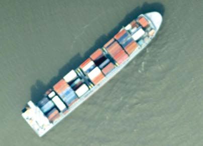
Space Operations and Astronaut Training
                                                                                                Portfolio: ODARIS

         Table of Contents
         1.       Introduction and Overview of ODARIS. . . . . . . . . . 1
         2.       Real-Time Information System. . . . . . . . . . . . . . . . . . . 3
         3.       Implementation. . . . . . . . . . . . . . . . . . . . . . . . . . . . . . . . . . . . 6
         4.       Example: The AMARO Flight Experiment. . . . . . . . 7
         5.       Way forward. . . . . . . . . . . . . . . . . . . . . . . . . . . . . . . . . . . . . . . 9

         Publisher
         German Aerospace Center (DLR)
         Spacecraft Operations and Astronaut Training
         Münchener Straße 20, 82234 Weßling

         Photos
         @ DLR CC-BY-3.0

Page 2                                                                           2020-12-09_RB_SP_ODARIS_v01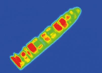
Space Operations and Astronaut Training
Portfolio: ODARIS
2. Real-Time Information System
The On-board Data Analysis and Real-time Information System ODARIS will provide information about
time-critical events within a few minutes after the image acquisition. ODARIS is a current research project at DLR.
A prototype of a real-time information system has been developed. Its main features are:
• Analysis of sensor data on-board,
• Response to user queries,
• Generation of alarms when predefined events happen.
ODARIS needs a data source as input, for example images of an Earth observation camera. Especially for
maritime surveillance also an AIS (Automatic Identification System) receiver and an AIS antenna can be
integrated as a second data source additionally to a camera. AIS is a cooperative system, primarily intended
for avoidance of collision of ships. Ships send out their identification, position, course, speed and other
traffic-relative data. The data is received by other ships and ground stations. Nowadays, also satellites can
receive AIS data.
ODARIS requires communication hardware, like an Orbcomm or Iridium modem and a corresponding antenna
to communicate with the network of communications satellites such that user queries can be received and us-
er alarms can be sent.
On-board- Hardware
Satellite
Satellite
Communication
Antenna
Modem
Camera Onboard-Computer
AIS-Receiver AIS Antenna
Fig. 2-1 Overview on the on-board components
The onboard computer computes both the data analysis and performs the request and alarm service.
2021-03-05_RB_SP_ODARIS_v01 Page 3Space Operations and Astronaut Training
Portfolio: ODARIS
1 ID Tpe Position Time AIS
EO-Platform 12 Transporter 4.99°/52.43° 13:03:57 Yes
13 Iceberg 5.33°/52.43° 13:05:43 Yes
13 Oil-Platform 5.38°/55.43° 13:05:45 No
15 Unknown Ship 4.99°/49.19° 13:52:22 No
Fig. 2-2 Images are captured and processed automatically.
Pus
2 hM
e ss
EO-Platform a geSpace Operations and Astronaut Training
Portfolio: ODARIS
Use
3 r Qu e
EO-Platform ry <
1m
in
Send me
details about
this ship
Fig. 2-4 The user requests detailed information.
Qu
4 ery
Res
EO-Platform pon
se <
1m
in
Fig. 2-5 The user receives detailed information.
Figures 2-2 - 2-5 visualize the principle and the main features of ODARIS with an exemplary application.
An Earth O bservation platform like a satellite or a HAPS captures images of an area and an on-board data
processing system detects several objects. The geographical position of the objects is stored in a database
together with other information like the time to which the position correlates, its velocity, the length, and
information about the AIS signal. A push message is sent to a user on ground via the satellite communication
network to inform about an unknown ship that does not send any AIS signal. The user sends a user query and
asks for more details about this ship and receives detailed information a few minutes later.
2021-03-05_RB_SP_ODARIS_v01 Page 5Space Operations and Astronaut Training
Portfolio: ODARIS
3. Implementation
The ODARIS software system is based on a Linux software stack and mainly programmed in C++.
Its main tasks are the execution of data analysis and the communication with the ground, like answering user
requests and sending alarm messages. The software consists of several independent working applications
(services) communicating over a database, as illustrated in Figure 3-1. Using a service based modularised
software system architecture offers two main advantages. First, high system responsiveness for communica-
tion services can be achieved, by, at the same time, providing large computing capacity for the data pro-
cessing services. Second, in case of a software failure, only the erroneous service is affected directly. The er-
roneous service can be reinstated independently, while keeping the rest of the system operable.
Service
SBD Message
Service Service
AIS Query
Database
Service Service
Ship Detect Push
Fig. 3-1 ODARIS service based modularized software architecture
At the current state, a user can query data from the system’s internal database by sending SQL requests via
e-mail over the Iridium IOT (Internet of Things) service. For the future, a user application with a user-friendly
application with a GUI (graphical user interface) is going to be developed, that can be installed and used on
mobile devices.
Page 6 2021-03-05_RB_SP_ODARIS_v01Space Operations and Astronaut Training
Portfolio: ODARIS
4. Example: The AMARO Flight Experiment
The first demonstration of the on-board data analysis and real-time information system was done within the
AMARO (autonomous real-time detection of moving maritime objects) project. During an aircraft flight
experiment campaign the prototype system was tested and its performance, especially regarding real-time
information capability, was investigated. The prototype was designed and built using commercial-off-the-shelf
hardware adequate for aircrafts. The flight experiment over the North Sea took place in April 2018.
As camera of the AMARO experiment, the instrument MACS (modular aerial camera system) of the
DLR institute of optical sensor systems in Berlin was used.
For satellite communication the Iridium service was selected. Figure Z shows the aircraft certified Iridium an-
tenna used for the flight campaign is shown.
Fig. 4-1 Figure: Cesna airplane with installed Iridium antenna.
Fig. 4-2 S hip detected by AMARO at 12th April 2018, 11:45 UTC at the mouth of the Elbe, Hamburg.
Left: RGB image, Right: Thermal Image.
2021-03-05_RB_SP_ODARIS_v01 Page 7Space Operations and Astronaut Training
Portfolio: ODARIS
Content Response
query Send information about detections 1320, 1321, 1322, 1320 Cap_2018-04-12T11:45:32.966Z CAT_
1323, 1324 and 1325. SHIP OBJ_PENDING
Split into 3 messages if needed. 1321 Cap_2018-04-12T11:45:33.964Z CAT_
SHIP OBJ_PENDING
1322 Cap_2018-04-12T11:45:34.962Z CAT_
SHIP OBJ_PENDING
1323 Cap_2018-04-12T11:45:35.960Z CAT_
SHIP OBJ_PENDING
1324 Cap_2018-04-12T11:45:36.958Z CAT_
SHIP OBJ_PENDING
1325 Cap_2018-04-12T11:45:37.956Z CAT_
SHIP OBJ_PENDING
query Send quicklook image of object 1322.
Split into 5 messages if needed.
query Send geographic coordinates of the 4 corners for the Latitude/Logitude:
datatake with captureID=
Cap_2018-04-12T11:45:33.964Z Upper left corner: 53.872534°/9.123720°
Lower left corner: 53.872793°/9.138797°
Lower right corner: 53.884518°/9.13821°
Upper right corner: 53.884363°/9.123402°
Table 4-1 Example of a query and respond during the AMARO flight experiment
With the AMARO experiment, the ODARIS system was demonstrated for the first time on an aircraft. It was
successfully demonstrated that the Iridium service can be used for message exchange. More than 84% of the
user queries were answered in less than five minutes with an average of less than two minutes.
Page 8 2021-03-05_RB_SP_ODARIS_v01Space Operations and Astronaut Training
Portfolio: ODARIS
5. Way forward
The ODARIS prototype is based on the system developed for the AMARO project. Currently, the ODARIS
system is prepared for an application and experiment for a DLR compact satellite mission in Low Earth Orbit.
DLR launched the project ScOSA (Scalable On-Board Computing for Space Avionics) where a new on-board
computer is developed. The on-board computer consists of several independent computing nodes: reliable
computing nodes (RCN), high performance nodes (HPN) and interface nodes (IN). RCNs are very similar to
classical on-board computer, using certificated space hardened hardware components. The focus is reliability
and endurance. The current version of the RCNs uses a radiation hardened LEON3 system on a chip accompa-
nied by a flash-based FPGA (field programmable gate array). The RCN offers a 50 MHz dual LEON3 processor,
a 64 MiB error correcting RAM and non-volatile memories. It is primary used for critical system management
and surveillance tasks which are less computational demanding. For execution of computationally intensive
tasks, the HPNs are used. To achieve high computing performance and keep system costs down, commer-
cial off-the-shelf hardware is used.
Part of the ODARIS software like the ship detection algorithm is already implemented and tested with the
ScOSA framework using the HPNs. Future usages on satellites will make use of this new class of on-board
computer that paves the way for image analysis and image processing tasks executed on-board of spacecraft.
2021-03-05_RB_SP_ODARIS_v01 Page 9You can also read