Oxford Canal Heritage Trail Guide - A city walk exploring the cultural and industrial heritage of the Oxford Canal
←
→
Page content transcription
If your browser does not render page correctly, please read the page content below
Oxford Canal
            Heritage Trail Guide
       A city walk exploring the cultural and
      industrial heritage of the Oxford Canal

    Take a walk on a canal in the heart of the City of Oxford
and discover a fascinating world outside of its dreaming spires!

           www.oxfordcanalheritage.org

                              ORD C
                         XF         A
                     O
                                       N
               THE

                                        AL
               H

                                    IL

                     R                  A
                E

                         IT
                              AGE TR
On the Heritage Trail
The self-guided Oxford Canal Heritage Trail        a thriving narrowboat community, canal
is a linear walk along the Oxford Canal that       locks, under ancient bridges along a green
is approximately three miles (five kms) in         corridor full of wildlife. On the trail you will
total. You can begin either in Pocket Park         learn why the canal was, and continues to
just inside Hythe Bridge near the centre of        be, so important, nationally as well as locally.
Oxford City or at Ball’s Bridge in Wolvercote      You will also find out why the canal was built,
to the north of the city. There is the option      who built it, who paid for it, and who pays
of walking past Ball’s Bridge up to Duke’s         for it now; the uses to which it was first put,
Cut to complete the whole Trail although           how its usefulness has changed overtime,
you will have to return to near Balls Bridge       how it could have been lost for ever, and the
to get back into Oxford. However, unless the       reasons for its revival.
weather is poor, take your time and, whilst        There is a large scale map of the Heritage
you are walking, imagine the bustle of life on     Trail at its start in Hythe Bridge Street
this 200 year old canal when horses pulled         (Ordnance Survey grid reference SU 508
working boats full of coal and other cargoes       064) and near the end of the trail at Ball’s
to Oxford. You can still see glimpses of the       Bridge in Wolvercote. A copy can also be
past as you walk past Victorian suburbs,           found at the back of this Trail Guide.

PAGE 3.    Location 1a: Hythe Bridge A new chapter in Oxford’s Long History
PAGE 4.    Location 1b: Hythe Bridge A thousand-year-old wharf
PAGE 5.    Location 2: Isis Lock A pivotal location in a national transport network
PAGE 6.    Location 3: Jericho Oxford’s first planned suburb
PAGE 7.    Location 4: Walton Well Bridge Past industries
PAGE 8.    Location 5: Aristotle Bridge A well, a wharf, a workhouse and a watering hole
PAGE 9.    Location 6: The Trap Grounds A preserved reserve
PAGE 10.   Location 7: St Edward’s School ‘Messing about on boats’
PAGE 11.   Location 8. Ball’s Bridge A fatal brawl
PAGE 12.   Location 9. Wolvercote Lock “Takin’ a look”
PAGE 13.   Location 10. Duke’s Cut A second connection to the River Thames
PAGE 14.   Trail Map

   Access: The towpath is level and generally well-maintained but all walkers should take
   care as it may be muddy and is rough and narrow in places. Access for people with mobility
   problems, using wheelchairs, or pushing pushchairs is available at Hythe Bridge and Balls
   Bridge but Isis Bridge (location 2) is steep and joining the Trail via Rewley Road (Location 3)
   may be better but there is a slope down to the towpath. Some exit points at bridges before
   the end of the Trail are more accessible than others.
   Transport: There is no public transport back to Oxford direct from Duke’s Cut end of
   the walk, but buses are available from near Balls Bridge in Wolvercote, and near to some of
   the exit points at bridges along the route.
   Trail Manners: Walkers have right of way but watch out for cyclists. Please respect all
   the canal’s inhabitants, whether birds, animals, or indeed humans, as we shall be passing by
   many residential boats on our way.

       Detailed information about Trail access, transport and refreshments
                  is on the website www.oxfordcanalheritage.org
                                                   2
Location 1: Hythe Bridge                                                                            AUDIO
                                                                                                     TRACK

 A new chapter in Oxford’s long history                                                              1a

  Directions 1:          Stand on the flat
  areas bounded by railings on three sides,
  where the Oxford Canal towpath meets
  Hythe Bridge Street (Ordnance Survey grid
  reference SU 508 064). Look across the road
  in a south-easterly direction towards the
  car-park and the green mound of Oxford
  Castle beyond.

The car-park you can see is built over the site of
a wharf that marked the end of the Oxford Canal
which was opened on New Year’s Day 1790 taking
over 20 years to build in stages as and when funds
                                                        Pocket Park entrance to Heritage Trail
were raised. In 1792, the Oxford Canal Company,
a group of share holders who funded the canal           In 1996 Oxford Prison closed its doors for the
project, realising that this wharf was too small        last time and, together with Castle, the building
for their needs, bought more land to the left-hand      became an audio-visual heritage attraction,‘Oxford
side of the car-park, where Nuffield College now        Castle Unlocked’, operated by Oxford Preservation
stands. This second wharf was used exclusively for      Trust. The rest of the vibrant Oxford Castle Quarter
the delivery and storage of coal, while the original    contains a hotel, restaurants, art gallery, market
wharf (buried under the car park you are looking at)    square and outdoor theatre space.
received building materials such as timber, stone,      Can you see The Duke’s Cut public house in the far
and slate, and manufactured goods such as china         right-hand corner of the car-park ? A ‘cut’ is another
and porcelain.                                          name for a canal. The pub’s name, however, is
Much of the labour needed to build this final section   deceiving because the actual Duke’s Cut is some
of the canal was supplied by convicts from the          three miles away, and marks the end of this walk.
nearby Oxford Castle Prison. The prisoners also         The pub was originally called the Queen’s Arms
built both wharves and warehouses supervised by         and dates from the early 19th century.
the prison governor Daniel Harris, a skilled engineer   In the 1930s both of the Canal Company’s wharfs,
and builder. He also designed the Company’s first       or basins, were sold to the famous Oxford car
headquarters, which still stands in New Inn Hall        manufacturer, William Morris. Nuffield College,
Street, is now part of St Peter’s College and home      one of the newest colleges that make up Oxford
                         to its Master. The 1829        University, was built on one of them, taking its name
          ORD C
       XF       A        house bears the Oxford         from the title with which Morris was honoured in
     O
                         Canal Company Cartouche
               N

                                                        1938: Lord Nuffield. The other wharf remains, for
THE

                AL

                         complete with Britannia,       the present, a City Council car-park, although the
                         the city arms, St Mary         location remains ripe for development, there is
                         the Virgin, The Radcliffe      a good prospect that parts of the Georgian canal
 H

               IL

    R             A
  E

      IT       R         Camera and a river barge
         AGE T                                          infrastructure will be restored as part of any new
                         with a mast.                   design.

      Hythe                Directions 2:         Turn to look at the MAP which shows the full
                           extent of the Oxford Canal Heritage Trail and the ten places of interest
      Bridge               which are described in this Guide.

       1                                                3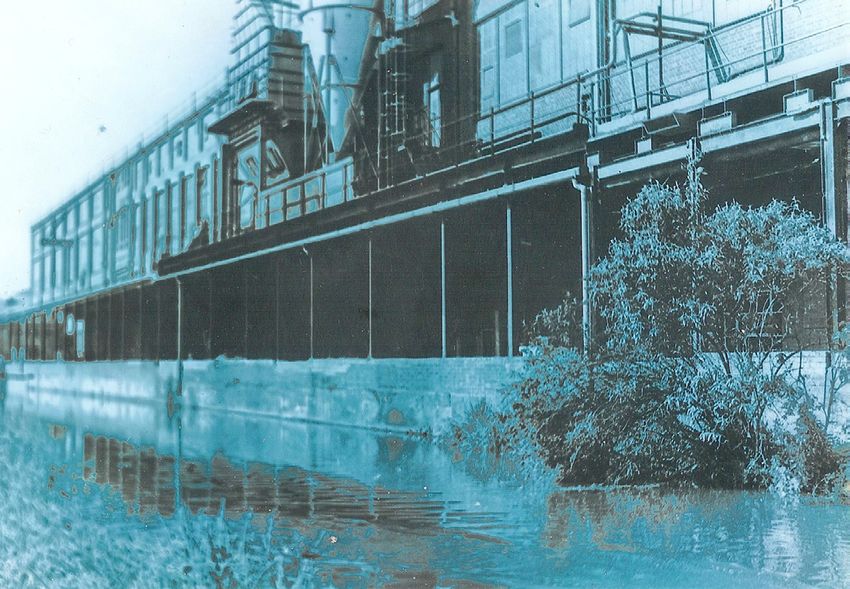
AUDIO
 Location 1: Hythe Bridge                                                                           TRACK

 A thousand-year-old wharf                                                                          1b
As you stand here at Hythe Bridge, you are looking       within the largely uneducated and self-contained
at the main entrance to the city from the west. A        community of boatpeople, many of whom could not
bridge has existed here since the beginning of the       read or write. The building on the opposite corner
thirteenth century straddling a side stream of the       of the street, where Upper Fisher Row meets Hythe
River Thames known as the Castle Mill Stream, after      Bridge Street, which now a house, was also once a
a mill that once operated next to Oxford Castle.         pub called The Running Horses. Both pub names –
The word ‘hythe’ is old English for a wharf or landing The Nag’s Head and The Running Horses – reflect
place. It’s difficult to imagine what a hive of activity the importance of horses in the days of the working
this area once was, as materials such as timber, canal boats.
slate, hay, and Cotswold stone were unloaded here The canal towpath and boats
and on the opposite bank for centuries. The stones In fact the path we are walking along is named ‘the
and timber were brought by boat to build some of towpath’ because it
the oldest colleges and houses in Oxford.                was once busy with
On the far side of Castle Stream is a long narrow         horses towing along
road called Fisher Row that runs the length of the        canal boats. We will
stream. We can see Upper Fisher Row. Fisher               soon walk past a
Row marks the edge of St Thomas’ parish, which            line of residential
historically was the home of many families whose          narrowboats. Boats
livelihoods depended on both the river and the            have been used as
canal. This parish was the heart of a busy local          permanent homes
brewing economy: Brewing not only relied on river         in Oxford since at
barges to bring in raw materials but it also used a lot   least the time of
of water, both for power and to make the beer, so the     the first national
prevalence of streams in St Thomas’ parish made           census in 1841, and
it an ideal location. Many of the streams, and all of     undoubtedly for a
the breweries, have now vanished, but from here,          long time before
looking across the Castle Mill Stream, you can see        that.                                  Residential moorings

two reminders of this brewing heritage in the two         The moorings along Hythe Bridge Arm were
public houses, one of which still stands.                 registered as residential moorings in 1989 after
For nearly two centuries The Oxford Retreat, the pub      years of campaigning by Oxford’s boat residents.
on the corner of Middle Fisher Row and Hythe Bridge       Whilst working boats and boaters have long gone,
Street, was called The Nag’s Head and it was the          the boating community continue to remind visitors
boating pub of Oxford. Under its roof countless boats     of life and work on the canal and the boats are an
were sold, deals were sealed and many men found           interesting and colourful part of Oxford life.
employment as crew or hauliers. Pubs also played
an essential role in the exchange of information –

   Directions 3:           As you begin the walk, the grass on your right is where the canal was
   cut back after the Second World War. Beyond the circular monument commemorating the
   bi-centenary of the completion of the Oxford Canal, continue with the Castle Mill Stream on
   your left and a line of residential narrowboats on your right. Beyond the boats is Worcester
   College, which formerly owned all the land down to the stream edge before selling the
   strip along which you are walking to the Canal Company in 1788. Cross the bridge and turn
   sharp right to access the lockside, minding your head on the low curve of the bottom of the
   bridge.

                                                          4
AUDIO
 Location 2: Isis Lock                                                                                           TRACK

 A pivotal location in a national transport network                                                               2
As you read earlier, the arrival of the canal in 1790
was a cause for great celebration in Oxford. But
its completion had a wider national importance
too. The canal not only linked Oxford with the
coalfields and factories of central England, but it
also connected with the River Thames here, putting
Oxford on the shortest water route between the
Midlands and London. Canalboats loaded with
coal and manufactured goods could move onto the
Thames or transfer their cargoes to Thames barges
at Oxford for the onward journey towards the capital.
Obviously a manmade canal cannot simply flow into
a river. A lock was needed to make the transition.                 Isis Bridge Picture Credit: Katherine Shock
The first lock, a simple barrier located near the last
                                                                   the Midlands with London was short-lived. The
stop by Hythe Bridge, proved inadequate, so Daniel
                                                                   Grand Junction Canal opened between London and
Harris, the prison governor, was asked to build
                                                                   Birmingham in 1805. This provided a more direct,
a replacement. He selected this location and his
                                                                   faster, and wider route, and although the Oxford
convicts had completed it by 1797.
                                                                   Canal Company continued to be profitable right
                              The Oxford Canal was one             through to the middle of the 20th century, the prime
               ORD C
          XF         A        of four original trunk canals
      O                                                            strategic importance of the Oxford Canal began to
                              which linked the Midlands
                        N

                                                                   diminish from that moment. Originally Isis Lock, or
THE

                         AL

                              with four strategic ports:           Louse Lock as it was more commonly known, was
                              London was one, and the              twice the width of the version you see today. This
 H

                              others were Liverpool (via the
                     IL

      R                  A                                         was to enable the wider barges of the river to reach
  E

          IT
               AGE TR         Trent and Mersey Rivers); Hull       the central wharves. But with the coming of the
                              (via the Humber); and Bristol        railway, the interchange between the river and canal
                              (via the Severn). For its first 15   continued to reduce, and the decision was made in
                              years the Oxford Canal was           1844 to refashion the lock chamber in order to admit
  Isis Lock                   one of the most important and

               2
                                                                   only narrowboats. The cast-iron turnover bridge
                              profitable transport routes in       was built at the same time. It bears the number 243,
                              Britain, but the Oxford’s pivotal    bridge No. 1 being at Longworth, near Coventry,
                              significance in connecting           where the canal begins.

      Directions 4: Retrace your steps under the bridge – mind your head again! To the
      left, a short detour across the footbridge which spans the Castle Mill Stream will take you
      to a wonder of Victorian engineering, a railway swing bridge installed in 1851 to take trains
      across the Sheepwash Channel, the short stream which connects the Oxford Canal with
      today’s main River Thames. The Oxford Preservation Trust is overseeing the restoration and
      conservation of this extraordinary reminder of the early railway age. If desired, the main
      Thames Path can be reached by continuing under the railway.
      To continue on the main Oxford Canal Heritage Trail, walk northwards along the narrow strip
      of land which is bordered by the Castle Mill Stream on your left and the canal on your right.
      Before the canal was built, the Stream was the main branch of the River Thames, carrying
      barges to Hythe Bridge or to the south of the city. The trees here include field maple, wild
      cherry, alder, crack willow, hawthorn, ash, and elder. Stop at the first bench, opposite the
      distinctive landmark of St Barnabas Church.

                                                                   5
AUDIO
 Location 3: Jericho                                                                                                     TRACK

 Oxford’s first planned suburb                                                                                             3
The land through which this section of canal was dug                                                           which an association
in 1789 was known as Little and Great Bear Meadows,                                                            was      formed        to
which ran all the way down to the Castle Mill Stream.                                                          campaign against the
The name must derive from the Bear Inn (in central                                                             threatened closure
Oxford), as both the pub and the fields here were                                                              of the waterway.
owned by a family called Furse in the 16th century,                                                            Virtually all freight
and it was the Reverend Peter Wellington Furse from                                                            was then transported
whom the Canal Company purchased the land. When                                                                by road or rail, but the
Furse sold all of his remaining meadowland in the                                                              canal’s supporters
1820s, a coalmerchant called Henry Ward purchased                                                              pointed to leisure
a large plot close to Worcester College, and went             St Barnabas Church Picture Credit: Valerie Petts use as a viable future
on to establish a wharf there. After Henry Ward’s             option, and were proved right. The boat-hire company
death in 1852 his sons William, Henry, and George             College Cruisers, a little farther on, perpetuates
inherited the land, and in 1868 they sold part of it to       a commercial activity for which Jericho has been a
the Oxford Canal Company and donated the rest for             focus since the 1960s.
the construction of St Barnabas Church. Henry Ward            In recent years, another famous literary figure, Philip
had also provided the funds for a floating chapel             Pullman, has been at the forefront of another well-
for boatmen on the Castle Mill Stream near Hythe              publicised campaign, this time to retain a boat-repair
Bridge. You can learn more about this unusual place           facility in Jericho. His books Northern Lights and
of worship on the website: www.oxfordcanalheritage.           Lyra’s Oxford incorporate an imaginary yet familiar
org.uk . The funds for construction of the church             Jericho, where ‘the wharves along the waterfront …
were provided by another major local philanthropist,          were bright with gleaming harness and loud with the
Thomas Combe, superintendent of the Oxford                    clop of hooves and clamour of bargaining’. Regular
University Press.                                             visitors were ‘gyptian families, who lived in canal-
The church was designed in an Italianate style by Sir         boats, came and went with the spring and autumn
Arthur Blomfield and opened in 1869. It features in           fairs, and were always good for a fight’.
Thomas Hardy’s novel Jude the Obscure. As a young             And fight is what the real boat owners of Oxford
man, Hardy had worked for Blomfield in London,                had to do, in a figurative sense, as part of a unified
and his reference in the novel to ‘the church of              resistance of boaters, Jericho residents, and St
ceremonies’ reflects St Barnabas’ importance within           Barnabas’ Church, at two Public Inquiries, in 2005 and
the Oxford Movement, which attempted to encourage             2008. Pullman had a prominent role in both Inquiries,
the Church of England to adopt more of the rituals of         eloquently expressing the hopes of all who cherish the
the Catholic faith.                                           distinctive contribution that the boatyard has made to
The poet John Betjeman, who studied in Oxford in              Jericho. As a result of this collective effort, and strong
the 1920s, was fond of Jericho, and wrote a poem              City Council planning guidelines, future plans for
inspired by the church. He was also fond of canals,           the site includes new boatyard, piazza, sports hall,
                    and on 3 June 1955 he chaired a           community centre and housing.
         ORD C
      XF       A    meeting at Oxford Town Hall at
    O
                        N
THE

                        AL

                             Directions 5: As you continue northwards, notice on the right the
 H

                             end houses on Combe Road, which provides access to College Cruisers.
                    IL

      R                 A
  E

          IT
               AGE TR        These are the setting for the deaths in ’The Dead of Jericho’, the first of
                             Oxford author Colin Dexter’s Inspector Morse mysteries to be televised.
                             On the far side of the footbridge which spans the canal there is a potted
                             history of Jericho on a sign to the right of the steps. Just beyond the
      Jericho                bridge, we say farewell to the Castle Mill Stream. Stop just before the

               3
                             bridge (No. 242) which carries Walton Well Road over the canal.

                                                          6
AUDIO
  Location 4: Walton Well and Lucy’s Ironworks                                                                              TRACK

  Past industries                                                                                                            4
In the 19th century the far bank of the canal, south                     at the junction of Walton Well Road and Longworth
of Walton Well Road, was a hub of industry. The new                      Road. If you are interested, it can be reached by
flats you can see are owned by W. Lucy & Co one of                       turning right at the top of the ramp leading up from
Oxford’s largest residential property landlords. The                     the canal. Port Meadow can be reached by turning
flats replaced a foundry that the company operated                       left.
here until 2007. It was a second major source of                         William Carter’s ironworks produced agricultural
local employment in Jericho, complementing the                           tools, pipes, girders, iron railings, man-hole covers,
Oxford University Press to the south-east. The iron                      and lamp-posts. In 1830, the foundry acquired
works date from 1825, when William Carter moved                          the name ‘Eagle Ironworks’ under his successor,
his existing foundry from Summertown to here.                            Charles Grafton. In the 1860s William Lucy took
                                                                         over the firm and it operated as W. Lucy and Co
                                                                         for over 150 years. Lucy’s was a well-known
                                                                         landmark in Jericho providing quite a spectacle of
                                                                         heat, light and steam throughout the day and night
                                                                         and continuing production as the canal’s industrial
                                                                         past slowly disappeared. Nevertheless although
                                                                         working boats no longer bring coal to a foundry,
                                                                         people in Lucy’s new flats, on residential boats and
                                                                         walking over Walton Well Bridge to Port Meadow
                                                                         ensure that the area continues to bustle with life.

Lucy’s Foundry Picture Credit: Ruth Walton

Carter undoubtedly saw the advantages of this
canalside location for transporting his goods, but
metalworking was already evident here: a William
Ward was identified as ‘a smith at Walton Well Dock’
when his son was baptised at St Giles’ Church in
1823.
Walton Well Dock was operated by Henry Ward,
who is featured in Track 3. Henry built boats here
from at least 1819, and his eldest son William
continued the business until the 1880s. This William
Ward was twice Mayor of Oxford; one of his acts
of philanthropy was to provide a drinking fountain                       Walton Well Bridge Picture Credit: Olivia Brooks

                ORD C
           XF
       O              A
                                             Directions 6: Continue under Walton Well Road Bridge (No. 242).
                          N
THE

                                             The extensive gardens of the large houses of Southmoor Road can be
                            AL

                                             seen on your right. This section of the towpath is badly eroded at the
                                             time of writing (Spring 2014), and probably too rough for wheelchair
  H

                          IL

      R                    A
                                             use, but improvements are anticipated in the near future.
   E

          IT
               AGE TR

                                             The alternative is to cross the bridge, follow Walton Well Road to
                                             Kingston Road, turn left, walk to the anchor pub and rejoin the Trail at
   Walton Well                               Aristotle Lane (Location 5). Stop just beyond the little humpbacked brick
     Bridge                                  bridge (No. 240) which carries Aristotle Lane over the canal towards

               4
                                             Port Meadow.

                                                                        7
Location 5: Aristotle Bridge                                                                                        AUDIO
                                                                                                                     TRACK

 A well, a wharf, a workhouse and a ‘watering hole’                                                                     5
Observant walkers will have noted that Aristotle
Bridge is numbered 240, and the one before, at Walton
Well Road, was numbered 242. What happened to
241? It was recorded in the Oxford Canal Company
archives as ‘the Workhouse Bridge’, and was a
wooden lift bridge of the kind we shall see later in the
walk. As the Canal Company neared the completion
of their 20-year project to bring the canal to Oxford,
money was tight, and these wooden bridges, at the
time used almost exclusively by farmers and their
workers, were much cheaper to build than fixed
ones made of brick. These lift bridges, also known
as drawbridges, are a distinctive feature of the
southern Oxford Canal.
The name ‘Workhouse Bridge’ links it with the City                                       Aristotle Bridge Picture Credit: Valerie Petts

Workhouse, established on Rats and Mice Hill (now
Wellington Square) in 1771. Until 1865 the Oxford          opened in October 1789, and very quickly the
Board of Guardians, who were responsible for the           site became a focus for other kinds of industrial
welfare of the workhouse inmates, managed a small          activity too. A boathouse was erected to the south
mixed farm on the banks of the canal, on land known        of the bridge to harbour the Canal Company’s own
as Pepper Hills. This was where the Southmoor              inspection launch in 1790, and a boat-repair yard
Road gardens that you passed now slope down to             had been established to the north of the wharf by
the water.                                                 at least 1802. St John’s College had been buying up
                                                           canal-side plots since the turn of the century. When
Aristotle Bridge is also an interesting name. It derives
                                                           it advertised a lease on the wharf in 1839, the notice
from a spring or well known as Aristotle Well, now
                                                           listed – in addition to a dwelling house and four
hidden in the cellar of the new house immediately
                                                           tenements – a covered dock, stables, workshops,
south of the bridge. It was one of several springs lying
                                                           sheds, and kilns for the making of bricks, lime, and
parallel to the course of the canal, at the bottom of a
                                                           tiles.
gravel terrace formed during the Ice Age. We have
already passed Walton Well, and Plato’s Well once Dolly’s Hut
flowed within the grounds of Worcester College, Across the road, where The Anchor public house
near our first stop.                                     now stands, there was a hostelry known as Heyfield’s
                         On the opposite side of the Hutt. It was named after William Heyfield, the landlord
                         canal, is Hayfield Wharf, who had presided over it for well over 50 years when
                         which was an important he died there at the age of 90 in 1778. Although the
                         feature of the Oxford Canal inn was renamed as The Anchor in the 1840s and
          O R D
       XF       CA
     O
                         from its earliest days. The rebuilt in the 1930s, it was universally known until
               N
THE

                  AL

                         newspaper Jackson’s Oxford quite recently as Dolly’s Hut, taking the name from
                         Journal shows that several another landlord, William Dolley, who kept the house
                         kinds of coal were available for a quarter of a century from 1852. It was a hostelry
 H

               IL

    R              A
  E

                         here when the wharf first popular with canal boatmen for 150 years.
      IT         R
         AGE T

      Aristotle             Directions 7: Continue northwards and stop by the Trap
                            Grounds noticeboard, just before the large new brick Frenchay Road
       Bridge

        5
                            bridge (No. 239A), which links new residential developments on either
                            side.

                                                           8
Location 6: Trap Grounds Local Wildlife Site                                                                       AUDIO
                                                                                                                    TRACK

 A preserved reserve                                                                                                   6
The new bridge is the modern incarnation of an
ancient right of way here which dates back to at
least medieval times. Then it was known as ‘Wycroft
Lane’, and led to a three-acre property near Port
Meadow which included Wyke Meadow. Later the
lane became known as ‘My Lady’s Way’, a probable
reference to the abbesses of Godstow, who owned
much of the land hereabouts for several hundred
years. Later it acquired the name Frog Lane, by
which it is still known today.
Frog Lane leads due west along the northern edge
of the Trap Grounds reed bed, designated as a Local
Wildlife Site. This is Oxford’s only known breeding
site for the water rail, an elusive aquatic bird, and
is also host to the largest colony of breeding reed
warblers in the city, and the county’s only recorded
population of the spider Nesticus cellulanus. There                          The Trap Grounds boardwalk Picture Credit: Diane Wilson
is also a rare colony of viviparous lizards, and        The name ‘Trap Grounds’ has been in use since
grass-snakes, glow-worms, and slow-worms. Foxes         at least 1781, when Jackson’s Oxford Journal
saunter along Frog Lane in broad daylight, and          announced the auction of ‘a Leashold Estate in
muntjac deer may be glimpsed here in the twilight       the Parish of Wolvercott, called the Trap Grounds’.
of summer evenings. Overhead in the big willows,        It was once applied to a much more extensive
tree-creepers and woodpeckers make their nests in       area on the east side of Port Meadow, and may be
spring. An area of woodland and scrubland beyond        a corruption of the designation ‘Extra Parochial’,
the reed bed was saved from development in 2006         which denoted exemption from the payment of
after a long community based campaign led by            church tithes. Or the name may record the practice
Catherine Robinson, a local historian and author,       of trapping fish and eels in channels when the river
ended in success in the House of Lords with the site    flooded across the Meadow. We shall probably
now registered as a Town Green.                         never know.

               ORD C
          XF         A
      O
                              Directions 8: As we continue north, passing under another
                        N
THE

                         AL

                              new road bridge (No. 238B, carrying Elizabeth Jennings Way) we
                              reach a wooden lift-bridge (No. 238). As mentioned, this type of hand-
                              operated bridge is a distinctive feature of the Oxford Canal. It was
 H

                     IL

      R                  A
  E

          IT                  less expensive than a stone or brick bridge, and, because economies
               AGE TR
                              were needed as the canal neared completion, the Canal Company
                              chose to build several in this style on the approach to Oxford.
                              Continue past the line of residential boats as far as the point where
      The Trap                the canal narrows to reveal the location of another former agricultural
      Grounds                 lift-bridge.

               6
                                                        9
AUDIO
 Location 7: Opposite St Edward’s School                                                                                        TRACK

 ‘Messing about on boats’                                                                                                          7
The playing fields opposite, and the grassland
between the canal and the railway, belong to St
Edward’s School. The school was opened here in
1873. One of its first pupils was Kenneth Grahame,
author of The Wind in the Willows. Grahame must
have seen horse-drawn narrowboats travelling
along this stretch of the Oxford Canal, and maybe
this inspired the scene where Toad escapes from
prison to hitch a ride on a boat: ‘Round a bend in
the canal came plodding a solitary horse, stooping
forward as if in anxious thought. From rope traces
attached to his collar stretched a long line, taut,                     St Edwards school playing fields canal side Picture Credit: Maria Parsons

but dipping with his stride, the further part of it       Talking of Kenneth Grahame, his whiskery hero
dripping pearly drops.’ Toad watches as the boat          ‘Ratty’ is no stranger to these parts. Ratty, with his
approaches ‘With a pleasant swirl of quiet water at       blunt snout, round face, and small neat ears, was not
its blunt brow, the barge slid up alongside of him,       a rat but a water vole. Along this stretch of the canal
its gaily painted gunwale level with the towing-path,     there still lives a community of these shy creatures,
its sole occupant a big stout woman wearing a linen       one of only five colonies identified in a survey of
sun-bonnet, one brawny arm laid along the tiller.’        all the waterways in Oxford in 1997. Another Wind
Grahame chose to refer to a ‘barge’ rather than a         in the Willows character is Otter. Recently, otters
narrowboat, and perhaps this is a good moment             too have been seen on the canal indicating lack of
to clarify the difference: barges are wide and flat,      pollution in the water. Some sections of the bank are
and they work on rivers and wide canals such as           Conservation areas where boat mooring is prohibited
the Grand Junction between Birmingham and                 to encourage ecological diversity. The residential
London. The vessels which ply the smaller canals          moorings along this stretch of canal are known as
like the Oxford are called narrowboats, which are of      Agenda 21 after an international commitment to
a uniform width which enables them to access the          local communities and the environment made in
entire national canal system. As we saw earlier, Isis     Rio in 1992 prompted a unique British Waterways
Lock, which was originally built for barges, was later    and Oxford Boaters Coop to establish low impact
reduced in width to accommodate only narrowboats.         mooring.

               ORD C
          XF
      O              A
                              Directions 9: Continue under the railway bridge (which carries
                        N
THE

                              the line to Bicester), past allotments on your right, and the railway line
                         AL

                              to Birmingham – once the canal’s great rival! – on the left. Beyond the
                              railway, depending on the time of year, you may be able to see the wide
 H

                     IL

      R                  A    expanse of Port Meadow through the trees. The view from the crest of
  E

          IT
               AGE TR
                              the brick bridge (No. 236) is impressive. Cross the bridge to look at the
                              MAP, positioned just a few feet away, on the edge of Wolvercote Green.
                              Please note if you are beginning the Trail at Wolvercote or Duke’s Cut
 St Edward’s                  and walking from north to south and the city, please read Track 1 which
    School                    will give you an overview of both the background to the Oxford Canal

               7              Heritage Trail and the historical context in which the canal was devised.
                              Then, although awkward, read the guide from back to front!

                                                         10
Location 8: Ball’s Bridge, Wolvercote Green AUDIO
TRACK
A fatal brawl 8
The Plough Inn on Wolvercote Green dates from across Port Meadow, to be rescued
at least 1812, when John Ball was the landlord. He by some friends in a boat. However, he was soon
died in 1840, aged 74, but the brick bridge over the apprehended, and sentenced to fourteen years’
canal is still known as Ball’s Bridge in memory of his transportation for manslaughter.
tenure here. Life on the canal was inevitably physically
This was the scene of a dramatic, fatal incident in demanding and competitive, and there are many
1829 involving a member of one of the most prolific stories of disputes between working boatmen being
and long-established boating families of Oxford, settled by the use of fists. All was usually forgiven
28-year-old Thomas Beesley. He had been accused and forgotten later over a pint of beer, however:
of stealing a duck from the common Wolvercote there was no place for grudges in such a close-knit
stock on Port Meadow, but just as he was denying community.
it, according to a contemporary account, ‘the duck There also used to be a wharf here. By 1930 it
quacked; it was in his pocket’! A fight ensued, which was used exclusively by Henry Osborne-King, a
was resumed the same evening, when Beesley and corn merchant who supplied hay and straw to be
some accomplices moved to stand provocatively transported to the Midlands. Eventually, even these
on Ball’s Bridge. In the ensuing fracas a 16-year-old loads were being moved by rail though: a sign of
local boy called John Barrett was fatally wounded the economic decline of the canal system, which
when Beesley ‘without the slightest provocation,’ had begun with the advent of competition from the
witnesses said, ‘struck him a terrific blow on his railways in the 1840s and accelerated during the First
head with a bludgeon, which felled him to the World War, when many boatmen were conscripted
ground, and from which he was removed weltering into military service.
in blood, and totally insensible’. Beesley then fled
Directions 10: A little farther north is Wolvercote Lock, overlooked by the
bridge (No. 235) which carries the Godstow Road westwards to Port Meadow and Lower
Wolvercote. The original bridge was demolished to make way for the present one, which was
built in 1849 to span both the canal and the Great Western Railway.
Leaving the Trail: There are still two locations on the Heritage Trail, but if you
wish to leave here, there is convenient access to buses to Oxford, shops and pubs, and
to Port Meadow and Lower Wolvercote. If you do leave the Trail at this point, please read
the Closing Summary at the end of this guide.
To leave the Trail, cross the bridge over the canal and walk towards The
Plough, then EITHER turn left into the road called Wolvercote Green and
walk as far as the junction with Godstow Road, where there is a bus stop
ORD C
XF A opposite the village hall; OR walk up the road called First Turn into the
O
village, beyond which is Woodstock Road, from where there are frequent
N
THE
AL
buses back into the city.
If you wish to explore beautiful Port Meadow, it is possible to walk back to
H
IL
R A
E
IT
AGE TR Oxford (approximately 4 miles) by following the Thames Path. To reach it
you will pass by the entrance to Wolvercote Lakes, a haven of biodiversity
managed by Oxford Preservation Trust. The Thames Path is accessed
just beyond The Trout Inn at Godstow, after passing through Lower
Ball’s Bridge
Wolvercote, where there is a shop and pubs. The Oxford Canal Heritage
8 Trail is signed from the river at Medley so you can cross Port Meadow
and return to Walton Well Bridge should you wish to do so, or continue on
the Thames Path towards Botley Road.
11Location 9: Wolvercote Lock AUDIO
TRACK
“Takin’ a look” 9
This lock was completely rebuilt in 1846. Nowadays
all the locks have steps and a handrail inserted into
the sidewall, but this was not the case originally,
leading to many tragedies. Jackson’s Oxford Journal
reported the death of an 11-year-old boy in its issue
of 22 May 1790, for instance, just months after the
opening of the canal. He fell while endeavouring to
cross the lock, and drowned before any assistance
could be procured. The families who worked on the
canals considered themselves very lucky if they had
never experienced bereavement by drowning at
some point: it was, understandably, an occupational
hazard. More jocularly, the boaters’ term for falling
off the boat was “takin’ a look”.
Above the lock, note the channel designed to take
excess water down to the next level when the lock
gate is closed. In Oxfordshire dialect it is known
as a ‘lasher’, a name used on rivers as well as the
canal. As we continue to our final destination, past
another section of Agenda 21 residential moorings
and two more wooden lift-bridges, brace yourself for
a stark reminder of the 21st century when the canal
passes beneath first the A34 Oxford ring road and
then the A40. Wolvercote Lock from Ball’s Bridge Picture Credit: Mark Davies
You might like to consider these words from 1944 as “To step down from some busy thoroughfare on
you walk, from a book called Narrow Boat by L. T. to the quiet tow-path of a canal, even in the heart
C. Rolt, one of the founders of the Inland Waterways of a town, is to step backward a hundred years or
Association, which is a member organisation more and to see things in a different, and perhaps
of the Oxford City Canal Partnership. The IWA more balanced perspective. The rush of traffic on
campaigned to keep the British canal system open the road above seems to become the purposeless
after the Second World War, and is still the main scurrying of an overturned ant-hill beside the
pressure group in the sector: unruffled calm of the water, which even the slow
passage of the boats does not disturb.”
ORD C
XF A
O
Directions 11:
N
There is an option to leave the Trail here, by
THE
AL
taking the steep flight of steps on the left up to the Godstow Road.
There is a regular bus service to Oxford from Lower Wolvercote (turn
H
IL
R A right) or from opposite the village hall (turn left). Alternatively, you can
E
IT
AGE TR
continue past the village hall up to the roundabout, turn right down the
Woodstock Road, and cross at the pelican crossing. All buses from here
will take you into the city centre.
Wolvercote Otherwise, continue under the two road bridges and stop where the
Lock canal splits in two, near the humpbacked brick bridge (No. 232). There
9 is a bench here, which you might find provides some welcome relief!
12Location 10: The Duke’s Junction AUDIO
TRACK
A second connection to the River Thames 10
river is lower than that of the canal, but there are
occasions when it is higher, and the lock allows for
both situations. It is possible to follow the Duke’s
Cut a little farther on foot, but there is no through
route to the Thames Path or to Wolvercote. The mill
closed in the 1990s.
A closing summary: You have now
walked more or less directly northwards from
the city centre for three miles. In addition
to learning about the canal and some of the
structures along its route we have seen the
Duke’s Cut Picture Credit: Mark Davies
location of the canal’s terminus, many bridges,
In 1789, a private channel, or cut, was dug for George, and several locks. We have seen a landmark
the fourth Duke of Marlborough – the main local church and the remaining active wharves at
landowner and a major shareholder in the Oxford Hayfield Road and Jericho, passed domestic
Canal Company – in order to allow narrowboats housing, new and old, and public houses in
from the canal to reach his paper mill at Lower locations unchanged from the canal’s earliest
Wolvercote. The Duke’s Cut extended westwards days. We have learned of past industries, of
for 250 yards, linking the canal with Wolvercote Mill the early importance of convict labour, and
Stream, a backwater of the River Thames. the struggle to keep the canal open in the face
The mill was leased in 1782 to William Jackson, of competition from first the railway, and then
proprietor of the newspaper Jackson’s Oxford from road transportation.
Journal, which is an important source of information Finally, we learned something about the living
about the early days of the canal. Jackson was also history of the canal, the residential boaters,
a Canal Company shareholder. Although the mill and the different communities for whom
depended originally on water for its power, it began it is socially, culturally, and recreationally
burning coal in 1811. As late as 1856 the Delegates important. Small wonder then that threats to
of the Oxford University Press, who had taken the canal have been strongly resisted and that
over the lease of the mill, bought two horse-drawn the Oxford City Canal Partnership continues
narrowboats to bring 100 tons of coal each week to make the case for the restoration of the
from the Moira Colliery in Leicestershire – a round canal terminus, near where our walk began.
trip of 216 miles. The Oxford Canal is an 18th-century marvel
XF
ORD C
A
To the west of the bridge No. of engineering and its rich heritage justly
O
232 is Duke’s Cut Lock. It is deserves to be more widely known. In time it
N
THE
AL
unusual and ingenious in that is hoped that a signature gateway will provide
it is designed to allow for the a distinctive entrance to the canal on Hythe
H
IL
R A variable level of the river water Bridge as befits this industrial gem in the city
E
IT
AGE TR
beyond. Usually, the level of the of dreaming spires!
Directions 12: To return to Oxford by public transport from
Duke’s Cut here, you will need to retrace your steps back to Wolvercote Lock
10
(Location 9) or Ball’s Bridge (Location 8) and follow the instructions
there.
13St. Edward’s
2.5 Miles 2 Miles School 1.5 Miles 1 Mile City
0.5 Miles
75 minutes 60 minutes 45 minutes 30 minutes
15 minutes NORTH
0 Miles Centre
RD.
STOCK
A34
WOOD
WES
Frenchay St Peter’s
TER
Wolvercote
CANAL
E ST.
Roundabout Road The College
OXFORD
N-B
Bridge Anchor
G EO RG
Aristotle
GOD
Railway
Y- PA
Bridge Bridge
Oxford Canal
SS R
7
STOW
.
Heritage Trail
RD
Ball’s 6 St Barnabas WO
The Bridge RC
W
Trap
D.
Church E ST Nuffield Oxford
NE
Wolvercote Plough Inn Grounds ER College Castle
RD.
Lock Local 5 ST
.
8 Wildlife Site Worcester
Walton Well College
Duke’s 9 Road Bridge
Lock
Former Lucy’s
Ironworks Original
10 1
ST.
Jericho Boatyard & terminus of the
0
A4
Duke’s 4 Community Centre Oxford Canal
BR ID G E
Cut Lock
k
PORT MEADOW 2 Loc
T.
Isis
DS
3
H YT H E
N
KE
HOL
LY B
R
U
PA
SH
Thames ROW
Path
Oxford
Station
RIVER THAMES
BOTLEY RD.
Thames
LOCATIONS J AME S B R INDL E Y Path
1. Hythe Bridge This Guide to the Oxford Canal Heritage Trail is one of the new resources developed as part of the
2. Isis Heritage Lottery funded Oxford Canal Heritage project (2013-2014) to raise the profile of the final 3 mile
TrailLock
guides can be downloaded from www.oxfordcanalheritage.org
3. Jericho stretch of the 77 mile Oxford Canal in Oxford. The project worked with local communities to produce
4. Walton Well Bridge more information about the history and natural environment of the Oxford Canal and in particular about its
5. Aristotle Bridge cultural and industrial heritage. Everything is available at www.oxfordcanalheritage.org Why not revisit
6. The Trap Grounds it after your walk?
7. St Edward’s School
8. Ball’s Bridge Find out more about some of the people and events mentioned in this Trail Guide by visiting the
9. Wolvercote Lock Oxfordshire History Centre in Cowley Oxford www.oxfordshire.gov.uk/cms/public-site/oxfordshire-
10. Duke’s Cut
history-centre and listening to the Oxford Canal Heritage Oral histories of people who lived or worked
Authors: Oxford Heritage Canal project writing team (or whose families lived or worked) on the Oxford Canal, who currently live on the canal or have strong
led by Mark Davies with Charlie Henry, Maria Parsons
and Steph Pirrie. connections through art, literature, conservation or canal maintenance.
Designer: Ruth Walton. www.ruthwalton.co.uk
© Oxford Canal Heritage. www.oxfordcanalheritage.org
Many thanks to the Heritage Lottery Fund and
Please make a donation to the Canal and River Trust, a national charity that maintains about 2000 miles of
everyone who has contributed to the making of this waterways in England and Wales including the Oxford Canal. Text CANAL to 70123 to donate £3 or visit
Guide. If your photography has been used and needs
crediting please contact us. the website www.canalandrivertrust.org.uk
14You can also read