Clwydian Range and Dee Valley Area of Outstanding Natural Beauty (AONB) - Supplementary Planning Guidance Note - April 2018
←
→
Page content transcription
If your browser does not render page correctly, please read the page content below
Supplementary Planning Guidance Note

Clwydian Range and Dee Valley Area of
Outstanding Natural Beauty (AONB)

April 2018
This SPG was adopted by Denbighshire County Council on 18thApril 2018,
Flintshire County Council on 22nd May 2018 and adopted as interim guidance by
Wrexham County Borough Council on 8th May 2018. The AONB Joint Committee
and Partnership approved the content of the document on 22nd June 2018. The
draft SPG was the subject of public consultation between November 2017 and
January 2018. A report of the comments made during the consultation and the
changes made as a result is available on request.

                                     -2-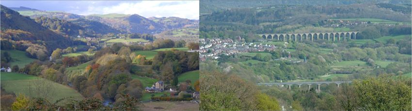
Contents
1. The Area of Outstanding Natural Beauty (AONB) 4
2. Purpose of this Supplementary Planning Guidance 4
3. What is Natural Beauty? 6
4. AONB Special Qualities 7
5. Understanding Landscape Character and the Special Qualities 9
6. Landscape Types and Development Considerations 10
7. Factors for Landscape Change 18
8. Key Design Considerations 20
8.1 Scale and Siting 21
8.2 Design 22
8.3 Materials 24
8.4 Setting 25
8.5 Landscaping 27
Appendix 1 Map showing extent of local authority areas within the AONB and
contact information
Appendix 2 Main AONB Planning Policies of the Planning Authorities
Appendix 3 Summary of main differences in Permitted Development Rights in
the AONB, World Heritage Site and Conservation Areas
Acknowledgements
This document has been prepared on behalf of Denbighshire, Flintshire and
Wrexham planning authorities and the AONB Joint Committee/Partnership by Iwan
Evans Planning, sup-ported by a working group of officers from the three authorities,
the AONB and Natural Resources Wales.
This document is also available in Welsh
-3-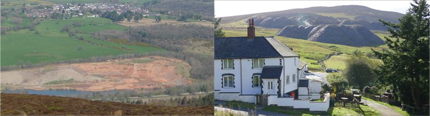
Clwydian Range and Dee Valley
             Area of Outstanding Natural Beauty (AONB)

1.    The Area of Outstanding Natural Beauty (AONB)

1.1   AONBs are designated for their outstanding landscape and the need to
      conserve and enhance their natural beauty for the enjoyment of existing and
      future generations. The Clwydian Range was designated as an AONB in
      1985 and in 2011 the area was extended to include the Dee Valley. Within
      the Dee Valley is the Pontcysyllte Aqueduct and Canal World Heritage Site
      designated in 2009. The AONB is one of five in Wales and in accordance with
      national planning policy “must be afforded the highest status of protection
      from inappropriate development” which is identical to the protection afforded
      to National Parks.

1.2   The statutory designation of the AONB is underpinned by national planning
      policies in Wales in the document Planning Policy Wales (PPW) (2016). The
      document states the primary purpose is to con-serve and enhance its natural
      beauty. Development Plan policies and development management decisions
      should favour the conservation of natural beauty and have regard to
      economic issues and social well-being. Development which occurs outside
      an AONB but could have some impact on its setting also needs to be
      considered.

2.    Purpose of this Supplementary Planning Guidance

2.1   The AONB covers part of the counties of Denbighshire, Flintshire and
      Wrexham. This guidance is primarily targeted at individuals proposing new
      development and for decision makers involved in the management of the
      AONB. The intention is to heighten awareness of the importance of the
      AONB, and, in so doing, raise the standard of new development and
      landscape design. It provides some general design principles which should
      be followed to assist new development proposals whether planning
      permission is required or not. No specific guidance is given on what proposals
      may need planning permission as more specific advice is given elsewhere.
      Permitted development thresholds are however more restrictive within the
      AONB and a summary of the main differences are shown in Appendix 3.
      Before considering any new development, it would be advisable to seek
      professional assistance from a planning agent or architect, to ascertain
      whether planning permission is needed or any other consents are required
      such as works affecting public rights of way or highways. If planning
      permission is required, prospective applicants may wish to obtain further
      advice from their local planning authority by submitting a pre-application
      request for advice before embarking on a formal planning application. Further
      information can be obtained from individual authorities and contact details for
      planning departments and the AONB are given in Appendix 1 together with a
      map showing the respective local authority areas within the AONB.

2.2   Once adopted by the planning authorities this guidance will be a material
      planning consideration when they are making planning decisions within their

                                        -4-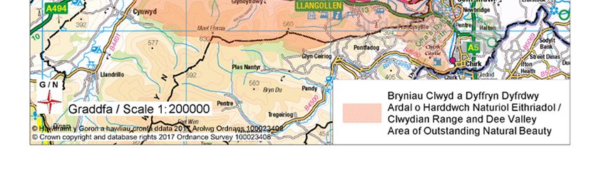
respective AONB areas or which affect its set-ting. It should be read in
      conjunction with the relevant policies of individual development plans and
      other Supplementary Planning Guidance (SPG) documents. With more
      complex or larger planning applications, full details of the proposal will need
      to be submitted to allow the local planning authority to fully assess the impact
      on the AONB. The current main planning polices of individual authorities
      relating to the AONB are included in Appendix 2. Further information on
      planning policies and procedures of individual authorities are available on
      their websites.

2.3   The three authorities have entered into a joint agreement to dis-charge their
      AONB functions by means of a Joint Committee. This committee is supported
      by an Officers Working Group which is made up of officers from the local
      authorities, Natural Resources Wales and the AONB Partnership (The AONB
      partnership represents landowners, local authorities, farmers, conservation
      and recreation interests) Critically the local authorities and the AONB must
      produce an AONB Management Plan every five years which provides a
      framework to inform and guide anyone who undertakes activities within it.
      This statutory document also identifies the “special qualities” of the AONB
      and includes an Action Plan to conserve and enhance these qualities. The
      AONB Management Plan can be viewed at:
      http://www.clwydianrangeanddeevalleyaonb.org.uk/plans-and-strategies/
      The AONB Joint Committee and Partnership approved this planning
      guidance.

2.4   Designers, developers, landowners and relevant organisations should have
      regard to this guidance when preparing their plans, proposals or strategies.
      Local authority planning officers will also assess development proposals
      against the design principles out-lined in this document together with other
      material planning considerations.

                                        -5-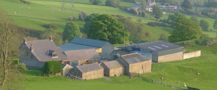
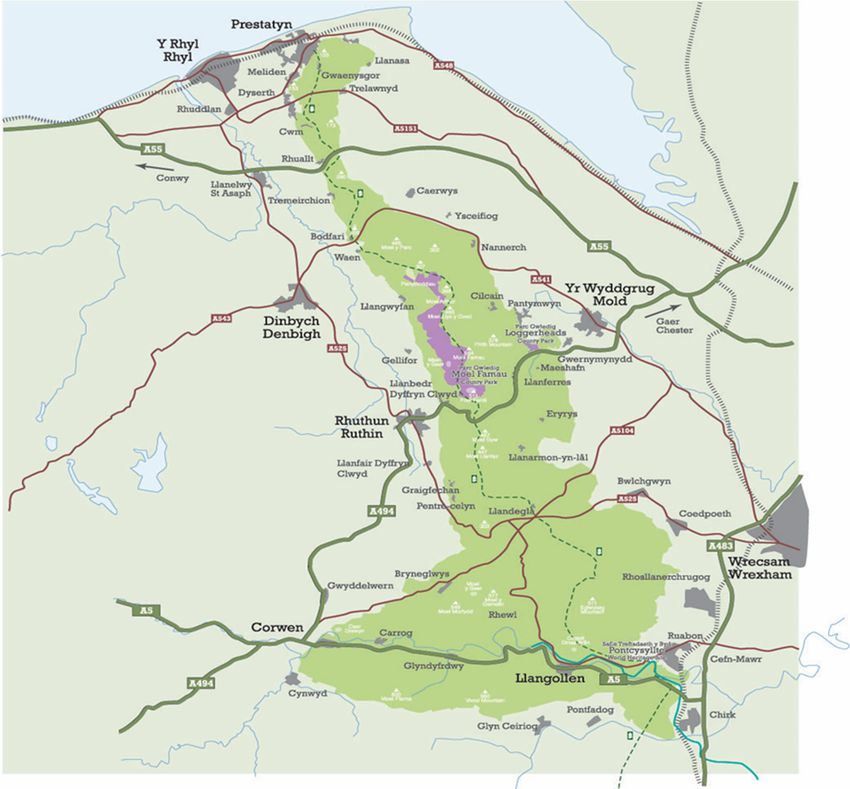
Map showing AONB shaded in green

3.    What is Natural Beauty?

3.1   The concept “natural beauty” is mentioned in the primary legislation
      responsible for designating AONB's and in PPW but there is no statutory
      definition of the term. The concept can be interpreted differently by
      individuals, but generally it is how we each perceive and value the
      countryside around us. Most people however, can equate their understanding
      to the following definition which was first put forward by the Countryside
      Council for Wales in 1995.

3.2   “Natural beauty applies to unspoiled, rural landscapes that are largely free
      from the effects of disfiguring development or urbanisation, although over the
      ages they have been shaped and nurtured by human activities. People
      perceive and appreciate “natural beauty” through all their senses, responding
      to many different aspects of the landscape, including its distinctive character,
      its aesthetic qualities, the presence of wildlife, its cultural and historical
      dimensions and its perceptual qualities such as, for example, tranquillity,
      remoteness and a sense of freedom. Perceptions of, and preferences for
      “natural beauty” are informed by people's personal characteristics, cultural
      backgrounds and individual interests. “Natural beauty” occurs, to varying
      degrees, in many, though by no means all landscapes. Some places may,

                                        -6-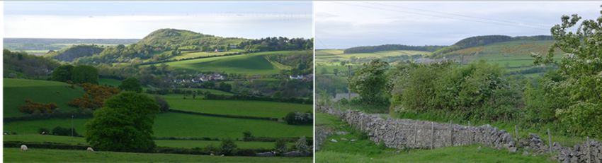
however, be judged to display “natural beauty” to an outstanding degree and
      may as a result be recognised as warranting a national level of protection.”
         (DERIVED FROM ASTATEMENT ON NATURAL BEAUTY CCW RESEARCH PAPER)

      Upland character of the AONB

3.3   The term triggers a complex sequence of emotions which begins to explain
      how we interact with our past heritage and most distinctive natural
      landscapes. It also assists in recognising what should be conserved and
      enhanced when planning new development. New proposals need to be
      successfully integrated within their rural context, with reference to commonly
      associated issues of landscape and visual amenity, natural and built heritage.

4.    AONB Special Qualities

4.1   Special qualities are those individual features and qualities which define the
      character of the area and set it apart from surrounding areas. They are a
      component of the areas “natural beauty” and recognise the human influence
      in shaping the landscape and establishing cultural identity. The AONB
      Management Plan identifies these special qualities and goes into detail on
      policies and objectives to conserve and enhance them. Consideration
      should be given to how new development proposals impact on these
      special qualities and whether they are conserved and enhanced during
      the process. In some cases, it will not be clear if, or to what degree, new
      development will impact on the special qualities. Developers and decision
      makers will need to judge the extent of impact and suggest changes to ensure
      overall conformity, bearing in mind that the AONB Management Plan is one
      of several material planning considerations. To assist in this process, the
      Special Qualities, their individual components and the relevant Management
      Plan policies to conserve and enhance them are identified below.

                                        -7-
Special        Components of Quality                          AONB Management
Qualities                                                     Plan policies relevant to
                                                              Planning
Landscape      Tranquillity – feeling of calm and stillness   1. Conserve and enhance
Character      with peace and quiet.                          the Special Qualities and
and Quality    Remoteness and Wildness, Space and             distinctive character of
               Freedom – feeling of trepidation and           the AONB’s landscape
               sometimes danger and sense of freedom in       and associated features
               a wide-open landscape. Also, a sense of        including the historic built
               belonging and attachment between               form.
               communities and their land-scape.
                                                              2. Safeguard the
                                                              panoramic views,
                                                              tranquillity and
                                                              environmental quality of
                                                              the AONB for the
                                                              generations of today and
                                                              the future.

                                                              3. Secure the equitable,
                                                              sustainable use of the
                                                              area’s natural resources
                                                              to con-serve and enhance
                                                              the special qualities of the
                                                              AONB.

                                                              4. Protect and promote
                                                              traditional cultural
                                                              distinctiveness within the
                                                              AONB including the
                                                              Welsh language.
Habitats and   Heather Moorland and Rolling Ridges –          5. Secure natural systems
Wildlife       moor-land ridges of the central Clwydian       and networks that provide
               Range and expansive open moorland found        more and better places
               in Llandegla, Ruabon, Llantysilio and North    for nature for the benefit
               Berwyn.                                        of wildlife and people.
               Broadleaved woodlands and Veteran
               trees – various small copses of woodland.      6. Restore, reconnect and
               River Valleys and the River Dee – the          expand key habitats and
               dramatic and powerful Dee with the smaller     species at a landscape
               rivers Alyn and Wheeler.                       scale in order to increase
               Limestone grasslands, cliffs and screes        resilience to
               – car-boniferous outcrops such as Graig        environmental change.
               Fawr in Meliden and the Eglwyseg
               Escarpment in Llangollen.
Historic       Historic Settlement and Archaeology –          7. To conserve and
Environment    historic settlement patterns, conservation     enhance features and
               areas and features left by previous            sites of archaeological,
               generations.                                   cultural or historic
               Industrial Features and the World              importance within the
               Heritage Site – includes limestone and         AONB whilst recognising
               slate quarrying, lead mining – the             that the whole of the area
               Pontcysyllte Aqueduct and Canal World          has an historic dimension.
               Heritage Site.

                                         -8-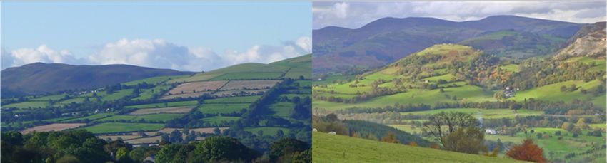
Historic Defence Features – chain of Iron     8. Ensure that the World
               Age Hillforts, castles and other defensive    Heritage Site is
               features.                                     conserved and enhanced
               Small historic features – mix of small        in the context of its setting
               historic features such as wells, village      within the AONB.
               pumps, boundary stones and way markers.
               Traditional boundaries – drystone walls
               and hedges reflecting traditional
               craftsmanship.
Access         Iconic Visitor and Cultural Attractions –     9. To promote the
Recreation     sites identified with the AONB such as Moel   sustainable use and
and Tourism    Famau, Castell Dinas Bran, Valle Crucis       enjoyment and
               Abbey, Horse-shoe Pass and Pontcysyllte       understanding of the
               Aqueduct.                                     landscape of the AONB in
               The Offa’s Dyke National Trail and            a way that contributes to
               Promoted Routes – the Offa’s Dyke path        local prosperity and social
               stretches from Prestatyn in the north to      inclusiveness.
               Llangollen in the south – other footpath
               networks and extensive areas of Access        10. Ensure the
               Land enhances accessibility.                  attractiveness of the
                                                             AONB’s landscape and
                                                             views as a primary basis
                                                             for the areas tourism are
                                                             retained.
Culture and    The Built Environment – villages, towns       11. Ensure that new
People         and smaller scattered settlements.            development adopts the
               People and Communities – a rich mix of        highest standards of
               culture and sense of community and            design and is sympathetic
               services to sustain rural life.               to the character and
                                                             appearance of the AONB.

5.    Understanding Landscape Character and the Special Qualities

5.1   Various elements of the special qualities can be found within different types
      of landscape which have been geographically defined. These are usually
      referred to as landscape character areas and are distinctive from each other
      due to their unique characteristics. It is important to define what makes up
      landscape character to ensure new development maintains and enhances
      this character. Other non-development activities such as agriculture will also
      have an impact on landscape character.

      Moel Hiraddug in the north of the AONB

                                        -9-
5.2    Information on the area’s landscape and qualities can be obtained from
       LANDMAP, an all Wales assessment, recorded and evaluated in a nationally
       consistent manner. LANDMAP provides an assessment of five aspects -
       Geological Landscape, Landscape Habitats, Visual and Sensory, and
       Historic and Cultural Landscapes. This in-formation can help us to
       understand how we can best influence development decisions in the following
       ways.

   LANDMAP                  Use in development management considerations
GIS mapping           This spatial framework is helpful in compiling baseline
                      information for a site and its visual setting. The study area
                      could be quite extensive for example in the case of assessing
                      telecom masts.
Description of        Compiling all 5 LANDMAP aspect area information for a given
characteristics,      site and its visual setting together will help provide baseline in-
qualities and         formation on the landscape character.
components
Evaluation of         Areas with higher evaluations point to where conservation and
importance from       enhancement will be important. Lower evaluations point to
a national to local   areas where landscape enhancement is required.
scale
Recommends            This can point to elements of the landscape that need to be
locally               con-served or enhanced which planning proposals should
appropriate           positively address.
management
guidelines

5.3    LANDMAP can be viewed at
       https://naturalresources.wales/guidance-and-advice/business-
       sectors/planning-and-development/evidence-to-inform-development-
       planning/landmap-the-welsh-landscape-baseline/?

5.4    In addition to LANDMAP, site evaluation will help identify key views, visual
       character, the presence of distinctive characteristics and special qualities.
       This local character assessment will also identify specific natural and built
       heritage conservation features that might need to be addressed for a new
       development project.

6.     Landscape Types and Development Considerations

6.1    Seven main landscape types have been identified in the AONB using
       LANDMAP visual and sensory data (see Landscape Types map), ranging
       from the built environment to the remoter upland areas. The special qualities
       and key characteristics of each landscape type are highlighted in the following
       table together with analysis of relevant development management
       considerations. Development can impact on AONB character and special
       qualities in a number of ways as identified in the tables below. By highlighting
       the characteristics of each landscape type in more detail, it is possible to build
       a picture of what con-tributes to character and how it may be possible to retain

                                           - 10 -
and enhance these features. In the case of “Built Environment”, the term is
used more generically to include buildings and infrastructure.
The AONB Landscape Types
- 11 -Built environment
Special Qualities Landscape Character and Quality, Historic Environment,
Culture and People.
Key characteristics
The built environment has varying influences on the character of the AONB and its
setting, and includes towns, villages, farming and rural enterprise development,
residential settlement and transport, energy and communications infrastructure.
The built environment is particularly distinctive where it has derived from a response
to place - the way topography, availability of local materials, historical approaches
to building, craftsmanship/ vernacular and sometimes incremental evolution has
formed places that appear to fit with the landscape. These places often have a sense
of rural tradition and his-tory derived from rural farming and mining industry.
Defence, status in the landscape and borderland location of the area’s chain of
upland hills, has also given rise to some unique historic hillforts, castles, earthworks
and field archaeology.
Building materials vary across the area. Their use and inherent colour contribute to
local distinctiveness, rural traditions, and general visibility in the landscape and
therefore clearly influence the character of the wider landscape as well as the
locality. For example:
The use of stone in buildings, field boundaries and retaining walls is
widespread across the area, however the type of stone locally available
(limestone, sandy limestone, shales, and slate) and its workability introduces
some variation across the AONB.
White washed farms and cottages with slate roofs, with rendered elevations
for weather protection are evident across the area, particularly in open and
elevated landscapes.
Mellow red and yellow brickwork is found in some older farm buildings and
worker cottages and terraces, influenced by local brick works and
characteristics of clay, before introduction from further afield as transport
networks improved and brought more standardised ranges of colour and use.
Grey ashlar stonework or ashlar-effect render is evident in polite Georgian
houses found in some villages and estates.
Rural estates often use a single colour to mark out the buildings, fencing and
gates associated with a large house.
Faded red oxide roofs mark out some older farms.
- 12 - Dark blue metal sheeting is used on some barns, as well as Yorkshire timber
boarding.
Natural and darker stained timber cladding is used in some outhouses and
log stores.
There is some relationship between settlement/development, where it lies in the
landscape and how this influences the AONB’s special qualities:
Scattered rural farms and development more generally is rarely located much
above the mid-point of hillslopes, avoiding steep landforms and more remote,
exposed places. The uplands and skylines are therefore in the main free of
development except for some strategically located transmitter/telecoms and
electricity infrastructure.
Major transport routes follow the easiest valley lines through the area. The
A55 in major rock cutting at Rhuallt being an exception.
Remote, tranquil, wilder character, natural skylines and freedom are most
apparent where development is absent or very low key and well-integrated.
Night time tranquillity through the absence of light source is also higher.
Development management considerations
See the section on Key Design Considerations.
Quarries
Special Qualities Landscape Character and Quality, Historic Environment,
Culture and People, Habitats and Wildlife.
Key Characteristics
There are a number of relic quarries, rock outcrops, spoil mounds and
trackbeds within the area which now after many years of weathering,
naturalisation and in places resto-ration have become part of the historical
and cultural story of the area.
Active quarrying lies outside of the AONB, but close enough to influence
views from the area, for example sand and gravel extraction at
Aberwheeler.
Development management considerations
There are a number of active quarries within and adjacent to the area. Long
term planning for landscape integration along the boundaries of such
- 13 -developments is necessary, with landscape schemes implemented as part
of advance works with ongoing management.
The reuse of sites for waste management and industrial activities need to
avoid impacts upon tranquillity.
Recreational use of disused sites should promote the quiet enjoyment of the
countryside.
Lowland areas
Special Qualities Landscape Character and Quality (tranquillity), Historic
Environment, Culture and People.
Key Characteristics
The edge of the Vale of Clwyd rises to meet the Clwydian Range. The narrow
strip within the AONB shares similar enclosed farmland and historic parkland
characteristics with the wider Vale to the west. Rural traditions in field
pattern, hedgerows, trees and woodland, narrow lanes, small villages and
scattered rural property prevail, with occasional estate influences (estate
fencing, gates with modest ornamentation, stone walls and gateways to
drives, parkland trees).
Development management considerations
This area as well as the wider Vale of Clwyd provides an important setting to
the hills and ridges of the Clwydian Range that rise above it. The scale,
character and integration of development here needs to take account of
elevated views from the adjacent hillslopes.
Rolling lowlands
Special Qualities Landscape Character and Quality (tranquillity, space, remote
areas) Historic Environment, Culture and People.
- 14 -Key Characteristics
The rolling lowlands lie to north of the area and include the farmed wooded
slopes of Gronant Hillside, the farmed Trelawnyd plateau and wooded valley
west of Cefn Du.
These are areas of farmland with mosaic of field patterns and woodland along
steeper ground and streams, scattered rural settlement, narrow lanes and
one small village. Limestone in building and occasional field boundaries is
characteristic of the Trelawnyd plateau.
The Trelawnyd plateau feels relatively remote in spite of the close proximity
to the large villages and towns of the coastal plain.
There is a strong visual connection with adjacent areas – Gronant hillside
connection with the coastal plain, seascape and Prestatyn Hillside; and
Trelawnyd plateau connection with the enclosing limestone escarpment and
Gop Hill.
Development management considerations
Tranquillity is locally affected where the A5151 crosses open sections of the
Trelawnyd plateau. Noise from the A55 also extends for some distance into
this area. Retrofit options to reduce visual movement and noise levels would
benefit the area.
This area contributes to the tranquillity and freedom of views experienced
from the adjacent hill slopes and uplands. Consider key views over this area,
scale and prominence of development proposals.
River Valleys
Special Qualities Landscape Character and Quality (tranquillity, remote areas)
Historic Environment, Culture and People, Access, Recreation and Tourism.
Key Characteristics
There are several valleys within the AONB, each made distinctive by their
topographical form, visual relationship with surrounding hillslopes and
uplands, openness or enclosure provided by woodland, trees and hedgerows
and localised presence of settlement, development, roads and activity.
As lines of least resistance through an area of elevated hills and ridges the
valleys they often include villages and main roads, the latter with local effects
on tranquillity.
- 15 - In the case of the Vale of Llangollen, there are diverse historical influences
within a visually scenic valley context - including farming, quarrying, lines of
communication (river, road, rail and canal infrastructure) rural villages and
town with urban villages to the east.
The engineering solution to the topographical challenges and beauty of the
valley have been addressed in the design of the Pontcysyllte and Chirk
Aqueducts and Horseshoe falls. This has given rise to the area’s recognition
for its landscape and heritage value.
Scenic qualities and visual interest also derive from a valley’s ‘lines of visual
force’ i.e. valley shape, skyline edges, descending ridges, crags/ outcrops
and screes and sinuous line of river, to which the pattern of fields, woodland
and trees complement the overall scene. An example for the hillslopes area
would be how Castell Dinas Bran marks the top of its rounded hill with
particular aesthetic effect.
Development management considerations
Topography (enclosing hillslopes, narrow valley sections) and floodplains
form natural constraints to development within the valley and place pressure
open more open and elevated locations where development could be more
intrusive.
Strategic development of a scale to be potentially visible in the landscape
should work with ‘visual lines of force’ and areas with a strong integrating
pattern of vegetation (i.e. intact tall hedgerows, lines of hedgerow trees,
copses and woodland)
New proposals within the Vale of Llangollen need to assimilate and
complement land-scape character and heritage values to support both the
AONB and World Heritage Site.
Hill slopes
Special Qualities Landscape Character and Quality (tranquillity, wild, remote)
Historic Environment.
Key Characteristics
Hill Slopes include steep rising landform, escarpments below the uplands and
lower hills of the AONB.
Land cover and settlement characteristics are strongly rural and where
development is minor or absent perceptions of tranquillity, remoteness and
wildness can be particularly strong.
- 16 - These areas all form prominent scenic backdrops to adjacent settled lower
areas of the north-east Wales coastal plain, Vale of Clwyd, Deeside, Vale of
Llangollen and Welsh Maelor and as such provide a strong sense of place.
Geomorphology and landform has brought about some notable natural and
wild areas. For example - outcropping rock, native woodland, and scrub and
grassland mosaics of the limestone escarpments above Prestatyn, Dyserth,
Bryn Alyn and the Eglwyseg valley.
Irregular field patterns and woodland edges, scattered farms along winding
narrow lanes and tracks occupy more gentle hillslopes, shallow cwms and
side valleys of the area. Some large areas of forestry lie within this area.
Reservoirs are found in some of the shallower eastern facing valleys.
Scattered farming and worker cottages associated with historical mining and
pro-cessing industries lie this area, with occasional villages at lower
elevations. Older settlement is distinctive displaying use of stone, vernacular,
rural traditions and integration with the landscape.
Development management considerations
Slope angle has greatly influenced ease of access to this area and much of
the pattern of development hasn’t altered or evolved much (with the exception
of forestry), which in part gives the landscape a strong rural and traditional
character.
The area’s visibility and contribution to scenic quality and sense of place to
the more populated adjacent areas, makes the area sensitive to change from
development. Available views, development scale, character and integration
is therefore important to consider.
Development within or encroaching upon the more natural and wild
escarpments can have particular contrast and appear at odds with the AONB
special qualities.
Upland areas
Special Qualities Landscape Character and Quality (tranquillity, remote, wild),
Habitats and Wildlife, Access, Recreation and Tourism, Historic Environment.
Key Characteristics
The uplands comprise elevated rolling ridges, hilltops and plateau of pasture
fields and open moorland. The highest points include Moel Famau (554m)
within the Clwydian Hills, Moel y Gamelin (577m) on the Llantysilio Mountain
- 17 -ridgeline, Ruabon Mountain (502m) on the Esclusham/Ruabon escarpment
and Moel Fferna (628m) on the north Berwyn ridge.
Notable scenic qualities of the area include its natural upland skylines – as
the chain of hills that define the horizon and backdrop to north-east Wales;
there are some particularly distinctive skyline silhouettes - for example Moel
Y Parc from the north, Moel Arthur, Moel Famau (its pyramidal form and the
highest point marked by the jubilee tower); the bedding plains and outcrops
of the limestone escarpments across the area; and the areas of open
moorland heather that create strong colour contrasts with the enclosed lower
hillslopes such as at Ruabon and Llantysilio Mountain,
Development is absent except for some remotely located transmitter
infrastructure, quarrying and occasional crossings by electricity
infrastructure, roads, lanes and tracks.
Many areas are open moorland unenclosed by field patterns. Where present
post and wire fencing is used, with some dry-stone walling along the Clwydian
Hills. Forestry extends into some areas from the adjacent hillslopes.
The northern Berwyn ridgeline differs, in its access by lanes and pattern of
improved pasture fields, occasional forestry and pockets of moorland.
Historic, cultural marks in this area are visually iconic - in the case of the
Jubilee Tower, Castell Dinas Bran and many of the Iron Age hillforts. Other
earthworks, cairns and field systems are more subtle, add to the local
character but remain of historical importance.
These areas have wide ranging expansive views of landscape and settled
lower areas. The sense of removal from towns and villages below, lack of
development and visual foci, openness and exposure contribute to the area’s
special qualities of space and freedom, remoteness, tranquillity and wildness.
Development management considerations
This is a very visible area of the AONB where natural skylines make an
important contribution to the area’s special qualities, making it very sensitive
to change from development.
Accessibility along roads and lanes brings potential for activity, movement
and noise that can erode the tranquillity of this area. The high passes are
popular destinations for visitors and recreation with notable destinations at
Bwlch Pen Bara and the Horseshoe Pass. The management of people,
parking and character of development have evolved and been treated
differently in these locations, with varying success. These are sensitive open
locations where careful attention to visual integration is important to support
the areas’ special qualities.
Vertical structures on skylines have considerable contrast against the sky and
horizontal form of the landscape. The eye-catching nature of such
development makes it very difficult to successfully integrate in designated
landscapes.
7. Factors for Landscape Change
7.1 The landscape we see today has largely been shaped by the influence of
man. This process continues, although with the progression of climate
- 18 -variations, the future pace of change will increase. Factors influencing
landscape change are discussed below.
7.2 Agriculture and Forestry: The future care and management of the
landscape is heavily dependent on agricultural and forestry activity. Around
20% of AONB land is covered by agricultural conservation initiatives and
these have had a positive impact on habitat and landscape conservation,
particularly the management of common land. Future changes to agri-
environmental support schemes may also impact on the landscape. The
challenge will be to ensure that the farming community sustains a living whilst
ensuring the landscape and habitats benefit. For example, the right amount
of grazing will sustain calcareous grassland to a high biological interest and
protect it from the encroachment of woodland scrub. Likewise, the dominant
heather moorland of the Clwydian Range, Llantysilio and Ruabon Mountain
is improved when bracken is brought under control. The removal or re-
instatement of hedgerows, stone walls and tree felling can all have a
significant visual impact. The felling and re-planting of older coniferous trees
with mixture of broadleaf and conifer species will improve the landscape and
biodiversity.
7.3 Tourism: Tourism can help diversify the local economy and is expected to
grow in the future. Currently around £39 million is spent annually in the
AONB. There are honey pots such as Moel Famau, Loggerheads and
Llangollen which become very busy at certain periods. Sustainable tourism
activities should be spread more widely throughout the area and new facilities
such as car parking sensitively located and landscaped to reduce landscape
impact. The popularity of walking, cycling and associated health benefits and
feeling of well-being will assist in the growth of outdoor activities.
7.4 Development: The future scale and location of new development is
determined by local planning authorities in their Local Development Plans. A
growing and ageing population will put increased demand on services and
housing. The extent of growth in the AONB itself will be limited and of a scale
and character which will not undermine the special qualities of the AONB. It
will also be important to ensure that urban encroachment or other
development outside the AONB does not impact adversely on its landscape
character and quality, set-ting or sense of tranquillity. Development begins to
impact on tranquillity with the introduction of intrusive movement, sources of
artificial light and sound. More specifically, development can bring pressures
on special qualities in the following ways:
Major roads crossing the area locally affect tranquillity - the A55 having
considerably wider visual impact and audible disturbance.
Settlement and growth outside and adjacent to the AONB can have a
bearing on perceptions of tranquillity, remoteness, space and freedom.
It will be important to analyse the impact of larger proposals close to
the AONB boundary and, if necessary, to seek mitigation measures or
even relocate the development.
Active quarries can introduce noise and activity with local disturbance
to tranquillity.
- 19 - The reuse of disused quarries for waste management/ storage/
industrial processes can bring disturbance to sites that have
naturalised over time and are tranquil places.
The major town of Llangollen is steadily expanding beyond the valley
floor. This could alter the balance of open country-side and rural town
within views, to one of a town with greater visual influence and
urbanising qualities. There are similar smaller scale examples
elsewhere, where villages follow the line of the lower hillslopes - for
example the villages to the west of the Clwydian Ridge.
Distinctive rural settlement within the AONB is not limited to
conservation areas or listed buildings. Attention to what is locally
distinctive and why and how new development might complement this,
is important to how the landscape can accommodate change, whilst
conserving and enhancing its special qualities.
Livestock numbers and welfare standards can introduce the need for
large barns, on farms that have evolved through addition of smaller
barns and outhouses.
Excessive lighting of development impacts on the sense of tranquillity,
wildlife and quality of life.
The built environment of the AONB, notably the World Heritage Site,
Listed Buildings, Conservation Areas and Historic Parks and Gardens
all contribute to the special character of the area, and insensitive
development and change can impact on the quality of these heritage
assets.
7.5 Renewable energy and climate change: The area is not appropriate for any
large scale renewable energy projects such as large wind turbines or solar
farms. Larger renewable energy proposals outside the AONB can be highly
visible and impact on its setting. On and off-shore wind farms are redefining
the outlook, sense of space and visual focus of views from the AONB. This
can affect perceptions of tranquillity, space and freedom. There may be some
pressure in the future for smaller turbines and solar panels. The influence of
climate change will not be immediately obvious, but increases in temperature
will lead to habitat loss and change. More in-tense rainfall will cause further
footpath and soil erosion in up-land areas. The AONB has published a
document entitled “Working with a Changing Climate” which gives further
information on how the area could adapt to climate change.
8. Key Design Considerations
8.01 Good quality design does not need to be elaborate or expensive, - usually the
best design solutions are those simply conceived and executed. They are
respectful of their immediate surroundings and the setting in which they are
placed, be that in the open countryside or amongst other buildings. Neither
does new design always need to adhere strictly to vernacular building
character or the use of traditional materials. Simply cladding an inappropriate
building or extension with local stone will not necessarily make it acceptable.
As a point of principle, new development should firstly seek to avoid
any adverse impacts on the AONB before investigating mitigation
measures. It is crucial that new development proposals are informed by a
- 20 -thorough assessment of the site surroundings and its setting. Making use of
photomontages can be helpful in demonstrating how a development proposal
sits within the landscape.
8.02 This guidance adopts a practical and pragmatic approach to design solutions
and firstly looks at the proposal and gradually widens the scope of potential
impact to the immediate site surroundings and beyond to the wider landscape
setting of the AONB. It also gives some practical examples of good design
solutions and what should be avoided. It does not however state in detail
whether proposals need planning permission (see Appendix 3 for permitted
development thresholds). More detailed information on such matters can be
obtained elsewhere from the websites of the individual local authorities or
from the national planning portal.
8.03 This guidance will be supplemented in the future with more detailed Design
Notes on topics specific to the AONB.
8.1 Scale and Siting
8.11 Most new proposals within the AONB will be on a relatively small scale due
to its rural location. The scale of new development should be relative to
what's already around it. For example, a new extension on a dwelling should
be relative to the existing size of the dwelling. If it is too large it could
overwhelm the existing property and surrounding buildings. The positioning
of a larger dwelling next to smaller cottages is likely to be out of scale and will
stand out. The mass is the combined effect of the height, bulk and silhouette
of a building or group of buildings. In some cases, the impact of scale can be
mitigated by good siting, design and the sensitive use of materials. Some
traditional cottage style dwellings have been spoilt by large insensitive
extensions.
8.12 Smaller scale housing estates will be appropriate in the larger villages and
the same principles of scale and siting will apply. Some new dwellings will be
justified as affordable need dwellings. The use of more traditional materials
and modest designs should ensure prices are maintained at an affordable
value.
8.13 New farm buildings will be on a larger scale and therefore their potential
impact could be greater depending on site location, their design and use of
materials. It would be preferable to site new buildings close to the original
farmstead to create a compact farm complex. Stand-alone buildings and
structures may have no specific scale reference points and consequently their
mass will be more obvious especially if poorly sited. In such circumstances,
it may be possible to re-locate a building amongst some natural screening of
trees and woodland or within the natural landform. If possible higher vantage
points and more visible sites which break the skyline on upland slopes should
be avoided. The above advice will also apply to other buildings in more open
countryside. Before embarking on a project, the following questions regarding
scale and siting should be considered.
- 21 -8.14 It's a question of scale and siting
Is the scale of the development commensurate with its functional
need?
Is it in scale with the size and mass of surrounding buildings and
structures?
Is the scale relative to plot size and close to established development?
Will the development impact on neighbouring properties?
Is the siting appropriate and takes advantage of natural screening and
local, topographic features avoiding natural skylines?
Can the development be re-located to a more suitable site?
8.2 Design
8.21 Once matters of scale and siting have been considered, attention can be
given to the appearance of the development. The design will need to fit
functional needs and the usual approach will be to study the appearance of
existing or traditional buildings in the locality. Many new dwellings have
introduced more suburban or “executive” style designs which are more
common to urban areas rather than the rural character of the AONB. An
existing building may be of historic interest or lie within a Conservation Area.
If so any alterations or extensions will need to preserve and enhance the
original character of the building. Maintaining original rooflines and the
spacing between windows and doors make an important contribution to
character, and small changes to the design can have a detrimental effect on
the overall integrity and appearance of the de-sign. This is commonly referred
to as maintaining “local distinctive-ness” by respecting the pattern of the
arrangement and size of buildings, their plots, the general range of building
styles and integration of harmonious colours and materials.
8.22 Extensions are usually best positioned to the side or to the rear. In terms of
scale and design they are usually subservient to the original building by being
smaller with a lower roof. If appropriate, a subtle change in the use of
complimentary materials can add interest and help date the buildings history.
8.23 For free standing buildings or structures there may be more freedom to
express new design ideas which are modern but respectful of traditional
design forms. In many cases, modern designs and materials can create
interesting and diverse forms of architecture. The contrast can accentuate
traditional designs. For example, the careful use of glazing can create
interesting new spaces and allow light into older buildings. However, the
introduction of more urbanised features such as large windows and elaborate
entrance gates and walls should be avoided.
- 22 -Innovative designs with good use of modern materials
8.24 In many cases the conversion of more traditional agricultural buildings to
other more economical uses such as holiday accommodation can be
challenging. Local authorities will normally only allow the conversion of
structurally sound buildings which have some architectural merit worth
keeping. It follows that any scheme of con-version should retain this
architectural merit without destroying it. This will usually not involve significant
alterations to the original structure such as raising the roof or adding a
complete new wing. However, the addition of porches and limited new
openings may be acceptable provided the character of the original building is
retained. As a general rule, it is preferable to re-use existing buildings that
are available for conversion before building from new.
Sympathetic conversion retaining historic character
8.25 Another matter to consider is whether the design will stand the test of time
i.e. will it age gracefully and be an example of good design for its era. Before
embarking on a project, the following questions on design should be
considered.
8.26 It's a question of design
Is the design compatible with existing building character?
If an extension, is it subservient to the original building?
Does a modern design echo or compliment more tradition-al designs
in the area and retain or enhance local distinctiveness?
- 23 - Does the scheme avoid details which “urbanise” the rural scene with
inappropriate windows, gates, kerbs or fencing?
Can existing buildings be re-used and converted?
Will it stand the test of time?
8.3 Materials
8.31 The choice of materials and the way they are used can be critical in
complimenting the design and adding aesthetic value. The predominant
building material in the AONB is stone or plain rendering coloured in white or
cream. In areas, closer to the Vale of Clwyd and Llangollen reddish/brown
brick has been introduced. Most roofs are covered with blue/black Welsh
slates. The colour palette is therefore muted with the predominance of blue,
grey/white shades. Colours should seek to harmonise with the surrounding
landscape and settlements. To understand how colour can be best integrated
see
http://www.malvernhillsaonb.org.uk/wp-
content/uploads/2015/02/guidance_on_colour_use_screen.pdf
8.32 If stone is being used it should preferably be re-cycled local stone or new
locally sourced stone. Stone pointing is usually flush with lime added to the
mortar to give a white colouring which will fade over time. Older field boundary
walls will be constructed of dry stone with no mortar added. Roof material is
usually darker than the walls and this helps to sit the building down in the
landscape and make it less intrusive. A red tiled roof within an area of darker
roofs will obviously stand out and be inappropriate.
Good renovation retaining character
8.33 Coloured render (white/cream/grey) can be applied quickly over large areas.
In some cases it can be matched with stone i.e. one elevation in stone and
others in render. Render should be applied smoothly and not patterned with
odd shapes in relief. On more traditional buildings, there is no or limited use
of barge boarding with guttering being fixed directly into stone.
- 24 -Innovative design and traditional stone boundary treatment
8.34 On many new buildings plastic is now being used for doors, windows and
boarding. On traditional buildings plastic materials should be avoided, but if
this is not possible, at least the existing size of windows and glazing patterns
should be retained and appropriate frame colours used. Traditional window
openings have a vertical emphasis or occasionally square. These should be
retained and similar patterns adopted in extensions and new buildings.
8.35 Wooden doors and windows of traditional patterns should be retained on
older buildings. The selective use of naturally finished timber boarding can be
appropriate in certain locations and is likely to weather over time. The impact
of larger agricultural buildings can be softened by the introduction of wooden
materials on extensive elevations. Very often the impact of a larger building
can be mitigated with correct colouring matching the background hues in the
landscape. For agricultural buildings, the use of dark green, grey or blue will
blend in with the surrounding countryside. Darker coloured roofs also produce
less glare and are less visible from greater distances or surrounding higher
ground. On the other hand, lighter coloured materials are likely to stand out
and be easily visible from a wider surrounding area especially from higher
ground. Likewise, metal cladding of traditional form, shape and colouring can
be applied in a contemporary way. In conclusion, use colour to harmonise
with the landscape/settlement setting of the development. Before embarking
on a project, the following questions on materials should be considered.
8.36 It's a question of using the right materials
Are the materials appropriate for the area?
Can material be re-cycled or sourced locally?
Are the materials being applied in the correct manner?
Can modern materials be applied in a sympathetic and innovative
way?
Does the colouring of materials harmonise with surrounding landscape
and development?
Will materials stand the test of time?
8.4 Setting
8.41 Any new development should be assessed against its immediate
environment and within its wider landscape setting. This is especially true in
- 25 -a protected landscape where long distance views are important and need to
be protected. Higher ground opens wider vistas over the surrounding
countryside allowing the eye to scan greater distances. Very often the
visibility of development from greater distances is overlooked and although
scale is diminished by distance, from certain viewpoints, development can
look out of place and prominent. The same can apply when looking up at
higher ground which is visible from valley bottoms. Care should therefore be
taken to steer development away from the skyline, open elevated ground or
sites overlooked from higher ground. The visible impact of new development
will be minimised if sited in more enclosed landscapes, hidden by existing
landforms and a screen of hedgerows, trees and woodland. Development
should work with the contours/flow of the landform and prevailing patterns of
land cover to minimise disturbance. Whilst elements of the landscape may be
locally changed to accommodate development, the prevailing character of the
landscape should remain intact. Visual prominence is when development
forms a new focal point in the landscape which detracts from the general
scene, visual focus and sense of place.
8.42 In this context, new development outside the AONB but close to the boundary
can impact on the setting of the AONB and its natural beauty. Consideration
should therefore also be given, as stated in Planning Policy Wales (2016), to
development outside the AONB which can have an impact on the designated
area. The extent of the impact is likely to depend on scale and proximity to
the boundary. In some instances, the accumulation of development can, over
time, begin to have an adverse impact on setting. This is termed “cumulative
impact” of smaller developments. Although a proposal by itself might not be
significant, in combination with similar proposals in the vicinity, it has passed
the threshold of acceptability.
Pontcysyllte aqueduct
8.43 A good example of the concept of setting is in the way the Pontcysyllte
Aqueduct and Canal World Heritage Site has been designated. The actual
designation follows the Llangollen canal from Horseshoe Falls near
Llangollen via the Pontcysyllte Aqueduct through to Chirk Bank in Shropshire.
However, a wider 'buffer zone” following adjoining hillside ridgelines has also
been identified acknowledging a wider setting for the canal and aqueduct.
One of the overall aims is to “manage the World Heritage Site and Buffer
- 26 -Zone in a sustainable manner to conserve, enhance and present the
Outstanding Universal Value of the site locally and internationally” (refer to
the SPG on the World Heritage Site which should be read in conjunction with
this guidance if the proposal is within the WHS or its buffer zone). Long
distance landscape views are important and new development should avoid
intruding on the focus and appreciation of these views. For major
developments within or adjacent to the AONB a landscape and visual impact
assessment in accordance with the Guidelines for Landscape and Visual
Impact Assessment (third edition) is recommended, with advice provided by
a professional with landscape assessment and design experience.
8.44 There is therefore a recognition that setting goes beyond the immediate
vicinity of a building or structure and that a wider perspective needs to be
considered. Before embarking on a project, the following questions on setting
should be considered.
8.45 It's a question of setting
Is the site visible from a wider surrounding area and is it visually
prominent in the landscape?
Can a building be sited in the fold of the landscape and screened by
natural vegetation?
Will the development spoil important views from within or outside the
AONB and impact on its wider setting?
Does a proposal outside but close to the boundary of the AONB impact
on its setting and special qualities?
8.5 Landscaping
8.51 Buildings can be screened by good planting schemes, earth mounding and
various other forms of boundary treatment. Very of-ten older structures in the
countryside have mature planting around them acting as functional wind
screens and points of interest. Where possible such features which make up
the existing land-scape fabric should be retained or enhanced. Trees and
plants soften the outline of buildings, add to biodiversity and a modest
landscaping scheme can quickly assimilate new development into the
countryside. The way a site is enclosed should also be part and parcel of the
initial design process and should not be an after-thought. Existing stone walls
and hedges should be retained and restored where possible and protected
from building activity. However, landscaping will not by itself, make a poor
development acceptable.
8.52 Again, as with architectural design, the type of shrubs, trees and permanent
materials used for landscaping should reflect what is in the immediate vicinity.
Where possible, it is best to choose indigenous species of local provenance
and avoid more exotic or alien plants. The planting of leylandii trees or other
quick growing conifers should be avoided.
8.53 The means of enclosing a plot can often add to or detract from local
distinctiveness. Grand entrances with extensive vehicular access points will
- 27 -reflect a suburban or more “executive” design approach which should be
avoided. Wooden close boarded fencing, or extensive brick walling are not
appropriate materials for enclosure in more rural areas; - natural hedging or
stone is more acceptable. Likewise using hard landscaping materials such as
brick or paviours for access roads are not encouraged and will impede natural
drainage. If new external lighting is proposed this should be considered as
part of an overall landscaping scheme and kept to a minimum to protect the
AONB’s dark skies and avoid light pollution. Excessive lighting will produce
glare and light trespass outside the site which can impact on tranquillity,
wildlife and local quality of life. It is possible to provide shields and baffles and
angle lighting downwards to prevent the upward spillage of light, minimise
lighting output (maximum 3500 lumens), introduce timers and specify colour
temperature (less than 3000 kelvin) to moderate the impact of lighting over a
wider area. Development proposals should be accompanied by sufficient
technical details of any lighting to enable an assessment to be undertaken.
8.54 Development should generally seek to avoid steeper landforms where more
extensive engineering work is required. The extent of landscape disturbance
from cut and fill, earthworks and retaining structures increases in extent
relative to gradient steepness. The successful restoration of disturbed ground
is also more difficult due to thin soils and slope angle. Where engineering
works are unavoidable, consideration should be given at the outset to the
sensitive disposal of any excess material or re-profiling and restoring the site
to create a natural landform.
8.55 Taking account of the predominant colour palette of surrounding vegetation
can help to identify the correct choice and colour of new materials. Before
embarking on a project, the following questions on landscaping should be
considered.
8.56 It’s a question of landscaping
Has landscaping been considered at the outset?
Can a building be located within existing natural screening?
Are plants and materials compatible to the area proposed with the
avoidance of hard landscaping?
Is the means of enclosure appropriate and not introducing urban
elements such as grand entrances?
Is the lighting scheme properly designed to avoid excessive light and
light trespass outside the site?
Will the landscaping contribute to the natural beauty of the AONB?
Are existing landscape features retained and restored?
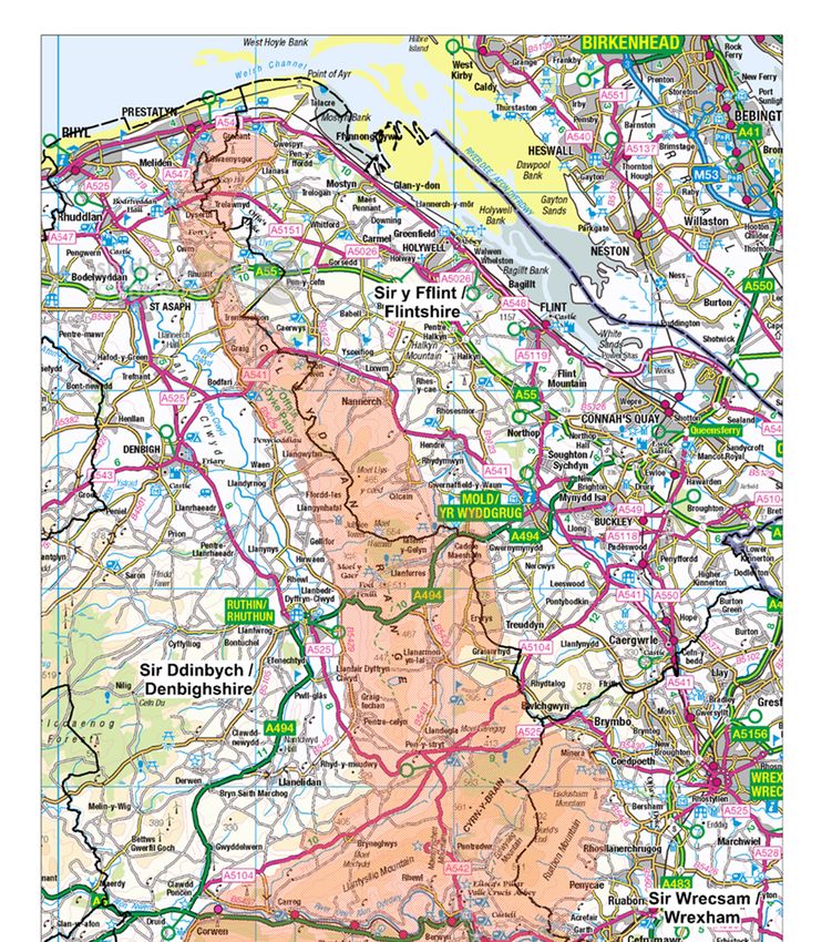
- 28 -Appendix 1 Map showing extent of local authority areas within the AONB
and contact information
- 29 -Contact details for Local Planning Authorities and the Clwydian Range
and Dee Valley Area of Outstanding Natural Beauty
Denbighshire County Council Email – planning@denbighshire.gov.uk
Development Management Tel – 01824 706727
P.O. Box 62
Ruthin
LL15 9AZ
Website: https://www.denbighshire.gov.uk/en/resident/planning-and-building-
regulations/planning/planning.aspx
Flintshire County Council Email – planningdc@flintshire.gov.uk
County Hall Tel – 01352 703234
Mold
Flintshire
CH7 6NF
Website: http://www.flintshire.gov.uk/en/Resident/Planning/Home.aspx
Wrexham County Borough Council Email – planning@wrexham.gov.uk
Environment and Planning Tel – 01978 298994
16 Lord Street
Wrexham
LL11 1LG
Website: http://www.wrexham.gov.uk/planning
Clwydian Range and Dee Valley AONB
Loggerheads Country Park
NR. Mold
Denbighshire
CH7 5LH
Email – clwydianrangeaonb@denbighshire.gov.uk
Tel – 01824 712757
Website: http://www.clwydianrangeanddeevalleyaonb.org.uk/plans-and-
strategies/
- 30 -You can also read