Land South of the B7062, Cardrona Representation to the Scottish Borders Local Development Plan 2 Main Issues Report Renwick Country Properties ...
←
→
Page content transcription
If your browser does not render page correctly, please read the page content below
Land South of the B7062, Cardrona

Representation to the Scottish Borders Local
Development Plan 2 Main Issues Report

Renwick Country Properties

January 2019
2
Contents
1. Introduction
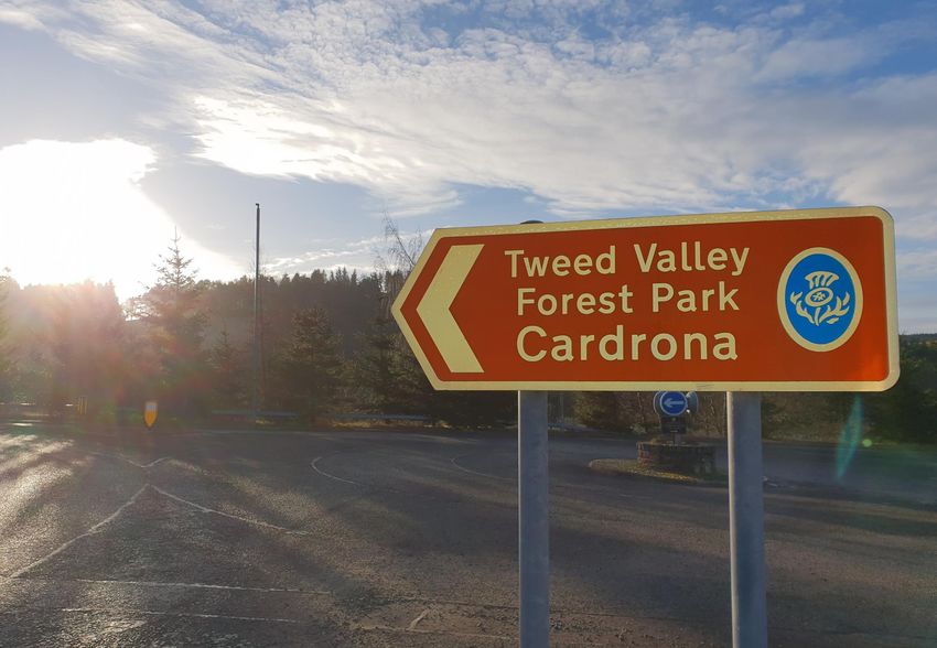
2. Cardrona Context
3. Housing Opportunity
4. Effective Land Supply Criteria
5. Conceptual Masterplan
6. Summary and Conclusions
Author: Checked By: Date:
TF TJ 30/1/19
Ferguson Planning 3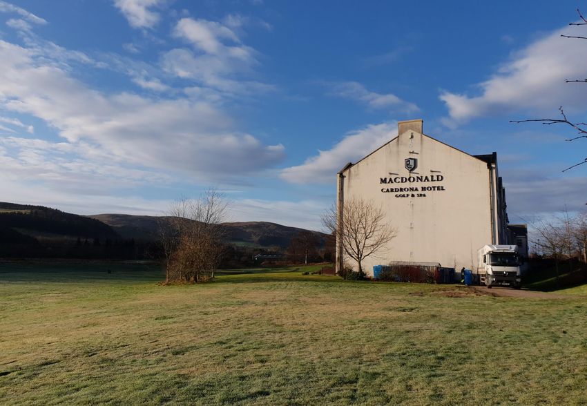
Introduction
      Overview                                                 Scope and Structure
                                                                                                        1
                                                         1.5   This statement reviews the current planning
1.1   We write on behalf of Renwick Country
                                                               policy context and summarises the design
      Properties in response to the request for
                                                               process which has led to the preparation of
      comments on the Scottish Borders
                                                               a conceptual masterplan for the site. The
      Local Development Plan 2 Main Issues
                                                               remainder of this report is broken down into
      Report (MIR).
                                                               the following sections:
                                                         •     Section 2 - Cardrona Context: Provides
1.2   This site representation relates (in part) to
                                                               background information to Cardrona and the
      site ACARD001 which, thus far, has been
                                                               context of the proposed site.
      excluded from the Main Issues Report.
                                                         •     Section 3 - Housing Opportunity: Considers
                                                               current proposals for housing land provision
1.3   The site was put forward as a potential
                                                               set out within the MIR and discusses the
      housing site at the “Call for Sites” stage. This
                                                               opportunity for the provision of housing on
      submission will make reference to the
                                                               the subject site.
      Planning Department’s (PD)        high     level
                                                         •     Section 4 – Effective Land Supply Criteria: the
      assessment and address why the site is
                                                               following      section outlines the Scottish
      indeed worthy of allocation (in addition
                                                               Government’s tests of site effectiveness and
      and/or instead      of     some       proposed
                                                               how the proposed Cardrona site meets those
      sites contained within the MIR). Evidence
                                                               tests.
      provided will show the site’s acceptability
                                                         •     Section 5 - Conceptual Masterplan:
      and its assistance in meeting the housing
                                                               Outlines some of the key built form,
      shortfall/need in Tweeddale.
                                                               landscape and movement principles. Indicative
                                                               plans are provided to help illustrate how
1.4   This submission is further supported by:
                                                               housing numbers, roads, footpaths and
      •     Landscape, Visual and Capacity Appraisal
                                                               landscape could be accommodated.
      •     Illustrative Masterplan
                                                         •     Section 6 - Summary and Conclusions: Sets
                                                               out a review and reflection of the design
                                                               development process and provides a link
                                                               through to the next development stage
                                                               process.

                                                                                    Ferguson Planning   5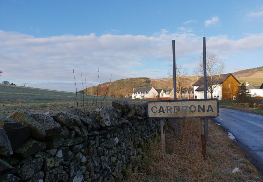
6
Cardrona Context                                                                                                                                                            2
      Cardrona
2.1   Cardrona is located approximately 3 miles         2.6   Cardrona is also a relatively small settlement                 2.8        Cardrona is situated within an area of
      east of Peebles and 3 miles west of                     with a total population of 880 recorded In the                            sensitive     landscape      that     requires
      Innerleithen, two key settlements within the            2011 census. As Cardrona has seen limited                                 consideration. This includes the River Tweed
      Western Borders Strategic Growth Areas as               expansion since its development in the late                               as a site of Special Scientific Interest (SSSI)
      identified within SESPlan (Refer to Figure 1).          1990s it has experienced limited population                               and a Special Area of Conservation (SAC) as
                                                              growth. There is an opportunity for                                       well as the wider landscape comprising the
2.2   The village is accessed via the A72 to the              Cardrona to expand in a respectable and                                   Tweed Valley and associated open
      north, or the B7062 to the south, both                  sustainable manner to the existing                                        countryside. These matters are reviewed in
      offering good accessibility to Cardrona via             settlement.                                                               detail by the Landscape, Visual and Capacity
      both the private car and public transport.                                                                                        Appraisal produced by Here + Now.
                                                        2.7   The village also boasts tourist facilities
2.3   Cardrona is approximately 15 miles or a 30              including the MacDonald Hotel and golf
      minute drive to Galashiels Train Interchange            course bolstering local employment and
      which provides services to Edinburgh and                facilities. The community is further serviced
      beyond. Travel time directly by car is                  by a local café.
      approximately 40 minutes to the Edinburgh
      Bypass and a further 20 minutes into the city
      centre.

2.4   Cardrona is situated in a sustainable location
      as it is regularly serviced by the local public
      transport network. The village is serviced by
      four bus routes, the 62B, 363, P32 and X62
      providing regular services every 30 minutes to
      Melrose, Innerleithen, Peebles, Edinburgh and
      Galashiels.

2.5   As a relatively new settlement Cardrona has
      the capacity to allow for further housing
      growth in the Western Borders and to
      take pressure off constrained settlements
      such as Peebles.                                            Figure 1. Site location in the Western Borders Strategic Growth Area. Source: Here + Now | urban design futures.
                                                                                                                                                                 Ferguson Planning   7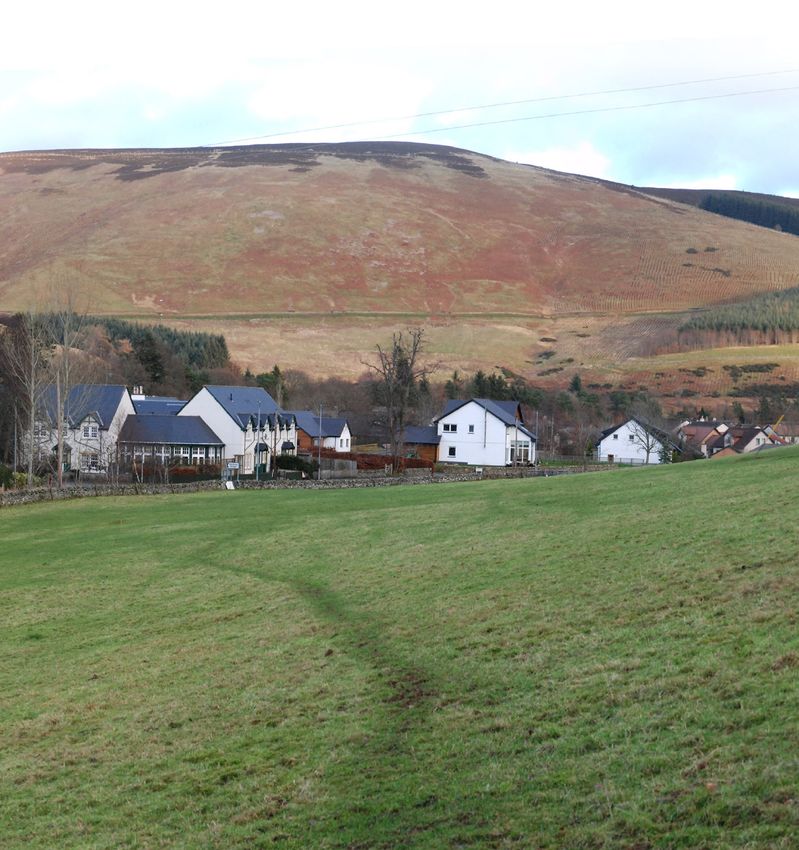
Historic Development
2.9     Cardrona is unique in the Scottish Borders as            2.11      Historically the only existence of Cardrona                                                                     2007
        there are no other new settlements of its                          on maps included Cardrona Mains and
        kind. It was created through an award                              Cardrona Hill as shown on Figures 2 and 3.
        winning rural village design concept by
        leading Architects.                                      2.12      After development of Cardrona began in
                                                                           1999, there has been minimal expansion to
2.10    Cardrona is the first settlement to be                             the settlement      as     its townscape has
        created in the Borders for over 200 years and                      stayed relatively similar to the aerial Google
        was initially a major intervention in the                          Earth image from 2007 (shown in figure 4).
        landscape. The village was developed as part                       Cardrona has not experienced significant
        of a tourism project comprising a hotel, golf                      expansion like other Borders settlements. Its
        course and village. An historic hamlet was                         development to the north and east is
        located at Cardrona Mains, where there is                          constrained by the Tweed River and the
        a cluster of C-listed buildings and which are                      south is constrained by the golf course. There
        now fully integrated within Cardrona village                       is therefore minimal opportunity available for
        and softened with boundary treatment and                           expansion to the settlement beyond that
                                                                           proposed on the subject site.                        Figure 4 Aerial image Cardrona 2007. Source: Google Earth Pro
        open space.
                                                                                     1883                                                                                                  1906

       Figure 2 Historical map of Cardrona. Source: National Library Scotland                             Figure 3 Historical map of Cardrona. Source: National Library Scotland
                                                                                                                                                                   Ferguson Planning   8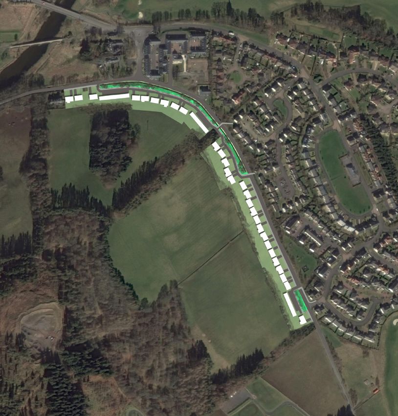
Site Context
2
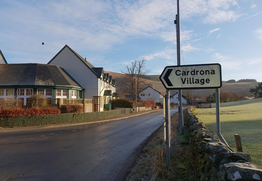
2.13 The subject site is located directly adjacent to
the current Cardrona settlement on land
south of the B7062. The site has the capacity
to introduce circa 30-40 new housing units to
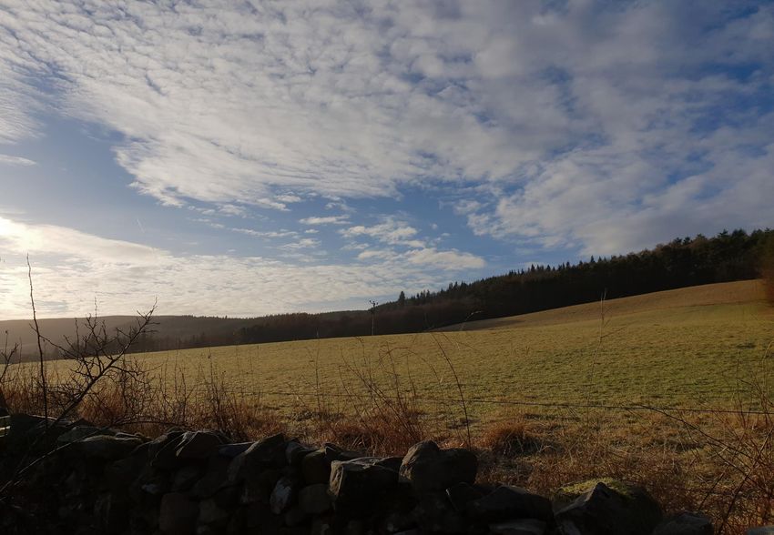
Cardrona. It is within an area of agricultural
land currently used for low level sheep grazing
and contained by the hill to the south. Images
of the site are shown in Figures 5, 6 and 7. The
proposed site is not identified as being in a Figure 5 north facing direction of site
flood risk zone and sits low within the
landscape.
2.14 Figure 8 and appended plans indicate the area
shown in red is the area being considered for
future housing development with the wider
area retained under client control to enable
any potential wider landscape measures.
2.15 The agricultural landform is restricted by the
embankment which runs up from the rear of
Figure 6 west facing direction of site
the subject site to a dense woodland that sits
at the top of the hill. This also acts as a form of
containment for the proposed housing.
2.16 The site is bound to the north and east by the
B7062 and existing housing, to the west by 2
existing residential dwellings and to the south
by a embankment towards the summit of
Cardrona Hills and a tree belt.
Figure 8 Potential developable area on the site. Source: Here + Now Figure 7 east facing direction of site
Ferguson Planning 9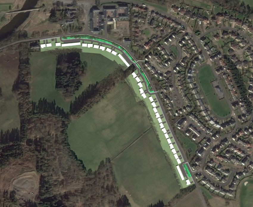
Housing Opportunity
      Overview                                                  Main Issues Report
                                                                                                                                                                   3
3.1   The scale of housing required for the Scottish                                                              3.9    In addition to being more suitable than the
                                                          3.5   The identification of a site to the north of
      Borders area is set out within SESPlan and                                                                         above site, (in our opinion), it again should
                                                                Cardrona (SCARD002) land at Nether
      to be updated shortly once SESPlan2 has                                                                            also be seen as sequentially preferable to
                                                                Horsburgh as a potential ‘’Longer Term’’
      been formerly adopted.                                                                                             other local sites identified. In particular:
                                                                mixed use site indicates that the Council
                                                                recognise the opportunity for further
3.2   The proposed SESPlan Spatial Strategy                                                                              - Ref. MESHI001-Eshiels-200 units
                                                                development including housing to be located
      identifies Cardrona within the Western                                                                             - Ref. MESHIE002-Eshiels-40 units
                                                                in or near Cardrona.
      Borders as a Strategic Growth Area (SGA) and
      the Northern Housing Market Area (HMA). It          3.6   In our opinion, the allocation of land to the     3.10   Ferguson Planning have reviewed the Local
      is also identified, at the local level by LDP2            north of Cardrona, has not fully proven to be            Development Plan 2 (LDP) and Main Issues
      Main Issues Report (MIR), as being within the             in line within the associated SEA criteria nor           Report (MIR). In particular the ‘Growing our
      Tweeddale Locality.                                       be deliverable in the short to medium term.              Economy’ and ‘Planning for Housing’ Chapters
                                                                The same conclusion is also reached for the              as they both relate to the potential allocation
      The Scottish Borders Local                                sites mentioned at Eshiels and sites identified          of new housing lands for the LDP 2.
      Development Plan (2016)                                   later in this report.
                                                                                                                  3.11   Prior to coming on to answering the related
3.3   Housing         Supplementary          Guidance     3.7   Subject site provides a strong opportunity to            questions within the MIR we would make a
      accommodating the Scottish Borders Local                  provide an expansion of the settlement and at            number of observations in terms of approach
      Development Plan identifies a total of 135                a scale which is in keeping. The opportunity is          or structure of the MIR report and potential
      houses in the Northern Housing Area Markets               deliverable in a short     time-frame (ie. 5             improvements when producing the Proposed
      within Peebles and Innerleithen. The most                 years) and will assist in addressing the                 Plan.
      significant allocation is for 70 units at March           local housing shortfall in Tweeddale.
      Street Mills, in the centre of Peebles which is
      not yet developed.                                  3.8   The proposed site most certainly should be
                                                                considered more favourably in planning terms
3.4   It is considered that the Tweeddale locality is           than the potential large allocation detailed
      significantly under delivering housing sites              within the MIR to the north of the A72
      and not keeping pace with the ever increased              (ref.SCARD002) which      is      considered
      consumer demand. Immediate steps are                      (including by SNH) to be exposed in the
      required and with it allocation of further sites.         landscape and with no strong relationship
      The lack of clarity on specification and timing           to the existing village.
      of a bridge crossing within Peebles is further
      adding to housing constraints in the short to                                                                                           Ferguson Planning   11
      medium term.
Current Housing Overview
3.16 Table 1 ‘Housing Land Requirement’ outlines 3.17 The above requirement seeks the delivery of
3.12 There is a requirement for the LDP 2 approximately 839 homes per annum.
Proposed Plan to use the most recent housing the Scottish Borders Supplementary Guidance
(SG) and which was based on the SESplan Whether one takes the HNDA or SSG it is
dataset that emanates from the SESPlan 2 critical to appraise whether that annual target
Examination/Adoption. It is expected that a Supplementary Guidance (SSG).
and related effective 5 year land supply is
clearer picture will follow in the LDP 2 being delivered.
Proposed Plan as at that stage the Table 1: Scottish Borders Housing Land Requirement
latest housing audit will have fed into the 3.18 It is noted by the Council within paragraph 5.1
process. of the LDP2 MIR that “a site is only considered
Housing 2009-2025
to be effective where it can be demonstrated
3.13 However, as part of this consultation process, Requirement that within 5 years it will be free of constraints
while not always directly comparable, it is and can be developed for housing”.
important to make some observations on 2009-2019 9,650
housing requirements, supply and whether, at 3.19 With that in mind and the aforementioned
the current time, there is agreement that an 2019-2024 3,280
yearly requirements mentioned previously
effective 5 year land supply exists within the 2025 492 one requires to look back and understand if
Scottish Borders (as required by SPP and that has been achieved and if not what
SESplan policy guidance). TOTAL 13,422
actions are going to be taken to rectify the
shortfall.
3.14 There is limited value going back over data
that is considered out of date or superseded. 3.20 This is clearly outlined by the Reporter in the
However, it is worth touching upon housing recent SESplan2 examination. The relevant
supply and completions to understand extracts are outlined:
whether there is or could be an effective five
year housing land supply and whether
3. Replace the final sentence of paragraph
additional housing is required in the future to
ensure any shortfalls are addressed. 5.11 with the following: “They will maintain a
five year effective housing land supply at all
3.15 The current LDP touches upon the related times, within each Council area, measured
HNDA and a yearly delivery target of 492 against the five year housing supply targets.
homes per annum. The SESplan These are calculated by multiplying the annual
Supplementary Guidance (SSG) target is average housing supply targets (Table 5.1) by
almost twice that.
five, and fully accounting for any deficit or
surplus in completions against the housing
supply target in previous years.
Ferguson Planning 12Any deficits arising must be added to the 5- 3.24 It would therefore suggest that, in annual 3.26 Undertaking the five year effective
3
year all-tenure housing supply target to terms, housing delivery is running at c. 65% land supply study will also require a
ensure that the whole target is achieved by below the required target and gives rise to “reality check” and full understanding of the
the end of the plan period." significant questions as to how the current Scottish Borders Housing Market. This, in our
land supply can indeed be considered opinion, should lead to the allocation of
4. Replace the first sentence of paragraph “effective” now or into the future. This is further deliverable sites in areas where
5.12 with the following: "Where a shortfall in further confirmed with the fact that historic people wish to live, such as Cardrona.
the five year effective land supply is identified, trends show that, on average, 43% of
sites for greenfield housing development completions are from windfall sites. 3.27 These are the locations that housebuilders
proposals may be allocated in Local want to develop in and are based on
Development Plans or granted planning This leads to two general conclusions: consumer demand. Recent trends show that
permission to maintain a five years effective the majority of housebuilding in the Scottish
housing land supply, subject to the following • There is considered not to be a five year Borders has been by Affordable Housing
criteria:” effective land supply providers. While this is commended, going
forward, it is vital that a significant uplift in
3.21 In simplistic terms, when one acknowledges • There is a “root and branches” review private sector housing is delivered across the
the annual housing requirement and then required of the sites deemed to be Scottish Borders.
reviews, for example, Appendix 2 - Table 9 “effective” prior to the Proposed LDP2
and 10 of the adopted LDP it gives rise to consultation. It would appear from a 3.28 Not least to provide an appropriate tenure
significant concern regarding an effective five review of available documentation that mix but also in that the private sector housing
year land supply. the sites allocated within the current LDP will assist in cross funding affordable housing
are not entirely “effective” and will not in that particular area. Housebuilder interest
3.22 It shows that over the five years between meet the five year supply targets in full as (led by the market) is often in the more
2010 and 2014/15 there was an average sought by SPP and SESplan. affluent towns where demand far outstrips
annual completion trend rate of some 367 supply both for mainstream and affordable
dwellings per annum. 3.25 The forthcoming Planning Bill does touch housing. It is this issue that the LDP2 must
upon further gatechecks to better understand address and pro-actively plan for.
3.23 Further completion trends are outlined within the actual delivery of allocated sites. While
the MIR (Table 4) and Scottish Borders this may not mean the removal of some sites
Housing Audit 2018 (Table 8) for the years it does mean that they should be moved into
2012/13 to 2016/17 showing an annual a non-effective/constrained or long term
(average) housing delivery of only 298 development opportunity.
dwellings. This indicates a fairly significant
drop in housing delivery and cause for
concern.
Ferguson Planning 13Future Housing Overview
3.29 Much of the LDP2 MIR quite rightly focuses 3.33 One requires greater clarity on how any sites
on planning for the future of housing delivery considered “potentially effective” and “Post
in the Scottish Borders. Year 7” have been arrived at and beyond that
how the 1,827 units on constrained sites will
3.30 It details the future housing supply targets be addressed. There is passing comment that
within it and the appended technical note for the sites can be delivered within the plan
the years 2021/22 to 2030/31 and, while period of LDP2. But that largely fails to
slightly different years, relates to the SSG land address if or how the five year effective
requirements detailed within the Housing land supply, as it currently stands, will hit the
Supplementary Guidance (SG). target levels set? And if they are not
what additional sites are being provided to
3.31 However, it is ill-advised to purely ensure it is met.
focus on those second ten year supply targets
(ie. 2021/22 to 2030/32) as being all that 3.34 Housing delivery analysis should be
LDP2 requires to concern itself with. There is undertaken annually and local councils
a requirement to understand whether the stepping in where shortfalls have been
first five year supply targets that form identified.
part of the current LDP are in fact being
delivered in full as sought by SPP and 3.35 We are now into 2019 and in the fourth
SESplan. If not and, as previously outlined year of the LDP. One would therefore expect
in the Reporter’s conclusions to the to see all the sites identified to be
SESplan2, that shortfall must be carried completed or under construction.
forward and added to any future
requirement. 3.36 While not exhaustive Table 2 on the following
page outlines housing sites identified in the
3.32 The Housing Technical Note that informs the LDP but which we consider likely to be
LDP2 MIR outlines in Table 4 what is constrained in whole or part.
considered to be the ‘Established Land Supply
(2017 HLA). There are a number of concerns 3.37 Thus the need to consider additional
when reviewing the table. The first being opportunities that are likely to be more
looking at past trends in the ‘Effective (Years deliverable within a shorter time frame.
1-5)’ supply against the annual delivery in
reality.
Ferguson Planning 14Table 2: Potential LDP (Adopted) Constrained / Non Effective Sites
Market Area Reference Unit Constraints LDP (Adopted)
No. Sites
Supplementary EA200-Ashkirk 20 • 2019 Not Started
• Marketed. No Purchaser
Guidance sites
Central HMA • Low Market Demand
SG- 100 • 2019 Not Started
• Slow/Long Build Out Rate
ACOLD011- • No Planning Permission
• Access/Infrastructure
Berwickshire Coldstream • Low Market Demand
• Unlikely to be started / completed by LDP 2021
• Slow/Long Build Out Rate
HMA MCHIR001- 60 • 2019 Not Started
• Access/Infrastructure
Chirnside • No Planning Permission
• Lower Dev. Density
• Low Market Demand
• Unlikely to be started / completed by LDP 2021
SG- 100 • 2019 Not Started • Slow/Long Build Out Rate
AKELSO26- • Phase 1 requires to be built out first • Access/Infrastructure
Central HMA
Kelso • Access/landlocked in short term • Lower Dev. Density
• Unlikely to be started / completed by LDP 2021 • Unlikely to be started / completed by LDP 2021
SG- 50 • 2019 Not Started EC2- 6 • 2019 Not Started
RKELSO002- • No Planning Permission Clovenfords • Land in Administration / Auction
Kelso • Significant Access/Parking Constraints • Flooding
• Listed Building / Capacity Constraints • Unlikely to be started / completed by LDP 2021
• Unlikely to be started / completed by LDP 2021 EC6- 60 • 2019 Not Started
SG-ASELK033- 30 • 2019 Not Started Clovenfords • No Planning Permission
Selkirk • Potential Flooding Constraints • Unlikely to be started / completed by LDP 2021
• Unlikely to be started / completed by LDP 2021 AEARL011- 120 • 2019 Not Started
SG- 75 • 2019 Not Started Earlston • Phase 1 requires to be built out first
MSELK002- • No Planning Permission • Access/landlocked in short term
Selkirk • Potential Flooding Constraints • Landscaping / Flooding
• Potential Contamination from Mill • Unlikely to be started / completed by LDP 2021
• Unlikely to be started / completed by LDP 2021 EGL17B/41/L32 270 • 2019 Not Started
SG- 300 • 2019 Not Started B/GL200 - • No Planning Permission
ATWEE002- • No Planning Permission Galashiels • Land in Administration / Auction
Tweedbank • Major Transport & Utility Infrastructure • Land locked (in part)
Required • Low Market Demand
• Potential Flooding Constraints • Access / Trunk Road
• Environmental/Landscape Constraints • Topography / Engineering
• Unlikely to be started / completed by LDP 2021 • Unlikely to be started / completed by LDP 2021
Western HMA SG- 30 • 2019 Not Started AGATT007- 40 • 2019 Not Started
MPEEB006- • No Planning Permission Gattonside • Planning Permission (no action)
Peebles • Phase 1 requires to be built out first • Sale Value Expectations
• Access/landlocked in short term • Flooding
• Potential Flooding Constraints • Unlikely to be started / completed by LDP 2021
• Unlikely to be started / completed by LDP 2021 EL16B- 7 • 2019 Not Started
SG- 70 • 2019 Not Started Lilleasleaf • Bought by Community Trust
MPEEB007- • No Planning Permission / ‘Live’ Appeal in • Community Garden
Peebles progress • No houses to be developed on land
• Unlikely to be started / completed by LDP 2021 • Unlikely to be started / Ferguson
completedPlanning
by LDP 202115
SG Total: 755Table 2 continued…
EM32B-Melrose 230 • Lower Density than specified AEDDL002- 35 • 2019 Not Started
• Topography / Access (in part) Eddleston • Low Market Demand
ANEWT005-NSB 900 • 2019 Not Started • Access
• Land locked (in part) • Topography/Landscape
• Low Market Demand • Density
• Access / Infrastructure • Unlikely to be started / completed by LDP 2021
• Landscape Western AWALK005- 100 • 2019 Not Started
• Topography / Engineering Walkerburn • Low Market Demand
HMA
• School Provision • Access
• Will not be completed by LDP 2021 • Topography/Landscape
ASELK021-Selkirk 20 • 2019 Not Started • Density
• Potential Flooding Constraints • Unlikely to be started / completed by LDP 2021
• Unlikely to be started / completed by LDP 2021 Outside BC04B- 45 • 2019 Not Started
AAYT0003-Ayton 20 • 2019 Not Started Cockburnspath • Low Market Demand
HMA
• No Planning Permission • Access
Eastern • Low Market Demand • Density
HMA • Phase 1 requires to be built out first • Unlikely to be started / completed by LDP 2021
• Access/landlocked in short term
• Unlikely to be started / completed by LDP 2021 LDP- Sub Total 2,439
Aeyem006-7- 132 • 2019 Not Started
Eyemouth • No Planning Permission TOTAL 3,194
• Low Market Demand (SG+LDP)
• Slow/Long Build Out Rate
• Access/Infrastructure
• Lower Dev. Density
• Unlikely to be started / completed by LDP 2021
BEY2B-Eyemouth 244 • 2019 Not Started
• No Planning Permission
• Low Market Demand
• Slow/Long Build Out Rate
• Access/Infrastructure
• Lower Dev. Density
• Unlikely to be started / completed by LDP 2021
MREST001-Reston 100 • 2019 Not Started
• No Planning Permission
• Slow/Long Build Out Rate
• Access/Infrastructure
• Contamination
• Unlikely to be started / completed by LDP 2021
Northern TE6B-Eddleston 30 • 2019 Not Started
HMA • Low Market Demand
• Flooding
• Topography/Landscape
• Density
Ferguson Planning 16
• Unlikely to be started / completed by LDP 2021Proposed Allocations: Deliverability
3
3.38 As we have indicatively shown there are Concerns 3.45 Within Table 3 below we note sites that again
land allocations totalling a significant 3.42 Moving forward to the LDP2 MIR and the we would request be reviewed in greater
3,194 homes, 200 of which are in the approach in identifying new land for housing detail in relation to their general location
Western HMA that we would question in in the forthcoming LDP2. We again have some acceptability and overall deliverability in the
terms of being fully deliverable as part of reservations regarding the approach taken in short to medium term. Many of which are
any five year effective land supply or during allocating certain sites and the lack of identified in areas where large allocations are
the lifespan of the current LDP. allocations within demand housing market yet to come forward and thus adding further
areas and towns. allocations in these areas requires greater
3.39 Even if one were to take the approach that consideration.
50% of the above sites were delivered be it 3.43 As noted previously we consider prior to
within the 5-10 year cycle that still producing the LDP2 Proposed Plan further 4.46 The MIR notes that it will consider stand
results in c.1,597 homes not meeting the review is required and in taking on board the alone new settlements. It would appear that
LDP’s objective on housing delivery. outcome of SESplan2. In our opinion there one is being looked at nearby at Eshiels. For
needs to be an increase to compensate for this to be considered it requires significant
3.40 In short there are arguably a further the identified shortfall. evidence that such proposals are deliverable
1,500 to 3,000 new allocations required in within the lifespan of the LDP. In addition to
order to meet set targets given the 3.44 If that requires altering the total allocation this extending existing settlements, such as
constraints of existing allocated sites. An over within the Housing Market Areas then we Cardrona, should be seen to be sequentially
reliance on windfall sites should not be consider that should be undertaken. Over preferable. Not least because the
advocated by the LDP2 but more modest and identifying land in locations where there is infrastructure already exists and thus has a
deliverable sites added to the housing supply. not significant housing demand is much greater chance in being delivered.
counterproductive and only going to lead to
3.41 To be clear we are not advocating in whole or housing targets not being met and pent up 3.47 We have outlined within this representation a
part that the sites be removed but more an demand in areas where developers and site immediately adjacent to Cardrona that
acknowledgment that there are more people wish to live. we consider capable of delivering in the short-
long term opportunities that are unlikely to go term and that should be allocated for housing
towards providing an effective five year land in addition to / or in place of other
supply. Thus there is a need to provide sites opportunities highlighted by the LDP2 MIR
that can be delivered within a 5 year period. consultation paper. There is a need for sites
of a modest scale (30 – 40 units) that are in
locations that are attractive to developers;
that can commence in a relatively short
timeframe, and are of a scale that do not
require major investment in infrastructure
Ferguson Planning 17Table 3: MIR Proposed / Alternative - Site Constraints
AEDDL009- 35 • Existing Undeveloped Allocations
Market Area Reference Unit Constraint
Eddleston • Transport Impact
No. • Landscape Impact
Supplementary • Infrastructure
Guidance (MIR) • Low Market Demand
Sites • Unlikely to be completed by LDP2
Eastern / MDUNS005- 100 • Landlocked/Access SEDDL001- TBC • Existing Undeveloped Allocations
• Flooding Eddleston • Transport Impact
Berwickshire Duns
• Existing Undeveloped Allocations • Landscape Impact
HMA • Infrastructure
ACOLD014- 100 • Landlocked/Access • Low Market Demand
Coldstream • Flooding • Unlikely to be completed by LDP2
• Existing Undeveloped Allocations SPEEB009- TBC • Transport Impact
Western / MESHI001- 200 • No settlement Peebles • Landscape/Environmental Impact
Eshiels • Access • Flooding
Tweeddale
• Infrastructure /sewerage • Infrastructure
HMA • Landscape / Ecology Impact • Unlikely to be completed by LDP2
• Unlikely to be completed by LDP2
MESHIE002- 50 • No settlement
TOTAL 675+
Eshiels • Access
• Infrastructure /sewerage
• Landscape / Ecology Impact
• Unlikely to be completed by LDP2
SCARD002- TBC • No settlement
Cardrona • Access
• Infrastructure /sewerage
• Landscape / Ecology Impact
• Unlikely to be completed by LDP2
SPEEB008- TBC • Landlocked / Access
Peebles • Transport Impact
• Landscape Impact
• Infrastructure
• Unlikely to be completed by LDP2
APEEB056- 150 • Transport Impact
Peebles • Landscape Impact
• Infrastructure
• Unlikely to be completed by LDP2
AEDDL008- 40 • Existing Undeveloped Allocations
Eddleston • Transport Impact
• Landscape Impact
• Infrastructure
• Low Market Demand
• Unlikely to be completed by LDP2
Ferguson Planning 18Effective Land Supply Criteria
Effective Land Supply Criteria Table 4: Effective land supply criteria and site assessment
4
4.1 It is considered that the planned development Effective land Interpretation Site Assessment
of housing on the subject site is not only supply Criteria
✓
deliverable within a five year time frame but Ownership the site is in the ownership or All landowners are actively promoting the site for
control of a party which can be development and are willing to work together to achieve that
could help to round off development on the
expected to develop it or to release aim
southern side of Cardrona. The existing it for development
topography of the landscape and natural
woodland act as a natural boundary to create
✓
Physical the site, or relevant part of it, is The area of the site put forward as suitable for development is
a strong, defensible settlement edge. Further
free from constraints related to considered to be free from physical constraint as identified in
commentary on this is provided in the following slope, aspect, flood risk, ground the accompanying LVIA. The site is capable of being accessed
sections stability or vehicular access which from the existing road network. We believe that HSE pipeline
would preclude its development installation safety requirements have been taken into account.
4.2 In the Effective Land Supply, it is acknowledged
not all of the sites in the audit will be effective,
Contamination previous use has not resulted in
contamination of the site
The site has always been in agricultural use and there is no
known contamination on the site. ✓
and it is important that the audit distinguishes
effective, i.e. unconstrained sites, from those Deficit funding any public funding required to The development would be financed privately with no public
which are affected by constraints and cannot make residential development funding sought. An affordable housing provider may be
be overcome in time to contribute to the
housing land requirement.
economically viable is committed
by the public bodies concerned
brought in to deliver that aspect. There are no known deficits
or constraints to funding the development. ✓
4.3 As shown in Table 4, the proposed site meets
all of the Effective Land Supply criteria and Market ability the site, or a relevant part of it, can The site is considered to be capable of delivering in the short-
be developed in the period under term (0-5 years) should it be allocated for housing. The client ✓
therefore is deemed as an acceptable site to be consideration; has recently sold allocated housing land in Cardrona and
included as a housing allocation site in the expressions of development interest in the subject site can be
Scottish Borders LDP 2. provided if required.
Infrastructure the site is either free of It is understood that water / drainage capacity is available in
infrastructure constraints, or any the existing network. Utilities infrastructure and any road
required infrastructure can be
provided realistically by the
improvements that may be required to serve the
development can realistically be provided by the developer. ✓
developer
Landuse Housing is the sole preferred use of The request for this site to be allocated as housing is the sole
the land in planning terms purpose of this representation. ✓
Ferguson Planning 19Cardrona
Site Reference Site name Settlement RGA Proposed Use Indicative Capacity Ha MIR status
ACARD001 South of B7062 Cardrona Western Housing 30-40 3.5 Excluded
Initial assessment
Floodrisk SAC SPA SSSI Ramsar
N/A N/A N/A N/A N/A
Initial assessment summary
• The site is within the Tweed Valley Special Landscape Area.
• The River Tweed has a number of local environmental designations e.g. SSSI, SAC, however none within the proposed site identified for housing development.
• SEPA 1 in 200 year flood mapping shows no likelihood of river or surface water flooding. There are no water courses on the site.
Background Information
Minerals and coal NNR Prime Quality Agricultural Land Current use Planning history references
N/A N/A On/Adjacent to site Greenfield As part of the original Golf course village development (97/05665/REM).
The site (ACARD001) was considered as part of the Housing SG.
There have been no site specific applications on the site.
Accessibility and sustainability assessment
Access to public transport Access to employment Access to services Wider biodiversity impacts Site aspect
Good Good Good
Accessibility and sustainability summary
The site is located in a sustainable location and is close to the strategic public transport network. The site is serviced by a bus route that runs along B7062 through the bus
stop at Cardrona Mains going both directions is located directly opposite the site. The main bus stop located at Cardrona Shop is located within a few minutes’ walk from the
site, providing a regular connection to Peebles, Innerleithen, Melrose, Galashiels and Edinburgh. The hotel, golf course and services provided adequate employment
opportunities and its close proximity to Peebles ad Innerleithen, also provide further opportunities.
Local impact and integration assessment
Conservation area Open space Listed Buildings Scheduled Monument Ancient woodland inventory Archaeology Garden and designed
N/A N/A Adjacent to site N/A N/A Adjacent to site N/A
Local impact and integration summary
The site will have no direct impact on existing historical buildings in Cardrona.
While there are no known archaeological sites within the proposed, in any case that there may be archaeological issues, an archaeological impact assessment may need to be
carried out.
Ferguson Planning 20Landscape Assessment
NSA SLA Over 200 metres? Over 12 degree slope? Wild land
4
Landscape summary
The character of the landscape established a setting which due to its undulating landform and associated treebelts/pockets can absorb further development.
The development site offers strong back-clothing, and the shelter belt and forestry plantation associated with the site and within the landscape context which forms
landscape compartments in this undulating landscape.
These actions may increase the existing landscape’s capacity for development or enhance the existing environment for both the settlement and its context.
Planning and infrastructure assessment
Physical access/road capacity
The development of the site will impact on the location of 30 mph speed limit, however this offers an opportunity to provide improvements to road safety measures.
The B7062 road that runs between Cardrona and the site provides a connecting route to the surrounding area. The scale of development is respectful of the village setting
and the limitations of the road.
Right of way TPOs Contaminated land Water supply Sewerage Gas Supply Education Provision
N/A N/A Available Available Available Good
Planning and infrastructure summary
It is acknowledged that a Transport Assessment will be required to assess the capacity of the B7062 road and its use as a housing access.
Development of the site may require improved safety measures to be implemented on the B7062 road, including pedestrian crossing, street lighting and extension of the
30mph speed limit.
The site is in a sustainable location as it is in close proximity to public transport networks.
Any upgrade top the infrastructure would be undertaken by the developer.
Overall Assessment
MIR Status Overall assessment Site Capacity
Excluded Acceptable 30-40
Conclusions
The site comprises a large grassland located to the south of the B7062 in Cardrona. The landscape of the site is characterised by a gradual incline from the road up towards
Cardrona Hill. Due to the difficult topography, development potential of the site is limited to the section following the B7062 edge.
The site is within the Tweed Valley Special Landscape Area, however there is none in the proposed development site.
New landscape treatment of the new southern extents of Cardrona settlement should be positively incorporated.
Landscape buffers will be required and the long term maintenance of the landscaped areas must be addressed; Refer to Landscape Appraisal provided.
In conclusion, it is not considered that there are any insurmountable planning issues, which cannot be overcome through mitigation. Therefore, the site is deemed acceptable
as a preferred housing site allocation.
Ferguson Planning 21Conceptual Masterplan
Table 5. Outlining constraints and opportunities on the site
5
5.1 This section sets out the key policy-related Contextual Key Features Opportunities/ Constraints
and physical features in Table 5 that have Analysis
been identified throughout the report. From • Subject site near an established • Provide development that is in keeping
these features opportunities and constraints residential development across the with the residential areas of Cardrona.
that will help shape and guide a masterplan B7062. • The proposed site is not identified as being
have been highlighted and interpreted by Strategic and Local • The site is located along the south of the within a flood risk area.
indicative masterplans of how the site may be Setting B7062 and would strengthen and round
developed. off the settlement southern boundary.
• The majority of the site gradually slopes • Ensure development layout responds
towards the Tweed. directly to the need for levels on the site to
• The shelterbelt/woodland along the be addressed.
southern boundary provides screening • Contain development towards the B7062,
from Cardrona Hills. as the land slopes steeply upwards,
• Traditional stone wall runs along the development will need to be carefully
Topography and northern edge of the site. designed to respect the topography.
Landscape • The site is identified as a Special Landscape
Area, therefore it is essential that any
development is sensitive and respectful of
the surrounding area.
• Provide additional screening on the
northern boundary following the B7062 to
enable reduced views from the road.
• The site is accessed via the north • Introduce properties that have front
through the A72 or the B7062 from the gardens and stone wall boundary
south. treatments.
• The townscape is traditional of built form • Provide a new pedestrian access point from
Townscape and found within the Scottish Borders. the site into the existing village and The
Connections Green.
• Provide new pedestrian footpaths and
street lighting along B7062 as traffic
calming measures.
• Extend the 30mph speed limit to Cardrona
Way Junction. Ferguson Planning 235.2 The following masterplan (Fig.9) layout
outlines how the proposal can be developed
in response to the key opportunities and
constraints of the site. The indicative
layouts focus on how a development would
respond to the fabric of the existing village
and the topography.
5.3 The layout shows a density of approximately
30-40 dwellings. This density level enables
the site to deliver affordable housing as part
of the development and introduce enough
development in order to shape the southern
settlement boundary of Cardrona. This latter
point is encouraged by the Border Council’s
SPG Placemaking and Design (2010) on the
design and guidance for ’10-49 houses on or
near settlement edge.’
5.4 The density and location of the development
also responds to criteria set by Policy PMD2
Quality Standards of the Scottish Borders
Local Development Plan, which stipulates that
a development should be of a ‘density
appropriate to its surroundings’.
Figure 9 Indicative masterplan of proposed site and its integration into the existing village. Source: Here + Now
Ferguson Planning 24Summary and Conclusions
Summary
6.9 It is possible for the new housing
6
6.1 It is positive that the LDP2 MIR has identified 6.5 The proposal also can assist in creating a new
the Cardrona area as being suitable for gateway to Cardrona from the East and development to be absorbed into the
expansion. However, we consider the West as well as traffic calming measures landscape successfully through strong
identified location on the opposite side of the along the B7062. landform, ensuring field patterns and tree and
A72 to be misguided. The subject site is hedgerow cover are integrated respectfully.
considered the more logical area in terms of 6.6 The development would create a safer Careful consideration of the landscape
growth and relationship with the existing pedestrian environment as the housing ensures the new development doesn’t appear
settlement. development is likely to require increased too elevated in relation to the existing
safety measures to be implemented along the settlement.
6.2 A masterplan solution has been provided B7062, such as the earlier introduction of the
which explores the housing potential of the 30mph speed limit and, pedestrian footpaths 6.10 The PD outlined, in the review of the subject
site and sets out a vision for a new housing and street lighting. site, previous comments made by the
development south of B7062 to create a Reporter during the current LDP review.
strong, defensible settlement edge to 6.7 There are no protected trees on or adjacent
Cardrona. This proposal responds to the to the site and there are no international or 6.11 This process should be about looking at new
existing landscape characteristics of the local national designation constraints associated sites afresh and appraising them on today’s
area, and provides a design solution to with the site. The site is located within the requirements and associated evidence.
accommodate approximately 30-40 new Tweed Valley SLA and it will be important to
residential dwellings. respect the landscape setting through 6.12 One also needs to take account of the
appropriate location and density of housing as potential contradiction in how other sites
6.3 The Site Assessment identifies the B7062 as well as though the implementation of robust have been reviewed. For example, a
separating the proposed development site to landscaping and structure planting, as possible large allocation (SCARD002) on the
the existing Cardrona village. However, the mentioned and shown within the Landscape opposite side of the A72 has been indicated at
proposed development will create a Appraisal. Cardrona and to which we believe would have
continuous extension of the already existing a far more significant impact on the landscape
village that will respect the character and 6.8 The opportunity is one which is considered and with no real relationship with the existing
landscape of the surrounding area as shown deliverable in a short time-frame given settlement.
in the proposed Masterplan. housing demand in this part of the Borders.
Cardrona is a popular village in which to live, 6.13 This is confirmed when one reviews the LUC
6.4 The development of the proposed site would mainly due to its countryside setting development appraisal undertaken on behalf
be incorporated within the existing character combined with excellent public transport links of the PD. It comments that it is not directly
of Cardrona and would therefore create an to both Edinburgh and the central and related to the settlement and that the site is
extended settlement boundary that is natural southern Borders via the A72. It is important highly visible and could potentially effect the
and appropriate. that land allocations are made in sustainable Special Landscape Area.
and sought after locations. Ferguson Planning 26Conclusions
6.14 Ferguson Planning believes the MIR does not • Being visually contained by existing tree •
currently provide enough land for housing in belts to the south east and by housing and
Response to MIR - Question 7: Do
the Western Borders Strategic Growth Area. It by further tree belt to the north-west. you agree with the preferred
also proposes to allocate a number of options for additional housing
sites in unsustainable positions. • Offering a housing land opportunity that is
in a sought after location to live.
sites? Do you agree with the
6.15 It is considered that the subject site should be alternative options? Do you have
included in any future provisions for • Creating a focal point at this other alternative options?
housing land within Local Development Plan 2 location/junction through a Gateway to
and for approximately 30-40 houses. We Cardrona and to reduce traffic speed on
believe that the site offers a strong the B7062 including footpath links to the
opportunity for residential development by: surrounding countryside and around the We disagree with the preferred site
village. allocations set out within the MIR and
• Being located within close proximity to the contend that there is a need to identify
original core of Cardrona Village, and in • Providing a footpath route that can be further appropriate housing land
close proximity to the bus stop and village integrated, offering an off road walking opportunities with the Western Borders area
centre. and biking route which links into the wider to ensure that demand is met and pressure
Core Path network. on Peebles is reduced. The site at the south
• Occupying only the lower part of the site of Cardrona provides a short term and
immediately adjacent to the existing • Providing an opportunity to increase the deliverable site that can contribute to the
housing and avoids the higher, more affordable housing supply in the village provision of additional units (30-40).
visible part of the site. alongside market housing. This site would
provide an excellent opportunity to work
• Having no direct impacts on the River with Scottish Borders Council /Eildon HA to
Tweed and there is no flood risk associated provide a further phase of Affordable
with the site. Housing units at this location. There is
known further demand for all tenures in
• Providing a logical extension and natural the Peebles Housing Market Area.
rounding off to the settlement boundary
towards the south of the village. • Being viable and deliverable within the 5-
Development which is close to rear of year plan cycle
houses opposite the B7062 would be less
dense to respect and reflect existing
character.
Ferguson Planning 27LANDSCAPE + VISUAL IMPACT APPRAISAL
LANDSCAPE CAPACITY STUDY
LAND SOUTH OF B7062 , CARDRONA
PREPARED ON BEHALF OF
RENWICK COUNTRY PROPERTIESCONTENTS Introduction Introduction & methodology.......................... 3 01 Site context Site context................................................... 5 Planning context........................................... 6 Built environment character.......................... 7 Built environment assessment...................... 8 Integrated Habitat Networks......................... 9 Landscape Character Assessment............... 10 02 Landscape analysis Boundaries, trees + woodland....................... 13 Landform & drainage..................................... 14 Built context .................................................. 15 Landscape appraisal...................................... 16 03 Landscape and visual analysis Viewpoint / receptor analysis........................ 18 Viewpoint photography: site.......................... 19 Viewpoint photography: landscape context.. 21 Visual appraisal and analysis: summary....... 22 04 Landscape capacity Landscape capacity...................................... 24 Landscape recommendations....................... 25 Urban design options.................................... 26 Urban design - notional housing layout......... 27 Indicative sections......................................... 28 Indicative masterplan - illustrative................. 29
INTRODUCTION + METHODOLOGY

This report provides an analysis and appraisal of the landscape character and
capacity for development of the land to the south of the B7062 where it forms the           A72
existing southern extents of the settlement of Cardrona. Land within this study
area is being proposed for potential housing development by Renwick
Country Properties. This report describes the landscape qualities and its                                              RIVER TWEED
                                                                                            MACDONALD
capacity for housing development.                                                           HOTEL
                                                                                                                                                                CARDRONA GOLF COURSE
The study provides a landscape and visual capacity appraisal for a new housing
development and includes an analysis of the impact of potential housing
development on the landscape character and townscape context. It includes
recommendations and mitigation measures which would positively enhance the
site’s landscape character and value, and help to manage the impact of housing                                       SEMI-DETACHED PROPERTY
                                                                                                                                                                    CARDRONA
on the visual amenity of this site.

This report is prepared by HERE+NOW with urban design expertise input from
consultants at Urban Design Futures. Landscape analysis informed an early urban
design layout response which provided extents and locations of development                                           LAND OWNED BY CLIENTS                                    CARDRONA
envelopes which form the basis for the assessment work.
                                                                                                                                                                              VILLAGE HALL

 For the purposes of landscape analysis, visual impact appraisal and
 landscape recommendations, it should be noted that development is only
 being considered in the lower part of the overall study area. Control of
 the overall area in ownership is retained which enables a comprehensive
 approach to be taken. As such, diagrams and landscape analysis /
 recommendations make specific reference to the stretch of land fronting
 the B7062 between the existing semi-detached building in the north west                                                                                                     CARDRONA
 corner and the field boundary diagonally opposite the junction of B7062 with                                       CARDRONA                                                 WAY
 Cardrona Way.                                                                                                      HILL

The analysis and appraisal exercise was carried out by desk and field survey,
with photography taken using a AF-S NIKKOR 18-70mm lens set to 50mm.                                                                                                           B7062
Individual photos were stitched using Adobe Photoshop ‘automate photomerge’.
Photographs were taken on publicly accessible land from a height of 1.65m using
a Nikon D80 505Si SLR.
                                                                                        Land ownership indicated over Google Earth aerial imagery.
                                                                                        A zone suitable for potential housing development is indicated as a finding in this report; landscape
A range of viewpoints were visited in order to appraise visual impact, the local site   analysis diagrams use the ownership boundary for the purposes of locating information and for ease of
impact, and potential changes to landscape character arising from the proposed          cross referencing.
development. The report identifies any significant direct or indirect impacts on the
character of the landscape and the visual impact from these viewpoints.

LANDSCAPE AND VISUAL IMPACT APPRAISAL | LANDSCAPE CAPACITY STUDY                                                                             LAND SOUTH OF B7062 , CARDRONA         |    3
01 SITE CONTEXT
SITE CONTEXT

THE SITE LOCATION

The sudy area is located on the southern fringes of the existing
settlement of Cardrona, a village which is approximately 3 miles east
of Peebles and 3 miles west of Innerleithen, two key settlements in the
Scottish Borders.

Cardrona is accessed via the A72 to the north, or the B7062 to the
south, both routes offering good transport connections. 15 miles east           PEEBLES
is Galashiels, which benefits from the Galashiels Rail/Bus Interchange.
Cardrona is approximately an hour’s drive from the centre of Edinburgh,
                                                                                      STUDY AREA        INNERLEITHEN
and the cluster of Tweed Valley settlements (Peebles, Cardrona,                                                                     GALASHIELS
Innerleithen) have very much formed their own economy and offer based
around outdoor pursuits and the leisure industry.

The Cardrona MacDonald Hotel is an important local employer, and
the golf course a key feature of this leisure landscape. In addition,
visitors come from much further afield to enjoy the excellent biking
infrastructure - routes, trails and cafes set within the rural Borders
landscape setting.

The study area is within an agricultural area of coarse grassland
                                                                            PEEBLES
currently used for sheep grazing. The southern extents give way to
the summit of Cardrona Hill, and the north edge of the site is fronted
onto by the residential properties which back onto the B7062. There is
evidence of informal use of the fields for dog walking, linking into the                               CARDRONA
wider footpath network.                                                                   STUDY AREA

The only existing building within the study area is a sub-station, in the
north west corner; there is an underground gas (ethylene) pipeline
                                                                                                                  INNERLEITHEN
within the area to the south, route indicatively shown on the landscape
analysis diagrams on p15.

                                                                                                                                   LINWOOD

LANDSCAPE AND VISUAL IMPACT APPRAISAL | LANDSCAPE CAPACITY STUDY                                        LAND SOUTH OF B7062 , CARDRONA   |   5
CLUSTER OF B-GRADE LISTED BUILDINGS AT
PLANNING CONTEXT NETHER HORSBURGH
The site is an area of open agricultural fields designated within the Tweed
Valley Special Landscape Area (SLA2). This designation is described in LCARD002
fuller detail on p9, where the landscape character is appraised.
Immediately to the north of the proposed development site is a site
MCARD006
identified for mixed use development - MCARD007, South of Horsbrugh LCARD001
Bridge (1.95ha.) This site has been allocated with a housing capacity of
5 units.
Further north, at the main approach to Cardrona from the A72 another
VIADUCT (LISTED)
housing site is identified - MCARD006, North of Horsbrugh Bridge RBUP/178/2 - CORE PATH
(1.59 ha.), with an indicative housing capacity of 25 units. This housing MCARD007 CLUSTER OF C-GRADE LISTED BUILDINGS AT
designation is supported by landscape and open space policies - CARDRONA MAINS (SEE P13)
SSSI / SAC - RIVER TWEED
LCARD001- open space and LCARD002 - woodland.
CAR
The historic settlement at Cardrona, Cardrona Mains, is formed of a
DRO
group of C listed buildings, which are situated immediately to the north
OW
NA
of the proposed site boundary. RBUP/180/1
N
SET
PROMOTED PATH
ERS
TLE
There are core paths in the area, which are noted to be very well used,
HIP
ME
however they do not bound or cross the proposed site.
BOU
NT
NDA
BOU
Y
AR
UND
ND
RY
IP BO
SH
ARY
R
NE
OW
(PE
R
INTG/54P/1 - PERMISSIVE/CUSTOMARY PATH
ENVIRONMENTAL DESIGNATIONS
SBC
)
There are a number of environmental designations within the landscape SLA 2 - TWEED VALLEY
context of Cardrona, specifically the River Tweed is both identified SPECIAL LANDSCAPE AREA
as a Site of Special Scientific Interest (SSSI) and a Special Area of
C-GRADE LISTED
Conservation (SAC). BUILDING
The wider landscape context comprising the Tweed Valley and associated
open countryside is a Special Landscape Area (SLA). INTG/160/3 - CORE PATH
Extract from Scottish Borders Local Plan (2016),
with ownership boundary overlaid
LANDSCAPE AND VISUAL IMPACT APPRAISAL | LANDSCAPE CAPACITY STUDY LAND SOUTH OF B7062 , CARDRONA | 6BUILT ENVIRONMENT CHARACTER
The majority of settlements in this part of the Scottish Borders
including Peebles, Innerleithen and Walkerburn, which are all in
relatively close proximity to the site, began as ribbon developments
located on the main roads that ran through the valley floors before
gradually expanding outwards to take the forms that they have today.
The original buildings are characterised by predominately stone
walls with a natural or harled finish, steeply pitched slate roofs and
narrow sash and casement windows and dormer windows in the roof
space.
The modern village of Cardrona takes many of its cues from these
traditional building forms. The layout comprises relatively compact
terraced houses grouped in mews courtyards around the original C
listed Cardrona Mains together with a larger and looser arrangement
of terraced and semi detatched houses to the south grouped around a
large village green. The mews houses are predominately 1.5 - 2 storey
and generally finished with a white render although they also contain
some small elements of natural stone and timber. Roofs are steeply
pitched with a grey slate finish throughout and incorporating dormer
windows projecting above the eaves as a repeating feature. The
Innerleithen Main Street and traditional building forms -
houses grouped around the village green are more stylistically varied
stone walls, steep slate roofs, sash and casement windows
incorporating a mixture of natural stone, brick and render but again
characterised by steeply pitched roofs and dormer windows.
There is a short terrace of original 1.5 storey stone cottages immediately
to the north of the site (photo 1) and a semi-detatched pair of original
1.5 storey stone cottages immediately to the west (photo 2).
The B7062 which runs along the eastern and northern boundaries of Photo 1
the site currently forms a boundary edge to Cardrona with the majority
of development turning its back onto the road.
Mews terraced housing around Cordrona Mains + adjacent
traditional stone cottages Photo 2
LANDSCAPE AND VISUAL IMPACT APPRAISAL | LANDSCAPE CAPACITY STUDY LAND SOUTH OF B7062 , CARDRONA | 7You can also read