Wye canoe? Canoeists' guide to the River Wye - GOV.UK
←
→
Page content transcription
If your browser does not render page correctly, please read the page content below
Wye canoe? Canoeists' guide to the River Wye
We are the Environment Agency. It’s our job to look after
your environment and make it a better place – for you,
and for future generations.
Your environment is the air you breathe, the water you
drink and the ground you walk on. Working with business,
Government and society as a whole, we are making your
environment cleaner and healthier.
The Environment Agency. Out there, making your
environment a better place to live and play.

This guide is also available in Welsh.
Mae’r cyfeirlyfr hwn ar gael yn Gymraeg hefyd.

Published by:
Environment Agency
Sapphire East
550 Streetsbrook Road
Solihull
B91 1QT
Tel: 03708 506506.
Email: enquiries@environment-agency.gov.uk
www.environment-agency.gov.uk

Cover photograph - canoeing at Ross-on-Wye

© Environment Agency
All rights reserved. This document may be reproduced with prior permission of the Environment Agency
ISBN: 978-1-84432-914-4
Edition: 13th edition 2011
Contents

Introduction                           04   Health and hygiene                                     24
The River Wye                          05   Health and hygiene guidelines                          24
Conservation of wildlife               06   Leptospirosis (Weil's Disease)                         24
Navigation and recreational advice     09   Itinerary                                              25
Navigation rights and access           09   Launching and landing                                  25
The Rivers Wye and Lugg navigation     10   Overview of map sections                               26
Canoeing on the River Wye              11   Maps                                                   28
Upper Wye Canoe Access Agreement       11   Accommodation                                          56
River gradings                         13   Tourist information centres                            60
River gradings for the River Wye       15   Useful websites                                        60
BCU and WCA contacts                   17   Transport                                              61
Canoe hire and instruction             17   Maps                                                   61
Good practice guides                   18   Acknowledgements                                       61
Code of conduct                        19   Wye Management Advisory Group
General guidance for all river users   19   (WyeMAG)                                               61

Specific guidance for those out on the
water in a boat                        19
Guidance for specific activities       20
Fishing seasons                        20
Safety on the river                    22
Daily river level information          22
Safety guidelines                      22
Tides                                  23

                                                 Environment Agency Canoeists' guide to the River Wye   3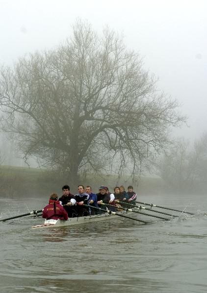
Introduction
We are the navigation authority responsible for the Rivers
Wye and Lugg. It’s our job to look after the environment and
the navigation for these rivers.
The Wye Navigation Advisory Committee (WNAC) assists us in
developing sustainable recreation and navigation on the
river. The group was set up in 2003 and operates under an
independent chairperson. Members represent a wide range of
user interests, including pleasure craft operators, canoeists,
rowers, landowners, local authorities and those with angling
wildlife and conservation interests.

                                                           The River Wye at Symonds Yat

4   Environment Agency Canoeists' guide to the River Wye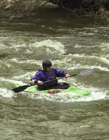
The River Wye
The Wye Valley is an important area         gravelly stretches mixed with rocky
for tourism, attracting many                cascades. The river is narrow and fast
thousands of visitors each year.            flowing through the high hills and
The river is a unique resource for          rugged terrain towards Hay-on-Wye.
sport and recreation. It is important       From Hay to Whitney, the Wye flows
for many activities as well as              between the Black Mountains and the
canoeing, including game fishing            Radnorshire Hills. Here the river is
(mainly for salmon), coarse fishing,        generally shallow, with minor rapids
rafting, rowing, walking, bird watching     and several long pools. From Whitney
and picnicking.                             to Hereford, the character of the river
                                            changes as it meanders through a
The River Wye is about 250km long
                                            broad floodplain. Below Bredwardine,
and one of the longest rivers in
                                            the channel narrows before entering a
Britain. It is mostly unaltered with no
                                            wide valley with high banks upstream
large man-made structures such as
                                            of Ross-on-Wye. From here, the river
weirs on the main stem of the river or
                                            enters perhaps the most dramatic
on most of the tributaries. The Wye
                                            section, with spectacular views and
rises in the Cambrian Mountains on
                                            deep wooded gorges down to
Plynlimon before meeting the Severn
                                            Chepstow where it enters the Severn
Estuary at the fortress town of
                                            Estuary.
Chepstow. Close to its source, the
river is characterised by still, shallow,

                                                                       Walking at Ross-on-Wye

                                                Environment Agency Canoeists' guide to the River Wye   5
Conservation of wildlife                                   and luck is required to spot one.
                                                           However, you can see signs of otters
The River Wye is a Site of Special                         as you canoe down the Wye and the
Scientific Interest (SSSI) and Special                     Lugg: footprints at the edge of muddy
Area of Conservation (SAC) under the                       banks and droppings (‘spraints’) on
European Habitats Directive. Also the                      rocks are the obvious signs to look
lower river from Mordiford to                              out for. It is an offence under the
Chepstow is an Area of Outstanding                         Wildlife and Countryside Act 1981 to
Natural Beauty (AONB) and is                               kill, injure or take an otter from the
regarded as one of the finest lowland                      wild without a licence; to damage or
landscapes in Britain. Some of the                         obstruct an otter’s den (holt) or
plants and animals found along the                         disturb an otter in its resting place.
river are of international importance.                     You should take care not to disturb
Below are just some of the species                         any dense vegetation, tree roots or
that you might see along your journey.                     rocky cavities that might harbour an
Otter                                                      otter, especially during the daytime
Otters now range all over the River                        and when looking for a suitable entry
Wye catchment and its main                                 or exit point to the river.
tributaries, including the River Lugg.
They can grow to the size of a
medium-sized dog, and are largely
nocturnal mammals. A lot of patience

                                                                                             Otter

6   Environment Agency Canoeists' guide to the River Wye
Water-crowfoot

White clawed crayfish                    equipment is dried thoroughly before
These are the UK’s only native           you use it again in another river to kill
freshwater crayfish and the River Wye    the infection.
system is the best site known in
                                         It is an offence under the Wildlife and
Wales for them. Crayfish are naturally
                                         Countryside Act to take or sell native
found amongst stones in the river bed
                                         freshwater crayfish from the wild.
and bank, and amongst tree roots and
in other cavities such as stone walls.   Water-crowfoot
They favour clean water habitats and     There are several different species of
are therefore sensitive to pollution.    this aquatic plant found along the
                                         upper and lower reaches of the river.
There are some serious threats to the
                                         In the summer, the plant can form
survival of this native species by the
                                         extensive mats, and produces flowers
introduction of the North American
                                         that add to the beauty and character
signal crayfish. This non-native
                                         of the river.
crayfish competes for food and
habitat, and carries the crayfish        Water-crowfoot forms part of a habitat
plague. This fungal plague is also       that helps give the River Wye its SAC
carried in water and on equipment        Status. It is illegal to remove it without
such as wetsuits, canoes and fishing     consent from Natural England or the
equipment that have been in contact      Countryside Council for Wales. If you
with infected water or crayfish. It’s    are experiencing problems navigating
important that you make sure all         the river as a result of extensive

                                             Environment Agency Canoeists' guide to the River Wye   7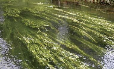
Salmon

growth of this plant, please contact                       During these months, you should take
one of the Environment Agency’s                            care not to disturb or damage areas of
Biodiversity Officers on                                   gravel bed that may appear to have
029 2024 5256 for advice; they will                        been recently disturbed, as these are
be happy to help.                                          likely to be redds.
Salmon                                                     Other species that are found in the
The Wye Atlantic salmon population is                      River Wye, and which also give the
of considerable importance in UK                           river its SAC status, include: sea
terms and, historically, the river is the                  lamprey, brook lamprey, river lamprey,
most productive in Wales for this fish.                    twaite shad and bullhead.
Modification of the river has been kept
                                                           If you require any further information
to a minimum, thereby protecting
                                                           on any of the above species, you can
important spawning habitat.
                                                           contact your local Biodiversity Officer
Salmon require a good flow of clean                        on 029 2024 5256 or Fisheries Officer
water over an exposed gravel bed for                       on 029 2024 5289. Natural England
spawning. Migration up the river                           and the Countryside Council for Wales
generally occurs between October and                       can also provide information on the
January, with spawning usually                             SSSI and SAC designation and
occurring in late winter. Eggs are                         designated features.
buried in the gravel in nests known as
“redds”, with fry emerging in May.

8   Environment Agency Canoeists' guide to the River Wye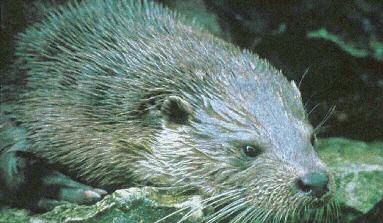
Navigation and
recreational advice
Navigation rights and access which we are the navigation authority)
is approximately 185 kilometres. The
The River Wye has been used for Gloucester Harbour Trustees are the
navigation for many centuries. In the navigation authority for the tidal
past the Wye was an important section of the River Wye downstream
commercial waterway but, the of Bigsweir Bridge.
infrastructure that supports this, such
as locks and weirs, has long since The public right of navigation below
been removed. Today, boating on the Hay does not give a right of access to
river is mostly canoeing and rowing, the riverbank and other than at
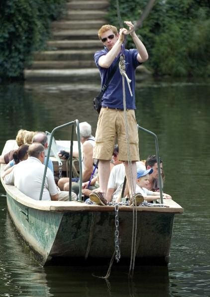
but with some passenger sightseeing accepted public sites, you must get
boats operating around Symonds Yat. permission from the landowner before
launching and landing canoes.
A public right of navigation extends Permission is also needed to camp or
from Bigsweir Bridge upstream to Hay picnic on the banks or neighbouring
Town Bridge on the main River Wye, fields.
and on the River Lugg between its
confluence with the Wye and
Presteigne Town Bridge. The combined
length of the non-tidal navigation on
the Rivers Wye and Lugg (the part for
Canoes at Symonds Yat
Environment Agency Canoeists' guide to the River Wye 9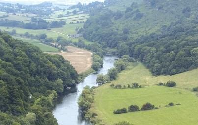
The Rivers Wye and Lugg navigation

  Legend

             Rivers Wye and Lugg - non-navigation

             Public right of navigation - Environment Agency jurisdiction

             Tidal river navigation - Gloucester Harbour Trustees jurisdiction

         0          5         10                   20 Miles

 N

         0      5       10         20 Kilometres

© Crown Copyright. All rights reserved. Environment Agency 100026380, (2007)

10   Environment Agency Canoeists' guide to the River Wye
Canoeing on the River Wye
On the main river above Hay-on-Wye, Upper Wye Canoe Access
the boating activity is almost
exclusively canoeing. You can canoe
Agreement
continuously for 133km (the length of Upstream of Hay Bridge, the river can
the public right to navigate from Hay provide some good canoeing water
Town Bridge to Bigsweir) which makes but there is no established public
the Wye a great river for long distance right of navigation. An agreement
touring. For this reason it is popular exists that facilitates shared access
with Duke of Edinburgh expeditions between the anglers and paddlers.
as well as many canoe enthusiasts.
Canoeing these upper reaches is
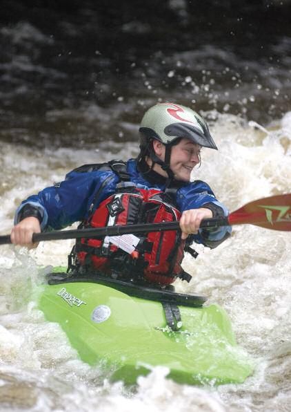
White water canoeing is enjoyed on considered at its best during the high
parts of the upper river catchment. The flows of autumn and winter, while
rapids at Symonds Yat are a nationally fishing takes place during drier
important canoeing site owned by the months, giving the opportunity for an
British Canoe Union (BCU). There are a amicable sharing of the river. The
number of commercial canoe hire agreed dates for canoe access are 18
firms and adventure holiday October to 15 March inclusive for the
companies based on the Wye, offering upper Wye. However, under the
canoe and kayak trips. agreement, canoeing is possible
outside these dates when river levels
are above the red markers on two
gauges, which you can check on the
Wye and Usk Foundation website -
www.wyeuskfoundation.org/
conditions/index.php. This allows for
paddling every day when water
conditions are best for adventurous
canoeing. The agreement secured
access and egress points and
provided signage and maps.
Representatives from local Outdoor
Centres, riparian owners, Countryside
Council for Wales, Environment
Agency Wales, and the British
Outdoor Professionals Association,
Environment Agency Canoeists' guide to the River Wye 11Kayaking at Symonds Yat
led by the Wye and Usk Foundation, Remember - there are many
were responsible for delivering the
arrangements.
users of the Wye. Please
respect their wishes and
The upper Wye is not recommended
for beginners or canoeists that do not
needs!
have considerable experience of
white water.
To avoid problems, it is essential that
everyone who uses the river acts
responsibly and follows advice in the
Wye code of conduct.
12 Environment Agency Canoeists' guide to the River WyeRiver gradings
The following classifications Grade IV – Difficult: long stretches of
heavy rapids and falls with irregular
are used by the Welsh waves and often powerful holding
Canoeing Association (WCA) stoppers. The route is not obvious
on the canoewales.com from the water, and bank inspection
website to describe the level is usually necessary. A mistake or
swim could be serious.
of difficulty. The grading of
rivers is very difficult, with Grade V – Extremely difficult: longer
rapids, large drops with very big
differing opinions amongst waves, dangerous stoppers and rocks
paddlers, and as a result any to negotiate. This is a challenge to any
classification is very canoeist. Although never absent in
subjective and dependant the lower grades, in grade V,
substantial danger is always a
on conditions. possibility. Continual inspection
and/or protection are often
necessary.
Grade I – Easy: moving water with the
odd disturbances in the shape of Grade VI – Limit of navigation: a line
small, regular waves and slight down exists – just. Luck may often
meanders. play a part. There is always a real risk
to life. Very favourable water
Grade II – Moderate: the water is
conditions and protection may make
faster and rapids are more frequent;
rapids of this grade feasible. Very
rocks, waves and small stoppers are
skilful paddling and the ability to pick
found but always with an obvious
the ideal days are also involved. Most
channel.
of the time, they are too dangerous to
Grade III – Harder: the pace quickens canoe.
with fairly big waves and stoppers
which are quite capable of holding a
boat firmly. Rapids are much more
continuous and, although the route is
fairly obvious, it is necessary to be
able to manoeuvre the kayak well.
Environment Agency Canoeists' guide to the River Wye 1314 Environment Agency Canoeists' guide to the River Wye
Gradings for the River Wye
A description of the river gradings for
the various stretches of rivers as
described in the canoewales.com
website is summarised below.

Stretch                          Length   Grade                        Notable Features
Pont Rhydygaled to Llangurig     8 km     II
Llangurig to Rhayader            17 km    III(IV)
Rhayader Falls                            III or IV (IV in             Rapids/falls
                                           high water)
Rhayader to Builth Wells         26 km    II - III                     Rapids
Builth Wells to Llyswen          20 km    II – III (IV)                Rapids, no portages
Llyswen to Hay-on-Wye            16 km    I
Hay-on-Wye to Brewardine         25 km    I
Brewardine to Hereford           27 km    I - II
Hereford to Ross-on-Wye          49 km    I
Ross-on-Wye to Monmouth          39 km    I - II                       Symonds Yat Rapids
Monmouth to Chepstow             33 km    I - II

                                               Environment Agency Canoeists' guide to the River Wye   15
Gradings for the River Wye
Legend
Grade I
Grade I–II
Grade II
Grade II–III
Grade II–III (IV)
Grade III
Ungraded
0 12.5 25 50 Kilometres
N
© Crown Copyright. All rights reserved. Environment Agency 100026380, (2007)
16 Environment Agency Canoeists' guide to the River WyeBCU and WCA contacts Canoe hire and instruction
WCA Regional Officer: Several companies in the Wye Valley
Pam Bell, Rose Cottage, offer canoes for hire and instruction,
Llanelli Hill, Upper Cwm Nantgam, and will guide groups of canoeists.
Abergavenny, NP7 0RF For details contact local Tourist
Tel: 01873 831 825 Information Centres.
BCU Local River Advisor:
(Hay-on-Wye to Symonds Yat):
Stephen Phillips, 1 Knights Way,
Newent, Gloucester GL18 1QJ
Tel: 01531 822 614
steve@sandmphillips.fsnet.co.uk
BCU Local Access Officer:
(downstream of Monmouth)
Graham Symonds, 7 White Hill Close,
Monmouth, NP5 4FG
Tel: 01600 713 461
Kayaking at Monmouth
Environment Agency Canoeists' guide to the River Wye 17Good practice guidelines
Our aim is to see the river used (particularly at dawn and dusk) to
respectfully by all parties and in a minimise disturbance of breeding birds
way that is sensitive to the many and otters. Avoid trampling and
environmental designations. In order launching/landing on or near sensitive
to achieve harmony we have produced otter sites, especially in the Clifford and
a code of conduct. Below is some Whitney sectors of the river.
general information included in Some of our native species and
the code. habitats are facing a challenging future
Salmon and trout lay their eggs in – but recreational water users including
gravel between October and April. canoeists and anglers, can help protect
Trampling and launching canoes on them. There is a risk of unknowingly
gravels used by salmon may damage spreading undesirable species and
their eggs and young fry. This is of disease with serious consequences.
particular concern upstream of Spores and parasites can survive in
Glasbury, and when the water level damp or wet conditions for 5 to 6 days
is low. on clothing and equipment such as
Game stocks are now a scarce resource canoes and fishing tackle. You can help
so please do not canoe if the risk of prevent harm to our wildlife by ensuring
disturbance is high. While coarse fish all equipment used in other freshwater
stocks are not in danger it is worth bodies is thoroughly dry or disinfected
remembering that they spawn between with a saline solution before reusing on
April and July, and so unnecessary the River Wye.
disturbance of gravels should be All river users are encouraged to
avoided at these times. navigate in a way which avoids
In May and June, two rare and protected endangering or injuring other people,
species of migratory fish, Allis and their boats and the bed and banks of
Twaite shad, are present and breeding the river. The river is there for all to
in fast flowing gravelly areas of the river. enjoy so please show consideration for
It is an offence to damage or destroy people, wildlife and property.
these spawning areas, so canoeists
must avoid trampling or dragging You should be aware that
canoes across these parts of the river ignoring this advice could
during these months. result in a criminal offence
The Wye is also an important habitat for
being committed, and you
a variety of birds and mammals. Keep
clear of gravel shoals and islands may be subject to
between 1 April and 31 July enforcement action.
18 Environment Agency Canoeists' guide to the River WyeCode of conduct
The code of conduct is intended to • have special regard for beginners,
help people enjoy the river without as you would for learner drivers on
reducing the enjoyment of others or the road;
damaging the environment. Canoeists • hail to draw a person’s attention to
are asked to follow the relevant a situation which might otherwise
sections of the code below, which are result in inconvenience, damage or
supported by all the main user groups. collision. Please treat a hail as a
friendly warning and not as an
General guidance for all insult;
river users • please be as quiet as possible -
have respect for other river users
• look after the river environment
and avoid spoiling the enjoyment
and avoid damaging banks and
of others;
bankside vegetation, waterweed
and gravel beds; • be friendly and polite to local
residents and try to avoid
• avoid dragging equipment over
arguments;
rock slabs and boulders;
• follow the Countryside Code and
• do not disturb birds and other
have regard for others’ property.
wildlife you find along the river.
Avoid areas used by wintering
wildlife, nesting birds and Specific guidance for those
spawning fish in the appropriate out on the water in a boat
season. Stop your activity if you
• all boaters must use the river in a
are clearly disturbing wildlife;
safe fashion and have appropriate
• protect native species and safety equipment;
habitats – use dry or disinfected
• whenever possible come ashore at
equipment if used in other
recognised landing places;
freshwater bodies;
• do not land on gravel shoals and
• do not trespass on private banks
islands between 1 April and 31
or moorings;
July;
• never throw rubbish into the river
• there is an agreement for canoeing
or leave it on the banks;
on the upper river. Details can be
• park sensibly without causing found at
obstruction; www.wyeuskfoundation.org/navig
• get changed out of public view; ation/index.php;
Environment Agency Canoeists' guide to the River Wye 19• obey the general rules of • fishing from a boat is not
navigation and any local byelaws; allowed unless you have a valid
• in particular, remember that larger rod licence and permission from
boats are less manoeuvrable and the owner/tenant of the fishery
cannot use such shallow waters as rights. If you are boating
canoes, rafts and rowing boats; upstream of Hay on Wye, then
permission will also be required
• give way to those engaged in
from the riparian owner.
organised competition and have
regard to any instructions given by
officials;
Guidance for specific
activities
• canoeists should take care when
approaching rowing boats training The following descriptions can help
in the vicinity of Hereford, Ross identify the various types of fishing.
and Monmouth. Please comply Coarse fishing: These anglers are
with the Collision Regulations and often seen with an umbrella. Look out
stay to the right hand side of the for the float 5-10m out and try to
river (when going up or avoid their area called a ‘swim’.
downstream);
Fly fishing: Usually standing, wading
• when boating in a group try to
or on bank. Avoid area opposite and,
keep together, especially when
as they keep moving downstream,
passing anglers;
avoid area downstream in particular.
• groups of young novice boaters Watch for end of line.
should be led by suitably
experienced responsible persons Game/fly fishing: Sometimes best
– preferably a qualified instructor; to paddle behind them after
acknowledgement.
• if in doubt about where to pass or
any other query, group leaders
should try to: Fishing seasons
• keep away from banks being Salmon and Sea Trout:
fished; 3 March to 17 October except above
• comply with reasonable Llanwrthwl Bridge where season is
directional requests; 3 March to 25 October.
• keep well clear of fishing tackle; Non Migratory Trout:
• avoid loitering in pools if 3 March to 30 September
anyone is fishing; Coarse:
• pass anglers with as little noise 16 June to 14 March
and disturbance as possible.
20 Environment Agency Canoeists' guide to the River WyeEnvironment Agency Canoeists' guide to the River Wye 21
Safety on the river
The Wye can be dangerous and has                            • make sure that you can swim at
been the site of many accidents. It is                        least 50 metres in the type of
at its most dangerous when there are                          clothing you’ll be wearing;
strong currents, high water levels or                       • carry a repair kit for your canoe,
cold weather conditions. Don’t take                           and make sure that you know how
risks and never underestimate the                             to use it;
power of the river. The Wye is a fast
                                                            • make sure that your canoe has
flooding river, which can rise after
                                                              built-in buoyancy or has inflated
heavy rain at a rate of over 30cm an
                                                              bags inside to prevent it sinking if
hour. When in flood, it is best to keep
                                                              you capsize;
off the river altogether.
                                                            • if you wear glasses, tie them with a
Daily river level information                                 piece of string around the back of
We offer an automated telephone                               your head in case you capsize;
service called River Call which provides                    • if you have not canoed before,
information on levels for the River Wye.                      make sure someone with
The telephone number for this service                         experience goes with you;
is 0906 619 7755 (BT premium rate).                         • if your canoe has not been used for
                                                              some time ensure that it is river-
Safety guidelines                                             worthy.
Although common sense is the most
important requirement, the risk of                          You should learn how to cope if an
accidents can be minimised by                               accident occurs. Ideally you should be
following these simple guidelines:                          able to:
• wear an approved buoyancy aid or                          • help somebody who is in difficulty
  life jacket and helmet;                                     in the water or has capsized;
• inspect rapids before ‘shooting’                          • give first aid;
  them;                                                     • revive somebody who is
• you should never canoe alone, but                           unconscious.
  if you must, let someone know
                                                            Most of the above may seem
  where you are going, your
                                                            obvious, but it is surprising how often
  estimated time of arrival, and let
                                                            they are overlooked and lead to a
  them know when you have arrived;
                                                            great deal of trouble, not only for the
                                                            individual, but also for other people.

22   Environment Agency Canoeists' guide to the River Wye
Rafting at Monmouth
Tides
Below Bigsweir Bridge the Wye is In an emergency phone 999 and ask
tidal and can be very dangerous, for Coastguard (coastal areas) or
especially below Tintern. If you wish Police (inland areas).
to canoe this stretch, leave Tintern no
later than one hour after high water
and travel down without stopping. Finally ...
Inexperienced canoeists are advised
to avoid this stretch and should on no
if in doubt, don't !
account travel below Chepstow, as
currents in the Severn Estuary are
extremely dangerous.
Environment Agency Canoeists' guide to the River Wye 23Health and hygiene
The quality of water in the River Wye is Leptospirosis
generally good, but unlike tap water it
is untreated and contains natural
(Weil's Disease)
bacteria and other micro-organisms. Leptospirosis is a bacterial infection
Although the risk of contracting an caused when bacteria carried in the
illness is small, there are sensible urine of infected animals enters the
precautions which you can take to blood stream. The severity can vary
stay healthy. from mild flu-like symptoms with
severe headache, to jaundice and
Health and hygiene meningitis associated with Weil’s
disease.
guidelines
The infection is caught by direct
• do not swallow river water;
contact with bacteria in urine or a
• cover any cuts or sores with gloves polluted environment. The bacteria
or waterproof plasters; can enter the human body through
• where possible, wash or shower cuts, grazes, mouth or mucous
after taking part in water sports, membranes such as those which line
especially if you have capsized; the nose and ears. The usual
• wash your hands before eating; incubation is 2 to 12 days. The illness
resolves in 2-3 weeks. A few cases
• see your doctor if you feel ill after
develop jaundice, and then the
having taken part in water sports,
condition is known as Weil’s disease.
particularly if you experience flu-
like symptoms. Leptospirosis is very rare, and the
deteriation into Weil’s Disease even
For detailed advice on the health
rarer. Weil’s Disease is a very serious
aspects of rivers, contact your local
illness, and must be swiftly
Council's Environmental Health
diagnosed and treated. The earlier
Officer.
leptospirosis is treated the better, so
consult your doctor if you feel ill after
coming into contact with water
anywhere in or near the river.
Following the precautions already
given will greatly minimise any
possible risk.
24 Environment Agency Canoeists' guide to the River WyeItinerary Launching and landing
We hope this guide provides useful Canoeists may launch or land at the
information to help you plan and points listed without needing to get
enjoy your canoeing trips. express permission, unless stated
otherwise. Landing may also be
Every effort has been made to ensure
made, with permission, at certain
that the information is accurate. No
riverside campsites and through
liability can be accepted for any
individual arrangements with some
errors, inaccuracies or omissions. In
landowners.
particular, readers should note that
details such as land ownership, camp References to right or left bank refer
sites and landing places can change to the river as viewed looking
from year to year. downstream.
For convenience, the river between Be aware of the designated water
Glasbury and Chepstow has been skiing zone between Livox Quarry
divided into 12 sections, each with a (ST 543979) to Chepstow Castle
corresponding map. The sections are (ST 531946). Chepstow railway bridge
not intended as day runs and to Beachley Point on the Severn is
canoeists should decide for designated for all similar aquaplaning
themselves how far they can travel activities.
comfortably in a day.
The first column in the itinerary is the
distance from Glasbury in kilometres;
the second the distance in miles and
the third is the distance between
points in miles.
Environment Agency Canoeists' guide to the River Wye 25Overview of map sections
3
2
1
4
5 6
7
8
9
1 Glasbury to Hay-on-Wye 5.5 miles
2 Clifford to Turner's Boat 8 miles 10
3 Turner’s Boat to Byford 7.75 miles
4 Byford to Breinton Common 5.75 miles
5 Hereford to Hampton Bishop 4.25 miles
6 Confluence of River Lugg to Hoarwithy 9 miles
7 Hoarwithy to Backney Common 7.75 miles 11
8 Ross-on- Wye to Kerne Bridge 5.75 miles
9 Kerne Bridge to Hadnock Island 11.75 miles
10 Monmouth to Redbrook 2 miles
11 Bigsweir Bridge to Tintern 6 miles
12 Tintern to Chepstow 6.5 miles
12
0 2 4 8 Miles Crown Copyright. All rights reserved.
Environment Agency, 100026380, 2007
N
0 2 4 8 12 1 6 Km
26 Environment Agency Canoeists' guide to the River WyeRowing at Monmouth
Environment Agency Canoeists' guide to the River Wye 27Map 1 Glasbury to Hay-on-Wye
Hay on Wye
3
5
1
2
Glasbury
0
0 0.25 0.5 1 Miles
Crown Copyright. All rights reserved.
E 0 0.25 0.5 1 1.5 K m Environment Agency, 100026380, 2007
28 Environment Agency Canoeists' guide to the River WyeMap 1 Glasbury to Hay-on-Wye
KM Miles Miles
0 0 Glasbury ( SH PH PC CH) NGR SO 179393
Village with post office, shops and inn. Many small rapids, usually
shallow over the next few miles. These may have to be waded. Launch
on the left bank above bridge on Glas-y-Bont Common. Canoeists are
requested to launch from 18 October to 3 March between 10.00am
and 4.30pm only. This is to avoid disturbing anglers – see red text
below. Car park at junction of A438 and A4350.
5 3 3 Hollybush Inn ( PH CH) NGR SO 198404
8 5 2 Boatside Weir NGR SO 222427
Natural weir at right hand bend, normally passable right, but inspect
at low water.
9 5.5 0.5 Hay-on-Wye ( SH PH PC i CH) NGR SO 229426
Welsh border and market town with post office, stores, hotels and
inns. Castle ruins, but not open to the public. For 200m below the
bridge there are shallows and no clear course. Immediately below the
landing place, beware of iron stakes in river bed on right, where Dulas
Brook joins the river. These may be just below the surface. Landing on
right bank 100m below bridge. Steps. No permission required.
Small car park.
13 8 2.5 Clifford NGR SO 242458
Upstream of Hay Bridge there is no established legal right of
navigation. An agreement exists that facilities shared access between
the anglers and paddlers. Please refer to www.wyeuskfoundation.org
for further details.
Upstream of Hay Bridge there is no established legal right of navigation. An agreement exists
that facilities shared access between the anglers and paddlers. Please refer to
www.wyeuskfoundation.org for further details.
Key to Itinerary and Maps
NGR National Grid Reference i Tourist Information Centres
Camp site Launch/land point
PH Public House close to river PC Toilet
SH Shop CH Canoe hire
Distance in miles from Glasbury
Environment Agency Canoeists' guide to the River Wye 29Map 2 Clifford to Turner’s Boat
7
15
The Boat Inn
5
6
Whitney Toll Bridge
4
10
0 0.25 0.5 1 Miles
Crown Copyright. All rights reserved.
E 0 0.25 0.5 1 1.5 K m Environment Agency, 100026380, 2007
30 Environment Agency Canoeists' guide to the River WyeMap 2 Clifford to Turner’s Boat
KM Miles Miles
13 8 2.5 Clifford NGR SO 242458
Ruins of Clifford Castle on right bank. Formerly an important border
castle. Interesting remains of railway embankments. Do not
launch/land on or near Clifford Common, sensitive wildlife site.
14.5 9 1 Rhydspence NGR SO 243473
The border between Wales and England. The old inn on the main road
(A438) left bank is the ‘first house’ in England.
16.5 10.25 1.25 Whitney-on-Wye ( SH ) NGR SO 258475
Demolished railway bridge. Beware of underwater obstructions. Closely
followed by toll road bridge, built in 1774 and one of the few private
bridges left in the country. Land at steps on left bank just upstream of
bridge. Private. Fee payable for launching and use of car park. Apply to
Toll Bridge Cottage (Tel. 01497 831 669). Pub and shop are in village,
10/15 minutes walk away.
17.5 11 0.75 Boat Inn (PH ) NGR SO 269265
There is a small rapid which sets into the left bank. From here, for four
miles the river takes several large meanders and there are some
shallows which may have to be waded. Land at steps on left bank by
Boat Inn.
19.5 12 1 Locksters Pool ( ) NGR SO 269462
Deep pool on sharp left-hand bend. Large catches of salmon have
been recorded in the series of salmon pools on this stretch.
25.5 16 4 Turner’s Boat ( ) NGR SO 313460
Key to Itinerary and Maps
NGR National Grid Reference i Tourist Information Centres
Camp site Launch/land point
PH Public House close to river PC Toilet
SH Shop CH Canoe hire
Distance in miles from Glasbury
Environment Agency Canoeists' guide to the River Wye 31Map 3 Turner’s Boat to Byford
9
8
20
7
0 0.25 0.5 1 Miles
Crown Copyright. All rights reserved.
E 0 0.25 0.5 1 1.5 K m Environment Agency, 100026380, 2007
32 Environment Agency Canoeists' guide to the River WyeMap 3 Turner’s Boat to Byford
KM Miles Miles
25.5 16 4 Turner’s Boat ( ) NGR SO 313460
The name of an island passable on the left. Some small rapids during
the next few miles to Bredwardine Bridge.
31.5 19.5 3.5 Bredwardine (SH PH) NGR SO 337446
Brick built six-arched bridge. Small village with post office, store
and inn.
34 21 1.5 The Scar, Brobury NGR SO 352445
High sandstone cliff on left bank, clothed with beeches. Look out for
several large boulders in river bed, often just below the surface.
34.5 21.25 0.25 Moccas Court NGR SO 358435
Large Georgian mansion on right bank, built in 1783.
The grounds around the house were landscaped by Capability Brown.
35 21.75 0.5 Moccas NGR SO 365433
Abutments only remain of Moccas Toll bridge, which stood from 1868
to 1960 when it was damaged by floods and not restored. Beware
stones close to surface.
36.5 22.5 0.75 Bycross ( ) NGR SO 376425
37 22.75 0.25 Monnington Falls NGR SO 375429
See separate plan. Land on gravel bank on left for inspection of falls
only. The channel, except in flood conditions, is to the left of the island
with a small fall at the top. Inspect the whole run of fast water for
obstructions and fallen trees.
37.5 23.25 0.5 Preston on Wye ( ) NGR SO 382426
Church near right bank.
38 23.75 0.5 Byford ( ) NGR SO 400425
Few houses on left bank. Weedy shallows as far as Bridge Sollers.
Landing on left bank 200m below pumping station, in front of black
and white cottage. Overgrown area. Site of old ford. Access from road
down narrow lane. No permission required. No parking or facilities.
Key to Itinerary and Maps
NGR National Grid Reference i Tourist Information Centres
Camp site Launch/land point
PH Public House close to river PC Toilet
SH Shop CH Canoe hire
Distance in miles from Glasbury
Environment Agency Canoeists' guide to the River Wye 33Monnington Falls
Trees overhanging
channel
Gravel Bank
Island
Inspection
Area
FLAT ROCKS
Area dry at
summer levels
MAJOR FALL
Approach close
to left bank
8
Land here
to inspect
0 50 100 200 Y ds
Crown Copyright. All rights reserved.
N 0 50 100 200 M Environment Agency, 100026380, 2007
34 Environment Agency Canoeists' guide to the River WyeMonnington Falls
Land on gravel bank above falls on the left for inspection of falls only. You should hear the fall
as you canoe round the corner. The fall and channel can be inspected as shown, by courtesy of
the owner. Look carefully for the flat rocks, especially if the river has risen at all, and make sure
that you can recognise the approach. Check the channel next to the island for fallen or
overhanging trees. Parties should tackle the fall individually and land on the right bank below
the island or return up the right hand channel to land on the flat rocks.
Environment Agency Canoeists' guide to the River Wye 35Map 4 Byford to Breinton Common
30
Byford
25
0 0.25 0.5 1 Miles
Crown Copyright. All rights reserved.
E 0 0.25 0.5 1 1.5 K m Environment Agency, 100026380, 2007
36 Environment Agency Canoeists' guide to the River WyeMap 4 Byford to Breinton Common
KM Miles Miles
38 23.75 0.5 Byford ( ) NGR SO 400425
Few houses on left bank. Weedy shallows as far as Bridge Sollers.
Landing on left bank 200m below pumping station, in front of black
and white cottage. Overgrown area. Site of old ford. Access from road
down narrow lane. No permission required. No parking or facilities.
40 24.75 1 Bridge Sollers NGR SO 413430
Bridge across river.
43 26.75 2 Cannon Bridge NGR SO 432412
Few houses on right bank. No bridge.
44.5 27.5 0.75 New Weir NGR SO 434419
No weir now. Large attractive walled garden on left, well maintained by
the National Trust, with surviving masonry and a cistern from the
Roman period. Gardens are open to the public from March to October.
47.5 29.5 2 Breinton Common NGR SO 451401
Left hand channel round island.
54 33.75 4.25 Hereford ( SH PH PC i) NGR SO 509396
Key to Itinerary and Maps
NGR National Grid Reference i Tourist Information Centres
Camp site Launch/land point
PH Public House close to river PC Toilet
SH Shop CH Canoe hire
Distance in miles from Glasbury
Environment Agency Canoeists' guide to the River Wye 37Map 5 Hereford to Hampton Bishop
40
Hereford
35
0 0.25 0.5 1 Miles
Crown Copyright. All rights reserved.
E 0 0.25 0.5 1 1.5 K m Environment Agency, 100026380, 2007
38 Environment Agency Canoeists' guide to the River WyeMap 5 Hereford to Hampton Bishop
KM Miles Miles
54 33.75 4.25 Hereford ( SH PH PC i) NGR SO 509396
Hereford grew up around an ancient river crossing, which explains its
name, meaning 'ford of the army'. Among the many places of interest
are the cathedral and medieval chained library, the Old House
museum, Museum of Cider, city walls and the old castle site at Castle
Green. A variety of river crossings include the disused iron railway
bridge at Hunderton, the modern Greyfriars Bridge, the Wye Bridge
built in 1490 and the elegant Victorian suspension bridge of 1898.
Landing on right bank below old road bridge. No permission required.
Car parking nearby.
56.5 35 1.25 Bartonsham NGR SO 523387
Sewerage outfall on left and private road bridge, followed by railway
bridge. Small rapid below railway bridge, passage to right.
61 38 3 Hampton Bishop NGR SO 550382
Road (B4224) behind floodbank on left. The village inn, the 'Bunch of
Carrots', takes its unusual name from a salmon pool nearby. No
launching or landing permitted here.
67.5 42 4 Confluence of River Lugg NGR SO 565372
Key to Itinerary and Maps
NGR National Grid Reference i Tourist Information Centres
Camp site Launch/land point
PH Public House close to river PC Toilet
SH Shop CH Canoe hire
Distance in miles from Glasbury
Environment Agency Canoeists' guide to the River Wye 39Map 6 Confluence of River Lugg to Hoarwithy
Confluence
of the
40 River Lugg
10
45
Carey Islands
50
Hoarwithy
11
0 0.25 0.5 1 Miles
Crown Copyright. All rights reserved.
N 0 0.25 0.5 1 1.5 K m Environment Agency, 100026380, 2007
40 Environment Agency Canoeists' guide to the River WyeMap 6 Confluence of River Lugg to Hoarwithy
KM Miles Miles
67.5 42 4 Confluence of River Lugg NGR SO 565372
River Lugg joins the Wye from the left.
68 42.5 0.5 Holme Lacy Bridge/Mordiford ( CH) NGR SO 568364
Modern bridge at the junction of the B4399 and the B4224. Landing at
Lucksall Caravan Park downstream on left, but only with prior
permission of owners (Tel. 01432 870 213).
74 46 3.5 Mancell's Ferry NGR SO 575327
Fishing croy on left. Follow signs to keep to the right around bend.
75.5 47 1 Capler Hill NGR SO 588327
Steep wooded slope on left bank, leading up to the double ramparts
of Capler Camp, an Iron Age hill fort. A variety of birds inhabit these
woods and dappled fallow deer may be sighted. From here to Ross, the
river follows several large meanders.
78 48.25 1.25 Carey Islands NGR SO 577307
Group of islands with rapids in between. The best course is normally to
the right of the first island.
79 49 0.75 Carey NGR SO 570306
Demolished railway bridge. One of three railway bridges crossing the
Wye between Ross and Hereford which were dismantled when the
Hereford to Gloucester line closed in 1964.
82 51 2 Hoarwithy ( SH PH) NGR SO 549295
Road bridge with village on right bank. Post Office, inn and the
prominent 'Italianate' church of St Catherine's which has featured in at
least three films. Landing on left bank about a quarter of a mile
downstream of bridge. Prior permission should be sought from Mr
Jenkins at Lower Ruxton Farm (Tel. 01432 840 223) for the left bank.
Landing at steps on right bank. Fee payable for launching. Contact Mrs
Roberts at Tresseck Farm (Tel. 01432 840 235).
Key to Itinerary and Maps
NGR National Grid Reference i Tourist Information Centres
Camp site Launch/land point
PH Public House close to river PC Toilet
SH Shop CH Canoe hire
Distance in miles from Glasbury
Environment Agency Canoeists' guide to the River Wye 41Map 7 Hoarwithy to Backney Common
60
55
13
Hoarwithy
11
12
0 0.25 0.5 1 Miles
Crown Copyright. All rights reserved.
E 0 0.25 0.5 1 1.5 K m Environment Agency, 100026380, 2007
42 Environment Agency Canoeists' guide to the River WyeMap 7 Hoarwithy to Backney Common
KM Miles Miles
82 51 2 Hoarwithy ( SH PH) NGR SO 549295
Road bridge with village on right bank. Post office, inn and the
prominent 'Italianate' church of St Catherine's which has featured in
at least three films. Landing on left bank about a quarter of a mile
downstream of bridge. Prior permission should be sought from
Mr Jenkins at Lower Ruxton Farm (Tel. 01432 840223) for the right
bank. Landing at steps on right bank. Fee payable for launching.
Contact Mrs Roberts at Tresseck Farm (Tel. 01432 840235).
85.5 53 2 Sellack NGR SO 565280
Suspension footbridge.
87 54 1 Strangford NGR SO 578286
Demolished railway bridge on the old Hereford to Gloucester line.
88.5 55 1 Fawley Chapel NGR SO 591294
Interesting chapel on left bank (no public access from river).
89.5 55.75 0.75 How Caple NGR SO 600298
The Inglestone Estate. For 2 miles downstream, the salmon pools are
indicated by red and green discs fixed to the trees. Please observe
these and paddle on the green side of the river.
91.5 57 1.25 Hole-in-the-Wall NGR SO 609287
PGL canoe centre on left bank with private access just above rapids.
92 57.25 0.25 Foy NGR SO 605284
Elegant suspension footbridge, built after an earlier structure was
swept away by floods in 1919. Current restricted by small islands.
Channel varies according to level. Church on right after 400m.
94.50 58.75 1.5 Backney Common NGR SO 589269
A simple metal cross sits on the left bank. This commemorates an act
of bravery by the rector of Brampton Abbotts in 1904, who died whilst
saving his son and his daughter's friend from drowning. Demolished
railway bridge 400m downstream at Backney. Weedy shallows.
99.5 61.75 3 Ross-on-Wye ( SH PH PC i ) NGR SO 596244
Key to Itinerary and Maps
NGR National Grid Reference i Tourist Information Centres
Camp site Launch/land point
PH Public House close to river PC Toilet
SH Shop CH Canoe hire
Distance in miles from Glasbury
Environment Agency Canoeists' guide to the River Wye 43Map 8 Ross-on-Wye to Kerne Bridge
13
Ross on Wye
65
Kerne Bridge
70
0 0.25 0.5 1 Miles
Crown Copyright. All rights reserved.
N 0 0.25 0.5 1 1.5 K m Environment Agency, 100026380, 2007
44 Environment Agency Canoeists' guide to the River WyeMap 8 Ross-on-Wye to Kerne Bridge
KM Miles Miles
99.5 61.75 3 Ross-on-Wye ( SH PH PC i ) NGR SO 596244
Long curve on river from motorway bridge to Wilton Bridge. The market
town of Ross sits attractively on a rise above the river, with a backdrop
of wooded hills. Interesting features to visit include the market house,
plague cross and museums. Landing at steps on left bank 100m below
the Hope and Anchor pub. Steps, no permission required. Car parking
nearby. Please do not land or launch at Wilton Bridge.
100 62.25 0.5 Wilton Bridge NGR SO 590243
13th Century castle on right before bridge, not open to the public. Use
middle arch of the stone bridge and channel to the right of the island.
107.5 66.75 4.5 Goodrich Castle NGR SO 577199
Impressive Norman fortification set against the skyline on the right,
managed by English Heritage and open daily throughout the year.
108.5 67.5 0.75 Kerne Bridge ( PH PC) NGR SO 581192
Gravel bank approximately 50m downstream of bridge. Land here to
inspect the fast water for obstructions and fallen trees. Landing at
steps on left bank 800m below road bridge. Picnic site and car park.
No permission required. Goodrich village 800m to the right. Please do
not land/launch at the bridge.
Key to Itinerary and Maps
NGR National Grid Reference i Tourist Information Centres
Camp site Launch/land point
PH Public House close to river PC Toilet
SH Shop CH Canoe hire
Distance in miles from Glasbury
Environment Agency Canoeists' guide to the River Wye 45Map 9 Kerne Bridge to Hadnock Island
Lower Lydbrook
70
14
Kerne Bridge
75
16
Symonds Yat East
15
17
Symonds Yat West
80
0 0.25 0.5 1 Miles
Crown Copyright. All rights reserved.
E 0 0.25 0.5 1 1.5 K m Environment Agency, 100026380, 2007
46 Environment Agency Canoeists' guide to the River WyeMap 9 Kerne Bridge to Hadnock Island
KM Miles Miles
108.5 67.5 0.75 Kerne Bridge ( PH PC) NGR SO 581192
Gravel bank approximately 50m downstream of bridge. Land here to
inspect the fast water for obstructions and fallen trees. Landing at
steps on left bank 800m below road bridge. Picnic site and car park.
No permission required. Goodrich village 800m to the right. Please do
not land/launch at the bridge.
112 69.5 2 Lower Lydbrook ( PH) NGR SO 596170
Inn on left bank above rapids. Keep to the left of the island down
Lydbrook shallows. Landing on left bank at the steps to the picnic site
and car park. Launching for individuals but NOT groups. Donations
requested in honesty box.
112.5 70 0.5 Welsh Bicknor ( ) NGR SO 591177
Church and youth hostel on right bank followed by a railway bridge,
now used as a footbridge. This is an important fishing stretch. Please
pass through quietly and do not linger.
116 72 2 Symonds Yat Rock NGR SO 551172
Start of the long loop in river. The 150m high limestone bluff of
Symonds Yat Rock is visible on the left.
121.5 75.5 3.5 Symonds Yat West ( PH) NGR SO 557164
Landing and launching from the steps on right bank about 1km
upstream of rapids. Car park available. Fee payable. Small passenger
carrying pleasure boats based here. Landing at Ye Olde Ferrie Inne on
the right bank. Permission required from the Inn (Tel. 01600 890 232).
122.5 76 0.5 Symonds Yat East ( PH CH PC) NGR SO 561160
See separate plan. Small passenger carrying pleasure boats and a 'rope
and cable' ferry for crossing the river are based here. Grade 2 rapids
below the Yat can be inspected from the Peregrine Way cycle path on left
bank. Large waves in the lower parts and congestion possible. Landing
and launching from the steps on the left bank at the Wyedean Canoe
Centre (Tel. 01600 890 129). Fee payable. Car parking available.
124.5 77.5 1.5 The Biblins ( ) NGR SO 549145
Narrow suspension bridge across river. Landing for campers only.
127.5 79.25 1.75 Hadnock Island NGR SO 538155
Pass either side of island. Left side usually less weedy.
132 82 2.75 Monmouth ( PC SH PH CH i) NGR SO 512129
Key to Itinerary and Maps
NGR National Grid Reference i Tourist Information Centres
Camp site Launch/land point
PH Public House close to river PC Toilet
SH Shop CH Canoe hire
Distance in miles from Glasbury
Environment Agency Canoeists' guide to the River Wye 47Symonds Yat
16
Symonds Yat East
Rapids to left
of river island
0 50 100 200 Y ds
Crown Copyright. All rights reserved.
N 0 50 100 200 M Environment Agency, 100026380, 2007
48 Environment Agency Canoeists' guide to the River WyeSymonds Yat
A straight fast rapid, just below the ferry, stretches the length of the island. This can be
inspected from the Peregrine Way cycle path on left bank. Watch particularly for standing waves
at the lower end of the rapid. A waymarked footpath can be followed to Yat Rock. The views are
worth the climb and there is a cafe at the top.
Environment Agency Canoeists' guide to the River Wye 49Map 10 Monmouth to Redbrook
Monmouth
18
Confluence
of the River
Monnow
85
0 0.25 0.5 1 Miles
Crown Copyright. All rights reserved.
N 0 0.25 0.5 1 1.5 K m Environment Agency, 100026380, 2007
50 Environment Agency Canoeists' guide to the River WyeMap 10 Monmouth to Redbrook
KM Miles Miles
132 82 2.75 Monmouth ( PC SH PH CH i) NGR SO 512129
River runs alongside main road with the attractive town to right with a
ruined castle, market, Nelson Museum and the Naval Temple on Kymin
Hill. Monmouth derives its name from the Monnow river which is
bridged by a unique 14th century fortified gate house. Landing at
second set of steps on right immediately downstream of rowing club
by car park. No permission required.
132.5 82.5 0.5 Confluence of River Monnow NGR SO 512122
River Monnow joins the Wye from the right. Beware of underwater
obstructions resulting from the demolition of the two railway bridges.
Rocky shallows in this area.
135 84 1.5 Redbrook (SH PH) NGR SO 536100
Village with shops on left and inn on right. Large boulders in river
above disused railway bridge now used as a footbridge. It was at
Redbrook that the last recorded act of piracy took place on the River
Wye when men came down from the Forest of Dean and captured two
barges. There is no record of their arrest.
141 87.5 3.5 Bigsweir Bridge NGR SO 539051
Key to Itinerary and Maps
NGR National Grid Reference i Tourist Information Centres
Camp site Launch/land point
PH Public House close to river PC Toilet
SH Shop CH Canoe hire
Distance in miles from Glasbury
Environment Agency Canoeists' guide to the River Wye 51Map 11 Bigsweir Bridge to Tintern
Bigsweir Bridge
90
Brockweir Bridge
19
95
0 0.25 0.5 1 Miles
Crown Copyright. All rights reserved.
N 0 0.25 0.5 1 1.5 K m Environment Agency, 100026380, 2007
52 Environment Agency Canoeists' guide to the River WyeMap 11 Bigsweir Bridge to Tintern
KM Miles Miles
141 87.5 3.5 Bigsweir Bridge NGR SO 539051
Narrow road bridge on the A466. Note that this is the upstream limit of
tidal water. Rapids 800m downstream of bridge.
142 88.5 1 Llandogo (SH PH) NGR SO 526041
Village with shops and inn on right. There are some rapids between
this point and Tintern and the banks become muddy from here.
147 91.5 3 Brockweir Bridge ( SH PH) NGR SO 539011
Village on left with shops and inn. Landing at restored stone landing
on left bank just upstream of bridge, although this can be awkward
and muddy at low tide. No permission required. Very limited car
parking in village. Alongside the river are the remains of old quays
where supplies from sailing barges were loaded and unloaded in the
past. Rapids below bridge when tide is out. Important: From this
point, the river should only be used by canoeists with reasonable
experience. There is currently no landing site at Tintern or downstream
after Chepstow as dangerous weirs are exposed at low water.
149.5 93 1.5 Old Railway Station, Tintern NGR SO 536006
Café, Information Centre and picnic area on right.
150.5 93.5 0.5 Tintern (SH PC PH i) NGR SO 535000
Village on right with shops and inns. Footbridge across river. Ruins of
a magnificent 12th century Cistercian abbey and now popular tourist
attraction on the right. The tide is considerable and canoeists should
leave Tintern not later than one hour after high water and travel
straight through to Chepstow. High water at Tintern is 4 hours before
high water at Dover.
161 100 6.5 Chepstow ( SH PC i) NGR SO 535944
Key to Itinerary and Maps
NGR National Grid Reference i Tourist Information Centres
Camp site Launch/land point
PH Public House close to river PC Toilet
SH Shop CH Canoe hire
Distance in miles from Glasbury
Environment Agency Canoeists' guide to the River Wye 53Map 12 Chepstow
95
100
Chepstow
103
0 0.25 0.5 1 Miles
Crown Copyright. All rights reserved.
N 0 0.25 0.5 1 1.5 K m Environment Agency, 100026380, 2007
54 Environment Agency Canoeists' guide to the River WyeMap 12 Tintern to Chepstow
KM Miles Miles
150.5 93.5 0.5 Tintern (SH PC PH i) NGR SO 535000
See map 11. Village on right with shops and inns. Footbridge across
river. Ruins of a magnificent 12th century Cistercian abbey and now
popular tourist attraction on the right. Important: Canoeists should
leave Tintern not later than one hour after high water and travel
straight through to Chepstow.
161 100 6.5 Chepstow ( SH PC i) NGR SO 535944
Walled market town with extensive remains of a 11th century Norman
castle and town gate. Landing on slipway near Boat Inn. Please note
that landing here usually involves wading through soft mud that can
be very dangerous. Limited car parking nearby.
Canoeists are recommended not to attempt to canoe below Chepstow as the junction with the
River Severn has very dangerous currents.
Key to Itinerary and Maps
NGR National Grid Reference i Tourist Information Centres
Camp site Launch/land point
PH Public House close to river PC Toilet
SH Shop CH Canoe hire
Distance in miles from Glasbury
Environment Agency Canoeists' guide to the River Wye 55Accommodation
The list below is intended as a guide Facilities vary and some sites are no
to camping facilities bordering the more than a farm field with a water
Wye. While attempts have been made supply. Further information about
to ensure that the list is as accurate as camping and other accommodation
possible, it is not intended to be can be obtained from local Tourist
definitive and sites will change from Information Centres.
year to year. You are strongly advised
to check details in advance, especially
for groups.
Key
F field only D drying facilities S shower
Sh shop LP launching/landing point CH canoe hire
W water T toilets
1 Ms B Lewthwaite NGR: S0 198 404
Hollybush Inn River access: On right bank, grounds
Old Brecon Road adjoining river
Hay-on-Wye
HR3 5PS Open: All year
T: 01497 847 371 Facilities: T S W D LP CH Sh B&B
2 Mr D Lloyd Jones NGR: SO 197 437
Borders Hideaway Holiday Home Park River Access: No
Clyro
Nr Hay-on-Wye
HR3 5SG Open: All year
T: 01497 820 156 Facilites: S W T Wb D
3 Mr and Mrs Davies NGR: SO 225 431
Radnors End Campsite River access: No
Radnors End
Hay-on-Wye
HR3 5RS Open: March to October
T: 01497 820 780 Facilities: TSD
4 Mr Huxtable NGR: SO 259 475
Whitney Toll Bridge River access: Land at concrete steps on
Whitney-on-Wye left bank - just upstream
Herefordshire of bridge.
HR3 6EW Open: All year
T: 01497 831 669 Facilites: T W LP
56 Environment Agency Canoeists' guide to the River Wye5 Mr and Mrs Taylor NGR SO 268 473
The Pound River access Steps on left bank just past
Whitney-on-Wye Boat Inn. Campsite across
Herefordshire road, opposite Inn
HR3 6EH Open: All year
T: 01497 831 391 Facilities: W T LP (B&B) Sh nearby
6 Mrs S Mason NGR: SO 269 462
Oakfield Farm River access: On right bank at left hand
Locksters Pool bend (small shingle beach)
Clifford
Herefordshire
HR3 5HJ Open: All year
T: 01497 831 373 Facilities: W LP ( B&B at farmhouse)
7 Mr D A Price NGR: SO 311 459
The Weston River access: Shingle beach on right
Brewardine bank, top end of
Herefordshire Turner’s Boat
HR3 6DD Open: May to October
T: 01981 500 396 Facilities: F LP
8 Mr and Mrs Fenn NGR: SO 376 425
Byecross Farm River access: 400 metres upstream
Moccas of Monnington Falls on
Herefordshire right bank
HR2 9LJ Open: All year
T: 01981 500 284 Facilities: T W S LP
9 Mr J Price NGR: SO 384 424
New Court Farm River access: On right bank, 1km below
Preston on Wye Monnington Falls
Herefordshire
HR2 9JU Open: March to October
T: 01981 500 349 Facilities: W LP T in summer
10 Mr and Mrs Williams NGR: SO 567 363
Lucksall Camp Site River access: On left bank, 200m below
Mordiford Holme Lacy Bridge
Herefordshire Open: 1 March to 30 November
HR1 4LP Please book for groups
T: 01432 870 213 of 10 or more
E: karen@lucksallpark.co.uk Facilities: T W S LP Sh
11 Mr H Jenkins NGR: SO 549 294
Lower Ruxton Farm River access: On left bank, 400m below
Kings Caple Hoarwithy Bridge
Herefordshire
HR1 4TX Open: Mid July to end August
T: 01432 840 223 Facilities: F W LP
12 Mrs Roberts NGR: SO 547 292
Tresseck Farm River access: Steps on right bank
Hoarwithy
Herefordshire
HR2 6QJ
T: 01432 840 235 Open: Easter to end September
E: bookings@tresseckcampsite.co.uk Facilities: F W LP T
Environment Agency Canoeists' guide to the River Wye 57You can also read