PANMURE Town centre regeneration - High Level Project Plan - Panuku Development Auckland
←
→
Page content transcription
If your browser does not render page correctly, please read the page content below
PANMURE
Town centre regeneration

High Level Project Plan
CONTENTS
1 INTRODUCTION 5 5 PRINCIPLES AND GOALS 37 8 PLACE-LED COMMUNITY ENGAGEMENT 53
5.1 Our commitment 38 AND COMMUNICATION
1.1 Mihi 8 5.2 Panuku project principles 38 8.1 Our approach 54
1.2 Shaping spaces for Aucklanders to love 9 5.3 Goals 39 8.2 Community and stakeholder engagement 55
1.3 Panuku – Who we are 10 Goal 1: Restore town centre vitality 39 8.3 Placemaking 56
1.4 Why Panmure? 11 Goal 2: Improve connections to and 39 APPENDIX 1: COUNCIL PROPERTY OVERVIEW 60
2 PURPOSE OF THIS PLAN 13 within the town centre
APPENDIX 2: SPECIAL HOUSING AREAS 61
2.1 Developing the Unlock Panmure story 15 Goal 3: Make a step change in housing 39
Goal 4: Demonstrate leadership in 39 FIGURES
3 VISION 17
sustainable development Figure 1: Project area 26
4 CONTEXT 21 Figure 2: Unitary Plan zoning 28
4.1 Background and location 22 6 STRATEGIC MOVES 41
Figure 3: Volcanic viewshafts – 29
4.2 Mana Whenua 23 6.1 Move 1: Develop a high-quality 42
areas up to 15 metres
4.3 Cultural narrative 24 urban neighbourhood
4.4 Project area 26 Figure 4: Volcanic viewshafts – 29
6.2 Move 2: Reconnect the 43
4.5 Planning 27 areas up to 27 metres
centre to its community
4.6 The Panmure community 30 Figure 5: Move 1: Develop a high- 42
6.3 Move 3: Enliven the 44
4.7 Market dynamics and housing demand 31 quality urban neighbourhood
heart of Queens Road
4.8 Transport and connectivity 33 Figure 6: Move 2: Reconnect 43
4.9 Infrastructure capacity 34 6.4 Move 4: Foster mainstreet 45
the centre to its community
vitality and business growth
Figure 7: Move 3: Enliven 44
7 PROPOSED IMPLEMENTATION 47 the heart of Queens Road
7.1 Development strategy 48
Figure 8: Move 4: Foster mainstreet 45
ABBREVIATIONS 7.2 Funding 48
vitality and business growth
7.3 Commercial value creation 49
AMETI Auckland Manukau Eastern Transport Initiative 7.4 Total value creation 49
ACPL Auckland Council Property Ltd 7.5 Timeframes and phasing 49
AT Auckland Transport 7.6 Outcomes monitoring 50
BID Business Improvement District
CCO Council-controlled organisation
the council Auckland Council
HLPP High Level Project Plan
LTP Long-term plan
Panuku Panuku Development Auckland
SHA Special Housing Area
THAB Terrace Housing and Apartment Building Zone
2 PANMURE HLPP TRC Tāmaki Regeneration Company PANMURE HLPP 3
INTRODUCTION

               PANMURE HLPP   5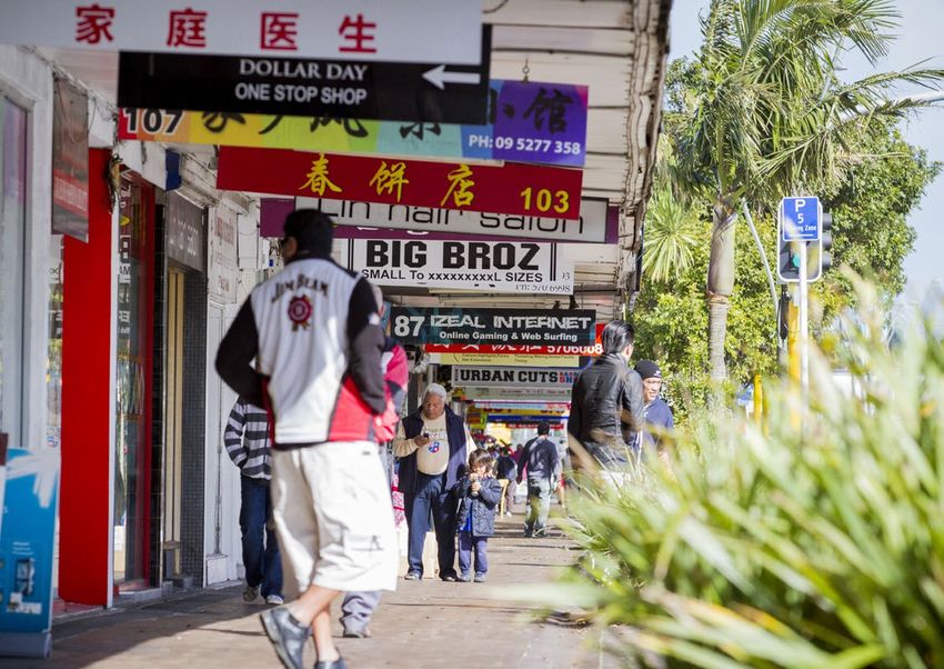
1          INTRODUCTION
                   This plan seeks to unlock Panmure’s           As the city’s redevelopment agency, Panuku Development Auckland       In this HLPP we outline the strategic moves Panuku will make to
                                                                 (Panuku) is leading the Unlock Panmure project.                       achieve the vision for Panmure over time and working alongside
                   considerable potential as a prime                                                                                   other agencies, local groups and the community.
                                                                 Panmure enjoys strong political and community support for its
                   location for regeneration. Located            revitalisation. Panuku developed this High Level Project Plan         Those four strategic moves are:
                   between two stunning natural features -       (HLPP) in close collaboration with Auckland Council, Maungakiekie-
                                                                                                                                       1.   Develop a high-quality urban neighbourhood.
                   Mount Wellington and Panmure Basin -          Tāmaki Local Board, Mana Whenua, Tāmaki Regeneration Company
                                                                                                                                       2.   Reconnect the centre to its community.
                                                                 (TRC) and the Panmure community.
                   Panmure is situated close to a number                                                                               3.   Enliven the heart of Queens Road.
                                                                 The council family, TRC and the Crown own a concentration of          4.   Foster mainstreet vitality and business growth.
                   of major employment areas including
                                                                 property within the project area, which provides a big opportunity
                   Auckland’s CBD.                               for partnership and to achieve an integrated development.
                                                                                                                                       Panuku will champion development on surplus council land
                                                                                                                                       and buy land strategically to provide development momentum
                                                                 TRC is leading the delivery of 7500 new houses for Tāmaki’s           for positive change. We will create a development environment
                   With many large development-ready sites       anticipated population increase of 20000 over the next 15-20 years.   that encourages and supports the private sector to achieve
                   and a growing demand for new, different       Major investment as part of the Auckland Manukau Eastern              great outcomes.
                                                                 Transport Initiative (AMETI) will get underway later this year
                   types of housing, this plan will build                                                                              We will also work with the council to provide fit-for-purpose
                                                                 with the construction of an urban busway between Panmure
                   on Panmure’s distinct landscape, good         and Pakuranga.
                                                                                                                                       community facilities, improve public spaces, and connections
                                                                                                                                       to and from the town centre. This will help support the vitality
                   infrastructure, transport connectivity,                                                                             of Panmure town centre and grow local businesses.
                   community facilities and local amenities
                   to realise the vision of creating a vibrant
                   town centre that is a great place to live,
                   visit and do business.

6   PANMURE HLPP                                                                                                                                                                         PANMURE HLPP     7
1.2
                                                                                                                                 SHAPING SPACES FOR
    1.1       MIHI                                                                                                               AUCKLANDERS TO LOVE

                      NAU MAI TAKU ITI. PIKI MAI E TAKU RAHI.               WELCOME ONE. WELCOME ALL.                        Panuku Development Auckland’s
                                                                                                                             structure is the first of its kind in
                     NĀKU KOE I TIKI ATU I TE PAE-O-TE-RANGI.               YOU, FROM BEYOND THE HORIZON I HAVE TAKEN.                                                                    TRANSFORM
                                                                                                                             New Zealand.
                                  KA TŌIA MAI, KA KŪMEA MAI                 I DRAW YOU NIGH, I DRAW YOU HITHER                                                                            Creating change through urban renewal
                             KIA EKE TANGAROA, EKE PANUKU.                  TO RAISE EXPECTATIONS AND TO FULFIL POTENTIAL.   We work across multiple locations and scales – from large,
                                                                                                                                                                                          We lead the transformation of select parts of our
                                                                                                                             long-term urban renewal projects, to small projects on
                                                                                                                                                                                          region; working alongside others and using our
                                                                                                                             specific sites. We operate in a commercial way but with
                                 Panuku, panuku, kia haumi e, kia hui e     Upward, onward until all is met and done                                                                      custodianship of land and planning expertise.
                                                                                                                             good public outcomes. We make a profit and deliver returns
                                                                                                                             to the council, but at the same time ensure developments     E.g. Wynyard Quarter
                                           kia ara mai he tāiki ngāpara.    and that which rises will endure still.
                                                                                                                             and community outcomes are positive and sustainable.
                                Ka whakairihia e te rangi hei hua tipua,    From high it heralds divine aspirations,
                                                                                                                             Panuku has been established to provide leadership and
                                 ka poua ā-whenua hei tupuranga hōu.        grounded in visions of new beginnings.           remove barriers to enable urban transformation. We will
                                                                                                                                                                                          UNLOCK
                                                                                                                             pilot ideas to advance council objectives in affordable
                                                                                                                             housing, housing for older people and iwi partnerships. We   Unlocking development potential for others
                                        Māna e huaki te mana tangata        It empowers in essence our very being            have the backing of council finances, which allows us to
                                                                                                                                                                                          We are the facilitator; using our relationships to break
                                                                                                                             borrow at low cost and obtain funding through Auckland’s
                                                    e hora ai aku mahi.     and pervades all that we have achieved.                                                                       down barriers and influencing others, including our
                                                                                                                             10-year budget process. We can structure the delivery of
                                                      Kia hua ko te pai,    Let good be rife                                 projects in a way that helps fund public-good outcomes.      council family, to create development opportunities.

                                                      kia piki ko te ora,   and may good health be assured,                                                                               E.g. Old Papatoetoe

                                he tohu kaitiaki o taku tuakiri tuku iho.   as guardianship defines a legacy given.

                                                                                                                                                                                          SUPPORT
                                    Nōku te whiwhi, nōku te hūmārire.       As destiny beckons, peace is mine.
                                                                                                                                                                                          Making the most of what we’ve got
                               Ka tūhono a Rangi, ka tūhono ki a Papa,      The sky itself seems to greet the earth,
                                                                                                                                                                                          Intensification is a key driver in the Auckland
                                     taku taura here whanaungatanga;        epitomising all I hold and revere;                                                                            Plan. We support housing demands by enabling
                                                                            a token from that distant past.                                                                               development of council-owned land.
                                        he mea nō tua whakarere mai.

                                  E kore e memeha; tū te ao, tū te pō,      It abides as day and night without fail,                                                                      E.g. Link Crescent, Whangaparāoa

                                                  mauri tau, mauri ora.     with a gentle heart and a lively spirit.

8   PANMURE HLPP                                                                                                                                                                                                                PANMURE HLPP         9
1.3       PANUKU – WHO WE ARE                                                                                                                                         1.4               WHY PANMURE?
     Panuku Development Auckland is      We manage about $2 billion in land and buildings that the council                                                                 Panmure was chosen as an
                                         owns. We continually review this portfolio to find smart ways to
     a council-controlled organisation   generate income for the region, grow the portfolio or release land                LIKE THE NAME SAYS                              Unlock location for the following reasons:
     of Auckland Council that helps to   or properties that others can use better.                            We’re the first Auckland Council organisation whose name     •   Major public investment is planned as part of the Tāmaki     •   There are council and Crown landholdings that can act as
     rejuvenate parts of our city.                                                                            represents what makes us unique as a New Zealand-based           urban transformation led by TRC, a joint venture between         catalysts for private sector investment and redevelopment.
                                         It’s important we understand the communities in which we work.         company: our connection to Māori culture and identity.
                                         Panuku identifies development opportunities, and plans and                                                                            the Government and the council to build 7500 new homes
                                                                                                                                                                                                                                            •   There is a good level of market attractiveness for residential
                                         prepares the ground to attract private investment and make it             Development Auckland clearly states what our                and new community facilities over the next 15-20 years.
                                                                                                                                                                                                                                                development, with demand for different housing types
                                         easier for others to develop houses and commercial buildings.          organisation is about, while Panuku is an abbreviated          Other significant public investment includes AMETI.
                                                                                                                                                                                                                                                (e.g. terraces and apartments).
                                         Together with our partners, we unlock the full potential of this           form of the whakataukī, or proverbial saying,          •   There has been a high level of local board planning and
                                         land to create spaces for Aucklanders to love.                                      Eke Panuku, Eke Tangaroa!                         there is political and community support for change.
                                         Auckland is experiencing significant housing and infrastructure      This saying acknowledges unseen energies from the realm      •   The town centre is strategically located, with
                                         pressures as a result of rapid growth. About 800 people move          of the land and sea, which are often called upon through        good infrastructure and access to public transport.
                                         to Auckland each week, and current projections suggest the             Māori oratory traditions to help invigorate, inspire and       Panmure is positioned between Mount Wellington
                                         population could reach 2.01 million by 2033 – an increase of more    manifest success, excellence and progress within groups.         and Panmure Basin, providing mountain and water
                                         than 517,000 people within the next two decades.                      Our organisation, like a waka, not only requires strength       connections to the Tāmaki River and Waitematā Harbour.
                                         To cater for this growth, we need a step change in urban renewal       to move forward, but skill to navigate, balance to ride    •   There is a good range of local services, leisure and
                                         and intensification of town centres and brownfields. Panuku has                 smoothly and teamwork to propel.                      recreational facilities, including council facilities that
                                         the role and mandate to address this challenge.                                                                                       can be enhanced to support future growth in the area.

10   PANMURE HLPP                                                                                                                                                                                                                                                                                                PANMURE HLPP   11
PURPOSE OF THIS PLAN

                       PANMURE HLPP   13
2.0 PURPOSE OF THIS PLAN                                                                                                                    2.1             DEVELOPING THE UNLOCK PANMURE STORY
     The purpose of this HLPP is to outline                                In addition, this HLPP aims to summarise the projects proposed        Panuku has worked closely with                                   What we heard from the community captured the things
                                                                           to achieve the redevelopment of Panmure and seeks to:                                                                                  they value and their many good ideas to make the local
     the short, medium and long-term goals                                                                                                       Maungakiekie-Tāmaki Local Board, TRC                             centre a better place. These include:
                                                                           •   Outline the context of what is proposed, including the
     for the Unlock Panmure project.                                           strategic rationale for decision-making, information about
                                                                                                                                                 and the local community in shaping the                           •   A local supermarket and a greater variety of shops to restore
                                                                               any existing statutory or non-statutory plans that inform         future plans for Panmure town centre.                                a greater sense of safety and vibrancy in the town centre,
     The plan was endorsed by Maungakiekie-Tāmaki Local Board
                                                                               the proposal, known market opportunities, statutory issues                                                                             especially on the western side of Queens Road.
     in February 2018 and Auckland Council’s Planning Committee
                                                                               and stakeholder requirements.                                     Community sessions and an online survey were open between
     March 2018.                                                                                                                                                                                                  •   Planning for better connections between the train station,
                                                                                                                                                 October and December 2017, enabling people who visit, work
                                                                           •   Provide a vision and supporting principles, goals and strategic                                                                        town centre, and the places where people bring their
     It is the central project initiation document used to detail key                                                                            and live in Panmure to share their thoughts. More than 280
                                                                               moves to guide the work programme for this project.                                                                                    families for recreation.
     strategic moves and seek approval for any additional actions                                                                                people completed the survey and expressed their views on local
     in Panmure. These actions include buying and selling sites and        •   Describe existing and proposed projects,                          connections, safety, community facilities and places to visit.   •   Making the most of proximity to Mount Wellington
     undertaking further detailed project planning, design and analysis.       including specific properties involved and any                                                                                         and Panmure Basin for better public use.
                                                                                anticipated high-level outcomes or benefits.
                                                                                                                                                                                                                  •   Making better use of community spaces such as Clifton Court.
                                                                           •   Describe the approach to place-led engagement.
                                                                                                                                                                                                                  •   Upgrading community facilities such as the library, community
                                                                           •   Outline the proposed high-level funding strategy.                                                                                      hall, Lagoon Stadium, Lagoon Pool and Leisure Centre.

                                                                                                                                                                                                                  •   Reflecting Panmure’s diverse
                                                                                                                                                                                                                      community through art and events.

14   PANMURE HLPP
VISION

         PANMURE HLPP   17
3.0    VISION

                          This HLPP builds on extensive work completed to date including the Maungakiekie-
                                      Tāmaki Local Board Plan and the Tāmaki Reference Plan.
                                                   It outlines Panuku’s intention to:

                              Create a vibrant centre that is a great place to live, visit and do business.
                                This will be done by building on Panmure’s distinct landscape, good
                          infrastructure, transport connectivity, community facilities and local amenities.

18   PANMURE HLPP                                                                                             PANMURE HLPP   19
CONTEXT
PANMURE HLPP 214.1 BACKGROUND AND LOCATION 4.2 MANA WHENUA
Panmure has a rich history and culture As Auckland grew eastwards, the first Tāmaki River bridge was built The past decade has seen significant transport investment, with Mana Whenua play an integral cultural, Increasingly, as Te Tiriti o Waitangi/the Treaty of Waitangi • Ngāi Tai ki Tāmaki
in 1865, with train services coming to Panmure in 1873. Housing and Panmure Station and bus interchange completed in 2014 as part of settlements are reached, and through cultural and commercial • Ngāti Maru
and enjoys a strong sense of community. industry expansion grew hand in hand, with the Mount Wellington the first stage of AMETI. These are valuable assets for the centre, social and economic role in unlocking the redress, Mana Whenua can be leaders in revitalisation and • Ngāti Pāoa
Originally a port town, Panmure was once district sometimes called ‘the home of modern industry’. Leading giving Panmure residents exceptional public transport connection potential of Panmure. Engagement with placemaking. It is important that their input into decision-making • Ngāti Tamaoho
nationwide manufacturers and distributors were based there, such to wider Auckland. processes enables opportunities for Mana Whenua contribution • Ngāti Tamaterā
considered as the potential new capital for Mana Whenua has contributed to defining
as Alex Harvey Industries, Fisher & Paykel, Mason & Porter Ltd within the market. These opportunities may extend to joint • Ngāti te Ata
New Zealand. The town centre sits within (Masport), Dulux and Berger paints, and British Motor Corporation.
Panmure lies in the Tāmaki urban transformation area, one of the overall goals of this project. ventures, land purchase and development. • Ngaati Whanaunga
10 Spatial Priority Areas in the Auckland Plan. The transformation
the dramatic embrace of Mount Wellington Over four years, 80 shops were built in the Panmure town centre
will contribute to that plan by increasing the number of homes The 12 Tāmaki Makaurau Mana Whenua iwi and hapū listed have
• Te Ākitai Waiohua
and 20 offices were established. Mana Whenua has a strong historical footprint in Panmure • Te Kawerau ā Maki
and Pamure Basin and has a proud heritage and creating a quality town centre prided by locals. and seek to build on this association through involvement in interests in the broader Panmure area. Panuku will endeavour to
• Ngāti Rehua
as a strategic transport stop for rapid Panmure continued to grow as a busy and prosperous town, development which recognises their values and draws on work in partnership with these iwi/hapū towards best care for land,
• Waikato-Tainui
supplying all the needs of local residents and rivalling Queen Street Te Aranga Māori design principles. water and people throughout planning and implementation of land
access by canoe to the Waitematā Harbour in the CBD. However, industry slowly relocated through the 1980s, development in Panmure.
• Te Ahiwaru
and the west coast. with cheaper land opening in East Tāmaki and Manukau. As nearby
shopping malls increased, Panmure town centre’s vibrancy and
appeal slowly declined.
Today Panmure is a humble local centre surrounded by low-density
residential and light industrial areas. Its residents enjoy a relaxed
setting just outside the city while maintaining great access to the
city’s amenities. Panmure is community oriented, with a large
range of services and local opportunities to get involved in. Its
shopping areas offer a range of day-to-day necessities, clothing,
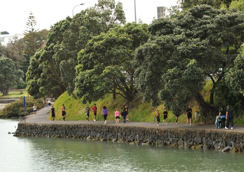
speciality stores and an array of ethnic eateries. The area’s parks
and domains are popular and provide excellent recreational
opportunities for families.
22 PANMURE HLPP PANMURE HLPP 234.3 CULTURAL NARRATIVE
Mana Whenua engagement on the Te Tauoma is associated with occupation of the Wai o Taiki Kai-a-Hiku (Panmure Basin) is the food bowl Te Wai o Taiki (Tāmaki River) was an important strategic transport mountains and waterways that form tribal history. In their particular For Ngāti Pāoa, Mokoia Pā remains an important tūrangawaewae,
(Tāmaki River) and Panmure area, as it relates to Mana Whenua. for the taniwha ‘Moko Ika Hikuwaru’. route, being easily navigable for waka. It provided good access to philosophical view, Māori are not separate from nature or the but it also represents a time of major change and grief. The tapu is
Unlock Panmure project has articulated Te Tauoma is said to be the name of the original hill (now quarried Waitematā and Hauraki on the east coast, as well as connecting natural world. They are part of the natural world because they are such that it is a place to be respected, and any desecration of the
“Kai-a-Hiku was named by Taikehu, a Chief aboard the Tainui waka.
a cultural narrative specific to the area. away) next to Maungarei (Mount Wellington). As a geographical
On his travels along the Te Wai o Taiki, Taikehu found the taniwha
to the land portage links to Manukau Harbour on the west coast. all born of Papatūānuku (the Earth Mother). The idea of being born tapu is a takahi (to undermine) of Ngāti Pāoa mana.
area, it is said to encompass Maungarei, Panmure, and the area As such, the Tāmaki River was a culturally and spiritually important from the earth is the foundation for whakapapa and relates the
This narrative provides an overview of Moko Ika Hikuwaru feasting on fish trapped in the basin and In the early 19th Century, many descendants of Te Waiohua lost
along the western side of Tāmaki River to the Waitematā Harbour. waterway to all Mana Whenua. environment with people. … identity is thus bound into Auckland’s
the association Mana Whenua has with The coastal environment and pā, as well as the portages and
therefore named the basin after this event. The taniwha made his
volcanic cones and the extensive gardens that surrounded them,
their lives defending Waipuna and Te Tauoma against invading
den in the deep pool at the entrance to the Basin and this place is tribes from the north armed with muskets.
Panmure and its wider surrounds. pathways connecting the various features and tupuna maunga,
known as Te Kopua a Hiku and is where the taniwha resides to “Te Wai o Taiki is associated with the Tainui waka, drawn over this together with the Manukau harbour and the land portage--Te Tō
continue to be highly valued. portage in its crossing from the east coast to the west coast. Te Waka (the dragging place for canoes)--between the two Auckland It is envisaged that the cultural narrative provides context
this day. Taikehu and those with him drank from a spring that feeds
Wai o Taiki was navigated by both the Tainui and Te Arawa waka. harbours, the Waitemata and the Manukau. This portage from east for ongoing discussion with Mana Whenua as part of future
TE TAUOMA – PANMURE The volcanic cones of Tāmaki Makaurau are referred to in the into the Basin and named it Te Waipuna a Rangiātea in memory
The narrative of Tainui’s journey around the Waitematā Harbour and to west was a main highway throughout pre-European times and implementation, in particular through:
Tāmaki Makaurau Collective Settlement as the Tūpuna Maunga, of their home Rangiātea in Hawaiiki.” 1
The pūrākau or story of place brings forward the essence of place, ultimately into the Tāmaki River and across the Ōtāhuhu portage access to the Manukau Harbour gave canoes access to the wider
recognising their ancestral importance to Mana Whenua of Tāmaki • expressing Mana Whenua cultural associations
its whai me te pai rawa – glory and splendour. We are all associated Panmure Basin is also known as Te Kai o Hikuwaru (abbreviated recording the journey of the Tainui waka around the Waitematā west coast as well as through another small portage to the Waikato
Makaurau. The volcanic features are cultural and spiritual tāonga
to places which resonate deeply with us. The following pēpēha to Kai-a-Hiku) and Te Wai Roto o Moko Ika. Harbour, events surrounding its journey into the Tāmaki River and River, and so to the interior of New Zealand. These historical stories • pursuing development consistent with Te Aranga
or resources for Mana Whenua. The maunga provided sites for
describes the identity of one who has a deep affinity to Tauoma. the Ōtāhuhu portage.” give shape and meaning to the lives of [tribes]. They form their design alongside Mana Whenua principles and guidance
defensive pā and māra (gardens) and were symbols of mana In the time of Te Waiohua, Te Kai o Hikuwaru was used as a
whakapapa, on which they draw in their goal to be enabled to live
Ko Maungarei te Maunga and identity. waka (canoe) carving and landing site. An entire fleet of canoe • favouring a people-centred environment that
as Māori.”
Ko Te Waitematā te Moana were sculptured and maintained at the whare waka (canoe house) Various features within and surrounding the Tāmaki River and supports community-building and an awareness
Maungarei (Mount Wellington) is one of these significant
Ko Wai Mokoia / Te Wai o Taiki te Awa for the paramount chiefs of Te Waiohua through to the time of Manukau Harbour are named and associated with the voyage and respect for the natural environment
maunga and the most visible feature on this area’s landscape. Mokoia Pā and its landscape hold numerous stories in the history
Ko Mokoia me Mauinaina ngā Pā Tawhito Kiwi Tāmaki. of Tainui and Te Arawa waka, their crew and descendants. These
Occupation by Mana Whenua would have included using the of Tāmaki and New Zealand. Next to the Panmure Basin and Tāmaki • improving stormwater management, which
Ko te Waipuna-a-Rangiātea te Puna Wai Māori places are imbued with the mana associated with the Tainui waka
maunga as a pā, and the lower slopes for customary activities Te Waiohua also occupied and cultivated the nearby lands at River, the pā is a significant feature for all Mana Whenua, especially should be an integral and visible part of the projects.
Ko te Moko-Ika-Hikuwaru te Taniwha and serve as important sites and tāonga to those iwi and hapū
including māra and wāhi tapu. Waipuna down through to Ōtāhuhu to take advantage of both Ngāti Pāoa where the pā was a major stronghold and also a place
who retain customary authority over those places today.
the Manukau Harbour to the west and Te Wai o Taiki to the east. of grief following a battle with Ngā Puhi.
The pa of Maungarei and Te Tauoma were both occupied by the
The Waitangi Tribunal Manukau report (Wai 8) also conveys the
ancient confederation of tribes known as Te Waiohua through The presence of taniwha is a deep and respectful association One account locates Mokoia Pā as a headland pā at the entrance
spiritual link to these places and their importance to the customs
to the 18th Century. This began with the paramount chief and to ancestral lands, sites of significance, wāhi tapu and tāonga. to the Panmure Basin, with Mauinaina on the hill where the
and identity of Mana Whenua:
progenitor of Te Waiohua, Huakaiwaka and his ancestors, and This recognises the significance of Kai-a-Hiku, its associated Church of England now stands. However, the names are used to
ended with the final paramount chief of Te Waiohua and progenitor waters and lands: describe the same location. Another account from Ngāti Pāoa has
of Te Ākitai Waiohua, Kiwi Tāmaki. “One of the markers of Māori identity, then and now, has been
Mokoia encompassing the pā and the area around the lagoon, with
their ability to trace (preferably by recitation of chants) ancestral
The maunga in this region were positioned to look across “The entrance to Kai-a-Hiku also has cultural significance due to Mauinaina being the kāinga that extended along the Tāmaki River.
genealogy or whakapapa from particular canoes and landforms,
Tāmaki Makaurau in all directions - over the Manukau Harbour their association with the kawau (black shag), which are said to
in the process marking ancestors, marriages, offspring, events,
to the south, the Tāmaki isthmus to the west and Tīkapa Moana represent/hold spirits/wairua of Ngāti Pāoa tūpuna. Pōhutukawa
(Hauraki Gulf) in the north and east. trees that align the edge of Kai-a-Hiku entrance are associated
with roosting habitat for the kawau.” 2
1.Cultural Values Assessment in relation to the Proposed AMETI Project Phase 2A, Prepared for Auckland Transport by Tama Hovell, Atkins Holm Majurey Ltd, January 2016
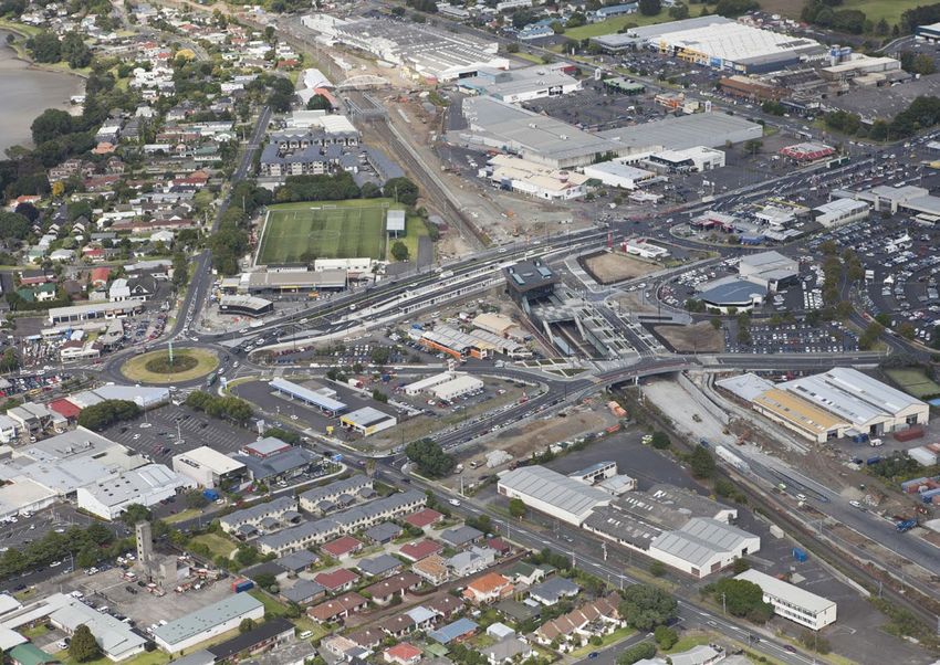
24 PANMURE HLPP 2. Cultural Values Assessment in relation to the Proposed AMETI Project Phase 2A, Prepared for Auckland Transport by Tama Hovell, Atkins Holm Majurey Ltd, January 2016 3. Narrated by Maihi Te Kapua Te Hinaki of Ngāti Paoa, recorded in the Journal of Polynesian Society (JPS) 6 PANMURE HLPP 254.4 PROJECT AREA 4.5 PLANNING
The Unlock Panmure project area is A number of statutory and non-statutory Enabling provisions
43 hectares (ha) and covers the town plans and policies have considered the Auckland Plan Panmure is identified as a town centre
centre mainstreet of Queens Road, strategic role and structure of Panmure. and an area of moderate change
Unitary Plan Zoned Town Centre, with a portion of
Panmure transport interchange and MT WELLINGTON
These plans reflect a broad understanding
the centre permitted to 27m through
a commercial area to the west. (Maungarei)
of Panmure as a town centre with the Height Variation Control, surrounded
M
ou
significant potential for growth. by mixed-use and Terrace Housing and
Auckland Council owns 7.3ha and the Crown 3ha of landholdings nt
ain Apartment Buildings Zone (THAB).
Ro
within the project area outlined in (see Figure 1). ad
Auckland’s more recent planning vision and regimes reinforce Maungakiekie- Supports quality infrastructure
• Community facilities include Panmure Library, Panmure this direction for Panmure, with proposed zoning that supports Tāmaki Local investments to match growth. Prioritises
Community Hall, Stone Cottage, Lagoon Pool & Leisure Centre, the growth and intensification of the centre. Board Plan securing funding to develop a civic space
and Lagoon Stadium. and community facilities in the heart of
2 The Auckland Unitary Plan confirms a strategic direction to enable
4 LAND OWNERSHIP the town centre.
• Transport assets include the Panmure interchange, two formal intensification of the wider project area. The zoning provides for
Park and Ride sites, two informal park and ride sites, and five 3 Pleasa
Panmure HLPP Project Area a town centre zone with urban development along the centre’s Tāmaki Open Supports investment in replacing the
Po
nt Vie
w Road
mainstreet Queens Road, surrounded by mixed-use and terrace Space Network community centre, recognising the need
ta
Ellers
ad
public carparks. Auckland Council
ka
lie-P
oe R o
anm
Lan
ure H 1 5
ighw housing and apartment buildings zoning. Plan for aquatic and leisure facilities
e
ay
Jellic
Crown
y
• Land along Lagoon Drive has also been acquired for
d
wa
n Roa
Community Supports investment in investigating
igh
Clifto
implementing the AMETI busway (Panmure to Pakuranga). There are a number of volcanic viewshafts that impact on Panmure
nH
n Crt
gto
Tamaki Regeneration Company
6 Facilities library and indoor leisure provision,
gto
Pilkin
town centre. These restrict most building in the centre to a height
llin
Network Plan recognising the fit-for-purpose issues
We
Quee 1 Formal Park & Ride of 15m or below (see grey highlights in Figure 3). In some areas
Mt
ns Ro
BILL MCKINLAY
ad
(highlighted purple in Figure 4) building to a height limit of 27m is and the condition of existing facilities
d La 2 Formal Park & Ride
PARK oa go
lan
dR on
Dr
permitted. All other areas within the centre have a variable height
ad
Ire ive
ne
Informal Park & Ride limit between 15m and 27m, depending on viewshaft contours.
Ro
3
La
oli
we
p
Vi
Tri
d
sin
aR 4 Informal Park & Ride
et The Unitary Plan specifically requires that issues of significance
Ba
Hor
Te
5 Shopper car park to Mana Whenua are addressed in respect to the Te Tiriti o
9
Waitangi/the Treaty of Waitangi partnerships and participation.
7 Kings
Road6
Library & Community Hall
This means integrating mātauranga and tikanga Māori into
7 Stone Cottage sustainable management of the natural and physical environment;
8 economic, social and cultural development; and protection of
s re
PANMURE BASIN Lagoon Stadium
Qu
8
rch C
Mana Whenua cultural heritage.
een
(Kai-a-hiku)
Chu
sR oa
9 Lagoon Pool & Leisure Centre
d
Figure 1: Project area
26 PANMURE HLPP PANMURE HLPP 274.5 PLANNING
▬ ▬ ▬ ▬ ▬ ▬ ▬ ▬ ▬ ▬ ▬ ▬ ▬ ▬ ▬ ▬ ▬ ▬ ▬ ▬ ▬ ▬ ▬ ▬ ▬ ▬ ▬ ▬ ▬ ▬ ▬ ▬ ▬ ▬ ▬ ▬ ▬ ▬ ▬ ▬ ▬ ▬ ▬ ▬ ▬ ▬ ▬ ▬
▬ ▬ ▬ ▬ ▬ ▬ ▬ ▬ ▬ ▬ ▬ ▬ ▬ ▬ ▬ ▬ ▬ ▬ ▬ ▬ ▬ ▬ ▬ ▬
Unitary Plan Zones in ▬ ▬ ▬ ▬ ▬ ▬ ▬ ▬ ▬ ▬ ▬ ▬ ▬ ▬ ▬ ▬ ▬ ▬ ▬ ▬ ▬ ▬ ▬ ▬
▬
▬
▬
▬
▬
▬
▬
▬
▬
▬
▬
▬
▬
▬
▬
▬
▬
▬
▬
▬
▬
▬
▬
▬
▬
▬
▬
▬
▬
▬
▬
▬
▬
▬
▬
▬
▬
▬
▬
▬
▬
▬
▬
▬
▬
▬
▬
▬
▬
▬
▬
▬
▬
▬
▬
▬
▬
▬
▬
▬
▬
▬
▬
▬
▬
▬
▬
▬
▬
▬
▬
▬
▬
▬
▬
▬
▬
▬
▬
▬
▬
▬
▬
▬
▬
▬
▬
▬
▬
▬
▬
▬
▬
▬
▬
▬
nt nt
d
d
Panmure town centre. ce ce
oa
oa
▬ ▬ ▬ ▬ ▬ ▬ ▬ ▬ ▬ ▬ ▬ ▬ ▬ ▬ ▬ ▬ ▬ ▬ ▬ ▬ ▬ ▬ ▬ ▬ t
▬ ▬ ▬ ▬ ▬ ▬ ▬ ▬ ▬ ▬ ▬ ▬ ▬ ▬ ▬ ▬ ▬ ▬ ▬ ▬ ▬ ▬ ▬ ▬
rt C
res ▬ ▬ ▬ ▬ ▬ ▬ ▬ ▬ ▬ ▬ ▬ ▬ ▬ ▬ ▬ ▬ ▬ ▬ ▬ ▬ ▬ ▬ ▬ ▬
rt C
res
oa d
oe R
oe R
en C ou C ou
▬ ▬ ▬ ▬ ▬ ▬ ▬ ▬ ▬ ▬ ▬ ▬ ▬ ▬ ▬ ▬ ▬ ▬ ▬ ▬ ▬ ▬ ▬ ▬ sc
C re 19.5m 19.5m
Je ll ic
Je ll ic
oe R
rt
Auckland Council C ou
19.5m
Je ll ic
Gree Gree
Railway (25,000)
Open Space - Sport and Active Recreation Zone Open Space
Rural -- Sport
Waitakere
and Active
Foothills
Recreation
Zone Zone Rural - Waitakere Foothills Zone n Ro n Ro
ad ad
ad
ad
ay
ay
OpenRailway
Space - (25,000)
Civic Spaces Zone Open Space
Rural -- Civic
Waitakere
Spaces
Ranges
Zone Zone Rural - Waitakere Ranges Zone
o
o
Ste Ste
W
W
ge ge
ton R
ton R
wa wa
Roads (8,000)
Open Space - Community Zone Open Space
Strategic
- Community
TransportZone
Corridor Zone Strategic Transport Corridor Zone Fo r 18m rt Fo r 18m rt
Gree 19.5m Av 19.5m Av
n Road en en
g
g
Roads (8,000) 18m 18m ue 18m 18m ue
Pilkin
Pilkin
Business - City Centre Zone Business
Special
- City Centre
PurposeZone
Zone Special Purpose Zone
ad
Parcels
ay
Business - Metropolitan Centre Zone Business
Coastal
- Metropolitan
- GeneralCentre
Coastal
Zone
Marine Zone [rcp] Coastal - General Coastal Marine Zone [rcp] 19.5m 19.5m
E ll e E ll e
o
Ste
W
rsli e rsli e
ge
ton R
Parcels
wa 18m 19.5m 18m 19.5m
Fo r
Business - Town Centre Zone Business
Coastal
- Town- Centre
Marina Zone
Zone [rcp/dp] Coastal - Marina Zone [rcp/dp] -P a 18m -P a 18m
nm u nm u
Po
Po
Property Boundaries 18m rt re H re H
Av
tak
tak
ig 27m ig 27m
Business - Local Centre Zone Business
Coastal
- Local- Centre
MooringZone
Zone [rcp] Coastal - Mooring Zone [rcp] 19.5m en h wa
y
18m 18m
h wa
y
18m 18m
g
a
a
Property Boundaries
18m 18m ue
Pilkin
La
La
Business - Neighbourhood Centre Zone Business
Coastal
- Neighbourhood
- Minor PortCentre
Zone [rcp/dp]
Zone Coastal - Minor Port Zone [rcp/dp]
27m 27m
ne
ne
Indicative Coastline (i) 19.5m 19.5m
Business - Mixed Use Zone Business
Coastal
- Mixed
- Ferry
Use Zone
Terminal Zone [rcp/dp] Coastal - Ferry Terminal Zone [rcp/dp]
Indicative Coastline (i) 19.5m 27m 19.5m 27m 19.5m
Business - General Business Zone Business
Coastal
- General
- Defence
Business
Zone
Zone
[rcp] Elle
Coastal - Defence Zone [rcp] 18m 18m 19.5m 18m 18m 19.5m
Rural Urban Boundary (RUB) r sl ie 27m 27m 27m 27m
-P a 18m 18m 19.5m
nm u
Po
Business - Business Park Zone Business
Coastal
- Business
- Coastal
ParkTransition
Zone Zone Coastal - Coastal Transition Zone
18m e 18m e
T
T
Ko Ko
Rural Urban Boundary (RUB) re H a a
tak
Business - Heavy Industry Zone Business
Water
- Heavy
[i] Industry Zone Water [i] igh w 27m Ro Ro
Zones ay 18m 18m
18m ad 18m ad
a
Business - Light Industry Zone Business
Hauraki
- LightGulf
Industry
Islands
Zone Hauraki Gulf Islands
ne
ne
La
Residential - Large Lot Zone 27m 27m
La
La
27m 19.5m 19.5m
ne
Future Urban Zone Future Urban
Road [i]
Zone Road [i] 27m 27m
ew
ew
ement Zone Residential - Rural and Coastal Settlement Zone 19.5m 27m Caen 19.5m 27m Caen
19.5m R oad R oad
Vi
Vi
Green Infrastructure Corridor (Operative in some Special Housing Areas) Lakes
Green Infrastructure Corridor (Operative in some Special Housing Areas) Lakes
n
n
27m
si
si
Residential - Single House Zone
19.5m
Ba
Ba
Rural - Rural Production Zone LakesProduction Zone
Rural - Rural Lakes
18m 18m 19.5m 27m 27m
d
d
oa
oa
an Zone Residential - Mixed Housing Suburban Zone
27m 27m
R
R
Base
Rural - Region Auckland Council (5m) Base Region Auckland Council (5m)
y
y
Rural - Mixed Rural Zone Mixed Rural Zone
wa
wa
a
a
et
et
one Residential - Mixed Housing Urban Zone
e
La go
La go
or
or
18m
ig h
gh
Land Outside Land Outside
T
Rural - Rural Coastal Zone Rural - Rural Coastal Zone Ko Kings Kings
H
H
artment Buildings Zone Residential -Terrace Housing and Apartment Buildings Zone Road Road
i
Te
Te
a
nH
nH
WaterConservation Zone Water
o n D ri
o n D ri
Ro
Qu
Qu
Rural - Rural Conservation Zone Rural - Rural
Open Space - Conservation Zone 18m ad
een
een
Rural - Countryside Living Zone Region Cache Public
Rural - Countryside Open Space Extent
Living Zone Region Cache Public Open Space Extent
s
s
one Open Space - Informal Recreation Zone
ne
ve
ve
Roa
Roa
Region Cache Public Open Space Extent Region Cache Public Open Space Extent
27m
La
Open Space - Sport and Active Recreation Zone Rural - Waitakere Foothills Zone
27m 19.5m
d
d
ew
19.5m 27m Caen
Open Space - Civic Spaces Zone Rural - Waitakere Ranges Zone
R oad
Vi
n
d
d
oa
oa
si
Open Space - Community Zone Strategic Transport Corridor Zone
Ba
Business - City Centre Zone Special Purpose Zone 27m Figure 3: Volcanic viewshafts - areas restricted to 15m or below (grey) Figure 4: Volcanic viewshafts - areas permitted to 27m (purple)
d
oa
R
Business - Metropolitan Centre Zone Coastal - General Coastal Marine Zone [rcp]
y
wa
a
et
La go
Business - Town Centre Zone Coastal - Marina Zone [rcp/dp]
or
gh
Kings
H
Business - Local Centre Zone Coastal - Mooring Zone [rcp]
Road
i
Te
nH
o n D ri
Qu
Business - Neighbourhood Centre Zone Coastal - Minor Port Zone [rcp/dp]
een
Business - Mixed Use Zone Coastal - Ferry Terminal Zone [rcp/dp]
s
Business - General Business Zone Coastal - Defence Zone [rcp]
ve
Roa
Business - Business Park Zone Coastal - Coastal Transition Zone
d
Business - Heavy Industry Zone Water [i]
Business - Light Industry Zone Hauraki Gulf Islands
Figure 2: Unitary Plan zones
d
Future Urban Zone Road [i]
oa
Settlement Zone
Green Infrastructure Corridor (Operative in some Special Housing Areas) Lakes
e
Rural - Rural Production Zone Lakes
burban Zone
Rural - Mixed Rural Zone Base Region Auckland Council (5m)
ban Zone
Rural - Rural Coastal Zone Land Outside
nd Apartment Buildings Zone
Rural - Rural Conservation Zone Water
ne
Rural - Countryside Living Zone Region Cache Public Open Space Extent
ion Zone
Region Cache Public Open Space Extent
28 PANMURE HLPP PANMURE HLPP 294.6 THE PANMURE COMMUNITY 4.7 MARKET DYNAMICS AND HOUSING DEMAND
Panmure’s current population of 4226 is Panuku has identified Panmure as an area Housing Market Growth Indicators*
expected to rise by 93 per cent to 8175 for growth, Panmure is among the next Panmure Special Housing Area 2,769 (2020)
Age (SHA) housing stock/growth (SHA areas Q4 2016)
by 2046. Its population growth has been suburbs in Auckland where demand for
0-14 years 15-64 years Tāmaki regeneration area 7,500 (2030)
relatively slower than the wider region, more residential and business development
65+ years housing stock/growth (TRC Annual Report 2016)
increasing at a compounded annual growth is expected to increase. Population growth primary area 8,300 (2018)
rate of only 1.35 per cent from 2013 to (Panmure) 10,750 (2033)
The average tenure of residence is split between 45 per cent
2017, when Auckland grew at 2.8 per cent. staying one to four years, and 43 per cent staying 5 to
12,280 (2043)
10-plus years. (12 per cent of people indicated ‘other’ in the Population growth primary area 18,900 (2018)
The area has a high proportion of working-age group people research statistics). and including Point England 23,920 (2033)
and it has a similar ethnic composition to wider Auckland, with and Mount Wellington 27,120 (2043)
a marginally lower Māori population (9.2 per cent). European Population growth within the 82,700 (2018)
remains the largest ethnic group. Diversity in ethnicities has Ethnicity
Maungakiekie-Tamaki Local 107,800 (2033)
grown between 2001 and 2013, with Asian and minority European Māori Pacific Board area 122,300 (2043)
ethnicities increasing by 15.5 per cent.
Asian Other First home buyers’ 43.9%-52.5%
affordability index of net income
Home ownership 43% (2013 census)
Tenure of residence 1-4 yrs 45%
5-9 yrs 20%
10+ yrs 23% (QV)
House median $813,200-$920,000
Household Income (QV 12/2017)
Less than $20,000 $20,000 – $50,000 Median market rental $512-$520 (QV 12/2017)
$50,000 or more
*Statistics New Zealand data unless otherwise stated
30 PANMURE HLPP PANMURE HLPP 314.8 TRANSPORT AND CONNECTIVITY
RECENT DEVELOPMENTS HOUSING DEMAND RETAIL AND COMMERCIAL Panmure has exceptional public transport CITY RAIL LINK AMETI (PANMURE TO PAKURANGA)
The following developments by long-term The under supply of housing is a key strategic issue for Auckland Queens Road is one of Auckland’s largest outdoor retail strips, links and good motorway connections With the City Rail Link (CRL) expected to be completed in 2023, AMETI’s set of travel improvement projects have included heavy
local organisations are nearing completion: and has been the subject of much political and planning focus. with about 157 businesses on the mainstreet and side streets. the frequency of the rail network is expected to double. Trains will investment in Panmure over the past 10 years. Early phases
Panmure town centre is community-oriented, featuring many
to the wider Auckland region. arrive at Panmure every five minutes during the peak and every included improvements at Te Horeta Road and completion of
• Kotuku House is a new development of 36 public housing units Housing scarcity has a number of effects. It inflates the value
health centres and community groups and more than 42 eateries 10 minutes across the day. This effectively reduces travel times the Panmure Station and bus interchange in 2014 (Stage 1).
specifically designed for older Asian people. The development of existing housing stock, which directly impacts on people’s ability
offering food from different cuisines. PANMURE STATION and provides passengers with more choice and freedom. Instead
was built by the Chinese New Settlers Services Trust and to enter the market, household debt and disposable income. Stage 2 of AMETI is planned to start later in 2018 and take three to
of needing to plan ahead with timetables, passengers will be able
opened in March 2018. It increases pressure on rentals for those who can’t, or choose Panmure is an affordable location for retail and service businesses Panmure Station has two major transport networks – four years. It includes changing the roundabout at Ellerslie-Panmure
to just ‘turn up and go’.
not to, own their own home. to set up and grow. It has a range of well-sized spaces for rent at the railway and AMETI – and is the terminal station for numerous Highway and Queens Road to an intersection with traffic signals
• McDonalds Panmure is due to finish redeveloping its site at
reasonable prices. However, much of the retail property stock is in local connector bus services. Residents near the station have The CRL will also open up key employment destinations along and building an urban busway from Panmure to Pakuranga. Buses
the corner of Ellerslie-Panmure Highway and Mount Wellington Panuku seeks to enable housing in places where existing
poor condition and the town centre lacks a designated town square easy access to Auckland CBD (18 minutes by train), numerous the train network for Panmure passengers including Aotea Station, will travel in dedicated lanes, avoiding road congestion. Stage 3
Highway in late 2018. This will deliver a new restaurant and more infrastructure is already in place and adding more people will
or similar meeting area where the community can gather and spend employment areas and other popular destinations. Karangahape Road, Newmarket and Mt Eden. (Pakuranga to Botany) is in the design and consenting phase, with
than 500m2 of ground floor retail. The floor above is leased to add to the town centre’s vitality. We see Panmure town centre
time. Property owners are a mix of owner operators and investors. completion expected in 2026.
a commercial operator. as a prime location for housing and mixed-use developments. Currently, Panmure Station is Auckland’s fifth-busiest railway
BUS – THE NEW NETWORK
Retail spend in the area in the year to June 2013 was station (up from 15th in 2013) and when AMETI is finished,
Factors that will make Panmure more WALKING AND CYCLING
$111.06 million (data from Marketview, 2013). daily boarding is expected to increase from 3700 to 12000. In December 2017, Auckland Transport launched a new bus
desirable as a future housing choice are:
Rail passenger boardings have vastly exceeded initial projections. network for east Auckland. It is part of a wider network being A number of projects are already underway and more are planned
Core retail made up most of Panmure’s spending (48 per cent),
• The affordability of housing compared to By some estimates, one million boardings a year will be reached rolled out across Auckland to simplify routes and make taking that will improve walking and cycling connections in Panmure.
while recreation (12 per cent), automotive (12 per cent) and
other areas in central Auckland. sometime between 2019 and 2021, with two million as early public transport easier. These include the extension of the Glen Innes to Tāmaki Shared
food and beverage (12 per cent) were significant contributors.
as 2026. This significant flow of customers will support town Path, the Jubilee Bridge replacement, the Tāmaki Estuary Path,
• Better connections to other parts of Auckland due The higher share of core retail spend reflects the food and Panmure features as a key terminal station in the new network.
centre retail and commercial activities, particularly on sites walking and cycling improvements planned as part of AMETI and
to major upgrades to public transport including AMETI. beverage spend is much lower than comparative town centres Most buses from the eastern suburbs terminate at Panmure where
around the station. footpath widening at Panmure Basin and the Rotary Walkway.
that have a supermarket. passengers can connect to Eastern Line rail services. Local services
• Special Housing Areas (SHAs) and the population
are designed to connect to Panmure Station, providing convenient
growth that they offer. Automotive spend is expected to decrease in the future due
access to many destinations, especially once AMETI is completed.
to the closure of Moyes Holden in November 2017, which was
• The Tāmaki Transformation Plan to meet housing, cultural
the area’s largest car dealership for more than 30 years. Local services also cover the eastern suburbs of Sunny Hills,
and community needs and improve the living environment
Farm Cove, Bucklands Beach and Pakuranga Heights. Frequency
in Panmure, Glen Innes and Point England over the next Panuku recognises the opportunity it has in redeveloping Panmure
ranges from 15 to 30 minutes during the peak, to half-hour to
15-20 years. town centre to strengthen and add vitality to its current retail and
hourly across the day.
commercial offering, in particular along Queens Road.
• Notable commercial developments
currently in initial planning stages.
32 PANMURE HLPP PANMURE HLPP 334.9 INFRASTRUCTURE CAPACITY
The council has assessed the
infrastructure capacity of Panmure,
with key points as follows:
• Water supply: generally good capacity in the network.
• Wastewater: some wastewater constraints in the area
and some upgrades are likely required.
• Stormwater: minor network upgrades required east of
Jellicoe Road. The topography is generally steep enough that
excess rainfall will drain to the Panmure Basin via overland flows.
• Open space: A shortfall in provision; the town centre
particularly lacks a civic space as a focal point for
community events.
• Education: Increasing capacity at existing schools
could cater for most of the projected growth.
34 PANMURE HLPP PANMURE HLPP 35DEVELOPMENT PRINCIPLES
AND GOALS
PANMURE HLPP 375.1 OUR COMMITMENT 5.3 GOALS FOR UNLOCK PANMURE
As the lead council agency in Panmure’s Panuku has committed, through its key strategic and policy These four project goals are based on the GOAL ONE: RESTORE GOAL THREE: MAKE A
documents, to a particular way of doing business. These TOWN CENTRE VITALITY STEP CHANGE IN HOUSING
transformation, Panuku will champion the documents, which can be accessed separately include the: outcomes specified in the Maungakiekie-
The local board plan identifies a thriving local Panuku seeks to increase the number and types
project’s goals and coordinate local and • Statement of Intent and Business Plan
Tāmaki Local Board Plan 2017 and previous economy in the town centre as a key outcome. Panmure has of homes available in the town centre. Panmure has a number of
central government activities needed to • Corporate Responsibility Framework planning work for Panmure. traditionally been successful at supporting the needs of the local development-ready sites that represent significant opportunities
achieve them. • Māori Engagement Framework population; however, there is some evidence of decline in the for new homes to be built to cater for the growing number of
• Māori Commercial Relationships Action Plan centre. Investment is therefore seen as timely and we intend it to people expected to move there in the next decade.
• Māori Responsiveness Action Plan act as a catalyst to reinvigorate the town centre. This revitalisation
• Mana Whenua Values and Principles for Panuku Projects is an opportunity to cater for population growth and build the town GOAL FOUR: DEMONSTRATE LEADERSHIP
• Panuku and Mana Whenua Roles and Decision-Making Process centre economy. IN SUSTAINABLE DEVELOPMENT
• Panuku and Mana Whenua Project Charter for Unlock Panmure.
Panuku will make the most of development
GOAL TWO: IMPROVE CONNECTIONS
opportunities to strengthen connections to
TO AND WITHIN THE TOWN CENTRE
Panmure’s majestic natural features, from the popular Panmure
Panmure originated as a port town and has strong Basin to the majestic Mount Wellington and the reserves along
5.2 DEVELOPMENT PRINCIPLES transport links due to being the traditional portage along the
Tāmaki River and rail infrastructure that was developed later.
the Tāmaki Estuary. This will help give the town centre its own
point of difference and enhance its character.
Its mainstreet shopping area is disconnected from the local We are working on introducing environmental standards in all our
community due to poor local access. Improving the quality of new developments. These standards will ensure that development
walking and cycling links will give residents better access to the initiated by us provides leadership in environmental design. When
These are the principles that guide Panuku projects. • Provide for housing – identify sites and providers that can • Undertake place-led engagement – work with the local
wide range of services and amenities that the centre has to offer. choosing development partners, we will consider their ability to
contribute to housing affordability through a range of housing board and community, providing a tailored approach in each
• Demonstrate leadership – act as a catalyst for urban deliver sustainable design elements.
products and accessible housing for a diverse population. community to best harness the local identity, attributes and
development and provide for additional density in strategic
aspirations within development areas. Development in Panmure should provide a ‘whole of site’ direction
locations. Make decisions based on robust evidence about • Integrate sustainability – deliver projects that can actively
on integrating sustainability. We want to showcase to the market
the costs and benefits associated with delivering strategic respond to climate change, improve environmental quality • Strategically create value from assets – manage assets to
how developments can deliver on green building objectives and
outcomes across development projects. and design, and deliver infrastructure to support long-lasting attract private investment, optimise returns from development
integrate with town centre intensification. This will bring visibility
behavioural change. and disposals and make strategic acquisitions to assist
• Deliver quality place-led design – deliver high-quality design, to Panmure and act as a catalyst for embracing sustainability.
outcomes.
and inclusive and accessible outcomes for public realm and • Work with Mana Whenua – partner collaboratively with iwi
commercial projects. Development enabled by Panuku will apply to achieve shared outcomes and support Mana Whenua as • Support local economic development – work with other
Te Aranga Māori Design Principles. partners in exercising their kaitiakitanga and manaakitanga. agencies and the community to ensure that redevelopment
contributes to local prosperity and stimulates innovation.
38 PANMURE HLPP PANMURE HLPP 39STRATEGIC MOVES
PANMURE HLPP 416.1
MOVE 1: DEVELOP A HIGH-QUALITY 6.2 MOVE 2: RECONNECT THE
URBAN NEIGHBOURHOOD CENTRE TO ITS COMMUNITY
We will champion the delivery of a Development and commercial analyses We will work with key stakeholders 1. Improve pedestrian and cycling connections
indicate there is good market demand to along Pleasant View Road, Kings Road and
high-quality urban neighbourhood support residential development in Panmure. to improve the physical links Queens Road to strengthen access between
by increasing the supply of quality Panuku will carry out the following initiatives: MT WELLINGTON
(Maungarei)
between the town centre and its immediate residential areas, the town centre
and Panmure Station.
housing and diversity of services • Activate council landholdings to enable residential community, train station,
M
in Panmure town centre. high-quality, medium-density housing ou
nt
ain
Ro
mountain and basin. 2. Ensure intersection improvements along MT
WELLINGTON
developments. We will ensure a range of ad
Lagoon Drive at Ireland Road and Basin View (Maungarei)
M
Panmure has the ability to contribute significantly housing choices suitable for building Many of Panmure’s facilities and natural assets are Lane as part of AMETI to improve walking ou
nt
ain
Ro
ad
to the Auckland housing supply by developing council strong communities. underused due to poor local connections. The town access to Panmure Basin and Lagoon Pool
adRo
e Road
& Leisure Centre from the town centre.
gton
landholdings to grow the centre into a high quality • Work with major landowners and developers centre needs to maximise the benefit of transport 4
Pilkin
Jellico
urban neighbourhood. The development programme to deliver quality and well-integrated mixed- investments including AMETI, greenways, and walking 3. Provide direct physical and visual connection
Pleasa
Po
1 nt View
ta
Road 4
ka
aims to increase quality housing supply and diversity and cycling improvements. We have an opportunity Ellers
Lan
Pleas lie-P
use developments that contribute positively ant V
between Queens Road and Panmure Basin anm
Po
y
e
iew ure H
wa
Road ighw
ta
Ellers
e Road
ay
igh
MT WELLINGTON
ka
in the centre’s service offer. to strengthen links between Panmure Station and
lie-P Clifto
anm n Crt
to town centre service offerings. through a pedestrian and cycling overbridge.
nH
WAR MEMORIAL
Lan
ure H
ighw
gto
2 Queen RESERVE
Jellico
e
ay s Road
the town centre.
llin
y
oad
wa
Panuku will investigate incorporating the 1
We
BILL MCKINLAY
Panuku will lead quality housing development on council
igh
ton R
Mt
• Work with the Crown and community Clifto PARK
La
ad
n Crt
nH
go
overbridge structure in redeveloping council
Ro
on
ad
Ln
landholdings and strategic sites acquired to support Walking and cycling projects planned
gto
o
g
d
oli
dR
Dr
aR
w
3
Pilkin
housing providers to provide quality n
ive
Trip
et
e
la
Vi
llin
or Ire
sin
landholdings along Lagoon Drive. H
We
Ba
Te
the centre’s regeneration. Primarily we will model a affordable homes. Quee and being carried out in Panmure include: 2
Mt
ns Ro 2
ad Kings
medium-density housing type, which is not the area’s BILL MCKINLAY
La 4. Greenway improvements to strengthen
Road
PARK ad • AMETI walking and cycling
Qu
res
o go
predominant form of development. dR on
een
rch C
lan Dr
visual and physical links between the town
ad
sR
Ire ive
shared path along Lagoon Drive.
ne
Chu
oad
Ro
La
oli
w
centre and its natural assets including
e
p
Vi
We will also require all buildings to meet Homestar
Tri
d
sin
aR PANMURE BASIN MOVE 2: RECONNECT THE CENTRE TO ITS COMMUNITY
et • Glen Innes to Tāmaki Shared Path along
Ba
(Kai-a-hiku)
6 standard and sustainability objectives to uplift the Te
Hor Mount Wellington, Panmure Basin and
Pilkington Road. Mount Wellington Memorial Reserve Panmure HLPP Project Area
overall quality of the local built environment.
Kings
Road • Tāmaki Estuary Path. through greenway improvements.
Connections already planned:
- AMETI walking and cycling shared path
• Panmure Basin and Rotary
s
along Lagoon Drive.
h Cre
PANMURE BASIN
Qu
Walkway footpath widening. - Glen Innes to Tāmaki Shared Path along
een
(Kai-a-hiku)
rc
Chu
sR
Pilkington Road.
oad
MOVE 2: RECONNECT THE CENTRE TO ITS COMMUNITY - Tāmaki Estuary Path.
• Jubilee Bridge replacement. - Panmure Basin footpath widening.
MOVE 1:
1: DEVELOP A HIGH QUALITY URBAN NEIGHBOURHOOD
Figure 5: Move 1 – Unlock Panmure projectMOVE
area DEVELOP A HIGH QUALITY URBAN NEIGHBOURHOOD Panmure HLPP Project Area - Jubilee Bridge replacement.
Panmure HLPP
HLPP Project
Project Area
Area
Panuku will work with delivery agencies for the projects - Rotary Walkway footpath widening.
Panmure
above and provide leadership on town centre initiatives
MOVE
MOVE 1:
1: DEVELOP
DEVELOP A
A HIGH
HIGH QUALITY
QUALITY URBAN
URBAN NEIGHBOURHOOD Mixed Use
NEIGHBOURHOOD Mixed Use Figure 6: Move 2 – MOVE 2: RECONNECT THE CENTRE TO ITS COMMUNITY
Connections already planned: Connections planned as part of this HLPP:
to further enhance the planned walking and cycling Reconnect
MOVE 2: RECONNECT
the centre
THE
MOVE 2: CENTRE TOTHE
RECONNECT ITS CENTRE
COMMUNITY TO ITS COMMUNITY
- AMETI walking and cycling shared path Walking and cycling improvements
MOVE 2: RECONNECT
MOVE 2:THE CENTRE
RECONNECT TOTHE
MOVE
ITSCENTRE
COMMUNITY
2: RECONNECT TO
THE ITS COMMUNITY
CENTRE TO ITS COMMUNITY
Panmure HLPP Project Area along Lagoon Drive.
Panmure
Panmure HLPP
HLPP Project
Project Area
Area Public-good development
Public-good development network. The following initiatives will further improve to its community Panmure HLPP Project Area
- Glen Innes to Tāmaki Shared Path along
Greenway improvements
Panmure
Panmure HLPP
HLPP Project
Project Area Area
Panmure HLPPPanmure
Project Area
Mixed local connections. HLPP Project Area Pilkington Road.
Intersection improvements
Mixed Use
Use Residential
Residential - Tāmaki Estuary Path.
Connections already planned:
Connections already Connections already planned:
planned: - Panmure Basin footpath widening.
Public-good Connections -already
- AMETI planned:
walking and cycling
path shared path
Public-good Development
development INITIATIVES
INITIATIVES Connections already planned:
Connections -already
AMETI planned:
AMETI
walking-along and
walking
cycling
and cycling
shared
shared
path shared-path Jubilee Bridge replacement. Overbridge for walking and cycling
along
AMETI Lagoon
walking
Lagoon Drive; andDrive;
cycling
Activate council
council landholding
landholding toto enable
enable high
high - AMETI walking and cycling
along Lagoon shared
-Drive; path - Rotary Walkway footpath widening.
Activate - AMETI walking extension
and
along
of the shared
cycling
- extension
Lagoon
Glen Innespath
ofDrive; to Tāmaki
the Glen Innes to Tāmaki
Residential quality medium density
quality medium density housing
housing along Lagoon-Drive;
extension
along Lagoonof the Shared Path along Pilkington Road;
Glen Innes to Tāmaki
Residential --Drive;Shared
extension
Tāmaki EstuaryofPaththe
Path; along
Glen Pilkington Road;
Innes to Tāmaki INITIATIVES
developments. Ensuring a range of housing - extension of the Glen Innes to Tāmaki Connections planned as part of this HLPP:
42 PANMURE HLPP INITIATIVES
developments. Ensuring a range of housing
choices suitable
suitable to
to build
build strong
strong communities
communities Shared Path along
Shared Path
- extension
Pilkington
along
of the Glen
- Panmure
Road;
Pilkington
Innes
- Tāmaki
Shared Path
Basin to
Estuary Road;
Tāmaki
along
footpath Path;
Pilkington Road;
widening;
Walking and cycling improvements 1 PANMURE HLPP
Pedestrian and cycle connection improvements 43
INITIATIVES choices - Shared
Tāmaki Estuary
Path Path;
- Jubilee
along Bridge replacement;
Pilkington
- Panmure
- Rotary
Tāmaki Estuary Road;
Basin
and
footpath
Path; widening; along Pleasant View Road, Kings Road, and
Activate - Tāmaki Estuary Path; Estuary - Walkway footpath widening.
Activate council
council landholding
landholding to
to enable
enable high
high --Tāmaki
Panmure Basin- Panmure
footpath
Path; widening;
- JubileeBasinBridge replacement;
footpath andGreenway improvements
widening; Queens Road to strengthen access between
quality Work with
with major
major land
land owners
owners and
and developers
developers - Panmure Basin footpath widening;
quality medium
medium density
density housing
housing Work --Panmure
Jubilee Bridge
Basin
Connections replacement;
footpath
- Rotary
-planned
Jubilee and
widening;
Walkway
Bridge
as part footpath widening.
replacement;
of HLPP: and immediate residential areas, town centre, and
developments. to deliver
deliver quality
quality and
and well
well integrated
integrated mixed
mixed - Jubilee Bridge--Jubilee
replacement; and
developments. Ensuring a range of
Ensuring a range of housing
housing to Rotary Walkway footpath
Walking
Bridge-replacement;
Rotary
and widening.
cycling
Walkway
improvements
and footpath widening. Intersection improvements Panmure StationYou can also read