July 2012 - Environmental Protection Information Center (EPIC)
←
→
Page content transcription
If your browser does not render page correctly, please read the page content below
SR 197 and US 199 in Del Norte County
             Ruby 1, 01-DN-197-PM 4.5; Ruby 2, 01-DN-197-PM 3.2-4.0;
Patrick Creek Narrows, 01-DN-199-PM 20.5-20.9, PM 23.92-24.08, & PM 25.55-25.65;
The Narrows, 01-DN-199-PM 22.7-23.0; Washington Curve, 01-DN-199-PM 26.3-26.5
               EA: 01-48110, 01-45490, 01-45000, 01-47940, 01-44830

                                  July 2012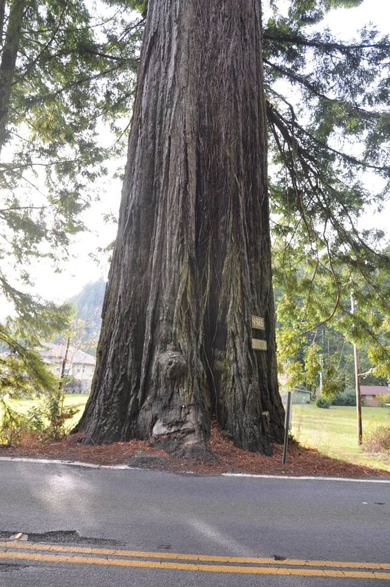
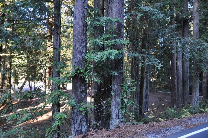
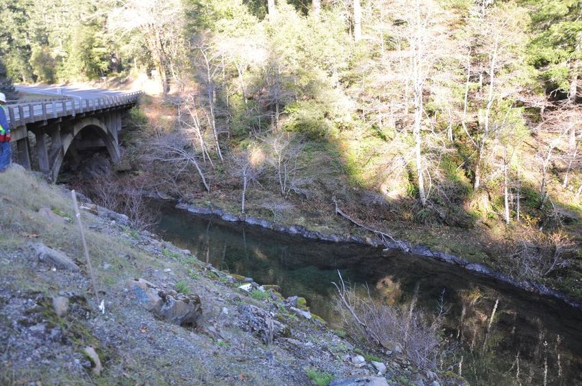
Table of Contents

                                                                                                                                 Page
1. Introduction .................................................................................................................... 1
2. Project Background ......................................................................................................... 2
3. Biology and Literature Review ........................................................................................ 3
    a. Old-Growth Redwood Forest ..................................................................................... 3
    b. Old-Growth Douglas-Fir Forest .................................................................................. 4
    c. Structural Roots, Absorbing Roots, and Root Development ...................................... 5
    d. Tree Failure ................................................................................................................ 6
    e. Disturbance Distance from the Tree (Potential Effects Zone) ................................... 6
    f. Ground Penetrating Radar (GPR) and Air-Spade® ...................................................... 7
4. Potential Tree Effects ...................................................................................................... 7
    a. Breaking/Severing the Structural Roots ..................................................................... 7
    b. Grading and Compaction of Soil within the Structural and Absorbing Root Zone .... 8
    c. Fill in the Critical Root Zone........................................................................................ 8
    d. Alteration of Soil pH ................................................................................................... 8
    e. Root Impact and Root Mortality ................................................................................ 9
    f. Death of Treetops ..................................................................................................... 10
    g. Reduction in Radial and Height Growth ................................................................... 10
    h. Platform Roots ......................................................................................................... 10
    i. Wind Throw ............................................................................................................... 11
    j. Tree Failure................................................................................................................ 11
    k. Hydrological Effects and Road Runoff ...................................................................... 11
    l. Changes in Crown or Tree Canopy Temperatures .................................................... 11
    m. Anticipated Effect to Surrounding Trees from Tree Removal ................................ 12
    n. Species Relative Tolerances of Construction Root Effects (cut, fill, grading,
    trenching, heat, soil compaction, pruning, shaving, poor aeration, seasonal
    saturation, pavement installation, etc.)....................................................................... 12
5. Methods ........................................................................................................................ 14
    a. Tree Inventory Development ................................................................................... 14
    b. Data Acquisition & Tree Evaluation Procedure ....................................................... 16
6. Results: Summary of Tree Inventory & Effects by Project Location ............................. 19
    a. Ruby 1 ....................................................................................................................... 19
    b. Ruby 2....................................................................................................................... 27
    c. Wind Effects (Ruby 1 and 2 sites) ............................................................................. 39
    d. Patrick Creek Narrows Location 2 ............................................................................ 40
    e. Washington Curve .................................................................................................... 48
7. Conclusions ................................................................................................................... 55
8. References and Literature Cited ................................................................................... 56

Appendix A. Tree Inventory Summary & Comments
Appendix B. Tree Current Condition & Potential Effects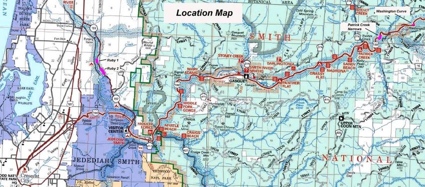
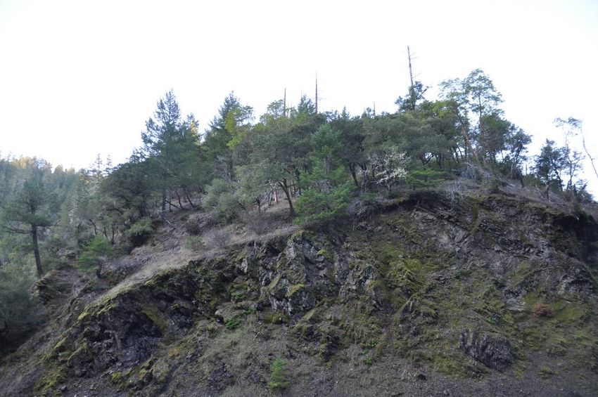
197/199 Safe STAA Access           Forester/Arborist Report                           page 1

1. Introduction
Caltrans is in the planning process for road widening and bridge improvements for 7
locations, known collectively as the “197/199 Safe STAA Access Project.” Based on the
Draft Environmental Impact Report/Environmental Assessment (DEIR/EA) (Caltrans
2010) and Caltrans’ tree surveys it was known that at 4 of the 7 project locations there
are potential tree and forest-related effects. East-West Forestry Associates, Inc. and
Urban Forestry Associates, Inc. subcontracted with ICF International, in contract with
Caltrans, to evaluate the potential tree effects of the 4 project sites, which are known as
“Ruby 1,” ”Ruby 2,” “Patrick Creek Narrows Location 2” and “Washington Curve.” These
projects are located on State Route 197 (SR 197) and U.S. Highway 199 (US 199) east of
Crescent City California per the attached map (Figure 1).

The maritime vs. inland sites are strikingly different. All are located immediately along
the Smith River corridor. However, the Ruby 1 and Ruby 2 project areas are narrow
strips of roadside forest edge trees in moderately to highly developed environments.
These two projects are located areas that were originally Alluvial Redwood Forest
(California Gap Analysis Program [GAP] land cover code 82310; Davis, Stoms et. al. 1998)
on the Smith River flats, within the North Coast Ecoregion. The Washington Curve and
Patrick Creek Narrows Location 2 (PCN2) projects are characterized by Mixed Evergreen
Forests (GAP land cover code 81100) and Upland Douglas Fir Forests (GAP land cover
code 82420) much further up the river canyon in the Klamath Ecoregion (Sleeter &
Calzia 2011). The Ruby 1 and Ruby 2 projects consist of minor adjustments in road
alignment and culvert replacement. The PCN2 and Washington Curve projects involve
changes in alignment with large cuts of hill slopes and construction of a bridge at the
PCN2 site. The developed roadside environments at Ruby 1 and Ruby 2 are far more
complex in terms of potential tree effects versus the sparsely forested slopes in the
relatively stressful climatic zone at Washington Curve and the burn site at PCN2.
Consequently, the analyses of effects at the sites differ for the roadside versus the
hillside trees.

The forester and the arborist team evaluated potential effects to redwood trees,
remnants of an old-growth forest, at the Ruby 1 and Ruby 2 project locations and
potential effects to old Douglas-fir trees at PCN2. The team specifically evaluated
proposed development in terms of concomitant effects on assessed trees and stands.
The forester/arborist team determined that an analysis of younger trees greater than 5″
in diameter at breast height (DBH, measured at 4.5 feet above ground level) at all these
locations is desirable, considering the importance of the younger trees to the health and
survival of the old trees. The team did a less intensive analysis of the early seral stage
forests at Washington Curve hillside cut and the PCN2 hillside cut, which was recently
burned in a wildfire.
197/199 Safe STAA Access            Forester/Arborist Report                         page 2

In order to efficiently complete these tasks, the forester/arborist team, Tom Gaman,
Registered Professional Forester #1776, and Ray Moritz, Consulting Arborist and Society
of American Foresters Certified Forester #241, visited the four project sites the week of
5 December 2011. During that week, the forester/arborist team was accompanied by
the Caltrans’ Staff. The team reviewed all planned project effects, conducted a
comprehensive on-site inventory of all potentially affected trees, and evaluated
potential project effects on tree-by-tree and stand level bases. This report provides a
description of the tree inventory and an evaluation of potential tree-related effects.

The two members of the forester/arborist team collectively have 3 degrees in forestry
and over 70 years of experience inventorying and evaluating trees in California. Much of
the assessment is based upon their professional experience and judgment.

2. Project Background
The project sites are all located along the Smith River in a wild and scenic river corridor
as shown in Figure 1. The Ruby 1 and Ruby 2 projects are located on SR197 in coast
redwood forests with associated minor components of red alder, emergent wetland and
previously disturbed vegetation, near the Ruby van Deventer County Park. The Patrick
Creek Narrows locations and Washington Curve project locations are located within the
Six Rivers National Forest with sparse Douglas-fir and mixed hardwood vegetation with
minor components of white alder forest and ruderal vegetation on disturbed sites. The
total extent of the roadside forested areas of concern is approximately 20 acres at most,
or less that 0.02% of the Smith River watershed area.

The sites are well documented in the DEIR/EA and further described in the “Effects by
Project Location” section below.

                   Figure 1. Project Vicinity and Location Map (Caltrans)
197/199 Safe STAA Access Forester/Arborist Report page 3
3. Biology and Literature Review
The team reviewed project documents including layouts, typical cross-sections, existing
tree mapping, the DEIR/EA (available on-line), and other materials provided by Caltrans.
The team also conducted a literature review of the biology and management of
Douglas-fir and coast redwood, species tolerances of construction effects, and root
system characteristics.
A number of issues have arisen as the result of planning for this road project. This
literature review and biological discussion is focused on the matters of major concern.
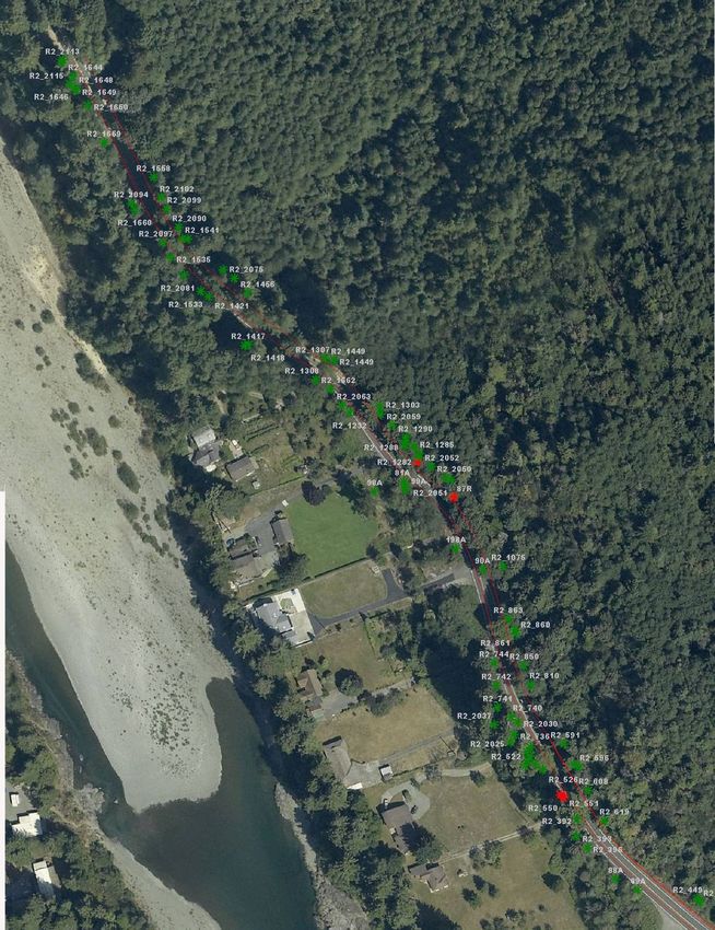
a. Old-Growth Redwood Forest
The forester/arborist team reviewed literature addressing the term “old growth.” Old-
growth is defined by botanists, ecologists and foresters as natural forest stands that
exhibit unique ecological features and a complex of distinguishing characteristics,
including:
• Mixed age stands with distinct regeneration patterns (McBride and Jacobs 1977).
• Trees of great age relative to the longevity of the species (Singer 2009).
• Large diameter trees with diameters of 2 to 4 meters and heights of 60 to 100
meters (Dagley 2007).
• Trees greater than 36 inches in diameter (California State Parks informal
communications).
• Enormous wood mass (Dagley 2011; M. Barbour and J. Major 1977).
• Complex trunks with “goose pen” butt hollows, cavities, dead branches, often
with multiple leaders (some of which may be dead), massive branches and large
vertical sprouts (Dagley 2007).
• Multiple layer canopies with redwoods forming the dominant crown class,
sometimes sharing the upper canopy with Douglas-fir, and hardwoods restricted
to the intermediate or suppressed canopy classes (Dagley 2007).
• Regeneration is random, clumped gap-phase reproduction (Dagley 2007).
• Coarse woody debris (Singer 2009).
• Snags (standing dead trees) (Dagley 2007).
• Fertile, intact, and generally acidic soils (USDA Forest Service 1993).
• Healthy fungal ecosystems (Giusti 2007; Singer 2009).
• Minimal human disturbance (Franklin et. al. 1981; USDA Forest Service 1993).
In forest ecology literature, the term “old-growth” is not generally applied to individual
large coast redwoods trees outside the context of the old-growth forest or stand. The
literature review found no research addressing remnant trees of old-growth forests.
Individual very large old remnant trees from former old-growth forests that have been
harvested were found in the project area. These large, old trees were given special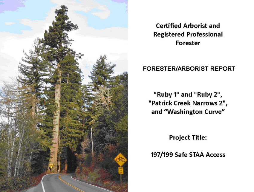
197/199 Safe STAA Access            Forester/Arborist Report                           page 4

consideration, and are identified as “old trees” for the purpose of this report. The root
“potential effects zone” (PEZ) was greatly expanded in evaluating such trees because
that zone is based on a multiple of the diameter of the tree (see Section 5). In
arboricultural literature and municipal ordinances, large old native trees and trees of
historical significance in urbanized/developed environments, some of which may be
remnant trees of old growth forest, are often awarded “heritage tree” status
(Bernhardt E. and Swiecki T. 1991). Special consideration for the preservation and
protection of such old trees is typically required. The trees at the project sites have not
been designated as heritage trees.

b. Old-Growth Douglas-Fir Forest
Old-growth Douglas-fir is defined by botanists, ecologists and foresters as natural
forests stands that exhibit unique ecological features and a complex of distinguishing
characteristics, including:

    •   Most often occurring with the dominant crown class that is even-age (Franklin,
        et al. 1981).
    •   Trees of great age (200 to 750 years) relative to the longevity of the species
    •   Large trees with dominant tree diameters of 1 to 3 meters and heights of 50 to
        90 meters (Franklin et al. 1981).
    •   Massive living and dead branches, dead leaders are common resulting from
        drought, beetle epidemics, and other factors (USDA Forest Service 1993).
    •   Multiple layer canopies with old Douglas-fir forming the dominant crown class
        (USDA Forest Service 1993), sometimes sharing the upper canopy with Douglas-
        fir, and hardwoods that are mostly restricted to intermediate or suppressed
        canopy classes.
    •   An accumulation of standing dead trees (USDA Forest Service 1993).
    •   The forest floor is typically littered with coarse woody debris (trunks and large
        branches, Singer 2009).
    •   Intact soils with a well-developed herbaceous layer (Franklin, J. F. and Spies, T. A.
        1991).
    •   An abundance of nitrogen-fixing epiphytes and bacteria
    •   Healthy fungal ecosystems, including fungi in the organic soil, and standing and
        fallen and decayed logs (USDA Forest Service 1993).
    •   Minimal human disturbance (Franklin et al 1981).

“Old-growth” therefore cannot be applied to individual Douglas-fir trees outside the
context of the old-growth forest or stand because the characteristics of old growth that
distinguish it from young growth and “second” growth involve the full range of forest
stand ecology, soils, hydrology, wildlife, and forest species composition and structure. In
this report such individuals, most of which are now remnants in the absence of their
former old growth forests, are referred to as simply “old” trees.
197/199 Safe STAA Access Forester/Arborist Report page 5 c. Structural Roots, Absorbing Roots, and Root Development Structural roots of the large old trees are the major lateral roots close to the tree base, within the “zone of rapid taper,” approximately within a radial area from the root attachment to six feet from the root crown. Beyond this zone, roots rapidly divide into smaller lateral roots, then thin fibrous roots and, ultimately, into absorbing roots commonly called “feeder” roots. The function of structural roots is to mechanically support the aerial portion of the tree, conduct soil nutrients, minerals and water from the smaller roots to the trunk, and store energy reserves. The structural root zone includes the large lateral “buttress” and “sinker” roots close to the tree trunk base (typically within six to nine feet of the base). These are the roots that support the tree’s vertical load and wind lever force loading. The “feeder root” zone is composed of the absorbing roots and fine roots. Ninety percent of these roots are in the upper foot of soil and distal to the structural root zone, even well beyond the canopy drip line. Note that the drip line or canopy perimeter, rule of thumb has no biological significance with respect to root growth extension and health. These are short-lived roots that often dieback during droughts and freezes. They rapidly regenerate during conditions favorable for growth (Urban 2008). Most of the absorbing roots are within one foot of the soil surface and grow upward from the woody roots. The term “feeder root” is a misnomer, but it is commonly used to describe non-woody absorbing roots (Shigo 1993; Harris, Clark and Matheny 1999). They are considered to be ephemeral in that they are to the most extent very short-lived (days or weeks). Absorbing roots exude carbohydrates into the surrounding soil that supports a rich environment of symbiotic bacteria and fungi (mycorrhizae) that help the tree absorb soil nutrients, minerals and water. The species populating the four sites can be separated into two distinctive groups from a root structure perspective. The oaks, bay laurels, tanoaks, big leaf maple and knobcone pine all have roots that divide rapidly and have zones of rapid taper that are relatively limited. Large lateral roots and sinker roots of these species are quite close to the trunk, six feet or less. In contrast, the coast redwood and Douglas-fir form large buttress roots and long laterals in maturity to support the massive weight of the aerial portions of these trees. Large laterals up to 15 centimeters (6 inches) in diameter may extend great distances (more than 20 feet from the tree base). Coast redwood develops the most extensive lateral root system of its associate species by far. Coast redwood also has the shallowest root system of its associate species, and yet it is the most wind firm of its associate large conifers, quite likely a function of its massive root system. Coast redwood is also the most tolerant of root disturbance. It can grow successionally higher root systems from adventitious buds on its trunk as alluvial silt builds up on redwood-populated stream benches over many years. Redwoods have been found to be buried in 30 feet of fill and still thriving (USDA Forest Service, 1990). Redwoods are also highly tolerant of root exposing stream bank erosion. Redwoods greater than 210 feet tall with 30% of their root systems fully exposed by river cutting or slides have formed
197/199 Safe STAA Access            Forester/Arborist Report                           page 6

new adventitious root systems lower on their trunks to compensate for dead, exposed
roots. Removal of up to 40% of the absorbing roots of trees in general, including
redwood, is unlikely to have a substantial effect on the overall health and stability of the
trees because absorbing roots are ephemeral under undisturbed conditions and
reproduce rapidly (Harris, Clark and Matheny 1999). Removal or shaving of up to 20% of
the structural support roots is unlikely to affect tree stability because trees generally
have a safety factor in the range of 4.5 times the strength required to resist the
expected stress load (Dunster 2009). None of the large redwoods at the project sites
would be affected to this extent.

d. Tree Failure
Tree failure is the structural failure of branches, trunks or roots due to excessive forces
exercised on the whole tree or tree part from trunk or branch weight or by external
forces acting on the tree as a whole, including wind, snow, ice, effect from other falling
trees, or earthquake ground acceleration.

e. Disturbance Distance from the Tree (Potential Effects Zone)
The type of disturbance is more important than the distance from the tree. Generally,
the structural supporting root zone radius is less than 3 times the DBH (State of
California Parks and Recreation 2011). A root radius of three times DBH encompasses
the major structural roots that support the tree weight and wind loads. Smiley,
Fraedrich and Henderickson found that 3 times DBH is the “minimum” radial distance
from the tree for serious root disturbance, “preferably” 5 times the DBH. Most of the
laterally extending roots beyond the 3 times DBH zone are rope-like and 0.5 to 1.0
inches in diameter on young trees and 1.0 to 2.0 inches in diameter in mature trees.
(Hagen 2001). For redwood and other resilient species the team assessed a root zone of
5 times DBH to protect the long term health and stability of the trees (Smiley, Fraedrich
and Hendrickson 2002). For Douglas-fir the team assessed a root zone of 10 times tree
diameter because this species is susceptible to aggressive root disease and decay fungi
which can affect both tree health and stability over time. An optimum tree protection
zone (in feet) for trees with good tolerance to disturbance 360° around the tree is 0.75
ft. times DBH (i.e., 27 foot radius for a 36 inch DBH tree). For moderately tolerant
species 1.0 ft. times DBH in inches is optimum and for trees that are poorly tolerant to
disturbance 1.25 ft. times the DBH in inches (Matheny and Clark 1998). However, roads
typically affect only one side of the root zone, less than 50% of the total root zone. Most
healthy trees would tolerate the removal of 50% of their absorbing roots (Sinclair, Lyon
and Johnson 1987). As long as large lateral roots and sinker roots, which provide tree
structural stability and occur only in the first nine feet of root extension, are not
removed most trees should tolerate excavation affecting 20% of the root zone.

No known sinker roots will be affected by the project. This analysis assessed trees within
the PEZ. This was defined on a tree by tree basis, as whether there would be any ground
197/199 Safe STAA Access            Forester/Arborist Report                          page 7

disturbing activities within the 5 times the DBH from the face of the tree (or 10 times for
Douglas-fir). This is further discussed in Section 5 of this report.

f. Ground Penetrating Radar (GPR) and Air-Spade®
Ground penetrating radar is a state of the art method used for general determination of
tree roots, water lines, and other underground utilities, and it has been found to be
valuable in many situations where there is concern about severe damage to unseen
structural roots. The forester/arborist team researched the issue and determined that
there are a very small number of trees with root systems severely affected by the
project. Also, with GPR there is a likelihood of false readings indicating roots where
there are only voids, old decayed wood, boards and soil tubes filled with dissimilar soil
material. Given the time and expenditure of public resources required, that ground
penetrating radar is not appropriate in this instance.

In this situation, the use of an Air-Spade® is suitable for excavation within the root zones
of trees with moderate or greater root effects and which shall have more than 20% of
their root zones affected. Concern for greater disturbance and long term tree health
might dictate the use of root-friendly excavation methods to determine the location of
roots and/or limit root disturbance. The Air-Spade® Excavator uses blasts of compressed
air to remove soil around roots, without physically damaging the roots. It is used by
arborists for excavations near trees where there are concerns about impacts to roots. It
is not efficient at excavating dry soil and creates an unacceptable amount of dust when
used on dry soils adjacent to roads. The soil should be deep irrigated 48 hours prior to
excavation, allowed to drain, and then excavated.

4. Potential Tree Effects
Based on the literature review and professional experience, the forester/arborist team
considered the major potential effects of the proposed project on old and younger
redwood and Douglas-fir trees, and other native trees in the area. These contributed to
the development of the tree inventory and assessment methods discussed in Section 5.

a. Breaking/Severing the Structural Roots
Breaking, severing, fracturing, shaving or debarking of structural roots could occur
where structural roots are close to the surface and heavy equipment grading,
excavation, or compaction and paving would take place. Unless roots of high value are
isolated from heavy equipment, damage could occur. Where there is not enough depth
from finish grade to the root system, asphalt is sometimes laid directly over roots and
the roots may be wounded or killed by heat damage. Road construction and
improvements typically affect only one side of the root zone, less than 50% of the total
root zone. Most healthy trees would tolerate the removal of 50% of their absorbing
roots as long as the soil conditions allowed regeneration (Sinclair, Lyon and Johnson
1987). As long as sinker roots are not removed, most trees should tolerate excavation
affecting 20% of the root zone. Redwoods, in particular, are very tolerant of root
197/199 Safe STAA Access            Forester/Arborist Report                            page 8

disturbance and pruning. Root sprouts from cut laterals and secondary roots grow
rapidly, easily extending 10 feet in a single year. The redwood forest is located in the
rough coastal canyon and riparian environments where natural disturbance events are
common. Their roots are constantly being buried or exposed by the natural events of
flood stage river cutting and sedimentation, terrestrial erosion, landslides and
deposition. They are among the longest living species and are well adapted to
disturbance. No known sinker roots would be cut by this project, except on some trees
designated for removal. Protective measures can be implemented to preserve structural
and sinker roots of trees to be retained.

b. Grading and Compaction of Soil within the Structural and Absorbing Root
Zone
Soil under roadways and supporting shoulders is typically graded to remove the organic
top soil and compacted to approximately the 90th–95th percentile with heavy rollers or
“sheepsfoot compactors.” This means that all the soil macropore space and much of the
micropore space has collapsed. Tree root health requires approximately 50% pore space
(an equal amount of macropores and micropores), and absorbing roots require organic
topsoil for good tree health. The macro pores are those than drain rapidly to soil “field
capacity moisture content” and provide soil aeration. Micropores allow moisture to
move up from the water table via capillary action and hold water for tree root
absorption (Urban, 2008). More than 90% of the absorbing roots occur in the top one
foot of natural soils (Harris et al. 1999).

c. Fill in the Critical Root Zone
The critical root zone or critical root radius has been defined variously by arborists and
urban foresters to be DBH X 18 (a 10 inch tree would have a 180 inch (15ft.) critical root
radius. Fill soil is one of the most damaging construction operations affecting root
systems. Fill soil is often dense, massive subsoil with low pore space deposited on top of
the native grade and typically compacted in lifts to assure resistance to erosion,
subsidence or collapse. Fill inhibits water infiltration, percolation through the soil
profile, soil aeration, and release of toxic gases (CO, CO2 and methane), creating an
unfavorable root environment. Compacted fill soil also inhibits the infiltration of
precipitation and ground water recharge. There are now available a number of
engineered structural soils, the best known of which is Cornell Mix or CU-Structural Soil.
These soils can be compacted to the greater load capacity typically required for major
highways and still provide a healthy root environment. The key is to provide a rock
skeleton, the pore space of which is filled with a clay loam bound by a water-holding
polymer, the combination of which provides a healthy well-aerated root environment
with adequate soil moisture holding capacity (Grabosky et al. 1998).

d. Alteration of Soil pH
A slightly acid soil (pH 6.5 is typically ideal) is needed for soil nutrient uptake by trees.
Excessively acid soils and alkaline soils may substantially affect nutrient uptake and tree
197/199 Safe STAA Access            Forester/Arborist Report                          page 9

health. Compacted and paved soils can result in carbon dioxide (CO2) and carbon
monoxide (CO) build-up that is converted into carbonic acid that can acidify the soil and
prohibit soil nutrient availability to plants.

However, additional large CO2-trapping layers of pavement are not anticipated for areas
where substantial tree root zones would be covered. Acidification potential is soil type
dependent. Most soils have abundant buffering agents and it is very difficult to
significantly change soil pH. When CO2 is trapped in the soil by compaction or pavement
it is converted to carbonic acid that can make nutrients unavailable to trees. When the
soil is decompacted or otherwise aerated the soil moves quickly back to its original pH
(Urban 2008). The forester/arborist team expects that, due to the relatively small area
to be compacted and filled or paved in the project area, there will be no measurable
effect on soil CO2 levels.

e. Root Impact and Root Mortality
Lateral roots compartmentalize wounds rapidly by creating boundaries to decay (Shigo,
1993, pg. 199). Absorbing roots are ephemeral (naturally live for short periods of a few
days to a few weeks, in some cases a month), and are regularly replaced. The vast
majority of effect zone trees will have no root zone effects connected with the project.
Of those that have effects, almost all will have less than 20% of the root zone disturbed,
and the majority of those will have less than 10%. Of those trees where roots will be
disturbed, most of the disturbance will be absorbing roots that occur in the upper foot
of soil and which are ephemeral, living only a few days to a few weeks under
undisturbed conditions (Dunster 2009; Urban 2008). A small percent of secondary roots
and larger lateral roots could be affected by the project, particularly those trees along
the Washington Curve and PCN2 road cuts. Different species have varying sensitivity to
root effects with coast redwood being the least sensitive, oaks, bay laurel, tanoak being
moderately tolerant and Douglas-fir, red alder, cedars and big leaf maple being the most
sensitive. Coast redwood is uniquely tolerant of root exposure, fill and root cutting. It
has been known to produce entirely new adventitious root systems where river silt
deposition from flooding has built up soils around the trees, even up to 30 feet deep, or
where river scouring has removed the surrounding soil redwoods grow a new lower root
system (USDA Forest Service 1990).

Roots grow much more rapidly than the aerial portions of trees, often up to 10 feet in a
year (Urban 2008). Cut root wounds are typically compartmentalized rapidly, small roots
sprout from around the cut, and a few sprouts quickly dominate and grow rapidly. Coast
redwood root sprouts have been known to grow to two to three inches in diameter
within two years after cutting (personal observation). Fractured and crushed roots will
also sprout new growth but cannot compartmentalize decay as rapidly and effectively.
Therefore it is far better to cut roots greater than one inch in diameter that are likely to
be damaged during construction.
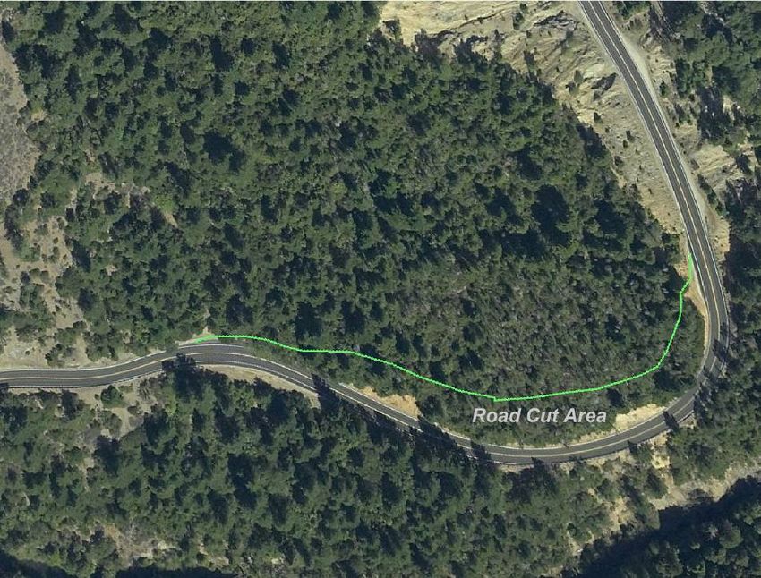
197/199 Safe STAA Access           Forester/Arborist Report                          page 10

Trees of the same species that are within root extension of each other may graft their
roots together forming a common root matrix. This is particularly common with
redwoods, oaks and Douglas-fir. The formation of a common root matrix buffers the
trees against the systemic effects of both natural and development effects. Natural root
grafts provide important physiological benefits to trees within the matrix, including the
transfer of soil water and minerals, organic compounds and even beneficial fungi. Root
grafts can also serve to transfer pathogens form one tree to the next. However, the
competitive benefits of natural grafting apparently outweigh the risks or this
phenomenon would not be so prevalent across a wide spectrum of species (S. Lev-
Yadun 2011).

f. Death of Treetops
Treetops, also called leaders, naturally dieback in coast redwood due to drought,
prolonged soil saturation, rodent girdling, and natural slides and fill. Human effects
causing dieback include soil compaction and impermeable paving of large areas of the
critical root zone, misapplication of herbicides, and disruption of the natural hydrology.
As discussed above, root grafting buffers individual trees and the stand as a whole
against stress-related dieback.

g. Reduction in Radial and Height Growth
Most trees naturally respond to root effects by extending their roots in other areas of
the critical root zone. Thus, typically the reduction in tree height and diameter growth is
only temporary.

h. Platform Roots
The ability of trees to grow new roots is species dependent, and a function of the soil
environment throughout the critical root zone. Redwoods are uniquely proficient in
growing new adventitious roots from latent buds on their trunks, and new “platform
root” systems when deep natural fill occurs due to stream sedimentation or terrestrial
erosion (Burns and Honkala 1990). Oaks and Douglas-fir are not capable of establishing
entirely new root systems after sedimentation or erosion. The proposed work at the
project sites studied effects of only a small percentage, typically 10% or less, of the
critical root zones of most roadside trees. The trees at the edge of the major cuts at
Washington Curve and Patrick Creek Narrows may be affected up to 30% of the critical
root zone. Most healthy, vigorous trees can tolerate this amount of disturbance (Harris,
Clark and Matheny 1999, pg. 310; Sinclair, Lyon, and Johnson 1987). Knobcone pine will
not tolerate a 30% reduction in root system but the knobcone pine are poor
competitors, short-lived and consequently in decline at this site. At Washington Curve
they are currently being displaced by other more competitive species such as canyon
live oak, which is growing under the pine and is more tolerant to root disturbance
(Harris et. al, 1999).
197/199 Safe STAA Access           Forester/Arborist Report                         page 11

i. Wind Throw
Most of the affected roadside trees are currently exposed to stand edge conditions and
have adapted to development and increased exposure over many years. Based upon the
inventory, the level of disturbance of roadside trees required for this project is not
expected to have a substantial effect on the integrity of the structural root systems.
Coast redwood is the most wind firm of all its associate species (USDA Forest Service
1990).

Douglas-fir is a relatively wind firm species where soils allow deep root penetration. The
structural roots tend to grow obliquely into the lower soil horizons. Most of the surface
roots are ropelike (USDA Forest Service 1990). Where there are high water tables, dense
clay soils, or shallow soils, the root systems may be quite shallow. We have not
observed unusually clayey soils or high water tables at any of the study sites. Shallow
soil conditions were observed at Washington Curve, the proposed road cut areas at
Patrick Creek Narrows 1 and 2 and at Patrick Creek Narrows 3.

j. Tree Failure
Tree failure is the structural failure of branches, trunks or roots due to excessive forces
exercised by the tree mass or by external forces acting on the whole of the tree or tree
parts. External forces include wind, snow, ice, impact from other falling trees or
earthquake ground acceleration. Road improvement operations can destabilize retained
trees through root effects, stand alteration, or indirect effects such as changes in soil
aeration, soil saturation or soil dehydration. Some potential tree failures can be avoided
through protective measures such as root protection during construction, use of the Air-
Spade® and other measures.

k. Hydrological Effects and Road Runoff
Substantial changes in the hydrology of a site can have widespread effects on tree
health and stability. Massive cuts can disrupt the lateral movement of water and root
zone soil recharge. Extensive new pavement over the critical root zone may substantially
reduce precipitation infiltration and soil water recharge causing tree dieback or even
mortality. Long periods of soil saturation reduce soil cohesion and tree anchorage and
can even cause massive root mortality and whole tree failure. The effect of road
construction on retained trees depends on the extent of increased runoff versus
infiltration, the extent and duration of saturation and the condition of the undisturbed
portion of the critical root zone (Smiley 2009). While the existing roads and driveways
decrease water infiltration and ground water recharge and increase runoff, the adjacent
trees are well-adapted to these conditions. The proposed project involves so little
surface area it would have no measurable effect on infiltration and runoff.

l. Changes in Crown or Tree Canopy Temperatures
The project sites are along the Smith River and Middle Fork Smith River and have been
subject to the evaporative stress of edge locations and canyon winds prior to the level
197/199 Safe STAA Access           Forester/Arborist Report                          page 12

of development we see today. While the natural distribution of redwood forest
indicates that this species has a strong preference for the relatively cool, moist, high
precipitation, foggy maritime environment it does perform well in environments where
prolonged high temperatures may occur during the dry season and fog is less frequent if
there is high moisture availability (Borchert, M., D. Seggatta. and M. Purser 1988).
Redwoods growing on more open sites, such as forest edge or on steep slopes appear to
withstand the greater exposure (Daubenmire 1975). The redwood sites at Ruby 1 and
Ruby 2 are on river flats with less competition and good soil moisture availability. Most
of the old trees have been exposed to edge conditions for many decades since there
was intact forest.

m. Anticipated Effect to Surrounding Trees from Tree Removal
When a new stand edge is created by removing trees at the edge of an intact stand the
internal sheltered trees suddenly exposed will have a relatively higher probability of
failure. Internal trees generally rely on the presence of surrounding trees for stability,
have smaller diameters, lower live crown ratios (LCR – the percent live canopy relative
to the total height of the tree), and have not developed the required reaction wood to
counter the wind forces at the edge of the stand. This affects conifer trees (redwood,
Douglas-fir, true firs, cedars, pines, etc.) more than hardwood trees (oak, bay laurel,
maple, madrone, etc.) (Dunster, J. 2009; Daubenmire 1975; Borchert et. al. 1988). The
proposed plan only creates new stand edge conditions where there will be large cuts at
PCN2 and Washington Curve. The species adjacent to the PCN2 and Washington Curve
sites are well adapted to their high exposure to canyon winds.

n. Species Relative Tolerances of Construction Root Effects (cut, fill, grading,
trenching, heat, soil compaction, pruning, shaving, poor aeration, seasonal
saturation, pavement installation, etc.)
Urban Forestry and Arboricultural observations have rated various genera and species
for tolerance of construction effects. The follow is a summary of those ratings.
197/199 Safe STAA Access              Forester/Arborist Report                              page 13

Table 1. Tolerance of Roots to Construction Effects by Species

 Common Name               Latin Name           Tolerance                      Source
Vine maple            Acer Cincinatum           Good             Peepre, undated Costello & Jones,
                                                                 2003
Big leaf maple        Acer macrophyllum         Good             Matheny & Clark, 1998
California Buckeye    Aesculus californica      Good             Matheny & Clark, 1998
Alder, Red            Alnus rubra               Poor             Peepre, undated, Costello & Jones,
                                                                 2003
Madrone               Arbutus menziesii         Poor             Matheny & Clark, 1998, Moritz,
                                                                 2012
Incense Cedar         Calocedrus decurrens      Moderate         Matheny & Clark, 1998
False cypress         Chamaecyparis spp.        Good             Gilbert, 1996
Pacific dogwood       Cornus nuttallii          Good             Peepre, undated
Ash                   Fraxinus spp              Moderate         Fraedrich, 1995
Sitka Spruce          Picea sitchensis          Moderate         Matheny & Clark, 1998
Knobcone Pine         Pinus attenuata           Moderate         Moritz 2012 – poor for fill
Ponderosa Pine        Pinus ponderosa           Good             Matheny & Clark, 1998
Poplars, California   Populus spp.              Poor             Matheny & Clark, 1998
Douglas-fir           Pseudotsuga menziesii     Poor             Dunster, 2011 – Fill & saturation
                                                Good             Matheny & Clark 1998-Pruning
Canyon Live Oak       Quercus chrysolepis       Good             Moritz, 2012
Oregon White Oak      Quercus garryana          Good             Matheny & Clark, 1998
Coast Redwood         Sequoia sempervirens      Good             Moritz, 2012 Matheny & Clark, 1998

Note that the tolerance of coast redwood to root disturbance is very high while Douglas-
fir is generally poor. Douglas-fir is tolerant of fill if limited to 25% of critical root zone but
may experience decline slowly at fill greater than 25%. Douglas-fir tolerates limited root
pruning if less than 20% of critical root zone affected.

Under the following conditions, root pruning should be avoided:

    •   Trees that are stressed by drought, insect infestation, disease, excessive
        trimming or prior root disturbance (Mann 2002. Impacts “Root Pruning: The
        Good the Bad and the Ugly.” In Roots vs. Infrastructure. CUFC Conference)
    •   Trees leaning more than 40° (Dunster 2009. Tree Risk Assessment In Urban Areas
        and the Urban/Rural Interface)
    •   Trees with extensive root decay (more than 33% of structural roots have less
        than 33% shell wall thickness) (Dunster 2009)
    •   Trees with excessive trunk heart rot, where the trunk shell wall is less than the
        trunk radius X 0.33 (Mattheck 2004. The Face of Failure)
    •   Trees with root crown cavity openings more than 30% of the root crown
        circumference (Mattheck and Breloer 1994. The Body Language of Trees: A
        Handbook For Failure Analysis)
197/199 Safe STAA Access Forester/Arborist Report page 14
• Trees that would have been root pruned on another side
• Species considered intolerant of root pruning (Costello and Jones 2003)
5. Methods
a. Tree Inventory Development
Caltrans staff provided the forester/arborist team with the DEIR/EA, design documents,
some tree records, some bibliographic materials, and public comments on the DEIR/EA.
The forester/arborist team reviewed the most current project information prepared by
Caltrans Project Development Team (PDT) for the 4 project locations. The team had a
telephone conference meeting with Caltrans PDT on November 15, 2011. There was a
follow-up meeting in Eureka at Caltrans offices on December 5, 2011. Subsequently the
forester/arborist team spent 3 days in the field (December 6, 7, and 8) with Caltrans’
engineering and project staff inspecting the sites and assessing potential road
improvement project effects.
Large numbers of native trees occur at all four sites. Based on forester/arborist team
member experience, the initial field reconnaissance, and the literature review, the team
determined that trees that will remain, within a pre-specified PEZ, after the project is
complete, have the greatest likelihood of being affected by the project. Therefore the
team determined that it would objectively evaluate all retained trees within the PEZ at
each of the 4 project sites of interest.
Each tree has a “structural root zone,” composed of a larger set of roots that physically
support the above-ground mass of the living tree, and an extended much-larger
feeder/absorbing root zone which is composed of finer roots and nonfibrous absorbing
roots which take up water, minerals and nutrients. Some fine rope-like lateral roots
have been determined to extend under and across roads and even to the far side of
formidable barriers in the developed environment. However, a general rule applies that
the closer to the tree, the more important the roots for both tree health and stability.
Although there is no absolute rule, the State of California Parks and Recreation
Handbook (State of California Parks and Recreation 2011) suggests that the “root health
zone” is a circular area with the tree trunk at the center and a radius of 5 times the
diameter of the tree trunk measured at breast height” (DBH). This includes the
“structural root zone of 3 times the diameter of the tree” and a portion of the smaller
roots and absorbing root zone. The forester/arborist team decided that this was a
reasonable standard of impact for resilient tree species. Therefore the “potential effects
zone” or PEZ on the road work side of the trees for this project was determined to be 5
times the diameter for all trees except Douglas-fir. The forester/arborist team
concluded that Douglas-fir’s greater sensitivity to root disturbance and high
susceptibility to root disease and windthrow required the application of a 10 X DBH PEZ.
As such, a 14″ redwood tree would have a PEZ zone of 70″ (from the face of the tree at
its root crown) while a 14″ Douglas-fir would have a PEZ with a 140″ radius (from the
root crown face of the tree). If work is planned, no matter how minor, within the PEZ of197/199 Safe STAA Access Forester/Arborist Report page 15 any tree, then that tree was evaluated. Additionally, trees that had special importance (such as the large old redwoods at Ruby 2) and trees outside of the effect zone that could be affected by the construction (for instance, alongside a driveway) were also evaluated. In the interest of time, similar and adjacent hardwood trees (mostly 6–10″ in DBH) were evaluated as groups. The PEZ trees evaluated in this report are not necessarily the same trees that were identified in the DEIR/EA. The reason for this is that the DEIR/EA identified many trees that are outside of the PEZ, and, as such, are not directly relevant to the project as planned. The forester/arborist team concluded during the first day of field work that Caltrans had done an adequate job of identifying trees to be removed as a result of the project. Therefore they simply reviewed these trees at all project sites, and did not comprehensively evaluate trees that would be cut, except to note that no large old redwood trees would be removed as a result of the project. The team recognizes that roadside trees within the historic highway rights-of-way have by now adapted to or declined from the existing and historic root disturbances and other road effects. Therefore roadside trees were evaluated for their current condition, and potential project effects. Distance from the project activity to the face of each tree and percentage of root zone affected were taken into account. The site conditions and the proposed road improvements for the roadside trees vs. the hillside trees and the project locations are quite dissimilar so the team adopted separate inventory methodologies: a methodology for roadside trees and another for hillside trees. In all up to 28 observations were recorded for each potentially affected “roadside tree” as shown in Table 2 (“Tree Effects Data Collection Form” used at Ruby 1, Ruby 2 and roadside at PCN2), while less-detailed inventory methodology was adopted for potentially affected “hillside trees,” all of which would either be removed or retained (Table 5, used at Washington Curve and for hillside trees at PCN2). Trees that would be removed as a result of the project were noted as to number, species, and diameter, but not further evaluated. For the trees that will remain, the resulting data set provides a basis for evaluating tree-level and stand level effects. All tree locations and associated tree level data were imported into the geographic information system (GIS). Therefore, all data items and tree records can be evaluated individually or in clumps relative to the planned highway improvement efforts. Many trees were located in the field using Garmin GPS waypoints. Such locations are subject to measurable error. While every effort was taken to locate trees correctly, some trees were difficult to access in the field and are therefore subject to other location error. In particular, trees at PCN2 are located on steep and sometimes gravely hazardous terrain above the travel lane and are subject to this type of location error. The tree mapping as presented in this report is for reference purposes. The trees referenced are tagged and readily identifiable in the field.
197/199 Safe STAA Access           Forester/Arborist Report                          page 16

Trees stems 5″ and larger in diameter at breast height (DBH) were recorded. Smaller
trees, 4.9″ and less, were not tallied. Many trees at all of the project sites are multiple
stemmed trees and they were recorded as “clumps,” or individual multiple stemmed
trees. In the case of redwoods such trees are multi-stemmed trees which sprouted from
a single root base, primarily because they were previously harvested or cut down by
humans. Oaks are naturally multi-stemmed and many were recorded as clumps. In the
case of alders and small maples at PCN2, clusters or minor groups of smaller trees
(similar trees usually in the 6–10″ diameter classes and located within close proximity to
one another) were simply too numerous to individually tally using the “Roadside
Method.” Such clusters were also recorded as clumps. On the hillsides, where the
“Hillside Method” was utilized, some clusters of smaller madrones and tanoaks were
recorded as clumps. In all cases of clumps multiple stem diameters were measured and
recorded. Therefore this project contains a count of the number of individual trees
(which includes individual single-stemmed and multi-stemmed trees) by species, size
class and other variables. In cases where maples and alders were aggregated as clumps
the number of existing tree stems is also reported.

In this manner the forester/arborist team assessed the following number of trees at the
four sites:

    •   57 individual live trees and/or multiple trunk trees or clumped trees at the
        Ruby 1 site, with a total of 105 stems; trees to be removed were not recorded at
        Ruby 1.
    •   87 individual live trees, multiple trunk trees or otherwise clumped trees at the
        Ruby 2 site, with a total of 153 stems to be retained; 7 stems to be removed and
        a stump were also recorded.
    •   16 live single-stemmed trees at the PCN2 site were measured using the
        “Roadside Method” described below. Also at this site 31 additional individual
        trees and clumps of trees on the burned hillside above the road cut, and a small
        number of riverine alders and maples, were evaluated using the “Hillside
        Method,” also described below.
    •   143 trees or groups of trees, 179 stems in all, at the Washington Curve project
        location were recorded using the Hillside Method. Of these 140 stems will be
        removed, all within the proposed road cut.

The tree inventory for all affected trees at these locations is included in Appendix A and
Appendix B (Roadside Method) and in Table 10 & Table 12 (Hillside Method).

b. Data Acquisition & Tree Evaluation Procedure
Based upon field reconnaissance and literature reviews, the forester/arborist team
collected the “Roadside Method” data items identified below in Table 2 for each tree in
the effect zone at Ruby 1 and Ruby 2, and for sensitive roadside trees at PCN2. The
“Hillside Method,” where only species, size, and “save” or “remove” collected, was used
at all other locations (Table 5).
197/199 Safe STAA Access Forester/Arborist Report page 17
At the Roadside Method locations the team evaluated the current condition of each tree
in the PEZ that would be retained (rather than removed) and that could be adversely
affected by the project. The team also recorded data for potential effects including root
zone effects, wind effects, effects from increases in ambient light, wind throw effects,
potential effects that would result from adjacent tree removals, and construction
mechanical equipment such as graders and backhoes used during road construction.
Table 2. “Roadside Method” Tree Effects Data Collection Forms
Caltrans Field PEZ Surveys on SR 197 and US 199
Ruby 1 & Ruby 2, Patrick Creek Narrows Location 2 (East side of road)
December 6, 7 & 8, 2011
Item # Data Item Variable response
1 Tree #
2 Species
3 DBH (inches)
4 GPS waypoint (when applicable)
5 photo#
6 Removal Code Protect or Remove
7 Live Crown Ratio % of total height compacted crown ratio
D=dominant, C=Co-dominant,
8 Tree Position
I=Intermediate, S=Suppressed
9 Existing baseline condition and tree defects (as identified in Dec. 2011)
a. Top damage y/n
b. Bole damage y/n
c. Root damage y/n
d. Root cut depth Inches
e. Root fill depth Inches
f. Compaction y/n
g. Culvert in PEZ y/n
h. Paving in PEZ y/n
Distance (horizontal feet) to project footprint
10
from face of tree
11 Potential project effects (for retained PEZ trees only)
a. % of root zone affected % root zone
b. root zone effects 0 (negligible) or 1 (low) to 5 (high)
c. wind movement effects 0 (negligible) or 1 (low) to 5 (high)
d. increased light effects 0 (negligible) or 1 (low) to 5 (high)
e. increased windthrow effects 0 (negligible) or 1 (low) to 5 (high)
f. adjacent tree removal effects 0 (negligible) or 1 (low) to 5 (high)
g. mechanical damage during construction 0 (negligible) or 1 (low) to 5 (high)
12 Miscellaneous comments Text
Numbered photographs are referenced for most roadside trees. Although too numerous
to reproduce here, the forester/arborist team has provided Caltrans with photographs
referenced in this report.197/199 Safe STAA Access Forester/Arborist Report page 18
“Roadside Method” Tree Effect Severity Categories
Percent of Root Zone (face of tree at base to 5 times the tree DBH, 10 times DBH for
Douglas-fir) Effects were rated 0 to 5 as follows.
Table 3. Percent of Root Zone Effect Severity Categories
Effect Severity
Description of Effect
Category
0 - None No measurable effect
1 - Minimal Less than 10% of root zone (absorbing roots only)
2 - Slight 10% to 20% of root zone
3 - Moderate 20% to 30% of root zone (Absorbing and < 3″ laterals)
4 - Considerable 30% to 40% root zone (< 30% of Structural + Associated small
laterals & absorbing roots)
5 - Severe > 40% of root zone ( < 3″ laterals & < 30% structural )
“Roadside Method” Health and Structural Stability Potential Project Effects were
evaluated 0 to 5 as follows.
Table 4. Health and Structural Stability Effect Severity Categories
Effect Severity
Extent and Duration of Effect
Category
0 - None No project related effect on health and stability
1 - Minimal Minor short term effect, recovery within weeks
2 - Slight Minor health effect; recovery within months
3 - Moderate Moderate health and/or stability; recovery 1 year
4 - Considerable Serious impact intervention necessary
5 - Severe Intervention unlikely to improve condition
The hillside trees were generally smaller, younger, more numerous, and, in the view of
the forester/arborist team, less ecologically important than the larger, older individuals
inventoried utilizing the “roadside method.” Data items are shown in the table below.
Table 5. “Hillside Method” Tree Data Collection Forms
Caltrans Field Tree Effect Surveys on US 199
Item # Data Item Variable response
1 Tree #
2 Species
3 DBH (inches)
6 Removal Code Retain/Remove
13 Miscellaneous comments Text197/199 Safe STAA Access Forester/Arborist Report page 19 Both the Roadside Method and Hillside Method provide quantitative means for assessing tree effects and assure that tree protection is applied at the tree level, as may be necessary. The entire data set has been included in the Appendices A & B. 6. Results: Summary of Tree Inventory & Effects by Project Location Based on the inventory of all trees at each project location, the forester/arborist team evaluated potential effects for every tree within the PEZ at Ruby 1 and Ruby 2, PCN2, and Washington Curve where work is planned within the tree effect zone, as described above. The forester/arborist team prepared the summaries that are contained in this section and an assessment of overall effects in the conclusion to this report. a. Ruby 1 The Ruby 1 site is located in a dense coastal alluvial redwood forest dominated by redwood trees. Ruby 1 includes a small number of large redwood trees that, although large and undoubtedly quite old, appear much younger than their counterparts at Ruby 2. The project site is located at Mile Post 4.5 on North Bank Road (SR 197) approximately 2.5 miles south of its junction with SR 101. The location is adjacent to the Ruby van Deventer County Park, a public camping area and Smith River access. From there the Ruby 1 project area extends southeasterly for approximately 700 feet. Affected trees are located on both sides of the road. The setting is further described in the DEIR/EA Section 2.3.1.1 (Caltrans 2010). State Route 197 and Del Norte County’s Ruby van Deventer County Park have been in existence for decades. All of the trees along SR 197 have had to adjust to the cumulative effects of runoff, grading, cut, fill, compaction, impervious road and parking areas construction, traffic, and road maintenance, yet the trees remain in remarkably healthy condition. The current proposed highway improvement project entails lengthening a curve, widening the shoulder by varying widths, and improving the super elevation and friction by adding asphalt concrete (away from the river) at the inside of a curve. One culvert would be replaced, one culvert inlet would be extended and one new inlet would be installed. The project is described in the DEIR/EA. Trees to be removed include 2 alders, a rotted 42″ bay stump with many sprouts, and a clump of 2 redwood trees 17″ & 18″ in diameter.
You can also read