From Policy to Action' - Climate Resilience Implementation Plan for Spatial Planning (CRISP) for the eThekwini Municipality
←
→
Page content transcription
If your browser does not render page correctly, please read the page content below
‘From Policy to Action’ – Climate Resilience Implementation Plan
      for Spatial Planning (CRISP) for the eThekwini Municipality

       :
As a federally owned enterprise, GIZ supports the German Government in achieving its objectives in the field of international cooperation for sustainable development. Published by: Deutsche Gesellschaft für Internationale Zusammenarbeit (GIZ) GmbH Registered offices Bonn and Eschborn, Germany Section Governance and Human Rights Friedrich-Ebert-Allee 36 + 40 53113 Bonn, Germany T +49 228 4460–37 62 F +49 228 4460–17 66 E info@giz.de I www.giz.de Project The project ‘Cities Fit for Climate Change’ is part of the International Climate Initiative (IKI). The Federal Ministry for the Environment, Nature Conservation and Nuclear Safety (BMU) supports this initiative on the basis of a decision adopted by the German Bundestag. The project also cooperates with the Federal Ministry of the Interior, Building and Community (BMI). Responsible for Part I (GIZ) Dr Daphne Frank Head of Project Cities Fit for Climate Change T +49 228 44 60–33 62 E daphne.frank@giz.de Responsible for Part II (eThekwini Municipality) Helene Epstein (Senior Manager) Strategic Spatial Planning Branch Development Planning, Environment & Management Unit 166 KE Masinga Road Durban, South Africa, 4001 T +27 31 311–7159 E helene.epstein@durban.gov.za Design and layout EYES-OPEN, Berlin Photo credits (cover) Amina Schild: front cover small circle, back cover main picture and bottom small circle Felix Volgmann: front cover top picture, back cover top small circle Lea Kulick: front cover bottom picture URL Links This publication contains links to external websites. Responsibility for the content of the listed external sites always lies with their respective publishers. When the links to these sites were first posted, GIZ checked the third-party content to establish whether it could give rise to civil or criminal liability. However, the constant review of the links to external sites cannot reason- ably be expected without concrete indication of a violation of rights. If GIZ itself becomes aware or is notified by a third party that an external site it has provided a link to gives rise to civil or criminal liability, it will remove the link to this site immediately. GIZ expressly dissociates itself from such content. On behalf of Federal Ministry for the Environment, Nature Conservation and Nuclear Safety (BMU), Berlin GIZ is responsible for the content of this publication. Printing: druckriegel GmbH, Frankfurt am Main Printed on 100% recycled paper, certified to FSC standards. As at Durban, South Africa, May 2019

Acknowledgements
Acknowledgements
The development of the Climate Resilience Implementation Plan Contributors of the eThekwini Municipality involved in the
for Spatial Planning (CRISP) was led by the eThekwini municipal development of the CRISP:
team and supported by the global project Cities Fit for Climate Ajiv Maharaj (Economic Development Unit), Andrew Mather
Change (CFCC) of the Deutsche Gesellschaft für Internationale (Coastal, Stormwater and Catchment Management
Zusammenarbeit (GIZ) on behalf of the German Federal Ministry Department), Basheshile Thusi (Natural Resources Division), Bheki
for the Environment, Nature Conversation and Nuclear Safety. The Khoza (Parks Leisure and Cemeteries (Agriculture)), Brian O’Leary
CFCC project commissioned the local experts of the Urban Earth (Information and Research), Claire Norton (Land Use Management),
consultancy 1 who worked in close cooperation with the municipal Emmanuel Letebele (Strategic Spatial Planning), Eric Parker (Land
core team and developed the CRISP, which forms Part II of this Use Management), Faizal Seedat (Human Settlements Unit), Geoff
publication. Tooley (Coastal, Stormwater and Catchment Management Depart-
ment), Gerald Clarke (Environmental Planning and Climate Protec-
Authors: tion Department), Hope Joseph (eThekwini Water and Sanitation),
Part I: core team GIZ Jabulani Mdiniso (Parks, Recreation and Culture), Logan Moodley
Dr Daphne Frank, Zane Abdul, Lea Kulick (eThekwini Transport Authority), Malcolm Canham (Disaster
Management), Manoj Rampersad (eThekwini Transport Authority),
Part II: core team within eThekwini Municipality Michelle Lotz (Environmental Planning and Climate Protection
Helene Epstein (Strategic Spatial Planning Branch), Emmanuel Department), Natasha Govender (Environmental Planning and
Letebele (Strategic Spatial Planning Branch), Nongcebo Hlongwa Climate Protection Department), Navin Badasar (Electricity Depart-
(Climate Protection Branch), Itumeleng Masenya (Energy Office) ment), Ndumiso Zondo (Strategic Spatial Planning), Neela Naidoo
(Strategic Spatial Planning), Phakamile Mbonambi (Economic
Cities Fit for Climate Change team Development Unit), Prema Christopher (Integrated Development
Philipp Kühl, Amina Schild, Lea Kulick, Sudakhar Krishnan, Andrea Planning), Ranjith Sookdeo (Electricity Department), Ravesh
Palma, Zane Abdul, Karen Pacheco, Elizabeth Dubbeld (formerly GIZ) Govender (Integrated Development Planning), Richard Boon
(Environmental Planning and Climate Protection Department),
Coordinator in South Africa Sanele Khawula (Strategic Spatial Planning). Sanjeeth Sewchurran
Godje Bialluch (Electricity Department), Sean O’Donoghue (Environmental Planning
and Climate Protection Department), Takalani Rathiyaya (Economic
With support from consultants Development Unit), T ruman Hardon (eThekwini Water and Sanita-
Felix Volgmann, Leipzig tion), Zama Khuzwayo (Environmental Planning and Climate Protec-
Urban Earth, Durban tion Department)
With support from intern
Julia Brennauer
1
Climate Resilience Implementation Plan for Spatial Planning
Summary
The Climate Resilience Implementation Plan for Spatial Examples of such actions include:
Planning (CRISP) is a tool for promoting the integra
1. I dentify open space areas that provide flood mitiga
tion of eThekwini’s climate change response into its
tion services.
spatial planning framework. Specifically, the CRISP has
taken recommended climate change adaptation and 2. Amend land use schemes to accommodate renewable
mitigation actions from the Durban Climate Change energy installations.
Strategy (DCCS) that are relevant to spatial planning
3. Amend land use schemes to incorporate mitigation
and integrated these into the city’s Spatial Development
measures for buildings to respond to increasing heat.
Framework (SDF) and lower order plans. The SDF is
the spatial development ‘masterplan’ for the city and 4. Establish a working group to identify areas to which
one of its key planning instruments. coastal infrastructure at risk could be relocated in the
long term.
In this way, the CRISP seeks to contribute to the climate
resilience and spatial transformation of the city. Through 5. Identify priority transport nodes, priority feeder
the CRISP, the SDF now reflects specific climate resil routes, priority stations and transport corridors and
ience actions across the 10 DCCS themes and gives promote the facilitation of densification around these
proposals that sector departments should manage and transport nodes and stations.
implement as part of their sector plans. In some cases,
6. Identify approaches to facilitating the uptake of green
CRISP actions create the need to modify sector plans;
services and products.
in others, the actions complement existing sector plans.
This encourages more collaboration between various 7. Set up a technical/administrative committee to coor
departments and actors in eThekwini (Durban) and dinate climate change responses in the Municipality.
requires dealing with climate change in a proactive and
8. Support climate change focused research.
productive manner.
Once fully integrated into the city’s budgeting and de
velopment planning process, these actions can be im
plemented. This contributes to making the city climate
resilient and therefore benefits the population of eThek
wini.
Durban and eThekwini are used interchangeably to refer to the same city. eThekwini formally refers to
the Metropolitan Municipality that includes the city of Durban and surrounds. In this document, we refer
to it consistently as eThekwini. Some documents that are mentioned in this text, however, refer to the
municipality as Durban.
2
Content

Content

Summary  .  .  .  .  .  .  .  .  .  .  .  .  .  .  .  .  .  .  .  .  .  .  .  .  .  .  .  .  .  .  .  .  .  .  .  .  .  .        2

List of Abbreviations  .  .  .  .  .  .  .  .  .  .  .  .  .  .  .  .  .  .  .  .  .  .  .  .  .  .  .  .  .  .  .  .            4

List of Figures  .  .  .  .  .  .  .  .  .  .  .  .  .  .  .  .  .  .  .  .  .  .  .  .  .  .  .  .  .  .  .  .  .  .  .  .      5

Part I: Report on the Development of the Climate Resilience Implementation
Plan for Spatial Planning .  .  .  .  .  .  .  .  .  .  .  .  .  .  .  .  .  .  .  .  .  .  .  .  .  .  .  .  .  .  .            7

I.	 The Global Project: Cities Fit for Climate Change (CFCC) .  .  .  .  .  .  .  .  .  .  .  .  .                               7

II.	 eThekwini Municipality (Durban) Climate Change Response .  .  .  .  .  .  .  .  .  .  .  .                                  8

III.	The Preparation of the Climate Resilience Implementation Plan for
     Spatial Planning  .  .  .  .  .  .  .  .  .  .  .  .  .  .  .  .  .  .  .  .  .  .  .  .  .  .  .  .  .  .  .  .  .        12

IV.	 Process: How Was It Done? .  .  .  .  .  .  .  .  .  .  .  .  .  .  .  .  .  .  .  .  .  .  .  .  .  .  .  . 12

V.	 Outcome: What Were the Results?  .  .  .  .  .  .  .  .  .  .  .  .  .  .  .  .  .  .  .  .  .  .  .  .                     13

                                                                                                                                      3
Climate Resilience Implementation Plan for Spatial Planning

    Part II: Specific Recommendations of the Climate Resilience Implementation Plan for
    Spatial Planning for All Ten Themes of the Durban Climate Change Strategy . . . .   17

    1.	Water  .  .  .  .  .  .  .  .  .  .  .  .  .  .  .  .  .  .  .  .  .  .  .  .  .  .  .  .  .  .  .  .  .  .  .  .  .  .     18

    2.	 Sea Level Rise  .  .  .  .  .  .  .  .  .  .  .  .  .  .  .  .  .  .  .  .  .  .  .  .  .  .  .  .  .  .  .  .  .  .       22

    3.	Biodiversity .  .  .  .  .  .  .  .  .  .  .  .  .  .  .  .  .  .  .  .  .  .  .  .  .  .  .  .  .  .  .  .  .  .  .  . 25

    4.	 Food Security  .  .  .  .  .  .  .  .  .  .  .  .  .  .  .  .  .  .  .  .  .  .  .  .  .  .  .  .  .  .  .  .  .  .        27

    5.	Health  .  .  .  .  .  .  .  .  .  .  .  .  .  .  .  .  .  .  .  .  .  .  .  .  .  .  .  .  .  .  .  .  .  .  .  .  .  .    28

    6.	Energy  .  .  .  .  .  .  .  .  .  .  .  .  .  .  .  .  .  .  .  .  .  .  .  .  .  .  .  .  .  .  .  .  .  .  .  .  .  .    31

    7.	 Waste and Pollution  .  .  .  .  .  .  .  .  .  .  .  .  .  .  .  .  .  .  .  .  .  .  .  .  .  .  .  .  .  .  .           35

    8.	Transport  .  .  .  .  .  .  .  .  .  .  .  .  .  .  .  .  .  .  .  .  .  .  .  .  .  .  .  .  .  .  .  .  .  .  .  .  . 36

    9.	 Economic Development  .  .  .  .  .  .  .  .  .  .  .  .  .  .  .  .  .  .  .  .  .  .  .  .  .  .  .  .  .  . 39

    10.	Cross-Cutting .  .  .  .  .  .  .  .  .  .  .  .  .  .  .  .  .  .  .  .  .  .  .  .  .  .  .  .  .  .  .  .  .  .  .      41

    11.	Implementation Plan Across Sectors  .  .  .  .  .  .  .  .  .  .  .  .  .  .  .  .  .  .  .  .  .  .  . 42

    Sources  .  .  .  .  .  .  .  .  .  .  .  .  .  .  .  .  .  .  .  .  .  .  .  .  .  .  .  .  .  .  .  .  .  .  .  .  .  .  .   46

4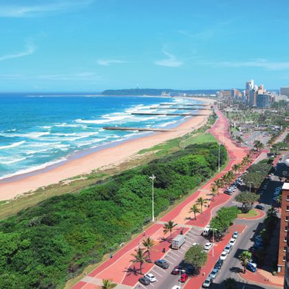
List of Abbreviations

List of Abbreviations

CER        Certified Emission Reductions
CFCC       Cities Fit for Climate Change
ClimPUDA Climate-Proof Urban Development Approach
CoGTA      Department of Co-operative Governance and Traditional Affairs
CPB        Climate Protection Branch
CRISP      Climate Resilience Implementation Plan for Spatial Planning
DCCS       Durban Climate Change Strategy
DEA        Department of Environmental Affairs
D’MOSS     Durban Metropolitan Open Space System
ECOD       Economic Development and Planning
EMA        eThekwini Municipal Area
EMCCC      eThekwini Municipal Climate Change Committee
EO         Energy Office
EPCPD      Environmental Planning and Climate Protection Department
EXCO       Executive Committee of Council
GHG        Greenhouse Gas
GIZ        Deutsche Gesellschaft für Internationale Zusammenarbeit
GWP        Global Warming Potentials
IDP        Integrated Development Plan
IRPTN      Integrated Rapid Public Transport Network
M&E        Monitoring & Evaluation
NMT        Non-Motorised Transport
PSC        Project Steering Committee
SALGA      South African Local Government Association
SDBIP      Service Delivery and Budget Implementation Plan
SDF        Spatial Development Framework
tCO2e      Tonnes of Carbon Dioxide Equivalent
TTT        Climate Change Strategy Technical Task Team
UNFCCC     United Nations Framework Convention on Climate Change
ZAR        South African Rand

                                                                                                   5
Climate Resilience Implementation Plan for Spatial Planning
List of Figures
Figure 1: Durban Climate Change Strategy Implementation Framework ......................................... 9
Figure 2: Various Relevant Steering Committees for the Climate Resilience
Implementation Plan for Spatial Planning ........................................................................ 10
Figure 3: Influence of the CRISP on Long Term Development Planning in the
eThekwini Municipality ................................................................................................... 15
Figure 4: GHG Emissions by Sector and Carbon Emissions by Source ............................................ 32
Figure 5: Wind Resource across e Thekwini Region at at 100 metres above ground level ................... 33
6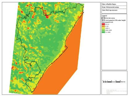
Part I: Report on the Development of the Climate Resilience Implementation Plan for Spatial Planning (CRISP)
Part I: Report on the Development of the
Climate Resilience Implementation Plan
for Spatial Planning (CRISP)
I. The Global Project: Cities Fit for Climate Change (CFCC)
CFCC is part of the International Climate Initiative The project supports the United Nations Framework
and is implemented by the Deutsche Gesellschaft für Convention on Climate Change (UNFCCC) process
Internationale Zusammenarbeit (GIZ). The German and contributes to the implementation of the New
Federal Ministry for the Environment, Nature Conser Urban Agenda, the international agreement of the
vation and Nuclear Safety supports this initiative based Habitat III process.
on a decision adopted by the German Bundestag. The
project also cooperates with the German Federal Min CFCC Implementation in South Africa
istry of the Interior, Building and Community.
The eThekwini Municipality has a national and inter
The project activities are carried out in three partner national reputation for being at the forefront of address
countries of the project namely: India, Chile and South ing climate change. It is an active member of several
Africa (namely eThekwini), and in partnership with international networks on climate change and has in
various international actors, for example in Germany ternationally renowned climate change experts among
and Sweden. The CFCC project aims to strengthen cit its staff. eThekwini representatives voiced high inter
ies as actors of sustainable development and it supports ested in the CFCC project, specifically requesting its
the development of integrated, resilient and low carbon support in structural local governance changes rather
instruments for sustainable urban development. In the than ‘just’ in implementing projects.
process, the project has developed a Climate-Proof
The key partners in the eThekwini Municipality are the
Urban Development Approach (ClimPUDA), which
Strategic Spatial Planning Branch, the Energy Office
promotes innovative approaches to urban planning
(Climate Change Mitigation and Energy), and the
including climate change aspects to make cities ‘fit for
Climate Protection Branch (Climate Change Adapta
climate change’.
tion). They are responsible for driving the project in the
Lessons learned from existing projects promoting municipality and coordinating with other departments
climate resilient and low carbon urban development are where required, for example for stakeholder consulta
analysed during the project. The three partner cities tion activities or discussing the Climate Resilience
Chennai, eThekwini (Durban) and Santiago de Chile Implementation Plan for Spatial Planning (CRISP)
are supported in improving their climate-proof strate implementation actions and progress. In addition, the
gies. The overarching goal is for climate change to CFCC project initiated the establishment of a steering
become an integrated and strategic part of urban devel committee in the municipality that consists of its key
opment. partners and others that are involved indirectly in the
7Climate Resilience Implementation Plan for Spatial Planning
project through the CRISP, such as Coastal, Stormwater Moreover, the CFCC project has key partners at the
and Catchment Management; Water and Sanitation; national level in South Africa, namely the:
Transport; Economic Development; Land Use Manage
• Department of Co-operative Governance and
ment and others. In the end, all relevant units and
Traditional Affairs (CoGTA)
branches of the municipality were involved in the pro
cess. The CFCC Steering Committee is a platform for • South African Local Government Association (SALGA)
the project to engage and exchange with its partners in
• Department of Environmental Affairs (DEA)
the municipality, report on progress, get feedback and
buy-in to activities.
II. eThekwini Municipality (Durban) Climate Change Response
Acknowledging the need of all residents – from big in As part of the DCCS Implementation Framework, the
dustries to vulnerable communities – to prepare for the city has established climate change governance structures
impacts of climate change, eThekwini Municipality with the aim of providing oversight and coordinating
engaged in an inclusive participatory process to develop the implementation of climate actions between munici
a combined mitigation and adaptation climate change pal departments. The structures consist of a political
strategy for the city. The Durban Climate Change Strat body, known as the eThekwini Municipal Climate
egy (DCCS) was adopted by the City Council in June Change Committee (EMCCC), which is chaired by the
2015. It represents a citywide approach for mitigating Mayor, and provides political oversight of climate change
and adapting to the impacts of climate change. EThek implementation in the city (see Figure 2). The EMCCC
wini also compiles and updates its greenhouse gas is supported by the Durban Climate Change Strategy
(GHG) emissions inventory in order to track its contri Technical Task Team (TTT), a senior administrative
bution to GHG reductions. The DCCS emphasises ac body convened at the level of Unit Heads. It provides
tion in 10 thematic areas, namely: water, sea level rise, the strategic drive for the DCCS and oversees its imple
biodiversity, food security, health, energy, waste and pol mentation across municipal sectors. The TTT is sup
lution, transport, economic development and knowledge ported by the DCCS Sub-Committee, which is con
management. A set of goals, objectives and responses vened at the level of Unit Deputy Heads and Senior
were developed for each theme. Even though it is set Management. The Sub-Committee is responsible for
against specific sector themes, the implementation of the operationalising climate change policies and plans at
DCCS, like the Climate Resilience Implementation Plan project level. The CRISP can be included in the overall
for Spatial Planning (CRISP), requires coordination and implementation framework at this level.
cooperation among all units and departments in the
municipality. The implementation plan for the DCCS
is currently being developed and implementation will
take place through a separate framework that is led by
the Climate Protection Branch and Energy Office.
8II. eThekwini Municipality (Durban) Climate Change Response
Figure 1: Durban Climate Change Strategy Implementation Framework
Strategy and Research
Governance Oversight and Co-ordination Projects and
and Steering Implementation
Monitoring, Evaluation and Reporting
DCCS Integrated Implementation Plan to be developed DCCS to be
from 2019: by end 2020: reviewed
M&E Framework and Reporting Tool to be developed entirely
Source: adapted from eThekwini Municipality
The figure shows a simplified version of Durban’s Climate mentation framework from the monitoring and evaluation
Change Strategy Implementation Framework, the elements framework to support decision making in the governance
that make up the framework and the relevant processes and structures and project implementation. The arrows pointing
information exchanges between these elements. This frame- down indicate an information flow from relevant strategies
work will support climate change implementation in Durban (international national and local) and research done by the
for the short to long term planning horizons. Arrows show city that is also informed by outcomes of project implemen-
the interdependent relationship between the different ele- tation and monitoring activities. In the bottom part of the
ments emphasising information exchanges and processes that figure, it is shown that the goal of the municipality is to in-
maintain the functionality of the framework. The governance clude all these existing actions into an integrated implemen-
and steering structures are described with more detail in tation plan for the DCCS, which will be developed by the end
Figure 2 of this document. The projects and implementation of 2020. This would be complemented by an M&E Framework
elements refer to existing projects and actions such as those and corresponding Reporting Tool. Short term milestones are
in the CRISP, greenhouse gas emissions reporting and other also depicted, which indicate that the framework and its
ongoing climate related projects. The arrows pointing up in- elements have not been fully developed to be functional yet.
dicate a flow of information into the governance and imple-
9Climate Resilience Implementation Plan for Spatial Planning
Figure 2: Various Relevant Steering Committees for the Climate Resilience
Implementation Plan for Spatial Planning
Executive Stakeholders:
The Council comprises an elected Mayor, Councillors,
Committee of executive committee and s everal implementation
Council committees.
(EXCO) Responsibility:
The Council serves to facilitate the provision of infrastruc-
ture, services and support to the people of eThekwini.
The council has five committees and every councillor
serves on at least one committee. Members of the
Executive Committee are tasked with the responsibility
of chairing the portfolio committees.
The portfolio committees are:
• ECOD (Economic Development and Planning)
• Community Services
• Security and Emergency Services
• Human Settlements & Infrastructure
• Governance & Human Resources
These committees have certain delegated powers
by which they take decisions on behalf of the council,
and are required to report and make recommendations
to Council on matters falling within their spheres of
operation.
Frequency: The EXCO meets twice a month.
eThekwini Stakeholders:
The committee is chaired by the Mayor of eThekwini
Municipal Municipality. It is made up of councillors that are
Climate Change responsible for administrative clusters.
Committee Responsibility:
(EMCCC): The EMCCC is responsible for providing political oversight
on climate change implementation in the city.
Frequency:
The EMCCC meets quarterly.
Durban Climate Stakeholders:
The TTT is made up of unit heads of Development Planning
Change Strategy and Environment, Human Settlements, Engineering, Trans-
Technical port, Economic D
evelopment, Finance etc.
Task Team Responsibility:
(TTT): The task team is an administrative body supporting the
EMCCC, convened at the level of Unit Heads. It provides
the strategic drivers for policy change and bears the task
of overseeing the implementation of the DCCS across
municipal sectors.
Frequency:
The TTT meets bi-monthly.
10II. eThekwini Municipality (Durban) Climate Change Response
Durban Climate Stakeholders:
The Sub-Committee includes senior managers and deputy
Change Strategy heads from the Strategic Spatial Planning Branch; Climate
(DCCS) Protection Department; Energy Office; Land Use Manage-
Sub-Committee: ment Branch; Economic Development Department; Coastal,
Stormwater and Catchment Management Department;
Human Settlements Unit; eThekwini (Durban) Water
and Sanitation; Parks, Recreation and Culture; eThekwini
(Durban) Transport Authority; Disaster Management
Department; Electricity Department and Integrated
Development Planning/Strategy Office.
Responsibility:
It supports the TTT, and is convened at the level of Unit
Deputy Heads and Senior Management. It is responsible
for operationalising climate change policies and plans at
project level.
Frequency:
The Sub-Committee meets as required.
CFCC Steering Stakeholders:
The Steering Committee comprises representatives from
Committee: the Strategic Spatial P lanning Branch, Climate Protection
Department, Energy Office and GIZ. F urthermore, it involves
extensive stakeholder engagement with the Land Use
Management Branch; E conomic Development Department;
Coastal, Stormwater and Catchment Management Depart-
ment; Human Settlements Unit; eThekwini (Durban) Water
and Sanitation; Parks, Recreation and Culture; eThekwini
(Durban) Transport Authority; Disaster Management
Department; Electricity Department and Integrated Devel
opment Planning/Strategy Office.
Responsibility:
The Committee focuses on the coordination and imple
mentation of the global CFCC project as a whole and on
providing a platform for exchange on climate change and
urban development. Furthermore, it coordinated and pro-
vided oversight for the d evelopment of CRISP.
Frequency:
This Steering Committee met every quarter since the be-
ginning of the CFCC project with the last one in May 2019.
11Climate Resilience Implementation Plan for Spatial Planning
III. The Preparation of the Climate Resilience Implementation
Plan for Spatial Planning (CRISP)
Through its various initiatives and champions, eThek joint brainstorming session. Previously, there had been
wini (Durban) has been a leader of climate change re no regular platform for exchanges on climate change
sponse in South Africa. However, this has not always and planning among various line departments. Hence,
resulted in visible actions in the field of urban develop the CFCC Steering Committee was established in
ment. There are three main reasons for this: firstly, even August 2016 to provide such a platform and to ensure
though climate change integration is visible at strategic coordination for the implementation of the project
planning levels this is not always easily translated to interventions.
operations and projects. Secondly, climate change has
Although topics raised by line departments at the kick-
not been fully integrated into sector risk profiles and
off workshop were largely sector-specific, referring to
subsequently not included in spatial and development
each department’s specific challenges, the interventions
plans. Thirdly, the development of eThekwini Munici
have proven to be relevant and applicable to many
pality is marked by the inclusion of high levels of infor
other line departments throughout the project. Due to
mal and semi-rural to rural areas leading to a complex
the cross-sectoral nature of the project, representatives
governance system. Therefore, the process of considering
of various municipal departments identified a lack of
climate change through the Durban Climate Change
collaborative implementation measures concerning
Strategy (DCCS) has just begun. The municipality
climate change.
needs to look at urban development in an integrated
way and add a climate lens to its development goals. As a result of these needs, the CRISP project was initi
ated to support the municipality in mainstreaming
Bilateral talks between the CFCC project and the key
climate change aspects consistently into its regular plan
departments enabled the identification of specific needs
ning processes by fostering a high level of involvement
and interests for interventions. In June 2016, a kick-off
of partners. The CRISP provides a starting point for this
workshop took place with a larger group of partners
process. The implementation of the activities is e nvisaged
from the municipality as well as national partners,
to be inter-departmental and therefore, guided by the
namely the Department of Co-operative Governance
established municipal climate change governance struc
(DCOG), the South African Local Government Asso
tures.
ciation (SALGA) and the Department of Environmen
tal Affairs (DEA). The workshop brought together
actors from selected line departments and initiated a
IV. Process: How Was It Done?
The initial intention was to create a more ’climate sen 3. Review of the Spatial Development Framework’s
sitive‘ spatial plan and develop an action plan to support content and current response to the DCCS.
its implementation. The approach t aken to develop the
4. Identification of key areas where a climate change
the Climate Resilience Impl ementation Plan for Spatial
spatial response is possible.
Planning (CRISP) included the following steps:
5. Development of a detailed analysis report that con
1. Transferring the climate change policy context from
siders the city’s strategic climate change plans.
global to local level.
6. Consultations with key municipal stakeholders and
2. Review of the Durban Climate Change Strategy
interactive workshop sessions. Stakeholders included
(DCCS) and identification of climate change re
municipal departments such as Land Use Manage
sponses relevant to spatial planning.
12IV. Process: How Was It Done?
ment; Coastal, Storm Water and Catchment Man draft content on climate sensitive spatial planning that
agement; Water and Sanitation; Electricity Depart could be included in the SDF and lower order spatial
ment and so on. plans. The report included an analysis of each of the
themes, their goals and responses and importantly their
7. Identification of specific spatial responses according
current representation in the SDF. In cases where aspects
to DCCS themes.
of themes lacked representation, recommendations were
8. Inclusion of recommendations into the Spatial added to the SDF. The process was guided by the CFCC
Development Framework (SDF) and its respective Steering Committee which met at intervals to evaluate
lower order plans and sector proposals. outputs and project milestones to improve or change
direction where required. One role of the CFCC project
The analysis report and review of the Spatial Develop
was to fill the gaps in the implementation of the CRISP
ment Framework (SDF) is based on the 10 themes and
and to conceptualise the process. Throughout the pro
goals of the DCCS, namely: Water, Sea Level Rise,
cess, high value was placed on streamlining the coordi
Biodiversity, Food Security, Health, Waste and Pollu
nation efforts into existing governing bodies to avoid
tion, Energy, Transport, Economic Development and a
overburdening stakeholders.
Cross cutting theme. In the initial stage of the CRISP
project development, these 10 themes were work
shopped with the key sector departments in order to
V. Outcome: What Were the Results?
The result of these cross-cutting discussions was the or section of respective plans in the city but is not fully
development of the analysis report and subsequently the and systematically integrated. The idea is that if climate
final recommendations included in the Spatial Develop change is part of the thinking in planning and determin
ment Framework (SDF) along with an itemised action ing action then it will become more consistently
plan. This plan described specific actions that have to reflected in planning documents.
be implemented to achieve climate change resilience.
Whilst the CRISP has already set targets in the SDF for
The main gateway to achieve climate resilience in the sectors it is difficult to influence the sectors to take
context of eThekwini is to climate-proof the Integrated action unless these targets are included in their budget
Development Plan Framework (IDP) and SDF. In par planning process. In addition, the reason for the pro
ticular the review processes of the SDF and IDP have posed action needs to be properly understood by staff
the potential to unlock municipal funding for climate within the sector departments. Financing climate
resilience measures through the link with the Service actions through city budgets requires an integrated
Delivery and Budget Implementation Plan (SDBIP). approach. Actions that have multiple co-benefits (or the
For example, one of the actions of the CRISP is to ability to leverage impact) are ‘smarter’ than those that
promote densification around transport nodes and sta compete for resources. In this way, competition for
tions, which requires inclusion into transport plans, finance and funding needs to be reduced through more
architecture, urban renewal and so on. In addition, there coordination and optimisation of existing steering bodies.
needs to be a coordinated strategy across relevant plan
The respective recommendations in the CRISP list of
ning and implementing departments to support inclu
actions for updating the SDF were written into the SDF
sion into sector and budget plans. Given that the review
sector proposals and the itemised list of actions was
process takes place annually, there are opportunities for
annexed to the SDF. The final SDF for 2017/2018 –
including these updates that consider climate change.
including the changes – was accepted and approved by
The purpose of this is to achieve consistency in planning
the City Council in May 2017 and therefore provides
and action to deal with climate change responses and
the legal mandate for relevant departments to imple
risks. Often climate change is reflected in some element
13Climate Resilience Implementation Plan for Spatial Planning
ment or act accordingly. A consultative workshop was need to work in an integrated manner became apparent
held in November 2017 with key sector stakeholders to as many departments had an interest in the respective
check on the progress of implementation and to iden actions. For example, developing an agriculture strategy
tify any barriers and complementary actions to support would entail interest from economic development in
implementation. This was followed by one-on-one sec terms of growth, job creation and so on; parks depart
tor engagements in 2018 to monitor progress and refine ment from a health and livelihood perspective; strategic
the recommended actions, budgets and timeframes for spatial planning and land use management in terms of
implementation as part of the annual SDF review process. identifying land for development at the same time as
protecting agricultural land and resources; and environ
Importantly, the CRISP helped to break down the ‘silo
mental planning and climate protection by ensuring
mentality’ that is prevalent in many government or
climate smart practices would be adhered to; among
ganisations and cities around the world. A silo mental
others. High relevance of the interventions within the
ity refers to reluctance to share information among
municipal administration was an important success
employees of different divisions in the same organisation
factor.
or to take decisions only considering one’s own field.
This was not an objective of the intervention at first but
developed as part of the development of the CRISP. The
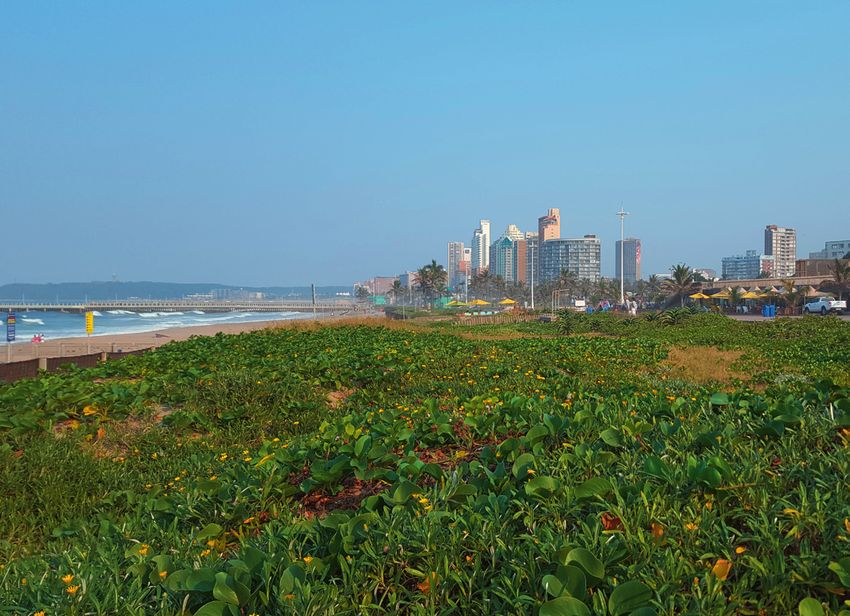
Durban’s beachfront; © Adobestock
14V. Outcome: What Were the results?
Figure 3: Influence of the CRISP on Long Term Development Planning in the
eThekwini Municipality
Municipal Climate Municipal Strategic
Change Framework Planning Framework
Medium term to Medium term to
long term long term
Integrated Long term
Implementation Plan development
for the DCCS framework
Input from DCCS to CRISP influence on Integrated
develop
Input CRISP
from DCCS to strategic framework Development Plan
develop CRISP
Spatial Development
Climate Resilience
Durban Climate Framework
Implementation Plan
Change Strategy
(DCCS) for Spatial Planning
(CRISP) Lower Order
Plans and Land
Use Schemes
Source: adapted from eThekwini Municipal website
The figure shows the influence of the CRISP in connecting the use schemes. There is a potential for further integration with
Durban Climate Change framework through the DCCS and the the Integrated Development Plan (IDP) but this would be an
municipal strategic planning framework. The target of the indirect connection and a result of further integration of the
CRISP was the SDF, however, the actions directly influence CRISP as part of the planned DCCS integrated implementation
lower order plans such as Local Area Plans (LAPs) and land plan (see Figure 1).
As of May 2019 the process of integrating the CRISP The city is currently developing a 1.5 °C Climate Action
actions into eThekwini’s spatial plan, relevant sector Plan in response to the Paris Agreement. This work is
plans and lower order spatial plans is ongoing. In some premised on the Durban Climate Change Strategies
cases actions proposed by the CRISP have already made (DCCS) and will ensure the accelerated and focused
an impact. For example, under the Transport theme, the implementation of the municipality’s climate actions to
Mpumulanga Functional Area Plan has incorporated achieve carbon neutrality by 2050 whilst reducing its
eThekwini’s first Active Mobility/Non-Motorised Trans carbon emissions and climate risks.
port (NMT) network into its spatial plan. Furthermore,
the Inner City Densification Plan has been amended to
include NMT. This has become a standard requirement
for all lower order spatial plans.
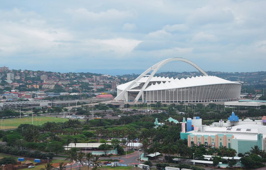
15Durban’s beachfront; © Lea Kulick Durban’s city centre; © Lea Kulick
Part II Specific Recommendations of the Climate Resilience Implementation Plan for Spatial Planning for All Ten Themes of the Durban Climate Change Strategy These specific recommendations refer to proposed changes to the Spatial Development Framework (SDF), which have been incorporated in the SDF of 2017/2018.
Climate Resilience Implementation Plan for Spatial Planning
1. Water
1.1 Overview
The Durban Climate Change Strategy identifies the • Identify existing critical infrastructure that is in areas
following responses for the water sector that have a of high flood risk and relocate it to areas of lower
spatial dimension: risk.
• Implement watershed management that responds to • Identify and prioritise the relocation or upgrading of
projected climate change impacts to optimise yields informal and low income settlements that are vulner
of clean freshwater and storage capacity in dams. able to flooding.
• Recognise, make use of and manage the role that Since the Spatial Development Framework (SDF)
open spaces, natural areas and agricultural land can includes a layer reflecting the Durban Metropolitan
play in providing flood and storm water protection Open Space System (D’MOSS), by default it includes
services. many of the open spaces that protect water management
areas, mitigate floods and are prone to floods. The
• Adopt a risk-averse approach to water quality protec
D’MOSS layer is primarily intended to protect biodi
tion by imposing stringent controls on water pollut
versity for its intrinsic value and the ecosystem services
ing land uses and activities to ensure that the impacts
it provides. However, it is not certain whether all areas
of climate change are not exacerbated.
supplying significant water services have been included
• Adopt and enforce a risk-averse approach to spatial, in D’MOSS.
land use and infrastructure planning and develop
ment controls that respond to potential climate
change amplified flood risks.
181. Water
1.2 Proposed Changes to SDF and Other Lower Order Spatial Plans
The following changes are proposed to the SDF regard
ing water and climate change:
Plan Comment Proposed Change
SDF Chapter 3: Synthesis of Climate change will have a significant effect on the land and its people in the
Key Issues, Challenges form of extreme weather conditions, storms, drought, floods and rising sea
and Development Trends: levels. These changes will also have a negative impact on biodiversity in the
Although this chapter municipality, which is located in one of 34 biodiversity hotspots in the world.
highlights the impacts Furthermore, water resources in the municipal area will be under threat and it
of climate change and is essential that areas upstream of water resources such as rivers and dams,
development on natural are protected. Open spaces in the municipal area play a crucial role in providing
resources it does not ecosystem services including protection from flooding, storm attenuation, and
specifically highlight the filtration of water. In the face of climate change, these open spaces need to be
impact on water resourc- preserved for these services that they provide. For new growth and development,
es. The following text in the SDF suggests that a comprehensive response to the challenge of climate
inverted commas is rec- change is needed in the eThekwini Municipal Area (EMA). This can be achieved
ommended for inclusion through appropriate densification of existing urban centres and well located
under the heading “Envi- settlements to maximise the use of existing services and infrastructural capaci-
ronmental Management ty, and ensuring that development concentrates along specific public transport/
and Climate Change”. mixed use corridors and w ithin existing nodes, that densification is promoted at
strategic locations, that environmental conservation areas and areas of high
ecosystem services delivery are demarcated and protected and areas of agricul-
tural importance are identified and protected. In terms of flood related risk, it is
projected that the EMA will experience increased flooding and it is essential
that new developments are not placed in areas at risk from flooding. Areas that
fall with in the 1:100 flood line have been mapped by Coastal and Stormwater
Department and work is currently underway to understand the impacts of
climate change on the extent of areas at risk from flooding. No development
should be permitted in these areas.
SDF Chapter 6: The SDF Key Under the first analysis layer, entitled Environment, Coastal, Agriculture, and
Spatial Proposals: The Disaster Management, the spatial proposals and strategies should include the
table highlighting the areas of flood risk that have already been identified (These are currently being
different analysis layers, updated to incorporate climate change risk). Under the Intended outcomes
guiding principles, spatial column water resources should be included. “Protect and manage important
proposals and strategies, environmental areas, agricultural, water and coastal resources.”
as well as the intended
outcomes.
SDF Chapter 6: The SDF Key The following text in inverted commas is suggested for inclusion: “It is recog-
Spatial Proposals: Para- nised that natural resources provide the platform for sustainable growth and
graph 3: The value of development for all of eThekwini’s residents, poverty alleviation opportunities for
open spaces in providing the Municipality’s most vulnerable households, and help to buffer the negative
protection from flooding impacts associated with climate change. For example, open spaces provide pro-
needs to be highlighted. tection from climate change amplified impacts such as flooding. The e Thekwini
Municipality is therefore committed to ensuring the long term sustainability of
the natural resource base through concerted efforts in a number of key areas.”
19Climate Resilience Implementation Plan for Spatial Planning
Plan Comment Proposed Change
SDF Chapter 6: The SDF Key The following text in inverted commas is suggested for inclusion: “The Durban
Spatial Proposals: Metropolitan Open Space (D’MOSS) plan identifies those environmental service
Paragraph 6: The project assets that require protection and management. These assets include rivers,
identified for mapping wetlands, estuaries, grasslands, forests and coastal zone resources. To ensure
open spaces that provide the sustained functioning of ecosystems that provide services, it is essential
flood protection services that we conserve and manage the biodiversity (simply defined as plants, ani-
should be mentioned here. mals and micro-organisms) that live in and shape these ecosystems. The
D’MOSS spatial layer that has been prepared, therefore, has a biodiversity focus.
In addition, areas have been included that provide ecosystem services, such as
protection from flooding. A research project is proposed to specifically map
open areas that provide flood mitigation services and to compare this with the
D’MOSS layer. Since all open space is likely to provide some flood mitigation
service it will be necessary for the research to rate the importance of these
areas relative to each other.”
SDF Chapter 6: The SDF Key The following text in inverted commas is recommended for inclusion: “The
Spatial Proposals: terrestrial and aquatic elements within drainage catchments are linked through
6.1.1 Managing the complex processes. The condition of these systems is felt downstream and
Drainage Catchments: A where degraded will impact on the quality of water resources and on the
section on the importance coastal plain.
of preserving water It is vital therefore that the adverse impacts of urban land are minimised and
resources in the catch- managed. Since most of e Thekwini Municipality’s water is supplied from outside
ments should be added. of the municipal area, key areas of importance are most likely be located above
catchments of dams. These areas are important for protecting the quality of
water entering dams and reducing sedimentation. This may require the preven-
tion of certain land uses/activities around dams so that water quality is not
compromised. It is recommended that research is done to identify key water
management areas and the protections that should be put in place for these
areas to protect water resources.”
SDF Chapter 6: The SDF Key The following text in inverted commas is recommended for inclusion: “Land uses
Spatial Proposals: adjacent to, or upstream from, open spaces can have major impacts on sensitive
6.1.8 Managing Develop- ecological systems. Activities therefore need to be carefully assessed and
ment Impacts: A section controlled to ensure that they do not undermine the ecological viability of the
on managing the impacts open space system. Developments proposed around dams and in upper catch-
of developments on ment areas should be assessed carefully as they could have an impact on the
water resources should city’s drinking water. It is recommended that research is done to identify key
be added. water management areas, including dams, and the protections that should be
put in place to protect water resources in the face of new developments.”
SDF Chapter 6: The SDF Key Furthermore, the areas at risk of flooding in the municipal area have been
Spatial Proposals: mapped and are currently being updated to incorporate the impacts of climate
6.1.9 Incorporating Climate change. The results from this work will assist planners when assessing devel-
Change Considerations: It opment applications.
is recommended that the
project that is currently
taking climate change into
account in the flood lines
is referenced at the end
of existing paragraph as
follows:
201. Water
Plan Comment Proposed Change
SDF Chapter 8: Table 10 Changes to the column Requirements to achieve policy Statements in inverted
Strategy 1 Manage urban commas:
growth, construct and
“Existing natural environmental resources should be protected and enhanced to
maintain viable built
ensure that the ecosystems within the open spaces are able to effectively deliver
environment and sustain
services, such as flood protection, especially in the face of climate change.
natural environments
and resources 3. Sustain Development must be directed away from sensitive areas such as floodplains,
natural environments areas of flood risk, unstable soils and steep slopes.”
and resources.
Add bullet:
“Protect key water management areas, including dams, to ensure that water
quality is not compromised.”
SDPs, All lower order spatial Include areas subject to flood risk in lower order spatial plans. Lower
LAPs, plans should explicitly order plans should also incorporate provisions highlighting this as an area
FAPs, identify flood risk areas of consideration when assessing development.
Pre- using the existing maps
cinct and discourage develop-
Plans ment in these areas.
1.3 Implementation Plan
It is also proposed that the following projects be imple
mented to further enhance the water and climate change
content of the SDF.
Project Responsible Estimated 2017/ 2018/ 2019/
Project Description
Name departments budget 2018 2019 2020
Identify Undertake a research project to identify key water Climate 500,000 X
key water management and key watershed areas which support Protection South
manage- the supply of clean and abundant freshwater in Branch African
ment and eThekwini Municipality. Since most of eThekwini Munici- (CPB), Water Rand
key pality’s water is supplied from outside the municipal & Sanitation. (ZAR)
watershed area, key areas of importance are most likely to be lo-
areas cated above catchments of dams. These areas are im-
portant for protecting the quality of water entering dams
and reducing sedimentation. This may require the pre-
vention of certain land uses/activities upstream of dams
so that water quality is not compromised. Other upstream
areas that may be of importance are areas upstream
of communities that depend on natural water resources
as well as those that protect ground water resources.
Once this information exists a layer can be added to the
SDF and addressed in detail in lower order plans.
Identify A research project is proposed to specifically map CPB, Coastal ZAR X
open open areas that provide flood mitigation services and Engineering, 1,000,000
spaces to compare this with the D’MOSS layer. Since all Storm
that open space is likely to provide some flood mitigation Water,
provide service it will be necessary for the research to rate Catchment
protection the importance of these areas relative to each other Management
from to understand which open spaces play a particularly Department
flooding. important role in this regard. A layer identifying
the areas rated as most important for flood impact
management can then be added to the SDF.
21Climate Resilience Implementation Plan for Spatial Planning
2. Sea Level Rise
2.1 Overview
The Durban Climate Change Strategy identifies the • Prioritise the relocation or upgrading of informal and
following responses with a spatial dimension for the sea low income settlements that are vulnerable to sea
level rise sector: level rise, coastal storms and coastal erosion.
• Adopt and enforce the provincial coastal manage • Relocate existing municipal buildings and infrastruc
ment line and risk zones to manage current and fu ture that are in high risk zones to areas of lower risk
ture development in the face of climate change. at the end of their economic life or when severely
damaged by storms.
• Adopt and enforce a risk-averse approach to spatial,
land use and infrastructure planning, and to develop The Spatial Development Framework (SDF) already
ment control that responds to all potential coastal addresses sea level rise to a certain extent by including
flooding and other coastal risks. the coastal erosion line as a spatial layer in the SDF.
2.2 Proposed Changes to SDF and Other Lower Order
Spatial Plans
The following changes are proposed to the SDF regard
ing sea level rise and climate change:
Plan Comment Proposed Change
SDF Chapter 3: Synthesis of Key “Sea level rise under three scenarios has also been mapped and development
Issues, Challenges and that falls within the most high risk scenario is discouraged. Restrictions on
Development Trends: The additions to existing land uses should also be applied that will limit potentially
following text in inverted hazardous outcomes resulting from sea level rise.”
commas is recommended
for inclusion under the
heading “Environmental
Management and Climate
Change”.
SDF Chapter 6: The SDF Key Under the first analysis layer, entitled Environment, Coastal, Agriculture, and
Spatial Proposals: The Disaster Management, the spatial proposals and strategies should include
table highlights the the sea level rise tool that is currently used when assessing development
different analysis layers, applications. Under the intended outcomes column, the following bullet point
guiding principles, spatial should be added: Discourage development within high risk areas for sea
proposals and strategies, level rise and coastal storms and incentivise development outside high risk
as well as the intended areas. This will allow for a steady retreat of development from the coastal
outcomes. management line.
222. Sea Level Rise
Plan Comment Proposed Change
SDF Chapter 6: The SDF Key The following text in inverted commas is recommended:
Spatial Proposals: 6.1.8
“Developments proposed on the coast need to be assessed according to the sea
Managing Development
level rise tool that has been developed considering three different sea level rise
Impacts: The sea level
scenarios. Development within the most high risk areas should be discouraged
rise modelling tool
and development outside high risk areas incentivised. Developers that want to
should be mentioned here
develop in high risk areas should be advised on the implications of future sea
after the existing text.
level rise”.
SDF Chapter 6: The SDF Key The following text in inverted commas is recommended (including the deletion
Spatial Proposals: of certain text passages):
6.1.9 Incorporating
“At this point, not all impacts of climate change have been mapped it is
Climate Change Consider-
e xtremely difficult to incorporate climate change considerations into planning
ations: The inclusion of
because of the difficulty in representing climate change impacts accurately at
the work that has been
a spatial level. However, one of the areas where significant progress has been
done on sea level rise
made is in the development of three sea level rise scenarios. A user-friendly
modelling should be
sea level rise tool based on the GIS spatial data has been developed that is
included.
currently being used by officials in the planning and environmental departments
to assess development applications.”
SDF Chapter 8: Table 10 Changes to the column Requirements to achieve policy Statements in inverted
Strategy 1 Manage urban commas:
growth, construct and
“Development must be directed away from hazardous areas such as floodplains,
maintain viable built
coastal areas at risk from sea level rise and coastal storms, unstable soils
environment and sustain
and steep slopes.”
natural environments
and resources 3. Sustain Changes to column Land use management guideline in inverted commas:
natural environments
and resources. “Ensure proposed development does not encroach onto environmentally sensitive
land, land within flood plains, and on land at risk from sea level rise.”
Changes to the column Alignment with policies in inverted commas:
“Add in Sea level rise tool that shows three different sea level rise scenarios”
SDPs, Lower order plans should Include the three sea level risk scenario lines in lower order spatial plans.
LAPs, reflect the three sea
FAPs, level rise scenarios so
Pre- that when development
cinct is proposed sea level
Plans rise is considered.
23Climate Resilience Implementation Plan for Spatial Planning
2.3 Implementation Plan
It is also proposed that the following project is imple
mented to further enhance the sea level rise and climate
change content of the SDF.
Responsible 2017/ 2018/ 2019/
Project Estimated
Project Description depart-
Name budget 2018 2019 2020
ments
Establish Set up an internal working group to conduct research Coastal ZAR 0 – X
a working into the identification of coastal infrastructure that is Engineering conducted
group to at risk from climate change impacts and evaluation of Branch in house
identify possible relocation options. It is recognised that a should take
areas significant amount of municipal infrastructure is located the lead
where in areas of high risk to sea level rise. If this infrastruc-
role with
coastal ture is significantly damaged, further development Strategic
infra- should be discouraged. Spatial
structure Planning,
Coastal Engineering Branch will play a lead role in
at risk the Energy
initiating a conversation with key service departments
could be Office, and
(including, Water, Electricity, and Treasury) in this re-
relocated Climate
gard, supported by Energy Office (EO), Spatial Planning
to in the Protection
and Climate Protection Branch (CPB). CPB have already
long Branch
submitted a request to have heads of Departments meet
term. providing
to discuss issues of climate change. This may serve as
support.
a suitable platform for this conversation.
24You can also read