Brown County Land Information Plan 2019-2021 - Land Information Office
←
→
Page content transcription
If your browser does not render page correctly, please read the page content below
Brown County
Land Information Plan
2019-2021

**Wisconsin Land Information Program
  Wisconsin Department of Administration
  101 East Wilson Street, 9th Floor
  Madison, WI 53703
  (608) 267-3369
  www.doa.wi.gov/WLIP
Version: 2019-02-21
Approved/Adopted by Land Information Council on: 2019-01-16 and County Board on 2019-02-21
_

CONTENTS
EXECUTIVE SUMMARY ................................................................3
PROJECT SUMMARY...................................................................4
1 INTRODUCTION ......................................................................6
2 FOUNDATIONAL ELEMENTS ................................................10
    PLSS ........................................................................................................................... 11
    Parcel Mapping ........................................................................................................ 12
    LiDAR and Other Elevation Data ............................................................................ 14
    Orthoimagery ........................................................................................................... 16
    Address Points and Street Centerlines .................................................................. 17
    Land Use .................................................................................................................... 19
    Zoning ....................................................................................................................... 19
    Administrative Boundaries ..................................................................................... 21
    Other Layers.............................................................................................................. 24

3 LAND INFORMATION SYSTEM ............................................26
    Public Access and Website Information ................................................................ 31

4 CURRENT & FUTURE PROJECTS ..........................................33
    Project #1: PLSS corner remonumentation........................................................... 33
    Project #2: Scan documents and index them using GIS ...................................... 35
    Project #3: Produce Aerial Orthophotography in 2020 ...................................... 35
    Project #4: Produce LiDAR in 2020 and derivatives including 1-foot contours36
    Project #5: Refill the GIS Specialist position ......................................................... 37
    Project #6: Maintain and Enhance all Foundational Element GIS layers ........... 37
    Project #7: Evaluate software tools like Pintegrity and the Parcel Fabric ........ 38
    Project #8: Rebuild and reorganize the Land Information Office Web Site ..... 38
    Project #9: Maintain and improve GIS applications such as the BrownDog .... 39
    Project #10: Educate and train staff ...................................................................... 39
    Project #11: Enhance GIS data to support surface water drainage & hydrologic
    modeling ................................................................................................................... 40

                                                                                                                                          2
EXECUTIVE SUMMARY
About this Document. This plan was prepared by the Brown County Land Information Council. By
statute, a plan for land records modernization is required for participation in the Wisconsin Land Information
Program (WLIP). The purpose of this document is twofold: 1) to meet WLIP funding eligibility requirements
necessary for receiving grants and retaining fees for land information, and 2) to plan for county land records
modernization in order to improve the efficiency of government and provide improved government services to
businesses and county residents. The format and content of this document are based upon the Wisconsin
Department of Administration (WiDOA) Uniform Instructions for Preparing County Land Information Plans dated
March 2018.

Program Background.               The Land Information Program is administered by the Wisconsin Department of
Administration and funded by document recording fees collected at the county level. In 2017, Brown County
brought in about $314,000 in program fee revenue, plus $51,000 in grants along with other miscellaneous
revenue. This plan lays out how funds from grants and retained fees will be prioritized. However, as the county
budget is determined with County Executive and County Board approval, this plan provides estimated figures that
are subject to change and are designed to serve planning purposes only.

Land Information in Brown County. Many of Brown County’s essential services rely on accurate
and up-to-date land information. Emergency response, resource conservation, infrastructure planning, economic
development, facility maintenance, regulatory inspection and many other county functions involve the storage of,
access to, and analysis of various land records. Efficient access to information about addresses, buildings, property
boundaries, roads, utilities, elevations, floodplains, districts, wards, zoning, land use, and other combinations of
land information is important for various functions of state, county and municipal government. This information is
very beneficial to private businesses and citizens as well. Every day, hundreds of people connect to Brown
County’s land records and GIS systems to gather data to help make decisions.

Mission of the Land Information Office. The overall mission of the Brown County Land
Information Office (LIO) is to provide support for all county functions that rely on storing, sharing, analyzing, and
depicting information and records related to land. Brown County also strives to meet the needs of municipal,
state and federal governments as well as businesses and citizens by providing exceptional public access to these
records via the Internet.

Project Summary. In the next three years, the LIO will:
            Continue PLSS Remonumentation & parcel map framework enhancements
            Continue GIS data improvements and document indexing using GIS
            Complete Aerial Orthophotography and LiDAR projects
            Continue to improve the online GIS mapping sites
            Hire a GIS Specialist to assist with LIO and GIS responsibilities.

The projects in this plan are based on a user needs assessment conducted by the GIS Coordinator/Land
Information Officer in 2018. The remainder of this document provides more details on Brown County and the
WLIP, summarizes land information projects, and reviews the county’s status in completion and maintenance of
the WLIP map data layers known as Foundational Elements.

Once approved, this plan supersedes all previous Brown County Land Information Plans and sets the direction for
land information program efforts for a time frame of 2019 – 2021.

                                                                                                                        3
PROJECT SUMMARY
The key projects planned for the next 3 years are described below. Each paragraph contains a summary of the
project description, reason for the project, and funding source. More detailed project information can be found in
Section 4 of this document.

Project 1: Continue remonumenting Public Land Survey System (PLSS) corners. To ensure
accuracy of all property boundaries and GIS mapping, completing survey corner remonumentation and obtaining
GPS coordinates on them is needed. The PLSS is the foundation for all boundary determinations and property
ownership, and this project will help reduce confusion about them. Also, this investment will help reduce costs for
private surveys and lower costs overall when doing construction and other land-related projects in Brown
County. Many corners west of the Fox River in the Williams Grant and Oneida Indian Reservation have not been
located or monumented since the original surveys in the 1800s. This project is being partially funded by a
Wisconsin Land Information Program grant.

Project 2: Scan more documents and index using GIS.                      Currently, the GIS map is used to index
over 30,000 land surveys, survey corner tie sheets, zoning permits, floodplain changes, and more. Indexing these
documents using geography and GIS makes these documents easily retrievable for both internal and external
customers via online GIS applications. This system has proven successful for tracking site-specific documents. In
the next three years, we plan to expand this system to include more zoning information and additional document
types such as soil tests and environmentally sensitive area (ESA) amendments. GIS links to other document
imaging systems such as the Register of Deeds Laredo and Tapestry systems will also be maintained.

Project 3: Produce aerial orthophotography in 2020.                        Obtaining new aerial orthophotography
every 3 years is a goal to help maintain all base map layers and track land use changes across the county. The last
flight was in 2017. A 2020 flight would coincide with the Decennial Census. Coinciding the photos with census
data collection can be useful in planning and other applications. Project funds will likely come from partners
including local municipalities, utilities, federal grants and other sources including the Brown County Land
Information Program revenues.

Project 4: Produce LiDAR topographic mapping (including 1-foot elevation contours) in
2020. Updating detailed topographic mapping every 10 years is the goal. The LiDAR data and the derivative
products such as 1-foot elevation contours is extremely useful for regional storm water analysis, watershed
planning, pollution abatement, preliminary construction design and earthwork cut/fill estimation, zoning review
and transportation planning. The last LiDAR flight was done in 2010. A 2020 flight would coincide with aerial
photos which is useful for planning, engineering and environmental applications. Project funds will likely come
from partners including the federal 3DEP program grants as well as local municipalities, utilities, and Land
Information Program grants.

Project 5: Re-fill the vacant GIS Specialist position.                Hiring the GIS Specialist (formerly GIS
Technician) is critical to ensure the success of this plan and Brown County’s GIS. This position has not been
funded since 2014 due to a shortfall in Land Information Program revenues and transfers of program dollars to
support staff in the Property Listing division.

Project 6: Maintain and enhance all Foundational Element GIS layers.                        Regular upkeep is
needed on all land information “Foundational Elements” described in Section 2 of this plan. Keeping our existing
system up-to-date is an important and significant effort. Project costs involve mostly staff time, paid for using
Land Information Program revenues and other funding sources.

                                                                                                                      4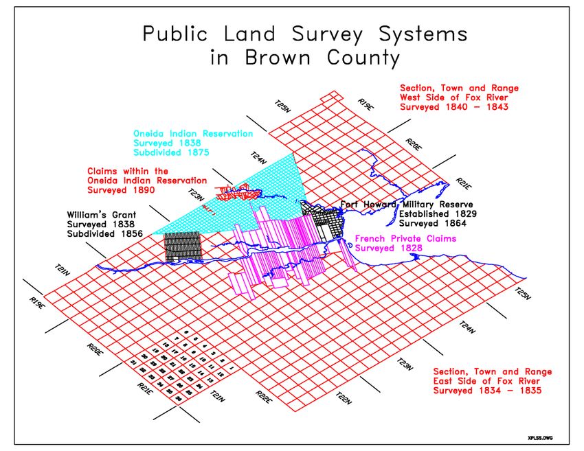
Project 7: Evaluate new software tools such as Pintegrity and the Parcel Fabric.                          These
tools, and other software updates such as ArcGIS Pro, will be evaluated for their potential in streamlining work
flows and making accurate, up-to-date information more easily available to all users of the data including the
public. If we determine these tools to be useful, they would be purchased pending sufficient funding.

Project 8: Rebuild the Land Information Office web site.                  Brown County will be moving to a new
web site template in 2019. This is a good opportunity to redesign and reorganize the Land Information page to
make information easier to find.

Project 9: Continuously improve the “BrownDog” and other GIS applications.                               These in
greater efficiency for staff and other users by speeding up searches for land information while doing common
tasks (assisting citizens with information, making edits to the parcel map, etc). Project costs involve staff time
using Land Information Program revenues.

Project 10: Educate and train staff.       Training is very important to ensure people can effectively use the
technology. The Land Information Program provides $1000 in training & education grants each year; This is
supplemented by other Land Information Program revenues as needed.

Project 11: Enhance GIS data to support surface water drainage & hydrologic modeling.
GIS software tools such as ArcHydro use input GIS data including LiDAR topography, stream mapping, and culvert
locations to model water flow across the surface and produce new GIS layers including detailed drainage patterns,
flow accumulation maps, as well as catchment, basin and accurate watershed boundaries. This information can
help with storm water planning, natural resource management, and water quality improvement efforts taking
place across the county. The 2020 LiDAR project would produce a key input dataset for this project.

See Section 4 of this document for more details on these planned activities.

                                                                                                                     5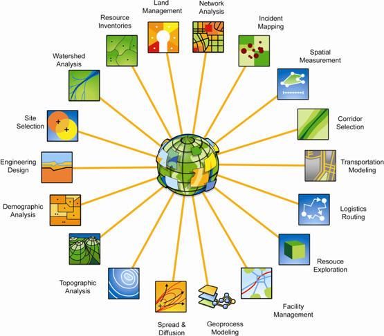
1 INTRODUCTION
In 1989, a public funding mechanism was created whereby a portion of
county register of deeds document recording fees collected from real
Any physical, legal, economic or
estate transactions would be devoted to land information through a new
environmental information or
program called the Wisconsin Land Information Program (WLIP). The characteristics concerning land,
purpose of the land information plan is to meet WLIP requirements and water, groundwater, subsurface
aid in county planning for land records modernization. resources or air in this state.
The WLIP and the Land Information Plan ‘Land information’ includes
information relating to
Requirement topography, soil, soil erosion,
In order to participate in the WLIP, counties must meet certain geology, minerals, vegetation,
requirements: land cover, wildlife, associated
Update the county’s land information plan at least every three natural resources, land
years ownership, land use, land use
Meet with the county land information council to review controls and restrictions,
expenditures, policies, and priorities of the land information office jurisdictional boundaries, tax
assessment, land value, land
at least once per year
survey records and references,
Report on expenditure activities each year geodetic control networks, aerial
Submit detailed applications for WLIP grants photographs, maps, planimetric
Complete the annual WLIP survey data, remote sensing data,
Subscribe to DOA’s land information listserv historic and prehistoric sites and
Coordinate the sharing of parcel/tax roll data with the Department economic projections.
of Administration in a searchable format determined by DOA – Wis. Stats. section 59.72(1)(a)
under s. 59.72(2)(a)
Any grants received and fees retained for land information through the WLIP must be spent consistent with the
county land information plan.
Act 20 and the Statewide Parcel Map Initiative
A major development for the WLIP occurred in 2013 through the state budget bill, known as Act 20. It directed the
Department of Administration (DOA) to create a statewide digital parcel map in coordination with counties.
Act 20 also provided more revenue for WLIP grants, specifically for the improvement of local parcel datasets. The
WLIP is dedicated to helping counties meet the goals of Act 20 and has made funding available to counties in the
form of Strategic Initiative grants to be prioritized for the purposes of parcel/tax roll dataset improvement.
For Strategic Initiative grant eligibility, counties are required to apply WLIP funding toward achieving certain
statewide objectives, specified in the form of “benchmarks.” Benchmarks for parcel data—standards or
achievement levels on data quality or completeness—were determined through a participatory planning process.
Current benchmarks are detailed in the WLIP grant application, as will be future benchmarks.
WLIP Benchmarks
Benchmark 1 & 2 – Parcel and Zoning Data Submission/Extended Parcel Attribute Set Submission
Benchmark 3 – Completion of County Parcel Fabric
Benchmark 4 – Completion and Integration of PLSS
More information on how Brown County is meeting these benchmarks appears in the Foundational Elements
section of this plan document.
6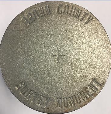
County Land Information System History and Context
Brown County’s land records system dates back to the 1800s. At that time, Brown County’s surveying and real
estate recordkeeping systems were among the best in the world given the technology of the time. However, over
the next 150+ years, the paper-based land records system grew unwieldy, outdated, and inefficient to use. By the
1970s, there were several initiatives to “modernize” land records at all levels of government through the use of
computer technology. In 1978, the Wisconsin Department of Administration, in cooperation with the University of
Wisconsin, inventoried and analyzed the impediments that limited the access and use of various public records.
The inefficiencies of the paper-based system were shown to lead to higher costs to taxpayers. Pressure to
modernize came from within government but also from the private sector, particularly real estate professionals,
engineers, surveyors, and other businesses that rely on county land records. In 1985, Governor Earl created the
Wisconsin Land Records Committee (WLRC) through Executive Order #79. The WLRC developed a conceptual
model for a land records modernization program and reported this to the governor in 1987.

In 1989, the Wisconsin Land Information Program was officially created through legislation. Under this program,
all 72 counties were to establish a local Land Information Office (LIO) as defined in statutes 59.72 and 59.43. The
funding mechanism is based on real estate document recording fees collected in the county Register of Deeds
office. The Brown County Board established an LIO in 1990 by resolution.

Since 1990, Brown County has succeeded in many land records modernization efforts including electronic real
estate document management, digital parcel mapping, GIS implementation, and providing internet access to
records. All of these efforts were guided by strategic planning efforts through the Brown County Land
Information Office Committee (now called the Land Information Council) while being supported by County
Executives and Boards.

The success of the Land Information Program is significant and measurable. Today, accurate digital land records
are more easily accessible than ever before and support a wide range of functions across the community as
depicted on the graphic
below.

By leveraging modern
technology, the Land
Information Program has
vastly improved upon
Wisconsin’s rich tradition in
openness in government by
giving businesses and citizens
the means to view open
records from the comfort of
their home or office using
internet technology.

Users can run database
queries on a centralized up-
to-date computer database,
thus shortening the time
spent searching.

Today, many systems are
highly dependent on land
information and GIS is deeply
integrated into these systems.

                                                             Figure 1: How GIS is used (credit: Esri)

                                                                                                                      7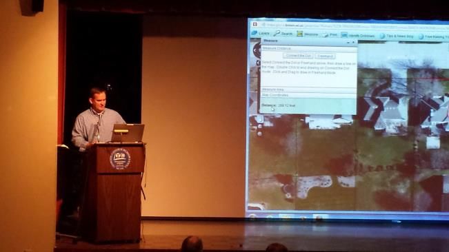
County Land Information Plan Process
County land information plans were initially updated every five years. However, as a result of Act 20, counties must
update and submit their plans to DOA for approval every three years. The 2019-2021 plan, completed at the end
of 2018, is the second post-Act 20 required update.
Plan Participants and Contact Information
Another requirement for participation in the WLIP is the county land information council, established by
legislation in 2010. The council is tasked with reviewing the priorities, needs, policies, and expenditures of a land
information office and advising the county on matters affecting that office.
According to s. 59.72(3m), Wis. Stats., the county land information council is to include:
Register of Deeds
Treasurer
Real Property Lister or designee
Member of the county board
Representative of the land information office
A realtor or member of the Realtors Association employed within the county
A public safety or emergency communications representative employed within the county
County surveyor or a registered professional land surveyor employed within the county
Other members of the board or public that the board designates
The land information council must have a role in the development of the county land information plan, and DOA
requires county land information councils to approve final plans.
This plan was prepared by the county LIO, the Brown County Land Information Council, and others as listed below.
* Land Information Council Members designated by asterisk and bold font
County Land Information Council and Plan Workgroup
Name Title Affiliation Email Phone
*Jeff DuMez GIS Coordinator, Brown County DuMez_JD@co.brown.wi.us 920-448-6295
Land Information Officer Planning & Land Services
*Paul Zeller County Treasurer Brown County Zeller_PD@co.brown.wi.us 920-448-4074
Treasurer
*Bill Bosiacki Zoning Administrator Brown County Planning & Bosiacki_BS@co.brown.wi.us 920-448-6480
Land Services Dept.
*Francine Roberg GIS Coordinator Village of Ashwaubenon Froberg@ashwaubenon.com 920-492-2308
*Norb Dantinne County Board Supervisor Brown County Board Dantinne_NA@co.brown.wi.us 920-863-6323
*Patrick Austin Realtor Mark D. Olejniczak Realty patrickaustinrealtor@gmail.co 920-321-9145
m
*Terry VanHout Real Property Lister Brown County Planning & VanHout_TL@co.brown.wi.us 920-448-6480
Land Services Dept.
*Jon Bechle Conservationist Brown County Land & Water Bechle_JE@co.brown.wi.us 920-391-4638
Conservation Dept.
*August Chief Information Officer Brown County Technology Neverman_AW@co.brown.wi.u 920-448-4025
Neverman / CISO Services Dept. s
*John Rousseau Captain Brown County Sheriffs Office Rousseau_JW@co.brown.wi.us 920-448-4200
*Chuck Lamine Planning Director Brown County Planning & Lamine_CF@co.brown.wi.us 920-448-6480
Land Services Dept
*Cullen Peltier Director of Public Safety Brown County Public Safety Peltier_CS@co.brown.wi.us 920-391-7400
Communications Communications Dept.
*Chad Weininger Administration Director Brown County Administration Weininger_CJ@co.brown.wi.us 920-448-4035
*Ryan Duckart County Surveyor Brown County Planning & Duckart_RL@co.brown.wi.us 920-448-6480
Land Services Dept.- Property
Listing
*Cheryl Berken Register of Deeds Brown County Register of Cheryl.Berken@co.brown.wi.us 920-448-4470
Deeds
8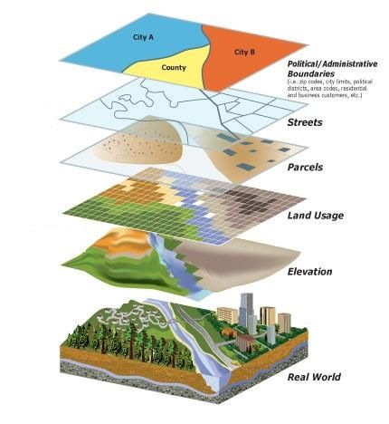
*Dale Raisleger    Engineering Technician    Brown County Public Works – Raisleger_DE@co.brown.wi.us 920-662-2173
                                             Highway Department
Tom Leslie         Property Analyst          Brown County Planning &       Leslie_TL@co.brown.wi.us       920-448-6480
                                             Land Services Dept.- Property
                                             Listing
Nick Peltier       Agronomist                Brown County Land & Water Peltier_NA@co.brown.wi.us          920-391-4633
                                             Conservation Dept.
Ryan Finstad     Enterprise System Analyst Brown County Technology          Finstad_RR@co.brown.wi.us     920-391-7400
                 II                        Services / Public Safety
                                           Communications Dept.
Joe Massie       Communications            Brown County Public Safety       Massie_JW@co.brown.wi.us      920-391-7400
                 Supervisor                Communications Dept.
Renee VandeVoort Assistant Director        Brown County Public Safety       VandeVoort_RT@co.brown.wi. 920-391-7400
                                           Communications Dept.             us
Chuck Mahlik       Financial Specialist      Brown County Treasurer’s       Mahlik_CT@co.brown.wi.us      920-448-4074
                                             Office
Kathy Meyer        Officer Manager           Brown County Planning &        Meyer_KA@co.brown.wi.us       920-448-6480
                                             Land Services Dept.
Cecelia Runyon     Administrative Secretary Brown County Planning &         Cecelia.Runyon@co.brown.wi. 920-448-6480
                                            Land Services Dept.             us
Dan Teaters        Senior Planner            Brown County Planning &        Teaters_DW@co.brown.wi.us     920-448-6480
                                             Land Services Dept.
Jason Bolz         Survey Crew Chief         Brown County Planning &        Bolz_JD@co.brown.wi.us        920-448-6480
                                             Land Services Dept.
Chad Miller        Property Analyst          Brown County Planning &        Chadwick.Miller@co.brown.wi. 920-448-6480
                                             Land Services Dept.            us
Shelly Ness        Central Services Specialist Brown County Planning &      Shelly.Ness@co.brown.wi.us    920-448-6480
                                               Land Services Dept.
Ker Vang           Transportation            Brown County Planning &        Vang_KV@co.brown.wi.us        920-448-6480
                   Planner/GIS               Land Services Dept.
Cole Runge         Principal Planner         Brown County Planning &        Runge_CM@co.brown.wi.us       920-448-6480
                                             Land Services Dept.
Devin Yoder        Transportation/GIS        Brown County Planning &        Devin.Yoder@co.brown.wi.us    920-448-6480
                   Planner                   Land Services Dept.
Karl Mueller       Planner I                 Brown County Planning &        Karl.Mueller@co.brown.wi.us   920-448-6480
                                             Land Services Dept.
Lisa Conard        Senior Planner            Brown County Planning &        Conard_LJ@co.brown.wi.us      920-448-6480
                                             Land Services Dept.
Matt Heyroth       Assistant Zoning          Brown County Planning &        Heyroth_MR@co.brown.wi.us 920-448-6480
                   Administrator             Land Services Dept. - Zoning
Lisa Luedke        Sanitary Inspector        Brown County Planning &        Luedke_LM@co.brown.wi.us      920-448-6480
                                             Land Services Dept.-Zoning
Laura Workman      Applications Support      Brown County Technology        Workman_LJ@co.brown.wi.us 920-448-4031
                   Manager                   Services Deparment
Beth Rodgers       MIC-PS                    Brown County Technology        Rodgers_BA@co.brown.wi.us     920-448-4026
                                             Services Department
Stacey Bix         Programmer / Analyst II   Brown County Technology        Bix_SL@co.brown.wi.us         920-448-4029
                                             Services Department
Kevin Raye         Enterprise Network &      Brown County Technology        Raye_KP@co.brown.wi.us        920-448-4338
                   Infrastructure Manager    Services Department
Mike Hronek        IT Director/GIS           City of Green Bay              MikeHr@greenbaywi.gov         920-448-3033
                   Coordinator
Bill Boyle         GIS Coordinator           City of DePere                 bboyle@mail.de-pere.org       920-339-4072

Tim Hennig         IT Manager/GIS            Village of Bellevue            TimH@villageofbellevue.org    920-468-5225
                   Coordinator
Steve Dunks        Building Inspection /     Village of Suamico             SteveD@Suamico.org            920-434-2212
                   Zoning / GIS
Phil Ohlinger      GIS Manager               Robert E. Lee & Associates     POhlinger@releeinc.com        920-662-9641

                                                                                                                         9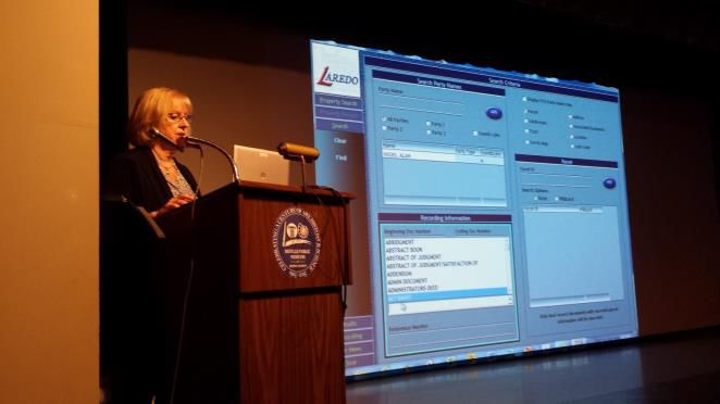
2 FOUNDATIONAL ELEMENTS
Counties must have a land information plan that addresses
development of specific datasets or map layer groupings
historically referred to as the WLIP Foundational Elements.
Foundational Elements incorporate nationally-recognized               PLSS
                                                                      Parcel Mapping
“Framework Data” elements, the major map data themes that
                                                                      LiDAR and Other Elevation Data
serve as the backbone required to conduct most mapping and            Orthoimagery
geospatial analysis.                                                  Address Points and Street Centerlines
                                                                      Land Use
In the past, Foundational Elements were selected by the former        Zoning
Wisconsin Land Information Board under the guiding idea that          Administrative Boundaries
program success is dependent upon a focus for program                 Other Layers
activities. Thus, this plan places priority on certain elements,
which must be addressed in order for a county land information plan to be approved. Beyond the county’s use for
planning purposes, Foundational Element information is of value to state agencies and the WLIP to understand
progress in completion and maintenance of these key map data layers.

Beyond Brown County’s use for planning purposes, the “Foundational Elements” listed here are valuable to state
agencies and others looking to see the status of common GIS layers used throughout the state. The layers listed
in this section are those “key map layers” identified in the Wisconsin Land Information Program statutes and
guidelines. This list is not a comprehensive list of all land information or GIS datasets available in Brown County.
There are many other datasets that have been produced for various county and other local projects. This
Foundational Elements listed below are focused on the key layers that were identified by the WLIP.

                                                                                                                       10
PLSS
Public Land Survey System Monuments
Layer Status
PLSS Layer Status
Status/Comments
Number of PLSS corners (selection, ¼, meander) set in 3036. This number had been higher in previous reports,
original government survey that can be remonumented in however, it has been determined that some corners are not
your county considered original.
Number and percent of PLSS corners capable of being 2355 (78%)
remonumented in your county that have been
remonumented
Number and percent of remonumented PLSS corners with 100% of the remonumented corners have survey grade
survey grade coordinates (see below for definition) coordinates.
SURVEY GRADE – coordinates collected under the
direction of a Professional Land Surveyor, in a
coordinate system allowed by 236.18(2), and obtained
by means, methods and equipment capable of
repeatable 2 centimeter or better precision
SUB-METER – point precision of 1 meter or better
APPROXIMATE – point precision within 5 meters or
coordinates derived from public records or other
relevant information
Number and percent of survey grade PLSS corners 100% of the remonumented corners are integrated into the
integrated into county digital parcel layer digital parcel layer.
Number and percent of non-survey grade PLSS corners n/a
integrated into county digital parcel layer
Tie sheets available online? Yes Survey Index & Tie Sheet Viewer app (click here)
Percentage of remonumented PLSS corners that have tie 100% of the remonumented corners have tie sheets available
sheets available online (whether or not they have on the above-noted Survey Index & Tie Sheet Viewer GIS app.
corresponding coordinate values)
Percentage of remonumented PLSS corners that have tie 100%
sheets available online (whether or not they have
corresponding coordinate values) and a corresponding
URL path/hyperlink value in the PLSS geodatabase
PLSS corners believed to be remonumented based on filed 0 (none)
tie-sheets or surveys, but do not have coordinate values
Approximate number of PLSS corners believed to be lost or 681
obliterated
Which system(s) for corner point identification/ Brown County uses a unique corner ID system. The above-
numbering does the county employ (e.g., the Romportl mentioned Tie Sheet Viewer online GIS app shows corner
point numbering system known as Wisconsin Corner Point names; If more information is needed, a grid map can be
Identification System, the BLM Point ID Standard, or other provided upon request.
corner point ID system)?
Does the county contain any non-PLSS areas (e.g., river Yes. Private Claims, Indian Claims, Oneida Reservation Lots,
frontage long lots, French land claims, private claims, farm Williams Grant, and the Fort Howard Military Reserve areas all
lots, French long lots, etc.) or any special situations use non-PLSS tract descriptions. The LIO web site includes a
regarding PLSS data for tribal lands? breakdown and map of each.
Total number of PLSS corners along each bordering county 243
Number and percent of PLSS corners remonumented along 227 (93%). The corners not remonumented along the county
each county boundary boundary are mostly the 1/16th corners through the Oneida
Indian Reservation.
Number and percent of remonumented PLSS corners along All of them (100%).
each county boundary with survey grade coordinates
In what ways does your county collaborate with or plan to The Brown County Surveyor contacts the adjacent counties if
collaborate with neighboring counties for PLSS updates on there are issues or questions. Updated tie sheets are sent
shared county borders? after corner maintenance is completed.
Custodian
Brown County Planning & Land Services Department / Surveyor’s Office (County Surveyor)
Maintenance
PLSS records are updated daily or as needed. Tie sheet PDFs include historical information.
Standards
Statutory Standards for PLSS Corner Remonumentation
11 s. 59.74, Wis. Stats. Perpetuation of section corners, landmarks.
s. 60.84, Wis. Stats. Monuments.
ch. A-E 7.08, Wis. Admin. Code, U.S. public land survey monument record.
ch. A-E 7.06, Wis. Admin. Code, Measurements.
s. 236.15, Wis. Stats. Surveying requirement.
SURVEY GRADE standard from Wisconsin County Surveyor’s Association:
SURVEY GRADE – coordinates collected under the direction of a Professional Land Surveyor, in
a coordinate system allowed by 236.18(2), and obtained by means, methods and equipment
capable of repeatable 2 centimeter or better precision
SUB-METER – point precision of 1 meter or better
APPROXIMATE – point precision within 5 meters or coordinates derived from public records or
other relevant information
Brown County uses the Survey Grade standard for all PLSS corner work.
Other Geodetic Control and Control Networks
e.g., HARN, Height Mod., etc.
Layer Status
With assistance of the WiDOT, municipalities, and private companies, Brown County has developed
and densified a HARN (High Accuracy Reference Network) using Federal Geodetic Control
Subcommittee guidelines. National Geodetic Survey monuments are also present.
Custodian
Brown County is not the custodian of the HARN or NGS monuments.
Maintenance
Brown County is not responsible for the maintenance of the HARN or NGS monuments.
Standards
Four Primary Stations (1 ppm), 36 Secondary (2 ppm) and over 50 Tertiary (10ppm) stations have been
established in Brown County. A Vertical Geodetic Control Network is also in place, and it is based on
the National Spatial Reference System. All 1st, 2nd, and 3rd order NGS monuments have been
recovered; GPS coordinates and elevations have been captured on more than 170 of these.
Parcel Mapping
Parcel Geometries
Layer Status
Progress toward completion/maintenance phase: County-wide parcel layer is 100% complete in
Brown County, and all of the county’s parcels are available in a digital CAD and GIS format. As of
September 2018, there are 102,498 tax parcels in Brown County. Parcels boundary lines are drafted
using coordinate geometry in AutoCAD as referenced to its source document, professionally analyzed,
and precisely mapped into a geodetic controlled PLSS base. The parcel map layer is maintained using
both AutoCAD and ArcGIS.
Projection and coordinate system: Transverse Mercator, NAD 1983 HARN WISCRS: Brown County,
Feet
Integration of tax data with parcel polygons: Brown County has a parcel polygon GIS model that
directly integrates tax/assessment data as parcel attributes.
Esri Parcel Fabric/LGIM Data Model: Brown County does not use the Esri Parcel Fabric Data Model,
or Esri’s Local Government Information Model. However, the Parcel Fabric will be evaluated in the next
three years.
Online Parcel Viewer Software/App and Vendor name: Brown County uses Esri’s Web AppBuilder
to publish parcels and other GIS data online. The site is named “BrownDog” and is available by
clicking here.
12 Unique URL path for each parcel record: Yes. The URL is stable and includes assessment data,
information on recorded documents, and more. Later in 2018, after Brown County converts our Tax
System to GCS Software, more information will be available.
Custodian
Brown County Planning & Land Services Department / Property Listing Division
Maintenance
Update Frequency/Cycle. Parcel maps including polygons are updated daily as needed.
The latest information is published online about 3 times per week.
Standards
Data Dictionary:
Detailed metadata is embedded in the GeoDatabase feature datasets. Additionally, a data dictionary is
available in PDF format online. A data dictionary is available for each element/attribute name, and
explanations of any county-specific notations for parcel attributes listed by s. 59.72(2)(a).
Parcel mapping meets National Map Accuracy Standards for 1” = 50’ scale.
Brown County meets the standards set forth by the statewide parcel mapping project;
Assessment/Tax Roll Data
Layer Status
Progress toward completion/maintenance phase: N/A. Brown County maintains tax roll data
throughout the year.
Tax Roll Software/App and Vendor name: In 2019, Brown County will switch from an in-house
custom AS/400 system to the GCS Software system (LandNav).
Municipal Notes: N/A. Brown County does tax listing for the entire county.
Custodian
Brown County Planning & Land Services Department / Property Listing Division.
Maintenance
Maintenance of the Searchable Format standard: To maintain the Searchable Format standard, the
county will use GCS Software’s exporting tool to produce a copy of the data in the Searchable Format
standard.
Searchable Format Workflow: The county maintains parcel/tax roll data in way that differs from the
state standard, but a third-party export tool (provided by GCS Software) makes it possible to produce
the Searchable Format with little human labor.
Standards
Wisconsin Department of Revenue Property Assessment Manual and attendant DOR standards
DOR XML format standard requested by DOR for assessment/tax roll data will be met after conversion
to GCS Software’s product is complete (late 2018)
Non-Assessment/Tax Information Tied to Parcels
e.g., Permits, Easements, Non-Metallic Mining, Brownfields, Restrictive Covenants
Layer Status
Brown County ties the following datasets to parcels via GIS and/or Parcel ID:
Shoreland Permits
POWTS (Private Onsite Waste Treatment Systems)
Agricultural field units
Non-metallic mining sites
Surveys (link to survey index)
Real estate documents (via Tapestry)
Municipal information (zoning, web sites, administrators)
Google Street View imagery
13Custodians
Brown County Planning & Land Services / Zoning Division
Brown County Land & Water Conservation Department
Maintenance
As Needed
Standards
Mapping tied to parcels generally follows the same accuracy standards as the parcel dataset (NMAS
1” = 50’).
ROD Real Estate Document Indexing and Imaging
Layer Status
Grantor/Grantee Index: Digitized grantor/grantee index November 21, 1980. In progress: 1962 to
November 20, 1980. Prior to 1962, paper index stored off-site and available upon request.
Tract Index: Official Tract Index is Private Claim and PLSS based – digitized January 1, 1989. Prior to
January 1, 1989 paper based Tract Index available in the Register of Deeds Office. 75 years after
Official Tract Index started another tract index system was created in Brown County called Abstract
Listing. Like the official Tract Index, it is Private Claim and PLSS based. Tracts were merged on June 1,
1995 and Abstract Listing books closed. All paper Abstract books were digitized and imported into
Register of Deeds Tract Index system for searching on November 21, 2006.
Imaging: TIFF images for documents from May 1, 1989 forward are linked to index and available
online through subscription service. TIFF images from 1962 to April 30, 1989 in production to be
linked to index and document number. Prior to 1962 images are on microfiche and available in the
Register of Deeds office only.
ROD Software/App and Vendor Name: Laredo/Tapestry from Fidlar Technologies.
Survey Index: The Brown County GIS system includes a map layer depicting the area boundaries of all
plats, certified survey maps, plat of surveys, transportation plats, and miscellaneous surveys. The GIS
layer includes attributes that allow for map searches and the attributes include surveyor name, date of
survey, and linkage to scanned survey image.
Custodian
County Register of Deeds
Maintenance
Daily updates. Off-site data replication (Index and Images) from 1962 forward. Remote searchers
access replicated data base
Standards
s. 59.43, Wis. Stats. Register of deeds; duties, fees, deputies.
ch. 706, Wis. Stats. Conveyances of real property; Recording; Titles.
LiDAR and Other Elevation Data
LiDAR
Layer Status
Most recent acquisition year: 2010
Accuracy: The Brown County Surveyor checked the accuracy of our delivered product by making
GNSS observations on over 93 photo-identifiable points. These observations showed the product had
an RMSE of 0.207(z) for an NSSDA accuracy of 0.405 feet (z)
Post spacing: Approximately 3.9 feet
Contractor’s standard, etc.: Quality Assurance procedures conducted by the Brown County Surveyor
showed the LiDAR data exceeded the spatial accuracy set forth in project specifications: Tests showed
an RMSEz of 0.21 feet and an NSSDA Accuracy of 0.41 feet.
Next planned acquisition year: 2020 if funding can be acquired.
14Custodian
Brown County Planning & Land Services Department / Land Information Office.
Maintenance
These data are housed on the internal GIS server and made available through the LIO Data Downloads
page.
Standards
Exceeds standards for 2-foot contour mapping (tests showd an RMSEz of 0.21 feet and an NSSDA
Accuracy of 0.41 feet, which is nearly sufficient for 1-foot contour generation).
LiDAR Derivatives
e.g., Bare-Earth Digital Terrain Model (DTM), Bare-Earth Elevation Contours, Bare-Earth Digital
Elevation Model (DEM), Digital Surface Model (DSM), etc.
Layer Status
The 2010 LiDAR dataset has been used to create:
Hydro-flattened DEM (per FEMA standards for flood mapping)
Terrain model
Two-foot contours in GeoDatabase, shapefile, and AutoCAD DWG formats
Brown County’s LiDAR dataset was NOT in place when FEMA last published countywide flood
mapping in 2008-09.
Online viewing: Many web applications include these data layers including the Multi-Purpose GIS app
Downloading data is possible from the LIO web site (various formats)
Custodian
Brown County Planning & Land Services Department / Land Information Office.
Maintenance
These data are maintained on the internal GIS server and made available through the LIO Data
Downloads page.
Standards
Quality Assurance procedures conducted by the Brown County Surveyor showed the LiDAR data
exceeded the spatial accuracy set forth in project specifications: Tests showed an RMSE z of 0.21 feet
and an NSSDA Accuracy of 0.41 feet.
Other Types of Elevation Data
Layer Status
In addition to the 2010 LiDAR data & its derivatives, Brown County has two-foot contour data from
April 2000. This was based on aerial photography and produced using photogrammetric mapping
techniques. The 2000 dataset does not cover the entire county.
Custodian
Brown County Planning & Land Services Department / Land Information Office
Maintenance
All previous elevation datasets are maintained on the county’s internal GIS server
Standards
This dataset was found to have inaccuracies, and although the contractor re-mapped parts of it, this
dataset has not been deemed to meet the two-foot accuracy standards in all areas.
15Orthoimagery
Orthoimagery
Layer Status
Most recent acquisition year: 2017
Resolution: 6 inches
Online viewing: Orthoimagery can be viewed on the BrownDog GIS app
Downloading data is possible via the LIO web site (TIF or SID formats)
Next planned acquisition year: 2020
WROC participation in 2020: Brown County will provide imagery to WROC in 2020 if a flight is
completed, regardless of vendor. Brown County chooses qualified vendors based on an RFP or bid
process. The WROC vendor proposal may or may not be selected based on price or other criteria.
Custodian
Brown County Land Planning & Land Services Department / Land Information Office
Maintenance
All imagery is maintained on the GIS server and made available to internal and public users.
This dataset is available for download as TIF and SID format on the Brown County Land Information
web site.
Brown County plans to produce high-resolution photos every 3 years pending sufficient budget.
Standards
Orthoimagery from 2000, 2005, 2010, 2014, and 2017 were completed with a 6” ground resolution and
tested to ensure they meet National Map Accuracy Standards (NMAS) for 1” = 100’ mapping (NSSDA
Accuracy is 1.73’ or better).
Historic Orthoimagery
Layer Status
Brown County has contracted to produce historic orthoimagery for several years including 1938, 1960,
1978 and 1992 (in addition to the imagery from 2000, 2005, 2010, 2014, and 2017).
Online viewing: Historic orthoimagery can be viewed on the BrownDog GIS app
Downloading data is possible for some datasets via the LIO web site (TIF or SID formats)
Custodian
Brown County Planning & Land Services Department/ Land Information Office
Maintenance
All historic imagery is maintained on the GIS server where it can easily be called up to serve as a
historic base map to view land use changes over time. Historic images can be viewed and compared
as overlays using the Brown County Land Information web apps including the BrownDog.
Standards
The older aerial orthophotos have inconsistent mapping accuracy across the image, but generally the
historic images meet National Map Accuracy Standards for 1” = 200’ mapping for the older images
(1938, 1960, 1978, and 1992) and 1” = 100’ for the images from 2000 and after.
Other Types of Imagery
e.g., Oblique Imagery, Satellite Imagery, Infra-red, etc.
Layer Status
Brown County has not contracted for oblique imagery, but both oblique and street view imagery has
been produced by Google and Microsoft for most of the county and is accessible through web links on
the county’s GIS.
The 2014 and 2017 TIF images include a 4th band (near infrared).
Custodian
Brown County Planning & Land Services Department: Land Information Office (LIO)
16Maintenance
Future flights will include the near infrared band because this is useful for certain activities such as
wetland delineation.
Standards
Accuracy and other standards vary for each dataset but generally meet NMAS for 1” = 100’ mapping
Address Points and Street Centerlines
Address Point Data
Layer Status
100% complete.
Custodians
Brown County Municipalities (assign address numbers)
Brown County Planning & Land Services Department / Planning Division
Brown County Planning & Land Services Department / Property Listing Division
Brown County Planning & Land Services Department / Land Information Office
Brown County Public Safety Communications Department (assign 911 attributes)
Maintenance
Address points are updated daily or as needed by Planning & Land Services Staff and by Public Safety
Communications staff using a versioned SDE GeoDatabase and ArcGIS Desktop.
Standards
Address points are placed on buildings for residences and near entrances of larger commercial and
retail buildings using aerial orthophotos having National Map Accuracy Standards (NMAS) for 1” =
100’ mapping.
Building Footprints
Layer Status
About 70% complete. Most of the urbanized areas have contracted to have building footprints
produced from the 2010, 2014, and/or 2017 aerial imagery and Brown County has compiled these
footprints into the county GIS database. Additionally, Brown County incorporated free, downloadable
buildings created by Microsoft for much of the rest of the county.
Online viewing: Building footprints can be viewed online with the BrownDog GIS app.
Custodian
Municipalities within Brown County; also the county Planning & Land Services Department
Maintenance
Updated based on new aerial photography as needed or as time permits.
Standards
The goal is for all buildings to meet National Map Accuracy Standards (NMAS) for 1” = 100’ mapping
Other Types of Address Information
e.g., Address Ranges
Layer Status
Address ranges on street centerlines are 100% complete
Custodian
Brown County Planning & Land Services Department / Land Information Office
Maintenance
Address ranges on street centerlines are updated by Planning & Land Services staff as needed
17Standards
Street Centerlines meet National Map Accuracy Standards (NMAS) for 1” = 100’ mapping
Street Centerlines
Layer Status
Street centerlines are mapped countywide. Each segment includes about 30 attributes that support the
Brown County NG911 system, Metropolitan Planning Organization (MPO), and Public Works/Highway.
Streets include annotation. Mile markers are mapped on all freeways.
Online viewing: Street centerlines can be viewed online with the BrownDog GIS app
Custodian
Brown County Planning & Land Services Department / Planning Division
Brown County Planning & Land Services Department / Land Information Office
Maintenance
Street Centerlines are updated by Planning & Land Services staff as needed using a versioned SDE
GeoDatabase and ArcGIS Desktop
Standards
Street Centerline database schema is similar to that used by other counties and Esri. The centerline
mapping meets National Map Accuracy Standards (NMAS) for 1” = 100’ mapping
Rights of Way
Layer Status
Complete; in maintenance phase, updated as needed. This data is maintained as lines within our CAD
parcel dataset as well as our GIS parcel line feature class. Lines have layer codes that allow users to
filter the right of way lines from the rest of the parcel line work.
Online viewing: Road and railroad right of ways can be viewed online with the BrownDog GIS app
Custodian
Brown County Planning & Land Services Department / Property Listing Division maintains this data in
AutoCAD and also using a versioned SDE GeoDatabase and ArcMap
Maintenance
Brown County Property Listing updates this layer daily or as needed.
Standards
Horizontal accuracy standard: Meets National Map Accuracy Standards (NMAS) for 1” = 50’ mapping.
Trails & Sidewalks
e.g., Recreational Trails
Layer Status
Almost 100% complete. Brown County Planning & Land Services Department / Planning Division has
mapped all known trails and sidewalks in the county.
Trail mile markers are maintained on the major trails (Fox River State Trail, East River Trail, etc)
Online viewing: These can be viewed online with the BrownDog GIS app
Custodian
Brown County Planning & Land Services Department / Planning Division
Maintenance
Updated as needed, usually in conjunction with new aerial orthophotography.
Standards
Mapping meets National Map Accuracy Standards (NMAS) for 1” = 100’ maps
18Land Use
Current Land Use
Layer Status
Mostly complete but in need of updates. Brown County’s last full land use inventory was completed in
2014 and is again being revised in 2018. Aerial orthophotography is used to update land use.
Custodian
Brown County Planning & Land Services Department / Planning Division.
Maintenance
Updated as needed, usually in conjunction with new aerial photography or when Brown County is
updating land use plans. A new county comprehensive plan will be developed in 2019 and the land
use will be updated using 2017 aerials.
Standards
Land Use is coded based on the Bay-Lake Regional Planning Commission classification system
Land use mapping meets National Map Accuracy Standards (NMAS) for 1” = 100’ maps
Future Land Use
Layer Status
This layer was last completed countywide in 2007. It has not been updated since, though we plan to
update this layer as part of our county comprehensive plan update in 2019.
Custodian
Brown County Planning & Land Services Department / Planning Division
Maintenance
Updated as needed.
Standards
s. 66.1001, Wis. Stats. Comprehensive planning.
Zoning
County General Zoning
Layer Status
Not administered by Brown County.
Shoreland Zoning and POWTS (Private Onsite Waste Treatment Systems)
Layer Status
Complete; in maintenance phase, updated as needed.
Online viewing: Shoreland Zoning & POWTS layers can be viewed online with the BrownDog GIS app
Custodians
Brown County Planning & Land Services Department / Zoning Division
Brown County Planning & Land Services Department / Land Information Office
Maintenance
This data layer is updated as needed. Changes can occur with new navigability determinations, FEMA
flood map revisions, and DNR wetland changes. Data managed using a versioned SDE GeoDatabase
and ArcGIS Desktop.
Standards
Wisconsin NR115 and NR116 and Chapters 22 and 23 of the Brown County Code
19Farmland Preservation Zoning
Layer Status
The County does maintain a GIS representation of county farmland preservation boundaries.
Year of certification: 2017
Custodians
Brown County Planning & Land Services Department
Brown County Land & Water Conservation Department
Maintenance
Map layers are updated as needed.
Standards
Wisconsin Working Lands Initiative (Wis. Statutes chapter 91).
Floodplain Zoning
Layer Status
The County does maintain a GIS representation of floodplain zoning boundaries.
The county’s floodplain zoning GIS data is not the same as/identical to the FEMA map, the one
difference being we include polygon outlines showing LOMA/R (Letter of Map Amendment/Revision).
Limited Boundary Adjustment/Fill in Flood Fringe; Letters of Map Change
Custodians
Brown County Planning & Land Services Department / Zoning Division
Brown County Planning & Land Services Department / Land Information Office
Maintenance
Letters of Map Change are maintained in the GIS database and the area affected is shown on the
BrownDog online GIS map.
Standards
Chapters 22 and 23 of the Brown County Code
Airport Protection
Layer Status
The County does maintain a GIS representation of airport protection zoning boundaries
Airport protection zoning map depicts: Height limitation restrictions and general zoning overlay for
airport protection.
Online viewing: Airport zoning can be viewed online with the BrownDog GIS app
Custodians
Austin Straubel International Airport
Brown County Planning & Land Services staff assists with the mapping/GIS components.
Maintenance
This dataset is updated as needed.
Standards
Brown County Zoning Ch. 24 Ordinance
Municipal Zoning Information Maintained by the County
e.g., Town, City and Village, Shoreland, Floodplain, Airport Protection, Extra-Territorial, Temporary
Zoning for Annexed Territory, and/or Zoning Pursuant to a Cooperative Plan
20Layer Status
Brown County has assisted many of the smaller towns with zoning map production in GIS format. We
have also received copies of municipal zoning from other municipalities for use within certain
projects; However, as we are not often privy to changes, the county’s zoning map cannot be relied on
as current.
The LIO indexed all municipal zoning web pages and maps within ArcGIS Online:
http://browncounty.maps.arcgis.com/home/search.html?q=zoning&t=content&content=all
Custodian
Brown County Municipalities
Maintenance
Brown County will maintain municipal zoning data if provided by the municipality or if the county has
agreed to assist the municipality with zoning map updates.
Standards
Mapping accuracy standards: Zoning is usually based on parcel mapping, 1” = 50’ NMAS.
Administrative Boundaries
Civil Division Boundaries
e.g., Towns, City, Villages, etc.
Layer Status
100% complete
Custodians
Brown County Planning & Land Services Department / Property Listing Division
Brown County Planning & Land Services Department / Land Information Office
Maintenance
Updated as needed
Standards
Mapping meets National Map Accuracy Standards (NMAS) for 1” = 100’ mapping
School Districts
Layer Status
Progress toward completion/maintenance phase: School Districts are mapped; 100% complete.
Relation to parcels: Parcel attributes include a school district code
Attributes linked to parcels: School District ID
Online viewing: School Districts can be viewed online with the BrownDog GIS app
Custodians
Brown County Planning & Land Services Department / Property Listing Division
Brown County Planning & Land Services Department / Land Information Office
Maintenance
Updated as needed
Standards
Map layer meets National Map Accuracy Standards (NMAS) for 1” = 100’ mapping
Election Boundaries
e.g., Voting Districts, Precincts, Wards, Polling Places, etc.
Layer Status
Wards and County Supervisor Districts are mapped as a GIS layer (100% complete).
Online viewing: Districts & Wards can be viewed online with the BrownDog GIS app
21Custodian
Brown County Clerk’s Office
Planning & Land Services Department
Maintenance
Updates are made to boundaries during the Redistricting process.
Annexations can trigger other changes to wards and districts; the district changes are gathered from
resolutions filed in the County Clerk’s office and updated on the GIS map using a versioned SDE
GeoDatabase and ArcGIS Desktop.
Standards
National Map Accuracy Standards (NMAS) for 1” = 100’ mapping
Utility Districts
e.g., Water, Sanitary, Electric, etc.
Layer Status
Sanitary Districts and Sewer Service Area boundaries are mapped in GIS format (100% complete).
Online viewing: Sanitary Districts and Sewer Service Areas (SSAs) can be viewed online with the
BrownDog GIS app
Custodian
Brown County Planning & Land Services Department.
Maintenance
Updated as needed.
Standards
National Map Accuracy Standards (NMAS) for 1” = 100’ mapping
Public Safety
e.g., Fire/Police Districts, Emergency Service Districts, 911 Call Center Service Areas, Public Safety
Answering Points, Healthcare Facilities
Layer Status
Fire Districts: 100% complete*
Fire Stations: 100% complete
Police Districts & beats: 100% complete*
*Note: Brown County’s new 911 Computer Aided Dispatch vendor (Securus Technologies)
requires Fire and Police boundaries be merged into a single layer which we refer to as the
“XCAD_Grid”. Each polygon within this layer is coded with fire and police agency/beat codes.
EMS (Emergency Medical Service) area boundaries are part of the Fire District layer.
Online viewing: Public Safety layers can be viewed online with the BrownDog GIS app
Custodians
Brown County Planning & Land Services Department / Land Information Office
Brown County Public Safety Communications Department
Maintenance
Updated as needed
Standards
Map layer: National Map Accuracy Standards (NMAS) for 1” = 100’ mapping
Attribute schema: Securus Technologies XCAD Computer Aided Dispatch software
22You can also read