Proposed Road Network 2040 - National Transport Authority
←
→
Page content transcription
If your browser does not render page correctly, please read the page content below
Proposed Road Network 2040
        N20

                                     WHITECHURCH

                                                                                                                   M8

                                                     Cork North Ring Road

                                                                                                                     KNOCKRAHA                                         LEAMLARA
                                       MONARD
                                                                                WHITES CROSS
                                                                                                   SALLYBROOK

              BLARNEY
                                                                                                      BROOKLODGE

TOWER
                        Northern Distributor Road                                                                                                                 CARRIGTWOHILL
                                                                                                    GLANMIRE
                                                                                                                                                                                                             N25
                                                                                                                                   GLOUNTHAUNE
                                                                            HGV Restrictions

                                                                                                                                                                                                   Grade Seperation

                                                                                                                    LITTLE ISLAND
                                                                                                                    Dunkettle Interchange Upgrade
                                                                                                            N40

                                                                    South Docklands
 BALLINCOLLIG                                                       Access Roads

                           N40                                                                         DOUGLAS
                                                                                                                          PASSAGE WEST
                                                                       FRANKFIELD
                                                                                                     ROCHESTOWN
                        Demand Management
                                                                            East-West Link                                                                             BALLYMORE

                                                                             N27 to Cork Airport
                                  Southern Distributor Road                                           M28 Cork - Ringaskiddy
                                                                                                                                                         COBH
                                                                                                                               MONKSTOWN

                                                      CORK
                                                      AIRPORT

                                                                                                                                                    RINGASKIDDY
                                                                   BALLYGARVAN
                                                                                                                                                                                              WHITEGATE
                                                                                                                                                                    All routes and alignments are subject to change
                                                                                                     CARRIGALINE                                                    through the statutory scheme appraisal process.
                               N71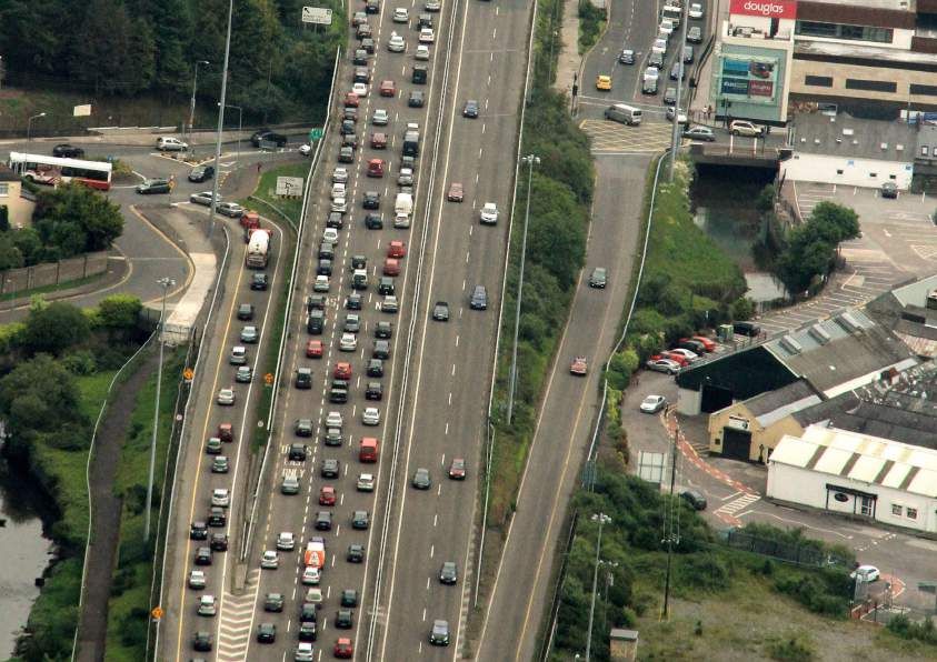
CORK METROPOLITAN AREA | TRANSPORT STRATEGY 89
Requirements of Regional and Bus lane and priority provision – Allows for the downgrading of national
Local Road Network approximately 33% of cross section; and routes entering Cork City, which can
Road traffic lane – approximately 33% therefore allow for the prioritisation of
Any additional regional road network
of cross section. sustainable modes on these routes.
provision needs to support a multi-modal
function, catering for public transport,
An indicative cross-section of the CNDR is
walking and cycling in addition to private Regional and Local Roads provided below.
motorised traffic. The regional road
The following outlines the additional regional
network provision is required to cater for
road network provisions for CMATS. The Cork Northern Distributor Road will
the following:
provide for orbital movement for bus,
Provide access to ‘open-up’ planned The Cork Northern Distributor Road pedestrian, cycle and some strategic and
development lands; CMATS requires additional road network general traffic and reduce reliance on radial
Provide walking and cycling linkages; infrastructure on the north side of routes through the city centre. CMATS
Provide access and priority to public Cork City to cater for access to planned proposes that the NDR would provide
transport routes; development lands, provide walking and connectivity at its western end to join the
Cater for orbital public transport cycling linkages, access to radial public existing N22. To achieve this, the link would
provision; transport routes, orbital public transport need to address several topographical and
provision, and the removal of some strategic environmental considerations including the
Support lower speeds and facilitate the traffic from Cork City Centre. This new River Lee and its associated floodplain, the
concept of legibility using the design road will be in the form of a distributor road requirement for a new bridge and a desire
principles of the Design Manual for Urban referred to as the Cork Northern Distributor to avoid severing the Lee Fields parklands.
Roads and Streets; Road (CNDR). This is distinct from the Cork
Facilitate the removal of through traffic North Ring Road (CNRR) outlined above, Further assessment of the final alignment
from Cork City Centre; and the case for which will be examined by will be needed to address these concerns
Facilitate the removal of local traffic from Transport Infrastructure Ireland. and the requirement to provide orbital
strategic road routes. connectivity between Cork’s Northside
The Cork Northern Distributor Road is a and key destinations including CUH, CIT,
To achieve these principles, the cross short-term objective and considered to be Blackpool and Tivoli Docks.
section of these roads should cater equally a ‘critical enabler’ for CMATS as it:
for walking, cycling, public transport and Creates opportunities for sustainable Southern Distributor Road
car traffic as follows: development of existing land banks The N40 is the focus for a significant
Footpath and Cycle lane provision – in the Northern Cork Metropolitan proportion of east-west trips in the Cork Cork
approximately 33% of cross section; area including Monard SDZ and the City - South Environs area. The over-reliance
Ballyvollane Urban Expansion Area; on the N40 for private vehicle trips allied to
limited sustainable transport connectivity
Facilitates the rollout of sustainable
has resulted in significant congestion at
transport measures including public
several pinch-points including Douglas
transport services for the North Cork
Village and the Kinsale Road Roundabout.
Metropolitan City area;
To address the significant shortfall in local
Facilitates the introduction of a HGV ban connectivity in the Southern Environs area,
within the City Centre; CMATS has identified the requirement for a
Serves the requirements of local traffic more comprehensive, multi-modal Southern
demand in the northern CMA: and Distributor Road (SDR).
Kiev
Kiev
TYPICAL CROSS-SECTION OF PROPOSED DISTRIBUTOR ROADS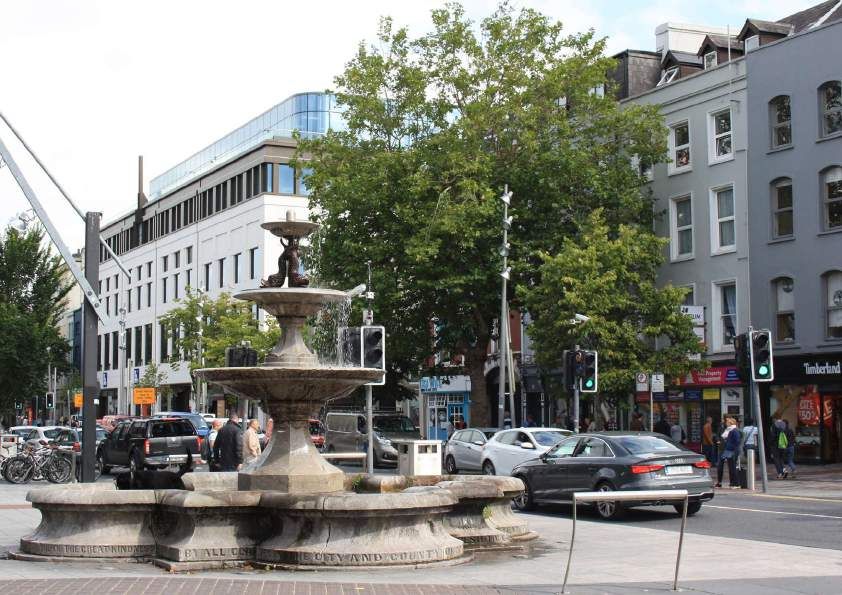
90 CORK METROPOLITAN AREA | TRANSPORT STRATEGY
The SDR will necessitate the upgrade of The over-arching objective of these The introduction of a congestion
the existing route and the creation of a roads is to reduce through traffic and to charge to enter the City Centre will be
new road link between Rochestown and facilitate walking, cycling, public transport considered during the lifetime of the
Sarsfield Road, via the Carrigaline Road, access and public realm improvements Strategy in line with public transport
Grange Road and Airport Road, and a in town and village centres. Similarly, improvements. Congestion charges are
proposed new link between the N27 and improvements to the road network at a useful demand management measure
Sarsfield Road with the potential to also Little Island should be designed with the that help to reduce air and noise pollution
link to the N71 via Lehanaghmore and Spur intention of prioritising walking and cycling and free-up space for pedestrians,
Hill. The SDR could also provide enhanced access particularly between the railway cyclists and public transport.
connectivity to Cork Airport with a potential station / bus services and employment
secondary access point. The road will destinations / residential areas. City Centre Movement Strategy
ultimately provide the basis for the Southern The Cork City Centre Movement Strategy
Outer Orbital bus route connecting The following UEAs will require local access (CCMS) outlines objectives to: improve the
Rochestown with CIT whilst also enabling and / or public realm improvements: vibrancy of Cork City Centre; to promote
interchange with radial bus routes. Midleton; sustained economic growth; to deliver
a much more attractive environment for
Carrigtwohill;
As with the Cork Northern Distributor Road, shoppers, visitors and tourists; and to help
the SDR will provide dedicated walking and Great Island including Belvelly new encourage sustained inward investment.
cycling infrastructure and support planned bridge (potentially bus only); Traffic management measures will be
residential development in the South Carrigaline; important to manage the flow of vehicles
Environs area. The SDR will support local Ballincollig; into the City Centre area.
transport access facilitating a reduction in
Dunkettle / Ballinglanna;
the N40’s use for local trips and its upgrade CCMS objectives included the
to motorway status. It is anticipated that Monard; and identification of a street hierarchy within
the SDR would be developed on an Stoneview. the City Centre to clearly identify the main
incremental basis. routes into and through the City Centre;
City Centre Traffic Management to maintain accessibility to the city centre
Whitegate and Marino Point off-street car parks; and to manage
Over the liftetime of the Strategy, there
The R624 (Cobh Road to Marino Point) access for deliveries.
will be a reduction of car travel to the
and the R630 (Midleton to Whitegate) road
City Centre island in line with increasing
network will require safeguarding in their A key objective is to deliver a more
recognition of the impacts of motorised
function and form to facilitate existing and efficient public transport system and
traffic and carbon emissions on the
future port related uses. to improve the reliability of existing bus
environment and people’s health. The road
services. The objectives also relate to
network within the City will be reviewed with
County Cork Urban Expansion Area pedestrians and cyclists where streets will
the aim of prioritising road space for public
Road Proposals be developed to provide a more pleasant
transport, walking and cycling provision.
The provision of additional road network and attractive shopping experience
infrastructure within the UAEs in Cork and a traffic management system that
Within CMATS, it is intended to create
County is required to support the encourages cycling in the City Centre.
a more attractive experience in the city
development of these areas. Local road
centre, while enhancing facilities for
network improvements in these areas will
pedestrians and cyclists, prioritising public
be designed to effectively accommodate all
transport, whilst still allowing access into
modes of transport.
off-street car parks and designating driving
routes into the city.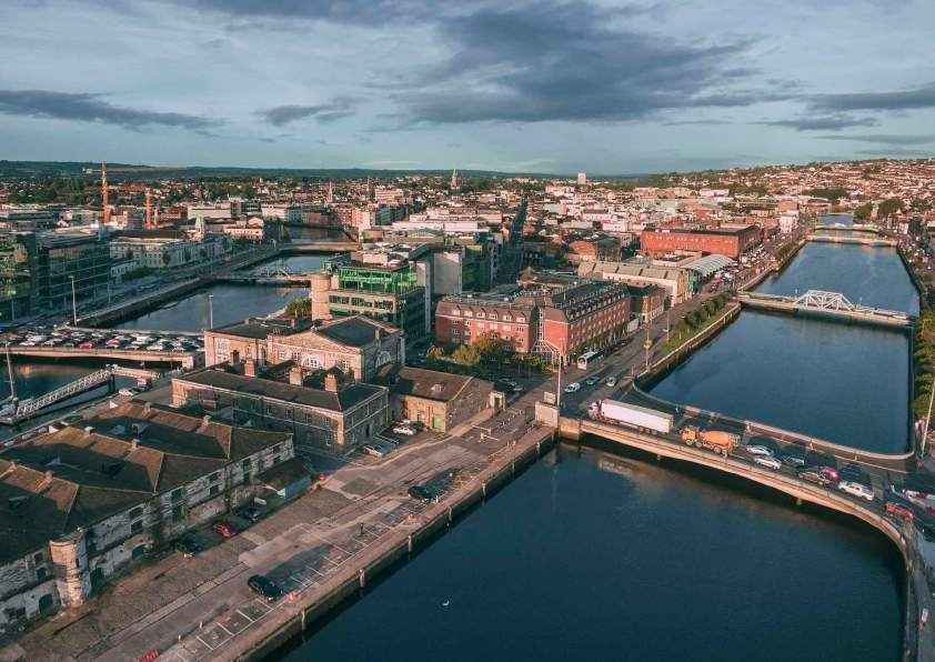
CORK METROPOLITAN AREA | DRAFT TRANSPORT STRATEGY   91

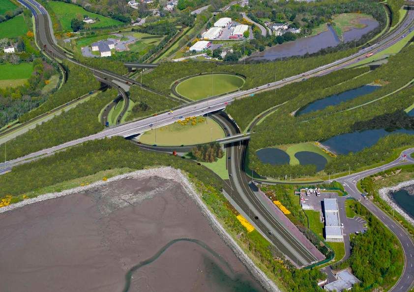
EXAMPLE OF DUNKETTLE INTERCHANGE UPGRADE
CORK METROPOLITAN AREA | TRANSPORT STRATEGY 93
CCMS as part of CMATS A more detailed analysis as part of the Bus lanes are proposed for Monahan’s
The CCMS will be implemented as part Local Area Plan (LAP) process is underway Road and segregated light rail transit is
of CMATS, modified as necessary to take to determine the appropriate level and proposed on Centre Park Road. Discreet
account of the CMATS proposals. Overall, phasing of bridge infrastructure. access points will be required from
CMATS will significantly increase the level Monahan’s Road. The number and form
of public transport provision and priority Docklands Bridge Infrastructure of these arrangements will be determined
above and beyond that proposed as part Cork City Council have proposed the as part of the LAP process.
of the CCMS. following infrastructure projects to connect
the North and South Docklands area while North Docklands Road Infrastructure
This includes continuous bus lanes and providing access to marine traffic: It has been proposed to realign Horgan’s
bus priority on all key public transport South Docklands Eastern Gateway Quay in the North Docklands area
approaches to the City Centre, as well Bridge; to remove car traffic from the quays
as increased bus lanes and priority and open-up quayside frontage for
Water Street Bridge; and
though the City Centre including the development. The re-aligned road will
adoption of bus priority measures on Mill Road Bridge. better tie-in with the new link to the
St. Patrick’s Street. reoriented Kent Station on Alfred Street
The Mill Road Bridge will be required to and a proposed bridge near Mill Road to
The route alignment of the proposed Light provide direct public transport, walking link directly to Kent Station.
Rail Transit (LRT) line will have a significant and cycling access to Kent Station. The
impact on traffic management proposals Eastern Gateway Bridge will provide a key Tivoli Access
within the City Centre. It is envisaged that multi-modal access to the South Docks Improved access to cater for public
the sections of the LRT alignment may which currently only has transport, pedestrians, cyclists and
also be shared with buses in some of the access from Victoria Road. general traffic is required to develop the
constrained areas of the city, particularly Tivoli Docks site as a new urban district,
Western Road, Washington Street, St. Further analysis is required to refine the following the relocation of Port of Cork
Patrick Street and MacCurtain Street. actual bridge layouts and locations in to Ringaskiddy.
each case.
Cork Docklands and Tivoli Docks A more detailed analysis as part of the
Bridge and Road Infrastructure South Docklands Road Infrastructure LAP process will be required to determine
Improved road and bridge connectivity to The key roads within the South Docklands the appropriate level of transport
Cork’s North, South and Tivoli Docks is area are Centre Park Road and Monahan’s infrastructure required including a
required to support the development of Road. Both roads will need to be potential eastern access.
these areas. The road and bridge network upgraded to accommodate increased
infrastructure will need to provide for demand by public transport, walking
multi-modal priority and prioritise and cycling.
movements for pedestrians, cycling and
public transport particularly in locations
closer to the city centre and Kent Station.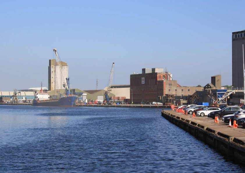
94   CORK METROPOLITAN AREA | TRANSPORT STRATEGY

     Heavy Good Vehicles (HGVs)
     and freight represent a key
     economic driver, moving
     goods throughout the CMA
     and nationwide.
CORK METROPOLITAN AREA | TRANSPORT STRATEGY 95
14 FREIGHT, DELIVERY & SERVICING
To meet NPF 2040 projections for Examine the potential for rail freight The relocation of port-related activity
The efficient movement Cork, construction of new homes, movement; from the city quays will be the first step
of goods is vital to our offices, social infrastructure and
places of education will require more
Requiring area-based construction, in freeing up significant tracts of strategic
brownfield development land to facilitate
competitiveness and movement of HGVs and lorries. Ireland
and delivery and servicing plans as
part of new development with a view to the sustainable growth of Cork City along
economic welfare. 65% is an export-led economy, and that consolidating deliveries where practical; suburban rail and light rail corridors. The
is reflected in increased demand for relocation of the Port of Cork, coupled
of our GDP is based on the development of improved access Re-timing freight trips to out-of-hours with the upgrade to the N28 to Motorway
the export of goods and routes to the Port of Cork- particularly wherever practicable; and standard (M28) will reduce some localised
services whereas the EU- in light of Brexit. Ensuring that delivery, servicing and HGV impacts within the city and reinforce
waste management trips are made as the transfer of strategic freight to the
25 average is 30%. Finally, at a city and metropolitan town green and quiet as possible through National Road Network.
scale, there will be a greater level of the use of zero or low emission vehicles
Smarter Travel - A Sustainable
delivery and servicing activity and waste such as electric vehicles or cargo bikes, As noted in the previous chapter, the R624
Transport Future
management due to economic activity and where appropriate. (Cobh Road to Marino Point) and the
changes in shopping habits. R630 (Midleton to Whitegate) will require
Both the Climate Action Plan and RSES safeguarding in their function and form
While presenting challenges in terms support the need to develop a freight to facilitate potential future expansion of
of increased trips, safety, congestion, strategy to accelerate the decarbonisation the Port of Cork’s activities in the Lower
air and noise pollution, the clustering of of the freight sector, integrate smart Harbour Area.
activities allied to an improvement in the technologies in logistics management
strategic transport infrastructure offers and reinforce the important role that the Heavy Good Vehicles
the possibility of innovative approaches strategic rail and road (including TEN-T) Heavy Good Vehicles (HGVs) and
to mitigate impact of freight activity in network play in efficiently moving freight. freight represent a key economic driver,
Cork. Over-arching objectives for the CMATS supports the development of moving goods throughout the CMA
management of freight movement include: this strategy in recognition of the need to and nationwide. Increased construction
Re-directing the through movement of decarbonise freight and the inter-regional activity will lead to an increase in the amount
freight from densely populated areas nature of the inter-regional nature of some of construction materials for example. HGV
and unsuitable local roads to the goods vehicle movements, especially as a movement can also have significant impacts
strategic road network; result of increased activity to and from the on traffic operations, noise, air pollution and
Port and Cork Airport as well as increased the safety of other road users, particularly
Examining the feasibility of consolidation development throughout the CMA.
centres and break-bulk facilities outside within urban environments.
of the national road network in the
Port of Cork Relocation HGV management proposals include:
medium term, to facilitate smaller
vehicles delivering to the City Centre; The relocation of the Port of Cork’s Implementation of HGV restrictions
industries and container terminal from the within the boundary created by the
City and Tivoli Docks area to Ringaskiddy N40 South Ring Road and proposed
is a long-standing objective for the region. Northern Distributor Road;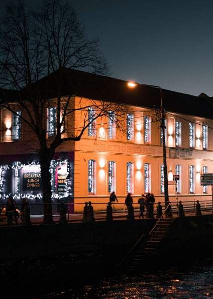
96 CORK METROPOLITAN AREA | TRANSPORT STRATEGY
HGV restrictions with Cork City Centre. Construction and Logistics reputation as an international quality food
The manner of implementation, Centres (CLCs) hub and its businesses and restaurants
enforcement, access routes and extent receive a large number of deliveries
The development of shared construction
of scheme should be determined at across the day to distribute fresh produce.
and logistics centres (CLCs) is a recent
a later stage between TII, the NTA, Personal delivery and waste management
trend in European cities projected to
stakeholders from the freight industry services will also exponentially increase
receive significant increases in population
and Cork City Council; as more people live in the CMA, creating
and construction activity in future years.
HGV restrictions in metropolitan town more congestion and air / noise pollution
CLCs are typically set-up near strategic
centres will be considered; and unless carefully managed. To off-set this, it is
development sites on sites adjacent to the
intended to:
Mobility management planning at key strategic road network to minimise travelling
freight locations such as the Port of distances for construction materials. Examine the feasibility of strategic
Cork to reduce the HGV impact on the consolidation centres and break-bulk
road network during peak periods. Developers are often required to sign facilities in proximity to the national
up to shared CLC centres as part of the road network in the medium term to
The restriction of HGVs from Cork City development management process. facilitate smaller, lower emission vehicles
Centre will improve the environment for Trips to and from construction sites are delivering to the city centre;
active modes and will improve safety, while minimised as HGVs with less than 80% Examine the case for urban or micro-
the regulation of delivery times can help occupancy will be held until fully occupied consolidation centres within Cork City
off-set local traffic congestion. and trips to construction sites can only take to reduce the number of last mile trips
The implementation of designated ‘lorry place through the use of a booking system. being made by motorised vehicles e.g.
routes’ on the national road network at The levels of development assigned to examining the case for cargo bikes
designated times of the day will help mitigate designated areas across the CMA would or small electric vans delivering to
delays and conflict with other modes. appear to justify the need for a number of restaurants and shops;
Whilst road user charging on the strategic construction and logistics centres. Require robust Delivery and Servicing
road network may be considered plans as part of an overarching
appropriate to discourage short trips, local The River Lee has long facilitated the Mobility Plan through the development
traffic, careful consideration should be movement and storage of freight and management process;
given to charging arrangements for HGVs. construction materials and offers an
obvious opportunity to reduce the need Examine the feasibility of out-of-hours
and length for motorised trips on the delivery and servicing through the use
road network. Rail based freight of low-noise vehicles and changes to
movement is also a possibility in the future planning conditions where appropriate;
but would likely necessitate a new link Minimise empty return trips by taking
between the relocated Port of Cork in inspiration from innovative practices
Marino Point and the Cork Suburban such as the Utrecht Cargohopper and
Rail network. Gothenburg’s Stadleveransen city delivery
system; and
Delivery and Servicing Support the placement of local ‘Click
and Collect’ facilities at rail stations,
Cork has a number of significant
new residential developments and
regeneration and employment areas that
Park and Ride facilities, to reduce the
will lead to an increase in delivery and
amount of individual personal deliveries
servicing needs. Taking one example, the
to workplaces and homes where the
Cork Metropolitan Area has a deserved
recipient is often absent.
CORK METROPOLITAN AREA | DRAFT TRANSPORT STRATEGY 97
CORK METROPOLITAN AREA | TRANSPORT STRATEGY 99
15 SUPPORTING MEASURES
Role of Supporting Measures Local Transport Plans (LTPs) Apart from street design, significant
A number of sustainable within CMATS Both local authorities should seek to improvements to the quality of design
transport projects will be A key principle for CMATS is to reduce translate the overarching outcomes and and layout of new development through
the development management process
delivered over the period dependency on the private car within the objectives through the use of area specific
Local Transport (Implementation) Plans- will be required to support the physical
CMA while increasing the attractiveness
to 2027, to provide of sustainable transport options. Another sometimes referred to as Sustainable infrastructure improvements outlined in
additional sustainable fundamental principle of the Strategy Urban Mobility Plans (SUMPs) at city or this Strategy.
Metropolitan town centre level.
travel options to is to support the future growth of the
CMA through the provision of an efficient
A quality built environment and street
complement increased transport network. Supporting measures These Plans should set ambitious and network (sometimes referred to as ‘Healthy
Streets’) typically encompasses a wide
capacity and faster have an important role to play in providing realistic targets to prioritise active and
range of indicators including traffic calmed
a future transport network that matches up sustainable transport mode shares that
higher quality public to these principles. The full benefits of the reduce local private motor trips over pedestrian and cycle environments, that
transport in the cities. significant investment that will be delivered the short, medium and long term. Cork includes safe street crossings, places of
County Council are currently progressing interest, accessibility to public transport,
under CMATS cannot be achieved
National Development Plan, 2018-2027 a LTIP at Little Island and envisage future activity, a low noise and air polluted
through the provision of infrastructure
LTPs for Carrigaline, Ringaskiddy, Midleton environment, and provision of essential
alone and must be combined with the
and other urban settlements. services and recreational facilities. Greening
implementation of measures that support
is also an indicator of a healthy city with
best use of that infrastructure.
Event Travel Plans should also be trees and green spaces providing multiple
considered for large trip-generating events benefits for the environment and people’s
The Strategy’s supporting measures will
such as match days and concerts, etc. health and wellbeing such as a reducing
be essential to the creation of physical,
to mitigate any negative impacts on the air pollution.
social and cultural environments where
walking, cycling and public transport are surrounding area and road network.
Universal design and Age-Friendly design
attractive, practical and logical alternatives
features such as tactile paving, dropped
to the private car. It will take a wide range Built Environment Measures
kerbs, street furniture, legible wayfinding
of supportive initiatives to: Urban Design and Place-making signage, permeable streets and public
Create communities that support There has been a change in emphasis in lighting should be included in public realm
sustainable transport; recent years to re-examine the role of our improvement schemes to ensure the
Improve public awareness and educate streets as places in their own right that accessibility of the outdoor environment
users on available options to help them support a wider range of functions than for all individuals. Other measures to
make the best choices; simply to facilitate the through movement ensure a positive perception of comfort
of traffic. Quality urban design is critical and safety can be effectively achieved
Prioritise sustainable transportation
to a sense of place and prioritises local through good urban design principles such
options; and
walking, cycling and public transport for as active ground floor uses and mixed-
Improve end to end trip facilities users of all abilities. use developments providing activity and
and integration.
passive surveillance.100 CORK METROPOLITAN AREA | TRANSPORT STRATEGY
CMATS supports the principles of Healthy Typically, effective behavioural change Workplace Travel Plans
Streets and Universal Design. programmes comprise of a highly Workplace Travel Plans, also known as
personalised approach aimed at engaging Mobility Management Plans, comprise a
Pedestrian and Cycle Wayfinding a group of people, making them think package of measures to promote / support
Wayfinding, or legibility, relates to how about their travel choices, providing them sustainable travel patterns. The Smarter
people can find their way around an with full information, and encouraging and Travel Workplaces Programme, managed
area. For pedestrians and cyclists this incentivising the use of alternatives. by the NTA, engages with larger employers
is of particular importance as they are The over-arching aim is to encourage in the CMA in the development and
more likely to move through an area if the people out of their private cars onto public implementation of Workplace Travel Plans.
route is clear, logical and easy to follow. transport and/or promoting the use of The Cork City and County Development
There are several wayfinding techniques active modes where feasible to do so. Plans include for Travel Plan requirements for
including architectural clues, surface new developments.
treatments, lighting, sight lines, and where There are a number of existing behavioural
appropriate, signage. The Design Manual change initiatives across the CMA Workplace travel planning provides
for Roads and Streets (DMURS) provides supported by the NTA and other sources. the opportunity to communicate the
guidance on wayfinding and is expected to These include the following: implementation of CMATS and to promote
be revised in the short term. Green Schools Travel; the benefits of the Strategy directly with
a large number of commuters. The
Workplace Travel programmes/ Mobility
Quality wayfinding techniques should be continuation and expansion of workplace
Management Plans;
employed alongside the delivery of the travel planning in the CMA will play an
improved walking and cycling networks. UCC’s Commuter Plan as part of its important role in delivering the behavioural
As outlined in the Walking section, the Green Camus initiative; change that is required to achieve the full
implementation of a quality wayfinding Transport and Mobility Forum’s ‘Mix benefits of CMATS.
techniques should not contribute to Your Mode’ supported through the EU’s
street clutter. The replacement of the BATTERI programme; and Smarter Travel Campus
existing finger post signage employed A number of workplaces including Smarter Travel Campus is a behavioural
in Cork should be replaced by a smart, Cork City Council and businesses in change programme encompassing actions
consistent wayfinding system along the the bio-pharma cluster at Ringaskiddy to encourage and support third level
lines of the Legible London system to are members of the NTA’s Smarter students and staff to walk, cycle, take public
benefit locals and visitors alike. Workplace Programme. transport or carshare on the commute
to campus. Smarter Travel Campus is a
Behavioural Change Programmes The Strategy supports the extension of the hands-on programme managed by the
A primary focus of this Strategy is to facilitate above programmes to cover more places NTA working with Third Level Institutions
a move to more sustainable forms of travel of education, shopping centres, hospitals, to implement campus travel plans. For
by advocating for much better integration and residential travel programmes as new example, UCC is an active Smarter Travel
of land use and transport and set out the housing development comes forward. Campus Partner Campus for a number of
physical infrastructure to enable the region Provision of dedicated cycling (and years and engage in initiatives during the
to do so. However, this will need to be walking) officers as the case in Dublin year to promote smarter travel.
supported at local level through behavioural City Council should be considered for
change initiatives (sometimes referred to as both local authorities in tandem with
‘soft measures’). improvements to the pedestrian and
cyclist network.CORK METROPOLITAN AREA | TRANSPORT STRATEGY 101
The Smarter Travel Campus programme
The availability of free can act as a supporting measure for
private parking at key CMATS by providing the opportunity to
communicate the implementation of CMATS
destinations has a and to promote the benefits of the Strategy
significant impact on the directly with the CMA’s third level population,
relative attractiveness of the particularly including those attending and
working in the large third level institutions,
private car versus sustainable UCC, CIT, St. John’s Central College and the
transport options. College of Commerce.
Walking and Cycling Officer Recent school building programmes have Establishment of a School ‘Cycle Bus’
London and Manchester have recently resulted in many new schools being built as in the case in Galway and Limerick;
appointed Walking and Cycling on greenfield sites at the edge of new Review of school opening and closing
Commissioners to act as a conduit between development areas, remote from existing times including consideration of
local authorities and key stakeholder residential catchments, with a resultant high staggered times in areas where there is
groups. At a minimum, the appointment of a level of dependence on car-based accessibility. a concentration of schools;
dedicated walking and cycling officer (similar In many cases, attempts to incorporate active
Review of bus routes, services and
to that of Dublin City Council) should be travel from the outset are undermined by a
times to serve schools with high car
considered to coordinate promotional events lack of adequate design provision for walking
mode shares;
between relevant stakeholder groups and to and cycling on the surrounding road network,
raise the profile of both modes. access arrangement and internal school Implementation of vehicle-restricted
campus layout. areas in the immediate vicinity of
School Travel Strategy schools;
Improving the quality and extent of school There are a number of land use planning Implementation of ‘No idling’ areas in
travel planning across the CMA is of critical and transport planning considerations relevant the immediate vicinity of schools to
importance to the achievement of modal to the provision of new schools and the reduce emissions created by stationary
shift, the improvement of public health and retrospective provision of walking and vehicles with engines running; and
reducing the impact of car-based journeys cycling infrastructure within the catchment A significant uplift in cycle parking
to school / linked trips to school and work. of existing schools: provision in primary and secondary
In simple terms, far too many children are The appropriate siting of schools. New schools.
driven relatively short distances to school. schools must be better integrated into
existing or planned new development CMATS recommends the further
Associated negative impacts relating to areas so as to optimise walking and investigation of this topic through a
this include the loss of opportunities to cycling catchments; comprehensive Cork Metropolitan Area
incorporate an element of active travel into School Travel Strategy.
Mandatory Travel Surveys and Travel
the journey to school, congestion and other
Plans for each school in the CMA;
public health and safety concerns relating As outlined in Chapter 6 (Walking), there
to the vehicular impact of school drop-off Review and targeted improvements to
are a number of best practice examples in
and collection. walking and cycling conditions in the vicinity
the field of school travel planning, including
of existing schools;
Edinburgh’s ‘School Streets’ programme
Identification of drop off areas for parents and Hackney Council’s ‘Safer Routes to
and school buses within walking distance School’ where lessons can be applied
of the school to facilitate Park and Stride in Cork.
campaigns or ‘Walking Buses’;102 CORK METROPOLITAN AREA | TRANSPORT STRATEGY
Green Schools Programme Electronic RTPI boards providing Driverless cars could potentially free up
Urban design that creates a Travel Module countdown information for public transport kerbside space as the requirement for on-
visually appealing urban Travel is the fourth theme of the Green- services in the immediate vicinity of large street residential and long-stay parking is no
Schools programme under which schools employers and third level educational longer required.
environment is often very prepare action plans to promote and campuses at a minimum, should be
conducive to encouraging increase the number of students walking, increased significantly as part of Travel Mobility as a Service
walking, cycling and public cycling, scooting, using public transport Plan implementation. Mobility as a Service (MaaS) is a concept
or carpooling on the way to school. The usually applied as an alternative to owning
transport. NTA works with An Taisce to oversee Marketing / Information Campaigns a private car to support urban living.
a school travel module as part of the Information provision and appropriate The concept typically involves the use of
Green Schools programme. The NTA has marketing are important factors that technology to support a mobility system
published a Toolkit for School Travel that can encourage people to use encompassing public transport, cycle hire,
presents a set of measures for use by sustainable modes. In delivering sustainable car clubs and taxis. MaaS transport solutions
schools to promote ways of reducing car transport improvements consideration have a transformative potential in promoting
use on the trip to and from school. should be given to branding, marketing, sustainable mobility.
advertising and using smart, creative, cost-
There is potential to extend the Green efficient campaigns targeted at increasing Transport services can typically be paid on
Schools Programme to all schools in and maintaining sustainable transport a subscription basis or on a Pay-As-You-Go
the CMA providing the opportunity to demand. Information campaigns should basis like the Leap card or London’s Oyster
communicate the implementation of be an integral part of CMATS delivery. This card. The Leap card in Dublin for example,
CMATS and to promote the benefits of could include for example, branding buses supports the use of Luas, bus, DART and in
the Strategy directly with the with key destinations on the route depicted more recent times, the Dublin Bike Sharing
school population. on the side, front-loading public transport Scheme and the GoCar car club scheme.
and walking and cycling information on Carpooling databases and apps are also
Real Time Passenger visitor information packs ahead of directions becoming more popular as a useful tool to
Information Systems for destinations by car. facilitate carpooling for commuters. MaaS will
also be a useful tool in land use planning to
Real Time Passenger Information (RTPI)
provides accurate information on actual Embracing Technology for support car free or low car developments near
Sustainable Transport public transport hubs and provide access to a
departure and arrival times, enabling
Technological advancements offer an car without owning one when needed.
passengers to more efficiently plan their
trips and the public transport operator to opportunity to respond to some of the
issues outlined in the Strategy and will Smarter Mobility
maintain or improve performance. The
become more prevalent over the lifetime The application of Intelligent Transport
NTA is currently providing a RTPI service
of the Strategy. Virtual parking and Systems (ITS) to the transport network will
for bus passengers in Cork City.
advanced booking of loading bays can increase the efficiency of its operation. ITS
assist companies make deliveries on time, represents the evolution of traffic management
RTPI signs are located where they will
reducing congestion and conflict. from a static unresponsive activity to a
provide information to the greatest
Autonomous vehicles, or driverless cars, dynamic responsive activity that can adapt to
number of bus passengers and to include
could potentially provide an opportunity to the ever-changing traffic conditions as they
as many main routes as possible. All
improve safety, with cars programmed to are presented in real time. This is facilitated
Bus Éireann stops are included on the
obey traffic regulations and speed limits and through the rapid collation and analysis of
website, smartphone Apps and SMS
geofencing preventing them from entering performance data which allows for swift
phone services.
certain spaces. informed decision making.CORK METROPOLITAN AREA | TRANSPORT STRATEGY 103
This technology can be investigated further
in Ireland to minimise conflict for competing
demands for limited road space and to
reduce search traffic and local congestion.
Autonomous Vehicles
Autonomous Vehicles (AVs), or driverless
cars, may potentially provide an opportunity
to improve safety, with cars programmed
to obey traffic regulations and speed limits
and geofencing preventing them from
entering certain spaces. Driverless cars
could potentially free up kerbside space as
the demand for on-street residential and
long-stay parking is no longer needed.
Smart Mobility measures could include: Furthermore, a third of round-trip car club
Expanding the Urban Traffic Control; members reported that they would have However, autonomous vehicles are not
bought a private car had they not joined considered as a substitute for walking,
Application of Variable Speed Limits;
a car club meaning a deferred purchase cycling and public transport. There are
Installation of a Bus Priority System; of a further 22 cars per car club vehicle. a number of outstanding legislative,
Use of dynamic parking systems; and Vehicles operated by car clubs also tend legal and technical issues in relation to
Smart delivery and servicing systems - to be greener than private cars as vehicles autonomous vehicles and their impact on
including pre-booking of delivery bays. are updated more frequently. Recent active travel and public transport.
developments in the car club market in
Car Clubs Europe, including the availability of point- Though outside of the scope of this
Car clubs are a growing area in Ireland to-point electric car clubs (such as the Strategy, both the NTA and local
with the long-established GoCar that Autolib in Paris) and one-way or ‘floating’ authorities will need to assess, legislate
operates nationwide, recently being joined car clubs such as the DriveNow and Zipcar and monitor benefits presented by the
by the YUKO car club in Dublin. Car clubs Flex, mean that these options are likely to advent of shared use Autonomous
can be an important tool in facilitating become more prominent in Ireland in the Vehicles likely to present themselves in the
car-free or low-car development in urban short to medium term and can play a role in first half of the Strategy timeframe. This
areas, providing access to a car for facilitating lower private car ownership. assessment will need to measure their
residents without the on-going expense of relevance against over-arching objectives
owning one. Dynamic Parking Systems or Virtual to promote more
Loading Bay Systems active travel, promote equitable transport
There is credible evidence to suggest that To support a more efficient use of kerbside and to reduce congestion, pollution and
the increased availability of car clubs leads space, urban areas in Europe have street clutter.
to a reduction of private car ownership. begun trialling smart technology including
A recent survey undertaken in London dynamic on-street parking models and Waterborne Transport
(Carplus, 2016) suggests that 10.5 private virtual loading bays, recouping costs by Waterborne transport may perform a role
cars are removed from London’s roads charging for vehicles to use this service. for facilitating certain movements and
for each car club vehicle, due to the users support of the Strategy. It is envisaged that
disposing of their own private cars. these will come forward and be delivered
on a commercial basis.104 CORK METROPOLITAN AREA | TRANSPORT STRATEGY
CORK METROPOLITAN AREA | TRANSPORT STRATEGY 105
16 IMPLEMENTATION
Costs and Funding Any changes in the proposed land use Suburban Rail
The success of the The overall cost of the Strategy is distribution however, must be consistent
Short Term:
National Planning approximately €3.55 billion (2018 prices), with the principle of Public Transit Oriented
Development (PTOD) CMATS is a live Provide through running of suburban rail
Framework depends on and its delivery will be subject to the
availability of funding. It is acknowledged document, subject to periodic review. services through Kent Station between
East Cork and Mallow;
its policy reflection and that each of the major elements of CMATS
Appropriate oversight arrangements will Include Mallow within Leap Card discount
programme delivery will require to be appraised individually on
be put in place for periodic monitoring of range to promote commuting trips by rail;
its own merits, in terms of feasibility, design,
at national, regional and planning, approval and funding. Business the progress on the Strategy’s outcomes Develop new stations in tandem with land
local level. cases will be required for each of the major such as integration of land use distribution use, and provide passing loops and platform
infrastructure proposals included in the and sustainable transport provision, mode improvements as required; and
National Planning Framework 2040 Strategy, in line with the requirements of the share, and air quality.
Undertake Review of Suburban Rail Network
Public Spending Code and the Common to determine level of upgrades and new
Appraisal Framework. In the event of population and employment
stations required.
growth earlier than anticipated than specific
forms of public transport infrastructure will Medium Term:
Phased Implementation
need to be brought forward as required
A phased implementation plan has been Increase the number of commuter services
for example, the light rail transit (LRT)
developed that incrementally builds to 3 trains per hour between both Midleton
or provision of specific Park and Ride
the transport infrastructure, services and Cobh, and Kent Station, subject to
facilities. The scalability of the public
and investment over time to align with sufficient demand/usage;
transport infrastructure means that planned
the continued growth of the CMA. The frequencies can also be revised upwards Increase the number of through running
Strategy’s timeline is cognisant of the to meet growing demand. Examples of services to Mallow to align with increase in
NDP, and aligned with the RSES. The this include: suburban rail services;
implementation plan has disaggregated the An additional platform at Kent Station will be
Light Rail frequency moving from a
strategy implementation timeframe into: required on the outer shunt line to facilitate
planned 5 minute headway to 2 minutes;
Short Term: 1-7 years; increased through running services, without
Cork Suburban rail running every 5
Medium Term: 7-12 years; and impacting on the operation of the Inter-City
minutes;
services;
Long Term: 12-20 years. Increase in the frequency of Bus
Signalling improvements are likely to be
Connects services; and
CMATS however is intended to be scalable, required at Glounthaune Junction and at
Provision of high quality pedestrian Kent Station; and
flexible and future-proofed enough to meet
and cycling infrastructure in advance of
changes in population and employment Develop new stations in tandem with land
Docklands development.
growth. use, and provide passing loops and platform
improvements as required.106 CORK METROPOLITAN AREA | TRANSPORT STRATEGY
Long Term: Provision of walking, cycling, public Douglas Road and South Douglas
Further increase the number of transport bridge near Mill Road to link Road Corridor;
commuter services up to 6 trains per Cork South Docks and Kent Station to N20 Mallow Road Corridor;
hour between both Midleton and Cobh, support development.
Summerhill North / Ballyhooly Road
and Kent Station; Corridor;
Medium to Long Term:
Increase the number of through running Hollyhill (Apple Campus) to City
services to Mallow up to 6 trains per hour Design, planning and implementation of
Centre; and
to align with increase in suburban rail the Light Rail Transit along the East-
West Corridor; Dunkettle to City Centre
services;
In order to meet this service increase, a There is potential for the phased
Medium Term:
double track between Glounthaune and implementation of the Light Rail system
with Kent Station, Pairc Úi Chaoimh, Completion of Cork based BusConnects
Midleton is required. In the long term the
and Cork Institute of Technology as network, including bus radial, cross-
completion of all stations and associated
potential phased termination points; and city and orbital bus services, priority
infrastructure such as passing loops,
measures and supporting measures.
platform improvements, etc. is required; The phased increase of service
and frequency and capacity can also be
Long Term:
Long term consideration for the delivered, depending on the level of land
use development and intensification, On-going operation and optimisation
electrification of commuter rail lines
and associated light rail costs. of the bus network routes and
between Mallow, Cobh and Midleton.
priority measures.
Light Rail Bus Network Cycling Network
Short Term: Short Term: Short to Medium Term:
Further develop, design and implement
The identification and protection of Development and completion of
BusConnects network for Cork based on
an alignment for the light rail scheme, the primary and inter-city cycle
CMATS network.
allowing development consolidation network, including the flagship ‘Lee
along the corridor; to Sea Greenway’ from Ballincollig to
Prioritisation of the following bus network
Design, planning and implementation of Crosshaven;
corridors in the short term:
interim high frequency bus service route Audit of cycling infrastructure throughout
East-West interim bus corridor following
and bus corridor priority measures along Cork City involving all relevant
Light Rail corridor alignment;
alignment of Light Rail is required to stakeholders;
serve the East-West Corridor Demand in Align implementation of the cycling
the Short to Medium Term; and network with the implementation of the
BusConnects network;
Feeder network and permeability review
LRT
to be undertaken and implemented; and
Further cycle network implementation
aligned with new development
Cork City Council Black Ash Park & Ride Comhairle Cathairle Chaorcaí opportunities and traffic calming.
Long Term:
Completion of secondary and Greenway
cycle network.CORK METROPOLITAN AREA | TRANSPORT STRATEGY 107
Walking Network Road Network Long Term:
Short to Medium Term: Short Term: Provision of Cork North Ring Road
Completion of the Cork Walking Strategy Completion of the Dunkettle Interchange (CNRR);
recommendations; Upgrade to remove significant bottleneck Ongoing review, monitoring and
Walkability audit of Cork City involving all on strategic network; implementation of National Road
relevant stakeholders; Completion of the Cork City Centre network demand management
Movement Strategy (CCMS), with a view measures; and
Align implementation of improvements
to the walking network with the to further developing the public transport Ongoing development of the regional
implementation of the BusConnects priority measures outlined within CMATS; road network to provide sustainable
network; Ongoing development of the regional access to development lands.
Ongoing maintenance and renewal of road network to provide sustainable
Funding and Operational Costs
footpaths, urban realm improvements and access to development lands;
Aside from capital investment the
walking network provision; and Appraisal and development of both
implementation of the Strategy will
A CMA-wide programme of improvement Northern and Southern Distributor
incur and on-going operational costs.
of walking access to public transport. Roads; and
A significant proportion of capital
Appraisal of Northern Ring Road (NRR) investment will require Exchequer funding
Long Term: as part of N/M20 Cork-Limerick Road. from Central Government, however other
Ongoing maintenance and renewal of sources of supplementary funding will be
footpaths, urban realm and walking Medium Term: required. These are likely to include but
network provision. Completion of the M28 Cork – not be limited to;
Ringaskiddy Motorway to provide Loans from the European Investment
improved access to Port of Cork and Bank (EIB) to fund feasibility and start-
Parking
industry in Ringaskiddy; up costs for public transport;
Short term
Ongoing review, monitoring and Development contributions for strategic
Design, Planning and Land acquisition implementation of National Road network public transport infrastructure based
for all strategic Park and Rides; demand management measures. on floorspace;
Prioritise Park and Ride at Dunkettle; Provision of bridge access for walking,
Site-specific development
Implement residential parking zones cycling, public transport and traffic
contributions, for example for footpath
across city and metro towns; and access to Cork South Docklands to
widening, real
support development.
Development of Mobility Hubs in time information boards or extension to
Ongoing development of the regional
regeneration areas. the Cycle Hire Scheme; and
road network to provide sustainable
access to development lands; Future levies imposed for congestion,
Medium Term safety or air quality reasons- e.g.
Completion of Northern Distributor Road;
Delivery of all BusConnects Park and workplace parking levies, road user
Ride Facilities; and Completion of Southern Distributor Road; charging, parking zones, or parking
Implement parking zones in new Ongoing review, monitoring and levies on out-of-town shopping centres.
residential areas. implementation of National Road network
demand management measures; and
Long term Ongoing development of the regional
Delivery of all remaining Park and road network to provide sustainable
Ride sites. access to development lands.108 CORK METROPOLITAN AREA | TRANSPORT STRATEGY
SHORT TERM MEDIUM TERM LONG TERM
A phased implementation Timeframe UP TO 2026 UP TO 2031 UP TO 2040
plan has been developed Cork Suburban Rail Network
Through Running at Kent Station
that incrementally builds the Increase service frequency to 3tph from Midleton and Cobh
transport infrastructure, services Kent Station Platform Improvements
and investment over time to Bypass loops at new stations on line north of Kent Station
Mallow platform improvements
align with the continued growth Cobh platform improvements
of the CMA. New Rail Stations (as required by land use development)
Dual Track to Midleton
Increase service frequency to 6tph from Midleton and Cobh
CMATS is designed to be Electification
scalable to meet changes in Purchase of Rolling Stock
population and employment Light Rail
Route Alignement Reservationand Interim Bus route
growth as needs arise as Interim Bus Service O&M
well as availability of funding. Planning and Design of LRT
Appropriate oversight Construction and Implementation of LRT
Bus
arrangement will be put in place Bus Network Implementation
for periodic monitoring reports Park & Ride
of delivery and progress. New Park & Ride Sites
Cycling
Primary Network
Secondary Network
Feeder Network
Inter Urban
Greenways
Walking
Footpaths and Walking Provision
Road Network
North & Southern Distributor Roads Appraisal
Delivery of both NDR & SDR
Apprasial of Northern Ring Road (NRR)
Delivery of NRR
Dunkettle Interchange
M28 Cork to Ringaskiddy Motorway
M20 Cork to Limerick
Delivery of Cork Distributor Roads
N27
N40 Demand Management
Docklands and Tivoli Road Network and Bridges
Regional Roads
Operation and Maintanance
Parking Management
Integration & ITSCORK METROPOLITAN AREA | DRAFT TRANSPORT STRATEGY 109
110 CORK METROPOLITAN AREA | TRANSPORT STRATEGY
CORK METROPOLITAN AREA | TRANSPORT STRATEGY 111
17 ENVIRONMENTAL PROTECTION
AND MANAGEMENT
Regulatory Framework for Freshwater pearl mussel catchments; Potentially feasible corridors within
Environmental Protection and Natural Heritage Areas and proposed which infrastructure could be
Management Natural Heritage Areas; accommodated will be identified and
these corridors assessed. The selection
In implementing this Strategy, the Authority Areas likely to contain a habitat listed in
of the preferred route corridor will avoid
will cumulatively contribute towards – in Annex 1 of the Habitats Directive;
constraints and meet opportunities to
combination with other users and bodies Un-designated sites of importance to the optimum extent, as advised by the
- the achievement of the objectives of the wintering or breeding bird species of relevant specialists; and
regulatory framework for environmental conservation concern;
protection and management, including In addition to the constraints identified
Entries to the Record of Monuments above, site-specific field data may be
compliance with EU Directives -
and Places and Zones of Archaeological required to identify the most
including the Habitats Directive (92/43/
Potential; appropriate corridors.
EEC, as amended), the Birds Directive
(2009/147/EC), the Environmental Entries to the Record of Protected
Impact Assessment Directive (2011/92/ Structures; Stage 2 – Route Identification,
EU, as amended by 2014/52/EC) and Architectural Conservation Areas; and Evaluation and Selection
the Strategic Environmental Assessment Relevant landscape designations. Potentially feasible routes within the
Directive (2001/42/EC) – and relevant preferred corridor will be identified and
transposing Regulations. Corridor and Route Selection assessed. The selection of preferred
routes will avoid constraints and meet
Process for Relevant New
Lower-Level Decision Making opportunities to the optimum extent,
Infrastructure as advised by the relevant specialists,
Lower levels of decision making and
The following Corridor and Route Selection taking into account project level
environmental assessment should
Process will be undertaken for relevant information and potential mitigation
consider the sensitivities identified in
new infrastructure: measures that are readily achievable;
Section 4 of the SEA Environmental
Report, including the following: In addition to the constraints identified
Stage 1 – Route Corridor
Special Areas of Conservation and above, site specific field data may be
Identification, Evaluation and
Special Protection Areas; required to identify the most appropriate
Selection
routes; and
Features of the landscape that provide Environmental constraints (including
linkages/connectivity to designated sites In addition to environmental
those identified in Section 4 of the SEA
(e.g. watercourses, areas of semi-natural considerations, the identification of
Environmental Report) and opportunities
habitat such as linear woodlands etc); route corridors and the refinement of
(such as existing linear infrastructure)
route lines is likely to be informed by
Salmonid waters; will assist in the identification of possible
other considerations.
Shellfish waters; route corridor options;You can also read


