Real Time Bus Location and Data Administration System
←
→
Page content transcription
If your browser does not render page correctly, please read the page content below

International Journal for Research in Applied Science & Engineering Technology (IJRASET)
                                                                            ISSN: 2321-9653; IC Value: 45.98; SJ Impact Factor: 6.887
                                                                            Volume 7 Issue IV, Apr 2019- Available at www.ijraset.com

  Real Time Bus Location and Data Administration
                      System
                                Rajeshree Pawar1, Amit Patil2, Manoj Yadav3, Sayali Shinde4
                                            1, 2, 3, 4
                                                         Computer Science, Shivaji University

Abstract: The massively populated states in the country needs an efficient and the effective transportation system for public use.
Public bus transportation is one of important and widely used transportation system. The android application developed for this
system with the use of other technology simplifies the transportation for travellers and management people as well. Tracking the
real time location and updating the data in the timely manner on the application advances the use of application.
Keywords: Administration, Latitude, Longitude, Google map API, real-time data update

                                                      I. INTRODUCTION
There is no real time information available about the government buses at the bus depot. Not the exact location of the buses is
known to the depot at particular time. Passengers need to wait for the bus without any knowledge. There is allot waste of time. The
depot management also fails to confirm the bus location. The movement of Bus Transport is always affected by various conditions
such as congestion, unexpected delays, and incident. The real time location tracking will help to the management and passengers as
well. The application will contains dynamic and updating data about the bus schedules and their running paths, departure and arrival
time. Use of advanced technology enhances the reliability of the database of the proposed system and can eliminate the drawbacks
of existing system document is a template.

                                                        II. RELATED WORK
An Manish Chandwani, Bhoomika Batheja, Lokesh Jeswani, Praveen Devnani, Prof. Richard Joseph (Computer Engineering,
VESIT, India) “Real Time Bus Tracking System”, proposed a location tracking system using Google map API and system is an
Android application that gives necessary information about all the buses travelling in Mumbai. The platform chosen for this kind of
system is android, reason being Android Operating System has come up on a very large scale and is owned by almost every second
person. As more and more applications of android operating system is developed day by day on large scale ever since it is advent. [1]
Manini Kumbhar, Meghana Survase, Pratibha Mastud, Avdhut Salunke Final Year Students of Department of Computer
Engineering SBPCOE, Indapur .Asst. Professor Shrinivas Sirdeshpande,Asst. Professor of Department of Computer Engineering
SBPCOE, Indapur, Pune(SPPU), Maharashtra, India “Real Time Web Based Bus Tracking System”, the relevant information
regarding all the bus numbers going from users source & destination along with the route details , real time location. Generally our
system is operated by GPS which is attached with the bus. Firstly GPS receives the satellite signals and then the position co-
ordinates with latitude and longitude are determined by it. The location is determined with the help of GPS and transmission
mechanism. After receiving the data the tracking data can be transmitted using any wireless communications systems.[2]
Prof. Seema Vanjire, Unmesh Kanchan, Ganesh Shitole, Pradnyesh Patil “Location Based Services on Smart Phone through the
Android Application”, The idea of using the mobile handsets and phones is to deliver the valuable services. Location-based services
or LBS refer to ‗a set of applications that exploit the knowledge of the geographical position of a mobile device in order to provide
services based on that information.‘ Location based services (LBS) provide the mobile clients personalized services according to
their current location. They also open a new area for developers, cellular service network operators, and service providers to develop
and provide value-added services: advising clients of current traffic conditions, providing routing information, helping the users to
find nearby shopping malls. [3]
Mihir Garude Department of Electronics Engineering, Nirmal Haldikar Datta Meghe College of Engineering, Airoli. “Real Time
Position Tracking System Using Google Maps API V3”, Firstly GPS based system that tracks the current location of the bus and the
passenger to calculate the distance between the two. Also tracks the real time speed of the bus. Secondly the prediction system,
which calculates the average velocity of each segment from the data that captures the historical trends of traffic on the basis of
different attributes like segment, day, time, volume of traffic and crossings in the segment. The proposed system is based on the
client server technology, which consists of two types of client side application and the server side. The drawbacks of both the parts
have been taken into account during development. Two client side applications are Bus Module and Passenger Module.[4]

 ©IJRASET: All Rights are Reserved                                                                                                       366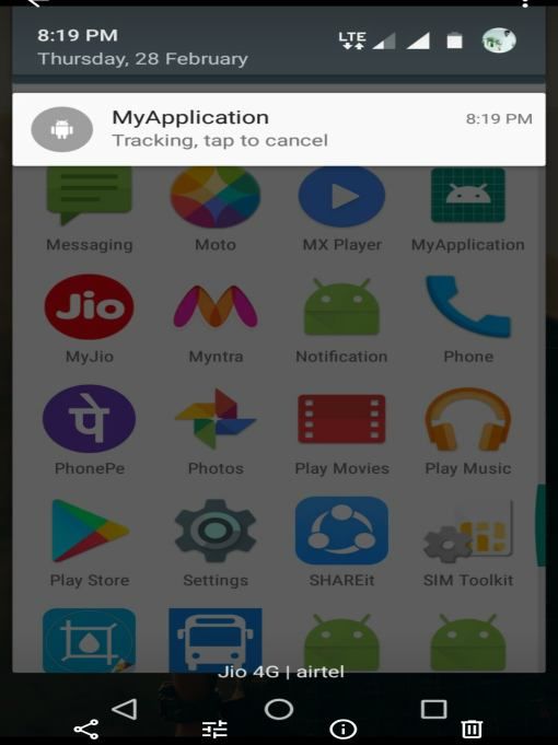
International Journal for Research in Applied Science & Engineering Technology (IJRASET)
ISSN: 2321-9653; IC Value: 45.98; SJ Impact Factor: 6.887
Volume 7 Issue IV, Apr 2019- Available at www.ijraset.com
P.Madhu Bala S.Sivaraman,Assistant Professor Paavai Engineering College ,Namakkal “GPS Based Bus Tracking System”, the
Vehicle Sensor Networks (VSN) are emerging as a new tool for effectively monitoring the physical world, especially in urban areas
where a high concentration of vehicles equipped with on board sensors is expected.A vehicle tracking system combines the
installation of an electronic device in a vehicle, or fleet of vehicles, with purpose-designed computer software at least at one
operational base to enable the owner or a third party to track the vehicle’s location, collecting data in the process from the field and
deliver it to the base of operation.[5]
Md. Palash Uddin [1], Md. Zahidul Islam [2], Md. Nadim[3] “GPS-based Location Tracking System via Android Device” The
purpose of system design is to create a technical solution that serves both the user and the admin. The system should be designed in
such a way that is very flexible to use for both the administrator and the user. The preparation of the environment needed to build
the system, the testing of the system and the migration and the preparation of the data that will ultimately be used by the system are
equally important. In addition to designing the technical solution, system design is the time to initiate focused planning efforts for
both the testing and data preparation activates. The Location Based Tracking System is a real life problem solving application. Both
the admin section and the user section are designed in such a way that both parties enjoy the facilities of the application. [6]
III. EXISTING SYSTEM
Applications developed for location tracking of the buses are mostly for private bus providers or some school or institute buses and
some travel agencies. This systems or apps are not for global use and do not used by public transportation system of any city of the
country. Unreliable bus transportation is actually national problem, especially in areas where there is no option for public bus
transport like local railways and such areas are main under consideration.
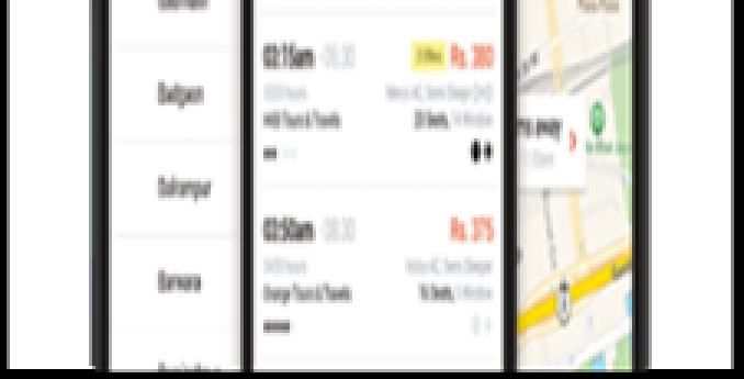
Fig 1. APSRTC and Red bus application
A. The existing applications like red bus, APSRTC, where’s the bus, etc. asks the users for pick and choose their bus from multiple
options by an operator that fits your schedule and payments 0r choose a bus based on fellow customer feedback and ratings for
each operator.
B. The applications has to be operated by multiple operators and hence operators should be registered at application administrative
system. These operators are limited and available in major population areas. So these existing applications are meant for
business and marketing schemes.
C. These applications provide facilities like seat reservation, cancellation, emergency accident alert system. Entertainment
resources, bus distance and timing schedules which can be not so much important aspects than real-time location tracking using
Google map API provided my our proposed system.
©IJRASET: All Rights are Reserved 367
International Journal for Research in Applied Science & Engineering Technology (IJRASET)
                                                                        ISSN: 2321-9653; IC Value: 45.98; SJ Impact Factor: 6.887
                                                                        Volume 7 Issue IV, Apr 2019- Available at www.ijraset.com

                                                 IV. SYSTEM ARCHITECTURE

                                               Fig 2.Architectural diagram of System
The Proposed System Has Three Modules

A. Transport Tracker Module
B. Firebase Unit For Administration System
C. The Display App

1) Transport Tracker Module

                                     Fig. 3. Transport Tracker Module Running In Background
This is android application running in background on a mobile device which is to be governed by the Conductor and Driver of the
travelling bus system who will start and stop the trip from one bus station to another bus station. It will help the firebase to store
latitude, longitude, timestamp, accuracy, altitude of the bus unit and will keep updating for every 10 sec of time interval and storing
the data in firebase. Only the driver and conductor of the bus unit will be provided access to this module and administrator at bus
depot will check location updates in firebase console.

 ©IJRASET: All Rights are Reserved                                                                                                        368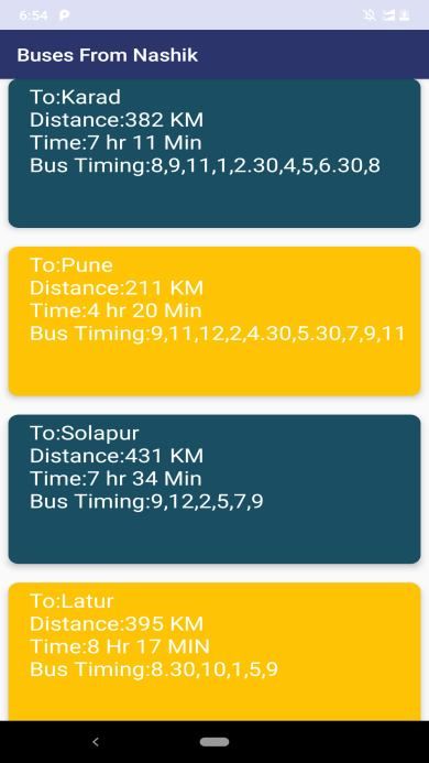
International Journal for Research in Applied Science & Engineering Technology (IJRASET)
                                                                      ISSN: 2321-9653; IC Value: 45.98; SJ Impact Factor: 6.887
                                                                      Volume 7 Issue IV, Apr 2019- Available at www.ijraset.com

2) Firebase Unit For Administration System: It is a central control for the administrator which can trace out all kinds of bus
   activities, location details along with data analysis in the firebase as a database system
a) Firebase: Firebase is a backend platform for building Web, Android and IOS applications. It offers real time database, data
   storage, user authentication, static hosting, Performance, crash reporting, different APIs, multiple authentication types and
   hosting platform, Google Analytics, Cloud Storage and much more.
b) Administrator: An Administrator is provided with proper Login Id and password other than firebase Login Id and password
   which will display the map with marker for every bus location in the Display App. The firebase can also be accessed using
   Gmail login and password from Display App.
c)   Backend: The backend is built with JavaScript, JSON, Node.js which tracks and stores Latitude and longitude of each bus
     location in the Firebase console which is real-time Database and keeps updating the marker for every 10 seconds for every
     single bus.

                                   Fig. 4. Storing Longitude and latitude For a Single Bus Unit

                                        Fig. 5. Auto-Updating Of Location for Each Bus

                                    Fig. 6. Storing Different Locations for Multiple Bus Units

 ©IJRASET: All Rights are Reserved                                                                                                 369
International Journal for Research in Applied Science & Engineering Technology (IJRASET)
ISSN: 2321-9653; IC Value: 45.98; SJ Impact Factor: 6.887
Volume 7 Issue IV, Apr 2019- Available at www.ijraset.com
3) Display App: A Remote user module i.e. end user with real-time bus location, bus arrival and departure time and all the bus
information. It will also be provided with login and password for Administrative department of bus depot which will be able to
get known the bus location for every single bus with Google map. The “Track-O-Bus” android application uses various
techniques for location tracking of bus using Google map API’s without using any physical IOT models like sensor, arduino etc.
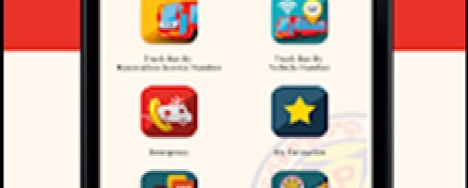
4) Components of Display App: A Display is app that displays and stores the vehicle information, snapped to the map API which
provides real-time data synchronization to the backend i.e. Firebase database and also static information and Graphical User
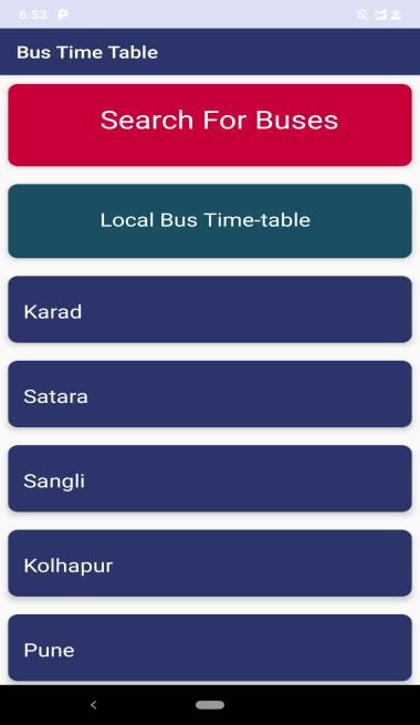
Interface for end users who can access the application for Bus informative. The application consists of different card views
which consists of different information about basic GUI, bus time-table, distance from one station to another station. It also
consists of district-wise more than 20 district bus time tables, bus availability for every 24 hour time interval.
Fig. 7.GUI for “Track-0-Bus”
Fig. 8.Bus Time-Table with Bus Details
5) Displaying .Map: It is a web interface that displays vehicle locations and schedule information. The android application uses
the Maps JavaScript API to display a styled map showing the bus locations and routes. It displays every single bus with proper
marker to each bus location and keeps changing for each 10 seconds for each bus location. The map for each bus location is
accessible only to the administrator of bus depot who will be provided with proper login and password other than firebase login
Id and password provided by the depot.
a) The whole map activity with marker for each bus location is provided in the Display App with a particular authentication for
administrator. The administrator can also login for Firebase using this Display app.
©IJRASET: All Rights are Reserved 370
International Journal for Research in Applied Science & Engineering Technology (IJRASET)
                                                                                   ISSN: 2321-9653; IC Value: 45.98; SJ Impact Factor: 6.887
                                                                                   Volume 7 Issue IV, Apr 2019- Available at www.ijraset.com

                                                         V. FUTURE SCOPE
The application can be further developed to web application and cloud can be used for data storage. To increase level of security in
the transportation system camera can be used. . It will help to monitor the crimes that happen now a days which is witnessed by
common people every day. This would prove a major breakthrough in reducing the crime rates. Also, with use of motion sensors the
speed of the bus can be calculated. Reservations of the seats in the buses and also payment options will be future development part
of the application. For analysing the data collected on the server data analysis can be used with machine intelligence concepts.

                                                          VI. CONCLUSION
The system improves the effectiveness and overall performance of existing transportation without any extra hardware deployment. It
is having low cost maintenance and wide future scope. With the implementation of the project, a complete track can be kept of the
buses. This system also throws a light on the frequency of the buses on the same route. The features of this systems are the efficient
usage of time, real time and updating information on the availability of buses, route congestion acknowledgment, and commuter
satisfaction. Real-time location tracking of the bus, continuously updating data of the bus time table and estimation of departure and
arrival time of the buses are main expected outcomes of this application.

                                                 VII.     ACKNOWLEDGMENT
We would like to give the special thanks to the computer science engineering department of the college DACOE HOD Prof. Ashish
N. Patil and project guide Prof. Sayali P.Shinde to have their guidance. We are also thankful to the technologies that we have used
to have such format of paper.

                                                                   REFERENCES
[1]   Manish Chandwani, Bhoomika Batheja, Lokesh Jeswani, Praveen Devnani, Prof. Richard Joseph(Computer Engineering, VESIT, India) “Real Time Bus
      Tracking System” IOSR Journal of Engineering (IOSRJEN) Volume 14, PP 24-28.
[2]   Manini Kumbhar, Meghana Survase, Pratibha Mastud, Avdhut Salunke Final Year Students of Department of Computer Engineering SBPCOE, Indapur .Asst.
      Professor Shrinivas Sirdeshpande,Asst. Professor of Department of Computer Engineering SBPCOE, Indapur, Pune(SPPU), Maharashtra, India “Real Time
      Web Based Bus Tracking System” International Research Journal of Engineering and Technology (IRJET) Volume: 03 Issue: 02 Feb-2016.
[3]   Prof. Seema Vanjire, Unmesh Kanchan, Ganesh Shitole, Pradnyesh Patil “Location Based Services on Smart Phone through the Android Application”
      International Journal of Advanced Research in Computer and Communication Engineering Vol. 3, Issue 1, January 2014.
[4]   Mihir Garude Department of Electronics Engineering, Nirmal Haldikar Datta Meghe College of Engineering, Airoli. “Real Time Position Tracking System
      Using Google Maps API V3” International Journal of Scientific and Research Publications, Volume 4, Issue 9, September 2014.
[5]   P.Madhu Bala S.Sivaraman,Assistant Professor Paavai Engineering College ,Namakkal “GPS Based Bus Tracking System”
[6]   Md. Palash Uddin[1], Md. Zahidul Islam[2] , Md. Nadim[3] “GPS-based Location Tracking System via Android Device” International Journal of Research in
      Computer Engineering and Electronics.
[7]   https://developers.google.com/maps/solutions/transporttracker/
[8]   https://codelabs.developers.google.com/codelabs/realti me-asset tracking/index.html?index=..%2F..%2Findex
[9]   https://firebase.google.com/

  ©IJRASET: All Rights are Reserved                                                                                                                           371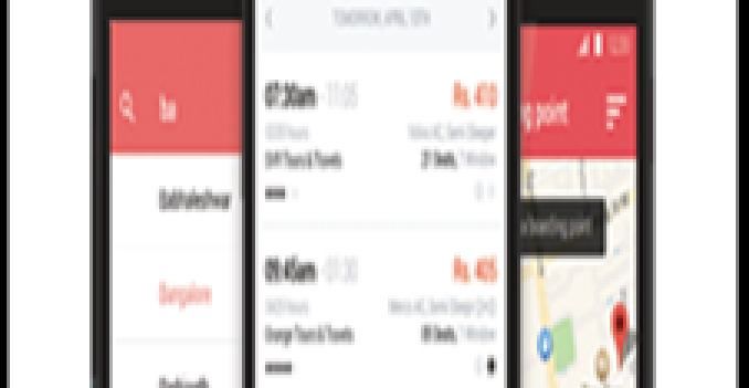
You can also read