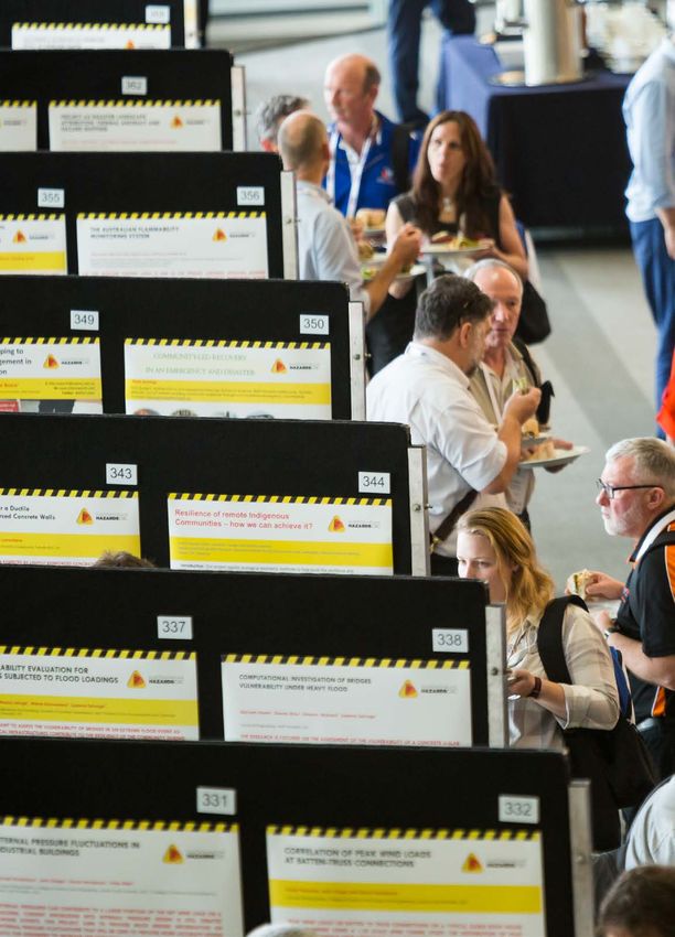
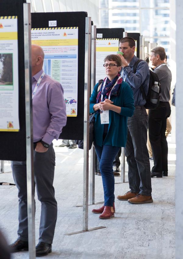
Research Posters Promoting key research fi ndings of the Bushfi re and Natural Hazards CRC - Bushfire & Natural Hazards CRC
←
→
Page content transcription
If your browser does not render page correctly, please read the page content below
Research
Posters
Promoting key research
findings of the Bushfire
and Natural Hazards CRC
 @bnhcrc bnhcrc.com.au
© 2021 Bushfire and Natural Hazards CRC
Publisher: Bushfire and Natural Hazards CRC
Report no. 664
May 2021
 The Bushfire and Natural Hazards Cooperative
All photographs are credited to the Bushfire and Research Centre advises that the information
Natural Hazards CRC unless otherwise noted. contained in this publication comprises general
 statements based on scientific research.
All material in this document, except as identified below,
 The reader is advised and needs to be aware
is licensed under the Creative Commons Attribution-
 that such information may be incomplete or
Non-Commercial 4.0 International Licence.
 unable to be used in any specific situation.
Material not licensed under the Creative Commons licence: No reliance or actions must therefore be made
 on that information without seeking prior
• Bushfire and Natural Hazards CRC logo
 expert professional, scientific and technical
• Department of Industry, Science, Energy and Resources logo
 advice. To the extent permitted by law, the
• Cooperative Research Centres Program logo
 Bushfire and Natural Hazards CRC exclude all
• All photographs
 liability to any person for any consequences,
• All figures and graphics
 including but not limited to all losses, damages,
• All organisation logos
 costs, expenses and any other compensation,
All rights are reserved in content not licenced under the arising directly or indirectly from using this
Creative Commons licence. Permission must be sought publication (in part or in whole) and any
from the copyright owner to use this material. information or material contained in it.
INTRODUCTION

Since 2013, the Bushfire and A prominent and engaging take-away for attendees of each
Natural Hazards CRC has hosted an feature of the conference was conference’s Research Forum.
annual conference in partnership the collection of research project The 2020 annual conference was
with the Australasian Fire and and PhD program posters. cancelled due to COVID-19, so
Emergency Service Authorities this poster book, the seventh in
Council, following a similar 10-year Each year, around 100 the poster book series, presents
partnership with the Bushfire CRC.
 posters were displayed all the final research posters from
This presented the CRC with an the CRC’s research program.
opportunity to demonstrate the
 that summarised the This collection summarises much
latest science and lessons learned topics, methodology and of the CRC’s research and is an
 invaluable contribution to the
on issues of most relevance to all
conference attendees. Each year
 key findings from across better understanding of natural
 hazard science in our community.
the conference was in a different the student and research
state or territory, as well as New It is supported by three other end-
Zealand, and attendees came from
 cohort at the CRC. of-CRC publications: Highlights
a diverse range of fields, including and Achievements 2013–2021,
 This offered a simple but effective Hazard Notes 2013–2021 and
the emergency management and
 way to help researchers explain their Postgraduate Research. These are
response sector, governments of
 findings clearly and concisely to an all available on the CRC’s website.
all levels, research organisations
 audience beyond their usual networks.
and universities, volunteer The posters are also available
organisations, community and To ensure that the posters lived on, within the themes on the
health organisations, fire technology they were collected into an annual CRC’s Driving Change website:
industries and the general public. poster book each year – a feature www.bnhcrc.com.au/driving-change.

 Introduction 1
CONTENTS

 DISASTER RESILIENCE 21 Understanding the need for, availability of,
 and interpretation of information by the
 6 The Australian Disaster Resilience public during large scale hazard events
 Index Dashboard K Akers
 M Parsons, J Boshoff, I Reeve 22 Through Children’s Eyes: Disaster Risk
 7 Recovery Capitals (ReCap) Reduction Education for Children,
 L Gibbs, D Johnston, P Quinn, D Blake, with Children and by Children
 E Campbell, J Richardson M Rashid, JC Gaillard, K Ronan,
 Q Alam, B Towers
 8 Mapping community engagement
 for preparedness in Australia
 K Johnston, B Ryan, M Taylor
 EXTREME WEATHER
 24 Impact-based forecasting for the
 ECONOMICS, MITIGATION coastal zone: East Coast Lows
 AND VALUE H Richter, C Arthur, D Wilke, B Ebert,
 M Dunford, M Wehner
 10 Improved decision support for 25 Improved predictions of severe weather:
 natural hazard risk reduction The meteorology of the Tathra bushfire
 G A Riddell, H van Delden, H R Maier, D Wilke, J Kepert, K Tory, P Fox-Hughes
 R Vanhout, A C Zecchin, G C Dandy
 26 Improved Predictions of Severe
 11 The Economics of Natural Hazards Weather: Ember Transport
 V Florec, A Rogers, A Hailu, D Pannell J Kepert, W Thurston, K Tory
 12 Disasters and Economic Resilience: 27 Real-time trial of the Pyrocumulonimbus
 The income effects of Cyclone Oswald Firepower Threshold: A prediction tool
 on Small Business Owners – a case study for deep moist pyroconvection
 on the Burnett River Catchment Area K Tory, J Kepert
 M Ulubasoglu
 28 Improving Flash Flood Response Outcomes
 13 Urban Form and Disaster Rick Reduction: Through Emergency Warnings and Improved
 Developing Performance Criteria for Regional Forecasting Techniques
 Urban Areas Exposed to Flooding K Robinson, S Corney, P Fox-Hughes,
 A March, S Kabir, K Davidson, G Mocatta, C White, J Bennett, C Irvine,
 L Nogueira de Moraes F Ling, L Roberts, C Velasco-Forero
 14 The Value of BNHCRC Research
 J Handmer, A Keating, K Strahan
 FIRE PREDICTIVE SERVICES
 EDUCATION AND 30 ACCESS-Fire: a case study
 M Peace, J Greenslade, J D Kepert, H Ye
 COMMUNICATIONS 31 Dynamic wind reduction factor in
 16 Flood Risk Communication predicting fire rate of spread
 M Taylor, M Tofa, K Haynes M Rashid, J Hilton, D Sutherland, K Moinuddin

 17 Adding Colour and Icons to 32 Fire surveillance and hazard mapping
 Emergency Warning Messages K Reinke, C Engel, S Jones
 D Greer, P Dootson, S Miller, V Tippett 33 Predicting live fuel moisture
 18 Comprehensive School Safety: content using soil moisture
 A participatory approach to school bushfire P Fox-Hughes, V Kumar, I Dharssi, M Yebra
 emergency management planning 34 Incorporating firebrands and spot fires into
 M Henry vorticity-driven wildfire behaviour models
 19 Advancing public health in the context J E Hilton, N Garg, J J Sharples
 of natural hazards: normalising 35 Flammability of live plants, do we
 preparedness within a framework of need a new testing approach?
 adapted Protection Motivation Theory A Filkov, T Miller, T Penman
 R Westcott
 36 Physics based simulations of grassfire
 20 Nurturing to avoid nature: The influence propagation on sloped terrains;
 of personality traits and cultural upslopes and down slopes
 worldview on floodwater driving J Innocent, D Sutherland, N Khan, K Moinuddin
 S Benjamin, A Lykins, M Parsons

2 Research Posters

37 Recovery strategies of Eucalyptus 54 “Time to find those ‘hidden’ Bininj structures,
 delegatensis subsp. Tasmaniensis after they are not hidden and EM gotta connect with
 the 2016 fires in Central Tasmania us!”: A pathway for effective community level
 D Rodriguez-Cubillo decision-making for emergency response
 B Sithole, O Campion, R Bununggurr,
38 Characterising smoke emissions from the 2013
 C Brian, S Sutton with ARPnet Team
 Eucalyptus forest fire in Southern Australia
 M N Ndalila, G J Williamson, D M J S Bowman 55 Scenario Planning for Remote Community
 Risk Management in northern Australia
39 Effect of spot fires and topography on fire rate
 J Russell-Smith, K K Sangha, A C Edwards
 of spread: Combustion tunnel experiments
 M Storey, O Price, M Almeida, C Ribeiro, 56 Women Caring for Country on the Frontier
 R Bradstock, J J Sharples K van Wezel
40 Coupling Litter and Soil Moisture Dynamics
 for Surface Fine Fuel Moisture Content
 Forecasting-Field Experiment INFRASTRUCTURE AND IMPACT
 L Zhao, M Yebra, A I J M van Dijk, G Cary
 58 Benefit-Cost Analysis of Retrofitting Older
41 Physics-based simulation of firebrand and heat
 Australian Houses for Windstorms
 flux on structures in the context of AS3959
 K Parackal, M Wehner, H Ryu, J Ginger,
 A Wickramasinghe, N Khan, K Moinuddin
 D Henderson, M Edwards
 59 Improving flood forecast skill
 using remote sensing data
FUTURE WORKFORCE A Wright, V Pauwels, J Walker, S Grimaldi, Y Li
43 Emergency volunteering 2030: 60 Retrofitting Strategy for Limited Ductile
 a sector-wide snapshot Reinforced Concrete Buildings in Australia
 B McLennan R Alazem, E Lumantarna, N Lam, S Menegon
44 Closing the research-practice gap 61 Parametric Study on the Mass of a Free-
 C Owen, N Krusel, L Bethune Dropped-Hammer on Dynamic Response
 of a Reinforced Concrete Beam
45 Divergent Thinking and Brain Plasticity
 M Nasim, S Setunge, T Maqsood
 B Brooks, S Curnin
 62 Fragility analysis of bridges
46 Diversity and inclusion: building
 subjected to extreme waves
 strength and capability
 I Qeshta, M J Hashemi, R Gravina, S Setunge
 C Young, R Jones, B Rasmussen,
 N Maharaj, F MacDonald
47 Enabling sustainable emergency volunteering
 P Dunlop, M Gagné, A Luksyte, D Kragt,
 MANAGING THE LANDSCAPE
 D Holtrop, H Muhammad Farid
 64 Fuels3D
48 Managing Non-Technical Skills in Teams B Hally, M Robey, S Hillman, L Wallace,
 C Bearman, P Hayes K Reinke, S Jones, S Ramsey
49 Enabling sustainable emergency volunteering 65 From hectares to tailor-made
 B McLennan, P Dunlop, J Chong, M Gagné, solutions for prescribed burning
 D Kragt, H Muhammad Farid, H Clarke, B Cirulis, T Penman,
 M Griffin, A Luksyte, L Bethune O Price, M Boer, R Bradstock
50 Service use and help-seeking experiences 66 Optimisation of fuel reduction burning
 of Australian first responders with regimes for carbon, water and vegetation
 mental health conditions T Bell, M Possell, D Pepper, D Parnell, S Karunaratne,
 W Rikkers, D Lawrence M Yu, M Gharun, M Neumann, M Adams
51 Teamwork in night fire aviation 67 Suppression Firing Prevalence & Practice
 C Owen H Simpson, R Bradstock, O Price

INDIGENOUS INITIATIVES POLICY, POLITICAL ENGAGEMENT
53 Hazards, Culture and Indigenous Communities
 AND INFLUENCE
 J Weir, T Neale, W Smith, E Daly,
 69 Implementing disaster resilience policy
 D Freeman, T McNaught, A Atkinson,
 in the Australian Federation
 M Bourke, A Leavesley, A Galpin
 S Hunt

 Contents 3

4 Research Posters
Disaster
Resilience
Disaster Resilience

 FINDINGS

 The Australian Disaster Resilience Index is a snapshot of
 the capacities for disaster resilience in Australian
 communities. A dashboard will help communities,
 governments and industry explore the index and
 understand the factors that influence disaster resilience
 around Australia.

 The Australian Disaster Resilience Three levels of insight.

 Index Dashboard
 Melissa Parsons1,2, Johan Boshoff3, Ian Reeve1
 1 Institute for Rural Futures, University of New England, Armidale
 2 Bushfire and Natural Hazards CRC, Victoria
 3 UNE-CASI (Computation, Analytics, Software, Informatics), University of New England, Armidale

 Developed by the University of New England and the Bushfire and Natural Dashboard design.
 Hazards CRC, the Australian Disaster Resilience Index dashboard is free to use
 and allows anyone with an interest in understanding the resilience of their
 local community to access this information. The dashboard was released
 in July 2020.

 Introduction
 The Australian Disaster Resilience Index is a snapshot of the capacities for disaster resilience in Australian
 communities. Understanding these capacities, and how they differ from place to place, will help communities,
 governments and industry work together to cope with and adapt to natural hazards such as bushfires, floods,
 storms and earthquakes.

 Who might use the index?

 What is disaster resilience and how does the index assess it?
 Disaster resilience is the capacity to prepare
 for, absorb and recover from natural hazards,
 and to learn, adapt and transform in ways
 that enhance these capacities in the face of
 future events. Disaster resilience arises from
 many social, economic and institutional
 capacities and the mix of these capacities in
 a community conveys how well it is
 positioned to absorb and adapt to natural
 hazards. The dashboard shows how these
 capacities for disaster resilience are
 distributed across Australia, and the factors
 that enhance or constrain disaster resilience
 in different communities.

 For more information, please email
 melissa.parsons@une.edu.au

 © 2020 Bushfire and Natural Hazards CRC bnhcrc.com.au

 6 Research Posters
Disaster Resilience
 OUTPUTS

New evidence-based guide to
disaster recovery

Recovery Capitals (ReCap) Community Capitals Framework
Prof Lisa Gibbs1, Prof David Johnston2, Phoebe Quinn1, Dr Denise Blake2, Emily
Campbell2, John Richardson3
1 Universityof Melbourne, Victoria
2 Massey University, Wellington
3 Australian Red Cross

The Recovery Capitals (ReCap) project applies a Community
Capitals lens to disaster recovery to increase understanding about
the interacting influences of social, built, financial, political, human,
cultural and natural capital on people’s wellbeing. Through end user-
oriented action-research, ReCap provides evidence-based
guidance through the production of a range of resources in different
formats that suit different needs and cultural perspectives.

 Figure 1: ReCap model adapted from the
Introduction resources have been designed based on
 Community Capitals Framework1
 the needs and perspectives expressed by
Disaster recovery processes are highly the end-users of this project.
complex, presenting challenges in how to
achieve holistic and inclusive approaches
when working with people and
 Outputs
communities. ReCap aims to produce ReCap is producing a series of resources
resources to help address these challenges. that will be in different formats to suit Guide to Post-Disaster Recovery Capitals
It is a collaboration between researchers, different needs, with versions tailored to
government and non-government both Australia and Aotearoa New Zealand.
agencies, and end-users from Australia and The pilot Australian edition of the first of
Aotearoa New Zealand. these – the ‘Guide to Recovery Capitals’
 (Fig. 2) – was released in July 2020 and can
Methods be found at
 https://www.redcross.org.au/recap.
The first step in the project was to develop
a framework to guide our approach to
reviewing relevant evidence and
 Next steps
developing recovery resources. The The ReCap project is still in progress. The
Community Capitals Framework1 was taken ‘Guide to Post-Disaster Recovery Capitals’
as the starting point for the ReCap is being adapted into an Aotearoa New
framework. Drawing on the practice Zealand edition, and both versions are
expertise of end-users and additional being distributed to end-users who will pilot
academic knowledge, this was developed it and provide feedback about feasibility,
into multidimensional approach to disaster appropriateness and usefulness. The
recovery that considers people, development of the complete set of Figure 2: Cover image of the first resource
geographies and temporality, while resources continues. produced through the ReCap project
interweaving issues of access, equity, and
diversity (Fig. 1).
Detailed evidence mapping against the
ReCap framework was undertaken using
previous research conducted by the
 For more information, please email
academic teams and collaborators. 1Flora, C., Flora, J., & Fey, S. (2004). Rural Communities:
 phoebeq@unimelb.edu.au Legacy and Change (2nd ed.). Boulder, CO: Westview
Key findings and considerations arising from
the evidence were then distilled, and Press.

 © 2020 Bushfire and Natural Hazards CRC bnhcrc.com.au

 Disaster Resilience 7
Disaster Resilience

 FINDINGS

 Building capacity to prepare: A
 generative model of community
 engagement for preparedness

 Mapping community
 engagement for
 preparedness in Australia
 Kim A Johnston1,2, Barbara Ryan 1,3, Maureen Taylor 1,4,

 1 Bushfire and Natural Hazards CRC, Victoria
 2 Queensland University of Technology
 3 University of Southern Queensland
 4 University of Technology Sydney

 Community preparation for disaster response has been empirically established as a key
 factor in mitigating risk associated with disasters. Although community engagement is
 used widely to support communities to build capacity to prepare, approaches to
 engaging a community have varied widely, with few frameworks empirically built or
 evaluated for effectiveness. This qualitative study of 30 emergency management
 agencies and practitioners, and thematic analysis of agency policy documents,
 investigated current approaches to community engagement to develop a model to
 help communities mitigate risk. Drawing together key concepts from natural hazard
 behaviour research, community development, participatory design and codesign, a five
 step Generative Model of Community Engagement for Preparedness is proposed, based
 on relationships, networks and shared meaning. The model has both theoretical and
 practical value for community engagement for risk personalisation and protective action
 because it not only helps communities prepare for emergencies but also helps build
 Figure1: Generative model of community engagement for preparedness
 relationships across communities that create social capital for recovery and during
 nonemergency periods.

 Introduction Results
 Community preparation in disaster response has been empirically established
 as a key factor in the protection of life during a disaster (Coles et al, 2018; Attributes of a best practice approach to CE for preparedness include:
 Gibbs et al., 2015). Risk management plans identify a clear role for Awareness and understanding of risk, recognition of self-responsibility, and
 collaborative engagement with local communities (Heath & Lee, 2016) the notion that preparation within a community is widely held as desirable
 Community engagement (CE) enhances social outcomes through and valued. Attributes of a CE for preparedness program should feature
 community decision making (Johnston et al, 2018) however, little is known • Community led
 about what makes a CE program for preparedness effective, and what are • Co-design and community development
 the attributes of a best practice approach to CE for preparedness. This study • A relational approach
 addresses this gap and establishes a framework for CE best practice. • Recognises the importance of community networks
 Methods The model – titled the Generative Model Of Community Engagement For
 A two-stage qualitative research design featuring 1) semi-structured Preparedness, (Figure 1) reflects and represents a synthesis from current
 interviews (N=30) and 2) document analysis, was undertaken between Oct Australian CE for preparedness practice (interview data and document
 2018 to Jan 2019. Empirical and grey literature was used to build an interview analysis) and responds to the principles of practice that prefaced successful
 guide. Data were thematically analysed and coding into core topics CE. The model details aims of each step, with an accompanying toolkit of
 (Glaser, 1992) while the second analytical stage applied an inductive tactics and monitoring/evaluation tools aligned to each step.
 analysis.
 Discussion
 The findings of this study support a high-level commitment by emergency
 agencies to engaging with the community in order to save lives and property
 For more information, please scan the QR code for project through risk identification and action. The model brings together the core
 documents and publications or email the researchers: features and benefits of a common understanding, language and practices
 used for CE for preparedness in Australia and around the world. There are
 kim.johnston@qut..edu.au four key theoretical and practical implications of the findings of this study for
 Barbara.ryan@usq.edu.au CE for preparedness, including systematising sharing of knowledge, the
 maureen.taylor-1@uts.edu.au importance of localised approaches, the challenge of shared responsibility,
 and systematising evaluation.

 © 2020 Bushfire and Natural Hazards CRC bnhcrc.com.au

 8 Research Posters
Economics,
Mitigation
and Value
Economics, Mitigation and Value

 UNHARMED

 A flexible approach to
 understanding and planning risk
 reduction for different hazards
 and from different perspectives
 Improved decision support for natural hazard risk reduction
 Graeme A. Riddell1,3, Hedwig van Delden2,3, Holger R. Maier1,3, Roel Vanhout2, Aaron C. Zecchin1,3,
 Graeme C. Dandy1,3.
 Gawler River UNHaRMED Mitigation Planning - GRUMP
 1 School of Civil, Environmental & Mining Engineering, The University of Adelaide, South Australia, Australia
 2 Research
 Working with the Gawler River Floodplain Management Authority, its 6 constituent councils and the
 Institute for Knowledge Systems, Maastricht, the Netherlands Department for Environment & Water’s Fire and Flood team we have been assessing structural and
 3 Bushfire and Natural Hazards CRC, Victoria, Australia
 non-structural risk reduction options against different scenarios of economic and population
 development in the floodplain.
 The project has developed a tool for pro-active disaster risk assessment and reduction The results are to be used to build the business case for investment in improved flood defences and
 planning – UNHaRMED. It is based on two driving principles: to develop a more strategic, long-term approach to understanding and reducing flood risk in a
 1. Prevention is better than cure – “It’s better to build a fence at the top of a cliff, than key development area to the north of Adelaide. Risk assessment has included assessing the direct
 damage to buildings, roads, and agriculture, along with indirect impacts due to service disruption
 park an ambulance at the bottom.” Helen Clark. Challenges: where to build it, how following flood events. Below are results for damages per return period and expected annual
 high, how much does it cost…? damage (EAD) plotted spatially and against time.
 EAD 2018 - Baseline
 2. Tomorrow’s risk is being built today. We must therefore move away from risk Implementing a floodway in
 the circled area reduces the
 assessments that show risk at a single, present point, and move instead towards risk 1in50 year damage from
 assessments that can guide decision makers towards a resilient future. GFDRR (2016) 1in500 $98million to $73million and
 2060 2040 2018 the expected annual damage
 (EAD) from $7.3million to
 $6.4million
 The software is designed to 1in200

 explore risk into the future,
 modelling hazard, exposure 1in100

 and vulnerability to provide EAD 2018: $7.3 million
 decision-relevant risk metrics. It 1in50
 EAD 2018 - Floodway
 EAD 2040: $7.9 million Maps of
 is designed with the inputs from
 EAD per
 over 50 organisations across 1in20 EAD 2060: $9.2 million hectare
 Australia. across the
 - 100 200 300 400 500 600
 floodplain
 The following highlights some of Damage (AUD 2018) Millions

 the applications of UNHaRMED Baseline scenario of changing risk due to economic
 in the last year. and population growth in the floodplain.
 UNHaRMED User Interface showing hazard and exposure maps and
 All results shown are indicative. vulnerability functions.

 Exercise ForeThought: State Strategic Mitigation Exercise – Coastal Flooding & Climate change and bushfire risk - Victoria
 Climate Change Working the Bureau of Meteorology we explored the impact of climate change on
 A two-day exercise was run with stakeholders from across State, and Local Governments, along with private sector extreme fire weather to better understand potential impacts into the future. Using the
 representatives and NGOs to better understand and plan for sea-level-rise (SLR) and coastal flooding in Port Adelaide. BARRA reanalysis dataset we looked at the difference in fire behaviour on the 95th
 percentile weather between 1990-1995 and 2010-2019. This was to better understand the
 The discussion exercise was designed to better plan mitigation activities by taking a multi-agency perspective and
 change that has already happened. These are plotted below.
 exploring different scenarios of SLR, population growth and risk reduction actions.
 UNHaRMED was used to model these different scenarios and help stakeholders visualise, understand and quantify the 1990-1999 We also considered the difference in losses to
 trade-offs between different actions. The first day provided a foundation for the group of 50 participants to understand buildings between these two scenarios.
 how the risk was changing before day 2 demonstrated the costs and benefits of different mitigation actions. This assessment was also used as the basis for
 understanding and modelling future climate
 As the project sponsor, SAFECOM is pleased to have had projections, not shown here. These results have
 participants from across State and Local Government, critical fed into several assessments for a range of
 infrastructure providers and NGOs contributing real-life input into organisations.
 the practical application of the UNHaRMED tool in the Port
 Adelaide coastal flooding scenario.

 This collaboration facilitated complex discussions that highlighted 2010-2019
 the need for interconnected planning across agencies and
 sectors to achieve effective mitigation that also take into
 account the social acceptability of proposed solutions.

 Participants agreed that the flexibility of the UNHaRMED tool
 allows it to be easily applied to different hazards and geographic
 areas, limited only by the availability of access to appropriate
 data.

 Brenton Keen, Director Emergency Management Office, Difference in losses from 95th percentile event
 SAFECOM. Fire behavior from 95th percentile weather between 1990-1999 and 2010 - 2019

 We would like to thank the many organisations
 and individuals we have worked with in both
 developing and applying UNHaRMED. This work
 would not have been possible without their
 contributions.

 For more information, please email
 holger.maier@adelaide.edu.au

 © 2020 Bushfire and Natural Hazards CRC bnhcrc.com.au

 10 Research Posters
Economics, Mitigation and Value
ECONOMICS 101 FOR THE EMERGENCY MANAGEMENT SECTOR

A free online course on the economics
of natural hazards to help practitioners
become enthusiastic and effective
utilisers of economic analysis.

The Economics of Natural Hazards Selected images
Veronique Florec1,2, Abbie Rogers1,2, Atakelty Hailu1,2 and David
Pannell1,2
1 Bushfire and Natural Hazards CRC, Victoria
2 The University of Western Australia, Western Australia

 This free online course on the economics of natural hazards
 will help natural hazard managers build their skills and
 understanding in the core economics concepts and
 models that are relevant to natural hazards management.

Rationale Potential outcomes
Emergency management agencies do These are some of the potential
not necessarily collect their data with outcomes for participants and the
strategic economic analyses in mind. sector as a whole: Above: Economic concepts are explained in simple terms in
Because of this, there can be • Improved ability for natural hazard the videos.
inconsistencies and holes that make managers and decision makers to
the carrying out of economic analyses frame decision-making problems
difficult. There is a need for a shift in appropriately, choose the
thinking among agencies collecting appropriate economic tools to
data, to ensure that the data are useful define and compare options and
for economic analyses and source and utilise relevant data.
management decisions. In addition, • Improved ability for researchers and
economic analysis of natural hazards students to choose the best tools
can be complex, and there is a lack of and approaches for economic
economics capacity in the sector. analyses of natural hazards and their
 management.
Aims • Increased economic capacity within
 the emergency management
The information presented in the course sector.
will allow natural hazard managers to • Improved data collection and more
become enthusiastic and effective data available useful for conducting
utilisers of economic analysis, be able economic analyses.
to interpret and use the results of
economic analysis appropriately,
understand the importance and For more information, please email
challenges associated with intangible veronique.florec@uwa.edu.au
values, and understand more broadly Above: Hand-made graphs and drawings help explain the
the data requirements for particular concepts presented in an engaging and entertaining way.
types of economic analyses.

 © 2020 Bushfire and Natural Hazards CRC bnhcrc.com.au

 Economics, Mitigation and Value 11
Economics, Mitigation and Value

 FINDINGS

 Small business owners in the
 Burnett River catchment area
 suffered income losses of $21,005
 following Cyclone Oswald 2013.

 Figures
 Disasters and Economic Resilience: The
 income effects of Cyclone Oswald on
 Small Business Owners – a case study on
 the Burnett River Catchment Area
 Mehmet Ulubasoglu1,2
 1 Bushfire and Natural Hazards CRC, Victoria
 2 Deakin University, Victoria

 Introduction
 From 22 to 29 January 2013, Category 1 ex- Discussion
 tropical Cyclone Oswald, depicted in Figure 1, While the estimated income losses appear to be Figure 1: Cyclone Oswald Path
 moved across parts of Queensland and New large, they are plausible considering the wide-
 South Wales, causing severe storms, flooding and scale devastation to important infrastructure
 tornadoes with most of the devastation felt in the (including ports and water treatment facilities),
 Bundaberg and North Burnett regions. The that agricultural small businesses are heavily
 flooding events associated with Cyclone Oswald represented in these areas, and that agricultural
 that occurred in this region present a unique losses alone in North Burnett and Bundaberg
 opportunity to causally investigate the impacts of were estimated at $265 million (Queensland
 a major disaster on small businesses in a regional Government, 2018a).
 community with an important agricultural base.
 As 98% of Australian businesses are small These would have had knock-on effects on other
 businesses, this study provides a layer to dissect sectors in the region. They are also consistent with
 disaster resilience and recovery on an important the low capacity for disaster resilience of the
 section of the community and workforce. Burnett River catchment area, as assessed by the
 CRC’s ANDRI project.

 Method This finding supports a key insight from our
 Using the ABS Census Longitudinal Dataset (2006, Queensland Floods 2010-11 report (Ulubasoglu
 2011, 2016) and the ‘difference-in-differences and Beaini, 2020), in which we identified three
 methodology, the research explores the income possible channels through which disaster-
 effects of Cyclone Oswald on small business induced economic shocks can be transmitted to
 owners residing in the four Burnett River individuals, vis-à-vis income. These are: owning a
 Catchment local government areas (LGAs) business, working in sectors whose economic
 depicted in Figure 2. In particular, we estimate activity is susceptible to disaster shocks (both
 the income changes of small business owners in positive and negative), and working part-time.
 Burnett River Catchment Area (treatment group)
 between 2001 and 2016, compared to small Our research findings also illustrate the difficulty in
 business owners in a control group who are fully mitigating economic losses in regional Figure 2: Burnett River Catchment Area LGAs and
 closely matched on a range of characteristics communities in Australia, particularly where Richmond River Catchment Area LGAs
 including income, education, marital status, age, economic activity is concentrated in – and
 and their mover/nonmover status over time. The centred around – disaster sensitive industries like
 Richmond River catchment area LGAs (NSW) are agriculture or tourism. For the Wide Bay-Burnett
 chosen as control group as they closely resemble region, these difficulties will only be exacerbated
 the treatment group (Figure 2). by the projected population growth and climate
 change, which is expected to increase extreme
 weather events and the risk of further inundations
 Result in communities like Bundaberg.
 Small business owners in our treatment LGAs
 suffered 45.3% income losses between 2011 and
 2016, which corresponds to $21,005, compared For more information, please email
 to what they would have earnt had the cyclone mehmet.ulubasoglu@deakin.edu.au
 events not happened.

 © 2020 Bushfire and Natural Hazards CRC bnhcrc.com.au

 12 Research Posters
Economics, Mitigation and Value
 FINDINGS

Appropriate management of disaster risk in a
dynamic urban context requires performance
criteria to be explicit in considering both
direct and indirect impacts generated by the
interdependent elements of urban system to
which these criteria apply.

Urban Form and Disaster Risk Reduction:
Developing Performance Criteria for Urban Areas Exposed to Flooding
Saimum Kabir1, Professor Alan March1,2, Dr. Kathryn Davidson1, Dr. Leonardo Nogueira de Moraes1,2
1 The University of Melbourne, Victoria Services and amenities
2 Bushfire The uninterrupted access to
 and Natural Hazards CRC, Victoria community services can positively
 influence the recovery process
Australia’s national policies have advocated a flexible performance-based approach
to planning for disaster resilience. The Victoria Planning Provisions warrant (v)
performance-based planning mainly by Overlay controls. In an existing urbanized area,
Flood Overlays come as a development-control measure, but they have no or limited
implication on land use, land subdivision, dwelling density, distribution of open space
etc. which have significant connection with risk avoidance and recovery process. In
addition, Overlays are ineffective in reducing indirect impact of flooding. It also lacks Open spaces
performance criteria to assess urban form’s capacity to mitigate the flood risk. Green open spaces can contribute
 to flood regulation through
 increased soil permeability and allow
 room for excess water to move
Introduction Discussion
 (iv)
Although existing spatial and urban resilience approaches The alliance between urban morphological elements and
have dealt with urban form indirectly, and, conversely, disaster risk reduction are discussed below:
some studies in urban morphology have tried to grasp the • The association between density and DRR is
complexity of urban-natural environments, an explicit controversial. High-density development within a pre-
morphological perspective on disaster risk reduction (DRR) existing vulnerable location may expose more people
is still lacking in academic research[1]. This study seeks to and property to flood hazards, increasing disaster risk.
address this gap by identifying performance criteria at the Conversely, when coupled with land use diversity, high Streets
morphological scale based on the substantive evidence of net density offers more room for avoidance of sensitive Well-connected built environments
associations between urban form variables (Density, Street, areas and can influence attributes such as social provide alternative options, creating
Land use, Plot, Building, Open space) and DRR (response, capital and place attachment which facilitates redundancy of links that allow the city
recovery and mitigation). It is argued here that, an urban recovery.
 to remain connected and minimise
morphological approach provides an appropriate mobility disruption
framework for examining urban form’s performance in • Street patterns, permeability and drainage feature
disaster risk reduction. were identified as associated with disaster response (iii)
 and recovery both at the macro and micro scales. At
Methods the macro scale, gridded networks, with small blocks,
This study has been undertaken as a systematic literature are found more desirable for improving emergency
review. The research question addressed by this study is: service accessibility and for facilitating rapid
What particular role can urban form play in disaster risk evacuation, while at the micro scale, the incorporation
reduction? Thompson Reuters Web of Science and Google of various street design features such as vegetated
Scholar bibliographic databases were used to identify the swales, wayfinding systems, and a network of small and
literature on urban form and environmental performance; medium assembly areas may enhance the ability of Plots
urban form and disaster risk recovery, response and rapid recovery. Plot density (subdivision) represents the
mitigation. When combined, the dataset included number of people, goods and
 • Open spaces have the potential to act as an agent of infrastructure exposed and subjected
publications (articles, book chapters, conference recovery, to provide essential life support, as a primary to risk
proceedings, reports) from a variety of disciplines place for rescue and shelters; and a mode for
(Engineering, Urban Planning, Environmental Study, mitigation.
Geoscience Study, Disaster Science, etc.). The studies were (ii)
then reviewed to determine if they actually covered the • Various aspects of plot(subdivision, impervious
intended search. They were excluded if the studies (a) coverage) and building (form, footprint, setback, roof
failed to address the research question and (b) were not type, material and technology) have bearing on
based on empirical data. disaster risk reduction. Studies also showed that urban
 wide transformations in this micro scale aspects can
Results have positive effects on the macro scale.
There are substantial indications that urban form has In reducing disaster risks, various urban form measures may
bearing on disaster risk reduction. Fig1 (i)-(v), show the reinforce or conflict with one another. Different trade-offs Buildings
implication of various urban form variables on flood risk may occur due to conflicts in purposes and priorities, and The overall spread of built-up areas
assessment. However, in several cases evidence on the varying requirements depending on the type of disaster across the landscape, in the form of
relationship between urban form elements is contentious, impervious surfaces, can lead to flood
 and the stage of risk management. Trade-offs may also losses.
ambiguous and even contradictory. This contradiction occur within spatial scales. Any intervention in urban form
seems to lay on contextual variations, and the selection of should be pursued in an integrated manner in order to
control variables during analysis. Inconsistency is also maximize synergies and minimize trade-offs between (i)
observed in consideration of multi-scalar implications of potentially competing strategies for risk reduction and
urban form on disaster risk reduction. urban development.
 1. Forgaci, C. and Van Timmeren, A., 2014. Urban form and fitness: Towards a
 space-morphological approach to general urban resilience. In ISDRC 2014:
 20th Annual International Sustainable Development Research Conference" Figure1: Implication of Urban form on flood risk assessment
 Resilience–The New Research Frontier", Trondheim, Norway, 18-20 June.

 © 2020 Bushfire and Natural Hazards CRC bnhcrc.com.au

 Economics, Mitigation and Value 13
Economics, Mitigation and Value

 FINDINGS

 A pragmatic approach to
 valuing research on disaster risk
 reduction

 The Value of BNHCRC Research
 John Handmer1,2,3, Adriana Keating1,2,3, Ken Strahan1,4
 1 Bushfire and Natural Hazards CRC, Victoria
 2 The Risk Laboratory
 3 RMIT University
 4 Strahan Research

 Funders of research on fire and emergency management increasingly want Figure 1
 to ensure that research dollars will generate value for the emergency
 management sector and contribute to risk reduction. Researchers are
 often asked to justify their funding requests as well as their expenditure. This
 paper sets out two approaches developed to value the disaster risk
 management research funded by the BNHCRC.
 Introduction Discussion
 The key objective of this work is to estimate values Conventionally, research value for emergency
 of research for communicating with: a) Treasury, management related research in Australia has
 where economic impacts across society in the been conceptualised in terms of value for
 form of e.g. benefit-cost ratio, cost effectiveness, specific fire and emergency service agencies, or
 or return on investment are important; b) agency in some cases for the whole formal fire and
 funders, who are interested in financial impact for emergency management sector. We have
 their agencies and focus on the return on their broadened the potential worth by considering a
 contribution; and c) dedicated research funding variety of pathways to value. These were drawn
 organisations who want to understand and from the relevant literature on the value of public
 promote the value of the research they fund, for research. They expand the potential value of
 Australian society broadly. research and highlight the range of strategic
 areas that publicly funded research enhances.
 Methods 1. The first approach values each of the four
 There is no specific framework for assessing the identified pathways using methods that are
 value of research in the wildfire – or more easily reproduced and compatible with the
 available data.
 generally the disasters – context. However, we
 have identified a number of pathways for 2. The second approach identifies CRC project
 BNHCRC research to have positive impact and impacts by pathways, and then rates each
 therefore value. Drawing on the models impact using a dimensionless ratio scale.
 reviewed (Strahan et al 2020), and applying a Drawing on the case studies, a sample of
 broad view of public value, we have identified impacts will be valued in dollar terms and this
 four main pathways to value for hazards related will allow the monetisation of all impacts.
 research: Some factors, such as the estimated effect of
 • Project level impacts – mostly direct impacts CRC research on loss reduction and discount
 on agency policy or practice; rates, are likely to have major impacts on the final
 • Training and capacity building; value and these should be tested for sensitivity.
 • Knowledge generation;
 • Broader social and economic impacts.
 We have taken two approaches to estimating
 monetized value. Approach one is to estimate For more information, please email Figure1: Steps in assessing the dollar value of BNHCRC research
 the total value of each pathway; approach two john.handmer@rmit.edu.au
 is to ascribe value for each of the four pathways
 by individual BNHCRC projects.

 Strahan, K, Keating, A, Handmer, J (2020) “Models and frameworks for assessing the value of disaster research” Progress in Disaster Science https://doi.org/10.1016/j.pdisas.2020.100094

 © 2020 Bushfire and Natural Hazards CRC bnhcrc.com.au

 14 Research Posters
Education and
Communications
Education and Communications

 FINDINGS

 More than 90% of people who
 drive through floodwater
 experience no adverse
 consequences

 Flood Risk Communication
 Mel Taylor1,2, Matalena Tofa1,2, Katharine Haynes1,3
 1 Bushfire and Natural Hazards CRC, Victoria
 2 Macquarie University, New South Wales
 3 University of Wollongong, New South Wales

 This project focused on gaining a better understanding of people’s
 behaviour in and around floodwater. Specifically, the two behaviours
 associated with the greatest number of fatalities in Australia; driving
 into floodwater and recreating in floodwater. Findings from this
 research are being used to identify and quantify challenges for flood Examples of public flood campaigns aimed at preventing
 risk communication and develop guidelines for those communicating people driving into floodwater

 with the public.

 Introduction Results • 40% reported they could recall an official campaign aimed
 Flooding is a significant cause of death, accounting A total of 2184 people were surveyed. Some key at preventing people driving or playing in floodwater.
 for the second highest number of fatalities due to findings are listed below.
 • 26% of respondents had entered floodwater on • 6.4% recalled the message ‘if it’s flooded forget it’
 natural hazards in Australia after heatwaves. Our
 research investigating vehicle-related flood land
 fatalities in Australia found that at least 96 people • 19% had engaged in activities in flooded rivers
 died in incidents between 2001and 2017, with older • 55% had driven (or been driven) through
 males (aged 50–59 and 70–79) being the highest- floodwater in the last 5 years
 risk group. • 40% reported they could recall an official flood
 campaign
 This 3-year research project comprised several • 6.4% could recall the core ‘if it’s flooded, forget
 studies. These included investigation of factors it’ message.
 associated with driving into floodwater with the
 general public and State Emergency Services (SES), Of those who drove through floodwater:
 interviews to understand how experts and lay • 61% drove through water estimated to be 15-
 public differ in their conceptualisation of flood and 45cm deep
 flood risk, consolidation and exploration of vehicle- • 91% drove through with no adverse
 related flood fatality data, and evaluation of public consequences
 flood risk communication and the public’s recall of • 0.7% needed rescuing by emergency services
 flood campaigns and messages. In addition, Public recall of flood campaigns: national survey (n=2109)
 experimental research has been undertaken to
 develop and validate a tool to assess expertise in Discussion
 the risk assessment of floodwater.
 Our study findings have many implications for flood
 risk communication. The fact that more than half
 Stakeholder summaries of these studies are
 the public drive through floodwater and 90% incur
 available in a series of Research into Practice Briefs.
 no adverse consequences means that flood
 communication asserting risks and danger will
 Methods not align with lived experience and is likely to be
 This poster presents keys findings from just one rejected.
 research study - an online public survey of driving Recall of flood risk messaging is generally poor,
 and recreating in floodwater. Data were collected although better in some states where both the risks
 from a proportionally representative sample of the can be greater (due to remoteness and lack of
 adult Australian population, balanced by state and alternative routes) and campaigns have been
 gender. strongly promoted in recent times.

 The survey investigated experiences of driving into,
 and entering, floodwater. This included collecting For more information, please email
 details of a specific recent incident of driving into mel.taylor@mq.edu.au Research into Practice Briefs – generated from research activities
 floodwater. The survey also investigated recall of Outputs from this project are available at
 flood risk campaigns and messaging. https://www.bnhcrc.com.au/research/floodrisk
 communication

 © 2020 Bushfire and Natural Hazards CRC bnhcrc.com.au

 16 Research Posters
Education and Communications
 FINDINGS

Red headers on bushfire
evacuation messages help
encourage community members
to follow emergency instructions

Adding Colour and Icons to Emergency
Warning Messages
Associate Professor Dominique Greer1, Dr Paula Dootson1, Dr Sophie Miller1 & Professor
Vivienne Tippett2
1 QUT Business School, QUT, Queensland
2 School of Clinical Sciences, Faculty of Health, QUT, Queensland

Current Australian emergency warning messages that have been
refined to match evidence-based practice already encourage
community members’ readiness to act on emergency instructions.
What happens when we add colour and/or icons to emergency
warning messages?

Introduction Results
Since 2014, emergency service agencies across Adding colours and/or icons to the Evacuate
Australia have adopted a range of evidence- Now (Bushfire) message creates small
based practice when constructing emergency improvements:
warning messages.
 • Adding a red header to the message
As the written elements of warning messages are improved the comprehensibility and
working well to encourage readiness to act effectiveness of the message Figure 1. Mock emergency warning (1 of 16)
(Greer et al., 2019), this research examines the
effect of adding colour and/or icons to official • The event described in the message is
warning messages. considered more likely when either a coloured Prepare to evacuate

 icon or no colour/icon is used.
This research complements the increasing Fire Flood
industry interest in developing a National Multi- • Adding a red header to the message
Hazard Warning System that can promote clear improved how confident participants felt in
understanding of warnings and appropriate their ability to complete the action.
protective action across Australian jurisdictions.
 While these improvements are small from a
Methods statistical standpoint, the effect small changes
 can have at a population level are likely
A total of 2,482 Australians across all impactful, especially when message
states/territories participated in a survey. improvements can save lives, properties and
 Evacuate now

 reduce harm.
Participants first read one of 16 mock emergency Fire Flood
warnings (see Figure 1) about either a bushfire or The other three messages showed no
a riverine flood that were variously presented improvement (or loss) in message
without icons, with icons, in greyscale and colour comprehension, effectiveness, threat appraisal,
(see Figure 2). or coping appraisal as a result of adding colours
 and/or icons. Colours and/or icons might be
Participants then answered a series of questions useful, however, to aid the interpretation of less
about their demographic characteristics, well-worded emergency warning messages if
message comprehension and effectiveness, they reduce uncertainty.
threat appraisal and coping appraisal. Figure2: Example icons in colour and greyscale

Data were analysed using two-way between-
groups ANOVA. For more information, please email
 dominique.greer@qut.edu.au

 © 2020 Bushfire and Natural Hazards CRC bnhcrc.com.au

 Education and Communications 17
Education and Communications

 Comprehensive School Safety: A participatory approach
 to school bushfire emergency management planning.
 Matthew Henry
 Central Queensland University, School of Human Health and Social Sciences,
 QLD
 Bushfire and Natural Hazards CRC, VIC
 Supervisors : Professor Ken Purnell & Dr. Briony Towers

 A participatory approach to school bushfire emergency management planning.
 Although schools have an emergency management plan for bushfire to keep students, staff and
 the broader school community safe, are these plans effective during a bushfire event?
 This research will examine the degree of involvement of the principal, students, staff, parents
 and community stakeholders in school bushfire planning, how concerned each group are about
 bushfire risk and whether the school community believe they could be more involved in school
 bushfire planning. The project will use a participatory action research (PAR) methodology to
 work collaboratively with the school principal, teachers, students, parents and members of the
 school community to investigate effective participatory approaches to school bushfire planning.

 The UN-level Comprehensive School Safety (CSS) framework (UNESCO/UNICEF, 2014) provides a
 detailed and coordinated approach to reducing all hazard risks to the education sector. The CSS
 provides a guiding framework that can be customised to the Victorian school setting to facilitate
 the development of a participatory approach to school bushfire emergency management
 planning.

 Research questions
 1.Are current school bushfire emergency management
 planning policies and practices sufficient to be effective
 during a bushfire event?
 2. Does the development of a participatory approach to
 school bushfire emergency management planning have
 the capacity to improve planning effectiveness?

 Research Aims
 1.Examine current school policies
 and practice related to school bushfire emergency
 management planning.
 2.Investigate opportunities for the implementation of a
 participatory approach to effective school bushfire
 emergency management planning.

 • (Source, GADRRRES, 2014)
 The research will involve:
 • A Participatory Capacity and Vulnerability Analysis (PCVA) Focus group interviews with students
 • Transect walk with students/school staff
 • Risk and resource hazard mapping exercises
 • Semi structured interviews with the school principal
 teaching staff, parents/carers, community stakeholders

 A participatory approach to school bushfire emergency management planning, and the adoption
 of a school safety framework specifically designed for the Victorian school setting, has the
 potential to enable school communities to better prepare for, mitigate, respond to and recover
 from the impacts of bushfire.

 © 2020 Bushfire and Natural Hazards CRC bnhcrc.com.au

 18 Research Posters
Education and Communications
 FINDINGS

 Easily achievable fire-fitness strategies
 normalise preparedness to become a
 routine part of daily life, narrowing the
 awareness-action gap.

Advancing public health in the context of
natural hazards: normalising preparedness
within a framework of adapted Protection
 Figures
Motivation Theory.
Rachel Westcott1,2
1 Bushfire and Natural Hazards CRC, Victoria
2 Engine Room Solutions Pty Ltd, South Australia

This project proposes public health policy and processes to assist people to negotiate natural
hazards in an increasingly hostile, climate change induced environment. This is achieved by
normalising preparedness – to make “fire-fitness” routine and everyday. With data gathered from a
diverse regional community in South Australia this predominantly qualitative research adapted
Protection Motivation Theory (PMT) and used Thematic Analysis (TA) to identify strategies which
favour beneficial outcomes for individuals, communities and their immediate social microclimates.
Locally bespoke and societal-wide applications are recommended to help narrow the awareness-
action gap, promote public safety and well-being and identify topics requiring further research.

Introduction Proposed categories are:
 v A new type of workplace leave: Catastrophic
The awareness-preparedness gap – i.e. the mismatch Day/Extreme Fire Weather Leave
between people’s awareness and readiness to v Financial incentives
manage a hazard threat and treat risk - is widely v Effective use of the social microclimate -
acknowledged as persistently too large. While the synchronous, synergistic delivery of information
magnitude of the gap remains, human morbidity v Acknowledging and rewarding best practice fire-
and mortality in bushfire (and other) natural hazards fitness
will not be significantly reduced; people will continue v Adaptive rewards – that an action is gainful - and
to make poor decisions, thereby perpetuating the dynamic risk assessment Figure 1: Research rationale – broad summary of key
cycle of negative outcomes and ramifications v Cropland fires: use of firebreaks, crop types and elements. The word “human” is used wholistically.
emergency responders routinely encounter. crop placement and planting around assets Adverse environmental and animal impacts which
Previous studies have contributed to addressing this Each of these strategies contributes to cultivating a inevitably affect humans are assumed inclusions.
problem, but none have identified the need to culture of preparedness over the short, medium and
establish a preceding culture of normalised long terms. Importantly, a fire-fitness program for any
preparedness, which this author has named “fire- given group must be locally relevant and bespoke.
fitness” (trademark pending).
 Future use of this research
Methods
 The recommendations from this research are readily
Data collection took place in a bushfire at-risk achievable and need only some visionary advocacy
regional area in South Australia from June to August to instigate and trial. None require regulatory or
2015. Two demographically diverse groups - animal legislative action to implement. These strategies are
owners and Emergency responders participated in not intended to replace preparedness campaigns.
eight focus groups (n=72) and 32 individual Rather, they are designed to change the
interviews. A pilot survey (n=37) of livestock and preparedness environment by establishing a
cropland primary producers completed the data preceding culture of fire-fitness as a routine social
collection phase. norm – to develop a prescient suite of lifestyle
 adaptations to confront and manage the ‘new
Results and Discussion reality’ of extreme weather events.
Findings were grouped into six main categories of
strategies and proactive, potentially life-saving It is important to note that while these strategies are
public health and safety policies with each aiming to able to be adopted and implemented quickly, they
make preparedness as routine as buying the will optimally promote and achieve medium to
groceries or fuelling a car. longer term changes in the public’s level of Figure 2: A new type of workplace leave, financial
 improved fire-fitness, and in the perception among incentives and synchronicity in the social
 the wider population of the need to adapt to a microclimate are some fire-fitness strategies to
 worsening natural hazard environment. normalise preparedness.

 For more information, please email: The complete project can be accessed at:
 rachel@engineroomsolutions.com.au https://researchdirect.westernsydney.edu.au/islando
 ra/object/uws%3A49051

 © 2020 Bushfire and Natural Hazards CRC bnhcrc.com.au

 Education and Communications 19
You can also read