PROTECTING THE HAURAKI GULF ISLANDS - Raewyn Peart and Cordelia Woodhouse
←
→
Page content transcription
If your browser does not render page correctly, please read the page content below
PROTECTING THE
     HAURAKI GULF
       ISLANDS

Raewyn Peart and
Cordelia Woodhouse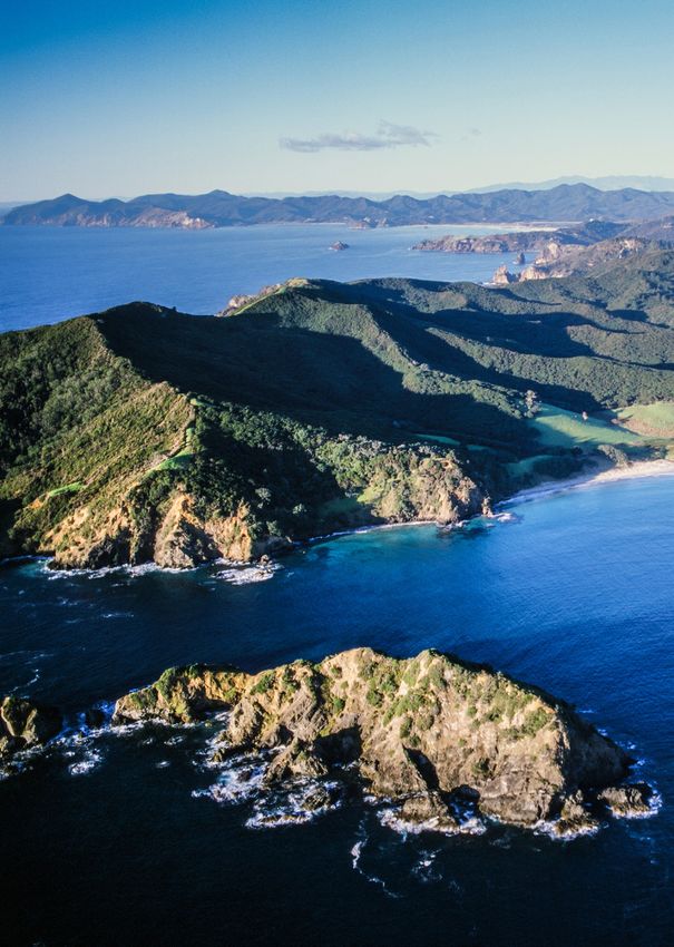
PROTECTING THE
 HAURAKI GULF
   ISLANDS

  Raewyn Peart and
 Cordelia Woodhouse
First published November 2020
Published by:
Environmental Defence Society Incorporated
P O Box 91736 Victoria St West
Auckland 1142
Phone (09) 302 2972
manager@eds.org.nz
www.eds.org.nz
www.environmentguide.org.nz
© Environmental Defence Society Incorporated 2020
Design: Neale Wills, Wilsy Design & Production Ltd
Photographic images: Raewyn Peart unless otherwise indicated
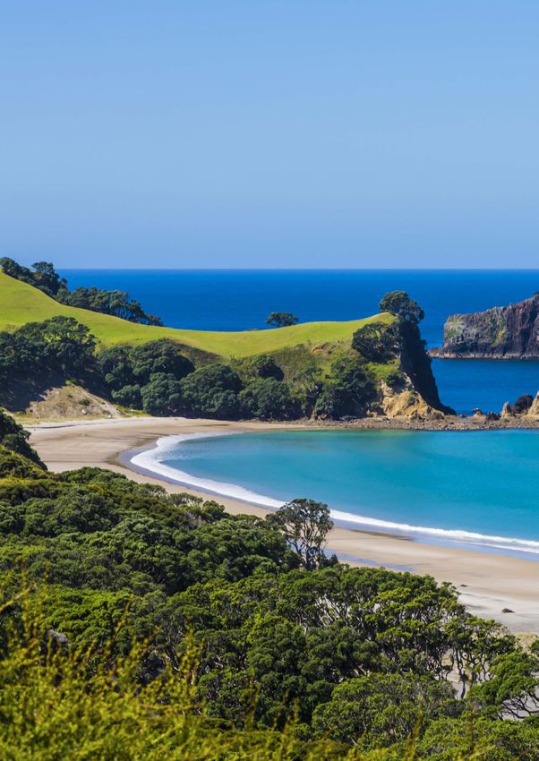
Cover image: Palmers Beach, Aotea/Great Barrier Island
Copies can be downloaded from www.eds.org.nz
ACKNOWLEDGEMENTS
We would like to acknowledge the support of Auckland Council in funding this case study. We would also like to thank all
those who generously agreed to be interviewed for this study and the peer reviewers for their invaluable contributions. This
case study will form part of a report being supported by the Department of Conservation and Land Information New Zealand.
ii PROTECTING THE HAURAKI GULF ISLANDS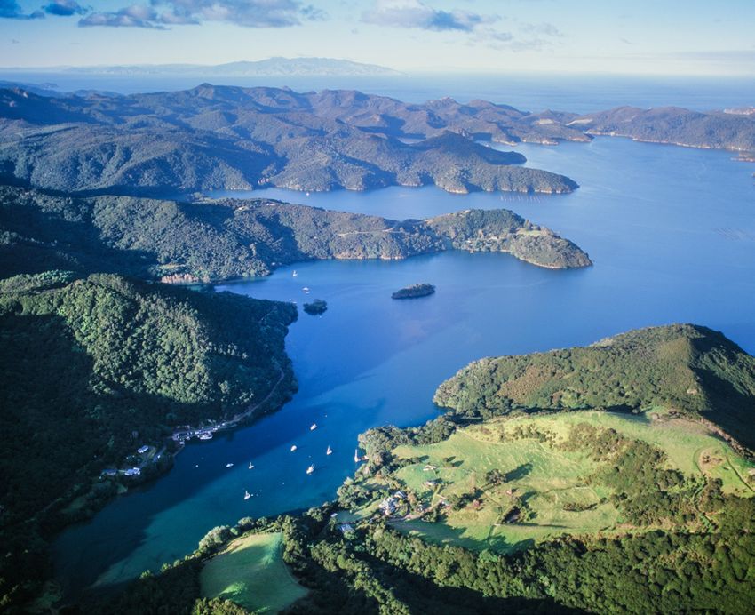
TABLE OF CONTENTS

1   Introduction                                                                                         1
    PART ONE: OVERALL CONTEXT                                                                            3
2   The Hauraki Gulf                                                                                     3
    2.1 Geological formation of islands                                                                  3
    2.2 Early Māori settlement                                                                           4
    2.3 Early European settlement                                                                        4
3   Statutory management framework                                                                       5
    3.1 Resource Management Act                                                                          5
    3.2 National instruments                                                                             9
    3.3 Hauraki Gulf Marine Park Act                                                                    10
    3.4 Regional instruments                                                                            15
    3.5 District instruments                                                                            17
    3.6 Incorporation of the Hauraki Gulf islands into the Auckland Unitary Plan framework              19
    PART TWO: ISLAND CASE STUDIES                                                                       21
4   Aotea/Great Barrier Island                                                                          21
    4.1 Māori heritage                                                                                  21
    4.2 Natural heritage                                                                                22
    4.3 Historical pressures                                                                            22
    4.4 Current and future pressures                                                                    23
    4.5 Statutory management responses                                                                  28
    4.6 Non-statutory management responses                                                              36
    4.7 Key issues and opportunities                                                                    38
5   Waiheke Island                                                                                      41
    5.1 Māori heritage                                                                                  41
    5.2 Natural heritage                                                                                42
    5.3 Historical pressures                                                                            42
    5.4 Current and future pressures                                                                    43
    5.5 Statutory management responses                                                                  53
    5.6 Non-statutory management responses                                                              58
    5.7 Key issues and opportunities                                                                    60
6   Rākino Island                                                                                       63
    6.1 Māori heritage                                                                                  63
    6.2 Natural heritage                                                                                63
    6.3 Historical pressures                                                                            63
    6.4 Current and future pressures                                                                    64
    6.5 Statutory management responses                                                                  66
    6.6 Non-statutory management responses                                                              68
    6.7 Key issues and opportunities                                                                    68
    PART THREE: CONCLUSIONS                                                                             69
7   Key findings                                                                                        69
    References                                                                                          72
    Case studies                                                                                        75

                                                                                             CONTENTS        iii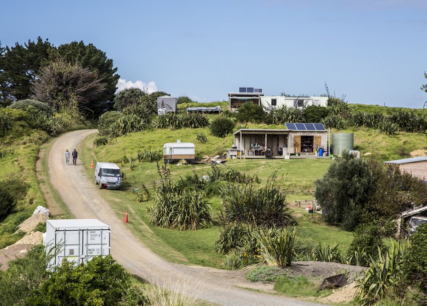
LIST OF FIGURES

     2.1    Hauraki Gulf Marine Park and catchments                                                                   3
     3.1    Extent of the ONL and natural character overlays on Aotea/Great Barrier Island                            6
     3.2    Extent of the ONL and natural character overlays on Waiheke Island                                        7
     3.3    Extent of the ONL and natural character overlays on Rākino Island                                         7
     3.4    Hierarchy of RMA plans                                                                                    8
     3.5    Structure of the Hauraki Gulf Islands District Plan                                                      18
     4.1    Vegetation cover on Aotea/Great Barrier Island                                                           23
     4.2    Settlement areas on Aotea/Great Barrier Island                                                           28
     4.3    Planning controls for sub-areas within the Great Barrier Island settlement areas                         30
     4.4    Minimum site areas for various zones within the Great Barrier Island settlement areas                    31
     4.5    Land managed by DOC on Aotea/Great Barrier Island (and neighbouring islands)                             32
     4.6    Ecological management units on Aotea/Great Barrier Island                                                34
     5.1    Risk of coastal inundation at Blackpool                                                                  49
     5.2    Land units applying to Waiheke Island                                                                    53
     5.3    Description of land units applying to Waiheke Island                                                     54
     5.4    Subdivision rules for different land units                                                               55
     6.3    Planning map for Rākino Island                                                                           66
     6.4    Subdivision capacity on Rākino Island                                                                    67
     7.1    Comparison of the three case study islands                                                               69

     LIST OF ACRONYMS

     AUP                            Auckland Unitary Plan
     DOC                            Department of Conservation
     EDS                            Environmental Defence Society
     EEZ Act                        Exclusive Economic Zone and Continental Shelf (Environmental Effects) Act 2012
     EMU                            Ecosystem management unit
     EPA                            Environmental Protection Authority
     GIFT                           Gulf Innovation Fund Together
     HGMPA                          Hauraki Gulf Marine Park Act 2000
     NZCPS                          New Zealand Coastal Policy Statement
     ONL                            Outstanding natural landscape
     QEII                           Queen Elizabeth the Second
     RMA                            Resource Management Act 1991
     RPS                            Regional policy statement
     Sea Change                     Sea Change Tai Timu Tai Pari

iv           PROTECTING THE HAURAKI GULF ISLANDS
1. INTRODUCTION

Aotearoa New Zealand’s distinctive natural landscapes are      exploration of the concept of landscape in the New
an integral component of our individual and national well-     Zealand context, to be released later in 2020.
being. For Māori, they provide a deep cultural connection
                                                               This case study focuses on three of the Hauraki Gulf
with the past and future through whakapapa. Landscapes
                                                               islands with permanent settlement: Aotea/Great Barrier
provide physical and spiritual respite, historical links and
havens for biodiversity. They are a source for creative        Island, Waiheke Island and Rākino Island. These islands
endeavour, a key component of the New Zealand brand,           each have a unique character and settlement pattern and
and a major drawcard for tourists.                             face different, but in some cases overlapping, challenges.

                                                               The case study is based on a review of the available
  A tourist is commonly defined as someone who                 literature supplemented by interviews with some
  travels and visits places for pleasure and interest.1        30 key informants. The interviews were undertaken
  This includes both international and domestic                on a confidential basis to encourage frankness. We
  visitors, and for the Hauraki Gulf islands, includes         have included some quotes from these interviews to
  those visiting from Auckland as well as from further         provide ‘colour’ to the analysis below. However, we
  afield. It generally does not include part-time              have not identified the source in order to maintain the
  residents, such as those who own a holiday home              confidentiality of the respondent. Some quotes are from
  on the islands. Nor does it include people travelling
                                                               published sources, and where this is the case, we have
  purely for business purposes.
                                                               footnoted the reference.

Despite the importance of landscapes to New Zealand,           The report is structured into three main parts. Part One
we are still seeing poor landscape outcomes. In order to       provides the overall context for the case study. This
address this matter, the Environmental Defence Society         includes a description of the Hauraki Gulf and the overall
(EDS) has initiated a project to investigate how existing      statutory management framework that applies to the area,
legislative and policy tools could be more effectively         including an analysis of the effectiveness of the Hauraki
deployed to manage important natural landscapes, as            Gulf Marine Park Act 2000 in protecting the landscapes
well as how a new ‘protected landscapes’ model could           of the Hauraki Gulf. Part Two of the report includes
be adopted to achieve better landscape protection in           the island case studies including a description of their
New Zealand.                                                   Māori and natural heritage; historical, current and future
The project involves case studies of landscape                 pressures; statutory and non-statutory management
protection in Te Manahuna/Mackenzie Basin, Te Pātaka           responses; and key issues and opportunities. In order
o Rākaihautū/Banks Peninsula, Waitākere Ranges and             to assess the effectiveness of landscape management
the Hauraki Gulf Islands. It also includes an investigation    on the islands, we have investigated a wide range of
of potential linkages between tourism and landscape            pressures impacting their natural environments. Part
protection. All the case studies will be integrated into       Three of the report draws together the key findings of the
an overall synthesis report, which will contain a broader      study and recommendations.

                                                                       Man O'War Bay, Waiheke Island (Craig Potton)

                                                                                      CHAPTER 1. INTRODUCTION               1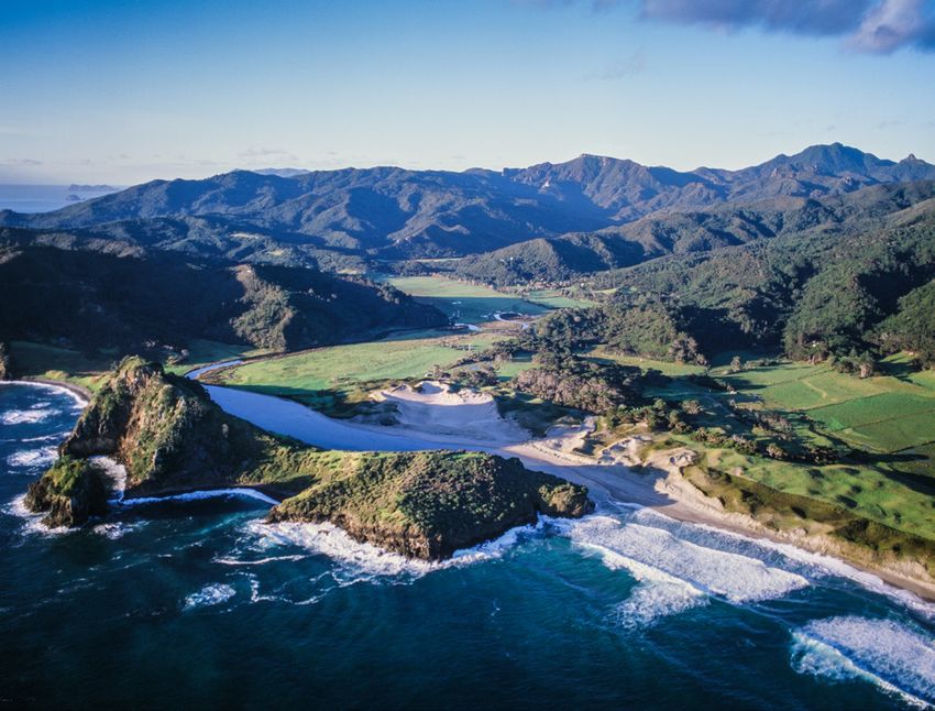
Harataonga, Aotea/Great Barrier Island (Craig Potton)

    ENDNOTES

    1   Cambridge English Dictionary

2           PROTECTING THE HAURAKI GULF ISLANDS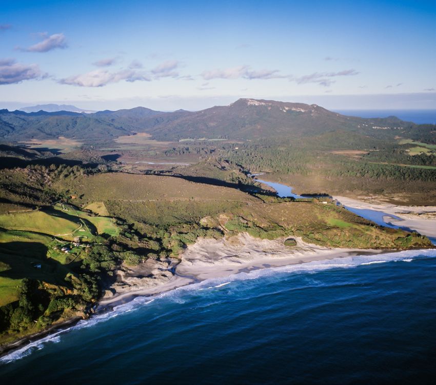
PART ONE: OVERALL CONTEXT

2. THE HAURAKI GULF

  “The Hauraki Gulf has a quality and diversity of
  biology and landscape that makes it outstanding
  within New Zealand. The islands of the Gulf are
  valued as habitats of plants and animals, once
  common, now rare, and are often the only places
  where these species exist naturally.” 1

The Hauraki Gulf/Tīkapa Moana/Te Moananui-o-Toi
is a place of outstanding landscapes, rich indigenous
biodiversity and spiritual importance to Māori. It is an area
used by many to live and work, for recreation and for the
sustenance of human health, wellbeing and spirit.
The Gulf covers 1.2 million ha of ocean stretching from
Pākiri in the north-west, around the seaward side of the
Mokohinau Islands and Aotea/Great Barrier Island and
down to the south of Whangamatā on the eastern side
of the Coromandel Peninsula (see Figure 2.1). The inner
Gulf is sheltered to the east by Great Barrier Island, and
to the west and south, by the mainland. This means it is
exposed only to the northern winds prompting its name:
‘the northern wind’ – hau (wind) and raki (north).
Within the Gulf there are more than 65 islands, many of
which are protected and managed by the Department of
Conservation (DOC) as public conservation land. Of the
islands in the Hauraki Gulf that are larger than 10ha, 43
per cent are predator free including Rākino Island (but not
Waiheke or Aotea/Great Barrier islands), making it an area      Figure 2.4: Map of the Hauraki Gulf Marine Park and catchments
                                                                Figure 2.1 Hauraki Gulf Marine Park and catchments
particularly rich in native bird and other life. 2                                                                    2: LESSONS LEARNED FROM SEA CHANGE TAI TIMU TAI PARI   15

                                                                2.1 Geological formation of islands
                           Stony Batter, Waiheke Island         The Hauraki Gulf was formed following the last ice age,
                                                                over 20,000 years ago, when the sea levels were 130m
                                                                lower than present levels. 3 At that time, the seabed of the
                                                                Gulf would likely have been low lying plains dominated
                                                                by the volcanic cones of Aotea/Great Barrier and Te
                                                                Hauturu-o-Toi/Little Barrier.4 The other islands of the
                                                                Gulf would have been the hills and ridges punctuating
                                                                the plains. Around 600 years ago Auckland’s youngest
                                                                volcano, Rangitoto, erupted in the middle of the main
                                                                channel into the Waitematā Harbour. Rangitoto now
                                                                forms a focal point when looking out from Auckland into
                                                                the Hauraki Gulf, and links the scenery and geology of the
                                                                isthmus with that of the Gulf.5

                                                                With the melting of glaciers after the last ice age, the seas
                                                                rose and flooded the river valleys, with the coastal hills
                                                                becoming islands. The resulting marine environment of
                                                                the Gulf now ranges from deep ocean areas to shallow
                                                                seas; bays, inlets and harbours scattered along the
                                                                coastline; and the broad intertidal flats of the Firth of
                                                                Thames.6 On the eastern coast of Aotea/Great Barrier
                                                                Island, white quartz sand was thrown up from the sea to

                                                                                                       CHAPTER 2. THE HAURAKI GULF                                                3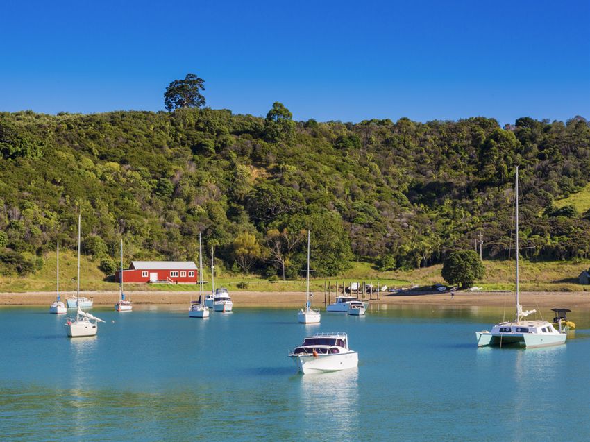
create beaches and dune barriers. These extensive dunes
    now provide important habitat for a variety of plants                 “If the vitality of the Gulf’s mauri (life principle) is
                                                                          impaired through environmental degradation, then so
    and birds such as the northern New Zealand dotterel/
                                                                          is the spiritual wellbeing of tangata whenua”.11
    tuturiwhatu and variable oyster catcher/torea-pango.

    The Hauraki Gulf islands contain a wide variety of other
                                                                     2.3 Early European settlement
    habitat types, including coastal broadleaf forest and
                                                                     Europeans first encountered the Hauraki Gulf when,
    wetlands, resulting in a varied landscape high in natural
                                                                     in November 1769, Captain James Cook and his crew
    character and conservation values. The specialness of
                                                                     anchored off Cooks Beach in Mercury Bay (as the beach
    the Hauraki Gulf and its islands was recognised when the
                                                                     and bay are now called) while observing the passage
    Hauraki Gulf Marine Park Act (HGMPA) was passed to               of Mercury. He later sailed down to the Firth of Thames
    protect it in 2000.                                              and wrote about the “noble” timber of the Waihou River
                                                                     “which he believed would furnish plenty of materials either
    2.2 Early Māori settlement
                                                                     for the building of defences, houses or vessels”.12 These
                                                                     comments attracted the attention of European traders
        “The Hauraki Gulf is often referred to as ‘pataka kai’
                                                                     who sailed to the area in search of logs to be sold for
        a food basket in the literal and metaphysical sense:
                                                                     profit as ships’ spars. However, it was not until after 1840
        a place where spiritual and physical sustenance is
                                                                     when Auckland was established on the invitation of Ngāti
        gathered.” 7
                                                                     Whatua o Ōrākei, that exploitation of the Gulf’s rich natural
                                                                     resources accelerated.
    The Hauraki Gulf is an area of high cultural and spiritual
    significance to mana whenua. It is spoken about as               The European settlers stripped much of the remaining
    the landing place of Kupe’s waka that carried the first          indigenous forest and drained most of the wetlands,
                                                                     turning many of the Gulf islands into extensive pastoral
    Polynesian voyagers to Aotearoa from Hawaiki over
                                                                     farms. They also brought with them the Norway rat and
    800 years ago. 8 The story goes that, following Kupe’s
                                                                     ship’s rat and later introduced mustelids (ferrets, stoats
    navigational directions, a number of subsequent
                                                                     and weasels) amongst a multitude of exotic species.
    explorers arrived in the Hauraki Gulf. They included Toi
                                                                     These introduced mammals predated on New Zealand’s
    (Toitehuatahi) who named the islands of the Gulf ‘nga            indigenous terrestrial fauna (native birds, bats, lizards,
    poito o te kupenga o Toi Te Huatahi’ (the floating fishing       frogs and invertebrates). The introduction of possums
    net of Toi Te Huatahi). Toi was followed by explorers and        and rabbits, for sport and in an attempt to develop a fur
    settlers carried on the Tainui, Arawa, Aotea, Takitimu and       trade, also led to wide-scale destruction of vegetation.
    Mataatua waka.9                                                  Fortuitously mustelids, possums and Norway rats did
                                                                     not make their way to Aotea/Great Barrier Island and
    The Hauraki Gulf islands were situated at the crossroads
                                                                     possums did not reach Waiheke Island.
    of the busiest waterways in Aotearoa, linking the Bay
    of Plenty and the Bay of Islands, as well as being the
    east-west passage across the isthmus joining the Pacific                                                                 Ngāti Paoa waka
    and Tasman Seas. It was also an area rich in forest and
    marine resources and with fertile soils. As a result, early
    settlement groups would often be displaced by turbulent
    interactions with those passing through. It is likely that the
    smaller islands were the location of temporary settlements
    which provided a base for seasonal harvesting. Larger
    groups permanently settled on the more extensive islands,
    such as Aotea/Great Barrier and Waiheke, where evidence
    of numerous kāinga, gardens, food storage areas, middens
    and pā can still be seen in the landscape.10 The rich
    historical association of mana whenua with the Hauraki
    Gulf, since the time the first waka arrived many centuries
    ago, has resulted in it being a taonga of utmost cultural
    and spiritual significance.

    ENDNOTES

    1    Hauraki Gulf Marine Park Act 2000, Preamble, Clause 1       7     Hauraki Gulf Forum, 2014, 10
    2    Hauraki Gulf Forum, 2011, 13                                8     Peart, 2016, 22
    3    Hauraki Gulf Islands District Plan, Annexure 1c             9     Hauraki Gulf Islands District Plan, Annexure 1a
    4    Hauraki Gulf Forum, 2011, 22                                10    Hauraki Gulf Islands District Plan, Annexure 1a
    5    Hauraki Gulf Islands District Plan, Annexure 1c             11    Hauraki Gulf Forum, 2009, 15
    6    Hauraki Gulf Forum, 2011, 15                                12    Hauraki Gulf Islands District Plan, Annexure 1a

4             PROTECTING THE HAURAKI GULF ISLANDS
3. STATUTORY MANAGEMENT FRAMEWORK
3.1 Resource Management Act whole. 2 Although the Act does not create primacy
for environmental protection (through the setting of
The Resource Management Act 1991 (RMA) is the main environmental bottom lines), other policy and planning
piece of legislation in New Zealand that sets out how documents developed under it may do so.
the environment should be managed. It is underpinned
by the principle of sustainable management, and seeks The reasoning of Environmental Defence Society v New
to “promote the sustainable management of natural Zealand King Salmon has been subsequently applied
and physical resources“.1 Under the RMA, sustainable in a number of cases. Of particular importance is RJ
management is broadly defined as follows: Davidson Family Trust v Marlborough District Council
which concerned an application for a resource consent.
(2) In this Act, sustainable management means In that case the Court of Appeal held that, if the planning
managing the use, development, and protection document does not clearly indicate whether a resource
of natural and physical resources in a way, or at consent should be granted or refused, then reference to
a rate, which enables people and communities the purpose and principles of the Act may be appropriate.
to provide for their social, economic, and cultural This enables an ‘overall broad judgment’ approach
wellbeing and for their health and safety while— to be applied, which may result in economic benefits
(a) Sustaining the potential of natural and physical outweighing provisions seeking environmental protection.
resources (excluding minerals) to meet the The case highlights the importance of having clear and
reasonably foreseeable needs of future directive provisions in regional and district planning
instruments to protect the environment.
generations; and
Sections 6, 7 and 8 of the RMA supplement the
(b) Safeguarding the life-supporting capacity of air,
sustainable management purpose contained in section
water, soil, and ecosystems; and
5 and identify matters that are of special significance for
(c) Avoiding, remedying, or mitigating any adverse resource management.
effects of activities on the environment
Matters of national importance are listed in section
Previously an ‘overall broad judgment’ approach was 6 and decision-makers must ‘recognise and provide’
adopted in interpreting the sustainable management for them. Outstanding natural landscapes (ONL) are
purpose of the RMA. The Supreme Court in Environmental identified under section 6(b) and their protection is a
Defence Society v New Zealand King Salmon rejected matter of national importance. Other matters of national
this approach and determined that the definition of importance include protection of the natural character
sustainable management must be read as an integrated of the coastal environment, wetlands, lakes and rivers
Home Bay, Rākino Island
CHAPTER 3. STATUTORY MANAGEMENT FRAMEWORK 5(section 6(a)), protection of significant indigenous Natural character concerns the expression of natural
vegetation (section 6(c)), the relationship of Māori and elements, patterns and processes in the landscape.
their culture with taonga (section 6(e)) and the protection A common broad-brush description is that natural
of historic heritage from inappropriate subdivision, use character consists of the physical naturalness of an
and development (section 6(f)). area (in terms of non-living and living features) and its
perceived naturalness in terms of how people perceive
An ONL must be both natural (meaning a product of
and experience the physical elements. 5 The New
nature) and outstanding. The criteria for identifying a
Zealand Coastal Policy Statement (NZCPS) includes a
landscape as outstanding include:3
list of matters that natural character may include, which
■ Natural science factors (geological, topographical, provides context for its interpretation under the RMA.6
ecological, and dynamic components of the
Once natural character is identified, it must then
landscape)
be assessed against a scale of naturalness. Natural
■ Aesthetic values character is commonly rated on a seven-point scale
■ Expressiveness (legibility) from very low (ie highly modified), low, moderate-low,
moderate, moderate-high, high and very high (ie virtually
■ Transient values unmodified). The category of ‘outstanding’ natural
■ Whether the values are shared and recognised character was first introduced by the 2010 NZCPS.7
■ Value to tangata whenua A number of the Hauraki Gulf islands are partially overlaid
with both ONL and outstanding natural character
■ Historical associations
designations. In particular, Aotea/Great Barrier Island is
Natural character, a matter of national importance to be largely classified as an ONL. Waiheke and Rākino islands
preserved under section 6(a) of the RMA, is not the same both have ONL designations, but these are not as extensive
thing as a natural feature or landscape.4 However, there (see Figures 3.1, 3.2 and 3.3). In particular, the protection on
is a considerable degree of overlap between the two Waiheke Island is largely restricted to the less developed
concepts. The preservation of natural character and the eastern end, and very little of Rākino Island is identified
protection of it from inappropriate subdivision, use and as an ONL. Across all three islands, areas of high and
development is central to the management of landscapes outstanding natural character are scattered around the
within the coastal environment. coastlines, overlapping with ONLs in these areas.
Figure 3.1 Extent of the ONL and natural character overlays on Aotea/Great Barrier Island
6 PROTECTING THE HAURAKI GULF ISLANDSFigure 3.2 Extent of the ONL and natural character overlays on Waiheke Island
Figure 3.3 Extent of the ONL and natural character overlays on Rākino Island
CHAPTER 3. STATUTORY MANAGEMENT FRAMEWORK 7Under the RMA, ONLs must be protected from
‘inappropriate’ subdivision, use and development. 8 This
is not necessarily an absolute protection and allows
National
the possibility of ‘appropriate’ development. What is Environmental
inappropriate is heavily affected by context and so Standards
National
is determined on a case-by-case basis against the Policy
background of the landscape or feature that is to be Statements
preserved or protected.9 As we describe below, ONLs and
areas of outstanding natural character within the coastal
environment are afforded a higher level of protection as a Regional
result of the provisions of the NZCPS. Policy
Statements
In order to provide for the protection of landscape values
as well as other resource management matters, a cascade
of planning documents is created under the RMA, all of
which must give effect to the provisions of the Act (see
Figure 3.4). These give substance to the RMA’s purpose
Regional District
by identifying objectives, policies, rules and methods Plans Plans
relating to land and resource use activities. The hierarchy
is intended to move from the more general to the more
specific both in content and locality, with each level
required to ‘give effect to’ (meaning implement) the level
above it.10 These documents are addressed in turn below. Figure 3.4 Hierarchy of RMA plans
Awana, Aotea/Great Barrier Island (Craig Potton)
8 PROTECTING THE HAURAKI GULF ISLANDS3.2 National Instruments
A spotlight on the role of the NZCPS in decision-
Although the protection of ONLs has been identified as making within the Hauraki Gulf
a matter of national importance in the RMA, there is no
national policy statement on landscape. However the The 2010 NZCPS replaced the 1994 version, providing
NZCPS, which came into effect on 3 December 2010 and clearer direction on how to protect and manage New
applies to all the Hauraki Gulf islands under Policy 1(2)(b), Zealand’s coastal environment.13 The NZCPS now
addresses landscapes in the coastal environment. contains directive policies that require the avoidance of
adverse effects on matters of national importance. For
The NZCPS requires that adverse effects of activities on example, Policies 13 and 15 direct that adverse effects
ONLs or areas with ‘outstanding’ natural character must of inappropriate development on outstanding natural
be avoided. As shown above, ONLs on the three islands character and ONLs in the coastal environment be
overlap with areas of outstanding natural character. In all avoided. Policy 11 contains a similar direction for the
other areas within the coastal environment, significant recognition and protection of indigenous biodiversity.
adverse effects on natural character and landscapes
must be avoided, and all other adverse effects avoided, The Supreme Court in Environmental Defence Society
remedied or mitigated.11 v New Zealand King Salmon considered the meaning
of ‘avoid’ in the relevant provisions of the NZCPS, and
The NZCPS thereby provides a graduated scheme of as it is used in section 5(2)(c) of the RMA (“avoiding,
protection and preservation of areas of natural character and remedying, or mitigating any adverse effects of
landscape in the coastal environment, with a clear bottom activities on the environment”). It held that avoid
line for areas identified as being outstanding. A similar had the ordinary meaning of “not allow” or “prevent
bottom line is provided to protect threatened indigenous the occurrence of”.14 In that sense, Policies 13 and
biodiversity and threatened or naturally rare ecosystems and 15 (the ‘avoidance policies’) provide something of an
vegetation types within the coastal environment.12 environmental bottom line.15 This directive language
provides a strong degree of protection for outstanding
The NZCPS also recognises that the coastal environment
areas within the coastal environment. It creates
needs to provide for a number of other uses such as
a strong obligation on decision-makers to avoid,
aquaculture, port activity and nationally and regionally rather than remedy or mitigate, the adverse effects of
significant infrastructure. While the NZCPS provides for inappropriate development on these areas with the
these activities in appropriate locations, there is a clear determination of what is inappropriate being assessed
direction that this should not undermine the protection of against the backdrop of what is sought to be protected.
other important coastal values.
The impact of this is two-fold. Lower order planning
Ōkupu, Aotea/Great Barrier Island instruments, such as the Hauraki Gulf Islands District
Plan and the Auckland Unitary Plan (AUP), must ‘give
effect to’ (meaning to implement) the directive policies
contained in the NZCPS. For resource consents, there
is a different, lesser obligation to have regard to the
provisions of the NZCPS.
There have only been a handful of cases that have
interpreted the provisions of the NZCPS as they apply to
the Hauraki Gulf in a post Environmental Defence Society
v New Zealand King Salmon context. In Man O’War v
Auckland Council, it was argued that the approach taken
to the management of ONLs would be inevitably more
restrictive as a result of the Supreme Court’s findings
in Environmental Defence Society v New Zealand King
Salmon and that, as such, a more nuanced approach to
identifying what was ‘outstanding’ was required (ie that
it be outstanding at a national level).16 This argument
was rejected by the Court, as discussed later in this
report, as whether land has sufficient attributes to make
it outstanding is a factual assessment based on the
quality of the landscape itself, rather than the subsequent
actions that may or may not be inappropriate within the
ONL. The Court also reiterated that the NZCPS does not
place a prohibition on development. While the area at
issue was sufficiently natural for the purposes of section
6(b) of the RMA, it was not pristine or remote, and it is
in this setting that any new activity would need to be
assessed.17 Importantly the case upholds the requirement
for avoidance of adverse effects in these areas.
CHAPTER 3. STATUTORY MANAGEMENT FRAMEWORK 93.3 Hauraki Gulf Marine Park Act
The NZCPS has also been considered in relation to
The idea of protecting the special qualities of the Hauraki
a number of resource consent appeals for activities
in the Hauraki Gulf. Interestingly, it has been Policy Gulf through statute has been around for many decades.
11 of the NZCPS which has been the focus of these The Hauraki Gulf Maritime Park Act was enacted in 1967
decisions. In Pierau v Auckland Council18 resource following concerns that the Hauraki Gulf islands needed
consent to hold large and medium sized music to be protected from overseas interests, who had begun
festival events (between 500 and 3,000 people) near buying up islands further north in the Bay of Islands. The
Te Arai Point was refused on the basis of risks to Act established the Hauraki Gulf Maritime Park and the
endangered or at risk biodiversity (bitterns, fernbirds Hauraki Gulf Maritime Park Board to manage the new
and fairy tern) and its habitat. The Court held that, Park. The Maritime Park only included land and did not
given the uncertainty as to the potential effects on encompass the marine area of the Gulf.
these species, a precautionary approach was required The Maritime Park began as an area of 4,926ha and
and absolute avoidance of effects was required. With included the islands of Motutapu, Moturoa, Te Hauturu-
regard to natural character, the Court also held the o-Toi/Little Barrier and Poor Knights as well as parts of
moderate to high natural character values would not the Mercury Island group and Kawau Island. By 1971, an
be protected by the application.
additional 3,588ha had been acquired and amalgamated
under the umbrella of the Maritime Park. There were three
In Waiheke Marinas Limited, the NZCPS was
gifts of land, including the Aldermen Islands from Ngāti
recognised as a “seminal policy document” guiding
Hako and Ngāti Hei; four islands in the Mercury group
the decision in that case.19 The case concerned the
from Ngāti Karau, Ngāti Whanaunga and Ngāti Hako; and
development of a recreational boating marina in
4ha of land on Kawau Island from Mr Goodwin. 24
Matiatia Bay on Waiheke Island. Although the area
was recognised as having regionally significant As well as bringing together a multitude of different
landscape qualities, it was not identified as an ONL. pieces of land into a cohesive Maritime Park, the Board
As such, the strict requirement to avoid adverse undertook pioneering restoration work on Tiritiri Matangi
effects on ONLs and areas of outstanding natural Island which still serves as an inspiration for other Gulf
character did not apply. However, the requirement islands. Despite these impressive results, the Hauraki Gulf
to avoid ‘significant’ adverse effects of the activity, Maritime Park Act was repealed by the Conservation Law
and to avoid, remedy and mitigate ‘other’ adverse Reform Act 1990 which sought to reduce the number of
effects remained relevant. 20 The Court held that the environmental and conservation quangos. The Maritime
landscape and natural character impacts would be Park Board was disestablished and its functions handed
significant and the relevant provisions were framed to over to the newly formed DOC, with the former Maritime
‘strongly discourage’ this type of development. 21 Park split between three conservancies: Northland,
Auckland and Waikato. 25
In the later case of SKP Incorporated v Auckland
Council,22 which similarly concerned the construction The concept of a ‘marine park’ was first voiced during
of a marina on Waiheke Island (but this time at the early 1980s, but it was not until 2000 that the
Kennedy Bay), the NZCPS played less of a role. HGMPA finally came into force, ten years after the
Again, the development area was not within an ONL, disestablishment of the Maritime Park Board. The
and as such strict avoidance of adverse effects was HGMPA has the overall purpose of better integrating
not required. However, the area was much more the management of the natural, historic and physical
modified than Matiatia, and therefore the adverse resources of the Hauraki Gulf, its islands and catchments
effects on landscape and natural character values and establishing common management objectives;
were considered to be minor. Policy 11 of the NZCPS establishing the Hauraki Gulf Marine Park and Hauraki
was also discussed, in relation to little blue penguins Gulf Forum; and recognising the deeply rooted
and their habitat, but there was no evidence to relationships that exist between tangata whenua and
suggest the species would be adversely affected by the Gulf. 26 The purpose of the Hauraki Gulf Marine Park
the development. 23 includes “to recognise and protect in perpetuity the
international and national significance of the land and the
It is clear from these decisions that the NZCPS adds natural and historic resources within the Park.”27
a layer of direction to decision making, particularly
Unlike the previous Maritime Park, which had focused
in ‘outstanding areas’ and for the protection
only on the protection of reserve land on the Hauraki
of indigenous biodiversity within the coastal
Gulf islands, the new Marine Park also incorporated the
environment. However, the real strength of the
NZCPS is the need for planning documents to give seabed and seawaters. Currently, land within the Park
effect to its provisions. This has resulted in strong is primarily publicly owned, although there is provision
planning provisions that reflect the directive nature within the Act to include other areas. Local authorities
of the NZCPS avoidance policies (eg that adverse can add their reserves to the Marine Park and private
effects from inappropriate development in the coastal landowners with protected areas (eg land subject to a
environment be avoided in ‘outstanding areas’). covenant) can also include their land. These areas remain
under the ownership and control of the original landowner
10 PROTECTING THE HAURAKI GULF ISLANDSbut are managed to give effect to the purposes of the of its various components, such as natural and physical
Act. 28 To date, reserves have been contributed by the resources and the historic and cultural associations of
Waitākere City Council and the Royal Forest and Bird people and communities. The requirement to provide for
Protection Society. Sir Rob Fenwick is the only private the life-supporting capacity of the Gulf is central to the
landowner to add land to the Marine Park. He contributed HGMPA and is intended to incorporate the landscape,
over 300ha of covenanted land at Te Matuku Bay, Waiheke taking into account both the land and the sea.
Island in 2002. 29 Given the national importance of the Hauraki Gulf Marine
Section 7 of the HGMPA provides for, as matters Park, these management objectives are treated as
of national importance, the recognition of the being of an equivalent status to that of a national policy
interrelationship between the Hauraki Gulf, its islands statement under the RMA. The provisions of the HGMPA
and catchments, and the ability of that interrelationship to must be given effect to in regional policy statements
sustain the life-supporting capacity of the environment of (RPS) and regional and district plans. In addition, consent
the Hauraki Gulf. The life-supporting capacity of the Gulf authorities must have regard to the sections when
includes the capacity to provide for the historic, traditional, considering an application for a resource consent. 31 The
cultural, and spiritual relationship of tangata whenua with Supreme Court’s decision in Environmental Defence
the Gulf and its islands; the social, economic, recreational Society v New Zealand King Salmon made it clear that the
and cultural well-being of people; the use of the resources requirement to ‘give effect to’ is a strong direction that
of the Gulf for economic activities and recreation; and to “simply means to implement”. However, unlike the NZCPS
which contains strong directive language, the HGMPA
maintain the soil, air, water and ecosystems of the Gulf. 30
contains more flexible language that is unlikely to act as
The management objectives to provide this recognition
a ‘veto’ against inappropriate development in the same
are set out in section 8.
way as the NZCPS.32 This flexibility, and the balancing of
Interestingly, the Act’s only direct reference to ‘landscape’ interests inherent within the Act, has ultimately lead to
is in the preamble where it states “The Hauraki Gulf has a it having little weight in judicial decisions (as described
quality and diversity of biology and landscape that makes in the spotlight below). It is a salutary lesson on the
it outstanding within New Zealand.” However, section 8 importance of using clear and directive language if
encompasses the concept of landscape through the listing protection of important values is to be achieved.
Whakanewha Bay, Waiheke Island
CHAPTER 3. STATUTORY MANAGEMENT FRAMEWORK 11A spotlight on how Courts have applied the On closer inspection, these internal conflicts may
Hauraki Gulf Marine Park Act 2000 be at least partially resolved through considering
the more detailed wording of the sections. Sections
The HGMPA has been considered by the Courts 8(a)-(d) require “protection” (and for sections (a)-(c)
numerous times over the past two decades. It is clear “enhancement where possible”) whereas sections
that they struggle to meaningfully apply its provisions 8(e) and (f) require only “maintenance and where
in the context of the RMA.33 This may be, in part, due appropriate enhancement”. This results in a lower
to the requirements in sections 9 and 10 of the HGMPA standard for the social and economic wellbeing
that require local authorities to amend their plans to give
of communities, and recreation and enjoyment
effect to the Act within 5 years of its commencement.
values, compared to those relating to life-supporting
capacity of the environment, natural historic and
The practical application of the Act is often akin to a
physical resource matters and matters of Māori
‘tick-boxing’ exercise. In determining whether to grant
cultural importance.40
a resource consent, for example, it is merely listed
as one of the factors to be assessed. Some cases go
While the HGMPA places importance on the
further and openly state that the Act does not add
protection of tangata whenua values in the Gulf, this
anything to the decision-making process. For example:
must be balanced against the other interests listed
A careful reading of Sections 7 and 8 which are in sections 7 and 8. This has been highlighted in
in general terms, leads us to the conclusion that the recent Ngāi Ta Ki Tāmaki Tribal Trust v Minister
it adds nothing to the statutory directions of the of Conservation decision.41 Although in that case
Resource Management Act, the provisions of the the Supreme Court found in favour of the iwi, the
New Zealand Coastal Policy Statement, or the outcome was largely a result of the Treaty obligations
more detailed provisions of the ARPS [Auckland in the Conservation Act (section 4) rather than the
Regional Policy Statement] and Coastal Plan. 34 RMA or HGMPA.
We have concluded that, for current proposes, Despite all this, it is clear the HGMPA cannot be
the [objectives of the Act] are subsumed within ignored. In Sanford Limited v The New Zealand
those of the Resource Management Act generally, Recreational Fishing Council Inc,42 a decision made
Part 2, and also within the New Zealand Coastal by the Minister of Fisheries setting the total allowable
Policy Statement … The achievement of the catch of kahawai in and around the Hauraki Gulf was
broad objectives of the RMA ... will also achieve judicially reviewed on the basis that the Minister had
the objectives of the HGMPA. In broad terms it is not adequately taken into account the provisions of
difficult to understand that the HGMPA adds to the HGMPA. While the Court of Appeal ultimately
the matters under consideration. 35 decided that the Minister had broadly met the
objectives of the Act, it found that he had failed to
Other cases openly criticise the Act stating the
have particular regard to its provisions: the social,
“broad and unqualified statements [in the Act] merely
economic, recreational and cultural wellbeing of
confuse the more logical structure of the RMA”36; that
the people of the Hauraki Gulf and in particular to
the Act is a “downgrading of the RMA” and that the
Act loses the hierarchy of matters of importance in maintain and enhance its physical resources (the
Part 2. These concerns have been accompanied with kahawai stock).
a warning of the “danger of endeavouring to graft
local legislation onto legislation addressing matters of We discuss the importance of directive language in the
New Zealand wide importance”. 37 context of the Waitākere Ranges Heritage Area Act 2008
in EDS’s case study on the Waitākere Ranges. Like the
Some cases highlight the inconsistencies present HGMPA, the Waitākere Ranges Heritage Area Act is
within the Act. In Long-Bay Okura Great Park Society local legislation enacted to protect a specific landscape
v North Shore City Council38 the Court considered that (in that case the Waitākere Ranges). However, unlike the
the Act had a broader purpose than the RMA, noting HGMPA, that Act contains directive language that has
that it mandates significantly greater consideration of been effective in protecting the Waitākere Ranges from
recreational values. However, the Court found the Act
further development in the form of creeping subdivision.
of little assistance, largely as a result of the internal
The provisions of the Waitākere Ranges Heritage Area
conflicts within the management objectives in section
Act also withstood the amalgamation process during
8, noting that 8(e) “the maintenance and enhancement
the formation of the Auckland Unitary Council and they
of economic and social wellbeing” may be completely
helped ensure that the protection of the Waitākere
at odds with the other objectives in section 8 (which
require, among other things, the protection and Ranges was carried through into the AUP. This provides a
enhancement of natural resources and the cultural and useful contrast to the HGMPA and further reinforces the
historic associations of people and communities).39 need for clear and un-conflicting language in resource
management instruments.
12 PROTECTING THE HAURAKI GULF ISLANDSWhile the HGMPA does require decision-makers to have the Forum consist of representatives of local and central
regard to its protective provisions (many of which mirror government as well as tangata whenua of the Hauraki
those in the RMA and NZCPS), as a result of the broad Gulf and its islands. Unlike the Hauraki Gulf Maritime Park
nature of those provisions, it often does not appear to add Board, which had direct management responsibilities,
anything to the decision-making process. This indicates the Forum is set up as an integrating body to coordinate
that the Act needs to be strengthened and its objectives, the numerous agencies that play a management role in
and the priority between them, made clearer. In addition, the Gulf. The Forum was not intended to duplicate the
its ongoing linkage with RPSs and regional and district responsibilities of these agencies which include DOC
plans as they are changed and reviewed could be (responsible for the management of conservation land,
strengthened by including similar directive wording as marine reserves and protected species), councils (generally
that in the Waitākere Ranges Heritage Area Act which responsible for management of catchments and the
requires that “when preparing or reviewing” a RPS, coastal marine area) and the Ministry for Primary Industries
regional plan or district plan that affects the heritage area, (responsible for decisions on biosecurity and fishing).44 The
“the Council must give effect to the purpose of this Act Forum is instead tasked with promoting decision-making
and the objectives”.43 by these agencies in a manner that is consistent with the
management objectives contained in the Act.
While local Acts, such as the HGMPA and Waitākere
Ranges Heritage Area Act, are often criticised for In addition, the Forum prepares a report every three years
providing an unnecessary layer of complexity we believe on the state of the Hauraki Gulf. Through these reports,
such criticism is unwarranted. These criticisms stem from the Forum highlights issues and promotes and advocates
the rationale that protection for these areas can already be for the integrated and sustainable management of the
provided for under the RMA and so local acts should not Gulf. While these reports touch on coastal development
be required. However, the RMA has failed to adequately and the impact that this can have on landscape values,
protect many of New Zealand’s landscapes, particularly the reports are largely focused on the marine environment
when it comes to cumulative degradation. As such, EDS – including the sustainability of fishing stocks, pollution
considers there is merit in using specific legislation, and biodiversity. This further reinforces the limited
particularly when it contains directive language, to protect effectiveness of the Hauraki Gulf Marine Park Act in
some of our most special places. protecting the landscapes of the Hauraki Gulf islands.
The HGMPA also established the Hauraki Gulf Forum, The Forum also instigated the Sea Change Tai Timu Tai
a new entity to oversee and integrate the management Pari project (Sea Change) which developed a marine
of the Hauraki Gulf and its catchments. The members of spatial plan for the Hauraki Gulf (see spotlight).
Rākino Island houses
CHAPTER 3. STATUTORY MANAGEMENT FRAMEWORK 13A spotlight on Sea Change Tai Timu Tai Pari focus of this case study. However, a marine protected
area is recommended for the Noises Islands, which are
In the Hauraki Gulf Forum’s 2011 ‘State of Our Gulf’ located a short distance away from Rākino Island.46
report a new approach to managing the Hauraki Gulf Catchment-based actions are also identified to
was called for. This was the concept of marine spatial address sediment and nutrient flows into the Gulf.
planning: an approach that considered the entire
marine area as a system and looked strategically at In addition, the Plan recommends the creation of
how to better manage activities and stressors on it. Ahu Moana co-management areas in nearshore
areas throughout the Hauraki Gulf Marine Park
In 2013, the Sea Change project was established. (extending one kilometre seawards). These are areas
Sea Change was focused on developing a marine that would be jointly managed by mana whenua and
spatial plan for the Hauraki Gulf Marine Park with local communities, with the aim of strengthening
the objective of halting environmental decline and customary practices and improving the management
improving its environmental health, ‘mauri’ and of local fisheries and inshore coastal waters.
abundance. The process was led by a governance
group representing equal partnership between mana The Plan does not identify lead agencies to
whenua and local and central government. implement each of the recommended actions. Instead
there is an expectation that partner agencies will
The Sea Change Plan, New Zealand’s first marine work together to implement the Plan. A Government
spatial plan, was finalised in December 2016. The Plan Response Strategy for the marine conservation and
was developed through a collaborative stakeholder fisheries elements of the Plan has been developed by
process, involving representatives from mana whenua officials with advice from the Sea Change Tai Timu
as well as stakeholders representing commercial Tai Pari Ministerial Advisory Committee. This is sitting
and recreational fishing, farming, aquaculture, with Ministers and awaiting implementation after the
infrastructure, community and environmental 2020 General Election.
interests. It brought together the strands of evolving
natural resource management practice in New While the Plan itself is not legally binding, it contains a
Zealand, integrated mātauranga Māori and scientific strong framework for the management of the Hauraki
approaches, and built on international best practice.45 Gulf and should be used to inform changes to policies
and plans under the RMA.
The Plan covers the entire Hauraki Gulf Marine Park
and is split into four parts Support for the implementation of the Sea Change Plan is
included in the draft Waiheke Area Plan, discussed further
■ Kaitiakitanga (guardianship) which describes a below, which sets out a vision to help shape the future
management approach interwoven with mana of the inner Hauraki Gulf islands.47 In an accompanying
whenua perspectives topic paper, the importance of the Sea Change Plan is
discussed in relation to managing visitor experience and
■ Mahinga kai, pātaka kai (replenishing the
protecting the value of key destinations (such as Waiheke
food basket) which addresses fish stocks and
Island). Developing a Hauraki Gulf Visitor Strategy,
aquaculture
as set out in the Sea Change Plan, is included as a
recommended action.
■ Ki uta ki tai (ridge to reef) which addresses
biodiversity and water quality
Harataonga Beach, Aotea/Great Barrier Island
■ Kotahitanga (prosperous communities)
which addresses public access to the
marine environment and designing coastal
infrastructure
Each chapter contains a description of the current
situation, the objectives to address the issues and a
series of recommended actions for achieving them.
The Plan specifies over 180 recommended actions,
spread over 16 themes. Particularly relevant to this
case study is the objective to protect, enhance and
restore ecologically important marine habitats in the
Hauraki Gulf Marine Park. To assist with this, the Plan
proposes the creation of 13 new marine protected
areas and the extension of two existing ones. None of
these areas are adjacent to the islands that are the
14 PROTECTING THE HAURAKI GULF ISLANDS3.4 Regional Instruments Regional Policy Statement
RPSs provide an overview of the resource management
Auckland Unitary Plan issues specific to the region and include policies and
The AUP was made operative in part in September methods to achieve the integrated management of those
2016 but remains subject to a number of appeals. The resources. An RPS must give effect to higher order
AUP replaces the Auckland Regional Policy Statement national documents, such as the NZCPS, and Part 2 of
and 13 different district and regional plans, increasing the RMA.
consistency within the planning regime for the Auckland Chapter B of the AUP contains the RPS objectives and
region. The principle purposes of the AUP are threefold: policies; these are separate to the other objectives and
to describe how the people and communities of the policies in the plan. A number of significant resource
Auckland region will manage Auckland’s natural management issues for the Auckland region are identified.
and physical resources while enabling growth and Relevant to this case study, they include natural heritage
development; to provide the regulatory framework to (landscapes, natural features, volcanic viewshafts and
help make Auckland a quality place to live and a place trees); natural resources; the coastal environment; issues
where environmental standards are respected and for mana whenua and environmental risk.48 The AUP
upheld; and to provide a principle statutory planning addresses these matters separately, with objectives and
document for Auckland. policies listed for each, although noting that the provisions
While Waiheke, Aotea/Great Barrier and Rākino islands of the Plan are to be read in an integrated manner.
come within the jurisdiction of Auckland Council, they The issue of landscape protection is primarily addressed
are currently subject to an unusual planning regime. in Chapter B4. Outstanding natural features and
Unlike the other Auckland Council district plans that landscapes and areas of high and outstanding natural
were incorporated into the AUP in 2016, the Hauraki character in the coastal environment must be identified
Gulf Islands District Plan remains separate. However, and protected from inappropriate subdivision, use and
the Hauraki Gulf islands are subject to the RPS, regional development. In addition, the ancestral relationships
coastal plan and regional plan provisions in the AUP. We of mana whenua with these landscapes must be
heard from residents on the Hauraki Gulf islands that recognised and provided for.49 Areas identified as an
this has resulted in a confusing management framework. ONL, outstanding natural features and areas of high and
Incorporation of the Hauraki Gulf islands into the AUP is outstanding natural character in the coastal environment
currently being considered. are included in Schedules 7 and 8 as descriptions, and are
Oneroa, Waiheke Island
CHAPTER 3. STATUTORY MANAGEMENT FRAMEWORK 15mapped on the accompanying planning maps (as shown bottom-lines (or agreed targets) should be established
in Figures 3.1-3.3 above). for managing the Hauraki Gulf’s natural and physical
resources to provide greater certainty in sustaining the
The chapter relating to the coastal environment
Hauraki Gulf’s ecosystem services and assist in avoiding
states that development should be designed, located
incremental and ongoing degradation.56 Work should be
and managed to preserve the characteristics and
in partnership with mana whenua to protect and enhance
qualities that contribute to the natural character of the
coastal environment.50 Sprawling or sporadic patterns culturally important environmental resources.
of development should be avoided or mitigated by The RPS also states that applications for development
concentrating development in areas already characterised in the Hauraki Gulf should assess the cumulative effect
by development or which have degraded natural on ecological and amenity values. 57 Development
character values.51 Where practicable, areas in the that compromises the natural character, landscape,
coastal environment with degraded natural character conservation and biodiversity values on the islands
should be restored or rehabilitated and areas with high or should be avoided. Opportunities for educational and
outstanding natural character enhanced.52 recreational activities on the Hauraki Gulf islands should
In respect of the Hauraki Gulf islands, the RPS states be enhanced, provided they are consistent with the
that use and development should support the social protection of the islands’ natural and physical resources.58
and economic wellbeing of the resident communities Economic activities should also be provided for while
of Waiheke and Aotea/Great Barrier islands while ensuring that the impacts of the activity do not result in
maintaining or, where appropriate, enhancing, their natural further degradation of marine ecosystems.59 The national
and physical resources. This should occur without further significance of the Hauraki Gulf Marine Park should
degradation of environmental quality or adversely affecting also be promoted as a visitor destination, and economic
the life-supporting capacity of marine ecosystems. 53 development opportunities that complement the unique
values of the islands and the Hauraki Gulf provided for.60
The objectives in the RPS that relate specifically to the
Hauraki Gulf islands have a stronger focus on restoration Regional coastal plan
rather than simply requiring protection of landscapes and The AUP coastal plan provides for development that has a
values. The RPS states that restoration and enhancement functional or operational need to be located in the coastal
of the Hauraki Gulf’s ecosystems, islands and catchments marine area, while protecting natural character, landscape
should be encouraged54 and restoration of natural values, natural features, and significant ecological values;
character values of the islands promoted.55 Ecological recognising and providing for mana whenua values; and
Kaitoke, Aotea/Great Barrier Island (Craig Potton)
16 PROTECTING THE HAURAKI GULF ISLANDSenabling communities to provide for their social and while the Bill was still progressing through the legislative
economic well-being.61 The plan sets out the parameters process, the Waiheke County Council’s District Scheme
for activities that impact on the coastal environment. (prepared under the Town and Planning Act) was being
reviewed. Unlike the Town and Country Planning Act,
Good water quality is fundamental to most activities
the RMA enshrined the principle of sustainable land-use
undertaken in the coastal environment and underpins the
management and environmental protection.67 Knowing
life-supporting capacity of the marine environment. The
that the RMA would likely be enacted, and would result
coastal plan regulates discharges (sediment, litter, heavy
in transformative change, the Council drove the District
metals, nutrients and other contaminants) into the coastal
Scheme from an environmental perspective – prioritising
marine area. It states that water and sediment quality in
the protection of natural and physical resources. The
the coastal marine area should be maintained where it is
significance of landscape values in the document is a
excellent or good, and progressively improved over time
reflection of this.
in degraded areas.62 Proposals to discharge contaminants
should be required to adopt the best practicable option to The District Scheme had zonings based on land uses
prevent or minimise adverse effects on the environment.63 as its main structure and included a three-page chapter
on Landscape Design and Management. This document
The coastal plan also contains a number of provisions
later contributed to the Hauraki Gulf Islands District Plan.
regulating different activities – such as aquaculture. These
However, the District Plan placed much more emphasis
require avoidance of adverse effects on areas subject
on landscape – with landscape being the basis on which
to special overlays (such as significant ecological areas,
it was structured.68 The District Plan, which became
outstanding and high natural character, ONLs and areas
operative in 1994, was the first plan to be prepared under
of significance to mana whenua).64 There are existing
the RMA. It adopted an innovative and proactive planning
mussel farms in areas adjacent to both Waiheke Island
process and is unlike other district plans that have been
and Aotea/Great Barrier Island. Those at Aotea/Great
prepared since.
Barrier are located within a designated ONL, requiring
avoidance of all adverse effects.65 The District Plan adopts a catchment-based approach
to mapping which integrates terrestrial, freshwater and
marine ecosystems into the planning framework. The
3.5 District Instruments Plan maps and identifies landscape elements, patterns
The Local Government and Environment Select and processes. Critical landscape elements (for example
Committee recommended that the Hauraki Gulf Islands remnant stands of indigenous vegetation, steep erosion-
District Plan be excluded from the Unitary Plan process.66 prone areas, wetlands, cultural features and estuarine
This was on the basis that the Hauraki Gulf islands were areas) are mapped and protected. The remaining land is
geographically isolated and therefore were not likely to identified as appropriate for human development. This
grow at the same rate as the rest of the Auckland region. effectively divides the land into development and no
It was recognised that, while the Hauraki Gulf islands development areas and creates an ‘effects based’ plan for
had been modified to some extent, they still retained a the Hauraki Gulf Islands.69
high degree of natural character and therefore requiring
Recognition of the particular character that relates to each
an ecologically-based approach to planning. However, in
area helps ensure that the landscape remains central to
practical terms, this means that management of the land
the planning process.70 In developed areas, land units are
area on the islands is contained in a different document to
separated into their different use categories (eg residential
that which applies to the marine area and the two areas
and commercial). For rural areas, the land units are based
have been thought about separately in terms of planning.
on landform characteristics (eg coastal cliffs, wetlands and
As the islands and the marine environments surrounding
productive land). The Plan splits resource management
them are ecologically linked it would make sense for the
issues into three different categories (see Figure 3.5):
planning documents that apply to them to be integrated.
■ Strategic Management Units: There are three
For the purpose of the District Plan, the islands are split
strategic management areas in the District Plan
into two groups: the inner islands (which include Waiheke
which recognise the different character and identity
and Rākino islands) and the outer islands (which includes
of the islands: Waiheke Island, Aotea/Great Barrier
Aotea/Great Barrier Island).
Island and Other Islands.
The review of the Hauraki Gulf Islands District Plan was
■ Land Units: These make up the area within each
completed in 2011, and the current plan became operative
strategic management area, and are based on
in 2013. This was only a few years before the AUP process,
common features of the physical and natural
and it was thought unnecessary to re-do the Plan at that
characteristics of the particular land or activities to
early stage. This does not, however, preclude the District
be undertaken on that land (landform land units)
Plan being incorporated into the Unitary Plan in the future
and the policy areas that may require a more robust
and that is the current intention of Auckland Council
and targeted approach (eg commercial areas).
which will shortly begin a review of the Plan.
Each land unit has a set of objectives, policies and
The approach taken in the District Plan stems back to the rules which determine the nature and extent of
late 1980s. Prior to the RMA being enacted in 1991, and development that can occur on the land.
CHAPTER 3. STATUTORY MANAGEMENT FRAMEWORK 17You can also read