Report Vegetation Assessment and Mapping of South Islet (Willis Islets), Coral Sea Marine Park
←
→
Page content transcription
If your browser does not render page correctly, please read the page content below
Report
                Vegetation Assessment and
Mapping of South Islet (Willis Islets), Coral Sea Marine Park

                                               Prepared by Joy Brushe
                                                For Parks Australia, the
                                            Department of Agriculture,
                                            Water and the Environment
                                                          January 2021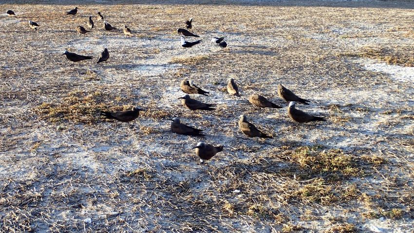
Acknowledgements
Organising and undertaking the vegetation survey field trip to Willis Island required the assistance of
many people. The contribution of following people and organisations are acknowledged:

My husband Larry for assisting in preparation for and participation during the field survey and for
proof reading the report.

Bureau of Meteorology (BoM) for providing the opportunity to undertake the survey and particularly
the staff of the BoM hub in Cairns and the officers stationed on Willis Island for their hospitality and
assistance prior to and during the field visit and during our day in Cairns after arriving back from the
voyage.

The captain and crew of the “Spirit of Freedom” who looked after us very well during our sea voyage
and provided assistance in loading and unloading gear.

Staff and Management of Parks Australia (Department of Agriculture, Water and the Environment)
particularly Stephanie Lemm (Senior Marine Parks Officer, Marine Parks Branch) and Narelle
Southam for obtaining the necessary permits, organising the required training and certifications for
the survey participants and assisting with purchase and supply of field gear; Carolyn Armstrong for
GIS support and Stephanie Lemm for proof reading and providing input into the report.

SGS Cairns International analyses of the soil samples.

                                                                                                       i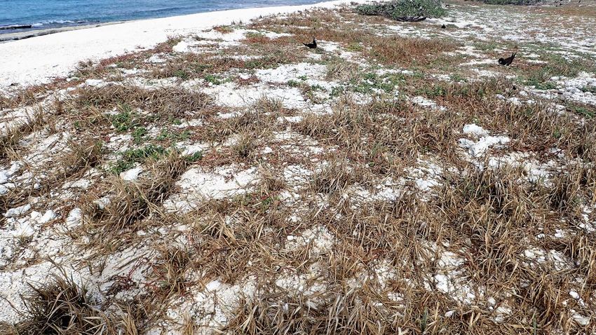
Table of Contents
Executive Summary .......................................................................................................................... 6

1.0            Introduction..................................................................................................................... 7

      1.1            Objectives of the Willis Island Vegetation Survey .............................................................. 7

      1.2            Limitations of the Vegetation Survey and Mapping ........................................................... 7

      1.3            Nomenclature and Naturalised Status ............................................................................... 9

2.0            Background Information................................................................................................... 9

      2. 1           Location and Physical Environment ................................................................................... 9

      2. 2           Climate.............................................................................................................................. 11

      2. 3           Management Background ................................................................................................ 11

      2. 4           Ecological Values .............................................................................................................. 12

      2. 5           Existing Information ......................................................................................................... 13

3.0            Methodologies ............................................................................................................... 13

      3.1            Vegetation Mapping ......................................................................................................... 13

      3.2            Site Data Recorded ........................................................................................................... 13

      3.3            Permanent Vegetation Monitoring and Biocondition Assessment Sites ......................... 14

      3.4            Reference GPS Coordinates.............................................................................................. 15

      3.5            Soil Analyses ..................................................................................................................... 16

4.0            Results and Discussion ................................................................................................... 16

      4.1            Prevailing Climatic Conditions .......................................................................................... 16

      4.2            Floristic Composition ........................................................................................................ 17

      4.3            Vegetation Communities .................................................................................................. 21

      4.4            Permanent Monitoring Sites ............................................................................................ 39

      4.5            Seabirds ............................................................................................................................ 40

      4.6            Turtles ............................................................................................................................... 40

                                                                                                                                                    Page ii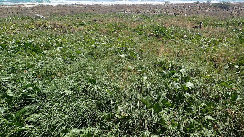
4.7               Soils Analyses.................................................................................................................... 41

5.0              Recommendations ......................................................................................................... 44

      5.1               Weed Management.......................................................................................................... 44

      5.2               Follow up Vegetation Assessment ................................................................................... 46

6.0              References ..................................................................................................................... 46

Appendix 1 Vegetation Structure............................................................................................................... 49

Appendix 2 Plot Orientation of the Permanent Monitoring Sites and List of the Data Recorded at these
            Sites ....................................................................................................................................... 50

Appendix 3 Location and Coordinates of Reference Points....................................................................... 53

Appendix 4 List of Plant Species Recommended for Rehabilitation Planting on Willis Island ................... 55

Appendix 5 Soil Analyses Methods ............................................................................................................ 56

      List of Tables
      Table 1 Current and long term temperature and rainfall records for Willis Island (Australian Bureau
                 of Meteorology, 2020) ........................................................................................................ 11

      Table 2 Comparison of species recorded on Willis Island with species records for Coral Sea Marine
                Park cays and previous records for Willis Island ................................................................. 19

      Table 3 Results of Soils Analyses ........................................................................................................... 42

                                                                                                                                                  Page iii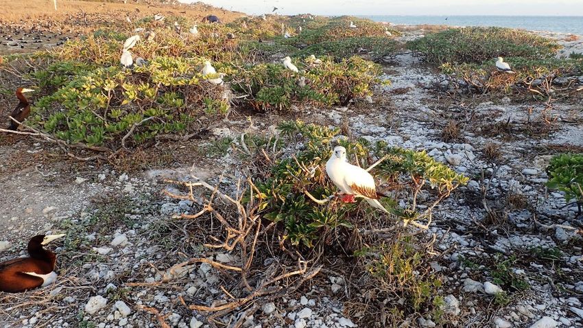
List of Figures
Figure 1 Location of Willis Island .......................................................................................................... 10

Figure 2 Location of vegetation data recording sites and permanent monitoring sites ...................... 15

Figure 3 Comparison of monthly rainfall data for the preceding 12 months with long term averages
           (Australian Bureau of Meteorology, viewed November 2020) .......................................... 16

Figure 4 The red dots mark the location of weed species recorded outside the mown area during the
           October 2020 vegetation survey. ....................................................................................... 21

Figure 5 Vegetation map of Willis Island based on patterns visible on 2019 drone image and field
           data recorded in October 2020........................................................................................... 23

Photographs
Photo 1 Dry conditions at Willis Island during the October 2020 survey ............................................... 8

Photo 2 Profile of Willis Island .............................................................................................................. 10

Photo 3 Growth form and dieback of Argusia argentea on Willis Island ............................................. 22

Photo 4 Littoral open herbland ............................................................................................................. 25

Photo 5 Sparse herbland on accreting shoreline .................................................................................. 26

Photo 6 Lepturus repens grassland ....................................................................................................... 27

Photo 7 Sporobolus virginicus closed grassland ................................................................................... 28

Photo 8 Stenotaphrum micranthum grassland ..................................................................................... 29

Photo 9 Argusia argentea dwarf shrubland.......................................................................................... 30

Photo 10 Site 8 Argusia argentea dwarf open shrubland .................................................................... 30

Photo 11 Site 13 Sporobolus virginicus closed grassland ..................................................................... 31

Photo 12 Site 42 Sporobolus virginicus grassland ................................................................................. 32

Photo 13 Site 36 Sporobolus virginicus closed grassland with emergent Argusia argentea low shrubs
           ............................................................................................................................................ 33

Photo 14 Site 46 Achyranthes aspera/Sporobolus virginicus open herbland ....................................... 34

Photo 15 Site 47 and MO2 Ipomoea pes-caprae subsp. brasiliensis/Sporobolus virginicus closed
           herbland .............................................................................................................................. 35

                                                                                                                                               Page iv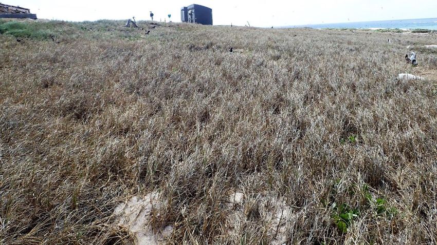
Photo 16 Site 52 Argusia argentea shrubland ...................................................................................... 36

Photo 17 Site 43 Argusia argentea dwarf shrubland with mid dense ground stratum dominated by
           Sporobolus virginicus .......................................................................................................... 37

Photo 18a and 18b Site37 Mown area of open grassland dominated by the exotic grass,
          Dactyloctenium aegyptium ................................................................................................. 38

Photo 19 The access track used to ferry supplies and gear to and from transport boat to the BOM
          facility. ................................................................................................................................. 39

                                                                                                                                              Page v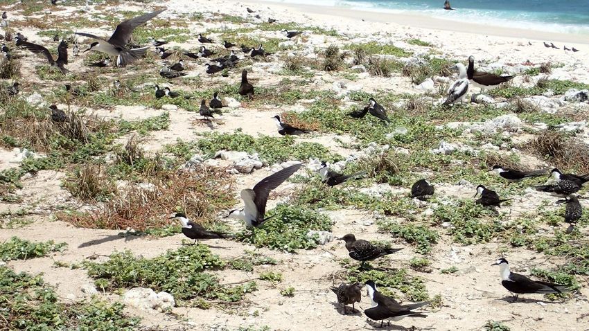
Executive Summary
This document has been prepared for Parks Australia, Australian Department of Agriculture, Water
and the Environment. A one and a half day field trip was undertaken on Willis Island, Coral Sea on
17th and 18th October, 2020 by two people with the following outcomes:
• A comprehensive species list of vascular plant species was compiled.
• A total of 16 plant species was recorded consisting of eight naturally occurring species native
to Coral Sea cays, six naturalised exotic species not naturally occurring in Australia, one
planted native species and one species considered to be exotic on the mainland but
naturally occurring on the cays.
• Floristic composition at the time of the survey was compared to that of previous surveys of
both Willis Island and other Coral Sea Marine Park cays.
• Digital site data and photographs recorded at 52 sites has been provided to Parks Australia.
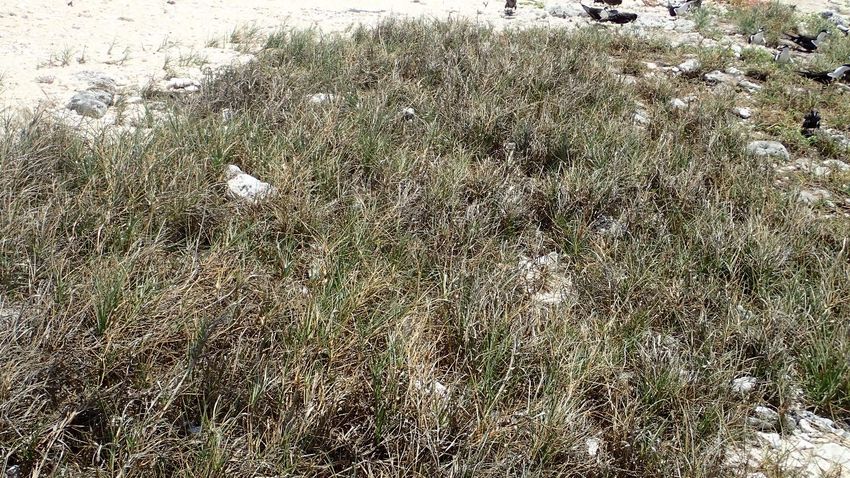
• Incidental observations of species and abundance of nesting seabird species present as well
as evidence of turtle nesting activity were also recorded at each of these sites.
• Twelve natural vegetation communities were identified and described.
• These vegetation communities were compared to those present on other Coral Sea cays and
the Capricorn Bunker, Great Barrier Reef cays.
• A vegetation map was produced showing the location of each of these communities on the
island. Parks Australia have been provided with rectified spatial files of the vegetation map
polygons and associated data.
• Four permanent monitoring sites were established and surveyed, two representing natural
marine couch grassland communities of the island, one representing a natural coastal
Argusia argentea (octopus bush) community and one located in a herbland at the site of the
sewage outlet.
• Nutrient analyses were undertaken on nine soil samples collected at the four permanent
monitoring sites at different depths from 0m to 60 cm.
• Results of the soil analyses were compared to those obtained on previous occasions on
other Coral Sea cays, and the Capricorn Bunker cays and Lady Elliot Island, Great Barrier Reef
cays.
• Seventeen reference GPS coordinates were recorded to assist with future aerial image
rectification.
• Recommendations are included in relation to weed control, other biosecurity management
and suitable plant species for rehabilitation planting.
Limitations of the report include:
• extremely dry conditions on the island at the time of the survey;
• lack of a suitable rectified aerial image for delineation of vegetation communities;
• insufficient time on the cay to complete comprehensive surveys;
• difficulty accessing some sites due to the abundance of nesting seabirds; and
• lack of Coral Sea vegetation benchmark data for biocondition assessment.
Page 6
While the October, 2020 survey provided good information on the vegetation of the island during
dry conditions, it is recommended that a survey be undertaken immediately following a wetter
period to provide better information on the vegetation diversity of the island.

1.0 Introduction
In October 2020, a survey of South Islet (Willis Islets), commonly referred to as Willis Island, was
conducted to assess and map the vegetation. Willis Island is part of the Coral Sea Marine Park and
has been the site of a Bureau of Meteorology weather station since 1921. The island was severely
impacted by cyclone Yasi in 2011.

1.1 Objectives of the Willis Island Vegetation Survey

The objectives of the vegetation survey were to:
      1. Establish and survey permanent monitoring sites (including *BioCondition reference sites if
         suitable) in as many vegetation communities as possible using the methodologies of Neldner
         et al. 2019 (secondary sites), Eyre et al., 2017 and Eyre et al. 2015;
      2. Traverse the island and record data at tertiary or quaternary site level (Neldner et al. 2019)
         to:
             ▪ ground truth the vegetation map;
             ▪ compile species lists;
             ▪ determine presence, abundance and distribution of weeds;
             ▪ identify other disturbance/threats to native cay vegetation; and
             ▪ record presence and nesting of seabirds and evidence of turtle nesting on the island
      3. Collect plant specimens as appropriate for identification and incorporation into the
         Queensland Herbarium and Australian National Herbarium collection as voucher records of
         species recorded on Willis Island; and
      4. Collect soil samples for nutrient analyses.

*BioCondition is a site-based, quantitative, and repeatable, condition assessment methodology that provides a measure
(expressed as a BioCondition score between 0 and maximum of 1 and BioCondition Class of 1, 2, 3 or 4 – one being the
best) of how well a terrestrial ecosystem is functioning for biodiversity values. A suite of attributes (e.g. tree canopy cover,
coarse woody debris, native plant species richness, litter cover) are assessed at a site and evaluated against benchmarks
for those attributes. The benchmarks for attributes are derived from a reference state for the Regional Ecosystem – the
latter being the natural variability in attributes of an ecosystem relatively unmodified since the time of European
settlement (Eyre et al. 2015).

1.2     Limitations of the Vegetation Survey and Mapping

The prevailing and preceding very dry conditions on the island at the time of the survey made the
vegetation survey challenging as many short-lived species, including annual invasive weed species,
were not growing on the island at this time. Due to the dryness of the vegetation, the vegetation
patterns on the drone image used to prepare the vegetation map did not accurately match the
vegetation actually present on the ground. Photo 1 shows the state of the native marine couch

                                                                                                                        Page 7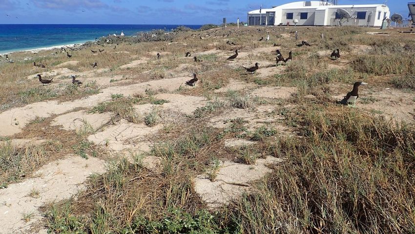
(Sporobolus virginicus) grassland at the time of the survey. The pattern on the 2019 aerial image
indicates this area was a dense grassland at the time the image was taken.

Photo 1 Dry conditions at Willis Island during the October 2020 survey

The dry conditions also made collection of soil samples difficult and prevented sample collection
from deeper in the soil profile.

The survey was undertaken during the peak seabird nesting season on the island. The presence of
large numbers of nesting seabirds including shearwaters in burrows made traversing the Island
during the survey both slow and difficult as care had to be taken not to disturb the nesting birds with
some areas inaccessible. Comprehensive survey of one of the permanent monitoring sites would
have dislodged red-footed booby chicks (Sula sula) from their nests in the native Argusia argentea
(octopus bush) shrubs and therefore only limited data could be recorded at this site.

Early June, after the end of the wet season and shearwater nesting period, would be the most
suitable time for vegetation survey with fewer ground and shrub nesting seabirds and moister
conditions favouring germination and growth of herbaceous and small shrub species that were
dormant in the seed bank at the time of the October 2020 survey.

A recent accurately rectified cloud free aerial image was not available prior to the field visit. There
was some cloud cover in the only image available, making delineation of the vegetation patterns
difficult and therefore limiting the accuracy of the vegetation map line work in parts of the island
obscured by cloud.

The vegetation communities described and mapped on Willis Island in this report have been
compared to Coral Cay vegetation communities identified and mapped by Batianoff et.al. (2008a)
and Hemson and Melzer (2020) and Capricorn Bunker vegetation communities and regional
ecosystems described and mapped by Batianoff et al. (2012). The Coral Sea cays do not occur within

                                                                                                   Page 8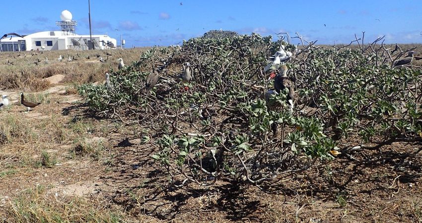
a currently identified Bioregion of Queensland and have no regional ecosystem mapping. Whilst
equivalent Capricorn Bunker regional ecosystems have been assigned to the vegetation communities
identified during this survey, the ecosystems of the Coral Sea cays differ from those of the Capricorn
Bunker cays in terms of both climate and available pathways for species recruitment. Although initial
surveys have been undertaken to establish biocondition benchmarks for the Coral Sea cays (Hemson
and Melzer, 2020), available benchmarks are currently restricted to Pisonia grandis (pisonia)
communities and there are no biocondition benchmarks available for any of the vegetation
communities present on Willis Island.

1.3 Nomenclature and Naturalised Status

Scientific plant species names used in this report are according to the Census of the Queensland Flora
2019 (G.K.Brown & P.D.Bostock, 2019). Common names are included in brackets following the first use
of each scientific name.

The term “non-native cay species” is used in this document to include exotic plant species not native to
Australia and mainland native plant species that are not considered native to the Coral Sea cays. The
term “weeds” is used to describe invasive herbaceous non-cay species that are self-propagating
naturally on the island.

2.0 Background Information

2. 1 Location and Physical Environment

The location of Willis Island is shown in the map in Figure 1. The island is located at 16.28780S,
149.96520E, 450 kilometres east-north east of Cairns and 466 km north-east of Townsville,
Queensland beyond the Great Barrier Reef. It is situated in the Coral Sea Marine Park approximately
50 km north-west of the Magdelaine Cays. Willis Island is located on the north-western side of the
sunken Willis Reef atoll and is the southernmost and largest of three coral cays comprising the Willis
Islets, which stretch in a NNE to SSW line for about 12 kilometres. It is protected on the eastern and
southern sides by the fringing reef.

Willis Island is an oval shape and is aligned NW to SE with a vegetated area of approximately six
hectares with a maximum length of 470 metres and a maximum width of 140 metres. The vegetated
area is surrounded by a sandy beach which ranges from approximately 25m to 35 m wide. The
exception to this is a 65m wide sandy spit at the north-western end. The island rises to a maximum
elevation of 8-9 metres above sea level (Farrow, 1984). The cay has a relatively narrow, low beach
rock platform that extends from the south-eastern tip to about three-quarters of the length along
the north-eastern shore, seaward of the sandy beach.

The cay is derived almost entirely from coralline and algal limestone with some organic content
derived from guano accumulation and decomposed plant material. The profile of the island is shown
in Photo 2.

                                                                                                Page 9
Figure 1 Location of Willis Island
Photo 2 Profile of Willis Island
Page 102. 2 Climate
The climate of the area has been described as a dry, tropical maritime climate with seasonal rainfall,
high and relatively stable temperatures throughout the year and high evaporation. Prevailing winds
from May to November are the South East Trade Winds with northwest Monsoon winds prevailing
during the wet season from December to April. An average of two to three cyclones affect the Coral
Sea per year, mainly between December and April. Willis Island was severely impacted by Cyclone
Yasi in 2011. Long term monthly and annual rainfall and temperature on Willis Island and monthly
averages for the 12 months preceding the October 2020 field survey are listed in Table 1.
Comprehensive and detailed information on Willis Island climate can be found in Batianoff et al.
2008a.
Table 1 Current and long term temperature and rainfall records for Willis Island (Australian Bureau
of Meteorology, 2020)
Current year (Oct 19 to Oct 20) Long Term Average (1921-2020)
Minimum Maximum Minimum Maximum
Rainfall Rainfall
temperature temperature temperature temperature
(mm) (mm)
Monthly Total (°C) (°C) (°C) (°C)
21st to 31st Oct-19 24.2 28.6 4.4 23.7
Nov-19 24.5 30.0 9.8 24.7 29.9 38.5
Dec-19 25.7 31.1 28.2 25.5 30.7 95.9
Jan-20 26.6 31.9 104.8 25.7 30.7 192
Feb-20 27.6 32.8 50.8 25.7 30.4 217
Mar-20 26.2 31.2 105.6 25.5 29.9 205.2
Apr-20 25.7 30.1 48.8 24.8 28.9 124.3
May-20 24.1 28.0 49.4 23.9 27.8 72.4
Jun-20 23.8 27.5 32.4 22.7 26.6 54.4
Jul-20 22.8 26.7 16.6 22 26 38.8
Aug-20 22.6 27.2 19.2 22 26.4 22.6
Sep-20 23.5 27.9 3 22.6 27.4 16
1st to 20th Oct 23.6 28.5 7.2
Oct-20 24.2 29.1 7.4 23.7 28.7 20.8
Annual 24.8 29.5 480.2 24.1 28.6 1101.5
1s t to 31s t October 2020 tempera tures were us ed to determi ne current yea r a nnua l a vera ge tempera tures
1s t to 20th October 2020 a nd 21s t to 31s t October 2019 were us ed to ca l cul a te the current yea r a nnua l ra i nfa l l
2. 3 Management Background
Willis Island is part of the Coral Sea Islands Territory which is an external territory of Australia and is
also part of the Coral Sea Marine Park. Parks Australia is responsible for the management of Willis
Island.
Page 11Willis Island and the surrounding waters are zoned Habitat Protection Zone (Reefs) (IUCN IV) under
the Coral Sea Marine Park Management Plan 2018. This zone is managed to allow activities that do
not harm or cause destruction to seafloor habitats while conserving ecosystems, habitats and native
species in as natural a state as possible.
A Bureau of Meteorology weather station, established in 1921, is located in the central, highest part
of the island. Currently the station and associated infrastructure are contained within an area of
approximately 0.75 ha. The grounds within the operational area around the buildings and
infrastructure are regularly mown.
2. 4 Ecological Values
The “dry” tropical vegetation of the Coral Sea cays including Willis Island are an important link with
Indo-Pacific region and the Melanesian Islands with the assistance of seabirds and prevailing east-to-
west South Equatorial Currents (Batianoff et al.,2008a and 2008b).
The vegetation communities on the Coral Sea cays, including Willis Island are unique, differing from
those of both the Pacific/Melanesian cays and those of the Great Barrier Reef and provide important
seabird habitat.
Willis Island is an important nesting site for a range of seabirds including Sterna sumatrana (black-
naped tern), Sula leucogaster (brown booby), Anous stolidus (common noddy), Anous minutus (black
noddy), Sula sula (red-footed booby), Onychoprion fuscata (sooty tern), and Ardenna pacifica
(wedge-tailed shearwater) (Wilgar, 1994). The nesting seabirds are also important in supplying
nutrient to the cay with nutrient leached into the water lens also being fed out to the sea and
providing nutrient important to the ongoing health of the surrounding reef.
Pluvialis dominica (lesser golden plover), Sterna bergii (crested tern), Pluvalis dominica (lesser
golden plover), and Arenaria interpres (ruddy turnstone) are permanent residents on the island
(Wilgar, 1994).
Fregata ariel (least frigatebird), Fregata minor (great frigatebird), Egretta sacra (eastern reef egret),
Sula dactylatra (masked booby) and Phaethon rubricauda (red-tailed tropicbird) are also regularly
seen on the island (Shelley, 2019 and Wilgar, 1994).
Todiramphus sancta (sacred kingfisher) and a number of other land birds are also frequently seen
on the island (Wilgar, 1994).
Willis is also a nesting site for the vulnerable Chelonia mydas (green turtle) and the vulnerable
Eretmochelys imbricata (hawksbill turtle) is present in the waters of the surrounding reef (Wilgar,
1994).
Page 122. 5 Existing Information
Previous reports on the vegetation of Willis Island include a report by S. Donaldson who visited and
surveyed some northern Coral Sea Islands including Willis Island during 1994–95 (Donaldson, 1994)
and a report on the 2006/2007 visit and survey of the then Coringa-Herald National Nature Reserve
by George Batianoff and others (Batianoff et al. 2008a). The National Herbarium contains plant
specimen records for plant specimens collected on Willis Island submitted in 1981 by A. Skeat. It is
not known whether a report on this visit was prepared.
3.0 Methodologies
3.1 Vegetation Mapping
Prior to the field trip, a spatially rectified 2019 DigitalGlobe drone image was used to delineate
patterns of vegetation on the island using the Quantum GIS program. Point coordinates of suitable
locations for ground truthing of the vegetation polygons were created using the QGIS program and
uploaded to a Garmin GPSMAP 66S Global Positioning System. Data was recorded in the vicinity of
these locations and others during the field trip. The vegetation map polygons were attributed using
the vegetation communities identified and described from data recorded at these sites.
3.2 Site Data Recorded
Two people spent one and a half days surveying and recording the vegetation on Willis Island on 18th
and 19th October, 2020. As time on the island was limited, it was not possible to undertake
comprehensive replicate site surveys in each vegetation community present on the island. To ensure
sufficient data was obtained and the vegetation of the entire island was thoroughly assessed, a
modified “quick” methodology was used with the following data recorded at each of 52 locations
across the island:
• GPS coordinates
• vegetation structure (from estimated height and cover)
• all plant species present
• cover of each species at the site
• total weed cover
• slope
• surface soil description
• observations of nesting seabirds and other seabirds and evidence of turtle activity present
The number of square metres included in each site was not defined. The data recorded at each of
the 52 sites represented an area surrounding the recorded GPS coordinates that was homogeneous
in terms of vegetation community, soil, slope and aspect.
The location of these sites are shown in Figure 2.
Page 13The site data recorded was used to:
1. identify and describe all of the vegetation communities present on the island and the
variation within each community;
2. obtain a complete floristic inventory for the island;
3. identify the spatial extent and abundance of all weed species present on the island;
4. attribute vegetation patterns on the drone imagery to create a vegetation map for the
island;
5. determine habitat preferences of seabirds and turtles;
6. assess the recovery of the islands vegetation from the impact of Cyclone Yasi;
7. assess potential human impact on the island’s vegetation; and
8. look for evidence of pests, diseases or any other issues affecting the vegetation of the island.
Heights and covers of total vegetation at each site were estimated to derive the structure class of
the vegetation at each site as described in the methodology in Neldner et al. (2019). Structural
classes derived from heights and covers are tabled in Appendix 1.
The cover of each species at each site was recorded as one of the following cover classes:
1. trace to 5%
2. 6% to 25%
3. 26% to 50 %
4. 51% to 75%
5. 75% to 95 %
6. 95% to 100%
This method provided a simple rapid method to document the relative dominance of each species at
each site.
3.3 Permanent Vegetation Monitoring and Biocondition Assessment Sites
Four 50m x 20m permanent monitoring sites were established on the island to enable comparisons
of the vegetation over time, monitor biocondition and to assess the impact of climate change and
other disturbances on the vegetation of the island.
Sites were permanently marked with star pickets located at the 0m and 50m ends of the 50m
transect in the centre of the plots.
Three of the permanent sites were surveyed using the secondary site survey methodology of
Neldner et al. (2019). The fourth site, located in an Argusia argentea (octopus bush) community,
could not be comprehensively surveyed during the October 2020 field trip as large numbers of red-
footed boobies (Sula sula) including chicks were sitting on nests in the branches of the Argusia
shrubs throughout the site and site survey would have caused unacceptable disturbance to these
nesting birds. The permanent monitoring sites were located in a representative area within the
selected vegetation communities and outside the boundaries of the operational area. As the sites
are permanently marked with labelled star pickets, the sites can be re-monitored any time in the
future. The marine couch (Sporobolus virginicus) grassland sites may be suitable reference sites to
Page 14obtain benchmarks for this community on other Coral Sea cays. To obtain benchmark data, the sites
would have to be re-monitored at a wetter time of the year.
To ensure long term secure data storage and accessibility, data recorded at the permanent
monitoring sites will be stored digitally by Parks Australia and also by the Queensland Herbarium in
the CORVEG database and the Queensland Herbarium photo database.
No permanent monitoring sites were established in the herblands immediately adjacent to the
shoreline as the vegetation in these areas is dynamic, constantly changing with wave accretion/
depositional processes and periodic inundation caused by cyclonic and storm surges.
Location of the permanent monitoring sites are shown in Figure 2. Plot orientation and a list of the
data recorded at the permanent monitoring sites are contained in Appendix 2.
Figure 2 Location of vegetation data recording sites and permanent monitoring sites
3.4 Reference GPS Coordinates
Reference GPS coordinates were recorded using a Garmin GPSMAP 66S global positioning system at
numerous fixed point locations such as corners of roofs and solar arrays, path intersections,
anemometer antenna etc. for the purposes of image rectification. The accuracy of these positions as
Page 15recorded on the GPS was approximately 3m.The coordinates and locations of these are contained in
Appendix 3.
3.5 Soil Analyses
Soil colour and texture were recorded at each of the 52 vegetation survey sites.
Soil samples were collected at various depths from each of the permanent monitoring sites for pH,
conductivity and nutrient analyses.
Soils were analysed by SGS Cairns International. A summary of the methodologies used are
contained in Appendix 5.
4.0 Results and Discussion
4.1 Prevailing Climatic Conditions
Prevailing conditions at the time of the October 2020 field survey were very dry. Comparison of
rainfall records from Willis Island recorded in the 12 months preceding the survey with long term
averages graphed in Figure 3 shows that all months in the preceding 12 months had been drier than
average. The BoM recorded only 480.2mm of rain falling during this period compared with the long
term annual average of 1101.5mm based on 95 years of records spanning 1921 to 2020 (Australian
Bureau of Meteorology, viewed November 2020). Refer to Table 1 Current and long term
temperature and rainfall records for Willis Island (Australian Bureau of Meteorology, 2020).
Figure 3 Comparison of monthly rainfall data for the preceding 12 months with long term averages
(Australian Bureau of Meteorology, viewed November 2020)
Page 164.2 Floristic Composition
Sixteen species were recorded on the island during the October 2020 field trip. These included all
living plants and identifiable standing dead plants. No other species were identifiable in litter or from
seeds on the ground. Of these sixteen species, eight were naturally occurring species native to Coral
Sea cays, six were naturalised exotic species not naturally occurring in Australia, one was a planted
native species and one was a species considered to be exotic on the mainland but naturally occurring
on the cays. The vegetation was very dry at the time of the survey and had obviously died back
during the preceding dry period. Many species previously recorded were not present in the above-
ground vegetation during the October 2020 field survey. It is probable that most of these were
present in the seedbank. A vegetation survey soon after the end of the wet season would provide
the best opportunity to obtain a complete floristic inventory for the island. Table 2 includes a
comparison of species recorded during the October 2020 survey with those recorded during
previous surveys of Willis Island and also whether or not there are voucher pressed specimens in
herbarium collections confirming the identification of these species at the Willis Island location.
The mature plants of the planted tree species, Cocos nucifera and Casuarina equisetifolia subsp.
equisetifolia that were present on Willis Island prior to cyclone Yasi are no longer present on the
island. One small plant of Cocos nucifera was observed during the survey.
The native grass Stenotaphrum micranthum (beach buffalo grass), positively identified during the
October 2020 survey, had not previously been recorded on Willis Island. This species commonly
occurs on cays throughout the Coral Sea and the Great Barrier Reef.
The vegetation of Willis Island is very similar to the vegetation present on other smaller Coral Sea
cays with a small, limited number of species present compared to the vegetation of the mainland
and continental islands. This is a consequence of limited mechanisms for recruitment. The Coral Sea
cays also do not contain Casuarina equisetifolia, Pandanus tectorius and several other species that
characterise the vegetation of cays within the Great Barrier Reef. Pisonia grandis is present on some
of the larger Coral Sea cays. According to historical records, however, Pisonia grandis has never been
present on Willis Island.
Batianoff et al (2008a and 2008b) described the origins and dispersal mechanisms of the Coral Sea
cays including Willis Island. According to Batianoff et al., the species found on these cays are a
subset of the broader ubiquitous tropical Indo-Pacific oceanic flora with the naturally occurring flora
of the Coral Sea Marine Park Cays and Willis Island most likely derived from Pacific-Melanesian
islands. Batianoff claimed that mechanisms of dispersal of naturally occurring species are via ocean
currents and seabirds, and the establishment of naturalised exotic species on Willis Island was a
consequence of human activity.
Batianoff et al also noted that due to isolation and prevailing westerly currents, the Coral Sea Marine
Park cays and Willis Island have a unique species assemblage, and noted that the vegetation of Willis
Island does not contain widespread native cay species such as Ipomoea macrantha, Lepidium
englerianum, and Plumbago zeylanica (native plumbago) that tend to characterise the smaller cays
of the Coral Sea Marine Park. It was also noted that Willis Island has the only Ipomoea pes-caprae
subsp. brasiliensis (goats foot convolvulus) found in the area (Batianoff, 2008).
Page 17Table 2 contains a comparison of the species recorded on Willis Island with those recorded on the
Coral Sea Marine Park and Willis Island cays by Donaldson (1994) and Batianoff et al (2008a) and in
the Coral Sea Marine Park by Hemson and Melzer (2020). Willis Island was not visited in the 2019
survey by Hemson and Melzer.
The Willis Island Building Rectification Environmental Plan for Contractors (Bureau of Meteorology
2013) also lists the following weed species as present on Willis Island:
• Argemone ochroleuca (Mexican poppy)
• Cleome gynandra (cats whiskers)
These two species were not present on the island at the time of the October 2020 survey and there
are no other records of their previous presence on Willis Island.
The native Abutilon indicum and Abutilon albescens were both listed in the Building Rectification
Environmental Plan for Contractors. Abutilon indicum is a previously used synonym for Abutilon
albescens. The current name for this species in Australia is Abutilon albescens (lantern bush). No
plants of this species were growing on the island at the time of the survey and there was no
evidence of fallen or dead standing plants. It is likely that viable Abutilon albescens seeds are still
present on the island.
Most of the herbaceous sub-shrub, Achyranthes aspera (chaff flower) recorded were dead plants.
The native Boerhavia albiflora var albiflora has a large fleshy root enabling it to survive longer dry
periods than most other herbaceous species and this species was alive and thriving at most sites.
Portulaca oleracea (pigweed), a native cay succulent, was also growing successfully in the dry
conditions as were the native perennial native grasses, Sporobolus virginicus (marine couch) and
Lepturus repens (stalky grass).
There were some invasive weeds present on the island at the time of the survey. Cenchrus echinatus
(Mossman River grass) was present as dead standing plants and small infestations of Euphorbia
cyathophora (dwarf poinsettia) were observed in four locations. These were marked with pink
flagging tape and pointed out to BoM staff who agreed to remove them and monitor for regrowth.
No evidence of the exotic grass, Eleusine indica (crows foot grass) was present which was unusual
given this weed has previously been reported and is known to be a highly invasive species. It is likely
that a seedbank of this, and other previously recorded weed species, are present and will re-
establish in wetter conditions. The mown area consisted of an open grassland dominated by the
exotic grass, Dactyloctenium aegyptium (coast button grass). A number of other exotic invasive
herbaceous species were also present in the mown area. The locations of weed species recorded
during the survey outside the mown area are shown in Figure 4.
Page 18Table 2 Comparison of species recorded on Willis Island with species records for Coral Sea Marine Park cays and previous records for Willis Island 1 = recorded by Donaldson, 1994; 2 =recorded by Batianoff et al. 2008a; 3 = recorded by Hemson and Melzer, 2019; 4 = recorded during October, 2020 by Brushe A = abundant (present at 70–100% of sites with >30% cover per site); F = frequent (present at 30–70% of sites with 15–30% cover/site); I = infrequent (present at 10–30% of sites with
South                   South-       South                         National     Queensland
                                                                                               North                    Chilcott
                                                                                                             West                     West      Magdelaine                     Herbarium     Herbarium
                                                                                              East Cay                    Islet
              Scientific name                       Common name                 Family                        Cay                     Islet       Island      Willis Island    Specimen       Specimen
                                                                                              (Herald                   (Coringa                                                for Willis    for Willis
                                                                                                            (Herald                 (Coringa   (Magdelaine
                                                                                               Cays)                     Islets)                                                  Island        Island
                                                                                                             Cays)                   Islets)      Cays)
$Portulaca oleracea                             pigweed                     Portulacaceae    1, 2(I/F), 3   2(I/F), 3   2(I), 3     2(I), 3    1, 2(I), 3    1, 2(I), 4(F)         Y             Y
Sporobolus virginicus                           sand couch                  Poaceae          1, 2(F), 3     2(F), 3     2(I)                   1, 2(F), 3    1, 2(F), 4(A)         Y             Y
Stenotaphrum micranthum                         beach buffalo grass         Poaceae          1, 2(I)        2(I)        2(I/F), 3              1, 2(I), 3    2(?), 4(R)            N             N
Tribulus cistoides                              Bulls head burr             Zygophyllaceae   1, 2(F), 3     2(F), 3     2(F), 3     2(F), 3    1, 2(F), 3    1, 2(I/F), 4(R)       Y             Y
Xirnenia americana                                                          Olacaceae        1,
Weed Species
*Alternanthera pungens                          khaki weed                  Amaranthaceae                                                                    1, 2(D)               Y             N
*Amaranthus viridis                             green amaranth              Amaranthaceae                                                                    1, 2(I), 4(I)         Y             Y
*Cenchrus echinatus                             Mossman River grass         Poaceae                                                                          1, 2(I), 4(I)         Y             Y
*Cynodon dactylon                               couch                       Poaceae                                                                          2(I)                  Y             Y
*Dactyloctenium aegyptium                       coast button grass          Poaceae                                                                          2(F), 4(F)            Y             Y
*Eleusine indica                                crows foot grass            Poaceae                                                                          1, 2(I)               Y             Y
*Euphorbia cyathophora                          dwarf poinsettia            Euphorbiaceae                                                                    2(F), 4(I)            Y             Y
*Euphorbia prostrata                            prostrate caustic creeper   Euphorbiaceae                                                                    1, 2(I), 4(R)         Y             Y
*Trianthema portulacastrum                      black pigweed               Aizoaceae                                                                        2(R), 4(R)            Y             Y
*Tridax procumbens                              tridax daisy                Asteraceae                                                                       1, 2(R)               Y             Y
Planted Species
#Casuarina equisetifolia subsp. equisetifolia                               Casuarinaceae                                                                    2(R)                  N             Y
#Cocos nucifera                                 coconut                     Arecaceae                                                                        2(R/I), (4R)          N             N

                                                                                                                                                                                               Page 20
Figure 4 The red dots mark the location of weed species recorded outside the mown area during the
October 2020 vegetation survey.
4.3 Vegetation Communities
The vegetation on Willis Island consisted predominantly of grasslands and herblands with low shrubs
of Argusia argentea scattered along the coastline and also in other areas throughout the island.
Vegetation communities identified, described and mapped in this section are very similar to
communities present on the Coringa Islets, Herald Cays and Magdelaine Cays of the Coral Sea
Marine Park mapped and described by Batianoff et al. (2008a) and Hemson and Melzer (2020).
The following native communities, present on the above cays were not present on Willis Island in
October, 2020.
• Ipomoea violacea vineland
• Abutilon albescens open shrubland to shrubland communities
• Plumbago zeylanica shrubland to closed shrubland
• Cordia subcordata communities
• Pisonia grandis communities
• Colubrina open-heath
Page 21The Ipomoea pes-caprae/Sporobolus virginicus herbland community on Willis Island is not present
on any of the Coringa, Herald or Magdelaine cays, although it does occur as a component of some
vegetation communities on the Capricorn Bunker cays in the southern Great Barrier Reef.
It is likely that during wetter conditions, Abutilon albescens shrublands will re-establish from the
seedbank on Willis Island. It is also likely that Achyranthes aspera herblands will be more extensive
following rainfall events.
The Argusia argentea communities on the Willis Island were lower in height than those on the
Coringa, Herald and Magdelaine cays with most less than one metre tall. The exception to this were
a number of plants on the upper slope adjacent to the mown areas that reached a height of over
2m.
In 2006/2007 George Batianoff and others noted that there was an absence of Argusia argentea
dieback at Willis Island, most likely due to the relatively recent establishment of A. argentea on the
island as earlier reports and aerial photographs did not show its presence on Willis Island. The
individuals that were present on the island at the time of their survey were younger than mature
individuals in the Coringa, Herald and Magdelaine cays (Batianoff 2008a). There was some dieback of
A. argentea on Willis Island in the October 2020 survey and the low height and extremely multi-
branched growth form suggested that they had been buried (or partially buried) by sand deposits
sand and had continued to grow through these sand deposits. Photo 3 shows the typical growth
form of the Willis Island Argusia argentea.
Photo 3 Growth form and dieback of Argusia argentea on Willis Island
Figure 5 lists the vegetation communities present on Willis Island in October 2020 and shows their
spatial distribution on the island.
Page 22Willis Island 2019/2020 Vegetation Map
Figure 5 Vegetation map of Willis Island based on patterns visible on 2019 drone image and field data recorded in October 2020
Page 23The units shown in the map are described below. Equivalent or similar Coral Sea and Capricorn
Bunker cays vegetation communities and Regional Ecosystems described and mapped by Batianoff
et al., (2008a and 2012) and Hemson and Melzer (2020) are included for each of these communities
where applicable. The vegetation and Regional Ecosystems of the Capricorn Bunker cays are listed as
similar rather than equivalent to those of the Coral Sea as they differ floristically due to differences
in both climate and available pathways for species recruitment.
Issues relating to large scale of cay vegetation mapping as a consequence of the small size of coral
cays as well as the dynamic nature of some of the cay vegetation communities create difficulties in
determining whether small areas dominated by particular species should be described and mapped
as a component of surrounding communities or whether they should be identified and mapped as
separate communities. Examples are the Boerhavia albiflora, Achyranthes aspera, Ipomoea pes-
caprae herbland communities and Abutilon albescens shrublands, all of which can form patches
large enough to map separately but which typically occur in small patches that mosaic with other
vegetation types. Some of these are also quite short-lived (e.g. Abutilon albescens and Achyranthes
aspera communities). Some cay communities can also vary between grasslands and forblands with
changes in floristic dominance at different times. These issues have to be taken into account when
comparing vegetation communities with those described and mapped in other cay vegetation
reports.
Location of sites referred to in the vegetation community descriptions are shown on the map in
Figure 2.
The following descriptions are based on data recorded during the October 2020 survey and reflect
the prolonged extremely dry conditions at that time. Greater diversity is likely to be present during
and following wetter seasons.
Unvegetated Units
A Sandy shores
Total area = 3.22 ha
Equivalent Capricorn Bunker Unit: A - Sandy shores
Equivalent Coral Sea Unit (Batianoff et al., 2008a): A - Sandy shores
Equivalent Coral Sea Unit (Hemson & Melzer, 2020): Sandy shores
B Lithified shore
Total area = 0.33 ha
Equivalent Capricorn Bunker Unit: B - Lithified shores
Equivalent Coral Sea Unit (Batianoff et al., 2008a): B - Lithified shores
Equivalent Coral Sea Unit (Hemson & Melzer, 2020): Lithified shores
Page 24Vegetated Units
Beach and Dune Communities
These communities are present on the foredune areas, swales and flats adjacent to the shoreline.
1 Open herblands, herblands and open forblands
Total area =0.97 ha
Sites: 1, 2, 3, 4, 10, 12, 17, 19, 26
Similar Capricorn Bunker Vegetation Community and Regional Ecosystem:
1d - Seashore mixed herbland (Regional Ecosystem 12.2.14i)
Equivalent Coral Sea Vegetation Communities (Batianoff et al., 2008a):
1 - Littoral open-grassland/herbland; and 4 - Boerhavia herbland
Equivalent Coral Sea Vegetation Communities (Hemson & Melzer, 2020):
Littoral grassland/herbland; and Boerhavia albiflora herbland
Photo 4 Littoral open herbland
These communities are subjected to periodic inundation during storm surges and king tides. The
vegetation is extremely dynamic and is constantly re-establishing with coastal erosion and accretion.
Vegetation in the open forblands was dominated by Boerhavia albiflora var. albiflora (boerhavia).
The herblands and open herblands were typically dominated by Boerhavia albiflora var. albiflora,
Lepturus repens and Portulaca oleracea. Small patches of Sporobolus virginicus were present in some
places. Achyranthes aspera was present at site 12 and occasional Ipomoea pes-caprae subsp.
brasiliensis was present in the vicinity of site 1.
Page 252 Sparse herbland and open forblands
Total area = 0.06 ha
Sites: 6, 21
Similar Capricorn Bunker Vegetation Community and Regional Ecosystem:
1e - Very sparse herbland, mainly sand (North Reef) (Regional Ecosystem 12.2.14g)
Equivalent Coral Sea Vegetation Communities (Batianoff et al., 2008a):
1 - Littoral open-grassland/herbland; and 4 - Boerhavia herbland
Equivalent Coral Sea Vegetation Communities (Hemson & Melzer, 2020):
Littoral grassland/herbland; and Boerhavia albiflora herbland
Photo 5 Sparse herbland on accreting shoreline
These communities consisted of pioneer vegetation establishing on accreting shorelines. They were
dominated by Boerhavia albiflora var. albiflora or Portulaca oleracea. Occasional plants of Lepturus
repens and Stenotaphrum micranthus were also present, the latter only in the vicinity of site 6.
Argusia argentea seedlings were establishing on the shoreline in this community on the northern
spit.
Page 263 Lepturus repens open grassland to grassland with patches of open forblands and herblands
Total area = 0.25 ha
Sites: 20, 22, 24, 25, 28, 33, 39
Similar Capricorn Bunker Vegetation Community and Regional Ecosystem:
1d - Seashore mixed herbland (Regional Ecosystem 12.2.14i)
Equivalent Coral Sea Vegetation Community (Batianoff et al., 2008a):
2 - Lepturus open-grassland
Equivalent Coral Sea Vegetation Community (Hemson & Melzer, 2020):
Lepturus repens open to closed grassland
Photo 6 Lepturus repens grassland
The grass, Lepturus repens was the dominant species present. Boerhavia albiflora var. albiflora were
present at all sites. At the time of the survey this community also had patches of open forblands and
herblands variously dominated by Boerhavia albiflora var. albiflora, Lepturus repens and Portulaca
oleraceus. Sporobolus virginicus and Tribulus cistoides (bulls head burr) were also present in the
vicinity of site 39.
Page 274 Sporobolus virginicus open to closed grassland
Total area = 0.12 ha
Sites: 5, 11, 45
Similar Capricorn Bunker Vegetation Community and Regional Ecosystem:
1c - Sporobolus virginicus tussock grassland (Regional Ecosystem 12.2.14d)
Equivalent Coral Sea Vegetation Community (Batianoff et al., 2008a):
3 - Sporobolus open to closed-grassland
Equivalent Coral Sea Vegetation Community (Hemson & Melzer, 2020):
Sporobolus virginicus open to closed grassland
Photo 7 Sporobolus virginicus closed grassland
This community was present only in small patches on the frontal dune area. Other species in this
community were Boerhavia albiflora var. albiflora and Portulaca oleracea.
Page 285 Stenotaphrum micranthum grassland
Total area = 0.04 ha
Sites: 7
Similar Capricorn Bunker Vegetation Community and Regional Ecosystem:
Component of 1d - Seashore mixed herbland (Regional Ecosystem 12.2.14i) and other
foreshore beach vegetation communities
Equivalent Coral Sea Vegetation Communities (Batianoff et al., 2008a):
Component of Units 1 - Littoral open-grassland/herbland, 2 - Lepturus open-grassland and 3 -
Sporobolus open to closed-grassland
Equivalent Coral Sea Vegetation Community (Hemson & Melzer, 2020):
Component of Littoral grassland/herbland and Boerhavia albiflora herbland.
Photo 8 Stenotaphrum micranthum grassland
Lepturus repens and occasional Boerhavia albiflora var. albiflora, Portulaca oleracea and Sporobolus
virginicus were also present in this unit. Stenotaphrum micranthum is more abundant in the other
Coral Sea cays and the Capricorn Bunker cays where it is a component of most seashore
communities. This community was present only in one location on Willis Island in the SW coastline
area and was mapped as a separate unit because its location and extent were accurately known. For
consistency with mapping on the other cays it could be included as a component of shoreline
grassland/ herbland communities 1 and 2.
Page 296 Argusia argentea dwarf open shrublands to dwarf shrublands
Total area = 0.68 ha
Sites: 8, 9, 15, 16, 23, 27, 34, MO4
Similar Capricorn Bunker Vegetation Communities and Regional Ecosystems:
This community is similar to Capricorn Bunker Vegetation Community 2a - Argusia
argentea-Scaevola taccada open-scrub (littoral scrub) +/- Pandanus tectorius emergents
(Masthead) (Regional Ecosystem 12.2.19a) and 2b - Argusia argentea open-scrub with
Casuarina equisetifolia subsp. incana emergents (Regional Ecosystem 12.2.19b). However,
Pandanus tectorius and Casuarina equisetifolia, however, are not present on the Coral Sea
cays.
Equivalent Coral Sea Vegetation Community (Batianoff et al., 2008a):
10a - Argusia open-shrubland to open-scrub
Equivalent Coral Sea Vegetation Community (Hemson & Melzer, 2020):
Argusia open shrubland to open scrub
This community is lower in height than on the other Coral Sea Cays and on the Capricorn Bunker cays.
Photo 9 Argusia argentea dwarf shrubland
Photo 10 Site 8 Argusia argentea dwarf open shrubland
Page 30The ground layer of this community was sparse and variously dominated by Boerhavia albiflora var.
albiflora, Lepturus repens and Portulaca oleracea. The ground layer of site 34 was co-dominated by
Lepturus repens and Sporobolus virginicus.
Communities on the slopes
These communities are located well above the highest astronomical tide level and rarely if ever
experience sea water inundation and wave erosion.
7 Sporobolus virginicus grassland to closed grassland
Total area = 1.81 ha
Sites: 13, 14, 18, 29, 30, 31, 32, 35, 38, 40, 42, 44, 48, 49, 51, MO1, MO3
Similar Capricorn Bunker Vegetation Community and Regional Ecosystem:
4 - Mixed tussock grassland/herbland (Regional Ecosystem 12.2.17a)
Equivalent Coral Sea Vegetation Community (Batianoff et al., 2008a):
3 - Sporobolus open to closed-grassland
Equivalent Coral Sea Vegetation Community (Hemson & Melzer, 2020):
Sporobolus virginicus open to closed grassland
Photo 11 Site 13 Sporobolus virginicus closed grassland
Page 31Photo 12 Site 42 Sporobolus virginicus grassland
This was the dominant vegetation community on the island. Boerhavia albiflora var. albiflora was
present at all sites. Achyranthes aspera was present at sites 31, 40, 42, 48, MO1 and MO3. Ipomoea
pes-caprae subsp. brasiliensis was present in sites 13, 14 and 48. Occasional plants of Lepturus
repens and Tribulus cistoides and Portulaca oleracea were present at sites 35, 48 and 31
respectively. Sites 31 and 32 had low numbers of the invasive exotic weed, Euphorbia cyathophora.
Page 328 Sporobolus virginicus closed grassland with emergent Argusia argentea low shrubs
Total area = 0.16 ha
Site: 36
Similar Capricorn Bunker Vegetation Community and Regional Ecosystem:
Nil
Similar Coral Sea Vegetation Community (Batianoff et al., 2008a):
3 - Sporobolus open to closed-grassland (NE Herald), 10b - Argusia tall open-shrubland
(dieback) (NE Herald)
Similar Coral Sea Vegetation Community (Hemson & Melzer, 2020):
Sporobolus virginicus (sand couch) grasslands
The Argusia argentea is lower in height and has less dieback than reported on NE Herald by
Batianoff et al., 2008a
Photo 13 Site 36 Sporobolus virginicus closed grassland with emergent Argusia argentea low shrubs
Occasional Boerhavia albiflora var. albiflora and Ipomoea pes-caprae subsp. brasiliensis were
present in the vicinity of site 36. The invasive exotic weed, Euphorbia cyathophora was also present
at this location.
Page 339 Achyranthes aspera open herbland to herbland
Total area = 0.08 ha
Sites: 46, 50
Similar Capricorn Bunker Vegetation Communities and Regional Ecosystems:
Small patches of Achyranthes aspera are present within vegetation community 4 - Mixed
tussock grassland/herbland (Regional Ecosystem 12.2.17a) and vegetation community 5c -
Abutilon albescens shrubland (Regional Ecosystem 12.2.18c) as well as recently disturbed
areas within other units.
Equivalent Coral Sea Vegetation Community (Batianoff et al., 2008a):
6 - Achyranthes mixed herbland
Equivalent Coral Sea Vegetation Community (Hemson & Melzer, 2020):
Achyranthes aspera herbland
Photo 14 Site 46 Achyranthes aspera/Sporobolus virginicus open herbland
Achyranthes aspera is a short-lived herbaceous sub-shrub that dies off in dry conditions as
demonstrated in Photo 14. At the time of the October 2020 survey, this community was co-
dominated by Sporobolus virginicus. Boerhavia albiflora var. albiflora are also present at these sites.
Page 34You can also read