Rural living handbook - A guide for rural landholders of the Adelaide Plains, Mount Lofty Ranges and Fleurieu Peninsula - Landscape South Australia
←
→
Page content transcription
If your browser does not render page correctly, please read the page content below
Rural living
handbook
A guide for rural landholders of the Adelaide Plains,
Mount Lofty Ranges and Fleurieu Peninsula
Adelaide and Mount Lofty Ranges natural resources centres

Eastwood
T: 8273 9100
E: DEW.AMLR@sa.gov.au

Gawler
T: 8115 4600
E: DEW.AMLRGawlerOffice@sa.gov.au

Black Hill
T: 8336 0901
E: DEW.AMLRBlackHillOffice@sa.gov.au

Willunga
T: 8550 3400
E: DEW.AMLRWillungaOffice@sa.gov.au

www.naturalresources.sa.gov.au/adelaidemtloftyranges

Licensed under Creative Commons Attribution 3.0 Australia
www.creativecommons.org/licenses/by/3.0/au
Copyright owner: Crown in right of the State of South Australia 2020

Disclaimer
This handbook is not a comprehensive guide to managing your land. It is intended to help you find good
advice. No legal liability is accepted for the information, errors or omissions contained in this booklet.

Acknowledgements
The format and some of the general content of the Rural living handbook are based on a rural living
handbook produced by the Goulburn Mulwaree Council and the Sydney Catchment Authority, NSW.
The Adelaide and Mount Lofty Ranges Natural Resources Management Board would like to thank both
organisations for permission to draw on the ideas contained in that document.

This handbook was originally funded by the Australian government.
The 2020 reprint was funded by the NRM levy.
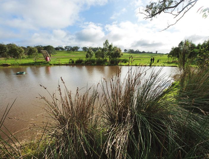
Table of contents
  Introduction – rural living                            3

1 | Buying your property                                 5
  Moving out of the city                                 5
  Living in the region                                   6
  What is the Adelaide and Mount Lofty Ranges Natural
  Resources Management Plan?                             7
  Planning and managing your property                    8
  Case study                                            10

2 | Natural resources                                   11
  Water                                                 11
  Soil                                                  14
  Native vegetation and animals                         16
  Fire                                                  19
  Weeds                                                 22
  Pest animals                                          23

3 | Property management                                 25
  Waste management                                      25
  Effluent management                                   26
  Chemicals                                             27
  Wood smoke and heating                                29
  Livestock management                                  29
  Fences                                                31
  Farm safety                                           33
  Rates                                                 34
  Absentee landholders                                  35
  Developing your property                              35
  Improving your knowledge                              36
  Further reading                                       37

4 | Local information                                   39
  Revegetation                                          39
  Declared plants                                       40
  Endangered fauna                                      41
  Endangered flora                                      42
  Local contacts                                        43
  Local government contacts                             44

Acronyms                                                45
Introduction – rural living
‘Getting away from it all’ is an Australian             The Rural living handbook brings together
dream. In the Adelaide and Mount Lofty Ranges           some of the significant issues that you will face
(AMLR) region, getting away from it all often           as a rural landholder within the AMLR region.
involves buying a rural block. Rural blocks can         It also provides contact details for people and
be productive farmland, a bush block or a               organisations that provide support to rural
combination of both.                                    landholders.

However, the environment is under pressure
from our collective lifestyles. So the Adelaide
and Mount Lofty Ranges Natural Resources
Management Board through the Department
for Environment and Water, along with private
businesses and individuals, is pursuing sustainable
development to protect our environment for
the future.

Local activities have a significant effect on
water quality and catchment health. We have
a responsibility to ensure that we care for and
maintain healthy watercourses, soil, remnant
vegetation and native fauna populations.

As we need to get along well with our neighbours,
we should avoid affecting the chosen lifestyle of
others in pursuing our individual goals. However,
our rural landscape is a productive farming and
resource area, and some legitimate activities carried
out in the region may have unavoidable impacts.

Different people will want to manage their land
in different ways. Some will want to keep and
enhance the existing bush; others will want to run
stock and cultivate crops. Whatever your goals as
a landowner or manager, you need to be aware            Map of the Adelaide and Mount Lofty Ranges Natural
of your rights and responsibilities.                    Resources Management Board region

                                                               Rural living handbook | Introduction – rural living | 3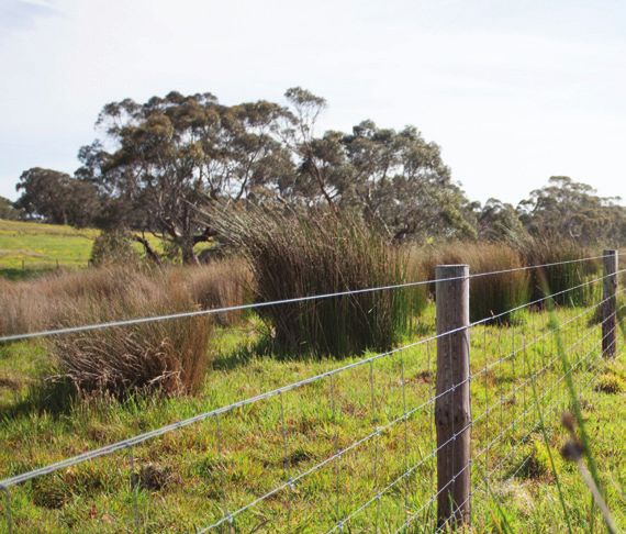
1 | Buying your property
           • Moving out of the city
           • Living in the region
           • What is the Adelaide and Mount Lofty Ranges
             Natural Resources Management Plan?
           • Planning and managing your property
           • Case study

Moving out of the city                                  • Is there enough shade and water for livestock?
                                                        • Are you aware that in most instances you require
Before you decide to buy a rural property, it is          approval to remove native vegetation? How
recommended that you have it independently                might this affect your activities?
assessed, and consider the following questions:
                                                        • Is there enough water to carry out the activity
• Does the zoning of the land allow your proposed         or activities that you have in mind and is it of
  use, or will you need to apply for a change of          suitable salinity?
  land use or any other permit?
                                                        • Do you know what the regulations and
• Are all required services provided to the property?     conditions are for building dams or sinking
  If not, can they be provided economically? Or is        bores? Do you know that any work undertaken
  it an area that will always have limited services?      in or around a watercourse requires a permit
  Services include phone, internet (connections in        (see chapter 2 on ‘Natural resources’)?
  rural areas may be slow, so check with providers),
                                                        • Does the vendor have a water licence or
  gas, water, sewer and electricity.
                                                          authorisation, and are they willing to transfer
• Is the land use that you plan for the property          this to you as the buyer? Is an approved meter
  suited to the landscape and capability of the land?     installed? You can check metering requirements
• What weeds are on the property? Are any of              with the Department for Environment and Water.
  them declared weeds? (By law declared weeds           • Has a water allocation plan been adopted
  must be controlled).                                    for the area in which the property is located?
• Is there soil erosion on the property that will         Note that water allocations plans are legal
  be time consuming and expensive to fix?                 documents and may prohibit the building
                                                          of new dams, or the taking of water (from
• Are there pest animals (e.g. rabbits, foxes)
                                                          dams, watercourses or underground) in some
  on the property?
                                                          areas. The latest versions of plans can be
• What is the likely amount of time and money             found at www.naturalresources.sa.gov.au/
  required to control weeds, erosion and pest             adelaidemtloftyranges.
  animals on the property?
                                                        • Is the soil fertile and the pH appropriate for
• Are there good-quality pastures? Are they               pasture, crops or any other produce that you
  dominated by native or introduced species?              want to grow?
  Will they provide all-year round ground cover?

                                                                  Rural living handbook | Buying your property | 5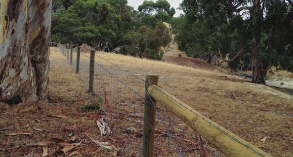
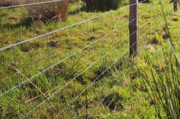
• Are the fences in good repair and suitable           • Are any threatened species of flora and fauna
    for confining stock and the overall grazing            known to live on the property?
    management of the property?
                                                         After you have satisfactorily answered all these
  • Are there suitable stockyards/facilities for the     questions, will the property meet your needs and
    animals you intend to run?                           desired lifestyle?
  • Do you know the history of the property?
    Have previous owners sown pastures and used
    fertilisers? Will you need to remove rubbish?        Living in the region
  • Is the region prone to flood or bushfire? Will you   The Adelaide and Mount Lofty Ranges
    need to undertake any management activities          (AMLR) region
    to minimise these risks?
  • If there is no existing dwelling and you want        The AMLR region supports a mosaic of remnant
    one, does the land have a building entitlement?      bushland, farming land, urban development,
                                                         hills and plains, diverse marine environments
  • Are there existing or proposed adjacent land         and 364 kilometres of spectacular beaches
    uses that will affect your enjoyment of the          and coastline.
    property? For example, are there legitimate rural
    uses nearby such as agriculture, horse-keeping,      The region covers a vast area, including a
    quarries, mines or forestry that produce dust,       significant area of ocean. As shown on the map
    odours or noise?                                     in the introduction, the region extends from north
  • Is there a Heritage Agreement on the property        of Kapunda and Mallala through the Northern
    that requires you to undertake specified             Adelaide Plains and Barossa Valley and down
    management actions and limit the land uses?          to the Southern Vales and Fleurieu Peninsula.

  • Have you asked the local council if there are:       Services available to landholders
    – any development applications proposed nearby?
                                                         The owners of small- and medium-size parcels
    – other developments that have been approved
                                                         of land make up a significant proportion of
      but not started?
                                                         landholders in the region. They are often new
    – any restrictions on developing certain desired     to the land and have not come from a farming
      land uses?                                         or rural background. There are a number of staff
    – any rights-of-carriageway or other easements       throughout the region whose role is to help new
      on the property that need to be maintained         and existing landholders manage their land in
      and/or which may allow neighbours access?          a productive and sustainable way.
    – any covenants or agreements on the property
                                                         Your local District Officer has intimate knowledge
      that protect certain areas?
                                                         on managing natural resources in your local area.
  • Are there any derelict mine shafts on the            District Officers can provide advice and support
    property? If so, are they fenced to ensure safety?   with issues such as declared weed control,
                                                         watercourse or native vegetation management
                                                         and revegetation projects. They can provide this
                                                         support over the phone or on site and the service
                                                         is free of charge.

                                                         Your local Sustainable Agriculture Officer has
                                                         extensive knowledge of agricultural practices
                                                         and issues and can provide advice and support
                                                         on issues such as grazing, soil, and pasture
                                                         management, livestock management, water
                                                         resources management and property planning.
                                                         Sustainable Agriculture Officers can provide free
                                                         advice over the phone or on site. These officers
                                                         also regularly organise land management courses,
                                                         workshops and field days for landholders on
                                                         a variety of topics. Contact your local natural
                                                         resources centre for further details (see the
                                                         ‘Local information’ chapter).

6 | Rural living handbook | Buying your property
Local government
The rural area within the AMLR region incorporates
13 local government areas consisting of:
Adelaide Hills Council
Alexandrina Council
Barossa Council
City of Mitcham
City of Onkaparinga
City of Playford
                                                      Get to know local agricultural, business, tourism
City of Tea Tree Gully                                and industry activities. These combine to support
City of Victor Harbor                                 the society and economy of the region and you
                                                      can play your part as a rural landholder.
District Council of Mallala
District Council of Mount Barker
District Council of Yankalilla
                                                      What is the Adelaide
Light Regional Council                                and Mount Lofty Ranges
Town of Gawler                                        Natural Resources
Your local council can assist you with a range        Management Plan?
of issues including development applications,
dog registrations, waste collection and much          At the cornerstone of our efforts to better manage
more. Contact details for local governments           our natural resources is the Adelaide and Mount
can be found in the ‘Local information’ chapter.      Lofty Ranges Natural Resources Management
                                                      (NRM) Plan.
For more information about local governments,
visit the Local Government Association website        The plan was developed by the Adelaide and
at www.lga.sa.gov.au.                                 Mount Lofty Ranges NRM Board – following
                                                      extensive consultation with the community and
Landholder’s duty of care                             stakeholders – to provide leadership, encourage
                                                      community action, foster partnerships and identify
Section 9 of the Natural Resources Management         where investment is required.
Act 2004 identifies a general statutory duty for
all people to act reasonably in relation to the       The NRM Plan is a long-term plan for all of us
management of natural resources in the state.         and our collective futures – one that will lead to
This is termed a ‘duty of care’.                      thriving communities caring for our hills, plains
                                                      and seas. The plan includes long-term goals and
Good practices on your rural property will benefit    targets for the condition of natural resources in
you, the environment and the prosperity of the        the region. The board’s investment priorities are
region. By looking after the water, soil, plants      defined over a three-year period and are delivered
and animals you will benefit not only the natural     through a range of strategic actions.
environment, but also your chosen enterprise or
land use, as well as other landholders in the area.   The plan is presented in two volumes:
Good practices will also help to ensure that your     Volume 1: The strategic plan for the region –
property is maintained for future generations.        provides information on natural resources of the
                                                      region, and is intended to guide the action of all
This handbook will help you learn about good          stakeholders involved in managing natural resources
environmental and occupational safety practices.
Neighbours and other landholders in the region        Volume 2: Business and operational plan –
can also be good sources of advice. Talk to them,     outlines the strategic actions the board will
join groups such as Landcare and the local CFS        undertake and how they will be funded.
brigade, and contact local authorities such as        It can be downloaded from:
Natural Resources AMLR, your local council and        www.naturalresources.sa.gov.au/
state government agencies for advice.                 adelaidemtloftyranges

                                                                Rural living handbook | Buying your property | 7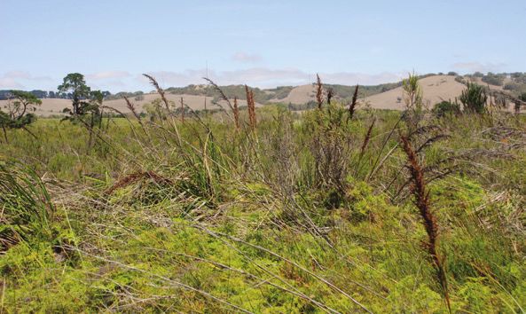
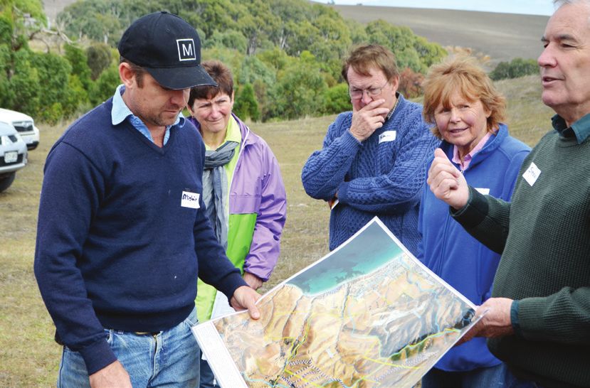
Planning and managing                                      Visit www.naturemaps.sa.gov.au to create
                                                             quality property maps, or contact your local
  your property                                              natural resources centre to obtain one.
                                                           3. After obtaining a map of your property, you will
  Property plans can help you to achieve your rural
                                                              need to identify the following:
  living goals by setting up the basis for efficient and
  sustainable property management. A plan will help           • soil types and soil characteristics (e.g. pH,
  you play a part in supporting a healthy landscape              salinity, erodibility, phosphorus and nitrogen
  and prosperous region. Property plans take a                   content)
  whole-of-property approach and are useful for               • slope (in degrees)
  all rural landholders.                                      • areas of remnant vegetation and vegetation
                                                                 type (e.g. stringy bark woodland, tea tree
  Beginning your property plan                                   wetland)
                                                              • watercourses, gullies, drainage lines
  A number of methods, documents and property                    and dams
  planning consultants can help you develop a
                                                              • areas prone to seasonal waterlogging
  property plan. A basic guide is provided below.
                                                              • erosion and salinity-prone areas
  Property plan guide                                         • stock water infrastructure and shade areas
                                                                 for stock
  1. What do you want to achieve on your property?            • rock outcrops
     What is your vision? For example, do you want to         • water supply
     run a grazing enterprise, preserve and restore           • climate, rainfall and seasonality
     biodiversity or develop a horticultural enterprise?
                                                              • landscape types and physical features
  2. Obtain a good map of your property. Aerial               • current land uses
     photographs are very useful, as well as surveyor’s       • permanent infrastructure.
     boundary plans, topographic and cadastral
     (boundaries and ownership) plans. The map
     needs to be to a metric scale large enough
     to clearly show the features of the property.

8 | Rural living handbook | Buying your property
4. Carry out a SWOT analysis of the property’s 8. Use the information in this handbook to
capabilities as follows: help you understand issues and best practices
• What Strengths does the property have in these areas and to set goals and actions.
that you can take advantage of (e.g. areas Develop a realistic plan that takes into
of high-quality soils)? account your available time and resources
• What Weaknesses will need attention for achieving these goals.
before they cause problems (e.g. existing 9. Prioritise your actions and then set out
weed infestations)? to achieve them. Remember that certain
• What Opportunities are there to develop activities (such as weed control and
your resources further (e.g. moving fence revegetation) should be timed to take
lines to improve management)? into account seasonal conditions.
• What Threats exist that could affect the 10. Constantly monitor, improve and reshape your
property (e.g. potential erosion areas)? goals as necessary along the way. Your initial
5. On an overlay (a clear plastic film that can be plan will change over time.
drawn on) of the map, illustrate the permanent 11. Make sure you regularly monitor and maintain
features such as the property boundary, the areas where you have worked to address
watercourses, native vegetation, infrastructure, any issues quickly.
land types (i.e. from the most productive soils
to the least) and contours. More information
6. Use this information as a base. On a second
The Department for Environment and Water
overlay, draw where you want features, such
has an interactive mapping website that enables
as fences, productive paddocks, shelterbelts,
users to create maps showing aerial images,
woodlots, dams, troughs, lanes and gates.
property boundaries, native vegetation and
(Rearranging fences according to land features
more. This website can be found at
can help you to use the land more efficiently.)
www.naturemaps.sa.gov.au
Work out where planting needs to go to
achieve maximum effectiveness for windbreaks, Natural Resources AMLR staff can help you
erosion control and repair, shelter, salinity develop your property plan and let you know
reduction and to provide habitat for native birds of training courses in plan development.
and animals. These resources are funded by the Australian
7. Write notes about: Government and managed by the Adelaide
• proposed land use and Mount Lofty Ranges NRM Board. For more
• planning for houses, sheds, stockyards, information, contact your local natural resources
windbreaks, dams, roads and fence centre (see the ‘Local information’ chapter).
realignments
• methods to control and prevent weeds and
pest animals
• methods to sustain or improve water quality
for stock and downstream users
• methods to control stormwater movement
and prevent erosion
• reducing bushfire hazards, conserving soil,
preserving trees
• treating and disposing of effluent and
rural rubbish
• legal and planning requirements
• methods to improve stock management
or alternative water sources for stock
• methods and timing for proposed
revegetation of disturbed areas.
Rural living handbook | Buying your property | 9Case study
Wes and Margaret Seeliger
Property location: Flaxman Valley, Barossa Ranges
Property size: 560 ha (plus 40 ha leased)
Current enterprise: Dairy (managed by son Steven and his wife Verica)
Rainfall: 670 – 751 mm (approx)
Soil type: Sandy loam over clay
Features: 12 ha native vegetation; established 11 km of shelter belts; some fenced
and revegetated watercourses; an average of 186 ha of pasture cut for hay.
Wes Seeliger has played an active role in land Key points learnt over time:
management over the years. The Seeligers’ dairy • perennial pastures, although expensive to
is one of the few thriving operations remaining establish, are worth the investment in the
in the area – and their success is the result of long term
dedication and well-managed perennial pastures.
Wes’ interest in pastures goes right back to when • to manage the land to its capability and to fence
he left school in 1954 and started his own plot appropriately to help make this possible
trials with different species. It wasn’t long before • maintaining native vegetation and revegetating
his father became interested and became one of has landscape-wide benefits
the first in the district to recognise the importance • soil fertility is the foundation of all good land
of soil nutrients (particularly phosphorus and management.
molybdenum) and soil acidity. This was the start
of a professional approach to pastures that There is no doubt that much of the Seeligers’
continues today. success comes from getting the basics right.
Pastures need to be well managed to recover the
The foundation of the Seeligers’ pastures has cost of establishment and continue to contribute
always been perennial grasses – mainly cocksfoot, to farm profitability.
phalaris and perennial rye with sub-clover. South
Australia’s Mediterranean climate encourages The underlying principle that Wes applies
many land managers to think of a growing season is managing different areas on his property
that starts in April and ends in October, however, according to their capability.
every year we have summer storms, and every year
the perennials respond. On the other hand, annual This management principle has helped him
grasses deteriorate with the rain and leave you overcome problems such as waterlogging and
with little more than a fire risk. salinity, as well as reducing the likelihood of
soil erosion. Weed infestations are also reduced
Weeds are always a threat, particularly broadleaf through successful competition from more
weeds following summer rain. The Seeligers work desirable grazing species.
on the principle that the best way to beat these
weeds is to provide competition. Recently, annual The Seeliger farm makes extensive use of shelter
grasses such as barley grass and silver grass began belts. While some land managers are reluctant
creeping into a couple of paddocks. These will be to ‘give up’ productive land for trees, animals
sprayed in autumn at a rate that doesn’t kill the sheltered from cold winds need less feed, and
perennials. The Seeligers still have good perennial pastures sheltered from drying winds are more
pastures that were sown 30 years ago – the secret productive. The trees in the shelter belts also
is: they look after them. Rotational grazing is benefit native wildlife, by providing shelter,
the key to achieving this, as set stocking proved a food source and a safe corridor for movement.
a recipe for disaster.
10 | Rural living handbook | Buying your property2 | Natural resources
• Water
• Soil
• Native vegetation and animals
• Fire
• Weeds
• Pest animals
Water What are water affecting activities?
Water management is an integral part of successful Water affecting activities (WAA) are those that can
property management. Using water efficiently will potentially have adverse impacts on the health and
minimise your costs while preserving flows for the condition of water resources, on other water users
environment. Managing watercourses and dams and on the ecosystems that depend on water
effectively will improve water quality on your resources. These water resources include watercourses,
property and for downstream users. lakes or dams, floodplains, groundwater, springs,
wetlands, waterholes and catchment landscapes,
among others. Management of water affecting
Water legislation
activities is needed to protect our natural systems
The Adelaide and Mount Lofty Ranges Natural and water-dependent ecosystems, maintain water
Resources Management Board (the board) quality, and minimise impacts on other water users.
manages surface water resources, including
The board regulates WAAs in accordance with
activities in and around watercourses and dams,
its Adelaide and Mount Lofty Ranges Natural
under the Natural Resources Management Act
Resources Management Plan, and where applicable
2004. Ground water resources in South Australia,
in accordance with a WAP if one has been adopted
including bores and wells, are managed by the
for the area.
Department for Environment and Water (the
department).
Most of the board’s area is (or will be) covered
by statutory Water Allocation Plans (WAP). These
plans may affect how you can take or use water
on your property. Information on each adopted
WAP is available at www.naturalresources.
sa.gov.au/adelaidemtloftyranges or from the
Eastwood Natural Resources Centre (see the
‘Local information’ chapter).
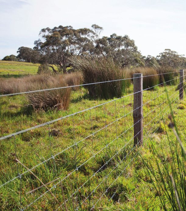
Rural living handbook | Natural resources | 11Activities requiring a permit Causes of riparian zone degradation include:
• allowing stock access to watercourses
Activities requiring a permit include, but are not
limited to: • invasion and competition from pest animal
species (e.g. rabbits) and weed species
• the construction or enlargement of dams
(e.g. Willows and Blackberries)
or structures to collect or divert water
• recreational activities
• drilling, deepening and backfilling wells,
bores and groundwater access trenches • building
• building structures obstructing or depositing • channel realignment.
solid materials in a watercourse, lake or
Effects of riparian zone degradation include:
floodplain (e.g. erosion control; construction
of water crossings; or dumping material) • unstable banks
• excavating material from a watercourse, dam, • erosion of watercourses
lake or floodplain (e.g. excavating or cleaning • flow restriction
dams, waterholes and on-stream dams)
• weed invasion
• removing any vegetation (exotic or native plants)
• reduced water quality
in a watercourse, dam or riparian zone
• reduced biodiversity of both aquatic and
• draining or discharging water or brine into
terrestrial flora and fauna
a watercourse or dam (e.g. desalination waste,
stormwater/urban discharge, drainage and • reduced aesthetic value.
salinity control)
The following activities are essential to reduce
• the use of effluent or water imported to an area degradation and loss of riparian vegetation:
for commercial activities (e.g. irrigation).
• fence riparian areas to protect them from stock;
Landholders, property managers, local government, alternative water sources and shade/shelter must
industry and organisations must lodge permit be provided
applications with the board for any of the activities • encourage the regeneration of native vegetation
listed above.
• minimise the number of tracks and trails leading
There are instances where the board has worked to your riparian area; this will reduce the amount
towards cutting red tape and a permit is not of sediment and nutrient-rich runoff from the
required. For example, if you want to desilt tracks into the watercourse
your dam or there are certain species of weeds • minimise ground disturbance during weed
you want to tackle on your watercourse, then removal activities in the riparian zone
please visit our water affecting activities web
page to view the information under ‘Cutting • minimise herbicide and pesticide use; ensure
red tape’: www.naturalresources.sa.gov.au/ that pesticides and herbicides are registered
adelaidemtloftyranges. for use near water
• revegetate degraded and eroded riparian areas
For bores/wells permit applications visit www. with suitable local native vegetation.
environment.sa.gov.au/licences-and-permits
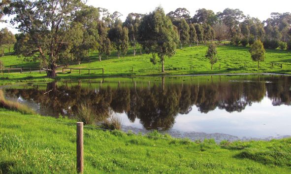
Managing farm dams
Riparian zones
The primary use of farm dams is to provide water
The riparian zone is the area directly influenced for stock and domestic purposes. If not properly
by a river, creek, watercourse or drainage line. managed, farm dams can have an impact on
The zone generally extends from the normal water the water quality on your property, and affect
level to the floodplain. downstream users and the environment. All dams,
new and existing, should be managed to maximise
Healthy riparian vegetation – trees, shrubs and
stock safety and health and to minimise impacts
groundcovers – will make your watercourse
on the environment. Note that a water allocation
banks more stable and help prevent erosion.
plan for the area may limit taking of water from
The vegetation will also filter out nutrients from
a dam, and/or may require the installation of
surrounding paddocks, support wildlife and
a bypass for low flows.
create habitat for native wildlife.
12 | Rural living handbook | Natural resourcesNative plants and grasses help stabilise dam banks
Here are some hints for improving dam health: For every millimetre of rainfall and square metre of
roof area, one litre of rainfall can be collected. For
• Use fencing to limit stock access to one or
example, if your total roof area is 200 m2, 200 L
two locations at the dam. Best practice is to
of water can be collected for each mm of rainfall.
completely exclude stock from dams and provide
Calculating your water requirements and collection
alternative watering points. This prevents stock
area will help you decide the size of tank you need.
from fouling the water and minimises erosion.
The result should be good water quality and
a long lasting dam which benefits both stock Reducing household water use
and the environment. Saving water in and around your home benefits
• Prevent nutrients from entering the dam by the environment and there are many ways to do
leaving an unfertilised strip where water flows this. People who live in rural areas have developed
into the dam. This will help minimise the chances water saving methods through necessity and
of a blue-green algae outbreak. experience.
• Avoid using fertilisers, herbicides and pesticides Try these tips for using less water inside your house:
around dams and watercourses.
• install dual flush toilets with a high star rating
• Encourage native plants to grow in and around
the dam – reeds, sedges and rushes at the water’s • use water-saving shower heads with a high
edge and grasses and shrubs on the banks; native star rating
vegetation will filter out sediments and nutrients • install water efficient washing machines and
and provide habitat for native animals. dishwashers with a high star rating; only use
• Don’t plant trees on the dam wall, as their roots washing machines and dishwashers when full
may weaken it. It is best to have permanent grass • ensure that there are no leaks in your plumbing
cover on dam walls to reduce erosion. system and repair any dripping taps promptly
• Maintain dam spillways well, as they are crucial • install water-efficient taps and tap aerators.
to dam stability.
The SA Water website provides useful tips for
Rainwater tanks saving water with a few simple changes to your
everyday activities. Visit www.sawater.com.au
In our Mediterranean climate of hot and dry to find out more.
summers and wet winters, collecting and storing
as much rainfall as possible is important. As Outside water use
climate variability increases, capturing and storing
rainfall becomes increasingly important. Collecting Outside water use for gardens, lawns and
and storing rainwater in tanks is a sustainable way watering stock on an average rural residential
of reducing your reliance on mains, ground or block (e.g. 2 ha) can be 125–250,000 L per year.
surface water supplies.
Rural living handbook | Natural resources | 13Stock requirements More information
As a guide, stock usually require the following For more information about water resources,
amounts of water (on average): water affecting activities and to apply for
• horse – 17,000 L per year (47.5 L/day) permits, visit www.naturalresources.sa.gov.au/
adelaidemtloftyranges.
• sheep (adult – dry feed) – 2500 L per year
(7 L/day) For more information on water saving, visit the
• beef cattle – 21,000 L per year (57.5 L/day) SA Water website at www.sawater.com.au.
• dairy cattle – 26,500 L per year (72.5 L/day) For information and advice on funding available
• dog – 3000 L per year (8 L/day) to landholders for watercourse restoration work,
contact your local natural resources centre
• pig (boar or dry sow) – 5000 L per year (see the ‘Local information’ chapter).
(13.5 L/day).
For more information on the installation and use
Please note that stock water requirements vary of greywater systems, contact your local council.
greatly depending on factors such as the life-stage
of the animal (e.g. a lactating cow on grass may
need up to 250 L per day), the time of the year, Soil
the moisture in the pasture, and water quality
(e.g. animals drink more water if it is salty). It is Your soil is a valuable resource containing nutrients
critical that animals have access to reliable and for pastures and crops and for the growth of
clean water at all times. native species.
The greatest threat to your soil is erosion from
Garden requirements wind and water. Soil erosion can be exacerbated
Gardens can potentially need a lot of water, by animals, vehicles and vegetation removal.
especially during the hotter months, but there Erosion removes valuable soil from your property,
are many ways to reduce that need. reduces the productivity of your land, and pollutes
watercourses, dams and reservoirs with turbid
For example: water that is full of nutrients and silt.
• plant drought-tolerant species – use local The best protection against erosion is adequate
native plants where possible groundcover. Remnant native vegetation and
• install a drip irrigation system perennial pastures provide the most durable
• mulch all garden areas to a depth of 75 mm protection for your soil. If using native grasses,
careful management is required for them to persist.
• compost household and garden waste and
use it to improve soil condition and organic Carefully consider pasture improvement management
matter content strategies as they can impact areas of native grasses.
• keep lawn to around 5 cm in height to reduce Herbicides and grazing management can safely
evaporation (the blades shade each other) be used to control weeds and maintain permanent
grass cover, providing they are used appropriately.
• infrequent watering improves the drought
resistance of your plants by encouraging deep
roots – water less often, but for longer periods
at slow rates
• install a rainwater tank – rainwater tanks can supply
a substantial proportion of household water
• use greywater in the garden – greywater is the
wastewater from baths, showers, hand basins
and washing machines’ final rinse; do not use
water from toilets, or kitchen wastewater. Use
greywater in a controlled way to avoid adverse
health impacts – it should not be stored for
more than 24 hours. Contact your local council
or the Office of the Technical Regulator for
guidelines on applying to use greywater.
14 | Rural living handbook | Natural resourcesErosion You can also prevent soil loss and erosion by
controlling water runoff with devices such as
Some soils are very susceptible to the various contour banks, sediment traps, flumes, straw
forms of water erosion. Factors such as slope, bales and mulches.
rainfall intensities and natural groundcover
influence natural erosion rates, as can overstocking It is important to obtain technical advice from
or over-cultivating paddocks. the relevant authorities before undertaking any
of these works. There may be erosion control
You can help minimise erosion and retain topsoil structures already on your property. If so, they
on your property by using the following good land should be maintained and not disturbed to ensure
management practices: their continuing operation. Contact your local
• Provide adequate vegetation cover, particularly natural resources centre for more assistance (see
at ground level. Ground vegetation should the ‘Local information’ chapter).
provide at least 70 per cent groundcover all
year round. Soil acidity
• Understand the grazing patterns of the livestock Many of our soils are naturally acidic but light-
you keep. For example, horses do not evenly textured soils in high rainfall areas are at particular
graze paddocks and alpacas are fussy eaters. risk. Soil acidity is a gradual process that is best
An understanding of the grazing habits of your corrected before the implications become irreversible.
animals will enable you to manage your pastures
and avoid overgrazing. The effects of soil acidity include:
• Rotate your activities to rest the land and maintain • reduced agricultural production and viability
continuous grass cover in grazing paddocks. • increased production costs due to the costs
• Seek professional advice about revegetating of treatment
the property using appropriate local native • groundcover decline, increasing the likelihood
species by establishing windbreaks and native of erosion and declining water quality
vegetation along watercourses and farm roads.
• reduced water use by vegetation contributing
This will help filter out sediment and nutrients
to salinity.
as well as provide stability and habitat for
native fauna. Note: determine your landscape Some causes of soil acidity include:
type prior to undertaking revegetation works.
Dense planting of trees in an open grassland • natural pH decline through leaching
for example, can detrimentally affect the value • high legume content of pastures contributing
of that habitat and local native fauna. to nitrate leaching
• Protect and enhance existing native vegetation. • removal of alkaline plants (especially hay),
When choosing plants, local native species will animal produce and waste products speed
grow well, provide habitat and not become up the acidification process
weeds. It is well worth joining a local Landcare • ‘nitrate leaching’ – lack of deep-rooted grasses
group which can help with plants propagated to catch the nitrogen produced before it leaches
from locally collected seed indigenous to
your area. • application of nitrogen fertilisers.
• Cultivate and plant along contour lines. Don’t There are three basic strategies for managing
cultivate steeply sloping land as this can lead acid soils:
to erosion. 1. Use deep-rooted perennial pastures to
• Construct access roads along the contour improve nitrogen recycling and slow the rate
on gentle slopes wherever possible and avoid of acidification.
waterlogged areas. 2. Use lime to raise soil pH (most useful if only
• Find out about your land’s capabilities. Contact the topsoil is acidic).
your local natural resources centre for a fact 3. Use plants that are tolerant of acid soil conditions.
sheet about the Land Capability Classification
System. Altogether, there are eight capability
classes and it is recommended that you don’t
cultivate land in Classes 5–8.
Rural living handbook | Natural resources | 15Contact your local natural resources centre for Sodicity is a more widespread form of land
more information about the causes of soil acidity degradation than salinity. It affects nearly one third
and help with treatment options (see the ‘Local of all soils in Australia, causing poor water infiltration,
information’ chapter). surface crusting, erosion and waterlogging.
Runoff from sodic soils carries clay particles into
Dryland salinity watercourses, causing environmental problems
in rivers and wetlands. This runoff is more likely
Dryland salinity occurs naturally when groundwater to carry higher levels of nitrogen and phosphate
discharges or seeps to the surface, bringing soil which contribute to algal blooms in watercourses.
salts with it. Salt can also be drawn to the surface
by capillary action. When the water balance is Applying gypsum to the affected soil can treat
disturbed by the removal of deep-rooted perennial topsoil sodicity. Large quantities of gypsum are
vegetation, dryland salinity is accelerated. Dryland usually required for more than a short-term effect.
salinity can cause vegetation loss and stream The best way to treat sodic subsoil is to stop the
salinisation and be a precursor to soil erosion. subsoil from being exposed. It is important to
get technical advice before treating your soil.
Causes of dryland salinity include:
• removing deep-rooted perennial vegetation and More information
replacing it with shallow-rooted pastures and
crops – this raises the water table, which brings For more information on soil management,
salt to the surface contact your local natural resources centre or
contact Primary Industries and Resources South
• blocking natural groundwater flow (e.g. by roads Australia (see the ‘Local information’ chapter).
or dams).
Some effects of dryland salinity include: Native vegetation and animals
• loss of desirable vegetation
• growth of salt-tolerant species Remnant native vegetation
• reduced crop and pasture production Remnant native vegetation is an area’s remaining
• waterlogged soil indigenous vegetation, including forests, woodlands,
shrublands and native grasslands. Much of the
• soil erosion original native vegetation in the AMLR region
• increased salt loads in rivers and streams has been cleared for agriculture since European
• reduced surface and groundwater quality settlement. In some instances, this has resulted
in problems including soil erosion, loss of soil
• declining soil structure structure, weed invasion, increased salinity,
• damage to buildings, roads, septic systems reduced water quality and loss of biodiversity.
and pipes.
Protecting and promoting native vegetation can
These impacts of dryland salinity can affect your enhance the value of your property and increase
property. When considering methods to manage productivity, by providing shade and shelter
dryland salinity, it is important to get technical for stock, windbreaks for crops and pasture,
advice from the relevant authorities. See ‘More habitat for native wildlife and stabilising soils
information’ at the end of this section. to reduce erosion.
Sodicity If conserving biodiversity is one of your goals,
use the following priorities to help you decide
Sodic soils contain enough exchangeable sodium where to start:
to adversely affect soil stability and plant growth.
Priority 1: Protect remnant native vegetation
As a result, clay particles in the soil lose their
tendency to stick together when wet. This leads • Exclude stock from native vegetation by ensuring
to unstable soils that may erode or become you have good fencing.
impermeable to both water and plant roots.
• Control feral animals such as rabbits, foxes, deer,
goats and cats.
16 | Rural living handbook | Natural resources• Consider whether and how you will need to How good is that piece of bush?
manage overabundant native grazing animals
(e.g. kangaroos). Rule of thumb: Any patch of native vegetation
is valuable. A minimum of 30 per cent cover of
• Control weeds using the following principles:
native vegetation across a rural property will help
a. accurately identify plants so that natives maintain ecosystems and improve productivity.
are not accidentally removed or damaged Your neighbour’s bush and others nearby may
b. use minimal disturbance techniques help contribute a viable local core habitat area
c. start in the best areas of bushland and or ‘corridor’ of vegetation for native animals.
work outwards
Most native plant diversity is in the groundcover
d. concentrate on high-threat weeds first. layer. Spring is the best time to appreciate a range
of native wildflowers that may be dormant for
Priority 2: Encourage natural regeneration much of the year.
Many areas have the capacity to naturally Remember to:
regenerate – provided they are carefully managed.
Regeneration is far cheaper than revegetation • avoid fragmenting existing areas of native
and is more likely to represent the original genetic vegetation, including remnant grasslands. If you
and species diversity of the site. are building new fencelines, roads or services,
consider building them around areas of native
Encouraging natural regeneration generally vegetation rather than through them
requires the same management activities as for • ensure that plant species are correctly identified
protecting remnants. However, a higher level when spraying weeds (many native species can
of weed control will usually be needed, and be easily misidentified as weeds).
carefully managed grazing is sometimes useful
in promoting native grasses over introduced Native Vegetation Act 1991
pastures and pasture weeds.
Remnant native vegetation is protected from
Priority 3: Revegetate clearance under the Native Vegetation Act 1991.
Strict exemptions exist for certain situations such
Revegetate using local native species, with the
as for maintaining roadsides, fencelines, firebreaks
range and rationing of species selected to
and developments.
represent the original vegetation association.
For more information contact your local natural
When planning a replanting program, always
resources centre (see the ‘Local information’ chapter).
try to:
• use seed that is sourced locally wherever possible
• use plants that have been grown locally to
ensure they acclimatise to local conditions
• select a range and ratio of species to represent
the original vegetation association as closely
as possible.
Thick strips of native trees (about five trees
wide) and shrubs can provide shelter for stock
and protection against drying winds, moderate
temperature extremes, prevent pollution
of streams by nutrient runoff, and impede
windblown weed seeds.
Rural living handbook | Natural resources | 17Environment Protection and Biodiversity Several species of venomous snakes could live
Conservation Act 1999 in your area. Most snake bites recorded in South
Australia happen to people who try to catch
This Commonwealth Act is designed to protect or kill them. Give snakes some space and they
nationally threatened species and ecological will generally leave the area.
communities from direct and indirect threats.
Four ecological communities that occur in the The snake season usually lasts from late October
AMLR region are protected under this Act. to early March. The following actions can reduce
the chance of snake bite:
They are:
• Store loose sheets of iron, timber, and other
• Fleurieu Peninsula swamps materials off ground level (e.g. on pallets).
• Peppermint box grassy woodland • Mow frequently trafficked areas and those
• Iron-grass natural temperate grassland around buildings.
• Grey box grassy woodlands and derived • Wear enclosed leather shoes or gaiters when
native grassland. walking in long grass or near creeks or farm dams.
• Wear long trousers and leather gloves
Native animals if handling vegetation.
All native animals in South Australia are protected • Let snakes pass through and away from your
(except those specifically listed as “unprotected” house or paddock, but if they decide to take
under the National Parks and Wildlife Act 1972). up residence contact a snake catcher to
This means that it is illegal to trap, kill or harm them relocate them.
unless licensed otherwise. Although we would like • If you see a snake, stand still and allow it to
to live in unison with native animals, sometimes they continue on its path.
can pose a threat to our safety or activities. It is
important to understand how to correctly manage Providing a fauna-friendly property
these situations on your property.
If you would like to encourage small birds and
A few native animals can become a nuisance if not other wildlife, such as bats, around your property,
managed appropriately. For instance, kangaroos here are some ways to attract them:
often show a strong liking for planted native
• Leave dead trees with hollows intact, whether
seedlings. It is crucial to fence off revegetation
standing or on the ground.
areas as well as gardens, which native animals
such as kangaroos will also often target. • Plant a variety of local native shrubs, especially
dense or prickly ones. Use mainly white, pink or
Possums can sometimes become nuisances in roof yellow flowering shrubs and keep red flowering
spaces. In such cases, it is best to provide nest shrubs in smaller numbers. Large numbers of red
boxes for the possums outside the house, remove flowering shrubs can attract noisy mynah birds
them from the roof, and seal entrance holes. and larger honeyeaters that actively exclude
Possums are territorial, so removing them from other smaller birds from the area.
your property can result in death of the animal
• Provide bird baths and other watering points.
and injury to others.
• Build and maintain nest boxes where few hollow
Your legal requirements: trees remain.
• you need a permit • Manage your animals to ensure that they don’t
• trapped possums must be released within interfere with native fauna. For example, if you
24 hours of capture (at sunset on the day own a cat, ensure that it doesn’t stray and attach
of capture). a bell attached to its collar to alert native birds.
• they must be released within 50 metres • Do not remove mistletoes – they are an excellent
of where you caught them. source of food and habitat for a range of animals.
Find out more on how to deal with possums at: Feeding native animals and birds can be an issue
www.environment.sa.gov.au. Some councils as it may make them dependent. Human foods
also hire out possum traps (see the ‘Local may also cause problems for native animals; for
information’ chapter). example, bread can cause lumpy jaw in kangaroos.
18 | Rural living handbook | Natural resourcesFrogs are desirable animals to have living on your
property.
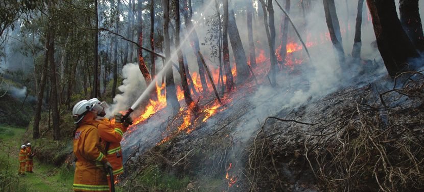
Fire
Living in a rural setting is a lifestyle choice for
The following actions will encourage frogs to stay
many South Australians. The benefits are enormous;
or colonise:
but the risks are real.
• use ponds or pools as part of your garden
landscaping All people living in the bush, including those in
peri-urban fringe areas of Adelaide and regional
• place logs or other large timber off-cuts around
South Australia, are vulnerable. It is therefore vital
the edge of open water bodies
that you have a practical Bushfire Survival Plan.
• plant native reeds, rushes and sedges in clumps
around water bodies Legislation
• plant tussock-forming vegetation a short distance
Fire and Emergency Services Act 2005
from dams so frogs can shelter and forage.
The purpose of this Act, which established the
A pond, dam or creek full of life not only creates
South Australian Fire and Emergency Services
a healthy environment but can provide many
Commission, is to:
peaceful hours for you and your family to explore.
• provide for the continuation of a metropolitan
More information fire and emergency service, a country fire and
emergency service, and a state emergency service
For information on managing native vegetation,
• provide for the prevention, control and
contact your local natural resources centre (see
suppression of fires
the ‘Local information’ chapter). Natural Resources
AMLR staff can also visit your property and give • handle certain emergency situations.
you advice.
Key points:
Further information on native species in the • landowners are obliged to manage fuel levels
Adelaide and Mount Lofty Ranges region can on their properties
be found at www.naturalresources.sa.gov.au/
• if council believes that conditions on private land
adelaidemtloftyranges.
in a fire district may cause an unreasonable risk
of the outbreak of fire on the land, or the spread
of fire through the land, the council may issue
a written notice specifying action(s) that the
landowner must undertake within a specified time.
Rural living handbook | Natural resources | 19Fire danger ratings Bushfire survival plan
The Fire Danger Rating is issued on a daily basis for Your Bushfire Survival Plan outlines the work
each Fire Ban District. The rating reflects the risk of required to help safeguard your property and,
a bushfire spreading and is based on factors that most importantly, what actions you and your
contribute to fire behaviour such as temperature, family will take on high fire risk days and if
wind speed and humidity. The categories from a fire threatens.
lowest risk to highest are: Low-Moderate, High,
If you live in the bush, the suburban fringe or
Very High, Severe, Extreme and Catastrophic. Total
regional South Australia, then you are in danger
fire bans are issued on days that are rated Severe of experiencing a bushfire.
or higher.
The decision whether to ‘stay and defend’ your
Daily updated fire danger ratings for your area can home, or ‘go early’ for each of the Fire Danger
be found on the CFS website, www.cfs.sa.gov.au. Rating levels is critical and should be made before
the fire danger season – and well before a
Bushfire warnings bushfire arrives.
A new bushfire advice and warnings system was If you plan to ‘stay and defend’ your property,
implemented in South Australia in 2010. This you will need to consider the following:
system, agreed to nationally, will help you decide • Are you physically fit to fight spot fires in and
what actions you need to take depending on the around your home for up to 10 hours or more?
predicted fire danger. Three levels of messaging
• Are you mentally and emotionally able to cope
will help you make informed decisions about what
with the intense smoke, heat and noise of
actions you need to take to survive a bushfire.
a bushfire, while implementing your plan?
They are:
• Are you able to implement your plan while
1. Advice – no immediate threat but messages will
caring for young children, elderly or disabled
keep people informed about low-level incidents
people in your home?
2. Watch and act – people need to take action to • Do you have the resources and equipment
protect themselves, their family and neighbours to effectively fight a fire – a water supply of at
3. Emergency warning – highest level of risk to life. least 5000 L (a water tank, pond, dam, creek
or swimming pool) and a petrol/diesel powered
Emergency warning messages will be broadcast firefighting pump with adequate hose length?
over ABC local radio accompanied by the Standard
• Does your home have a defendable space of
Emergency Warning Signal. These warnings can
at least 20 m cleared of flammable materials
also be accessed through AlertSA (www.alert.
and vegetation?
sa.gov.au) or the smartphone app.
• Is your home in a location that puts it at higher
than normal risk or makes it difficult to defend,
such as on a steep slope or in close proximity
to bushland?
20 | Rural living handbook | Natural resourcesBushfire Survival Plans can be downloaded from of the most effective ways to protect against
the CFS website (www.cfs.sa.gov.au). Once you radiant heat, direct flame and ember attack. Seek
have completed your plan, practice it regularly and professional advice for design and installation.
keep it in a safe and easily accessible place for quick
reference, e.g. on the fridge. Machinery maintenance
Property protection Landholders need to take precautions to ensure
that every item of equipment on their property
A home can ignite in various ways during a which generates heat in one form or another
bushfire – from radiant heat ahead of the fire is in good working order and not likely to ignite
front, burning debris falling on the building, crops, pastures or any other flammable substances
and direct flame contact. However, research has during the fire danger season.
shown that the biggest ignition source is sparks
and embers that travel through the air before, and When the machinery is in the field, always carry
hours after, the fire front has passed. Sparks and a full knapsack or water extinguisher, and a rake
embers enter a home wherever there is a gap, or shovel. This precaution is mandatory when
such as under roofing tiles, under the floor, in harvesting a flammable crop, spreading lime or
crevices, window sills, vents and under verandahs. fertiliser, or moving a flammable crop after harvest.
Some basic measures will improve your home’s Livestock protection
fire safety:
Identify the safest paddock on your property and
Smooth surfaces – no nooks and crannies where consider moving stock into this paddock on high
leaves and debris can gather. fire danger days. Your safe paddock should:
Roofing – well-secured metal roofing is • have a reliable water supply
preferable, a tiled roof needs to be well fitted
• have clear access
with fire-resistant sarking (i.e. fibreglass-based
aluminum foil). • be well grazed with minimum fuel to carry fire
Walls – non-flammable wall materials such as • be well fenced.
brick, mud brick and fibre cement are necessary
If animals do sustain burns, the best form of
as vinyl weatherboards, rough timber, and other
immediate first aid is to sponge the affected
wall claddings can warp or catch fire.
area with cold water until proper veterinary care
Windows, crevices and vents – spark-proof is available.
your home with metal flywire screens on windows
and doors, or install fire-resistant metal shutters. Fire ban information
Cover all wall cavities in fine wire mesh.
Fire danger seasons change from year to year,
Skylights – install wire-reinforced glass or a depending on seasonal conditions. Check the
thermo plastic cover on skylights as plastic can CFS website (www.cfs.sa.gov.au) for the current
melt and glass can break in strong heat. dates for your fire ban district.
Property access – gateways should be at least
Total fire bans can be declared at any time of the
4 m wide with vertical clearance of 4 m. Provide
year, not just during the fire danger season. With
clear access with a turnaround point for
a few exceptions, no fires can be lit in the open
firefighting vehicles.
on a Total Fire Ban day.
Gutters – regularly clean gutters and remove
leaves and bark from any areas where they may More information
become trapped.
For more information visit the CFS website
Prepare a 20 m defendable zone around your www.cfs.sa.gov.au or call the Bushfire
house by minimising the amount of fuel close to Information Hotline on 1800 362 361.
it. This will prevent fires from burning close to the
house and minimise the effect of radiant heat For information about fire prevention, contact
and direct flame impact. your local council’s fire prevention officer (council
contact details are in the ‘Local information’ chapter).
Sprinkler system – a home bushfire sprinkler
system that directs water over the roof, windows,
doors and exposed under floor areas is one
Rural living handbook | Natural resources | 21You can also read