School of Earth Sciences - The University of ...
←
→
Page content transcription
If your browser does not render page correctly, please read the page content below
School of Earth Sciences
Potential research projects offered for Level 4 (Honours) and Level 5
(Masters) students commencing in 2021.
   • Geology
   • Geochemistry
   • Geophysics
   • Environmental and Marine Geoscience
   • Hydrogeology
   • Mineral Geoscience
   • Petroleum Geoscience
   • Numerical Modelling and Data Analytics

The projects outlined in this booklet are not necessarily all of those
available. Please feel free to talk to staff members about designing
projects around your interests.
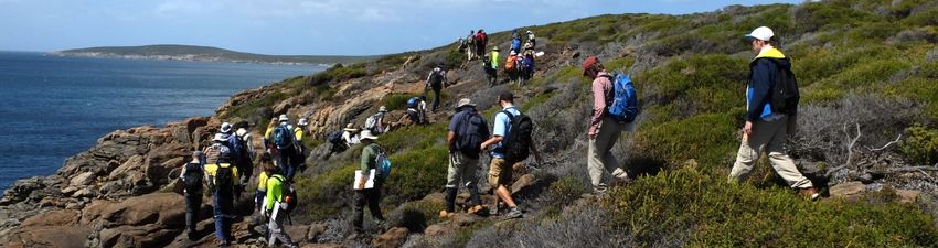
Geoscience Projects
 This document describes projects suitable for students undertaking a
 24pt research project as part of an Honours or Masters degree. Some
  projects are also suitable for the larger 36pt thesis in the Master of
                Science by Thesis & Coursework degree.

We encourage you to consider what types of geoscience research problems interest you
and to choose a project topic that will motivate you to do your best work throughout the
year. The aim of the 24pt project is to provide you with an opportunity to learn how
research works and to begin developing your research skills.
The 24pt project is one of the best ways to demonstrate skills in problem-solving,
communication (reading, writing and speaking), and completing a major task on time – all
key elements for employment in the resources industry and government agencies. It is also
a pathway to higher degrees by research (MSc, MPhil, PhD) and students often discover a
passion for research during their Honours or Masters research!
This document does not summarise all possible projects and you are welcome to speak
with any staff in the School who supervise projects in the areas of interest to you. We
recommend that you have a UWA supervisor and a general idea of your project by the
end of this year for both semester 1 and semester 2 commencements in 2021. Do not
leave organising a project until the first teaching week of 2021 or late July! Remember
that many of the supervising staff take leave through January and in July between
semesters.

Geoscience is a broad discipline that includes Geology, Geophysics, Geochemistry,
Geobiology and Computation/Numerical Modelling and its application to environmental,
marine, groundwater, energy and mineral deposits exploration and/or management. The
breadth of research activity in the School of Earth Sciences means opportunities for
students to undertake diverse research projects. Research may be focused on resolving
questions related to fundamental Earth processes and knowledge as well as applied to
natural resources with social and economic benefits.

You are welcome to contact staff directly (contact details are provided in the booklet) to
discuss projects where they are listed as the main contact. If you are interested in an MSc
by thesis & coursework degree, some of the projects outlined in this booklet can be
extended into or set up as larger projects (e.g. 36pt projects). You are welcome to contact
supervisors to discuss as required.

                                          2
Project:       Automated 3D gravity & magnetic inversion
Majors or      Geoscience, Geology, Computer science
Masters:
Supervisor:    Alan Aitken, alan.aitken@uwa.edu.au, 6488 7147
Description:   Geophysical inversion is a modelling process that generates a spatial property
               model (e.g. density) directly from geophysical data. Projects are available to
               apply new technologies to gravity and magnetic inversion problems. Work will
               be completed making full use of Pawsey Centre supercomputer infrastructure
               and will involve testing new codes, assessing performance and helping to
               further develop the approach. Software is designed to be used by non-
               specialists, however, computing experience and reasonable maths ability are
               desirable.

Project:       How the West was one…the Rodona-Totten Shear Zone
Majors or      Geology, Geophysics
Masters:
Supervisor:    Alan Aitken, alan.aitken@uwa.edu.au; 6488 7147
Description:   The reconfiguration of Mesoproterozoic Australia occurred between ca. 1600
               Ma and ca. 1300 Ma, through a complex series of plate margin processes.
               The culmination of this was the collision of the South and West Australian
               cratons inferred to have occurred along the Rodona Shear Zone, east of
               Israelite Bay. This project involves the use of high-resolution aeromagnetic
               and gravity data from Australia and Antarctica to understand shear-zone
               structure and kinematics. This new map of the shear zone will be tied in with
               new data from beneath the Eucla Basin, from the Albany Fraser Orogen, and
               from Antarctica

Project:       Into the twilight zone of the North Australian Craton
Majors or      Geology, Geoscience or related
Masters:
Supervisor:    Alan Aitken, alan.aitken@uwa.edu.au, 6488 7147
Description:   The concept of the North Australian Craton is central to models of Australia’s
               formation. However its true nature and the details of its formation remain
               cryptic due to extensive cover of sedimentary basins. This project will seek to
               map the cratonic architecture, in particular using new geophysical models to
               map the poorly known zone from 20 – 80 km depth. Revealing the key
               features of this little known zone will allow a more comprehensive
               appreciation of cratonic development with impacts for the development of
               Australia and the Nuna supercontinent.

                                             3
Project:       Mapping workflows for subglacial geology: A data analytics approach
Majors or      Geology, Geoscience, Computer Science or related
Masters:
Supervisor:    Alan Aitken, alan.aitken@uwa.edu.au, 6488 7147 and Eun-Jung Holden, eun-
               jung.holden@uwa.edu.au, 6488 5806
Description:   Knowledge of the geology beneath the Antarctic Ice Sheet is essential to
               understand ice-sheet bed conditions. Antarctic Geology is very poorly known
               with
Project        Oxygen isotope make-up of the Archean mantle
Majors or      Geology
Masters:
Supervisor:    Marco Fiorentini, marco.fiorentini@uwa.edu.au, 6488 3465 and Laure Martin
Description:   Komatiites are remarkable rocks. These crystallised products of the hottest
               lava flows ever erupted on the surface of the planet provide a snap shot of
               the Early Earth and a glimpse of the planet’s origin. Most of the preserved
               komatiites are Archaean and Proterozoic in age, although a few rare but
               notable examples formed in the Phanerozoic, such as the ones outcropping
               on Gorgona Island off the coast of Columbia. Komatiites are thought to be
               associated with mantle plumes sourced from deep mantle reservoirs, possibly
               at the core-mantle boundary. Thus, these lavas provide invaluable insights
               into the composition of the deep mantle, the nature of core-mantle
               differentiation processes and the chemical, physical and thermal state of the
               Early Earth.

               The modern mantle has an inferred bulk oxygen isotope composition (δ18O) of
               about 5.5‰. Hadean and Archaean magmatic zircons derived from sources in
               the upper mantle have δ18O compositions in a similar range, implying that the
               oxygen isotopic composition of the upper mantle has remained relatively
               constant, and comparable to the modern mantle throughout Earth’s history.
               Conversely, the composition of the deep mantle - inferred from δ18O
               measurements on olivine crystals from komatiites - appears to have changed
               through time. Whereas the source of the Gorgona lavas exhibits signatures
               between 4.4 and 5.5‰, recent works shows that the source of ca. 3.3 Ga
               komatiites from the Barberton greenstone belt of South Africa is significantly
               lighter, about 3 to 4‰.

               This discovery is puzzling because there was previously no indication that the
               Archaean mantle may have had a different oxygen make-up to its modern
               counterpart. This project, part of a larger ARC-funded project, aims to
               understand whether the light oxygen isotope signature recorded in the South
               African komatiites is an isolated phenomenon or whether any secular
               evolution in the oxygen isotope composition of Archaean and Proterozoic
               komatiites globally can be ascertained. To address this conundrum, the
               project involves petrographic, minero-chemical and isotopic study of fresh
               olivine grains from a selected range of 2.7 Ga Australian komatiites and 1.9 Ga
               Russian ferropicrites.

Project:       Fluxing of mantle carbon as a physical agent for metallogenic fertilization of
               the crust (funded by Australian Research Council)
Majors or      Geology, Geochemistry
Masters:

Supervisor:    Marco Fiorentini, marco.fiorentini@uwa.edu.au, 6488 3465

                                             5
Description: Sulfur is a fundamental element that links the evolution of the Earth´s main
four spheres. Although the cycling of this volatile element across the
atmosphere, hydrosphere and biosphere is relatively well understood, the
long-term evolution of the sulfur budget in the lithosphere and its flux across
from the mantle into the crust remains enigmatic. This knowledge gap may
be addressed through new insights into the transport mechanisms of sulfide
in magmatic systems.
Recent work has shown that carbonate may be ubiquitously associated with
sulfides from some of these magmatic systems, especially the volatile-rich
ones emplaced at the lowermost levels in the continental crust that display a
genetic connection with the lithospheric mantle. The consistent occurrence
of mantle-derived carbonate intimately associated with magmatic sulfide
mineralisation in these settings attests to a critical role of carbon, as a
volatile or fluid phase, in the physical and chemical flux of sulfur and metals
across the lithosphere.
This project will be undertaken within a larger project run by a multi-national
team of researchers, and will focus on the role of carbonate in sulfide
transport along magmatic conduits. The work will involve the integration of
whole-rock geochemical measurements of selected samples with in-situ
minero-chemical information from a range of silicate, carbonate, phosphate
and sulfide mineral phases using the analytical infrastructure available at
UWA including scanning electron microscope, laser ablation ICP-MS and the
ion probe. Depending on logistics, work will be undertaken on already
available material and/or there is a possibility to visit selected field areas for
sampling. It is expected that the project will lay the foundations required to
develop much needed new tools for the successful exploration of elusive Ni–
Cu–Co–PGE systems.
Project: Garnet chemistry to constrain ore processes and establish exploration
methodologies for orthomagmatic systems in high temperature
metamorphic settings (funded by Independence Group NL)
Majors or Geology
Masters:
Supervisor: Marco Fiorentini, marco.fiorentini@uwa.edu.au, 6488 3465 and Laure Martin
Description: Given its resilience to both chemical and physical processes, garnet has been
widely used in exploration targeting as an indicator mineral in diamond
exploration, especially in the northern hemisphere. Its mineral-chemical
record is known to reflect precious information on the P-T conditions that
characterised its genesis in a range of magmatic and metamorphic
conditions. Furthermore, garnet is commonly recovered in heavy mineral
concentrates. However, it is still unknown whether garnet can provide useful
information on the conditions that favoured nickel-sulfide ore genesis, or
whether garnet survives the weathering and regolith environment in
Australia. Hence, it is unknown whether garnet can be used as an indicator
mineral in exploration targeting for orthomagmatic systems.
It is argued that there is potential for garnet to retain information about the
ore forming process that formed the Nova-Bollinger Ni-Cu-sulfide deposits,
6Western Australia. However, at this stage this is just a working hypothesis
that needs to be tested as it is currently based only on a significant but rather
restricted range of anomalous trace element data. The objectives of the
Honours/Masters project are:
1- Expand our database on garnet occurrences and compositions (chemical
and isotopic) in the different lithologies, in both the Nova and Bollinger
deposits as well as in the metasedimentary country rocks, mafic granulites
and mafic/ultramafic intrusions that host disseminated magmatic sulfides up
to 5km from known mineralisation.
2- Document the garnet-forming reactions in the different lithologies
composing the Nova-Bollinger deposits to understand the chronology of
garnet crystallisation versus the formation of the Ni-Cu-sulfides.
3- Unravel the metamorphic history associated with the Ni-Cu Nova-Bollinger
deposits. This objective is key to refine the geological model of the Nova-
Bollinger deposits for further exploration by providing quantitative P-T
conditions for the deposit, depth of formation, geothermal gradient and
presence or not of a metamorphic gradient.
Project Refining the Mesoproterozoic Australian-Antarctic connection with new P-
T-t constraints on high-temperature metamorphism in southwestern
Australia
Majors or Geology
Masters:
Supervisor: Naomi Tucker, naomi.tucker@uwa.edu.au
Description: The Albany-Fraser Orogen (AFO) preserves an intriguing record of long-lived
thermally extreme metamorphism that occurred during Mesoproterozoic
suturing of parts of Australia and East Antarctica. The orogen is also unique
for its seemingly rapid exhumation rate, which is an unusual feature,
compared with other Mesoproterozoic orogens. Despite these remarkable
characteristics, the AFO is understudied, with a lack of quantitative P-T-t
constraints on the peak metamorphic conditions, prior to exhumation.
These new data are needed to: (1) provide robust P-T-t constraints across the
full extent of the orogen; (2) make inferences about the likely thermal drivers
of metamorphism, and (3) to contextualise exhumation and better
understand how fast the orogen was cooling.
This project will investigate the P-T-t evolution of amphibolite-granulite facies
rocks from spectacular coastal exposures near Albany. Work will involve
petrography and a combination of P-T modelling, geochronology (zircon,
monazite) and/or mineral chemistry. Some familiarity with metamorphic
petrography is essential.
This project also has broader implications for our understanding of the
subglacial geology of Antarctica. Metamorphic rocks from the AFO correlate
with outcrops in Wilkes Land, East Antarctica. Much of East Antarctica is
covered by ice and snow, so our understanding of what lies below is limited.
Using the coastal exposures from Albany as a proxy, this project will provide
further insight into the hidden geology of Antarctica.
7Project Igneous and Metamorphic Petrology of crustal rocks
Majors or Geology, Geochemistry, Geoscience, Mineral Geoscience
Masters:
Supervisor: Tony Kemp, tony.kemp@uwa.edu.au, 6488 7846
Description: Projects are available in the general fields of igneous and metamorphic
petrology and analytical geochemistry. Topics include, but are not limited to -
(1) petrology and geochemistry of Proterozoic dolerite and gabbro intrusions
in the Yilgarn Craton and Albany-Fraser Orogen, (2) use of hornblende-
plagioclase geobarometry in granites to reconstruct Archean geodynamics,
(3) formation and magmatic evolution of Archean anorthosite complexes, (4)
critical mineral resources – lithium and rare metal mineralization in
pegmatites and S-type granites, (5) partial melting processes in
metasedimentary rocks from garnet and cordierite chemistry, (6) tracking
ancient continental growth using detrital chromite and rutile. All projects
would involve petrography and mineral chemistry, with scope for whole rock
geochemistry and, potentially, U-Pb isotope geochronology. Projects can be
tailored to suit individual interests, and may be extend to the 36 pt MSc
project.
Project: Mapping in high grade shear zones, Bremer Bay, WA
Majors or Geology, Geoscience, Petroleum Geoscience
Masters:
Supervisor: Myra Keep, myra.keep@uwa.edu.au, 6488 7198
Description: There is potential for a suitable student to conduct a detailed field mapping
study of a high-grade ductile shear zone at Banky’s Beach, Bremer Bay. This
project would involve mapping of a detailed transect across the exposed
ductile shear zone, and collection of detailed structural measurements across
the exposed shear zone, with a view to interpreting the history of the shear
zone.
Project Geological mapping of Venus
Majors or Geology, Geoscience
Masters:
Supervisor: Myra Keep, myra.keep@uwa.edu.au, 6488 7198
Description: Our record of the early evolution of Earth is limited by erosion, burial,
tectonic dismemberment and periods of impact cratering. The Venusian
surface preserves a rare and pristine record of terrestrial planet evolution. We
aim to map in detail parts of the Atalanta Planitia Quadrangle (V4) of the
northern hemisphere. Our proposed area contains vast areas of Venusian
8“tesserae” that is thought to represent the oldest surviving Venusian
landscapes, and which provides a rich and detailed history of the evolution of
the Venusian planetary surface. This project will involve interpreting SAR data
and using first-order geological relationships to understand the kinematic
evolution of the ancient tessera terrains in this block. Students must have a
good understanding of structural geology and tectonics to 3rd year level. The
scope of the project is compatible with extension to Masters level.
Project: Neotectonics and mass transport deposits in offshore petroleum basins of
northern WA
Majors or Geology, Geoscience, Petroleum Geoscience
Masters:
Supervisor: Myra Keep, myra.keep@uwa.edu.au, 6488 7198
Description: The northwest of WA hosts Australia’s largest recorded earthquakes (ML 7.3,
Meeberrie, 1941). Identification of modern surface offsets (fault scarps), both
onshore and offshore, together with recently calculated earthquake focal
mechanism data suggests that modern geomorphology may yield evidence as
to recent earthquake activity throughout north-western WA, which may have
triggered mass transport deposits. This project seeks to map modern mass
transport deposits and fault reactivation in offshore areas in the Carnarvon
and Browse basins, using seismic data, with a view to understanding the pre-
reactivation geometries and timing, and relating them to the modern tectonic
setting.
Project: General projects in seismic structural interpretation
Majors or Geology, Geoscience, Petroleum Geoscience
Masters:
Supervisor: Myra Keep, myra.keep@uwa.edu.au, 6488 7198
Description: Projects are available in seismic structural interpretation across the North
West Shelf, on a range of topics including: fault reactivation and inversion,
neotectonics, igneous distributions, cross section restoration and potentially
also in microstructure and geomechanics for qualified students. Please see
Myra for details.
Project Modern fluvial-deltaic reservoir analogues for subsurface Reservoir
modelling
Majors or Geology, Geoscience, Petroleum Geoscience
Masters:
Supervisor: Simon Lang, simon.lang@uwa.edu.au; Mick Oleary@uwa.edu.au;
Victorien.Paumard@uwa.edu.au
9Description: Subsurface reservoir facies modelling (for oil, gas, geo-sequestration, waste
disposal and water resources) requires a range of uncertainty to be
considered regarding the size, shape and 3D geometry of geobodies in the
subsurface. Predicting likely spatial relationships of facies both in 2D and in
the connected 3D space is critically important because it can impact the
outcome of flow simulations it models (high-permeability networks, barriers
and seals).
This project focussed on coastal-deltaic geobodies and specifically on aspects
of several modern Deltas on the WA coast from the Gascoyne region to the
Pilbara. The project will be GIS based followed up by a field sortie to confirm
facies predictions and to obtain vital statistics on texture and sedimentary
structures. Sediment sampling, augering, coring, and a range of geophysical
tools will be used to make facies maps that will be used to characterize the
Deltas in the mode of the WAVE3 classification scheme and ultimately to
guide reservoir modelling as training images. Field work will be conducted
between May and August. The project will be supported by funds from the
new Reservoir Analogues Consortium funded by industry.
Project Quaternary to Recent coastal processes and evolution from high resolution
seafloor mapping of the Western Australian continental shelf
Majors or Geology, Geoscience, Marine Geoscience
Masters:
Supervisor: Simon Lang, simon.lang@uwa.edu.au; Mick Oleary@uwa.edu.au;
Victorien.Paumard@uwa.edu.au
Description: Regional scale seafloor mapping of the West Australian continental shelf
based on high resolution 3D seismic datasets and satellite imagery offers a
valuable dataset for understanding larger scale coastal processes and
shoreline evolution based on sedimentation patterns observed from
bathymetric datasets. The project will help create improved datasets from
various data sources and using GIS mapping (enhanced by sediment sampling
and shallow borehole data), will focus on the evolution of selected clastic
and/or carbonate geobodies and their spatial and temporal relationships.
The results will be used to improve our understanding of the evolution of the
continental shelf during significant changes in relative sea-level and variable
climate history, with spin-off value for sedimentology of shallow marine and
shoreline deposits, including geotechnical aspects and geo-archaeology. The
opportunity to conduct field work may arise in conjunction with related
projects by the School. The project will be supported by funds from industry
and related research grants and related research grants focussed on climate
change and its impact on coastal evolution.
10Project Quantitative Seismic stratigraphy
Majors or Geology, Geoscience, Petroleum Geoscience
Masters:
Supervisor: Simon Lang, simon.lang@uwa.edu.au; Victorien.Paumard@uwa.edu.au;
Anthony.Gartrell
Description: With ~15% of siliciclastic hydrocarbon reservoirs located within deep-water
basins, a key challenge for the industry is to predict when and where coarse-
grained sediments are delivered from the edge of continental margins (i.e.
shelf-edge) to the continental slope and basins, and how these sediments
accumulate in deep water (i.e. type and architecture of deep-water systems).
This project aims at applying the innovative approach of quantitative 3D
seismic interpretation (QSS) to investigate the linkages (quantified
relationships) between shelf margin architecture, hydrodynamic processes
along deltaic shorelines and reservoir properties (type, volume, architecture)
in deep water in a variety of basin settings. The project is underpinned by
state-of-the-art, full volume, semi-automated 3D seismic interpretation
methods that enable very high-resolution seismic stratigraphic analysis of
large datasets in a short time frame. The project will involve detailed analysis
of one or more subsurface case studies (margins in a variety of climatic and
tectonic settings), including the use of appropriate analogues from literature
and outcrops.
This study will evaluate how quantitative measurement of shelf edge
parameters on seismic data can be a useful exploration tool to predict shallow
marine depositional style and deep-water play development.
Project Depositional history and reservoir characterisation, North West Shelf and
onshore basins
Majors or Geology, Petroleum Geoscience
Masters:
Supervisor: Annette George, annette.george@uwa.edu.au, 6488 1923
Description: A variety of petroleum reservoirs are encountered in the offshore basins of
the North West Shelf and onshore basins in WA. These projects can be
undertaken in shallow or deep marine depositional systems to reconstruct
depositional and tectonic history of specific basins or through specific
stratigraphic units (notably reservoirs, both conventional and
unconventional). Projects typically use core to petrographic-scale description
and interpretation to establish depositional and relative sea-level history
(using sequence stratigraphy and related techniques) and/or major controls
on reservoir quality (i.e. principally distribution of porosity and permeability).
Projects may include Hylogger® spectral analysis and portable XRF analysis of
core to obtain geochemical data for characterising facies, chemostratigraphy
and establishing diagenetic history. Some projects could involve application
of higher level microscopic techniques (scanning electron, cathode
luminescence). Also suitable for 36 pt Master of Science projects.
11Project: Tectonic assembly of northern Thailand
Majors or Geology, Geoscience
Masters:
Supervisor: Annette George, annette.george@uwa.edu.au, 6488 1923, Luis Parra Avila
Description: Thailand, like much of SE Asia, is an amalgam of a number of significant
geological terranes that accreted to Indochina in the late Paleozoic–Mesozoic
during the Indosinian Orogeny. There are opportunities for projects, within a
larger industry-sponsored project, focusing on specific elements of the
tectonic history: e.g. characterisation of igneous suites (rocks and mineral
grains) related to volcanism and potential back-arc basin development;
detrital zircon geochronology and geochemistry to constrain sediment
provenance and sediment dispersal during basin development. This region is
well known for hosting a wide array of mineral deposits. These topics are also
good for 36 pt Master of Science projects with suitable prior learning.
Project: Tectonostratigraphy and Basin History, Thailand onshore and offshore
basins
Majors or Geology, Geoscience, Petroleum Geoscience
Masters:
Supervisor: Annette George, annette.george@uwa.edu.au, 6488 1923 and Victorien
Paumard
Description: The basins of northern Thailand and related offshore basins record the impact
of late Paleozoic–early Mesozoic collision overprinted by Cenozoic strike-slip
tectonics. They are geologically younger analogues of older onshore basins in
WA. These complex basins are also associated with significant gas resources
and hence unravelling their depositional and deformational history is critical
to understanding resource formation and distribution in the basin fills. There
are opportunities for projects using seismic and well data to interpret the
tectono-stratigraphic history of these Paleozoic–Mesozoic basins, reconstruct
paleogeography and consider implications for energy prospectivity. These
topics are also very suitable for 36 pt Master of Science projects.
Project Consequences of the Pliocene?–Pleistocene Coolgardie asteroid impact on
the vegetation of Western Australia
Majors or Geology, Geoscience, Petroleum Geoscience, Botany
Masters:
Supervisor: Daniel Peyrot, daniel.peyrot@uwa.edu.au, 6488 2672
Description: The crater of Calgoordie (NW Kalgoorlie), resulted from the impact of aand ii) reconstruct the evolution of the wetland vegetation having colonized
the sheltered, small-scale, habitat.
Project: Consequences of the 100Ma-old Ora Banda asteroid impact on
vegetation and marine ecosystems of Western Australia
Majors or Geology, Geoscience, Petroleum Geoscience
Masters:
Supervisor: Daniel Peyrot, daniel.peyrot@uwa.edu.au, 6488 2672
Description: The crater of Ora Banda (NW Kalgoorlie), resulted from the impact of aDescription: The Coral Bay Coast is home to some of Western Australia’s most iconic
beaches. They are typically comprised of carbonate sediments that were
produced within the nearshore reef system and transported cross and/or
along shore under the prevailing coastal hydrodynamic regime. However,
there is increasing evidence to show that many of the beaches along the
Coral Bay coast are currently experiencing a regime of net sediment loss and
erosion. The aim of the project is the investigate the historical trends in
shoreline position along the Coral Bay Coast using historical aerial
photography, and using recently acquired bathymetric Lidar for the region
develop a hydrodynamic model to map current movement and sediment
transport and identify whether recent coastal infrastructure or increased
coral cover along the Coral Bay coast have resulted in the impounding or
trapping of sediment, limiting supply to the beach.
Project: Legacy and preservation of tropical cyclone deposits along the Pilbara Coast
Majors or Geology, Geoscience, Marine Geoscience
Masters:
Supervisor: Mick O’Leary, mick.oleary@uwa.edu.au
Description: Climate models are yet to accurately predict how tropical cyclone intensity
and frequency might change under future climate scenarios. An alternative
approach is to reconstruct time series of cyclone activity/intensity from the
geological record. However, the nature of cyclone generated storm deposits
and their preservation potential has not been explored. The aim of this
project is to investigate the sedimentary deposits of recent and historical
cyclone events along the Pilbara coast and establish what kind of sediment
logical deposit constitutes a cyclonic event and whether these types of
deposits are able to preserved within in the coastal sedimentary
environments.
Project: Submerged paleocoastal environments on the NW Shelf
Majors or Geology, Geoscience, Marine Geoscience
Masters:
Supervisor: Mick O’Leary, mick.oleary@uwa.edu.au
Description: During the last glacial cycle (80,000 to 10,000 yrs BP) sea level was between
20 and 120 metres lower than present. This period of time captured major
climatological events, as well the arrival of first Australians and extinction of
Australia’s mega fauna. In order to reconstruct how these coastal
paleoenvironments may have supported human populations, and responded
to changing regional climate this project will analyse a collection sediment
cores collected on the North West Shelf. The student will employ
sedimentological and geochronologial methods to reconstruct
paleoevironmental evolution of the NW Shelf during this late Pleistocene
period.
14Project: Evaluating heterogeneity in carbonate reservoirs and their controlling
influences: seismic to pore-system studies
Majors or Geology, Geoscience, Petroleum Geoscience
Masters:
Supervisor: Moyra Wilson moyra.wilson@uwa.edu.au
Description: Carbonate systems host ~50% of the world’s hydrocarbon reservoirs and
form major subsurface aquifers, yet their poroperm characteristics remain
notoriously fickle and difficult to predict. Unlike siliciclastics, carbonate
systems commonly show a greater range of pore types (e.g., intragranular,
biomouldic), significant secondary porosity, bi- to tri-modal pore systems, as
well as connected and unconnected pores. Better understanding of the
heterogeneity in carbonate reservoirs is reliant on evaluating the
considerable depositional and diagenetic variability in carbonate systems. A
number of often industry-supported projects are available, including at
Masters level. These projects will variably involve training in the study and
integration of: core, outcrop, seismic, sequence stratigraphic, facies,
microscopy, geochemical and petrophysical datasets.
Project: Coral Reefal Environmental change during periods of global climatic shifts
Majors or Geology, Geoscience, Marine Geoscience
Masters:
Supervisor: Moyra Wilson moyra.wilson@uwa.edu.au
Description: Environmental change during global climatic shifts may be manifest in marine
carbonate successions through changing: biota, mineralogy, facies, platform
structure, early diagenesis and geochemistry. Projects are available to
investigate controls on regional versus local change during times of major
climatic shifts. These periods include the shift from greenhouse to icehouse
conditions during the Cenozoic and the switches from glacials to interglacials
that are particularly marked in the Plio-Pleistocene to Recent. These projects
will variably involve training in the study and integration of: core, outcrop,
seismic, sequence stratigraphic, facies, microscopy and geochemical datasets.
This topic is also suitable for a 36 pt Master of Science project.
Project: Reefal and carbonate edifices: integrated seismic and sample studies to
evaluate environmental change and economic aspects
Majors or Geology, Geoscience, Marine Geoscience
Masters:
Supervisor: Moyra Wilson moyra.wilson@uwa.edu.au; Victorien Paumard
victorien.paumard@uwa.edu.au
Description: Reefal and carbonate systems are sensitive indicators of environmental
change, building edifices or platforms that are some of the world’s largest
bioconstructions. In the subsurface the origins, evolution, controlling
influences on, and economic potential of such edifices are best investigated
through combined seismic, log and sample datasets. A range of studies on
subsurface carbonate systems from Australasia will involve training in seismic
15analysis, facies approaches, petrology and where possible petrophysics to
investigate the evolution of a range of carbonate systems and their
controlling influences. This topic is also suitable for a 36 pt Master of Science
project.
Project: Western Australia’s coastal deposits as proxies for global climate change
Majors or Geology, Geoscience, Marine Geoscience
Masters:
Supervisor: Moyra Wilson moyra.wilson@uwa.edu.au
Description: Marine and coastal deposits of SW Australia lie at the transition of warm to
temperate waters, with the reefal and carbonate deposits acting as sensitive
indicators of local to regional environmental and climatic change. A series of
projects are available to investigate the impacts of oceanographic, climatic
habitat, and eustatic sea level changes on the modern and Plio-Pleistocene
coastal and marine deposits of SW Australia. These projects will variably
involve training in the study and integration of: modern sediment studies,
field outcrop, microscopy and geochemical datasets with fieldwork a
possibility. This topic is also suitable for a 36 pt Master of Science project.
Project: Testing for tsunami deposits, Australia’s Northwest shelf.
Majors or Geology, Geoscience, Geoarchaeology
Masters:
Supervisor: Moyra Wilson moyra.wilson@uwa.edu.au, Piers Larcombe
piers.larcombe@uwa.edu.au, Ingrid Ward ingrid.ward@uwa.edu.au
Description: Australia’s Northwest continental margin includes large numbers of mass
transport deposits, representing massive slope failures. Such failures are
likely to have produced many tsunamis in the region over many millions of
years. A series of highly unusual cemented deposits have been documented
on an island in the region. This project is aimed at testing whether these
deposits might represent a paleo-tsunami deposit. As part of testing this
hypothesis, the project will detail the microfossils and the mineralogy of the
deposits to help indicate the possible origin of the sediments. An opportunity
may exist to visit the field site to examine and further document the deposits
in situ. This project is aimed at Honours or Masters level and will involve
training in the study and integration of: outcrop, stratigraphy, microfossil
analysis, petrology and geoarchaeology. All results are anticipated to be
highly publishable when executed to high standard.
16Project: Paleoenvironmental records in the Montebello Lagoons
Majors or Geoscience, Geoarchaeology
Masters:
Supervisor: Moyra Wilson moyra.wilson@uwa.edu.au, Ingrid Ward
ingrid.ward@uwa.edu.au; Piers Larcombe piers.larcombe@uwa.edu.au,
Description: Marine core samples (totalling 26 m of core) have been collected from several
lagoons and mangrove deposits on the Montebello Islands, NW Australia. The
nearest equivalent of the lagoons are the drowned evaporite pans of Shark
Bay, but the exact formation history of the lagoons remains poorly
documented. The lagoons themselves are likely to have preserved records
that will reflect sedimentation during Post-Glacial transgression and
associated with past cyclonic or even tsunami-related activity. The sediments
may form a record of paleo-environmental change. The changing nature of
the lagoons with marine inundation may also provide completely new insights
into interpretations of the archaeological cave records within the Montebello
Is. and Barrow Is. that date back to ~14 ky BP and ~50 ky BP respectively.
Focussing on the microfossils contained within the cores, the formation
history of the lagoons and the paleoenvironmental record within them will be
explored as one or more projects. The work forms a critical part of a broader
geoarchaeological study of the Montebello Is. complex. Opportunities to
return to Montebello Is. for further fieldwork are possible but not guaranteed.
This project will involve training in the study and integration of core, sediment
stratigraphy, facies, microfossil analysis and geoarchaeology.
Project The origin of the Paroo Station lead carbonate mine: hypogene/ supergene
or supergene-only genesis?
Majors or Geology, Geochemistry, Mineral Geoscience, Ore Deposit Geology
Masters:
Supervisor: Steffen Hagemann steffen.hagemann@uwa.edu.au; 6488 1517 and Carl
Brauhart (CSA Global)
Description: The unique Paroo Station lead carbonate mine near Wiluna (Western
Australia) was discovered in 1991 by Renison Goldfields Corporation. From
2004 to 2015 this mine produced approximately 300,000 tonnes of lead
metal in concentrate form (rosslynhillmining.com.au). Cerussite is the main
Pb-carbonate ore mineral. It is hosted in 35 metre thick quartz-clay carbonate
(including cerrusite), mineralised zones within siltstone. The ‘accepted’
stratabound, sulphide free supergene ore deposit model has been
questioned by various researchers. Fluid inclusions are observed in cerrussite
and this projects main objective is to investigate the physico-chemical
parameters Pressure-Temperature-XComposition (P-T-X) of the hydrothermal fluids that
were trapped during mineralization and reconstruct the paleohydrothermal
system that caused Pb transport and precipitation. Ultimately, the fluid
inclusion data will be used to evaluate whether there is a hypogene
mineralization event. The carefully petrographically constrained fluid
17inclusions will be analysed using the in house fully automated Linkham
heating-freezing stage and laser-Raman spectroscopy.
The project is suitable for a 36 pt MSc thesis. Requires knowledge in
geochemistry and successful completion of the SEM course early in 2020 (as
advertised by the Centre for Microscopy, Characterisation and Analysis at
UWA).
Project: Garnet and clinopyroxene chemistry of the O’Callaghans polymetallic W-Zn-
Pb-Cu skarn, Paterson Orogen, Western Australia: Constraining the physico-
chemical conditions of prograde skarn formation
Majors or Geology, Geochemistry, Mineral Geoscience, Ore Deposit Geology
Masters:
Supervisor: Steffen Hagemann, steffen.hagemann@uwa.edu.au, 6488-1517 and Laure
Martin
Description: The O’Callaghans polymetallic skarn is located in the Paterson Province in
Western Australia and is one of the world’s largest W deposit in the world.
Garnets and pyroxene are part of the prograde, high temperature
hydrothermal silicate alteration which consists of garnet-clinopyroxene-
quartz, minor sulphides and scheelite. This investigation will define the
garnet and pyroxene species; define intra-garnet and pyroxene zonation and
provide P-T estimates based on e.g., the garnet-pyroxene geothermometer.
The petrographic and geochemical results of the garnet-pyroxene
assemblage will be used to better characterize stage 1 prograde
hydrothermal alteration and mineralization at the O’Callaghans skarn deposit
and, thereby, further refine the classification of this skarn type. The project
is also suitable for a 36 pt MSc thesis. Appropriate prior study and
successful completion of the SEM course in early 2020 (as advertised by the
Centre for Microscopy, Characterisation and Analysis at UWA).
Project: Fluid evolution in the Karouni gold deposit, Guyana, South America
Majors or Geology, Geochemistry, Mineral Geoscience, Ore Deposit Geology
Masters:
Supervisor: Steffen Hagemann steffen.hagemann@uwa.edu.au 6488-1517 and Mike
Tedeschi.
Description: The Karouni orogenic gold deposit, located in the Guyana Shield in South
America, is Troy Resources flagship gold deposit with production starting in
2015. The key objective of the project is the reconstruction of the
paleohydrothermal evolution of this gold system via fluid inclusion and stable
isotope investigations. The project involves detailed petrography of quartz
veins and breccias, cathodoluminescence of quartz-carbonate crystals and
identification of suitable fluid inclusion assemblages. The carefully
constrained fluid inclusions will be analysed using the in house fully
automated Linkham heating-freezing stage and laser-Raman spectroscopy.
18Oxygen and hydrogen isotopes will be measured on quartz and fluid
inclusions, respectively. The results will be used to constrain the
characteristics and evolution of the Karouni gold system and aid in the
exploration for new, concealed ore bodies in the area. This project is part of
the ‘to be established’ SAXI (South American Exploration Initiative) project,
thus the proposed Honours/Masters project provides the candidate with the
opportunity to collaborate with a team of national and international
researchers. The project is also suitable for a 36 pt MSc thesis. Appropriate
prior study and successful completion of the SEM course in early 2020 (as
advertised by the Centre for Microscopy, Characterisation and Analysis at
UWA).
Project Characterisation of proximal to distal alteration footprint of gold deposits in
the Yilgarn craton
Majors or Geology, Geochemistry, Ore Deposit Geology
Masters:
Supervisor: Nicolas Thébaud, nicolas.thebaud@uwa.edu.au , 6488 7139
Description: A range of projects are available focusing on gold deposit of the Yilgarn
Craton. These projects aim at characterizing the mineral paragenesis and
structural contexts and place gold mineralisation within this context. These
studies rely on a multi-disciplinary approach combining structural core
logging, mineralogy and lithogeochemistry.
Project: Tellurium in the lithosphere
Majors or Geology, Geochemistry, Mineral Geoscience, Ore Deposit Geology
Masters:
Supervisor: Nico Thébaud, nicolas.thebaud@uwa.edu.au, 6488 7139, Marco Fiorentini
and Laure Martin
Description: Tellurium is an element weakly abundant in the crust (~0.001ppm in the crust)
but commonly recognised in mineral systems including ortho-magmatic Ni-
PGE deposits but also in orogenic gold deposit. The purpose of this project is
to evaluate the nature and abundance of the Te-bearing mineral phases
associated with a range of environments including ore deposits, sediments,
volcanic complexes and intrusions. This in turn will provide an opportunity to
discuss how tellurium may be used to track the metal source within
mineralised systems.
Accordingly, research methodology will combine petrological investigation
and characterisation using optical and electronic microscopy and microprobe
analyses deployed on selected samples.
19Project: P-T conditions associated with gold mineralisation in the Oberon deposit in
the Tanami
Majors or Geology, Geochemistry, Mineral Geoscience, Ore Deposit Geology
Masters:
Supervisor: Nicolas Thébaud, nicolas.thebaud@uwa.edu.au, 6488 7139, and Andrew
Crawford
Description: This project aims at evaluating the P-T conditions associated with gold
mineralisation in the Oberon gold deposit (Tanami). The Oberon deposit is a
4.5 Moz gold deposit hosted in metasedimentary rocks of the Granites-
Tanami orogen. Mineralisation is associated with several quartz-albite vein
generations. Yet little detailed study of the conditions associated with the
mineralisation process has been conducted. This project will endeavour to
further the vein paragenesis and constrain the P-T evolution at the time of
mineralisation. Methodology for this project involves both field work (one
week) and lab work (ore petrology and fluid inclusion study).
Project: Structural and mineralogical controls on the relative and absolute
timing of gold mineralisation at the Garden Well Gold Deposit,
Duketon District, Western Australia.
Majors or Geology, Geochemistry, Mineral Geoscience, Ore Deposit Geology
Masters:
Supervisor: Nicolas Thébaud, nicolas.thebaud@uwa.edu.au, 6488 7139
Description: Using the excellent rock exposure in open pit together with drill-log,
geochemistry and petrography, this project aims to integrate the structural
and mineralisation history that can be derived from a focussed deposit scale
study of the Garden Well deposit into a regional framework. Using a
combination of field mapping and exploration diamond drill core, this project
aims to:
- characterise the structural framework of the Garden Well prospect from
open pit and drill core structural analysis; and
- establish the mineral paragenetic association related to the mineralisation
of the Garden Well deposit in the framework of its structural evolution.
This project includes fieldwork (4 to 5 weeks) and lab work (ore petrography).
Project: Topological uncertainty propagation –application to mine dewatering
Majors Hydrogeology, Physics, Engineering, Computer Science
including:
Supervisor: Guillaume Pirot guillaume.pirot@uwa.edu.au , Mark Jessell
mark.jessel@uwa.edu.au
Description: The objective of this project is to assess the uncertainty of topological
constraints (e.g. presence or absence of a fault) on mining activities such as
dewatering. Based on real cases reported by industry partners, a large
20ensemble of numerical synthetic models will be tested. It will in particular
involve designing and performing a sensitivity analysis of variables describing
topological uncertainty as well as other model input variables (e.g. mesh
resolution) on the drawdown of the hydraulic head.
This project is supported by the MinEx CRC industry and public consortium
(https://minexcrc.com.au/program-two-data-from-drilling/project-6-
automated-3d-modelling/ ). The scope is compatible for continuation to a 36
pt Master of Science project. This project would be suitable for students with
an interest in 3D geological modelling and statistics. Programming experience
would be useful but is not essential.
Project: Cost and value analysis of data collection scenarios to reduce geological
uncertainty
Majors Hydrogeology, Geology, Physics, Engineering, Computer Science
including:
Supervisor: Guillaume Pirot guillaume.pirot@uwa.edu.au , Mark Lindsay
Description: The objective of this project is to assess the economic efficiency of different
data acquisition strategies in a geological characterization context. Based on
real cases reported by industry partners, an ensemble of synthetic scenarios
will be tested. It will involve 3D geological modelling and integration of
surface and borehole geological data observations as well as geophysical
measurements.
This project is supported by the MinEx CRC industry and public consortium
(https://minexcrc.com.au/program-two-data-from-drilling/project-6-
automated-3d-modelling/ ). The scope is compatible for continuation to
Masters or PhD level. This project would be suitable for students with an
interest in 3D geological modelling and statistics. Programming experience
would be a benefit, but is not essential.
Project: Assessment of geological uncertainty
Majors Hydrogeology, Geology, Physics, Engineering, Computer Science
including:
Supervisor: Guillaume Pirot guillaume.pirot@uwa.edu.au , Mark Lindsay, Jérémie Giraud
Description: To improve the sustainability of our management and use of subsurface
resources (water, energy and minerals), decision makers rely on ensemble of
predictions, derived from ensemble of subsurface models. To estimate
prediction confidence, it is necessary to characterize properly the uncertainty
and diversity of (hydro-) geological or geophysical models. Though several
measures can be computed to characterize this geodiversity, the choice of
the measures is often subjective. This project will review and benchmark the
different indicators in order to formulate some recommendations with
respect to the properties of interest. The techniques to be investigated will
be defined with the student and can comprise data science concepts, image
processing, graph theory, etc.
21This project is supported by the MinEx CRC industry and public consortium
(https://minexcrc.com.au/program-two-data-from-drilling/project-6-
automated-3d-modelling/ ). The scope is compatible for continuation to
Masters or PhD level. This project would be suitable for students with an
interest in 3D geological modelling and statistics. Programming experience
would be a benefit, but is not essential.
Project: Understanding the drivers of coastal morphodynamics in Western
Australia using novel remote sensing techniques
For majors Marine Science, Marine Geoscience, Geoscience
including:
Supervisors: Jeff Hansen jeff.hansen@uwa.edu.au, 6488 3724 and Ryan Lowe
Description: The coastline of Western Australia (WA) is complex due to its
geomorphology (e.g. many coral and rocky reef) and is exposed to a unique
range of wave and water level conditions. For example, the south of the
state is exposed to large waves and small tides with the opposite occurring
in the north of the state. This projects aims to develop a more detailed
understanding of the coastal dynamics at a particular site or region of WA.
Historical (1980s- to present) shorelines will be mapped using a
combination of satellite imagery and aerial photography. The variability in
the mapped shorelines over time will then be linked to records of waves
and water levels to understand the primary drivers of coastal change. For
example, during La Niña years, the Leeuwin Current is stronger than normal
which causes sea levels to be elevated. Some existing research has
suggested the elevated sea level associated with La Niña conditions results
in additional beach erosion- but this link needs to be further explored at
additional locations. A greater understanding of how the coastline responds
to variations in sea level and waves will increase our ability to manage the
coast and mitigate the effects of climate change.
Project: Measuring the variability of the southwestern Australian coastline from
oblique aerial imagery
For majors Marine Science, Marine Geoscience, Geoscience
including:
Supervisors: Jeff Hansen jeff.hansen@uwa.edu.au, 6488 3724, Michael Cuttler
Description: The Western Australian coastline is well known to exhibit seasonal variability
in morphology. For example, WA beaches are typically wider in summer and
narrower in winter. Typical methods for surveying beach morphology require
accessing the beach at multiple times throughout the year. However, WA is
one of the most remote and rugged coastlines globally. Thus, there are vast
stretches of coastline that have limited access which limit the applicability of
typical survey methods. Recently, advancement in photogrammetry
techniques have allowed aerial photography to be exploited for measuring
coastal morphology with cm-scale accuracy. These advancements now
provide an opportunity for measuring stretches of coastline previously
unmeasurable with typical surveying techniques.
22UWA has partnered with the Peron-Naturaliste Partnership to capture
oblique aerial imagery of the southwestern Australian coastline, from
Rockingham to Cape Naturaliste. This project will employ photogrammetry
techniques and 4 years of bi-annual oblique aerial photographs to measure
coastal morphological change along 250 km of coastline. This large-scale
analysis will identify erosion/accretion ‘hot spots’ and provide value insight
into the interannual variability of this coastline.
Project: Quantifying coastal morphodynamics through community-sourced imagery
Majors Marine Science, Marine Geoscience, Geoscience
including:
Supervisor: Jeff Hansen jeff.hansen@uwa.edu.au, 6488 3724, Michael Cuttler
Description: With the proliferation of smart phones and social media, capturing and
sharing images of the coast has never been easier. A new coastal monitoring
program, CoastSnap, has recently been created to analyse community-
sourced imagery to provide quantitative data on coastal morphology.
CoastSnap was recently established at nine sites along WA’s south west
(between Rockingham and Busselton, see facebook.com/coastsnapwa). This
project will involve analysing the imagery from each of the new CoastSnap
WA sites to examine a range of coastal dynamics questions (e.g. magnitude
of shoreline change) and social science questions (e.g. who is taking photos,
what social media platform is the photo from, etc.).
Project: Wave runup and rock fisher safety along the Great Southern coastline
Majors Marine Science, Marine Geoscience
including:
Supervisor: Jeff Hansen jeff.hansen@uwa.edu.au, 6488 3724, Michael Cuttler
Description: The Great Southern region of WA is renowned for its rugged coastline, with
common tourist attractions included locations such as ‘The Gap and Natural
Bridge’. A popular activity amongst locals and visitors to the Great Southern
is rock fishing. However, this activity puts fishers in direct contact with the
large Southern Ocean swells that are prolific along this coastline. When these
large waves break, they cause up-rushes of water (wave runup) that surge
over the rock platforms where fishers are located. In the worst cases, anglers
can be knocked over, pulled into the sea, and drown. Furthermore, the
remoteness of the Great Southern means that most common fishing spots
are unpatrolled by lifesavers. Thus, there is a need to better understand the
physical processes that drive wave runup along this coastline. This project
will use video imagery collected at Salmon Holes (near Albany, WA) to
develop a quantitative understanding of wave runup at rocky coastlines that
will contribute to the development of a warning system for assessing rock
fishing risk.
23Project Use of artificial reefs for coastal protection: identifying opportunities for
WA
Majors or Geology, Geophysics, Marine Science, Environmental Science
Masters:
Supervisor: Ryan Lowe, Ryan.Lowe@uwa.edu.au, 6488 2706, Jeff Hansen and Michael
Cuttler
Description: Coastal erosion and flooding due to extreme storms and sea level rise poses a
major threat to populations and infrastructure. Traditional strategies to
mitigate coastal hazards have focused on use of hard (‘grey’) infrastructure
(e.g. seawalls, breakwaters, etc.), which despite being effective, generally
have many negative impacts on coastlines (e.g. degrading coastal
ecosystems, losses of coastal amenities, etc.). Alternative nature-based
forms of coastal protection are increasingly being considered for future use in
coastal mitigation and adaptation strategies, which potentially have
additional benefits including, for example, ecosystem services and lack of
visibility from the surface. Within WA, coastal erosion has become
particularly severe in a number of locations (i.e. erosion hotspots) that
require developing new coastal protection strategies. This project will assess
the feasibility of use of artificial reefs as potential solutions to WA’s coastal
erosion problems, including identifying suitable locations, optimum
design/placement and assessing likely future shoreline responses.
Project : Stream-aquifer interaction – moving beyond the hillslope
Majors Hydrogeology
including :
Supervisor : Sarah Bourke sarah.bourke@uwa.edu.au, Department of Water and
Environmental Regulation personnel
Description: It is now widely acknowledged that best-practice water resource
management requires a robust understanding of water fluxes between
surface water and groundwater. Streamflow is often generated by
groundwater outflowing to the surface, while water infiltration from
streams forms an important source of aquifer recharge. The majority of
studies examining streamflow generation processes have been conducted in
the context of hill-slope hydrology, where topography plays is the dominant
control on water movement. However, in highly weathered landscapes like
WA, subsurface geology can be more important than topography in
determining how much water ends in in streams and aquifers. Research
project opportunities can include the analysis of existing data sets as well as
field data collection to improve our understanding of geological controls on
surface water – groundwater interaction and streamflow generation. Field
sites may include Preston, Pemberton or sites in northern WA. Research
projects will be aligned with current water resource management challenges
and the outcomes will be used to inform robust water management
decisions.
24You can also read