Scottish School of Forestry (SSF) Balloch Campus Woodland
←
→
Page content transcription
If your browser does not render page correctly, please read the page content below
Scottish School of Forestry Campus Woodland – Conservation Plan 2016 - 2021

                 Woodland Plan (2016 – 2021)

             Scottish School of Forestry (SSF)
                    Balloch Campus Woodland

Plan ref no. :

Plan Approval date: 01/01/16

Plan expiry date:    31/12/21

Signed on behalf of Scottish School of Forestry (SSF):      Name:

                                                         Signature:

                                                             Date: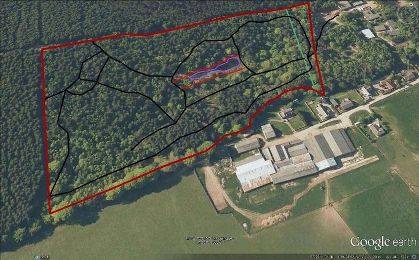
Scottish School of Forestry Campus Woodland – Conservation Plan 2016 - 2021

Contents
Inverness College UHI – property………………………………………...2

Description……………………………………………………………………3

Objectives……………………………………………………………………..3

Archaeology…………………………………………….…………………….4

Recreational Facilities………………………………………………………4

Zone 1…………………………………………………………………….……6

Zone 2………………………………………….………………………………7

Zone 3………………………………………………………………………….7

Zone 4………………………………………………………………………….8

Zone 5………………………………………………………………………….8

Zone 6………………………………………………………………………….9

Zone 7……………………...…………………………………………………..9

Zone …………………………………………...……………………….…...10

Zone 9……………………………………………………...…………….….11

Zone 10………………………………………………………………….……11

Photographs…………………………………………………………...……13

Photographs………………………………………………………….……..14

Photographs………………………………………………………………...15

Map 1- Location Map……………………………………………………..…2

Map 2 – Zone Site Map……………………………………………………...5

Map 3 – Site Access Tracks………………………………………………12
Inverness College UHI - property
Woodland name: Scottish School of Forestry Woodland
Nearest village/town: Balloch, Inverness
Postal area: Viewhill, Inverness IV2 5EA
OS Grid reference: NH 738 436
Local Authority area: Highland
Area of woodland: 10 ha
Area covered under new
proposed conservation area: 7.16 ha
Access: via B9006 Westhill to Croy road and Culloden Road leading to
Balloch
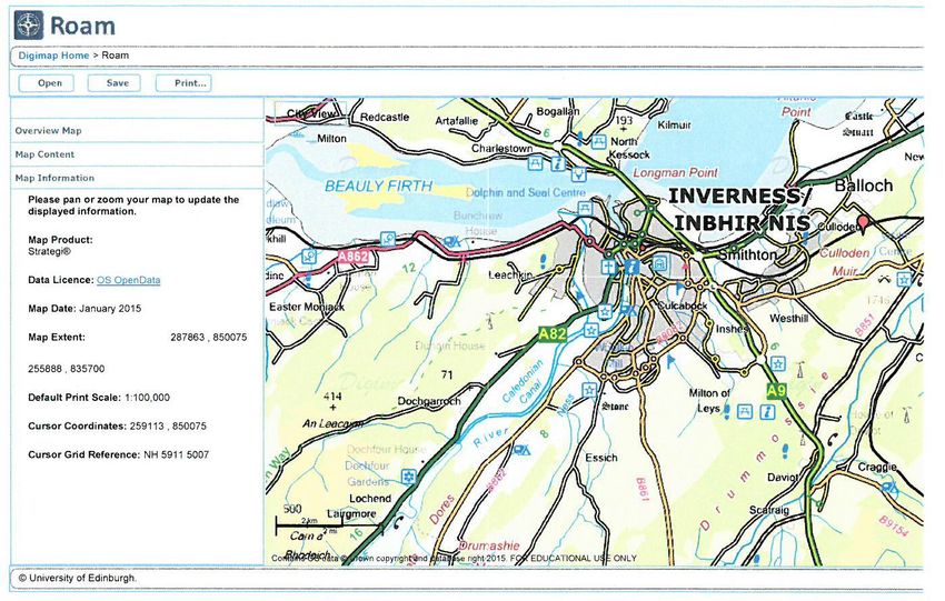
Map 1 - Location Map
2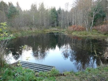
Description

This area is owned by Inverness College UHI and is adjacent to the
Scottish School of Forestry, Inverness College UHI (SSF). (Site Map – Map 2)

Access is from Culloden Road, Grid ref NH 738 436. (Map 1 - Location Map)

The area consists of woodland made up of both deciduous and
coniferous blocks and intimate mixtures.

The area has been restocked since 1970 (previously commercial
coniferous high forest) by planting and natural regeneration and is now
established with a diverse range of tree and ground flora species.

The area has been and will be managed over the long term using Low
Impact Silvicultural Systems (LISS) to regenerate, enhance and
demonstrate tree species resilience of the area.

Objectives:

1 Maintain and manage this area as a training and education resource
for the SSF and Inverness College UHI.

2 Provide practical forestry training with hand tools, forest motor manual
equipment and a variety of forestry tractors and all-terrain vehicles.

3 Provide training in practical arboriculture through tree climbing and
aerial tree works incorporating crown lifting, crown pruning, sectional
tree felling and invasive tree diagnostic techniques.

4 Provide education on practical tree and plant identification.

This small woodland is managed with care and attention as an
educational and training resource incorporating single tree or group
selection methods. This means that the area within the site is never
without tree cover but has a dynamic variety of tree, shrub and ground
flora. When windblow occurs however, this is cleared away and
regeneration of the woodland actively encouraged.

                                                                            3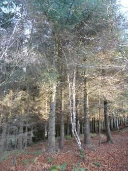
The prime objective is education and training and this means that groups
of our students and from other organisations that we support are
regularly working within the areas doing a number of agreed small scale
operations over an extended period of time to meet their educational
needs and those of the land based industries.
The small scale training operations that are commonly employed are as
follows but the list is not exhaustive:
Tractor driving on tracks
ATV driving on and off tracks
Chainsaw felling and crosscutting
Timber extraction by tractor, forwarder, ATV and cable crane
Clearing saw
Planting
Individual tree protection
Weeding
Coppice working
Draining
General maintenance operations
Archaeology
There is evidence of field boundaries on both the eastern and western
edges of the site plus two quarry sites close to the southern boundary.
Recreational Facilities:
There is a national network path along the northern boundary of the
area. Gates and styles give access to the area but as this is primarily a
forestry training site with machinery use no waymarked paths have been
incorporated for the general public.
4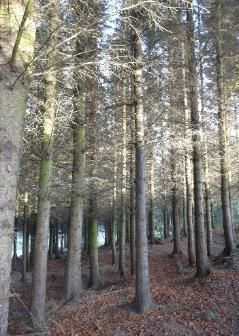
Map 2 – Zone Site Map

                        5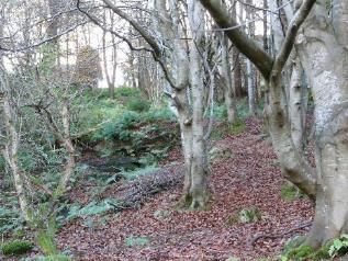
Operations by Zone (Map 2 – Zone Site Map)

All activities are for educational and training purposes in relation to
Forestry and Arboricultural operations and management and for rural
training by other bodies.

Zone 1           Mixed woodland - east

Zone 2           Broadleaved woodland - east

Zone 3           Conifer plantation

Zone 4           Arboretum

Zone 5           Veteran trees

Zone 6           Broadleaved woodland - west

Zone 7           Open conifer woodland - west

Zone 8           Millennium conservation area

Zone 9           Coppice

Zone 10          Pond

Zone 1 - Mixed woodland - east

Description:

Predominantly mature conifers with and understory of mainly birch, holly
and rowan. Brown earth soils on NW facing slope.

Operations:

1. Tractor driving on recognised tracks and ATV driving on tracks and off
tracks.

2. Tree climbing and crown lifting/deadwooding of large conifers.

3. Limited felling operation.

4. Brashing and pruning of all trees

                                                                          6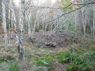
Zone 2 - Broadleaved woodland - east

Description:

Predominantly birch, beech, holly, willow, poplar with some conifer
content. Brown earth soil on N facing slope.

Operations:

1. Tractor driving on recognised tracks and ATV driving on tracks and off
tracks.

2. Tree climbing and crown lifting/deadwooding of large conifers.

3. Limited felling operation.

4. Brashing and pruning of all trees

Zone 3 - Conifer plantation

Description:

Predominantly high forest plantation conifers aged c40 years (Sitka
spruce, Norway spruce, Douglas fir and Grand fir). Devoid of ground
flora bar some mosses, ferns and light grasses.

Shallow skeletal soils on sandstone bedrock as evidenced by the two
small quarry borrow pits. N facing slope.

Operations:

1. Tractor driving on recognised tracks and ATV driving on tracks and off
tracks.

2. Tree climbing and crown lifting/deadwooding of large conifers.

3. Limited felling operation to remove sub-dominant/suppressed and
windblown trees and to open up natural spaces for natural regeneration
or planting as they become available.

4. High pruning of selected trees.

                                                                         7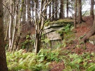
Zone 4 - Arboretum

Description: Predominantly grasses and gleyed soils supporting a wide
variety of mainly broadleaved trees planted in groups as an arboretum
resource to the south of the man-made pond. Approx. 30 years of age
(ash, sycamore, hazel, willow, poplar, cherry, southern beech, oak)

Operations:

1. Tractor driving on recognised tracks and ATV driving on tracks.

2. New planting small in blocks (up to 20 trees per species per block) to
enhance arboretum and resilience for the area.

3. Limited felling operation to remove and windblown trees and to open
up natural spaces for natural regeneration or planting as they become
available.

4. Pruning of selected trees.

Zone 5 - Veteran trees

Description:

Southern boundary with veteran pine and beech to the western end.

Operations:

1 Fence maintenance
2 Arboricultural tree climbing and deadwooding
3 Tractor and ATV access
4 Natural regeneration and planting with groups of conifers and
broadleaves to maintain the nature of the area and to protect the whole
site from SW gales

                                                                            8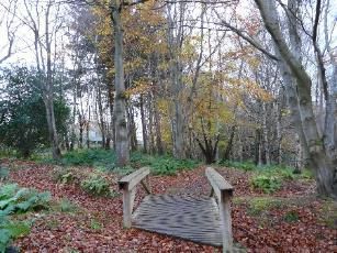
Zone 6 - Broadleaved woodland - west
Description:

Mature birch woodland with intermittent mature conifers and veteran
beech. Grass vegetation, gley soils on a level site.

Operations:

1 Fence maintenance
2 Arboricultural tree climbing and deadwooding of veteran and mature
  conifers
3 Tractor and ATV access
4 Harvesting and extraction of windblow and suppressed trees.
5 Natural regeneration and planting with groups of conifers and
  broadleaves to restock site over the long term using low impact
  silvicultural systems (LISS) tree shelters and small fenced enclosures
  for training purposes.
6 Draining

Zone 7 – Open conifer woodland – west

Description:

Flat area of gleyed soils subject to windblow of conifer and birch crop.

Operations

1 Fence maintenance
2 Tractor and ATV access
3 Harvesting and extraction of windblow and suppressed trees.
4 Natural regeneration and planting with groups of conifers and
  broadleaves to restock site over the long term using low impact
  silvicultural systems (LISS). Incorporating tree shelters and small
  fenced enclosures for training purposes.
5 Some mechanical mounding cultivation for planting or regeneration as
  training on small digger operation.
6 Draining

                                                                           9
Zone 8 - Millennium conservation area
Description:
Mainly podsols and surface water gleys to the north of the pond,
supporting a wide variety of native species of all age classes. Currently
managed as LISS and used for conservation training and species ID.
Area includes good woodland indicator species and has colonies of
creeping ladies tresses and chickweed wintergreen. Long term aim is to
slowly remove all non-native tree species
Operations:
1 Fence maintenance
2 Arboricultural tree climbing and deadwooding and pruning of mature
conifers. Removal of the 2 large beech near pond (see Fig 7)
3 Tractor and ATV access
4 Felling and extraction of non-native trees, a few at a time, over a long
period of time to create small openings for natural regeneration.
5 Natural regeneration of native conifers and broadleaves to restock site
over the long term using low impact silvicultural systems (LISS) tree
shelters and small fenced enclosures for training purposes.
6 Removal of 2 medium sized beech trees near pond (See Fig. 7)
7 Removal of exotic natural regeneration.
10Zone 9 – Coppice
Description:
Mainly brown earth and ground water gley soils to the east of the pond,
mainly birch currently being converted to a working willow coppice
woodland for training purposes.
Operations:
1 Fencing and other physical protection methods
2 Arboricultural tree climbing and deadwooding and pruning of mature
high forest conifers
3 Tractor and ATV access
4 Harvesting and extraction of trees to create small openings for
coppice establishment
5 Planting of coppice species and their establishment by tree shelters
and small fenced enclosures as necessary.
Zone 10 - Pond
Description:
Small man-made pond of around 0.2ha.
Conservation
Operations:
1 Educational pond dipping
2 Wildlife monitoring
3 Cleaning of excess algal growth
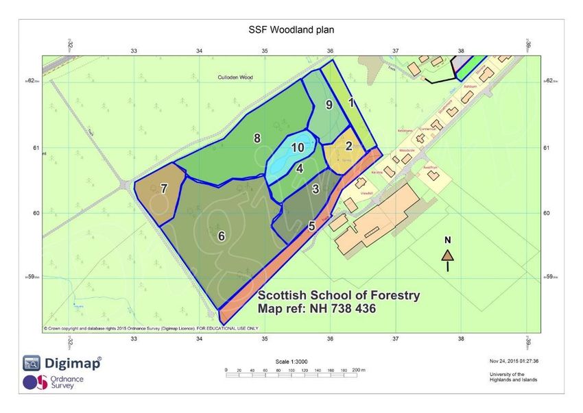
11Map 3 – Site Access Tracks
Legend for Access Tracks
Plan Boundary
Dyke
Main Tracks
Minor tracks
Pond
12Representative photos of the zones
Figure 1 - Zone 1 - Old Dyke Figure 2 - Zone 2 - site entrance track
Figure 3 - Zone 9 - Coppice working Figure 4 - Zone 2 - East Quarry
Figure 5 - Zone 4 Figure 6 - Zone 10 – Pond
13Beech to
Fell
Figure 7 - Zone 8 - Millennium Conservation Area (a) Figure 8 - Zone 8 Millennium Conservation Area (b)
Figure 9 - Zone 8 –
Millennium Conservation Area (c) Figure 10 - Zone 7- Open Conifer Woodland - West
Figure 11 - Zone 6 - Broadleaved Woodland - West Figure 12 - Zone 5 - Veteran Trees
14Figure 13 - Zone 3 - Conifer Plantation (a) Figure 14 - Zone 3 - Conifer Plantation (b)
Figure 15 - Zone 4 - Arboretum Figure 16 - Zone 4 - Quarry to west
Figure 17 - Windblow
1516
You can also read