Short abstracts digital volume - December 18, 2020 - 10th International INQUA Meeting on Paleoseismology, Active Tectonics and Archeoseismology ...
←
→
Page content transcription
If your browser does not render page correctly, please read the page content below
10th International INQUA Meeting on
      Paleoseismology, Active Tectonics and
        Archeoseismology PATA, Hornitos,
              Chile, November 2021

Short abstracts
digital volume
December 18, 2020

                                    Fondecyt 1201387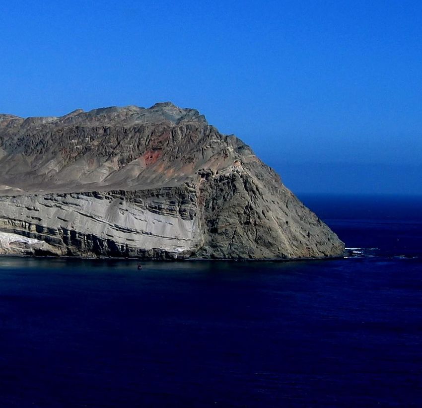
PREFACE
During 2020 the humanity has been impacted by the most dramatic planetary scale health emergency in decades.
Since the first announcement about the emergent pandemic (COVID-19) on December 2019 in Wuhan, China,
more than 67 million people have been infected by the SARS-CoV-2 coronavirus and more than 1.5 million
have been killed worldwide (Jones, N., Nature 588, 388-390, 17 December 2020). Temporary lockdowns, social
distancing together with other actions to fight the pandemic strongly impacted daily routines of billions of
persons, affecting the normal functioning of our societies. In addition, the average global temperature in 2020
is set to be about 1.2 ºC above the pre-industrial (1850-1900) level, according the World Meteorological
Organization (2 December 2020). And the USGS reports about 128 significant earthquakes occurred worldwide
(where significant is a combination of magnitude, responses and impact of the earthquakes). Together with the
loss of biodiversity, famine, water scarcity -that affects billions of persons-, war and increase of socioeconomic
inequalities in numerous countries in the world, this scenario challenge-us, as humans. Scientific knowledge
and collaboration, humankind and Human Rights become more necessary than ever.
The 10th International INQUA meeting on Paleoseismology, Active Tectonics and Archaeoseismology, PATA,
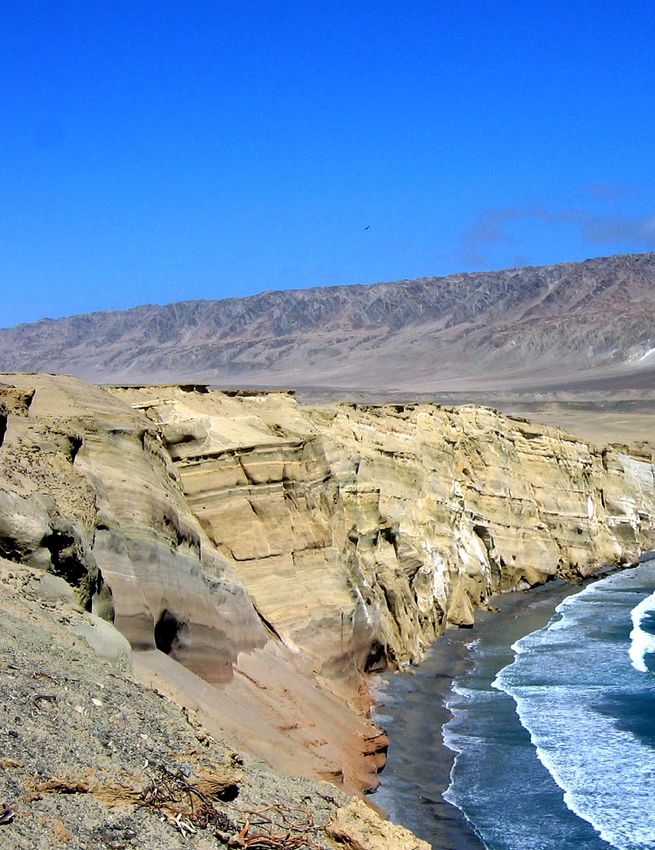
was originally programmed for November 2020 at Hornitos, in the hyperarid coastal Atacama Desert of
northern Chile, a region considered as a seismic gap located along the subduction margin of the Nazca plate
beneath the South American plate. Because of the pandemic, we moved the date of this meeting to November
2021, with the hope that we will have the opportunity to realize fieldtrips with the aim to visit some spectacular
evidences of past megathrust earthquakes and tsunamis, as well as Quaternary deformation associated to upper
plate crustal faulting activity, discussing also the impact of recent and past socionatural disasters together with
resilience strategies adopted by the first communities that inhabited this extreme environment.
To make this volume, we received and compiled 75 short abstracts covering the topics of active tectonics,
neotectonics, tectonic geomorphology, surface deformation, landslides, surface faulting, paleoseismology,
archaeoseismology, tsunami and paleotsunami records, earthquake geology and seismic hazard, as a testimony
of our persistence and compromise, as worldwide community of Earth Scientists, to contribute to making this
a sustainable world.
Hope to see you in the most arid environment worldwide, the coastal Atacama Desert, in 2021.
PATA 2021 Chile
Scientific Committee
December 18, 2020
1
CONTENTS

PREFACE ............................................................................................................................................................ 1
CONTENTS ......................................................................................................................................................... 2
Fault slip distribution along the southern 15 km of the M7.1 Ridgecrest earthquake surface rupture ................ 5
Mountain rivers reveal the earthquake hazard of geologic faults in Silicon Valley ............................................ 6
Crustal Faults and Surface-Rupturing Earthquakes in The Andean Forearc: Quaternary Kinematics and Tectonic
Loading of Southern Peru .................................................................................................................................... 7
The 11/11/2019 Mw4.9 Le Teil surface rupturing earthquake, a key event for understanding the recent activity
of the Cévennes fault system (S. France) ............................................................................................................. 8
Vertical motion rates in southern Iberia: an overview from Last Interglacial coastal units. ............................... 9
Offshore tsunami backwash deposits – hints through biomarker analysis ........................................................ 10
Surface rupture of the great Andean earthquake in the Central Andes Forearc in ~AD 1400 .......................... 11
Geologic evidence of past liquefactions in fine-grained lacustrine sediments (Quaternary Fucino basin, central
Italy): implications for liquefaction hazard ........................................................................................................ 12
Dropstone Deposition Process – Insight from Comprehensive Numerical Model ............................................ 13
Early postglacial faulting of glaciolacustrine sediments at Round Lake, Ontario, Canada ............................... 14
Studying Ancient Tsunamis in the Geological Record in the Humid Tropics: Implications for Mexican Research
............................................................................................................................................................................ 15
Segmentation of long-lived strike-slip faults in intraplate regions: A case study of the Yangsan Fault in SE
Korea .................................................................................................................................................................. 16
Variation in faulting characteristics within non-extended Stable Continental Region (SCR) crust .................. 17
Incas and Earthquakes, a peculiar and overlooked relationship. New insights from a pioneer
archaeoseismological survey within the Cuzco region, Peru. ............................................................................ 18
Neotectonic evidence for Late Quaternary reverse faulting in the northern Chile outer forearc (22.5°S-23°S):
implications for seismic hazard.......................................................................................................................... 19
Compiling hazardous faults in South America: Results and lessons learned from the SARA project .............. 20
Marine terraces and knickzones as proxies for uplift transients associated to megathrust earthquakes ............ 21
New (And Quite Fast) Geologic Slip Rates Along Patagonia's Major and Oftentimes Concealed Crustal Strike-
Slip Faults .......................................................................................................................................................... 22
Large landslides database along the Central Western Andes (15° - 20° S): constraints on mass-movement
development and implications on relief evolution ............................................................................................. 23
Can the major Northern Chile Seismic Gap produce ~Mw 9.5 tsunamigenic earthquakes? Unveiling past
socionatural disasters from geoarchaeological records along the hyperarid Atacama Desert at multimillennial
timescales ........................................................................................................................................................... 24
Offshore tsunami backwash deposits – a multi-proxy approach ....................................................................... 25
Middle-Late Pleistocene uplift of southwestern Sicily, central Mediterranean Sea: quantitative constraints on
regional and local deformation processes based on raised paleoshorelines....................................................... 26
Late Pleistocene and Holocene paleoseismology and deformation rates of the Pleasant Valley Fault (Nevada,
USA) .................................................................................................................................................................. 27
2011 Tohoku-oki and the historical Sanriki-oki tsunami - organic geochemical investigation of multiple tsunami
deposits at the Aomori coast (Northern Japan) .................................................................................................. 28
Multi-proxy investigation of the AD 1755 Lisbon tsunami deposits in Conil de la Frontera, Spain ................ 29

                                                                                                                                                                             2
Spatial variations in rock uplift rates in the Colca River basin inferred from landscape analysis and river terraces
dating, Central Andes ......................................................................................................................................... 30
Analysis of the Damage Orientation of the 1950 Earthquake in Cusco City..................................................... 31
Collisional Indenter Tectonics of the Santa Ana Mountains and the Southern Los Angeles Basin, Orange
County, California .............................................................................................................................................. 32
1909 Benavente Earthquake (Intensity X, Portugal): Seismic source determination through geological effects
............................................................................................................................................................................ 33
Paleoseismic evidence in multiple fault-branches across a transect of the Alhama de Murcia Fault (SE Spain)
............................................................................................................................................................................ 34
Slip rates variability along an irregular normal fault plane: Accelerated uplift accommodation during the late
Quaternary, Mejillones Peninsula, northern Chile ............................................................................................. 35
Structural and seismic segmentation of the Coastal Cordillera in Northern Chile: a general overview and the
linking processes ................................................................................................................................................ 36
New marine terraces 10Be exposure ages in the central-eastern part of the Mejillones Peninsula, northern Chile.
............................................................................................................................................................................ 37
Geomorphological map of the Quaternary deposits of Península de Mejillones, Antofagasta (Chile). ............ 38
Active tectonics of the Alps-Dinarides transition zone...................................................................................... 39
Geomorphology of the cumulative deformation since Oligocene age on the Mw 4.9 Le Teil earthquake fault
(South of France,11/11/19) ................................................................................................................................ 40
Is the Billecocha fault system (Northern Ecuador) a case where strike slip faulting interacts with mountain scale
gravitational deformations? Insights from morphological and paleoseismological investigations ................... 41
Characteristics of the topographical deformation in the central part of the Ulsan fault .................................... 42
Earthquake clustering along strike-slip fault system A rule rather than an exception ....................................... 43
The Truckee fault zone, California USA: Distributed active faulting in the northern Walker Lane ................. 44
Re-assessing the probabilistic fault displacement hazard for distributed faults: it’s normal to make a fault. ... 45
Integration of faults, earthquakes and geodetic data for estimating PSHA: the Italian model. ......................... 46
Inferring seismic hazards from a new 1:25,000 scale map of active and potentially-active continental faults in
Chile ................................................................................................................................................................... 47
Rupture History of the Himalayan Frontal Thrust in Central Nepal .................................................................. 48
Recording the giant 1877 CE tsunamigenic earthquake and its predecessors from submarine laminated
sediments off Northern Chile (19°35’S) ............................................................................................................ 49
Outreach on Earthquake Geology as a tool to increase social seismic awareness ............................................. 50
Surface rupturing earthquake in the Lower Rhine Grabens: results from paleoseismological trenching – “one
shot faults”?........................................................................................................................................................ 51
Quaternary deformation along the Western Andean Front (WAF) between 35° and 37° S, Chile: insights from
morphometric analysis ....................................................................................................................................... 52
Speleoseismology as a tool to validate and constrain seismic hazard models: examples from Central and
Southern Apennines in Italy. .............................................................................................................................. 53
Morpho structural and Paleo-seismological analysis of the Pachatusan Fault System –Cusco, Peru ............... 54
Slow-slip active faults in tropical areas: the case of the Opak Fault System (Central Java, Indonesia)............ 55
Radon (222Rn) soil exhalation of the Alhama de Murcia fault and earthquakes. ............................................... 56
Speleoseismology at Los Casares Cave (central Sapin): evidence of a paleoearthquake? ................................ 57
Pleistocene earthquakes in the Southern Peribalticum area - the GREBAL project summary .......................... 58
3Evidence of Holocene Subduction Earthquakes on the Central Hikurangi Subduction Margin ....................... 59
Sand deposits reveal great earthquakes and tsunamis at Mexican Pacific Coast ............................................... 60
Surface rupturing earthquake in the Upper Rhine Grabens: results from paleoseismological trenching .......... 61
Active faults or weakness zones in the northern Chile forearc? Understanding the competition between
subduction earthquake cycle and upper plate fault reactivation in subduction zones........................................ 62
Rupture Complexity in Large Strike-Slip Earthquakes: Rule or Exception? .................................................... 63
Paleoseismic Studies in Cusco: Evidence of paleo-earthquakes in the surface rupture zone of the 1986
earthquake .......................................................................................................................................................... 64
Seismic Potential of Crustal Faults in the Chilean Andes.................................................................................. 65
Locating Active (Holocene) Faults in the City of Beverly Hills, California (USA).......................................... 66
Archeoseismological analysis of the late 4th century tsunami event devastating the Roman City of Baelo Claudia
(Gibraltar Arc, South Spain). ............................................................................................................................. 67
The evolution of slopes in a seismically active carbonate terrain by normal faulting and generations of
landslides, Galilee, Israel ................................................................................................................................... 68
Stress field changes in Central Europe since Late Miocene to date as determined from volcanic rocks and
extensometric measurements in the Bohemian Massif, Central Europe ............................................................ 69
Fault reactivation due to Ice Loading (Bohemian Massif, Central Europe) ...................................................... 70
Neotectonic deformations in a cave: constraints from Th/U dating of damaged speleothems (Demänová cave
system, Low Tatra Mts, Western Carpathians) .................................................................................................. 71
Coseismic paleo-displacements along the Mt. Vettore bedrock fault scarp revealed by high resolution
topographic survey (central Italy, 2016 earthquake).......................................................................................... 72
Offshore tsunami backwash deposits - How to interpret palynological and micropalaeontological records? .. 73
Palaeostress inversion from post-glacial scarps on the Hellenic Subduction Forearc ....................................... 74
IPOC Creep as a natural lab: Deciphering fault slip behavior from fault gouge structure and composition and
high rate instrumental monitoring with the IPOC Creepmeter array ................................................................. 75
Glacial Quaternary geology of the Patagonian Andes across the Coyhaique-Puerto Aysén transect constrains
neotectonics and paleoseismological observations along the Liquiñe-Ofqui Fault Zone .................................. 76
Exploiting local geological data for fault-based seismic risk: a Fault2SHA experience. .................................. 77
The Truckee River Terraces of Reno ................................................................................................................. 78
Discussion on the possibility of glacial earthquakes during mid/late MIS 2 in the southern Baltic onshore
settings ............................................................................................................................................................... 79
410th International INQUA Meeting on Paleoseismology, Active Tectonics and Archeoseismology (PATA), November 2021, Chile
INQUA Focus Group on Paleoseismology and Active Tectonics
Fault slip distribution along the southern 15 km of the M7.1 Ridgecrest earthquake
surface rupture
Sinan O. Akciz (1), Salena Padilla (1), Alex Hatem (2), James F. Dolan (2)
(1) CSU Fullerton, Geological Sciences, Fullerton, CA, United States
(2) University of Southern California, Earth Sciences, CA, United States
Abstract: The Mw7.1 Ridgecrest earthquake of 5 July 2019 occurred in the transition area between the Eastern
California Shear Zone in the Mojave Desert and the Walker Lane to the north, which accommodates roughly
10 mm/yr of the motion between the North American and Pacific plates. We mapped the southernmost 15 km
of the rupture, which cut across Pleistocene lacustrine and alluvial deposits. We followed the main rupture
southeastwards from Highway 178, making field observations of fault orientations, slip sense, fault zone width,
and displacement measurements. Eighty-two offset measurements were made along the main (eastern) and
central strands of the ruptured fault zone, including measurements made on cracks. The summary of our
displacement data are: (1) a minimum of 70 cm of right-lateral slip occurred along the main fault rupture, but
the displacement rapidly decreased to10th International INQUA Meeting on Paleoseismology, Active Tectonics and Archeoseismology (PATA), November 2021, Chile
INQUA Focus Group on Paleoseismology and Active Tectonics
Mountain rivers reveal the earthquake hazard of geologic faults in Silicon Valley
F. Aron (1, 2), S. Johnstone (2,3), A. Mavrommatis (4†), R. Sare (2), F. Maerten (5), J. Loveless (6), C. W.
Baden (2), G. E. Hilley (2)
(1) Research Center for Integrated Disaster Risk Management (CIGIDEN) & Departamento de Ingeniería
Estructural y Geotécnica, Pontificia Universidad Católica de Chile, Macul, Santiago 7820436, Chile.
(2) Department of Geological Sciences, Stanford University, Stanford, CA 94305.
(3) Geosciences and Environmental Change Science Center, United States Geological Survey, Denver, CO
80225-0585.
(4) Department of Geophysics, Stanford University, Stanford, CA 94305.
(5) YouWol, 455, Avenue Alfred Sauvy, Le Lancaster, 34470 Perols, France.
(6) Department of Geoscience, Smith College, Northampton, MA 01063.
Abstract: The 1989 Mw=6.9 Loma Prieta earthquake resulted in tens of lives lost and cost California almost
3% of its GDP. Despite widespread damage, the earthquake did not clearly rupture the surface, which poses a
challenge to identifying and characterizing these hidden hazards. Here, we show that these hazards can be
illuminated by inverting earth's river topographic structure for fault slip- and moment accrual-rates – two
fundamental components in earthquake hazard assessments – by combining a geomorphic model of channel
incision with a mechanical model of slip along crustal, relief-generating faults. We applied this technique to a
set of thrust faults bounding the mountains along the western side of Silicon Valley in the San Francisco Bay
Area and discovered that: (i) a Mw=6.9 earthquake could occur on these faults over the next 100-250 years; if
they were to rupture today the quake could reach up to Mw=6.5-6.7, and (ii) this method may be deployed
broadly to evaluate seismic hazard in developing regions with limited geological and geophysical information.
Keywords: Mountain rivers, earthquake hazard, Silicon Valley
610th International INQUA Meeting on Paleoseismology, Active Tectonics and Archeoseismology (PATA), November 2021, Hornitos,
Chile
INQUA Focus Group on Paleoseismology and Active Tectonics
Crustal Faults and Surface-Rupturing Earthquakes in The Andean Forearc:
Quaternary Kinematics and Tectonic Loading of Southern Peru
Audin, L. (1), Benavente, C. (2), Rosell, L. (2), García, B. (2), Zerathe, S. (1), Delgado, F., Aguirre, E. (2),
Robert, X. (1), Saillard, M. (3), Hall, S. (4), Costa, C. (5).
(1) ISTerre, Université Grenoble Alpes – IRD, France
(2) Instituto Geológico, Minero y Metalúrgico INGEMMET, San Borja, Perú
(3) Université Côte d'Azur, IRD, CNRS, Observatoire de la Côte d'Azur, Géoazur, Valbonne, France
(4) College of the Atlantic, Maine, USA
(5) Departamento de Geología - Universidad Nacional de San Luis - Argentina
Abstract: As recurrence intervals of crustal surface-rupturing earthquakes reach thousands to tens of thousands
of years in the Andes, slip rates on individual faults are barely measurable by instrumental networks.
Consequently, satellite geodesy or even historical seismic catalogues do not reflect Quaternary nor Holocene
long-term deformation patterns. Nonetheless, an increasing amount of geomorphic data and paleoseismic
records shows that the continental Andes also accumulates strain with respect to megathrust interface. In the
forearc and Western Cordillera of the Central Andes, the tectonic loading is shared by a complex system of
interacting faults spread across the landscape, which are major but often seismically quiet fault zones. This
work explores some of the key places previously studied in Southern Peru, taking them all together in an attempt
to reach a broader understanding of distributed crustal deformation. Field mapping complemented with
topographic data, air photos and satellite images analysis allow precise determination of piercing points across
the Atacama landscape that are used to measure fault offsets and to map the tectonic markers. Geochronological
dating (TCN, OSL, C14) provide constraints to determine long-term slip rates. On a 10-100 ka time-scale, the
displacement rates range from 5 mm/yr to 0.1 mm/yr. Those rates are about 5 mm/yr faster than short-term
geodetic null estimates for this part of the Andes. This result also highlights a need for new constraints on
hazard assessment regarding the seismic cycle linked to the subduction processes and interseismic coupling.
Our study shows that now active faults are identified, we need more sites along the Western Cordillera in Peru
and Chile need to be targeted to better constrain the slip rates over different timescales, both to create a more
complete picture of distributed deformation throughout the forearc region (spatial) or to span multiple
timescales.
Keywords: Quaternary crustal faults, Andean forearc, Peru
710th International INQUA Meeting on Paleoseismology, Active Tectonics and Archeoseismology (PATA), November 2021, Hornitos,
Chile
INQUA Focus Group on Paleoseismology and Active Tectonics
The 11/11/2019 Mw4.9 Le Teil surface rupturing earthquake, a key event for
understanding the recent activity of the Cévennes fault system (S. France)
Stéphane Baize (1), Jean-François Ritz (2), Estelle Hannouz (3), Magali Riesner (4), Laurence Audin (3),
Pierre Arroucau (5), Laurent Bollinger (4), Matthieu Ferry (2), Hervé Jomard (1), Christophe Larroque (6),
Kevin Manchuel (5), Magali Rizza (7), Christian Sue (3)
(1) Institut de Radioprotection et Sûreté Nucléaire, Fontenay-aux-Roses, France
(2) Géosciences Montpellier, France
(3) IsTerre, Université de Grenoble – Alpes, France
(4) Commissariat à l’Energie Atomique, France
(5) Electricité de France, Aix-en-Provence, France
(6) Géoazur, Université de Nice – Sophia-Antipolis, France
(7) CEREGE, Aix-en-Provence, France
Abstract: On November 11, 2019, a very shallow and moderate Mw4.9 earthquake occurred in southern
France, causing significant damages and unexpected surface rupture. This earthquake that surprised inhabitants,
authorities and media appears as an infrequent event in this slowly deforming region.
The earthquake rupture occurred on a 5 km-long fault section along the La Rouvière fault, (LRF) belonging to
the Cévennes fault system (CFS). This major inherited structure acted as a normal fault during the Oligocene
extensional episode (20-30 Ma ago), whereas the 2019 earthquake inverted the sense of motion with a reverse
focal mechanism confirmed by field observations and geodetic measurements (Ritz et al., 2020). InSAR data
show that evidences of discrete surface faulting, warping and fissuring occurred in a wide band of tens to
hundreds of meters, which follows the geological trace of the LRF. Maximum vertical displacement over the
whole deformation band is ~25 cm, and localized vertical surface displacement locally reaches ~15 cm. The
LRF, previously not known as an active fault, is now under careful investigation, as well as the other faults of
the CFS. In the framework of a national effort (so-called “FACT axis” within the French RESIF consortium, a
national research infrastructure: www.resif.fr/en/), we started to investigate the recent tectonics of the CFS,
including mapping, geomorphological analysis and paleoseismological research.
To date, one year after the earthquake, we could gather evidences of pre-2019 Quaternary deformation in the
first paleoseismological trenches along the LRF.
The aim of this study is to check the occurrence of previous surface-rupturing events and to determine the slip
rates along faults, which are key parameters to evaluate the regional ground motion and surface rupturing
hazards. These data will also provide constraints for better understanding the regional geodynamics of the
studied region.
Ritz et al. (2020). https://www.nature.com/articles/s43247-020-0012-z
Keywords: Moderate earthquake surface rupture, Paleoseismology, France, Stable Continental Region
810th International INQUA Meeting on Paleoseismology, Active Tectonics and Archeoseismology (PATA), November 2021, Hornitos,
Chile
INQUA Focus Group on Paleoseismology and Active Tectonics
Vertical motion rates in southern Iberia: an overview from Last Interglacial coastal
units.
T. Bardají (1), J.L. Goy (2), C. Zazo (3), C.J. Dabrio (4), D. Moura (5), T. Boski (5), E. Roquero (6), P.G.
Silva (2), A. Martínez-Graña (2), J. Lario (7)
(1) Dpto. Geología, Geografía y Medio Ambiente; Universidad de Alcalá. 28805-Alcalá de Henares.
teresa.bardaji@uah.es
(2) Dpto. Geología; Universidad de Salamanca. 37008-Salamanca. joselgoy@usal.es; amgranna@usal.es
(3) Dpto. Geología; Museo Nal. CC. Naturales; CSIC. 28006-Madrid. carizazo@mncn.csic.es
(4) Dpto. Estratigrafía; Universidad Complutense de Madrid. 28040-Madrid. dabrio@ucm.es
(5) CIMA; Universidad do Algarve. Portugal. dmoura@ualg.pt; tbosky@ualg.pt
(6) Dpto. Edafología; ETSI Agrónomos; Universidad Politécnica de Madrid; 28040-Madrid.
elvira.roquero@upm.es
(7) Dpto. CC. Analíticas, Fac. Ciencias; UNED. 28040-Madrid. javier.lario@ccia.uned.es
Abstract: Low to moderate tectonic rates since the Pliocene have been described in Southern Iberia, currently
subjected to the compressive stress produced by the convergence between the Eurasian and Nubian plates. This
complex active plate boundary is characterized, between Azores and Tunisia (Bufforn & Udías, 2010), is
characterized by being partially coincident with coastal settings. Southern Iberia is a key site to understand the
local and regional responses to this shortening by analysing an accurate reference level such as the Last
Interglacial sea level. To accomplish this goal several assumptions were made: similar behaviour of sea level
in the open oceanic mesotidal Atlantic coast and in the closed microtidal Mediterranean coast; the difference in
sea level between Mediterranean and Atlantic coasts has remained unchanged since the last Interglacial (approx.
20cm at present, Ihde & Augath, 2000); age of MIS 5e peak at 130ka and sea level at 6m a.p.s.l. (Capron et al.,
2019). Taking these assumptions into account, a maximum uplift of 0,11 - 0,12 mm/yr has been calculated for
the Portuguese southern margin (Algarve) and Gibraltar Strait, and minimum subsiding rates of 0,20 – 0,002
mm/yr in Alicante – Murcia (Pérez-Peña et al., 2020) and Alentejo (Goy et al., 2019).
GPS data (Stich et al., 2006; Koulali et al., 2011; Cabral et al., 2017) reveal different present-day motions along
this boundary, with tectonic scenarios varying from left lateral shear in the Eastern Betics (Montenat et al.,
1987, Silva et al., 1993) to right lateral shear in Southwestern Portugal (Cabral et al., 2017). The overall NWN-
ESE transpressive regime of Southern Iberia can account for the relatively moderate uplift and subsidence rates
recorded since the Last Interglacial (Zazo et al., 1998). The objective of this contribution is to compare the
vertical motion trends calculated from the present altitude of Last Interglacial units, with the different tectonic
scenarios and local changes along this complex boundary.
Keywords: Vertical motion; MIS5; Southern Iberia
910th International INQUA Meeting on Paleoseismology, Active Tectonics and Archeoseismology (PATA), November 2021, Chile
INQUA Focus Group on Paleoseismology and Active Tectonics
Offshore tsunami backwash deposits – hints through biomarker analysis
Piero Bellanova (1,2), Mike Frenken (1,2), Jan Schwarzbauer (2), Lisa Feist (1), Pedro Costa (3,4), Juan I.
Santisteban (5), Helmut Brückner (6), Klaus Reicherter (1) and the M152 scientific Team
(1) Neotectonics and Natural Hazards Group, RWTH Aachen University, Germany
(2) Laboratory for Organic-Geochemical Analysis, Institute of Geology and Geochemistry of Petroleum and
Coal, RWTH Aachen University, Germany
(3) Instituto D. Luiz, Faculdade de Ciências, Universidade de Lisboa, Portugal
(4) Earth Sciences Department, Faculty of Sciences and Technologies, University of Coimbra, Portugal
(5) Department of Geodynamics, Stratigraphy and Paleontology, Fac. Geological Sciences, Complutense
University of Madrid, Spain
(6) Institute of Geography, Department of Geosciences, University of Cologne, Germany
Abstract: Little is known about offshore tsunami backwash deposits. Their sedimentary processes, impact on
benthic life and preservation potential are as yet unexplored. Few offshore sedimentary archives have been
studied for tsunami research. One of these is the shelf record of southwestern Iberia, where the M152 RV Meteor
expedition sampled a coast-perpendicular transect off the Algarve coast (water depths: 65-114 m). When tracing
the offshore sedimentary footprint of the AD 1755 Lisbon tsunami backwash, a predecessor tsunami layer has
been identified. While records of the AD 1755 tsunami and a potential predecessor are well documented
onshore, the offshore record of the sedimentology and dynamics of the backwash are as yet unexplored. At least
two tsunami deposits (AD 1755 and ca. 3700 cal. BP) were detected in vibracores obtained from the Algarve
shelf seafloor. A multi-proxy approach allowed to identify and differentiate these event deposits from the
background sedimentation. Organic-geochemical biomarker proxies, such as n-alkanes, polycyclic aromatic
hydrocarbons, terpenes and n-aldehydes, were used for a clear identification of the terrestrial-influenced
backwash. Further, the organic-geochemical signature of the onshore deposits of the AD 1755 tsunami from
the famous Boca do Rio site were compared with the proxies detected in the offshore backwash deposits. In the
latter, the biomarker assemblage is less distinctive, but still shows a significant discrimination from the
surrounding sediments.
Therefore, the Algarve shelf is a reliable archive for Holocene tsunami imprints. It may extend the onshore
record with its much lesser preservation potential due to subaerial erosion and present-day coastal morphology
being established only since the last four millennia. Multi-proxy approaches, including organic-geochemical
parameters, are a vital tool to (i) identify tsunami backwash deposits; (ii) help in calculating recurrence intervals;
and (iii) estimate the hazard potential for the related coastal area.
Keywords: AD 1755 Lisbon tsunami, tsunami backwash, offshore tsunami, organic geochemistry
1010th International INQUA Meeting on Paleoseismology, Active Tectonics and Archeoseismology (PATA), November 2021, Hornitos,
Chile
INQUA Focus Group on Paleoseismology and Active Tectonics
Surface rupture of the great Andean earthquake in the Central Andes Forearc in ~AD
1400
C. Benavente (1)*, L. Rosell (1), E. Aguirre (1), X. Robert (2), B. García (1), F. Delgado, S. Zerathe, L. Audin
(2), A. Palomino
(1) Instituto Geológico, Minero y Metalúrgico INGEMMET, San Borja, Perú
(2) Université Grenoble Alpes, CNRS, IRD, ISTerre, 38000 Grenoble, France
(3) Especialidad Ingeniería Geológica, Facultad de Ciencias e Ingeniería. Pontificia Universidad Católica del
Perú, San Miguel, Lima 15088, Perú.
*cbenavente@ingemmet.gob.pe
Abstract: Seismic hazard in Peru is often considered to be dominated by earthquakes on the subduction
interface. In the Central Andes Forearc, the size of the sources and the recurrence time of strong crustal
earthquakes are unknown, because geomorphologic and active fault mapping remains scarce. Here, we use
high-resolution DEMs, geomorphic features of surface ruptures, paleo-seismological evidences on alluvial
terraces and trench walls, and 14C dating constraints to show a primary >100 km surface rupture along the
Incapuquio Fault System (IFS). This is considered as the most important frontal thrust in the western margin of
the Central Andes. The values of the net slip vary between 1.2±0.14 to 1.6±0.18 m. Modeling of calibrated 14C
evidences that the last surface rupture occurred in the early 15th century (~AD 1400). According to the fault-
rupture parameters, we estimate that the earthquake was Mw>7.2.
No instrumental large intraplate earthquake has been recorded in the Central Andean Forearc yet and
paleoseismic studies are the only way to address the hazard evaluation. Though, this area has been occupied by
human civilizations since at least 4 ky but the historical catalogue of earthquakes in Peru is limited to the last
500 yrs. Consequently, the impact on any ancient civilization is not known.
According to recent archaeological research, the Chiribaya civilization inhabited southern Peru until ~AD 1400,
contrary to the idea that attributes the end of civilization to “mega-Niño” Miraflores climatic catastrophe (AD
1330). Therefore, we propose that the end of the Chiribaya civilization is associated with the reactivation of the
Incapuquio fault system.
Keywords: Surface rupture, Andean earthquake, Central Andes forearc
1110th International INQUA Meeting on Paleoseismology, Active Tectonics and Archeoseismology (PATA), November 2021, Hornitos,
Chile
INQUA Focus Group on Paleoseismology and Active Tectonics
Geologic evidence of past liquefactions in fine-grained lacustrine sediments
(Quaternary Fucino basin, central Italy): implications for liquefaction hazard
Paolo Boncio (1,2), Sara Amoroso (1,3), Fabrizio Galadini (3), Antonio Galderisi (1,4), Gianluca Iezzi (1,3)
(1) Università “G. D’Annunzio” Chieti-Pescara, Chieti, Italy
(2) CRUST - Centro inteRUniversitario per l'analisi SismoTettonica tridimensionale con applicazioni
territoriali, Chieti, Italy
(3) Istituto Nazionale di Geofisica e Vulcanologia, Rome, Italy
(4) Istituto di Geologia Ambientale e Geoingegneria, CNR, Rome, Italy
Abstract: Liquefaction of fine-grained sediments (silt/clay-size particles) is a topic of interest for earthquake
geology and local seismic hazard studies. Actually, the believing that significant liquefaction hazard is
associated primarily to the presence of loose sands is still diffuse among geologists and engineers.
We present the results of a study carried out in the Fucino lacustrine basin in central Italy, where there is
evidence of earthquake-induced past liquefactions within a fine-grained stratigraphic succession of Quaternary
age.
We studied in detail clastic dykes exposed on the walls of an artificial channel. The dykes are filled by fine-
grained sediments. A multidisciplinary analysis (earthquake geology, geognostic drilling, geotechnics, Vs
profiling, X-Ray Powder Diffraction mineralogical analysis, XRPD) allowed us to characterize the stratigraphic
succession beneath the dykes. The stratigraphic succession down to 20 m depth is formed by prevailing silt or
silt-clay mixtures ~170-180 kyrs-old.
Geologic observations suggest that the dykes are filled by silt liquefied and transported upwards by hydraulic
forces of short duration, as for earthquake-induced liquefaction. Geotechnical simplified methods allowed us
to estimate a high liquefaction hazard. Correlations of XRPD mineralogy of samples from dykes with those
from drilling cores allowed us to identify the most likely source layer filling the dykes, corresponding to a silt
layer at 7-8 m depths. This layer and the dykes lack illite and montmorillonite clay particles.
These results contribute to improve studies of liquefactions in sediments that differ from typical liquefiable
loose sands. Implications for the assessment of liquefaction hazard in late Quaternary fine-grained lacustrine
sediments are discussed.
Keywords: Liquefaction, fine-grained sediments, lacustrine sediments, clastic dykes, Fucino basin
1210th International INQUA Meeting on Paleoseismology, Active Tectonics and Archeoseismology (PATA), November 2021, Hornitos,
Chile
INQUA Focus Group on Paleoseismology and Active Tectonics
Dropstone Deposition Process – Insight from Comprehensive Numerical Model
Małgorzata Bronikowska (1), Małgorzata Pisarska-Jamroży (1), A.J. (Tom) van Loon (2)
(1) Institute of Geology, Adam Mickiewicz University, B. Krygowskiego 12, 61-680 Poznań, Poland. e-mail:
malgorzata.bronikowska@amu.edu.pl; pisanka@amu.edu.pl
(2) College of Earth Science and Engineering, Shandong University of Science and Technology, Qingdao
266590, Shandong, China
Abstract: Due to gradual melting of free floating and drifting at the lake surface ice, clasts (dropstones) of all
sizes are set free and eventually settle through the water column. Although the dropstones in glaciolimic and
marine sediments have frequently been described by many authors, no previous studies based on numerical
modelling has been addressed the dropstones deposition process in general. Here we present results of our
comprehensive numerical model devoted to the relationship between dropstone size, water depth and resulting
SSDS.
In aim to model the dropstone deposition process, two separate but complementary numerical methods has to
be combine. First of them addresses impact velocity calculations, while the second one allow the investigation
on the response of bottom sediments on pressure caused by impacting clast.
The presented comprehensive model allows the reconstruction of the depositional process of dropstones (which
have been modelled in the present study to be spherical and homogeneous). The deformations caused by the
impacting dropstone strongly depend on its diameter; the exact measurements of these soft-sediment
deformation structures can also provide information about the impact scenario. There is a water depth that limits
further increase of the settling velocity of a dropstone (and thus of its impact velocity); the velocity becomes
constant after reaching this depth, which depends only on the dropstone size. For dropstones in basins that are
deeper than the velocity-limiting depth, the reconstruction of the water depth is no longer possible.
Keywords: Dropstone deposition, numerical model
1310th International INQUA Meeting on Paleoseismology, Active Tectonics and Archeoseismology (PATA), November 2021, Chile
INQUA Focus Group on Paleoseismology and Active Tectonics
Early postglacial faulting of glaciolacustrine sediments at Round Lake, Ontario,
Canada
Brooks, Gregory R. (1), Pugin, André J.-M. (2)
(1) Geological Survey of Canada, Natural Resources Canada, 601 Booth Street, Ottawa, Ontario, Canada,
K1A0E8, Email greg.brooks@canada.ca
(2) Geological Survey of Canada, Natural Resources Canada, 601 Booth Street, Ottawa, Ontario, Canada,
K1A0E8, Email andre.pugin@canada.ca
Abstract: Round Lake, ~12 km2 and up to 30 m deep, is located in an intracratonic setting on the Canadian
Shield, northeastern Ontario, Canada, about 180 km northwest of the Western Quebec Seismic Zone. Within a
~0.5 by 1.8 km area of the lake sub-bottom, acoustic and hammer seismic surveys revealed multiple, low-
angled, normal faults that were identified previously as candidates for early postglacial, glacially-induced
faulting. As exemplified by three scarps, the faults have apparent throws of about 3 to 6 m and form obvious
steps within the glaciolacustrine deposits to the depth of penetration in the acoustic profiles. Unfaulted
glaciolacustrine deposits are draped across the faulted sediments, indicating that the faulting occurred in the
early postglacial period between 9.8-8.47 ka cal BP, when a large glacial lake inundated the regional landscape.
Hammer seismic profiles display signal penetration into the underlying glacial deposits, and reveal that the
faulting at many of the scarps is confined to the glaciolacustrine deposits. This characteristic is consistent with
the fault surfaces representing the headscarps of shallow mass movements within the glaciolacustrine deposits.
Several of the faults are deeper-seated, and may originate below the glaciolacustrine facies, as indicated by i)
the apparent extension of the fault planes to the surface of underlying glacial deposits, ii) the identical sub-unit
architecture in the head- and footwalls, and iii) the lack of fracturing, back rotation, and disruption to the
headwall sub-units, which would be indicative of displacement by a mass movement(s). Lack of penetration
of the acoustic or hammer seismic signals to bedrock does not allow determining whether this deeper-seated
faulting is associated with bedrock faulting.
Keywords: Early postglacial faulting, glaciolacustrine deposits, shallow geophysics, central Canada
1410th International INQUA Meeting on Paleoseismology, Active Tectonics and Archeoseismology (PATA), November 2021, Chile
INQUA Focus Group on Paleoseismology and Active Tectonics
Studying Ancient Tsunamis in the Geological Record in the Humid Tropics:
Implications for Mexican Research
Rocío Castillo-Aja (1), María-Teresa Ramírez-Herrera (2)
(1) Departamento de Geografía y Ord. Territorial, Universidad de Guadalajara, Guadalajara, Jalisco (México).
rocasaja@academicos.udg.mx
(2) Laboratorio de Tsunamis y Paleosismología, Instituto de Geografía, Universidad Nacional Autónoma de
México, Ciudad de México. tramirez@igg.unam.mx
Abstract: Tsunami deposits, preserved in the geological record, are a key tool in the reconstruction of tsunami
chronology, and in the assessment of tsunami hazard along coastal areas of tsunamigenic zones. The Indian
Ocean Tsunami (2004) boosted research efforts in tsunami deposits studies in a humid tropical environment,
however the study of this type of deposits in the humid tropics have been reported as challenging. Tsunami
deposits studies have been developed mainly where modern analogues have occurred, nevertheless, many areas,
near subduction zones in humid tropical environments, remain little explored. Here, we discuss the state of
knowledge of deposits of ancient tsunamis in the humid tropics; including both historical and prehistorical
events, summarize tools used and problems faced in identifying and dating them. Some of the challenges faced
in the identification of deposits of ancient tsunami in humid tropics are tropical storms, which are still not
completely solved; and, although historic data are helpful guides identifying ancient tsunamis, for some regions
the improvement of chronologies remain as a pending task. Nevertheless, results reported in literature show that
a multi-proxy approach and the formation of multidisciplinary teams has yielded encouraging results towards
identifying these deposits in the humid tropics. Finally, we discuss the experience in studies of ancient tsunamis
deposits in the Mexican Pacific Coast, which brings together two challenges, a humid tropical environment plus
the lack of a big modern analogue, aiming to contribute with a Mexican tsunamis research agenda.
Keywords: Ancient tsunamis, humid tropics, Mexico
1510th International INQUA Meeting on Paleoseismology, Active Tectonics and Archeoseismology (PATA), November 2021, Chile
INQUA Focus Group on Paleoseismology and Active Tectonics
Segmentation of long-lived strike-slip faults in intraplate regions: A case study of the
Yangsan Fault in SE Korea
Jin-Hyuck Choi (1)
(1) Center for Active Tectocnis, Geology Division. Korea Institute of Geoscience and Mineral Resources,
Korea. cjh9521@kigam.re.kr
Abstract: Fault systems associated with destructive earthquakes consist of a number of individual fault
segments. Earthquake recurrent patterns are often independent on each fault segments, and neighboring fault
segments are often sequentially ruptured by a single seismic event. Hence, segment geometry plays a key role
in evaluating earthquake cycle model in a given fault system. Also segment geometry of fault systems is one of
the essential parameters to assess earthquake hazards. A detail map of coseismic surface ruptures associated
with recent earthquakes, including along-rupture variations in geometry and offset, provide an opportunity to
examine segmentation of the faults. In some cases of no recent surface-faulting events, historical and
paleoseismological data could be used as an indicator of the fault segmentation. Shortly, fault segmentation
could be identified by investigations of surface ruptures associated with historical earthquakes. In intraplate
regions, however, major fault systems in general were not ruptured during historical period due to long (>
thousands of years) recurrence time. Paleoseismological data is also extremely rare to test segment geometry.
Here, I investigate segment geometry of the Yangsan Fault, which is one of the major, ~ 180 km long, active
strike-slip faults in Korean Peninsula. There are limited paleoseismic data and no surface-faulting by
instrumental seismic events along the fault. Tools for the segmentation of the fault are distributions of micro
seismicity, fault-related geomorphic features, and geometric discontinuities along the fault valley. Also we
consider inherited geology of surrounding area of the fault defined by field observations and geophysical
surveys. The results indicate that the Yangsan Fault could be divided into three major segments with a total of
more than fifteen sub-segments.
Keywords: Active Fault, Intraplate Strike-slip Fault, Segment Geometry
1610th International INQUA Meeting on Paleoseismology, Active Tectonics and Archeoseismology (PATA), November 2021, Hornitos,
Chile
INQUA Focus Group on Paleoseismology and Active Tectonics
Variation in faulting characteristics within non-extended Stable Continental Region
(SCR) crust
Dan Clark (1)
(1) Geoscience Australia, GPO Box 378, Canberra, ACT 2601, Australia, Email: dan.clark@ga.gov.au
Abstract: Broad agreement exists that SCR crust is not homogeneous with respect to seismogenic potential.
The majority of historical moment release in SCR settings is preferentially located in failed rifts of Cretaceous
to Paleogene age, and associated with pronounced lateral gradients in lithospheric thickness such as at the
boundaries of cratons. While accounting for less than 10% of historical global SCR moment release, non-
extended SCR crust accounts for more than two-thirds of the surface-deforming earthquakes documented, and
is locally associated with a rich paleoseismic record. The Australian non-extended SCR can be divided into
Precambrian and Phanerozoic components based on differences in seismogenic potential implied by the
character of neotectonic features. Herein we present results from two paleo-seismic studies that are illustrative
of endmember behaviours.
The 2018 Lake Muir earthquake sequence culminated in a MW 5.3 event that produced a 3 km-long and up to
0.4-0.6 m high surface rupture. It is representative of a class of ruptures in the Precambrian non-extended SCR
of Australia where the scarps are isolated from each other and there is little or no landscape evidence for the
recurrence of surface-deforming earthquakes, or of the construction of regional tectonic relief. In contrast, the
~75 km-long Lake George Fault scarp, in Phanerozoic eastern Australia, is associated with ~250 m of relief-
building in the last ca. 4 Myr. The fault is part of a connected network of faults that straddle the crest of the
continental divide in the southeast highlands. Episodes of activity on the fault involving tens of metres of uplift
are separated by much longer periods (≤10 times) of quiescence. While individual seismic events have not been
resolved, standard relations between rupture length and single event displacement suggest that the record may
relate to one hundred seismic cycles or more.
Keywords: Stable continental region, intraplate seismicity, episodic rupture, one-off rupture, seismic hazard,
paleoseismology
1710th International INQUA Meeting on Paleoseismology, Active Tectonics and Archeoseismology (PATA), November 2021, Chile
INQUA Focus Group on Paleoseismology and Active Tectonics
Incas and Earthquakes, a peculiar and overlooked relationship. New insights from a
pioneer archaeoseismological survey within the Cuzco region, Peru.
A. Combey (1), L. Audin (2), C. Benavente Escóbar (3), M.A. Rodríguez-Pascua (4), J. Bastante (5)
(1) ISTerre, Université Grenoble Alpes – PhD CDP Risk
(2) ISTerre, Université Grenoble Alpes – IRD
(3) Geología Ambiental, Instituto Geológico Minero y Metalúrgico, Lima, Peru
(4) Instituto Geológico y Minero de España, Madrid, Spain
(5) Director of the archaeological park of Machu Picchu, Cuzco, Peru
Abstract: Far away from the Pacific margin and its repeated and devastating megathrust earthquakes (Lima,
1746; Arica, 1868), the Cuzco region, heartland of the Incas, is nevertheless a seismic prone region
characterized by a high vulnerability. The large tectonic structure that crosses the area, the Cuzco Vilcanota
Fault Complex, triggered indeed several destructive events since the Spanish Conquest (1650, 1950, 1986,
2014).
Worldwide known for their megalithic constructions, the Incas are often considered as the inventors of a
singular seismic-resistant architecture. However, did they experience as well large ground shaking episodes?
In the absence of pre-Hispanic intelligible written sources, the dense human occupation of the Cuzco area over
the last two millennia makes thus archaeological remains a valuable marker for paleo-seismicity
characterization.
In order to improve the seismic catalogue and extend our knowledge on the Inca seismic risk management we
carried out the first detailed archaeoseismological survey in Peru. Based on a field-tested and quantitative
methodology, our approach led to the identification and registration of a large number of Earthquake
Archaeological Effects (EAEs) on monumental pre-Columbian sites of the Cuzco and Sacred Valley. Combined
with other evidences of past seismic activity like fault trenching, lake coring and ethnohistorical sources, we
aim to date prehistorical earthquakes and assess their induced social effects.
Our first results suggest the occurrence of, at least, one important seismic event during the Late Horizon (1400-
1533 AD) and argue for a reappraisal of previous archaeological interpretations. Shedding a new light on the
complex relation between Incas and earthquakes, our investigations are likely to have implications in the current
hazard assessment and might be crucial in inventing Andean societies more resilient.
Keywords: Archaeoseismology, megalithic architecture, risk perception, Inca, Peru
1810th International INQUA Meeting on Paleoseismology, Active Tectonics and Archeoseismology (PATA), November 2021, Hornitos,
Chile
INQUA Focus Group on Paleoseismology and Active Tectonics
Neotectonic evidence for Late Quaternary reverse faulting in the northern Chile outer
forearc (22.5°S-23°S): implications for seismic hazard
Cortés-Aranda, J. (1, 2); González, R.; Fernández, V.; Astudillo, L.; Miller, M.; Molina, D.; Oviedo, A.;
González, J.
(1) Departamento de Ciencias de la Tierra, Universidad de Concepción, Concepción, Chile.
(2) Millennium Nucleus The Seismic Cycle Along Subduction Zones, Valdivia, Chile
Abstract: In the northern Chile outer forearc (between 19°S and 23°S), extension is the dominant deformation
style conducted by crustal faults during the Neogene-Quaternary time span. Most of this extension has been
produced by normal faulting along submeridian branches of the Atacama Fault System (AFS). During the Late
Quaternary, several of these faults have built conspicuous metric-scale normal faulting scarps in alluvial
deposits; the construction of these scarps has been related, in some cases, to M~7 normal faulting
paleoearthquakes. On the contrary, shortening during this time span has been only locally reported. Until now,
no metric-scale reverse faulting scarps have been documented along submeridian strands of the AFS. In this
study, we present novel evidence for localized Late Quaternary shortening led by three NNE and NNW trending
faults in the outer forearc between 22.5°S and 23°S: the El Toro, Buey Muerto and Sierra Valenzuela faults.
The most recent deformation increments along these faults are compatible with reverse kinematics and produced
remarkable scarps in basement rocks, pre-Quaternary and/or Quaternary alluvial deposits. Based on their
characteristics, we interpret that these scarps are due to single reverse faulting paleoearthquakes. Considering
the maximum scarp height as a proxy for the coseismic slip, and fault length as a proxy for surface rupture
length, we have estimated magnitudes between 6.2 and 6.9 for the causative rupture events. Furthermore, we
calculate the horizontal displacement field at 5 km depth induced by the 1995 Antofagasta Earthquake, the 2007
Tocopilla Earthquake, and a synthetic deep earthquake in the 1877 Iquique Segment, to discuss how megathrust
ruptures may explain the observed reverse faulting in the study area; the same is performed for the interseismic
locking distribution for the megathrust in the 1877 Iquique Segment. Our results suggest that these faults may
experience reverse slip during both stages of the subduction cycle. Finally, we reinforce the need for addressing
the earthquake potential of the studied faults, and others similar, to acquire a more complete assessment of the
seismic hazard in the northern Chile outer forearc.
Keywords: Northern Chile; Late Quaternary fault scarps; reverse faulting paleoearthquakes; subduction cycle.
19You can also read