STRATHFIELD 2040 LOCAL STRATEGIC PLANNING STATEMENT - MARCH 2020 - shared ...
←
→
Page content transcription
If your browser does not render page correctly, please read the page content below
STRATHFIELD 2040
LO C A L STRAT E G IC
P L AN NI N G STAT EM ENT
 MARCH 2020
Front Cover Image: Strathfield Library, Rochester Street, Homebush

2      Strathfield Council
EnfieldIntermodal
   Enfield  IntermodalLogistics
                       Logistics Centre,
                                 Centre, Courtesy
                                         Courtesy of
                                                  of NSW
                                                     NSW Ports
                                                         Ports
Strathfield 2040 Local Strategic Planning Statement         3
Council acknowledges the Wangal people,
    the Traditional Custodians of the land on
    which the Strathfield Local Government
    Area is located. We pay respect to elders
    past, present and emerging.

4   Strathfield Council
Contents
About this Plan                                             7
    Overview                                                7
    Policy Context                                          8
    Implementation					                                     9
    Key Messages from Our Community                         11
    Local Special Characteristics                          12
Strategic Context                                         14
      Snapshot                                            14
      Our Place in the Region                             18
      Our People                                          19
      Our Economy                                         20
      Our Environment                                      21
Our 2040 Vision                                           22
Our Planning Priorities                                   24
Our Themes Explored                                       27
     Infrastructure and Collaboration                     28
     Liveability                                          40
     Productivity                                         54
     Sustainability                                       68
     Our Foundation - Working Together                    86
Glossary		      					                                     88
Appendices 						                                         90

                          Strathfield 2040 Local Strategic Planning Statement   5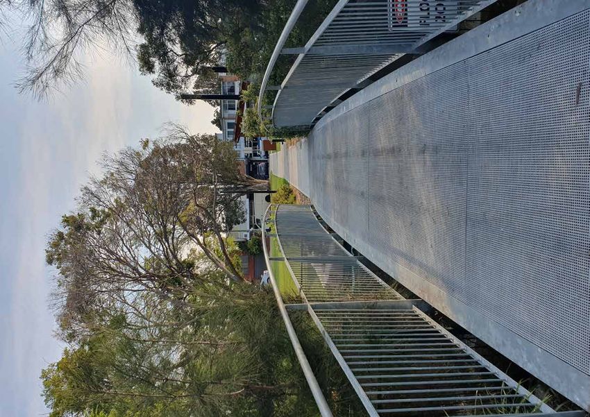
Abbreviations
ACU		           Australian Catholic University
BASIX		         Building Sustainability Index
CBD		           Central Business District
CSP		           Community Strategic Plan
DCP             Development Control Plan
DPIE		          Department of Planning, Industry and Environment
DFO		           Direct Factory Outlets
EILC		          Enfield Intermodal Logistics Centre
EP&A Act        Environmental Planning and Assessment Act, 1979
ERP		           Estimated Resident Population
GPOP		          Greater Parramatta Olympic Peninsula
IoT		           Internet of Things
LEP		           Local Environmental Plan
LGA             Local Government Area
LSPS		          Local Strategic Planning Statement
NSW		           New South Wales
OEH		           Office of Environment and Heritage
PRCUTS          Parramatta Road Corridor Urban Transformation Strategy
TAFE		          Technical and Further Education
TfNSW		         Transport for NSW
WSELP		         Water Street Employment Land Precinct
WSUD            Water Sensitive Urban Design

Figures
Figure 1		      Relationship between Regional, District and Local Plans
Figure 2		      Implementation Timeframes

Maps
Map 1		         Strathfield’s Place in the Region
Map 2           Strathfield Overall Structure Plan
Map 3           Infrastructure and Collaboration Structure Plan
Map 4           Active Transport
Map 5		         Liveability Structure Plan
Map 6		         Productivity Structure Plan
Map 7		         Educational Institutions
Map 8		         Sustainability Structure Plan
Map 9		         Tree Canopy
Map 10		        Urban Heat Map
Map 11		        Heat Vulnerability
Map 12		        Hazards and Risks

6      Strathfield Council
About this Plan
Overview
The Strathfield Local Government Area (LGA) is part of The LSPS will guide the future character of our LGA
the Greater Sydney Region and its Eastern City District. through land use planning and collaboration between
The Region is set to grow over the next twenty years neighbouring councils, other levels of Government and
and the LGA must accommodate some of this growth. key stakeholders.
Strathfield 2040, our Local Strategic Planning Statement
(LSPS) provides an opportunity for us to outline our It builds on recent engagement with our community
local considerations so that they can become part of a and land use planning work we have already undertaken,
coordinated response by Government in responding to including the Community Strategic Plan (CSP) and other
growth and shaping our future. studies and strategies. It also considers our analysis of
Regional, District and local issues likely to impact the LGA.
The LSPS defines Council’s long term vision for land use
and infrastructure provision within the LGA. It identifies The LSPS forms the foundation for our land use and
the economic, social and environmental opportunities infrastructure decisions going forward. It will be used
that will help us deliver and influence a future aligned with to inform the review of our Local Environmental Plan
our community’s aspirations and interests. It articulates (LEP) 2021 and the plans which follow that. It marks the
our unique place within the Eastern City District and beginning of a strategic and connected land use journey
considers the opportunities for us to strengthen our role that will be informed by future investigations, studies and
within the District and Greater Sydney Region. The LSPS conversations with our community.
outlines our starting point and sets out our roadmap,
the actions that we will take to influence and achieve
our desired future. These actions will be implemented
incrementally up to 2040.
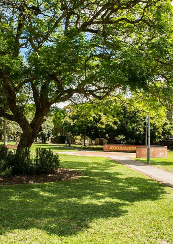
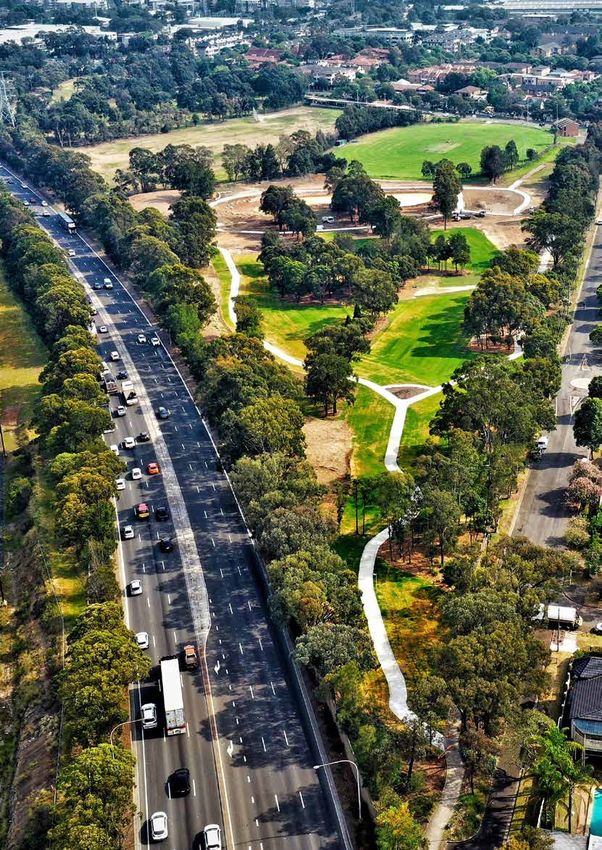
Elliott Reserve, Strathfield South
Strathfield 2040 Local Strategic Planning Statement 7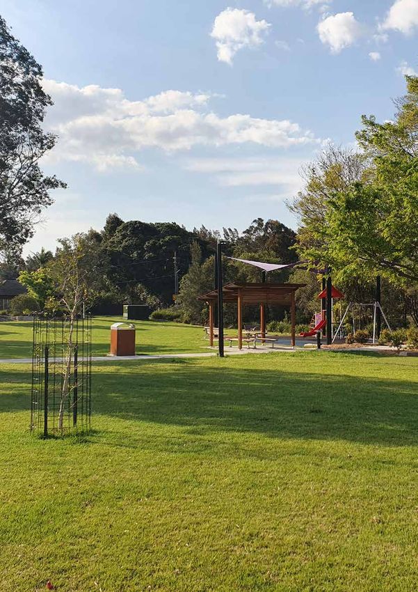
Policy Context
Strathfield 2040 gives effect to the Eastern City District     In developing this LSPS Council has had to demonstrate
Plan that identifies a series of actions that will provide     a clear link between State Government priorities of the
homes, jobs and related infrastructure to support future       District and Regional Plans and the local visioning and
growth. It is also informed by other State and Regional        planning of the LSPS. We have also had to ensure that the
strategies including the NSW Government’s Regional Plan        LSPS is consistent with other State Government land use
– A Metropolis of Three Cities, Future Transport Strategy      planning policies, such as:
2056 and the State Infrastructure Strategy 2018-2038.
                                                               • State Environmental Planning Policies (SEPPs), which
Strathfield 2040 is aligned with Council’s Community             cover specific social, economic and environmental
Strategic Plan (CSP), Strathfield 2030. Our CSP was              matters that may impact planning in local areas. The
developed from a strong foundation of research and               NSW Government is currently reviewing the SEPPs
analysis, an ongoing dialogue with our community, local          as part of an initiative to simplify the NSW planning
business, government and key agencies. The purpose of            system and reduce complexity.
the CSP is to identify the community’s main priorities,        • Section 9.1 Directions which are Ministerial Directions
aspirations for the future and identify the policy, services     issued under Section 9.1 of the Environmental Planning
and actions that will work towards meeting community             and Assessment Act, 1979 (EP&A) Act and are a suite
expectations.                                                    of directions which require consideration for local
                                                                 plan making which address issues such as employment,
The LSPS is informed by Strathfield 2030 and provides the        environment and heritage. The Directions provide
rationale for decisions about how we will use our land to        principles, aims, objectives or policies that must be
achieve the aspirations of our community. It explores the        achieved or given effect to in the preparation of Local
future of our LGA through four interconnected themes.            Environmental Plans (LEPs).
Each has their own set of planning priorities and related
actions. Together these will work towards achieving
our overall land use vision for the Strathfield LGA and
will ensure that the people who live, work and visit the
area have an abundance of opportunities and quality
experiences.

                                               COMMUNITY ENGAGEMENT

Figure 1: Relationship between Regional, District and Local Plans

8      Strathfield Council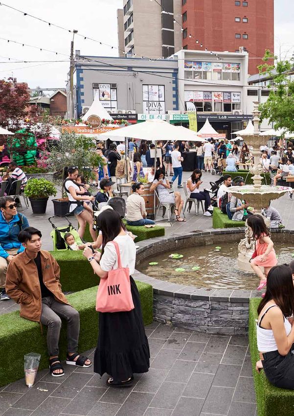
Implementation
The LSPS is supported by a comprehensive plan to              achieving our LSPS Vision. Within the LSPS each action has
deliver on its priorities and actions, the Strathfield 2040   been earmarked for implementation within a particular
Implementation Plan. This will ensure all the actions         timeframe.
are completed at the right time to work together in

Figure 2: Implementation Timeframes

The LSPS actions will accordingly be incorporated into        have been identified within each Theme of the LSPS.
Council’s operational plans and scheduled and monitored       Collectively, these measures will illustrate how we are
as part of our ongoing operations.                            progressing towards meeting our 2040 Vision. Enabling
                                                              each new Council to be informed on progress and the
Our progress towards achieving our long term Vision           opportunity to realign the LSPS with their own goals. The
will be reviewed within each Council term against a set       LSPS will be revised during each new Council term.
of measures and targets. These measures and targets

                                                              Strathfield 2040 Local Strategic Planning Statement         9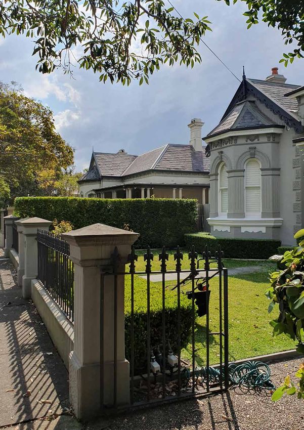
Albyn Road, Strathfield

10     Strathfield Council
Key Messages from Our Community
An important component in the preparation of the LSPS • Trees and well-planned open spaces are an important
is an understanding of what our community has told part of Strathfield’s character and these should be
us. It is informed by the engagement undertaken with maintained and protected
our community in 2017 and 2018 for the preparation of • They want greater diversity of housing options
Strathfield 2030 and more recently the survey undertaken
• They want to promote and protect biodiversity and
on our neighbourhoods.
the natural environment
Consistently the community has told us that: • They want places for social interaction to bring
neighbourhoods together in safe, well maintained
• They want access to reliable public transport to all public domains
parts of the LGA • They want revitalised centres and villages and diversity
• Population growth must be supported by planned and in the business mix
high quality infrastructure and services • They want to foster creativity, culture and learning
• They highly value Strathfield’s local character as the • They want to be engaged and informed on proposals
“beautiful garden suburb with heritage houses” and and decisions which affect them.
that this character must be protected
• High density development is best located where Further engagement was undertaken in June 2019
there is access to high frequency public transport and specifically on the LSPS Vision with members of Council’s
supporting infrastructure and low density areas should Community Panel. There was an overwhelming support
remain substantially unchanged for the draft Vision developed by Council amongst panel
members who participated.
• All new development should be of a high quality and
must deliver better outcomes in terms of protecting
local character, design, housing mix and sustainability
ACU, Strathfield
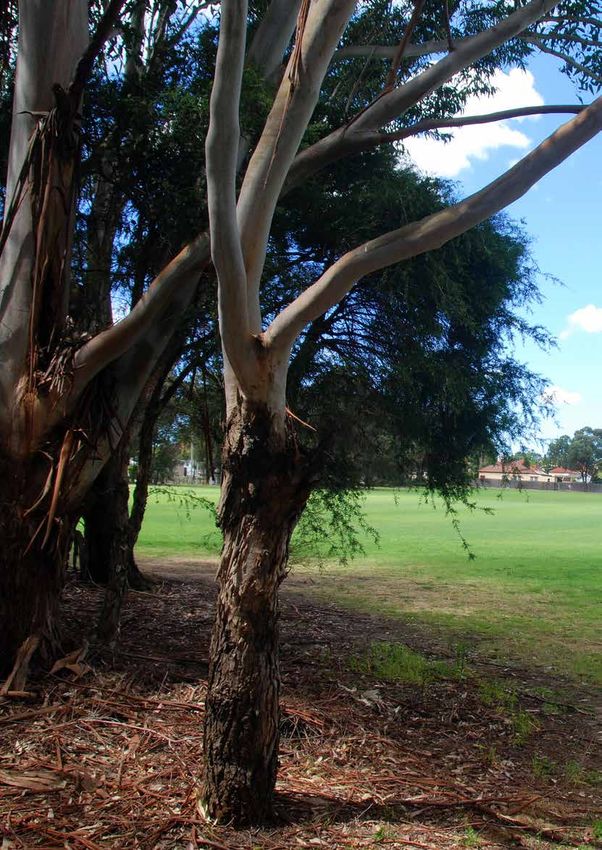
Strathfield 2040 Local Strategic Planning Statement 11Local Special Characteristics
There are some elements of our LGA that are distinct and highly
valued by locals. It is important that these special characteristics
are preserved and enhanced as we continue to grow. The LSPS
gives consideration to these characteristics.
• Our vibrant, highly educated, culturally diverse and socially
cohesive community
• Established streetscapes with wide tree lined avenues,
grassed nature strips, landscaped front setbacks and
established tree canopies
• Green and leafy streets augmented with public parks and
open spaces providing playgrounds, playing fields and
natural areas which connect our biodiversity corridors
• Our heritage buildings, sites and heritage conservation areas
that contribute to the unique local character and reflect
Strathfield’s waves of residential, economic and social
development
• Established residential subdivision patterns with homes
surrounded by landscaped setbacks and open space
• Our central location at the ‘heart’ of Sydney along with our
integrated public transport and road connections – “from
Strathfield you can go anywhere”
• Our close proximity to regional entertainment, sporting,
cultural and shopping facilities in the Inner West and
Greater Parramatta Olympic Peninsula (GPOP)
• Strathfield’s reputation as the education centre of Sydney’s
Inner West with a good mix of public and private schools
and a University campus
• Our employment based and urban services lands, including
Sydney Markets and the Enfield Intermodal Logistics
Centre (EILC) which provide employment across a range of
industries and supply goods and services to Greater Sydney
and NSW.
12 Strathfield CouncilParramatta Road at Cooper Street Strathfield 2040 Local Strategic Planning Statement 13
Strategic Context
Snapshot
                                                                      Population
       LGA POPULATION                                                 over 70 years
                                                                      Declined from 8.7% in
                                                                      2011 to 8.3% in 2016
                                                   Greater Sydney increased from 9% in 2011 to 9.5%
                                                   in 2016

2018                               2036            Largest change in age
                                                   structure
 45,143                            80,000 *        Young workforce with 23.1% of people aged
 ERP                               Projection      25 – 34 years, 3% increase from 2011 to 2016
* Source: NSW DPIE, 2019

              Median age
              Greater Sydney 36       32
              Population
              24-34 years
              Greater Sydney 16.1%
                                      21%
                                                   Population born overseas

                                                   56.3%
                                                   Greater Sydney 36.7%

                                                   Main birthplace other than Australia
                                                   China, India, South Korea and Sri Lanka

                                                   Language

       Aboriginal             0.3%                 64.2%
       people                                      Speak a language other than English at home
                             Greater Sydney 1.5%   Greater Sydney 35.8%

Demographics (Census 2016)

14     Strathfield Council
LIVEABILITY
Persons
per
dwelling
2.87
Greater Sydney
2.69 (2011) and 2.72 (2016)
Mortgage stress
(high loan repayments)
37.1%
Greater Sydney 36.5%
50.2% 40%
Rental stress
(high rental payments)
Greater Sydney 48.1%
58.2% Owned or
being purchased Rented
Greater Sydney 59.2% Greater Sydney 32.6%
Socio-economic disadvantage
In top 20% of least disadvantaged LGA’s in NSW,
with an index of 1026.
INFRASTRUCTURE
37.5% 1 4
Couple Town Hall Community based
families childcare centres
Greater Sydney 35.3%
16.3% 1 26
Early childhood Children’s
Lone centre playgrounds
person
Greater Sydney 20.4%
19 Grass and synthetic
sports and
facilities
2036
Predominant 35.7%
Couples with
household type
projection children
3 Community
centres 1 Library
Separate Medium High
house density density
HERITAGE
40.3% 15.7% 42.1% 17 Local heritage
conservation areas
Greater Sydney Greater Sydney Greater Sydney
55%
Other
20.3%
1.9%
23.5%
231 Local individual heritage items
including houses, shops, industry,
parks and wetlands
Strathfield 2040 Local Strategic Planning Statement 15PRODUCTIVITY SUSTAINABILITY
Registered businesses Tree canopy
$ 6,602 16.2%
Residents Local available 12,000 40,000
Mature street trees Mature trees in parks
employed jobs
23,560 28,209 9% Open
space 3 Bushland &
natural areas
Employment Industrial and 7 Regional parks = 50 ha
self-containment railway land
11.4% 20% Catchments 53% of LGA drains to
Cooks River
Largest employment sectors of
47% of LGA drains to
Parramatta River
our residents 3 Waterways
Health Care and
Social Assistance 13.8%
Professional, Scientific and
Technical Services 12% INFRASTRUCTURE
Retail Trade 9.9% 36.6% Residents travel
to work by public
The industry of Transport, postal and warehousing
grew by 13% between 2006 and 2016
transport
Greater Sydney 22.8%
Internet home
connection (households)
Greater Sydney 81.4%
81.6% Average weekday trips by
private vehicle
38% 29% vehicle as driver = 28,137 trips
17% vehicle as passenger = 16,401 trips
Residents that hold a
Bachelor or higher degree
Greater Sydney 28.3%
Private car
ownership 77.2%
(at least 1 car) Greater Sydney 81.3%
72.2% Residents completed
Year 12 schooling
No car ownership
(household) 13.2%
Greater Sydney 66.2% Greater Sydney 10.7%
16 Strathfield CouncilChurchill Avenue, Strathfield Strathfield 2040 Local Strategic Planning Statement 17
Strategic Context
Our Place in the Region
The Strathfield LGA is located in Sydney’s Inner West          by major transport systems including three rail stations
about 10.5 kilometres from Sydney’s Central Business           and major roadways including Parramatta Road, M4/
District (CBD) and half way between it and Parramatta’s        Westconnex and Hume Highway. It features a variety of
CBD. The LGA is bounded by Homebush Bay Drive to the           town and neighbourhood centres with shops and cafes,
north, Powells Creek, The Boulevarde and Coronation            significant commercial and industrial areas, and regional
Parade to the east, Punchbowl Road and Juno Parade             attractions such as Sydney Markets and DFO. Our road
in the south and Roberts Road, Chullora rail yards,            and rail networks play an important role in moving freight
Rookwood Cemetery and GPOP rail line to the west.              within the Eastern District and Greater Sydney.

The traditional owners of the land are the Wangal clan         Our LGA has significant parklands, open space,
of the Darug tribe. European settlement commenced in           environmental and bushland reserves including major
the 18th century. Through phases of development and            open space corridors adjacent to the Cooks River and
change, Strathfield LGA has developed well established         Powells Creek, which provide pathway connectivity to
residential areas known for its historic homes and modern      other LGA’s parks and biodiversity corridors.
architecture set within established gardens. It is supported

Map 1: Strathfield’s Place in the Region

18     Strathfield Council
Our People
The Estimated Residential Population (ERP) of the LGA in        Although there is a presence of a large number of schools
2018 was 45,143, representing an increase of 2.9% since 2017.   in the LGA, only 13% of the population are primary
The median age within the LGA is 32 years which is slightly     and secondary school aged children, also lower than
younger than the median age in Greater Sydney.                  the Greater Sydney average of 15.7%. Due to the large
                                                                young demographic, all age groups over 35 years are
The LGA has experienced a significant and steady increase       proportionally smaller than the Greater Sydney average,
in population since 2001. This growth is primarily in           even though the numbers of persons in each group has
response to greater housing supply in the form of new           increased from 2011 to 2016.
unit developments located near major transport hubs
and along Parramatta and Liverpool Roads. The effects           The LGA is culturally diverse with approximately 56% of
of migration and particularly settlement of new migrants,       residents born overseas compared to 37% in the Greater
has also contributed to the increased population. These         Sydney Area. Just over 64% of residents speak a language
trends are expected to continue and the population of           other than English at home, significantly higher than the
the LGA is expected to grow to reach over 80,000* in            35.8% within Greater Sydney.
2036.
                                                                The primary household structure of the LGA is couples
Since 2001 people aged 25-34 years have emerged as              with children (37.5%). Couples without children, lone
the largest age group in the LGA, making up 23.1% of the        person households or one parent households are less
population. The LGA has one of the largest young worker         represented than in Greater Sydney area. 7.6% of
populations in Greater Sydney. These trends are likely          households are group or share households which is higher
to be in response to increased housing supply close to          than the Greater Sydney rate of 4.5%.
transport hubs in the form of high density developments.
12.3% of the population are aged 18-24 years, also a higher     There has been a large increase in rental property
representation than the Greater Sydney average of 9.6%.         availability particularly around the town centres of
As the area grows it is anticipated that the dominant age       Homebush, Homebush West and Strathfield. Rental
group will remain that of the 25-34 year olds.                  accommodation accounts for 50% of the Homebush West
                                                                suburb.
The population of 0-4 year olds remains small at 5.7%,
slightly less than the Greater Sydney rate of 6.4%.

                                                                                          Strathfield Christmas Carols 2017
* Source: NSW DPIE, 2019

                                                                Strathfield 2040 Local Strategic Planning Statement       19
Our Economy
Strathfield LGA’s significant industrial and commercial areas The LGA is an important location for business and
provide strategic links to the metropolitan economy with industry offering immense potential for economic
access to high value consumer markets locally and outside investment. With 20% of the local area being developed
the region and to key distribution networks and supply and undeveloped industrial and employment land, it
chain infrastructure essential for producers. represents the highest amount of this type of land
within the district. Leading public and private schools
Important road connections including Parramatta Road/ and tertiary institutions such as the Australian Catholic
Great Western Highway, M4 Western Motorway, M5 University (ACU), University of Sydney (Facility of Health
South Western Motorway and Liverpool Road/Hume Sciences) and TAFE Western Sydney Institute all have a
Highway move both people and goods. The LGA also local presence.
supports major rail infrastructure within its boundaries,
which facilitates substantial passenger and freight In 2018 there were 28,209 jobs as well as over 6,602
movement across the Greater Sydney Region. businesses in the LGA. Its estimated Gross Domestic
Product was nearly $4 billion and the largest industries
Situated along the Western Rail Line are three rail stations include health care and social assistance, professional,
with Strathfield Station being the most central and scientific and technical services and retail.
connected node on the metropolitan network, providing
connections to Sydney’s CBD, the Northern corridor and There are a number of shopping and town centre
the Central Coast, and to the North West and South West precincts across the LGA. Centres range from the larger
growth areas. Strathfield Town Centre to smaller village centres of
Homebush, Homebush West, Strathfield South and Cave
Freight movement through the LGA connects supplier Road as well as Sydney Markets, the supplier of produce
and distribution channels from the west, southwest, north throughout the Greater Sydney and NSW. Shopping
and northwest directly to the main export terminals centres are generally located near transport interchanges
in Port Botany and beyond. The development of the and provide a range of services, food options and places
Enfield Intermodal Logistics Centre (EILC) by Sydney for people to meet and socialise.
Ports in Strathfield South further supports the future
infrastructure demands of the metropolitan economy. The Our diverse community values its vibrant collective
EILC is a key trade gateway connecting the people and natural, built, Aboriginal and introduced culture and
business of NSW to global markets. heritage. Together these provide a rich framework
with many opportunities to improve the livabilty and
Other key regional economic drivers within or in proximity productivity of the LGA.
to Strathfield include Sydney Markets, the largest fruit and
vegetable market in Australia and the world-class facilities
of GPOP.
Marlborough Road Entrance, Flemington, Courtesy of Sydney Markets
20 Strathfield CouncilOur Environment
Whilst the LGA is largely developed, the natural the environmental quality and landscape character of our
environment plays a vital role in contributing to local and area. Revegetated parkland sites consist of mostly native
regional ecosystems and human settlements. The tree tree, shrub and ground cover species planted in blocks
lined streets, well-kept gardens, playing fields and parks or strips along the upper Cooks River and at Mason Park.
contribute to the area’s cultural identity. Open parkland sites are dominated by open grassed and
paved surfaces with some areas of indigenous and exotic
Approximately 9% of the LGA is open space, which is vegetation. These are located within residential and
utilised for parks, reserves and for the conservation of industrial areas of the LGA.
environmentally sensitive areas. Parks can be found
throughout, including a large concentration of open space The natural areas of Mason Park Wetlands, Cox’s Creek
in the south adjacent to the Cook’s River. Council has Bushland Reserve and the Cooks River foreshore open
continued to increase the availability of open space by space network provide a glimpse of our natural heritage
strategically acquiring and embellishing land within the and continue to support surviving populations of
northern growth areas specifically targeting the Powells plants and animals, including small pockets of remnant
Creek and Parramatta Road Corridors and creating new vegetation which are listed as endangered ecological
pedestrian and cycle links. The large areas of open space communities under the NSW Biodiversity Conservation
provide areas of habitat and the open space corridors Act 2016. A number of endangered species are present
along the Cooks River and Powells Creek provide within the LGA including, the Green and Golden Bell-Frog
important habitat linkages and potential for riparian (Litoria aurea) and Downy Wattle (Acacia pubescens).
restoration.
Mason Park Wetlands in Homebush receives migratory
While certain areas of the LGA have an extensive wader birds from the Northern Hemisphere through
established tree canopy the overall canopy is only 16.2%, spring and summer each year and has international
a result of the significant industrial, rail and urban services biodiversity significance with a remnant wetland complex
land. Our canopy includes remnant trees and vegetation of she-oaks, mangroves and saltmarsh fringe the mudflats,
as well as exotic ornamentals and native rain forest trees. debris islands, and shallow open water. The main areas
Strathfield LGA’s cultural landscape character is very much of remnant native vegetation in the LGA are located at
tied to our tree lined residential and commercial streets Mason Park Wetlands – Coastal Saltmarsh, Cooks River/
and includes a range of tree species located in public areas Castlereagh Ironbark Forest at Coxs Creek, Weeroona
and on private properties. These trees form a valuable Road and Davidson Street.
community and natural asset and play a defining role in
Edwards Reserve, Strathfield
Strathfield 2040 Local Strategic Planning Statement 21Our 2040 Vision
Heart
At the heart of Sydney.
Culturally rich, well connected,
vibrant and leafy
STRATHFIELD
Proud 2040 Place
Proud of its A place of learning
heritage, and productivity,
character embracing new
and opportunities
parklands and supporting
diverse
lifestyles
22 Strathfield CouncilIn 2040 Strathfield and diverse retail, dining and entertainment experiences.
Parramatta Road is a tree lined place for people, with
enjoys its unique position at the heart of the Eastern City active transport and a variety of shops and cafes.
District with physical connections to both the Sydney
and Parramatta CBDs. Sitting on the edge of the Eastern There are strong economic connections to neighbouring
City District and the Central City District, Strathfield Burwood and Rhodes Strategic Centres. These provide
plays a pivotal role in delivering the social, economic and access to employment and retail opportunities for
environmental vision for a Greater Sydney. our residents. Our office spaces support the nearby
Parramatta CBD by providing opportunities for agencies
There is a strong sense of pride in place amongst our and businesses to locate locally, within easy reach to the
diverse and welcoming community who like to work CBD. Our industrial areas provide urban services for our
and play close to home. We value our heritage and community and are alive with niche and creative industries
environment and are proud of its well connected by day and support localised entertainment hubs by night.
transport, educational institutions and employment
opportunities. Our community is committed to the A revitalised Sydney Markets and an active and diversified
success of the area and works with Council to plan for and DFO precinct service our local needs and attract people
deliver the quality of life they enjoy. from across the Region and tourists visiting Sydney.
Our community is engaged in activated public and open Strathfield is a learning hub for the Eastern City District
spaces that encourage them to gather and participate with strong collaborative connections within and outside
in cultural activities. Modern infrastructure supports the Area. It delivers quality school and tertiary education
their day to day activities and a variety of uses that and employment options for our residents and beyond.
accommodate both local and District needs. Our streets
are lined by mature trees and corridors of green connect
our neighborhoods and centres with each other and our
green open spaces. There is an abundance of flora and
fauna living in our waterways, bushland and green spaces,
all highly valued by our community.
Our community chooses to walk and cycle and they
have easy access to transport that connects them to
opportunities for work and play with the Sydney CBD,
Parramatta CBD and key Strategic Centres. Development
and growth have not compromised our neighbourhoods,
heritage, environment or industrial lands. It has enabled
the delivery of updated, modern infrastructure and the
growth of creative solutions to the sharing of commercial,
recreation and social spaces. Freight is able to move within
and outside the area supporting our lifestyles and business
and contributing significantly to the Regional economy.
Our centres are alive with a diversity of people, colour,
food and deliver a variety of experiences, urban services,
recreational and employment opportunities. They are a
focal point for people who live and work nearby as well as
visitors from across Greater Sydney. The Strathfield Town
Centre is a vibrant hub encouraging business, enterprise
and experience. People travel there to enjoy the unique
Strathfield 2040 Local Strategic Planning Statement 23Our Planning Priorities
Infrastructure and Collaboration Liveability
P1. Collaboration ensures growth is sustained by well- P5. Well located and designed social and recreation
planned and accessible infrastructure infrastructure connects us and supports healthy and active
E1, E2 lifestyles for people of all ages and abilities
1.1 E1, E2, E3, E4, E6
2.1, 2.2, 3.1
P2. Connected, integrated, efficient and accessible
P6. Development balances growth with best practice
transport options connect Strathfield’s people to
planning and infrastructure provision to deliver sustainable,
their neighborhoods, centres, jobs, community and
liveable and well-designed neighbourhoods
recreation areas
E5, E6, E15, E16
E1, E2, E6, E10
2.1, 4.1, 4.2
1.1, 1.2
P7. Quality urban design complements all heritage and
P3. Freight corridors and local servicing meets needs
neighbourhood character
with minimal impact on neighborhoods and centres
E4, E16
E1, E2
4.1, 3.2
1.1, 1.2
P4. Digital infrastructure enables our community, P8. Diverse housing options provide for people at all
businesses and service providers to grow lifecycles and connects them to jobs, recreation, services and
E1 transport
1.3 E5
2.1, 2.2, 4.1
Strategic Links Legend: E1 - E21 = alignment to Eastern City District Plan Priority, 1.1 - 5.2 = alignment with Strathfield 2030 (CSP) Goal
24 Strathfield CouncilProductivity Sustainability
P9. Our centres are easy to get around, deliver activated
P13. Biodiversity and ecological health and resiliency is
social spaces, opportunities to connect, nearby housing
conserved, restored and enhanced
and local employment opportunities
E15, E17, E18
E2, E10, E11, E12, E13
4.3
2.3, 3.1, 3.2
P10. Industrial land and precincts deliver District and local P14. The Cooks River and Parramatta River catchments
urban services and provide activated spaces with minimal and waterways are healthy and accessible
impact on neighborhoods E14
E2, E9, E10, E11, E12, E13 4.3
3.1, 3.2
P15. Quality open spaces and thriving green corridors
P11. Strathfield’s unique experiences provide a central
offset the impacts of growth across the LGA
meeting point for Strathfield residents and visitors
E17, E18
E4, E6, E9, E10, E13
4.1, 4.3
2.1, 2.3
P16. A healthy built environment delivers sustainable
and resource efficient outcomes
P12. Our specialised education cluster provides E19
opportunities for learning, innovation and collaboration 4.1, 4.3
E7, E8, E11
3.1
P17. Hazards are minimised and infrastructure supports
resiliency
E20
4.3
P18. Our community is involved in designing Strathfield’s future
E2, E21, 5.1, 5.2
Strategic Links Legend: E1 - E21 = alignment to Eastern City District Plan Priority, 1.1 - 5.2 = alignment with Strathfield 2030 (CSP) Goal
Strathfield 2040 Local Strategic Planning Statement 252.8km to Rhodes LEGEND
4.7km to Settlers Park Ryde Local Centres
Waterways
Main Roads
ive
Sydney Recreation Facilities
Dr
Olympic Park Sydney Metro West
ay
B
sh Proposed Sydney Metro West Station
ebu Open Spaces & Reserves
H om
North Railway Networks
Strathfield Employment Areas (Industrial)
Parramatta Road Corridor
Public Car Park
(Potential EV Charging Station)
M4 Bay to Bay Cycleway
/W
est Priority Green Grid Project
Co Green Grid Connectors (Opportunities)
Par nne
ram x Strathfield Planned Precinct
8.6km to HOMEBUSH att
aR Greater Parramatta Olympic Peninsula
Parramatta WEST oad
Flemington
Station
Homebush
Station
Ce
HOMEBUSH
nte
Strathfield
Local Centre
nar
yD
riv
e
Burwood
Strategic Centre
STRATHFIELD varde
The Boule
Burwood
Liv
erp
oo
lR
oad
STRATHFIELD
Road
SOUTH
6.7km to
Roberts
Bankstown Health &
Education Precinct
20km to
Botany Bay
GREENACRE
8.4km to
Hurstville
Map 2: Strathfield Overall Structure Plan
26 Strathfield CouncilOur Themes Explored
Infrastructure and
Collaboration
Liveability
Productivity
Sustainability
Strathfield 2040 Local Strategic Planning Statement 27Infrastructure and
Collaboration
Strathfield LGA has well developed infrastructure but in New transport solutions will provide an opportunity
order to meet increasing population demand, additional for active transport proposals to expand footpaths and
and embellished infrastructure and services will be needed cycleways to facilitate walking and cycling. Encouraging
to meet the challenges of growing and increasingly diverse and accommodating emerging forms of transport such as
residential and business communities. ride and car sharing and including micro-mobility, such as
e-bikes and scooters will also be part of the solution.
Infrastructure planning to meet current and future
needs is a high community priority. Population growth Smart technologies can provide the infrastructure and
and greater building density will require well planned data to improve decision making, quality of services
infrastructure and services such as schools, health and and improve liveability and sustainability of the LGA.
transport as well as local infrastructure such as open Technology is changing the way communities interact
space, parks, community and recreational facilities, and creates opportunities for improvements to the way
footpaths and roads. Infrastructure and services are we plan for, deliver and maintain local and city shaping
provided by all tiers of government as well as the private infrastructure, liveable places and support connected
and community sectors. Providing quality infrastructure communities. Council will work with Transport for NSW
and services requires a collaborative, well-planned and (TfNSW) on smart technology, travel demand and traffic
integrated approach to ensure effective outcomes and management measures.
efficient use of available resources.
The Greater Sydney Olympic Peninsula (GPOP) will
Transport mobility and access is critical for access to deliver social, economic and environmental benefits to
employment, education, recreation and leisure activities the Region and to our LGA. GPOP is a 4,000 hectare
within the LGA and throughout Greater Sydney. The LGA area within the centre of Greater Sydney which overlaps
is earmarked for significant State transport initiatives with the northern suburbs of our LGA. A place based
which will shape our LGA and connectivity to the infrastructure compact pilot (PIC) is being trialled in
Region. These include 0-10 year committed initiatives of the GPOP to deliver connectivity, jobs, investment
WestConnex, Sydney Metro West and Parramatta Road opportunities within a beautiful natural environment. The
improvements. Other initiatives which are subject to PIC is a collaborative model of infrastructure and service
investigation over the next ten years include the More provision which aims to better align the timely delivery of
Trains, More Services Program (T1 and T2) and a train/mass these within a discreet geographical area. The PIC provides
transit link from Macquarie Park to Hurstville via Rhodes. a collaborative model which we can learn from and
potentially seek to pursue with the Burwood, Strathfield,
Homebush Planned Precinct.
Planning Priorities
P1 Collaboration ensures growth is sustained by well-planned and accessible infrastructure
Connected, integrated, efficient and accessible transport options connect Strathfield’s
P2 people to their neighbourhoods, centres, jobs, community and recreation areas
Freight corridors and local servicing meets needs with minimal impact on
P3 neighbourhoods and centres
P4 Digital infrastructure enables our community, businesses and service providers to grow
28 Strathfield CouncilOur Starting Point
Advantages Opportunities
• Strathfield Railway Station is one of the largest • New Council run Strathfield Connecter Bus
in NSW with Regional, country and State rail which loops every 30 minutes across LGA could
connections be extended
• The Parramatta Road Corridor Urban
• 30 minute City is a reality for the LGA which
Transformation Strategy (PRCUTS) can deliver
is located halfway between Sydney and
improved choice and quality development
Parramatta CBDs, both easily accessible delivering housing and economic local
outcomes with green corridors
• Successful advocacy and collaboration role
for Council and community to achieve greater
connectivity options to key significant nearby
precincts
Challenges
• Connecting the southern end of the LGA which currently has limited transport options
Strathfield Station
Strathfield 2040 Local Strategic Planning Statement 29Measuring Progress to 2040
We will measure our success towards meeting our vision for infrastructure and collaboration working together through
the following measures and targets:
• No areas within the LGA without access to Council, private or public transport
• Increased resident satisfaction with overall access or connectedness to transport (Baseline of 76% rating of excellent
– good in 2018)
• An increase in households without a private vehicle (Baseline of 13.2% in 2016)
• Decreased congestion on the rail network (Baseline to be determined)
• An increase in people with internet at home (Baseline of 81.6% in 2016)
• Increased use of smart technology in public places and facilities (Baseline to be determined)
Strathfield Connector Commuter Bus
30 Strathfield Council2.8km to Rhodes
LEGEND
4.7km to Settlers Park Ryde
Free WIFI Connections
State Bus Routes
ive
Sydney
Dr
Olympic Park Railway Network
ay
s hB Strathfield Connector
bu
me
Ho North Bay to Bay Cycle Way
Strathfield
Main Roads
Sydney Metro West
M4 Parramatta Road Corridor
/W
est Strathfield Planned Precinct
HOMEBUSH Par Co
nne
8.6km to ram x Council Car Park
WEST att (Potential EV Charging Station)
Parramatta aR
oad
Proposed Station Location
Greater Parramatta Olympic
Peninsula
Flemington
Station
Homebush
Station
Ce
Strathfield
nte
Local Centre
HOMEBUSH
nar
yD
riv
e
Burwood
Strategic Centre
varde
The Boule
STRATHFIELD
Burwood
Liv
erp
oo
lR
oad
STRATHFIELD
Road
SOUTH
6.7km to
Roberts
Bankstown Health &
Education Precinct
20km to
GREENACRE Botany Bay
8.4km to
Hurstville
Map 3: Infrastructure and Collaboration Structure Plan
Strathfield 2040 Local Strategic Planning Statement 31P1
P1 Collaboration ensures growth is sustained by well-planned and
accessible infrastructure
As the LGA continues to grow and transform it is critical the Parramatta Road Corridor. It is also important for our
that new development is aligned with the delivery community that any future Sydney Metro West station
of infrastructure to adequately support our changing at North Strathfield delivers high quality local outcomes
community, enterprises and contribution to the Eastern that include the delivery of social infrastructure. Council
City District. Infrastructure will need to connect and will collaborate with Sydney Metro West to identify
facilitate the availability of the right opportunities and opportunities and mitigate potential impacts for the LGA.
experiences including transport, open space, utilities,
social and cultural services. Council has a major role to play in providing, collaborating
and advocating for the infrastructure critical to achieving
Collaboration between Council, neighbouring councils, both our short term and 2040 Vision. It is important
NSW State Government and key stakeholders will be that new or upgraded infrastructure delivery does
critical to ensure the efficient use of existing and timely not negatively impact on the valued local character,
delivery of city shaping infrastructure to support new environment and amenity of our residents.
development, including residential development along
Future Vision, Hudson Park, Strathfield
Actions
A1 Collaborate with the NSW Government to ensure that any future development uplift along the
Parramatta Road Corridor and the Burwood, Strathfield, Homebush Planned Precinct is supported by
infrastructure, services and provisions to facilitate the delivery of affordable housing and best practice
sustainability
Immediate
32 Strathfield CouncilActions
A2 Work collaboratively with neighbouring councils, TfNSW and the Department of Planning, Industry and
Environment (DPIE) to enable the delivery of dedicated rapid public transport, active travel infrastructure
and place based outcomes along the Parramatta Road Corridor and any future Sydney Metro West
station at North Strathfield
Immediate to Long Term
A3 Work collaboratively with the DPIE and other stakeholders to ensure that future development within
Planned Precincts or other large areas of future growth facilitate the delivery of:
• diversity in housing consistent with the existing and desired future neighbourhood character
• high quality domain and open space
• well designed natural and built shade
• mechanisms for the delivery of required infrastructure
• high efficiency, low carbon infrastructure
• water sensitive urban design and water recycling system
Immediate to Medium Term
A4 Work collaboratively with Sydney Metro West and the DPIE to ensure that land use changes around
future Sydney Metro West stations deliver high quality outcomes that include the delivery of social
infrastructure, active transport, employment and connections to high quality public domain and open
space which incorporates public art provision
Immediate to Long Term
A5 Work collaboratively with Burwood Council, TfNSW and the DPIE to identify opportunities for
infrastructure upgrades within Strathfield Town Centre such as active travel paths, electric vehicle
charging stations, energy efficient lighting, water bubblers and shade
Immediate
A6 Work collaboratively with Burwood Council in planning the future direction of the Burwood Strategic
Centre to ensure that future land uses complement the function of Strathfield Town Centre and
Strathfield residents benefit from jobs provided within the Burwood Strategic Centre
Immediate
A7 Review Councils development contribution framework (s7.11, and s7.12 contributions plans) and develop
a Voluntary Planning Agreements Policy to ensure the delivery of local infrastructure to support growth
and deliver appropriate community benefit to support the needs of future residents including provisions
for sustainable transport infrastructures
Immediate
A8 Collaborate with the relevant NSW State Government authority to:
• identify future transport needs to support the growth of the LGA and investigate any future need
for residual transport corridor land and alternate needs such as open space
• develop road safety initiatives for strategically important centres and places
• identify under-utilised State owned land for the delivery of active travel connections, open space
and social/community infrastructure
• ensure that existing operations and any future expansion of the EILC has minimal adverse impact on
the surrounding residential land uses
• identify land to enable the delivery of the Green Grid Corridor through connections along the Cooks
River (including Cox’s Creek Channel) and Powell’s Creek
• ensure that new or the upgraded delivery of infrastructure services in the Strathfield LGA does not
adversely impact on the character and amenity of streets and neighbourhoods (eg undergrounding of
electricity, water sensitive urban design and naturalisation of existing concrete channels)
Immediate to Long Term
Strathfield 2040 Local Strategic Planning Statement 33P2 Connected, integrated, efficient and accessible transport options
P2
connect Strathfield’s people to their neighbourhoods, centres,
jobs, community and recreation areas
Access to transport, traffic congestion and parking are difficulties in accessing transport services. Council has
key community concerns. The LGA is known for its recently commenced the Strathfield Connector Bus
well-connected and accessible public transport systems. service to provide a more reliable local transport service.
Strathfield Station is one of the largest stations in Sydney
and is part of a network which features metro, Regional, The increase of population across Greater Sydney has
freight, country and State rail connections. Other train created pressure on transport systems. Overcrowding on
stations in the LGA include Homebush and Flemington Rail trains has impacted on the reliability of existing services
stations. The LGA has access to extensive State and local and increased traffic movements in and around the LGA
road networks including the M4 Motorway, Parramatta and has created significant traffic congestion.
Road, Hume Highway (Liverpool Road), The Boulevarde and
Centenary Drive/Homebush Bay Drive/Roberts Road. Although major transport infrastructure is controlled by State
Government, Council provides and maintains local transport
Access to well-connected and integrated public and infrastructure such as local roads, footpaths and cycleways.
private transport systems including rail, buses and taxis Council also collaborates with State Government to improve
allows our community to be less dependent on private access, frequency and coverage of public transport services.
vehicles than others within the Region. Extensive local
walkways are located through streets and parks as well as There is a need to maintain good access to roads, footpaths
the Bay to Bay Cycleway, which passes through the LGA and cycleways, including provision of access for people
and into other areas. with impaired mobility. Planning for better kiss and ride and
drop off/pick up zones to provide for car and ride sharing
However, transport access is not consistent across the and other emerging mobility options is a solution to these
LGA with areas particularly in the south experiencing issues, as is infrastructure to support active transport.
Actions
A9 Review the recommendations of the Draft Strathfield Active Travel Plan to identify barriers to walking
and cycling to local centres and key transport nodes and implement a program for the delivery of
pedestrian and cycling infrastructure to ensure neighbourhood accessibility and a more aesthetically
pleasing environment around transport infrastructure such as railway stations and bus interchanges.
Short Term
A10 Review the operation of the Strathfield Connector Bus service after 12 months of implementation to
ensure that it is providing effective connectivity across the LGA and collaborate with the NSW
State Government for funding if expansion of the service is required.
Immediate
A11 Actively encourage kiss and ride drop off/pick up zones at all railway stations, major bus interchanges and
schools as they are renewed.
Immediate to Long Term
A12 Investigate the installation of electric vehicle charging stations across the Strathfield LGA and include
provisions in Council’s DCP 2022 to ensure that the required infrastructure is provided in high density
residential, commercial and retail development.
Short Term
A13 Develop a policy for the inclusion of electric charging stations in Council facilities and car parks.
Short Term
34 Strathfield Council
Actions
A14 Develop controls in Council’s DCP 2022 that encourage the provision of facilities to support the
operation of car and ride sharing, e-bikes and other emerging mobility options in high density residential
and mixed use/commercial developments
Short Term
A15 Develop controls in Council’s DCP 2022 to facilitate the delivery of infrastructure to support walking and
cycling such as lockers, bicycle racks and showers in development along major transport corridors and
close to key transport interchanges/mass transit
Short Term
A16 Investigate options for the expansion of a resident parking scheme to manage parking around key
locations across the LGA
Short Term
A17 Prepare a Pedestrian Access and Mobility Plan (PAMP) for the following Centres:
• Strathfield Town Centre
• Flemington Station
• Homebush Station
• Parramatta Road
• Strathfield South
Short Term
A18 Develop controls in Council’s DCP 2022 that provide safe, high quality walking and cycling links that cater
for and encourage short trips to local centres, public transport services, schools, local open space, the
Green Grid and other trip attractors
Short Term
A19 Collaborate with the DPIE and TfNSW for improved public transport and active transport connections to
Rhodes Strategic Centre to enhance access to jobs and social infrastructure for Strathfield LGA residents
Immediate to Long Term
A20 Collaborate with the relevant NSW State Government authority to:
• Review the bus network to enhance access to jobs, services, education and social infrastructure for
all of Strathfield’s neighbourhoods
• Develop and implement transport and infrastructure plans that provide short-medium term
recommendations to alleviate and manage impacts of congestion on major roads including Centenary
Drive, Roberts Road, Parramatta Road and the Hume Highway (Liverpool Road), improve intersecting
traffic conflicts and identify required upgrades
• Deliver funding to facilitate the delivery of safe pedestrian crossings across Parramatta Road at
Homebush and Homebush West
• Deliver improved services on the T1 Western/Northern railway line
• Investigate and plan for the land use implications of regional transport corridors
• Integrate the Principal Bicycle Network into Council’s land use and local transport planning
• Investigate and assist in the delivery of a separated bicycle path from Hurstville to GPOP (via the
Water Street Employment Land Precinct (WSELP), Homebush Road, The Crescent, Subway Lane,
Loftus Crescent, Smallwood Avenue, Derowie Avenue, Pomeroy Street and Underwood Road
and from Burwood to Parramatta (via The Boulevarde, Broughton Road, Albert Road, Elva Street,
Beresford Road and Arthur Street)
Short to Long Term
A21 Work collaboratively with neighbouring councils, TfNSW and the DPIE to identify opportunities for
public/active transport connections to the Greater Parramatta Olympic Peninsula (GPOP), Concord
Hospital, Rhodes Strategic Centre and the Bankstown Health & Education Precinct
Short to Long Term
Strathfield 2040 Local Strategic Planning Statement 352.8km to Rhodes
4.7km to Settlers Park Ryde
LEGEND
ive
Sydney
Dr
Active Transport Connection
ay
Olympic Park B
sh
ebu Walking R outes
H om
Proposed Bicycle Network
West Connex
R ailway Line
M4 Main R oads
/W
Par est
HOMEBUSH ram Con
att nex
8.6km to WEST aR
oad
Parramatta
Flemington
Station Homebush
Station
Ce
HOMEBUSH Strathfield
nte
Local Centre
nar
Driy
ve
Burwood
Strategic Centre
varde
The Boule
STRATHFIELD
Burwood
Liv
erp
oo
lR
oad
STRATHFIELD
Road
SOUTH
6.7km to
Roberts
Bankstown Health &
Education Precinct
20km to
GREENACRE Botany Bay
8.4km to
Hurstville
Map 4: Active Transport
36 Strathfield CouncilP3 Freight corridors and local servicing meets needs
P3
with minimal impact on neighbourhoods and centres
Strathfield LGA is an important link in Greater Sydney and The Eastern City District has the highest concentration
NSW’s freight network. While Port Botany is the freight of parcel deliveries across Greater Sydney and future
hub and major focus of this network, to assist in import planning decisions should support the growing need for
and export requirements the Enfield Intermodal Logistics parcel deliveries and on-demand freight. It is expected
Centre (EILC) has been developed as a key logistics hub that deliveries will continue to increase to meet demand
which has a direct rail connection to Port Botany and to from centres such as the Australia Post Sorting Facility at
regional areas of NSW. The EILC reduces the reliance on Strathfield.
road transport of containers to and from Port Botany,
however it is expected that activities will continue to Over the next 20 years it is anticipated that demand
intensify to cater for growing trade volumes. for these services will increase and road and freight
movements may have negative impacts on the amenity
As our centres grow and diversify the volume of freight of residential neighbourhoods through noise and traffic
and servicing activity will also increase. Key, important congestion, particularly during the peak periods. It is
road freight routes which are critical to the District’s and important that while the LGA continues to play a major
Region’s productivity include Parramatta Road, Roberts role in supporting Greater Sydney and NSW’s freight and
Road/Centenary Drive, M4/West Connex, Cosgrove Road distribution needs, measures are put in place to minimise
and Liverpool Road between Cosgrove and Liverpool the impact on our community of expanding freight
Roads There is a need to protect these State corridors services.
from urban encroachment as they play an important role
in 24 hour freight operations. Freight is moved locally
primarily through Punchbowl Road, Cosgrove Road and
Wentworth Street.
Actions
A22 Collaborate with the NSW State Government to identify and protect key freight routes which support
the LGA and the District and to provide buffer zones to mitigate the emissions and noise from 24 hour
freight functions
Short Term
A23 Ensure that infrastructure supports the function of key freight corridors to ensure deliveries and on
demand freight are enabled across the LGA and District
Short Term
A24 Investigate and review zoning provisions in Councils LEP 2021 to limit incompatible uses with the Australia
Post Sorting Facility, EILC and Sydney Markets so as to protect the land and nearby residents
Immediate
Strathfield 2040 Local Strategic Planning Statement 37P4 Digital infrastructure enables our community,
P4
businesses and service providers to grow
Technology is changing the way communities interact Smart technology solutions promise optimised asset
and creates opportunities for improvements to the way management, improved environmental monitoring for
we plan for, deliver and maintain city shaping and local safety and hazard reduction, enhanced community
infrastructure, liveable places and support connected connectedness and a variety of employment and
communities. Through connectivity of the Internet of transport solutions.
Things (IoT), sensor technology and big data, the quality
of decision making, services and infrastructure can Council has a role to play through both advocacy for
be enriched to deliver liveable, productive and more enabling digital infrastructure to support our residents,
sustainable places. businesses and visitors, and in providing and promoting
local smart initiatives.
Smart technologies offer significant advantages and
opportunities to address the challenges of growth and
changing environments. Identifying and embracing
changes that will work as enablers will support the LGA’s
growth, prosperity and connectivity.
Actions
A25 Develop a Smart City Strategy that identifies how Council will respond to and take advantage of
technological changes to address local challenges, optimise use of assets, streamline asset management
and improve service delivery
Short Term
A26 Work collaboratively with utility providers to identify smart technology solutions across the LGA to
support future asset provision and management
Short to Medium Term
A27 Investigate accessible free Wi-Fi and technology solutions in new and upgraded Council facilities and
through place making, particularly through activated smart social outdoor hubs, parks and open spaces
Short Term
A28 Advocate to the Federal Government for priority access to enabling digital infrastructure
Short to Long Term
38 Strathfield CouncilYou can also read