Survey of potential Woodland Planting Site - Dechomet Co. Down. Survey completed by Judy Meharg MSc. Fieldfare Ecology. Date of Survey Tuesday ...
←
→
Page content transcription
If your browser does not render page correctly, please read the page content below
Survey of potential Woodland Planting Site - Dechomet Co. Down.
Survey completed by Judy Meharg MSc. Fieldfare Ecology.
Date of Survey Tuesday 29th December 2020
Introduction
Fieldfare Ecology were commission by Scottish Woodland to carry out a survey of a
potential woodland planting site to establish the presence of Lowland Acid Heath as
requested by Forest Service.
The survey involved the following:
Field assessment using the RCA template, and record photos as evidence at
each plot.
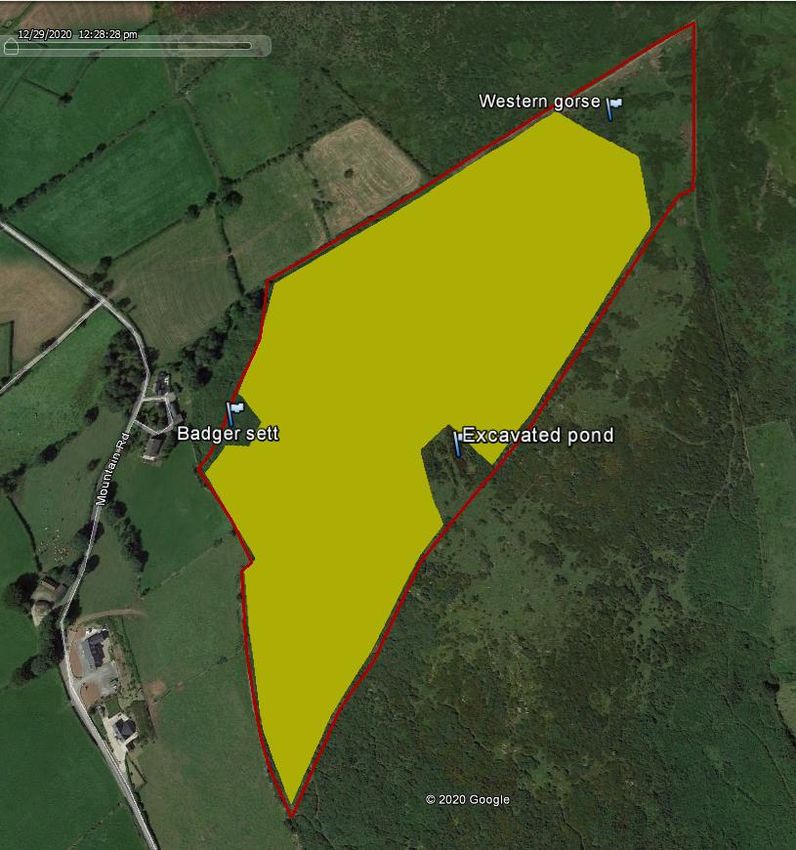
Preparation of a map showing the locations of the plots
Provision of an email summary of the site and how much of the site can be
planted and how much should remain as lowland heath. This should also be
backed up with an annotated map showing the division.
Survey
The site at Dechomet comprises 11 ha of hilly land in the Slieve Croob /
Castlewellan area. It is bounded by poor quality agricultural fences and broken
drystone walls to the east. It has been used for rough grazing by sheep and there is
the likelihood of wild deer. It sits between 190m and 270m above sea level.
The survey of the site at Dechomet was undertaken on the 29th December 2020
using the Rapid Condition Assessment by ecologist Judy Meharg and an assistant
from Fieldfare Ecology Ltd. The aim of the survey was to determine if Lowland Acid
Heathland habitat is present on the site. It should be noted that a full botanical
survey was not possible due to annual plants being absent at this time of year.
However as many of the typical of Lowland Acid Heathland indicator plants are
herbaceous perennials, these are identifiable if present all year round. Indicator
plants include heather species, bilberry, bog cotton, thyme, heath bedstraw and
western gorse.
24 2x2m quadrats were taken throughout the site to record the flora and the soil
depth. The survey data are attached in Annex B (please note there is no Q17)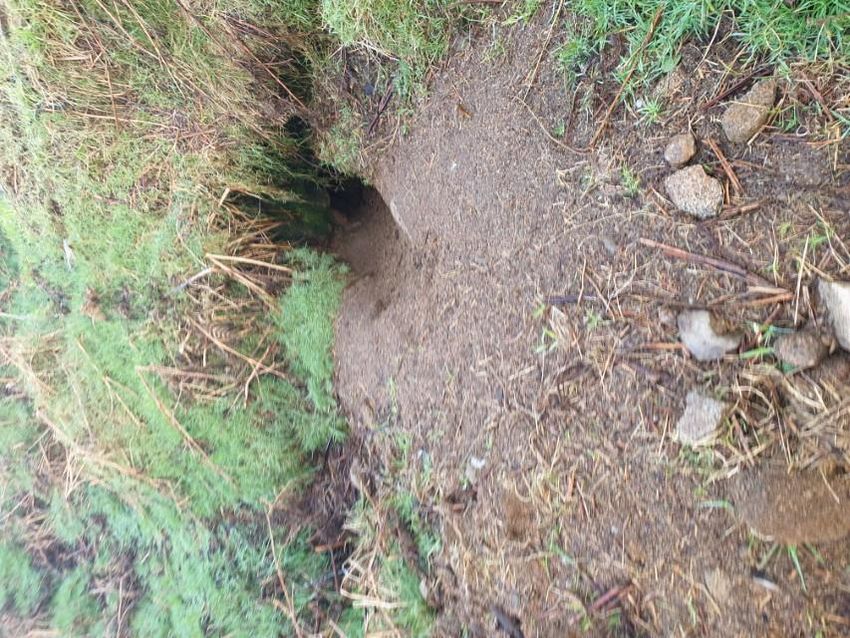
Map 1 Site map showing quadrat locations and vegetation types

Soil depths were recorded at every other quadrat. Soil was generally between 5-
35cm in depth and of a dark sandy nature containing high levels of schist. The
underlying boulders were often at surface level. No peat was found on site nor any
presence of heather or lowland acid heathland species apart from patches of
Western Gorse Ulex Gallii in amongst larger areas of Common Gorse Ulex
europaeus. Please refer to map for extent of vegetation types.
The dominant vegetation on the lower and western flank of the site was bracken and
patches of grass, the middle section was dominated by dense Ulex europaeus scrub
(which had been burnt by a wildfire in 2020) and the upper area, although still
dominated by Ulex europaeus, also contained patches of Ulex gallii associated with
rock outcrops. Along the top boundary there were areas of open grass. It should be
noted that the full extent of Ulex Gallii could not be determined due to the extent of
the 2020 wildfire however assessing orthophotography from pre-fire images suggest
that it is more frequent to the north of the site.
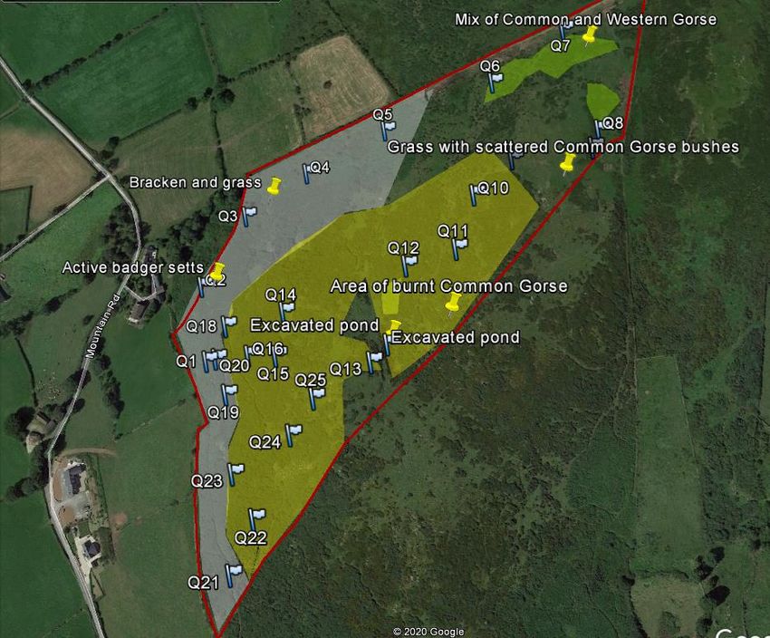
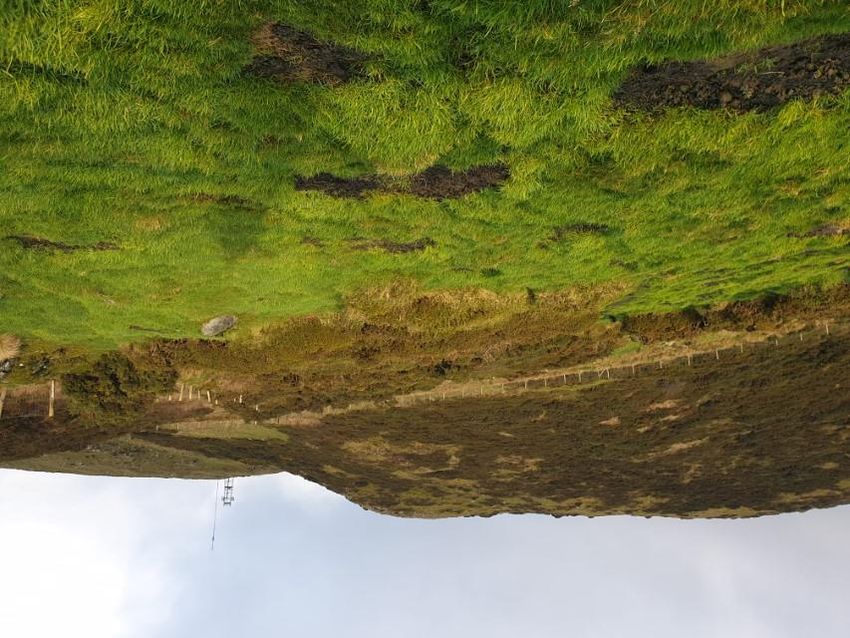
Photo 1 Photo looking south showing extent of burn

Photo 2 Western gorse with taller common gorse behind it in top corner of site
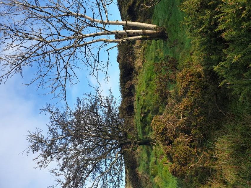
In a couple of areas across the site self-seeded trees of birch, hawthorn and ash
were growing which would indicate that if sheep, and other grazing animals, were
excluded the area would naturally progress through scrub to woodland.

Photo 3 Self-seeded Hawthorn and Ash trees
On the lower slope an active, well established badger sett was noted which had 4-5
entrances. The whole site was criss-crossed with badger pads.

Photo 4 Active badger sett on site

Current use of the site.
The site had been lightly grazed by sheep but encroachment by gorse is extensive,
probably due to under grazing. The area is important for Red Kites and the
landowner wishes to plant native woodland on this site as a suitable habitat. 6 Red
Kites and 2 buzzards were observed in the area during the survey. The owner is
licenced to provide a feeding station for Red Kites in an adjacent field.
Much of the site was affected by the 2020 burn and a few signs of regrowth at the
base of common gorse stems are now visible.
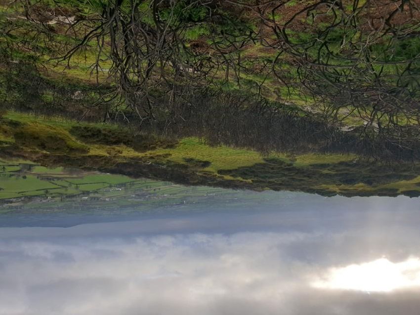
Site overview
Most of the site is vegetated by a mix of rough habitats comprising common gorse,
bracken and species poor grassland.
There were no signs of lowland acid heathland habitat on the site and no
characteristic species such as heathers, bilberry or tormentil were recorded.
On shallow soils and around rock outcrops, in the upper, northern area of the site,
there are patches of western gorse. The CEDaR website ‘Habitas’ describes the
Northern Ireland distribution of Ulex gallii as
“This is similar at first sight to the common gorse Ulex europaeus, but a closer look
shows that it is generally a smaller, more compact shrub, with smaller spines. The
most obvious difference is in time of main flowering - spring for U. europaeus and
late summer to autumn for U. gallii. Although called western gorse, in N. Ireland
its principal areas of occurrence include Co Down in the south-east of the
Province, especially in the Mourne and Slieve Croob areas. It is very common
within these areas.”
An active badger sett is present on the site, badgers are a woodland species and
would benefit from planting of a native woodland.
Rabbits are present at the lower areas of the site.

Recommendation
It is the opinion of the surveyor that the site would be suitable for planting with native
woodland species and rather than impacting on the habitats present that careful
planting would enhance the opportunities for carbon sequestration, biodiversity and
landscape.
Existing features, including areas to the north of the site where Ulex gallii is present,
should be left unplanted and the natural growth of this shrub around rock outcrops
and shallow soils integrated into the planting plan.
It would be advisable to leave an area around the excavated pond and the badger
sett unplanted and to leave space wherever outcrops of rock occur to accommodate
open areas and diversity within the planting.
Refer to map 2 below.
Map 2 Suitable area for native tree planting 9.25 ha

Judy Meharg
Michael Meharg
Fieldfare Ecology Ltd
1 January 2021
Appendix A

Species List

 Latin Name             Common Name      Comment
 Agrostis stolonifera   Grass            dominant grass throughout
 Betula pubescens       Birch            lone tree
 Crataegus monogyna     Hawthorn         lone tree
 Digitalis purpurea     Foxglove         sporadic under burnt gorse
 Fraxinus excelsior     Ash              lone tree
 Gallium saxatile       Heath Bedstraw   scarce
 Juncus articulatus     Jointed rush     one small patch
                                         one small patch around excavated
 Juncus effussis        Soft Rush        pond
 Primula vulgaris       Primrose         sporadic
 Pteridium aquilinum    Bracken          the lower slope and western flank
 Rubus fruticosa        Bramble          scarce
 Spagnum sp             spagnum          one small patch
 Ulex europaeus         Common gorse     throughout
                                         in small patches to upper section of
 Ulex gallii            Western gorse    site
 Umbilicus rupestris    Navelwort        on boundary wall
You can also read