Surveyor-General Victoria - Strategic Plan 2020 -2025 - Innovation - Property ...
←
→
Page content transcription
If your browser does not render page correctly, please read the page content below
Surveyor-General Victoria
               Strategic Plan 2020 -2025

Innovation
Message from the Surveyor-General of Victoria

                This strategy reflects the priorities of Land Use Victoria’s Strategic Land Assessment and Information division which focus       “We are committed to
                on:                                                                                                                               improving the social,
                 • modernising our processes and pursuing opportunities that digital platforms offer                                              economic and environmental
                 • future capabilities and a thriving culture that attracts and retains a diverse, inclusive and capable workforce                prosperity of Victoria by
                 • future proofing our systems and embracing technology and research                                                              delivering world-leading land
                 • collaboration and engagement and communicating our value and role to Victoria
                                                                                                                                                  ownership and land information
                 • ensuing our data yields powerful insights and facilitates quality decision making.
                                                                                                                                                  products and services to
                 These priorities reflect “Innovation” – the theme for this strategy.
                                                                                                                                                  Victorians.”
                As the 26th Surveyor-General of Victoria, I am part of the system responsible for ensuring that Victorians can have                                   Craig Sandy LS
                confidence and security in owning land. The role I hold involves significant trust from Victorians and for this I am deeply        26th Surveyor-General of Victoria
                grateful. Trust in institutions is important for the success of the work of Land Use Victoria, to provide certainty to citizens
                in land ownership which links it to Goal 16 – Peace, Justice and Strong Institutions, of the United Nations Sustainable
                Development Goals aimed at creating an ideal community.

                Surveyor-General Victoria
                Our branch includes approximately 50 people across five teams - Geodesy, Cadastral Infrastructure and Standards,
                Crown Survey Approvals, Geographic Names Victoria and the Surveyors Registration Board of Victoria.

                The focus of this strategy is innovation. Innovation is an approach to improving everything we do to provide a better
                service for the community we serve. Our approach is to be innovative in improving communication with our stakeholders
                and applying the insights we gain from these interactions. We are moving towards a diverse and inclusive culture that is
                reflective of our Victorian community. Our systems and process are designed to be best-of-breed to provide our end
                users with a satisfying experience when accessing our services.

Page 2
Strategic Plan 2020-2025
                .
Message from the Surveyor-General….continued

                           Monitoring of land surveying
                           A regulated land administration system gives Victorians certainty in ownership of their land holdings. Licensed
                           surveyors provide a service to every Victorian to efficiently and accurately determine the location of property boundaries
                           and the associated rights, restrictions and responsibilities in the use of their land.
                           The cadastral survey system is used to define where every Victorian property is located and the extent of the
                           boundaries. The boundaries are in most cases defined by a series of monuments, which may include boundary pegs or
                           fence posts or the bank of a river or shore of a lake or sea.

                           The Digital Cadastre Modernisation project
                           This ‘once in a generation project’, will create a state-wide network of digital data of all the parcel boundaries. The Digital
                           Cadastre Modernisation project complements existing Government initiatives such as Smart Planning, Digital Twin Pilot
                           and ePlan (digital lodgement of survey data) and will enhance the spatial accuracy of Vicmap. During the project, we will
                           connect with a broader audience using a range of communications channels.

                           In conclusion, the wellbeing of our society and economy relies on our ability to adapt our systems, management
                           practices, and regulatory functions to continue to provide certainty of land ownership. I am confident the Surveyor-
                           General Victoria teams will deliver the innovation necessary for our digital future.

                           Craig Sandy
                           26th Surveyor-General of Victoria
                           Chair of the Surveyors Registration Board of Victoria
                           Registrar of Geographic Names Victoria
                           .
                                                                                                                                                        SGV Strategy links to the United Nations
                                                                                                                                                        Sustainable Development Goal 16 –
                                                                                                                                                        Peace, Justice and Strong Institutions

Page 3
Strategic Plan 2020-2025
Strategic planning framework
  Surveyor-General Victoria (SGV) has several key areas of responsibility including setting and monitoring standards for surveying. Decisions and activities are
  shaped by a range of Acts and Regulations. SGV is a branch of the Strategic Land Assessment and Information Division (SLAI) of Land Use Victoria (LUV) in
  the Department of Environment, Land, Water and Planning (DELWP).

                                                                                                                                       Surveyor-General Victoria
                        To be Victoria’s trusted experts for land information, advice and spatial innovation.
                                                                                                                                       Strategic Plan 2020-2025
                                                                                                                                            (this document)

                                                                                   1.   Improved property valuations
                                                                                   2.   Digital cadastre roadmap
      Productive and                                                               3.   Improved use of government land
      effective land
                                                                                   4.   Virtual Vicmap
      management
                                                                                   5.   Supporting Victoria’s infrastructure
                                                                                        program
                                                                                   6.   Digital workplace
                                                                                   7.   Improved engagement
                                                                                   8.   Digital twin
                                                                                   9.   National collaboration
                                                                                   10. Datum modernisation
                                                                                   11. Spatial data insights

Key legislation
• Surveying Act 2004
• Survey Co-ordination Act 1958
• Geographic Place Names 1998
Strategic plan on a page .

                                                                    Innovation
                       SLAI 2030 vision    To be Victoria’s trusted experts for land information, advice and spatial innovation

                                                                                                                 Initiatives and
                           SGV purpose        SGV mission                   SLAI strategic priorities
                                                                                                                     projects

                                             Ensuring that:                 Modernisation                     5 Surveyor-General led
                      Ensuring               • citizens understand, use,                                      initiatives
                      Victorians have                                       Future capabilities
                                                shape and have certainty                                      10 SGV team led projects
                      confidence and            in their land ownership     Future proofing
                                                systems; and
                      certainty in their     • land information products
                                                                            Collaboration and engagement

                      land ownership            and services meet the       Powerful insights and quality
                                                needs of customers and      decision-making
                      and land                  stakeholders.
                      information
                      systems.

5
Strategic Plan 2020-2025
Certainty and confidence in land ownership

                           Land in Victoria
                           •   About 35 per cent of land is owned by the Crown and valued at $300 billion approx (Source: Victorian Government).
                           •   About 65 per cent of land is freehold and valued at $2.3 trillion approx (Valuer-General Victoria, 2019).
                           •   Total value of land in Victoria is in excess of $2.6 trillion.

                                                         In one way or another we all have
                                                         involvement with land and property.
                                                         Many of us do so through ownership
                                                         of a home or other property and we
                                                         take for granted the financial and
                                                         physical security such ownership
                                                                                                                                                   The financial
                                                         brings. It is simply what we expect in                                                    and physical
                                                         the society in which we live and rarely                                                   security that
                                                         do we pause to reflect on what enables                                                    property
                                                         us to have such confidence that ‘our                                                      ownership
                                                                                                                                                   brings.
                                                         property’ will remain just that.

                                                         – Chris McRae
                                                         Registrar of Titles (Victoria), 2013.

Page 6
Strategic Plan 2020-2025
Functions of Surveyor-General of Victoria

                   Responsibilities                                                    Key governance roles

                   Sets and monitors standards for surveying and survey                The statutory authority on land surveying and cadastral
                   information for the licensed surveying profession and ensures       boundaries.
                   high-levels of professional standards.                              Responsible for registering survey plans in the Central Plan
                                                                                       Office.

                   Ensures the certainty and integrity of Victoria’s land              Chair of the Surveyors Registration Board of Victoria.
                   ownership system through the cadastral survey system which
                   defines the location and dimensions of property boundaries.
                                                                                       Leads the Surveyor-General Victoria branch and its
                                                                                       contribution to the Department of Environment, Land, Water
                                                                                       and Planning.
                   Defines the location and dimensions of Crown land, its              Member of the Electoral Boundaries Commission in Victoria.
                   boundaries and advises users to enable the delivery of              Member of the Federal Redistribution Committee for Victoria
                   government services.                                                (federal electorate boundaries).
                   Leads Victoria’s network of positioning systems, survey             State verifying authority for the measurement of length.
                   marks and coordinates.
                   Is responsible for the naming rules for Victoria’s places, roads    The Registrar of Geographic Names in Victoria.
                   and localities as Registrar of Geographic Names.

Page 7
Strategic Plan 2020-2025
Snapshot of five key responsibilities

                    1. Set and monitor              2. Monitor surveying       3. Defining and         4. Managing and        5. Developing and
                    standards for surveying         matters affecting the      confirming Crown        improving the          delivering naming
                    and survey information          cadastral survey           land boundaries         positioning system     rules and guidelines
                    for the surveying               system                                             and network across     for places, roads and
                    profession                                                                         Victoria               localities

                    • SGV sets and monitors         • SGV monitors             • SGV delivers          • SGV delivers an      • SGV delivers a
                      the standard of cadastral       surveying matters          boundary definition     integrated network     strategy, sets of
                      surveys of the private          affecting the location     and mapping             of GPS ground          guidelines and rules
                      sector.                         and dimensions of          services for Crown      stations.              for the naming of
                    • Licensed surveyors              property and               land.                 • SGV delivers a         places, roads and
                      deliver land boundary           boundary definition.     • These boundaries        network of highly      localities.
                      definition to Victorians      • This system is an          can only be             accurate
                      who own land.                   important part of the      confirmed by the        coordinated marks
                    • SGV audits surveys to           Victorian land             Surveyor-General of     on the ground.
                      ensure the integrity of the     ownership system.          Victoria.
                      cadastral survey system
                      is maintained.

8
Strategic Plan 2020-2025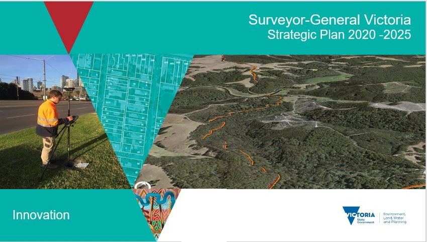
SGV branch teams – core business services and expertise
1. Cadastral 5. Secretariat,
2. Crown survey 4. Geographic
Team infrastructure and
approval
3. Geodesy
Names Victoria
Registration Board
standards of Victoria
• Surveying boundaries • Crown land ownership • Positioning infrastructure • Places, roads, localities • Maintaining the register
• Surveying regulations • boundaries • Positioning systems • Naming rules of licensed surveyors
Snapshot • Auditing licensed • Drafting Crown land coordinates • Culture and history • Administering graduate
surveyors plans training and professional
development programs
1. Property assessments – 1. Drafting and registering 1. Operations 1. Naming rules and Secretariat administration
ownership, boundaries, plans management and guidelines and coordination:
site conditions 2. Crown land records development of the 2. Place name audits 1. Registration of licensed
2. Crown land boundary management positioning services surveyors
3. Place name gazettal's
surveying network for Victoria
3. Examination of survey and registrations 2. Training and
3. Boundary and land plans 2. Survey mark accreditation
4. Place naming – training
status determinations maintenance and
4. Crown grant boundary 5. Historical data capture 3. Further Professional
information services
4. Audits of licensed and description Education and Training
3. Field surveying services 6. Advisory services
Services surveyors corrections
7. Engagement program –
(FPET) audits
– high precision, large
and 5. Legislation, regulations 5. Advisory services
scale place name
4. Reciprocal
and practice directives arrangements with
expertise development 4. Survey equipment practitioners
cadastral surveying
calibration services authorities
6. Advisory services
5. Advisory services - 5. Annual Report
7. Engagement program –
surveying and spatial
licensed surveyors 6. Engagement program –
science professionals
licensed surveyors and
6. engagement program - spatial sciences
licensed surveyors and professionals
spatial science
professions
Page 9
Strategic Plan 2020-2025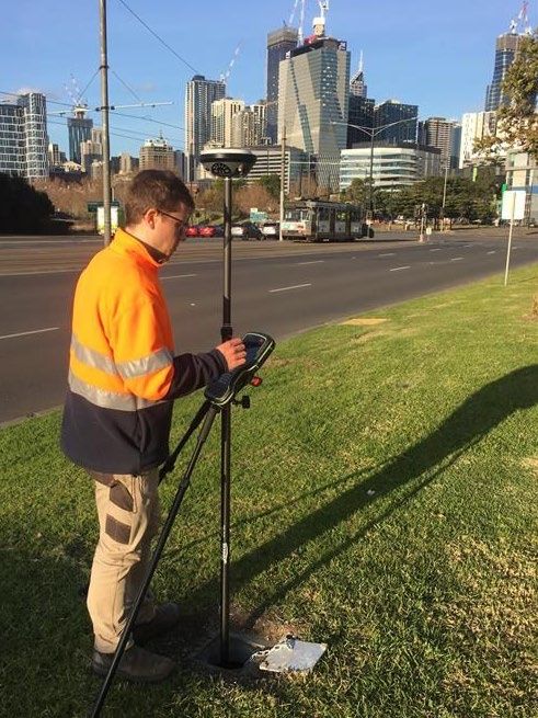
SGV services

                     Team                                                                 Examples of services
                     Cadastral infrastructure and   Survey assessment reports     Crown land status and        Audit report for licensed    Surveys for Government-
                                                                                  boundary advice for          surveyors                    related land dealings
                     standards                                                    licensed surveyors

                     Crown survey approval          Plan of Crown allotment       Title plan for Crown grant   Title plans for separate     Plans relating to parks
                                                    (OP)                          purposes                     dimension purposes           (national/state/forest) and
                                                                                                                                            native title.
                                                    LEGL Plans                    Certificates of adjustment   Certificates of correction

                     Geodesy                        Survey Mark Enquiry           Positioning service          High precision control
                                                    Service (SMES)                                             surveys

                     Geographic Names Victoria      Advisory service for complex Place name duplication        ‘In principle’ naming        Emergency services
                                                    naming assignments           checks                        approvals                    location data

                     Secretariat, Surveyors         Find a surveyor, check if a   Professional Training   Annual Report
                                                    surveyor is registered        Agreement (PTA) program
                     Registration Board of
                     Victoria

Page 10
Strategic Plan 2020-2025
Delivering core business services, strategic initiatives and projects
The SGV branch will deliver:
1. A defined set of team services 2. Four of the 11 SLAI four-year 3. Ten strategic projects.
that:
major initiatives. These are the
• maintain existing systems and
Surveyor-General strategic
products within the branch and
across SLAI, DELWP and the initiatives.
Victorian Government.
• are important to delivering
cross-SLAI, DELWP and the
Victorian Government strategic
projects.
5x SG-led 10x SGV team-led strategic
strategic initiatives projects
4x SLAI four year Initiatives, and Aligned to SLAI strategic priorities
1x aligned to SLAI strategic priorities
Page 11
Strategic Plan 2020-2025SGV strategic initiatives and projects
Surveyor-General Victoria led
Diversity and
Digital Cadastre Improved National
Datum modernisation capability
A. roadmap B. C. engagement D. collaboration E. development
SLAI Initiative No.2. SLAI Initiative No.10. SLAI Initiative No. 7. SLAI Initiative No. 9. SLAI Strategic Priority
Surveyor-General Victoria supporting
Improved use of Supporting Victoria’s
Virtual Vicmap Digital workplace Digital twin Spatial data insights
F. government land G. H. infrastructure program I. J. K.
SLAI Initiative No.3. SLAI Initiative No.4. SLAI Initiative No. 5. SLAI Initiative No. 6. SLAI Initiative No. 8 SLAI Initiative No. 11
Surveyor-General Victoria team-led
1. Cadastral infrastructure
and standards
2. Crown survey approval 3. Geodesy 4. Geographic Names
Victoria
New technology assessment – Major infrastructure projects – survey Survey Mark Enquiry Service Aboriginal place naming
Application of laser scanning for data quality improvements (SMES) Enhancement
boundary surveying
Digital case management system – Improving land holding record Positioning Australia – strategic Victoria’s complex site addressing
SGV Connect keeping systems, data flows for alignment review program
Crown land
Airborne gravity surveys Naming Rules – five year review
12
Strategic Plan 2020-2025Digital cadastre roadmap
Key benefits to Key benefits to
customers the community
Digital cadastre Cadastre 2034 (an initiative published by ICSM in 2015) is Australia’s vision for • Will connect the • A world-leading series of
the next generation cadastral system. It describes the characteristics of the Cadastral Survey projects to ensure the
roadmap systems that need to be in place to provide the Victorian community with the System to the digital accuracy and
SLAI Initiative No. 2
ability to readily and confidently identify the location and extent of all property coordinated Survey accessibility of Victoria's
rights. Control Network, helping most important surveying,
government mapping and spatial
The steps to achieve this vision for Victoria needs to be defined and this is the
departments, agencies datasets for use by
role of the project called 3D Digital Cadastre Roadmap for Victoria.
and businesses to be government and business
Land Use Victoria is working with the University of Melbourne’s Centre for better at locating and for the benefit of all
Spatial Data Infrastructure and Land Administration to produce the Roadmap. managing their assets. Victorians.
This project is nationally-significant; Victoria will collaborate with the other • Complements existing
States and Territories to create a roadmap that can be adapted for use initiatives such as Smart
elsewhere. Planning, Digital Twin
This initiative also includes three other projects that deliver on Cadastre 2034: Pilot and ePlan and will
the Digital Cadastre Modernisation Project, single format CAD File to ePlan enhance the spatial
conversion and the National 3D Cadastral Data Model. accuracy of Vicmap.
Page 13
Strategic Plan 2020-2025Datum modernisation
Key benefits to
Key benefits to customers the community
Datum • Ensure businesses and the community get maximum • Access to nationally consistent • Enhanced alignment of
benefit from advances in positioning technology. coordinate reference system. positioning services with other
modernisation • Recognising the growing use and reliance on positioning • Enhanced alignment of positioning spatial information.
SLAI Initiative No. 10
technology, we need to align the national coordinate services with other spatial • Enhanced spatial applications
reference system with that used for GPS. information. in a digitally enabled society.
• Develop and implement upgrades to the Australian • Increased accuracy and reliability of • Support advances in
Geospatial Reference System (AGRS) in Victoria. surveying and spatial data which can positioning technology,
be combined effortlessly. innovation and emerging
• Ensure businesses and community applications.
get maximum benefit from advances • Reduced costs and increased
in positioning technology. productivity.
Key activities • Increased productivity and innovation
1. Contribute to development of Australian Geospatial opportunities for business.
Reference System elements (GDA2020, ATRF, AVWS). • Overcome effects of regional
2. Implementation of new Australian Geospatial Reference deformation on spatial information.
System elements (GDA2020, ATRF, AVWS) within Land
Use Victoria (LUV).
3. Stakeholder engagement and education to support
organisations upgrade to the new coordinate reference
systems.
4. Procurement of airborne gravity surveys over regions of
Victoria to improve new vertical working surface.
5. Deformation modelling research project to enhance the
delivery of a time-dependent reference frame in areas
subject to deformation.
Page 14
Strategic Plan 2020-2025Improved engagement
Key benefits to
Key benefits to customers the community
Improved • Increase understanding and awareness of the work of SGV • increased understanding of the • Increased awareness of
branch. Cadastral Survey System, Geodetic Cadastral Survey System and
engagement • New content for different audiences – general business and Networks and their modernisation, the role it plays in Victorian
SLAI Initiative No. 7
government community, spatial sciences industry (current and SGV support of the state’s society.
future) and Victorians. infrastructure program, and how • Increased ability to participate
roads and places are named. in the democratic process of
• improved ability of customers and using and shaping the
stakeholders to get better utilisation Cadastral Survey System.
from the services delivered by SGV • Increased awareness of the
and SLAI. role of licensed surveyors
• Increased confidence in the
provision of government
services.
Key activities
1. Communications and engagement plan: business and
government.
2. Communications and engagement plan: geospatial industry,
current and future professionals.
3. Communications and engagement plan: Victorian community.
4. Social media plan – all audiences.
5. Victorian Surveying and Mapping Museum/display.
6. Industry report and business briefing: benchmark competitiveness
of Victoria’s Cadastral System. Audience: general business
community.
7. Quarterly newsletters and Annual Report from SG. Audience:
General business community and geospatial industry.
Page 15
Strategic Plan 2020-2025National collaboration
Key benefits to
Key benefits to customers the community
National SGV branch provides representatives to national collaboration • Shared knowledge from Victoria’s • Access to the latest national
forums in surveying, mapping and the spatial sciences. spatial professions and industry for developments in surveying,
collaboration the benefit of major national mapping and spatial data, as
SLAI Initiative No. 9 This allows for consistency and standardisation of surveying,
initiatives. well as applications for the
mapping and spatial science practices across Australia. It also
• Access to the latest national benefit of services delivered to
provides access to the best available knowledge nationally for
developments in spatial data and Victorians.
major projects.
applications.
• Enhance ability for practitioners
Key activities – national relationships across the surveying, mapping and
1. Intergovernmental Committee on Surveying and Mapping spatial science professions to
(ICSM) – the highest forum to ensure national standards and collaborate and work nationally.
best practices in surveying, mapping and the spatial sciences: • Standardised education and training
• Working Group on Addressing standards to enable national
• Working Group on Cadastre collaboration and access work
• Working Group on Geodesy opportunities in different jurisdictions.
• Working Group on Place Names
• Working Group on Tides and Mean Sea Level
• Working Group on Topographic Information
• Other ICSM working groups.
2. Council of Reciprocating Surveyors Boards of Australia and
New Zealand (CRSBANZ) – responsible for setting the
minimum national competency standards for land surveyors,
professional education standards, examination, and
qualification recognition.
3. Australian New Zealand Land Information Council (ANZLIC) –
the peak government body responsible for spatial information.
4. FrontierSI – complex spatial science research.
5. PSMA Australia – national geospatial data providers.
Page 16
Strategic Plan 2020-2025Diversity and capability development
Key benefits
Diversity and capability development • Increasing the diversity, capability and wellbeing of the SGV
branch and surveying profession will enhance its ability to
SGV recognises the need to continue
innovate and deliver work that reflects the needs of the
Aligned to SLAI 2030 strategic priorities: expanding the diversity of the branch and
Victorian community.
surveying profession more broadly. This
• modernisation • Increase the SGV branch’s ability to develop and maintain
includes gender, ethnicity and neurological
• future capabilities products and services during the digital revolution.
diversity as examples.
• Ensure resilience of the profession and SGV teams during
• future proofing SGV branch is creating a culture that is periods of sustained high levels of activity, such as the
• powerful insights and quality decision-making. diverse, innovative and future-focused current planning and building of major infrastructure in
Victoria.
Page 17
Strategic Plan 2020-2025SGV Branch strategic projects
SGV led strategic projects
Cadastral
Crown Survey Geographic Names
Infrastructure and Geodesy
Approval Victoria
Standards
New technology assessment Major infrastructure projects Survey Mark Enquiry Service Aboriginal Place Naming
– Application of laser – Survey data quality (SMES) enhancement
scanning for boundary improvements
surveying
SGV digital case Improving land holding Positioning Australia – Victoria’s Complex Site
management system – ‘SGV record keeping systems, data Strategic alignment review Addressing program
Connect’ flows for Crown land
Airborne gravity surveys Naming Rules – 5 year
review
18
Strategic Plan 2020-2025New technology assessment – Application of
laser scanning for boundary surveying
Cadastral Infrastructure and Standards About the project Key benefits
Aligned to SLAI strategic priorities: • Assessment of technology for suitability for boundary • Licensed surveyors complete boundary surveys
surveying in Victoria. (particularly for apartment blocks) faster and
modernisation
• Assessment of technology for mapping 3D surfaces. with better data.
Enable licensed surveyors to streamline and
embrace digital work methods, automate manual • Shape practice directives to embrace the technology. • Clients have better information about apartment
processes and achieve service excellence for boundaries.
clients of the boundary surveying services.
future capabilities
Improves the performance of Licensed Surveyors
Key activities
by allowing technological change.
1. Review and assess suitability of laser scanning
future proofing
technology to be effective to define property
Embraces new laser technologies to ensure of
boundaries.
Licensed Surveyors remain efficient and effective
in the future. 2. Assess capability specifically with apartments and other
enclosed environments (3D mapped definition).
powerful insights and quality decision- making
Enhances the ability of licensed surveyors to 3. Design appropriate directives that instruct Licensed
deliver high-quality services which will inform and Surveyors on how to use this technology in a compliant
shape future professional and technology manner.
developments. 4. Develop calibration service for laser scanners used by
Licensed Surveyors.
Great Ocean Road Laser Scan 2020
Page 19
Strategic Plan 2020-2025New SGV Connect – digital case management system
Cadastral Infrastructure and Standards About the project Key benefits
Aligned to SLAI strategic priorities: • New online digital case management system will • Increased efficiencies for managing and tracking
replace current manual processes. survey projects and activities within SGV branch.
modernisation
Implement an electronic case management • Will increase efficiencies for managing and tracking • Reduce the duplication of data captured within SGV
system commensurate with the current and future client requests and activities within SGV branch. by linking the process of CIS, CSA and Geodesy for
needs of a vital State Government branch and projects that deliver multiple products.
regulator.
future proofing
Implement an electronic case management
system that will meet future demand for Surveyor-
General Victoria services.
collaboration and engagement
Enable greater visibility of case management and
progress for clients and across all SGV teams.
powerful insights and quality decision-making
Build and maintain a high quality and accessible
set of data related to the operational processes
and efficiencies of SGV branch.
Page 20
Strategic Plan 2020-2025Major infrastructure projects –
survey data quality improvements
Crown Survey Approval About the project Key benefits
Aligned to SLAI strategic priorities: • Specific surveying standards for major
• Ensure major infrastructure projects’ survey data is of a infrastructure projects clearly articulated.
modernisation
Encourage increased efficiencies within consistently high level • Major infrastructure projects are not delayed by
Licensed Surveying profession with • Encourage greater use of digital submission of survey unnecessary re-work of survey plans.
encouragement to move to digital data data..
submissions.
future capabilities
Enable the team to manage and analyse three- Key activities
dimensional data.
1. Creation of a licensed surveying standards handbook for
collaboration and engagement infrastructure projects overseen by the Major Transport
Work with the Licensed Surveying profession to Infrastructure Authority.
encourage the adoption of more digital 2. Encourage digital submission of ePlan instead of paper.
processing.
powerful insights and quality decision-
making
Enable important decisions related to
infrastructure development to be resolved
quickly with fewer delays and cost overruns.
Murrumbeena station and elevated rail line was built as part of the Caulfield to Dandenong Level Crossing Removal Project.
Page 21
Strategic Plan 2020-2025Improving land holding record keeping
systems, data flows for Crown land
Crown Survey Approval About the project Key benefits
Aligned to SLAI strategic priorities: • Improve land management information practices. • Purchase, sale and lease decisions correctly
• Improve record-keeping in land-holding information informed by having clarity of boundaries,
modernisation
systems. ownership and status of Crown land and freehold
Incorporate effective, contemporary land record
lands.
holding, keeping and data flow practices into the
management of Victorian Crown land.
future proofing
Ensure systems for Crown land record holding, Key activities
keeping and data flows will meet future land • LUV 3D Digital Roadmap.
dealing demand. • Implementing recommendations in the Victorian
powerful insights and quality decision- Environmental Assessment Council’s (VEAC) Statewide
making Assessment of Public Land Final report.
Land dealing decisions will be correctly-informed • Implementing recommendations in the Great Ocean
by clarity of boundaries, ownership and status of Road Action Plan, ‘Protecting our iconic coasts and
Crown land and freehold lands. parks’.
Page 22
Strategic Plan 2020-2025Survey Mark Enquiry Services
(SMES) enhancement
Geodesy About the project Key benefits
Aligned to SLAI strategic priorities: • Improve customer experience and interaction with 1. Improved customer experience and interaction with
online applications. LASSI suite of online applications.
modernisation
• Support use on mobile devices. 2. Improved access to accurate and reliable survey
Upgrades to support implementation of datum
• Support access to new national coordinate control mark information at no cost.
modernisation initiatives.
reference systems. 3. Immediate access to LASSI products using mobile
future proofing devices.
Implement IT system advancements to
support current and future delivery of spatial
information.
collaboration and engagement Key activities
Conduct business needs analysis to ensure 1. Business needs analysis.
enhancements meet customer expectations. 2. Unification of LASSI suite of online applications.
powerful insights and quality decision- 3. Modernisation of user interface.
making 4. Review and enhancement of IT system processes.
Ensuring ongoing maintenance and 5. Implementation of datum modernisation initiatives.
accessibility to spatial information to support 6. Incorporation of data processing and adjustment
improved decision-making. capability.
7. Questionnaire for SMES customers to investigate
how they apply the geodetic data accessed through
this service.
Page 23
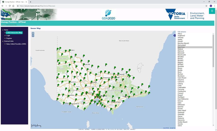
Strategic Plan 2020-2025Positioning Australia – strategic alignment review
Geodesy About the project Key benefits
Aligned to SLAI strategic priorities: • Update GPSNet systems and processes to align 1. Improved access to accurate and reliable positioning
with Positioning Australia program to improve services and data at no cost.
modernisation
positioning services across Australia. 2. Contribute to national open data policy intended to
Update GPSNet systems and processes to
• Access to accurate and reliable open data will increase uptake of positioning services and encourage
align with Positioning Australia program to
accelerate adoption and development of location- innovation.
deliver improved positioning services and
based technology and applications. 3. Increased productivity and reduced operational costs
data for no cost.
4. Avoid unnecessary duplication of effort.
future proofing Key activities
GPS ground station and processing
1. Signed national collaborative project agreement
software technology updates to ensure
with Geoscience Australia on National Positioning
delivery of highest quality positioning data
Infrastructure.
to encourage innovation.
2. Transfer operational control of 10n high quality
collaboration and engagement GPS ground stations to Geoscience Australia.
Ongoing collaborative arrangement with 3. Support installation of additional GPS ground
Commonwealth government, and support stations within Victoria.
to VARs during transition. 4. Transition from charging for a service to providing
powerful Insights and quality decision- free and open access to all data.
making 5. Adherence to service level agreements associated
As part of collaborative agreement, GPS with data distribution, analytics and monitoring.
ground station data is required to adhere
with service level agreement standards and
be made freely available to encourage
innovation and improve decision-making.
Page 24
Strategic Plan 2020-2025Airborne gravity surveys
Geodesy About the project Key benefits
Aligned to SLAI strategic priorities: • Acquisition of airborne gravity survey data over 1. Improve height determination from GPS
targeted regions of Victoria (Greater Melbourne and positioning in Victoria.
modernisation
central Victorian coastline, Eastern highlands). 2. Enhance the geoid model and ensure Victoria is
Enhanced gravity data will contribute to
• Enable accurate height determination from GPS. well placed to adopt a new national vertical
modernisation of national vertical reference
• Ensure Victoria is well-placed to adopt a new national reference surface.
system and support accurate and reliable height
vertical reference system. 3. Contribute to the Australian National Gravity
determination from GPS.
Database
future capabilities 4. Support a range of geological mapping
The ability to determine accurate and reliable applications.
heights from GPS will support a wide range of
applications and innovations. This significantly
reduces operational costs. Key activities
future proofing 1. Project agreement with Geoscience Australia who will
The improved gravity data will support height facilitate the airborne gravity survey data acquisition for
determination from GPS now and into the future Victoria.
when Australia adopts a new vertical reference 2. Funding provided by Victoria.
surface. 3. Geodesy team to lead development of project
collaboration and engagement specifications.
Acquisition to be organised through 4. Data included in national gravity database.
collaborative arrangement with Commonwealth 5. Data incorporated into national geoid model.
Government. The project will be a case study to
support similar surveys in Victoria and other
States and Territories.
powerful insights and quality decision-
making
Free and immediate access to accurate and
reliable height information from GPS will support
innovation and improve decisions-making. This is an image of the Australian Vertical Working
Surface of Victoria
Page 25
Strategic Plan 2020-2025Aboriginal place names
Geographic Names Victoria About the project Key benefits
Aligned to SLAI strategic priorities: • Supports reconciliation and the revitalisation of 1. Strengthens relationships with Traditional Owners to support
Victorian Aboriginal languages. reconciliation and revitalisation of Aboriginal language through
modernisation • Better integrates Aboriginal culture and history collaborative naming.
Incorporating an understanding of into Victoria’s place and road names. 2. Naming practices which reflect Victorian society as a whole by
Aboriginal languages and the meanings of appropriately recognising Aboriginal culture.
words used in place and road names.
future capabilities
Enable Geographic Names Victoria/
Surveyor-General Victoria (GNV/SGV) staff
and other naming authorities to develop Key activities
capability for using Aboriginal names when 1. Conducting training sessions on using
creating or auditing new place names. Aboriginal names when creating new place
names.
future proofing
Embed capabilities for using Aboriginal 2. Capturing historical information about
names when creating or auditing new place Aboriginal place names for existing places
names to the practices of GNV/ SGV staff and roads.
and other naming authorities. 3. Engaging with traditional land owners about
this initiative.
collaboration and engagement
Enhance capabilities of other naming
authorities for using Aboriginal place
names.
powerful insights and quality decision-
making
Learn from Traditional Owners to guide the
naming practices for using Aboriginal
language in the naming of roads, features
and localities.
Page 26
Strategic Plan 2020-2025Victoria’s complex site addressing program
Geographic Names Victoria About the project Key benefits
Aligned to SLAI strategic priorities: • Emergency services at times experience 1. Community safety – naming clarity and certainty for emergency
difficulties in attending emergencies in complex, services. Reduction in the risk of name duplication and confusion
modernisation
privately-owned sites (e.g. retirement villages, between public places and roads with privately-owned communities.
Ensuring place and road naming
universities and caravan parks) as the 2. Emergency services will be able to efficiently attend to emergencies
practices across Victoria recognise the
identification of roads and sub-addresses within within large, private communities.
different ways land parcels are inhabited/
these sites is not currently required by law.
used and how access is provided from
public roads and other infrastructure. • This initiative will look at ways to better engage
and educate the owners of these complex sites
future proofing about the benefits of complying with Victoria’s
Increase consistency of place and road place and road-naming rules.
naming practices across Victoria to
• This project will enable place and road names
enable emergency services to efficiently
to be provided to Victoria’s emergency services
attend to emergencies within large,
and assist with faster response times.
private communities.
collaboration and engagement
Ensure owners of roads complex sites
are aware of the benefits of complying
with Victoria’s place and road naming
rules. Key activities
1. Delivering the following for places and roads
powerful Insights and quality decision- on complex sites on privately-held land, e.g.
making retirement villages and caravan parks:
Leverage insights on response times i. Register road and place names in
from relationship with emergency VICNAMES; and
services to develop better engagement
ii. Follow Victoria’s place naming rules.
with owners of places and roads with
privately-owned communities which
enhance overall community safety.
Page 27
Strategic Plan 2020-2025Naming Rules – 5 year review
Geographic Names Victoria About the project Key benefits
Aligned to SLAI strategic priorities: • Naming rules must reflect the community and be in line 1. Rules that reflect the current needs of the community for the
with national and international standards. naming of places.
future proofing
Ensure Victoria’s place and road naming • To ensure the rules remain current they are required to 2. Assist with public safety by creating names that are reflective of
rules remain relevant and effective in the be reviewed every five years. this phase in history.
future.
collaboration and engagement
Ensure feedback from all relevant
stakeholders is incorporated into the
review.
powerful insights and quality
Key activities
decision-making
Ensure updates to the naming rules 1. Engagement with stakeholders.
reflect the most effective insights drawn 2. Geographic Place Names Advisory Panel provides
from both Geographic Names Victoria/ independent review.
Surveyor-General Victoria (GNV/SGV) 3. Review and briefing the Minister.
staff and stakeholders.
Page 28
Strategic Plan 2020-2025Timeline of major events and legislation in Victoria
1851 1885 Other Major Events and Legislation
Victoria was made a colony separate from NSW. Victoria Royal Commission on Land Titles and 1852 – First trigonometric surveys of Victoria.
Robert Hoddle, the 1st Surveyor-General of Surveys. Investigated three branches:
Victoria appointed. 1858 – First geodetic surveys of Victoria.
Prior to 1800 1. Transfer of Land Statute;
1861 – Board of Examiners, Surveyors established.
For tens of thousands of years Population of Victoria: 77,000 2. Working of the Titles Office; and
1881 – Water gazettal.
the Aboriginal Australians of 1835 3. The state of the surveys – past and present
Melbourne is 1882 – Reciprocal licensing of surveyors with all
Victoria occupied the land prior in their bearing upon the definition of the
1852 Discovery of gold in Victoria. other States and New Zealand.
to Europeans arriving. There founded. boundaries of properties. 1896 – Surveying Board of Victoria established.
were more than 39 Aboriginal 1855 Law and practices significantly shaped as a
1905 – Water Act introduced.
languages and in excess of 30 1837 Victoria Constitution Act 1855, established result of recommended changes.
1917 – Soldiers Settlement Act introduced.
aboriginal peoples. General Law Parliament as Victoria’s law-making body. 1940 – Survey Co-ordination Act first introduced.
land ownership 1891
is introduced. 1978 – Surveyors Act first introduced.
1802 1862 Population of Victoria: 1.14M.
Mathew Flinders surveyed Torrens Title Land ownership
introduced, General Law land 1895
Port Phillip.
ownership system grandfathered. Licensing of Surveyors starts in Victoria.
2008
World’s first online property settlement and registration, transacted in Melbourne.
1966 1989
1991 1996 2010 2018
Population: 3.22M. Local 2019
Docklands Population: Traditional Owners Aboriginal Heritage
Government Population: 6.38M.
Act 1991. 4.38M. Settlement Act 2010. Regulations 2018.
1962 Act 1989.
Sale of Land Act 1962. 2009 2015
1988 1990s 1995 Surveying (Cadastral
Major Transport Projects
1960 Subdivision Public access Citylink Act Surveys) Regulations 2015.
Facilitation Act 2009.
National Measurement Act 1960. Act 1988. to the internet. 1995.
2006 2014
1958 1987 1994 Aboriginal Heritage Act 2006. Subdivision Co-ordination Regulations 2014.
Property Law Act 1958. Planning and Project Development and
Survey Co-ordination Act 1958. Environment Act Construction Management 2004 2011
Transfer of Land Act 1958. 1987. Act 1994. Road Management Act 2004. Subdivision (Registrar’s Requirements) Regulations 2011.
Land Act 1958. Subdivision (Body Corporate) Subdivision (Procedures) Regulations 2011.
Forests Act 1958. 1978 1998 Regulations 2004.
Crown Land (Reserves) Act 1978. Geographic Place Surveying Act 2004.
National Parks Act 1978. Names Act 1998.
Page 29
Strategic Plan 2020-2025 Key Events in Victoria Legislative instruments shaping the SGV todayContact Us
Surveyor-General Victoria
Department of Environment, Land, Water and Planning
2 Lonsdale Street, Melbourne
surveyor.general@delwp.vic.gov.au
Phone: (03) 919 40284
Business units:
Cadastral Infrastructure and Standards – sgv.surveyors@delwp.vic.gov.au
Crown Survey Approval – csa.enquiries@delwp.vic.gov.au
Survey Mark Enquiry Service – smes.support@delwp.vic.gov.au or phone (03) 919 40770
Geographic Names Victoria – geo.names@delwp.vic.gov.au or phone (03) 919 40282
Surveyors Registration Board of Victoria - info@surveyorsboard.vic.gov.au
or phone (03) 919 40258
Connect with us:
@DELWPVictoria @DELWP_Vic DELWPVicGovAustralia @delwp_vic department-of-environment-land-water-&-planning
© The State of Victoria Department of Environment, Land, Water and Planning 2020
Accessibility
This work is licensed under a Creative Commons Attribution 4.0 International licence. You are free to re-use the work under that licence, on the condition that you credit
the State of Victoria as author. The licence does not apply to any images, photographs or branding, including the Victorian Coat of Arms, the Victorian Government logo If you would like to receive this publication in an alternative format, please
and the Department of Environment, Land, Water and Planning (DELWP) logo. To view a copy of this licence, visit http://creativecommons.org/licenses/by/4.0/
telephone the DELWP Customer Service Centre on 136186,
Disclaimer
This publication may be of assistance to you but the State of Victoria and its employees do not guarantee that the publication is without flaw of any kind or is wholly
email customer.service@delwp.vic.gov.au , or via the National Relay Service
appropriate for your particular purposes and therefore disclaims all liability for any error, loss or other consequence which may arise from you relying on any information on 133 677 www.relayservice.com.au. This document is also available on the
in this publication.
internet at www.delwp.vic.gov.au.
Page 30
Strategic Plan 2020-2025You can also read