THE BIDGEE BULLETIN - Environment.gov.au
←
→
Page content transcription
If your browser does not render page correctly, please read the page content below
JUNE 2020 ISSUE 4

               THE BIDGEE BULLETIN
           Quarterly Newsletter of the Murrumbidgee Monitoring Program

RESEARCH PROJECTS                                             Welcome to Issue 4 of The Bidgee Bulletin. In
                                                              this issue we highlight two of the research
This issue we feature two research projects developed by      projects that operate in conjunction with the
researchers from Charles Sturt University and partner         Murrumbidgee Monitoring, Evaluation and
organisations that explore the relationships between          Research (MER) Program. We also check in
environmental watering actions and biodiversity               with CSU PhD researcher Anna Turner and get
responses in the Murrumbidgee region. The projects are        an update on her work studying the prevalence
a baseline vegetation assessment (benchmarking)               of chytrid fungus in southern bell frogs in the
project, and a study of the importance of artificial          lower Murrumbidgee region. And in this issues
wetlands (such as farm dams) for frogs.                       'Who's Who in the Zoo' we feature Madeline
                                                              Gorham, one of our colleagues from the
VEGETATION BENCHMARKING                                       Commonwealth Environmental Water Office.
Regular flooding is vital to maintain healthy river red gum
forests and black box woodlands. Flood regimes                The Bidgee Bulletin is a quarterly newsletter
determine the types of vegetation communities that grow       designed to provide updates on our progress as
in different wetlands. Permanent wetlands and those           we monitor the ecological outcomes of
which regularly receive water are often characterised by      Commonwealth environmental water flows in the
large expanses of open water fringed by river red gum         Murrumbidgee Selected Area. The 2019-2022
trees. Shallow wetlands that are seasonally inundated         program builds on the previous five year
are often dominated by spike rush and the common reed.        monitoring period (2014-2019) and uses many
Wetlands that rarely become inundated, except during          of the same methods.
natural flood events, may experience dense river red
gum regeneration that results in saplings encroaching on
the wetland.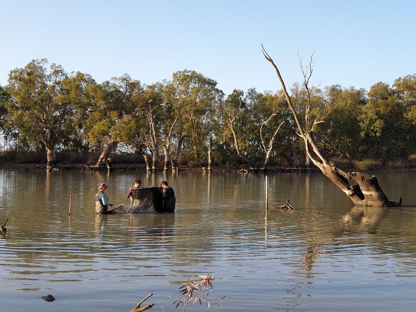
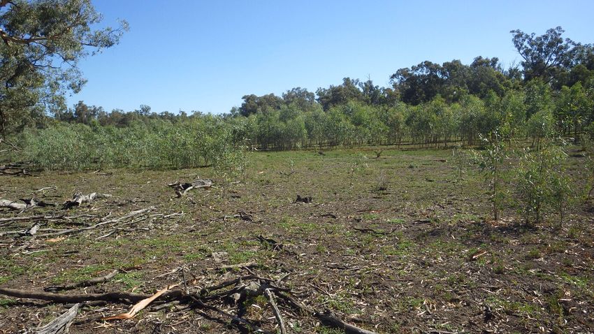
Some wetlands in the mid-Murrumbidgee region such as McKenna’s Lagoon
                                              have experienced high densities of river red gum recruitment, with trees
                                              growing throughout the wetland and resulting in a reduction in wetland health
                                              and function. CSU researchers are systematically benchmarking wetland
                                              vegetation diversity and structure to assess the health of wetland vegetation
                                              communities and the extent of red gum encroachment across the mid-
                                              Murrumbidgee and Lowbidgee regions. This information will help guide
                                              targeted delivery of environmental water which has been shown to maintain
                                              areas of open water and improve vegetation diversity.
 From top: River red gum encroachment at
McKenna's Lagoon in the mid-Murrumbidgee;
    barking marsh frog; Yanco billabong       FROGS IN FARM DAMS
                                              The majority of frog species found along the Murrumbidgee River require
                                              slow-moving or still water to breed. As many natural wetlands no longer
                                              receive regular water, many frog species have declined and populations of
                                              the threatened southern bell frog are now dependent on environmental water
                                              or artificial wetlands such as irrigation channels and farm dams. During the
                                              spring and summer drought of 2019-2020, CSU researchers in partnership
                                              with YACTAC (Yanco Creek and Tributaries Advisory Council) surveyed frogs
                                              in 42 sites along Yanco Creek. Surveyed sites included both farm
                                              infrastructure (farm dams and irrigation channels) and natural wetlands such
                                              as billabongs and creeks. Preliminary findings from the surveys indicate that
                                              six frog species were calling and using these habitats, including ground-
                                              dwelling species such as the spotted marsh frog, barking marsh frog and
                                              plain’s froglet; burrowing species such as the inland banjo frog; tree-dwelling
                                              species such as Peron’s tree frog; and the southern bell frog. Many species
                                              were recorded from farm dams highlighting the value of this type of habitat as
                                              a refuge for frogs during times of drought.

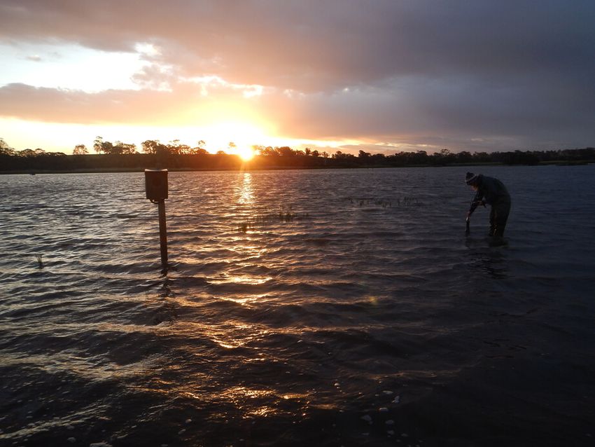
                                              In March, the Murrumbidgee Environmental Water Advisory Group (EWAG)
                                              meeting took place in Leeton. The following morning participants visited
                                              several wetland sites including Gooragool Lagoon where CSU researcher Dr
                                              Damian Michael explained the use of artificial bark covers to survey for tree-
                                              dwelling reptiles and invertebrates.

                                              The group is made up of community representatives, stakeholder groups and
                                              government departments. It provides a point of interface between the
                                              community and the Commonwealth and State governments and is an
                                              opportunity for high-level involvement in the management of water for the
                                              environment in the Murrumbidgee catchment.

 Below: Grey snake (photo: Damian Michael).   Detection of the little known grey snake around Lowbidgee wetlands is the
                                              subject of a new journal article published recently in Australian Zoologist. The
                                              snake was observed and identified by MER Program researcher Dr Damian
                                              Michael during routine wetland monitoring activities over Summer 2018-19.
                                              This was the first confirmed sighting of this species south of the
                                              Murrumbidgee River, representing a southern range extension and
                                              confirmation that the species still persists in south-western NSW. Improved
                                              awareness of this small noctural snake has seen us detect more individuals
                                              at key Lowbidgee wetlands during 2019-20 field monitoring activities.

                                               Find the article at: https://publications.rzsnsw.org.au/doi/10.7882/AZ.2020.008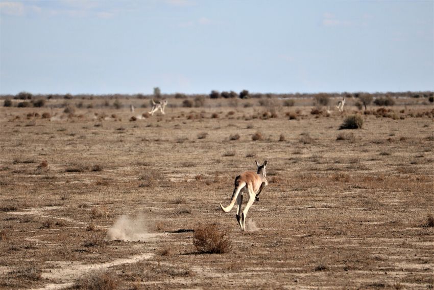
IT'S NOT EASY, BEING GREEN
                                                   Charles Sturt University PhD student Anna Turner has been a frequent visitor
                                                   to the wetlands of the Lowbidgee over the past couple of years. Since
                                                   September 2018 she's spent hundreds of hours searching for populations of the
                                                   threatened southern bell frog in the region. Anna's research is focused on
                                                   amphibian chytrid fungus in southern bell frogs and the effect of environmental
                                                   conditions, particularly temperature, on disease prevalence.

                                                   Her time in the field has involved capturing 1200 frogs, including over 500
                                                   southern bell frogs. She's been recording data including frog size, weight, body
                                                   temperature, sex, activity, distance to water and location, and has collected
                                                   skin swabs which are sent off to a laboratory to be analysed to determine if any
                                                   of the tested frogs are infected with the chytrid fungus and if so, what level of
                                                   infection they have.

                                                   Chytrid fungus is an aquatic fungus which lives on the frog’s skin and
                                                   consumes keratin in the skin cells causing a disease called chytridiomycosis.
                                                   The disease affects the frogs’ skin which can disrupt respiration and heart
                                                   function, and eventually lead to cardiac arrest and death. Since its discovery in
                                                   1998, chytrid has been detected in more than 500 amphibian species and
                                                   occurs in at least 52 different countries. In Australia, 62 out of 242 native frog
                                                   species have been detected with the chytrid fungus. As the fungus is sensitive
                                                   to temperature, the impacts on frog populations have largely occurred in cooler
                                                   regions and at higher altitudes. Little study has been done outside the
                                                   predicted temperature range of the fungus.

                                                   Last season (2018-19) Anna found low levels of chytrid infection in frogs
                                                   swabbed from the lower Murrumbidgee region. There was low prevalence and
                                                   low infection intensity, however it is present. This project is investigating how
                                                   chytrid fungus is able to survive in these regions which are predicted to be
                                                   outside its usual range due to environmental conditions. Anna has temperature
                                                   loggers deployed in wetlands which have been measuring water surface
                                                   temperature in a number of different vegetation types and depths. Using these
                                                   loggers she hopes to map out the temperature regimes of the wetlands and
                                                   gain a better understanding of where this fungus is able to persist and how
                                                   timing of watering events may influence infection prevalence and mitigate its
                                                   spread.

From top: southern bell frog; Anna Turner
collecting a skin swab; volunteer Matilda Terry
                                                    New Website Reveals Science Behind
measuring water quality; volunteer Chi Wei
spotlighting for frogs in the lignum at Eulimbah           Environmental Flows
Swamp.

                                                   Murray-Darling Basin communities can now access the science behind
                                                   environmental water with the launch of the new Flow-MER website. The
                                                   website brings together the work of independent scientists from some of
                                                   Australia’s leading regional universities and research institutions on how
                                                   Commonwealth environmental water is making a difference to the Basin’s
                                                   rivers, wetlands and floodplains. Monitoring, evaluation and research are
                                                   central to how Commonwealth water is managed to improve the health of our
                                                   rivers.

                                                   “The Flow-MER website is a great step towards improving transparency of our
                                                   decision making. It offers people a way to engage with the scientists and see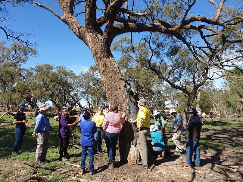
for themselves the thinking behind when and where we deliver water for the
 environment,” said Jody Swirepik, Commonwealth Environmental Water Holder.

 "Flow-MER builds on ten years of robust scientific monitoring and research that
 underpins our understanding of how plants and animals respond to water for the
 environment. By keeping decision makers abreast of the latest scientific findings,
 we can ensure that water for the environment is used in the best way possible to
 support fish, waterbirds, and wetlands,” said Dr Carmel Pollino, Principal
 Research Scientist at CSIRO.

 Numerous scientists work out in the field at locations across the Murray-Darling
 Basin, often with the involvement of Traditional Owners, local water managers
 and landholders.

 “No matter where you live in the Basin, you can look at the Flow-MER website to
 find out where scientists are monitoring environmental flows near you. There are
 plenty of great photos and some terrific stories about the frogs and turtles that
 we meet when we are out in the field,” said Skye Wassens, Principal Scientist,
 Charles Sturt University.

 The Flow-MER website is now online. Visit flow-mer.com.au

       Gayini Nimmie-Caira - return to
           traditional custodians
Gayini Nimmie-Caira, an 84,417 hectare property of internationally significant
Murrumbidgee floodplain and wetlands, was offically handed back to its
Traditional Custodians - the Nari Nari people, on 20th March 2020.

Originally purchased under an agreement between the Australian and New South
Wales governments to contribute to achieving Murray-Darling Basin Plan
outcomes, 19 separate properties were merged to form what is now known as
Gayini Nimmie-Caira. Since May 2018 the property has been managed by a
consortium led by The Nature Conservancy and including the Nari Nari Tribal
Council, the Murray Darling Wetlands Working Group and the Centre for
Ecosystem Science at the University of NSW.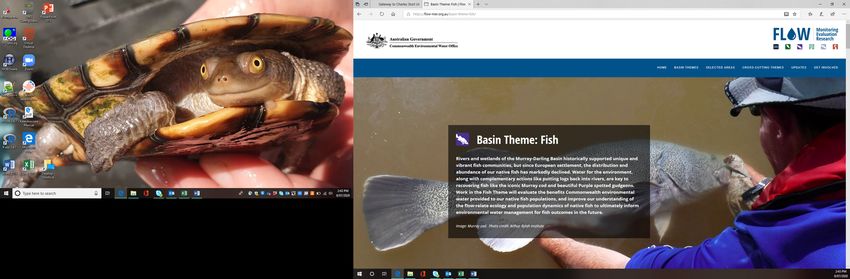
The property contains large areas of open lignum floodplain and floodways, and is
                                           home to a stunning variety of native Australian birds ranging from tiny spotted
                                           pardalotes to stately emus. When conditions are favourable extensive wetlands
                                           provide feeding and breeding habitat for many different species of waterbirds
                                           which can form large nesting colonies. The wetlands also support a range of
                                           threatened species including significant populations of the southern bell frog. It's
                                           part of the Lowbidgee floodplain, which is the largest area of intact wetlands
                                           remaining in the Murrumbidgee Valley and an area of national and international
                                           conservation significance.

                                           Known as 'Gayini', the Nari Nari word for water, the area has been managed by its
                                           Traditional Custodians for over 50,000 years and is rich in Indigenous cultural
                                           sites, including scar trees, burial mounds and camp sites. Since being back
                                           managing Country, the Nari Nari are using a combination of traditional and modern
                                           methods to assess, protect and restore the landscape - removing feral animals,
                                           reinstating a natural inundation regime, identifying and protecting cultural sites and
                                           repairing infrastructure.

                                           The director of The Nature Conservancy in Australia, Rich Gilmore, said: “Gayini is
                                           now legally owned by the Nari-Nari people, as it has been spiritually for 50,000
                                           years". The property will continue to be managed for the protection and restoration
                                           of Indigenous culture and heritage, conservation values and sustainable economic
From top: Telephone Creek; kangaroo near   development. The MER Program monitors several wetlands within Gayini Nimmie-
Eulimbah Swamp; processing at Avalon       Caira and welcomes the handover back to the Traditional Custodians.
Dam, Gayini Nimmie-Caira.

                                                             Map showing monitored wetlands within the three Murrumbidgee zones:
                                                                  Redbank, Gayini Nimmie-Caira and the mid-Murrumbidgee.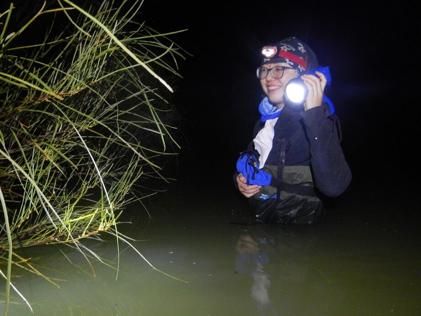
WHO'S WHO IN THE ZOO?
                                                  This issue we find out a little more about one of our colleagues from the
                                                  Commonwealth Environmental Water Office …

                                                  Name: Madeline Gorham
                                                  Organisation: Commonwealth Environmental Water Office
                                                  Position: Water manager
                                                  I studied at: Red Bend Catholic College in Forbes, then University of Canberra
                                                  to study Landscape Architecture/Environmental Science, then later at Charles
                                                  Sturt University for a Honours degree in Environmental Science &
                                                  Management.
                                                  In my previous jobs I: wrote policy for the Basin Plan and then worked with
                                                  landholders to achieve on-ground landcare initiatives
                                                  Food attitude: sweet
                                                  Beverage of choice: beer
                                                  How would you describe your work to a child?
                                                  I help rivers run and the things that live in the river, like fish.
                                                  What’s the best thing about your work?
                                                  variety
                                                  Your work in three words?
                                                  Water, Challenging, Political
                                                  Is your career your parents fault?
                                                  Yes probably. My Dad was a lucerne and sheep farmer on the Lachlan River
                                                  and my Mum works as a water licenser.
                                                  It’s now 2030, where are you?
                                                  Still working on the Bidgee
  The Murrumbidgee MER team would like to         Flashback to 1999 – where were you then?
acknowledge the consortium partners and local     Bedgerabong Public School
       landholders with whom we work.             Given the chance, who would you like to be for a day?
                                                  Annabel Crabb - an expert juggler
                                                  What’s your favourite sign off?
                                                  Cheers

   We respectfully acknowledge the Wiradjuri,
       Nari Nari and Muthi Muthi peoples,
  traditional owners of the lands on which this
              publication is focused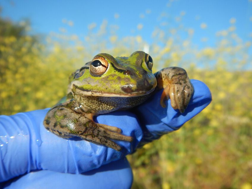
You can also read


