The Williamstown Farmland Project
←
→
Page content transcription
If your browser does not render page correctly, please read the page content below
The Williamstown Farmland Project
Assessing Contemporary Threats to Farmland in Williamstown, Massachusetts

                 Elizabeth Bigham, Juan Rebolledo, Nicholas Sommer
                     ENVI 302 Environmental Planning Workshop
                               Professor Sarah Gardner
                                      Fall 2020

                                     Clients:
     Andrew Groff, Planner, Community Development Dept., Town of Williamstown
      David McGowan, Executive Director, Williamstown Rural Lands Foundation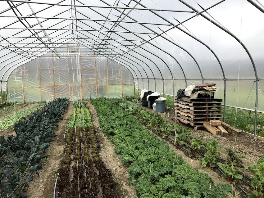
Contents

Land Acknowledgement ………………………….………………………………………….               3

Executive Summary …………………………………………………………………………… 4

Introduction …………………………………………………………………………………… 6

A Brief History of Farming in Williamstown …………………………………………………. 7

What is Farmland Conservation? ……………………………………………………………… 8

Project Goals ………………………………………………………………………………….. 10

Methodology …………………………………………………………………………………... 11

Threat Evaluation ……………………………………………………………………………… 16

Farm Summaries ………………………………………………………………………………. 20

Private and Other Landowners ………………………………………………………………… 46

Recommendations ………………………………………………………………………….;…. 51

Conclusion …………………………………………………………………………………….. 57

Appendix ……………………………………………………………………………………… 59

Bibliography …………………………………………………………………………………… 69

                                2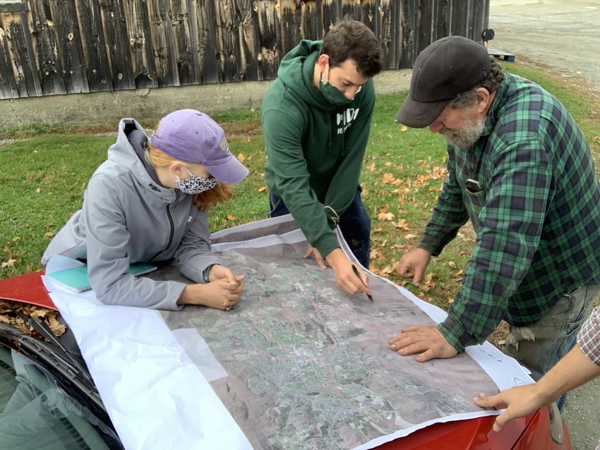
Land Acknowledgement

 “It is with gratitude and humility that we acknowledge that we are learning, speaking and gathering on
  the ancestral homelands of the Mohican people, who are the indigenous peoples of this land. Despite
tremendous hardship in being forced from here, today their community resides in Wisconsin and is known
as the Stockbridge-Munsee Community. We pay honor and respect to their ancestors past and present as
                  we commit to building a more inclusive and equitable space for all.”
                                                                     – Stockbridge-Munsee Community

                                                   3
Executive Summary
       Williamstown is an iconic escape in the Berkshires of Massachusetts. Stewarded for
centuries by the Mohican community of western New England and eastern New York, the 1800s
saw the clearcutting of as much as 80% of the town’s forests for agriculture (“Farms Under
Threat,” 2020). Since then, the town’s agricultural economy has seen many ups and downs.
Recent decades have revealed unprecedented losses of farms and farmland in Williamstown and
throughout the region. Today, sixteen active farms and stables remain in Williamstown operating
on approximately 2,005 acres of owned land and 2,180 acres of leased land. Five of these farms
are at imminent risk of loss within the next five years.
       “The Williamstown Farmland Project” is a collaborative effort by three students in the
Williams College Environmental Studies program as well as their professor, Williamstown’s
town planner, and the executive director of the Williamstown Rural Lands Foundation (WRLF).
During the fall of 2020, this team worked to identify contemporary risks to farmland operated by
these sixteen farms in Williamstown. They also produced tools and recommendations that can be
used for immediate farmland conservation in Williamstown.
       The report’s findings reveal a farming community that is persevering and committed to
agriculture but finds it increasingly difficult to make a living. Of the town’s sixteen farms, seven
have no form of land protection status above Ch. 61A, and only two have all their possible
owned lands conserved through APR or Conservation Restrictions. In addition to the five farms
identified at imminent risk of loss, two farms have no succession plans in place while only three
have solid plans for who will operate the farm long-term.
       Although the ages of Williamstown’s farmers vary, many are at—or near—retirement
age. This reflects a statewide trend where the average principal farm operator is 59 years old
(USDA, 2017). Due to the prevalence of non-prime agricultural soils and woods, the types of
land use practiced by these farms vary greatly. Agricultural land uses range from beef cattle to
dairy, vegetables to maple sugaring, horse boarding to pig farming, and haying to timber lots,
etc. The diverse nature of these farms means that most do not compete directly with each other
even as many have moved away from commodity market production due to low prices and an
inability to compete with larger, more productive farms. Farms that engage the community and
market value-added products seem to remain vibrant, which could serve as a model for future

                                                 4
farm evolution. However, our team found no farms in Williamstown were turning much—if
any—profits annually. Many were happy just to be able to get by.
       As 2020 draws to a close, resiliency is a theme that has amassed renewed attention. In
Williamstown, the resiliency of farms is a topic of immediate concern as seven out of sixteen
farms face high levels of threat to their farmland (Matrix 1). With 52% of all farmed land in
town being leased land, the status of lands owned by non-farm entities is also of significant
importance.
       This report, “The Williamstown Farm Project: Assessing Contemporary Threats to
Farmland in Williamstown, Massachusetts” builds off significant bodies of work by town
historians, farmland advocates, private citizens, and others to address these issues and more. It is
our hope that the insights and recommendations outlined below will serve the Williamstown
Rural Lands Foundation and the Town of Williamstown well and help guide the town’s farmland
conservation efforts for years to come.

                                                 5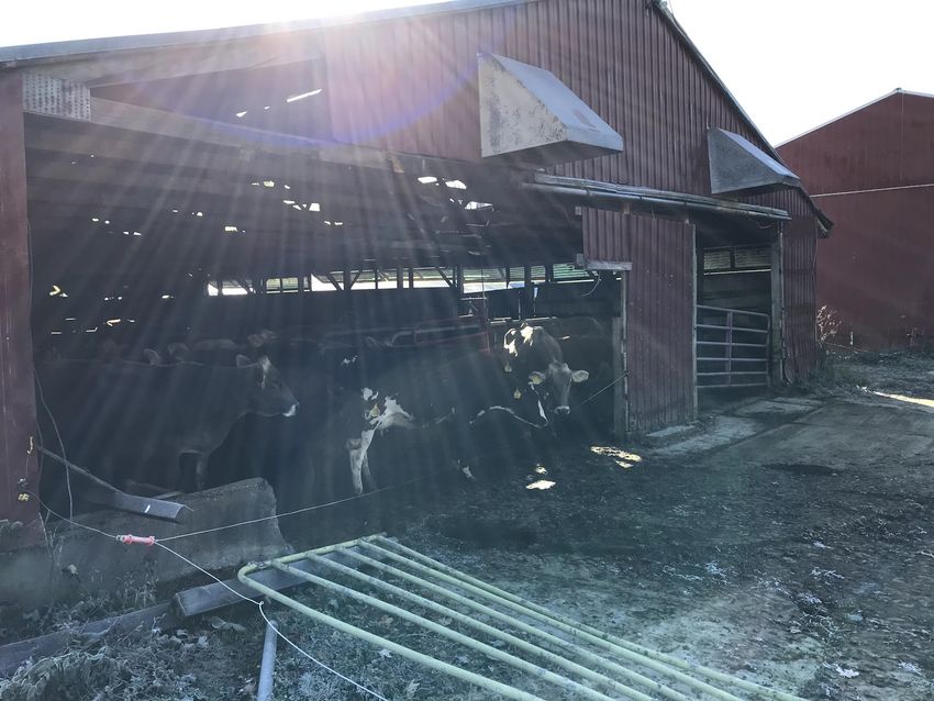
Introduction
       There is no place quite like Williamstown. Nestled within the heart of the Purple Valley,
salutary sunrises and sunsets have delighted residents and visitors alike for over 200 years. Since
its days under the stewardship of the Mohican people, the land has undergone significant
changes related to land use, particularly farmland. Currently, the town attracts those who seek to
trade the hustle and bustle of urban life for the tranquility of echoing woods and manicured
pastures. Visitors and seasonal residents come to appreciate the views, extensive hiking trails,
farm-to-table cuisine, and the charming rural-aesthetic that is maintained by local farms.
       Williamstown, however, is no longer the expansive agricultural hub it once was. Today,
only sixteen farms remain active in town, five of which are in danger of immediate loss. This is a
significant decline from the town’s peak of 138 farms in 1861 (Williamstown Historical
Museum). It is also a trend that is consistent with other New England towns which have seen
much of their agricultural land reclaimed by woods or lost to urban and residential development
use (“Farms Under Threat,” 2020).
       In Williamstown, the primary driver of farmland conversion to other land uses is large-lot
single family residential housing. This is also known as low density residential housing (LDR).
The onset of the COVID-19 pandemic has worried town planners of a possible increase in LDR
pressure that could expedite the loss of farms and farmland in Williamstown. While our research
generally found that many of Williamstown’s farmers are persevering and staunchly committed
to farming and the agricultural economy of the town, the economic reality is that many are
finding it harder than ever to make a living farming in the Berkshires.
       Over the fall semester of 2020, our team partnered with Andrew Groff, the town planner
for the Town of Williamstown, and David McGowan, the executive director of the Williamstown
Rural Lands Foundation (WRLF), to conduct an assessment of the contemporary threats to
farmland in Williamstown, Massachusetts. Our team interviewed each of the town’s sixteen
active farmers and developed a series of recommendations for how the Town of Williamstown
and WRLF can prioritize farmland preservation efforts in the near future. In this report we have
detailed our findings and recommendations as well as the evaluation criteria we utilized to
quantify the threat to each of the town’s farms.
       Although Williamstown has many tools at its disposal and good work is being done by
many of its residents, the town can and must do more to protect its farms. This report provides

                                                   6
new insight into how Williamstown should proceed with its efforts to preserve the land and keep
the town's strong agrarian tradition alive.
       We would like to thank our clients, David McGowan and Andrew Groff, our professor,
Sarah Gardner, all the farmers we interviewed, and the other townspeople and farming experts
we talked to related to this project. Our team learned a great deal along this journey, and we are
proud to present our work to the town and our clients.

A Brief History of Farming in Williamstown
       Williamstown has a complicated history. When the town was incorporated in 1765,
indigenous communities had already been inhabiting the region for at least 12,000 years. The
new settlers that came over the hills brought with them a slew of new agricultural practices and
economic forces that changed the local landscape. Throughout the 18th and 19th centuries,
extensive land clearing for subsistence agriculture resulted in the deforestation of as much as
80% of the landscape throughout Williamstown and New England in general (“Farms Under
Threat”). Deforestation for agriculture peaked around 1880, and since then Williamstown’s land
usage has been evolving and will continue to do so (Williamstown Historical Museum).
       Once renowned for its exemplary dairy industry, the Williamstown area has seen a
dramatic decline in the number—and size—of its active farms. In 1861, the town had as many as
138 active farms (Williamstown Historical Museum), and at points throughout the 19th and 20th
century, historical farms like Sweet Brook Farm and Haley Farm sprawled over as many as
2,800 and 800+ acres, respectively.
       Nowadays, plazas along Route 2 and condominiums and motels along Route 7 all stand
in places that used to contain sprawling pastures, erasing from memory the history on which
much of the town was formed. It is common practice for farmers to work day jobs just to keep
their farms afloat. Henry Art, professor emeritus of Williams College, sums up the primary issue
facing farms today, noting, “It’s ironic that a lot of land was kept open by an economic activity
that used to generate money. Now, it’s costing money to keep it in an open state” (iBerkshires,
2002). The rural landscape of Williamstown is the direct result of numerous generations of
farmers pouring their heart and soul into the soil, and its pastoral aesthetic continues to be
maintained by farmers today—mostly through haying.

                                                  7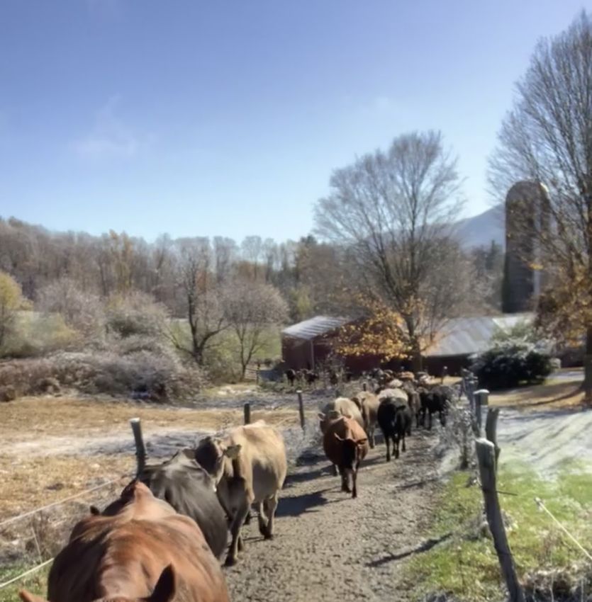
While the majority of Williamstown’s farmland has already been permanently lost,
ideally, farmland in the area will soon see a resurgence as organizations like the Williamstown
Rural Lands Foundation, MassWoods, the American Farmlands Trust, and others attempt to
support the goals outlined in “A New England Food Vision” (2011) and “Wildlands and
Woodlands: Farms and Communities” (2017). One of the primary ways these organizations are
working to realize this vision is by utilizing legal contracts to preserve the agricultural use of
farmland in perpetuity.

What is Farmland Conservation?
       As the tumultuous year of 2020 nears its close, one of the most profound themes that has
emerged in the last few months is resiliency. In the context of farmland, ensuring and supporting
the resiliency of local farms is paramount to supporting local food networks as well as
community vibrancy and historical values. Without protected land, the future of farming in
western Massachusetts is uncertain. In the five years between 2012 and 2017, Berkshire County
lost 52 of its 527 farms and over 3,000 acres of farmland to LDR development and other
pressures (USDA, 2017). In Massachusetts, the average principal farm operator is 59 years old
(USDA).
       As farmers enter retirement, these numbers indicate that the window for farmland
conservation is closing fast as many farms are losing their agricultural status. To stem the flow, it
is vital to add increasing amounts of protected agricultural land to preservation registries, so they
may be legally preserved for agricultural use for decades to come. Farmland conservation must
focus on both lands containing fertile/viable soils as well as lands with poorer soils but high use
values such as pasture or cropland because losing excessive farmland to development is not an
option. Instead, conservationists need to focus on finding a balance between conservation and
development that will sustain the economic and ecological vitality of the community in
Williamstown and the region generally.
       Unlike cows, we don’t have the luxury to ruminate on what the future will bring for
farming. We have already reached the point where we must think creatively and take agency by
utilizing any resources available to conserve farmland. Since farming in New England is an
increasingly immense (and unprofitable) financial burden for farmers, land conservation tools
attempt to alleviate some of the financial onus of farmland ownership. They achieve this by

                                                  8
compensating farmers for the difference between the market use value of their land and the
agricultural use value of their land. In Williamstown, there are four primary conservation tools
commonly used by WRLF and other organizations to preserve farmland:
       First, Conservation Restrictions (CRs) allow landowners (primarily private
landowners) to sell the development rights to their land in return for receiving a personal tax
credit for the difference between the appraised value of their non-residential land and its
enhanced value if developed. CRs can restrict land use in different ways including for
agricultural use, wildlife habitat, drinking water supply, or hiking trails. To ensure compliance, a
land trust or other organization is usually designated to monitor the property in perpetuity to
ensure that all the restrictions are being met. CRs are binding for future owners of the land, and
so long as the land itself remains in private ownership, it continues to generate taxes on the full
value of the residential part of the property and a reduced value on the CR-protected land. CRs
are able to do this because they serve effectively as charitable gifts which reduce overall income
tax for the farmer and reduce the owner’s property taxes due to the decreased market value of the
property.
       The second tool is an Agricultural Preservation Restriction (APR). An APR is a state-
managed land preservation agreement for active farmland. This is an agreement between the
landowner and the state. Providing farmland meets certain criteria, a farmer trades the
development rights of the property and commits to using their non-residential land for
agricultural purposes in perpetuity. In return, the landowner receives a one-time cash payment
from the state equal to the difference between the appraised value of the farmland and its
enhanced value if developed. The APR also binds future owners to agricultural businesses, and
the state assumes responsibility for monitoring and enforcement. A farm’s land is eligible for an
APR if it meets three basic criteria: 1) the farmland is greater than five acres, 2) it has been
actively devoted to agriculture for the past two years, and 3) it produces at least $500 (or $0.50
for each additional acre) in revenue annually. A number of other considerations also go into APR
eligibility. These include: soil quality (prime agricultural soils preferred), location, the degree of
threat to the land based on owner circumstances and financial situations, parcel size, and the
economic viability for future agricultural use. Due to these considerations, not all land that may
be eligible for an APR receives APR designation. Land that does not qualify can usually still
qualify for CRs or other conservation methods.

                                                  9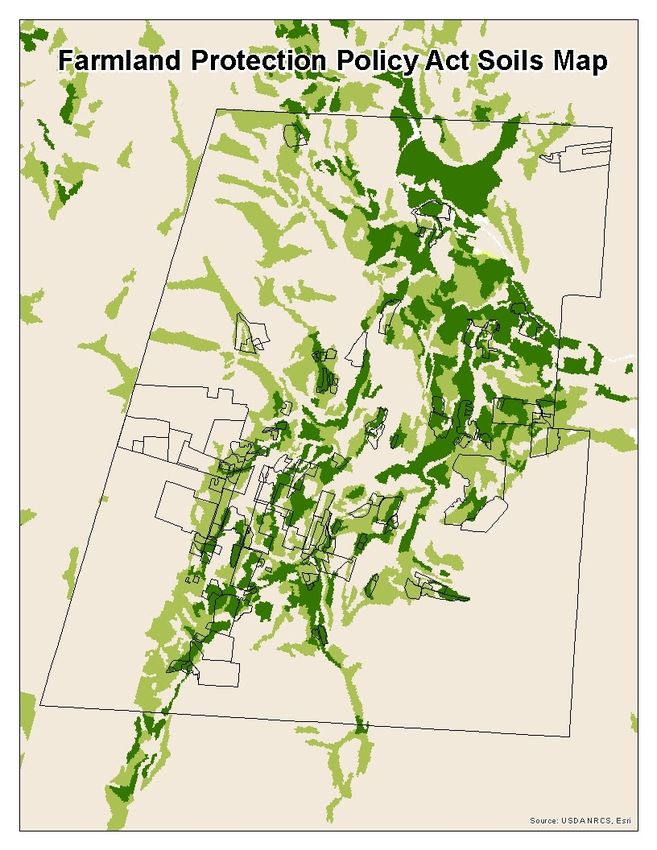
The third conservation tool is Chapter 61 of the Massachusetts Tax Code. Chapter 61
is a preferential tax program for land actively engaged in agricultural, forestry, or recreational
land use. Providing the land meets the state’s criteria, the landowner (farmer or private
landowner) enters into a deed restriction which commits the owner to conforming to the
specified land use and to providing annual evidence to the town that demonstrates the restrictions
are being met. So long as the landowner upholds the land use agreement, they are exempt or pay
reduced property taxes on the designated land. The specification for agricultural land use is
known as Ch. 61A. Unlike a CR or APR, Ch. 61 deed restrictions are revocable providing the
landowner pays five years of back taxes on the property when the land is withdrawn from the
program. Withdrawal of land from Ch. 61 makes it again eligible for development purposes.
Future landowners are not bound by Ch. 61 restrictions providing they pay the necessary back
taxes to withdraw the land from the program.
       The fourth tool to conserve farmland is a Gift or Purchase of Land with the WRLF or
an equivalent 501(c)(3) land trust. When lands are gifted to a land trust, the land use conditions
for the parcel are established by both parties at the time of transfer. These land use conditions are
binding in perpetuity. In exchange for gifted land, the landowner receives a personal tax credit
for the appraised value of the land and the land trust acquires management responsibility of the
property. In certain instances, a land trust may choose to purchase a property from the landowner
outright using a combination of its own, state, local, and other funds. When this happens, a
compensation rate is agreed upon and the land trust assumes management responsibility of the
property.
       In Williamstown, all four of these conservation tools are commonly used to preserve
farmland and open spaces. Our project focused on identifying farmland at risk of loss and
developing recommendations for how these tools can be leveraged to best conserve more
farmland in town. The next section of this report describes the Project’s Goals and Methodology
followed by its Evaluation Criteria, Key Findings, and Recommendations.

Project Goals
       Our research on Williamstown’s farmland consisted of four main goals. These goals were
clearly outlined by our project clients, David McGowan and Andrew Groff, and helped guide our
methodology and analysis. Our goals were as follows:

                                                 10
1. Identify land at risk of conversion from farmland to other purposes
2. Update parcel information of lands owned and leased by Williamstown farmers
3. Identify 4-5 priority farms for preservation efforts
4. Get a sense of farmer succession plans
Over the fall semester of 2020, our team set out to accomplish these goals with the
understanding that our findings would help identify contemporary threats to existing farmland
and help inform planning efforts to preserve the farming economy of Williamstown for the near
and long-term future.
Methodology
Background Research
First, we dove into research on farmland threats, agricultural preservation, and
development pressures. We started with a report by the American Farmland Trust (AFT), called
“Farms Under Threat New England,” which provided a solid understanding of the current state
of farmland, and what the future holds for farms across the region. While the AFT provided a
key background on a wide range of agricultural issues, “A New England Food Vision” (2011)
provided another, more local, food-based perspective on the matter. Importantly, we also wanted
to understand how to protect and preserve farmland into the future, as this was one of the goals
of our clients. We looked into literature on Agricultural Preservation Restrictions (APRs) which
are voluntary covenants that preserve farmland for future generations. We also looked into other
conservation restrictions, such as Conservation Restrictions and Ch. 61A, which both grant tax
breaks for farmers who utilize the program. Unlike CRs and APRs, farmers can remove their
farmland from Ch. 61A although they have to pay several years’ worth of back taxes as a result
of ending this contract. Finally, we looked at the 2013 “A Future for Farming” report, created by
Williams College students for the Environmental Planning Workshop course. This report serves
as a useful complementary tool to this report for conservation advocates like WRLF because it
identified among private property owners in Williamstown and North Adams those would
convert or lease some of their lands to agricultural use when provided with information on how
doing so could benefit them (“A Future of Farming,” 2013).
11Semi-structured Interviews/Farm Visits
Farmer outreach and in-person farm visits were the centerpiece of our project. As part of
farmer outreach, we acquired lists of farms, farmer names, and contact information from Sarah
Gardner and our project clients. We then drafted an introductory email, asked our clients to
review it, and sent it out to the sixteen active farmers in Williamstown. Within a few days, over
half a dozen farmers had responded to our email and reached out to set a meeting time. We
contacted farmers who did not respond by phone. Ultimately, we were able to interview
representatives from all sixteen farms including fourteen in-person visits, one Zoom call, and one
phone interview.
The in-person interview process consisted of farm visits to fourteen active farms and
stables in Williamstown. Each visit lasted between twenty and ninety minutes. To avoid asking
scripted questions, a semi-structured interview style was adopted for each visit. The goals for
each site visit were the following: 1) map out the farm property and other lands “leased”/farmed
by the farmer on a large map of Williamstown, 2) identify the primary land use of each piece of
land (hay, crop, vegetable, pasture, stable, etc.), 3) determine the ownership status of each piece
of farmed land, 4) identify which if any land parcels were designated as conserved via a CR,
APR, or otherwise, and 5) assess the general financial health of the farm and what—if any—
succession plans might be in place for the farm’s future. Most sessions were conducted by at
least two team members, but some sessions had all three team members present while others only
had one. During each meeting, notes were taken by hand and team members debriefed verbally
afterwards about the experience. In practice, most interviews consisted of conversations around a
large, printed map of Williamstown followed by a site tour and continued conversation.
Parcel mapping
Our clients were able to provide a number of ArcGIS related resources, including the web
address to the Williamstown property map, shapefiles of land parcels in Williamstown
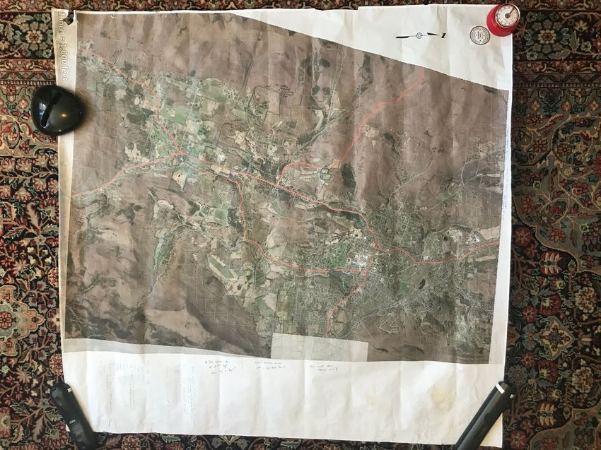
containing geospatial and property information, and a printed 3’ x 3.5’ town map that could be
marked up by the farmers during the interviews. A brief study of the property map and parcel
data gave us a good idea of what parcels we would be visiting or talking about during our
discussions with farmers. The property map also gave us an idea as to whether the farmer
themself owned the land or leased it from another landowner. Finally, the printed town map
12included land parcel outlines which proved extremely useful in our conversations with farmers as
it acted as a great talking point and provided farmers a way to physically draw out the properties
they owned/leased and label how they used the land.
Once the maps were marked up, we began to input this geospatial data into ArcMap. We
started by creating a series of new shapefiles to recreate each parcel that the farmer had marked
up. While several farmland parcels were within property boundaries, we wanted to stay true to
mapping only what was being actively farmed rather than the whole property lot. Once the
shapefiles were created, we added several categories to the attribute table in order to geospatially
show certain descriptors.
Map 1 in the Appendix shows all the lands actively farmed by the 16 farmers in
Williamstown.
One of the first attributes we created was land ownership. While some farmers owned
parts of the land they farmed, several also managed hay or produced crops on leased land.
“Leased” farmland can take many forms, but is most often a handshake agreement or
understanding between a farmer and landowner that allows the farmer to farm and maintain the
land for little to no cost. Since leased land comprises a large portion of the farmland in
Williamstown (52%), it was vital to understand where all these leased parcels were located since
the owners of these properties can decide independently of the farmer whether to place the land
into conservation protection or put it up for sale. To understand who land-owning players might
be in the future, and it was helpful to create a list of property owners who had farming activities
on their land. In ArcMap, farmland parcels that were owned by the farmer were marked with an
O, and those that were leased were marked with an L. We then wrote down the owner of each
specific farmland parcel, which can be used in the future to contact landowners who might be
selling their land.
Map 2 in the Appendix shows what farmland is under a lease agreement (either formal or
informal) versus what land is owned by the farmer. Map 3 in the Appendix shows what farmland
is owned by farmers themselves.
Next, we identified whether or not each farmland parcel was under a form of
conservation protection, or if there was a plan for that land in the future. We identified several
types of conservation, including APR, WRLF conservation, State Forest conservation, Ch. 61A,
FEMA flood zone protection, and others. While we found that several farmers (and landowners)
13were strongly anti-development and though this could be viewed as a temporary conservation
restriction, we decided not to list it as such.
Map 4 in the Appendix shows the conservation status of each individual parcel of land.
We also looked at farm size because lots less than five acres are not considered for either
APR or Ch. 61A. While it appears that there are several small lots that do not qualify for APR,
we decided to break up large chunks of farmland if they crossed parcel property lines. Even if
individual pieces make up a large field, we decided to split these if parcel ownership was
different despite being one consistent piece of farmland. Therefore, while these small plots may
not be considered for APR or Ch. 61A, they can still be considered for other conservation
restrictions, particularly if they make up a larger field when ignoring the property lines. Map 4
defines five unique types of conservation as such:
Map 4: Land Conservation Categories
APR Agricultural Preservation Restrictions only.
WRLF Land protected by WRLF only (includes lands owned by WRLF under APR and other
conservation restrictions).
Ch. 61 Includes Ch. 61 (forest land) and Ch. 61A (farmland protection).
Other Includes FEMA flood zone plane development restrictions, State Forest development
Conservation restrictions, town owned lands, state owned lands, and other assorted land trusts (Purple
Valley Partners, Mt. Hope Conservancy, Trustees of Reservation). Does not include any
land under APR or Ch. 61A.
None No conservation. While some farmers had a clear anti-development stance, we did not
consider that to be a conservation restriction.
Finally, we analyzed current agricultural land use and parcel soil status. This gave us
insight into the kinds of farming operations occurring in town and whether prime soils would be
lost if the farmer sold the land or the owner terminated the lease with the farmer.
14Map 5 in the Appendix shows the broadly defined land use/type of farming conducted on
each parcel. While there were multiple types of farming in Williamstown, we grouped all
agricultural practices into one of the six categories listed below:
Map 5: Land Use Categories
Crops Includes vegetables (pumpkin, tomatoes, leafy greens, cauliflower, broccoli, ginger,
peppers, butternut squash, etc.), corn and rye. Could be broadly defined as “human
food.”
Meadow/Pasture Includes all cover crop production (such as alfalfa, excluding rye) and all meadows, both
maintained and unmaintained.
Timber/Wood Includes all woodlots, whether harvested for timber or not. Includes woodlots that have
other agricultural purposes as well (such as animals roaming in woodlots). Does not
include sugaring or any sort of maple-related production.
Cows Includes any land that had cows, whether it be for dairy infrastructure, grazing, or a dual
use of grazing/hay. Includes land that is grazed on by multiple animals, including but not
limited to a mix of horses and cows.
Hay Any land that involves haying only (dual use lands are categorized elsewhere).
Special Any activity that did not fall into any of the above categories. Includes apple orchard,
berries, business lot, compost, horse boarding, (a former) llama barn, maple production,
and a USDA experimental field.
To map soil status for each parcel, we took soil data from the Farmland Protection Policy
Act (FPPA) soils map, updated August 2020 (Map 6). As a part of the Farm Bill of 1981, the
FPPA was designed to identify high quality soils as “Prime Farmland,” “Unique Farmland,” and
“Land of Statewide or Local Importance.” Using this data, we defined three farmland categories.
Map 7 in the Appendix shows the soil status of each farmland parcel with three soil
categories defined below. Map 8 in the Appendix shows the FPPA soils map from August 2020
with farmland parcels overlayed.
15Map 7: Soil Status Categories
Prime Farmland Little to no non-prime farmland (0 - 25% NPF)
Mixed Farmland Some non-prime farmland (25 - 75% NPF)
Non-Prime Farmland (NPF) Majority non-prime farmland (75% - 100% NPF)
Threats to Farmland Evaluations
To assess the overall and specific risks to farmland loss for individual farms, we
developed a Farmland Threat Evaluation Matrix (Matrix 1). This matrix details the acreage each
farm owns and leases and rates threat risks within six categories that could contribute to
farmland loss. Each farm is rated on six categories: Three of these are Land-Specific: i.e. Farm
Size, Soil Type, and Land Protection Status, and three are Operation-Specific: i.e. Succession
Plan, Business Model Adaptation, and Willingness to Consider APR/Conservation Restrictions.
These categories were chosen based on their ability to gauge the overall risk of farmland
conversion facing each farm. It should be emphasized that these six categories also only refer to
farmland owned by the farmers themselves and not land they lease.
Using the Threat Ratings Legend (Matrix 2), we developed color-coded ratings for all six
categories for each farm. A rating of 1 is green and considered the best. This rating generally
reflects land that is suitable for agriculture use and has been conserved in perpetuity through
APR or equivalent land conservation status. A yellow rating (usually a 2) is intended to identify
land that is worth keeping an eye on, but likely does not face imminent threat. This rating
encompasses a wide range and may include lands with mixed soil quality, some historical
business model adaptation, and mixed conservation status. A red or burgundy rating (usually 3 or
4) indicates a high level of threat which may present immediate concern, but not always.
By horizontally summing the category ratings for each row in the, Matrix 1, the Threat
Evaluation Matrix, we were able to produce a Raw Threat Score. This Raw Threat Score
provides a general indication of the overall risk to farmland for each farm. The lowest Raw
Threat Score is a 6, while the highest score is a 19. This means that farms with high scores
operate farmland that is more at risk than farms with low scores.
16We found that out of sixteen active farms and a maximum Raw Threat Score of 19, seven
farms earned a score between 15 and 19, and five earned a score between 10 and 14. Four farms
earned a score between 6 and 9. While these results could be interpreted with alarm, it is
important to note that the Raw Threat Scores are only one interpretation of threat level. The kind
of “immediate” threat to farmland loss may vary depending on the farm. As a result, individual
Raw Threat Scores should be interpreted with caution and readers should also understand that
this is only one metric that attempts to provide a general temperature check but does not account
for the full story behind the threat to a farm’s land.
To allow for more nuanced interpretation of the Threat Evaluation Matrix, the online
version of the matrix allows users to sort farms based on individual categories such as Soil Type,
Land Protection Status, or Succession Plan. Categorical rankings can be particularly useful to
singularly evaluate important questions such as: which farms lack succession plans and which
farms have land with no protection status?
While these matrices alone can provide a significant amount of information about the risk
to farmland in Williamstown, they do not tell the whole story. For instance, a farm with prime
soils but no land protection might receive a lower Raw Threat Score than it should whereas a
farm with non-prime soils and no Business Model Adaptation in over 20 years might receive a
higher Raw Threat Score than it should due to the type of farming it conducts which might
render these categories less important. Since any evaluation criteria requires tradeoffs, to provide
greater insight on farm-specific nuances, we have included detailed summaries about our key
learnings about each farm in our evaluation.
17Matrix 1. Farmland Threat Evaluation Matrix organized alphabetically by farm name. A Raw Threat
Score of 6 is the lowest level of threat to farmland loss. A Raw Threat Score of 19 is the highest rating
and indicates immediate threat of farmland loss.
18Matrix 2. Farmland Threat Ratings Legend. This legend explains the Threat Level point values included
in the Threat Evaluation Matrix. A higher Threat Level rating indicates a greater risk of farmland loss.
19Farm Summaries
In Williamstown, there are currently sixteen active farms. Our team was fortunate to visit
or make contact with all sixteen of these farms. To provide more insight into the Farmland
Threat Evaluation Matrix described above, we have compiled key learnings and takeaways for
each of these farms. These farm summaries include: the farm’s Raw Threat Score, a map of the
lands they farm (owned and leased), a summary of their land usage, a brief discussion of the
major threats facing the farm, and a short recommendation for how the Town of Williamstown
and Williamstown Rural Lands can foster relationships with each farm. This information can be
used to understand the unique challenges facing each farm as well as inform future farmland
conservation policy and priorities in Williamstown.
Farm A, Raw Threat Score: 14
Despite the name, Farm A actually Farm A
has a surprisingly small footprint. Operated
by a young farmer, Brian Cole, Farm A is a
one-acre vegetable operation that leases land
from Farm O. In 2018, Mr. Cole started the
farm and signed a five-year lease agreement
with the Phelps family. Now in year three,
the farm has seen success and earned a good
reputation, but barely brings in enough
money to support Mr. Cole. If things
continue the way they have, Mr. Cole will
likely not renew the lease agreement at the
end of its term.
The land on which Mr. Cole operates
has good soils which allows him to grow a
variety of vegetables that take full advantage of the available space. Mr. Cole likes to say that he
“grows a bit of everything” including lettuce, ginger, tomatoes, spinach, all kinds of vegetables,
and the occasional “mystery” vegetable. Normally, about 75% of the farm’s sales come from the
Williamstown Farmers Market and the remaining 20-25% from agreements with local
20restaurants. Due to COVID-19, Mr. Cole has been forced to adapt and has turned most of the
farm into a CSA (Community Supported Agriculture) where town residents buy shares of
produce which Mr. Cole packages up for them each week and personally distributes in town.
Although these business models work for Farm A, they require a lot of effort and barely bring in
enough money to support Mr. Cole. For now, Farm A is able to remain operational because Mr.
Cole enjoys the lifestyle and does not have to worry about supporting a family or high lifestyle
costs. He admits, however, that he does not foresee a long-term future for the farm.
In terms of production methods, Mr. Cole is committed to organic farming practices but
admits this can lead to 20% loss in crop yields. Without Federal, State, and National Resource
Conservation Service (NRCS) subsidies and grants, the farm would not be able to continue.
These monies have helped fund irrigation and greenhouse investments on the farm. Today, Farm
A has two hand-made greenhouses which help expand the variety of crops the farm produces and
extends the growing season for some temperature-sensitive crops.
As a young farmer, Mr. Cole has learned that farmland—even leasable land—is very
inaccessible unless one inherits it from their family. Ironically, he has observed that interest in
farming within farming families often seems to skip a generation. Mr. Cole has also observed
that in order to succeed as a modern farmer, a good education is also necessary. Even the
smartest young farmers, however, still face high startup costs, small marginal returns, and equity
issues that make entering the industry very difficult. APR protected lands can help lower some of
these costs and make life easier for new farmers, but that does not mean their life will be easy.
For now, Mr. Cole is committed to seeing Farm A through until the end of his lease agreement,
but he is uncertain about what he might do afterwards. One potential option may be to partner
with another farmer in growing cannabis or another crop, but it is unclear what the future might
hold.
Farm A receives a Raw Threat Score of 14 and is in imminent danger of loss, but due to
its size and lease status, this is not a farm that should receive priority preservation attention. That
said, Mr. Cole could be a farmer who might be interested in partnering with an existing farm in
the near future or taking over a larger farm in a few years if the opportunity arose. Ensuring Mr.
Cole remains an active farmer in Williamstown could go a long way in supporting an agricultural
future for the town. (Source: Brian Cole, Oct. 24, 2020)
21Farm B, Raw Threat Score: 7
Farm B
Farm B is a small but bustling
operation located on 34 acres abutting
Hancock Rd. in southwestern Williamstown.
The farm is primarily a vegetable farm but
has a diverse portfolio of smaller operations
including chickens (100), apple orchards (1
acre), and pigs (~5). The 40+ varieties of
vegetable crops benefit from prime
agricultural soils and the Zasada family
which manages the farm takes care to rotate
crops when necessary and practice organic
farming methods and large-scale
composting.
The business model for the Farm B
is unique because it is the only farm in
Williamstown completely supported by Community Supported Agriculture (CSA) shares. Farm
B’s CSA first started in 1991 and the farm now runs two CSA seasons: spring and winter. Farm
B benefits from over 85% retention rate year-after-year. One of the reasons the farm benefits
from high retention rates is because it makes a substantial effort to make the farm a welcoming
place for families to bring their kids and enjoy picking crops themselves, seeing the animals, or
attending cooking/gardening workshops or other fun events hosted by the farm. Earlier this year,
a young boy who visits the farm regularly expressed interest in teaching a frog catching class at
one of the farm’s ponds. The owners of Farm B supported his idea and made the event happen
and the frog catching became a muddy success!
One of the things that helps the farm keep its energy up is its apprenticeship program.
Every year, the Zasadas train 2-3 agriculture apprentices in all things farming-related. Each
apprentice stays with the farm for two years and this ensures the farm is always maintained by
smart, fresh talent.
Today the farmland at Farm B is entirely protected by APR and is owned by the
Williamstown Rural Lands Foundation. This land is leased to the Zasada family for 99 years
22which ensures its sustainability. Although the family lease the farmland, they own the house and
this creates a model that works well for the family, WRLF, and the town’s agricultural economy.
Prior to being placed into APR and purchased by WRLF, the farm had operated as a family-run
dairy farm for 150 years. The Zasada family moved to the property in the early 2000s and have
been growing the farm’s community engagement ever since.
Ultimately, Farm B is a model farm that is making the most of opportunities available to
it. If farms in Massachusetts are to continue operating, it seems that more will need to adopt the
community-first and value-added ethos embodied by Farm B. While an abundance of
community-centered farms could lead to oversaturation and market competition, it seems that
this is the direction small-scale farming in Massachusetts is headed (“MA Local Food Action
Plan,” 2015). This type of farming could also have many positive externalities and help restore
the importance of local food production to regional food networks.
Farm B receives a Raw Threat Score of 6 out of 19 which is a perfect score. This farm is
not in danger of farmland loss. (Source: Don Zasada, Oct. 26, 2020)
Farm C, Raw Threat Score: 15
Farm C
Located in the eastern-most corner of
town, the Chenail brothers manage the
second largest remaining dairy farm
operation in Williamstown, MA. Their herd
consists of 170 cows, half of which are
milked at any given time, the other half are
kept as “rotator” cows. Today, the Chenail
brothers officially own only about 15 acres
of crop and pasture fields immediately
surrounding their property, but they lease
over 270 acres of farmland for grazing, corn
harvesting, and hay. The majority of this
leased land is owned by the Town of
Williamstown, including The Spruces which
23was transformed from a trailer park into park/farmland in 2011. The remaining 58 acres of leased
land is owned by Williamstown resident Herb Allen who has a close relationship with the
Chenail Brothers and who bought the land from them with the understanding that the Chenails
would continue to farm the land.
In 1913, the grandfather of the Chenail brothers bought the farm which has now been
passed down through three generations. The farm has used town-owned land for over seventy
years and has built a self-sustaining dairy operation that does not make much money but
continues to operate. As dairy farmers, the Chenails belong to a milk co-op that sells their milk
on the commodity market. This means that the prices the farm receives for its milk are low and
the farm is sometimes told to dump excess milk so that supply can be regulated. With the decline
of small-scale dairy operations throughout New England in recent decades, the Chenails now
compete against large-scale dairy operations (500+ cows) in New York and Pennsylvania. These
operations are backed by big banks that force the farmers to continually increase their scale and
production and decrease their costs. To achieve low costs, the Chenails note that many of these
large farms employ primarily migrant laborers which keeps prices low and hurts smaller
operations like the Chenails.
With the onset of COVID-19, the dairy industry nationwide suffered massively as
restaurant and school demand (which account for over 30% of the market) evaporated. This
forced many farmers including the Chenail’s to dump thousands of gallons of milk and take
government subsidies just to stay afloat. Even as demand has returned, the Chenail’s admit they
are still in “survival mode” and they have been forced to limit production by 15%.
In terms of land use, the fifteen acres owned by the Chenails is primarily used for corn
and some vegetable production including pumpkins. The property has a small farm stand along
Luce Rd. open to the public which operates on the honor system. The land owned by the
Chenails benefits from Ch. 61A tax exemptions but has no other conservation status. The
brothers are hard workers who care a lot about their farm and their animals, but this keeps them
very busy, so land conservation is not high on their priority list. That said, the brothers are
middle aged and do not seem to indicate plans of slowing down, so it is unlikely their lands face
development risk at this time. That said, the farm did go out of business briefly in the early 2000s
but came back. As noted before, a significant portion of the land the farm leases is now owned
by Herb Allen which means its future is tied to whatever Herb Allen decides. For now, Mr. Allen
24seems content for things to continue the way they are, but the status of the land becomes more
concerning if Herb Allen were to move on or sell his land without designating the land for
conservation. The remaining lands the brothers lease are all town-owned, therefore their fate is
tied to whatever the town decides to do with these lands. (Source: Wally Chanail, Oct. 28, 2020)
Farm D, Raw Threat Score: 17 Farm D
Farm D is a small and private
operation. Nestled into the land at the end of
a long and winding driveway, anyone would
be caught off guard to see that the farm is
right in the middle of Williamstown. A host
of farm animals reside at the farm, perking
up at the sign of visitors. You’re likely to
run into a baying beagle when you get out
of your car. Luckily, Ms. Henderson is there
to shut off the natural alarm.
The farm used to operate as a 500-
acre dairy farm but over time the land has
been sold off to the town. The original barn
burned down in the 1940s and was replaced
by the current horse barn. Since then, it has been functioning as an equine facility and boarding
stable with room for 20+. Ms. Henderson states that she is downsizing the number of available
spots in her stable as she approaches her retirement. The upkeep of her facility is labor intensive
and it falls on her shoulders to get things done around the farm. Since a smaller operation makes
her day-to-day activities more manageable, she now limits the space to a handful of horses. The
majority of these horses are rescues. Currently, her operation primarily functions as a sanctuary
to various animals including horses, goats, chickens, ducks, dogs, and birds therefore it is
difficult for it to turn a profit.
Interestingly, in 2000 Ms. Henderson built a large post-and-beam home on her property.
The large house, along with a small guest house, are used to advertise another venture at the
25farm—a pet friendly country inn. Guests pay for lodging at the inn where they can enjoy a taste
of farm life and also visit the surrounding area. These additions provide Ms. Henderson with an
alternative source of income.
Ms. Henderson owns the 50 acres that make up her property. The majority of the land
does not have any conservation status, except for a small slice that abuts the Williamstown
cemetery. In terms of land use, the property is parceled into various pastures for the horses. The
property’s fields are hayed and used as feed for the horses. A stretch of woods is also found on
the property. The woods are not used for anything aside from recreational mixed-use trails. Ms.
Henderson states that town residents are often found hiking through the back sections of her
property,
The future longevity of Farm D is uncertain. Ms. Henderson does not have a succession
plan in place and no one is lined up to take over operations of the farm once she retires. Instead,
solar and golf businesses have approached her to express interest in the land. She says that,
ideally, someone would step up to continue her farm work and maintain the land.
Possible future alternative revenue sources include: growing berries on a small patch of
fertile soil, providing hayrides during the fall, and more horse boarding. While possible, these
ventures will most likely not come to fruition. Ms. Henderson states that, “The less we do, the
less we have to deal with the town.” As previously mentioned, Ms. Henderson is also not trying
to actively grow her business; on the contrary, she has been slowly downsizing and will continue
to do so, most likely until the farm gets sold off to the right buyer.
For these reasons, Farm D received a Raw Threat Score of 17 out of 19. This farmland is
in danger of being lost to residential development, but an opportunity may exist to facilitate a
farmer-match program to find someone willing to take over operations after Ms. Henderson
retires. (Source: Carolyn Henderson, Oct. 31, 2020)
26Farm E, Raw Threat Score: 9
Farm E
Farm E is a 460 acre farm off
Oblong Rd. that specializes in dairy and
beef products. Renowned for its delicious
meats and cheeses, Farm E is a 35-40 cow
operation, some of which are heifers for
milk, as well as a number of beef cows.
Tober Sabot and his family, who own and
operate most of the farm, also have pigs,
maintain and log the forest on their
property, and hay other parcels in town for
grazing and bedding for their animals. The
Sabots do not produce milk for the
commodity market—instead, they have
opted to add value into their product by
converting it into cheese. Farm E also has a
farm store, which houses their products as well as other local and artisan items.
The Sabots purchased the land in 2002 from the Phelps Family, who had put several
parcels of the farm into APR. The Sabots have since put several other parcels into Conservation
Restriction, part of which is managed by the WRLF. Having several parcels in CR has the added
bonus of increased access to grazing fields, which is incredibly important to maintaining his
herd. Beyond CRs, the Sabots have also worked with the state on a number of farmland grants,
ranging from temporary CRs to management plans. The most recent covenant that part of the
farm has been put under is the Farm Viability (Enhancement) Program (FVEP), which offers
farmland grants in exchange for agricultural protection for a maximum of fifteen years. Farmers
can opt to put land into FVEP twice. In the case of Farm E, the Sabots are on their second of two
FVEP terms, each lasting ten years.
While the FVEP program effectively conserves farmland, the protection is ultimately
short-lived. FVEP can protect land for up to thirty years with two fifteen-year grants. Mr. Sabot
mentioned that he could in theory develop the plots that are currently in FVEP but did not seem
27overly interested in that. He did, however, mention that he’s been in conversation with David
McGowan of WRLF, as he feels the land ought to be preserved for farmland in the future. One of
his plots is currently under no restriction, and his family has been considering putting a house on
that lot, which would still allow it to be conserved in APR.
Near the end of our visit, Mr. Sabot expressed desire for an easier way to identify private
landowners in town who might be willing to lease their land for grazing or haying purposes.
Although no database or network like this currently exists, a 2013 study by Williams students in
the Environmental Planning Workshop class found that many landowners in Williamstown and
North Adams were open to the idea of leasing their land for agricultural purposes once they were
informed about the tax breaks and other benefits this could bring (“A Future of Farming”).
Future farmland conservation efforts may want to consider reaching out to landowners identified
in the 2013 study to see if they would be willing to lease their lands to existing farmers.
Overall, Farm E is a stable operation, with young farmers who are eager to build the
business. Their ability to create and market unique products has enabled them to stand out from
the rest of the town’s dairy crowd. Farm E is also very open to visitors, mainly in the form of
their farm store, but their connection to Williamstown has helped make their farm a household
name. Farm E receives a Raw Threat Score of 9 out of 19 which is only three points above a
perfect score 6. This farm is not in danger of farmland loss. (Source: Topher Sabot, Oct. 31,
2020)
Farm F, Raw Threat Score: 11
Farm F is a nearly 100-acre farm near the Hoosic River in the northern part of
Williamstown. While the DeMayo’s are known throughout town for their horse boarding and
riding school, they also have a number of Scottish Highland cows, goats, and chickens. The
chickens provide eggs, and every so often Lisa DeMayo, the owner and manager of the farm,
sells off one of her cows for beef. However, the cows are much more useful to the farm as land
clearers: they trample and graze on otherwise pesky plants, which allows the horses to roam
freely throughout the property.
Ms. DeMayo’s most important operation is horse boarding and riding. The farm offers
riding lessons, summer programs, pony rides, and competitive riding. The Williams College
28Equestrian team also uses her space because
Farm F
it is an adequate size for competitive riding.
Ms. DeMayo noted she had a few dozen
horses boarded and/or ridden at the farm
before COVID-19, and although that
number has dropped since, people have
been “in the market” for horses as a
quarantine activity. She did, however, have
to cut her number of cows in half.
The Farm F is on a few hilly
parcels, some forested, some clear. The
cleared parts can be used by the grazing
animals, but the forest is so dense that Ms.
DeMayo has no way of using it. She did
note that a recent storm blew over several
old trees in the forests, and this has allowed
her farmhands to begin clearing the land for horse trails. Ms. DeMayo hopes to create a number
of trails in the future to expand where her riders can go on the property.
By nature of being located so close to the Hoosic River, the DeMayos run the risk of
flooding and have been deemed a FEMA floodplain. This effectively functions as a conservation
restriction as the floodplain designation prevents the land from being developed. Lisa DeMayo
noted that when Hurricane Irene swept through town, it managed to erode a significant portion of
her river and stream banks including parts of a fence that prevents the horses from wandering
off. The Galusha’s, who are related to the DeMayo’s, built a mound to prevent more land from
flooding in the future.
While the river and stream are two watery threats, the farmland faces another. Because
the soil is soggy, the DeMayo’s have experienced landslides before; some more significant than
others, but all disruptive in nature. Ms. DeMayo did not mention any direct losses caused by the
more recent large landslide, she did mention that as long as her family has owned the property,
the land has been marshy. This makes it unsuitable for crops, but also development. As a result,
the marsh also functionally helps conserve the farmland on the property.
29You can also read