Tsunami Resilience on the Oregon Coast - OSSPAC Publication 21-01 January 12, 2021 - Oregon.gov
←
→
Page content transcription
If your browser does not render page correctly, please read the page content below
Tsunami Resilience
     on the Oregon Coast
     OSSPAC Publication 21-01
     January 12, 2021

For: THE STATE OF OREGON
     Mike Harryman, State Resilience Officer   Tsunami Resilience on the Oregon Coast • January 12, 2021   1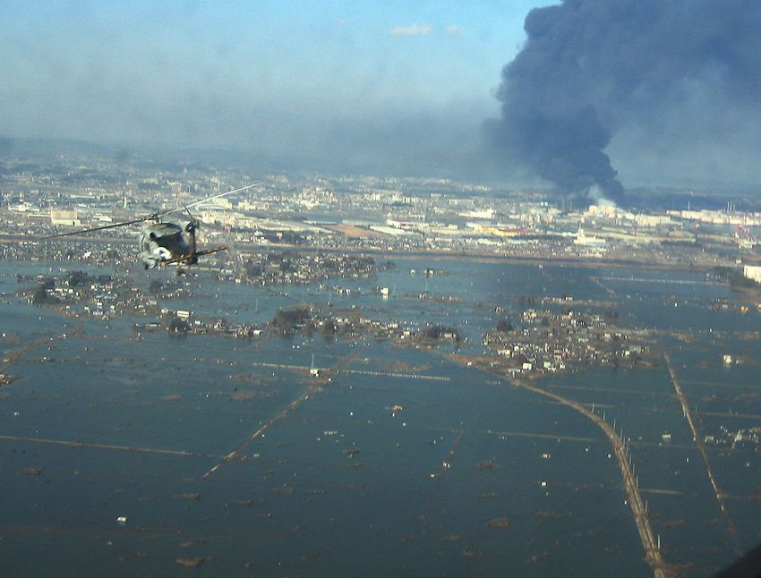
2020 OSSPAC Members:

                                                                                             Jeffrey Soulages
                                                                                             Chair, Public Member

                                                                                             Tiffany Brown
    Oregon Seismic Safety Policy Advisory Commission                                         Vice-Chair, Local Government Stakeholder

    After the Loma Prieta earthquake in 1989, Oregon residents                               Matt Crall
    demanded that the State of Oregon better address earthquake                              Department of Land Conservation & Development

    hazards throughout the state. The state legislature established                          David Gomberg
    the Oregon Seismic Safety Policy Advisory Commission (OSSPAC)                            Representative, Legislative Assembly

    in 1991 through Senate Bill 96. The Commission is a group of                             Dacia Grayber
    eighteen individuals appointed by the Governor. They represent a                         First Responder Stakeholder

    variety of interests regarding public policy and earthquakes and                         Bob Houston
                                                                                             Department of Geology and Mineral Industries
    include representatives of many state agencies, a member each
    from the Oregon House and Senate, representatives of important                           Joe Karney
                                                                                             Utilities Stakeholder
    stakeholder groups, and members of the public. The OSSPAC
    mission is to positively influence decisions and policies regarding                      Christina LeClerc
                                                                                             Oregon Department of Transportation
    pre-disaster mitigation of earthquake and tsunami hazards;
    increase public understanding of hazard, risk, exposure and                              Ed MacMullan
                                                                                             Banking Stakeholder
    vulnerability through education; and be responsive to new studies
    or issues raised around earthquakes and tsunamis.                                        Bonnie Magura
                                                                                             Schools Stakeholder

                                                                                             Walter McMonies
                                                                                             Multifamily Housing Stakeholder

                                                                                             Trent Nagele
                                                                                             Structural Engineer Stakeholder
    Copyright 2021 by the Oregon Seismic Safety Policy Advisory Commission of the State
    of Oregon. Excerpts from this report, except materials copyrighted by others, may be     Adam Pushkas
    reproduced for non-commercial use with attribution to the Oregon Seismic Safety Policy   Building Owners Stakeholder
    Advisory Commission.                                                                     Althea Rizzo
                                                                                             Oregon Office of Emergency Management
    Printed in the United States of America
                                                                                             Arnie Roblan
                                                                                             Senator, Legislative Assembly
    IBSN #
                                                                                             Susan Romanski
                                                                                             Public Member
    OSSPAC Publication Number 21-01
                                                                                             Aeron Teverbaugh
                                                                                             Department of Consumer and Business Services

                                                                                             Katie Young
                                                                                             Public Member

    Production Assistant: Deb Schueller

2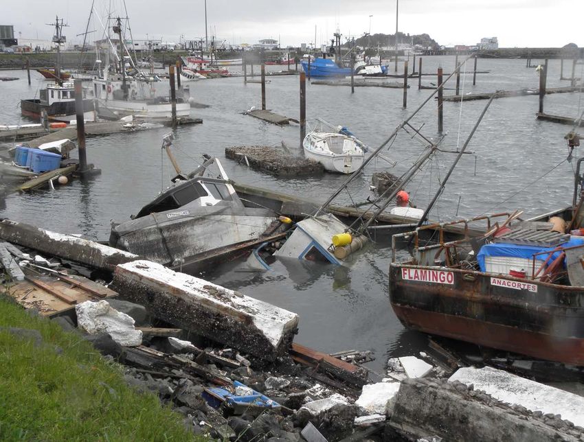
contents
preface.  .  .  .  .  .  .  .  .  .  .  .  .  .  .  .  .  .  .  .  .  .  .  .  .  .  .  .  .  .  .  .  .  .  .  .  .  .  .  .  .  .  .  .  .  .  .  .  .  .  .  .  .  .  .  .  .  .  .  .  .  .  .  .  .  .  .  .  .  .  . ii
executive summary.  .  .  .  .  .  .  .  .  .  .  .  .  .  .  .  .  .  .  .  .  .  .  .  .  .  .  .  .  .  .  .  .  .  .  .  .  .  .  .  .  .  .  .  .  .  .  .  .  .  .  .  .  .  .  .  .  .  .  .  . iv
chapter one
Early Efforts to Address Tsunami Risk on the Oregon Coast .  .  .  .  .  .  .  .  .  .  .  .  .  .  .  .  .  .  .  .  .  .  .  .  .  .  .  .  . 1

chapter two
Recent Developments and Setbacks. .  .  .  .  .  .  .  .  .  .  .  .  .  .  .  .  .  .  .  .  .  .  .  .  .  .  .  .  .  .  .  .  .  .  .  .  .  .  .  .  .  .  .  .  .  .  . 9

chapter three
Making the Coast More Resilient to Tsunamis .  .  .  .  .  .  .  .  .  .  .  .  .  .  .  .  .  .  .  .  .  .  .  .  .  .  .  .  .  .  .  .  .  .  .  .  .  .  . 15

chapter four
The Future of a Resilient Coast . .  .  .  .  .  .  .  .  .  .  .  .  .  .  .  .  .  .  .  .  .  .  .  .  .  .  .  .  .  .  .  .  .  .  .  .  .  .  .  .  .  .  .  .  .  .  .  .  .  . 25

references .  .  .  .  .  .  .  .  .  .  .  .  .  .  .  .  .  .  .  .  .  .  .  .  .  .  .  .  .  .  .  .  .  .  .  .  .  .  .  .  .  .  .  .  .  .  .  .  .  .  .  .  .  .  .  .  .  .  .  .  .  .  .  .  .  .  . 27
appendix a
List of Stakeholders .  .  .  .  .  .  .  .  .  .  .  .  .  .  .  .  .  .  .  .  .  .  .  .  .  .  .  .  .  .  .  .  .  .  .  .  .  .  .  .  .  .  .  .  .  .  .  .  .  .  .  .  .  .  .  .  .  .  .  . A1

appendix b
Glossary of Terms.  .  .  .  .  .  .  .  .  .  .  .  .  .  .  .  .  .  .  .  .  .  .  .  .  .  .  .  .  .  .  .  .  .  .  .  .  .  .  .  .  .  .  .  .  .  .  .  .  .  .  .  .  .  .  .  .  .  .  .  .  . B1

 Prepared by:
 OREGON SEISMIC SAFETY POLICY ADVISORY COMMISSION
 Tsunami Resilience Working Group

                                                                                                                                        Tsunami Resilience on the Oregon Coast • January 12, 2021                               i
preface
     In 2019, the Oregon legislature passed HB3309 and Governor Brown signed it into law. The main impact
     of this legislation was to remove the moratorium established 25 years ago through SB379 on constructing
     critical buildings on the Oregon coast within the tsunami inundation zone. This change in policy caught
     many in the emergency management and resilience community by surprise, including those of us serving
     on the Oregon Seismic Policy Advisory Safety Commission (OSSPAC).

     The purpose of this report is to review the history of the original SB379 legislation, study the work done by
     state agencies in assisting coastal communities with tsunami planning, explore recent changes in codes
     and standards, and recommend a way forward to assure the tsunami safety and resilience of our coastal
     communities.

ii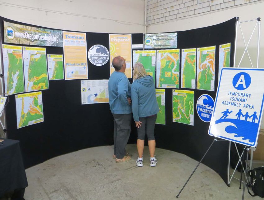
Throughout this report, the term “Cascadia event” is used to represent the Cascadia Subduction Zone
earthquake and resulting tsunami. “Tsunami Hazard Overlay Zone” refers to local land use planning
regulations that restrict certain uses and require other safety measures within tsunami inundation zones.

In gathering input for this report, the Tsunami Working Group of OSSPAC consulted with the State
Resilience Officer and engaged other state and local government officials. OSSPAC heard testimony from
representatives of non-governmental engineering organizations, code committees, representatives of
coastal stakeholders, and members of the public. Included in Appendix A is a list of the testimony received
from stakeholders.

OSSPAC received support from the Department of Consumer and Business Services (DCBS), especially
the Division of Financial Regulation and the Department of Land Conservation and Development (DLCD).
OSSPAC gratefully acknowledges the financial support of the Department of Consumer and Business
Services, Oregon Department of Geology and Mineral Industry (DOGAMI), and the Office of Emergency
Management (OEM).

          i
Jeffrey Soulages                                          Tiffany Brown
OSSPAC Chair                                              OSSPAC Vice-Chair

                                                 Tsunami Resilience on the Oregon Coast • January 12, 2021    iii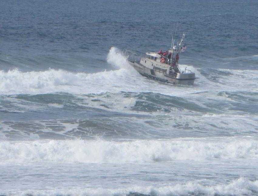
executive summary
     In 2020, the Oregon Seismic Safety Policy Advisory Commission (OSSPAC) voted to form a working group
     to investigate ways to address the tsunami safety and resilience of Oregon’s coastal communities. This was
     in reaction to the Oregon Legislature passing HB3309 in 2019, which removed the moratorium established
     25 years ago on constructing critical buildings on the Oregon coast within the tsunami inundation zone.
     Through workgroup meetings and stakeholder testimony, OSSPAC investigated the work done by state
     agencies in aiding coastal communities with tsunami planning, as well as recent changes in building codes
     and standards. The commission’s major recommendations are as follows:

iv
Recommendations

A. Support and strengthen the use of tsunami overlay zones and evacuation planning by coastal
   communities in Oregon. The first step to ensuring that coastal communities thrive after a major
   earthquake is to encourage good land use and evacuation planning. This allows each community
   to determine for itself what functions are most important, as well as their own level of acceptable
   risk. Support communities in their efforts to establish Tsunami Hazard Overlay Zones. Encourage
   the Oregon Department of Land Conservation and Development (DLCD) to continue to assist these
   communities and support critical projects like future revisions of the Tsunami Land Use Guide.
   Provide adequate funding to DLCD to support this mission in the form of $250K per biennium for
   grants directly to communities and a limited duration FTE for providing direct consulting to coastal
   communities. Work with DLCD, DOGAMI, and OEM to establish robust tsunami evacuation and
   wayfinding routes. Continue to support coastal community efforts to hold annual tsunami drills to
   improve evacuation wayfinding.

B. Continue to improve tsunami maps for use on the Oregon Coast. Maps and models are the data that
   inform land use planning, evacuation routes, and structural design. Different maps are required for
   different purposes. Support mapping efforts to give Oregon the best data on which to base decisions
   about the future. This includes worst-case maps used for evacuation, other maps for land use
   planning, and maps for structural design that are compatible with those used to design other hazards.
   Support DOGAMI’s efforts to develop updated maps for structural design using high-resolution for the
   best detail of the Oregon coast. The effort should incorporate the latest research in tsunami source
   characterization and be based on the consensus of experts throughout the nation. These maps should
   follow the procedures of ASCE 7-16 including surface roughness and nonlinear factors and should be
   consistent with earthquake inputs to the national earthquake hazard maps of USGS.

C. Establish state-wide structural load standards for designing critical buildings in the tsunami zone
   and vertical evacuation shelters. While land use planning will address many critical structures, it
   won’t catch them all. Not all coastal communities have a tsunami hazard overlay yet, and even those
   that do will have certain structures like fire stations that need to be located within the inundation
   zone in order to meet critical every day response needs. For those situations, a technically based,
   state-of-the art national consensus procedure for safely designing structures to survive in the tsunami
   inundation zone is required, and it needs to be applied consistently throughout the entire state. Adopt
   ASCE 7-16, including the entirety of Chapter 6 and the tsunami design geodatabase for the design of

                                                 Tsunami Resilience on the Oregon Coast • January 12, 2021   v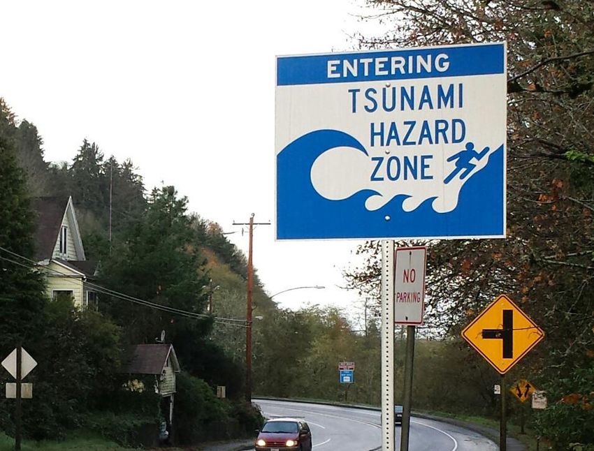
all Risk Category III and IV structures within the Tsunami Design Zone in the State of Oregon. Re-align
         the remaining portions of ORS 455.446 and 455.447 with this direction.

     D. Assist local communities with moving existing critical facilities out of the tsunami inundation zone.
        Making sure that new critical facilities are either out of the inundation zone or built to survive the
        tsunami’s effects is vital and will, over time, provide communities with resilient facilities. However,
        there are many existing hospitals, schools, and fire and police stations within the inundation zone along
        the coast that are not addressed by land use planning or modern building codes. Some communities
        have tried for years to move these facilities out of harm’s way; most do not have the resources to make
        it a reality. Develop a competitive grant program similar to but separate from the Seismic Rehabilitation
        Grant Program (SRGP) that can be used to replace critical existing public buildings and relocate them
        out of the inundation zone. Direct Business Oregon to administer and run the program, building upon
        their leadership of the SRGP. Pass legislation to authorize the issuance of bonds to provide the funding
        mechanism for the grants. Direct bond resources to fund the grants on a biannual basis with a goal
        of $50M per biennium. Explore the use of FEMA Building Resilience Infrastructure and Communities
        (BRIC) grants to leverage more dollars to flow to coastal community relocation projects using state
        grants as 25% match.

vi
chapter one
Early Efforts to Address Tsunami Risk on the Oregon Coast

     The Oregon coast has experienced catastrophic tsunamis for at least 10,000 years. As described in the
     Oregon Resilience Plan, scientists expect a powerful 20 to 100 foot tsunami to arrive on the coast 10 to 20
     minutes after a major Cascadia event. It will flood low-lying coastal communities and devastate anything
     in its path. While Cascadia events are infrequent, we should not have a false sense of security. Tsunamis
     generated by distant earthquakes created significant damage on the Oregon coast in 1964 and 2011.
     Still, many coastal communities do not have recent experience with tsunami damage, nor do most of the
     people who visit the coast each year. Tsunami planning is not always a top priority for coastal communities
     when more immediate needs require attention. However, incremental planning efforts for this impending
     disaster can significantly increase coastal community resilience.

                                                      Tsunami Resilience on the Oregon Coast • January 12, 2021    1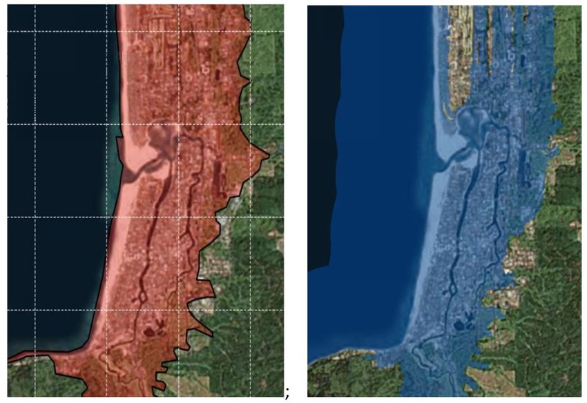
Distant Versus Local                    1995 – Senate Bill 379
Tsunamis:
                                        After the 1992 Northern California earthquake and the 1994
Distant tsunamis are caused by          Hokkaido Japan earthquake and tsunami, scientists and engineers
                                        in the Pacific Northwest began to warn the public about the
earthquakes across the Pacific
                                        significant threat of a major tsunami off the coast due to a
Rim from Oregon (e.g., Japan,           subduction zone earthquake. In 1995, the Oregon Legislature
Alaska, etc.). Coastal residents will   passed SB379, which established a tsunami inundation zone
not feel this earthquake, and the       along the Oregon coast set at approximately 40 feet elevation.
first wave will arrive four or more     This pioneering legislation was the first of its kind on the Pacific
hours after the earthquake occurs.      Coast. Two Oregon statutes (ORS 455.446 and 455.447) were
                                        established to prohibit new construction of Essential facilities
Notification could be by siren,
                                        including schools, hospitals, police stations, and fire stations
NOAA radio alerts, citizen alerts,      within the tsunami inundation zone. The legislation also instituted
or social media. Local tsunamis, on     a series of maps that defined the inundation zone for the entire
the other hand, are caused by an        coast of Oregon. The maps are still in use today. They are often
earthquake near Oregon’s coast.         called the “SB379” maps (see Figure 1.1).
Coastal residents will feel strong
                                        The 1995 maps were based on early run-up models created by
shaking and should “drop cover          DOGAMI for Siletz Bay. To create maps for the entire coastline,
and hold on” to protect themselves      DOGAMI partnered with the Oregon Graduate Institute of Science
during the earthquake and then          and Technology and the National Oceanic and Atmospheric
immediately evacuate to high            Association. They developed a new worst-case scenario based on
                                        a possible Gulf of Alaska earthquake and observations of other
ground, preferably on foot. The
                                        subduction zones worldwide. In a proceedings paper by Dr. George
first wave will arrive 15-20 minutes    Priest, the authors explain that the original maps were based on
after the earthquake, and citizens      the best data available at the time but that much was unknown
should not wait for official warning.   about potential Cascadia sources. They go on to say, “There is
Everyone in the area should have        no agreement among scientific professionals on the likelihood
a “grab and go” bag of emergency        of segmented ruptures, location and size of asperities, width of
                                        ruptures, amount of prompt slip relevant to tsunami generation
supplies handy for either type of
                                        and slip distribution.” It was noted that the large number of
event.                                  uncertainties needed to be greatly reduced to get a better
                                        understanding of the hazard and provide more accurate data.

 2
Figure 1.1: Part of an SB 379 tsunami
hazard map of the Tillamook Head
quadrangle. Red line indicates the extent
of modeled tsunami inundation.
As part of SB379, certain structures like hospitals, fire stations and police stations were prohibited
from being built in the inundation zone. However, a process was developed for communities to request
an exemption. As described in OAR 632-005-0080, applicants were required to submit written
documentation along with maps and other data to demonstrate how they intended to ensure the safety of
building occupants. DOGAMI would then review the documentation and grant or deny an exemption. The
moratorium did not apply to other types of buildings, including Major structures and Hazardous facilities.
For those buildings, the law only required consultation with DOGAMI before receiving a building permit.
The tsunami inundation zone restrictions enacted by SB379 were not intended to be a decision on land
use, although many perceived that to be the case. The restrictions were meant to be a “legislative”
restriction applied as a “public safety screening tool” before a permit would be issued by the local
jurisdiction. This was meant to give control to local entities, some of whom had their own building codes
enforcement, while others shared it with neighboring communities, and still others lacked this function
entirely and relied instead on the state Building Codes Division of the Department of Business and
Consumer Affairs.
Tsunami Resilience on the Oregon Coast • January 12, 2021 3In addition to directing DOGAMI to create inundation maps, SB379 also gave them the responsibility
to adopt new maps when better science and state-of-the-art data was made available. However, it
took almost two decades before newer, better maps were produced due to lack of funding by the state
legislature. Federal grants ultimately became available in 2013 to fund the production of new maps.
2013 – Updated Cascadia Inundation Maps by DOGAMI
Between 1995 (the time of the SB379 maps) and 2013, new research improved our understanding of
potential Cascadia earthquake sources and behavior of megathrust earthquakes in general. This work
included Cascadia structure modeling; paleoseismic studies based on turbidite deposits that revealed
the magnitude, recurrence, and rupture length of past events coupled with land-based investigations of
coastal estuaries and lakes; better theoretical understanding of megathrust earthquakes; and observations
of deformations of other historical great earthquakes around the world, particularly the 2004 Indian Ocean
earthquake and tsunami. In 2011, DOGAMI started work on a new set of deterministic tsunami hazard
inundation maps building on a pilot project undertaken at Cannon Beach in 2008 and focusing on the
southern coastal community of Bandon. The objective was to create new maps for evacuation. This work
continued into 2013, at which time a full set of maps was developed for the entire Oregon coastline.
Completed in 2013, the TIMS (Tsunami Inundation Map System) incorporates 15 different deterministic
earthquake rupture models for a Cascadia event, extending from southwest Washington to northern
California. They encompass the maximum considered Cascadia event as well as other distant events.
Based on the earlier pilot study, additional tsunami generation factors were considered, including fault
slip partitioned from the main Cascadia fault to a splay fault and amount of potential slip estimated from
geologic evidence of past Cascadia earthquakes and tsunamis (i.e. turbidite deposits and buried soils and
sands in estuaries and coastal lakes). A new logic tree, which is a way of defining the types of earthquakes
likely to produce a damaging tsunami, was developed to weight and rank the 15 rupture scenarios; a key
parameter was the estimated frequency of each size of earthquake based on data for the last 10,000
years. In addition to Cascadia ruptures, it included two Alaska earthquake sources, the maximum tsunami
to impact Oregon in 1964, and a hypothetical maximum distant tsunami from beneath the Gulf of Alaska.
These source characterizations were used as input into a hydrodynamic computer model to generate
tsunamis and estimate their propagation, inundation, and run-up at each point on the coast.
4While the SB379 maps had relied on a single Cascadia inundation line for the entire coast, TIM maps
illustrate five different Cascadia inundations and two distant tsunami inundations. The five Cascadia
inundations were named like sizes of T-shirts, each representing a range of years of return period and
confidence that each covers the full range of potential Cascadia inundations: small (S, 300 years, 26%
confidence), medium (M, 425–525 years, 79% confidence), large (L, 600–800 years, 95% confidence),
extra-large (XL, 1050–1200 years, 98% confidence) and extra-extra-large (XXL, maximum scenario at
1200+ years, 100% confidence), (see Figure 1.2). The two distant tsunami inundations give emergency
managers guidance on the worst that can be expected when a distant tsunami is on its way.
Figure 1.2: Detailed TIM series tsunami inundation maps for (left) Waldport and (right) Port Orford.
In 2014, DOGAMI and OEM convened a series of public meetings to review the TIMS and reach
consensus regarding a specific scenario that could be used for evacuation planning. They invited coastal
stakeholders, including emergency managers, community leaders, architects, and engineers. They
recommended using the maximum, XXL scenario for evacuation planning because it was most likely to
ensure that the public would find safety after any event. They also recommended that other events could
be used for land use planning and future revisions to the building code for the engineering design of
buildings on the coast, as these captured the most likely mechanisms and provided choices based on the
risk tolerance and policy objectives of each community.
Tsunami Resilience on the Oregon Coast • January 12, 2021 5In early 2018, the DOGAMI Governing Board established a tsunami line subcommittee to explore how to
incorporate the new work into the 1995 SB379 legislation. It was recognized that the TIM lines were based
on far superior digital terrain modeling than available in 1995 and much more accurate tsunami simulation
technology. The subcommittee initially recommended that the L (“large”) scenario replace the existing
SB379 maps. However, it was clear that the L line was significantly higher than the SB379 line and its
impact on coastal communities was unknown. A number of maps showing the difference between SB379
and the L inundation line were produced by DOGAMI to aid in this understanding. But later that year, the
Board ultimately decided not to pursue changing the regulatory line as they had been directed in the
original legislation. Instead, they asked the Governor to convene a multi-agency taskforce to recommend
updates to the existing ORS 455.446 and 455.447 laws. They also recommended that DOGAMI cease to
maintain the tsunami line regulatory and enforcement position.
2015 – DLCD Land Use Planning Guide, OEM Efforts, and Local Efforts
In 2014, Oregon DLCD prepared a comprehensive Tsunami Land Use Guide and initiated outreach efforts
to help communities that wanted to adopt a tsunami land use overlay zone to address future development
and improve evacuation planning in tsunami inundation zones (see Figure 1.3). The development guide
begins with information about the 2011 Tohoku earthquake and tsunami in Japan because the impacts to
life and property align closely with what Oregon could expect during a Cascadia event.
6Figure 1.3: Evacuation improvements
to Nedonna Beach.
The guide then walks communities through appointing an advisory committee, setting land use resilience
goals, having community meetings to solicit stakeholder input, deciding on the level of risk the community
is willing to accept for new buildings and existing infrastructure, and how to incorporate new tsunami rules
within their existing comprehensive plan. It contains model code language in the form of a Tsunami Hazard
Overlay Zone, which outlines the boundaries of the regulatory tsunami inundation zone, prohibits the
development of certain new Essential and Special Occupancy facilities, requires evacuation improvements
to be included in new land divisions, and provides an optional flexible permit process to modify underlying
code standards in order to achieve a higher degree of risk reduction. It also addresses tsunami awareness
education and outreach, debris management, and hazardous materials, as well as options for financing
evacuation facility improvements.
Tsunami Resilience on the Oregon Coast • January 12, 2021 7Figure 1.4: Map showing
communities on coast that have Gearhart
adopted overlay zones.
Rockaway Beach
TILLAMOOK
Newport
Florence
Reedsport
North Bend
COOS
DOUGLAS
Port Orford
Sources: Esri, Gamin, USGS, NPS
After a great deal of hard work by citizens throughout Oregon and the staff of DLCD, seven cities and three
counties have completed comprehensive tsunami land use planning and adopted tsunami hazard overlay
zones customized for their communities (see Figure 1.4). These locally adopted zoning rules identify which
scenario size (S through XXL) applies to their community based on the community’s acceptable level
of risk and prohibits the building of new Essential facilities within that designated inundation zone. This
approach allows for tailored decision-making based on each community’s unique tsunami hazard.
8chapter two
Recent Developments and Setbacks
2019 – ASCE 7-16 Adopted by State of Oregon
ASCE 7 is the primary reference document for the International Building Code and the Oregon Structural
Specialty Code. In 2011, the American Society of Civil Engineers created a subcommittee of 30
professional engineers to draft provisions for an entirely new Chapter 6 that addresses tsunami loads
on structures for the first time and includes specific provisions for vertical evacuation structures. It was
officially approved in March of 2016 after three years of development plus two years of ASCE and public
review including eight consensus ballots.
Tsunami Resilience on the Oregon Coast • January 12, 2021 9How Building Codes Work in
Oregon
Oregon's statewide building The main provisions of the new standard are intended to apply
to Risk Category III and IV buildings, as well as Risk Category II
code is based on national
buildings when adopted by local jurisdictions. This covers Essential
consensus codes, amended facilities like hospitals, police and fire stations, and ambulatory
to address Oregon-specific care facilities as well as schools, universities, jails, nursing homes,
conditions. The code is typically and hazardous and very large occupancy structures. The standard
administered and enforced by addresses structural design procedures for buildings within the
inundation zone with a sliding scale depending on depth, with
the local jurisdiction, but where
smaller depths requiring very few countermeasures and higher
a local jurisdiction determines depths requiring extensive countermeasures. Loading includes
that they do not have the hydrostatic and hydrodynamic loads, debris impact loads, and
resources to administer the foundation design to resist undermining. Structures and non-building
code, the state administers structures are both addressed, as are nonstructural systems. It also
it. Local governments cannot includes specific provisions for those choosing to construct vertical
evacuation structures.
require stricter construction
standards than those adopted Included with the code is a tsunami design geodatabase for all five
by the state, but they have western states that contains engineering design parameters for the
flexibility to incentivize particular maximum considered tsunami and serves as input parameters for
construction standards in order the rest of the code design procedures. This digital map parallels
the maximum considered ground motion maps established by USGS
to meet local development
already included in ASCE 7 using the same definition of hazard of
goals. Additionally, the state a 2% probability of exceedance in 50 years or a 2500-year return
has adopted several optional period. To develop the maps, a probabilistic tsunami hazard analysis
appendices that a local (PTHA) was conducted by a contractor to ASCE and reviewed by
jurisdiction can adopt based on a broad stakeholder and technical group convened by the NOAA
National Tsunami Hazard Mitigation Program (NTHMP). The inputs
local conditions and priorities.
into the model on earthquake source characterization were taken
directly from the USGS probabilistic seismic hazard model.
10TIM Maps ASCE 7-16 Maps
Basis Deterministic Probabilistic
Rupture scenarios 15 for Cascadia local 1000’s of plausible, synthetic
Table 2.1: Comparison of TIM
earthquake and 2 for Alaska rupture events including 372 maps to ASCE 7-16 maps.
distant earthquake scenarios of Cascadia
Cascadia source Full set of paleoseismic data Weighted full set of data by
characterization based on full and partial 50 percent in logic tree
ruptures
Account of total Slip limited for each No maximum slip parameter
slip earthquake event included
Effects of surface Not incorporated Included
friction
Figure 2.1: Comparison of
ASCE 7-16 map (left) with TIMS
map for M scenario (right) for
Seaside, Oregon.
Tsunami Resilience on the Oregon Coast • January 12, 2021 11OSSPAC has received a great deal of testimony regarding the tsunami maps included in the ASCE
Standard, especially as they compare with the TIM maps developed by DOGAMI. They are essentially
different, as illustrated in Table 1.1 and Figure 2.1. The reader is directed to work by Priest and Allan in
2019 and testimony from HK Thio given to OSSPAC, which covers both sides of this controversy.
In 2018, the Building Code Structures Board of the state of Oregon recommended to Building Code
Division of the Department of Consumer and Business Services to adopt the 2018 version of the IBC
for use in the 2018 Oregon Structural Specialty Code. As part of that effort, ASCE 7-16 was adopted
as a reference standard. However, when the state adopted ASCE 7, they did not adopt Chapter 6 of the
standard on tsunami loads and effects into the body of the code. Instead they adopted the chapter into
Appendix O of the OSSC as an option for individual adoption by local jurisdictions within Oregon.
The argument from BCD was that this provided more flexibility to Oregon coastal communities to allow
them to adopt tsunami design standards or not. It was also clear in communications between ASCE (Gary
Chock, ASCE Tsunami Loads and Effects Subcommittee Chair) and BCD (Mark Long, BCD Administrator)
that BCD felt they could not adopt Chapter 6 in the body of the code as there was confusion as to how to
use the maps embedded in ASCE 7 with the existing SB379 maps. The result is that the ASCE consensus
tsunami standards are voluntary within Oregon until adopted by a local jurisdiction.
2019 – HB3309 Passed by Legislature
In 2019, the Oregon Legislature passed HB3309, which ended the moratorium on construction of
Essential facilities within the tsunami inundation line of SB379. All structures that were formally prohibited
within the SB379 line now can be constructed and only require consultation with DOGAMI prior to issuing
a building permit. This was a deep disappointment to many in the Oregon earthquake and tsunami
resilience community. The original legislation was a point of pride, as Oregon was the only western state
with regulations directly addressing the tsunami threat on the Pacific coast.
Originally, HB3309 was entered as a bill to amend the definition of “surface mining” to exclude certain
excavation and grading activities, but it was changed by an amendment that removed the language from
ORS 455.446 prohibiting construction of Essential facilities in the inundation zone. The bill was sponsored
by Rep. McKeown (HD 9), Rep. Gomberg (HD 10) and Rep. Smith (HD 1), and it was supported by the
entire Coastal Caucus, which includes all senators and house members that represent districts bordering
12Case Study: OSU Hatfield
Marine Studies Building
the coast. The bill passed by a 56/4 vote in the House and 28/1
in the Senate. The Governor signed it into law right before the
session effectively ended due to a lack of quorum in the senate.
The bill’s passage caught many by surprise and created a lot of Located in Newport, Oregon near
anger and confusion within the seismic-safety and emergency- Yaquina Bay, the Gladys Valley
management community in Oregon. The timing was particularly
Marine Studies Building houses
odd, as earlier in the year the Governor had convened a tsunami
workgroup at the request of the DOGAMI Board to address options 72,000 square feet of research,
on what to do to update the SB379 regulatory maps that were meeting, and classroom space.
very out of date with the current Cascadia science. One objective It is constructed in the tsunami
of the workgroup was to study the impact of the current regulatory inundation zone. This provoked
framework on local communities. The group had met several controversy for many that
times and included state agencies, OSSPAC, representatives
believe new development should
from the Governor’s office, coastal stakeholders, and members
of the Coastal Caucus. But after three meetings, the group was be avoided in such a high-risk
disbanded. area (see additional discussion,
p. 20). However, it is the first
In hindsight, we can reflect on the effectiveness of the original building designed as a tsunami
SB379 legislation and whether the loss of the moratorium was
vertical evacuation structure in
truly the blow some perceive it was or whether it was simply
time to try a different approach. A key fact often missed is that Oregon. The building’s 47 feet
the original legislation was never intended to be a land use law high roof can support 900 people
and was simply intended as a “safety check” on construction and is meant to serve not only
of critical infrastructure within the inundation line. The final OSU students and faculty but
decision-making power remained with the local community
the nearby community in South
building official. The perception was that the original legislation
was stifling development on the coast. However, that didn’t Beach. A large exterior ramp is
appear to be true, as no building was ever prevented from being designed to accommodate the
built in the tsunami zone if a community chose to do so. It appears high numbers of people during an
the perception of a barrier to local control was enough to garner evacuation. A special elevator on
support from the Legislature to eliminate the moratorium. emergency power is designed to
assist the evacuation of those with
limited mobility. The building is
designed to be repairable after a
major tsunami.
Tsunami Resilience on the Oregon Coast • January 12, 2021 13In addition, SB379 put DOGAMI into the role of granting exceptions to the building moratorium in the
tsunami inundation zone, but they were uncomfortable in that role as they were not the Building Codes
Division, which administers state construction standards. Even in an advisory role, DOGAMI’s excellent
advice could too easily be ignored. According to DOGAMI testimony, no buildings were ever exempted from
building within the inundation zone.
2020 – HB4119 – Not Successful
During the May 2019 OSSPAC Meeting, a proposal was made to support state-wide adoption of the ASCE
7-16 tsunami provisions. The motion passed with three abstentions by state agency representatives. With
this support, the OSSPAC Chair and Vice-Chair wrote a letter in June of 2019 recommending the state
adopt the new tsunami design provisions in the ASCE 7-16 national consensus standard.
This letter led directly to HB4119, a bipartisan bill authored by Rep. Gomberg (HD 10) and Rep. Smith (HD
1) during the 2020 short Legislative session. It essentially rewrote ORS 455.446 and 455.447 to direct the
state to use ASCE 7-16 tsunami provisions for the design of all Risk Category III and IV buildings built on
the Oregon coast. The bill passed the House with a vote of 51 to 6. However, once it moved to the Senate,
the lack of quorum prevented any legislation from moving forward. It did not receive a vote by the end of
the session and thus was not successful.
14chapter three
Making the Coast More Resilient to Tsunamis
The question now is: how best to move forward? The answer is not clear-cut, as there are many diverse
stakeholders including state agencies, tsunami experts, engineers, coastal community representatives,
and business interests. In addition, the turbulent activities of the past year have hardened positions and
divisions instead of helping to bring consensus.
Any lasting solution will take compromise and will need to thread together several competing priorities:
• Ensure the safety of Oregonians and coastal visitors following a Cascadia event on the coast.
• Empower coastal communities to become more resilient, which will allow them to function and
build stronger after the event.
Tsunami Resilience on the Oregon Coast • January 12, 2021 15Case Study: Gearhart Fire
Station
• Continue to allow robust economic development of coastal
communities.
• Allow the state, counties, and cities certainty about
tsunami regulation and building code requirements
throughout the entire coast.
We believe it is important to focus on what all sides can agree
The current station, built in on, which is the necessity of ensuring the resilience of coastal
1958, is woefully inadequate communities. And we believe that the best solutions are those
to support the 35-member that allow local communities to determine for themselves how
best to protect themselves and their visitors.
Gearhart volunteer fire
department. It is also located
The Critical Role of Land Use Planning
within the tsunami inundation
zone about two blocks from OSSPAC believes that good land use planning is the critical first
the Pacific Ocean. In 2019, the step to ensuring that coastal communities not only survive the
department discussed replacing earthquake and tsunami but thrive afterward. This same advice
has been echoed over the past two decades by the federal effort
the station and looked at three
to reduce tsunami losses, the National Tsunami Hazard Mitigation
locations: the current location on Program. Long term planning that incorporates tsunami risk into
Pacific Way, a city park at North the decision-making process allows each community to determine
Marion Ave., or the High Point for itself what functions are most important as well as their own
site farther north on Marion acceptable level of risk.
Ave. All are in the tsunami zone,
For several years, individual communities have been choosing
as there is no buildable land to limit the construction of critical facilities in the tsunami
within the city limits that is high inundation zone themselves. As described in Chapter 2, this work
enough to not be impacted by has been ongoing since 2014, guided by the Oregon Department
an XXL tsunami event. The city of Land Conservation and Development. Using limited resources
compromised by preparing for and staff time from DLCD, seven cities and three counties have
already adopted Tsunami Hazard Overlay Zones, which is the
a smaller tsunami event, setting
primary means of directing land use planning around tsunami
a 50-foot elevation requirement safety.
for critical infrastructure.
16OSSPAC supports the goal of all coastal counties (7) and cities (33) establishing Tsunami Hazard Overlay
Zones so that the entire Oregon coast is addressed. We know this will take a great deal of time and effort,
but it is an important first step to allowing each community to individually decide how best to protect their
communities. While community overlays may be different, full participation is essential in order to enable a
level playing field for future development.
We are concerned that DLCD may not have the necessary resources to continue their great work
addressing tsunami risk, and we believe it is important enough to designate specific resources to support
them. This should include funding for DLCD so they can provide grants directly to communities to support
their planning efforts, as well as a small amount of additional staff support to provide direct consulting to
communities.
In addition to land use planning work for future critical facilities, state agencies (DLCD, DOGAMI, and OEM)
have been doing important work to establish robust tsunami evacuation and wayfinding routes. OSSPAC
heard testimony that some communities need funding to support infrastructure improvements to enable
safe evacuation. Other communities without buildable land above the tsunami inundation zone may need
more aggressive tactics, such as vertical evacuation structures. Keeping our communities safe by allowing
them to build the necessary infrastructure they need to allow timely refuge from an incoming tsunami is
critical to prevent large loss of life.
Like earthquakes, tsunamis do not happen very often. It is important to hold regular drills to ensure
everyone along the coast knows how to evacuate safely to high ground, how long it takes them to do so,
how to ensure loved ones are all accounted for, and the importance of having emergency supplies ready to
take with them.
Different Maps for Each Need
As described in Chapter 1, Oregon has been producing tsunami maps of various kinds since 1994. As
time progresses, the science of tsunami source mechanisms continues to improve. Maps and tsunami
model data are critically important, as they are the mechanism of how tsunami risk is communicated to
engineers, policy makers, and the public at large.
There are many types of relevant maps. Some are meant for the public to use, like evacuation maps.
Others are for scientists, engineers, and planning professionals. Some are based on deterministic
Tsunami Resilience on the Oregon Coast • January 12, 2021 17Case Study: Rockaway
Beach City Hall
scenarios; others are probabilistic, meaning they are based
on the chance that a certain size event will occur. Some are
conservative, and others are less so. There are no “one-size-fits-
all” maps; each should be developed in a way that best serves its
The City of Rockaway Beach, purpose.
Oregon is currently in the
process of planning for the OSSPAC believes that Oregon needs this variety of maps to ensure
relocation of several of its critical the safety of coastal communities. We also believe that maps
should utilize the best science available at the time, and that they
facilities to an area outside of
should not be static but rather updated on a regular basis. They
the tsunami inundation zone. should be based on a consensus of experts and align with other
This includes the Rockaway parallel efforts undertaken by state or federal entities like the
Beach Police and Fire stations, United States Geological Survey for related earthquake hazards
City Hall, and the Public Works like the national earthquake hazard maps.
department and equipment
In order to highlight and learn from the best leading-edge science,
storage, as well as the creation OSSPAC encourages ASCE, USGS, DOGAMI, Washington DNR,
of an emergency assembly and others to hold symposia to hear from current researchers in
area with shelter and supplies. the tsunami field, build consensus on the source characterization
The City has identified a parcel of Cascadia, and build this data into new models. OSSPAC has
heard testimony that three workshops have been scheduled over
of forest land outside of its
the next 12 months with the goal of building consensus amongst
urban growth boundary for the scientific community. It is anticipated that an updated logic
the relocation and is working tree for source characterization of Cascadia will be available in
to purchase the land, bring it 2021, and that this will drive the next generation of Cascadia
inside the City’s urban growth modeling. It is important that the entire Cascadia region, from
boundary, annex it into city California to British Columbia, should be using the same set of
expectations about tsunami and earthquake hazard risk so that
limits, and designate the land as
different state efforts are aligned and not disjointed at arbitrary
zoned for public facilities. Once regional boundaries.
these processes are complete,
the City will create a Master We encourage DOGAMI to regularly update their TIM maps as the
Plan for the parcel and begin the need arises for evacuation and land use planning, and to create
its own series of probabilistic maps based on their existing work,
relocation process.
18Case Study: Gold Beach
Hospital
new data, and new consensus agreements on tsunami source
characterizations. The probabilistic maps must utilize the site-
specific mapping procedures contained in ASCE 7-16 so they
can be used with the current code as substitutes for the current
ASCE 7 maps. Consistent with what other states are doing, these Curry Hospital serves Gold
should be 10-meter high-resolution maps and include surface Beach and all of Curry
roughness and nonlinear factors appropriate to local terrain. County. Built in 1948, it
was antiquated, too small,
Engineering Standards and located in the tsunami
In the upcoming years, land use planning will divert the inundation zone. The hospital
construction of many new critical buildings to areas out of the started looking at replacement
tsunami inundation zone. However, it won’t be enough for all options in 2012. After looking
coastal communities. Some do not yet have a tsunami hazard at many different locations,
overlay. Even those that do will likely have certain structures like including the hills above Gold
fire stations that need to be located within the inundation zone
Beach, they decided to stay at
in order to meet critical every day response needs. For those
situations, Oregon needs a technically based, state-of-the art the current site. The hillside
national consensus procedure for safely designing structures to plot had landslide issues and
survive in the tsunami inundation zone. would have required new road,
sewer, and electrical services,
OSSPAC heard testimony regarding the new Chapter 6 of ASCE
which was cost prohibitive.
7-16, which contains the first-of-its-kind provisions to address
tsunami hazards and allow structures to be safely built to Ultimately, they wanted to be
withstand them. All the western coastal states, including Hawaii close to the town’s population
and Alaska, are adopting the ASCE 7-16 tsunami provisions. to provide the emergency
services they need. The old site
The new Chapter 6 provisions are variable based on the location
was not within the old SB379
of the structure within the inundation zone. Buildings close to the
code-mandated line will likely need no significant changes from line, but it was within the
standard structures. As the location of the building gets closer to DOGAMI L line. No measures to
the water, the requirements get more stringent. This provides a mitigate the impact of tsunamis
market incentive for locating buildings out of the zone. were taken.
Tsunami Resilience on the Oregon Coast • January 12, 2021 19It’s important to note that the new tsunami provisions of ASCE 7-16 apply only to Risk Category III and
IV buildings and not to other buildings such as single-family homes, commercial buildings, or existing
structures. The costs to implement the building code provisions within the tsunami inundation line
appear reasonable - a few percent of the total construction budget. However, this is based on limited data
from the handful of structures that have used the new standard. Costs for building a vertical evacuation
structure would be significantly more. The provisions do not require any buildings to be vertical evacuation
structures unless the community or owner chooses to implement them.
While Chapter 6 of ASCE 7-16 has been adopted by the state of Oregon, it was made voluntary and will
only be in force by those jurisdictions that choose to adopt it or by developers that choose to use it.
OSSPAC encourages the state to adopt all chapters of the standard in full to provide a level playing field
and uniform protection for all coastal communities.
It would take a tremendous effort to get all seven counties
The hope is that ASCE 7 standards and 33 cities to agree to adopt standards one at a time.
for building in an inundation zone This is illustrated in the time it has taken to get individual
communities to adopt tsunami overlays, as described in
would be used only when no better Chapter 2. But it is critically important for the state building
option exists to relocate structures code to provide a uniform level of safety to protect all
out of the inundation zone. Oregonians and visitors. Tsunami load provisions should be
no different than snow, wind, seismic, and other loading
provisions in the building code. Statewide consistency will
remove uncertainty for communities, visitors, and developers who are currently navigating a patchwork of
different requirements from one location to the next.
The hope is that ASCE 7 standards for building in an inundation zone would be used only when no better
option exists to relocate structures out of the inundation zone. Critical structures built to these standards
might survive a large tsunami and be repairable. But most of the surrounding structures will likely be
devastated and unusable after the event, making recovery intensely challenging. That being said, some
coastal communities have no buildable land available to them outside the inundation zone. For those
communities, structures built to Chapter 6 standards – especially those with vertical evacuation options –
will be critical in providing emergency services and shelter immediately after an event. Help will not be
coming quickly if the entire region is impacted by a subduction zone earthquake.
20Existing Critical Facilities in the Inundation Zone
Ensuring new and replaced buildings are either out of the inundation zone or built to survive a tsunami’s
effects is vital to the resilience of coastal communities. However, up and down the coast there are many
existing hospitals, schools, fire stations, and police stations within the boundaries of the current inundation
zone that cannot be addressed by land use planning or innovative modern building codes (see Figure 3.1).
40
35
Figure 3.1: Chart of
30
existing critical buildings
within each of the TIM
25
map zones by county.
20
15
10
5
0
Clatsop Coos Curry Douglas Lane Lincoln Tillamook
TIM Scenario: XXL XL L M S
Breakdown by Type for XXL Scenario
4
20
43
Figure 3.2: Chart of existing critical buildings in XXL zone by
function. Note that a building in a larger tsunami zone is also
in the smaller zones because the zones overlie each other.
57
Hospital Police School Fire Station
Tsunami Resilience on the Oregon Coast • January 12, 2021 21Some communities have tried for years to move these facilities out of harm’s way, but most do not have
the resources to make this a reality. A good example of success is the effort made by the Seaside School
District to address their schools near the coast. In 1999, Seaside School District confirmed that most of its
schools were within the tsunami inundation zone. Working with DOGAMI, they produced several studies,
and it became clear that the only option was to relocate the schools away from the coast in the east hills
above the city. A bond measure was proposed in 2013 to purchase land for a new school site, but the
measure failed. In 2016, the district proposed another bond measure that successfully raised $99.7M to
replace the schools.
In 2005, Oregon Legislature established the Seismic Rehabilitation Grant Program (SRGP) with Senate
Bill 3. It has funded the retrofit of schools and emergency services facilities, making them more resilient
to earthquakes. Over the past decade, the program has distributed over $300M in grants for over 200
projects throughout the state. Business Oregon has run the program since 2014, and they have done a
good job in assisting communities in determining eligibility and completing applications.
Unfortunately for coastal communities, SRGP funds have done little to protect against tsunami risk.
Originally, facilities in an inundation zone were not eligible for the grants. This did change in 2019, and
now those buildings are eligible. But SRGP funds can only be used to retrofit existing facilities and not for
the relocation of existing facilities out of an inundation zone. In 2016, Seaside tried to use SRGP funds
for its school relocation effort and was unsuccessful. Fortunately, they were able to get $4M in matching
funding from the Oregon Office of Education.
It is true that relocating facilities out of the inundation zone is far costlier than a seismic retrofit project. It
requires new land and utilities, not to mention the cost of a new building. But coastal communities should
be eligible for assistance from the state to improve their tsunami resilience, just as other communities are
eligible for assistance to improve their earthquake resilience.
It would take an act of the Legislature to allow SRGP funds to be used for building relocation. While it could
be done, it seems prudent to leave the SRGP as-is and allow the program to continue to address the large
number of existing buildings in the state that still need to be retrofit against earthquakes. Instead, OSSPAC
recommends a separate program directed toward critical facilities in the inundation zone that need to be
relocated.
22The new program could be administered by Business Oregon, as they have a great deal of experience
already with the SRGP. If needed, new legislation could authorize the issuance of bonds to provide a
funding mechanism for the grants. These grants could be magnified with the new FEMA Building Resilience
Infrastructure and Communities (BRIC) grant program. BRIC grants can pay up to 75% of project costs for
hardening infrastructure susceptible to natural hazards. The state or communities would have to match
25% of the funding from FEMA. Such a program could greatly increase the mitigation dollars spent on
moving critical facilities out of a tsunami’s path.
Chapter 3 Recommendations
Support and strengthen the use of tsunami overlay zones and evacuation planning by coastal
communities in Oregon. The first step to ensuring that coastal communities thrive after a major
earthquake is to encourage good land use and evacuation planning. This allows each community to
determine for itself what functions are most important as well as their own level of acceptable risk.
Support communities in their efforts to establish Tsunami Hazard Overlay Zones. Encourage the Oregon
Department of Land Conservation and Development (DLCD) to continue to assist these communities and
support critical projects like future revisions of the Tsunami Land Use Guide. Provide adequate funding to
DLCD to support this mission in the form of $250K per biennium for grants directly to communities and
a limited duration FTE for providing direct consulting to coastal communities. Work with DLCD, DOGAMI
and OEM to establish robust tsunami evacuation and wayfinding routes. Continue to support coastal
community efforts to hold annual tsunami drills to improve evacuation wayfinding.
Continue to improve tsunami maps for use on the Oregon Coast. Maps and models are the data that
inform land use planning, evacuation routes and structural design. Different maps are required for
different purposes. Support mapping efforts to give Oregon the best data on which to base decisions
about the future. This includes worst-case maps used for evacuation, other maps for land use planning
and maps for structural design that are compatible with those used to design other hazards. Support
DOGAMI’s efforts to develop updated maps for structural design using high-resolution for the best detail of
the Oregon coast. The effort should incorporate the latest research in tsunami source characterization and
be based on the consensus of experts throughout the nation. These maps should follow the procedures of
ASCE 7-16 including surface roughness and nonlinear factors and should be consistent with earthquake
inputs to the national earthquake hazard maps of USGS.
Tsunami Resilience on the Oregon Coast • January 12, 2021 23Establish state-wide structural load standards for designing critical buildings in the tsunami zone
and vertical evacuation shelters. While land use planning will address many critical structures, it won’t
catch them all. Not all coastal communities have a tsunami hazard overlay yet, and even those that do
will have certain structures like fire stations that need to be located within the inundation zone in order
to meet critical every day response needs. For those situations, a technically based, state-of-the art
national consensus procedure for safely designing structures to survive in the tsunami inundation zone is
required, and it needs to be applied consistently throughout the entire state. Adopt ASCE 7-16, including
the entirety of Chapter 6 and the tsunami design geodatabase for the design of all Risk Category III and IV
structures within the Tsunami Design Zone in the State of Oregon. Re-align the remaining portions of ORS
455.446 and 455.447 with this direction.
Assist local communities with moving existing critical facilities out of the tsunami inundation zone.
Making sure that new critical facilities are either out of the inundation zone or built to survive the tsunami’s
effects is vital and will, over time, provide communities with resilient facilities. However, there are many
existing hospitals, schools, and fire and police stations within the inundation zone along the coast that
are not addressed by land use planning or modern building codes. Some communities have tried for years
to move these facilities out of harm’s way; most do not have the resources to make it a reality. Develop a
competitive grant program similar to but separate from the Seismic Rehabilitation Grant Program (SRGP)
that can be used to replace critical existing public buildings and relocate them out of the inundation zone.
Direct Business Oregon to administer and run the program, building upon their leadership of the SRGP.
Pass legislation to authorize the issuance of bonds to provide the funding mechanism for the grants. Direct
bond resources to fund the grants on a biannual basis with a goal of $50M per biennium. Explore the use of
FEMA Building Resilience Infrastructure and Communities (BRIC) grants to leverage more dollars to flow to
coastal community relocation projects using state grants as 25% match.
24You can also read