ANGLER'S GUIDE 2020-2021 - Fisheries and Oceans Canada ...
←
→
Page content transcription
If your browser does not render page correctly, please read the page content below
Fisheries and Oceans   Pêches et Océans
   Canada                 Canada

          Newfoundland and Labrador
ANGLER’S GUIDE 2020-2021
                www.nfl.dfo-mpo.gc.ca

   Help us conserve and protect our fish stocks.
 Report poaching activity to Crime Stoppers.
  1-800-222-TIPS (8477)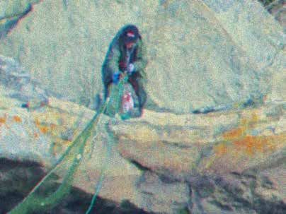
Fisheries and Oceans   Pêches et Océans
  Canada                 Canada

CONSERVATION & PROTECTION

Do you have questions or concerns?
    Contact Fisheries and Oceans Canada
     Newfoundland and Labrador Region

Bay Roberts		                                   (709) 786-3960
Marystown		                                     (709) 279-7863
Clarenville		                                   (709) 466-8272
Twillingate		                                    (709) 884-2411
Springdale		                                    (709) 673-5250
Stephenville		                                  (709) 643-8000
Rocky Harbour		                                 (709) 458-3082
Happy Valley-Goose Bay                          (709) 896-6150

Report Poaching Activity to Crime Stoppers
           1-800-222-TIPS (8477)

                                            Poachers value
                                            your silence.
                                            Don’t support them.
                                            Report them.
                                            Every time poachers take
                                            salmon they are stealing
                                            from our community. Poaching
                                            is illegal. Help put a stop to
                                            this crime. Protecting and
                                            preserving our fish is
                                            everyoneʼs responsibility.
                                            Contact Crime Stoppers
                                            anonymously.
                                            1-800-222-TIPS (8477)
                                            www.nlcrimestoppers.com
                                            Text: TIP190 + message
                                            to 274637 (CRIMES)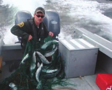
TABLE OF CONTENTS

  Outlined in the Angler’s Guide are the 2020/21 salmon management
  measures. Some of these measures are:
  • A retention limit of one fish on Class 2 rivers and a retention limit
      of two fish on Class 4, Class 6 and unclassified rivers.
  • Environmental Protocol.
  • Retention of salmon is not permitted on non-scheduled waters.
  • Catch and Release limits of three fish per day for Newfoundland
      and Labrador.
   Call 1-800-782-3058 for resources regarding updates and/or changes throughout the
   season.

   The Angler’s Guide is published by Fisheries and Oceans Canada (DFO). It provides
   anglers with information on some of the regulations pertaining to salmon and trout
   angling in inland and coastal waters of Newfoundland and Labrador. It is recommended
   that anglers read the guide to become familiar with the regulations prior to angling.
   Regulatory changes to management measures such as season dates, bag limits, river
   closures, and licence fees may occur following publication. The Angler’s Guide is
   neither a legal document nor a complete collection of current applicable legislation; it
   is an abbreviated guide issued for the convenience of anglers. The Fisheries Act and
   Regulations, and the Wildlife Act and Regulations, should be consulted for interpreting
   and applying the law. If further clarification is required, please contact DFO or the
   provincial government offices listed on Page 4.

GENERAL
General Regulations..............................................................................................................2
Important Telephone Numbers..............................................................................................4
Licence Fees..........................................................................................................................4
SALMON
Season Dates.........................................................................................................................5
Fall Angling..........................................................................................................................5
Retention Limits....................................................................................................................6
Catch and Release.................................................................................................................6
Watershed Management Plans..............................................................................................8
Closed for the Season .........................................................................................................13
2020 Environmental Protocol.............................................................................................16
TROUT
Trout Angling Zones...........................................................................................................18
Season Dates.......................................................................................................................18
Winter Trout Angling..........................................................................................................19
Daily Bag/Possession Limits/Size Restrictions..................................................................19
Rainbow Trout ...................................................................................................................20
Brown Trout........................................................................................................................21
Special Trout Management Areas ......................................................................................23
SMELT
Smelt Fishing Waters..........................................................................................................26
ANNEXES
Annex 1: Coastal Waters and Inland Waters.......................................................................28
      - Angling in Non-scheduled Waters/Coastal.............................................................29
Annex 2: Guide Requirements............................................................................................29
Annex 3: Program for Anglers with a Disability................................................................31
Annex 4: Salmon Management Measures..........................................................................32
      - River Classifications...............................................................................................32
Annex 5: Salmon Angling Log...........................................................................................33
      - Returning Scientific Tags........................................................................................34
      - Fishing in National Parks........................................................................................34
Annex 6: Salmon River Catch Data....................................................................................36
PUBLIC NOTICES
The Atlantic Salmon Conservation Foundation..................................................................35
Stop Aquatic Invasive Species............................................................................................43
Fish Habitat and All-Terrain Vehicles.................................................................................44
Nalcor..................................................................................................................................45
Safe Boating Messages.......................................................................................................46
Salmometer.........................................................................................................................48
           Published By: Fisheries and Oceans Canada, Communications Branch
        Newfoundland and Labrador Region, P.O. Box 5667, St. John’s, NL A1C 5X1
          www.nfl.dfo-mpo.gc.ca         DFO/2020-2025 Cat no: Fs111-1E-PDF

Angler’s Guide 2020-2021                                                                                                                1
GENERAL
GENERAL
GENERAL REGULATIONS
For these regulations, the following definitions apply:
Angle or Angling: Fishing, or attempting to fish, with a hook and a line with the
line held in the hand, or with a hook, line and rod held in the hand. This includes
casting and trolling.
Hooks or Hooked: means to be in possession of a hook and line with the line
held in the hand, or a hook, line and rod with the rod held in the hand, when a fish
takes the attached bait, lure, or artificial fly.
1. Salmon, trout and other sport fish may be taken in inland waters only by
angling using hook and line. No person angling in any inland waters may use
more than one rod and line at any time. The exception is winter trout angling
where an angler can use a maximum of three lines through the ice. (See
“Winter Trout Angling” on Page 19).
2. A resident can only angle in scheduled inland waters of the province with a
valid inland fishery licence to take salmon. A resident who is the holder of an
inland fishery licence for salmon can retain salmon and trout on their licence
while angling in scheduled inland waters.
3. A resident of the province does not require an inland fishery licence to angle
for trout.
4. Licence holders must carry their inland fishery licences (salmon or trout) at
all times while angling.
5. There is no age restriction on possessing an inland fishing licence. However,
a child up to and including 17 years of age cannot be part of an inland fishery
family licence if he/she holds an individual inland fishery licence.
6. Children under 14 years of age shall not angle on any scheduled river unless
accompanied by a person 17 years of age or older. The person 17 years of age
or older does not require a license to accompany the angler, but may not fish
without a license.
7. No person shall apply for, be issued, or hold more than one inland fishery
license to angle for salmon or trout.
8. Angling on scheduled salmon rivers is permitted only between one hour
before sunrise and one hour after sunset.
9. A single barbless hook must be used when angling on scheduled salmon
rivers for salmon and trout.
10. On scheduled and non-scheduled waters, anglers must return to the water
from which it was taken in a manner which causes the least harm, salmon fry,
parr and smolt, or salmon less than 30 centimetres (12 inches), or ouananiche
and rainbow trout less than 20 centimetres (8 inches).
11. Anglers fishing in inland waters in Newfoundland and Labrador are not
permitted to catch and retain any salmon where the salmon measures greater
than 63 centimetres in length. (Except for Robinson’s River, Fischell’s Brook
and Middle Barachois River. See Bay St. George South Rivers p.10).
12. Anglers may not retain spent salmon, commonly called “slinks”.
13. Anglers may not retain salmon caught in coastal waters at any time, even if
they have a valid inland fishery licence for salmon and tags.
14. Retention of salmon is not permitted on non-scheduled waters.
15. Any angler who “hooks” a salmon shall immediately affix and lock his or her
own tag through the gills and mouth of the salmon and cut out and remove the
month and day of capture, unless the salmon is released back into the water.
This includes cases where the angler allows another angler to land the salmon
(i.e., passing the rod).
2 Angler’s Guide 2020-2021GENERAL
16. A licenced guide who “hooks” a fish (trout or salmon) while guiding non
resident anglers and demonstrating the techniques of line casting to another
angler shall release the fish back into the water.
17. No salmon or trout taken by angling may be retained alive.
18. Salmon or trout taken by angling may not be headed, filleted, canned or
otherwise dealt with so as to make it impossible to readily determine the
species, length, weight and number of the fish.
19. Angling is not permitted within 23 metres (25 yards) downstream from the
lower entrance of any fishway, canal, obstacle or leap (falls).
20. Jigging, netting or purposely foul-catching sport fish in inland waters is
prohibited. Accidentally foul-caught fish must be released.
21. No person shall obstruct the passage of fish through a fishway or canal.
22. No person shall willfully disturb or molest any fish or spawn.
23. No person shall buy, sell, trade, barter or offer to buy, sell, trade or barter
any fish unless it was caught and retained under the authority of a licence
issued for the purpose of commercial fishing.
NON-RESIDENTS
(Please see Guide Requirements in Annex 2, Page 29)
24. A non-resident shall not angle for trout in non-scheduled inland waters of
the province without an inland fishery licence to take trout.
25. A non-resident can only angle in scheduled inland waters of the province
with a valid inland fishery licence to take salmon.
26. A non-resident angling in scheduled inland waters with a valid salmon
inland fishery licence shall not retain trout without possessing a valid non-
resident inland fishery licence to take trout.
27. The trout bag limit for a family licence and an individual licence is the
same. All fish caught shall be counted as the catch of the person to whom
the licence is issued.
FAMILY LICENCES
28. Family means a parent or parents and their children including adopted and
foster children, and children for whom parents are guardian, a grandparent
or grandparents and their grandchildren, and a person and his or her spouse
or cohabiting partner, but does not include an individual person.
29. Inland fishery licences for salmon and trout are available as individual and/
or family licences. However, no person shall apply for, be issued, or hold
more than one inland fishery licence to angle for salmon or trout.
30. A family inland fishery licence (salmon or trout) may be issued to a parent,
grandparent or guardian of a family and may include any child up to and
including 17 years of age. However, a child up to and including 17 years
of age cannot be part of an inland fishery family licence if he/she holds an
individual inland fishery licence.
31. With the exception of the parent, grandparent or guardian, any person 18
years of age or older cannot participate in a family inland fishery licence.
32. Persons 17 years of age or under, angling on a family inland fishery licence
(salmon or trout), must be accompanied and supervised by the parent,
grandparent or guardian who is the holder of the inland fishery licence.
The parent, grandparent or guardian must always carry the inland fishery
licence while angling.
33. Parents, grandparents or guardians named on a family inland fishery
licence (salmon or trout) may angle at the same time as the holder of the
licence, with or without being accompanied by children.
34. Bag limit for a family licence and an individual licence is the same. All fish
caught shall be counted as the catch of the person to whom the licence is
issued.
Angler’s Guide 2020-2021 3GENERAL
Important Telephone Numbers
ANGLING LINE
Call 1-800-782-3058 for resources regarding updates and/or changes throughout the
season.
Fisheries and Oceans Canada
For information on season dates, bag limits, closed areas and other regulations
Bay Roberts (709) 786-3960 Springdale (709) 673-5250
Marystown (709) 279-7863 Stephenville (709) 643-8000
Clarenville (709) 466-8272 Rocky Harbour (709) 458-3082
Twillingate (709) 884-2411 Happy Valley-Goose Bay (709) 896-6150
Transport Canada
For information on boating safety
Office of Boating Safety 1 (800) 230-3693
Provincial Government Services Centres
For information on obtaining resident and non-resident licences or for licence
inquiries
Mount Pearl (709) 729-3699 Grand Falls-Windsor (709) 292-4206
Harbour Grace (709) 945-3107 Corner Brook (709) 637-2414
Clarenville (709) 466-4068 Happy Valley-Goose Bay (709) 896-5428
Marystown (709) 279-0837 Labrador City (709) 944-5282
Gander (709) 256-1420
Provincial Department of Fisheries and Land Resources
For information on trout and salmon licences and guide requirements or guide
licences
Wildlife Division (709) 637-2025
Fish and Wildlife Enforcement Division
Headquarters (709) 637-2971
Western Regional Office (709) 637-2971
Eastern Regional Office (709) 729-2192
Labrador Regional Office (709) 896-7973
www.Stoppoaching.ca
Licence Fees: Salmon and Trout
Inland fishery licences are issued by the Department of Fisheries and Land Resources,
Wildlife Division. Licences may be obtained from commercial vendors, such as sporting
good shops, service stations, and other areas throughout the province, or from the Provincial
Government Service Centres listed above.
Licence Fees Individual Senior Family
Salmon
Resident $23.00 $14.95 $23.00
Non-resident $80.00 $80.00
Trout
Non-resident $12.00 $12.00
Note:
• Licence fees for inland fishing licences do not include the vendor’s processing fee of
$3.00 per licence and applicable HST.
• Fee for a resident aged 65 years and older $14.95 plus HST. (This fee does not apply to
Resident Family Licence).
• A person may, for a season, apply for, be issued and hold one inland fishery licence to
take salmon or one family inland fishery licence to take salmon but shall not apply for,
be issued or hold both of these for the same season.
4 Angler’s Guide 2020-2021SALMON
SALMON
Management measures for recreational salmon fishing in Newfoundland
and Labrador are developed in consultation with user groups and
stakeholders; including anglers, outfitters, conservationists, Indigenous
groups and the provincial government. The Minister of Fisheries,
Oceans, and the Canadian Coast Guard may make changes to
management measures for conservation reasons.
Season Dates 2020
ZONE AREA OPENS CLOSES
Zones 3 - 8 Cape Bauld to Cape Race June 1 Sept. 7
Zones 9 - 12 Cape Race to Cape Ray June 1 Sept. 7
Zone 13 Cape Ray to Cape St. Gregory June 1 Sept. 7
Zone 14A Cape St. Gregory to Cape Bauld June 1 Sept. 7
Zone 14B L’Anse au Clair to Cape Charles June 15 Sept. 15
Zones 1 and 2 Labrador North and East June 15 Sept. 15
Fall Angling Gander River, Exploits River, Humber River Sept. 8 Oct. 7
Note: Some individual rivers may have different opening and closing dates. Check
the watershed management plans section starting on Page 8 for details. For a complete
description of Zones, see the map insert included in this guide.
Fall Angling: September 8 – October 7, 2020
Gander River, Exploits River and Humber River
• Catch-and-Release angling as follows:
- main stem of Lower Exploits River, from Stoney Brook to river
mouth;
- main stem of Lower Humber River, from Boom Siding (outlet of
Deer Lake) to lower end of Shellbird Island;
- main stem of Gander River from outlet on Gander Lake to river
mouth.
• Angling not permitted on any tributaries of these rivers;
• Daily catch-and-release bag limit of three salmon;
• Fall Angling retention on the main stem of the lower Gander River will
be subject to the in-season review. Call 1-800-782-3058 for resources
regarding updates and/or changes throughout the season.
DID YOU KNOW?
That a video on best practices for catch and release of Atlantic
Salmon can be viewed in the online version of the Angler’s Guide
at: http://dfo-mpo.gc.ca/videos/practices-pratiques-eng.html.
Angler’s Guide 2020-2021 5SALMON
Retention Limits
Retention of salmon is not permitted on non-scheduled waters.
See Annex 4 on Page 32 for additional Atlantic Salmon Management
Measures.
River Classification Limit Tag Color Tag #
Class 0 Catch and Release N/A N/A
Class 2 One fish Red 1
Class 4 Two fish Green 3, 4
Class 6 Two fish Green 3, 4
Unclassified
Two fish Green 3, 4
(Zone 1 and 2)
Daily Retention
• A retention limit of one fish on Class 2 rivers and a retention limit of two
fish on Class 4, Class 6 and unclassified rivers.
• No salmon fry, parr, smolt or salmon less than 30 centimeters (12 inches)
may be retained on scheduled or non-scheduled waters. Fish should be
returned to the water in a manner which causes the least harm.
Catch-and-Release
DAILY CATCH-AND-RELEASE LIMITS
• Catch-and-release limits are in addition to the retention limits.
• A maximum of three fish on Class 2, Class 4, Class 6 and unclassified
rivers.
• A maximum of two fish on Class 0 rivers.
Note: An angler may catch-and-release salmon where permitted without
a valid tag; however a valid salmon inland fishery licence is required for
catch-and-release angling of salmon.
ANGLING LINE:
Information for in-season river openings, closures and
other recreational fishing information
1-800-782-3058
6 Angler’s Guide 2020-2021SALMON
Catch-and-Release Advice
Practice safe and responsible release
techniques to help ensure salmon
survival.
Follow these procedures to minimize injury to fish:
• Barbless hooks must be used.
• Do not use a tailer.
• When using a landing net, use one with knotless mesh, as
it is less harmful to fish scales, gills and eyes.
• A leader tip should be heavy enough to bring in large
salmon quickly, or light enough to allow large salmon to
break off.
• Move to a quiet water location.
• Bring the fish quickly into reach, or break it off after a
couple of runs.
• Do not beach the salmon; keep the entire salmon
underwater as much as possible.
• Handle the salmon gently; do not squeeze the fish and
avoid touching the gills and eyes. Loss of scales and
damage to the gills caused by pressure on the gills or by
removal from the water are the most serious injuries a
salmon can suffer.
• Remove the hook gently with pliers or with your thumb
and forefinger. If the hook must be left in, cut the leader
as close to it as possible.
• Support the fish under the belly, keeping it in an upright
position, underwater and facing into the current.
• Measure your fish and have a photo taken. Remember to
keep the fish in the water at all times and do not hold the
fish vertically by the tail.
• Be patient. Give the fish as much time as it needs to
recover and swim away on its own.
• Anglers should cease catch-and-release angling in
extreme environmental conditions (low water levels and
high water temperatures).
Remember: Landing, reviving and releasing your fish as
quickly as possible and following the above procedures
will increase the chances of fish survival.
Angler’s Guide 2020-2021 7SALMON
Watershed Management Plans
Individual Watershed Management Plans have been developed to improve
angling opportunities and to help meet conservation objectives by taking
into consideration the health of individual river stocks. Regulations
may affect bag limit, season length, fish length and limit of fish retained.
Unless otherwise stated, salmon season dates apply.
EXPLOITS RIVER (ZONE 4)
Classification
Class 6 (two fish) Main stem of Lower Exploits River, from
Stoney Brook downstream to Exploits Bay.
September 8 to October 7: fall fishery, catch-
and-release only. Fall angling not permitted on
tributaries.
Class 4 (two fish) Lower Exploits River tributaries below Grand
Falls, including Stoney Brook, Little Rattling
Brook, Great Rattling Brook, Three Brooks,
and Greenwoods Brook.
Class 2 (one fish) Mid-Exploits River and tributaries, from the
Grand Falls fishway to Red Indian Lake dam,
including Harpoon Brook, Badger Brook,
Noel Paul’s Brook, Little Red Indian Brook,
Tom Joe Brook, West Brook/Sandy Brook and
tributaries.
Class 0 (catch-and-release Exploits River Watershed above Red Indian
only) Lake dam, including Victoria River, Mary
March Brook, Lloyds River and all other
tributary streams flowing into Red Indian Lake.
Special Management Section
Main stem below Red Indian May 15–July 15: retention angling only for
Lake Dam 25 metres below ouananiche. No retention of ouananiche 25
fishway, downstream to centimeters or less, or 35 centimeters or greater.
Abitibi-Bowater steel bridge No retention of Atlantic salmon.
July 16–September 7: catch-and-release angling
permitted for salmon and ouananiche only.
Anglers must possess a salmon angling licence.
Salmon angling regulations for scheduled rivers
apply.
Closed for the Season
Exploits River main stem from Stoney Brook up to the Grand Falls dam.
Exploits River main stem below the Bishops Falls dam: on the south side from
dam down 200 metres to foot of rapids; on the north side from dam downstream
to the hydro-electric generating station tailrace.
Report Poaching Activity to Crime Stoppers
1-800-222-TIPS (8477)
8 Angler’s Guide 2020-2021SALMON
GANDER RIVER (ZONE 4)
Classification
Class 6 (two fish) Main stem of the Lower Gander River
Class 4 (two fish) Northwest Gander River and tributary streams.
Class 2 (one fish) All other tributaries of the Gander River
Watershed, with the exception of the colonized
areas*
*Colonized areas All waters above Big Dead Wolf Falls, including
Class 0 (catch-and-release Watchers and Caribou Brook on Big Dead Wolf
only) River (tributary of the Southwest Gander), and
all waters above Great Gull Falls on Great Gull
River (tributary of Northwest Gander).
Closed for the Season
Salmon Brook tributary, from fishway, downstream 245 metres to Lily Pond.
Gander River from 30 metres below to 5 metres above where Salmon Brook
flows into it at the high water mark.
HUMBER RIVER (ZONE 13)
Classification
Class 6 (two fish) September 8–October 7: fall fishery, catch-and-
release only on the Lower Humber River from
Boom Siding to Shellbird Island. Fall angling
not permitted on tributaries.
June 1–July 31: Adies Lake open.
Class 0 (catch and release South Brook, a tributary of the Humber River.
only)
Closed for the Season
Humber River, from a line between Lundrigan’s Wharf and Wild Cove Point,
upstream to Ballam Bridge.
Humber River (Deer Lake): tailrace, from the Deer Lake Power Company power
house to a point 25 metres west of Hinton Bridge (northwest) on the TCH and 25
metres east of the Hinton Bridge (northeast) on the TCH.
North Brook (Deer Lake), a tributary of Humber River.
All streams flowing into Adies Lake.
DID YOU KNOW?
In 2019, there were 19,300 Angler’s Guides distributed throughout
the Province of NL.
DID YOU KNOW?
In addition to the 90 DFO contracted fishery guardians on the
island there are 4 DFO fishery guardians in Labrador and 39
Aboriginal fishery guardians located throughout the province.
Fishery guardians enforce the fishing rules and regulations
affecting the rivers and ponds of Newfoundland and Labrador.
Angler’s Guide 2020-2021 9SALMON
MAIN RIVER (SOP’S ARM) (ZONE 3)
Classification
Class 4 (two fish) Main stem of Main River (Sop’s Arm).
Additional measures
Catch-and-release only on Sunshine Pool from 150 metres below to 300 metres
above falls.
Catch-and-release only on Northwest branch of Main River.
Closed for the Season
Section of Northwest branch of Main River 300 metres below to 300 metres above
the falls at Wardens Pool.
Angling not permitted within 23 metres (25 yards) downstream from any obstacle
or leap (falls). This regulation applies to both Sunshine Pool and Wardens Pool.
CONNE RIVER (ZONE 11)
Classification
Class 2 (one fish) Open June 21; only if 425 salmon (total small and large)
through counting fence by June 20.
If opened June 21, river will close July 5-8 for an
in-season review which will determine if angling will
resume.
Special Management Sections
Lower section of Conne River from top of Sandy Steady to river mouth limited to
retention only.
Retention and catch-and-release angling are permitted on the section of Conne
River upstream from Sandy Steady, including tributaries.
Closed for the Season
Conne River, where Bernard’s tributary empties into main stem.
Downstream within 80 metres of the DFO counting fence wing on the west bank,
120 metres from wing on east bank, and upstream within 100 metres of counting
fence trap.
BAY ST. GEORGE SOUTH RIVERS (ZONE 13)
Highland’s River, Crabbe’s River, Middle Barachois River, Robinson’s
River, Fischell’s Brook
Classification
Class 2 (one fish) Highland’s River from TCH to river mouth, Crabbe’s
River, Robinson’s River, Fischell’s Brook and Middle
Barachois River.
Additional measures
Salmon 60 centimeters or greater must be released on Robinson’s River, Fischell’s
Brook and Middle Barachois River.
Closed for the Season
Section of Crabbe’s River, including Twelve Mile Pool, upstream to its source.
Section of Barachois River, including Mine Pool, upstream to its source.
Section of Robinson’s River, including Chatter Pool, upstream to Big Falls at Mile 18.
Highlands River, from TCH upstream to river source.
10 Angler’s Guide 2020-2021SALMON
NORTHWEST RIVER, PORT BLANDFORD (ZONE 5)
Classification
Class 1 (one fish) River will open to angling on July 11th for a total quota
of 100 fish. For more information call 709-533-2801.
Catch-and-release angling not permitted for salmon greater than 30 centimeters
and less than 63 centimeters.
No person shall fish 100m above or below the salmon counting fence.
A provincial inland fishery licence and a valid tag are required to angle Northwest
River. Anglers are also required to obtain a National Park salmon licence and
tag. All salmon must be tagged with both a red provincial salmon tag and a Parks
Canada issued salmon tag.
The National Park salmon licence is free of charge and will be available at the
Northwest River Kiosk in the park on July 9 – 10 from 9am to 4pm, and during
fishing hours beginning on Saturday July 11th.
Please consider that the fishery on Northwest River may be closed at any time if:
1) water temperatures exceed 22 º C for three consecutive days; 2) water levels
are deemed to be too low for salmon passage upstream; and/or 3) concerns arise
related to the long term sustainability of the salmon population.
Pursuant to section 7.1(1) of the National Parks of Canada Fishing Regulations,
every person who holds a salmon licence and catches a salmon within Terra
Nova National Park of Canada shall immediately present the entire salmon
for registration at the designated area in the parking lot near the Trans Canada
Highway approximately 500m from the north bank of the Northwest River.
Closed for the Season
All portions of Northwest River outside the boundaries of Terra Nova National
Park.
The section of Northwest River known as Jigging Hole as identified by closure
signs.
COLINET RIVER (ZONE 9)
Classification
Class 2 (one fish) Colinet River.
RAGGED HARBOUR RIVER (ZONE 4)
Classification
Class 2 (one fish) Ragged Harbour River and tributary streams.
Closed for the Season
Ragged Harbour River, from 61 metres below to six metres above dam at Lower
Ragged Harbour River Falls.
CHECK OUT OUR ONLINE RIVER STATUS REPORT
It is updated in real-time so you will know
which scheduled salmon rivers are opened
and closed during the angling season.
https://inter-j01.dfo-mpo.gc.ca/isrs/report
Angler’s Guide 2020-2021 11SALMON
BAY ST. GEORGE NORTH RIVERS (ZONE 13)
Flat Bay Brook, Little Barachois Brook, Southwest and Bottom Brooks,
Harry’s River
Classification
Class 2 (one Retention angling permitted on Bottom Brook, Southwest Brook and
fish) Little Barachois Brook.
June 1: main stem of Harry’s River from Home Pool downstream to
river mouth, and Flat Bay Brook open to retention angling. Rivers
will be a Class 2 and may become a Class 4 (seasonal limit of two
fish) subject to in-season review results.
Additional measures
Catch and release angling only on George’s Lake and Pinchgut Lake.
Closed for the Season
Section of Flat Bay Brook above the Look Out Brook run, upstream to its source.
Section of Little Barachois Brook, including Old Logger School, upstream to its
source.
Southwest Brook, from Second Logging at Mile 19, upstream to its source.
Harry’s River system above Home Pool, including Spruce Brook, Little George’s,
Pinchgut River, Meadows Brook, Stagg Hill Brook and Gull Pond.
Any waters within 23 metres upstream or downstream of the counting facility at area
known as Gale’s Pit.
TERRA NOVA RIVER (ZONE 5)
Classification
Class 2 Unless specified as closed area, Terra Nova River and tributary streams
(one fish) are Class 2. This includes Maccles Brook.
From July 10-September 7, Starlight Pool and area from top of the
Trench to Tobin’s Pool.
Main stem from a point 200 metres above the old dam site at the outlet
from Terra Nova Lake to a point 300 metres below the old dam site.
Main stem from a point 300 metres below 8 mile bridge and 200 metres
above 8 mile bridge.
Class 0 Morine’s Pool, from a point 25 metres below The Bench to a point 100
(catch- metres above The Bench.
and-
release The section of river from a point 25 metres above Island Pool, to a point
only) 25 metres below Briffett’s/Second Steady.
The section of river from a point 25 metres below the upper fishway
(identified by DFO signs), downstream to a point 800 metres below the
upper fishway.
Unless specified as Class 2 (1 fish), the entire watershed above a point
200 metres above the DFO signs posted at the old Terra Nova Lake Dam
where Terra Nova Lake runs into Terra Nova River.
All tributaries (including Pitts Brook, Georges Brook, Butts Brook,
Russells Brook and Pinsents Brook) above the DFO signs posted 200
metres above the old Terra Nova Lake Dam.
Closed for the Season
Terra Nova River, 300 metres below Terra Nova Lake Dam (identified by DFO signs)
to 25 metres below the upper fishway (identified by DFO signs).
12 Angler’s Guide 2020-2021SALMON
Closed for the Season
RIVERS/SECTIONS CLOSED FOR THE SEASON
ZONE CLOSED AREA
Zone 1 Makkovik Brook (Makkovik, Labrador).
English River: 25 metres above and 25 metres below the counting fence.
Zone 2 Southwest Brook, Paradise River: from 25 metres above and below the
counting fence.
Sand Hill River: from 25 metres above and 60 metres below the counting
fence.
Dykes River (Muddy Bay Brook): 25 metres above and below the counting
fence.
Zone 3 Northwest branch of Main River (Sop’s Arm River): 300 metres below to
300 metres above falls at Wardens Pool.
Main River (Sop’s Arm River): Sunshine Pool and Warden’s Pool, within 23
metres downstream from any obstacle or leap (falls).
Zone 4 Burlington River, from 120 metres below to 38 metres above bridge on
Highway 413.
Exploits River, from Stoney Brook up to the Grand Falls dam.
Exploits River main stem below the Bishops Falls dam: on the south side
from dam down 200 metres to foot of rapids; on the north side from dam
downstream to the hydro-electric generating station tailrace.
Campbellton River, from 25 metres below to 25 metres above bridge on
Highway 340.
Gander River, from 30 metres below to 5 metres above where Salmon
Brook flows into Gander River high water mark.
Salmon Brook, Gander River tributary, from fishway, downstream 245
metres to Lily pond.
Barry’s Brook, Gander River tributary, from Leap Falls to a point 150
metres downstream.
Ragged Harbour River, from 61 metres below to six metres above dam at
Lower Ragged Harbour River Falls.
Deadman’s Bay River, from 25 metres above first falls to 25 metres
downstream from highway bridge.
Rattling Brook, from the power house to the Exploits River/Bay of Exploits.
Rattling Brook section of the river above the power house upstream to
Goulding’s spillway/intake/diversion fence, together with the section
upstream between Goulding’s spillway/intake/diversion fence to the new
Amy’s dam outlet, to be closed until July 8.
Rattling Brook waters above Amy’s Dam as marked by DFO closure signs.
Zone 5 Terra Nova River, 300 metres below Terra Nova Lake dam (identified by
DFO signs) to 25 metres below the upper fishway (identified by DFO signs).
All portions of Northwest River outside boundaries of Terra Nova National
Park.
Section of Northwest River 100m above and below the salmon counting
fence.
Section of Northwest River known as Jigging Hole, as identified by signs.
Angler’s Guide 2020-2021 13SALMON
ZONE CLOSED AREA
Zone 6 Bellevue River, from lower end of the culvert on the TCH downstream to
upper side of new bridge on Route 201.
Shoal Harbour River from mouth of the dam/fishway to 25 metres above the
water supply dam, as indicated by the DFO closure signs.
Section of Salmon Cove River 25 metres below the culvert that crosses the
Cabot Highway, to 50 metres above the culvert.
Zone 7 North River (Conception Bay), from 50 metres above falls down to
where Southern Stank Brook enters river.
Goulds Brook, tributary to South River, Conception Bay, from the
Retreat Centre up to Makinsons Highway bridge.
The portion of Shearstown River, Conception Bay, 6 metres above
the Conception Bay Highway Bridge, downstream 6 metres below the
Conception Bay Highway Bridge.
Zone 8 Witless Bay River, from the powerhouse to a point 25 metres
downstream.
Zone 9 Northeast Brook, Trepassey.
Northwest Brook, Trepassey, at Ladder Falls from top of falls to 25
metres downstream.
Branch River, from the Route 100 causeway (Maurice’s Meadow) over
the river to a point 915 metres upstream.
Portion of Salmonier River known as Metcalfe’s Falls to a point 23
metres below the falls.
Zone Salmonier River (Lamaline), from 168 metres on west side of upper
10 part of bridge to bait and spinner signs, and 240 metres downstream to
ocean on east side of upper part of the bridge.
Northeast River, Placentia, from 30 metres below to 23 metres above
fishway.
Cape Rodger River, at top of the falls, as marked by DFO closure signs.
Cape Rodger River, at Corner Pool, as marked by DFO closure signs.
Zone Jigging Hole, as marked by DFO caution signs on Garnish River.
11 Conne River, where Bernard’s tributary empties into main stem.
Conne River, 100 metres upstream from DFO counting fence trap, 80
metres downstream of the fence wing on the west bank of river, and
120 metres downstream of fence wing on east bank of river.
Little River, Bay d’Espoir, from its mouth to Big Falls.
Garnish River - 23 metres above and below the counting fence.
Grand Bank Brook, from its mouth to the upstream side of the bridge
on Marine Drive.
Zone Burnt Island River from the Otter Rub to its source.
12
Zone Great Codroy River from the mouth of Crooked Brook (Great Codroy
13 River tributary) upstream to falls.
Bullhouse Brook (Great Codroy River tributary) from upper side of
bridge at the TCH, upstream to its source.
Highlands River, from TCH upstream to river source.
Section of Crabbe’s River, including Twelve Mile Pool, upstream to its
source.
14 Angler’s Guide 2020-2021SALMON
ZONE CLOSED AREA
Zone Section of Middle Barachois River, including Mine Pool, upstream to
13 its source.
Section of Robinson’s River, including Chatter Pool, upstream to Big
Falls at Mile 18.
Section of Little Barachois Brook, including Old Logger School,
upstream to its source.
Southwest Brook, from Second Logging at Mile 19, upstream to its
source.
Harry’s River system above Home Pool, including Spruce Brook, Little
George’s, Pinchgut River, Meadows Brook, Stagg Hill Brook and Gull
Pond.
Harry’s River within 23 metres upstream or downstream of the
counting facility Harvey Gale’s Pit at Gallants.
Cook’s Brook.
Corner Brook Stream and tributaries, from the falls at the gorge to the
mouth, including all tributaries on this section.
Humber River, from a line between Lundrigan’s Wharf and Wild Cove
Point, upstream to Ballam Bridge.
Humber River (Deer Lake): tailrace, from the Deer Lake Power
Company power house to a point 25 metres west of Hinton Bridge
(northwest) on the TCH and 25 metres east of the Hinton Bridge
(northeast) on the TCH.
All streams flowing into Adies Lake.
North Brook (Deer Lake), a tributary of Humber River.
Blanche Brook.
Warm Creek/Brook river system (Stephenville) and tributaries of the
main stem including the connecting ponds of Noels Pond, Little Long
Pond, and White Sail Pond.
Romaine’s Brook, from Main Bridge to the headwaters.
Zone Trout River.
14A West River (St. Barbe).
Deer Arm River, Gros Morne National Park, between Ten Mile Pond
and Eastern Arm Pond, also known as Deer Arm Pond.
All waters of the Western Brook drainage basin, including Western
Brook, Western Brook Pond and Stag Brook.
Lomond Main River, from 23 metres below fish ladder entrance, up to
outlet from Bonne Bay Big Pond.
Kate’s Feeder, from River of Ponds Lake to its source.
Big Feeder Brook, from River of Ponds Lake to its source.
Bound Brook, Belburns.
Little Brook Ponds watershed: Goose Nest Brook and main stream,
from its outflow from Little Brook Pond down to salt water.
East River (Hawke’s Bay), from 25 meters below bridge on Highway
430, upstream to 25 metres above falls.
Manual’s Feeder and Rose’s Feeder (tributaries to St. Genevieve
River).
Parker’s River (West Brook, Pistolet Bay), from highway bridge on
route 430 downstream to river mouth, as posted by signs.
Torrent River, that portion of the river from the lower end (entrance) of
the fishway, downstream to 20 metres below Clifty Falls.
Angler’s Guide 2020-2021 15SALMON
2020 ENVIRONMENTAL PROTOCOL FOR THE
ATLANTIC SALMON RECREATIONAL FISHERY
IN NEWFOUNDLAND AND LABRADOR
The protocol for in-season conservation measures consists of management
actions that modify angling activities on rivers in Newfoundland and
Labrador based on a water temperature trigger and supporting secondary
parameters.
The management actions are as follows:
• When the water temperature in a river exceeds 20.0 degrees Celsius
(>20.0 ºC) over two to three days, the department will consider closing
the river to angling from 10:01 a.m. each day to one hour before sunrise
the following day, until conditions improve. Therefore, the river would
be opened daily from one hour before sunrise to 10:00 a.m. when water
temperatures are typically at their coolest. Secondary parameters such as
water levels and weather forecast will also be considered.
• The river could re-open when the temperatures fall to 20 degrees Celsius
or below (≤ 20.0ºC). Secondary parameters such as water levels and
weather forecast will also be considered.
Following a precautionary approach, an additional management action will
be applied to rivers that are open for catch and release only angling (Class
0 rivers) as follows:
• When the water temperature in a Class 0 river exceeds 18.0 degrees
Celsius (> 18ºC) over two to three days, the department will consider
closing the river to angling from 10:01 a.m. each day to one hour before
sunrise the following day, until conditions improve. Therefore, the river
would be opened daily from one hour before sunrise to 10:00 a.m. when
water temperatures are typically at their coolest. Secondary parameters
such as water levels and weather forecast will also be considered.
• The Class 0 river could re-open when the water temperatures decrease to
18.0 degrees Celsius or below (≤ 18.0ºC). Secondary parameters such as
water levels and weather forecast will also be considered.
(Further details on next page)
16 Angler’s Guide 2020-2021SALMON In addition to Fishery Guardians taking temperatures, DFO will utilize the following Near-Real-Time Streamflow and Climate Stations located online at (https://www.mae.gov.nl.ca/wrmd/ADRS/v6/Graphs_List. asp#Definitions): Northern Labrador • Ugjoktok River Below Harp Lake Coastal and Southern Labrador • Alexis River Near Port Hope Simpson • Eagle River Above Falls Exploits River and Notre Dame Bay • Great Rattling Brook Above Tote River Confluence • Peters River Near Botwood • Exploits River Below Noel Pauls Brook Northern Peninsula • Bartletts River Near St. Anthony • Northeast Brook Near Roddickton West Coast, Humber And Baie Verte • Upper Humber River Near Reidville • South Brook At Pasadena Trinity and Bonavista and Gander • Indian Bay Brook Near Northwest Arm • Middle Brook Near Gambo • Northwest River At Terra Nova National Park • Salmon Cove River Near Champneys • Shoal Harbour River Near Clarenville • Terra Nova River At Glovertown • Triton Brook above Gambo Pond Management actions will be published in Notice to Anglers and on the Newfoundland and Labrador DFO webpage online at http://www.nfl.dfo- mpo.gc.ca/NL/CP/Orders/2020/Notices-List Angler’s Guide 2020-2021 17
TROUT AND OTHER SPECIES

    TROUT AND OTHER SPECIES
INCLUDES SPECKLED (BROOK) TROUT, BROWN TROUT,
RAINBOW TROUT, OUANANICHE, ARCTIC CHAR, SMELT,
NORTHERN PIKE, WHITEFISH
The Minister of Fisheries, Oceans, and the Canadian Coast Guard
reserves the right to make changes to the plan if conservation concerns
warrant. A Parks Canada fishing permit is required to catch and retain
trout in a national park. Anglers should check with park staff for daily
bag/possession limit/size restrictions.

 Trout Angling Zones
                                       Newfoundland
                                       Zone 1: Insular Newfoundland
                                       Labrador
                                       Zone 2: 	Labrador, Strait of Belle
                                                 Isle area (Quebec-Labrador
                                                 border to Cape Charles)
                                       Zone 3: 	Southeastern Labrador,
                                                 north of latitude to 52º to
                                                 Groswater Bay and bounded
                                                 inland by west longitude 58º
                                       Zone 4: Western Labrador
                                       Zone 5: Central Labrador
                                       Zone 6: Northern Labrador

Season Dates 2020–2021
(non-scheduled waters)
 ZONE         Winter           Winter          Summer            Summer
              Opens            Closes           Opens             Closes
 Zone 1   February 1, 2021   April 15, 2021   May 15, 2020   September 7, 2020
 Zone 2   March 1, 2021            -               -         September 7, 2020
 Zone 3   February 1, 2021         -               -         September 15, 2020
 Zone 4   February 1, 2021         -               -         September 7, 2020
 Zone 5   February 1, 2021         -               -         September 15, 2020
 Zone 6   February 1, 2021         -               -         September 15, 2020

18		                                                    Angler’s Guide 2020-2021
TROUT AND OTHER SPECIES
Winter Trout Angling
These conditions apply to winter angling for ALL species of trout:
• Maximum of three separate lines each equipped with one hook per
method while angling through the ice.
• All three lines must be closely and constantly attended to by the angler.
• Where open water is available during the winter angling season,
anglers may angle with rod and line from shore or boat.
Daily Bag/Possession Limit/Size Restrictions
Insular Newfoundland
TROUT DAILY BAG LIMIT/SIZE POSSESSION
RESTRICTIONS LIMIT
Trout – 12 fish which can be a combination of 24 fish or 4.5kg
Includes speckled any of the species (speckled, brown, plus 1 fish
trout, brown trout, rainbow, ouananiche) or 2.25 kg round
rainbow trout and weight + 1 fish of any of those species,
ouananiche whichever is reached first. No rainbow
or ouananiche less than 20 centimeters
(8 inches) can be retained.
OTHER DAILY BAG LIMIT/SIZE POSSESSION
SPECIES RESTRICTIONS LIMIT
Arctic char 12 Arctic char, or 2.25 kg round weight 24 fish or 4.5kg
+ 1 fish of that species, whichever limit plus 1 fish
is reached first.
Smelt No limit. No limit.
Labrador
TROUT DAILY BAG LIMIT/SIZE POSSESSION
RESTRICTIONS LIMIT
Trout – 12 fish which can be a combination 24 fish or 4.5kg
Includes speckled of any of the species (speckled or plus 1 fish
trout and ouananiche ouananiche) or 2.25 kg round weight
+ 1 fish of any of those species,
whichever is reached first. No
ouananiche less than 20 centimeters
(8 inches) can be retained.
Lake trout (Zone 2) Two fish Four fish
Lake trout (Zones Three fish Three fish
3-6)
Speckled trout 6 fish or 1.13 kg + 1 fish, whichever 6 fish or 1.13
in Eagle Plateau limit is reached first. kg + 1 fish,
Management Zone, whichever limit
Chateau Pond and is reached first.
Gilbert’s Lake.
OTHER SPECIES DAILY BAG LIMIT/SIZE POSSESSION
RESTRICTIONS LIMIT
Northern pike Two fish Four fish
Arctic char Two fish Four fish
Whitefish No limit No limit
Smelt No limit No limit
Angler’s Guide 2020-2021 19TROUT
RAINBOW TROUT
Rainbow trout waters include a group of ponds and connecting streams in the
Bauline, Portugal Cove, Torbay and Green’s Harbour areas. Season dates vary for
scheduled and unscheduled rainbow trout waters as outlined.
Please note that in Bay d’Espoir the following rivers: Hughes Brook, First Brook,
Salmon River (East Bay), Northwest Brook, Southeast Brook and Little River are
open year-round to rainbow trout and daily bag limit does not apply.
SCHEDULED RAINBOW TROUT WATERS
BAULINE Baird’s Pond and tributary streams.
Freshwater (Motion) Pond and tributary streams.
Ocean (Long) Pond and tributary streams.
Brock’s Head Pond and tributary streams.
Funnel Pond and tributary streams.
PORTUGAL COVE Beachy Cove Pond and tributary streams.
Clement’s Pond and tributary streams.
Hugh’s Pond and tributary streams.
Northeast Pond and tributary streams.
Blast Hole Pond and tributary streams.
Hogan’s Pond and tributary streams.
Mitchell’s Pond and tributary streams.
Oliver’s Pond and tributary streams.
Picco’s Pond South (Neary’s) and tributary streams.
Western Round Pond and tributary streams.
TORBAY AREA/ Gallows Cove Pond and tributary streams.
MIDDLE COVE Little Gallows Cove Pond and tributary streams.
AREA
GREEN’S Unnamed stream flowing between Scotch Pond and
HARBOUR AREA Green’s Harbour.
Scotch Pond and tributary streams.
Coopers Pond, excluding stream from Black Duck Pond
to Coopers Pond, and tributary streams.
Cross Pond and tributary streams.
Little Coopers Pond and tributary streams.
SEASON DATES CONDITION
FOR SCHEDULED
WATERS
June 1–September 7, All species of trout may be retained in scheduled
2020 rainbow trout waters, Shoal Harbour River and Lower
Shoal Harbour River as part of the daily bag limit.
September 8–October Rainbow trout may be retained in scheduled rainbow
7, 2020 trout waters. Shoal Harbour River: coastal water to a
point 25 metres below dam.
20 Angler’s Guide 2020-2021TROUT
SEASON DATES NON-SCHEDULED RAINBOW TROUT WATERS
Summer fishery: BAULINE Bauline Rocky Pond.
May 15 - September
Three Corner Pond.
7, 2020
Middle Three Island Pond.
Winter fishery:
Great Pond.
February 1 - April 15,
2021 Three Island Pond.
Goose Pond.
Middle Pond.
Axes Pond.
Northwest Pond.
TORBAY AREA/ Jones Pond.
MIDDLE COVE AREA
BROWN TROUT
SEASON CONDITION
DATES
February 1 NON-SCHEDULED WATERS
- October 7,
2020 Princeton Brook, Bonavista Bay: coastal waters to the head of
Princeton Pond.
Robin Hood Pond, Port Rexton: mouth up to Route 230.
Colliers Bay River, Long Cove, Thornlea area: mouth to ½
kilometre upstream.
Chapel Arm River, Trinity Bay: mouth to ½ kilometre upstream.
Spread Eagle River, Trinity Bay: mouth to ½ kilometre upstream.
South Dildo River, Trinity Bay: mouth upstream to upper side of
bridge on Route 80.
New Harbour River, Trinity Bay: mouth to ½ kilometre upstream.
Hopeall River, Trinity Bay: mouth upstream to outlet from
Cobner’s Pond.
Green’s Harbour River, Trinity Bay: mouth to head of Scotch
Pond.
Whiteway River, Trinity Bay: mouth upstream to first pond.
Heart’s Delight River, Trinity Bay: mouth upstream to first pond.
Heart’s Content Brook, Trinity Bay: mouth upstream to first pond.
Harry’s Pond, on Salmon Cove River, Conception Bay.
Island Pond Brook, Conception Bay: mouth to head of Rossiter’s
Pond.
Shearstown River, Conception Bay: mouth to 1 kilometre
upstream, excluding that portion 6 metres above the Conception
Bay Highway Bridge, downstream 6 metres below the Conception
Bay Highway Bridge.
Angler’s Guide 2020-2021 21TROUT
BROWN TROUT
February 1 North River, Conception Bay: from Newell’s Road, downstream to
- October 7, bait-and-spinner signs near railway trestle.
2020 South River, Conception Bay: from ‘the Motion’, down to bait-
and-spinner signs near Route 70 highway.
Avondale River, Conception Bay: mouth to power line.
Indian Pond, Holyrood, Conception Bay: mouth to head of Indian
Pond.
Colliers River, Conception Bay: mouth to ½ kilometre upstream.
Seal Cove River, Conception Bay: mouth to head of Seal Cove
Pond.
Lower Gullies River, Conception Bay: mouth upstream to
Conception Bay Highway.
Kelligrews River, Conception Bay: mouth upstream to Conception
Bay Highway.
Manuels River, Conception Bay: mouth upstream to falls.
Topsail River, Conception Bay: mouth upstream to culvert on
Topsail Beach Road.
Quidi Vidi River: harbour entrance upstream to the dam below
Quidi Vidi Lake.
Waterford River: mouth upstream to where river exits Bowering
Park.
Stone Ducky Brook (Bay Bulls): mouth upstream to dam.
Witless Bay River: mouth upstream to 25 metres below the power
house.
Cape Broyle River: mouth to 1 kilometre upstream.
Mobile River: mouth upstream to power house.
Aquaforte River: mouth to ½ kilometre upstream.
Chance Cove River, Southern Shore: mouth to 1 kilometre
upstream.
September SCHEDULED WATERS
8 – October
Shoal Harbour River: coastal waters to a point 23 metres below
7, 2020
dam.
Salmon Cove River, Conception Bay: mouth to 1 kilometre
upstream.
North River, Conception Bay: mouth to 1 kilometre upstream.
South River, Conception Bay: mouth to 1 kilometre upstream.
Renews River: mouth to Southern Shore Highway.
Biscay Bay River: mouth to Flat Rock Pool.
Salmonier River: mouth to Vicker’s Road.
Colinet River: mouth to The Whirlpool, head of Colinet Pond.
North Harbour River, St. Mary’s Bay: mouth to spawning channel
at SAEN road.
Northeast River, Placentia: mouth to 30 metres below the fishway.
Southeast River, Placentia: mouth to ½ kilometre upstream.
Come by Chance River: mouth to ½ kilometre upstream.
Pipers Hole River: mouth to ½ kilometre upstream.
22 Angler’s Guide 2020-2021TROUT
BROWN TROUT
ADDITIONAL MEASURES
Retention of brown trout permitted on these scheduled salmon rivers June 1–
October 7, 2020. Only brown trout may be retained on these scheduled rivers
from September 8–October 7, 2020.
Valid salmon licence required when angling for brown trout on scheduled salmon
rivers at all times.
Barbless hooks required only on scheduled portions of rivers.
Special Trout Management Areas
Season dates, bag limits, possession limits and length limits may
vary in special trout management areas.
Unless otherwise specified, the daily bag limit for special
management areas of insular Newfoundland is six trout or 0.9 kgs +
one trout, whichever limit is reached first.
The possession limit is the daily bag limit.
MIDDLE BROOK WATERSHED and INDIAN BAY – BONAVISTA
NORTH (INCLUDING TRIBUTARY STREAMS AND
CONNECTING PONDS)
Summer Season Labour Day Winter Season
May 15 - August 8, 2020 September 4 - September 7, 2020 February 1 - April 1, 2021
Indian Bay – Bonavista North Watershed Special Trout Management Area.
Effective 2019, the Indian Bay Special Trout Management Area will be extended to
the following area: Anchor Brook in the north along the coast line to Trinity Brook
then west for 23 kilometers to the east side of Home Pond, then NW 17 kilometers
to a point approx. 5 kilometers NW of Indian Bay Pond then NE 57 kilometers to
the outflow of Anchor Brook. Any ponds enclosed by these boundaries will be
considered part of the zone. See map below for further detail.
MIDDLE BROOK WATERSHED PONDS
Rodney Pond First Burnt Pond
Butt’s Pond Black Duck Pond
Square Pond Second Burnt Pond
Pussels Pond
Angler’s Guide 2020-2021 23TROUT
SOUTHWEST POND, OTTER POND, AND COAKER’S STEADY
(Note: Effective 2019, Southwest Pond, Otter Pond and Coaker’s Steady are part of
the Indian Bay Special Trout Management Area. Details on bag limits are on page 23).
Summer Season Winter Season
June 1–September 7, 2020 No winter angling.
Scientific analyses have shown that the “mystery fish of Bonavista Bay,”
prevalent in Southwest Pond, are Atlantic salmon. If you are found in possession
of those or any other untagged Atlantic salmon, enforcement action will be taken.
STAR LAKE
Summer Season Winter Season
July 1–July 31, 2020 February 1–April 1, 2021
ADIES LAKE
Summer Season Winter Season
June 1–July 31, 2020 February 1–April 15, 2021
10 MILE LAKE AND ROUND LAKE (NORTHERN PENINSULA)
Summer Season Winter Season
June 1–September 7, 2020 No winter angling.
Daily bag limit is two trout, the weight (or combined weight) of any fish retained
cannot exceed 2.25 kg. Trout greater than 58 centimetres must be released.
Special trout management area includes: 10 Mile Lake and Round Lake
(Northern Peninsula) and all tributaries flowing in and out of 10 Mile Lake and
Round Lake and the St. Genevieve River system.
JONATHAN’S BROOK WATERSHED
Season Dates Minimum Size Bag/Possession Limit
Angling dates: consistent with Speckled Trout daily bag limit
the trout angling dates in non- (brook) trout and possession limit are
scheduled waters for insular less than 23 consistent with those of
Newfoundland and the salmon centimetres insular Newfoundland -
angling dates for the scheduled must be (See Page 19 - Daily Bag
waters of this watershed. released. limit.)
Special trout management area includes: Whitman’s Pond, Jonathan’s Park Pond,
Big Jonathan’s Pond, Lower Jonathan’s Pond and all the waters running in and
out of these ponds.
CHURCHILL RIVER DRAINAGE BASIN WATERSHED
(LABRADOR)
Season Minimum Size
Refer to Zone Season A minimum size limit of 60 centimetres for lake trout.
Dates page 16
Churchill River Drainage Basin Watershed is defined as:
West Forebay Winokapau Lake Smallwood Reservoir
Sandgirt Lake Lobstick Lake Ossokmanuan Reservoir
Atikonak Lake Ashuanipi Lake Gabbro Lake
Sims Lake Lake Joseph Shabogamo Lake
24 Angler’s Guide 2020-2021You can also read