URBAN CHANGE IN IRAN 8-9 November 2012 University College London, UK University College London, UK
←
→
Page content transcription
If your browser does not render page correctly, please read the page content below
PROCEEDINGS

               OF THE

      INTERNATIONAL CONFERENCE

URBAN CHANGE IN IRAN
       8-9 November 2012
   University College London, UK
   University College London, UK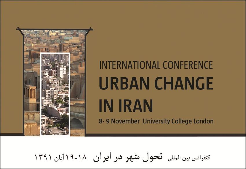
PROCEEDINGS OF THE INTERNATIONAL CONFERENCE

URBAN CHANGE IN IRAN
8-9 November 2012, University College London, UCL

 Editors:
 Fatemeh (Farnaz) Arefian, Seyyed Hosein Moeini

 Proceedings Team:
 Zohra Hasham, Maryam EFtekhar Dadkhah

 Front Cover Illustration:
 Zahra Rajaei

 For more information on the conference visit
 www.urban-change-in-iran.org, or contact
 info@silkcities.org

 Development Planning Unit, The Bartlett, UCL
 34, Tavistock Square, London, WC1H 9EZ
 Tel: +44 (0)20 7679 1111, Fax: +44 (0)20 7679
 1112, W.bartlett.ucl.ac.uk/dpu

 The Conference committee, e.g. host, organisers,
 sponsor and institutional partners, assume no
 responsibility for the statements made in the papers
 of this proceedings. Any opinions expressed are those
 of the individual authors. Copyright of a paper lies
 with the author.

 © All Rights Reserved.

PROCEEDINGS                               INTERNATIONAL CONFERENCW: URBAN CHANGE IN IRAN
                                              8-9 NOVEMBER 2012, UNIVERSITY COLLEGE LONDON   2
Host
The Bartlett Development Planning Unit, DPU, UCL
Scientific Chair
Prof. Yves Cabannes, Chair of Development Planning, the Bartlett Development Planning Unit,
UCL, UK
Principal Organiser
Fatemeh (Farnaz) Arefian, PhD Researcher, the Bartlett Development Planning, UCL; Director,
Civitas Phoenix, UK
Sponsor
UCL Institute for Risk and Disaster Reduction, UK
Institutional Partnerships
(Alphabetic Order)
Centre of Excellence in Urban Design, Shahid Beheshti University, Iran
Civitas Phoenix, UK
Encyclopaedia Iranica, USA
Iranian Association of Urban Designers, Iran
Oxford Brookes University, UK
Technical University Berlin, Germany
The Society of Iranian Town Planners, Iran
This Big City ( media partner), UK
UCLG Committee on Social Inclusion, Participatory Democracy and Human Rights
Urban Design Group, UK
PROCEEDINGS INTERNATIONAL CONFERENCW: URBAN CHANGE IN IRAN
8-9 NOVEMBER 2012, UNIVERSITY COLLEGE LONDON 3Advisory Committee
Prof. Yves Cabannes University College London UK
Mr. Abdolhamid Eshragh Encyclopaedia Iranica France
Prof. Iraj Etessam University of Tehran Iran
Scientific Committee / Paper Reviewers
Prof. David Alexander University College London, UCL UK
Dr. Camillo Boano University College London, UCL UK
Prof. Yves Cabannes University College London UK
Mr. Farrokh Derakhshani Aga Khan Award for Architecture Switzerland
Prof. Iraj Etessam University of Tehran Iran
Dr. Alireza Fallahi Shahid Beheshti University (SBU) Iran
Dr. Seyed Mohsen Habibi University of Paris France, Iran
Prof. Nigel Harris University College London, UCL UK
Prof. Robert Hillenbrand University of Edinburgh UK
Dr. Bernard Hourcade Centre National de la Recherche Scientifique (CNRS) France
Dr. Cassidy Johnson University College London, UCL UK
Dr. Hasan Karimian University of Tehran Iran
Dr. Ramin M.Keivani Oxford Brookes University UK
Dr. Hamid Majedi Azad University Iran
Prof. Ali Modarres California State University USA
Dr. Farshad Nasrollahi Technische Universität Berlin Germany
Prof. Elke Pahl-Weber Technische Universität Berlin Germany
Prof. Ali Parsa University of Salford UK
Dr. Parviz Piran Shahid Beheshti Universty (SBU) Iran
Dr. Mina Saidi Urban Observatory of Tehran and Cities of Iran France
Prof. Ben Wisner California State University USA
Prof. Fulong Wu University College London, UCL UK
PROCEEDINGS INTERNATIONAL CONFERENCW: URBAN CHANGE IN IRAN
8-9 NOVEMBER 2012, UNIVERSITY COLLEGE LONDON 4Welcome Message
PROCEEDINGS INTERNATIONAL CONFERENCW: URBAN CHANGE IN IRAN
8-9 NOVEMBER 2012, UNIVERSITY COLLEGE LONDON 5Table of Contents
Evaluating the Role of Tourism Potentials in the Development of Chabahar Free Zone .............. 13
Bahar Abdolah
Taimaz Larimian
Hooman Gharib
The Recognition of Structural-Spatial Development Models in the Immediate Primary Nucleolus
Ranges of Iranian Historical Cities and Presenting Design Approaches ......................................... 14
Maryam Abdoos
Mehrnaz Norouzi
Urban Continuity and Urban Change; Lessons from Jolfa a Historical District of Isfahan ............ 15
Armaghan Ahmadi Venhari
Hooman Foroughmand Arabi
The Impacts of Urban Design Interventions on the Night-Life of Urban Areas, Case Study:
Mashhad, Iran ...................................................................................................................................... 16
Atepheh Amid
Environmental Regeneration of the Historic Urban Fabric:A Case Study of Sarcheshmeh-
Oudlajan, a Historic Neighbourhood in Tehran ................................................................................ 17
Ata Aminian
Elnaz Behnam Kia
An Investigation on the Effects of Neighbourhood Borders on Equity and sustainability of
Contemporary Iranian Cities .............................................................................................................. 18
Delaram Ashtari
Mapping Cultural Landscape: A Step towards a Socially Responsive Urban Design ..................... 19
Mohammed Askarzadeh
Sahar Hosseini
Assessment of Tehran Metropolis Globalization Factors: Indispensable Changes on the Way to
Globalisation ........................................................................................................................................ 20
Zahra Azad
NeginMozafari
MahsaMostaghim
Ahmad Khalili
Tehran a Call for Spatial Justice.......................................................................................................... 21
Zahra Azizi
Mahya Fatemi
The Relationship between Urban Governance and Sustainable Urban Development in Iran ...... 22
Naser Barakpou
Ramin M. Keivani
PROCEEDINGS INTERNATIONAL CONFERENCW: URBAN CHANGE IN IRAN
8-9 NOVEMBER 2012, UNIVERSITY COLLEGE LONDON 8The Role of Residents’ Perception in Creating Sustainable Neighbourhoods Based on Subjective
Indicators ............................................................................................................................................. 23
Reza Basiri Mozhdehi
Rama Ghalambor Dezfooly
Monotechnic and Polytechnic Aspects in Iran’s Contemporary Urbanism and Architecture ....... 23
Marzieh Emami Meybodi
The Role of Qanat and Irrigation Networks in the Process Of City Formation and Evolution in the
Central Plateau of Iran, the Case of Sabzevar .................................................................................... 25
Hassan Estaji
Karin Raith
A Perceptual Approach to the Urban Colour Changing and Its Impacts ......................................... 26
Ehsan Fatehifar
Helia Taheri
Iranian Townscape and City Form, From Water-Based to Oil-Based Cities ................................... 27
Hooman Foroughmand Araabi
Maryam Khabazi
Pariya Pourmohammadi
Review on Urban Images of Tehran in Iranian Post-Revolution Cinema ....................................... 28
Hamed Goharipour
Re-Visiting Three Neighbourhoods of Modern Tehran: 400 Dastgah | Narmak | Nazi-Abad ....... 29
Rana Sadat Habibi
Bruno De Meulder
Seyed Mohsen Habibi
In the Shadow of Written History: an Exploration of the Tehran Bazaar as a Non-Place ............. 30
Farzaneh Haghighi
Spatial Autocorrelation in the Study of Neighbourhoods: Empirical Evidence from Kerman, Iran
.............................................................................................................................................................. 31
Asra Hosseini
Investigation on the Effects of Iran’s First Baby Boomers (1976-1986) on the Housing Economy
of Iran As Well As the Government Policies to Deal with the Problems Stem from It ...................... 32
Siavash Jamali
Manoochehr Dada
Developing Climate Friendly New Towns, a Case Study of Iran ...................................................... 33
Ghazaleh Jasbi
Pilgrimage, Power and Identity of the Place ..................................................................................... 34
Tahereh Keimanesh
PROCEEDINGS INTERNATIONAL CONFERENCW: URBAN CHANGE IN IRAN
8-9 NOVEMBER 2012, UNIVERSITY COLLEGE LONDON 9Measuring Essential Changes of Neighbourhood Walkability Improvement’s in Tehran
Metropolitan ........................................................................................................................................ 35
Ahmad Khalili
Reza Piroozi
Shabnam Shamlou-Kia
From Modesty to Immodesty: A Quranic Reading of Change in the Islamic Iranian City.............. 36
Seyed Mahdi Khatami
Michael Tawa
Spaces of Sovereignty: An Alternative Reading of the Concept of Iranian Cities ........................... 37
Hamed Khosravi
Bazaar, the City and the Flows of Social Capital ............................................................................... 38
M.Mehdi Maeiyat
Mahyar Arefi
Fabrizio Ivan Apollonio
Investigating Today and Yesterday Roles of River-valley Ecosystems in Mountainous Cities of
Iran and Their Reviving Guidelines, a Case Study: Alloosjard River in Moradbeig, Hamedan ..... 39
Amin Mahan
Mona Meschi
Disrupted Planning Paradigm Shift in Iranian Planning Culture: Challenges to Strategic Spatial
Planning in a Developing Country...................................................................................................... 40
Babak Manouchehrifar
Tehran the Scene of Modernity .......................................................................................................... 41
Azadeh Mashayekhi
Tehran and the Lost Nature ................................................................................................................ 42
Parisa Mirsadeghi
Textural Differences in Street Patterns of Iranian Cities ................................................................. 43
Nahid Mohajeri
Agust Gudmundsson
Recreation of Spirit of Place: An Approach towards Making Urban Texture Durable ................... 44
Shahriar Nasekhian
New Supplementary Planning and Design Documents for Urban Development Management in
Tehran .................................................................................................................................................. 45
Majid Paksaz
Soheila Sadeghzade
Bahareh Hamekasi
PROCEEDINGS INTERNATIONAL CONFERENCW: URBAN CHANGE IN IRAN
8-9 NOVEMBER 2012, UNIVERSITY COLLEGE LONDON 10Interaction of Structural Form and Quality of Content in Iranian Bazaars, case: The Historical
Bazaar of Tabriz................................................................................................................................... 46
Mohammadreza Pourjafar
Mohammadjavad Mahdavinejad
Nasrin Entezary Zenouz
Moein Aghaeemehr
Tehran: Old and New Emerging Spatial Inequality in Tehran ......................................................... 47
Hamidreza Rabiei Dastjerdi
Maryam Kazemi
A Cross-cultural Investigation of Public Spaces in Iranian Cities .................................................... 48
Mohammad Radfar
Spatial Identification and Comparison of Different Segregated Areas and Their Connection with
Their Surrounding Areas: A Case Study of Tehran ........................................................................... 49
Sara Sabet
Sara Mehryar
Application of Semantic WebGIS in Integrated Natural Disaster Risk Management in Iran......... 50
Behzad Sadri
Elnaz Feizshoar
Marjan Samiei
Shirzad Mahmoodiazar
Tehran Grand Bazaar as a Diorama of a Persistent Urban Artefact ................................................ 51
Negar Sanaan Bensi
Citizens as Drivers for Urban Change: Citizens’ Exhibition as Participatory Tool to Integrate the
Citizens’ View in the Development of Hashtgerd New Town Unique Paper .................................. 52
Sabine Schröder
Jenny Schmithals
Typo-Morphological Analysis of Housing Layout and Density in Tehran ...................................... 53
Homeira Shayesteh
Philip Steadman
From Utopia to Dystopia: Shushtare-No, Endeavors towards a Paradigmatic Shift ...................... 54
M. Reza Shirazi
Safeguarding Our Fragile ‘Historic Urban Landscapes’: Should Historic Iranian Cities Be
Worried? .............................................................................................................................................. 55
Damoun Vahabi Moghaddam
Sepideh Zarrin Ghalam
PROCEEDINGS INTERNATIONAL CONFERENCW: URBAN CHANGE IN IRAN
8-9 NOVEMBER 2012, UNIVERSITY COLLEGE LONDON 11The Evaluation of State-Led Regeneration in Large-Scale Property-Led Regeneration Projects in
Iran ....................................................................................................................................................... 56
Alireza Vaziri Zadeh
Cultural Heritage of Urban Definitions: Centres and Borders ......................................................... 57
Hamed Zarrinkamari
Maryam Moayery Nia
Posters Exhibited................. ..............................................................................................................58
Papers for the website............................ ...........................................................................................65
Panel discussions................................................................................................................................67
Global Dimension of Urban Change
Urban Development and Energy Efficiency in Iran
Cities in the Region
Urbanisation and Resilience to Natural Hazards in Iranian Cities
Guest Speakers....................................................................................................................................70
PROCEEDINGS INTERNATIONAL CONFERENCW: URBAN CHANGE IN IRAN
8-9 NOVEMBER 2012, UNIVERSITY COLLEGE LONDON 12Evaluating the Role of Tourism Potentials in the
Development of Chabahar Free Zone
Bahar Abdolah
MSc Student, Regional Planning, Department of Art and Architecture
Science and Research Branch, Islamic Azad University
Bahar.abdolah86@yahoo.com
Taimaz Larimian
MSc, Urban and Regional Planning
Department of Art and Architecture, Science and Research Branch, Islamic Azad University
timazlarimian@yahoo.com
Hooman Gharib
MSc Student, Network system, University of Sunderland
Ahora1010@gmail.com
Abstract
The development of tourism industry requires comprehensive knowledge of the economic,
social and cultural situation of the region. The commercial–industrial free zone of Chabahar
presents plenty of potentials to cause regional development in South-East Iran. Having a
significant number of natural, cultural and historical tourist attractions, proximity to the Persian
Gulf littoral states and having the particularly strategic position as one of the most important
transit corridors of Iran, this region can become a major tourist hub of Iran. However, due to
numerous problems and obstacles, this area could not fully benefit from its existing potentials.
The purpose of this study is to introduce and review the tourism potentials in Chabahar free
zone and their role in development of the region. FUZZY AHP method has been used for this
analysis. Finally, some guidelines have been provided for tourism development in Chabahar.
The results of the research show that among the investigated indicators, through application of
FUZZY AHP technique, improving facilities and utilities, development of advertising and
marketing and infrastructure investment respectively will potentially have the most significant
roles in the development of tourism industry in Chabahar. In addition, the results of field studies
indicate that multiplicity of decision makers, poor management, lack of adequate infrastructure
and weak marketing are main weaknesses of the region. However, the existing employment
context as the main opportunity and various tourist attractions as the main strength can be
efficient in the development of Chabahar Free Zone.
Keywords: Tourism and Development, Chabahar Free Zone, Fuzzy AHP
PROCEEDINGS INTERNATIONAL CONFERENCW: URBAN CHANGE IN IRAN
8-9 NOVEMBER 2012, UNIVERSITY COLLEGE LONDON 13The Recognition of Structural-Spatial Development Models in
the Immediate Primary Nucleolus Ranges of Iranian
Historical Cities and Presenting Design Approaches
Maryam Abdoos
Maryam.abdoos231@gmail.com
Mehrnaz Norouzi
M_norouzi@srbiau.ac.ir
Abstract
A general view of the expansion in historical districts of Iranian cities indicates a similar process
in all of them. Prior to the last two-hundred years ago, urban development was responsive to
the insufficient space inside the existing limits of a city, and it passed through a soft and
reasonable growth. During Qajar and the first Pahlavi, the areas surrounding the existing urban
nodes continued a gradual growth towards (or around) the old city walls. Since the mid- second
Pahlavi era (following the Land Reform), the urban growth became faster and more intensive,
particularly after the 1978 revolution. The urban space of this era had no particular location
quality; therefore, the necessity of communication between an urban space and its structural
and socio-spatial ground was neglected. Peripheral developments took place copying western
building models. The above three periods have more or less occured in all Iranian cities.
Historic city centres in Iranare generally connected to the peripheral developments and other
urban cores through a middle layer, which is neither fully modern nor fully traditional.
Environmental designers on one hand face traditional spaces, and on the other hand the
increasing changes in Iranian lifestyle. As it appears, it is a necessity to define the structural-
spatial patterns of the immediate peripheral areas around city centres in order to re-establish a
dialogue between the historic texture of central cores and contemporary developments. To
address the above need, this research provides a brief study of changes in peripheral areas of
five historic cities. The research offers a conceptual model for those changes in structural-
spatial dimensions, followed by an extraction of spatial and social structure indexes of those
parts. It concludes by suggesting some suitable approaches to the characteristics of cities. The
aim of this paper is to re-define structural and spatial patterns of peripheral fabrics around
historic cores that can be used for urban recreation in the intermediate layers between two new
and old areas. The research hypotheses include the following:
Attention to adjacent local characteristics in re-designing the intermediate areas would
improve their local identity and promotes its spatial-visual quality.
Regulating the dialogue and consistency between peripheral areas, the historic fabric and
new developments is possible through understanding spatial, visual and morphological
characteristics.
Keywords: Historical District, Pattern of City, Contextualism, Spatial Characteristics, Visual
Characteristics, Morphological Characteristics
PROCEEDINGS INTERNATIONAL CONFERENCW: URBAN CHANGE IN IRAN
8-9 NOVEMBER 2012, UNIVERSITY COLLEGE LONDON 14Urban Continuity and Urban Change; Lessons from Jolfa, a
Historical District of Isfahan
Armaghan Ahmadi Venhari
Urban Designer, PhD Candidate in Urban Design, Shahid Beheshti University
Ahmadi.armaghan@gmail.com
Hooman Foroughmand Arabi
Urban Designer, PhD Research Student in Planning Studies, Bartlett School of Planning
UCL University College London
hooman.araabi.11@ucl.ac.uk
Abstract
There is a dialectical relationship between continuity and change in urban phenomena. When
urban change accelerates, especially due to external forces, cities are likely to face the crisis of
identity. Iran is a country that has undergone very different situations throughout its history,
and its cities have respectively responded through different ways of survival. One of these cities
is Isfahan, which includes a district called Jolfa: the first designed neighbourhood of a city in
Iran. Jolfa as a place to settle Armenian immigrants to Iran in Safavid era is the most viable
historic urban space with 2% effete, and it is the heart of social life in contemporary Isfahan.
The main goal of this research is to find out how Jolfa has adapted to changing situations. Thus,
the process of site allocation for Jolfa, its development and current position is studied. In
response to the key role of ecologic and social aspects in Jolfa this research is focused on the
relation of socio-ecologic aspects and the built environment. The majority of Iran is located in
the climate where supplying water is much of a struggle and inhabiting in such a situation was
deeply based on innovative methods of managing resourses. Therefore the form of capital in
this territory was, unlike Europe, water rather than land. One of these innovative methods was
building creeks diverged from rivers called Madi and another was bringing green space into
built environment. Apart from their ecological functions, water canals function as
infrastructures prompting social interaction. This research focuses on historic processes of
development and the role of water. Although, some wrong decisions threaten this unique
neighbourhood, the sense of community is the key to Jolfa’s survival now. This research used
historic documents and traced the footprint of history in the contemporary city in a field study;
in addition, GIS was applied as a method of study. This research goes beyond the shape of city
and focuses on social aspects of it. It is also hoped that the results of this case study can be used
beyond Jolfa in other cases.
Keywords: Urban Change, Historic Development, Isfahan, Jolfa, Eco- social Development
PROCEEDINGS INTERNATIONAL CONFERENCW: URBAN CHANGE IN IRAN
8-9 NOVEMBER 2012, UNIVERSITY COLLEGE LONDON 15The Impacts of Urban Design Interventions on the Night-Life
of Urban Areas in the Case of Mashhad, Iran
Atepheh Amid
Architect/Planner, PhD Candidate, University of Westminster
atepheh.amid@gmail.com
Abstract
In contemporary societies modern life, based on technology, sets out new forms of social
activities and entertainments and the possibility to experience them during both day and night.
In Western societies, different leisure spaces including theatres, opera houses, cinemas,
restaurant, fast food restaurants, pubs, bars, clubs and cafes attract various groups of people for
socialising at night.
Night has been known and experienced differently in various cultures and time periods. Local
and international forces related to economic, cultural and political issues shape the night-time
activities of each city. As Roberts and Eldridge (2009) discuss there is no singular night-time
economy, but a number of economies in different cities or even in different areas of one city
running side-by-side in support or opposition to each other.
The discussion about the city at night is dominated by Western frameworks and experiences. In
this paper I will investigate Mashhad as a 24-hour city in Iran. Night-life in Iran as a middle-
eastern country cannot be explained using available literature because of religious practices or
a response to the climate. In Iran, religious rules and regulations do not allow any pubs, bars,
casinos or clubs. However, the cities work at night continuing day-time activities.
Mashhad is the second largest city of Iran. It is one of the holiest cities in Shiite Islam as the
shrine of Imam Reza is located at its centre. It has a population of almost three million and
annually hosts over 25 million pilgrims. This large number of visitors and the shrine
characterises the city and 24-hour activities. As the boundaries between day and night in
Mashhad are less visible, the night-time activities include all kinds of urban activities whether
religious, business, recreational, social or commercial.
The shrine area with its old urban fabric, almost covering the fortified old city of Mashhad, is the
main destination of pilgrims during day and night. This area has been working 24-hours for
many years, and will continue to work as long as it hosts pilgrims. However, an important issue
threatening the 24-hour feature of the area is the Regeneration and Reconstruction Plan of the
Shrine Area started in 2001. The main purpose of this plan, following the modernisation wave
started in Iran in 1930s, is to modernise the area in order to attract and accommodate more
pilgrims. This plan is based on changing the area’s features and improving its performance by
replacing the small shops, guest-houses and the residents’ houses with new multi-level
shopping centres and hotels and widening the current streets to facilitate the traffic. Financial
exclusion, emergence of neglected spaces, public space invaded by vehicles, loss of authenticity
and growth of placelessness are the initial results of this plan.
In this paper Mashhad is investigated as a city with organic 24-hour attributes, influenced by
religious, cultural and commercial issues, while the modernisation efforts of Iranian urban plans
are threatening the continuity of its night-life.
Keywords: Night-time Economy, Urban Design, Mashhad, Iran, Regeneration, Historic District
PROCEEDINGS INTERNATIONAL CONFERENCW: URBAN CHANGE IN IRAN
8-9 NOVEMBER 2012, UNIVERSITY COLLEGE LONDON 16Environmental Regeneration of the Historic Urban Fabric: A
Case Study of Sarcheshmeh-Oudlajan, a Historic
Neighbourhood in Tehran
Ata Aminian
PhD Candidate, Environmental Design, Sapienza – Università di Roma
ata.aminian@uniroma1.it
Elnaz Behnam Kia
PhD Candidate, Environmental Design, Sapienza – Università di Roma
elnaz.behnamkia@uniroma1.it
Abstract
There has been a sharp increase in the world’s urban population in recent decades. This has
caused a large array of new pressures in urban settlements and their historic areas, which have
become centres and drivers of economic growth in many regions of the world. The scale and
speed of development and the changing economy, have transformed urban areas as they adopt a
new role in cultural and social life.
Under processes of global market liberalisation, Iranian cities have been subjected to dramatic
development challenges. These have had an impact on the integrity of the urban fabric, and the
identity of communities, which had historically been successively produced by traditions and
good practices according to climate diversity and existing cultures. The new disruptive
processes in the urban development context with the aim of more income from real estate have
resulted in a drastic deterioration of the quality of the urban environment and life. Challenges
include a standardised and monotonous urban landscape, debilitating poverty, social isolation,
and an increasing risk of climate-related disasters.
This research is conducted in order to revise the methods of analyses, and the ways of their
interpretation; and to determine targets and strategies for better management of physical and
social transformation. By criticising the current urban policy and using international good
practices, and prioritising social and environmental factors with their reciprocal relationships,
which is important for a better regeneration and redistribution of resources, it also aims to
define improved strategies and policies with a scientific interpretation method of analysis. In
consequence, the focus of this research is not only on the clash between conservation and
innovation of a single fabric with its physical dimensions and historic values, it also tries to
suggest a paradigm to re-integrate the historic urban fabric as a component of the broader
context of the territorial system in which it is physically located, historically dated,
anthropologically stratified, and socio-economically integrated.
The case study of Sarcheshmeh-Oudlajan – a historic neighbourhood in Tehran – is chosen for
its characteristics as a both historic and contemporary built environment, its infrastructures
above and below ground, its land use patterns and spatial organisation, as well as all other
elements of the urban structure. It could be a good new model based on ecologically sensitive
policies and practices in order to improve sustainable growth, economic health and the quality
of urban life. In this way the research approach offers assistance in managing and mitigating the
impacts on urban heritage neighbourhoods through regeneration and conservation on the basis
of eco-efficiency aspects. These strategies may be generalised for other parts of the city, to
achieve a balance between urban growth and well-being of communities, and between
technological culture and environmental sustainability of the historic urban landscape.
Keywords: Historic Urban Fabric, Environmental Regeneration, Liveability, Bioclimatic
Approach, Open Space
PROCEEDINGS INTERNATIONAL CONFERENCW: URBAN CHANGE IN IRAN
8-9 NOVEMBER 2012, UNIVERSITY COLLEGE LONDON 17An Investigation on the Effects of Neighbourhood Borders on
Equity and sustainability of Contemporary Iranian Cities
Delaram Ashtari
Graduate Student, Urban Design
Urban Planning School, Faculty of Fine Arts, Tehran University
delaram.ashtari@ut.ac.ir
delaramashtari2004@yahoo.com
Abstract
The city is considered as a whole that is divided into components with different characteristics.
The neighbourhood might be known as its most important component; and while each of the
components is a specific unit, they get together and create a city. The concept of neighbourhood
is rooted in Iranian tradition, but nowadays modern spatial divisions in cities change the
definition of neighbourhood. These divisions change the link between neighbourhoods, and
redefine borders of them.
While borders are considered essential for defining an identity for the neighbourhood, they
also create new spaces that always remain undefined. These spaces have a dual nature:
separation and connection. Hence, borders determine the quality of relation between
neighbourhoods. They can create equity or spoil it, and ultimately cause neighbourhoods’
growth or decline.
In this paper, after reviewing the literature on spatial division and neighbourhood borders, I
have tried to recognise socio-spatial qualities of these spaces in contemporary Iranian cities.
Therefore I chose Azarbaijan Street - located in the central part of Tehran - as a case study and
investigated social and spatial features by observation and interviews.
This paper argues that neighbourhood borders should be considered as an urban space that is a
place for appearance of differences; and they have specific characteristics that are different
from adjoining neighbourhoods. Borders are shared spaces between neighbourhoods and have
a significant effect on forming social interactions and consequently creation of congruity and
equity among neighbourhoods. If we eliminate pedestrians from these spaces, the city becomes
as a collection of islands without meaning.
Keywords: Spatial Division, Neighbourhood, Neighbourhood Borders, Urban Space, Azarbaijan
Street
PROCEEDINGS INTERNATIONAL CONFERENCW: URBAN CHANGE IN IRAN
8-9 NOVEMBER 2012, UNIVERSITY COLLEGE LONDON 18Mapping Cultural Landscape: A Step towards a Socially
Responsive Urban Design
Mohammed Askarzadeh
University of Arizona
mha@email.arizona.edu
Sahar Hosseini
University of Wisconsin-Milwaukee
Hossein7@uwm.edu
Abstract
Examining the built environment along Jomhouri Street in the city of Tehran, and the process of
genesis of its landscape, this paper presents a conceptual framework for applying cultural
landscape to inform urban projects carried out in the city. Whether new constructions or
conservative interventions in the existing fabric, urban design in Tehran, especially in old urban
fabrics has been a controversial issue, puzzled by contradictory desires for moving towards
future and looking to the past. New approaches, introduced in recent years, though tried to be
sensitive to history, often failed to recognise the uniqueness of each case, capture the multiple
stories embedded in the landscape and address them properly. Of particular importance are
urban projects intervening in the streetscape of downtown Tehran, especially in those streets
constructed during the first Pahlavi’s (1921-1941) radical-modernising urban projects. Despite
the long-discussed harms and problems these streets brought to the city, they provide us with a
unique opportunity to view cross sections of the city. ‘Palimpsest of past forms super-imposed
upon each other’, as David Harvey (1990) puts it, landscapes of these streets are tangible and
visible articulations of numerous historical and contemporary discourses throughout the last
century. Not only these landscapes are not monotonous, but also each embraces multiple zones
with distinct identities. Hardly, following the structure of urban grids, these zones are products
of a syntax between various socio-economic factors, varying in time and place.
Acknowledging the importance of landscape as ‘public history’ (Hayden, 1995), this paper
argues that any urban design or policy should be fully informed by discourses that have shaped,
and are shaping landscape of the city. It further demonstrates the shortcoming of conventional
maps which only record and project fixed sets of data, and introduces a different approach for
mapping memories, daily activities and historical discourses that shape the cultural landscape
of the street but are absent from conventional maps. This mapping technique allows us to
visualise sets of important but often disregarded information in the form of a new layout, which
shall be added to the conventional maps always present in urban design projects. To further
explore and articulate this mapping technique, Jomhouri Street is used as a case study. Through
extensive fieldworks and historical analysis, the landscape, its various zones and processes of
their genesis are examined and mapped; in order to enable us to capture and present values
embedded in the site, which will inform future policy making and design decisions for the entire
or part of the street.
Keywords: Cultural Landscape, Spatio-cultural Layers, Collective Memories, Mapping
PROCEEDINGS INTERNATIONAL CONFERENCW: URBAN CHANGE IN IRAN
8-9 NOVEMBER 2012, UNIVERSITY COLLEGE LONDON 19An Assessment of Tehran Metropolis Globalisation Factors:
Indispensable Changes on the Way to Globalisation
Zahra Azad
Graduate Student, Urban Planning, Art University of Tehran
zahraazad1800@gmail.com
NeginMozafari
Graduate Student, Urban Planning, University of Tehran
negin.mozafari@ut.ac.ir
MahsaMostaghim
Graduate Student, Urban Planning, Art University of Tehran
mostaghim.mahsa@yahoo.com
Ahmad Khalili
PhD Candidate, Urban and Regional Planning, University of Tehran
ahmadkhalili@ut.ac.ir
Abstract
As globalisation expanded in recent years, a great number of cities especially in developing
countries have concentrated on effective efforts in order to be considered as global cities.
Among these cities, the absence of Tehran, as one of the largest cities of Asia, is tangible.
Although Tehran has a great potential for taking the advantage of being a global city, on the
grounds that it is located in the Heartland Area, GAWC world-city status classified Tehran
among the cities that are neither global nor shared their national territory with a world city.
Therefore, continuing denial of such trend can leave Tehran deprived of enormous advantages
following these flows. In this regard, this study is carried out to propose some strategies to
promote Tehran as a global city. The research is based on identifying key factors which can lead
to Tehran being considered as a global city.
Keywords: Globalisation, Tehran Metropolis, Factor Analysis, Regression Analysis
PROCEEDINGS INTERNATIONAL CONFERENCW: URBAN CHANGE IN IRAN
8-9 NOVEMBER 2012, UNIVERSITY COLLEGE LONDON 20Tehran: a Call for Spatial Justice
Zahra Azizi
Architect/Urban Designer, Bartlett school of Architecture UCL, ATEC Consultants
zahra.azizi@gmail.com
Mahya Fatemi
Architect/Urban Designer, Bartlett Development Planning Unit, UCL
Mahya.fatemi@gmail.com
Abstract
Space is not an empty void. It is always filled with politics, ideology and other
forces shaping our lives and challenging us to engage in struggles over geography.
Edward W. Soja (2010, p.19)
Placed among a blend of geographic collages and augmented landscapes, societies are
continuously striving for security, equality and drawing fair and democratic boundaries all the
while injustice embeds itself into space. The phenomenon of the ‘city’ and ‘urban life’ is born
through the evolving process of satisfaction of social primary and secondary needs. Overcoming
the basic needs in life furthermore calls for a certain profound personal spiritual fulfilment,
sometimes seeking a powerful definition of existence among the dynamic complex of urbanism.
Needs lead to the formation of traditions that entail the repetition of desires. Through the
continuity of a functioning social structure, urban fabrics come to being. Consequently, the
space is socially produced. Justice defined as ‘the quality of being fair and reasonable’ is also
suggested to be socially created over time and therefore can be considered as a temporal entity.
‘Time brings us to life, tempers our existence, makes us unalterably and irreversibly
contemporary, and in the end unavoidably temporary’ drawing us to behave accordingly to the
situations we are placed upon. Just or unjust behaviour manifested into space is an utter and
clear result of our own decision making; whether personal, economic or political.
So long as the ultimate goal of any decision would be the persistence of social welfare, spatial
justice would relatively be accomplished. However, the other end of the spectrum would be the
study of the immense gap between the affluent ‘who seal themselves for protection’ and the
deprived who become poorer by default. This favours the wealthy and disfavours the
unfortunate and therefore uneven developments form upon the geographies we live upon.
Tehran, a city that has welcomed rural migrants for decades, is an evident example of a
collection of social gaps which have widened over time through various divisions including class
and social background. As implied before, cities are living, responsive beings. Like every living
entity a city can reach the brink of a nervous breakdown. Inside every city, there is a breaking
point, for Tehran, that point is NOW. If she is pushed too far, one day she might just push back.
There always has been mutual interaction between man and the city. To implement one of the
most precious yet neglected factors of human rights, the freedom to shape and reshape
ourselves and the city, a collective force beyond that of the lone individual is required. ‘If our
urban world has been imagined and made, then it can be re-imagined and re-made.’
For Tehran this paper aims to extract opportunities, situations, ideals and dreams of a nation
with an eye for beauty and a taste for socio-economic happiness through the lens of seeking
spatial justice.
Keywords: Right to the City, Tehran, Spatial Justice, Social Structures, Uneven Development
PROCEEDINGS INTERNATIONAL CONFERENCW: URBAN CHANGE IN IRAN
8-9 NOVEMBER 2012, UNIVERSITY COLLEGE LONDON 21The Relationship between Urban Governance and
Sustainable Urban Development in Iran
Naser Barakpou
Associate Professor, Faculty of Urban Planning and Architecture, University of Art, Tehran, Iran
barakpoo@art.ac.ir
Ramin M. Keivani
Reader in International Land Policy and Urban Development, Oxford Institute for Sustainable
Development, Department of Real Estate and Construction, Oxford Brookes University
rkeivani@brookes.ac.uk
Abstract
Cities in Iran face major challenges in all domains of sustainability relating to environmental,
social and economic dimensions of development. These challenges are manifest at different
spatial scales from metropolitan to local neighbourhood levels. Environmental challenges
include high and ineffective energy consumption, destruction of natural environment, pollution
of air, water, soil, noise and other related problems. On the social and economic fronts, poverty
and inequality in access to public services and infrastructures and employment has led to rapid
growth of informal settlements and informal economic activities inside and on the fringe of
medium and big cities. Furthermore, dependence of municipalities on unsustainable and
irregular revenues that mostly derives from construction levies and taxes, has led to numerous
challenges for long-term provision of basic city services.
Previous research and reports on evaluating sustainability of Iranian cities and regions support
these claims (e.g. TURPC, 2011; WGES, 2009; World Bank, 2005). However, these have largely
focused on assessing what Faludi has described as ‘substantive’ issues in planning, i.e. methods
and application of planning such as identifying and measuring sustainable development
indicators in environmental, social and economic areas. As a result, and again using Faludi’s
terminology, they have neglected to examine underlying ‘procedural’ issues affecting
sustainability, e.g. urban governance, and the relationship between ‘substantive and procedural’
aspects. This paper argues that the ‘procedural’ factors, including institutional and social
capacities are fundamental for progressing and achieving sustainable development goals.
The main aim of this research, therefore, is to examine the institutional and social capacities for
moving and progressing towards sustainable urban development in Iran. The paper adopts a
systematic review or meta-analysis approach and brings together results of a number of
previous studies undertaken by the authors and other researchers on social and institutional
development in cities of Iran more generally. The findings indicate that there are not sufficient
social and institutional capacities for progressing towards sustainable cities. Nevertheless, the
paper contributes to better understanding of the potential that already exists, the barriers that
must be overcome and the role that main agents play in shaping and utilizing these capacities.
The paper finally presents a discussion about what may be the most appropriate future agenda
for research on relationship between sustainability and governance in Iranian cities.
Keywords: Sustainable Urban Development, Urban Governance, Social Capital, Institutional
Capital, Iran
PROCEEDINGS INTERNATIONAL CONFERENCW: URBAN CHANGE IN IRAN
8-9 NOVEMBER 2012, UNIVERSITY COLLEGE LONDON 22The Role of Residents’ Perception in Creating Sustainable
Neighbourhoods Based on Subjective Indicators
Reza Basiri Mozhdehi
MA, Urban Design, School of Architecture and Urban Planning
Iran University of Science and technology
Basiri1359@gmail.com
Rama Ghalambor Dezfooly
PhD, Urban Planning, Assistant professor in Department of Art and Architecture
Pardis branch, Islamic Azad University, Tehran, Iran
Ramaghalambor@gmail.com
Abstract
Despite the fact that sustainability has been turned into an essential and multi-functional goal in
planning and designing neighbourhoods, in recent decades, well-developed approaches to
achieve this goal are still usually restricted to objective-oriented and environmental-based
issues in many developing countries, including Iran. It is important how residents perceive
sustainability in terms of subjective-oriented indicators. Such perception affects well-being, one
of the most important subjective indicators in the quality of life, which directly affects and is
affected by sustainability.
This paper argues that if subjective indicators derived from principles such as ‘place
attachment’ and ‘sense of belonging to place’ are used to explain residents’ perception of a
sustainable neighbourhood, significant differences will be found between residents’ valuations
of subjective criteria of sustainability even in neighbourhoods located in the same city, Tehran.
These neighbourhoods were examined here through defining and localising related criteria and
special indicators derived from them.
Results show that residents’ perception of sustainability varies in these neighbourhoods
according to social classes, counteractions between the more and the less traditional
neighbourhoods, level of awareness of environmental concerns, and even factors such as
average age and gender. Therefore, in order to plan and design a sustainable neighbourhood, it
is not only necessary to consider objective-oriented environmental, social, and economic
indicators, but also, subjective and perceptual indicators should be employed. These perceptual
indicators should emphasise on local customisation based upon environmental, political,
cultural, and economic context of the place.
Keywords: Sustainability, Subjective Indicators, Residents’ Perception
PROCEEDINGS INTERNATIONAL CONFERENCW: URBAN CHANGE IN IRAN
8-9 NOVEMBER 2012, UNIVERSITY COLLEGE LONDON 23Monotechnic and Polytechnic Aspects in Iran’s Contemporary
Urbanism and Architecture
Marzieh Emami Meybodi
Research Scholar, UC Berkeley, Department of Environmental Design
PhD Candidate, University of Tehran
marziehemami@berkeley.edu
+1-510-502-3716
Abstract
Approximately seven decades after the industrial revolution, modernism became a growing
trend in Iran. The sparks of ‘being modern’ appeared in the Qajar period (through the Naser-e-
Adin shah’s abroad joineries in the late of 1880s). However, its related changes in the
morphology of society has been documented since the 1920s. Analysing the social, political and
cultural context of this change, according to ‘philosophy of technology’, reveals specific field of
science and thought.
Based on Mumford’s opinion, the philosophy of technology presents two aspects of technique in
the procedure of applied technology; they are Monotechnic and Polytechnic. Polytechnic offers,
receives and deals with instruction in many industrial arts and applied science, and it is adapted
to various needs and demands of human life. Monotechnic, offers instruction in a single
scientific of technical subject. According to Mitcham, Monotechnic is a powerful technique based
on scientific intelligent and quantitative productions. The word Monotechnic entered literature
in 1900s.
This paper presents a new framework to ease understanding of the multi-layered situations of
Iran’s contemporary urbanism and architecture based on Monotechnics and Polytechnics. The
result obtained from this review is presented in a comparative model. The research method is
qualitative; and it is based on interpretive-historical research.
Keywords: Polytechnic, Monotechnic, Iran, Contemporary, Urbanism, Architecture
PROCEEDINGS INTERNATIONAL CONFERENCW: URBAN CHANGE IN IRAN
8-9 NOVEMBER 2012, UNIVERSITY COLLEGE LONDON 24The Role of Qanat and Irrigation Networks In The Process Of
City Formation and Evolution in the Central Plateau of Iran,
the Case of Sabzevar
Hassan Estaji
PhD Candidate, University of Applied Arts Vienna
estaji@student.uni-ak.ac.at
Karin Raith
Associate Professor, Faculty Member, University of Applied Arts Vienna
karin.raith@uni-ak.ac.at
Abstract
‘The morphology and spatial patterns of cities have gradually developed to satisfy the cultural
needs of their populations and to respond to their surrounding environment’ (Kheirabadi, 2000).
The main cities of the central plateau of Iran are mostly located on the outer edge of this region.
This distribution of the cities within the territory is determined by climatic impacts. Due to the
scarce precipitation and the rapid evaporation of water for more than six months of the year,
the region lacks permanent rivers, for that reason it was hard to establish permanent
settlements. The population had to move between mountains and plains seasonally, but the
invention of ‘Qanats’ changed the history. By means of these underground aqueducts water was
funnelled from mountainous areas and aquifers to lower lands. Alluvial fans could be opened up
to settlement and an agrarian civilisation evolved. Qanats became a crucial factor for the
habitat.
Sabzevar is located in the northeast of Iran, south of the Sabzevar mountain range on the outer
edge of the Central Plateau of Iran. A close examination of the Qanat dispersion maps of the
Sabzevar region reveals that Sabzevar and the neighbouring villages are located in parallel with
the Sabzevar Mountains. The distance between the mountains and the settlements depends on
the length of the Qanats.
‘Qanat also underlies the street pattern of cities as well. In some cities, Qanat water flows in
tunnels beneath residential areas and surface near the cultivated area’ (English, 1997). This
water supply system is one of the important factors of the morphology of the desert cities. By
comparing old maps of the Sabzevar Qanats and water routes with maps of historical streets
and alleys in Sabzevar we found that the urban development pattern of Sabzevar is based on the
transformation of farming lots to urban residential spaces. When in the course of urbanisation
the fields were turned into houses with gardens, main streets were laid out along the course of
main Qanats and alleys along subsidiary channels. The resulting street pattern corresponds
with the old irrigation network and interestingly, the hierarchy of streets follows the hierarchy
of the water distribution net.
Keywords: Qanat, Irrigation Network, Iranian Cities, City Formation, Morphology, Sabzevar
PROCEEDINGS INTERNATIONAL CONFERENCW: URBAN CHANGE IN IRAN
8-9 NOVEMBER 2012, UNIVERSITY COLLEGE LONDON 25A Perceptual Approach to the Urban Colour Changing and Its
Impacts
Ehsan Fatehifar
University of Tehran, Iran
e.fatehifar@ut.ac.ir
Helia Taheri
University of Tehran, Iran
Helia.taheri@ut.ac.ir
Abstract
Imagine the city without colours...
Have you ever thought about that?
What is the colour of your hometown, or an ideal city in your mind?
Do you recognise a city through its colours or just by a single obvious colour?
These are our questions!
Today, as in the past, colour represents an important element of recognition, belonging,
legibility and quality of the city. However, perhaps we are not aware of changing the colour of
our spaces and its deep impacts. Same as with other countries, colour plays an integral role in
shaping cities’ identity in Iran. Therefore the research concerns an analysis of the city colour
palette reflecting urban change in Iran as a developing country. A comparison between studies
undertaken in other countries with those in Iran showed that we need a new and exact
perspective toward this subject. Adapting research achievements in other countries to find a
new effective approach for Iranian cities is our goal. The city of Qazvin was chosen to examine
the implementation of this approach.
In Iran some experiments has been done by the municipality of Tehran last year (2011). This
was through a survey, which involved two different groups of interviewees - experts and
ordinary people. However, it did not cover a balanced statistical society. The considerable gap
between the research results and its practical method showed us that redesigning questions
based on interviewees’ categories and also preparing new illustrated data with more
parameters are needed in order to fill the gap between the research results and its practical
codes.
Therefore, three different statistical groups have been selected, namely, ordinary people
(residents), tourists and experts. The group ‘ordinary people’ included three sub groups,
namely, elderly, adults and children. Qazvin city has been selected as a case in order to analyse
those groups in an ancient city, and to find more reliable data. New data generated from
different types of questions for each group, on the basis of each group’s characteristics. The
outcome helped us to find out more about people’s perspectives on their contemporary city and
also their ideal city.
In conclusion the outcome of this research reminds us to rethink the impacts of city colour
palette on ever changing cities. Moreover, it might create a responsive path to fill the gap
between the contemporary and the ideal city; developing previous studies and potentially
establishing a new perspective for further researches.
Keywords: Urban Changing, Colour Palette, Shaping Cities, Process of Colour Analysis
PROCEEDINGS INTERNATIONAL CONFERENCW: URBAN CHANGE IN IRAN
8-9 NOVEMBER 2012, UNIVERSITY COLLEGE LONDON 26Iranian Townscape and City Form, From Water-Based To Oil-
Based Cities
Hooman Foroughmand Araabi
PhD Research Student, Bartlett School of Planning, UCL, London, UK
hooman.araabi.11@ucl.ac.uk
Maryam Khabazi
MA, Theories of Urban Practice, Parsons, the New School for Design, New York, USA
Khabm534@newschool.edu
Pariya Pourmohammadi
MSc, Urban Design, Department of Art and Architecture, Science and Research Branch,
Islamic Azad University,Tehran, Iran,
ppourmohammadi@yahoo.com
Abstract
The development of cities is based on economy in Iran. Water and later oil have been the main
economic resources and therefore associated with power. Taking this point of view, this
research discusses what traits influenced the form and townscape of some Iranian cities in the
past. It includes two parts: the first part, the way the geopolitical situation of Iran valued the
water and how the movement of water affected the form of Iranian cities in pre-modern Iran are
discussed, and later, how water as an influencein the formation of the city was replaced by oil
after industrialisation and discovery of oil. The process of deterritorialisation of water and
consequently reterritorialisation of oil can be distinguished through previous discussions, with
two distinct examples of water-based city, Isfahan (Isfahan) and oil-based city, Abadan. In the
second part, historic constructions and their original and current usage are introduced, like
some water systems that were exploited in pre-modern Iran such as Qanat (subterranean
aqueducts), Yakhchal, Abanbar, Badgir (Wind Catcher), and madi, that shaped the townscape
and skyline of Iranian cities and how they worked and were used. The paper is concluded by
discussing how aquatic constructions lost their meaning and function and either were
destroyed or turned into tourist sites after the emergence of oil is concluded.
In fact, with the emergence of oil based cities many vernacular types of urban infrastructure
ceased to exist and the criteria for locating cities considerably changed. Thus, oil discovery
caused a quasi-revolution in Iranian cities’ form and location.
Keywords: Water-Based City, Oil-Based City, Form of the City, Deterritorialisation,
Reterritorialisation
PROCEEDINGS INTERNATIONAL CONFERENCW: URBAN CHANGE IN IRAN
8-9 NOVEMBER 2012, UNIVERSITY COLLEGE LONDON 27A Review of Urban Images of Tehran in the Iranian Post-
Revolution Cinema
Hamed Goharipour
MA, Urban and Regional Planning, Tehran University of Allameh Tabataba'i
Hamed_goharipour@yahoo.com
Abstract
Both metropolis and cinema are the products of modernity. Since the end of the nineteenth
century, the fortunes of cinema and the city have been inextricably linked to each other on a
number of levels. It can be said that cinema, space and place need each other for description.
First images of cities in the movies almost coincide with the birth of cinema; and after a short
time all major cities in the world were shown in movies. As a result of such links, the social and
physical changes in cities such as Berlin, Paris, Rome and the cities of the United States can be
reviewed through cinema along with other sources. All these contributed to the emergence of a
new genre in cinema: ‘city film’ or ‘urban symphony’. Subjects such as alienation, population
growth, mass storage, informal settlements, urban semiotics and so on, repeatedly and in
different time periods have been displayed in movies.
An analysis of a filmic representation of a city begins with observing how individual films
represent the conditions of a city or neighbourhood in a specific historic moment. The analysis
then moves beyond seeing film as a mere representation of social reality towards focusing on
how the cinematic text constructs and comments on those conditions. Any analysis of a city film
can begin with an examination of the primary urban spaces which are portrayed in the film.
How are these urban spaces staged and linked (or not linked) to other spaces in the city? How
are interior and exterior spaces defined? How are public and private spaces defined? How do
such spaces reflect the social reality of race, class, and gender?
In Iran, Tehran has been the major location of the films in recent decades. This city has been
cinematically analysed, sometimes as a context of the story, and/or sometimes as the main
theme of the film. The purpose of this paper is to provide a review of urban images of Tehran by
using Iranian films since the 1980s. For the purpose of this research some movies are selected
based on a) their themes in presenting urban problems, and b) their relationship with Tehran.
Following that the Tehran cityscape will be reviewed through those cinematic perspectives.
Keywords: Post Revolution, Cinema, Tehran, Film, Urban Image
PROCEEDINGS INTERNATIONAL CONFERENCW: URBAN CHANGE IN IRAN
8-9 NOVEMBER 2012, UNIVERSITY COLLEGE LONDON 28You can also read