2020-2030 U.S. Geological Survey - Circular 1476 - 21st-Century Science Strategy
←
→
Page content transcription
If your browser does not render page correctly, please read the page content below
U.S. Geological Survey

                                  2020–2030
21st-Century Science Strategy

Circular 1476

U.S. Department of the Interior
U.S. Geological Survey
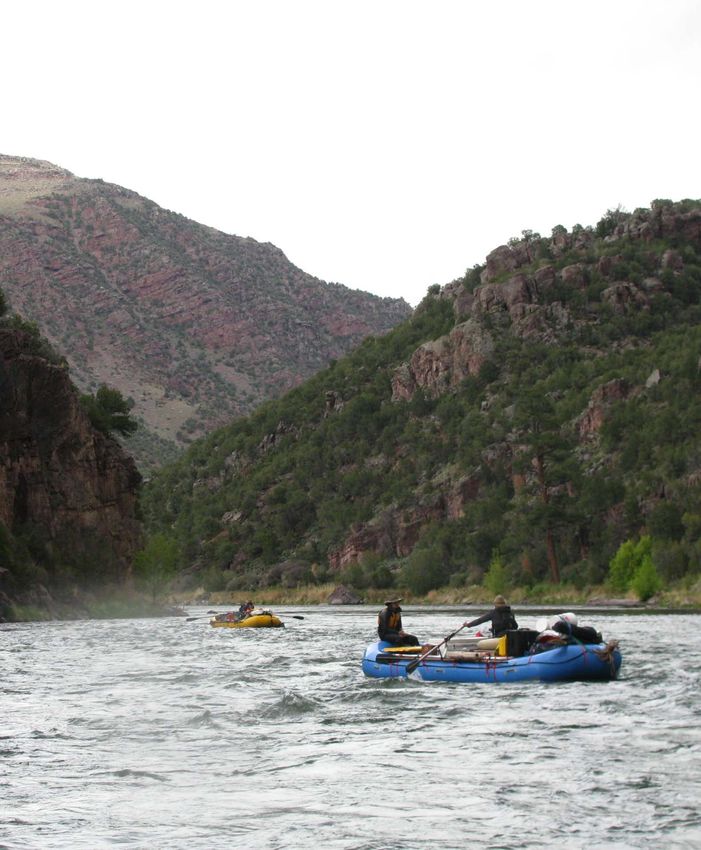
Cover. Design by P.K. Cascio, U.S. Geological Survey.
Page i. View downriver of Powell Expedition boats on the Green River in Red Canyon, Utah,
May 2019. Photograph by Anne Ballmann, U.S. Geological Survey.
U.S. Geological Survey

                                  2020–2030
21st-Century Science Strategy

Circular 1476

U.S. Department of the Interior
U.S. Geological Survey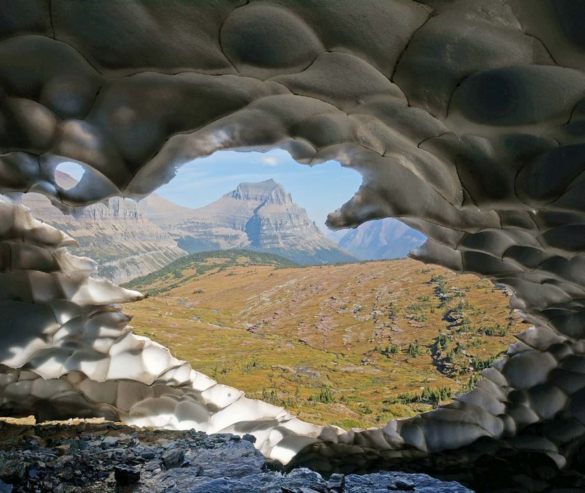
U.S. Department of the Interior
DAVID BERNHARDT, Secretary

U.S. Geological Survey
James F. Reilly II, Director

U.S. Geological Survey, Reston, Virginia: 2021

For more information on the USGS—the Federal source for science about the Earth, its natural and living
resources, natural hazards, and the environment—visit https://www.usgs.gov or call 1–888–ASK–USGS.
For an overview of USGS information products, including maps, imagery, and publications,
visit https://store.usgs.gov.

Any use of trade, firm, or product names is for descriptive purposes only and does not imply endorsement by the
U.S. Government.

Although this information product, for the most part, is in the public domain, it also may contain copyrighted materials
as noted in the text. Permission to reproduce copyrighted items must be secured from the copyright owner.

Suggested citation:
U.S. Geological Survey, 2021, U.S. Geological Survey 21st-Century Science Strategy 2020–2030: U.S. Geological Sur-
vey Circular 1476, 20 p., https://doi.org/10.3133/cir1476.

ISSN 2330-5703 (online)
iii

Foreword
    On the 75th anniversary of a report commissioned by Presi-                                  Now is the time to take stock of where USGS science will
dent Franklin D. Roosevelt, https://www.nsf.gov/od/lpa/nsf50/vbush1945.htm#transmittal
                             Science the Endless Frontier, the                              go in the next decade to ensure that we respond to 21st-
Director of the White House Office of Science and Technology                                century challenges with 21st-century science and technology.
Policy, Kelvin Droegemeier, suggested that the United States is This 21st-century USGS strategy and vision for the decade
entering the second bold era of science and described the need 2020–2030 embraces an integrated and predictive capability
for a new strategic framework as we enter the next era of sci-                              that accounts for complex natural system interactions, antici-
ence. This framework includes longer term planning horizons,                                pates the likelihood and consequences of evolving threats and
cross-portfolio integration, and innovative partnerships among                              hazards, and helps guide resilient adaptation and mitigation
the “whole of the science community”—including private sec- efforts. The USGS will step boldly into the next few decades
tor, academia, nonprofit organizations, and government—as                                   by delivering advanced science products to further our Nation’s
well as inclusive research environments that lead to greater                                prosperity and ensure our citizens’ safety and well-being.
diversity.                                                                                      This strategy lays out a path for the next evolution of USGS
    For the U.S. Geological Survey (USGS) to play a vital role in                           science   including a new integrative, predictive capability
this endeavor, we must engage in long-term plan-                                                        called EarthMAP that takes advantage of the USGS’s
ning. In 2020, we began the next major step in                                                               strengths, our expertise spanning the full range
the evolution of the USGS’s service to the                                                                      of Earth and biological sciences, our “boots
Nation with an effort to further integrate                                         “Now    is  the                 on the ground” presence, and our national
the components of our science and                                       time         to take  stock     of          and international scope and responsibili-
information management and technology                             where USGS science will                            ties. We will continue to work across
portfolios. Stewardship of the Nation’s                            go in the next decade to                           disciplines to innovate scientific data
land, water, mineral, energy, and                                ensure that we respond to                            collection and interpretation that provide
ecosystem resources involves weighing                               21st-century challenges                           essential inputs to EarthMAP and ways
complex tradeoffs among multiple and                                                                                 to test and improve the effectiveness of
often competing objectives. Increasingly
                                                                  with 21st-century science our predictive modeling. EarthMAP will
in the 21st century, resource managers and                                  and technology.”                      incorporate advances in sensor technolo-
decision makers need “the whole USGS”—                                                                          gies, integrated modeling, artificial intel-
integrated multidisciplinary data, research, geo-                                                           ligence, machine learning, cloud computing,
spatial tools, predictive models, and support tools—to                                                 and high-performance computing in order to observe,
inform their decisions.                                                                     understand,    and predict change across spatial and temporal
    The USGS is entering a new technological era with the                                   scales in real time and over the long term.
potential to deliver transformational science. A revolution                                     Enhanced integrative capabilities and technology will be
is underway in ground-, air-, and spaceborne sensors, and                                   necessary to answer the increasingly complex, interdisciplin-
access to expanding crowd-sourced data can provide essential ary, and computationally intensive scientific questions that are
information about the Earth and its systems at unprecedented                                most important to the Nation and the world. Recognizing and
spatial and temporal resolutions. On-demand storage, process- embracing this new paradigm presents tremendous opportuni-
ing hardware, and software are changing the paradigm for                                    ties for the USGS to lead the Earth and biological science com-
scientific computing and analysis, allowing the Earth System                                munity in the decades to come and to contribute to a holistic
Science community to take advantage of the age of big data                                  understanding of our Earth as a system of systems. Our future
and cloud computing. The historical and real-time data streams success will be determined by the decisions and investments
and targeted research for which we are known will be paired                                 we make in our people, technology, and scientific research in
with the ongoing explosion in information management and                                    the coming years.
technology capabilities to catalyze new types of analysis and                                   These are exciting times and opportunities!
enhance our knowledge.
                                                                                                                                               James F. Reilly II
                                                                                                                                                         Director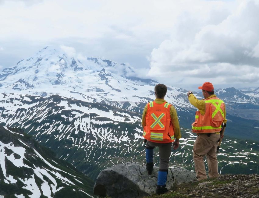
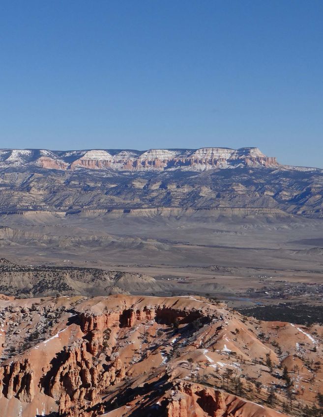
Bryce Canyon and Grand Staircase-Escalante, Utah. Photograph by Alex Demas, USGS.
v
Contents
Foreword.........................................................................................................................................................iii
Introduction.....................................................................................................................................................1
USGS Mission and Vision..............................................................................................................................2
Challenge and Opportunity in the 21st Century.........................................................................................2
The Earth System Challenge................................................................................................................2
Observations: Data Acquisition and Management..........................................................................4
Modeling, Prediction, and Predictability...........................................................................................6
Delivery of Actionable Intelligence....................................................................................................8
Earth and Biological Science Characterization, Assessment, and Synthesis............................9
Technological Innovation...................................................................................................................10
Achieving Our Vision....................................................................................................................................12
1. EarthMAP..........................................................................................................................................13
2. Scientific Focus................................................................................................................................14
3. Technical Focus...............................................................................................................................15
4. Partnership Focus ...........................................................................................................................15
5. Organizational Focus ......................................................................................................................16
Strategic Planning Framework...................................................................................................................17
Core Values ...................................................................................................................................................18
References.....................................................................................................................................................19
Figures
1. Diagram showing three interdependent foci—data, models, and delivery of actionable
intelligence—must be underpinned by science to understand, characterize, and
synthesize system processes .....................................................................................................3
2. Diagram showing conceptualization of EarthMAP as a system of systems ........................13
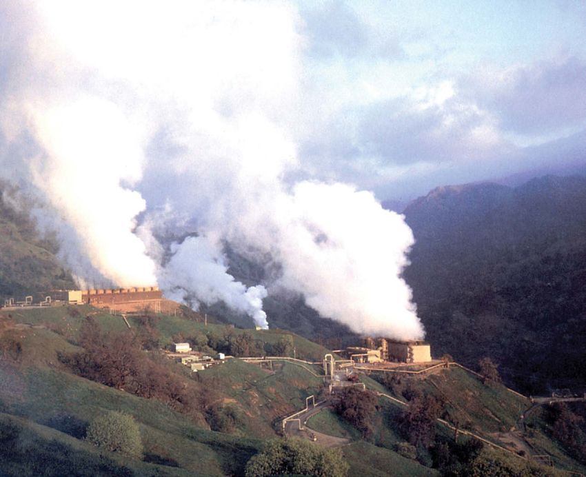
A geothermal power plant at The Geysers near Santa Rosa, California.
Photograph by Julie Donnelly-Nolan, USGS.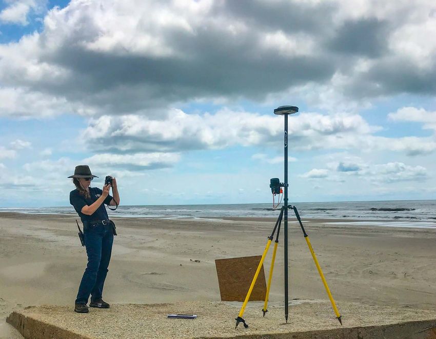
Forster’s tern chick in a nest in Pond A16, Don Edwards San Francisco Bay
National Wildlife Refuge, July 2019. Photograph by Jeanne Fasan, USGS.
U.S. Geological Survey

                                                 2020–2030
21st-Century Science Strategy

Introduction
      Since 1879, the U.S. Geological Survey (USGS) has             Colorado Rivers expedition was accomplished with com-
been the Nation’s primary Federal source of non-regulatory,         passes, sextants, chronometers, mercury barometers, and ther-
non-advocacy scientific information about the Earth and             mometers (USGS, 2019). Modern mapping is aided by digital
its processes. Created by an act of Congress, the USGS has          imagery, pulsed-laser light detection and ranging (lidar),
evolved over the ensuing 142 years, matching its talent and         and geophysical data acquired from satellites, aircraft, and
knowledge to the needs of society and the progress of science       unmanned airborne systems. Geologic and topographic data
and technology in order to accomplish its mission.                  can be processed through computer software to produce 3D
      Today’s Earth system challenges are far more complex          models and illustrations. The geologic map of the future may
and urgent than those that existed in 1879. Society’s greatest      be a fly-through, virtual-reality experience that will allow us to
challenges are directly or indirectly linked to major areas of      understand the architecture of the Earth as never before.
USGS science. Increased pressures on natural resources con-               As with any scientific endeavor, new technology allows
tinue with consequences for national security, food and water       us to better refine what we know about the way the world
availability, natural disasters, human health, and biodiversity     works. Molecular methods allow environmental DNA (eDNA)
loss. As we look forward 10, 20, and 30 years, our mission          to be detected, sampled, and monitored. The application of
will be more important than ever before. A broad but coherent       eDNA is boundless. Examples include early detection and
view is required for stewardship of the Nation’s land, water,       mapping of aquatic invasive species, distribution and abun-
mineral, energy, and ecosystem resources, which involves            dance of species, and detection of pathogens or diseases and
complex tradeoffs among multiple, often competing objec-            their transmission to and from wildlife.
tives. Increasingly, resource managers and decision makers                Our future vision and success will be determined by the
need “the whole USGS”: integrated multidisciplinary Earth           decisions and investments we make in our people, technol-
and biological science data, geospatial tools, predictive mod-      ogy, and partnerships in the coming years. This USGS Science
els, decision-support tools, and the expertise to interpret them.   Strategy endeavors to define the next evolution of USGS sci-
      Topographic and geologic mapping conducted by Major           ence, laying out a path for the next decade of innovation and
John Wesley Powell and crew during the 1869 Green and               achievement in service to society.

                                                                                  Photograph of Earth from the Blue Marble collection,
                                                                                  National Aeronautics and Space Administration.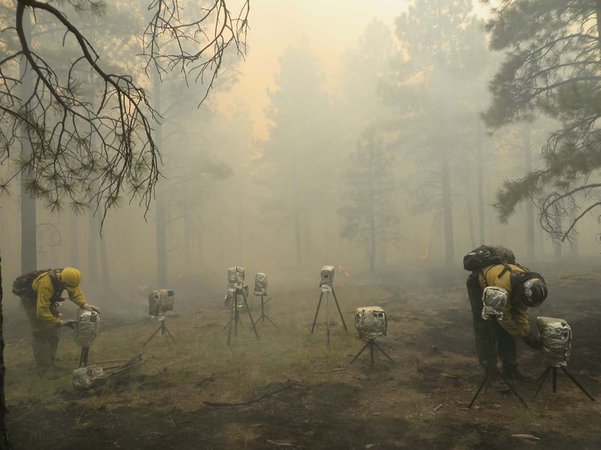
2   U.S. Geological Survey 21st-Century Science Strategy 2020–2030

USGS Mission and Vision
      USGS science advances the economic welfare of the            Simply stated:
Nation, protects the safety and health of our people, contrib-         The USGS mission is to monitor, analyze, and predict
utes maps and data to the public good, and advances under-         current and evolving dynamics of complex human and natu-
standing of the environment, ecosystems, and species that          ral Earth system interactions and to deliver actionable intel-
share our planet. Although the science mission of the USGS         ligence at scales and timeframes relevant to decision makers.
is broad, its elements are intrinsically related. Water, energy
and mineral resources, ecosystems, natural hazards, and land             The USGS is committed to an unbiased and impartial
use interact in myriad ways, often with complex and unantici-      scientific understanding of the Earth’s systems and to continu-
pated consequences. Through collaboration with partners in         ally evolve as societal needs change while embracing new
government, academia, industry, and beyond, USGS science           technologies and capabilities.
addresses enduring societal needs
                                                                   Our vision is to
                                                                       Lead the Nation in 21st-century integrated research, as-
                                                                   sessments, and prediction of natural resources and processes
                                                                   to meet society’s needs.

Challenge and Opportunity in the 21st Century
      The Nation faces unprecedented challenges: increas-               • Land system change (metrics: amount and pattern of
ing demand for energy and mineral resources, changing land                change in all terrestrial biomes, and biogeophysical
resources, vulnerability to natural hazards, water security and           processes in land systems that directly regulate climate
availability, emerging diseases affecting wildlife and human              through exchanges of energy, water, and momentum).
health, and loss of critical or unique ecosystems. These chal-           Other processes and systems, including the water cycle
lenges occur in a context of broad environmental, technologi-      (metrics: freshwater availability and use) and the introduction
cal, and societal change, all of which shape our long-term         of novel entities that exhibit persistence and mobility (met-
vision and direction which demand greater integration of our       rics: organic pollutants, radioactive particles, microplastics,
scientific capabilities and information management tech-           and nanoparticles), have not reached threshold levels at the
nologies. Such times of change also provide unprecedented          planetary scale but pose substantial risks at regional and local
opportunities for innovation and science to support the Nation     scales. The potential impacts of these issues, and the uncer-
in addressing challenges.                                          tainty surrounding them, complicate the already challenging
                                                                   tasks of exploring and managing natural resources, supplying
The Earth System Challenge                                         food and shelter, and mitigating the effects of natural hazards,
                                                                   all of which are essential for a society to thrive. Decision mak-
                                                                   ers—resource managers, emergency managers, and policy-
      Thriving societies around the world have developed with
                                                                   makers—are faced with a more complex range of issues than
a reliance on stable functioning of the Earth system. However,
                                                                   in the past, as well as a vastly increased body of potentially
this complex suite of interlinked physical, chemical, biologi-
                                                                   useful information to interpret. They need rapid and timely
cal, and human processes and systems is exhibiting increased
                                                                   access to reliable information that addresses their specific
risk of destabilizing change that could have profound societal
                                                                   problems. They need actionable intelligence to make informed
impacts. Of a set of metrics describing nine highly interde-
                                                                   decisions that may ultimately guide the sustainability of the
pendent processes and systems that help regulate the stabil-
                                                                   planet. Actionable intelligence is scientific information that is
ity and resilience of the Earth system, changes observed in
                                                                   directly available for use by stakeholders and enables decision
four are thought to have already exceeded threshold (poten-
                                                                   makers to take appropriate and timely action (without having
tially destabilizing) levels at the planetary scale (Steffen and
                                                                   to go through an additional production or interpretive phase).
others, 2015):
                                                                         Paramount to helping society address these risks and
     • Climate change (metrics: atmospheric carbon dioxide         plan for potential change is developing a more complete and
       and increases in top-of-atmosphere radiative forcing);      integrated understanding of the complexity of these interde-
                                                                   pendent processes and systems, the capacity to predict their
     • Change in biosphere integrity (metrics: biodiversity
                                                                   behavior, and the delivery of actionable intelligence to deci-
       loss and species extinction);
                                                                   sion makers. This is the heart of the USGS mission and vision
     • Biogeochemical flows (metrics: phosphorous and nitro-       for the 21st century.
       gen loadings); and
Challenge and Opportunity in the 21st Century 3
The past several decades yielded a steady advance of system across multiple spatial and temporal scales. Initially
the stature and capabilities of a broad spectrum of physical, focused on the oceans and atmosphere, with only simplified
chemical, and biological scientific disciplines and subdisci- land processes, ESS has evolved with a clear recognition of
plines, enabling an unprecedented understanding of numerous the need for a more robust treatment of terrestrial processes
processes within the Earth system. Moreover, an increasing and functions—physical, biological, and chemical—and their
recognition of the need to connect and integrate this under- interactions with broader planetary systems. The USGS is
standing across disciplines has fueled exploration of the uniquely positioned to assist and lead in this effort over the
intersections between disciplines, consistently providing new next decade. Doing so will require transdisciplinary integra-
insights, new understanding, and new capabilities. With grow- tion and advancement of (1) our data acquisition and manage-
ing scientific and societal awareness of the profound chal- ment, (2) our modeling and prediction capabilities, and (3) our
lenges previously noted, these disciplines have been evolving delivery of actionable intelligence. Moreover, these three foci
towards the consideration of the Earth as a single, unified will be supported with broad and aggressive characterization
system. Earth System Science (ESS) is a rapidly emerging of biogeophysical processes, strategically leveraging state-of-
transdisciplinary effort aimed at building a unified understand- the-art technologies to sustain and support the science (fig. 1).
ing of the structure and function of the Earth as a complex, The USGS will establish enterprise information management
adaptive system (Steffen and others, 2020). Three interde- and technology (IMT) capabilities that the Bureau workforce
pendent foci drive ESS forward: (1) observations of the Earth can leverage at multiple scales with consistent interoperable
system, (2) computer simulations of system dynamics into the software and database solutions to better facilitate integrated
future, and (3) high-level assessments and syntheses that initi- work. Investing in IMT infrastructure is fundamental to
ate the development of new concepts. strengthening the backbone for conducting science. We will do
The USGS, long at the forefront of disciplinary and all of this in concert with a broad community already working
interdisciplinary advances within the biogeophysical sciences, to advance ESS. To accomplish this, we will work in unison,
has a significant opportunity to accelerate the evolution of a as a whole organization, focused on this challenge.
unified understanding and prediction capability for the Earth
Observations: Modeling, Prediction, Delivery of Actionable
Data Acquisition and and Predictability Intelligence
Management
Readily Available Advanced Modeling Framework Dashboards
Embraces All Relevant Data Broad Incorporation of Decision Support Applications
Our Knowledge
Built on Robust Architecture Operational Capabilities
Integrated Across Boundaries,
Disciplines, Geographies,
and Sectors
Earth and Biological Science Characterization, Assessment, and Synthesis
All Supported by Technological Innovation
Figure 1. Three interdependent foci—data, models, and delivery of actionable intelligence—must be underpinned by science to
understand, characterize, and synthesize system processes. All must be supported by state-of-the-art technologies. Each of these
components drives requirements for the others and must be integrated and advanced together for the USGS to address societal
challenges in the 21st century.4 U.S. Geological Survey 21st-Century Science Strategy 2020–2030
Observations: Data Acquisition and Management
Observations underpin the scientific process and are Data originating from within the USGS range from a
crucial to developing understanding of a unified Earth sys- few observations at a small plot scale, to national monitoring
tem. The Earth and biological sciences generally lack suf- networks, to global satellite observations, to long-term records
ficient observational data at national scales. To address the of physical, hydrological, chemical, and biological observa-
Earth system challenge, the USGS will innovate to embrace tions. These observations over small spatial and temporal
all relevant data, both quantitative and qualitative, regardless scales provide valuable insights into process dynamics but are
of source, and extract as much meaningful information from often challenged by heterogeneity and thus can be difficult
them as possible. Making full use of all relevant data—histori- to scale (Acocella, 2015). Earth observing satellites such as
cal and contemporary—is fundamentally necessary to estab- Landsat provide consistent, repeated observations globally,
lish benchmarks for change, to reduce uncertainty, to calibrate but sensor and platform limitations constrain what we are able
and validate models, to train machines to search for patterns to observe and when. Over the next decade, the USGS will
and relations, and to accomplish a myriad of other purposes. work to develop systematic frameworks to link our observa-
Over the next decade, the USGS will adopt an aggressive tional capabilities. Part of this will require strategic modeling
stance towards the acquisition and full use of all relevant data, to bridge scales, but much will depend on more deliberate,
strengthening our research and development capabilities to integrative design of our observing systems and monitoring
enhance usability of data (U.S. Group on Earth Observations networks to fill critical gaps in what is observed, where, and
Subcommittee, Committee on the Environment of the National how often. The USGS will take a concerted approach towards
Science and Technology Council, 2019). a more holistic observational data acquisition paradigm.
¯
Crews make visual observations of activity at fissure 8, Kılauea Volcano, Hawaii,
May 31, 2018. Photograph by USGS.Challenge and Opportunity in the 21st Century 5
Sensors play a growing role in acquiring data at their satellite-based remote sensing observations to improve process
source. The Internet of Things (IoT) is a system of internet- understanding. Towards that end, the USGS has opportunities
connected physical objects (for example, vehicles, monitoring to be more aggressive in leading strategic large-scale interdis-
equipment, smart appliances, light bulbs, and fixtures) that ciplinary observational campaigns and field experiments that
collect and transfer data over a network using sensors and expand and broaden our understanding of Earth processes.
machines without human intervention. Processing data at the A more aggressive stance towards the use of multi-
originating source and integrating that data collection with disciplinary observational data establishes the requirement
other computing elements automates data transfer and related for more effective data management. The USGS’s ability
actions into an IoT model. The USGS will plan and execute a to elevate and accelerate a comprehensive interdisciplinary
secure, integrative approach to data acquisition and monitor- understanding of the Earth rests upon unifying and strength-
ing while leveraging artificial intelligence (AI) computing ening our data collection methods and protocols, our data
and machine learning (ML) capabilities to increase the rate by systems and architectures, and accessibility of our data. Over
which data can be interpreted and turned into knowledge. This the next decade, the USGS will develop and implement robust
will accelerate phases of our scientific project life cycle. infrastructures for collection, curation, and dissemination of
Our approach will fully engage the broader ESS com- data. Enterprise architectures, common data vocabularies,
munity to make all USGS data more broadly available to and effective metadata ontologies are needed across USGS to
others and to acquire relevant observational data from others support emerging as well as traditional data, to enable rapid
to advance our science (U.S. Group on Earth Observations and seamless discovery of relevant data, and to support highly
Subcommittee, Committee on the Environment of the National structured data needs such as those required by modeling and
Science and Technology Council, 2019). USGS research will decision analysis systems.
link our extensive and intensive datasets with airborne- and
Fire monitoring during wildfires, Santa Fe National Forest, New Mexico, 2014.
Photograph by Rachel Loehman, USGS.6 U.S. Geological Survey 21st-Century Science Strategy 2020–2030
Modeling, Prediction, and Predictability
Models integrate our understanding of processes and completeness of process representations largely depended
system dynamics within a consistent framework which can on the principal purpose of the model and was often con-
then be used to test our understanding, make predictions, and strained by the availability of data and computational capac-
generate new hypotheses. Hundreds of existing USGS models ity. More recently, the interdependent nature of all Earth
describe terrestrial processes and subsystems and range from system processes, increased data availability, and increased
simple heuristics to detailed algorithmic representations of computational capacity have driven the emergence of Earth
complex process interactions. Each of these models improves System Models (ESM)s that incorporate a comprehensive
our understanding of some portion of the Earth system and range of rigorous physical, chemical, and biological processes
receives some form of validation and testing. Some models and feedback mechanisms to achieve improvements in skill
are predictive, and some lead to new ideas and hypotheses. and utility.
Continued development of models at the process-oriented, Central to the development of ESMs is the recognition
subsystem level within the USGS is necessary for the growth that, at timescales ranging from sub-seasonal to seasonal
of our fundamental understanding of the Earth’s components; (2 weeks to 12 months) to decadal, many facets of terrestrial
however, the grand challenge and opportunity for the USGS biogeophysical processes have a greater influence on system
is to go further by integrating these process and subsystem predictability than the comparatively transient troposphere.
components into broader system frameworks. Over the next For example, in humid regions, feedbacks associated with the
decade, the USGS will incorporate and link our models within biosphere response to radiation and water availability explain
a rapidly evolving next generation of Earth system simulation as much as 30 percent of the variance in moist convection
and prediction. leading to precipitation (Green and others, 2017). Omitting or
Numerical models began decades ago as simplistic con- oversimplifying such processes can be severely detrimental to
ceptualizations of major, first-order Earth system dynamics, prediction skill. Still relatively nascent, ESMs are developing
and they have steadily evolved into robust general circulation rapidly to address challenges in understanding and predict-
models, global and regional climate models, and numerical ing the Earth system. Consequently, more and more biogeo-
weather models. In parallel, comparable models have evolved chemical and ecosystem functions are being incorporated into
that describe a broad range of hydrological, biogeochemi- ESMs. A broad suite of USGS expertise is highly relevant to
cal, biological, and ecological processes and subsystems. The this effort.
Lidar-derived digital elevation model of a low relief stream channel and
associated National Hydrography Dataset line features in central Iowa, 2018.Challenge and Opportunity in the 21st Century 7
Key opportunities for the USGS to play a significant lead- • Enhancing USGS technological skills to support the
ership role in the evolution of ESMs include the following: high computational, storage, and networking demands
• Integrating current understanding and modeling of working in the ESM realm, including long-term
capabilities through advanced model representations investment in computer scientists, software engineers,
and architectures that link interdisciplinary processes, applied mathematicians, and statistics researchers
as well as their errors and uncertainties, to identify necessary to complement our biogeophysical science
strengths and weaknesses and gain new insights expertise (National Academies of Sciences, Engineer-
into interdependencies; ing, and Medicine, 2016);
• Bringing expertise to bear on the problem of advancing • Advancing opportunities in high-performance comput-
and optimizing appropriate representation of terrestrial ing (HPC), cloud computing, and the ability to seam-
physical, chemical, and biological processes within lessly traverse both on-premise and cloud infrastruc-
ESMs, through hypothesis-driven contribution of new ture as one environment, transparent to the user;
process representations and through engagement in • Preparing existing USGS data and associated
ESM data assimilation, calibration, and validation knowledge to be used in ESM parameterization
activities (National Academies of Sciences, Engineer- and validation;
ing, and Medicine, 2016; Bonan and Doney, 2018);
• Establishing robust Bureau-wide developmental testbed
• Expanding the capacity to incorporate human dynamics infrastructure, including technology, methods, proce-
and anthropogenic influences—including behavior and dures, and policies needed to establish evidence-driven
decision making that can alter system dynamics—into approaches to regularly and systematically advance
the biogeophysical modeling realm (Müller-Hansen USGS ESM capabilities; and
and others, 2017);
• Advancing USGS software and application devel-
• Advancing understanding of the limits to predictabil- opment activities to include more opportunities
ity within the terrestrial Earth system and prioritizing to leverage ML, infrastructure as code, and big
development of additional process components that are data collaboration.
most important to improve prediction skill (Vought and
Droegemeier, 2019);
• Conducting model sensitivity studies such as Observ-
ing System Simulation Experiments to inform the
design of our data networks to improve modeling skill
(National Academies of Sciences, Engineering, and
Medicine, 2016);
A USGS scientist surveys Global Positioning System ground control point locations on North Topsail Beach and
within the Camp Lejeune Marine Corps Base, North Carolina, July 2020. Photograph by Chelsea Stalk, USGS.8 U.S. Geological Survey 21st-Century Science Strategy 2020–2030
Delivery of Actionable Intelligence
Central to the USGS vision and mission is meeting USGS “brand” which would simplify the learning process for
society’s needs through the delivery of information at scales, stakeholders encountering each new tool. Seizing these oppor-
at timeframes, and in forms relevant to decision makers. The tunities will make it easier to meet the goals of actionable
actionable intelligence concept requires understanding of intelligence. Accelerating information delivery means we must
the fact that decision makers frequently lack resources (for give careful consideration to how our Fundamental Science
example, time, expertise, or infrastructure) to digest, interpret, Practices and review processes can keep pace.
manipulate, or otherwise work to transform the information Developing broader operational capabilities through-
they receive into something they can use. To be most useful out the USGS will be an important approach towards timely
and relevant to stakeholders, the USGS must strive to answer delivery of actionable intelligence. For example, the routine
their questions specifically, succinctly, and simply, despite operational delivery of provisional data in near real time
the fact that their questions may be quite complex and may gives decision makers something they can use immediately.
require extensive research and analysis to answer. Moreover, The USGS has many opportunities to move more of its data
our information must be timely. It is equally important to into operational frameworks. Similarly, as the USGS moves
understand which factors drive the timing of a decision; when into the realm of predictive ESMs, there will be increasing
that time comes, decision makers will proceed with the best opportunities to provide model output as standard operational
information they have. Information delivered after a decision products, again giving decision makers actionable intelli-
has been made has low utility. Provision of USGS informa- gence, with opportunities for later refinement. By delivering
tion “at the speed of decision making” means that in many such products routinely, the USGS can become a consistent,
cases the USGS must anticipate what will be needed and begin reliable link in decision-making “supply chains,” fostering
developing it in advance. This in turn places a high emphasis advocacy for the continuation and growth of USGS products
on early stakeholder engagement to understand and anticipate and services.
their future needs and on developing predictive capabilities Pursuing these opportunities will require the USGS to
that provide information in advance of when it is needed. place more focus in the next decade on all aspects of data sci-
Timely delivery of actionable intelligence is dependent ence, but especially on communication aspects with visualiza-
upon the integration of data and modeling. Tools such as tion, cognition, and decision-making tools. Understanding
dashboards and decision-support applications provide excel- how USGS information is perceived and used by decision
lent mechanisms to synthesize diverse sources of information makers will be a key factor in making our information more
and visualize the results in effective ways. These tools can be actionable. Small differences in something as simple as a color
tailored to specific needs much faster when the underlying scheme, which is well understood in areas such as cartogra-
data and information are readily accessible, well organized, phy, can have a significant influence on how a product is inter-
and in compliance with standards supported by such tools. The preted and thus how effective it is. As the USGS broadens its
USGS actively develops these types of tools and has many portfolio of 21st-century products and services, more expertise
opportunities to streamline these efforts, as well as to make will be needed in this area to ensure maximum effectiveness.
the tools more consistent in appearance to better establish the
The USGS National Water Dashboard (https://dashboard.waterdata.usgs.gov/) provides provisional real-time data collected at USGS
stations in context with weather-related data from other public sources.Challenge and Opportunity in the 21st Century 9
Earth and Biological Science Characterization, Assessment, and Synthesis
The three foci discussed previously must be supported by data management systems within the USGS, we have excit-
a strong scientific foundation. The scientists within the USGS ing opportunities to establish innovative surveillance systems
provide understanding of the causes, effects, distributions, for early detection of biothreats and to improve assessment
relations, and impacts of fundamental processes and system and prediction of their extent and effects. Improved early
dynamics throughout the biosphere, hydrosphere, lithosphere, detection combined with better understanding of underlying
cryosphere, and atmosphere. Characterization and interpre- environmental factors may create new opportunities to identify
tation of natural hazards, water resources, animal health, signals of broader Earth system change that otherwise might
invasive species, energy and mineral resources, and topogra- go undetected.
phy and terrain are essential for the continued success of the The USGS conducts new assessments of energy and
USGS and for acquiring the advanced understanding needed mineral resources in basins across the globe, expands existing
to develop an integrated, systems view of the Earth. Among assessments by using new sensing and exploration technolo-
other benefits, such characterizations provide a critical base- gies, improves mapping of the surface and subsurface, and
line for measuring future change. Our strength has been and evaluates future energy and mineral resources ranging from
will remain our disciplinary expertise, but going forward will geothermal energy and heating resources to potential mineral
require acquiring additional capabilities to build and synthe- resources in mining and other waste products. The USGS can
size a more comprehensive Earth system understanding. help ensure the Nation can meet its resource needs sustain-
Hazard risk and vulnerability assessments, as well as ably by characterizing the full life cycle of energy and mineral
post-event characterization, are invaluable to helping the resources with an integrated, interdisciplinary perspective
USGS communicate risk and inform decision making. Such that provides a more complete understanding of the feed-
assessments, together with related monitoring and research backs among energy, mineral, and other resource develop-
activities, provide a proven foundation for the USGS to build ment. Moreover, this approach creates an opportunity for the
upon to inform broader Earth system challenges in the 21st USGS to represent this improved understanding within ESM
century. USGS approaches to monitoring earthquake, volcano, frameworks to explore broader system interdependencies
and flood hazards and warning the public about them are good and feedback.
working examples of delivering timely, actionable intelligence Characterization and mapping of the Earth’s surface
in an operational style and can serve as models or prototypes and subsurface composition and structure are foundational
for future development and expansion. Moreover, understand- to the USGS mission. Expanding, enhancing, and integrat-
ing how these local and regional risks compound with broader ing our 3D-elevation datasets, hydrography and hydrographic
Earth system risks is critical for assisting decision makers mapping products, geologic mapping, and land imaging will
to assess their overall risk profile and to develop effective enable innumerable opportunities throughout the USGS and
mitigation strategies. beyond. Because the fundamental interdependencies among
Despite the intrinsic importance of the water cycle in the physical, chemical, and biological processes often occur at
functioning of Earth’s interdependent systems, we still have small spatial scales, increasing the spatial resolution of obser-
only rudimentary knowledge of the quantity, quality, and dis- vations, terrain data, and models to resolve and parameterize
tribution of water resources across the Nation. Stream reaches these processes has been a key factor in improving under-
outnumber streamgages by four orders of magnitude. Only standing of the Earth system. Continuation of ongoing USGS
about 1,000 sites routinely measure snow water equivalent, efforts in this arena will fuel advancements in ESMs for many
and only about 1,000 groundwater monitoring sites report data years to come. The USGS has unique and important opportu-
in real time. The vast majority of ponds, lakes, and reservoirs nities to exploit the long temporal record of high-resolution
have no commonly reported measurements. USGS opportuni- Landsat data to explore land surface change and relate that
ties for more comprehensive assessment of water resource to change in process dynamics through advanced model-
availability depend heavily on harnessing all available data ing and analytics. Improved hyper-resolution elevation and
and combining those data effectively with models to fill obser- hydrographic data create many new possibilities for hydro-
vational gaps. Data assimilation and new technologies such as ecological and biogeochemical modeling at fundamental
using AI to augment and learn from the modeling process will process scales, with greater potential to scale up consistently
play increasingly important roles in the next decade. to watershed, regional, and national scales. Development of
Characterization of the distribution, dynamics, and a seamless national geologic map will enhance energy and
severity of biological threats and how these threats respond to mineral production, hazards mitigation, groundwater resource
environmental factors is paramount to reducing the occurrence management, infrastructure development, and more. In this
of wildlife disease and invasive species and the extensive costs way, the USGS can build upon its long history of mapping our
these incur. With the emergence of new sensor technologies Nation and planet by continuing to advance the technology
and a greater focus on integrating our observing systems and and understanding needed to meet society’s needs.10 U.S. Geological Survey 21st-Century Science Strategy 2020–2030
Technological Innovation
To pursue the necessary improvements in data acquisi- Internet of Things (IOT): The Internet of things (IoT)
tion and management, modeling and prediction, and provision describes the complex network of physical objects
of actionable intelligence, and to maintain and strengthen our and cyber objects—systems that involve computation,
characterization, assessment, and synthesis of fundamental sensing, communication, and other technologies for
processes and systems, the USGS will need to make the most the purpose of connecting and exchanging data with
of available and emerging technologies that enable USGS other devices and systems over the Internet (Boeckl and
science. These technological innovations will be imple- others, 2019).
mented with a continued emphasis on cybersecurity to ensure
the integrity and availability of the data for our scientists Artificial intelligence (AI) is intelligence demonstrated
and partners. by machines, unlike the natural intelligence displayed
The Nation’s natural resource challenges coincide with an by humans and animals. Any device that perceives its
era of unprecedented innovation and technical change that is environment and takes actions that maximize its chance
occurring faster, more efficiently, and with greater accessibility of successfully achieving its goals. Colloquially, the
than ever before. Rapid advances in AI/ML, augmented and term “artificial intelligence” is often used to describe
virtual reality, blockchain, IoT, robotics, autonomous vehicles, machines (or computers) that mimic “cognitive” func-
biotechnology, nanotechnology, quantum computing, and 3D tions that humans associate with the human mind,
printing create vast new opportunities to address Earth system such as “learning” and “problem solving” (Poole and
challenges, amplified as technologies become increasingly others, 1998).
connected (World Economic Forum, 2018). Changing expec- Machine learning (ML) is the study of computer algo-
tations come with this new era: a new generation that wants rithms that improve automatically through experience.
and expects more accessible, mobile, portable, flexible, and It is seen as a subset of artificial intelligence. Machine
customizable products, services, and experiences. As this new learning algorithms build a model based on sample
generation becomes incorporated into the ranks of scientists, data, known as “training data,” in order to make predic-
resource and emergency managers, and policy and decision tions or decisions without being explicitly programmed
makers, these same expectations will define how we approach to do so. Machine learning algorithms are used in a
Earth system challenges. Keeping up with the demands of wide variety of applications, such as email filtering and
delivering scientific data, products, and services in satisfy- computer vision, where it is difficult or unfeasible to
ing ways and recruiting and retaining new science talent will develop conventional algorithms to perform the needed
depend on an aggressive adoption of new technologies. tasks (Mitchell, 1997).
Several of the new technology opportunities stand out in Blockchain: Blockchain is a decentralized, distributed
the near term. AI and ML will play an increasingly key role ledger technology that records the provenance of a digi-
in analyzing and synthesizing our observational and model tal asset in an efficient manner with a high level of fault
output data. We have opportunities to train machines to search tolerance (Yaga and others, 2018).
for patterns in our data, such as early signals of drought, that
we might otherwise miss, or to fill missing links in our process Software-defined networking: Software-defined net-
understanding. Using AI/ML applications and software, in working (SDN) technology is an approach to network
partnership with the virtually unlimited resources cloud com- management that enables dynamic, programmatically
puting provides, enables the USGS tremendous opportunity to efficient network configuration in order to improve
advance the technology behind the science. network performance and monitoring, making it more
Blockchain concepts can help us design more effective like cloud computing than traditional network manage-
monitoring networks and surveillance systems, helping to ment (Benzekki and others, 2016).
increase early warning lead time and operate these networks Zero Trust Architectures: Zero trust (ZT) is the term for
more efficiently. As more and more devices, including sen- an evolving set of cybersecurity paradigms that move
sors, become connected to the internet, the IoT can help us defenses from static, network-based perimeters to focus
understand dynamics, interactions, and movement. The IoT on users, assets, and resources. A zero trust architec-
framework will be a regular part of the USGS science culture ture (ZTA) uses zero trust principles to plan industrial
moving forward. Having devices that collect and send data and enterprise infrastructure and workflows (Rose and
to cloud-ingest points where tools and services exist should others, 2020).
become a normal mode of doing science as the USGS collects, Gig-Ethernet Circuits: Gigabit Ethernet is the term
processes, analyzes, and reports our data in the future. applied to transmitting Ethernet frames at a rate of a
gigabit per second (IEEE, 2018).Challenge and Opportunity in the 21st Century 11
Quantum computing, still in its early stages, will open
new doors for nonlinear process modeling and modeling prob-
abilities and uncertainties without the need for large ensem-
bles. Already used in commercial sensor development, 3D
printing creates numerous possibilities for the USGS to inno-
vate and deploy new sensor technologies cheaply and quickly.
An aggressive pursuit of more familiar computational
technologies, including HPC and cloud- and high-throughput
computing, is essential for the USGS to address the Earth
system challenge. ESMs and AI/ML have high but differ-
ing computational needs; each has different requirements for
computational intensity and access to memory and storage.
Computers optimized for one need are generally suboptimal
for the other. Both applications will need much greater compu-
tational power than is available today, and we will need to use
it more efficiently. The USGS has many opportunities, both
with its own internal systems and through collaboration with
partners, to explore and optimize its computational solutions
in the coming decade. Implementation of a cloud computing
and long-term HPC strategy in the USGS is a fundamental
building block from which our journey begins.
USGS hydrologist flies a small drone equipped with a thermal infrared camera
during a groundwater/surface-water exchange study. Photograph by USGS.12 U.S. Geological Survey 21st-Century Science Strategy 2020–2030
Achieving Our Vision
Implementation of the USGS 21st-Century Science 4. A partnership focus to develop relationships between
Strategy involves five interrelated components: the USGS and the broader ESS community and to
strengthen linkages among Federal, Tribal, State, private
1. A focus to develop a Bureau-wide, integrative and sector, academia, and nonprofit organizations; and
predictive science capability called Earth Monitoring,
Analyses, and Prediction (EarthMAP); 5. An organizational focus to optimize interactions across
the USGS, develop our workforce, and improve our
2. A scientific focus to build upon our mission-specific facilities.
capabilities and drive greater interdisciplinary integra-
Detailed strategic implementation plans will be developed for
tion;
each of these components.
3. A technology focus to provide the 21st-century IT and
necessary technical innovations;
View of Glacier National Park, Montana, from the mouth of Reynolds
Glacier. Photograph by Joe Giersch, USGS.Achieving Our Vision 13
1. EarthMAP
To fulfill the vision of a Bureau-wide, integrated predic- Developing EarthMAP will be challenging. Success
tive science capability, the USGS initiated a multiyear effort to will not be easy, nor is it guaranteed. Fiscal constraints and
design and build the Earth Monitoring, Analyses, and Predic- competition for the highly qualified people necessary for
tion (EarthMAP) capability. EarthMAP was a concept origi- development will continue. The USGS will take a methodi-
nally articulated in the USGS Grand Challenges Integrated cal and structured approach to implement EarthMAP, requir-
Science Workshop, which brought together leading scientists ing new approaches to planning our science portfolios and
from across the USGS (Jenni and others, 2017). When fully strategic investments. By 2030, the USGS aims to deliver
implemented, EarthMAP will link the USGS’s capabilities well-integrated observations and predictions of the future state
in Earth system characterization science and rich datasets of natural systems—water, ecosystems, energy, minerals, and
with advanced integrated predictive models that are enhanced hazards—at regional and national scales, working primarily
through the use of AI/ML and HPC. EarthMAP will allow the with Federal, State, Tribal, and academic partners to develop
USGS to deliver actionable intelligence in the form of inte- and operate the capability.
grated observations, scenario planning, and predictions of the By using our strategic planning framework (described
future state of the Earth system—at the scales and timelines later in this document), we will carefully plan our science and
needed to inform decisions. At all scales, these predictions will focus on the knowledge gaps that limit progress towards the
account for complex system interactions and will be used to EarthMAP vision and identify initial goals for integrated and
anticipate the likelihood and consequences of evolving threats predictive science that is supported by investments in obser-
and hazards, to help guide resilient adaptation and mitiga- vations, models, technology, and partnerships. This planning
tion efforts, and, in ways unimaginable today, to further our effort will also identify the knowledge base across the entire
Nation’s prosperity, ensure our citizens’ safety, and support the scientific sector that can be leveraged to achieve this vision.
long-term sustainability of the Earth.
EarthMAP’s integrated predic-
tive capability will cross scientific
boundaries and disciplines. It will
require investments in data collection
ducts
and integration and new technology ted Pro
Integra ng, Analyses,
to include HPC, cloud computing, onitori )
Earth M tion (EarthMAP
P re d ic
advanced modeling, AI/ML, and a n d
visualization and decision-support
tools. EarthMAP will deliver power- Delivery
ful new products and services that
detect and assess vulnerabilities and
ience
anticipate the likelihood and con- heric Sc Analysis
Atmosp
Commu
sequences of evolving threats and
Humans
hazards, and it will provide decision-
nication
support tools that help guide resilient Fauna
Modeling and
adaptation and mitigation efforts Integration
DATA SYNTHESIS
Flora
(projections and predictions, early
y
warning) at the scale of decisions. hemistr
EAR TH SYSTEM Water C
Implementing EarthMAP r Observations an
d
CHARACTERIZATION undwate
will require a systems-of-systems u rf a c e and Gro M on ito rin g
S
engineering approach to analyze rface
Land Su
the complex suite of processes and
Soils velopment
systems that compose the Earth sys- Research and De
tem. The processes and systems that
Geology
will compose EarthMAP are quite
different from each other and oper- TE Crust
MP
ate independently, but also display OR
AL SPATIA
L
emergent properties (more complex
behaviors) and patterns when they
interact (fig. 2). Emergent patterns
likely evolve over time and must be Figure 2. Conceptualization of EarthMAP as a system of systems (modified from Jenni and
recognized, analyzed, and modeled to others, 2017).
be fully understood.14 U.S. Geological Survey 21st-Century Science Strategy 2020–2030
2. Scientific Focus
The USGS’s vision takes advantage of USGS strengths • Provide state-of-the-art species management scenarios,
and its unique position as a science organization with exper- assessments, and distribution maps for Department of
tise spanning the full range of natural science disciplines, its the Interior trust species;
nationwide presence, its collaboration with stakeholders, and
its national and international scope and responsibilities. Over • Detect and control invasive species and wildlife dis-
the next decade, we will take advantage of the USGS’s rich eases before they become established and potentially
Earth and biological datasets, advances in sensor technolo- affect human health and well-being;
gies, enhanced integrated modeling, ML, and HPC, includ- • Characterize the Earth and its processes more accu-
ing cloud computing, to observe, understand, and predict rately and provide 3D data, maps, and models that
change across spatial and temporal scales, in real time and in a enhance scientific insight and enable new applica-
predictive manner. tions in the management of the Nation’s public lands
Under this vision, USGS mission areas will work and resources;
together to provide significant advances in our ability to
• Monitor and assess availability and quality of the • Assess energy and mineral resources across the Nation
Nation’s freshwater supply by implementing new and and around the globe through integrated, interdis-
advanced observing systems, developing advanced pre- ciplinary assessment of the full life cycle of those
dictive water resource models, and developing routine resources; and
operational national predictions of water availability; • Expand the Nation’s understanding of the loca-
• Provide natural hazard risk-characterization tools and tion, availability, and supply-chain risks for energy
deliver real-time situational awareness that can be and mineral resources necessary to support national
used to enable communities and landscapes to become security and the development of infrastructure and
more resilient; new technologies.
• Provide ecological modeling and forecasting to pro-
vide actionable intelligence to managers at the scale
of decisions;
USGS microbiologist preparing a water sample.
Photograph by Ian M. Hyslop, USGS.You can also read