2020 CATALOGUE Imray charts and books
←
→
Page content transcription
If your browser does not render page correctly, please read the page content below
Imray charts and books

2020 CATALOGUE
IMRAY CHARTS

Imray charts
Imray charts set the standard across        We produce our charts on state-of-the-      Chart sheet sizes
Europe for the leisure sector with award    art digital printing machines which
                                                                                        C charts
winning cartography. They feature our       enable us to issue more frequent new
                                                                                        787 x 1118mm (31” x 44”)
distinctive colour scheme, coloured light   and updated editions. Nearly all our
sectors and fine overprinted latitude and   charts now show printing and correction     All other charts
longitude grids to make plotting easier.    dates to within six months of issue. This   640mm X 900mm (25” x 35½”)
As new digitally printed editions are       reduces the number of hand corrections      2000 series atlases and chart packs are
issued we are making better use of          that need to be applied.                    A2 format and printed on strong
colour and the latest charts show           Imray charts are printed on matt water-     cartridge paper.
coloured light flashes and improved         resistant Pretex paper which allows
clarity to define traffic separation        plotting in a wide range of pencils or
schemes.
                                                                                        Datum and printing history
                                            pens.
Based on up-to-date official surveys, our                                               All Imray charts are now based on
                                            Imray charts are normally published to      WGS 84 datum as indicated in the
charts receive continual attention and      an approximately A4 folded format
amendment by skilled staff to ensure                                                    catalogue. Apart from some of the
                                            enclosed in a cover and supplied in         Imray-Iolaire charts of the Caribbean
that they are always as current as          robust recycled PVC wallets.
possible.                                                                               Sea, all are metric.
                                            Flat and laminated sheets are available
                                                                                        Every chart includes details of the datum
                                            on request.
                                                                                        and projection on which it was based, to
                                                                                        allow it to be used safely with satellite
                                                                                        navigation systems.
             MCA
          Recognised
      Imray charts are approved
        for use on most yachts
           and motor boats
           under 24 metres

                                                                      Corrections
                                                                      The information shown on charts is liable to constant
                                                                      change. Visit www.imray.com to download the latest
                                                                      correction notices which are continually updated
IMRAY ATLASES AND CHART PACKS, PRINT ON DEMAND
Imray atlases and
chart packs
This range of small format charts is
designed for use on small chart tables
and in open cockpits. Each pack
consists of a series of charts, each
designed and edited to provide
perfect coverage. Within each pack
are small and medium scale passage
charts as well as larger scale harbour
plans and inset plans. Where
appropriate cross-Channel and cross-
North Sea charts are included to assist
approaches.
The list is expanding to include the
Mediterranean and beyond.
• Size A2 594 X 420mm
• Printed on strong cartridge paper
• Component charts in some of the sets are also
available separately either as folded to A4 in a
wallet or flat laminated. Full details of the
charts in each pack and which of these is separately available are
given in the the stock list and at www.imray.com.
• The packs are available as spiral-bound atlases or loose leaf packs. New chart atlases include a
See www.imray.com for details.
scratchcard with voucher code to
redeem in our
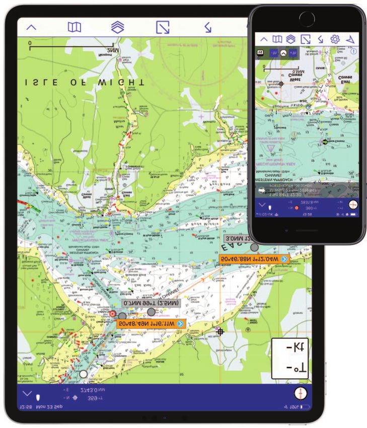
Imray Navigator app
Print on demand charts
Imray is an authorised print on demand supplier for official charts from the Admiralty,
Norwegian Hydrographic Office and SHOM (France). This means that the charts are
updated to include corrections on the most recent Notices for Mariners (Efs) and
printed on request. We are able to fulfil these orders quickly.
See www.imray.com for more information.
For orders, supplements,
the latest edition dates and
news see
www.imray.com
1
IMRAY ATLASES AND CHART PACKS
Skye
S.Uist
57[
Imray atlases and Barra Sea
SCOTLAND
Aberdeen
chart packs for the Barra
of the
Hebrides
Rum
Fort William
British Isles, Head Coll
Dundee
Netherlands, Belgium Tiree Mull
Oban
and France 2800 Firth of Forth
56[ Jura
Edinburgh
Islay Glasgow
Arran
ed
Cly
Malin Head Rathlin I.
of
2900
th
Fir
Bloody Foreland
Londonderry
No
55[N Newcastle
rth
Stranraer
North Larne
Ch
an
N.IRELAND Solway
n
Firth
el
Atlantic Donegal Bay Belfast Middlesbrough
Eagle I. Isle of
Sligo
Ocean Man
Flamborough Head
54[ Achill Head
2700 Fleetwood
Irish Sea Hull
IRELAND Grimsby
Slyne Head Anglesey Liverpool
Galway DUBLIN Holyhead
Galway
Aran Is. Bay
53[
ENGLAND
Limerick
Cardigan
el Bay WALES
a nn
Waterford
Ch
2000 SUFFOLK AND ESSEX COASTS ’s
ge
52[ Lowestoft to River Crouch eor Fishguard
G
10 sheets Cork St St David’s
Head
Milford
Swansea 2600
2100 KENT AND SUSSEX COASTS Old Head
Haven Cardiff LONDON
of Kinsale
Thames Estuary to the Solent Bristol
10 sheets Bristol Channel
2200 THE SOLENT Celtic Sea Lundy
51[ 10 sheets Hartland Pt Southampton
Brighton
2400 Portsmouth
Poole 2200
2300 DEVON AND DORSET COASTS Trevose Head
Lyme Bay
2100
The Needles to Start Point including Bill of Isle of
Plymouth Portland
Poole Harbour Wight
Falmouth Start Pt 2300
9 sheets English Channel
Land’s End
50[N 2400 THE WEST COUNTRY Isles of Scilly Lizard Pt
River Dart to the Isles of Scilly and Padstow Pte de
16 sheets 2500 Barfleur
Cherbourg
2600 THE BRISTOL CHANNEL CHANNEL
Trevose Head to St David’s Head ISLANDS Guernsey
including The River Severn 2110
12 sheets Jersey
49[
2700 NORTH AND WEST WALES
Anglesey to Milford Haven and St Malo
St George’s Channel
Ouessant Morlaix
12 sheets, includes Irish Sea 2510 Brest St Brieuc
passage charts
2800 MULL AND ADJACENT COASTS
48[
11 sheets Concarneau
Pointe de Penmarc’h Lorient
2900 FIRTH OF CLYDE
7 sheets
St-Nazaire
Belle-Île
Nantes
13[ 12[ 11[ 10[W 9[ 8[ 7[ 6[ 5[W 4[ 3[ 2[ 1[ W0[
2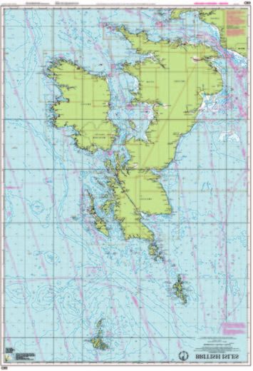
IMRAY ATLASES AND CHART PACKS
Varberg
DENMARK
Copenhagen
Esbjerg Malmö
Sjælland
Fyn
New chart atlases include a Baltic
scratchcard with voucher code to Sea
Sylt
redeem in our
Falster
Imray Navigator app Lolland
2150 Kiel
Die Kiel Canal
Elb Rostock
e
Lübeck
Spurn Head
Wilhelmshaven
R.Hu Bremerhaven Hamburg
mbe
r
Terschelling
Ameland
2120 Emden
Vlieland
Delfzijl
The Texel GERMANY
Wash Den Helder
North Sea IJsselmeer
2160
Gt Yarmouth
Lowestoft IJmuiden
AMSTERDAM
Chart atlases for The Netherlands
Include mobile download: Imray Digital Charts for The Netherlands
2000 Den Haag
Felixstowe
2140
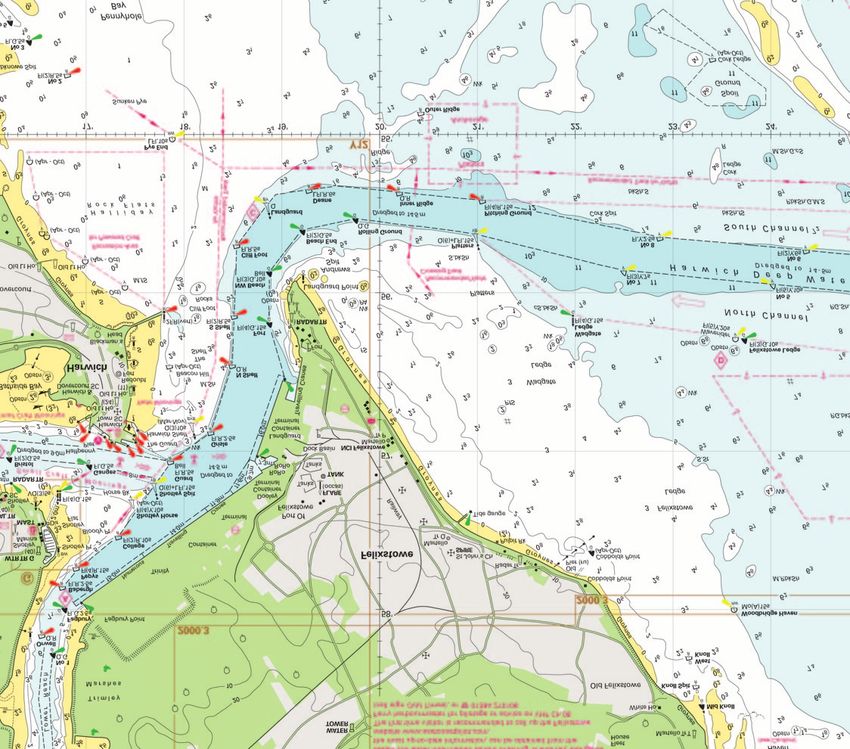
Harwich 2120 NORTH SEA - NIEUWPOORT TO DEN HELDER
NETHERLANDS 11 sheets, includes North Sea passage planning chart.
Thames 2130
Estuary
Vlissingen 2130 WESTERSCHELDE AND OOSTERSCHELDE
19 sheets.
Zeebrugge
Dover Antwerp 2140 RIJN AND MAAS DELTA
i t Dunkerque
Dungeness tra 7 sheets
rS Calais
ve
Do Cap Gris-Nez 2150 WADDENZEE - DEN HELDER TO NORDERNEY
Beachy BELGIUM
Head Boulogne 19 sheets. Includes passages from Borkum to
0
the Kiel Canal.
2160 IJSSELMEER
14 sheets
Dieppe
Cap d’Antifer
Le Havre
0
2110 NORTH FRANCE
FRANCE Nord-Pas-de-Calais, Picardy and Normandy coasts
11 sheets, includes cross-Channel passage planning chart
2500 THE CHANNEL ISLANDS AND ADJACENT COAST OF
FRANCE
17 sheets, includes cross-Channel passage planning chart
Spiral bound
atlas format
2510 NORTH BRITTANY 14 sheets
[E 1[ 2[ 3[ 4[ 5[E 6[ 7[ 8[ 9[ 10[E 11[ 12[ 13[
3
IMRAY CHARTS: THE BRITISH ISLES, NORTH SEA AND ENGLISH CHANNEL
C66 C23
Skye
S.Uist
Aberdeen
57[ Imray charts for Barra Sea
Rum
SCOTLAND
of the
the British Isles, Barra Hebrides Fort William
Head Coll
North Sea, Tiree Mull
Dundee
Oban
English Channel C63 C27 C24
C65 Firth of Forth
56[ and Ireland C64
Jura
Edinburgh
Islay Glasgow
Farne Is
C53 Arran
e d
Cly
Malin Head Rathlin I.
of
Blythe
th
Fir
Bloody Foreland
Londonderry
No
55[N Newcastle
rth
C62 C69 Stranraer
Larne
Ch
C54
an
N.IRELAND Solway
n
Firth
el
Donegal Bay Belfast Middlesbrough
Y70 Whitby
Eagle I. Isle of
Sligo Man
F
Barrow
54[ Achill Head
Fleetwood
Irish Sea Hull
IRELAND C52 Grimsby
Slyne Head Anglesey Liverpool
Galway DUBLIN Holyhead
C55 Galway
Aran Is. Bay
53[
C51 Pwllheli ENGLAND
Limerick
Loop Head nnon
R.Sha Cardigan
Wexford el Bay WALES
Waterford ann
Ch
’s
ge
52[ eor C60 Fishguard
North Cork
Mine Head
St
G St David’s C18
Head
C61 C59
Swansea
Atlantic Old Head
of Kinsale
Milford
Haven Y26 Cardiff LONDON
Mizen Head Bristol C2
Bristol Channel
Ocean C57 C58
Lundy
C56 C9
Hartland Pt
C12
51[ Southampton
Brighton
C10 C4 Poole C3
C5 Portsmouth
Celtic Sea Lyme Bay
C7 Trevose Head
Bill of Isle of
Padstow Plymouth Portland
Wight
Falmouth C14 Start Pt see inset
Y58
50[N
Land’s End English Channel
Isles of Scilly Lizard Pt C6
Pte de C3
see inset C33A Barfleur
CHANNEL Cherbourg
West Country area Hartland Pt
ISLANDS Guernsey
C34 Jersey
49[ C5
Y40 C35
Plymouth
C7 C58 Trevose Head Y41 Morlaix
C14 St Malo C33B
Padstow Ouessant Brest St Brieuc
Y46 Y43
Y58 Y45 Y44 Douarnenez
Falmouth Start Pt
Y47 C36
48[ Y48 Y42 Concarneau
Y49 Land’s End
Lizard Pt
Pointe de Penmarc’h Lorient
Y50 C6 C37 C39
C38
St-Nazaire
Belle-Île C40
Nantes
13[ 12[ 11[ 10[W 9[ 8[ 7[ 6[ 5[W 4[ 3[ 2[ 1[ W0
4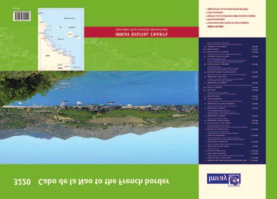
IMRAY CHARTS: THE BRITISH ISLES, NORTH SEA AND ENGLISH CHANNEL
Varberg
Thames Estuary Y6 Y2
area
Ipswich C1 C70
Y12
C28 Felixstowe
Harwich
Colchester Y16
Y17 Brightlingsea
DENMARK
Bradwell
Burnham- Y7
on-Crouch
Southend Thames Estuary Copenhagen
Tilbury Y18R.Thames Esbjerg Malmö
Sjælland
C2 North
Gravesend Sheerness Fyn
Chatham Foreland C8
Whitstable
Y14 Ramsgate Baltic
Sea
Sylt
Falster
Lolland
North Sea
C29 C26
Kiel
Flamborough Head
Die Kiel Canal
Elb Rostock
C25 e
Lübeck
Spurn Head
Wilhelmshaven
R.Hu Bremerhaven
mbe
r
Terschelling Hamburg
Ameland Emden
Vlieland
Delfzijl
Y9
The C28
Texel GERMANY
Wash Den Helder
IJsselmeer
Gt Yarmouth
IJmuiden
Lowestoft AMSTERDAM
see inset
NETHERLANDS
Felixstowe C1 C30
Den Haag
Harwich
Thames
Estuary
Vlissingen
C8 Zeebrugge Antwerp
Dover
it
Dungeness ra Dunkerque
r St Calais
e Ca
ov pG
Beachy
D
ris
-N
BELGIUM
Head Boulogne ez
Somme
32 Dieppe Solent area C9
Southampton
Cap d’Antifer Portsmouth
Lymington
Le Havre Y37
C15 Chichester
C4 Christchurch C3
C31 Bournemouth Y36 Y33
Poole Y35 Y34
Y23 Y38 Isle of
Weymouth Y39
Y32
Wight
FRANCE Swanage Y31 Y30
Bill of
Portland
English Channel
C5
0[E 1[ 2[ 3[ 4[ 5[E 6[ 7[ 8[ 9[ 10[E 11[ 12[ 13[
5
IMRAY C CHARTS
C1 Thames Estuary - Tilbury to North Foreland River Carron, Continuation to Forth & Clyde
and Orfordness Canal Entrance, Granton, Fisherrow, North
1: 120 000 WGS 84 Berwick, Dunbar
C2 The River Thames - Teddington to Southend C28 Harwich to Wells-next-the-Sea
WGS 84 1: 125 000 WGS 84
Richmond Bridge to Vauxhall Bridge Plans Wells-next-the-Sea, Blakeney
(1:13 700) Harbour, Gt Yarmouth Haven, Lowestoft
Vauxhall Bridge to Barking Creek (1:16 500) Approaches, Southwold Harbour, Rivers Ore
Barking Creek to Southend (1:40 400) and Alde, River Deben, Lowestoft Harbour
Plans Gallions Point Marina, South Dock C29 Harwich to Whitby
Marina, Limehouse Basin Marina, St 1: 285 000 WGS 84
Katherine Haven, Chelsea Harbour Marina, Plans Whitby, Scarborough, Filey,
Brentford Dock Marina, Continuation to Bridlington, River Humber, River Humber -
Teddington Continuation to Goole, Hull Marina,
C3 Isle of Wight Grimsby
1: 52 500 WGS 84 C30 Harwich to Hoek van Holland and Dover
Plans Lymington River, River Hamble, Strait
Bembridge Harbour, Continuation of 1: 200 000 WGS 84
Southampton Water Plans Dunkerque, Nieuwpoort, Oostende,
C4 Needles Channel to Bill of Portland Blankenberge, Zeebrugge, Breskens,
1: 75 000 WGS 84 Vlissingen
Plans Portland Harbour, Weymouth C31 Dover Strait to Le Havre
Harbour, Lulworth Cove, Worbarrow Bay, 1: 200 000 WGS 84
Chapman’s Pool, Swanage, Studland Bay, Plans Sovereign Harbour, Boulogne-sur-
Christchurch, Continuation of River Stour Mer, Le Tréport, Dieppe, St-Valéry-en-Caux,
C5 Bill of Portland to Salcombe Harbour Fécamp, Approaches to Le Havre & River
1: 100 000 WGS 84 Seine, Le Havre Yacht Harbour
Plans Bridport Harbour, Lyme Regis, C32 Baie de Seine - Le Havre to Cherbourg
Exmouth, Teignmouth Harbour, Torquay 1: 155 000 WGS 84
Harbour, Brixham Harbour, Tor Bay, River Plans Le Havre Yacht Harbour, Honfleur,
Dart Entrance Deauville/Trouville, Dives-sur-Mer,
C6 Salcombe to Lizard Point Ouistreham, Courseulles-sur-Mer,
1: 100 000 WGS 84 Arromanches, Port-en-Bessin, Grandcamp-
Plans Salcombe, Plymouth Sound, Looe, Maisy, Baie du Grand Vey, Saint-Vaast-La-
Polperro Harbour, Fowey Harbour and Hougue, Barfleur, Cherbourg, Port
Approaches, Charlestown Harbour, Chantereyne (Cherbourg)
C19 A Coruña to Gibraltar - Passage Chart
Mevagissey Harbour, Falmouth Harbour C33A Channel Islands
1: 825 000 WGS 84
C7 Falmouth to Isles of Scilly and Trevose Head 1: 120 000 WGS 84
Plans A Coruña, Baiona, Leixões, Lisboa
1: 120 000 WGS 84 Plans Alderney Harbour, Beaucette Marina,
Approaches, Cascais, Sines, Lagos, Bahía de
Plans Newquay Bay, Saint Ives, St Mary’s St Sampson Hbr, St Peter Port, Creux
Cádiz, Rota, Strait of Gibraltar, Gibraltar
Road, Hugh Town, Mousehole, Newlyn Harbour Approaches, Gorey, Omonville,
C20 Strait of Gibraltar to Archipélago dos
Harbour, Penzance, Saint Michael’s Mount, Herm Harbour & Rosière Anchorage ,
Açores & Islas Canarias - Passage Chart
Porthleven, Mullion Cove Diélette, Carteret, Bays of Sark, Little Russel
1: 2 500 000 WGS 84
C8 Dover Strait - North Foreland to Beachy C33B Channel Islands and North Coast of France
C23 Fife Ness to Moray Firth
Head and Boulogne 1: 120 000 WGS 84
1: 250 000 WGS 84
1: 115 000 WGS 84 Plans St-Quay-Portrieux, Binic, Dahouët,
Plans Wick Bay, Helmsdale, Inverness Firth,
Plans Sovereign Harbour, Rye Harbour, Erquy, Saint-Cast-Le-Guildo, St-Malo
Nairn, Burghead, Hopeman, Lossiemouth,
Folkestone, Dover, River Stour Entrance, Approaches, St-Malo, Granville, St Helier
Buckie, Banff & Macduff, Fraserburgh,
Ramsgate, Calais, Boulogne-sur-Mer Approaches (Jersey), St Helier Harbour
Peterhead, Aberdeen, Stonehaven,
C9 Beachy Head to the Isle of Wight C34 Cap d’Erquy to Ile de Batz
Montrose, Arbroath, Inverness
1: 110 000 WGS 84 1: 110 000 WGS 84
C24 Flamborough Head to Fife Ness
Plans Portsmouth, Langstone & Chichester Plans Primel, Le Léguer, Trébeurden,
1: 250 000 WGS 84
Harbours, Littlehampton, Shoreham Ploumanac’h, Anse de Perros, Perros-Guirec,
Plans Eyemouth Harbour, Berwick Harbour,
Harbour, Brighton Marina, Newhaven, Port-Blanc, Approaches to Rivière de
Holy Island Hbr, Farne Islands, Warkworth
Sovereign Harbour Tréguier, Tréguier, Approaches to Rivière de
Harbour (Amble) & Approaches, Blyth
C10 Western English Channel - Passage Chart Trieux and Paimpol, Port de la Corderie (Ile
Harbour, River Tyne, Continuation of the
1: 400 000 WGS 84 de Bréhat), Port Clos (Ile de Bréhat),
River Tyne, River Tyne - Further
C12 Eastern English Channel - Passage Chart Lézardrieux, Paimpol, St-Quay-Portrieux,
continuation to Newcastle, Sunderland
1: 300 000 WGS 84 Binic, Port du Légué, Dahouët
Harbour, Seaham Harbour, Hartlepool,
Plans Dover Strait C35 Baie de Morlaix to L’Aber-Ildut
River Tees, Whitby
C14 Plymouth Harbour and Rivers 1: 75 000 WGS 84
C25 Harwich to River Humber and Holland -
1: 20 000 WGS 84 Plans L’Aber-Ildut, Argenton, Portsall,
Passage Chart
Plans Plymouth, Mayflower Marina, Sutton Approaches to L’Aber Wrac’h & L’Aber
1: 340 000 WGS 84
Harbour and Queen Anne’s Battery Marina, Benoît, Port du Pontusval, Moguériec,
Plans Oudeschild, Den Helder, IJmuiden,
River Yealm, Continuation of River Tamar, Roscoff, Port de Morlaix
Scheveningen
Continuation of Saint Germans or Lynher C36 Île d’Ouessant to Raz de Sein
C26 IJmuiden to Die Elbe - Passage Chart
River 1: 80 000 WGS 84
1: 345 000 WGS 84
C15 The Solent - Bembridge to Hurst Point & Plans Baie de Lampaul (Ouessant), Port du
Plans IJmuiden, Den Helder, West-
Southampton Conquet, Port de Brest & Marina du Moulin
Terschelling, Lauwersoog, Borkum Yacht
1: 35 000 WGS 84 Blanc, Marina du Moulin Blanc, L’Elorn -
Harbour, Norderney Approaches,
Plans River Hamble, River Itchen, Hythe Continuation to Landerneau, Port de
Helgoland, Cuxhaven, Brunsbüttel
Marina Village, Lymington River, Newtown Camaret-sur-Mer, Port de Morgat, Port de
C27 Firth of Forth
River, Bembridge Harbour, Beaulieu River, Douarnenez
1: 75 000 WGS 84
Continuation of Beaulieu River, Cowes C37 Raz de Sein to Bénodet
Plans St Andrews, Crail, Anstruther, St
Harbour, Yarmouth Harbour, Wootton 1: 80 000 WGS 84
Monans, Elie, Methil Docks, Pettycur &
Creek Plans Ile de Sein, Audierne, St Guénole, Le
Kinghorn, Inchkeith, Burntisland, Aberdour,
C18 Western Approaches to the English Guilvinec, Lesconil, Loctudy, Bénodet,
Inchcolm, Dalgety Bay, Inverkeithing, North
Channel & Bay of Biscay - Passage Chart L’Odet Fleuve
Queensferry & Port Edgar, Charlestown &
1: 1 000 000 WGS 84
Limekilns, Grangemouth & Entrance to
6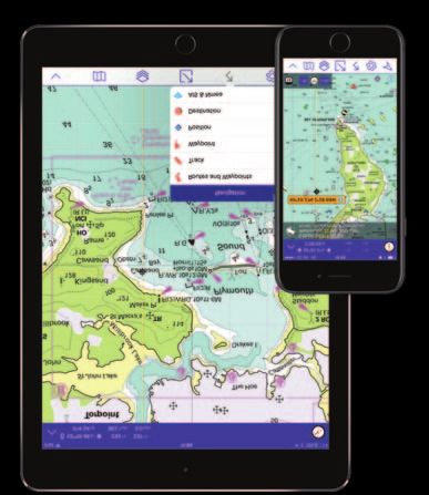
IMRAY CHARTS: BRITTANY - BISCAY - PORTUGAL - SPAIN
l C42 La Rochelle to Santander
52[ C18 Mine Head ne Felixstowe
CORK an Milford Haven ENGLAND 1: 350 000 WGS 84
Ch
’s Plans Approach to Arcachon, Capbreton,
rge Cardiff
o LONDON
Mizen Head Ge Bristol Rada de Higuer, Getaria, Zumaia, Abra de
St Bristol Channel
Dover
Lundy
tra
i t Bilbao, Laredo, Santoña, Santander, La
51[ Southampton Dungeness rS
ve Calais
Gironde & La Garonne, Continuation to
C10 Do
Celtic Sea Bordeaux
Trevose Head Isle of
Plymouth C43 Santander to A Coruňa
Wight
Falmouth
English Channel 1: 350 000 WGS 84
50[N Isles of Scilly Plans Santander, Ribadesella, Gijón, Avilés,
Pte de
CHANNEL Barfleur Luarca, Ribadeo, Ría de Viveiro, Ría de
ISLANDS Le Havre
Cherbourg Cedeira, A Coruña to Rías de Ares and
C12
Betanzos
49[ North C48 A Coruña to Porto
Roscoff
PARIS 1: 350 000 WGS 84
Atlantic Ouessant St Brieuc St Malo
Plans A Coruña, Ría de Corme e Laxe, Ría de
Brest
C36 Camariñas, Ría de Muros, Approaches to Ría
48[ Ocean Concarneau
de Arousa, Ría de Arousa, Cabo de Cruz,
Lorient
C37 Vilagarcía, Illa de Arousa to Cambados, Ría
St-Nazaire
C38 de Pontevedra, Ría de Vigo, Baiona, Viana
C39 Nantes FRANCE do Castelo, Leixões, Barra do Rio Douro
47[
C49 Ria de Aveiro to Sines
English Channel, C40
Les Sables-
d’Olonne 1: 350 000 WGS 84
Bay of Plans Figueira da Foz, Nazaré, Porto de
46[ Biscay & Iberia Biscay
C42 La Rochelle Peniche, Cascais, Lisboa Approaches, Lisboa
(Lisbon), Sesimbra, Entrance to Rio Sado
C41
(Setúbal), Setúbal, Sines
C43 La Gironde
C50 Sines to Gibraltar
45[N 1: 350 000 WGS 84
Bordeaux
Plans Sines, Lagos, Portimão, Vilamoura,
Vila Real de Santo António, Isla Cristina,
44[ C48 Mazagón, Chipiona, Rota, Bahía de Cádiz,
M14
Puerto Sherry, Sancti-Petri, Barbate, Tarifa,
Gijón Gibraltar, Strait of Gibraltar
C19 Santander
A Coruña Bayonne C51 Cardigan Bay - Milford Haven to Tremadog
Bilbao
43[ Bay
Cabo Finisterre
1: 145 000 WGS 84
Plans Pwllheli, Aberdovey, Aberystwyth,
Vigo Aberaeron, New Quay, Aberporth,
42[
M13 Cardigan, Newport Bay, Fishguard,
Barcelona
Entrance to Milford Haven
Leixões C52 Cardigan Bay to Liverpool
Tarragona
41[ Porto
1: 145 000 WGS 84
Ebro Plans Conwy, Conwy Bay, Holyhead, The
Swellies, Port Dinorwic, Caernarfon, Menai
SPAIN M3 Strait, Porth Dinlläen, Abersoch, Pwllheli,
40[N
Porthmadog, Mochras Lagoon, Barmouth
Valencia
Mallorca
C53 Donegal Bay to Rathlin Island
PORTUGAL 1: 200 000 WGS 84
39[ M12 Ibiza
LISBOA
C. de la Nao
Plans Ballycastle, Portrush, Lough Swilly,
Formentera
Alicante Mulroy Bay, Sheep Haven, Gweedore
Harbour and Approaches, Sound of Aran
38[ C49 and Burtonport, Church Pool, Teelin
Cartagena Mediterranean
C. de Palos Harbour, Killybegs Harbour, Mullaghmore
Huelva Sea Bay
See page 10
Faro M11
37[ Cabo São Vicente C54 Galway Bay to Donegal Bay
Málaga
C. de Gata 1: 200 000 WGS 84
Cádiz
Plans Sligo Harbour, Broad Haven Bay,
Gibraltar Portnafrankagh (Frenchport), Achill Sound,
36[ Strait of Gibraltar
C50 Approaches to Westport, Bofin Harbour
Oran
Tanger
(Inishbofin), Cleggan Bay, Clifden Bay,
ALGERIA
MOROCCO Approaches to Roundstone
35[N
11[ 10[ 9[ 8[ 7[ 6[ 5[W 4[ 3[ 2[ 1[ W 0[E 1[ 2[ C55 Dingle Bay to Galway Bay
1: 200 000 WGS 84
Plans Cashla Bay, Galway Bay, Galway
C38 Anse de Bénodet to Presqu’île de Quiberon C40 Le Croisic to Les Sables d’Olonne Harbour, Kilronan (Aran Is.), River Shannon
1: 80 000 WGS 84 1: 110 000 WGS 84 to Limerick, Kilrush, Foynes Harbour, Fenit
Plans Port la Forêt, Concarneau, Port Plans Le Croisic, Saint-Nazaire, Pornic, Island, Dingle Harbour
Manec’h, Ports Brigneau & Merrien, L’Herbaudière, Goulet de Fromentine, Port- C56 Cork Harbour to Dingle Bay
Doëlan, Îles de Glénan North, Lorient, Joinville (Île d’Yeu), Port de Saint-Gilles- 1: 170 000 WGS 84
Lorient Yacht Harbour, Port Tudy (Île de Croix-de-Vie, Les Sables d’Olonne Plans Dingle Harbour, Valentia Harbour,
Groix), Étel C41 Les Sables d’Olonne to La Gironde Portmagee, Sneem, Kilmakilloge &
C39 Lorient to Le Croisic 1: 110 000 WGS 84 Ardgroom Harbours, Castletown
1: 80 000 WGS 84 Plans Bourgenay, Approach to Jard-sur-Mer, Berehaven, Glengarriff Harbour, Bantry
Plans Sauzon, Le Palais, Port Haliguen, La Approach to Ars-en-Ré, Approach to St Harbour, Crookhaven, Schull Harbour,
Trinité-Sur-Mer, Port Du Crouesty, Piriac-sur- Martin-de-Ré, Approach to La Flotte-en-Ré, Baltimore Harbour, Castlehaven, Glandore
Mer, La Turballe, Le Croisic, Baie de Rade de la Pallice, La Rochelle and Port des Harbour, , Courtmacsherry Harbour, Kinsale
Pouliguen, Continuation of La Vilaine Minimes, St-Denis-d’Oléron, Douhet, Harbour, Cork Harbour Entrance
Boyardville, Rochefort, Royan, Port Médoc,
La Gironde & La Garonne, Continuation to
Bordeaux
7
IMRAY C CHARTS
C65 Crinan to Mallaig and Barra
Fair Isle 1: 155 000 WGS 84
C68 Plans Castle Bay (Barra), Mallaig,
Tobermory (Mull), Caledonian Canal
ORKNEY Entrance, Lynn of Lorn, Dunstaffnage Bay,
ISLANDS Oban, Loch Feochan Entrance, Sound of
59[ Luing
C66 Mallaig to Rubha Reidh and Outer
Pentla
C67 nd Firth Hebrides
Butt of Cape Wrath Duncansby Head 1: 155 000 WGS 84
Lewis C23 Plans Loch Gairloch, Kyleakin, Portree, Uig,
Wick
Dunvegan, Loch Boisdale (South Uist), Loch
S
North Carnan, Loch Maddy, East Loch Tarbert, St
IDE
Minch Kilda
Ullapool
BR
Stornoway C67 North Minch and Isle of Lewis
Lewis
HE
58[ Moray Firth 1: 155 000 WGS 84
TER
C66 Plans Loch Inchard (Kinlochbervie), Loch
Inver, Ullapool, Stornoway Harbour, Loch
OU
Harris Kinnaird Head
Carloway
N.Uist Fraserburgh
C68 Cape Wrath to Wick and the Orkney
Inverness Peterhead Islands
Skye 1: 160 000 WGS 84
S.Uist Kyle of Lochalsh
Plans Pierowall Harbour, Whitehall
Aberdeen
Harbour, Bay of Kirkwall, Stromness
57[ Barra Sea Harbour, Scrabster Harbour, Wick Bay
of the
Rum SCOTLAND C69 Loch Ryan to Belfast Lough and Strangford
Barra Hebrides Fort William Montrose Lough
Head Coll 1: 90 000 WGS 84
Dundee Plans Carnlough Harbour, Larne,
Tiree Mull Carrickfergus, Bangor Bay, Donaghadee
Oban
C24 Sound, Entrance to Strangford Lough,
C63 C27
Portaferry Marina, Strangford, Ardglass,
C65 Firth of Forth Stranraer, Portpatrick
C64
56[ Jura C70 Southern North Sea Passage Chart
Edinburgh 1: 900 000 WGS 84
Islay Glasgow
C80 British Isles
Farne Islands
C53 1: 1 500 000 WGS 84
Arran
d e
Cly
Malin Head
of
th
Fir
Blyth
Londonderry
Newcastle
No
55[N
C69
rth
C62 Stranraer
Larne
Ch
N.IRELAND ENGLAND
an
eln
8[ 7[ Belfast 5[W 4[ 3[ 2[ 1[
C57 Tuskar Rock to Old Head of Kinsale Tremadog Bay, Menai Strait, Menai Strait -
1: 170 000 WGS 84 The Swellies, Conwy, Dun Laoghaire,
Plans Kinsale Harbour, Cork Lower Harbour, Dublin Bay, Wicklow, Arklow, Wexford
Crosshaven, Youghal Harbour, Dungarvan C62 Irish Sea
Harbour, Waterford Harbour, Dunmore 1: 280 000 WGS 84
East Harbour, Kilmore, Cork continuation Plans Carrickfergus, Bangor Bay, Entrance
to East Ferry Marina to Strangford Lough, Portaferry Marina,
C58 Trevose Head to Bull Point Strangford, Ardglass, Entrance to
1: 130 000 WGS 84 Carlingford Lough, Malahide Inlet, Howth,
Plans Ilfracombe, Barnstaple and Bideford, Dun Laoghaire Harbour, Ribble Estuary,
Continuation to Barnstaple, Lundy, Bude Approaches to Fleetwood, River Lune,
Haven, Port Isaac and Port Gaverne, River Continuation to Carlingford Marina,
Camel, Padstow Harbour Continuation to Preston
C59 Bristol Channel - Worms Head and Bull C63 Firth of Clyde
Point to Sharpness 1: 160 000 WGS 84
1: 115 000 WGS 84 Plans Crinan Approaches, Ardrishaig, East
Plans The Mumbles, Swansea Marina, Loch Tarbert, Campbeltown Loch,
Porthcawl, Cardiff Bay, Penarth Marina, Campbeltown Harbour, Caladh Harbour,
Avonmouth, Continuation of River Avon Burnt Islands, Rothesay Harbour, Lamlash
(Avonmouth Bridge to Bristol), Bridgwater Harbour, Rhu & Helensburgh, Dumbarton,
Bay and Burnham-on-Sea, Watchet, Kip Marina, Largs Channel, Largs Yacht
Minehead, Continuation - Severn Bridge to Haven, Millport, Ardrossan, Irvine, Troon,
Sharpness Ayr, Girvan, Stranraer, Portpatrick
C60 Gower Peninsula to Cardigan C64 Belfast Lough to Lough Foyle and Crinan
1: 130 000 WGS 84 1: 160 000 WGS 84
Plans Fishguard, Ramsey Sound, Solva Plans Loch Sween (Tayvallich), Continuation
Harbour & Approaches, Jack Sound, of West Loch Tarbert, Port Ellen, Lough
Milford Haven, Tenby & Caldey Island Foyle, Portrush, Larne, Belfast Lough,
C61 St George’s Channel - Anglesey to Dublin, Carrickfergus, Bangor Bay, Continuation of
Waterford & The Smalls River Foyle to Londonderry
1: 280 000 WGS 84
Plans Cardigan, New Quay, Aberystwyth,
Aberdovey, Barmouth, Porthmadog,
8IMRAY Y CHARTS
New Y Charts
Individual charts from the 2000 series packs and atlases are now available as
Y charts. These are printed on water-resistant Pretex paper, supplied folded in a
recycled plastic wallet. Also available laminated.
Y2 Rivers Ore and Alde Y34 Chichester & Langstone Harbours
1: 35 000 WGS 84 1: 35 000 WGS 84
Y6 Suffolk and Essex Coasts Plans Southsea Marina, Northney Marina,
1: 120 000 WGS 84 Emsworth Yacht Harbour, Sparkes Marina,
Y7 Thames Estuary South Chichester and Birdham Marinas
1: 120 000 WGS 84 Y35 Portsmouth Harbour & Approaches
Y9 The Wash 1: 22 500 WGS 84
1: 90 000 WGS 84 Y36 Central Solent
Plans Boston, King’s Lynn, Brancaster 1: 35 000 WGS 84
Harbour and Overy Staithe, Wells-next-the- Y37 Southampton Water
Sea, Blakeney Harbour, Wisbech Yacht 1: 35 000 WGS 84
Harbour Plans Continuation of Southampton Water
Y12 Rivers Stour and Orwell Y38 West Solent
1: 35 000 WGS 84 1: 35 000 WGS 84
Plans Upper Orwell to Ipswich, Fox’s Plans Yarmouth Harbour
Marina, Woolverstone Marina, Suffolk Y39 Poole Harbour
Yacht Harbour, Shotley Marina 1: 20 000 WGS 84
Y14 The Swale Plans Salterns Marina, Continuation of
Studland Bay, Moriconium Quay & Lake
1: 40 000 WGS 84 Yard Marina
Plans Whitstable Harbour Y40 River Exe
Y16 Walton Backwaters to Ipswich and 1: 21 500 WGS 84
Woodbridge Plans Exmouth Dock, River Exe continuation
1: 35 000 WGS 84 to Exeter
Plans River Orwell continuation to Ipswich, Y41 Teignmouth and Tor Bay
Fox’s Marina, River Deben continuation 1: 55 000 WGS 84
Plans Teignmouth Harbour, Torquay
above Ramsholt, Tide Mill Yacht Harbour, Harbour, Paignton Harbour, Brixham
Woolverstone Marina, Suffolk Yacht Harbour
Harbour, Shotley Marina, Titchmarsh Y42 Exmouth to Salcombe
Marina 1: 100 000 WGS 84
Y17 The Rivers Colne, Blackwater, Crouch & Y43 River Dart
Roach 1: 15 000 WGS 84
1: 50 000 WGS 84 Plans Kingswear, Continuation to Totnes
Y44 Salcombe Harbour
Plans Continuation of River Colne to
1: 15 000 WGS 84
Colchester, Brightlingsea, Tollesbury Plan Salcombe
Marina, Bradwell Marina, Burnham Yacht Y45 Plymouth Harbour
Harbour, Continuation of River Roach to 1: 20 000 WGS 84
Rochford and Havengore Creek Plans Mayflower Marina, King Point &
Y18 The River Medway & Approaches - Millbay Marinas, Sutton Harbour and
Sheerness to Rochester and River Thames Queen Anne’s Battery Marina, Plymouth
Yacht Haven, Continuation of River Yealm
Sea Reach
Y46 River Fowey
1: 20 000 WGS 84 1: 9000 WGS 84
Plans Whitton Marine, Port Werburgh, Plans Continuation to Lostwithiel
Gillingham Marina, River Medway Y47 Falmouth Harbour
Continuation, River Thames Sea Reach 1: 20 000 WGS 84
Y23 Poole Harbour Plans Mylor Yacht Harbour, Falmouth
1: 17 000 WGS 84 Marina, Falmouth Inner Harbour
Plans Holes Bay, Salterns Marina, Y48 Helford River
1: 17 000 WGS 84
Moriconium Quay & Lake Yard Marina Plans Continuation of Helford River to
Y26 Milford Haven and River Cleddau Gweek
1: various WGS 84 Y49 Isles of Scilly
Plans Milford Marina, Neyland Yacht Haven, 1: 40 000 WGS 84
Milford Haven - St Ann’s Head to Neyland Plans St Mary’s Road
Point, River Cleddau above Neyland Point, Y50 Saint Mary’s, Tresco and
Continuation to Haverfordwest Surrounding Islands
1: 20 000 WGS 84
Y30 Isle of Wight
Y58 River Fal - Falmouth to Truro
1: 100 000 WGS 84
1: 20 000 WGS 84
Y31 Christchurch to the Solent
Plans Mylor Yacht Harbour, Falmouth
1: 60 000 WGS 84
Marina, Falmouth Inner Harbour
Plans Lymington River, Christchurch
Y70 Isle of Man
Y32 Eastern Approaches to the Solent
1: 85 000 WGS 84
1: 60 000 WGS 84
Plans Peel, Port Erin, Calf Sound, Bay Ny
Y33 Langstone and Chichester Harbours
Carrickey & Castletown Bay, Douglas,
1: 21 500 WGS 84
Ramsey
Plans Southsea Marina, Northney Marina,
Emsworth Yacht Harbour, Birdham Pool and
Chichester Marina
9IMRAY MEDITERRANEAN CHARTS
Imray charts for the M24
SL
Venice
Mediterranean Trieste
45[N Pula
ITALY M34
• 640 x 900mm FRANCE Genova
M
• Flat sheets or folded (A4 format) M40 M16
La Spezia Ravenna
• Printed on water-resistant M15
M14 MONACO
Ligurian
Pretex® paper Nice Sea
Sète Fos Livorno
Marseille Ancona
A
Toulon
Golfe du M6 M45 M17
Lion Bastia ITALY
I.d’Elba M33
Pesc
CORSE Civitavecchia
(CORSICA)
3220 Ajaccio ROME
M13
Barcelona
M7 M18
M8
Naple
Olbia
M46
Balearic
SPAIN SARDEGNA Tyrrhenian
40[ M3 Sea (SARDINIA) Sea
3200 Menorca
Valencia Palma Mallorca Cagliari
ISLAS M9 M47
M12 Ibiza
BALEARES M49
Alicante
3210 M35
Palermo
Cartagena Marsala
Bizerte SICILIA
M11
Málaga Annaba TUNIS
ALGER Bejaïa M31
Gibraltar Alboran
TUNISIA Malta Va
Sea
Tanger Sousse
Oran
Melilla M36
M50
35[
Sfax
RABAT ALGERIA
MOROCCO
TRIPOLI
M10
Mediterranean Spain chart atlases
Includes free mobile download: Imray Digital Charts
LIBYA
A new range of atlases focusing on the
30[ Mediterranean and designed to be used
alongside
5[ Imray pilot books which detailW0[Ethe 5[ 10[ 1
marked anchorages. Loose-leaf sheets
provide all of the necessary information for
passage planning and detailed approaches
to the harbours and anchorages of this
appealing cruising ground.
In loose-leaf A2 format in a tough
plastic wallet. Also available wiro-bound.
3200 ISLAS BALEARES
25 sheets
3210 GIBRALTAR TO CABO DE LA NAO
Coming soon
3220 CABO DE LA NAO TO THE FRENCH BORDER NEW
23 sheets
10IMRAY MEDITERRANEAN CHARTS
LOVENIA
M23
M25
CR
M20
OA
Zadar BOSNIA &
T
HERZEGOVINA
IA
Split M26
Ad
ria
t
Black Sea
ic
Se MONTE-
a Dubrovnik NEGRO
cara
M27
ALBANIA
M32 Durres
M29 G2 Tekirda…
Istanbul
es Bari
Brindisi Thessaloniki G22 Izmit
Salerno
Taranto
G1 G23
Çanakkale
G11 G21
Kerkira GREECE G27
G25
Aegean Mitilini
Sea TURKEY
G121 G26 G28
Khalkis
G13 Khíos Izmir
Ionian
Messina Patras
Sea ATHENS G31
M19 G32
G12 Pirgos G141
Catania Ermoupolis
G14 M21
Siracusa Kalamata Antalya
M30 G16 Kos
G33 G34 G35 Rhodos
G36 G40
alletta G15
Iraklion G38 G39
CRETE Nicosia SYRIA
Sitía Cyprus
G37
G3 Trablous
LEBANON
BEIRUT
Mediterranean Sea
Banghazi Tel Aviv
ISRAEL
Gaza
Bur Said
Alexandria M22
EGYPT
15[ 20[ 25[ 30[ 35[
M3 Islas Baleares - Formentera, Ibiza, Mallorca M8 North Sardegna M11 Gibraltar to Cabo de Gata & Morocco
and Menorca 1: 255 000 WGS 84 1: 440 000 WGS 84
1: 350 000 WGS 84 Plans Arcipelago di La Maddalena - Plans Strait of Gibraltar, Gibraltar,
Plans San Antonio (Ibiza), Puerto de Ibiza, Southern Group, Golfo di Cugnana, Golfo Estepona, Puerto de Almerimar, Almería,
Puerto de Palma (Mallorca), Porto Colom Spurlatta, Passaggio dei Fornelli, Porto Ceuta
(Mallorca), Puerto de Mahón (Menorca), Torres, Approaches to Alghero M12 Cabo de Gata to Dénia & Ibiza
Alcudia (Mallorca), Approaches to M9 South Sardegna 1: 500 000 WGS 84
Ciudadela (Menorca) 1: 255 000 WGS 84 Plans Mar Menor, Torrevieja, Alicante,
M6 Île de Corse Plans Approaches to Arbatax, Approaches Villajoyosa, Altea, Dénia
1: 255 000 WGS 84 to Torre Grande, Canale di San Pietro, M13 Dénia to Barcelona and Ibiza
Plans Macinaggio, Bastia, Approaches to Porto di Cagliari, Capo Carbonara, Golfo di 1: 440 000 WGS 84
Calvi, Ajaccio, Approach to Propriano, Teulada Plans Dénia, Valencia Harbour, Tarragona,
Bonifacio, Îles Lavezzi M10 Western Mediterranean - Gibraltar to the Barcelona Harbour, San Antonio (Ibiza)
M7 Bonifacio Strait Ionian Sea
1: 65 000 WGS 84 1: 2 750 000 WGS 84
Plans La Maddalena
11IMRAY MEDITERRANEAN CHARTS
M14 Barcelona to Bouches du Rhône M29 Golfo di Taranto Órmos Gouvíon (Nísos Kérkira), Kérkira
1: 440 000 WGS 84 1: 375 000 WGS 84 (Corfu Town) (Nísos Kérkira), Órmos Párga,
Plans Barcelona Harbour, Barcelona Port Plans Approaches to Brindisi, Approaches Continuation of Amvrakikós Kólpos, Limín
Vell, Puerto Olímpico, Palamós, Puerto de to Otranto, Approaches to Gallipoli, Alípa (Nísos Kérkira), Órmos Lákka (Nísos
L’Escala, Port Vendres, St-Cyprien-Plage, Approaches to Crotone Paxoí), Port Gaios (Nísos Paxoí)
Cap d’Agde, Sète, Golfe de Fos M30 Southern Adriatic and Ionian Seas - G12 South Ionian Islands - Nísos Levkas to
M15 Marseille to San Remo Dubrovnik to Kérkira (Corfu) & Sicilia Nísos Zákinthos
1: 325 000 WGS 84 1: 850 000 WGS 84 1: 190 000 WGS 84
Plans Marseille Vieux-Port & Îles du Frioul, Plans Approaches to Brindisi, Approaches Plans Dhióriga Levkádhos (Levkas Canal),
Îles d’Hyères, Golfe de St-Tropez, Golfe de to Siracusa Kólpos Aetoú (N. Ithaca), Órmos
La Napoule, Antibes, Nice, Rade de M31 Sicilia Argostolíou (N. Kefallínia), Órmos
Villefranche & Cap Ferrat, Monaco 1: 400 000 WGS 84 Zákinthou (N. Zákinthos)
M16 Ligurian Sea Plans San Vito Lo Capo, Approaches to G121 The Inland Sea
1: 325 000 WGS 84 Palermo, Catania 1: 95 000 WGS 84
Plans San Remo, Approaches to Genova, M32 Adriatic Italy (South) - Pescara to Bari Plans Dhioriga Levkádhos (Levkas Canal),
Golfo Marconi, Approaches to La Spezia, 1: 325 000 WGS 84 Vasilikí (Nísos Levkas), Órmos Fiskárdho
Viareggio, Approaches to Livorno Plans Porto di Ortona, Porto di Punta (Cephalonia), Órmos Ayias Eufimia
M17 North Tuscan Islands to Rome Penna (Vasto), Termoli Marina di San (Cephalonia), Órmos Frikou (Nísos Itháca),
1: 325 000 WGS 84 Pietro (Termoli), Isole Tremiti, Porto di Kálamos Harbour
Plans Scarlino to Punta Ala, Approaches to Vieste, Marina del Gargano, Porto di Trani, G13 Gulfs of Patras and Corinth - Patraïkós
Giglio Marina, Approaches to Bari Porto Nuovo Kólpos and Korinthiakós Kólpos
Civitavecchia, Approaches to Fiumicino M33 Adriatic Italy (North) – Po Delta to Pescara 1: 220 000 WGS 84
and Fiuma Grande, Approaches to Anzio 1: 350 000 WGS 84 Plans Mesolóngion, Liménas Pátron, Ríon -
M18 Capo d’Anzio to Capo Palinuro Plans Ravenna Coast, Porto di Ravenna, Andírrion Bridge, Órmos Aiyíou, Krissaíos
1: 325 000 WGS 84 Porto di Rimini , Porto di Fano, Porto di Kólpos, Órmos Andíkiron, Kiato, Órmos
Plans Rada di Gaeta, Golfo di Pozzuoli and Ancona, Porto di San Benedetto del Loutrákiou, Corinth Canal (Dhiórix
Rada di Napoli, Approaches to Acciaroli, Tronto, Marina di Pescara Korínthou)
Capo Palinuro M34 Golfo di Venezia G14 Saronic and Argolic Gulfs
M19 Capo Palinuro to Punta Stilo 1: 220 000 WGS 84 1: 190 000 WGS 84
1: 325 000 WGS 84 Plans Chioggia, Venezia, Approaches to Plans Marina Alimos (Kalamáki), Stenón
Plans Golfo di Policastro, Approaches to Grado, Monfalcone, Trieste Metópis, Limín Póros, Nisídhes Tselevínia,
Vibo Valentia, Isole Alicudi, Stretto di M35 Sicilian Channel Stenón Spétsai, Návplion
Messina 1: 375 000 WGS 84 G141 Saronikós Kólpos - Corinth Canal to Ákra
M20 Eastern Mediterranean - Sardegna to Port Plans Bizerte, Cap Gammarth to Carthage, Soúnion and Nísos Póros
Said and the Black Sea Port de Kélibia, Port Yasmine Hammamet, 1: 110 000 WGS 84
1: 2 750 000 WGS 84 Pantelleria Plans Órmos Falírou, Marina Alimos
M21 South Coast of Turkey, Syria, Lebanon & M36 South Coast of Sicily to Malta (Kalamáki), Limín Aígina
Cyprus - Passage Chart 1: 275 000 WGS 84 G15 Southern Pelopónnisos - Kalámata to Nísos
1: 785 000 WGS 84 Plans Licata, Porto Palo and Capo Passero, Kríti and Ákra Tourkovigla
Plans Alanya Limani (Turkey), Larnaca Siracusa, Grand Harbour & Marsamxett 1: 190 000 WGS 84
Marina (Cyprus), Mersin (Turkey) (Malta) Plans Liménas Kalamátas, Yíthion, Órmos
M22 Egypt to Israel, Lebanon and Cyprus - M40 Ligurian and Tyrrhenian Seas Kapsáli, Dhiakofti, Monemvasía (Yéfira),
Passage Chart 1: 950 000 WGS 84 Nísos Andikíthera to Nísos Kríti
1: 785 000 WGS 84 Plans Monte Argentario, Bonifacio Strait, G16 Western Pelopónnisos - Killini to Kalamáta
Plans Larnaca Marina (Cyprus), Jounié Golfo di Salerno 1: 190 000 WGS 84
(Lebanon), Hefa (Haifa) (Israel), Bur Sa’id M45 Tuscan Archipelago Plans Limín Killinis, Limín Katakólou,
(Port Said) (Egypt) 1: 180 000 WGS 84 Órmos Kiparissias, Órmos Navarínou,
M23 Adriatic Sea - Golfo di Trieste to Bar and Plans Approaches to Porto Capraia, Stenón Methónis, Koróni, Liménas
Promontorio del Gargano Approaches to Portoferraio, Bastia, Kalamatás
1: 750 000 WGS 84 Talamone, Approaches to Porto S. Stefano G2 Aegean Sea (North) - Passage Chart
M24 Golfo di Trieste to Lošinj and Rab M46 Isole Pontine to the Bay of Naples 1: 750 000 WGS 84
1: 220 000 WGS 84 1: 180 000 WGS 84 Plans Approaches to Ístanbul, Izmit
Plans Novigrad, Pore , Rovinj, Brijuni Plans Approaches to Ponza, Approaches to Körfezi, Çanakkale Bogazi (The
Islands to Pula, Veruda to Medulin Bay, Dardanelles)
Approaches to Punat, Approaches to Mali Porto d’Ischia, Approaches to Sorrento,
Lošinj, Otok Ilovik Channel Approaches to Marina Grande (Capri) G21 Northwest Aegean
M25 Otok Rab to Šibenik M47 Aeolian Islands 1: 275 000 WGS 84
1: 220 000 WGS 84 1: 140 000 WGS 84 Plans Approaches to Thessaloníki, Néa
Plans Prolaz Zapuntel Passage, Passage Plans Approaches to Lipari, Bocche di Skioni, Pórto Koufó, Nisís Dhiáporos
Between Otok Molat & Dugi Otok, Zadar, Vulcano, Approaches to Milazzo Anchorages, Nisís Ammouliani, Stenón
M49 West Sicily and Egadi Islands Thásou
Luka Telašdica, The Kornati Islands, Šibenik
and Rijeka Krka, Prolaz Proversa Vela & 1: 275 000 WGS 84 G22 Northeast Aegean
Mala Plans Isola di Ustica, Isole Egadi, 1: 275 000 WGS 84
M26 Split to Dubrovnik Approaches to Trapani, Approaches to Plans Approaches to Lágos and Fanárion,
1: 220 000 WGS 84 Favignana, Approaches to Marsala, Mazara Órmos Moudhrou, Entrance to Çanakkale
Plans Luka Rogoznica, Trogirski Kanal, del Vallo Bo azi, Nara Geçidi, Continuation to Nísos
Approaches to Split, The Drvenik Islands, M50 Sardegna to Ionian Sea Áyios Evstrátios
Splitska Vrata, Approaches to Hvar & the 1: 1 100 000 WGS 84 G23 Marmara Denizi
Plans Stretto di Messina 1: 275 000 WGS 84
Pakleni Islands, Approaches to Koreula,
Approaches to Ubli, Approaches to Gruž & G1 Mainland Greece and the Peloponnisos - Plans Türkeli & Pa alimani Islands, Istanbul,
Dubrovnik Marina Passage Chart Princes Islands, Approaches to Pendik
M27 Dubrovnik to Bar and Ulcinj 1: 729 000 WGS 84 G25 Northern Sporades and North Évvoia
1: 220 000 WGS 84 Plans Vórion Stenón Kérkiras, Ríon - 1: 190 000 WGS 84
Andírrion Bridge, Approaches to Pátras Plans Órmos Skíathou (Nísos Skíathos),
Plans Luka Polače, The Elaphite Islands,
Approaches to Dubrovnik, Boka Kotorska, G11 North Ionian Islands - Nísos Kérkira to Stenón Alonnísou, Linariá (Nísos Skíros),
Tivat, Approaches to Budva, Bar Marina, Nísos Levkas Continuation of Maliakós Kólpos, Nisoi
Ulcinj 1: 185 000 WGS 84 Likhades
Plans Continuation of North Ionian Islands
to Nisís Othoní, Vórion Stenó Kérkiras,
12IMRAY ATLANTIC OCEAN CHARTS
G26 Nísos Évvoia
1: 190 000 WGS 84
Plans Linariá (Nísos Skíros), Kími (Nísos Imray Iolaire charts for the Atlantic Ocean
Évvoia), Approaches to Khalkís,
Porthmós Evrípou, Dhíavlos Stenó,
E1 Arquipélago dos Açores CHART 100 NORTH ATLANTIC OCEAN
Erétria (Nísos Évvoia), Nisídhes Petaloi & 1: 750 000 WGS 84
Approaches to Marmari Plans Vila das Lajes, Horta, Lajes (Pico), PASSAGE CHART
G27 Nísos Lésvos & the Coast of Turkey Porto das Velas, Vila da Praia, Praia da At a scale of 1:7,620,000, this chart covers the
1: 190 000 WGS 84 Vitória, Angra do Heroísmo, Ponta North Atlantic from Brazil to Newfoundland and
Plans Ayvalik, Sígri (N. Lésvos), Entrance Delgada, Vila Franco do Campo, Vila do Gibraltar to the Caribbean. Interestingly, it has
to Kólpos Kalloní (N. Lésvos), Entrance Porto been constructed on a conical projection which
to Kólpos Yéras (N. Lésvos), Mitilíni (N. E2 Islas Canarias means that Great Circle tracks can be plotted as
1: 600 000 WGS 84 straight lines rather than curves. The chart shows
Lésvos), Bademli Limani Plans Tazacorte, Puerto de Santa Cruz, the main trend of contours, limits of ice,
G28 Nísos Khíos & the Coast of Turkey Puerto de la Estaca, Puerto de San magnetic variations and key routes as identified
1: 190 000 WGS 84 Sebastian de la Gomera, Dársena de Los by D M Street.
Plans Approaches to Psará (Nísos Psará), Llanos (Marina Santa Cruz), Dársena In the accompanying booklet are notes on the
Approaches to Khíos (Nísos Khíos), Pesquera (Marina Tenerife), Puerto de las routes and small wind rose charts, with charts
Órmos Mandráki (Nísos Oinoússa), Palmas, Morro Jable, Gran Trajal, Marina showing excessive wave heights and storm
Çesme Körfezi (Turkey), Foça Limani Rubicón, Puerto Calero, Puerto de Naos & frequencies.
Los Marmoles (Marina Lanzarote), Estrecho
(Turkey), Sigaçik Limani (Turkey) del Río Chart 100 is an important companion for
G3 Aegean Sea (South) E3 Arquipelago da Madeira Atlantic yachtsmen on passage and an excellent
1: 750 000 WGS 84 1: 170 000 WGS 84 source of planning information
Plans Approaches to Rhodes Plans Porto Santo, Porto de Recreio da
G31 Northern Cyclades Calheta, Funchal, Água de Pena, Porto de
1: 200 000 WGS 84 Machico, Quinta do Lorde, Ponta de São
Plans Limín Áy. Nikoláou (Nísos Kea), Lourenço, Enseada da Doca (Isla Deserta
Grande), Selvagem Grande, Selvagem
Approaches to Finikas (Nísos Síros), Pequena
Órmos Naousis (Nísos Páros), Míkonos & E4 Arquipélago de Cabo Verde
Approaches (Nísos Míkonos), Órmos 1: 500 000 WGS 84
Gávriou (Nísos Andros) Plans Porto Novo (Ilha de Santo Antão),
G32 Eastern Sporades, Dodecanese and the Mindelo (Porto Grande) (Ilha de São
Coast of Turkey Vicente), Ilha de Santa Luzia, Porto de
1: 200 000 WGS 84 Tarrafal (Ilha de São Nicolau), Porto da
Preguiça (Ilha de São Nicolau), Baía da
Plans Kuşadasi (Turkey), Stenón Sámou, Palmeira (Ilha do Sal), Porto de Sal-Rei
Póros Fóurnon, Órmos Pátmou (Nísos (Ilha da Boavista), Porto da Praia (Ilha de
Pátmos), Órmos Parthéni (Nísos Léros), Santiago), Cavaleiros (Ilha do Fogo),
Yalikavak Limani (Turkey), Stenón Lérou Porto da Furna (Ilha Brava)
G33 Southern Cyclades - (West Sheet) E5 Bermuda
1: 190 000 WGS 84 1: 60 000 WGS 84
Plans Stenón Kimólou-Políagou and Plans Saint George’s Harbour, Dockyard
Marina, Caroline Bay Marina, Hamilton
Stenón Mílou-Kimólou, Órmos Náxou
Harbour, Bermuda Approaches
(N. Náxos), Órmos Livádhiou (N. Sérifos),
Stenón Andipárou
G34 Southern Cyclades - (East Sheet)
1: 200 000 WGS 84
Plans Órmos Íou (Nísos Íos), Koufonisia
(Epano Koufonisia), Órmos Maltezana
(Análipsis) (Nísos Astipálaia) The
G35 Dodecanese and the Coast of Turkey British
Isles
1: 190 000 WGS 84
Plans Approaches to Kós (Nísos Kós), Canada
Approaches to Turgutreis (Turkey),
Bodrum (Turkey), Approaches to Ródhos C18
(Nísos Ródhos), Órmos Sími (Nísos Sími) Newfoundland
50[
G36 Marmaris to Kekova Adasi
1: 200 000 WGS 84
Plans Marmaris Limani, Skopea Limani, Bay
of
Göçek, Fethiye, Approaches to Biscay
Kastellórizo and Kan Nova
USA Scotia North Atlantic
G37 Nísos Kríti (West)
1: 190 000 WGS 84 Ocean Spain
40[ E1 Arquipélago
Portugal
Plans Kali Limenes, Órmos Áy. Galínis,
Palaiokhora, Órmos Gramvoúsa, Khanía, dos Açores
Órmos Soúdhas, Rethimno C19
G38 Nísos Kríti (East)
E5 Arquipélago
1: 190 000 WGS 84 Bermuda da Madeira E3
Plans Iraklion, Spinalónga, Áyios
30[N E2
Nikólaos, Sitía Islas
G39 Nísos Kárpathos to Nísos Ródhos Canarias
1: 190 000 WGS 84 C20
Plans Limín Fri (Nísos Kásos), Pigádhia
(Nísos Kárpathos), Órmos Líndhou (Nísos Puerto NORTH
Ródhos), N. Khálki to N. Alimiá 20[ Rico AFRICA
G40 Kan to Antalya
1: 200 000 WGS 84 Caribbean
Arquipélago
de Cabo Verde E4
Plans Kekova Roads, Kekova Adasi, Sea
Finike, Antalya Celebi Marina, Kemer Imray-Iolaire
Turkiz Marina 10[ Charts
70[ Venezuela 60[W 50[ 40[ 30[W 20[ 10[ 0[
13IMRAY-IOLAIRE CHARTS CARIBBEAN SEA
A141 A232
DOMINICAN A
A2
REPUBLIC A1 1 Eastern Caribbean
LE
A14 General Chart
A11 A231 A24
EW
PUERTO VIRGIN Anguilla A3
AR
RICO ISLANDS
St Martin A25
D
A12 A13
A23 St Croix Barbuda
A26
St Christopher A271
A234
Nevis
Antigua
A131 Montserrat
ISL
A28 A4
AN
Guadeloupe
DS
A281 Marie-Galante
Caribbean Sea A29 Dominica
15[N B
D A30 Martinique
NDS
A301
I SL A
St Lucia
B1
B3 B30
D231 St Vincent Barbados
RD
B31 B2
B311
DWA
Aruba The Grenadines
WIN
Bonaire D22
Curaçao D1 Grenada
D14 B32
D232 D22
Golfo de
Venezuela D23 D14 D11 B4
Tobago B5
D21
D14 I.de Margarita
I.la Tortuga
D12 TRINIDAD
CARACAS Cumana
D2 D131 D10
10[ D13
B6
VENEZUELA
70[ 65[ 60[W
1 Eastern Caribbean - General Chart
Imray Iolaire charts for the Caribbean 1: 1 800 000 WGS 84
Plans Cabo de la Vela (Colombia), Bahia
• Pilotage notes Most of the charts in the series include sailing directions Bolivar Puerto Ricardo (Colombia), Bahia
Honda (Colombia), Monjes del Sur
• Compiled with D M Street Jnr who has sixty years of unrivalled first-hand (Colombia), Bahia Salinas and Los Taques,
knowledge of the area Amuay
• Waterproof paper Each sheet is printed on durable water-resistant PUERTO RICO
Pretex® paper. Ideal for charter boats where wear and tear is considerable
A Puerto Rico to Martinique - Passage
• Flat or folded Published flat, size 640mm x 900mm (25’’ x 35’’) folded in a Chart
plastic wallet 1: 1 000 000 WGS 84
A1 Puerto Rico - Passage Chart
1: 285 000 Undetermined Datum
Plans Bahia De Mayaguez, Puerto
Arecibo, San Juan, Bahia De Ponce
A11 Bahia de Guanica to Punta Borinquen
1: 116 700 WGS 84
Plans Bahia de Mayaguez, Puerto Real,
Bahia de Boqueron, Cabo Rojo to Punta
Brea
A12 Punta Figuras to Bahia de Guanica
1: 116 700 WGS 84
Plans Bahia De Guanica, Bahia De
Guayanilla, Bahia De Ponce, Ponce, Isla
Caja De Muertos, Punta Petrona, Bahia
De Jobos, Arroyo
A13 Cabo San Juan to Culebra Island and
Punta Figuras
1: 116 700 WGS 84
Plans Palmas Del Mar, Puerto Arroyo and
Puerto Patillas, Ensenada Honda, Pasaje
Medio Mundo
14IMRAY-IOLAIRE CHARTS CARIBBEAN SEA
A131 Isla de Culebra and Isla de Vieques A271 North Coast of Antigua
WGS 84 1: 35 000 WGS 84 VENEZUELA
Isla de Culebra (1:33 500) A28 Guadeloupe
Isla de Vieques (1:44 500) 1: 150 000 WGS 84 D Gulf of Paria to Curaçao - Passage Chart
Plans Esperanza (Isla de Vieques), Plans Deshaies, Pigeon Island, Marina de 1: 1 021 000 WGS 84
Ensenada Honda (Isla de Vieques) Rivière Sens, Pointe-à-Pitre Approaches, D1 Port of Spain to Cabo Codera - Passage
A14 San Juan to Isla de Vieques and Isla Pointe-à-Pitre, Gosier, Sainte François & Chart
de Culebra Marina de la Grande Saline, Port Louis, 1: 583 700 WGS 84
A14 San Juan to Isla de Vieques and Isla de Îles de la Petite Terre Plans Puerto Carenero, Port of Spain
Culebra A281 Guadeloupe - Les Saintes and Marie- (Trinidad), Chaguaramus Bay (Trinidad)
1: 116 700 WGS 84 Galante D10 North Coast of Trinidad and Golfo de
Plans Bahia De San Juan, El Conquistador 1: various WGS 84 Paria
Marina and Las Croabas, Marina Puerto Plans Les Saintes, Marie-Galante, Sainte- WGS 84
Chico and Villa Marina, Isleta Marina, Anne & Anse Accul (Guadeloupe), Sainte- Plans Macqueripe Bay, La Vache Bay,
Cayo Lobos, Isla Palominos, Puerto del Marie (Guadeloupe), Petit Havre Maracas Bay, Las Cuevas Bay, Chupara
Rey Marina (Guadeloupe), Le Moule (Guadeloupe), Bay, Matelot Bay, Grande Riviere Bay,
A141 Cabo San Juan to Ensenada Honda and Northern Approach to Pointe-à-Pitre Sans Souci Bay, Toco Bay, Chaguaramas,
Isla de Vieques (Guadeloupe), Grande Anse (La Pointe a Pierre, Brighton, Point Fortin,
1: 40 000 WGS 84 Desirade), Grande-Bourg (Marie-Galante) Ensenada Cariaquita, Ensenada Uquirito,
Plans Puerto del Rey Marina A29 Dominica Ensenada Patao, Guiria
1: 75 000 WGS 84 D11 Trinidad to Carupano
Plans Prince Rupert and Douglas Bay, 1: 240 700 Undetermined Datum
VIRGIN ISLANDS Woodbridge Bay and Roseau Roads Plans Carupano, Bahias Puerto Santo,
A30 Martinique Playa Cacao, Ensenada Mejillones,
1: 95 000 WGS 84 Ensenada Pargo, Ensenada San Francisco,
A2 Puerto Rico to the Virgin and Leeward Plans St Pierre, Rade de Fort de France, Ensenada Uquire, Ensenada Cariaquita,
Islands - Passage Chart Pointe du Bout, Cul-de-Sac Marin, Macuro, Ensenadas Yacua, Ensenadas
1: 400 000 WGS 84 Mouillage du François, Havre du Robert, Patao & Uquirito, Guiria, Port of Spain
Plans Sombrero Island Havre de la Trinité (Trinidad), Chaguaramus Bay (Trinidad)
A23 Virgin Islands and St Croix A301 Pointe du Diamant to Havre de la Trinité D12 Carupano to Cumana and Isla de
WGS 84 1: 60 000 WGS 84 Margarita
Virgin Islands (1: 285 000) Plans Havre de la Trinité, Cul-de-Sac 1: 173 000 WGS 84
St Croix (1:100 000) Marin Plans Pampatar, Margarita Yachting
Plans Frederiksted (St Croix), Marina, Porlamar, Bahia de Mangle,
Christiansted (St Croix), Green Cay Punta de Piedras, El Saco (Isla Coche),
Marina (St Croix), Port Alucroix and WINDWARD ISLANDS Cumana, Laguna Grande del Obispo,
Limetree Bay (St Croix), Charlotte Amalie Bahia Escondida
(St Thomas), Road Harbour (Tortola) D13 Isla de Margarita to Carenero
A231 St Thomas to Virgin Gorda B Martinique to Trinidad Passage Chart 1: 255 000 Undetermined Datum
1: 90 000 WGS 84 1: 750 000 WGS 84 Plans Cumana, Islas Piritu, Puerto
Plans Charlotte Amalie (St Thomas), Cruz B1 St Lucia Carenero
Bay (St John), Road Harbour, Sea Cow Bay 1: 75 000 WGS 84 D131 Puerto Mochima to Bahia de Barcelona
& Nanny Cay Marina (Tortola), Benner Plans Rodney Bay and Yacht Harbour, 1: 63 900 WGS 84
Bay (St Thomas), Great Camanoe to Scrub Port Castries, Grand Cul de Sac Bay, Plans Marina Club Nautico El Morro,
Island Marigot Harbour, Soufrière Bay and The Americo Vespucio Marina & El Morro,
A232 Tortola to Anegada Pitons, Laborie Bay, Vieux Fort Bay and Puerto la Cruz Marina, Inset (Bahia
1: 90 000 WGS 84 Anse de Sables Bergantin to Bahia de Pertigalete),
Plans Road Harbour & Approaches B2 Barbados Puerto Mochima National Park
(Tortola), Virgin Gorda Yacht Harbour 1: 60 000 WGS 84 D14 Islas Los Testigos; Isla La Tortuga; La
(Virgin Gorda), South Sound (Virgin Plans Port St Charles, Speightstown, Blanquilla
Gorda), Gorda Sound (Virgin Gorda), Bridgetown (North), Bridgetown (South) Various Datum
Great Camanoe to Scrub Island, Fat Hogs B3 The Grenadines - St Vincent to Grenada Los Testigos (1:30 000)
Bay & Maya Cove (Tortola) 1: 200 000 WGS 84 Isla La Tortuga (1:60 000)
A233 Virgin Islands B30 St Vincent to Mustique Plans Los Testigos, Isla La Tortuga, La
A231 and A232 printed on 1: 90 000 WGS 84 Blanquilla, Laguna El Carenero
a double-sided sheet Plans Chateaubelair Bay (St Vincent), Anchorage
A234 Northeast Coast of St Croix Kingstown Bay (St Vincent), Calliaqua D2 Cabo Codera to Cabo San Roman -
1: 27 700 WGS 84 Bay & Blue Lagoon (St Vincent), Passage Chart
Plans Salt River Bay, Christiansted Admiralty Bay (Bequia), Friendship Bay 1: 583 700 WGS 84
Harbour, Green Cay Marina (Bequia), Baliceaux & Battowia, West Plans Puerto Carenero, Puerto Cabello
Coast Of Mustique D21 Carenero to Punta San Juan
B31 Bequia to Carriacou
LEEWARD ISLANDS 1: 90 000 WGS 84
1: 244 400 WGS 84
Plans Bahia San Juan, Puerto
Plans Charlestown Bay (Canouan), Chichiriviche and Parque National
A3 Anguilla to Dominica - Passage Chart Tobago Cays, Clifton Harbour (Union Morrocoy, Puerto Cabello, Puerto La
1: 400 000 WGS 84 Island), Hillsborough Bay (Carriacou), Cruz, Puerto Calera, Puerto La Guaira,
A4 Guadeloupe to St Lucia - Passage Chart East Coast of Carriacou, South Coast of Carabelleda YC & Marina Mar, Puerto
1: 400 000 WGS 84 Carriacou Azul (Naiguata), Ensa de Corsarios,
A24 Anguilla, St Martin and St Barthélémy B311 Middle Grenadines - Canouan to Puerto Carenero, Higuerote
1: 100 000 WGS 84 Carriacou D22 Isla Los Roques / Las Aves
Plans Prickly Pear Cays, Shoal Bay & Island 1: 32 500 WGS 84 Undetermined Datum
Harbour (Anguilla), Crocus Bay B32 Carriacou to Grenada Las Aves (1:65 900)
(Anguilla), Road Bay (Anguilla), Simpson 1: 90 000 WGS 84 Isla Los Roques (1:89 700)
Bay Lagoon and Baie de Marigot (Saint Plans Tyrrel Bay (Carriacou), Grenada Bay, Plans Las Aves, Isla Los Roques,
Martin), Great Bay (Sint Maarten), Oyster Grenville Harbour, Grenada - South Lighthouse Island (Ave de Sotovento),
Pond (Sint Maarten), Port de Gustavia Coast, Grenada - Southeast Coast, Long Island (Ave de Sotovento), Round
(Saint Barthélémy), Anse de Grand Fond Saint George’s Harbour Island (Ave de Sotovento), Eastern End
(Saint Barthélémy) B4 Tobago Barlovento, Cayo de Agua, Eastern End
A25 St Christopher, St Eustatius, Nevis, 1: 65 000 WGS 84 Carenero, Puerto El Roque
Monserrat and Saba Plans Man of War Bay, Tyrrel’s Bay, King’s D23 Punta Aguide to Cabo San Roman and
1: 100 000 WGS 84 Bay, Scarborough, Buccoo Reef, Plymouth the A, B, C Islands
Plans Fort Baai (Saba), Oranje Baai B5 Martinique to Grenada, Tobago and 1: 255 400 WGS 84
(St Eustatius), Basseterre Bay Barbados - Passage Chart Plans Puerto Cumarebo, Oranjestad
(St Christopher), The Narrows, 1: 500 000 WGS 84 D231 Bonaire and Aruba
Charlestown (Nevis), Saba, Montserrat B6 Grenada to Tobago and Trinidad WGS 84
A26 Barbuda 1: 375 000 WGS 84 Aruba (1:75 000)
1: 45 000 WGS 84 Plans Chaguaramus Bay Bonaire (1:75 000)
Plans Gravenor Bay Plans Aruba, Bonaire, Oranjestad, Lac
A27 Antigua Baai, Kralendijk
1: 50 000 WGS 84 D232 Curaçao
Plans Mamora Bay, Falmouth & English 1: 88 000 PSAD 1956
Harbours, Nonsuch Bay, Jolly Harbour Plans Santa Marta Baai, Piscaderabaai,
Approaches Willemstad and Schottegat, Spaanse
Water
15You can also read