COAST STATE OF THE - FUTURE CLIMATE-DRIVEN RISKS - AND THEIR SOLUTIONS - ON MARTHA'S VINEYARD, NANTUCKET AND GOSNOLD (ELIZABETH ISLANDS) - The ...
←
→
Page content transcription
If your browser does not render page correctly, please read the page content below
STATE
 OF THE
 COAST

FUTURE CLIMATE-DRIVEN RISKS — AND
THEIR SOLUTIONS — ON MARTHA’S VINEYARD,
NANTUCKET AND GOSNOLD (ELIZABETH ISLANDS)
                                            Proudly sponsored by
                                            ReMain Nantucket
For some, coastal areas are home. For others, they are
beloved places of recreation, livelihood, family, and
memories. For many, they hold personal significance.
We continue to be drawn to the wild beauty of the
coast, even as we see these increasing impacts of
our changing climate.

The Islands are on the frontlines of coastal change. Yet visiting Martha’s
Vineyard or Nantucket on a calm, sunny summer day can make us forget what
is to come. More frequent flooding of harborfronts and downtown areas, some
of the highest rates of beach erosion statewide, and billions of dollars of
coastal real estate at-risk will impact an economy and a way of life that is
inextricably tied to the coast.
The Trustees has witnessed accelerating changes at our special coastal
places — and we have growing concern about these impacts, which threaten our
natural landscapes and the way of life of the hundreds of thousands of visitors
who enjoy the 17 miles of beaches that we manage on the Islands each year.
At Norton Point on Martha’s Vineyard, for example, we continue to lose ground:
over the course of 97 years (1897-1994), 74 acres eroded. More recently, in
less than 30 years (1994-2018), the beach lost 93 acres — 25% more land lost,
despite the shorter timespan.
Difficult decisions lie ahead to confront a turbulent future and adapt our coastal
landscapes — including beaches, coastal banks, salt marshes, habitats, and
developed coasts. We know the work to confront these challenges is already
underway on the Islands. But time is running out.
In this report, we present a timeline for actions and solutions, along with
their tradeoffs, to adaptation and retreat. Each of these issues will need to be
addressed in the next few decades, but we can meet these challenges together.
Island-wide collaboration can be a powerful tool, helping to prioritize adaptive
planning and designs as a region, and advocating as a united front for policies
and funding to be brought to scale. With continued partnerships, and an urgency
of action, this unique region could be a true model in leading other coastal
communities forward, into a more resilient future.

Jocelyn Forbush                       Tom O’Shea
Acting President & CEO                Managing Director, Resources and Planning
CONTENTS

State of the Coast.. . . . . . . . . . . . . . . . . . . . . . . . . . . . . . . . . . . . . . . . . . . . . .4

Beaches.. . . . . . . . . . . . . . . . . . . . . . . . . . . . . . . . . . . . . . . . . . . . . . . . . . . . . . . . . . . . . . 8

Salt Marshes.. . . . . . . . . . . . . . . . . . . . . . . . . . . . . . . . . . . . . . . . . . . . . . . . . . . . . 10

Developed Coastlines.. . . . . . . . . . . . . . . . . . . . . . . . . . . . . . . . . . . . . . . 24

Coastal Banks.. . . . . . . . . . . . . . . . . . . . . . . . . . . . . . . . . . . . . . . . . . . . . . . . . . . 26

Habitats.. . . . . . . . . . . . . . . . . . . . . . . . . . . . . . . . . . . . . . . . . . . . . . . . . . . . . . . . . . . . . . 28

Advocacy. . . . . . . . . . . . . . . . . . . . . . . . . . . . . . . . . . . . . . . . . . . . . . . . . . . . . . . . . . . . . .30

Facing the Future Together.. . . . . . . . . . . . . . . . . . . . . . . . . . . . . 32

Cultural Resources.. . . . . . . . . . . . . . . . . . . . . . . . . . . . . . . . . . . . . . . . . . . 36

Coastal Impact Matrix.. . . . . . . . . . . . . . . . . . . . . . . . . . . . . . . . . . . . . . 37

Citations and Sources.. . . . . . . . . . . . . . . . . . . . . . . . . . . . . . . . . . . . . . .38

Organizations and Resources.. . . . . . . . . . . . . . . . . . . . . . . . . .40

Coastal Resilience and
Collaboration on MV.. . . . . . . . . . . . . . . . . . . . . . . . . . . . . . . . . . . . . . . . . .42

Nantucket’s Resilient Coastlines:
a Whole Island Approach. . . . . . . . . . . . . . . . . . . . . . . . . . . . . . . . . . .43

Towns included in this report: Aquinnah, Chilmark, Edgartown,
Gosnold, Nantucket, Oak Bluffs, Tisbury, and West Tisbury.

                                                            Photo Credit: Above Summit
State of the Coast

                   Generations of Martha’s Vineyard, Gosnold (Elizabeth Islands),
                   and Nantucket inhabitants understand that oceanfront
                   landscapes are among the most dynamic, changing with
                   winds, seasons, storms, and tides. The Islands have been
                   buffeted for centuries by powerful tempests, from early floods
                   that cut them off from the mainland and the Great Hurricane
                   of 1635 to winter storm Riley (March 2018) and Tropical
                   Storm Isaias (August 2020).

                   Today, these enduring and beloved places face the            affected coastal areas largely appear to be beaches,
                   intensifying and accelerating impacts of climate             dunes, and coastal banks.
                   change — ocean warming and acidification, flooding
                                                                             • by 2050 Nantucket could lose nearly 569 acres of high
                   from sea level rise, and stronger storms and wave
                                                                               salt marsh — an area 11 times as big as Boston Common
                   energy. These are unprecedented threats to all that
                                                                               [CIT. 2] — and 50 acres of total marsh. Menemsha docks
                   exist on the shore, and they make clear that we need
                                                                               could be underwater at high tide every 5 1/2 days [CIT. 15].
                   to make smart choices today about how to respond.
                                                                             • less than 10% of Martha’s Vineyard remaining
                   We want to continue to live, work, and play on the
                                                                               land is considered available for development, while
                   shoreline, as we have for years. For some people
                                                                               only a reported 8.6% is available for development on
                   it may feel like climate change is too enormous to
                                                                               Nantucket [CIT. 16], presenting a challenge for retreat
                   confront, and resources to respond to it too scarce.
                                                                               from rising seas and erosion.
                   And yet…
                                                                             • nearly 800 structures — including homes,
                   If you know the Vineyard or Nantucket, you’ve likely        businesses and infrastructure — are at risk of being lost
                   experienced downtown areas and access roads                 by 2050 to erosion on land with a total appraised value
                   flooded, harbor areas inundated, ferries canceled,          of more than $4.6 billion, FEMA data shows. More than
                   water supplies threatened, and homes damaged or             44 miles of roads on both Islands are also at risk.
                   lost. You’ve seen beaches narrow from Edgartown to
                                                                             • roughly 900 structures on Martha’s Vineyard and
                   Siaconset, salt marshes shrink, barrier beaches
                                                                               Nantucket may experience daily flooding from tides in
                   breached, and estuaries and salt ponds threatened.
                                                                               2050, given an expected increase in sea level of more
                   Consider:
                                                                               than 2.5 feet.
                    • since 1887 Martha’s Vineyard and Nantucket
                                                                             We may have only 10 to 20 years before climate change
                      combined have lost 3,295 acres of coastal areas,
                                                                             forces our hand. Do we adapt and accommodate change,
                      or about 5.1 square miles due to erosion — roughly
                                                                             or resist it? Do we avoid impacts or accept loss? Managing
                      the size of Aquinnah, or about 2,500 football
                                                                             expectations now for the future and leveraging short-term
                      fields [CIT. 5]. Based on a review of historic maps,
                                                                             adaptation can act as a bridge to transformational change.

4   State of the Coast Report: The Islands
WHAT IS STATE OF THE COAST?

Our annual report, now in its second year, is an analyti-
cal and qualitative assessment of coastal conditions in
Massachusetts, region-by-region. This year’s focus on
Martha’s Vineyard, Nantucket and the Elizabeth Islands
(Gosnold) offers a glimpse at on-the-ground techniques
and future-facing opportunities to create more resilient
and healthier coasts. Most of the data used is based on
High Sea Level Rise projections, to be consistent across all                  Beach or Dune
levels. (Please see citations for more detailed information.)                 Coarse Stratified Deposits
The report is a guiding resource that can stimulate                           Moraine Deposits
discussion, action, and collaboration among public officials,
conservation partners, residents, and others. Designed
to be both information-rich and highly visual, graphics
include a coastal matrix and beach erosion chart offering
a visual comparison of community impacts, along with
maps of flooding impacts and illustrations explaining
coastal processes.
Readers will also find town-specific data and shoreline
features along with additional information on our coastal
microsite (thetrustees.org/coast).

WHY US?

As the largest private coastal landowner and conservation
organization in Massachusetts, The Trustees has
witnessed firsthand the widespread effects of climate           The Islands of Martha’s Vineyard and Nantucket were formed by retreating
change up and down the coast, with some of the highest          glaciers that left mixed sediment deposits in their wake. These simplified
erosion rates in the state on the Vineyard and Nantucket.       USGS geology maps show the unique composition of each island divided into
                                                                three broad categories based on the type of deposit: beach and dune, coarse
We are in a unique position to share a long-term                stratified deposits, including glacial outwash material, and glacial moraine
perspective that speaks to our mission, values, and             deposits, which contain till, and coarse stratified deposits. This graphic also
                                                                shows island vulnerability to the natural processes of erosion due to the na-
philosophy — and underscores the urgent need for new
                                                                ture of their landscapes. Sandy beach and stratified glacial outwash deposits
coastal strategies. We see this report as a framework for       along the coastlines are extremely vulnerable to erosion through wave action
conversation, partnership building, and proactive island-       and large storm events. Meanwhile, glacial moraine deposits of mostly soil
wide strategies in the next 5, 10 and 20 years. Calls and       and rock, which typically form the higher elevated terrain, are more stable
                                                                and less prone to erosion. While many factors are at play including lack of
meetings with local stakeholders reinforced our view that
                                                                intense development pressure and orientation to storms, and less wave expo-
now is the time for collaborative, forward-looking              sure than south- and east-facing coasts, the west coast of Martha’s Vineyard
adaptations to accelerating climate change.                     may be less vulnerable to erosion due to its glacial moraine footprint.

                                                                                                                                                  5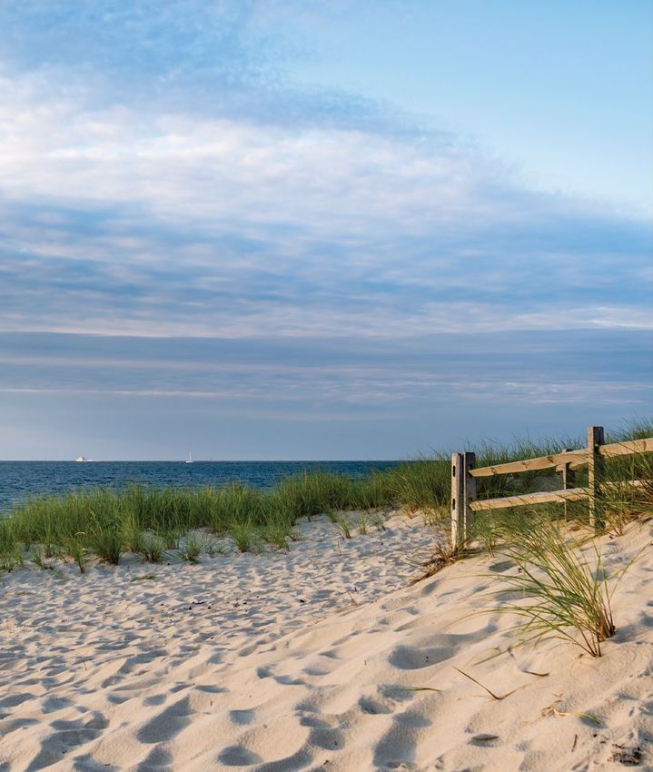
The report highlights two significant climate-related        THE MAIN CHALLENGES AND OPPORTUNITIES
             hazards — sea level rise and coastal storms. Both are
                                                                          As Islanders know, and our latest data indicates, challenges
             anticipated to accelerate after 2050 with widespread
                                                                          are everywhere, including:
             effects on coastal areas. We need to start thinking now
             about how to transform crisis into opportunity.               • beach erosion will accelerate, with sand moving
                                                                             offshore and alongshore, overwashing beaches, and
             formed by retreating glaciers, the diverse shorelines
                                                                             shorelines narrowing.
             of Martha’s Vineyard and Nantucket face different impacts,
             and their edges are being constantly redefined. As such,      • without room to migrate inland, many salt
             they present unique opportunities for the Islands to            marshes will turn into tidal flats and open water.
             innovate and test potential solutions. In other words, we
                                                                           • significantly accelerated flooding of coastal
             believe these frontline communities can be frontrunners,
                                                                             homes and businesses, transportation networks, and
             developing resiliency strategies and taking actions that
                                                                             critical infrastructure may require short-term adaptive
             may serve as models for the rest of the world.
                                                                             design and relocation.
                                                                           • coastal banks may erode more rapidly, helping to
                                                                             nourish nearby shorelines with much needed sediment
                                                                             deposits, but also jeopardizing structures and the more
                                                                             hidden cultural and pre-historic resources.
                                                                           • habitats, which play critical roles in sustaining island
                                                                             ecosystems and economies, may continue to decline
     “There are really, truly magic things                                   and degrade unless they are restored and managed in
                                                                             sustainable and innovative ways.
      that can be done if you think about
                                                                          Island communities have already begun projects on the
      what it is to live with water instead                               ground, from living shorelines to elevated structures.
      of fight against it.”                                               Several partnerships between island communities have
                                                                          been forged, and two new island-wide, climate-focused
       CECIL BARRON JENSEN,                                               positions filled. This is encouraging, but many climate-re-
       EXECUTIVE DIRECTOR OF REMAIN NANTUCKET                             lated projects are in the planning phase, and more needs
                                                                          to be done. Another challenge is that islands are finite
                                                                          spaces — limiting options for retreat. After all, adaptation
                                                                          and retreat require having somewhere to adapt or retreat to.
                                                                          It will not be enough to craft solutions parcel by parcel, or
                                                                          town by town. Each island as a whole — and the Islands
                                                                          together — must be considered, from discussing whether
                                                                          interior uplands can serve as refuge for vulnerable areas
                                                                          and people to targeting the places with the greatest

6   State of the Coast Report: The Islands
chances for resiliency. Self-reliant by nature and necessity,
     Islanders must now look outward to one another — and
     beyond — to conserve and protect these fragile landscapes.
     What is needed now is transformative innovation and
     broad collaboration.
                                                                                          “We have to look at the common
                                                                                           good as opposed to our individual
     WHAT YOU CAN DO TO HELP                                                               interests in order to make this
    This is a call to be imaginative and forward-thinking.                                 all work.”
    Making strategic choices and sacrifices, educating our
    communities, advocating for change, and engaging as                                     LIZ DURKEE,
    stakeholders and volunteers will go a long way toward                                   CLIMATE CHANGE PLANNER FOR
    creating models of resiliency that other places will                                    MARTHA’S VINEYARD
    want to follow.
     Only by acting together can Martha’s Vineyard,
     Nantucket, and Gosnold — among the most treasured
     and iconic places in the world — prepare to confront the
     turbulence that lies ahead.

                                                                     This conceptual illustration, based off the Bruun Rule, illustrates how sea level
                                                                     rise can result in erosion to sandy shorelines. The Bruun Rule does not include
                                                                     additional factors contributing to beach erosion, including but not limited to
                                                                     storms, changes in the wave environment, limitations on sediment supply, and
                                                                     the movement of sand by near-shore ocean currents.

CURRENT BEACH PROFILE

FUTURE EROSION DUE TO ELEVATED SEA LEVEL

SAND DEPOSITED FROM ERODED SHORELINE

ELEVATED SEA LEVEL

INITIAL SEA LEVEL
Beaches
             With nearly 200 miles of beaches and dunes, Martha’s Vineyard,
             Nantucket, and the Elizabeth Islands [CIT. 4] are iconic Massachusetts
             destinations for tens of thousands of summer visitors. They also
             represent globally significant ecosystems that protect inland
             areas from storms.
             These are naturally fragile and dynamic sandy places, where
             winter storms erode what summer currents try to gradually
             restore. Climate change, however, is disrupting this natural rhythm
             with sea level rise and stronger storms that will accelerate the
             deterioration of these landscapes — and many others.

                           We appreciate the need to balance public access with land protections,
                           which involves both managing expectations and following best practices.
                           We also understand this is not the time nor are these the places for
                           massive interventions, but we still need to act. When it comes to beaches,
                           evidence suggests we need to let them migrate landward and restore
                           them where it makes sense.

                           WHAT THE DATA SHOWS

                            • Our island beaches experience some of the highest erosion rates
                              statewide, based on a review erosion data [CIT. 5]. Some locations
                              also have high accretion rates. The historic landward migration, with
                              particularly significant losses on south- and east-facing sands, is now
                              projected to occur at unprecedented rates. These changes to beaches
                              may happen gradually but, as any Islander knows from winter storms,
                              they can also occur virtually overnight. Consider:
                            • beaches migrate Norton Point, a 2.5-mile barrier beach of sand
                              and dunes, may be open ocean by 2070. It has already migrated to
                              the north more than 1,500 feet since 1897 [CIT. 5]— a distance longer
                              than the Empire State Building is tall.
                            • beaches erode Martha’s Vineyard beaches have lost more than 1,400
                              acres since 1897, and Nantucket nearly 1,900 acres. A section of
                              Nantucket’s southwest coast, from Madaket to Hummock Pond Road
                              receded about 1,450 feet since 1887 [CIT. 5]. FEMA predicts the coast
                              may erode another 1,350 feet by 2100 [CIT. 10].

8   State of the Coast Report: The Islands
• beaches disappear FEMA modeling of future surge. It’s best to let them change without inter-
coastal erosion on the Islands predicts up to vention, in both undeveloped and developed areas.
3,000 acres of beachfront is at risk of eroding
restoring beaches and dunes We can nourish
by 2050 [CIT. 10].
beaches with more sand or rebuild dunes when
The expense and short-term nature of sand nour- storms damage beaches, but we need to be smart
ishment techniques, the vulnerable geology of the and strategic about it: Where? When? At what
Islands, and the increasing fury of Mother Nature, cost? And for how long? Do we respond reactively
means making hard choices: Which beaches can or think long-term? For instance, in a matter of
or should we protect? Which ones should we let weeks, Edgartown pulled an emergency permit for
go? And does intervening for some adversely dredged sand to replenish a storm-ravaged South
impact others? Beach and protect Atlantic Road. In contrast, on
nearby Norton Point Beach, The Trustees, Dukes
LOOKING AHEAD County, and Edgartown are working together on
a longer-term restoration project to build overall
With sand constantly shifting, it’s critical to con- resiliency and provide improved protection for
sider island communities as a whole in developing public access, habitat, and surrounding land.
light touch, nature-based strategies. We need to
work on effective short-term beach interventions sourcing sand Strategies like sand renourish-
and target areas that can provide multiple public ment may only go so far. Sand supplies are limited
benefits. Let’s discuss: and expensive (about $25 per cubic yard on the
Islands), and at times need to be imported. It
creating pathways for migrating beaches cost more than $1 million to replenish 1,500 feet
When development or protective barriers like of Lobsterville Beach in Aquinnah, and restoring
seawalls block a beach, it has no place to go. The a small dune can cost a few hundred thousand
sand erodes offshore or moves downdrift. Remov- dollars after extensive permitting and design.
ing seawalls can allow a beach to migrate inland, Offshore sand is far more plentiful, but we need to
but also places nearby buildings in a vulnerable discuss on a broad, island-wide basis if that option
position. Adaptations on developed beaches such is financially, legally, and ecologically sound — or if
as moving or elevating buildings may be costly. other options exist.
Retreating from migrating beaches or conserving
undeveloped land areas behind beaches can allow creating artificial reefs and living
natural beach migration to occur with impacts to shoreline sills These structures, in a variety of
both development and beaches. permutations, are being deployed worldwide to
reduce wave energy, prevent beach erosion, and
managing sediment We need to collectively direct provide habitat for shellfish and other organisms.
material to its highest and best uses once we They have less impact on longshore processes
understand how, where, and why sediment is mov- than hard structures and may be effective for
ing. Then we can prioritize and pair dredging proj- moderate wave environments. But the size of reef
ects with specific areas based on that data, erosion needed for our south-facing Island shorelines is
patterns, flood projections, and priority needs. likely not feasible or permittable. Together, we
allowing barrier beaches to change These need to think about how to adapt or innovate
highly dynamic resource areas can both breach and future-facing strategies to fit our common needs.
repair, providing natural protection from waves and
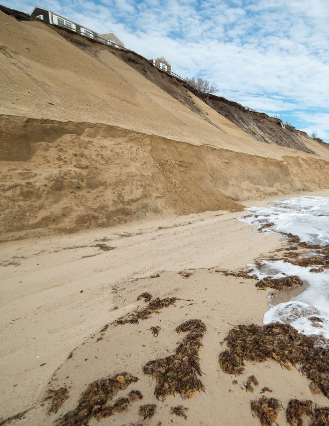
HISTORIC EROSION: NORTON POINT BEACH, EDGARTOWN, MARTHA’S VINEYARD [CIT. 5]
Norton Point Beach lost 74 acres between 1897 and 1994. Yet more recently, between
1994 and 2018, the beach has lost 93 acres — 25% more acreage in less than 30 years.
Katama Bay
Atlantic Ocean
Coastal beach in 1897 Coastal beach in 2009 Coastal beach in 2018
in 2009 Land in 2018
Coastal beach
Coastal beach in 1897 Coastal beach in 1994 Coastal beach in 2016
Coastal beach in 1994 Coastal beach in 2016
9
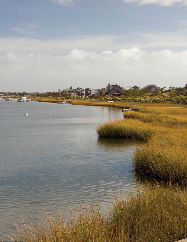
Salt Marshes
             With wide open views, natural beauty, and diverse wildlife, salt
             marshes are one of the most productive ecosystems on the planet.
             Their grasses, flooded and drained by tides, accumulate captured
             sediment and decomposing plant matter to form peat and provide
             growing space for roots, allowing marsh to naturally build. They
             also protect our shorelines from storms and flooding, provide
             habitat, and help preserve water quality.

                           The Islands have nearly 1,800 acres of marsh [CIT. 2] that sea level rise threatens
                           to outpace (only Gosnold appear to be spared significant marsh loss). Unlike
                           large marshes found on the North Shore or Cape Cod, most of these island
                           marshes fringe estuarine areas.
                           Some marshes may have a chance to migrate landward, and survive, where the
                           absence of built barriers and natural topography allow. It will take concerted
                           strategizing on an island-wide basis to determine where the best chances of
                           restoration and protection reside. We must also educate Islanders and visitors
                           about the importance of salt marshes to the ecosystem as a whole if we are to
                           get everyone onboard with the value-based choices that must be made.

                           WHAT THE DATA SHOWS

                           loss and growth of marshes Based on state data, significant marsh loss may
                           occur on the Islands by 2050 due to sea level rise [CIT. 2]. At the same time, some
                           locations will experience new marsh growth or expansion because with rising sea
                           level, marsh will be able to expand to area that was previously dry land.
                            • Overall, total marsh loss on Martha’s Vineyard may exceed 266 acres
                              [CIT. 2] — about one-third the area of Central Park in New York City.

                            • On Nantucket, 568 acres (66%) of high marsh may be lost [CIT. 2].
                            • At the same time, more than 600 acres of new marsh growth or migration
                              could occur where land is undeveloped, particularly in Nantucket (438 acres)
                              and Edgartown (89 acres).
                            • While high marsh could recede in many areas, we may see a dramatic
                              expansion of other coastal areas. This is good news for new shellfish
                              habitat, even as the Islands benefit from the expansion of aquaculture.
                            • On Martha’s Vineyard, estuarine open water may increase by 152 acres (2%)
                              by 2050, while regularly flooded marsh may increase by 188 acres (413%).
                              Estuarine beaches and tidal flats may increase by 240 acres (51%) in
                              some locations [CIT. 2].

10   State of the Coast Report: The Islands
POTENTIAL MARSH MIGRATION: PRESENT-2070 [CIT. 2]
Current marsh Marsh migration by 2050
Marsh loss by 2030 Marsh migration by 2070
Salt marshes depend on their ability to migrate with rising sea level.
Some marshes may be trapped against steep landforms and drown
over time, while others may have the space and time to migrate to
new areas. Migration includes loss of low marsh, conversion of high
marsh to low marsh, and migration of high marsh (given no barriers)
as other low-lying areas experience increased or new tidal inunda-
Madaket tion. The current salt marsh system (blue) shown here in Madaket
is projected to be fairly resilient to sea level rise through 2050, with
Harbor
Long some near-term losses of low marsh by 2030 (dark blue) offset by
Pond later expansion (light green). Eventually, however, accelerating sea
level rise could result in a wholesale conversion of marsh to open
Madaket water here in Madaket (light green), with only a modest potential for
inland migration by 2070 (dark green).
Nantucket
• On Nantucket, estuarine open water may these critical conservation opportunities to
increase by 108 acres (2%) by 2050, while communities and land trusts. The project is led
regularly flooded marsh may increase by 518.5 by the University of Rhode Island and funded
acres (1,066%). Estuarine beach and tidal flats using Volkswagen settlement funds awarded
may increase by 225 acres (91%) in some by the state Attorney General’s office.
locations [CIT. 2].
restore existing marshes for resiliency
at-scale This involves relocating structures,
LOOKING AHEAD where possible, and removing or adapting tidal
If we are to enhance the resiliency of salt marsh restrictions to improve tidal flow and help marsh
on the Islands, it requires thinking more holisti- keep pace with sea level rise. Low-risk, nature-
cally beyond specific town interests and making based techniques include ditch remediation,
trade-offs to ensure that we focus on the places runneling, assisted migration, and relocation of
with the best chances for success. With limited structures. Examples are:
time, resources, and funding, we need to act • Nantucket Conservation Foundation restored
wisely and strategically together. Medouie Creek, a high priority wetland
conserving salt marsh migration restoration site. They installed a culvert under
pathways If new salt marsh is to migrate onto a lowered dike road and dredged an existing
higher ground, land must be permanently and tidal creek and old ditch, allowing daily tides
sustainably protected from development. Tools back into the wetland and restoring an historic
can include coastal buyouts, rolling easements, salt marsh to its natural function.
conservation and deed restrictions, and in-lieu fee • Mass Audubon, Oak Bluffs, and Edgartown
programs once we identify what is protected and shellfish departments, the University of Rhode
what is not. Examples include: Island, and the EPA’s Atlantic Ecology Division
• The Martha’s Vineyard Commission, Town of created a living shoreline to restore a section
Oak Bluffs, and Martha’s Vineyard Land Bank of salt marsh habitat at Sengekontacket Pond
are considering using a District of Critical in 2016. The project used 100% biodegradable
Planning Concern to protect future salt marsh materials including coir logs made of coconut
migration areas around Sengekontacket Pond fibers and bags of local oyster and quahog
[see DCPC callout box on page 35]. shells to dissipate wave action and reduce
erosion, allowing the shoreline to establish.
• Elsewhere in New England, Rhode Island’s Salt
Marsh Conservation Project involves 1) recon-
ciling maps showing where salt marshes will More action, and more action now, is
migrate landward against town data to identify needed to preserve and protect our natural
the most important unprotected parcels that coast. Learn more and get involved at
need to be conserved and 2) communicating thetrustees.org/coast
11Martha’s Vineyard
The diverse landscapes of Martha’s Vineyard present unique
challenges, from the sturdy soil and rock ridge of glacial
moraine at Gay Head Cliffs, Cedar Tree Neck, and Menemsha
Hills to the shifting gravels, sands, and silts that make up the
center and southern parts of the Island — places like Katama,
Wasque, and Long Point Wildlife Refuge. Altogether, this one
island has five Eco-Regions: the central sandplain, coastal
sandplain, western and eastern moraines, and Aquinnah.
The ways in which people inhabit the island are no less the Martha’s Vineyard Commission, Land Bank Commission,
varied, with a year-round population of 17,000 booming to Climate Action Task Force, Island Climate Action Network,
more than 100,000 in-season. Head northeast from Alley’s and Vineyard Futureworks, among others. And collaborative
General Store in West Tisbury and you encounter the bustle projects exist between towns, such as a CZM-funded proj-
and density of Down-Island, with its harbors, commercial ect that will see Oak Bluffs partner with other island Towns
districts, and critical public services. Head southwest, and to map and develop spatial datasets of low-lying areas
you’ll travel through the more rural Up-Island communities that serve as pathways for coastal waters to flow inland,
with their winding roads, undulating fields, and stone walls. coordinating with the National Weather Service’s Coastal
Flood Threat and Inundation Mapping website. But how do
Virtually every resident and visitor may be affected by sea
fragmented coalitions — six governments, the Wampanoag
level rise as soon as 2050, whether it’s decreased property
Tribe of Gay Head (Aquinnah), community members and
values, flooded or eroding cultural and historic sites, ferry
organizations — reach consensus on hard decisions that
cancellations (more than 1,700 between 2018–2020 due
must take the whole island into account?
to weather [CIT. 14]), fishery declines, slumping beaches and
bluffs, and blocked access routes. The MV Commission has called for support in establishing
a regional climate adaptation program and a process to
pursue MVP initiatives. If Island stakeholders agree and all
With 32% of the Island developed, another come to the table, then technical assistance and knowledge
can be shared. Decisions can also be made about where to
40% is conserved [CIT.9], limiting retreat direct island resources in the short- and mid-term to have
options for homes while providing room the best chances for resiliency in the long-term.
for coastal habitat migration. In many cases, we may need to let nature restore itself
or actively unbuild developed areas. In other cases, it will
mean shoring up defenses and adapting or retrofitting struc-
Every Martha’s Vineyard community, including the tural designs in innovative, sustainable ways. That requires
Wampanoag Tribe of Gay Head (Aquinnah), has begun the increasing public awareness, establishing common values,
process of assessing vulnerabilities and planning, often setting priorities, and making sacrifices. We need to both
through two state-sponsored programs — the Coastal reduce our exposure and increase our capacity to deal with
Resilience Grant Program and the Municipal Vulnerability climate-driven effects. If we fail to do that now, then we
Preparedness Program. The Island also has town climate may lose some of what might otherwise have been saved.
change committees and island-wide organizations such as
12 State of the Coast Report: The IslandsTisbury
Impacts Projected to Occur By 2050
DEVELOPED COAST
OCEAN-FACING SHORELINE (7.2 MILES) [CIT. 4]
property damage A 10-year storm in Tisbury may flood up Shoreline types below can overlap, not cumulative
to 437 structures (11%), while a 100-year storm in may flood
Coastal Beach (6.4 MI)
up to 501 (12%) [CIT. 3]. The ferry terminal and iconic Black
Dog Bakery, which raised its floor by a foot, could be at risk. Coastal Bank (0.8 MI)
road flooding About 8 miles (8%) could flood in the event Saltmarsh (1.3 MI)
of a 10-year storm, and an estimated 10 miles (10%) in a
100-year storm event [CIT. 3]. Beach Road and Lagoon Pond Bulkhead, Seawall, Revetment (2.0 MI)
Road are particularly vulnerable to heavy storms, flooding Developed (Res & Non Res) (5.2 MI)
and sea level rise, along with the Five Corners intersection.
Coastal Dune (3.3 MI)
harbor and waterfront damage Navigation channels
are at risk from sea level rise and flooding, and the working
0% 10% 20% 30% 40% 50% 60% 70% 80% 90% 100%
side of the harbor is unprotected from northerly storms. At
risk is the commercial waterfront and low-lying utilities and
services, such as the police station, harbormaster’s office, 2050 STORM AND TIDAL FLOODING [CIT. 1,3]
post office, and wastewater pump station. Tisbury has
received CZM funding to develop resiliency management
strategies for the Vineyard Haven Harbor shoreline over the
next 50 years, including dune and beach nourishment and
elevation of roadways.
NATURAL COAST
erosion The coast of Tisbury is relatively stable, though
one section of West Chop has receded almost 400 feet
since 1897 — its lighthouse was moved twice in the 1800s.
Eastville breakwater may not be long enough to adequately
protect the harbor and Beach Road.
marsh loss Regular flooding may transition 31 of 43 acres
(71%) of high marsh to low marsh or open water. Total
Roads potentially flooded by 100-year storm flooding
marsh (high and low) may decline by 22 acres (47%) [CIT. 2],
Buildings potentially flooded by 100-year storm flooding
with impacts to Lake Tashmoo, Lagoon Pond, and the Mink
Meadows area. Buildings and roads potentially affected by daily/frequent tidal flooding
Areas potentially affected by 100-year storm flooding
habitat changes About 13 of 67 acres (19%) of estuarine
Areas potentially affected by daily or frequent tidal flooding (MHHW)
beach/tidal flats could be lost to open water [CIT. 2]. Signifi-
Current Shoreline
cant risks to fish and shellfish habitat exist in Lagoon Pond,
Lake Tashmoo, the Outer Harbor, and off Eastville Beach.
13Oak Bluffs
Impacts Projected to Occur By 2050
DEVELOPED COAST
OCEAN-FACING SHORELINE (7.0 MILES) [CIT. 4]
Shoreline types below can overlap, not cumulative
property damage A 10-year storm in Oak Bluffs may flood
up to 554 structures (10%), while a 100-year storm may flood
Coastal Beach (5.3 MI)
up to 797 (15%) [CIT. 3]. The downtown area is at serious risk
Coastal Bank (1.9 MI) of flooding.
Saltmarsh (0.3 MI)
road flooding About 11 miles (10%) could flood in a 10-year
storm, and an estimated 15 miles (13%) in a 100-year storm
Bulkhead, Seawall, Revetment (2.6 MI) [CIT. 3]. Roads in need of short-term infrastructure improvements
Developed (Res & Non Res) (4.3 MI)
or elevation include Eastville Avenue and County Road by the
hospital, part of Seaview Avenue by Inkwell Beach, and County
Coastal Dune (2.4 MI) Road at Tradewinds Road. Sea level rise could inundate most
of East Chop Drive, part of Beach Road on Joseph Sylvia State
0% 10% 20% 30% 40% 50% 60% 70% 80% 90% 100% Beach, and areas around Farm and Sengekontacket ponds.
harbor and waterfront damage At risk is Oak Bluffs
2050 STORM AND TIDAL FLOODING [CIT. 1,3] Harbor and critical infrastructure, including ferry terminals and
low-lying utilities. Oak Bluffs has received CZM funding for an
engineering study to develop options for protecting shore and
coastal infrastructure in the Oak Bluffs Harbor area against
existing flood and coastal erosion risks.
NATURAL COAST
erosion Most of Oak Bluffs may remain relatively stable due to
shoreline armoring. Oak Bluffs has 2.6 miles (37%) of armored
shoreline, the most of any of the towns except Nantucket (with
3.5 miles of armored shoreline, but only 4%). However, one
section of east-facing coast has receded more than 600 feet
since the 1800s, with maximum short- and long-term annual
rates of 6 and 4 feet, respectively. East Chop bluff erosion
remains a concern.
Roads potentially flooded by 100-year storm flooding
marsh loss Regular flooding may transition 46 of 70 acres
Buildings potentially flooded by 100-year storm flooding (66%) of high marsh to low marsh, and 29 acres (38%) may be
Buildings and roads potentially affected by daily/frequent tidal flooding lost overall [CIT. 2].
Areas potentially affected by 100-year storm flooding
habitat changes Estuarine beach/tidal flats may increase
Areas potentially affected by daily or frequent tidal flooding (MHHW)
from about 38 to 68 acres (30%), and estuarine open water
Current Shoreline
may also increase [CIT. 2]. A causeway and herring run between
saltwater Lagoon Pond and freshwater Upper Lagoon Pond is
vulnerable to saltwater inundation from sea level rise.
14 State of the Coast Report: The IslandsEdgartown
Impacts Projected to Occur By 2050
DEVELOPED COAST
OCEAN-FACING SHORELINE (36.2 MILES) [CIT. 4]
property damage A 10-year storm in Edgartown may Shoreline types below can overlap, not cumulative
flood up to 757 structures (10%), while a 100-year storm
may flood more than 1,107 (15%) [CIT. 3]. At risk commercial Coastal Beach (31.5 MI)
waterfront district areas include numerous docks, restau- Coastal Bank (1.4 MI)
rants, shops, and residences, as well as Chappaquiddick
Ferry infrastructure. Saltmarsh (7.5 MI)
road flooding An estimated 49 miles of roadway (17%) Bulkhead, Seawall, Revetment (1.3 MI)
could flood in a 10-year storm, and about 71 miles (25%) in Developed (Res & Non Res) (6.9 MI)
a 100-year storm [CIT. 3]. At significant risk are Atlantic Drive,
Beach Road, Bend in the Road/State Beach Road, Chap- Coastal Dune (22.3 MI)
paquiddick Road, Main Street, and Dock Street. A climate
vulnerability assessment commissioned by The Trustees 0% 10% 20% 30% 40% 50% 60% 70% 80% 90% 100%
shows Dike Bridge has a 50% projected chance of flooding
by 2030, jumping to 100% by 2070. 2050 STORM AND TIDAL FLOODING [CIT. 1,3]
harbor and waterfront damage The waterfront in
downtown Edgartown is the heartbeat of this historic
seaside village, yet it is extremely vulnerable to flooding. For
example, between Lighthouse Point and the Reading Room
along Cooke Street Pier, an estimated 89 structures and one
mile of roadway could flood in a 10-year storm.
NATURAL COAST
erosion Sections of the southern coast have receded as
much as 1,500 feet since 1897, with maximum short- and
long-term annual rates of 54 and 27 feet, respectively [CIT. 5].
Wasque has been particularly vulnerable, and significant
erosion is expected on south-facing shorelines including
Norton Point Beach.
Roads potentially flooded by 100-year storm flooding
marsh loss Regular flooding may reduce 331 of 508 acres
(65%) of high marsh, with 227 acres (44%) of overall Buildings potentially flooded by 100-year storm flooding
marsh could be lost [CIT. 2], possibly including marsh in Buildings and roads potentially affected by daily/frequent tidal flooding
Chappaquiddick and Felix Neck Wildlife Sanctuary. Areas potentially affected by 100-year storm flooding
Areas potentially affected by daily or frequent tidal flooding (MHHW)
habitat changes Estuarine beach/tidal flats and estuarine
Current Shoreline
open water may both increase by 190 acres (80%) and 105
acres (2%), respectively [CIT. 2].
15West Tisbury
Impacts Projected to Occur By 2050
DEVELOPED COAST
OCEAN-FACING SHORELINE (7.8 MILES) [CIT. 4]
Shoreline types below can overlap, not cumulative property damage A 10-year storm may flood up to 93
structures (2%), while a 100-year storm may flood up to
Coastal Beach (7.6 MI)
174 (4%) [CIT. 3].
Coastal Bank (1.2 MI) road flooding About 10 miles of roadway (5%) could
Saltmarsh (0.2 MI)
flood in a 10-year storm. An estimated 17 miles (8%) could
flood in a 100-year storm [CIT. 3], including sections of Tiah’s
Bulkhead, Seawall, Revetment (0.4 MI) Cove Road. Most of West Tisbury’s primary roads are safely
Developed (Res & Non Res) (2.1 MI)
located away from vulnerable areas.
Coastal Dune (3.4 MI)
NATURAL COAST
erosion Sections of the south coast have receded up to
0% 10% 20% 30% 40% 50% 60% 70% 80% 90% 100%
800 feet since the 1800s, with maximum short- and long-
term annual erosion rates of 8 and 7 feet, respectively [CIT. 5].
2050 STORM AND TIDAL FLOODING [CIT. 1,3] Beach erosion is expected to continue. The coast on
Vineyard Sound may be more stable, with relatively little ero-
sion. Lambert’s Cove Beach has been relatively stable with
an average long term erosion rate of less than 1 foot/year.
marsh West Tisbury is the only town in this report that may
gain more high marsh—about 5 acres (20%). Total marsh
(high and low) may increase by 8 acres (19%) [CIT. 2].
habitat changes Approximately one acre of 65 acres
(2%) of estuarine beach/tidal flats could be lost to open
water [CIT. 2].
Roads potentially flooded by 100-year storm flooding
Buildings potentially flooded by 100-year storm flooding
Buildings and roads potentially affected by daily/frequent tidal flooding
Areas potentially affected by 100-year storm flooding
Areas potentially affected by daily or frequent tidal flooding (MHHW)
Current Shoreline
16 State of the Coast Report: The IslandsChilmark
Impacts Projected to Occur By 2050
DEVELOPED COAST
OCEAN-FACING SHORELINE (19.5 MILES) [CIT. 4]
property damage A 10-year storm in Chilmark may flood Shoreline types below can overlap, not cumulative
up to 164 structures (6%), while a 100-year storm may
Coastal Beach (15.1 MI)
flood up to 254 buildings (10%) [CIT. 3]. Menemsha, with the
largest shoreline concentration of residents and buildings, Coastal Bank (6.3 MI)
is particularly vulnerable to inundation from storms and sea
Saltmarsh (0.4 MI)
level rise.
road flooding About 12 miles (7%) could flood in a Bulkhead, Seawall, Revetment (0.3 MI)
10-year storm [CIT. 3], and an estimated 18 miles (11%) in Developed (Res & Non Res) (2.3 MI)
a 100-year storm. At risk are Hariph’s Creek Bridge and
Chilmark’s connection to other towns via South Coastal Dune (6.5 MI)
Road-State Road.
0% 10% 20% 30% 40% 50% 60% 70% 80% 90% 100%
harbor and waterfront damage Menemsha Harbor
is vulnerable to sediment deposition and storm surge,
posing a risk to rescue boats, fishing vessels, tourism, 2050 STORM AND TIDAL FLOODING [CIT. 1,3]
and public safety.
NATURAL COAST
erosion The coast near Squibnocket Pond has receded up
to 1,000 feet since the 1800s. Beach erosion is expected
to continue in pockets on the north side. Broad sections of
the south coast have receded 500 feet or more in that time,
with maximum erosion rates exceeding 6 feet per year [CIT. 5].
Significant impacts along the entire southern shoreline have
affected beaches including Squibnocket and Lucy Vincent.
marsh loss Regular flooding may transition about 35 of
170 acres (20%) of high marsh to low marsh, though total
marsh area may stay about the same [CIT. 2]. Marsh migra-
tion may be possible at Memensha in the near future before
Roads potentially flooded by 100-year storm flooding
marsh is lost to open water.
Buildings potentially flooded by 100-year storm flooding
habitat changes Estuarine beach/tidal flats will increase Buildings and roads potentially affected by daily/frequent tidal flooding
from 44 to 64 acres (44%) [CIT. 2].
Areas potentially affected by 100-year storm flooding
Areas potentially affected by daily or frequent tidal flooding (MHHW)
Current Shoreline
17Aquinnah
Impacts Projected to Occur By 2050
DEVELOPED COAST
OCEAN-FACING SHORELINE (7.4 MILES) [CIT. 4]
Shoreline types below can overlap, not cumulative property damage A 10-year storm may flood up to 39
structures (6%), while a 100-year storm may flood up to 53
Coastal Beach (7.4 MI)
structures (8%) [CIT. 3]. At risk are low-lying homes in areas
Coastal Bank (2 MI) such as Lobsterville and Dogfish Bar, cultural resources,
food crops including cranberries, and artesian wells.
Saltmarsh (0.3 MI)
road flooding About 4 miles (9%) of roadway could
Bulkhead, Seawall, Revetment (0 MI) flood in a 10-year storm, and an estimated 6 miles (13%)
Developed (Res & Non Res) (1.3 MI)
could flood in a 100-year storm [CIT. 3]. The single route to
Aquinnah over a low-lying bridge at Hariph’s Creek is vulner-
Coastal Dune (5.2 MI) able to sea level rise and storm surge. Flooding could also
limit access to Moshup Trail, Oxcart Road, Clay Pit Road,
0% 10% 20% 30% 40% 50% 60% 70% 80% 90% 100% Lobsterville, West Basin, and East Pasture Shore.
2050 STORM AND TIDAL FLOODING [CIT. 1,3] NATURAL COAST
erosion Sections of coast have receded up to 800 feet
since the 1800s. Maximum short- and long-term beach
erosion may continue at a rate of 5 feet per year on the
south-facing coast [CIT. 5]. Erosion may impact beaches
and dunes around Moshup Beach, Philbin Beach, and
Squibnocket Pond.
marsh loss Regular flooding may transition about 18 of
25 acres (72%) of high marsh to low marsh, and what little
marsh exists today (high and low) may actually increase by
3 acres (12%) during this time [CIT. 2].
habitat changes Estuarine beach/tidal flats may increase
from 22 to 33 acres (54%) [CIT. 2]. Menemsha Pond and
Squibnocket Pond, among other places, are vulnerable to
storms and sea level rise.
Roads potentially flooded by 100-year storm flooding
Buildings potentially flooded by 100-year storm flooding
Buildings and roads potentially affected by daily/frequent tidal flooding
Areas potentially affected by 100-year storm flooding
Areas potentially affected by daily or frequent tidal flooding (MHHW)
Current Shoreline
18 State of the Coast Report: The IslandsGosnold*
Impacts Projected to Occur By 2050
DEVELOPED COAST
OCEAN-FACING SHORELINE (57.5 MILES) [CIT. 4]
property damage A 10-year storm in Gosnold may flood Shoreline types below can overlap, not cumulative
up to 81 structures (24%), while a 100-year storm may flood
Coastal Beach (49.2 MI)
up to 100 (29%) [CIT. 3].
road flooding About 9 miles of roadway (11%) could flood Coastal Bank (11.1 MI)
in a 10-year storm, and 12 miles (15%) in a 100-year storm Saltmarsh (9.0 MI)
[CIT. 3], including a water supply control route. On Naushon,
critical access between Upper Wharf and downtown is Bulkhead, Seawall, Revetment (1.5 MI)
vulnerable to rainstorm washout. Developed (Res & Non Res) (4.2 MI)
harbor and waterfront damage The main channel to
Coastal Dune (7.5 MI)
Cuttyhunk is vulnerable to overwash. Disruption of nav-
igation and water transport is among the most serious
0% 10% 20% 30% 40% 50% 60% 70% 80% 90% 100%
concerns. Sea level rise and storms threaten the entrance
channel to Cuttyhunk and the waterfront infrastructure of
both Cuttyhunk and Naushon. Copicut Neck and Church’s 2050 STORM AND TIDAL FLOODING [CIT. 1,3]
Beach are vulnerable to storms, along with the increasingly
overwashed causeway between Naushon and Nonamesset.
NATURAL COAST
erosion Sections of the largely rocky or moraine coast
have experienced relatively little erosion, though one por-
tion of Barges beach on Cuttyhunk has seen up to 300 feet
of erosion since the 1800s [CIT. 5].
habitat changes About 2 of 40 acres (5%) of estuarine
beach/tidal flats could be lost to open water [CIT. 2].
Roads potentially flooded by 100-year storm flooding
Buildings potentially flooded by 100-year storm flooding
Buildings and roads potentially affected by daily/frequent tidal flooding
* Gosnold, once part of Chilmark but an independent Town since 1863, is part of Areas potentially affected by 100-year storm flooding
Duke’s County. The Town is made up of the Elizabeth Islands: Nonamesset,
Areas potentially affected by daily or frequent tidal flooding (MHHW)
Uncatena, Weepecket, Gull, Naushon, Pasque, Nashawena, Penikese and Cutty
hunk, with the Town’s government based on Cuttyhunk. Current Shoreline
19Nantucket
Winter storm Grayson might have had a genteel name,
but it packed a punch in the winter of 2018. Floodwaters
approaching three feet deep roiled Nantucket’s downtown
streets, totaling cars, swamping homes and businesses,
and surrounding Brant Point lighthouse.
fast forward to june 2021, and all signs indicate that by 2050, and 4.42 feet by 2070 [CIT. 1]. The highest point of
the island heeded the wake-up call. A year after Grayson, the island is a mere 111 feet above sea level, just south of
the community gathered for its first official resilience Sankaty Head Light.
building workshop, which led to acceptance of an MVP
climate change, or even a sudden severe storm,
and Hazard Mitigation Plan in 2019, and hosted a two-day
could dramatically impact the island’s natural and
workshop on Keeping History Above Water. Nantucket has
developed coast and its historic character as well as the
since hired a full-time Coastal Resilience Coordinator and
outposts of Tuckernuck and Muskeget, which experience
contracted an engineering firm to develop a comprehensive
severe erosion. High tide flooding already impacts low-lying
coastal resilience plan, expected to be finalized this fall.
areas and downtown streets, even on sunny days. Roads
An updated harbor management plan and a sediment trans-
have closed, and beaches have eroded along the south-
port study for both harbors is planned to be undertaken in
facing shore, which is losing up to 15 feet per year [CIT. 5].
the next few years, among other initiatives.
For a mere 48 square miles, Nantucket has much to protect
Organizations across the island — from the Nantucket
and more critical infrastructure than most towns its size.
Conservation Foundation, Land Bank, Land Council, and
At stake is its access to the mainland by multiple harbors,
Preservation Trust to the Nantucket Shellfish Association,
ferries, and an airport. At risk by 2050 is $2.6 billion in
ACKlimate, and ReMain Nantucket, among others — are
parcel values, according to FEMA data, plus historic
increasingly galvanized to raise public awareness and find
resources, uniquely preserved architecture, and an economy
ways to accommodate, protect or retreat. In a recent survey
reliant on global tourism and outdoors recreation. The
(Envision Resilience Nantucket Challenge Survey Report),
island also harbors one of the greatest concentrations of
more than 70% of residents and regular visitors said they
rare and endangered species in Massachusetts [CIT. 17], from
are “very worried” about climate impacts. They know the
the New England blazing star to the Nantucket moth and
challenges are great.
northern long-eared bat.
to live on nantucket is essentially to live on a boomer-
Over 50% of the County (including Tuckernuck and
ang-shaped beach, the dynamic remnants of a glacier’s
Muskeget) is protected and preserved, which leaves limited
retreat thousands of years ago. It makes for 81 miles of
opportunities for retreat and requires a strategic realign-
wondrous sandy shoreline, visited by thousands each
ment of resources among a wide range of landowners — as
summer. And yet the island’s greatest asset — a low-lying
well as a leap of imagination. ReMain Nantucket’s Envision
pristine coast, with glorious beaches — may also be its
Resilience Challenge in June provided a sweeping exercise
greatest liability.
in what creative adaptation might look like: Floating piers
With a population of about 11,000 that swells more than and canals. Artificial reefs and barrier islands. Boardwalks
fourfold in-season, the median home value is about $1.08 as deployable barriers. Front lawns as detention basins.
million and median household income more than $107,000, Sponge parks and marine gardens. And modular, mobile
2019 census data shows. But wealth is no match for water. structures and vertical spaces that share space with nature,
Since the tide gauge was installed in 1965, the mean sea and let the waters in.
level in Nantucket Harbor has risen by approximately 8
As one of the event speakers noted, “It’s not one big fix, and
inches [CIT. 20]. Seas may rise 2.62 feet around Nantucket
we all go home happy. It’s a new way of thinking and living
that will be with us and our children for a long time to come.”
20 State of the Coast Report: The IslandsTown of Nantucket
Impacts Projected to Occur By 2050
DEVELOPED COAST
OCEAN-FACING SHORELINE (80.9 MILES) [CIT. 4]
property damage A 10-year storm in Nantucket may flood Shoreline types below can overlap, not cumulative
up to 1,436 (10%) structures, and a 100-year storm up to
Coastal Beach (75.2 MI)
1,932 (13%) [CIT. 3]. At significant risk is the town’s historic
downtown district, Brant Point, and Madaket. Coastal Bank (6.6 MI)
road flooding About 69 miles (15%) of roadway may Saltmarsh (13.0 MI)
flood in a 10-year storm and an estimated 95 miles (21%)
in a 100-year storm. Washington and Easy Streets, among Bulkhead, Seawall, Revetment (3.5 MI)
others, already see high tide flooding [CIT. 3]. Developed (Res & Non Res) (21 MI)
harbor and waterfront damage This area is at extreme
Coastal Dune (48.9 MI)
risk of future flooding and storm damage. The Steamship
Authority terminal, Hy-Line terminal, and shipping channel
0% 10% 20% 30% 40% 50% 60% 70% 80% 90% 100%
have been cited as critical vulnerabilities. Downtown street
flooding significantly disrupts travel and commerce, includ-
ing routes to the ferry terminals and between commercial 2050 STORM AND TIDAL FLOODING [CIT. 1,3]
docks and the rest of the Island.
NATURAL COAST
erosion Parts of the south coast have receded up to 1,800
feet since the 1800s, with maximum short- and long- term
annual rates of 17 and 11 feet, respectively [CIT. 5]. Beach
erosion could be particularly severe along the south shore,
potentially affecting one wastewater treatment plant and
the airport. Great Point is migrating west, while erosion
impacts Siasconset and Jetties Beach.
marsh loss Regular flooding may transition 569 of 863
acres (66%) of high marsh to low marsh, while total marsh
(high and low) may lose 50 acres (5%) [CIT. 2].
habitat changes Estuarine beach/tidal flats and estuarine Roads potentially flooded by 100-year storm flooding
open water may increase by 225 acres (91%), and 108 acres Buildings potentially flooded by 100-year storm flooding
(2%), respectively [CIT. 2]. Buildings and roads potentially affected by daily/frequent tidal flooding
Areas potentially affected by 100-year storm flooding
Areas potentially affected by daily or frequent tidal flooding (MHHW)
Current Shoreline
21ENVISION RESILIENCE NANTUCKET: “LIVING WITH WATER”
the envision resilience nantucket challenge, a spring surfaces, vertical buildings, and absorptive parks. One
2021 design studio run by non-profit organization ReMain team’s “Living with Water” proposal for a model residence
Nantucket, tasked teams from design programs at five along Brant Point’s Hubert Avenue creates an intercon-
leading universities to reimagine the Nantucket harborfront nected living and mobility network by using a layered sys-
using the latest sea level rise projections. Led by Carolyn tem of shoreline hydro-ecology, dune restoration, elevated
Cox of the Florida Climate Institute, students worked with boardwalks, and yard space transformed into a retention
24 local and regional advisors with expertise in a wide pond circled by dense native plantings.
range of disciplines, from conservation and architecture
to civil engineering and historic preservation, to identify
Credit: Alex Renaud, Environmental Engineering & Landscape Architecture,
threats, research solutions and propose adaptive designs.
Northeastern University ’23. “Living with Water” by Alex Renaud was developed
Their innovative models, presented to a jury in late April and for the Envision Resilience Nantucket Challenge
the public in June, featured flip-up boardwalks, permeable
22 State of the Coast Report: The IslandsFEMA COASTAL HAZARD EROSION AREA (2050 HIGH SCENARIO): MADAKET, NANTUCKET [CIT. 5 AND 10]
this coastal area in madaket, and
other portions of the Nantucket southern
FEMA coastal hazard
coastline, have experienced significant erosion area (2050 high scenario)
shoreline erosion and retreat since 1887 1978 historical shoreline
(red dashed line). Continued erosion 1955 historical shoreline
between 1978 (green dashed line) and
1887 historical shoreline
present day, has had a high impact on sev-
Structures
eral coastal properties and land parcels.
Parcels
By 2050, considering the modeled high
Roads
sea level rise scenario, FEMA projects the
area in purple will be under a significant
erosion threat due to climate change and
sea level rise.
COSKATA-COATUE, NANTUCKET: AREA OF CHANGE BETWEEN 1887 AND 2019 [CIT. 5]
the coskata-coatue wildlife refuge is a dynamic
barrier beach system that has experienced natural ero-
sion and accretion events over the last century. However, Area of change
over the last century, the beach has experienced a net between 1887 and 2019
loss of 63 acres of sand and has migrated in a westerly
Accretion
direction because of its direct exposure to coastal
processes. Looking to the future, Coskata-Coatue is Erosion
likely to see continuous westward migration, overwash Possible future breaches
of dunes, and a narrowing of barrier beach in places due
to sea level rise and erosion. Boston University research-
ers also found that breaches could occur in the future at
certain locations [see circled areas on graphic] [CIT. 19].
time loss gain net change
period (acres) (acres) (acres)
1887-1955 365.7 284.0 -81.7
1955-1978 85.5 144.5 59.0
1978-2009 202.9 87.9 -115.1
2009-2014 4.0 138.8 134.8
2014-2019 73.0 13.1 -59.9
1887-2019 484.0 421.3 -62.7
23Developed
Coastlines
The wild beauty and vital resources of the ocean are what draw
so many of us to its shores to live, work, and play. And yet, as
the impacts of climate change intensify, it is this very proximity
to water, wind, and wave energy which presents the developed
coastlines of Martha’s Vineyard and Nantucket with their
greatest risks.
two main issues exist for island communities The first is an
urgent need to protect the critical supply chain infrastructure located
at vulnerable waterfront and port areas and to safeguard (or rapidly
restore) transportation, communication, and medical services that
face disruption during severe storms and weather-related emergen-
cies. The second issue is about shifting where we live and work so
that we stay out of harm’s way.
Accelerating forces of melting ice, warming oceans, and higher seas
may not impact us as gradually as we once thought. In some areas,
today’s flood zones are forecast to be tomorrow’s high tide zones,
threatening road access to harbors, hospitals, airports, and down-
town commercial areas.
Fishing vessels and ferries, providing vital connections to and from
the mainland and between island outposts, may face inundated and/
or storm-damaged docks. Utility and communication infrastructure
may be damaged or interrupted. And residents who rely on private
wells may lose access to clean water due to saltwater intrusion.
And then there are the year-round homes and vacation retreats, from
the low-lying campground cottages of Oak Bluffs to the shingled
beach houses of Madaket. Many people have lived here for genera-
tions. Others return season after season. As a strategy, retreat inland
is not always a viable option for them.
24 State of the Coast Report: The IslandsYou can also read