2022-2023 Community Pedestrian and Bicycle Training Tool Kit
←
→
Page content transcription
If your browser does not render page correctly, please read the page content below
2022-2023 Community Pedestrian and
                    Bicycle Training Tool Kit
 Safe System Approach to Road Safety:
 The Safe System Approach focuses on saving lives, with the understanding that humans make mistakes and
 bodies are fragile. Attention is focused on reducing fatal and serious injuries when a crash occurs through ways
 a street is designed, the ways we manage our streets and their infrastructure, and engaging and educating
 communities on how to use streets safely.

 The Community Pedestrian and Bicycle Safety Training (CPBST) team adapted the Federal Highway Administration
 (FHWA) Safe System elements and principles to make them impactful for the communities we work with.
 Specifically, we include community engagement as a key element in a Safe System, and make equity a central
 component. We also acknowledge the key role of collaboration between transportation professionals and the
 communities they work with in order to create safe streets for all.

 Within the Safe System Approach, the CPBST team:
     1. Reviews pedestrian and bike crash data and safety strategies;
        2. Facilitates walking and biking assessments;
        3. Strategizes with communities to define specific pedestrian and bike safety goals and actionable next steps;
           and
        4. Empowers communities to strengthen collaborations to implement specific walking and biking safety
           recommendations.
 We’ve created a table of potential community improvements that can help you create a safer community with the
 Safe System Approach. There are many ways to plan a bikeable and walkable community; this toolkit is just a
 starting point.

 Within our table of potential community improvements, we’ve tagged them with keywords we found relevant to the
 specific strategy. These keywords include:
    •      Community Engagement/Partnerships - allow opportunities to engage with the community and create
           partnerships with community-based organizations, local businesses, and others.

    •      Data - strategies that collect, analyze, and provide data for projects.
    •      Encouragement and Education - encourage communities to walk, bike, or use public transportation and/
           or provide educational opportunities to learn how to safely walk, bike, or roll in communities.
    •      Infrastructure - infrastructure-specific and change the layout of the roadway.
    •      Safe Routes to School (SRTS) - encourage and support SRTS efforts in communities.
    •      Speed Management -   help manage speeds on the roadway to make communities safer for those walking and
           biking.
    •      Vulnerable Populations - create safer streets and communities for our most- vulnerable populations such as
           seniors, people with disabilities, and children.

About the CPBST
The Community Pedestrian and Bicycle Safety Training (CPBST) program is a statewide active transportation and
community engagement project of UC Berkeley SafeTREC and California Walks. It uses the Safe System Framework to
engage residents and advocates to develop an action plan to improve active transportation safety in their communities,
support complete streets planning, and strengthen collaboration with local officials and agency staff.

Funding for this program was provided by a grant from the California Office of Traffic Safety, through the National
                                    Highway Traffic Safety Administration.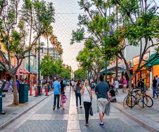
Bike and/or Pedestrian Advisory Committees
A volunteer group of residents, community stakeholders, and subject experts that advise and
make recommendations to decision makers on walking and biking programs, projects, and
policies.

When to Use: To provide opportunities for residents, community stakeholders, and subject
experts to help shape walking and biking programs, projects and policies.

Community Engagement/Partnerships, Data, Encouragement and Education, Infrastructure,
Safe Routes to School (SRTS), Speed Management, Vulnerable Populations

Bike and/or Pedestrian Master Plans
An official government document used to guide funding decisions and/or prioritize specific
walking and biking improvement programs, projects, and policies.

When to Use: To create city-wide or regional government plans that prioritize walking and
biking.

Community Engagement/Partnerships, Data, Encouragement and Education, Infrastructure,
Safe Routes to School (SRTS), Speed Management, Vulnerable Populations

Bike Box
A designated space usually painted in a high-visibility green paint where people biking can
stop in front of people driving at a red light. They make sure people biking are visible and
encourage more predictable approaches to and through the intersection by all road users.

When to Use: To provide a safe place for people biking to stop at a red light. This allows
those biking to wait at a red light in front of those driving, providing higher visibility and
awareness for those driving to share the road.

Encouragement and Education, Infrastructure, Vulnerable Populations

Bike Lane
A section of a roadway exclusively for people biking or using a scooter, which reduces conflicts
between people walking, biking, and driving. Colored pavement within a bike lane increases its
visibility.

There are different types of bike lanes:
     • Protected bike lane: physically separated space from vehicle travel lanes using
       bollards, planters, parked cars, and curbs. They provide the highest amount of security
       and safety.
     • Buffered bike lanes: separated space from vehicle lanes using a painted buffered
       space.
     • Conventional bike lane: a space that is striped with white paint and located along the
       right side of a road.
     • Bike Boulevard: a shared road intended to prioritize bike travel with painted white
       sharrows along the route which indicate to all road users to share the space.

When to Use: To provide safe, comfortable roads for people biking in the community. By
separating those biking from those driving, it’s easier for people driving to navigate the road.
Oftentimes, they also improve the safety of people walking along the corridor.

Encouragement and Education, Infrastructure, Speed Management, Vulnerable Populations
Bike Parking
A designated location for bikes to be safely stored, including bike corrals, bike racks, bike
lockers, and other parking options. They encourage people to bike to their destinations
because they have a safe place to store them.

When to Use: To encourage more people to bike by providing them plenty of safe ways to
park bikes at destinations.

 Encouragement and Education, Infrastructure

Bike Rodeo
An on-bike education event for youth to teach them the skills needed to ride a bike safely.
They can include bike safety inspections, helmet distribution to those in need, and teach bike
maintenance skills and rules of the road. Rodeos can also include scooters, skateboards, and
roller skates.

When to Use: To encourage school children to bike, scoot, skateboard or roller skate to school
and educate them on how to do so safely.

Community Engagement/Partnerships, Encouragement and Education, Safe Routes to School
(SRTS), Vulnerable Populations

 Bike Safety Diversion Program
 A sponsored program by a local law enforcement agency that offers bike traffic school to
 remove or reduce a traffic violation fine for people who bike. Attendees also learn bike laws
 and safe riding skills.

 When to Use: To provide a way for people who bike to remove or reduce a traffic violation
 fine, similar to what is already provided for people who drive.

 Community Engagement/Partnerships, Encouragement and Education, Vulnerable
 Populations

Bike Sensor
A detector that captures when a bike passes over it to trigger the traffic light. Most commonly,
they are either video detectors or in-pavement sensors. In-pavement sensors are often paired
with road markings to let those biking know where to position themselves at an intersection to
trigger the signal.

When to Use: To prioritize people biking along a roadway and create a safe, accessible path of
travel.

Data, Encouragement and Education, Infrastructure, Vulnerable Populations

Bike Signal
A traffic signal that directs people biking through an intersection and reduces potential conflict
with other road users like people walking or driving.

When to Use: To provide dedicated signals for people biking especially on corridors with
protected bicycle lanes. By separating their movements from people driving, the safety of
people biking is increased.

Encouragement and Education, Infrastructure, Vulnerable Populations
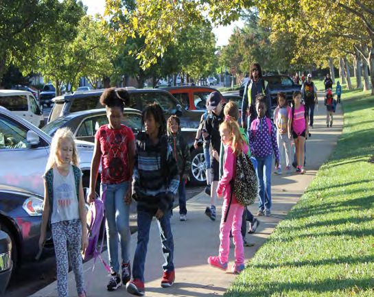
Bike Train
 A group of students who bike to school accompanied by an adult along a designated route.
 Students can join the bike train along any of several identified stops.

 When to Use: To encourage more students to bike to school, improve the safety of people
 walking to school, and involve students and parents directly in SRTS work.

 Community Engagement/Partnerships, Encouragement and Education, Safe Routes to School
 (SRTS), Vulnerable Populations

Community Benefit Agreement
A legally enforceable contract between a community coalition and the developer of a proposed
development project. In exchange for public support of the project, the developer contributes
benefits to the local community, such as pedestrian and bike safety improvements and open
green space.

When to Use: To improve the safety of people walking and biking or increase open green
space for the community at or near new development projects.

Community Engagement/Partnerships, Encouragement and Education, Infrastructure, Speed
Management, Vulnerable Populations

Community Coalition
A variety of partners in a community that work together to improve active transportation safety.
This can include work in affordable housing and active transportation, land use solutions, and
public transportation investments.

When to Use: To provide a well-rounded, safe community for those living in and traveling to it.

Community Engagement/Partnerships, Data, Encouragement and Education, Infrastructure,
Safe Routes to School (SRTS), Speed Management, Vulnerable Populations

Community Liaison/Promotores Campaign
A program that trains community residents to become public health workers. They can teach
their neighbors advocacy skills to promote safe walking and biking behaviors among their
communities.

When to Use: To promote safe walking and biking in communities, by teaching the people in
the community themselves to become advocates.

Community Engagement/Partnerships, Encouragement and Education, Safe Routes to School
(SRTS), Speed Management, Vulnerable Populations

Community Walk or Bike Ride
An event that encourages residents to walk or bike together and explore local themes, such
as art, music, history, and architecture.

When to Use: To encourage more residents to walk or bike. This can be a more comfortable
introduction to walking or biking in the community for those with no experience.

Community Engagement/Partnerships, Encouragement and Education, Vulnerable
Populations
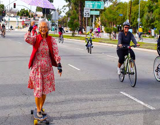
Complete Streets
Streets designed to provide a safe, comfortable space for all people using the street,
regardless of age or ability. Complete Street policies are set at the state, regional, and local
levels and are frequently supported by roadway design guidelines.

When to Use: To encourage more residents to walk, bike, or take transit and improve the
safety of vulnerable populations using the corridor.

Community Engagement/Partnerships, Data, Encouragement and Education, Infrastructure,
Safe Routes to School (SRTS), Speed Management, Vulnerable Populations

Curb Extension (Bulbout)
A sidewalk that is lengthened into the street, to shorten the distance and time it takes to
walk across the street. They can be used at corners or mid-block and can be built with paint,
bollards, or planters. Curb extensions can often be lengthened to create public spaces,
landscaped areas, or transit waiting areas.

When to Use: To increase the visibility of people walking at intersections, shortening crossing
distances, reduce turn speeds of those driving, increase the waiting space of people walking,
provide additional public space, reduce illegal parking at corners crosswalks and bus stops,
and provide the space needed to install two curb ramps per corner.

Encouragement and Education, Infrastructure, Speed Management, Vulnerable Populations

Curb Ramp
A ramp that provides access between the sidewalk and roadway for people using wheelchairs,
strollers, walkers, crutches, handcarts, bicycles, and people walking who have trouble
stepping up and down high curbs. Without curb ramps in place, people with mobility
disabilities are often forced to travel in the street with traffic to move around.

Curb ramps should include truncated domes which serve as a detectable warning, which can
be seen, felt and heard.

When to Use: To create roads and sidewalks that are accessible and safe to use for people
with disabilities. It is often difficult and dangerous, impossible even, for a person using a
wheelchair, scooter, walker, or other mobility device to cross a street if the sidewalk on either
side of the street ends without a curb ramp. Curb ramps must be provided in order to have
equal access to public spaces for all ages and abilities.

Encouragement and Education, Infrastructure, Vulnerable Populations

Daylighting
The practice of pushing parking spaces 20 to 25 feet back from a pedestrian crossing, which
increases the visibility between people walking and driving, reducing conflicts.

When to Use: To increase the safety of people walking along a corridor and improve the
visibility between people walking and driving.

Encouragement and Education, Infrastructure, Speed Management, Vulnerable Populations
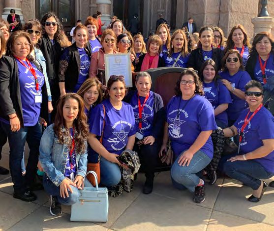
Designated Safe Route
A route that redirects students to walk and bike along an identified safer route to and from
school that typically has better walking and biking infrastructure.

When to Use: To provide safe ways for school children to walk and bike to school.

Encouragement and Education, Infrastructure, Safe Routes to School (SRTS), Speed
Management, Vulnerable Populations

Earn-A-Bike Program
A program that provides residents, typically youth, the opportunity to earn a bike by
participating in classes that teach them the rules of the road, bike safety, and basic bike
mechanic skills.

When to Use: To provide more equitable access to bikes, given that not every resident can
afford one.

Community Engagement/Partnerships, Encouragement and Education, Safe Routes to School
(SRTS), Vulnerable Populations

Engaged Elected Official
Engaging a decision maker for walking and biking safety in a community to help bring much-
needed support for safety improvements and policies. They can bring awareness and gain
public funding support for bike and pedestrian projects.

When to Use: To prioritize biking and walking in a community through the adoption of policies,
plans, and laws at the government level.

Community Engagement/Partnerships, Data, Encouragement and Education, Infrastructure,
Safe Routes to School (SRTS), Speed Management, Vulnerable Populations

Evaluation of Program or Project
The collection and analysis of data in order to help make program and funding decisions, as
well as understand the impacts of the project or program.

When to Use: To use data to prioritize actions and to track progress related to transportation
safety efforts. Evaluation may also support future requests for funding.

Data, Encouragement and Education, Infrastructure, Safe Routes to School (SRTS), Speed
Management, Vulnerable Populations

Funding Opportunities that Prioritize Safety
Local, regional, statewide, and national funding sources identified that can pay for safety
improvements. This can include OTS grants, Caltrans’ Active Transportation Program, and
local mini-grant opportunities.

When to Use: To implement and improve walking and biking safety programs and
infrastructure projects.

Data, Encouragement and Education, Infrastructure, Safe Routes to School (SRTS), Speed
Management, Vulnerable Populations
Helmet/Light Distribution
Helmet and bike light distribution to those to residents in need. They typically run in
conjunction with bike education to promote helmet use to prevent head injuries and encourage
safe riding.

When to Use: To provide more equitable access to helmets and bike lights, which greatly
improve the safety of people biking.

Community Engagement/Partnerships, Encouragement and Education, Safe Routes to School
(SRTS), Vulnerable Populations

High-Injury Network (HIN)
A data-driven approach to safety that maps fatal and serious crashes to identify streets where
the highest concentrations of crashes are occuring. This data can be used to prioritize funding
and safety projects in those areas.

When to Use: To use data to prioritize actions and to track progress related to transportation
safety efforts.

Data, Infrastructure, Speed Management, Vulnerable Populations

High-Visibility Road Markings and Signage
Infrastructure to emphasize or indicate space for particular road users and help them detect
each others’ location on the road. They also increase visibility at night. They make signs and
markings appear brighter and easier to see and read and increase the visibility of road signs,
especially during periods of low-light and at night.

When to Use: To emphasize or indicate where each road user should be on the road,
especially at night when regular paint alone is hard to see.

Encouragement and Education, Infrastructure, Speed Management, Vulnerable Populations

Hybrid Beacon (HAWK)
A marked crossing signal that is activated by people walking. It alerts people driving to stop at
an intersection or mid-block crosswalk and brings more visibility to people crossing the road.

When to Use: To increase the safety of people walking by signaling those driving to stop
while people walking cross the street.

To increase safety of people crossing the major streets where side-street volumes do not
support the installation of a conventional traffic signal.

Encouragement and Education, Infrastructure, Speed Management, Vulnerable Populations

Link Crash and Medical Data
A link between hospital, police, emergency response, and other data can provide accurate,
coordinated, and timely monitoring of injuries and deaths. This data can also be used to
support prioritizing safety projects, evaluation of projects, and monitoring safety projects.

When to Use: To use data to prioritize actions and to track progress related to transportation
safety efforts.

Data, Speed Management, Vulnerable Populations
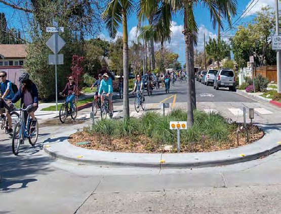
Median Gardening
The addition of trees and landscaping to medians to provide aesthetic benefits and traffic
calming.

When to Use: To calm traffic and add greenery to communities.

Infrastructure, Speed Management

Multi-Use Trail/Shared Path
A separated off-road space for people walking and biking, away from people driving. Some
separate people biking and walking into their own lanes. These are most commonly used
along rivers, shorelines, canals, utility rights-of-way, railroad rights-of-way, within school
campuses, or within and between parks.

When to Use: To provide safe, off-road paths for people walking and biking in the community,
especially near parks and other green spaces.

Encouragement and Education, Infrastructure, Vulnerable Populations

Neighborhood Speed Awareness Program
The use of radar trailers and changeable message sign boards to make people driving aware
of their speed.

When to Use: To increase traffic safety awareness and lower speeds along specific streets.

Community Engagement/Partnerships, Data, Encouragement and Education, Speed
Management, Vulnerable Populations

Neighborhood Traffic Circle
A raised circular island in a residential intersection which directs traffic to flow in one direction.

When to Use: To reduce the speeds of people driving and severity of potential crashes by
narrowing the travel lane and turning radius of those driving.

Infrastructure, Speed Management, Vulnerable Populations

Open Streets
A temporary closure of streets to vehicle traffic and opens them to people walking and biking,
and other social activities.

When to Use: To create temporary closures on community streets to provide a safe, more
comfortable place for people walking and biking.

Community Engagement/Partnerships, Encouragement and Education, Infrastructure,
Vulnerable Populations
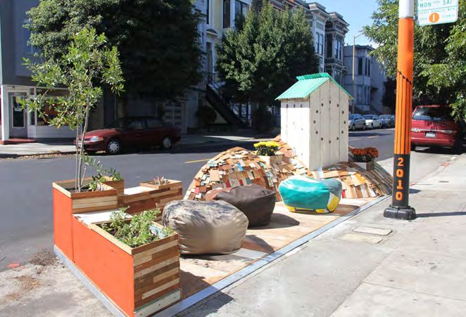
Parklet
A sidewalk extension that gives people walking more space along the street. Parklets can
include benches, tables, greenery, and bike racks, and also provide space for people to sit
and enjoy the space next to restaurants and other businesses.

When to Use: To provide more open space for residents, including spaces for sitting, eating,
and bike parking. They widen sidewalks and can also slow traffic by taking a portion of the
roadway.

Encouragement and Education, Infrastructure, Speed Management

Participatory Campaign
A campaign that invites the community to participate in pedestrian and bike educational safety
activities such as mural painting, crosswalk performances and neighborhood walk, bike, and
bus tours.

When to Use: To provide ways for the community to get directly involved in the planning
process for a project and provide their input directly to those planning the project.

Community Engagement/Partnerships, Data, Encouragement and Education, Infrastructure,
Safe Routes to School (SRTS), Speed Management, Vulnerable Populations

Paved Shoulder
A functional space for people walking and biking on the edge of a roadway.

When to Use: To provide space for people walking and biking on roads where there are no
sidewalks or bike lanes.

Encouragement and Education, Infrastructure, Vulnerable Populations

Pedestrian/Bike Count
A data collection of how many people are walking and/or biking on a street to demonstrate
the need for more pedestrian and bike infrastructure. This can be collected either manually or
through automated counters.

When to Use: To collect volume data to demonstrate the need for safety improvements on a
street.

Data, Encouragement and Education, Infrastructure, Speed Management, Vulnerable
Populations

Pedestrian Head Start (Leading Pedestrian Interval)
A traffic signal that gives people walking a 3-7 seconds head start to enter the intersection
before people driving receive a green light. This improves the visibility of people walking in the
intersection and highlights their right-of-way over turning vehicles.

When to Use: To increase the safety of people walking by allowing them a headstart on
crossing, which also increases their visibility to people driving.

The National Manual on Uniform Traffic Control Devices (MUTCD) recommends a pedestrian
crossing speed of 3.5 feet per second. California’s MUTCD recommends 2.8 feet per second
where people with disabilities or seniors walk. This allows vulnerable populations, like school
children or older adults, more time to cross the street safely.

Encouragement and Education, Infrastructure, Vulnerable Populations
Pedestrian Lane
A defined space on the roadway for people walking. They can be on one or both sides of the
roadway.

When to Use: To provide a space for people walking on roads with low to moderate speeds
and volumes.

Encouragement and Education, Infrastructure, Speed Management, Vulnerable Populations

 Pedestrian Plaza
 A repurposed underutilized street, alley, or other community space that incorporates
 benches, tables, greenery, and bike racks.

 When to Use: To provide more open spaces for people walking.

 Community Engagement/Partnerships, Encouragement and Education, Infrastructure, Speed
 Management

Pedestrian Safety Island (Pedestrian Refuge Island)
A designated area in the middle of a crosswalk where people walking can stop and rest. Along
with the island, high-visibility crosswalks and signage can also be installed.

When to Use: To create safe places of refuge for people walking across wide roads or streets
where people walking have trouble crossing due to high volumes of traffic. These can also be
used in areas where there’s a large presence of vulnerable road users like school children or
older adults.

Encouragement and Education, Infrastructure, Speed Management, Vulnerable Populations

Pedestrian-Scale Lighting
Lighting that is positioned towards sidewalks and pedestrian paths, located closer to the
ground, and installed closer together to improve the walking experience.

When to Use: To provide sufficient lighting for people walking and improve sightlines for
people walking, biking, or driving at night. It can also provide a sense of safety on previously
dark roads that people may have avoided walking on at night.

Encouragement and Education, Infrastructure, Vulnerable Populations

Pedestrian Scramble
An intersection that stops driver traffic in all directions and allows people walking to
simultaneously cross in all directions of the intersection, including diagonally. This lets people
cross the street without having to worry about potential conflicts with drivers turning right on a
red light.

When to Use: To provide safety improvements for people walking at intersections with a large
volume of people walking. These are oftentimes used in downtown city corridors where people
walking often outnumber people driving.

Encouragement and Education, Infrastructure, Speed Management, Vulnerable Populations
Permeable Sidewalk/Pavement
Sidewalk or pavement that allows stormwater to filter through to the soil below. Since water
seeps through the pavement, puddles and ice will not form on the road which improves safety
for people walking, biking, or driving.

When to Use: To manage stormwater on low-traffic roads and provide safe road conditions
for people walking, biking, or driving.

Encouragement and Education, Infrastructure

Photo and Video Voice
Tools that use images or videos to communicate perspectives and raise awareness of safety
issues in a community. Photo and Video Voice testimonials offer greater flexibility for residents
to engage in community planning.

When to Use: To gather more information and data directly from those impacted by traffic
violence, near misses, and unsafe streets in a community. This data can then be used as a
tool to advocate for safety improvements.

Community Engagement/Partnerships, Data, Encouragement and Education, Safe Routes to
School (SRTS), Speed Management, Vulnerable Populations

Placemaking
An approach that deeply engages the arts, culture,and creativity — especially from
underrepresented communities — in planning and designing projects so that the resulting
communities better reflect and celebrate local culture, heritage and values.

When to Use: To get residents directly involved with improvements in the community and
ensure any changes are in line with their vision for the community.

Community Engagement/Partnerships, Encouragement and Education, Infrastructure, Safe
Routes to School (SRTS), Speed Management

Protected Intersection
The physical separation and protection of people walking and biking at and in intersections.
They can include posts, bollards, concrete, or other infrastructure. Bike crossings are placed
next to, but separated from, pedestrian crossings to minimize potential conflicts between those
walking and biking as well.

When to Use: To improve the safety of people walking or biking at and in intersections with a
history of collisions. They can also facilitate left turns for people biking by providing a waiting
area to complete the crossing in two stages.

Encouragement and Education, Infrastructure, Speed Management, Vulnerable Populations
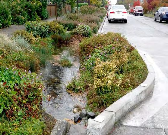
Provide Rapid Response
Physical and emotional care to crash survivors and their families. It can provide a way to get
planners in the community to reassess key intersections or streets for safety improvements.

When to Use: To support those impacted by traffic violence and the families who have lost a
loved one to traffic violence.

Data, Encouragement and Education, Vulnerable Populations

Public Bike Repair Station
A station that houses tools to perform basic bicycle repairs and maintenance, such as inflating
a flat tire or adjusting brakes, to support safer biking.

When to Use: To provide free access to tools for people biking in the community, regardless
of their economic status. They also help improve the safety of people biking by providing
regular access to bike tools to make sure their bikes are safe to ride.

Encouragement and Education, Infrastructure, Vulnerable Populations

Quick-Build Project
A semi-permanent project that can be implemented quickly to prioritize the safety of those
using the street. Oftentimes, they are intended to test improvements and can undergo
changes after installation to make them more impactful. They can be completed with as little
as paint and posts, but can include concrete and other more permanent elements. They can
be planned rapidly and installed roughly within a year of the start of planning.

When to Use: To create impactful, money-saving safety projects. Quick-builds are a tool that
can improve the safety of a street for a margin of what a full project would cost. They can be
used as a way to test out a project or new infrastructure element before committing to it fully.

Encouragement and Education, Infrastructure, Speed Management, Vulnerable Populations

Rain Garden
A landscaping feature designed to reduce flooding along a street. They can be installed
along with bulbouts to make an area more inviting to walk and bike. They can help manage
stormwater, add greenery to a corridor and replace concrete curb extensions to provide an
aesthetic alternative.

When to Use: To calm traffic along a corridor, while managing stormwater, and provide an
aesthetic green element to the street.

Encouragement and Education, Infrastructure, Speed Management

Raised Crosswalk
A type of speed table that brings the roadway to the same level as the sidewalk. It allows
people to cross without a curb ramp and makes people walking in the crosswalk more
visible to people driving. Raised crosswalks can be located at intersections or mid-block. At
intersection locations, the raised area can be extended to include the entire intersection.

When to Use: To physically encourage people driving to slow down before passing over the
crosswalk and provide a level path from curb to curb for people walking.

Encouragement and Education, Infrastructure, Speed Management, Vulnerable Populations
Rectangular Rapid Flashing Beacon (RRFB)
A marked crosswalk signal that is activated by people walking. It signals to people driving to
yield at an unsignalized intersection or midblock crosswalk. They are particularly effective for
crossing multi-lane streets with speed limits less than 50 mph.

When to Use: To increase the safety of people walking by encouraging those driving to yield
to people crossing the street.

Encouragement and Education, Infrastructure, Speed Management, Vulnerable Populations

Reduced Speed Limit Zone
Areas with a decreased speed limit of 25, 20, or 15 miles per hour. These areas are typically
near schools or senior zones.

When to Use: To reduce the speed of people driving and improve the safety of people
walking.

Data, Encouragement and Education, Infrastructure, Safe Routes to School (SRTS), Speed
Management, Vulnerable Populations

Road Rightsizing
The conversion of an existing four-lane, undivided roadway into a three-lane roadway. They
can allow the newly reclaimed space to be used as bus lanes, bike lanes, sidewalks, or other
uses. They also reduce the speed of people driving which makes it safer for people who walk
and bike along the corridor.

When to Use: To provide more street space for people walking, biking, or taking transit. It also
reduces vehicle speeds along a corridor.

Encouragement and Education, Infrastructure, Speed Management, Vulnerable Populations

Roundabout
A circular island in an intersection that directs people driving to slow down and yield before
entering the intersection. Roundabouts are an alternative to traffic signals and are designed
for roads with speeds greater than 25 mph.

When to Use: To promote slower speeds in an intersection. To reduce T-bone and head-on
crashes which typically result in more serious injuries.

Encouragement and Education, Infrastructure, Speed Management, Vulnerable Populations

Safe Haven Program
A program that partners with local businesses and community organizations to serve as safe
places where students can go and ask for help on their walk to and from school.

When to Use: To improve the safety of students walking and biking in the community and
provide opportunities for local businesses and community organizations to get involved
directly in SRTS work.

Community Engagement/Partnerships, Encouragement and Education, Safe Routes to School
(SRTS), Vulnerable Populations
Safe Passages Program
A program that places parents and volunteers at key locations that students travel to get to
and from school to support their personal safety and help them make it safely to school.

When to Use: To improve the safety of people walking and biking in the community and
provide opportunities for parents and volunteers to get involved directly in the SRTS work.

Community Engagement/Partnerships, Encouragement and Education, Safe Routes to
School (SRTS), Speed Management, Vulnerable Populations

Safety Messaging Campaign
A campaign that informs the general public of a safety message or call to action. They can
include community events, public service announcements, pamphlets, billboards, commercials
and art.

When to Use: To inform residents on how to create safer streets for all and create an
atmosphere where the community can look after one another’s safety.

Community Engagement/Partnerships, Data, Encouragement and Education, Speed
Management, Vulnerable Populations

Safe Routes to School (SRTS) Community Program
A program that consists of a broad partnership of community stakeholders working together
to promote walking and biking to school through education, incentives, and infrastructure
improvements.

When to Use: To create opportunities to promote walking and biking for school children, as
well as create safer streets at and surrounding the campus.

Community Engagement/Partnerships, Data, Encouragement and Education, Infrastructure,
Safe Routes to School (SRTS), Speed Management, Vulnerable Populations

Safe Routes to School (SRTS) Data Collection
The gathering of information on how students travel to and from school and parents’ thoughts
about their children walking and biking to and from school. The National Center for Safe
Routes to School offers the Student Travel Tally and Parent Survey forms.

When to Use: To better understand how a school currently travels to and from the campus
and look to encourage students to walk and bike to school.

Community Engagement/Partnerships, Data, Encouragement and Education, Safe Routes to
School (SRTS), Speed Management, Vulnerable Populations

School or Community Crossing Guard Program
A program that trains adults to direct the traffic of people walking, biking or driving at key
intersections, typically near schools. These can be volunteer, part-time, or full-time positions.

When to Use: To improve the safety of people walking to and from the school campus and
provide new opportunities for local jobs.

Community Engagement/Partnerships, Encouragement and Education, Safe Routes to School
(SRTS), Speed Management, Vulnerable Populations
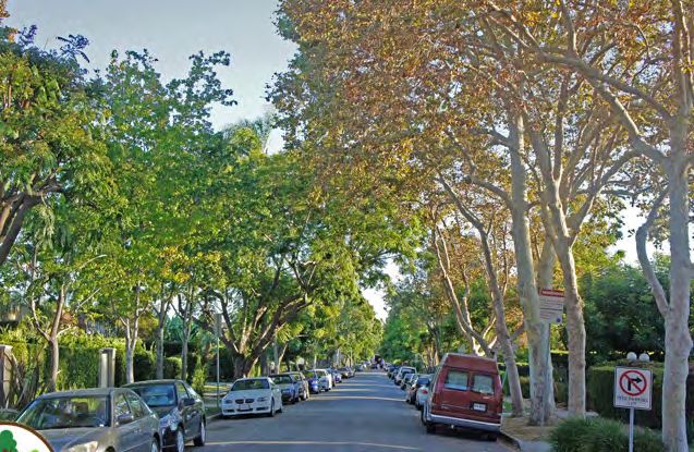
Shade Tree
A tree that provides shade, decreases noise pollution, and improves mental well-being
in a community. They can also slow deterioration of pavement, which improves a street’s
walkability and bikeability.

When to Use: To provide a comfortable environment for people walking, slow traffic, manage
stormwater, and other community improvements.

Encouragement and Education, Infrastructure, Vulnerable Populations

Sidewalk
A separated place to walk outside of the road. To be accessible, they must be installed in all
urban areas and have a minimum width of six feet with sufficient lighting, shade, and level
surfaces.

When to Use: To make roads accessible to all ages and abilities, especially for residents
with disabilities, and in areas where people walking are forced to travel in the street due to
insufficient or missing sidewalks.

Encouragement and Education, Infrastructure, Vulnerable Populations

Sidewalk Landscaping
The conversion of a concrete sidewalk space into a landscaped area. It can include native
plants and other neighborhood improvements like rain gardens.

When to Use: To enhance existing sidewalks and add greenery to communities.

Encouragement and Education, Infrastructure

Slow Streets
The reduction of through vehicle traffic on low-volume and low-moderate speed streets with
temporary signage and barriers aimed to create a shared space for people walking and biking.

When to Use: To create cost-effective ways to lower the speed of people driving and create
safer, more comfortable routes for people walking and biking.

Community Engagement/Partnerships, Encouragement and Education, Infrastructure, Speed
Management, Vulnerable Populations

Speed Hump
A piece of raised pavement in a street, approximately 3 to 4 inches high at its center which
extends the full width of the street, in order to slow vehicle speeds.

When to Use: To reduce the speed of people driving and improve the safety of people
walking.

Encouragement and Education, Infrastructure, Speed Management, Vulnerable Populations
Street Story
A tool that allows community residents and agencies to collect and share information about
transportation experiences, including near misses, safety concerns, and safe locations to
travel. The platform is publicly accessible and free to use at https://streetstory.berkeley.edu.

When to Use: To gather more information and data directly from those impacted by traffic
violence, near misses, and unsafe streets. This data can then be used as a tool to advocate
for safety improvements.

Community Engagement/Partnerships, Data, Encouragement and Education, Safe Routes to
School (SRTS), Speed Management, Vulnerable Populations

Student Safety Patrol Program
A program that enlists upper elementary, middle and high school students to direct their peers
to and from school during arrival and dismissal. Students can also be walking buddies and
provide safe walking and biking education to younger classmates.

When to Use: To get school children involved in advocating and creating safer routes to their
schools.

Community Engagement/Partnerships, Encouragement and Education, Safe Routes to
School (SRTS), Speed Management, Vulnerable Populations

Temporary Demonstration Project
A project that installs short-term safety enhancements that allow community residents to
experience and give feedback on a project before it is permanently installed. They differ
from quick-build projects because they are installed before a decision is made by the local
government body. They provide a way to test out potential projects before voting on making
them permanent.

When to Use: To create a way to test out a potential project, provide residents a tangible way
to experience the potential changes, and gather community feedback on the project before
permanently installing it.

Community Engagement/Partnerships, Data, Encouragement and Education, Infrastructure,
Speed Management, Vulnerable Populations

Transportation Injury Mapping System (TIMS)
A web-based tool that allows users to analyze and map crash data from California’s crash
database (Statewide Integrated Traffic Records System - SWITRS). The platform is publicly
accessible and free to use at https://tims.berkeley.edu.

When to Use: To use data to prioritize actions and to track progress related to transportation
safety efforts.

Data, Encouragement and Education, Infrastructure, Safe Routes to School (SRTS), Speed
Management, Vulnerable Populations
Vision Zero
A strategy to eliminate all traffic fatalities and serious injuries on a city, county, or state’s
streets. This is accomplished while increasing safe, healthy, equitable mobility for all people
using the street but especially vulnerable users.

When to Use: To encourage more residents to walk, bike, or take transit and improve the
safety of vulnerable populations using the corridor. To reach zero deaths and serious injuries
within a city, county, or state.

Data, Encouragement and Education, Infrastructure, Safe Routes to School (SRTS), Speed
Management, Vulnerable Populations

Walking or Biking Assessment
An assessment to identify safety concerns, barriers, and opportunities for key safety
improvements, along specific routes in a community. Key safety improvements can include
community programs and/or infrastructure projects.

When to Use: To gather information from residents and others on unsafe conditions on
specific streets for people walking and biking. This is a way to gather data to advocate for
safety improvements.

Community Engagement/Partnerships, Data, Encouragement and Education, Infrastructure,
Safe Routes to School (SRTS), Speed Management, Vulnerable Populations

Walking School Bus
A group of students who walk to school accompanied by an adult along a designated route.
Students, including those who are driven to school, join the walking school bus along several
identified stops.

When to Use: To encourage more kids to walk to school, improve the safety of people
walking to school, and get kids and parents involved directly in the SRTS work.

Community Engagement/Partnerships, Encouragement and Education, Safe Routes to
School (SRTS), Vulnerable Populations

Wayfinding
A system of signage and pavement markings that guide people walking and biking to popular
community destinations. Wayfinding tells someone walking or biking the distance or the time it
will take to walk or bike to a destination.

When to Use: To make navigating for people walking and biking as easy as possible.
Wayfinding can also encourage walking and biking because navigating the community is
easier for those new to walking or biking.

Encouragement and Education, Infrastructure, Vulnerable Populations
Photo Credits Bike and/or Pedestrian Advisory Committees: http://cityofgilroy.org/ImageRepository/Document?documentID=11264 Bike and/or Pedestrian Master Plans: https://www.ci.richmond.ca.us/ImageRepository/Document?documentID=33809 Bike Box: https://nacto.org/wp-content/uploads/gallery/2012_bikebox/bikebox_02_sanfrancisco_jan10.png Bike Lane: https://boyonabike.files.wordpress.com/2013/08/photo-5.jpg?w=538&h=398 Bike Parking: https://www.bart.gov/sites/default/files/images/basic_page/PH_Cropped.jpg Bike Rodeo: https://www.sanpabloca.gov/ImageRepository/Document?documentId=13110 Bike Safety Diversion Program: https://transportation.stanford.edu/sites/default/files/styles/home_promotional_image_ small/public/2020-04/DSC08515_0.JPG?itok=XVsBkiG3 Bike Sensor: https://nacto.org/wp-content/uploads/gallery/2012_detectionactuation_3dgallery/detection.jpg Bike Signal: https://ladotbikeblog.wordpress.com/2011/08/11/anatomy-of-a-bicycle-friendly-street-bicycle-signals/ Bike Train: https://www.saferoutespartnership.org/sites/default/files/pictures/john%20carroll%20bike%20train.JPG Community Benefit Agreement: https://www.forworkingfamilies.org/sites/default/files/publications/2005CBAHandbook.pdf Community Coalition: https://yt3.ggpht.com/ytc/AKedOLQAXQD1SI6R6WUSxTRbmVu2hObsh5-z2gJpWIkO=s900-c-k- c0x00ffffff-no-rj Community Liaison/Promotores Campaign: https://www.diadelamujerlatina.org/wp-content/uploads/2021/03/Promotores- Capitol-scaled.jpg Community Walk or Bike Ride: https://www.sbsun.com/wp-content/uploads/2017/09/0923_nws_sbs-l-fonwalk-0924-002- fp1.jpg?w=620 Complete Streets: https://smartgrowthamerica.org/wp-content/uploads/2020/08/CityHealth_Complete-Streets_Before- After-e1596742216178.png Curb Extension (Bulbout): https://www.mercurynews.com/wp-content/uploads/2020/08/bulbout.jpg?w=640 Curb Ramp: https://ada.ashdownarch.com/wp-content/uploads/2010/09/IMG_2151-300x267.jpg Daylighting: https://www.sfmta.com/sites/default/files/Red%20Visibility%20Curbs.jpg Designated Safe Route: https://ladot.lacity.org/sites/default/files/2020-02/safe%20routes%20to%20school-hero.jpg Earn-A-Bike Program: https://i0.wp.com/localnewsmatters.org/wp-content/uploads/2021/05/Bike-Shop_Earn-A-Bike_ February-2021_COVID_-30-scaled.jpg?w=2340&ssl=1 Engaging Elected Official: https://en.wikipedia.org/wiki/Laura_Friedman Evaluation of Program or Project: https://safetrec.berkeley.edu/sites/default/files/publications/cpbst_evaluation_ report_070219.pdf Funding Opportunities that Prioritize Safety: https://catsip.berkeley.edu/sites/default/files/styles/panopoly_image_original/ public/atplogo.png?itok=TZLvVY4q×tamp=1580770120 Helmet/Light Distribution: https://sfbike.org/wp-content/uploads/2018/12/Seth_LUTN_2.jpg High-Injury Network (HIN): https://img.hoodline.com/uploads/story/image/39446/visionzero.jpg?max-h=400&w=1110&fit=c rop&crop=faces,center High-Visibility Road Markings and Signage: https://www.worldhighways.com/sites/ropl-wh/files/39380.jpg Hybrid Beacon (HAWK): https://www.usbarricades.com/pedestrian-safety/hawk-high-intensity-activated-crosswalk- pedestrian-beacon-system-vac-power.html Link Crash and Medical Data: https://tims.berkeley.edu/images/safetypm-thumbnail.jpg Median Gardening: https://www.sfbetterstreets.org/wp-content/uploads/2011/12/median-greening.jpg Multi-Use Trail/Shared Path: https://www.cityofgoleta.org/home/showpublishedimage/2637/636552487307270000 Neighborhood Speed Awareness Program: https://www.marincounty.org/-/media/images/maringov/press-release-images/ featured-stories/dpw/dpw-speedsigns-121919-385x308.jpg?la=en Neighborhood Traffic Circle: https://www.longbeach.gov/globalassets/go-active-lb/media-library/images/mobility-toolkit/ toolkit_mini-traffic-circle.jpg Open Streets: https://ladot.lacity.org/sites/default/files/2020-02/Open-Streets.jpg Parklet: https://images.squarespace-cdn.com/content/v1/5512f68be4b0a3782aad46b0/1437711525927- QGLUKAJSYHPN9GUTC5KY/image-asset.jpeg?format=1000w
Participatory Campaign: https://cpb-us-e1.wpmucdn.com/sites.usc.edu/dist/0/510/files/2021/11/07-USC-Slow- Jam-2019-11-06_PM2721-SLOW_Vermont-1080x1080_no-caption.png Paved Shoulder: https://ruraldesignguide.com/files/2016-12/mississippi-hwy-67-north-of-d-iberville-alta.jpg Pedestrian/Bike Count: https://www.idahosmartgrowth.org/app/uploads/2019/07/bike-counts.jpg Pedestrian Lane: https://ruraldesignguide.com/files/2016-12/1482177754_pg3-17-rendering-pedestrianlane.png Pedestrian Plaza: https://tribepilatesstudio.com/wp-content/uploads/2021/11/Santa-Monica-3rd-Street-Promenade- 1024x662.jpg Pedestrian Safety Island (Pedestrian Refuge Island): https://www.longbeach.gov/globalassets/go-active-lb/media-library/ images/mobility-toolkit/toolkit_ped-refuge-island.jpg Pedestrian-Scale Lighting: https://nextstl.com/wp-content/uploads/16336184569_738ab91c92_c.jpg Pedestrian Scramble: https://www.linkedin.com/pulse/other-side-thinking-carefully-pedestrian-scramble-john-turecki Permeable Sidewalk/Pavement: https://dot.ca.gov/-/media/dot-media/programs/design/images/permeable-pave- schematic.jpg?h=306&w=420&hash=6FC5A9AE90A69ED024F01F3E3927B174 Photo and Video Voice: https://safetrec.berkeley.edu/sites/default/files/strengthening_partnerships_pe1_crowdsourced_ data_strategies.pdf Placemaking: https://www.artplaceamerica.org/sites/default/files/public/chicanopark.png Protected Intersection: https://www.slocity.org/home/showpublishedimage/15463/637607475310270000 Provide Rapid Response: https://pbs.twimg.com/profile_images/433949513170952192/CAbJVD6p_400x400.png Public Bike Repair Station: https://ladotlivablestreets-cms.org/uploads/718efd1404bc45dc928f1368e6b7f3a1.jpg Quick-Build Project: https://www.calbike.org/wp-content/uploads/2019/08/People-Using-Streets-13-1030x580.jpg Rain Garden: https://www.migcom.com/sites/default/files/styles/news_slideshow/public/ACEC_4-1. jpg?itok=LyeRzI1X&c=ab51d4ec07d613915c1641f824a23184 Raised Crosswalk: https://sf.streetsblog.org/wp-content/uploads/sites/3/2010/11/raisedcrosswalk11.jpg Rectangular Rapid Flashing Beacon (RRFB): https://www.lincoln.ne.gov/City/Departments/LTU/Transportation/Traffic- Engineering/RRFB Reduced Speed Limit Zone: https://www.driverseducationusa.com/drivers-ed-course-california/traffic-laws-and-rules-of- the-road/school-sign-25mph.jpg Road Rightsizing: https://assets-global.website-files.com/581110f944272e4a11871c01/593fff8e11016b4e86a56ea7_ Before-and-after-Typical-should-be-used-for-main-page.jpg Roundabout: https://www.chicoer.com/wp-content/uploads/migration/2017/201711/NEWS_171129861_AR_0_ EXYESOWNJAIC.jpg Safe Haven Program: https://www.cde.ca.gov/eo/in/images/safehaven180x160_001.jpg Safe Passages Program: https://images.squarespace-cdn.com/content/v1/58cb4339be65946ee837f5bc/1594076283303- J84A5SZHK5ZNKYV5CDX9/photo+of+safe+passage.jpg?format=1000w Safety Messaging Campaign: https://scag.ca.gov/sites/main/files/imagecache/medium/main-images/featured-2020-go- human-re-launch.jpg?1643885164 Safe Routes to School (SRTS) Community Program: https://www.saferoutespartnership.org/sites/all/themes/saferoutes/ images/SRP-logo-no-border290.png Safe Routes to School (SRTS) Data Collection: https://saferoutescalifornia.files.wordpress.com/2011/09/scag_ modeshare_l.jpg School or Community Crossing Guard Program: https://riversideca.gov/pworks/images/B4S_crossingguard02_106402c. jpg Shade Tree: https://blog.grow-trees.com/wp-content/uploads/2016/06/West-Hollywood-Trees.jpg Sidewalk: https://www.fostercity.org/sites/default/files/styles/gallery500/public/imageattachments/publicworks/page/5121/ dsc01116_-_copy.jpg?itok=uRr2SG6D Sidewalk Landscaping: https://www.gardenfortheenvironment.org/garden-tips-archive/2014/12/1/sidewalk-gardens Slow Streets: https://s.hdnux.com/photos/01/11/72/20/19375163/3/1200x0.jpg Speed Hump: http://www.stocktonca.gov/files/PWProvider_SpeedHump2.jpg Street Story: https://safetrec.berkeley.edu/sites/default/files/styles/panopoly_image_original/public/crowdsourceddata. png?itok=1dyCwLEP×tamp=1503600294
Student Safety Patrol Program: https://p18cdn4static.sharpschool.com/UserFiles/Servers/Server_27918651/Image/ Activities/Clubs%20&%20Organizations/Safety%20Patrol/safety_patrol2.jpg Temporary Demonstration Project: https://catsip.berkeley.edu/sites/default/files/styles/panopoly_image_original/ public/20200911-reimagine19thinstall-a69a1297.jpg?itok=LqSEKhSI×tamp=1602890502 Transportation Injury Mapping System (TIMS): https://tims.berkeley.edu/images/gismap-thumbnail.jpg Vision Zero: https://gmtma.org/wp-content/uploads/2016/02/vision-zero.png?w=300 Walking or Biking Assessment: https://safetrec.berkeley.edu/sites/default/files/styles/panopoly_image_original/public/ fowlercpbst.png?itok=LsXJGYX9×tamp=1612484159 Walking School Bus: https://solanosr2s.ca.gov/wp-content/uploads/2017/11/WSB_1-e1513726266890.jpg Wayfinding: https://media.segd.org/s3fs-public/styles/galleryformatter_slide/public/PRES_130207_MCu_c_39. jpg?itok=vnwOZJxB
INDEX
Community Engagement/Partnerships                     Encouragement and Education
 Bike and or Pedestrian Advisory Committees            Bike and or Pedestrian Advisory Committees
 Bike and/or Pedestrian Master Plans                   Bike and/or Pedestrian Master Plans
 Bike Rodeo                                            Bike Box
 Bike Safe Diversion Program                           Bike Lane
 Bike Train                                            Bike Parking
 Community Benefit Agreement                           Bike Rodeo
 Community Coalition                                   Bike Safe Diversion Program
 Community Liaison/Promotores Campaign                 Bike Sensor
 Community Walk or Bike Ride                           Bike Signal
 Complete Streets                                      Bike Train
 Earn-A-Bike Program                                   Community Benefit Agreement
 Engaged Elected Official                              Community Coalition
 Helmet/Light Distribution                             Community Liaison/Promotores Campaign
 Neighborhood Speed Awareness Program                  Community Walk or Bike Ride
 Open Streets                                          Complete Streets
 Participatory Campaign                                Curb Extension (Bulbout)
 Pedestrian Plaza                                      Curb Ramp
 Photo and Video Voice                                 Daylighting
 Placemaking                                           Designated Safe Route
 Safe Haven Program                                    Earn-A-Bike Program
 Safe Passages Program                                 Engaged Elected Official
 Safety Messaging Campaign                             Evaluation of Program or Project
 Safe Routes to Schools (SRTS) Community Program       Funding Opportunities that Prioritize Safety
 Safe Routes to Schools (SRTS) Data Collection         Helmet/Light Distribution
 School or Community Crossing Guard Program            High-Injury Network (HIN)
 Street Story                                          Hybrid Beacon (HAWK)
 Student Safety Patrol Program                         Multi-Use/Shared Path
 Temporary Demonstration Project                       Neighborhood Speed Awareness Program
                                                       Open Streets
Data                                                   Parklet
                                                       Participatory Campaign
 Bike and or Pedestrian Advisory Committees            Paved Shoulder
 Bike and/or Pedestrian Master Plans                   Pedestrian/Bike Count
 Bike Sensor                                           Pedestrian Head Start (Leading Pedestrian Interval)
 Community Coalition                                   Pedestrian Lane
 Complete Streets                                      Pedestrian Plaza
 Engaged Elected Official                              Pedestrian Safety Island (Pedestrian Refuge Island)
 Evaluation of Program or Project                      Pedestrian Scale Lighting
 Funding Opportunities that Prioritize Safety          Pedestrian Scramble
 Link Crash and Medical Data                           Permeable Sidewalk/Pavement
 Neighborhood Speed Awareness Program                  Photo and Video Voice
 Participatory Campaign                                Placemaking
 Pedestrian/Bike Count                                 Protected Intersection
 Photo and Video Voice                                 Provide Rapid Response
 Provide Rapid Response                                Public Bike Repair Station
 Reduced Speed Limit Zone                              Quick-Build Project
 Safety Messaging Campaign                             Rain Garden
 Safe Routes to Schools (SRTS) Community Program       Raised Crosswalk
 Safe Routes to Schools (SRTS) Data Collection         Rectangular Rapid Flashing Beacon (RRFB)
 Slow Streets                                          Reduced Speed Limit Zone
 Street Story                                          Road Rightsizing
 Temporary Demonstration Project                       Roundabout
 Transportation Injury Mapping System (TIMS)           Safe Haven Program
 Vision Zero                                           Safe Passages Program
                                                       Safety Messaging Campaign
Safe Routes to Schools (SRTS) Community Program Shade Tree
Safe Routes to Schools (SRTS) Data Collection Sidewalk
School or Community Crossing Guard Program Sidewalk Landscaping
Shade Tree Slow Streets
Sidewalk Speed Hump
Sidewalk Landscaping Temporary Demonstration Project
Slow Streets Transportation Injury Mapping System (TIMS)
Speed Hump Vision Zero
Street Story
Student Safety Patrol Program Safe Routes to School (SRTS)
Temporary Demonstration Project Bike and or Pedestrian Advisory Committees
Transportation Injury Mapping System (TIMS) Bike and/or Pedestrian Master Plans
Vision Zero Bike Rodeo
Bike Train
Infrastructure Community Coalition
Bike and or Pedestrian Advisory Committees Community Liaison/Promotores Campaign
Bike and/or Pedestrian Master Plans Complete Streets
Bike Box Designated Safe Route
Bike Lane Earn-A-Bike Program
Bike Parking Engaged Elected Officia
Bike Sensor Evaluation of Program or Project
Bike Signal Funding Opportunities that Prioritize Safety
Community Benefit Agreement Helmet/Light Distribution
Community Coalition Participatory Campaign
Complete Streets Photo and Video Voice
Curb Extension (Bulbout) Placemaking
Curb Ramp Reduced Speed Limit Zone
Daylighting Safe Haven Program
Designated Safe Route Safe Passages Program
Engaged Elected Official Safe Routes to Schools (SRTS) Community Program
Evaluation of Program or Project Safe Routes to Schools (SRTS) Data Collection
Funding Opportunities that Prioritize Safety School or Community Crossing Guard Program
High-Injury Network (HIN) Street Story
Hybrid Beacon (HAWK) Student Safety Patrol Program
Median Gardening Transportation Injury Mapping System (TIMS)
Multi-Use/Shared Pat Vision Zero
Neighborhood Traffic Circle
Open Streets
Parklet
Participatory Campaign
Paved Shoulder
Pedestrian/Bike Count
Pedestrian Head Start (Leading Pedestrian Interval)
Pedestrian Lane
Pedestrian Plaza
Pedestrian Safety Island (Pedestrian Refuge Island)
Pedestrian Scale Lighting
Pedestrian Scramble
Permeable Sidewalk/Pavement
Placemaking
Protected Intersection
Public Bike Repair Station
Quick-Build Project
Rain Garden
Raised Crosswalk
Rectangular Rapid Flashing Beacon (RRFB)
Reduced Speed Limit Zone
Road Rightsizing
Roundabout
Safe Routes to Schools (SRTS) Community ProgramYou can also read