A REGIONAL SCALE RADON MONITORING NETWORK IN THE VOLCANIC ISLAND OF TENERIFE, CANARY ISLANDS (SPAIN)
←
→
Page content transcription
If your browser does not render page correctly, please read the page content below
22nd International Radon Symposium. American Association of Radon Scientists and Technologists (AARST)
                                    Las Vegas, USA, October 14-17, 2012

A REGIONAL SCALE RADON MONITORING NETWORK IN THE VOLCANIC
         ISLAND OF TENERIFE, CANARY ISLANDS (SPAIN)

   Ronaldo Viñas (1,3), Antonio Eff-Darwich (1,2), José A. Rodríguez-Losada (1,2), Luis E. Hernández (1,2,3)

                       (1) Departamento de Edafología y Geología, Universidad de La Laguna, Spain
                               (2) Volcanological Institute of the Canary Islands, INVOLCAN
                                       (3) Government of the Canary Islands, Spain

                                                                                                               1
Tenerife

           2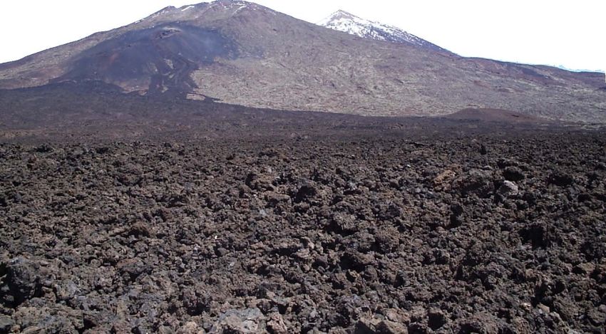
geological frame
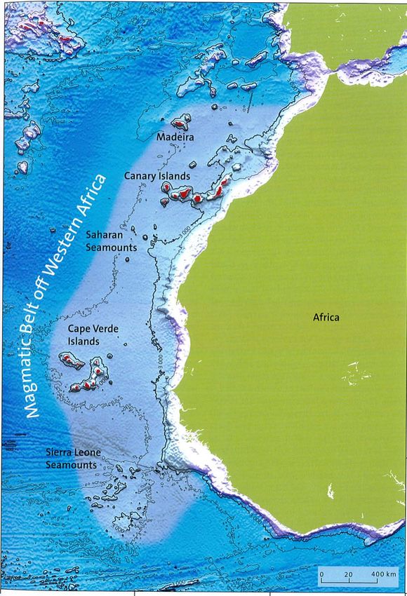
From the point of view of volcanology,
Canary Islands are located in the
Magmatic Belt off Western Africa.
The Canaries present a singular
geodynamic position, shared with the
islands of Madeira and Cape Verde, far
from any plate margins but upon a zone of
transit between oceanic an continental
crust.
Currently, it seems clear that the stresses
generated in the Atlas Mountains
(Morocco) and the slow movement of
African plate to the East (1 - 2 cm/year)
have influenced the formation of the
Canary Islands.
3
W                                                                           E

           La Palma
             1971

                                                                                hot
                                                                               spot
         El Hierro
           2011

    The most accepted hypothesis of Canary Islands origin is the “Hot Spot” Theory

Exist a magmatic focal-point fixed in the mantle, above wich the oceanic crust moves in
West-East direction. The displacement of the thin litospheric plate causes the successive
volcanic islands formed above the “hot spot” to be aligned as the present day, according
to the direction followed by the plate in its movement.                                     4
Canary Islands evolution

                           5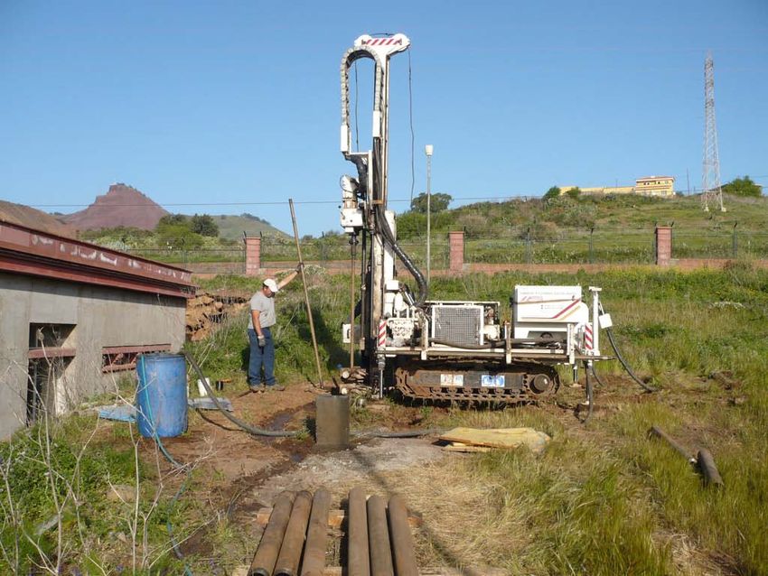
Practically all the volcanic processes have taken place in the Canary Islands

                                                  Eruption classification depends
                                                  on:
                                                   Violence
                                                   Effusive activity
                                                   Explosive activity
                                                   Magma Chemistry
                                                   Structures                       6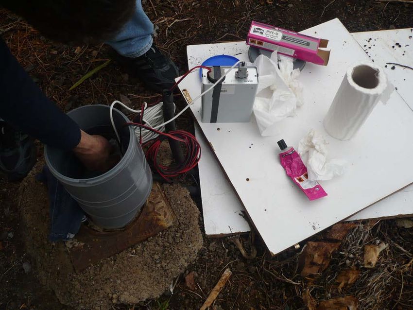
plinian, vulcanian eruption
                                                         (salic)

         hawaiian, strombolian eruption
                    (basaltic)

                                                           v
                                                           v
                                                          vv
                                                           v
                                                          shallow magmatic chamber
crust

mantle
                                  deep magmatic chamber

                thermal anomaly                                                 7
The Canarian Geochemical and Radiological Database

                                       Geochemistry
In the Canary Islands we can recognize a whole spectrum of possible volcanic rocks in the world.

                                                                                                   8
Tenerife is the largest island of the archipelago ( 2.034 km2) and one of the largest volcanic islands in the world

                               1706                          1705
                            1909                       1704
                                                     1705
                                    1798

                     The morphology of Tenerife is the result of a complex geological evolution                       9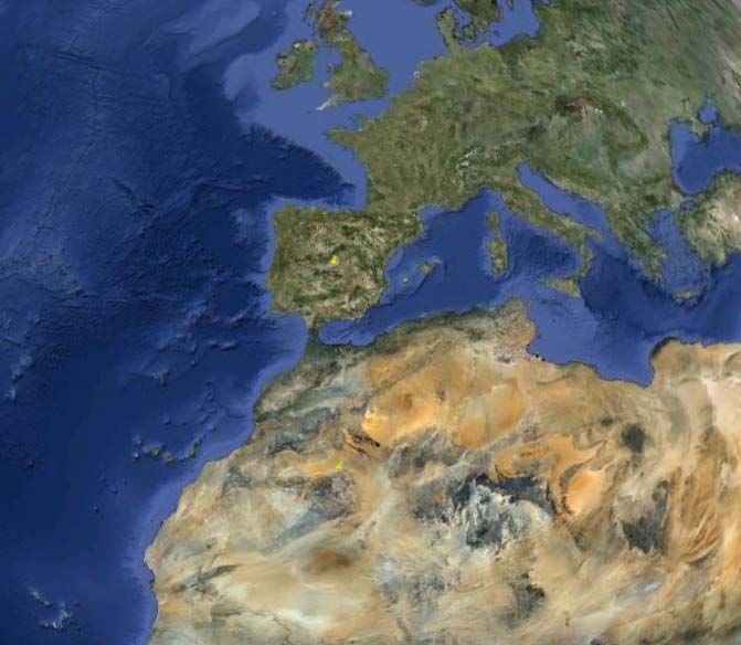
NATURAL RESOURCES FOR CONSTRUCTION PURPOSES

                                              10
The Canarian Geochemical and Radiological Database In order to limit the external gamma radiation dose from building materials to 1.5 mSv/y per practice, it has been proposed a safety criterion, namely the external activity index (He) (Mujahid et al., 2008): He = CRa/370 + CTh/259 + CK/4810 where CRa, CTh and CK are the specific activities of radium, thorium and potassium expressed in Bq/kg. The internal exposure to carcinogenic radon and its short-lived progeny is quantified by the internal activity index (Hi): Hi = CRa/185 + CTh/259 + CK/4810 The standard safety criterion requires that in both cases He
Spatial distribution of the internal activity index (Hi) on the island of Tenerife

The close relation between the content of radioactive elements and the geology of the
island is illustrated in this figure. The largest values of the internal activity index (Hi) are
found in the areas affected by the activity of the Cañadas and Teide-Pico Viejo Edifices,
recalling that the lavas erupted by these volcanoes, that cover of a good portion of the
                                                                                                   12
Normalised radon exhalation rate as a function of the internal activity index for a
sample of rocks from the Canarian Database.
plagioclase basalt
The radiological analysis of the Canarian Database also contains the radon exhalation
rates of the volcanic rocks. At present, the radon exhalation rate has been determined in a
small sample of rocks. The first results indicate that there is an increase of the radon
exhalation rate as a function of magmatic differentiation, namely, the largest exhalation
rates correspond to felsic rocks.
13Radon at home
low quality building
material
poor insulation
basaltic rocks
salic rocks
14Radon at home
complex multivariant problem
Rn
Rn
15Radon at home
main bedroom
other places
Radon concentration as a function of time in the main bedroom of a problem house (black
line) and in different places of the house (red line). Vertical red dashed lines indicate the time
period of evaluation of radon concentration in all the different places of the house, but the
main bedroom 16Radon at home
main bedroom
other places
Radon concentration as a function of time in the main bedroom of a problem house
(black line) and in a poor-isolated wall of the house (red line). The thick horizontal red
line indicates the time period with rain. 17What happens underneath?
18Radon transport in the subsurface
A network of boreholes (approximately 30 meters depth) are being built to study the
transport of radon in different geological settings of the island of Tenerife.
19Radon transport in the subsurface
drilled
boreholes
projected
boreholes
At present, 6 boreholes have been drilled. Most of them are equipped with temperature
sensors, every 8 meters and a Radon detector at the top of the borehole. These sites
are also monitored in an attempt to find a relationship between temporal and spatial
variations in Radon concentration as the result of an increase in the geological/volcanic
activity in the island. 20Radon transport in the subsurface
borehole 1
borehole 2
The first results obtained from the network of boreholes indicate that the transport
of radon significantly differs from one site to the other, indicating the effect of the
different geological settings.
21CONCLUSIONS
•In Spain there is no legislation that takes into account radon in buildings. One of the
objectives of this project is to raise authorities awareness of the need to legislate on this
matter.
•There is a close relation between the content of radioactive elements and the lythological
units of the island.
•According to magmatic differentiation, hazard indexes are quite low at the mafic rocks
(more basaltic) and high at the felsic rocks (more salic), exceeding in some cases the safety
criterion.
•We are doing a map of activity index in Tenerife.
•We are implementing a boreholes network for studying the transport of Radon from the
subsurface to buildings and infrastuctures.
•We are studying the problem of low income houses.
•We are studying wich volcanic materials are suitable for use as building materials.
•We also are using radon as a geological activity parameter.
22thank you litoteca@yahoo.es
You can also read