AMERICAN SAMOA FOREST ASSESSMENT AND RESOURCE STRATEGY 2011 - 2015 Forestry Program
←
→
Page content transcription
If your browser does not render page correctly, please read the page content below
AMERICAN SAMOA

FOREST ASSESSMENT AND
 RESOURCE STRATEGY

             2011 – 2015
              Forestry Program
Division of Community and Natural Resources
    American Samoa Community College
      Pago Pago, American Samoa 96799
                June 2010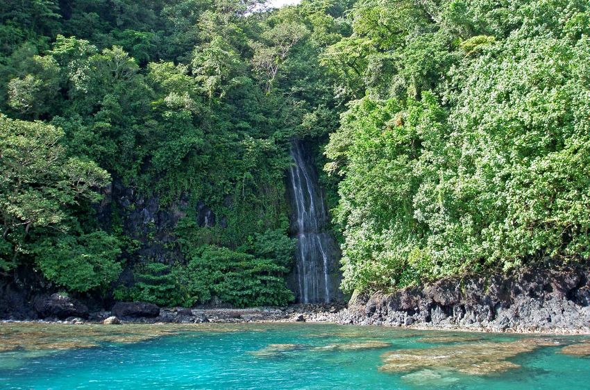
ACKNOWLEDGEMENTS

        The American Samoa Community College Division of Community and Natural
Resources Forestry Section would like to thank the many individuals who helped make this
assessment and resource strategy possible. Technical support from Anne Marie LaRosa at the
Institute of Pacific Islands Forestry was critical in helping us start and finish this process.
Zhanfeng Liu and Lisa Fischer of the Forest Service and Dr. W. Arthur Whistler of Isle Botanica
were instrumental in helping construct the revised vegetation map that was used in the analysis.
We are very grateful to all the members of the American Samoa Forestry Advisory Council who
provided important input at critical junctures in the process, and we are deeply indebted to all our
colleagues in local partner agencies who gave so generously of their time and expertise in
providing invaluable input to the development of the analysis and strategy components.
Members of the Advisory Council are listed in Appendix A, and the local colleagues who
assisted during the process are listed in Appendix B at the end of this document. We hope that
our efforts to carry out these strategies in the coming years will help bring about our shared
dream of conserving and enhancing American Samoa’s precious forests for future generations of
American Samoans.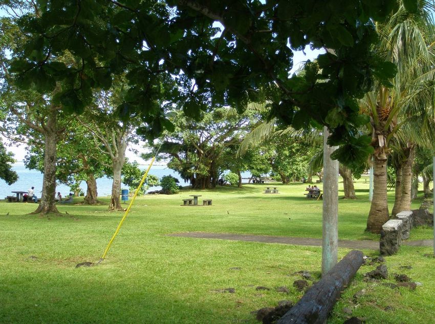
TABLE OF CONTENTS
I. INTRODUCTION ....................................................................................................................... 1
    METHODOLOGY FOR ASSESSMENT AND STRATEGY DEVELOPMENT .................... 2
II. AMERICAN SAMOA FOREST RESOURCE ASSESSMENT............................................... 6
    A. BACKGROUND ................................................................................................................... 6
       1. American Samoa’s Forests ................................................................................................. 6
       2. Value of Forests .................................................................................................................. 9
       3. Land Tenure ........................................................................................................................ 9
       4. American Samoa Forestry Programs ................................................................................ 10
    B. FOREST CONDITIONS AND TRENDS ........................................................................... 11
       1. Rapid Population Growth ................................................................................................. 11
       2. Forest Conversion ............................................................................................................. 12
       3. Forest Health and Invasive Species .................................................................................. 14
       4. Natural Disturbances......................................................................................................... 16
       5. Employment...................................................................................................................... 16
    C. EXISTING PLANS RELATED TO FOREST RESOURCES IN AMERICAN SAMOA . 17
       1. American Samoa Wildlife Action Plan............................................................................. 17
       2. Community Wildfire Protection Plan ............................................................................... 17
       3. Forest Legacy Program Assessment of Need ................................................................... 17
       4. American Samoa 5-year Plan for Forest Stewardship, 2005-2009....................................18
       5. American Samoa Community Forestry Program 5-Year Plan, 2008-2012 .......................18
       6. Invasive Species Strategic Plan .........................................................................................19
    D. REGIONAL PRIORITIES AND OPPORTUNITIES FOR COLLABORATION ............. 19
    E. CRITICAL FORESTRY ISSUES IDENTIFIED BY STAKEHOLDERS.......................... 20
    F. SPATIAL DATASETS USED FOR OVERLAY ANALYSIS ........................................... 20
    G. CRITICAL ISSUES AND PRIORITY LANDSCAPE AREAS ......................................... 24
       Issue 1. Sustainability of Urban Forests ............................................................................... 24
       Issue 2. Protection of Coral Reefs......................................................................................... 27
       Issue 3. Conservation of Wetlands........................................................................................ 29
       Issue 4. Maintaining Fresh Water Quality ............................................................................ 33
       Issue 5. Conservation of Native Flora and Fauna ................................................................. 35
    H. CONCLUSIONS AND DATA GAPS FROM THE CRITICAL ISSUES ANALYSIS ..... 37
    I. ASSESSMENT REFERENCES............................................................................................ 40
III. AMERICAN SAMOA FOREST RESOURCE STRATEGY ................................................ 42
    A. LONG-TERM STRATEGIES ............................................................................................. 42
       Issue 1 – Sustainability of urban forests ............................................................................... 42
       Issue 2 – Protection of Coral Reefs....................................................................................... 44
       Issue 3 – Conservation of wetlands ...................................................................................... 45
       Issue 4 – Maintaining fresh water quality............................................................................. 47
       Issue 5 – Conservation of native flora and fauna.................................................................. 48
    B. INVESTING FINANCIAL AND HUMAN RESOURCES ................................................ 50
    C. TRANSLATING STRATEGIES INTO ACTIONS ............................................................ 52
       1. Basis for program, agency, and partner coordination ....................................................... 52
       2. Existing S&PF program planning requirements ............................................................... 52
    D. MONITORING AND REPORTING................................................................................... 53
APPENDIX A: AMERICAN SAMOA FORESTRY ADVISORY COUNCIL .......................... 55
APPENDIX B: STAKEHOLDERS’ INVOLVEMENT IN SWARS DEVELOPMENT............ 56
APPENDIX C: RELATED STRATEGIC PLANS CONSULTED FOR SWARS...................... 61
APPENDIX D: GLOSSARY OF ACRONYMS.......................................................................... 62
APPENDIX E: STATE AND PRIVATE FORESTRY PERFORMANCE MEASURES........... 63
I. INTRODUCTION

         The American Samoa Community College Division of Community and Natural
Resources, the American Samoa Department of Public Safety Fire Department, and the United
States Department of Agriculture Forest Service collaboratively administer federally funded
forestry programs in American Samoa. Support for these programs is allocated through the
Forest Service State and Private Forestry section as a combination of formula and competitive
funding. To ensure the most efficient allocation of federal monies, the 2008 Farm Bill required
each state and territory to complete an analysis of forest conditions and trends and use that
analysis to produce a long term strategy for the investment of federal forestry program resources.
Each state and territory was required to submit, by June 18 2010, a Statewide Assessment and
Resource Strategy document that describes its key forest issues, priority landscapes, and long-
term strategies in the context of the overarching national themes of conserving working forest
landscapes, protecting forests from harm, and enhancing public benefits from trees and forests.
This document presents American Samoa’s Statewide Assessment and Resource Strategy. The
first section describes the methodology and findings of the assessment and includes important
information about American Samoa’s geography, forests, and forestry programs. The second
section details the long-term strategies developed on the basis of this assessment.

Pago Pago Harbor and Matafao Mountain. Photo by Mark Schmaedick.

                                                1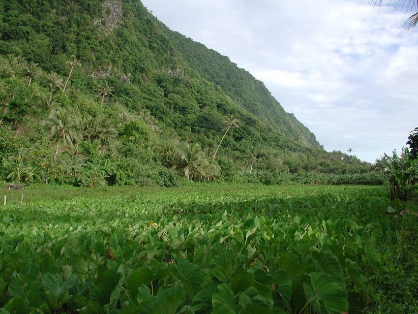
METHODOLOGY FOR ASSESSMENT AND STRATEGY DEVELOPMENT

        Development of the American Samoa Statewide Assessment and Resource Strategy
(SWARS) was a collaborative and iterative process. The American Samoa Community College
Division of Community and Natural Resources (ASCC CNR) solicited involvement from local
stakeholders and experts throughout the process. Key participants were the Department of Public
Safety Fire Department, Department of Marine and Wildlife Resources, Department of
Commerce, National Park of American Samoa, American Samoa Environmental Protection
Agency, USDA Natural Resources Conservation Service, American Samoa Department of
Agriculture, National Oceanic and Atmospheric Administration, Department of Parks and
Recreation, and the Office of Samoan Affairs, as well as private farmers and landholders and
ASCC CNR staff. Large meetings were held with the American Samoa Forestry Advisory
Council and other stakeholders on April 9, 2009 to introduce the SWARS process and obtain
preliminary inputs and on January 28, 2010 to discuss the draft assessment and proposed
strategies (Appendix B). (The American Samoa Forestry Advisory Council combines the Forest
Stewardship Advisory Council and the Community Forestry Coordinating Committee.) Later
drafts were reviewed with ASCC CNR staff on May 13, 2010 and the Forestry Advisory Council
on May 20, 2010. Besides these larger meetings, numerous smaller meetings were held with
individual agencies and stakeholders throughout the course of the SWARS effort (Appendix B).
Staff of the American Samoa office of the Natural Resources Conservation Service participated
in the SWARS development as members of the American Samoa Forestry Advisory Council, and
the NRCS technical committee for American Samoa (located in Hawaii) has also been furnished
a copy of the SWARS for review. Because almost all of the local NRCS working group (Soil and
Water Conservation District) members are also members of the Forestry Advisory Council, it
was not deemed useful to schedule separate meetings with SWCD.

Aoa Village, Tutuila Island. Photo by Mark Schmaedick.

                                                 2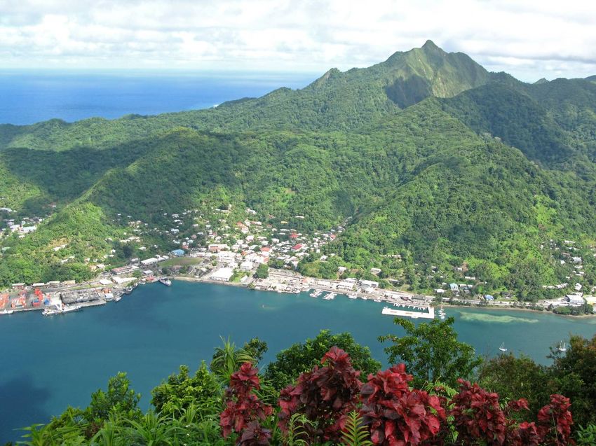
Initial meetings with stakeholders and experts identified five critical issues for forestry in
American Samoa. (Stakeholders involved in each step of the process are listed in Appendix B.)
Spatial and non-spatial data was then obtained to inform each issue. Where spatial data was
available, it was used in an overlay analysis conducted to identify priority forest landscapes in
the territory. For each issue, spatial data affecting the issue was portrayed as a set of GIS layers.
Each GIS layer was comprised of (0, 1) cell values depicting presence or absence of a key factor.
For example, in the stream buffer layer, all cells falling within a stream buffer have value = 1 and
those outside have value = 0. Most of the spatial data layers were relevant to more than one
issue, so they appeared in the overlay analyses for multiple issues.

        For each issue, after discussion of each layer informing the issue, each individual
stakeholder was asked to assign a value 1-10 to each of the layers depending on its perceived
importance to the issue. To ensure meaningful values were assigned, only stakeholders who have
expertise on a specific issue were asked to rate the layers used in the analysis for that issue. The
weights for the overlay analysis were then obtained by dividing the mean for each layer by the
sum of all the layer means for that issue so that the weights for each issue add up to 100%. To
delineate the priority landscapes for each issue, the overlay analysis was done by calculating a
priority value for each cell by summing across the data layers each layer’s value (0,1) for each
cell, multiplied by the layer’s weight. Possible output cell values thus ranged from 0% to 100%.
The natural breaks classification method in ArcGIS 9.2 was used to classify the output cell
values into low, medium, and high priority classes which were then mapped. Impervious surfaces
and water were masked out in this analysis. The overlay analysis produced a map of high,
medium, and low priority forest landscapes for each issue.

        In addition to identifying critical issues and delineating priority landscapes, the
assessment also describes the general conditions and trends in American Samoa’s forest
resources and threats to those resources and reviews relevant aspects of the territorial wildlife
action plan, the community fire protection plan, and the Forest Legacy assessment of need.
Based on this assessment, the resource strategy section presents a long-term plan to maximize
program impacts in light of national and local program priorities by focusing resources on
addressing those critical issues in the identified priority landscapes through collaborations with
local and regional partners. The strategy was developed through a series of stakeholder meetings
(Appendix B) while referencing existing forestry program strategic plans and related plans from
other agencies. The process served to link local priorities to the national State and Private
Forestry program themes and objectives.

                                                  3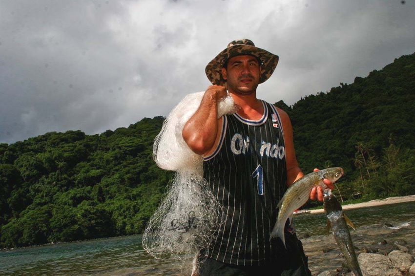
State and Private Forestry National Themes and Objectives
1. Conserve Working Forest Landscapes
1.1. Identify and conserve high priority forest ecosystems and landscapes
1.2. Actively and sustainably manage forests

2. Protect Forests from Harm
2.1. Restore fire-adapted lands and reduce risk of wildfire impacts
2.2. Identify, manage, and reduce threats to forest and ecosystem health

3. Enhance Public Benefits from Trees and Forests
3.1. Protect and enhance water quality and quantity
3.2. Improve air quality and conserve energy
3.3. Assist communities in planning for and reducing wildfire risks
3.4. Maintain and enhance the economic benefits and values of trees and forests
3.5. Protect, conserve, and enhance wildlife and fish habitat
3.6. Connect people to trees and forests, and engage them in environmental stewardship activities
3.7. Manage and restore trees and forests to mitigate and adapt to global climate change

                                  American Samoa in the Pacific

                                                4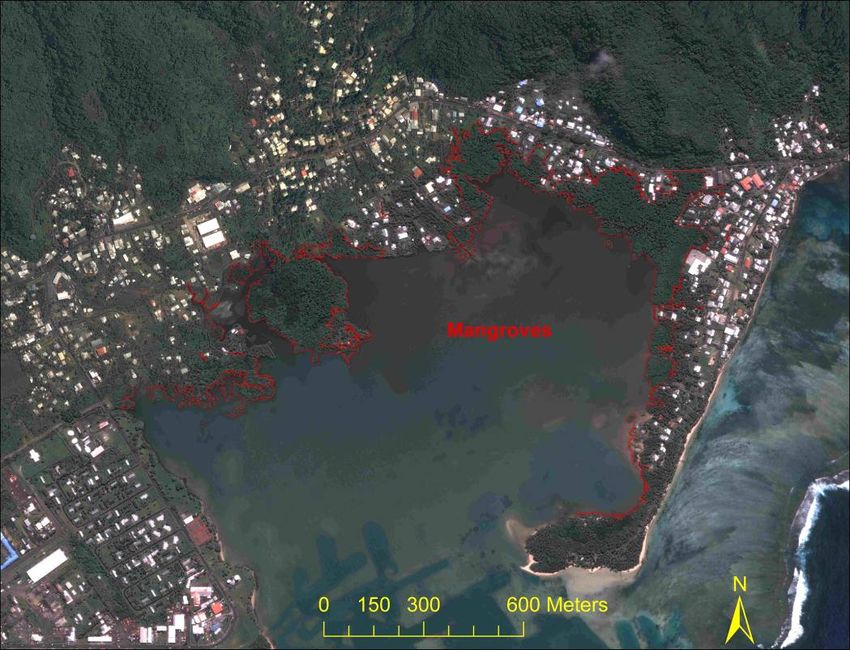
Tutuila, Aunu’u,
                                          & the Manu’a Islands
                                            American Samoa

Tutuila, Aunu'u, and the Manu'a Islands showing major roads and national park lands.

                                         5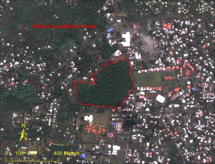
II. AMERICAN SAMOA FOREST RESOURCE ASSESSMENT
A. BACKGROUND
American Samoa, the only territory of the United States south of the Equator, is located
in the Pacific Ocean about 2,500 miles south of Hawaii and 1,600 miles northeast of New
Zealand. (See map on page 4.) The territory consists of seven islands: five inhabited high
volcanic islands (Tutuila, Aunu’u, Ofu, Olosega, and Ta’u), one inhabited atoll (Swains), and
one uninhabited atoll (Rose). Rose Atoll is a wildlife refuge managed by the U.S. Fish and
Wildlife Service, so is not included in the assessment and resource strategy. Swains Island has
been proposed as a potential Forestry Legacy Program site, but is not otherwise considered in
this assessment and strategy due to its remote location and difficulty of access for forestry
programs. The total land area of American Samoa is 76 square miles, with a population of
69,200. The majority of the population is on the south side of the largest island, Tutuila. The
climate is hot, wet, and humid, with an annual rainfall of about 129 inches. The topography is
rugged and steep with about 42% of the land having slopes of 45% and higher.
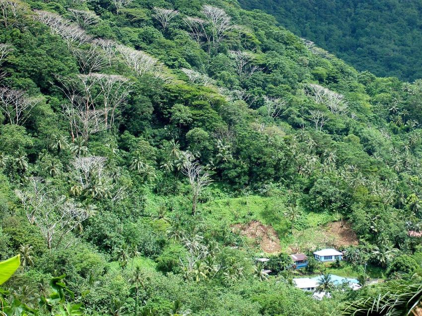
1. American Samoa’s Forests
The natural vegetation of American Samoa is tropical rainforest, due to the warm climate
and year-round rainfall. Unlike the temperate forests of North America, which are typically
dominated by one to a few species, tropical rainforests are dominated by a combination of many
species. In American Samoa, native forests extend from the seashore up to the highest mountain
peaks. Topographical variation, along with human and natural disturbances, has influenced the
growth and distribution of various rainforest types across American Samoa’s landscapes.
Throughout American Samoa’s undisturbed coastal areas occurs a narrow strip of
vegetation referred to as littoral forest. The littoral forest is comprised of various coastal species
whose presence and distribution are influenced by the surrounding sea. Littoral forests provide
habitat for a number of wildlife species including flying foxes, seabirds, and nesting sea turtles.
On the south side of American Samoa’s largest island, Tutuila, lies the Tafuna Plain.
Within the Tafuna Plain occurs one of American Samoa’s most threatened forest types, referred
to as lowland lavaflow rainforest. The lavaflow rainforest sits directly above important aquifers
from which the community receives the majority of its drinking water. Tree species in this forest
type are adapted to rocky lavaflow areas with little soil and low water-holding capacity. The
lavaflow rainforest is also one of American Samoa’s tallest forests highlighted by its enormous
giant banyan (Ficus spp.) and tava (Pometia pinnata) trees that tower over the plains.
Another threatened forest type in American Samoa is the mangrove forest. Out of the
seven islands that comprise American Samoa, mangroves occur on only two, Tutuila and
Aunu’u. Mangrove forests occur on these islands’ coastal areas, particularly in sheltered lagoons
and protected areas where freshwater enters the ocean at the mouths of streams. The largest
mangrove forests are located on the south side of Tutuila Island in the lagoons of Leone and
Nu’uuli villages. Mangroves serve as prime habitat for numerous fish, crustacean, and mollusk
6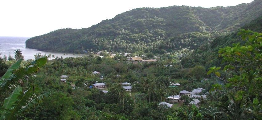
species. Unlike the other forest types that are comprised of many species, the mangrove forests
of American Samoa are dominated by just three species.

        Freshwater wetlands, including marshes and swamps, are another important vegetation
type in the territory. Marshes occur on all five of the territory’s high islands and provide habitat
for rare fauna and flora such as the locally rare Pacific black duck (Anas superciliosa) and the
rare herb Limnophila fragrans. Several of the marsh areas are also used for wetland taro
production. Swamps, inland wetlands dominated by woody species, are also important habitat for
native plants and animals.

        American Samoa’s urban forests are defined as trees managed by people in and around
residential and public areas such as gardens, parks, sports fields, and lawns. The majority of the
urban forests are concentrated around the densely populated villages in the relatively flat areas of
southwestern Tutuila Island. Urban forests are comprised of a combination of native and non-
native trees planted and maintained for food, shade, beauty, wind breaks, building materials,
medicine, shoreline protection, boundary markers, etc.

                                                 7
Papa Stream in native forest above Nu'uuli Village. Photo by Don Vargo.
American Samoa’s highest peak (Mt. Lata, 3,166 ft) is on the second largest island of
Ta’u. The topographical characteristics at the summit of Mt. Lata produce an area of high
rainfall, cool temperatures, and strong winds. These factors have influenced the growth of a
unique vegetation type referred to as summit scrub. Summit scrub is characterized by stunted
trees covered with epiphytes, vines, and ferns, and occurs only on Ta’u Island. Summit scrub
provides prime nesting habitat for the Tahiti petrel. Mt. Lata’s remote location, high elevation,
cool temperatures, and dense vegetation cause it to be rarely visited by humans. The summits of
several of Tutuila Island’s highest mountains have nutrient-poor, highly weathered soil derived
from trachyte plug remnants of eroded ancient volcanoes. The montane scrub vegetation on these
peaks is the only known home of some of American Samoa’s rarest native plant species.
Most of the rainforest between the coastal areas and the mountain peaks is comprised of
Rhus secondary forest growing in areas once disturbed by humans or natural causes, such as
cyclones. Much rainforest remains, however, especially on the north side of Tutuila and in
scattered patches on the Manu’a Islands.
82. Value of Forests
Forests provide American Samoa’s residents with numerous ecological, cultural, and
economic values. Ecologically, American Samoa’s forests are important for providing food and
habitat for native plants and animals. Some forest types are home to rare and endemic plants and
animals. Forests also maintain the balance of American Samoa’s water and nutrient cycles. Their
ability to moderate water flow and absorb nutrients helps prevent flooding, erosion, and
contamination which can potentially degrade important resources such as coral reefs, streams,
aquifers, and wetlands. Other ecological benefits of forests include recharging aquifers, restoring
soil fertility, and carbon sequestration.
Like the sea, forests have played an integral part in the shaping of Samoan identity and
culture. For thousands of years Samoans have depended on the resources forests provide for
sustaining life and livelihood. Resources such as medicine, food, clothing, canoes, fishing gear,
and traditional building materials exemplify the integral role forests play in traditional Samoan
daily life. Trees and forests also play an important cultural role, appearing frequently in Samoan
legends, traditional ceremonies, and legends. For generations, Samoans have spoken of the
forests in their proverbial sayings and chiefly language to symbolize important events and
gatherings.
Although no timber industry exists in American Samoa, forests provide other resources
of economic value. The tropical forest is a place of rich species diversity inhabited by a number
of unique and rare native plants and animals. Such features generate income by attracting eco-
tourists who come to appreciate the forests’ natural beauty. Forests are also economically valued
by fishermen. The mangroves are natural fish nurseries that replenish fish stocks that fishermen
depend on for income. In addition, many of American Samoa’s native tree species are harvested
to create traditional handicrafts, oils, traditional clothing, and mats that can also generate income.
Although modern appliances are used for most cooking, many families still cook at least a
Sunday meal in a traditional Samoan earth oven, or umu, fired by fuel wood purchased or
obtained locally. Much of traditional agricultural production comes from agroforestry systems.
Cocoa, coconut, breadfruit, various fruit trees, and other trees are often interplanted with taro,
yams, bananas, giant taro, and other crops. The nitrogen-fixing Erythrina subumbrans is
commonly grown with taro to help maintain soil fertility.
3. Land Tenure
The land tenure system in American Samoa consists of five ownership types: communal
lands owned by aiga (extended families) of a village, government lands owned by the American
Samoa government, freehold lands and individually owned lands owned by private landowners,
and church lands owned by religious denominations. Approximately 88.4% of the land is
communal, 4.0% individually owned, 2.1% freehold, 2.1% church, and 3.4% government owned.
Communal lands are managed under the traditional Samoan matai (chiefs) system. Under this
system, lands are owned by different aiga within a village. Each aiga is headed by a matai. The
matai holds authority over the land and makes decisions about activities pertaining to the land.
Unlike other national parks, the National Park of American Samoa is not owned by the federal
government, but was established on communal land under a 50-year lease agreement between the
9United States National Park Service and the local aiga who retain ownership of the land. The
terrestrial portions of the national park cover about 13.2% of the territory’s land area. All lands
except government owned lands and the national park are eligible for participation in USFS
S&PF programs, comprising a total of 40,660 acres.
The near-shore fishery provides nutritious protein for many families. Photo by Zhanfeng Liu.
4. American Samoa Forestry Programs
The American Samoa Forestry Program is in the American Samoa Community College
Division of Community and Natural Resources. This is an outcome of a unique agreement
between ASCC and the United States Forest Service in 1986. The Forestry Program is one of the
major programs within ASCC CNR and is funded through the U.S. Forest Service. The USFS
funded programs at ASCC include Urban and Community Forestry, Cooperative Forest Health
Protection-Invasive Plants, Forest Health Protection, Forest Stewardship, and the Forest Legacy
Program. (The Conservation Education Program will be joined with the UCF Program in July
2010.)
The Forestry Program is presently headed by the ASCC CNR Extension Programs
Coordinator who is serving as the Acting Forestry Program Manager while a new Program
Manager is being recruited. The Forestry Program receives technical assistance and works
closely with a Forestry Researcher, housed in the ASCC CNR Research Division. Technical
10assistance for forest health is also provided by an entomologist and a plant pathologist, also
housed in the ASCC CNR Research Division. The Forestry Researcher and Plant Pathologist
positions are currently vacant but expected to be filled soon. An ASCC CNR GIS Specialist
provides GIS/GPS support. The Forestry Program’s 12 regular staff members, two AmeriCorps
volunteers, and student interns conduct program outreach and delivery activities to clients,
schools, farmers, villages, churches, and the community at large. There is a branch office on
Ta’u Island with two agents to serve the Manu’a Islands communities. The program also receives
technical assistance from the USFS S&PF Pacific Southwest Region and the Pacific Southwest
Research Station as well as program guidance from the American Samoa Territorial Forestry
Advisory Council. The American Samoa Forestry Advisory Council combines the Forest
Stewardship Advisory Council and the Community Forestry Coordinating Committee.
USFS funded fire programs are operated by the American Samoa Department of Public
Safety Fire Division. The division is responsible for all fire suppression in the territory with back
up from the airport fire and rescue if needed. It also implements fire prevention and education
programs. There are three stations and substations on Tutuila Island and one on Ta’u Island.
Total staffing is approximately 48, including firefighters and administrative staff.
Staff capacity building is a high priority for American Samoa forestry programs given the
limited number of local skilled workers and high turnover rates of professional human resources
(off-island contracts) for forest management and program operation. Therefore, there is a great
need to provide training opportunities—both non-formal and formal—to build local staff
capacity.
The Forestry Program collaborates with government agencies both at the local and
federal levels, regional organizations, and non-governmental organizations in program planning,
implementation, and evaluation. Moreover, the Forestry Program works with the interagency
American Samoa Invasive Species Team (ASIST), community members, farmers, clients,
students, and volunteers in preserving, protecting, enhancing, and managing the forests and
related natural resources in American Samoa.
B. FOREST CONDITIONS AND TRENDS
1. Rapid Population Growth
American Samoa is comprised of five volcanic islands and two remote atolls—one
uninhabited and the other home to only a few individuals. Of the five high islands, 96% of the
population resides on the main island of Tutuila. Many American Samoans from the neighboring
islands of Ofu, Olosega, and Ta’u migrate to Tutuila for better employment opportunities and
education. In addition, Tutuila attracts many immigrants who come seeking economic
opportunities. The 2000 U.S. Census reported 36.1 percent of the population was foreign-born.
More recent estimates suggest that most current residents were not born in the territory. The
great majority of immigrants are Samoans from independent Samoa, but there are also many
from Asia and neighboring Pacific island countries such as Fiji and Tonga. In 1990, American
Samoa’s population was 46,773, and it had increased to 57,291 by the year 2000. By 2008, the
11mid-year population was estimated at 69,200 and it was projected that by the end of year 2010,
Tutuila’s local population will have increased to 80,000, a 42% increase over the past twenty
years. While Tutuila’s population is rapidly increasing, that of the Manu’a Islands is not.
2. Forest Conversion
In 2001, the Forest Inventory and Analysis (FIA) Program of the USFS Pacific Northwest
Research Station, in collaboration with ASCC CNR, conducted an inventory of American
Samoa’s forests. To better understand the trends in American Samoa’s forests, FIA used a land
cover map completed in 1985 (Cole et al. 1988) to compare 1985 forested area to forested area
inferred from then current Ikonos imagery. From that comparison, it was estimated that forest
lands had declined by 3% over the 15 year period (Donnegan et al., 2001). The 2001 FIA report
also estimated that 90.1% of the territory’s land area was forested (including agroforest), and 7%
urban at that time. The 2009 vegetation mapping effort by ASCC CNR and USFS in support of
this SWARS used Quickbird imagery from 2005 (Tutuila and Aunu’u) and 2007 (Manu’a) and
estimated 81% of land area was forested. (See map on page 7.) Unfortunately the different types
of imagery and methods used do not permit a direct comparison with the Cole et al. (1988) and
Donnegan et al. (2001) estimates.
Mangrove areas in Pala Lagoon, Nu'uuli. Quickbird 2005.
12In order to sustain American Samoa’s increasing population, important forest habitats
have been cleared and replaced by agriculture and development. The combination of limited flat
lands and high demand for lands suitable for growing crops, building roads, homes, and
businesses have significantly increased pressure on the forest. The main island of Tutuila
contains 34,082 acres of land, which is 70% of the total land area for American Samoa. Out of
the 34,082 acres, only 18,626 acres have less than 45% slope, so areas for development and
agriculture are limited. According to the 2009 vegetation map, approximately 5,960 acres of
Tutuila’s land was identified as agriculture and 2,084 acres as developed. Agriculture and
development combined covers 24% of the island.
The mangrove forests of Tutuila and Aunu’u Islands have significantly declined over the
past twenty years. Residents clear and fill in mangroves for building homes, businesses, and
churches, and for dumping trash. Some of Tutuila’s largest mangrove forests are located within
heavily populated villages, increasing their vulnerability to encroachment and destructive
activities. Although American Samoa’s mangroves are protected under the Federal Coastal Zone
Management Acts of 1972 and 1990, land ownership and prosecution issues make enforcement
difficult. The 1985 Cole et al. (1988) land cover map identified 148 acres of mangrove forests on
Tutuila and Aunu’u Islands. In 2002 and 2003, ASCC CNR conducted a comprehensive
assessment of mangroves from which they identified 122 acres of mangroves remaining (Bardi
and Mann 2003). According to the assessment, approximately 5 acres of mangroves were lost
every year, and it was predicted that the mangroves would be completely gone within 25 years if
the trend continued. The 2009 vegetation mapping estimated that only 89 acres of mangrove
forest remain.
With a total land area of around 3,000 acres, the Tafuna Plain was originally almost
entirely covered by lavaflow rainforest. Today, this forest has been reduced to a small patch
completely surrounded by development and agriculture. The landscape in which this last remnant
of lavaflow rainforest occurs is flat, highly populated, and centrally located, making it ideal for
businesses and homes. According to the Donnegan et al. (2001) FIA report, only 40 acres of
lowland lavaflow rainforest were identified with the majority of the Tafuna plains being
converted to urban development and plantations. Today, those 40 acres has been reduced to 28
acres, a 30% decrease in a period of 9 years.
Many of American Samoa’s forests are far from roads and grow on steep and rugged
terrain. The difficulty of access and unsuitability of these forested landscapes for agriculture and
development have helped some forests remain intact for many years. Although the steep and
rugged slopes have protected some forests for a long time, farmers are increasingly encroaching
into these areas as a result of suitable flat lands being occupied with urban development and
agriculture. The majority of forest clearing on steep slopes is taking place near roads on the
southern half of Tutuila Island. Tutuila’s main road runs along the entire southern coast
providing farmers with easy access to the hillsides. Most of the island’s intact forests occur on
the northern side where the main road reaches only to a few villages on the far western and
eastern ends. These forested landscapes will certainly be threatened if roads are extended into the
remote areas of the north.
13Remnant lowland lavaflow rainforest in the Tafuna Plain. Quickbird 2005.
3. Forest Health and Invasive Species
Invasive species threaten all of American Samoa’s forests—even those too remote or steep to be
of interest to developers or farmers. Although no detailed data could be found on the overall
distribution and severity of invasives across American Samoa’s landscapes, evidence of their
negative impact can be seen on many mountain slopes where native trees are being replaced by a
variety of invasive species. In addition, with increasing globalization come increased
opportunities for the introduction of new potentially dangerous exotics.
Forest trees are affected by both exotic and native arthropod defoliators, such as
Thalassodes pilaria, Cleora samoana, Badamia exclamationis, and Adoretus versutus and borers
such as Xylosandrus compactus. Brown root rot caused by Phellinus noxius is also common in
the rainforest and in the urban forest. While they may severely damage or kill individual trees,
these pests are not considered serious threats to the critical functions of the forest in American
Samoa where the forest is valued for purposes other than timber production. (See section above.)
14In the urban forest, however, heavy defoliation by caterpillars, or loss of trees to brown root rot
can be a significant problem. In general though, damage inflicted by strong winds, weed eaters,
machetes, and poor pruning tends to be greater than that inflicted by insects or diseases. Often
such mechanical injury facilitates subsequent insect or disease attack. Exotic invasive insects
occasionally become a problem. Examples are the erythrina gall wasp (Quadrastichus
erythrinae) attacking the native Erythrina variegata orientalis since its accidental introduction in
2005, and the Seychelles scale insect (Icerya seychellensis), which severely damaged breadfruits
and many other tree species in the urban forest before it was brought under biological control.
Pigs were introduced to the Samoan islands by the earliest settlers and remain an
important part of Samoan culture, prepared in traditional earth ovens for special occasions and
for traditional Sunday meals. Feral pigs are abundant in many forested areas where they spread
invasive plants, damage understory vegetation, and destroy riparian areas by their feeding and
wallowing behavior. Pig densities have been reduced in some forested areas by snaring and
hunting, but remain high in other areas.
Probably the greatest danger to the native rainforest is the spread of exotic invasive
plants. Serious threats already established in American Samoa include the African tulip
(Spathodea campanulata), Mexican rubber tree (Castilla elastica), albizia (Falcataria
moluccana), red-bead tree (Adenanthera pavonina), strawberry guava (Psidium cattleianum),
cinnamon (Cinnamomum verum) and false kava (Piper auritum).
Red-flowered African tulip trees are invading forested areas in western Tutuila. Photo by Simon Stowers.
15Invasive Falcataria moluccana trees killed by girdling. Photo by Fuiava Kitiona Fa’atamala.
4. Natural Disturbances
In the last 30 years American Samoa has been struck by six major tropical cyclones.
More frequent, but less severe tropical storms and near misses from cyclones also bring strong
winds, heavy rains, and high surf. These severe weather events can topple trees and defoliate
large areas of forest. Landslides often occur on the steep mountain slopes. Subsequent growth of
invasive plant species may prevent the natural succession of native trees. Flooding can also
adversely affect trees, especially in the urban forest around low lying villages. Fire is not a part
of the natural disturbance and succession processes in American Samoa’s forests. Structure fires
and brush fires do occur, but tend to be limited in duration and extent due to the frequent rainfall,
high humidity and lack of a dry season.
5. Employment
American Samoa’s labor force consists of three sectors: government (35%), private/other
(36%), and two large tuna canneries (29%). In 2008, the two tuna canneries employed 4,861
people. Unfortunately, in 2009, one of them closed leaving over 2,000 people unemployed. It is
unclear whether the remaining cannery will continue in American Samoa or move elsewhere
where labor costs are lower. Loss of one or both canneries and associated businesses will
16dramatically decrease local tax revenues making current levels of public sector employment
unsustainable. Unemployment is a potentially serious threat to forests in American Samoa. With
little land and no source of income, residents may be more inclined to clear upland forest to
increase subsistence and commercial agricultural production.
C. EXISTING PLANS RELATED TO FOREST RESOURCES IN AMERICAN SAMOA
1. American Samoa Wildlife Action Plan
The Comprehensive Strategy for Wildlife Conservation in American Samoa was
produced by the American Samoa Department of Marine and Wildlife Resources (DMWR) as a
guide to resources in need of conservation due to decline in abundance, highly localized or
restricted distributions, and vulnerability to threats. Its description of wildlife resources and plans
for their conservation reveal many areas of shared interest with the forestry programs and
opportunities for continued collaboration.
Some of these commonalities include the shared need to obtain accurate, detailed maps of
vegetation and invasive plant distributions for delineating priority conservation sites,
encouraging the use of native species in urban forests, and controlling key invasive species. To
conserve forest resources and native wildlife, both ASCC CNR and DMWR implement
conservation efforts through research, education, and public awareness programs in schools,
villages, and churches and in local media. The resource strategy section of this document details
long-term strategies by which the local forestry programs will contribute to addressing these
shared concerns.
2. Community Wildfire Protection Plan
According to the American Samoa Community Wildfire Protection Plan, produced by the
American Samoa Department of Public Safety, 2007 saw a total of 98 structure fires and 45
brush/wildfires. Most fires are caused by arson or human activities such as burning rubbish or
clearing weeds. A wildland fire risk assessment in 2008 concluded that American Samoa as a
whole fell into the high-risk range due to the ignitability of the many wood-sided structures,
volume of fuels close to these structures, and fire history. The plan’s principle recommendations
in order of priority were reduction of fuels along roads, empty lots, and common areas;
prevention education and outreach; and improvement of community egress and firefighter
ingress. The plan does not include any spatial analysis, but recommends measures be taken to
reduce fuel loads in the villages of Aoloaufou, Leone, and Tafuna. ASCC CNR and DPS have
shared responsibilities for educating the public on fire prevention. The long-term strategies
addressing wildfire protection are described in the strategy section of this report.
3. Forest Legacy Program Assessment of Need
The American Samoa Community College Division of Community and Natural
Resources is the local lead agency for the Forestry Legacy Program. American Samoa’s Forest
Legacy Program Assessment of Need was produced by ASCC CNR in 2003. It stated that
although large areas of native forest remained in the territory, population growth and
17accompanying development of agriculture and urban infrastructure posed an imminent threat to
the forests. Additional threats cited were poorly planned public works projects and invasive
species. Although the American Samoa Coastal Management Act provides for designation of
“Special Management Areas” where development is restricted, there are no laws to prevent
deforestation and no endangered species act to protect habitat of rare and endangered plants and
animals. Criteria for Forest Legacy eligibility were that the land must be forested and threatened
by conversion, it must contain one or more of a set of important public values, and its
preservation must help conserve large, contiguous blocks of forest land and/or create buffers for
or facilitate management of other protected lands. Two Forest Legacy Areas were proposed: the
Tafuna lowland lavaflow rainforest remnant on Tutuila Island and the entire area of Swains
Island. As noted earlier, the Tafuna lowland lavaflow rainforest represents the last remnant of
this type of forest in the archipelago. This area has been approved for Forest Legacy Program
funding, and the program is currently in the process of clarifying documentation of title. Swains
Island is privately owned. Acquisition of the island would protect important seabird roosting
habitat and allow continued succession of remaining unmanaged coconut plantations to native
forest. The forest consists of patches of littoral trees (Hernandia sonora, Pisonia grandis,
Neisosperma oppositifolia, Pandanus tectorius, Guettarda speciosa, and Tournefortia argentea)
interspersed among the coconut palms, which are the most abundant tree species. Acquisition of
the island would also provide an opportunity to eradicate the non-native Polynesian rat and
prevent incursion by other rat species, giving further protection to the seabirds. To date Forest
Legacy Program funding for Swains Island has not been actively pursued. The resource strategy
calls for completing the process of acquiring the Tafuna lowland forest before initiating the FLP
process for Swains Island.
4. American Samoa 5-Year Plan for Forest Stewardship, 2005-2009
The most recent Forestry Stewardship Program plan identifies forest clearing for
agriculture and development, damage from cyclones, and the spread of invasive plants as key
concerns. Five strategies were described. The first was organization of a Forest Stewardship
Committee, which was done. The committee is now combined with the Community Forestry
Coordinating Committee as the American Samoa Forestry Advisory Council. The second
strategy was to produce high quality planting materials and technical and planning assistance for
forestry stewardship. The third strategy was to provide training for extension agents and program
clients. The fourth was to identify areas suitable for timber stand improvement, wildlife habitat
improvement, or watershed protection and encourage the landowners to implement these
activities. The final FSP strategy was to promote practices to reduce erosion from hillside
agriculture, identify and promote native trees that grow well in such areas, and to encourage the
use of native trees in agroforestry lands adjacent to native forest. Most of the essential elements
of these FSP strategies will continue as described in the resource strategies section below.
5. American Samoa Community Forestry Program 5-Year Plan, 2008-2012
The current Community Forestry Program 5-year plan describes key problems as high
population growth in an area of limited arable land with high susceptibility to erosion and fragile
ecosystems, frequent tropical cyclones, vulnerability to sea level rise, and a lack of knowledge of
ecosystem concepts. Approaches to address these issues included promotion of aesthetically
18pleasing, appropriate, and culturally important trees by community groups in public areas;
protection of coastlines and stream banks from erosion; raising awareness of the value of
community forests; and facilitating education of the public about conservation of natural
resources. As described in the strategy section below, these approaches will continue in the
coming years, with increased emphasis on use of native trees beneficial to wildlife and
increasing awareness of, and improving community responses to invasive species.
6. Invasive Species Strategic Plan
An invasive species strategic plan is currently under development by ASCC CNR
Forestry and will be completed by November 2010. The key components in the draft plan are
professional staff capacity-building in weed management, GIS, media development, and grants
management; prevention of invasions through training in identification and publicizing lists of
high-risk species; control and monitoring efforts against key established species; and educating
the public to increase awareness of the dangers of invasive species. Several of these components
are included in the resource strategies discussed in this document and others will be added as the
invasive species strategic plan is completed and the SWARS strategies are updated.
D. REGIONAL PRIORITIES AND OPPORTUNITIES FOR COLLABORATION
As an island territory, American Samoa shares no contiguous areas with other U.S. states
or territories. Nevertheless, the territory shares many common forestry concerns with the other
U.S. Pacific states, freely associated states, and territories, including the state of Hawaii, the
Federated States of Micronesia, Guam, the Commonwealth of the Northern Mariana Islands,
Palau, and the Republic of the Marshall Islands. These concerns include unique and fragile
ecosystems with many endemic plants and animals, vibrant indigenous culture, diverse land
tenure systems, important traditional subsistence agroforestry, high susceptibility to severe
storms and the effects of global climate change, and often a lack of skilled personnel. The Pacific
Islands Committee of the Western Forestry Leadership Coalition meets annually and promotes
the unique mutual interests of the islands in the USFS and the broader U.S. forestry community.
The Institute of Pacific Islands Forestry (S&PF), located in Hawaii, provides crucial technical
assistance addressing the unique needs of the islands’ forestry programs. ASCC CNR, along with
the American Samoa Department of Agriculture, participate in the Secretariat of the Pacific
Community’s (SPC) annual meeting of heads of agriculture and forestry. SPC provides technical
support in the areas of agriculture, forestry, natural resources, human development, and health to
its 26 member countries and territories in the Pacific Basin region. Sharing ideas and expertise
with regional partners in these Pacific organizations benefits all ASCC CNR forestry programs
directly and indirectly.
19E. CRITICAL FORESTRY ISSUES IDENTIFIED BY STAKEHOLDERS
As described in the methods section above, ASCC CNR consulted with local experts,
stakeholders, and partners to identify critical issues related to the territory’s forests and spatial
and non-spatial datasets pertaining to those issues. The spatial datasets were then used in an
overlay analysis to delineate priority landscape areas for each issue. Five critical issues were
identified:
1. Sustainability of urban forests
2. Protection of coral reefs
3. Conservation of wetlands
4. Maintaining fresh water quality
5. Conservation of native flora and fauna
F. SPATIAL DATASETS USED FOR OVERLAY ANALYSIS
Where possible, factors influencing critical issues were depicted spatially as GIS layers to
be incorporated in the overlay analysis for each issue. Most of these factors influenced multiple
issues, so they appear in the analysis for more than one issue. The following 12 factors were
used.
Agriculture. Areas of agriculture as depicted in the 2009 American Samoa vegetation
map (p. 7) produced by ASCC CNR and USFS. Includes areas of taro, banana, coconut,
breadfruit, vegetable crops, and cattle production.
Coastal Erosion. Areas subject to coastal erosion; depicted as a 30 foot buffer zone
extending inland from the coastline.
Fire Prone Areas. Most fires occur in and around urban and disturbed areas. Areas at risk
were portrayed by extracting urban cultivated areas from the 2009 ASCC CNR USFS
vegetation map (p. 7).
High Value Conservation Areas. Shows critical habitats for native species that are rare or
potentially threatened or which have special cultural value. Areas were delineated with
assistance from American Samoa Department of Marine and Wildlife Resources experts
and using existing vegetation and topographical maps. Includes sea bird and sea turtle
nesting sites, fruit bat roosts, and Pacific black duck and native snail habitat. In addition
to these areas, native forest—including the Littoral Strand, Mangroves, Montane Scrub,
Rain Forest, and Summit Scrub vegetation types from the 2009 ASCC CNR USFS
vegetation map (p.7) and areas wetlands mapped in the wetlands layer—are included in
this data layer.
Invasive Species. No maps exist of territory-wide invasive species distributions. Instead,
areas most at risk from invasive species are shown by extracting from the 2009 ASCC
CNR USFS vegetation map (p.7) areas of urban cultivated vegetation and agriculture.
These areas were deemed most susceptible to invasive species introduction and initial
establishment. To these areas were added the entire areas of all villages known to contain
20significant populations of key invasive species (Adenanthera pavonina, Castilla elastica,
Cinnamomum verum, Falcataria moluccana, Psidium cattleianum, and Spathodea
campanulata).
Native Forests. Combines areas on the 2009 ASCC CNR USFS vegetation map (p. 7)
classified as Littoral Strand, Mangroves, Montane Scrub, Rain Forest, Rhus Secondary
Forest, and Summit Scrub.
Public Water Supplies. Maps all watersheds that contain an American Samoa Power
Authority drinking water well.
Rapid Development Areas. Shows areas of rapid urban development by depicting the
villages with the highest numbers of projects per area submitted to the local Project
Notification and Review System of the American Samoa Coastal Zone Management
Program during 1984-2006.
Rapid Population Growth Areas. Depicts villages with the highest population growth per
area in the interval between the 1990 and 2000 censuses. The shape file maps all villages
with a growth rate >5 persons/ha.
Steep Slopes. All areas of 45% or greater slope.
Stream Corridors. Includes all streams with buffer extending 50 feet on either side of the
streams.
Wetlands. Maps all wetlands with a 50 foot buffer included around them.
21Spatial datasets 1-6 used for overlay analysis for priority landscapes.
1. Agriculture. Areas of agriculture as depicted in the 2009 American Samoa vegetation map (p. 7) produced by ASCC CNR and USFS. Includes areas of taro, banana,
coconut, breadfruit, vegetable crops, and cattle production.
2. Coastal Erosion. Areas subject to coastal erosion; depicted as a 30 foot buffer zone extending inland from the coastline.
3. Fire Prone Areas. Most fires occur in and around urban and disturbed areas. Areas at risk were portrayed by extracting urban cultivated areas from the 2009 ASCC
CNR USFS vegetation map (p. 7).
4. High Value Conservation Areas. Shows critical habitats for native species that are rare or potentially threatened or which have special cultural value. Areas were
delineated with assistance from American Samoa Department of Marine and Wildlife Resources experts and using existing vegetation and topographical maps. Includes
sea bird and sea turtle nesting sites, fruit bat roosts, and Pacific black duck and native snail habitat. In addition to these areas, native forest—including the Littoral
Strand, Mangroves, Montane Scrub, Rain Forest, and Summit Scrub vegetation types from the 2009 ASCC CNR USFS vegetation map (p. 7) and areas of wetlands
mapped in the wetlands layer—are included in this data layer.
5. Invasive Species. No maps exist of territory-wide invasive species distributions. Instead areas most at risk from invasive species are shown by extracting from the
2009 ASCC CNR USFS vegetation map (p. 7) areas of urban cultivated vegetation and agriculture. These areas were deemed most susceptible to invasive species
introduction and initial establishment. To these areas were added the entire areas of all villages known to contain significant populations of key invasive species
(Adenanthera pavonina, Castilla elastica, Cinnamomum verum, Falcataria moluccana, Psidium cattleianum, and Spathodea campanulata).
6. Native Forests. Combines areas on the 2009 ASCC CNR USFS vegetation map (p. 7) classified as Littoral Strand, Mangroves, Montane Scrub, Rain Forest, Rhus
Secondary Forest, and Summit Scrub.
22Spatial datasets 7-12 used for overlay analysis for priority landscapes.
7. Public Water Supplies. Maps all watersheds that contain an American Samoa Power Authority drinking water well.
8. Rapid Development Areas. Shows areas of rapid urban development by depicting the villages with the highest numbers of projects per area submitted to the local
Project Notification and Review System of the American Samoa Coastal Zone Management Program during 1984-2006.
9. Rapid Population Growth Areas. Depicts villages with the highest population growth per area in the interval between the 1990 and 2000 censuses. The shape file
maps all villages with a growth rate >5 persons/ha.
10. Steep Slopes. All areas of 45% or greater slope.
11. Stream Corridors. Includes all streams with buffer extending 50 feet on either side of the streams.
12. Wetlands. Maps all wetlands with a 50 foot buffer included around them.
23G. CRITICAL ISSUES AND PRIORITY LANDSCAPE AREAS
Issue 1. Sustainability of Urban Forests
American Samoa’s urban forests are comprised of native and non-native species planted
and managed around residential, church, and commercial property and public areas including
sports fields, parks, and government lands. American Samoa contains approximately 3,106 acres
of urban forests with the majority concentrated in and around villages on the southwest lowland
plains of the main island Tutuila. Urban forests provide numerous benefits such as food, shade,
income, beauty, protection from strong winds, medicine, and habitat for birds and other wildlife.
Many challenges face urban forests as the population continues to increase and landscapes
change. The focus must be to conserve and sustain the urban forest while at the same time
enhancing public benefits derived from this precious resource.
Lions Park, in the Tafuna Plain area. Photo by Neil Gurr.
Threats to Urban Forests
Because of the aesthetic value of the urban forest and the importance of individual trees
in the urban landscape, damage or tree death from pests and diseases is perceived to be more
important here than in other local forest settings. Exotic plants imported for the urban landscape
24can become invasive threats themselves as well as serving as pathways for the introduction of
exotic plant-feeding arthropods and plant pathogens.
American Samoa’s combination of increasing population and development also threatens
Tutuila’s urban forests. As the population increases, the availability of flat lands suitable for
development declines. Scarcity of these landscapes has resulted in urban forests being replaced
with development projects such as homes, businesses, churches, and roads.
Fire, although currently not a major threat to most of American Samoa’s forests, can
potentially be devastating to urban forests. Although American Samoa’s climate is wet and
humid, with year round rains, the months of June through September sometimes bring periods of
dryness. Instances of fires occur when residents clear lands and burn piles of debris (branches,
weeds, and trash). In some cases, farmers use fire to clear areas of thick grass and for girdling
and killing large trees. When such activities overlap with dry conditions, urban forests are at risk
of being destroyed.
Tropical almond, Terminalia catappa, is a popular native ornamental tree in villages, but is frequently
heavily damaged by various caterpillar species including Badamia exclamationis. Photos by Mark
Schmaedick.
25You can also read