AMSR Series in A-Train - JAXA Products and Services for AMSR-E - Keiji Imaoka and Akira Shibata
←
→
Page content transcription
If your browser does not render page correctly, please read the page content below
AMSR Series in A-Train
- JAXA Products and Services for AMSR-E -

            Keiji Imaoka and Akira Shibata
            Earth Observation Research Center
           Japan Aerospace Exploration Agency

                  A-Train User Workshop
                     October 25, 2010
                    New Orleans, USA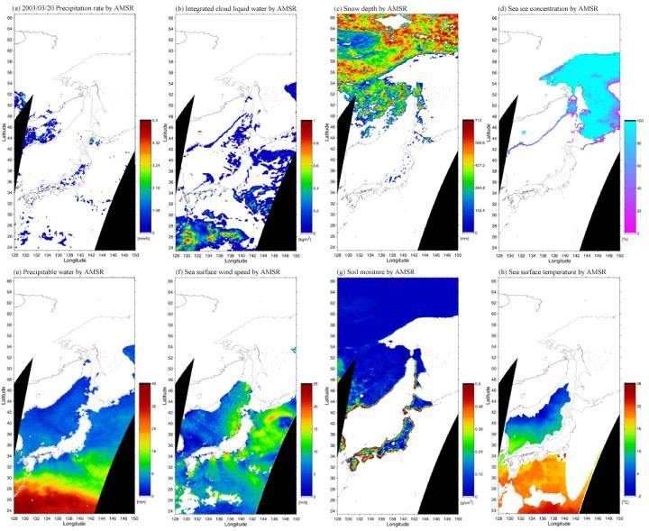
Advanced Microwave Scanning
Radiometer for EOS (AMSR-E)
Mission status
- Continuous observation over 8-years after the
launch on May 4, 2002 onboard NASA’s EOS
Aqua satellite.
- Stable brightness temperature records, except
the loss of 89GHz-A data from November 2004.
Instrument characteristics
- Multi-frequency microwave radiometer, which is
capable of observing various parameters
related to water (developed by JAXA).
- High-spatial resolution compared to existing
instruments by large size antenna.
- C-band (6.9GHz) channels for estimating SST
and soil moisture.
- Afternoon (1:30 pm) equatorial crossing time
that is currently unique for microwave Pre-launch AMSR-E in Tsukuba
radiometers. Space Center
2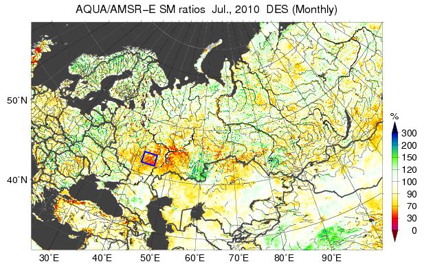
AMSR-E Operation Status
                                End of Nominal Ops.
                                                                            GCOM-W1 Launch
                             89GHz A anomaly                                  (into A-Train)

                                        Torque increase began   Swap ADE A to B
Radiometer sensitivity [K]

                                                                                       Page 3
                                                                                                3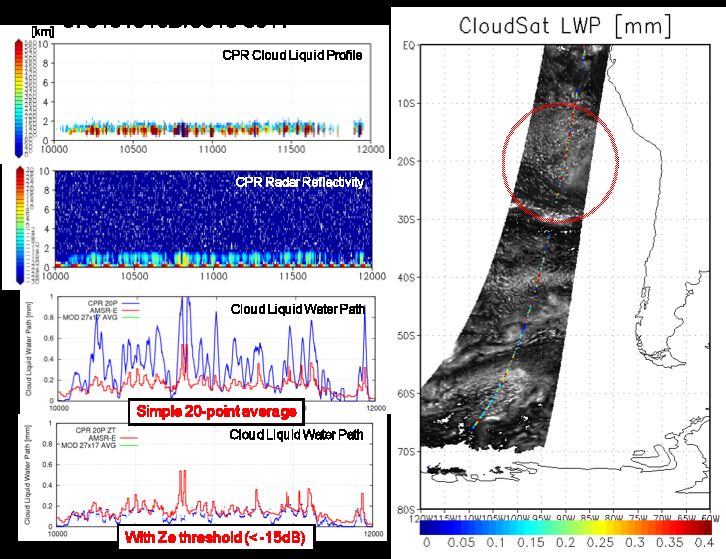
Scanning Geometry
                      Rotating direction

                                                   Along-track
                                                    direction

                            Off Nadir
                             Angle
                            47.5 deg.
  Incidence
                                           (N+2)
    Angle
                                             th
   55 deg.

                                           (N+1)
                                             th

                                           N th                                    89
                                                                              89   A
                                                                              B

        Scanning Geometry                             89GHz Multi-horn Scan

                                                                                        4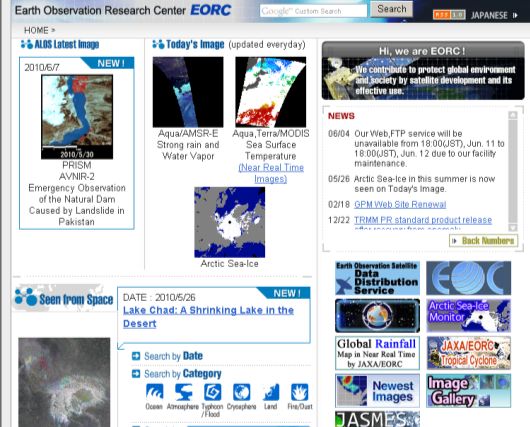
Overlap with CloudSat

                        5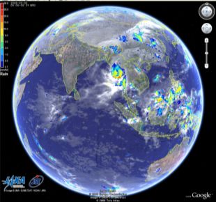
Processing Levels

 Level              Contents
                    • Swath data with geolocation information
 Level-1A           • Scene counts
                    • ½ orbit starting from northern/southern-most latitudes
                    • Swath data with geolocation information
 Level-1B           • Brightness temperatures
                    • ½ orbit starting from northern/southern-most latitudes
                    • Swath data with geolocation information
 Level-2            • Geophysical parameters (8 parameters)
                    • ½ orbit starting from northern/southern-most latitudes
                    • Grid data with 0.25 degrees (or 25km) resolution
                    • Brightness temperatures and geophysical parameters
 Level-3            • Daily and monthly temporal average
                    • Equidistant Cylindrical and Polar Stereo Projection

 • All products are in HDF4 format, which can be accessed and read by using NCSA HDF
   Library. The “AMSR Data Input Toolkit (ADIT)” is also available.
 * Subset and mapped products are available for Level-1B and 2, with approximately 3000 by
  3000km areas with designated center geolocation.                                           6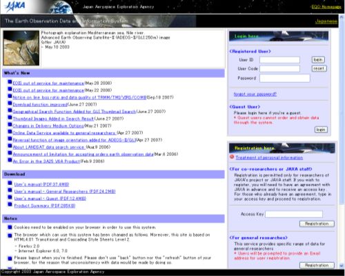
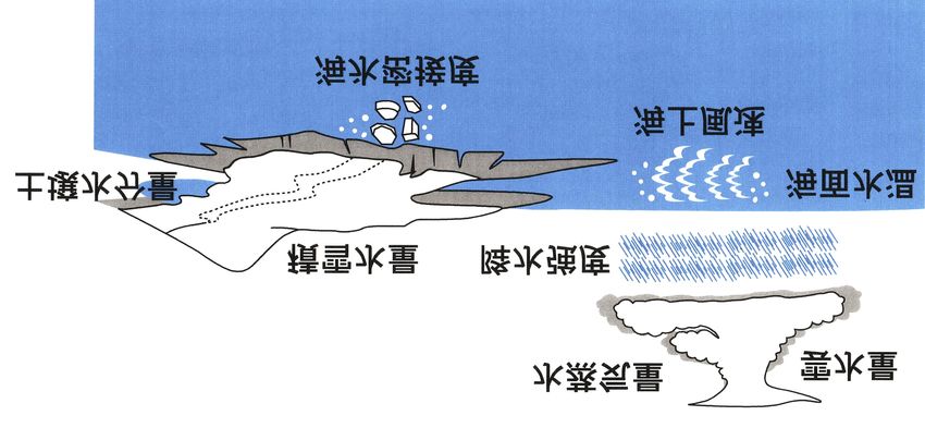
Standard Geophysical Products
                                                           Spatial
                         Products            Area
                                                         resolution                                                          Cloud liquid
                                                                                                         Water vapor
                                                                                                                                water
Brightness
                                         Global           5-50km
temperature

                         Integrated      Over global
                                                           15km
                                                                                       Snow water
                         water vapor     ocean                                         equivalent
                         Integrated
                                         Over global
                         cloud liquid                      15km
                                         ocean
                         water                                        Soil moisture                  Precipitation
 Geophysical parameter

                                         Tropical -
                         Precipitation                     15km
                                         extratropical
                                                                                                                               Sea surface
                         Sea surface     Over global
                                                           50km                                                                temperature
                         temperature     ocean
                         Sea surface     Over global                                                                 Sea surface
                                                           15km
                         wind speed      ocean                                                                       wind speed
                                         High                                         Sea ice concentration
                         Sea ice
                                         latitude          15km
                         concentration
                                         ocean
                         Snow depth      Land area         30km

                         Soil moisture   Land area         50km

                                                                                                                                       7
Level-1B Swath (AMSR)

                                                                    Ocean

                                                        Precipitating Clouds

                                                                    Land

BH   BV   AH   AV   V   V   H   V   H   V   H   V   H     V     H     V
                                                                            8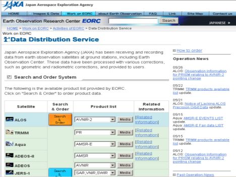
Level-2 Swath (AMSR)

                       9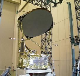
Level-3 Daily Grids

    Sea Surface Temperature         Precipitation

    Sea Surface Wind Speed      Soil Moisture Content

     Total Precipitable Water       Snow Depth          10
Level-3 Monthly Grids
Integrated water vapor Integrated cloud liquid water
Sea surface wind speed Precipitation
11GSMaP
Global rainfall map by merging TRMM, AMSR-E,
and other satellite information.
0.1-degree lat/lon grid, hourly products.
Available 4-hr after observation.
Browse images, 24-hr animation, displaying by
Google Earth.
Binary data are also available via password
protected ftp site.
Based on JST/CREST GSMaP algorithm.
http://sharaku.eorc.jaxa.jp/GSMaP/
12Monitoring Soil Moisture
AMSR-E is continuously observing
the Earth after the launch on May 4,
2002 onboard EOS Aqua satellite.
Wet
Norm
Dry
Serious crop damages have been reported
due to catastrophic drought over western
part of Russia in 2010.
AMSR-E soil moisture is well capturing this
phenomena and indicates that the drought
already began from April-May period.
Black: Nominal trend (2002-2009 average)
Images and data provided by H. Fujii of JAXA/EORC. Red : Trend in 2010 13Monitoring Sea Ice Extent
Arctic Sea Ice Extent: 7,522,500 km2 (October 24, 2010)
Arctic sea ice extent is monitored on a daily basis by AMSR-E
http://www.ijis.iarc.uaf.edu/en/index.htm
CSV data can be downloaded from the web site.
14Microwave and IR SST Combination
C-band (6.9GHz) is indispensable frequency for retrieving SST and soil
moisture. Microwave measurement can provide cloud-through frequent
SST mapping.
Microwave and IR observations complement each other in terms of
spatial resolution and error sources. Importance and needs of Merged
SST from microwave and IR are increasing.
GLI SST on April 10, 2003 AMSR SST on April 10, 2003
SST images around east coast of Japan on April 10, 2003, observed by Image of the New Generation Sea Surface
GLI (left) and AMSR (right). Difference of spatial resolution and cloud Temperature (NGSST) for Open Ocean on
effect are clearly seen in the figures. May 10, 2005. Provided by NGSST
development group led by Professor
Kawamura of Tohoku University. 15Research Product: All-Weather SSW
AMSR-E 6.925 and 10.65 GHz
data can be used to retrieve
sea surface wind speed inside
Area of 15m/s winds or more
tropical cyclones.
The all-weather sea surface
Area of 25m/s winds or more
wind speed product will find
wide application to
meteorological services.
Typhoon track
AMSR-E all-weather ocean wind speed product (color shading)
and the best-track data (circles, linear interpolation of the 12 and
18 UTC best-track data to 17 UTC) of Typhoon SHANSHAN at 17
UTC on 13 September 2006. The best-track data was determined
without any AMSR-E data. (Courtesy of Shuji Nishimura.)
16Products and Services
Standard Product
- http://www.eorc.jaxa.jp/about/distribution/index.html
All products, except ALOS and GOSAT, can be used by registration.
Research Product (not limited to below), Browse Images
- AMSR-E
http://sharaku.eorc.jaxa.jp/AMSR/index.html
http://sharaku.eorc.jaxa.jp/cgi-bin/amsr/pmips/quicklooks.cgi (testing)
- GSMaP
http://sharaku.eorc.jaxa.jp/GSMaP/index_j.htm
- IARC-JAXA Information System
http://www.ijis.iarc.uaf.edu/en/index.htm
Tools
- Earth Observation Data Viewer and ADIT
http://sharaku.eorc.jaxa.jp/AMSR/tool/index.html
17How to get JAXA’s EO data
EORC Homepage: http://www.eorc.jaxa.jp/
Data Distribution
Service
[Standard Product]
Research Project
Sites
[Research Product]
18Top page of Data Distribution Service
EOC/EOIS:
Earth Observation Information System
EOIS All users can download
JAXA’s Earth
(Earth Observation Observation data (except
Interface System) for ALOS and GOSAT)
after user resistration.
There is a category of users. 19Thank you for your attention.
20You can also read