Appendix 8: Soils Report - NET
←
→
Page content transcription
If your browser does not render page correctly, please read the page content below
Appendix 8: Soils Report
Prepared for
Arrow Energy Pty Ltd
ABN: 73078521936

Wells and Gathering
Construction
Phase 1 Desktop Soil Assessment

07-Sep-2021
Commercial-in-Confidence

L:\Secure\Projects\606X\60651803\500_Deliverables\504_Deliverable_Warrakirri\Final Report\60651803_Warakirri Wells and Gathering_Soil
Assessment_Final_to issue.docx
Revision 0 – 07-Sep-2021
Prepared for – Arrow Energy Pty Ltd – ABN: 73078521936
AECOM                                                  Wells and Gathering Construction
                                                       Commercial-in-Confidence

Wells and Gathering Construction
Phase 1 Desktop Soil Assessment

Client: Arrow Energy Pty Ltd
          ABN: 73078521936

Prepared by
AECOM Australia Pty Ltd
Level 8, 540 Wickham Street, PO Box 1307, Fortitude Valley QLD 4006, Australia
T +61 7 3056 4800 www.aecom.com
ABN 20 093 846 925

07-Sep-2021

Job No.: 60651803

AECOM in Australia and New Zealand is certified to ISO9001, ISO14001 AS/NZS4801 and OHSAS18001.

© AECOM Australia Pty Ltd (AECOM). All rights reserved.

AECOM has prepared this document for the sole use of the Client and for a specific purpose, each as expressly stated in the document. No other
party should rely on this document without the prior written consent of AECOM. AECOM undertakes no duty, nor accepts any responsibility, to any
third party who may rely upon or use this document. This document has been prepared based on the Client’s description of its requirements and
AECOM’s experience, having regard to assumptions that AECOM can reasonably be expected to make in accordance with sound professional
principles. AECOM may also have relied upon information provided by the Client and other third parties to prepare this document, some of which
may not have been verified. Subject to the above conditions, this document may be transmitted, reproduced or disseminated only in its entirety.

L:\Secure\Projects\606X\60651803\500_Deliverables\504_Deliverable_Warrakirri\Final Report\60651803_Warakirri Wells and Gathering_Soil
Assessment_Final_to issue.docx
Revision 0 – 07-Sep-2021
Prepared for – Arrow Energy Pty Ltd – ABN: 73078521936
AECOM                                                Wells and Gathering Construction
                                                     Commercial-in-Confidence

Quality Information
Document             Wells and Gathering Construction

Ref                  60651803

Date                 07-Sep-2021

Prepared by          Max Setchfield

Reviewed by          Navjot Kaur/Simon Muniandy

Revision History

                                                                                                    Authorised
 Rev          Revision Date          Details
                                                                              Name/Position                  Signature

 A            29-Jul-2021            Draft for client review                  Navjot Kaur
                                                                              Technical Lead -
                                                                              Acid Sulfate Soils
 0            07-Sep-2021            Final                                    Navjot Kaur
                                                                              Technical Lead -
                                                                              Acid Sulfate Soils

L:\Secure\Projects\606X\60651803\500_Deliverables\504_Deliverable_Warrakirri\Final Report\60651803_Warakirri Wells and Gathering_Soil
Assessment_Final_to issue.docx
Revision 0 – 07-Sep-2021
Prepared for – Arrow Energy Pty Ltd – ABN: 73078521936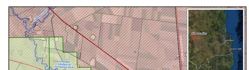
AECOM                                                Wells and Gathering Construction
                                                     Commercial-in-Confidence

Table of Contents
1.0         Introduction                                                                                                                 5
            1.1       Site Description                                                                                                   5
            1.2       Proposed Disturbance                                                                                               5
                      1.2.1      Well Pads                                                                                               5
                      1.2.2      Gathering and Pipelines                                                                                 6
2.0         Objective                                                                                                                    9
3.0         Scope of Works                                                                                                               9
4.0         Methodology                                                                                                                  9
            4.1       Relevant legislation and guidelines                                                                                9
            4.2       Desktop review                                                                                                    10
                      4.2.1      Publicly available data                                                                                10
                      4.2.2      Arrow provided data                                                                                    10
            4.3       Suitably Qualified Person                                                                                         10
5.0         Desktop Review                                                                                                              11
            5.1       Topography and geomorphology                                                                                      11
                      5.1.1      Regional physiography                                                                                  11
                      5.1.2      Topography                                                                                             11
            5.2       Surface geology                                                                                                   11
            5.3       Atlas Soil Landscape Units                                                                                        15
            5.4       Land Resource Area: Central Darling Downs                                                                         17
                      5.4.1      Recent alluvial plains (1a)                                                                            17
                      5.4.2      Brigalow plains (5a/5b)                                                                                17
                      5.4.3      Summary                                                                                                19
6.0         Disturbance Management                                                                                                      20
            6.1       Topsoil suitability and management                                                                                20
            6.2       Soil stripping and stockpiling/storage                                                                            20
            6.3       Returning topsoil/spoil to the trench                                                                             20
                      6.3.1      Compaction Strategies                                                                                  21
            6.4       Reinstatement and erosion controls                                                                                21
            6.5       Construction inspection and maintenance regimes                                                                   21
7.0         Conclusions                                                                                                                 23
8.0         Recommendations                                                                                                             23
9.0         References                                                                                                                  24
10.0        Limitations                                                                                                                 25
Appendix A
        Curriculum Vitae                                                                                                                A

List of Tables
Table 1                  Project disturbance area                                                                                        5
Table 2                  Soil landscapes which intersect the Project                                                                    15
Table 3                  Identified LRAs in the Central Darling Downs (Harris et al., 1999)                                             18
Table 4                  Summary of the Project soil units and LRA                                                                      19
Table 5                  Guide to estimated stripping depths                                                                            20
Table 6                  Typical Erodibility Ratings                                                                                    21

List of Figures
Figure 1                 Project Site Location                                                                                           8
Figure 2                 Regional Physiography- Central Lowlands Province                                                               12
Figure 3                 Slope Class and Slope Range (%)                                                                                13
Figure 4                 Surface Geology                                                                                                14
Figure 5                 Soil Landscape Units                                                                                           16

L:\Secure\Projects\606X\60651803\500_Deliverables\504_Deliverable_Warrakirri\Final Report\60651803_Warakirri Wells and Gathering_Soil
Assessment_Final_to issue.docx
Revision 0 – 07-Sep-2021
Prepared for – Arrow Energy Pty Ltd – ABN: 73078521936
AECOM Wells and Gathering Construction 5
Commercial-in-Confidence
1.0 Introduction
AECOM Australia Pty Ltd (AECOM) was appointed by Arrow Energy Pty Ltd (Arrow) to undertake a
desktop soil assessment for the proposed development of new wells and gathering (herein referred to
as the ‘Project’), to support Arrow’s Regional Interests Development Approval (RIDA) application under
the Regional Planning Interests Act 2014 (RPI Act).
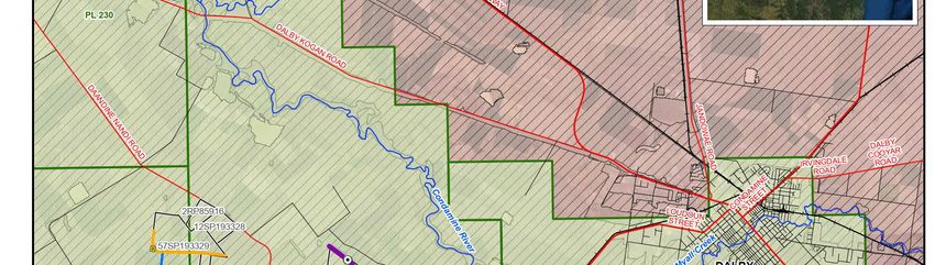
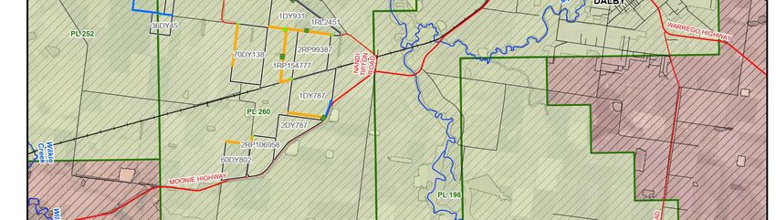
The proposed Project is located approximately 15 km south-west of Dalby along the Moonie Highway,
shown in Figure 1.
1.1 Site Description
The impacted land parcels and approximate disturbance areas are summarised in Table 1:
Table 1 Project disturbance area
Petroleum Tenure (PL) Land parcel Parcel size (Ha) Disturbance area (Ha)
PL 252/ PL 260 Lot 57 of SP193329 294.9 11.3
Lot 36 of DY45 89.0 0.51
PL 260 Lot 1 of RL2451 12.6 0.12
Lot 1 of DY931 241 11.78
Lot 70 of DY138 254.9 4.8
Lot 1 of RP154777 245.7 8.65
Lot 1 of DY787 266.4 6.2
Lot 60 of DY802 129.2 2.8
Lot 2 of RP106958 127.8 1.1
Total 1661.5 47.26
1.2 Proposed Disturbance
The two main components of the Project are construction of well pads and associated gathering
pipeline and other infrastructure. A generalised disturbance overview of these components is given
below.
1.2.1 Well Pads
In general, the sizes of the well pads can be managed so that the maximum level of overall disturbance
is consistent with the existing EA intensity of impact (1 ha per well for a single well pad to 0.3 ha per
well for up to eight well pad).
The size of well pads is determined by several factors, including
the number of wells,
the type of wells,
the type and manoeuvrability of drill rigs,
the terrain which determines whether cut and fill earthworks are required,
whether the area is cleared or supports vegetation,
the existing land use,
the equipment stored temporarily on the pad,
the area required for offices, light vehicle parking, equipment and supplies deliveries and
L:\Secure\Projects\606X\60651803\500_Deliverables\504_Deliverable_Warrakirri\Final Report\60651803_Warakirri Wells and Gathering_Soil
Assessment_Final_to issue.docx
Revision 0 – 07-Sep-2021
Prepared for – Arrow Energy Pty Ltd – ABN: 73078521936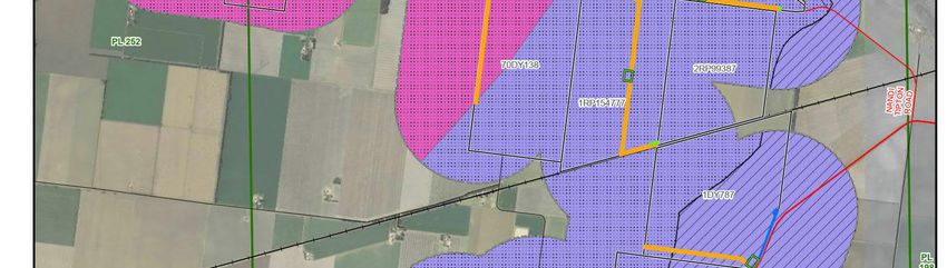
AECOM Wells and Gathering Construction 6
Commercial-in-Confidence
the required separation distance between wells and the area required to complete drilling
operations safely.
In some cases, additional area is required for areas with higher slope, heavy vegetation and/or to
provide sufficient room for cut and fill earthworks batters, diversion drainage and additional erosion and
sediment controls. As such, including the additional area (if needed), the total disturbance area varies
between 1 ha for single well pads, 1.15 ha (2-well pad), 1.3 ha (3-well pad and 1.45 ha for 4-well multi-
well pad.
Well locations will be determined following consultation with the landholder to manange impacts to their
operations and lifestyle. . As such, well sites are located in areas that reduce impact on farming where
possible, such as:
on the fringes of Intensively Farmed Land (IFL)
in corners of paddocks
or areas of land unsuitable for farming
on or near access tracks, easements and road reserves
Right of ways
The key steps in the well pad construction are given below:
Clearing of the area (if not already cleared by agricultural activities), including stripping and
stockpiling of topsoil. For minimal disturbance well pads the topsoil will be left in place.
Laying and levelling the well pad foundations to provide a stable platform for the drilling rig.
Carrying out site preparation works using earthmoving equipment such as graders, excavators and
bulldozers. Where the subgrade material is deemed to be inadequate and unsuitable for heavy
vehicle access or where all weather access is required, consideration shall be given to:
- Amendment of soil (using additives and / or dynamic compaction); or
- Use of technologies (rig mats, tracked vehicles, roll-out sheets, etc.); or
- Clear, grub and remove unsuitable material and replace with more suitable material such as
gravel.
For this Project, a total of five well pads are being proposed including one minimal disturbance well pad.
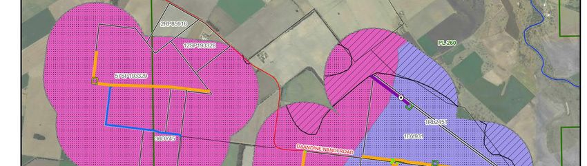
1.2.2 Gathering and Pipelines
The main disturbance area will be a common easement, containing water/gas pipelines and fibre
optic/power cables within an approximately 30 m wide right of way (ROW) for gathering on these
properties. (Plate 1).
Conventional trenching for pipeline installation involves an open trench between 1-2 m wide and
approximately 2.0 m deep to install, inspect or maintain piping, conduits or cables. After installation, the
trench is backfilled with the original material and the surface is restored.
Where the pipelines are required to be installed below existing roads or infrastructure, other trenchless
technologies such as thrustbore may be used.
The key steps in the pipeline construction are given below:
Detailed survey of the ROW and construction areas.
Establishing temporary access tracks if necessary.
Installing temporary gates and fences as required.
Clearing vegetation, where required, and grading the ROW to prepare a safe construction working
area (on average the ROW will be 30 m in width).
Separating and stockpiling topsoil and subsoil to protect and preserve topsoil.
L:\Secure\Projects\606X\60651803\500_Deliverables\504_Deliverable_Warrakirri\Final Report\60651803_Warakirri Wells and Gathering_Soil
Assessment_Final_to issue.docx
Revision 0 – 07-Sep-2021
Prepared for – Arrow Energy Pty Ltd – ABN: 73078521936
AECOM Wells and Gathering Construction 7
Commercial-in-Confidence
Crossing watercourses, roads and existing buried pipelines by open cut, boring or alternate
trenchless technology (e.g. Horizontal Directional Drilling [HDD] methods) depending upon the type
and nature of the crossing.
Delivering pipe sections along the ROW.
Welding the low-pressure high-density polyethylene (HDPE) pipe sections together to form ‘a
string’.
Creating a trench in which to lay the pipeline. The trench is excavated by a trenching machine and
may include the use of rock saws, excavators, rock hammers or blasting in hard rock terrain.
Lowering the pipeline strings into the trench and placing padding (e.g. screened trench subsoil)
around the pipe to protect the pipe from external damage.
Returning the subsoil and topsoil to their original horizons.
Testing the integrity of the pipeline by pneumatic testing or filling it with water and pressurising it to
above the maximum allowable operating pressure (i.e. hydrostatic pressure testing).
Cleaning up, restoring and progressively rehabilitating the construction ROW and all temporary and
permanent tracks, gates and fences.
Installation of multiple pipelines in a single ROW is sequential. The first pipeline is installed, and the
trench backfilled before the next pipeline installation commences.
Plate 1 Typical Pipeline ROW Layout
L:\Secure\Projects\606X\60651803\500_Deliverables\504_Deliverable_Warrakirri\Final Report\60651803_Warakirri Wells and Gathering_Soil
Assessment_Final_to issue.docx
Revision 0 – 07-Sep-2021
Prepared for – Arrow Energy Pty Ltd – ABN: 73078521936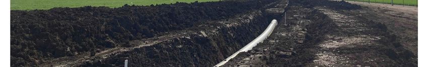
AECOM                                                Wells and Gathering Construction                                                   8
                                                     Commercial-in-Confidence

Figure 1    Project Site Location

L:\Secure\Projects\606X\60651803\500_Deliverables\504_Deliverable_Warrakirri\Final Report\60651803_Warakirri Wells and Gathering_Soil
Assessment_Final_to issue.docx
Revision 0 – 07-Sep-2021
Prepared for – Arrow Energy Pty Ltd – ABN: 73078521936
AECOM Wells and Gathering Construction 9
Commercial-in-Confidence
2.0 Objective
The key objectives of the desktop soil assessment for the Project were to:
Assess various soil types within the Project.
Assess key issues including soil degradation, loss of productivity and subsidence related to the
identified soil types.
Provide strategies to manage these identified soil issues during construction.
3.0 Scope of Works
The scope of works for undertaking the desktop soil assessment includes:
Desktop review encompassing:
- Review of available mapping and publications sourced from the Queensland Government
Open Data Portal and Queensland Spatial Catalogue.
- Review of available data provided by Arrow relevant to the Project.
Preparation of this desktop soil assessment report, including recommendations for each soil type
including soil stripping, stockpile storage, returning topsoil and subsoil to trench, addition of
ameliorants and/or fertilizers (if needed), compaction strategies, erosion controls, post-construction
inspection and maintenance regimes.
4.0 Methodology
The methodology for the desktop soil assessment is summarised below:
4.1 Relevant legislation and guidelines
The key legislation applicable to the works undertaken as part of this desktop soil assessment is the
RPI Act, administered by the Department of Infrastructure, Local Government and Planning (DILGP).
The Act restricts the carrying out of resource of regulated activities where the activity is not exempt from
the provisions of the RPI Act, or a RIDA has not been granted.
The Act identifies four Areas of Regional Interest (ARIs), including: a priority agricultural area (PAA); a
priority living area (PLA); the strategic cropping area (SCA); and a strategic environmental area (SEA).
The alignment (the resource activity) intersects PPA and SCA.
PAA: an area which includes one or more areas used for a priority agricultural land uses (PALU),
identified in the relevant regional plan. PALUs may include certain types of agriculture, plantations,
and/or intensive horticulture. In the case of the alignment, the PALUs are identified in the Darling
Downs Regional Plan.
SCA: defined as an area mapped as potential Strategic Cropping Land (SCL) on the Department of
Natural Resources, Mines and Energy (DNRME) trigger map. The SCL is likely to be highly
suitable for cropping due to a combination of the soil, climate, and landscape features.
This desktop soil assessment has been prepared in accordance with Australian legislations, Standards
and Guidelines and Arrow’s Standard Operating Procedures (SOP) for Surat Basin including:
RPI Act, Statutory Guideline 02/14, Carrying out resource activities in a Priority Agricultural Area,
State of Queensland, Department of State Development, Manufacturing, Infrastructure and
Planning, August 2019
RPI Act, Statutory Guideline 03/14 Carrying out resource activities in a Strategic Cropping Area,
State of Queensland, Department of State Development, Manufacturing, Infrastructure and
Planning, August 2019
Environmental Authority EA0002659 Non-Scheduled Petroleum Activity Petroleum Pipeline
Licence -PPL2052, dated 5 February 2021
L:\Secure\Projects\606X\60651803\500_Deliverables\504_Deliverable_Warrakirri\Final Report\60651803_Warakirri Wells and Gathering_Soil
Assessment_Final_to issue.docx
Revision 0 – 07-Sep-2021
Prepared for – Arrow Energy Pty Ltd – ABN: 73078521936AECOM Wells and Gathering Construction 10
Commercial-in-Confidence
Environmental Authority EPPG00972513, dated 14 January 2021
Guidelines for Soil Survey along Linear Features, Soil Science Australia, 2015
Arrow Land Disturbance Procedures (ORG-ARW-HSM-PRO-00146)
4.2 Desktop review
The purpose of the desktop review was to obtain background information within the Project on potential
soil types and landscapes, information on the underlying geology and topography and understand
potential PAA and SCA limitations.
The Project area presented in the desktop mapping and interpretations is represented by a 1 km buffer
applied to the proposed drill pads and gathering network (ROW, crossing and pipeline).
4.2.1 Publicly available data
The desktop review involved a search of publicly available soil data, sourced from the Queensland
Government Open Data Portal and Queensland Spatial Catalogue, including:
Priority Agricultural Area mapping (Department of State Development, Manufacturing,
Infrastructure and Planning (DSDMIP), 2013).
Strategic Cropping Land trigger map (Department of Natural Resources and Mines (DNRME),
2020).
Central Darling Downs Land Management Manual (Harris et al., 1999).
Australian Soil Resource Information System (ASRIS) Atlas of Australian Soils (Northcote et al.,
1960-1968).
This information was used to develop a map of soils and physical limitations for the Project.
4.2.2 Arrow provided data
Arrow provided the following data to assist in validating the potential soil types and landscapes likely to
occur within the Project area, including:
Disturbance areas of the drill pads, ROW, pipeline and crossing.
Standard pipeline construction, rehabilitation requirements and procedures.
Relevant Environmental Authorities (EA).
4.3 Suitably Qualified Person
AECOM confirms that the desktop review and interpretation of available data, has been undertaken
directly or under the supervision of a suitably qualified person (SQP). Copies of curriculum vitae have
been provided in Appendix A.
L:\Secure\Projects\606X\60651803\500_Deliverables\504_Deliverable_Warrakirri\Final Report\60651803_Warakirri Wells and Gathering_Soil
Assessment_Final_to issue.docx
Revision 0 – 07-Sep-2021
Prepared for – Arrow Energy Pty Ltd – ABN: 73078521936AECOM Wells and Gathering Construction 11
Commercial-in-Confidence
5.0 Desktop Review
5.1 Topography and geomorphology
5.1.1 Regional physiography
The Project area is located wholly within the Condamine Central Lowlands physiographic region
(Figure 2). The region is described as a low-lying area of undulating siltstone hills with alluvial
sediments on the floodplains of the Condamine River and highly weather bedrock on the slopes
(CSIRO, 2011).
5.1.2 Topography
Regionally, there is a north-south topographic high of the Taroom Hills and an east-west topographic
high of the Great Dividing Range. Two major drainage systems separate these topographic highs: the
Condamine River and Wilkie Creek, both draining towards the north-west (Figure 1).
The surface elevation across the Project area is relatively flat at 330 m Australian Height Datum
(mAHD), which is consistent with the area being located on the Condamine Lowlands and floodplains of
the Condamine River (Figure 2) (State of Queensland, 2021).
The digital elevation model (DEM) for the Project area is presented in Figure 31, and was used to
calculate the slope of the surrounding landscape. Based on the calculations, the slope within majority of
the Project area range from near level (AECOM Wells and Gathering Construction 12
Commercial-in-Confidence
Figure 2 Regional Physiography- Central Lowlands Province
L:\Secure\Projects\606X\60651803\500_Deliverables\504_Deliverable_Warrakirri\Final Report\60651803_Warakirri Wells and Gathering_Soil
Assessment_Final_to issue.docx
Revision 0 – 07-Sep-2021
Prepared for – Arrow Energy Pty Ltd – ABN: 73078521936AECOM Wells and Gathering Construction 13
Commercial-in-Confidence
Figure 3 Slope Class and Slope Range (%)
L:\Secure\Projects\606X\60651803\500_Deliverables\504_Deliverable_Warrakirri\Final Report\60651803_Warakirri Wells and Gathering_Soil
Assessment_Final_to issue.docx
Revision 0 – 07-Sep-2021
Prepared for – Arrow Energy Pty Ltd – ABN: 73078521936AECOM Wells and Gathering Construction 14
Commercial-in-Confidence
Figure 4 Surface Geology
L:\Secure\Projects\606X\60651803\500_Deliverables\504_Deliverable_Warrakirri\Final Report\60651803_Warakirri Wells and Gathering_Soil
Assessment_Final_to issue.docx
Revision 0 – 07-Sep-2021
Prepared for – Arrow Energy Pty Ltd – ABN: 73078521936AECOM Wells and Gathering Construction 15
Commercial-in-Confidence
5.3 Atlas Soil Landscape Units
The relevant soil landscape units have been sourced from the ASRIS Atlas of Australia Soil (Northcote
et al., 1960-1968) (herein referred to as ‘the Atlas’), which was compiled by the Commonwealth
Scientific and Industrial Research Organisation (CSIRO) to provide a nationally consistent description of
Australian soils. Mapped units are published at a scale of 1:2,000,000, but the original 10 map
compilation were at scales from 1:250,000 to 1:500,000. This scale mapping is commonly used for
desktop studies.
The soil landscape units identified in the Atlas provide a description of the physical environmental,
displaying the occurrence and distribution of geological regimes, landscape units and associated soil
types. Soil landscape units are reoccurring soil mapping units with shared geology, landform, soil and
vegetation associations. More than one soil type can occur within a landscape unit, represented with a
dominate and several subdominant types.
The Atlas indicates two soil landscape units within 1 km of the proposed drill pads and gathering
network, which are summarised in Table 2, and presented graphically in Figure 5.
The dominant soil type of each landscape unit is presented alongside the corresponding Australian Soil
Classicisation (ASC) soil order and Principle Profile Form (PPF), to aid in the interpretation of soil types
encountered along the alignment and is based on Ashton & Mackenzie (2001).
Table 2 Soil landscapes which intersect the Project
Soil landscape Landform Dominant
Dominant soil type1 Dominant ASC Group3
units description PPF2
CC24 Plain Dominant soils are Ug5.24, Vertosol
grey cracking clays Ug5.28,
with some dark Ug5.16
cracking clays
Kf3 Plain with very low Dominant soils are Ug5.16 Vertosol
sandy rises and dark cracking clays
banks separated by
flats and depressions
Notes:
1. ASRIS Atlas of Australian Soils (Northcote et al., 1960-1968)
2. Principal Profile Form (Northcote, 1974)
3. Dominant Australian Soil Classification (Isbell, 2002)
L:\Secure\Projects\606X\60651803\500_Deliverables\504_Deliverable_Warrakirri\Final Report\60651803_Warakirri Wells and Gathering_Soil
Assessment_Final_to issue.docx
Revision 0 – 07-Sep-2021
Prepared for – Arrow Energy Pty Ltd – ABN: 73078521936AECOM Wells and Gathering Construction 16
Commercial-in-Confidence
Figure 5 Soil Landscape Units
L:\Secure\Projects\606X\60651803\500_Deliverables\504_Deliverable_Warrakirri\Final Report\60651803_Warakirri Wells and Gathering_Soil
Assessment_Final_to issue.docx
Revision 0 – 07-Sep-2021
Prepared for – Arrow Energy Pty Ltd – ABN: 73078521936AECOM Wells and Gathering Construction 17
Commercial-in-Confidence
5.4 Land Resource Area: Central Darling Downs
Due to the broad scale of the Atlas (1:2,000,000), a review of the Land Resource Areas (LRA) mapping
was used to further assess the soil types within the Project. LRA identified to intersect the Project are
presented in Table 3.
LRAs have been determined from the Central Darling Downs Land Management Manual (Harris et al.,
1999), and are based on the combination of geology, landscape features (slope/relief), vegetation and
groups of soils. LRA maps are not designed to strictly identify soils in a particular map unit but predict
their probable occurrence.
Land suitability indicates the identified LRAs have agricultural potential as cropping land (broadacre and
horticulture) and pasture (sown and native pastures).
Typical soil characteristics show a good correlation with the soil landscape units mapped in the Atlas
(Northcote et al., 1960-1968), with the Project likely to mainly encounter cracking clay soils.
The typical soil types likely to be encountered in each LRA, along with generic soil properties, are
detailed in the following subsections.
5.4.1 Recent alluvial plains (1a)
Common soils within this LRA are deep to very deep (0.8 to 1.8 m) coarse, self-mulching cracking clays
on recent alluvial plains on mixed basalt/sandstone alluvium. Soil are distributed along the active
floodplain of the Condamine River and tributaries, including river terraces, streambanks, old river
channels and plains.
Generic soil features include a medium to heavy clay, self-mulching surface soils, which are moderate
to coarse and granular. The surface soil is often non-sodic and can sometimes be lightly crusted. The
subsoil is commonly sodic to strongly sodic with medium to very high salinity. The profiles have an
alkaline trend, consistent with depth.
The land is suitable for dryland/irrigated cropping and grazing of native pastures, depending on the risk
presented by inundation and erosion.
Native vegetation has mostly been cleared but contains fringing woodland to open forests of river gum,
Queensland blue gum and some acacia species.
5.4.2 Brigalow plains (5a/5b)
Typical soils associated with this LRA are deep to very deep (1.0-1.6 m), self-mulching grey cracking
clays with shallow gilgai on the brigalow claysheet. Soils are located on flat to very gently sloping
undulating brigalow clay plains north of Warra and around Kupunn, west of Dalby.
Generic soil features include an angular blocky surface structure, which is strongly alkaline. The subsoil
is often a structured clay, with mild alkalinity in the upper subsoils, tending to strongly acidic deeper in
the profile. The subsoil is both strongly sodic and saline.
The land is suitable for continual grain and cotton cropping, only limited by strongly sodic and saline
subsoils. The soils are susceptible to erosive flooding.
Native vegetation has mostly been cleared but contains brigalow, belah, wilgas scrub and black tea tree
in low lying areas.
L:\Secure\Projects\606X\60651803\500_Deliverables\504_Deliverable_Warrakirri\Final Report\60651803_Warakirri Wells and Gathering_Soil
Assessment_Final_to issue.docx
Revision 0 – 07-Sep-2021
Prepared for – Arrow Energy Pty Ltd – ABN: 73078521936AECOM Wells and Gathering Construction 18
Commercial-in-Confidence
Table 3 Identified LRAs in the Central Darling Downs (Harris et al., 1999)
Landform Estimated Agricultural land Typical Generic physical and chemical soil properties
LRA Major soils
description ASC classification vegetation Soil (m) pH Dispersion1 Sodicity2 Salinity3
Recent Board level Black and grey Vertosol A1 – crop land: Poplar box or Surface soil: 8.7 Low Non-sodic Very low
alluvial plains of cracking clays broadacre and Queensland 0-0.15
plains (1a): mixed basaltic with bleached horticulture blue gum open Upper 9.1 Medium Sodic Medium
Condamine and sands or loams woodlands, or subsoil:
sandstone over brown or grasslands 0.15-0.6
alluvium black clays
Lower 8.1 Medium Strongly High to
subsoil: sodic Very high
0.6-1.4
Brigalow Flat plains, Grey self- Vertosol A1 – crop land: Brigalow, belah Surface soil: 8.5 Low Non-sodic Low
plains with gently mulching broadacre and forest with wilga 0-0.05
(5a/5b): undulating cracking clays horticulture with some black Upper 9.0 Low to Sodic Low
Kupunn clays plains tea tree subsoil: medium
with shallow 0.05-1.2
to deep gilgai
Lower 4.3 High Strongly High
subsoil: sodic
1.2-1.5
Notes:
1. Clay dispersion is measured as a dispersion ratio (Baker and Eldershaw, 1993)
2. Sodicity calculated as the percentage of exchangeable sodium (ESP) (Baker and Eldershaw, 1993)
3. Salinity estimated from the measurement of the electrical conductivity in a 1:5 suspension of soil to water (Shaw, 1988)
L:\Secure\Projects\606X\60651803\500_Deliverables\504_Deliverable_Warrakirri\Final Report\60651803_Warakirri Wells and Gathering_Soil Assessment_Final_to issue.docx
Revision 0 – 07-Sep-2021
Prepared for – Arrow Energy Pty Ltd – ABN: 73078521936AECOM Wells and Gathering Construction 19
Commercial-in-Confidence
5.4.3 Summary
Based on available chemical and physical data from the Central Darling Downs Land Management
Manual (Harris et al., 1999) (Table 3), soils within the Project are expected to have an alkaline upper
subsoil (pH 8.0 to 9.0). The soils are also expected to be sodic or strongly sodic and have medium to
very high levels of salinity in the subsoil. Levels of sodicity and salinity are generally expected to be
lower in surface soils, increasing with depths in the soil profile.
A summary of identified LRA within the Central Darling Downs Land Management Manual (Harris et al.,
1999), cross-referenced with the Atlas soil landscape units and associated ASC soil classification is
presented in Table 4.
Based on the available Atlas and LRA mapping, the soils within the Project are expected to be is
dominated by self-mulching cracking clays, such as Vertosols.
Table 4 Summary of the Project soil units and LRA
Approximate
Soil landscape Dominant % of total
LRA Land parcels disturbance
units (ASRIS) ASC Project area
area (ha)
Recent alluvial CC24 Vertosol Lot 1 of DY787 4.1 8.7%
plains (1a)
Kf3 Vertosol - 0 0%
Brigalow plains CC24 Vertosol Lot 1 of DY787 25.4 37.5%
(5a/5b) Lot 1 of RL2451
Lot 1 of DY931
Lot 1 of RP154777
Lot 2 of RP106958
Lot 60 of DY802
Lot 70 of DY138
Kf3 Vertosol Lot 57 of SP193329 17.7 53.8%
Lot 36 of DY45
Lot 1 of DY931
L:\Secure\Projects\606X\60651803\500_Deliverables\504_Deliverable_Warrakirri\Final Report\60651803_Warakirri Wells and Gathering_Soil
Assessment_Final_to issue.docx
Revision 0 – 07-Sep-2021
Prepared for – Arrow Energy Pty Ltd – ABN: 73078521936AECOM Wells and Gathering Construction 20
Commercial-in-Confidence
6.0 Disturbance Management
The major limiting factors for the soils encountered within the Project area are soil structure and texture,
along with subsoil salinity and sodicity issues. The proposed management options for these issues are
presented in the following subsections.
6.1 Topsoil suitability and management
The generic soil properties in the Central Darling Downs Land Management Manual (Harris et al.,1999),
were reviewed against the criteria set out in the Selection of Topdressing Material for Rehabilitation of
Disturbed Areas in the Hunter Valley (Elliott and Veness, 1981) to determine the suitability of available
soil material for reuse as topsoil, as detailed in Table 5. The depth of primary growth media was
estimated using the reported plant available water capacity. These estimates should be reviewed
following a detailed pre-characterisation assessment of soils within the Project area to assist in
identifying rooting depth and nutrient deficiencies.
Table 5 Guide to estimated stripping depths
Estimated primary
LRA Limiting factors
growth media (m)
Recent Alluvial Plains 0.15-0.2 Soils have a narrow moisture range for effective
(1a) workability, which can be improved by adding a sandier
textured material.
Brigalow Plains (5a/5b) 0.2-0.25 Gypsum can be incorporated into the subsoil material to
limit dispersion and erosion.
6.2 Soil stripping and stockpiling/storage
The Project area largely crosses existing agricultural land, with some isolated clusters of timbered areas
along the lot/plan boundaries. Where clearing is required, timber should be cleared and retained for
chipping or habitat recreation. Chipping can provide a useful soil amendment and limit weed growth.
Suitable topsoil should be stripped for the width of the pipeline trench and access track plus (nominally)
1 m each side of the trench. The estimated primary growth media depths provided in Table 5 can be
used as a guide.
Topsoil and subsoil (which may have dispersive or sodic subsoil horizons) should be stockpiled
separately to avoid mixing. Topsoil management should be undertaken in line with the requirements
listed in Arrow’s Land Disturbance Procedure (ORG-ARW-HSM-PRO-000146).
Stockpiles are not recommended to exceed 3 m in height, to manage degradation through physical,
biological and chemical processes. Based on the typical ROW construction, stockpiling is expected to
be undertaken in section along the length of the trench to maintain access/egress. The stockpile should
not be compacted to reduce surface runoff and facilitate infiltration.
Stockpiles should be in place for the minimum duration practicable to safely install the infrastructure,
which is understood to be typically less than three months. Where practicable work should be staged to
not extend over a wet season. In situations where this is unavoidable, quick vegetation such as pasture
species and mulches can be used to reduce surface erosion.
Consideration should be made for drainage flow direction and diversions in place to prevent stockpile
erosion. Appropriate erosion and sediment control measures should be documented prior to works
commencing.
6.3 Returning topsoil/spoil to the trench
Excavated soils should be returned to the trench in the pre-disturbance soil profile. Topsoil that has
been stripped can be re-spread as part of stabilisation and rehabilitation activities.
Sodic soils are expected to be encountered along the alignment and should be blended with
appropriate soil ameliorants (gypsum and organic matter) during the rehabilitation process to reduce the
L:\Secure\Projects\606X\60651803\500_Deliverables\504_Deliverable_Warrakirri\Final Report\60651803_Warakirri Wells and Gathering_Soil
Assessment_Final_to issue.docx
Revision 0 – 07-Sep-2021
Prepared for – Arrow Energy Pty Ltd – ABN: 73078521936AECOM Wells and Gathering Construction 21
Commercial-in-Confidence
potential for soil dispersion. Sampling and analysis of soil prior to reuse is recommended to assist in
identifying nutrient deficiencies and ameliorant requirements. The use of such ameliorants should also
be discussed with landholders prior to application.
The disturbance area should be re-shaped into a stable landform with consideration for surface
drainage lines.
6.3.1 Compaction Strategies
The backfilling and compaction of the trench is also dependant on the use of appropriate equipment
suited for compacting soil in trenches, ensuring the soil is moisture conditioned (i.e. if the soil is too wet
or dry to compact) adding moisture based on the inherent moisture content.
The soils are generally placed in thin layers (typically 300 to 400 mm), adding moisture conditioning, if
needed, followed by thorough tampering with the bucket (or a roller attachment for the excavator). The
site-specific compaction strategies should be informed by the geotechnical assessment and
construction design for various components including well pads, gathering, pipeline, access tracks etc.
Compaction of surface layers within the ROW disturbance areas should be undertaken in a way to
improve the water infiltration capacity and aeration along the contour, prior to the re-shaping and re-
spreading of topsoil and revegetation.
6.4 Reinstatement and erosion controls
The different soil types traversed by the alignment have variable erodibility characteristics, determined
primarily by soil structure, texture and sodicity. An overview of the erodibility ratings associated with
each soil type is provided in Table 6, based on typical Queensland soils described in the Department of
Transport and Main Roads (DTMR) Road Drainage Manual (DTMR, 2019).
An estimate of the long-term soil loss from both sheet and rill erosion can be calculated using the
Revised Universal Soil Loss Equation (RUSLE) (IECA, 2008). This issue is less of a concern in the
Project area due to the flat terrain, including many laser levelled paddocks.
Erosion and sediment controls should be identified, documented and implemented as part of soil
preparation works. These documents should remain in place until stabilisation of the disturbance area is
achieved.
Table 6 Typical Erodibility Ratings
Soil type and ASC Description of erodibility characteristics Erodibility rating
Uniform non-cracking clays - Light to heavy clays with strong structure: Very Low (1)
Dermosols
fine aggregates Low (2) to Moderate (3)
coarse aggregates
Uniform cracking clays – Light medium to heavy clays that shrink and Low (2) to moderate (3)
Vertosols crack open when dry and swell when wet, gilgai
micro relief common.
6.5 Construction inspection and maintenance regimes
The disturbance area should continue to be visually monitored until such time that the site is considered
effectively stabilised or rehabilitated, in line with Arrow’s rehabilitation criteria. To help in adequate
rehabilitation, the quantity of ameliorants needed (if any) for topsoil and subsoil based on pre-
construction land use are generally calculated based on site specific laboratory analysis.
After completion of pipeline installation, cropped areas should be stabilised to combat erodible /
dispersive surface soils (below topsoil) and then topped with a topsoil dressing to match the thickness
and quality of the surrounding topsoils of undisturbed areas, as a minimum.
Ideally, topsoils stripped during pipeline installation would have been stockpiled and reused in the same
location and to the same thicknesses to match the original soil profile as closely as was practical.
Inspection and maintenance should include assessment of surface stabilisation (e.g. lack of erosion of
L:\Secure\Projects\606X\60651803\500_Deliverables\504_Deliverable_Warrakirri\Final Report\60651803_Warakirri Wells and Gathering_Soil
Assessment_Final_to issue.docx
Revision 0 – 07-Sep-2021
Prepared for – Arrow Energy Pty Ltd – ABN: 73078521936AECOM Wells and Gathering Construction 22
Commercial-in-Confidence
the topsoil / crop-supporting layer and the health of surface vegetation) in accordance with Arrow’s
rehabilitation criteria.
Waterway crossings (if any) might require specific inspection and maintenance regimes, which should
be considered at the time of conceptualising and designing each crossing.
L:\Secure\Projects\606X\60651803\500_Deliverables\504_Deliverable_Warrakirri\Final Report\60651803_Warakirri Wells and Gathering_Soil
Assessment_Final_to issue.docx
Revision 0 – 07-Sep-2021
Prepared for – Arrow Energy Pty Ltd – ABN: 73078521936AECOM Wells and Gathering Construction 23
Commercial-in-Confidence
7.0 Conclusions
The proposed Project area intersects two ARIs, PAA (PALU) and SCA, and as such requires a RIDA
application to be submitted under the RPI Act.
Based on the desktop review of the geology, landscape features, vegetation and groups of soils, two
landscape units (CC24 and KF3) and two land resource areas (Recent alluvial plains and Brigalow
plains) were identified within 1 km of the proposed drill pads and gathering network.
The Project is located between the Condamine River and Wilkie Creek, described as the Condamine
Lowlands. The area contains low-lying siltstone hills with alluvial sediments on the floodplains of the
Condamine River and highly weather bedrocks on the slopes. The low-lying area has an elevation of
330 mAHD and slope ranges from near levelAECOM Wells and Gathering Construction 24
Commercial-in-Confidence
9.0 References
Arrow, 2020. Land Rehabilitation Plan. ORG-ARW-HSM-PLA-00064. Version 5. November 2020.
Arrow, 2020. Land Disturbance Procedures. ORG-ARW-HSM-PRO-00146.
Ashton LJ and McKenzie NJ, 2001. Conversion of the Atlas of Australian Soils to the Australian Soil
Classification, CSIRO Land and Water (unpublished).
Baker DE and Eldershaw VJ, 1993. Interpreting soil analysis for agricultural land use in Queensland.
Harris PS, Biggs, AJW and Stone, BJ (eds), 1999. Central Darling Downs Land Management Manual.
Department of Natural Resources, Queensland. DNRQ990102.
CSIRO, 2011. Physiographic Regions of Australia. Bioregional Assessment Source Dataset. Viewed 19
July 2021. http://data.bioregionalassessments.gov.au/dataset/a0f3edb6-6afd-4eb9-a9be-e815f8ec4eab
Department of Environment and Science (DES), 2021. Environmental Authority EPPG00972513. Dated
5 February 2021.
DES, 2021. Environmental Authority EA0002659. Dated 14 January 2021.
Department of Natural Resources and Mines (DNRME), 2018. Detailed surface geology – Queensland.
MERLIN Database. Accessed 19 July 2021.
DNRME, 2019. Office for Groundwater Impact Assessment (OGIA): Updated Geology and Geological
Model for the Surat Cumulative Management Area.
Department of State Development, Manufacturing, Infrastructure and Planning (DSDMIP, 2019. RPI Act
Statutory Guideline 02/14: Carrying out resource activities in a Priority Agricultural Area. State of
Queensland. August 2019.
DSDMIP, 2019. RPI Act Statutory Guideline 03/14: Carrying out resource activities in a Strategic
Cropping Area. State of Queensland. August 2019.
Department of Transport and Main Roads, 2019. Road Drainage Manual. September 2019.
Geoscience Australia, 2021, SRTM-derived 1 Second Digital Elevation Models Version 1.0,
Commonwealth of Australia. Accessed 19 July 2021.
Isbell RF, 2002. The Australian Soil Classification. Revised Edition. CSIRO Publishing, Melbourne.
Soil Science Australia, 2015. Guidelines for Soil Survey along Linear Features.
Shaw RJ, 1988. Soil salinity and sodicity: in Understanding Soils and Soil Data. Australian Society of
Soil Science Incorporated, Queensland Branch, Brisbane.
State of Queensland, 2019. Queensland Globe https://qldglobe.information.qld.gov.au/
L:\Secure\Projects\606X\60651803\500_Deliverables\504_Deliverable_Warrakirri\Final Report\60651803_Warakirri Wells and Gathering_Soil
Assessment_Final_to issue.docx
Revision 0 – 07-Sep-2021
Prepared for – Arrow Energy Pty Ltd – ABN: 73078521936AECOM Wells and Gathering Construction 25
Commercial-in-Confidence
10.0 Limitations
AECOM Australia Pty Ltd (AECOM) has prepared this report in accordance with the usual care and
thoroughness of the consulting profession for the use of Arrow Energy Pty Ltd (Arrow) and only those
third parties who have been authorised in writing by AECOM to rely on this soil assessment (report).
It is based on generally accepted practices and standards at the time it was prepared. No other
warranty, expressed or implied, is made as to the professional advice included in this report.
It is prepared in accordance with the scope of work and for the purpose outlined in the professional
services agreement (10315CNT) and Call-off-Order (COO) dated 25 November 2020.
Where this Report indicates that information has been provided to AECOM by third parties, AECOM
has made no independent verification of this information except as expressly stated in the report.
AECOM assumes no liability for any inaccuracies in or omissions to that information.
This report was prepared in July 2021 and is based on the available information at the time of
preparation. AECOM disclaims responsibility for any changes that may have occurred after this time.
This report should be read in full. No responsibility is accepted for use of any part of this report in any
other context or for any other purpose or by third parties. This report does not purport to give legal
advice. Legal advice can only be given by qualified legal practitioners.
Except as required by law, no third party may use or rely on this report unless otherwise agreed by
AECOM in writing. Where such agreement is provided, AECOM will provide a letter of reliance to the
agreed third party in the form required by AECOM.
To the extent permitted by law, AECOM expressly disclaims and excludes liability for any loss, damage,
cost or expenses suffered by any third party relating to or resulting from the use of, or reliance on, any
information contained in this report. AECOM does not admit that any action, liability or claim may exist
or be available to any third party.
Except as specifically stated in this section, AECOM does not authorise the use of this report by any
third party.
It is the responsibility of third parties to independently make inquiries or seek advice in relation to their
particular requirements and proposed use of the site.
Any estimates of potential costs which have been provided are presented as estimates only as at the
date of the report. Any cost estimates that have been provided may therefore vary from actual costs at
the time of expenditure.
L:\Secure\Projects\606X\60651803\500_Deliverables\504_Deliverable_Warrakirri\Final Report\60651803_Warakirri Wells and Gathering_Soil
Assessment_Final_to issue.docx
Revision 0 – 07-Sep-2021
Prepared for – Arrow Energy Pty Ltd – ABN: 73078521936AECOM Wells and Gathering Construction
Commercial-in-Confidence
Appendix A
Curriculum Vitae
L:\Secure\Projects\606X\60651803\500_Deliverables\504_Deliverable_Warrakirri\Final Report\60651803_Warakirri Wells and Gathering_Soil
Assessment_Final_to issue.docx
Revision 0 – 07-Sep-2021
Prepared for – Arrow Energy Pty Ltd – ABN: 73078521936Résumé 1
Simon Muniandy
ANZ Upstream Oil and Gas Market Sector Lead
Qualifications Career History
Bachelor of Science (Hons, Geology)
Areas of Experience
- Conventional and Unconventional Oil and Gas
- Programme and Project Management
- Contamination Assessment and Remediation
- Geology, hydrogeology, & geochemistry
- Operations Management
Career Summary
Simon is the ANZ Upstream Oil and Gas Market Sector
Lead and Technical Director with more than 20 years’
experience in the geoscience/environmental industry,
with projects across Australia, Pacific Islands, Papua
New Guinea and S.E. Asia. Simon has a leading role
the Oil and Gas market sector responsible for the
delivery of AECOM projects to the onshore upstream oil
and gas industry across ANZ.
Simon has extensive experience in the oil and gas and
mining industry specifically in the risk management of
environmental liabilities related to the acquisition,
operation, decommissioning and demolition of facilities
associated with all aspects of these industries.
Simon has managed the design, implementation and
execution of a range of environmental projects
including decommissioning and remediation of fuel
terminals, marine, aviation and retail facilities. Simon
also has extensive experience in upstream
unconventional oil and gas, including development
approvals and associated environmental assessments,
baseline monitoring, water/brine management related
to treatment and storage infrastructure, surface water
discharge and aquifer storage. Simon has also been
responsible for the design, management and execution
of a $20M (Office of Groundwater Impact Assessment)
groundwater monitoring bore program for Santos.
29-Oct-2015AECOM Résumé Simon Muniandy 2
Title
Due to his achievements associated with the OGIA - Financial management;
drilling project, Simon was awarded the URS Pyramid
- Project support and technical review;
Award for project management in 2014.
- Stakeholder management;
Simon has been able to apply his oil and gas industry
experience to work collaboratively to achieve his - Strategy Planning, Budgeting and Forecasting;
Client’s objectives and develop business for AECOM
- Health and Safety Management and Leadership.
across technical disciplines and geographies.
Project Management
Detailed Experience
Project Manager, ExxonMobil Environmental Services -
Major Projects, Mobil Oil Australia, Australia, PNG,
ANZ Upstream Oil and Gas Market Sector Lead Indonesia
Queensland Office, AECOM Australia Pty Ltd Simon was the Project Manager responsible for the
Simon is responsible for the delivery of upstream oil management of ExxonMobil’s environmental liabilities
and gas projects across ANZ. His responsibilities associated with the operation and/or decommissioning
include; health and safety, cost control, contract of major facilities in Australia. Critical to the successful
management, scheduling and resourcing to enable the execution of projects was the ability to evaluate risk and
flawless execution of AECOM projects for our oil and prioritise a large number of sites across the portfolio,
gas clients. Whilst Simon’s remit is across all AECOM then effectively manage the environmental risk and
technical services, he reports to Asia Pacfic commercial objectives for each site.
Environment Managing Director
Simon has successfully completed multi-million dollar
Work Group Manager Geoscience and Remediation site assessment and remediation projects across
Services, Queensland Australia with a number of projects receiving
Queensland Office, AECOM Australia Pty Ltd recognition for flawless execution across health and
As Work Group Manager, Simon is responsible for the safety (zero recordable incidents), on schedule and
leadership and management of the Geoscience and under budget. Simon was responsible for the following
Remediation Services group consisting of portfolios:
approximately 30 staff. Simon is accountable for the
- Non-Operating Distribution Terminals and
group’s financial performance, technical direction,
Pipelines (National);
business development and the technical delivery of a
wide range services including: - Aviation Terminals (National);
- Contaminated land assessments and remediation - Marine Fuel Terminals (Queensland);
- Hydrogeological assessments and modelling - PNG LNG Office and Housing;
- Geochemistry - Oil Field Divestment – Aceh, Indonesia
- Soil Science His responsibilities as a project manager with
ExxonMobil Environmental Services included:
- Geophysics
- Geology Duties:
Client Management - Management of environmental risks and liabilities;
Santos & Caltex - National Client Account Manager, - Management of consultants and contractors on
AECOM Australia Pty Ltd major projects (>$15M AUD).
Simon was AECOM’s national client account manager
for Santos & Caltex, responsible for the successful - Technical review and stewardship of
delivery of all AECOM projects nationally and environmental assessment and remediation.
throughout the Pacific. Simon provides Santos &
Skills:
Caltex with a single point of contact for contract or
issues critical to project delivery. Simon also is Principal - Contractor Management;
in Charge for a range of Coal Seam Gas (Coal Bed
- Cost and budget controls;
Methane) groundwater and environmental projects
including; the management of associated water, - Health and safety stewardship;
infrastructure decommissioning, remediation and
environmental assessments. His responsibilities as the - Technical expertise including soil and
National Client Account Manager include: groundwater remediation, and risk assessment;
- Contracts negotiation and reporting; - Risk management;
29-Oct-2015AECOM Résumé Simon Muniandy 3
Title
- Communication of project risks and analysis to Our technical team, comprising experienced project
stakeholders including senior management. managers, field hydrogeologists, site supervisors,
drilling and completions engineers enable the delivery
Oil and Gas
of reliable groundwater monitoring infrastructure which
Project Director, Shallow Groundwater Assessment,
is designed, drilled and completed to CSG standards.
QGC
Design and construction of 44 groundwater monitoring Principal in Charge, Old Bogandilla, Emu Park Wells,
bores in the Surat Basin Aquifers targeted: Springbok Queensland
Sandstone and Walloon Coal Measures. The URS was commissioned to design, procure and
groundwater monitoring program to assess CGS manage the installation of a 1500m deep monitoring
impacts on groundwater and potential groundwater well at Old Bogandilla site and a 1600m deep brine
dependant ecosystems. A small mobile drill rig to install injection monitoring well at Emu Park site, located near
shallow groundwater well, compliant with the Code of Roma QLD. The project was completed on budget
Practice and API specifications. The project received without any recordable health and safety incidents.
an QGC Wells team award for excellence.
Principal in Charge, Roma MAR Pumping Tests,
Project Manager, Spring Gully and Taloona Queensland
Evaporation Pond Assessment and Remediation During the construction phase of the Roma Managed
Assessment of an 83ha and 10ha brine storage and Aquifer Recharge Project (MAR), URS was
evaporation ponds, and development and design of a commissioned to perform pumping tests on the Roma
remedial strategy to protect nearby sensitive receptors. MAR injection bores. The objective to gain a better
The multidisciplinary delivery team has produced the understanding of the hydraulic parameters of target
first remediation and approvals plan of this type in the aquifers and to determine the bore efficiency of each
CGS industry in QLD. injection bore.
Principal in Charge, Water Facilities Upgrade Project Principal in Charge, MAR Numerical Model,
Scotia – Design Phase, Brisbane Team, Queensland Queensland
In 2012 URS designed and subcontracted the The project included, update of the numerical model for
construction and supervised the filed assembly and injection which URS had previously designed, review
oversaw commissioning of a managed aquifer recharge baseline assessments of all private bores within the
(MAR) water injection system. URS was commissioned Roma MAR injection impact zone, provide
to design and oversee construction of the injection recommendations on remedial actions which may be
equipment and manage the design of the reverse required due to injection.
osmosis plant. URS had previously successfully
Principal in Charge, Regional Bore Inventory- Data
installed the injection bore and had performed
Review, Queensland
hydrogeological testing to ensure that the aquifer had
In order to comply with the Queensland Department of
the capacity to accept the required injection volume and
Environment Resource Management, Baseline
rate.
Assessment Guidelines for Roma Regional Bore
Principal in Charge, Deep Monitoring Program, Inventory, the Client required data collected by their
Queensland field staff to be reviewed by a third party. URS attended
URS engaged a combination of large oil and gas 10% of the baseline assessments being conducted by
service providers (Halliburton, Weatherford, GE Oil & the Client RBI team and reviewed all information
Gas) and smaller scale drilling and services companies presented in the baseline assessment reports
to design a turnkey approach for developing, managing completed by the Client RBI team, enabling sign off by
and executing large scale groundwater drilling projects the regulator.
for Coal Seam Gas (CSG) operators.
Principal in Charge, Landholder Bore Investigations,
The 16-well campaign based in Roma, targeted zones Queensland
of the Springbok and Hutton sandstones to depths of The Client was required to conduct down-hole surveys
up to 1,150 mBGL. In order to manage potential of landholder bores in the Fairview field. The surveys
influxes from gas bearing units (Walloon Coal will be used to establish which formation the well is
Measures), a full BOP stack (annular, double rams) screened in, review the construction of the bore and the
was been employed, and all auxiliary gear on site (mud integrity of the casing, and to determine their suitability
systems, generators, pumps) were intrinsic safety for use as ongoing groundwater monitoring points. URS
rated. was commissioned to manage the down-hole survey of
the bores and perform the data analysis of the survey
URS was responsible for the planning, procurement,
data. Use of existing bores for monitoring purposes
management and delivery of a groundwater well
gave a large cost saving to the client.
installation campaign targeting aquifers in close
proximity to, and underlying economics CSG reserves.
29-Oct-2015AECOM Résumé Simon Muniandy 4
Title
Project Manager, Regional Bore Inventory - Roma management of the design of a separate reverse
Fairview Arcadia Valley, Queensland osmosis plant.
The aim of the project was to collect accurate, verifiable
Environmental Studies
and representative information on the private bores
Principal in Charge GE Project Eldridge - Due Diligence
within and surrounding the clients’ petroleum leases or
Assessment
Authorities to Prospect (ATPs). The baseline
URS was commissioned by GE to perform Due
assessments were required to assist with any potential
Diligence assessment for the sale of 5 chemical sites
make good agreements with landholders and the
across eastern Australia. The project required that URS
assessment was a requirement of the Queensland
complete the entire project; desk top, intrusive
Water Act 2000. The baseline assessment included all
assessment and reporting) within two weeks. GE were
water bores within and potentially surrounding coal
able to successfully complete the transaction based on
seam gas tenures, including water bores not formally
the timeliness and quality of the URS reports.
registered or notified to the Department of Environment
and Resource Management. Principal in Charge – Santos Moonie to Brisbane
Pipeline Assessment and Decommissioning Plans
Project Manager, Narrabri Surface Water Monitoring,
URS were appointed as the environmental consultants
New South Wales
to assess and manage the environmental impacts and
Development and completion of a baseline surface
decommission planning for the entire 300km Moonie
water monitoring program for the Clients Narrabri
Brisbane crude oil pipeline. Through an extensive
operations. Scope of work incudes; site familiarisation
review of operational records, URS were able to rank
and orientation, desktop analysis and site selection,
each section of the pipeline for the risk of impacts and
map preparation, detailed catchment characterisation,
tailored an assessment process for each risk level
monthly field visits, sampling, preparation of post
(high, medium low,). On the basis of the assessment
monitoring memorandums, tracking and review of
URS identified a limited number of impacted site
laboratory data, reporting and data analysis.
requiring remediation or further risk assessment,
Project Manager, Narrabri Environmental Monitoring, ensuring management of Santos risk into the future.
New South Wales
In preparation for the potential decommissioning of the
Field groundwater and environmental monitoring for the
pipeline URS prepared an abandonment plan
Narrabri operations team including, collection of 22
recommending the most cost effective and safest
groundwater samples, collection of 16 raw CSG
options for decommissioning the pipeline along its
groundwater samples and collection of 5 surface water
entire length including; agricultural regions, urban
samples, and tracking and review of lab data.
residential regions, road and rail crossings, and creek
Project Manager, Screening Study – Hydraulic crossings. On the basis of the plan Santos were able to
Connectivity Studies select the best decommission techniques for all section
Assessment of telemetry bores for suitability of aquifer of the pipeline.
hydraulic assessment. There were 70 private bores
Team Leader/Principal in Charge, Various
that have been equipped with telemetry to monitor
environmental projects, Mobil/Shell/Caltex/BP,
groundwater levels within the bores. During the regular
Australia, Pacific Islands, S.E. Asia
operation of these bores by the landholder, water level
Simon has successfully filled a number of key roles
data is collected on the drawdown and recovery within
(project manager, technical reviewer, Principal in
the wells. This information alongside flow rates and
Charge) on contaminated site assessment and
information available through various sources can be
remediation projects for the oil majors. Simon has acted
used to determine localised aquifer hydraulics. The
as a team leader for URS contaminated site projects in
desktop assessment through interrogation of all
Victoria, Northern Territory and Queensland where his
available information was to identify which of the
tasks included the management and technical review of
approximate 70 bores have the suitability for further
multiple projects to ensure the technical delivery of
analysis for hydraulic assessment, based on;
project for our Clients.
Groundwater level pumping and recovery data,
pumping rate is constant, and availability of well flow Project Manager, Department of Planning and
rate or volume of water extracted. Infrastructure, Northern Territory
Simon was the project manager for the remediation and
Project Manager, Scotia MAR – Injection Equipment
ongoing assessment of the Darwin Waterfront
Modification and Implementation, Queensland
Redevelopment. The project management included the
URS was commissioned to investigate the modification
development and completion of remedial work plans for
of existing Managed Aquifer Recharge equipment used
each of the construction areas, independent
for permanent use in a separate scheme. The study
environmental consultant supervision of construction
lead to a full redesign of the existing system and project
and remedial works, ongoing groundwater monitoring of
the site, assessment of former navy fuel storage tanks,
29-Oct-2015You can also read