APPLICATIONS OF SATELLITE-AIS (S-AIS) FOR ARCTIC SHIPPING
←
→
Page content transcription
If your browser does not render page correctly, please read the page content below
APPLICATIONS OF
SATELLITE-AIS (S-AIS)
FOR ARCTIC SHIPPING

                 +1 519 622 4445   |   exactearth.com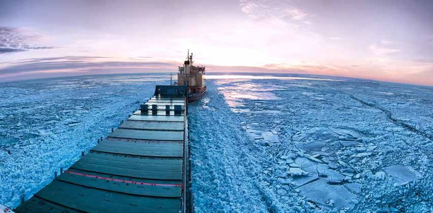
EXECUTIVE SUMMARY
Automatic Identification System (AIS) is a mandatory1 navigation safety communications system under the provisions
of the Safety of Life at Sea (SOLAS) Conventions which requires ships of more than 300 gross tons engaged on
international voyages, cargo ships of more than 500 gross tons not engaged on international voyages, and all passenger
ships irrespective of size to be fitted with AIS. exactEarth, Ltd (www.exactearth.com) is a private data services company
delivering real-time global location-based maritime vessel tracking information for government and commercial agencies
through its exactAIS® service. The ability to decode such AIS messages using a constellation of satellites, or Satellite AIS
(S-AIS), has been exactEarth’s focus since 2010 as they have exploited big data
management expertise to deliver clear, global, real-time maritime vessel tracking
information to government authorities when, where and how they have needed
                                                                                                   BEING ABLE
it. The superior detection technology of these satellites supports the rapid                       TO TRACK,
build-up of verifiable Maritime Domain Awareness (MDA), which is now used to                       MONITOR AND
support 100s of maritime safety, security, and commercial applications including
monitoring the remote waters of our planet like the Arctic.
                                                                                                   ANALYZE VESSEL
                                                                                                   MOVEMENTS WITH
                                                                                                   CONFIDENCE
BACKGROUND                                                                                         REQUIRES
The Arctic Region is warming at roughly twice the global average rate with the
                                                                                                   ACCURATE,
reduction in summer sea ice being both one of the clearest indicators and one of
the most dramatic effects of this trend.                                                           TRUSTED DATA ON
                                                                                                   WHICH TO BASE
Alongside the transformation in physical and biological processes across the                       THE BEST POSSIBLE
whole region, we are witnessing the rise of a wide number of interconnected
social transformations driven by the increased accessibility to this once
                                                                                                   DECISIONS.
remote Ocean environment. Nation States are disputing territorial claims as
the economic and strategic potential of the Arctic emerges; the International
community demands coordinated research activities; the oil and gas industry wishes access to the sea bed for
exploration; the shipping industry as a whole examines the potential for new and economically important shipping lanes.

According to the Intergovernmental Oceanographic Commission “never has accurate information been more important,
yet at present we know very little about the Arctic Ocean”.2 Environmental disasters such as the Rena sinking off
New Zealand in 2011 and the oil spill catastrophe in the Gulf of Mexico in 2006 shed new light on the critical need for
protection of the ocean environment. The ability for ships to transport more commodities, and potentially hazardous
materials, form risks too great to ignore around ship disasters.

To help combat environmental degradation, coastal countries around the world have developed active monitoring
and enforcement programs and established marine protected areas (MPAs) to further buoy the preservation of
particularly delicate ecosystems. Despite these preventative and punitive measures, the very nature of the open sea
presents a daunting environmental protection mandate for maritime authorities. Not only must they survey massive
protection zones with limited resources, their monitoring and enforcement tasks are further challenged by the variety of
surveillance targets and range of illicit activities, as well as variable weather conditions. In short, MPAs can seem like one
big potential crime scene for illegal dumping, oil spills and illicit fishing.

1) SOLAS Ch. 5 Regulation 19 Para 2.3 www.navcen.uscg.gov/pdf/AIS/AIS_Regs_SOLAS_MTSA_FR.pdf accessed 14 Sep 12
2) Why Monitor the Arctic Ocean? (The Intergovernmental Oceanographic Commission), 2010

                                                                     PAGE 2                       +1 519 622 4445   |   exactearth.com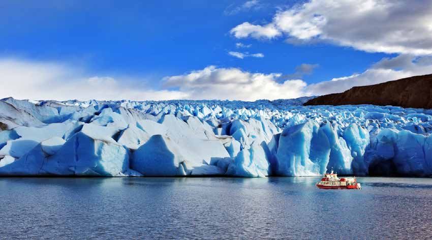
ARCTIC SHIPPING
Shipping in the Arctic is on the increase as the sea ice retreats further each year and the region opens to further
industrial development.

In addition, the retreating ice is opening the Canadian Northwest Passage and the Russian Northern Sea Route to regular
commercial shipping, which could have perhaps the largest impact on shipping in the region.

Both routes offer viable alternatives to established sea routes. The journey by ship from North America’s Pacific Coast
to Western Europe is one-third shorter using the Northwest Passage than by using the traditional Panama Canal route.
Using the Russian Northern Sea Route offers shipping an alternative for the Asian/Western Europe Route avoiding the
potentially dangerous Suez Canal route or the incredibly long voyage around the African Cape.

In August 2010, a super tanker navigated through the Northern Sea Route for the first time carrying 70,000 tonnes of
gas from Murmansk in Russia to Ningbo in China. In 2013, the first cargo ship crossed the Northwest Passage, heralding a
new era of commercial activity in the Arctic.3

Ship traffic is set to grow in this most remote of Ocean regions and now includes commercial ships, tourist cruises,
research ships, coastguard icebreakers, exploration survey ships and fishing fleets.

It is evident that there is heightened risk to safety of life and damage to the sensitive environment due to increased
numbers of vessels involved in Arctic tourism, mineral extraction, fishing and transportation of goods. Furthermore, the
ability to monitor traffic and respond to incidents is severely restricted because of the climatic conditions and limited
rescue resources.

3) http://news.nationalpost.com/news/canada/northwest-passage-crossed-by-first-cargo-ship-the-nordic-orion- heralding-new-era-of-arctic-commercial-activity

                                                                           PAGE 3                           +1 519 622 4445          |   exactearth.com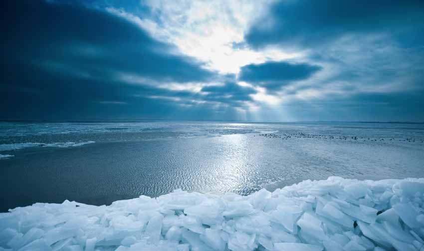
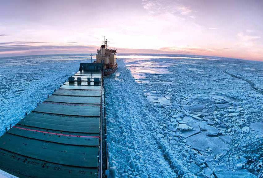
SATELLITE AIS– THE GAME CHANGER
Monitoring Arctic shipping is a challenge as the Arctic
Coastline is remote and uninhabited with little or no
industrial development. Infrastructure and systems are
simply not in place as they are elsewhere in the world.

Satellite-AIS (S-AIS) is ideally suited to monitoring
such a remote region and provides a unique insight
into Arctic Shipping. Such data provides safety
agencies, national authorities, commercial companies
and research institutes with an unparalleled view into
ship traffic movements in this remote region allowing
the analysis of risk to vessels, the environment and
safety of life.

With an expansive S-AIS data archive dating back to
July 2010, exactEarth have a wealth of information
already gathered to help organisations interested in
Arctic Shipping. With available datasets specifically
aimed at providing archived data for just the Arctic
                                                                                 Figure 1: exactAIS Arctic Archive Coverage
region, exactEarth S-AIS data captures every vessel
movement in this traditionally unmonitored remote area.

HISTORICAL IMPLICATIONS
Understanding the changes in ship traffic in the Arctic over time is vital in order to not only provide reliable information to
safely guide future practices but also to understand the impact of this increased activity on this pristine, fragile and rapidly
changing environment.

The Arctic region is generally defined as being the area in which the average temperature for the warmest month is below
10oC. For exactEarth data we have defined an area as shown to the right covering the full extent of the Arctic Ice Pack
and including all of the Northwest Passage and Northern Sea Route including the Bering Sea, the Sea of Okhotsk and the
Northern Atlantic Region around Iceland. This represents approximately –50o to 90o N Latitudes / -180o to 180o Longitudes.

Arctic datasets contain all shipping data from July through to October to provide

 •   Investigation and analysis of individual ship tracks
 •   Pattern analysis for insight into activities and trends
 •   Traffic counting on specified routes or channels
 •   Density plots for input into environmental models and impact research studies
 •   A single source of information to aid administrations, commerce and safety agencies with detailed insight of risk to
      vessels, the environment, and safety of life.

                                                               PAGE 4                      +1 519 622 4445      |   exactearth.com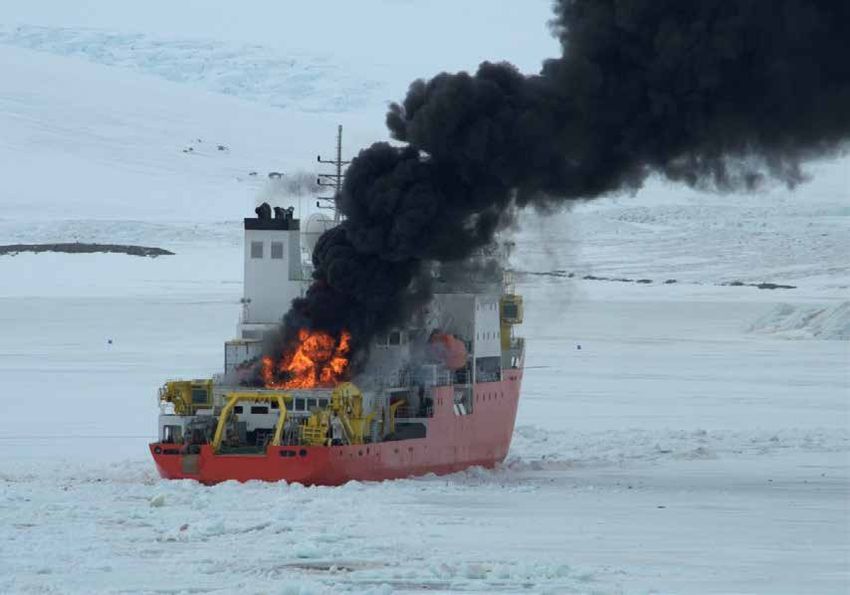
DENSITY MAPS FROM exactEarth
Plotting shipping density is especially useful for environment modelling and
other macro analysis where more generalized forms of traffic patterns are
required. Density Maps can be easily created from the exactAIS Archive to
provide information across any part of the Arctic Region. Such maps show
clearly the concentration of shipping and can be used to assess human
impact in a form that is easily assimilated and readily understood.

Density Maps from exactEarth deliver in depth vessel pattern analysis by
transforming thousands to millions of AIS messages into individual geospatial
data points.                                                                       Figure 2- Shipping Density Map Arctic
                                                                                   Region
Users receive only the data they request and exactEarth eliminates the             To learn more visit, www.exactearth.com/
complexity and time it takes to turn AIS messages into actionablemap data.         products/exactais-density-maps

LIVE MONITORING OF SHIPPING
IN THE ARCTIC
The Arctic is one of the most hostile maritime environments on
our planet, causing hazards such as ice accretion on vessels, which
can lead to instability, or collisions with icebergs and growlers.
Although sea ice is receding, it is subject to piling up in summer
months preventing a complete ice-free passage.

Due to these problems, an International Code of Safety for Ships
in Polar Waters (The Polar Code) has been developed, with
support from the International Maritime Organisation (IMO).
According to the Polar Code and Safety of Life at Sea (SOLAS)
all vessels traversing in Arctic waters are required to be equipped
with AIS to help monitor vessels in these dangerous waters. With
limited search and rescue, and few, if any, other vessels in the area,
it is crucial to provide accurate and up-to-date surveillance of all
ships in the Arctic Region to pre- vent accidents and potential loss
of life. Due to the extended range of surveillance of Satellite AIS
from exactEarth, the icy waters are monitored consistently in the Arctic. All ships travelling through this vast remote area
are now detected with exactEarth’s dedicated Polar coverage.

Real-time positions of the vessels allows for faster location and reaction in case of accident. With the increase in
commercial shipping and passenger vessels in the area, this crucial information can help in the rescue of crew aboard
vessels and assist in preventing environmental damage, or potential loss of life.

exactAIS provides a global capability for monitoring all AIS- equipped vessels using the exactEarth satellite constellation
and global network of ground stations. exactAIS streams the data securely, quickly and continuously. This real-time data
enables the monitoring of vessel traffic in any area of the ocean allowing authorities to monitor even the remotest of
regions such as the Arctic.

                                                            PAGE 5                    +1 519 622 4445     |   exactearth.com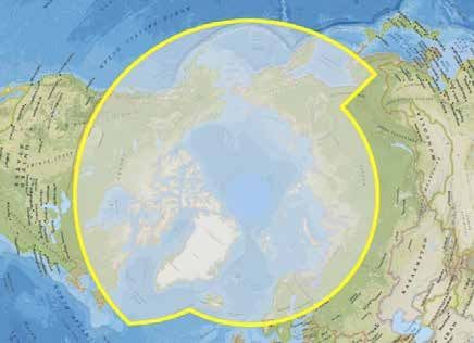
exactAIS FEATURES
•    ata is easily integrated with weather and ice prognosis data to ease implementation with other communication
    D
    systems
•   Critical tracking of passenger ships in Arctic waters to ensure compliance with safety measures and facilitate faster
     response times in the event of accident. Data enables the monitoring of other vessels in the vicinity of passenger
     ships in case they may be requir ed to assist taking on passengers in a rescue scenario
•    Minute by minute Satellite c overage over Polar areas delivering a n unparalleled understanding of maritime traffic
      trends to allow for proper analysis into the most efficient security measures and safe st shipping routes

                                                           PAGE 6                     +1 519 622 4445    |   exactearth.com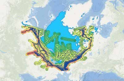
CONCLUSION
The Arctic sea area covers vast regions of the Earth’s surface and is becoming ever more important as the ice cover
reduces making these areas more accessible to fishing, tourism, mineral exploitation and a viable shipping route. While
this can be very beneficial for commercial tankers there are still risks associated with this voyage. Conditions are still
harsh, which can lead to oil spills and environmental disasters. The lack of communication infrastructure in the region
also hinders Search and Rescue operations making it critical to establish safety regulations. The region is not only
covered with ice, but also is liable to poor visibility for vessel traffic. As such it is one of the most hostile maritime
environments on our planet.

With complete global coverage, exactAIS accurately monitors all vessels in the Arctic region. Now all polar shipping
traffic can be monitored in real-time to provide safety and security to vessels traversing these treacherous waters.
Authorities can also gain better insight into the realities of Arctic shipping traffic and trends with detailed historical data
from the summer months dating back to 2010 with exactAIS Archive.

With the receding ice opening these waters, shipping companies are eager to explore the new routes and new
possibilities. While the increase in shipping is understandable, vessels traversing the Arctic waters need to ensure they
follow the best practices and acquire the latest technology to avoid major incidents in this fragile ecosystem.

                                                              PAGE 7                     +1 519 622 4445     |   exactearth.com
Founded in 2009, exactEarth was established for the purpose of making Satellite AIS data services available
to the global maritime market. Based in Cambridge, Ontario, Canada, exactEarth leverages advanced satellite
technology to deliver vessel monitoring solutions characterized by high performance, reliability, security,
and simplicity. exactEarth is a leading organization in the field of global Automatic Identification System
vessel tracking, collecting the most comprehensive ship monitoring data and delivering the highest quality
information to customers around the world.

exactEarth Ltd. 		       exactEarth Europe
260 Holiday Inn Drive 		 Satellite Applications Catapult
Unit 30, Building B 		   Electron Building, Fermi Avenue
Cambridge, Ontario 		    Harwell (Didcot)
N3C 4E8 			              Oxfordshire, OX11 0QR
				United Kingdom

+1 519 622 4445 		                           +44 (0)7500 935091

©2021 exactEarth Ltd. All rights reserved.

                                                            PAGE 8        +1 519 622 4445    |   exactearth.com
You can also read