Background Paper 4 Infrastructure Position Statement - North Norfolk District Council
←
→
Page content transcription
If your browser does not render page correctly, please read the page content below
North Norfolk District Council

Background Paper 4
Infrastructure Position
Statement
Setting out the potential infrastructure requirements to support the housing
and employment growth set out within the emerging North Norfolk Local Plan
2016-2036

Published to support Regulation 18 First Draft Local Plan (Part 1) consultation.
May 2019
Background Paper Infrastructure Position Statement
No 4

National Legislation   National Planning Policy Framework (NPPF) February 2019
and Guidance
                       National Planning Policy Guidance

                       Planning Acts

Related Evidence       Full list in Appendix B

Related Background     Paper 2 - Distribution of Growth
Papers / Evidence
                       Paper 3 - Approach to Employment

North Norfolk District Council
Planning Policy Team. March 2018

01263 516318
planningpolicy@north-norfolk.gov.uk
Planning Policy,
North Norfolk District Council,
Holt Road, Cromer, NR27 9EN
www.north-norfolk.gov.uk/localplan

All documents can be made available in
Braille, audio, large print or in other language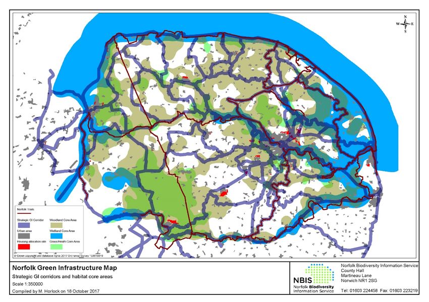
Contents
Introduction............................................................................................................................................ 1
1.      Purpose and Summary of key findings ..................................................................................... 2
2.      Background and Methodology.................................................................................................... 6
        What is infrastructure?................................................................................................................. 6
        Infrastructure and Planning......................................................................................................... 6
        The Community Infrastructure Levy .......................................................................................... 7
        Infrastructure in the Local Plan ................................................................................................ 10
        Infrastructure in the Current Local Plan .................................................................................. 10
        Policy Context ............................................................................................................................. 10
3.      Partnerships and Funding Mechanisms ................................................................................. 12
        Local Enterprise Partnerships (LEPs) ..................................................................................... 13
        Norfolk Strategic Framework (NSF) ........................................................................................ 14
        Norfolk Infrastructure Plan ........................................................................................................ 14
        Infrastructure Funding Mechanisms ........................................................................................ 15
4.      Physical Infrastructure ............................................................................................................... 16
     4.1        Utilities – Energy................................................................................................................. 16
        Electricity ..................................................................................................................................... 16
        Gas ............................................................................................................................................... 18
        Renewables................................................................................................................................. 18
     4.2 Utilities – Water ........................................................................................................................ 20
     4.3 Telecommunications ............................................................................................................... 25
        Broadband Infrastructure ...................................................................................................... 25
        Mobile Telecommunications Infrastructure ...................................................................... 27
     4.4 Transport ................................................................................................................................... 30
        Strategic Transport improvements .......................................................................................... 30
        Transport within North Norfolk.................................................................................................. 31
        Walking and Cycling .................................................................................................................. 37
5.      Environment and Green Infrastructure.................................................................................... 39
        Flood Protection ......................................................................................................................... 39
        Strategic Flood Risk Assessment ............................................................................................ 40
        Marine Planning and Coastal Management ........................................................................... 42
        Green Infrastructure and the Natural Environment ............................................................... 44

                                                                                     Regulation 18 First Draft Plan (Part1) Consultation Version             i
Green Infrastructure ................................................................................................................... 45
        Minerals, Waste and Recycling ................................................................................................ 49
6.      Social Infrastructure ................................................................................................................... 50
        Education ..................................................................................................................................... 50
        Health ........................................................................................................................................... 55
        Dentists ........................................................................................................................................ 59
        Pharmacies ................................................................................................................................. 59
        Adult Social Care and an aging population ............................................................................ 60
        Community facilities ................................................................................................................... 61
        Sport and Leisure, cultural facilities and public art................................................................ 63
        Public realm improvements and public art ............................................................................. 65
7.      Moving Forward .......................................................................................................................... 67
APPENDICES ..................................................................................................................................... 68
     APPENDIX A: 2011 CENSUS ...................................................................................................... 68
     APPENDIX B: Evidence Base ...................................................................................................... 71
     APPENDIX C: Summary of Infrastructure Capacity Constraints by Type ............................. 74
     APPENDIX D: Approved Renewable Energy Schemes in North Norfolk .............................. 76
     APPENDIX E: Water Recycling Centres in North Norfolk ....................................................... 77
     APPENDIX F: Traffic Growth in North Norfolk ........................................................................... 79
     APPENDIX G: Estimates of Station Usage (rail) in North Norfolk 2010/11 – 2017/18........ 80
     APPENDIX F: Statement of Common Ground: Norfolk and Suffolk Coastal Authorities .... 81

                                                                                    Regulation 18 First Draft Plan (Part1) Consultation Version            ii
Introduction

 I.    This background paper forms part of the Council’s evidence base to inform plan
       making in relation to potential infrastructure requirements to support the proposed
       growth as set out within the emerging Draft Local Plan. The Council is not seeking
       comments specifically on this background paper although you may wish to refer to it
       in making any comments on the Draft Local Plan.

 II.   The purpose of the paper is to establish the current infrastructure provision and
       capacity, to identify the strategic infrastructure requirements arising from planned
       growth and to identify potential funding and delivery mechanisms. Infrastructure, in
       planning terms, can be defined as ‘any facility, service or physical structure that
       supports or enables proposed development, whether privately or publically funded’.
       This stage of the report will outline the state of infrastructure provision in North
       Norfolk, allowing infrastructure providers to update future investment plans.

III.   This is one of a number of background papers which have been prepared to help
       explain and justify various aspects of the new draft Local Plan which is being
       prepared by North Norfolk District Council.

IV.    The background papers include:
       • Paper 1 - Approach to setting the Housing Target
       • Paper 2 - Distribution of Growth
       • Paper 3 - Approach to Employment
       • Paper 4 - Infrastructure Position Statement (This paper)
       • Paper 5 - Interim Green Infrastructure Strategy
       • Paper 6 - Development Sites Selection Methodology
       • Paper 7 - Housing Construction Standards

                                                Regulation 18 First Draft Plan (Part1) Consultation Version   1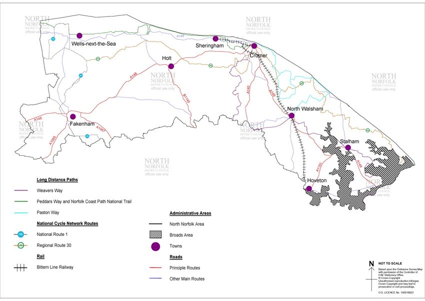
1. Purpose and Summary of key findings

1.1. In order to ensure new development delivers sustainable communities, the
     infrastructure, facilities and service needs of these populations must be properly
     planned for. This Interim Infrastructure Position Statement (IPS) is designed to
     inform the development of the North Norfolk Local Plan 2016-2036, and provide
     evidence to support preparation of strategic policies to deliver:

   •   The provision of infrastructure for transport, telecommunications, waste
       management, water supply, wastewater, flood risk and coastal change
       management, the provision of health, security, community and cultural
       infrastructure and other local facilities; and,
   •   climate change mitigation and adaptation, conservation and enhancement of the
       natural and historic environment, including landscape.

1.2. The IPS will support the first Draft Local Plan Regulation 18 Consultation during
     2019 and is intended to be a living document which reflects the current stage of the
     Local Plan according to the latest available data. It seeks to provide the most
     accurate picture of current infrastructure requirements and costs.

1.3. The purpose of the statement is:

   •   To establish current infrastructure provision and capacity;
   •   to identify the strategic infrastructure needs arising from new residential and
       economic development for the District for the plan period to 2036; and
   •   identify, in broad terms, potential funding and delivery mechanisms.

1.4. The information in this report will be used to inform the preparation of the emerging
     Local Plan and will inform the Infrastructure Development Plan (IDP). Specifically, at
     this stage in the process, the document will:

   •   Outline the current state of Infrastructure provision in North Norfolk;
   •   provide the basis to work with and inform partners of future infrastructure
       requirements that may inform future investment plans;
   •   assist in the identification of appropriate infrastructure requirements and the
       locations of new development;
   •   help to address the requirements of planning policy as set out in the NPPF; and
   •   provide evidence to support the production of the Local Plan.

1.5. This report does not identify specific costs, funding sources or delivery mechanisms,
     as these issues will be included in an IDP. Moreover, the Local Plan Viability Study
     provides further information on mechanisms to support infrastructure delivery
     (sought through developer contributions in the form of Section 106 agreements),
     particularly in relation to the delivery of affordable housing.

1.6. The following table sets out a summary of the key, known infrastructure constraints
     within the Large Growth Towns, Small Growth Towns and Large Growth Villages as
     defined within the settlement hierarchy of the emerging Local Plan.

                                               Regulation 18 First Draft Plan (Part1) Consultation Version   2
Settlement   Infrastructure summary

North        •   Potential energy grid constraints that may require interventions to
Walsham          overcome. (Section 4.1)

             •   Traffic management constraints regarding the railway bridges on
                 the western approaches to the town along the Cromer Road,
                 Aylsham Road & Norwich Road and the impact of large or heavy
                 goods vehicles travelling through the town. A western ‘link road’ is
                 proposed between the B1150 (Norwich Road), the B1145
                 (Aylsham Road) and the A149 (Cromer Road) would alleviate
                 these issues. (Section 4.4)

             •   Potential localised flood risk from un-named drains. (Section 5)

             •   Within the first tranche of settlements looking at opportunities for
                 green infrastructure improvements in the Green Infrastructure
                 Position Statement. (Section 5)

             •   Minerals Resource allocation MIN 15 – Land at Lord Anson’s
                 Wood. (Section 5)

             •   The growth levels proposed in the emerging local plan will
                 necessitate the provision of a new primary school. It is proposed
                 that this will be delivered through the North Walsham Western
                 Extension allocation. (Section 6)

             •   GP capacity (Section 6)

Fakenham     •   Potential energy grid constraints that may require interventions to
                 overcome. (Section 4.1)

             •   Potential improvements required to Fakenham WRC identified
                 within Anglian Water’s Water Recycling Long Term plan (Section
                 4.2)

             •   Congestion hotspots identified with improvements to the
                 A148/B1105 junction and the A148/A1065 roundabout set out by
                 Norfolk County Council. (Section 4.4)

             •   Within the first tranche of settlements looking at opportunities for
                 green infrastructure improvements in the Green Infrastructure
                 Position Statement. (Section 5)

             •   Fluvial flood risk from River Wensum and tributaries to the south
                 of the town. (Section 5)

             •   A new 2 Form Entry Primary School is proposed through the Core
                 Strategy allocation at Rudham Stile Lane, which is now being
                 considered through a planning application. (Section 6).

             •   Potential to re-provide a swimming pool in Fakenham at
                 Fakenham Academy. (Section 6)

                                        Regulation 18 First Draft Plan (Part1) Consultation Version   3
Settlement   Infrastructure summary

Cromer       •   Potential energy grid constraints that may require interventions to
                 overcome. (Section 4.1)

             •   Congestion hotspots within the Town, specifically during the peak
                 tourist season. (Section 4.4)

             •   Within the first tranche of settlements looking at opportunities for
                 green infrastructure improvements in the Green Infrastructure
                 Position Statement. (Section 5)

             •   Not shown to be at risk of fluvial or tidal flooding but a number of
                 un-named drains with potential to present a flood risk. Surface
                 water flooding issues. (Section 5)

             •   Norfolk County Council Education Authority has indicated the
                 potential need for a new primary school site as residential
                 development in the Town is likely to put pressure on existing local
                 schools. A 2ha site would be required. (Section 6)

Holt         •   Potential energy grid constraints that may require interventions to
                 overcome. (Section 4.1)

             •   Congestion and poor public transport provision / car parking.
                 (Section 4.4)

             •   Minerals Resource allocation MIN 71 – Land at Holt Road.
                 (Section 5)

             •   GP capacity (Section 6)

             •   Holt does not have a secondary school and there is limited
                 capacity at the existing primary school in the town. The Education
                 Authority has indicated that the town will require additional
                 primary school capacity to meet the proposed growth. The
                 proposed allocation on Land South of Beresford Road (HO4)
                 proposes to reserve two hectares of land for a new two-form entry
                 school in Holt. (Section 6)

Sheringham   •   Congestion, particularly during the peak tourist season (Section
                 4.4)

             •   Not shown to be at risk of fluvial or tidal flooding but a number of
                 un-named drains with potential to present a flood risk. Surface
                 water flooding issues. (Section 5)

             •   GP capacity (Section 6)

Stalham      •   Lack of public transport options (Section 4.4)

                                        Regulation 18 First Draft Plan (Part1) Consultation Version   4
Settlement Infrastructure summary
• GP capacity (Section 6)
Wells-next- • Congestion, particularly during the peak tourist season & lack of
the-sea car parking (Section 4.4)
• Flood risk primarily driver by tidal/coastal influences. Residual risk
should defences fail. Tidal locking has potential to increase levels
upstream not draining effectively during high tide. (Section 5)
• Lack of public transport options (Section 4.4)
• GP capacity (Section 6)
Hoveton • Anglian Water is currently preparing a position statement related
to the Hoveton catchment. (Section 4.2)
• Congestion on A1151 on bridge through Wroxham, which could
become worse as a result of Norwich Growth Triangle
development. (Section 4.4)
• GP capacity (Section 6)
Briston &
Melton
Constable
Mundesley • Flood risk from fluvial influences of the Mundesley Beck
combining with the tidal forces of the North Sea. (Section 5)
• Mundesley Coastal Management Scheme to refurbish and
improve coastal defences. (Section 5)
• GP capacity (Section 6)
Blakeney • Seasonal congestion and parking issues and a lack of public
transport options (Section 4.4)
Ludham • GP capacity (Section 6)
Regulation 18 First Draft Plan (Part1) Consultation Version 52. Background and Methodology
What is infrastructure?
2.1. Infrastructure, in planning terms, can be defined as ‘any facility, service or physical
structure that supports or enables proposed development, whether privately or
publically funded’. This report divides each element into three categories, although
in practice there can be significant overlap between different subjects. This report is
structured in this manner:
1. Physical infrastructure – e.g. utilities (i.e. water supply and waste water,
gas, electricity, telecommunications and digital communications) and
transport infrastructure and transport services;
2. Environmental and Green infrastructure – e.g. flood protection, coastal
management, public realm, public open space, green space, parks and play
space, and waste management;
3. Social infrastructure – e.g. education, health, social care, the emergency
services, community facilities, arts and culture, sport and recreational
facilities, and community facilities.
Infrastructure and Planning
2.2. The recent consultation on a National Infrastructure Assessment highlights the
importance of infrastructure in the delivery of new development. 1 This has a focus
on seven key priorities:
• Building a digital society: fast, reliable data services everywhere.
• Connected, liveable city-regions: linking homes and jobs.
• New homes and communities: supporting delivery of new homes.
• Low-cost, low-carbon: ending emissions from power, heat and waste.
• Revolutionising road transport: seizing the opportunities of electric and
autonomous vehicles.
• Reducing the risks of extreme weather: making sure the UK can stand up to
drought and flooding.
• Financing infrastructure in efficient ways: getting the right balance between
public and private sectors.
2.3. It has long been recognised that in facilitating growth and sustainable development
supporting infrastructure must also be provided. Over the years, various
governments have introduced mechanisms in an attempt to achieve better
integration. Since 1990 (Town and Country Planning Act) local planning authorities
have been able to secure planning obligations from new development often known
1
National Infrastructure Commission (2019) National Infrastructure Assessment [Online]
https://www.nic.org.uk/wp-content/uploads/CCS001_CCS0618917350-001_NIC-NIA_Accessible.pdf [Accessed
23/04/2019]
Regulation 18 First Draft Plan (Part1) Consultation Version 6as planning gain or Section 106 agreements. This allows for some funding to be
provided for infrastructure such as transport, education provision and affordable
housing directly from appropriate developments. In the mid-2000s, the Government
considered a number of alternative options for raising money from development for
infrastructure and community benefits including another national tax (the Planning
Gain Supplement), and the formalisation of tariffs. The option for Local Planning
Authorities to establish a Community Infrastructure Level (CIL), was introduced in
April 2008. The principle behind this Levy is that those responsible for new
development should make a reasonable contribution to the costs of providing
additional infrastructure to meet the needs arising from that development. Since then
there have been numerous amendments to the regulations and the take up has
been uneven across the country.
The Community Infrastructure Levy
2.4. The Community Infrastructure Levy (CIL) is a planning charge, introduced by the
Planning Act 2008 as a tool for local authorities in England and Wales to help deliver
infrastructure to support the development of their area. Where the CIL is introduced,
charging authorities must set out what infrastructure is required to support the level
of development in the local plan, identify if a funding gap exists, and establish a “123
list” to set out how the funding raised will be spent. The CIL charging schedule must
undergo an examination to establish how the charging level will impact on the
viability of developments.
2.5. The Community Infrastructure Levy system remains under review. “A new Approach
to Developer Contributions” 2 published in February 2017 set out some of the short-
comings of the current system and recommended a number of changes, including
the introduction of a mandatory Local Infrastructure Tariff to capture contributions
from all development, alongside continuation of the section 106 regime for larger
developments. In the November Autumn budget statement, the Government stated
that DCLG will launch a consultation with detailed proposals on the following
measures:
• Removing restriction of Section 106 pooling towards a single piece of
infrastructure where the local authority has adopted CIL, in certain
circumstances such as where the authority is in a low viability area or where
significant development is planned on several large strategic sites. This will
avoid the unnecessary complexity that pooling restrictions can generate;
• speeding up the process of setting and revising CIL to make it easier to respond
to changes to the market. This will include allowing a more proportionate
approach than the requirement for two stages of consultation and providing
greater clarity on the appropriate evidence base. This will enable areas to
implement a CIL more quickly, making it easier to set a higher ‘zonal CIL’ in
areas of high land value uplift, for example around stations;
• allowing authorities to set rates which better reflect the uplift in land values
between a proposed and existing use. Rather than setting a flat rate for all
development of the same type (residential, commercial, etc.), local authorities
will have the option of a different rate for different changes in land use
(agricultural to residential, commercial to residential, industrial to residential). All
the protections for viability from CIL, such as the Examination in Public, will be
retained;
2
Gov.uk (2016) A new approach to Developer Contributions [Online]
https://www.gov.uk/government/uploads/system/uploads/attachment_data/file/589637/CIL_REPORT_2016.
pdf [Accessed 23/04/2019]
Regulation 18 First Draft Plan (Part1) Consultation Version 7• changing indexation of CIL rates to house price inflation, rather than build costs.
This will reduce the need for authorities to revise charging schedules. This will
ensure CIL rates keep up with general housing price inflation and if prices fall,
rates will fall too, avoiding viability issues; and
• giving Combined Authorities and planning joint committees with statutory plan-
making functions the option to levy a Strategic Infrastructure Tariff (SIT) in
future, in the same way that the London Mayoral CIL is providing funding
towards Crossrail. The SIT would be additional to CIL and viability would be
examined in public.
2.6. The consultation document Supporting Housing Delivery through Developer
Contributions was published in March 2018 alongside the revised NPPF which
includes a new approach to viability. The paper suggests that the Government could
consider setting contributions at a national level, but this is not currently proposed.
The objectives of the short term reforms were:
• Reducing complexity and increasing certainty;
• Supporting swifter development through focusing viability assessment on plan
making rather than decision making;
• Increasing market responsiveness so that local authorities can better target
increases in value, while reducing the risks for developers in an economic
downturn;
• Improving transparency for communities and developers over where
contributions are spent and expecting all viability assessments to be publicly
available; and
• Allowing local authorities to introduce a Strategic Infrastructure Tariff to help fund
or mitigate strategic infrastructure.
2.7. The proposals included:
• Reducing the statutory consultation requirements on setting and reviewing CIL;
• align the evidence for local plans and CIL;
• removing the restrictions on section 106 pooling for authorities that have adopted
CIL, where authorities fall under a threshold based on the tenth percentile of
average new build house prices, meaning CIL cannot feasibly charged, or where
development is planned on several strategic sites;
• improve viability assessment in plan making;
• expecting all viability assessments to be conducted on an open book basis, and
be publically available;
• allow CIL charging schedules to be set based on the existing use of land
• index residential development to regional or local authority house prices. For non-
residential development the Government could index commercial development to
a factor of house prices and Consumer Price Index (CPI),36 or to CPI alone;
• remove regulatory requirements for Regulation 123 lists;
• amend the CIL Regulations to require the publication of Infrastructure Funding
Statements; and
• allow combined authorities and joint committees, where they have strategic
planning powers, to introduce a Strategic Infrastructure Tariff.
2.8. The Government response to the consultation, published in October 2018 set that a
further consultation document would be required to address many of the concerns
raised. In December 2018 the Government published a further consultation
Regulation 18 First Draft Plan (Part1) Consultation Version 8document entitled ‘Reforming developer contributions: technical consultation on draft
regulations. This proposed the following:
• Removing the current statutory requirement for two separate rounds of
consultation in every circumstance;
• Removing the restriction which prevents local authorities using more than five
section 106 obligations to fund a single infrastructure project (“the pooling
restriction”);
• Allowing a grace period for developers to submit a Commencement Notice in
order to confirm exemption of relief;
• Setting out the approach to abatement;
• Indexation of community Infrastructure Levy rates in line with the value of the
development rather than the cost of building infrastructure;
• Removing regulation 123 requirements and ensuring that local authorities set out
how they propose to use developer contributions through Infrastructure Funding
Statements;
2.9. The Government, at the time of writing this Infrastructure Position Statement, have
not responded to the consultation and the Community Infrastructure (Amendment)
(England) Regulations 2019 are still in draft form.
Current position in North Norfolk
2.10. North Norfolk District Council undertook work in 2010 regarding the possible
introduction of CIL across the District. Evidence did not support the viable
introduction of such a Levy at the time and the Council decided not to take forward
the introduction of a Community Infrastructure levy. The Council may consider the
introduction of such a levy in the future.
2.11. Currently infrastructure in North Norfolk is delivered through developer
contributions in the form of S.106 contributions. S.106 planning obligations are
bespoke legal agreements made between the Council and the developer and any
other parties with an interest in the land, to secure the delivery of new infrastructure,
improve existing infrastructure or to make a financial contribution towards its
provision. These contributions are necessary only to make the development
acceptable in planning terms.
2.12. Most of these Section 106 agreements are agreed through the County
Council’s Planning Obligations Standards 3 and other contributions are negotiated on
a case by case basis. The Norfolk Planning Obligations Standards includes standard
requirements per dwelling for Children’s Services, Libraries, and fire hydrants and
may require contributions subject to negotiation towards Adult Care, Green
Infrastructure and Public Rights of Way.
3
Norfolk.gov.uk (2018) Planning Obligations [Online] https://www.norfolk.gov.uk/rubbish-recycling-and-
planning/planning-applications/planning-obligations [Accessed 23/04/2019]
Regulation 18 First Draft Plan (Part1) Consultation Version 9Infrastructure in the Local Plan
2.13. Paragraph 20 of the National Planning Policy Framework (NPPF) requires
that local planning authorities should set out the strategic priorities for the area in the
Local Plan. This should include strategic policies to deliver:
• Housing (including affordable housing), employment, retail leisure and other
commercial development;
• infrastructure for transport, telecommunications, security, waste management,
water supply, wastewater, flood risk and coastal change management, and the
provision of minerals and energy (including heat);
• community facilities (such as health, education and cultural infrastructure); and
• conservation and enhancement of the natural, built and historic environment,
including landscapes and green infrastructure, and planning measures to
address climate change mitigation and adaptation.
2.14. Paragraph 22 of the NPPF sets out that strategic policies should look ahead
over a minimum 15-year period from adoption in order to anticipate and respond to
long-term requirements and opportunities, such as those arising from major
improvements in infrastructure.
Infrastructure in the Current Local Plan
2.15. Infrastructure improvements through the Core Strategy have been delivered
through S106 agreements, investment from utility providers and statutory bodies
including the Council. As North Norfolk has not introduced a Community
Infrastructure Levy, contributions to local infrastructure requirements are sought
through S106 agreements.
2.16. Preparing an Infrastructure Position Statement and Infrastructure Delivery
Plan aids the understanding of what demands may be made on developers in terms
of contributing to infrastructure provision needs whether those arising from their
particular development or those arising due to the cumulative impacts of
development across the plan area or parts of it. This can then be considered
alongside inherent development costs to calculate whether and inform Local plan
development through viability considerations.
Policy Context
2.17. The Local Plan review will provide the planning policy framework for the
District to 2036 and provide the strategic priorities and objectives. Infrastructure
constraints and requirements are based on the emerging policies continued in the
First Draft Plan consultation version summer 2018.
2.18. The population is set to grow from 102,900 in 2014 to 115,800 in 2036 (ONS)
representing a 13% growth. The 2011 Census demonstrates that, of the resident
population of 101,449, approximately 46% live in the Market towns, 18% in
designated Service Villages, with the rural areas accounting for 37% of the District’s
population. A full list of population figures can be found in Appendix A.
2.19. The Government’s objective is to significantly boost the supply of homes.
National planning policy sets out that the starting point for local planning authorities
to meet their local housing as identified through the standard methodology 4. This
Regulation 18 First Draft Plan (Part1) Consultation Version 10should be the basis for strategic policies unless exceptional circumstances justify an
alternative approach which also reflect current and future demographic trends and
market signals. National planning policy is also clear that additional needs that
cannot be met within neighbouring areas should also be taken into account in
establishing the amount of housing to be planned for.
2.20. The starting point of the standard methodology is the nationally produced
housing projections which are published biennially by the Office for National
Statistics (ONS). These statistics provide a trend-based projection of new homes
required for each District over the next 30 years in order to address projected
demographic growth. This demographic growth trend is then subject to a standard
adjustment (uplift) with the size of the adjustment determined by the local ratio
between incomes and house prices, with required uplifts being greatest in those
areas where housing is least affordable. This uplift in North Norfolk is substantial
and results in around a 35% increase in the housing requirement.
2.21. The current standard national methodology is based on ONS projections from
2014. Using these for calculating housing need, the result for North Norfolk
is 10,860 dwellings over the 20-year period between 2016 and 2036. This equates
to an annual average requirement of 543 net new dwellings.
2.22. The emerging Local Plan proposes to distribute this growth in the following
locations through the plan period:
Settlement Dwellings With Dwelling Proposed New Total
Planning Permission at Completions Allocations Growth
January 2019 (01/04/16 - 30/01/19) (2016 -
2036)
North Walsham 218 222 2,160 2,600
1,163Inclusive of approx
900 dwellings on the
Trinity College site at
Fakenham 129 600 1,892
Large Growth Fakenham (decision on
Towns planning application
pending).
909
Cromer 244 73 592
Holt 411 85 330 826
Sheringham 255 89 115 459
Small Growth Stalham 73 80 130 283
Towns
Wells-next-the-
31 79 70 180
Sea
Hoveton 31 2 100 133
Briston & Melton
113 28 80 221
Constable
Large Growth Mundesley 46 21 50 117
Villages
Blakeney 5 19 30 54
Ludham 9 1 35 45
400Suitable sites
Small Growth Villages named in
276 189 to be identified in 865
Villages Policy SD3
a Part 2 Plan.
Regulation 18 First Draft Plan (Part1) Consultation Version 11All remaining
Remainder of
settlements and 377 183 0 560
District
countryside
Windfall
Development
2,295
2019-2036 Across
Entire District
TOTALS 3,252 1,200 4,692 11,439
Total Projected Housing Growth 2016 - 2036
2.23. It is proposed that 4,452 dwellings will be met through dwellings that are
already subject to planning permission or have already been complete or will be
complete by adoption of the Local Plan. In terms of this quantum of development
this Infrastructure Position Statement will detail known information regarding s.106
agreements and set out the infrastructure improvements that have been agreed to
deliver this development.
2.24. 2,295 dwellings are proposed to be delivered through windfall development. It
is anticipated that this would predominantly be small scale development that is
delivered over the plan period. Therefore, in terms of infrastructure it is envisaged
that necessary infrastructure improvements may be required through the decision
making process. There are potential implications on local infrastructure depending
on where the windfall comes forward. This could place an additional burden upon
the infrastructure in the smaller towns and villages in the District.
2.25. 41 % of the overall growth, 4,692 dwellings, is proposed to be delivered
through specific site allocations proposed through the emerging Local Plan. New
infrastructure will be required to support these 4,692 dwellings. This Infrastructure
Position Statement proposes to set out the infrastructure constraints in regard to the
increased levels of growth and set out the proposed infrastructure improvement
measures in order to overcome known constraints.
3. Partnerships and Funding Mechanisms
3.1. This report sets out the current state of infrastructure provision in North Norfolk
based on a range of evidence, commissioned jointly as part of the Norfolk Strategic
Framework (NSF) as well as specifically commissioned work for North Norfolk
District Council (NNDC), and in consultation with infrastructure providers.
3.2. The provision of infrastructure is not solely provided by developers. Organisations
such as Anglian Water, the Environment Agency, and NHS England also have
statutory responsibilities and investment plans. In developing these plans, the
growth identified through the Local Plan plays an important role in establishing their
investment priorities.
3.3. The methodology used has been to gather information on each of the topics, provide
a general overview of providers and partners involved, set out the existing provision,
any published strategies and infrastructure plans, current capacity and any identified
constraints on the basis of proposed growth. Appendix B gives a list of all sources
of data and reports used. To provide a summary of the key issues, a table showing
area-specific issues, any timing or phasing issues, etc. is provided in Appendix C.
3.4. Most of the infrastructure required to support new development needs to be planned
and provided by service providers and other organisations.
Regulation 18 First Draft Plan (Part1) Consultation Version 123.5. The table below sets out the key partnerships responsible for the delivery of
infrastructure in North Norfolk. The section below summarises the key plans and
strategies which inform the Infrastructure Positions Statement, but further
information is also provided in each topic specific section.
Organisation Service Responsibility
Duty to Cooperate/ Norfolk Coordination of joint evidence base,
Strategic Framework County publication of Norfolk Strategic Framework…
Group
Norfolk County Council Non-strategic highways network, cycle ways,
rights of way, public transport, adult social
care, waste disposal, education, fire and
rescue, community safety, libraries,
community centres, youth clubs and surface
water drainage. Advisory service archaeology
and ecology/ biodiversity and Broadband.
Norfolk Constabulary Policing
Norfolk Fire and Rescue Fire and Rescue
North Norfolk CCG & NHS Health care
England
UK power networks and National Electricity and Gas
Grid
Anglia Water Water supply and waste water
Environment Agency Tidal and Fluvial Flooding and Coastal
Erosion
Network Rail National Rail Network
Natural England Ecology
Norfolk Coastal Partnership Landscape
North Norfolk AONB Landscape
Norfolk Biodiversity Partnership Ecology
Norfolk Wildlife Trust Ecology, Biodiversity and Geodiversity
Historic England Built and Natural Heritage Assets
Marine Management Organisation Marine planning
Highways England Strategic Road Network
Sport England Recreation provision
New Anglia Local Enterprise Economy
Partnership
Open reach (on behalf of BT) Telecommunications
Mobile UK Telecommunications
Local Enterprise Partnerships (LEPs)
3.6. From 2015 Local Enterprise Partnerships (LEPs) have received funding for
infrastructure direct from government. New Anglia LEP is the Local Enterprise
Partnership for Norfolk and Suffolk. The New Anglia LEP is a business-led
collaboration between the private, public and education sectors across Norfolk and
Regulation 18 First Draft Plan (Part1) Consultation Version 13Suffolk. Their ambition is to drive economic growth and transform the local economy
into a global centre for talent and innovation. It provides a funding stream from
central government via a range of initiatives including the Growth Deal, the Local
Transport Body, Enterprise Zones and the Growing Places Fund. Its recently
published New Economic Strategy 5 sets out a number of infrastructure objectives
which underpin all priority places and themes:
• Strengthening the reliability of high quality mobile coverage.
• Completing the provision of high speed broadband.
• Rail improvements, driving reliability, wifi, journey times and frequency
through the new franchise and capital investment.
• Further development of the A47, A14, A11, A10, bypasses to relieve
congestion and last mile connectivity and commuting transport in our priority
places.
• Utility provision for business and new communities, including local energy
networks.
Norfolk Strategic Framework (NSF)
3.7. In October 2015, the Norfolk planning authorities came together to establish a
Norfolk Strategic Planning Forum to ensure the “duty to cooperate” (created in the
Localism Act 2011, and amended in the Planning and Compulsory Purchase Act
2004) is met. This is a legal duty on local planning authorities, county councils in
England and public bodies to engage constructively, actively and on an on-going
basis when preparing Local Plans. The Norfolk Strategic Framework (NSF) has
been prepared and is intended to inform the preparation of statutory development
plans.
3.8. The Norfolk Strategic Framework Members Forum has been established, to oversee
the preparation of the NSF, which seeks agreement in relation to the strategically
important cross boundary issues affecting the delivery of growth in Norfolk. The draft
Norfolk Strategic Framework was consulted on between August – September 2017
and the final version was published in March 2018 6. North Norfolk, as well as being
a contributor to the framework, has commented on it as a consultee in order to
stress the importance of key sectors in the rural economy as opposed to a focus on
tier one employment sites.
3.9. The final document, published in January 2018, provides an understanding of the
cross boundary land use issues. The document contains 23 agreements that all of
the Norfolk Authorities have agreed to, relating to strategic cross boundary issues. It
is noted within the document that Norfolk’s infrastructure is comparatively under
developed compared with many other parts of the wider south and east of England
and will need significant enhancement if growth is to be delivered at the scale
envisaged.
Norfolk Infrastructure Plan
5
The New Anglia Local Enterprise Partnership (2017) A strategy for Growth and Opportunity [Online]
https://newanglia.co.uk/our-economic-strategy/ [Accessed 23/04/2019]
6
North Norfolk District Council (2019) Norfolk Strategic Planning Framework (NSPF) [Online]
https://www.north-norfolk.gov.uk/media/4082/latest-endorsed-version-of-the-norfolk-strategic-planning-
framework.pdf [Accessed 23/04/2019]
Regulation 18 First Draft Plan (Part1) Consultation Version 143.10. The Norfolk Infrastructure Plan 2016 7 sets out key infrastructure in Norfolk to
deliver economic development. The key strategic priorities are:
• The Norwich Northern Distributor Road (NDR): To secure a Development
Consent Order (DCO) and commence construction of the NDR.
• Transport for Norwich: To deliver key elements of the Norwich Area
Transportation Strategy including the city centre measures.
• A47: To work with Highways England (HE) to ensure expedient delivery of the
improvements set out in the governments Roads Investment Strategy and lobby
for further improvements.
• Rail Improvements: To continue the high profile campaign to improve the
Norwich-London route (Norwich in 90’), working with Network Rail and the
franchise holder, Greater Anglia and seek improvements on the Great Yarmouth
line. Also to push for improvements on Norwich-Cambridge and Cambridge-
King’s Lynn services.
• Broadband: By 31 March 2015, the ‘Better Broadband for Norfolk’ project seeks
to achieve: A minimum speed of 2 megabits per second (Mbps) for all premises
and ‘Superfast’ Broadband (24Mbps+) for as many premises as possible.
3.11. The 2017 Norfolk Infrastructure Plan updates this plan with a more detailed
list of schemes for the next 10 years. All of the projects in this list are judged on
three criteria:
• Delivering significant housing and jobs growth
• Identified in existing plans/programmes
• Have a committed route to delivery
3.12. Most of these schemes will provide strategic network improvements to north
Norfolk. The Bacton/Walcott coast protection sandscaping scheme is seen as a
priority for the District. This scheme seeks to protect the cliffs at Bacton and Walcott
to ensure that the Bacton Gas Terminal, a key piece of national infrastructure, is not
compromised by coastal erosion. Additionally, the proposal to open a rail station at
Broadland Business Park on the Sheringham-Norwich line will have a direct benefit
on the residents of North Norfolk in terms of improving public transport options to a
major centre of employment.
Infrastructure Funding Mechanisms
3.13. A number of funding mechanisms are potentially available for infrastructure
improvements associated with new development. These include developer
contributions – via section 106 or planning conditions as well as through
infrastructure provider funding mechanisms and Government initiatives such as the
Housing Infrastructure Fund (HIF) or the Growing Places Fund (GPF).
3.14. £5.5 billion is available to local authorities through the HIF, specifically for
infrastructure to unlock housing. This funding will unlock up to 650,000 new homes
by helping to fund much needed infrastructure in areas of greatest housing need.
This is being allocated to local authorities on a competitive basis to fund physical
infrastructure such as roads, community facilities and utilities.
7
Norfolk.gov.uk (2017) Norfolk Infrastructure Delivery Plan [Online] https://www.norfolk.gov.uk/-
/.../norfolk/.../norfolk-infrastructure-plan-2016.pdf [Accessed 23/04/2019]
Regulation 18 First Draft Plan (Part1) Consultation Version 153.15. The Council submitted a HIF Marginal Viability bid to Government to address
capacity issues on the Fakenham bypass through the provision of two new
roundabouts on the A148 Fakenham bypass corridor in conjunction with a proposed
major residential / mixed use development to the north of the town.
3.16. The £730 million GPF supports key infrastructure projects designed to unlock
wider economic growth, create jobs and build houses in England. The fund seeks to
address schemes that have been stalled or delayed due to instances of prior lack of
investment in infrastructure or land assemble through market or the planning
process. This funding supports a range of projects from site access/clearance,
broadband and transport infrastructure, utilities, refurbishment of building and flood
defence barriers.
3.17. For coastal schemes there are separate funding streams, notably the Grant in
Aid, partnership funding and also council’s own revenue and capital budgets. Large
scale coast protection schemes can potentially be funded through central
government (via the Environment Agency). The benefits of a scheme are compared
with the costs in a cost-benefit analysis so that schemes from across the region can
be compared and prioritized. There is a limited amount of funding available and it is
highly competitive, often “partnership contributions” (local contributions) are required
for the scheme to go ahead. Due to the rural nature of the North Norfolk coast, few
locations are likely to receive funding through this route. Each year, the Council
receives funding from the government as part of an annual Revenue Support Grant
to help pay for local services. Approximately £340,000 per year is allocated for the
maintenance of the existing sea defences in North Norfolk. Funding for local
government is in a period of change with continued pressure across council
budgets.
3.18. A further potential funding stream is the Coastal Community Fund. The
Coastal Community Fund Round 5 has £40 million available for spend from April
2019 to end of March 2021. However, this is now closed for new applications. It is
anticipated that further rounds of funding will be available through the plan period.
4. Physical Infrastructure
4.1 Utilities – Energy
Electricity
4.1.1. National Grid owns and operates the national gas and electricity transmission
network. It does not distribute gas or electricity to individual premises – separate
companies own and operate the distribution networks. UK Power Networks (UKPN)
covers the South East and East of England and they own and maintain electricity
cables and power equipment. Companies who supply electricity buy electricity from
UKPN. The electricity network is subject to operational constraints and UKPN will
not normally provide additional unassigned capacity so that the costs of capacity
upgrades falling on developers can be significant.
Regulation 18 First Draft Plan (Part1) Consultation Version 164.1.2. In the Government’s Spring Statement 2019 8 a Future Homes Standard is to
be introduced by 2025 to ensure that all new homes are built with low carbon
heating and world-leading levels of energy efficiency. This has implications for the
electricity as low carbon heating solutions utilise more electricity, heat pumps for
example may potentially increase peak electrical demands from new housing by up
to 25%. Alongside this the roll out of electric vehicles will place additional demands
on electricity use.
4.1.3. North Norfolk’s energy is supplied mainly from Sall, Thorpe and Trowse
132kV substations fed from Norwich main, whilst the west of the District is supplied
from Hempton. Each of these 132/33kV substations supplies a number of further
Primary substations within North Norfolk, connected by the 33kV network. The 33kV
is essentially three networks with once to the west serving King’s Lynn and West
Norfolk, one centred in Norwich and extending to Attleborough and one serving the
towns along the southern border and extending round to Great Yarmouth.
4.1.4. North Norfolk District Council commissioned a study to examine the
implications of planned growth and the projected energy demands for new
development sites to understand the likely impact of this new development and how
it can be delivered. The 2019 North Norfolk Power Study looked at existing demand
for electricity and gas as a baseline of energy demand across the District. Plans for
development, both commercial and domestic, were also reviewed and the likely
additional peak power demand was forecast, based on benchmarks and
forthcoming changes to government policy.
4.1.5. The key findings of the study highlighted that based on existing Peak Power
Demand vs. Substation Winter Spare Capacity Stody, Cromer and Egmere indicate
the lowest amount of spare capacity. However, at present levels there are no
deficits in terms of energy capacity.
4.1.6. One potential barrier to new development is available capacity at 132kV in
particular Trowse and Thorpe substations. Distribution Network Operators (DNOs)
produce business plan submissions to OfGEM for forthcoming regulatory periods.
OfGEM do not encourage DNOs to invest ahead of time and only undertake work
once the load has materialised. Future reinforcement at Thorpe/Trowse was
included within UKPN’s RIIO-ED1’ business plan (Apr 2015 – Mar 2023)
submission to OfGEM. However, the load has grown more slowly than anticipated
so UKPN may not undertake the works within that period.
4.1.7. There are no development proposals for 2018/19 outlined in the 2018 Long
Term Development Statement that will increase capacity within North Norfolk.
However, there are potential longer term upgrades within UKPN’s business plan for
asset reinforcement and replacement at higher voltages.
4.1.8. The study highlights a number of recommended interventions to overcome
grid constraints:
• Semi-islanded approaches, utilising on-site generation and smart energy
management solutions;
8
Parliament.uk (2019) Spring Statement 2019: Written Statement – HLWS1373 [Online]
https://www.parliament.uk/business/publications/written-questions-answers-statements/written-
statement/Lords/2019-03-13/HLWS1373/ [Accessed 25/04/2019]
Regulation 18 First Draft Plan (Part1) Consultation Version 17• Work with UKPN to offer demand side response services, where on-site
generation could be turned up or load reduced in response to network
signals; and
• Investment in infrastructure on these sites could be delivered through an
Energy Services Company model, which can then provide a steady revenue
stream for those involved.
Gas
4.1.9. National Grid owns and operates the high pressure gas transmission system
in England. Local suppliers then supply gas to homes and premises. Developments
to the network are as a result of specific connection requests e.g. power stations,
and requests for additional capacity on the network from gas shippers. Generally,
network developments to provide supplies to the local gas distribution network are
as a result of overall demand growth in a region rather than site specific
developments.
4.1.10. Some 60% of properties in North Norfolk are not supplied with gas. 9 These
households are more likely to have to rely on more expensive forms of energy such
as oil or Liquid Petroleum Gas. The towns within the District have the lowest
percentage of properties that are not supplied with gas. The rural parishes within
the District have the highest percentage of homes that are not supplied with gas.
4.1.11. Bacton Gas Terminal is one of six reception terminals in Britain and is a
complex of 6 gas terminals, providing up to a third of the UK’s gas supply. Five gas
pipelines connect the terminal to other parts of the UK. It is a nationally significant
infrastructure. Developments adjacent to pipelines are governed by the Planning
Advice for Developments near Hazardous Installations (PADHI). The current Local
Plan includes a policy to enable ancillary development within the defined Bacton
Gas Terminal. Also there are proposals for coastal defence works to protect the
terminal. See section 5.2.
Renewables
On shore
4.1.12. Renewable energy developments include wind, solar and biomass. Currently
there are 10 solar power developments in the district which combined generate
some 158.65 Mega Watts (MW), enough to power approximately 41,500
households. There is one on-shore wind turbine at East Ruston and three biomass
sites which together generate 5MW, enough to serve about 2,500 dwellings. For full
list see Appendix D
4.1.13. The ministerial statement of June 2015 amended Government policy
regarding on-shore wind turbine development, requiring that planning permission
should only be granted in areas identified as suitable. This was then subsumed into
the updated NPPF published in 2019, which sets out that plans should:
• Provide a positive strategy for energy from renewable sources that
maximises the potential for sustainable development, while ensuring that
9
Nongasmap.org.uk (2019) The non-gas map [Online] https://www.nongasmap.org.uk/ [Accessed
23/04/2019]
Regulation 18 First Draft Plan (Part1) Consultation Version 18You can also read