BIRTH OF THE EUROPEAN SATELLITE NAVIGATION CONSTELLATION - GALILEO IN-ORBIT VALIDATION - DLR
←
→
Page content transcription
If your browser does not render page correctly, please read the page content below
→ Birth of THE EUROPEAN
  SATELLITE NAVIGATION
  constellation

 Galileo In-Orbit Validation
What’s in a name?
                                         The development phase of Europe’s satellite
                                         navigation system was named after Italian
                                         astronomer Galileo Galilei (1564–1642),
                                         famous as the first to turn a telescope to the
                                         heavens. His discovery of Jupiter’s largest
                                         four moons proved invaluable for early
                                         navigation: their orbital motion could be used
                                         as a celestial clock, visible from all over Earth.

An ESA Communications Production
BR-297 September 2011
Author 		         S. Blair, EJR-Quartz
Production Editor K. Fletcher
Designer          Taua
ISBN 			          978-92-9221-044-1                                                           Acknowledgements
ISSN 			          0250-1589                                                                   With thanks for contributions from the
Copyright © 2011 European Space Agency                                                        ESA Galileo and GNSS Evolution teams.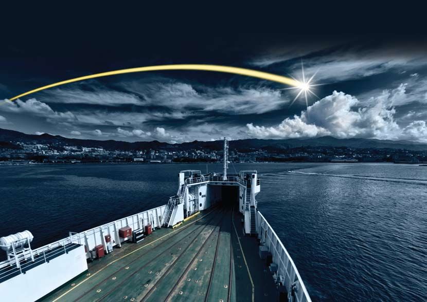
BIRTH OF THE EUROPEAN
SATEllite navigation
CONSTELLATION
Galileo In-Orbit Validation

Contents

European satellite navigation taking shape......                                                                  2

Guided by the sky..............................................................................................    4

How satellite navigation works...............................................                                     6

Europe’s first steps..........................................................................................     8

Anatomy of a navigation satellite......................................                                           10

Galileo on the ground................................................................................             12

Services today and tomorrow....................................................                                   14

Galileo IOV overview.................................................................................             16
→ European satellite
  navigation taking shape

                                                                                                                                   ESA - P. Carril

The first element of Europe’s global satellite navigation           The first satellites will prove that the space and ground
system is on its way. Two Soyuz rockets will launch two             segments meet many of Galileo’s requirements and will
satellites each: the four Galileo In-Orbit Validation (IOV)         validate the system’s design in advance of completing and
satellites that form the operational nucleus of the full            launching the rest of the constellation.
constellation. Developed in collaboration between ESA and
the European Commission (EC), Galileo will provide                  These first satellites are fully representative of the others that
high-quality positioning, navigation and timing services to         will follow them into orbit. Fourteen more will combine with
users across the whole world as a civil-controlled service with     these four to provide the ‘Initial Operational Capability’ by
guaranteed continuity of coverage.                                  mid-decade, which will then lead into the next phase, the
                                                                    final 30-satellite ‘Full Operational Capability’ (FOC).
Each satellite combines the best atomic clock ever flown for
navigation – accurate to one second in three million years – with
a powerful transmitter to broadcast precise navigation data. ESA
has built a supporting ground network around the globe.

2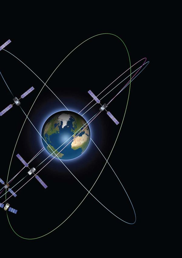
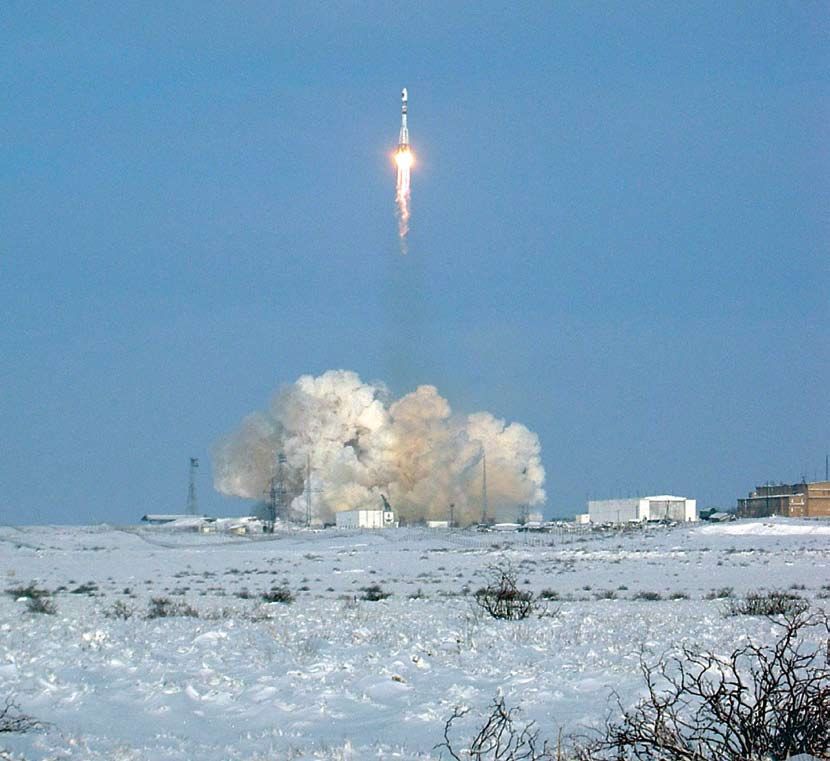
Soyuz at CSG:
                                                                                                delivering the first satellites
                                                                                                The first pair of satellites are the first payloads to fly on
                                                                                                Russia’s Soyuz rocket from its new launch site at Europe’s
                                                                                                Spaceport in French Guiana (CSG: Centre Spatial Guyanais).
                                                                                                This three-stage rocket is assembled horizontally in the
                                                                                                traditional Russian approach, then moved to the vertical so
                                                                                                that its payload can be mated from above in the standard
                                                                                                European way. A new mobile launch gantry helps this
                                                                                                process, while protecting the satellites and the launcher
                                                                                                from the environment.
                                                                              ESA – P. Carril

                                                                                                A European dispenser holds the satellites in place during
                                                                                                launch and then releases them into their final orbit.
                                                                                                A special version of the launcher is being used: a more
First Galileo satellites undergoing testing in Thales Alenia Space’s Rome facility
                                                                                                powerful Soyuz ST-B variant plus a Fregat-MT upper stage to
                                                                                                deliver the satellites into their final circular 23 222 km orbit.
                                                                                                The reignitable Fregat was previously used in its baseline
                                                                                                version to deliver ESA’s GIOVE-A and -B experimental
                                                                                                satellites. Fregat-MT carries an additional 900 kg of
                                                                                                propellant.
                                                                                                                                    ESA/CNES/Arianespace – D. Ducros

                                                                                                                                                                       Soyuz at CSG

                                                                                                                                                                                      3
→ Guided by the sky
     The underlying idea behind Galileo and other satnav systems
     is simple: many ultra-precise clocks are placed in orbit, and
     their times are broadcast together with their exact positions.
     Anyone with a receiver can combine these signals to find their
     three-dimensional location on the planet. In addition, the
     signals’ time stamps serve to synchronise global electronic
     transactions, such as inter-banking exchanges,
     telecommunications and energy networks.

     Satellite navigation is a hi-tech replication of an ancient
     tradition. Just like us, our ancestors looked to the sky to
     navigate and to mark out time. The Phoenicians relied on the
     few thousand stars visible to the naked eye to traverse the
     Mediterranean and strike out around Africa. On the other side
     of the globe, Polynesians navigated by those same celestial
     markers across thousands of kilometres of open Pacific.

     Astronomy itself was born as Egypt, Babylonia and other
     agricultural societies tracked the motion of the Sun, Moon

                                                                                                                                                                                                                          jay8085
     and stars in order to record the most auspicious times for
     planting crops.
                                                                                        Astronomical clock, Prague

Finding our way
      1119 AD                    1460                       1610                       1773                             1817                                     1908                                      1942

                                                                                                                                                                                                                          Hines, Ronald Maxwell
                                                                                                                                                                              Anschütz im Schnitt
                                                                                                                                         Otto Buchegger
                                                                                                     Racklever

First reference to a     The quadrant, a tool      Galileo Galilei discovers    John Harrison’s marine           First gyroscope                          Steel ships make                          Radio navigation systems
compass being used for   subsequently developed    the first four moons of      chronometer solves the           constructed by Johann                    traditional compasses                     developed for aerial
navigation at sea, by    into the sextant, first   Jupiter. He realises their   problem of measuring             von Bohenberger.                         less reliable; first                      warfare during World
Chinese writer Zhu Yu.   employed in marine        motion makes them a          longitude at sea.                                                         gyrocompass developed.                    War II, including the
                         navigation to measure     kind of clock that can be                                                                                                                        Long-Range Navigation
                         latitude.                 observed anywhere on                                                                                                                             (LORAN) system.
                                                   Earth, and uses them to
                                                   help establish longitude
                                                   more accurately.

     4
The very first clocks were built as aids to astronomy – first
                 relying on the constant drips of water, before moving to
                 clockwork mechanisms that reproduced the motion of the
                 Solar System in miniature. Europe’s first purely mechanical
                 clocks appeared in the 13th century, although they lost hours
                 per day and had to be regularly reset with the aid of sundials.

                 Around the same time, navigators became less dependent on
                 the sky. The compass allowed sailors to find their direction
                 even when the heavens were cloudy. Before that, maritime
                 trade would largely come to a halt during winter.
                                                                                                                                      By the 20th century, mechanical clocks had become ever more
                 Meanwhile, the old astrolabe astronomy instrument evolved                                                            precise, only to be rendered obsolete by quartz clocks in both
                 into the practical sextant for navigation. A ship’s latitude                                                         accuracy and price. Quartz clocks came to sit at the heart of new
                 could be faithfully reckoned by measuring the angle of                                                               radio ranging systems developed during the Second World War
                 prominent stars. But while north/south latitude could be                                                             to serve long-distance aircraft. Atomic clocks proved far more
                 fixed by the stars, west/east longitude proved more elusive,                                                         accurate, drifting only a matter of seconds per million years.
                 which rendered long-distance navigation a hit-and-miss affair.
                 This was because Earth’s rotation keeps the stars moving                                                             Equally significantly, inertial navigation based on gyroscopes
                 sideways at a rate of 15 degrees per hour: any timing drift                                                          supplemented the long-serving compass. Gyrocompasses
                 caused large positioning errors. It was only in the 18th century                                                     proved effective, first on ironclad ships, then planes and
                 that self-taught inventor John Harrison crafted the first                                                            eventually the rockets that opened up flight beyond the
                 reliable ‘marine chronometer’. Losing less than five seconds                                                         atmosphere. All the technological ingredients – spaceflight
                 every ten days, Harrison’s invention was sufficiently reliable                                                       and satellites, radio navigation and atomic clocks – came into
                 for ships to traverse the oceans safely, winning him a fortune                                                       place to enable a new era of precision navigation. It only
                 from the British Admiralty.                                                                                          remained to put them together.

       1957                                              1960                                  1978                       1993                                  2005                      2008                       2011
                                NASA/A. Siddiqi

                                                                                                                                          Nachoman-au
                                                                       U.S. Air Force

Sputnik launched; study                           US Transit satellite                  Navstar 1, the first GPS   GPS becomes fully                    Launch of ESA’s GIOVE-A     Launch of ESA’s GIOVE-B   Launch of the first IOV
of its signal shows that                          launched, first in a                  satellite, is launched.    operational, with 24                 satellite, securing radio   satellite, carrying the   satellites.
Doppler shift can be                              series delivering                                                satellites.                          frequencies for the         most accurate atomic
used to derive ground                             Doppler-based ranging.                                                                                upcoming constellation.     clock ever used for
position.                                                                                                                                                                           satellite navigation.

                                                    Radio-ranging, from Earth to space
                                                    The underlying radio-ranging principle behind Galileo is                          receivers can measure the differing arrival times of
                                                    not new. It has been used for decades on a terrestrial,                           signals from separate beacons to fix an aircraft’s
                                                    two-dimensional basis: long-distance aircraft measure                             position over Earth’s surface. But with satnav systems
                                                    their position against a global network of radio                                  delivering heightened precision, terrestrial radio
                                                    beacons. Systems like the US LORAN and Russian                                    navigation systems are now in sharp decline: LORAN
                     CambridgeBayWeather

                                                    Chayka incorporate time measurements so that                                      was switched off across the US and Canada in 2010.

                                                                                                                                                                                                                              5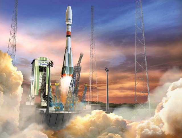
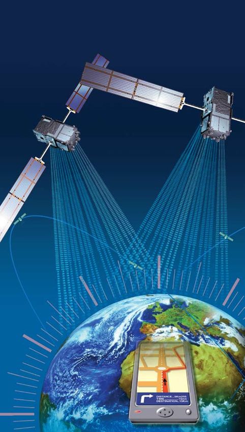
→ How satellite navigation
  works

                                                        time 2
                                                        distance 2

                                                                                             time 3
                                                                                             distance 3
                    time 1
                    distance 1

                                                                                                                        time 4
                                                                                                                        distance 4

                                          latitude + longitude + altitude + time check = position reading

Navigation beacons have to be as visible as possible. So                A broad spread of navigation satellites is needed to ensure
20th-century LORAN radio navigation towers guiding air traffic          that multiple signals can be received at any point on Earth.
stood hundreds of metres tall, while the lighthouses warning            Locking on to more signals yields greater accuracy, but four is
mariners of treacherous waters reach dozens of metres or are            the absolute minimum required. Three are used to
built on high ground. In essence, navigation satellites are the         ‘trilateralise’ (the three-dimensional equivalent of
same except they are located on the ultimate high ground of             triangulation) the user’s longitude, latitude and altitude on
space, making them visible anywhere on Earth.                           Earth’s surface, and a fourth to determine the time offset
                                                                        between the (precise) satellite clock and the (less precise)
The signal emitted from each satellite is a microwave radio             clock in the user’s receiver.
wave containing the time it was transmitted and the
satellite’s orbital position. Because the speed of light is             Design trade-offs dictate a medium-Earth orbit as the optimal
known, the time it takes for the signal to reach a receiver can         altitude for navigation satellite constellations, beginning with
be used to calculate the distance from the satellite. Galileo’s         the US GPS and Russian Glonass. After 20 years of
timing is accurate to the nanosecond*, so this distance can be          development, the completed GPS became operational in
derived to a very high degree of certainty. Combine inputs              December 1993. Made available to civil users, GPS pioneered a
from multiple satellite signals simultaneously – like viewing           host of novel applications; satellite navigation has since
several lighthouses at once – and your place in the world is            become part of all our lives. Yet GPS, like Glonass, remains a
pinpointed; the stated aim of Galileo is to deliver accuracy in         dual-use, foreign-military-controlled system.
the metre range once the full system is completed.

* there are 1000 million nanoseconds in one second
6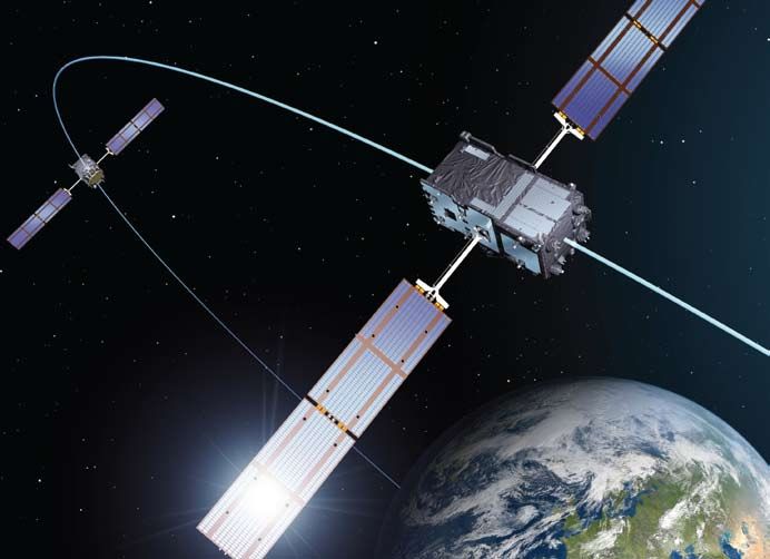
Receiving the signals
Modern satnav receivers are sufficiently
miniaturised to fit within car dashboards,
tracking sensors or mobile phones. It takes
a lot of embedded intelligence for them to
do their job: finding their place in the world.
To begin with, using antennas just a few
centimetres across, they have to lock onto
the minimum four satellites. Each signal is
surprisingly faint, equivalent in energy to
the beam of a car headlight shining from
one side of Europe to the other. So the
receivers incorporate detailed almanacs of
the satellite orbits. By knowing where the
various satellites are meant to be at any
time, the receivers can reduce the time it
takes to achieve signal lock from minutes to
just a few seconds.
Each satellite in space has its own code to
identify it, so complex that it comes close to
random electrical noise. The receiver stores
these complex codes in its memory, and
uses them to generate full-power replica
signals of the faint signals received. This
approach does not need full-size antennas,
so user receivers are small and satnav can
be widely used.
The stronger versions of the signals are
used for the calculations that derive the
final navigational data displayed to the user.
At the same time, the receivers also keep
their internal clocks synchronised with the
satellite’s onboard atomic clock, by instantly
determining the clock offset between them.

                                             7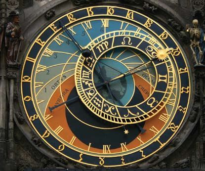
→ Europe’s first steps
The enormous potential benefits of satellite navigation             Today, EGNOS is operational and certified, forming the basis
brought ESA and the EC together in collaboration. In the early      of a wide range of general and safety-critical applications
1990s the two organisations defined a European Satellite            across our continent (see page 14).
Navigation Strategy so that Europe could be autonomous in
this increasingly important strategic and commercial sector.        For Galileo, ESA and the EC agreed a staggered approach. ESA
                                                                    launched two GIOVE satellites in 2005 and 2008, with a
ESA began research and development in cooperation with the          representative ground segment. These satellites secured the
EC and the civil aviation community. The development                frequencies provisionally set aside for Galileo by the
strategy was conceived with two major pillars:                      International Telecommunications Union as well as evaluating
                                                                    the performance of key technologies. Remaining in good
•   EGNOS (European Geostationary Navigation Overlay                health to this day, the GIOVE satellites are being moved to
    Service) A pan-European ‘augmentation system’,                  higher altitudes to make room for the Galileo satellites.
    complementing GPS to deliver reliability information to
    users (it uses GPS signals, improving the service by adding
    correction and additional information). It will also
    complement Galileo when deployed.

•   Galileo A fully autonomous and interoperable worldwide
    satellite navigation system, broadcasting global navigation
    signals for high-performance services.

                 Galileo implementation plan                                               FOC Phase 2
                                                                                           All services
                                                                                           Total 30 satellites and ground segment

                                                                  FOC Phase 1
                                                                  Open Service, Search & Rescue,
                                                                  Public Regulated Service
                                                                  Total 18 satellites and ground segment

                                         In-Orbit Validation
                                         4 IOV satellites and ground segment

       Galileo System Testbed
       GIOVE A, GIOVE B, GIOVE mission segment

8
Lessons learnt
Results from GIOVE-A and -B helped to steer the design of
the Galileo IOV satellites. GIOVE-A, Europe’s first navigation
satellite, helped to prove:
— Satellite design Europe’s first satellite to operate from
medium-Earth orbit, where the radiation is extremely
Launched into history severe.
— Orbit models navigation loop Confirmed the orbit
The historic first step in the in-orbit validation of the models used to generate the navigation signal, with the
Galileo system was the construction of the two GIOVE required accuracy of orbit and clock estimates.
satellites, built in parallel with complementary capabilities — Rubidium clock High stability demonstrated in the harsh
to provide redundancy. Their name stands for Galileo radiation environment.
In-Orbit Validation Element, additionally commemorating — Ionosphere effects Assessed using a global network of
Galilei Galileo’s discovery of the first, largest moons of ground stations.
planet Jupiter – ‘Giove’ in Italian. — Sensor stations Data from the 15 GIOVE experimental
data stations showed the basic design assumptions of
GIOVE-A Flown on a Soyuz launcher (pictured) from Baikonur the operational ground segment are sound.
Cosmodrome in Kazakhstan on 28 December 2005, GIOVE-A — GPS to Galileo time offset GPS and Galileo run on
was constructed by Surrey Satellite Technology Ltd in the UK. different time systems, so the difference between their
Carrying the first Galileo signal generator ever flown into timings must be known exactly for the two systems to
orbit, GIOVE-A was equipped with a phased-array antenna of work together. GIOVE signals incorporate a measurement
individual L-band (1200–1600 MHz frequency range) of the current separation on an experimental basis,
elements to illuminate the entire visible Earth beneath it, as demonstrating that interoperability of the two systems is
well as two very stable rubidium atomic clocks. Two types of indeed feasible.
radiation detectors monitor its orbital environment.
In addition, GIOVE-B has also proved:
GIOVE-B Flown on a Soyuz launcher from Baikonur — Passive hydrogen maser clock Proven to be the most
Cosmodrome on 27 April 2008, GIOVE-B was built by a stable clock ever flown for navigation applications.
consortium headed by Astrium and Thales. It features an — Multiplexed BOC The high-performing ‘multiplexed
improved phased-array antenna of individual L-band elements binary offset carrier’ (BOC) in one of the two GIOVE‑B
illuminating the visible Earth, a signal-generation unit able to channels is an advanced modulation technique that
produce new types of signals with features agreed between offers robust protection against signal interference and
the EU and the USA, an exceptionally stable passive hydrogen the misleading signal reflection known as ‘multipath’.
maser clock along with a rubidium clock, and a new radiation
sensor to monitor its orbital surroundings.
ESA – P. Carril
ESA – P. Carril
GIOVE-A GIOVE-B
9→ Anatomy of a navigation
satellite
Satellites are high-performance machines, designed to work
perfectly for years. The Galileo satellites and especially their
navigation payloads incorporate numerous innovations to 8
perform their job over their 12-year design life:
1 L-band antenna Transmits the navigation signals in the L-band. • Rubidium clock An atomic clock
based on a different technology,
2 Search & rescue antenna Picks up distress signals from beacons on ensuring redundancy to the masers.
Earth and transmits them to a ground station for forwarding to local It is accurate to within
rescue services. 1.8 nanoseconds over 12 hours.
3 C-band antenna Receives signals containing mission data from uplink • Clock monitoring and control unit
stations. These include data to synchronise the onboard clocks with a Provides the interface between the
ground-based reference clock and integrity data that contain four clocks and the navigation
information about how well each satellite is functioning. This integrity signal generator unit. It also
information is incorporated into the navigation signal for ensures that the frequencies 6
transmission to users. produced by the master clock and
active spare are in phase, so that
4 Two S-band antennas Part of the telemetry, tracking and command the spare can take over instantly
subsystem. They transmit housekeeping data about the satellite should the master clock fail.
platform and payload to Galileo’s ground control segment and, in turn,
receive commands to control the satellite and operate the payload. The • Navigation signal generator unit
S-band antennas also receive, process and transmit ranging signals Generates the navigation signals using 4
that measure the satellite’s altitude to a few metres. input from the clock monitoring and
control unit and the uplinked navigation and
5 Infrared Earth sensors and 6 visible light Sun sensors These integrity data from the C-band antenna. The
keep the satellite pointed at Earth. The infrared Earth sensors detect navigation signals are converted to L-band for
the contrast between the cold of deep space and the heat of Earth’s broadcast to users.
atmosphere. The Sun sensors are visible-light detectors that measure
the angle to the Sun. • Gyroscopes Measure the rotation of the satellite.
7 Laser retroreflector Allows the measurement of the satellite’s • Reaction wheels Control the rotation of the satellite. When they
distance to within a few centimetres by reflecting a laser beam shone spin, so does the satellite, in the opposite direction. The satellite
from a ground station. The reflector will be used only about once a rotates twice per orbit to allow the solar wings to face the Sun’s rays.
year, because altitude measurements via S-band antenna are
otherwise accurate enough. • Magnetotorquer Modifies the speed of rotation of the reaction
wheels by introducing a magnetism-based torque (turning force) in
8 Space radiators Radiate excess heat to deep space, maintaining the opposite direction.
onboard electronics within their operational temperature range.
• Power conditioning and distribution unit Regulates and controls
9 Passive hydrogen maser clock The master clock on the satellite. Two power from the solar array and batteries for distribution to all the
are flown for redundancy. This atomic clock uses the ultra-stable satellite’s subsystems and payload.
energy oscillations of a hydrogen atom to measure time to within
0.45 nanoseconds over 12 hours. • Onboard computer Controls the satellite platform and payload.
105
4
7
6
ESA – J. Huart
3
1
Orbital FOC architecture
The full operational capability (FOC) constellation will
consist of 27 operational satellites plus three spares,
circling Earth in three circular medium orbits, at an altitude
of 23 222 km with an orbital inclination of 56º to the
equator, in planes separated by 120º longitude.
2
Atomic clock technology
Atomic clocks placed in orbit are the underlying technology
behind satellite navigation. All clocks are based on regular
oscillations – traditionally the swing of a pendulum, tick of
ESA – P. Carril
clockwork or pulse of quartz crystal. Highly accurate atomic
clocks rely on switches between energy states of an atom’s
electron shell, induced by light, laser or maser energy.
The first atomic clock, developed in England in 1955, was the
size of a room. For satellite navigation, the challenge was to
come up with a design that was compact and robust enough
to fly in space. Thanks to long-term ESA research and
development, two separate atomic clock technologies have
been developed and qualified in Europe, then proved suitable
for the harsh environment of space by the GIOVE missions.
Galileo carries both types of atomic clock: a smaller
rubidium atomic clock, accumulating three seconds’ error
9 every million years, and a bulkier hydrogen maser clock,
accumulating one second’s error every three million years.
11→ Galileo on the ground
DLR, GfR mbH
Telespazio
Galileo Control Centre,
Oberpfaffenhofen, Germany
Galileo Control Centre,
Fucino, Italy
Galileo ground
station, Kourou,
French Guiana
Galileo in-orbit testing facilities,
Redu, Belgium
New Caledonia, South Pacific, site of a Galileo
uplink and sensor station
TTC antenna, Kiruna, Sweden
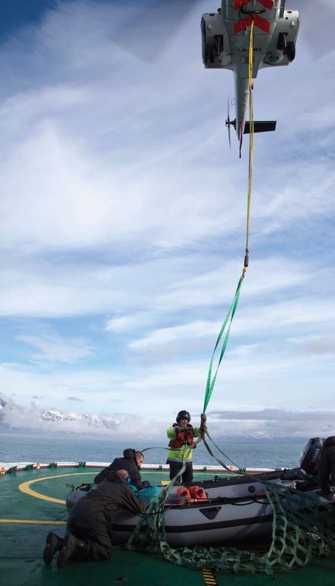
Sensor station, Svalbard, Norway
There is a lot more to Galileo than just its satellites in space. The Satellite orbits drift as well, nudged by the gravitational tug of
worldwide ground network is essential to ensure the continued Earth’s slight equatorial bulge and by the Moon and Sun. Even
reliability of the time and positioning information embedded the slight but continuous push of sunlight itself can affect
within the signals from space. satellites in their orbital paths. So the global network of ground
stations picking up the Galileo signals perform radio-ranging in
Satellite navigation relies on the receiver to derive the time and reverse on the satellites emitting them, to pinpoint their current
point in space that the signal was emitted, with an extremely position and identify any orbital drift.
high level of accuracy. This information is embedded within the
signal itself. But onboard atomic clocks can still drift – and just a This information on the satellites’ clock performances and
billionth of a second clock error corresponds to a 30 cm range error. positions is gathered so that a correcting message can be
uplinked to the satellites for rebroadcast to users in the
So a network of ground stations continuously checks each satellite signals themselves. Completing the loop in this way
satellite’s clock against Galileo System Time, which is generated means that optimal system performance can be maintained
by the Precise Timing Facility at the Galileo Control Centre in over time. The quality and reliability of each individual Galileo
Fucino, Italy, which is in turn cross-checked for alignment to the signal is also checked.
international Coordinated Universal Time by a group of European
timing laboratories.
12GALILEO
SATELLITES
Galileo IOV
ground segment
architecture
Tracking
and telecommand
stations
Kiruna Kourou
Uplink stations Sensor stations
worldwide Receive telemetry worldwide
and uplink commands Gather data
Uplink navigation to satellites on satellite orbits,
message for rebroadcast clock accuracies
by Galileo satellites + signal strength
USERS
Ground mission Ground control
segment Realtime connection segment
Fucino Oberpfaffenhofen
Compiles navigation message, including Oversees the satellites and writes
any clock+orbit corrections needed any housekeeping commands needed
The Galileo ground segment is one of the most complicated • Tracking and telecommand stations Two, at Kiruna in
developments ever undertaken by ESA, having to fulfil strict Sweden and Kourou in French Guiana.
levels of performance, security and safety. • Uplink stations A network of stations to uplink the
navigation and integrity data.
• Ground mission segment (GMS) In the Fucino Control Centre • Sensor stations A global network providing coverage for
in Italy, it must provide cutting-edge navigation performance clock synchronisation and orbit measurements.
at high speed around the clock, processing data collected • Data dissemination network Interconnecting all Galileo
from a worldwide network of stations. GMS has two million ground facilities.
lines of software code, 500 internal functions, 400 messages
and 600 signals circulating through 14 different elements.
• Ground control segment (GCS) In the Oberpfaffenhofen
Control Centre in Germany, it monitors and controls the
constellation with a high degree of automation.
During the IOV phase, these two centres will have distinct
roles; in future, they will work together as hot backups with
realtime data synchronisation. In the event of the
catastrophic loss of one centre, the other will be able to
continue operations. Coping with the ionosphere
Incoming solar radiation splits apart air molecules
at the top of the atmosphere to form an
electrically-charged layer known as the ‘ionosphere’.
Radio pioneers used the ionosphere to reflect their
signals beyond Earth’s horizon, but for satellite
navigation it is more of a hindrance than a help.
Ionospheric interference can cause satnav
receivers to lose signal lock or add significant signal
delays, in the worst case causing positioning errors
of dozens of metres. Dual-frequency receivers that
receive two satnav frequencies simultaneously can
overcome this kind of error. Single-frequency
receivers of the type used in cars or mobile phones
rely on ionospheric error estimates that are
2 4 6 8 10 12 14 16
generated by the Galileo ground segment and
metres included in the signal message. Galileo incorporates
The ionosphere at around noon GMT, showing ionospheric scintillations due to an advanced ionosphere-modelling system to make
incoming solar energy, in terms of the positioning errors that could result its error calculations.
13→ Services today
and tomorrow
Today: EGNOS
The first pillar of Europe’s navigation programme, EGNOS, is already
operational, sharpening the accuracy of GPS signals across Europe.
In addition, it informs users about the current integrity (level of
reliability) of the system based on the GPS satellites’ orbits, atomic
clock accuracy and ionospheric delay. If the accuracy of the signal
falls below a given threshold, users are warned within six seconds.
The Open Service, for applications where human life is not at
stake, such as personal navigation, goods tracking and precision
farming, has been available since October 2009.
The Safety-of-Life Service, where human lives depend on the
accuracy and integrity of the signals, became available for its
primary purpose of aircraft navigation (beginning with vertical
guidance for landing approaches) in March 2011.
The system is based on a network of ground stations, control centres
and three geostationary satellites. The ground stations gather data
on the current accuracy of GPS signals and embed it in the EGNOS
signal, which is uplinked to the satellites to be transmitted to users.
EGNOS is designed against international standards set by the
International Civil Aviation Organisation (ICAO) and its
development was coordinated with other satellite-based
augmentation systems around the world: MSAS in Japan, WAAS
in the US, and GAGAN in India.
WAAS EGNOS GAGAN MSAS
B. Suhr / Governor of Svalbard
14Tomorrow: EGNOS plus Galileo
Once Galileo becomes operational, a
portfolio of navigation services will be
offered by Galileo and EGNOS, based on
varying user needs:
• Open Service The Galileo navigational
signal will be accessible by the general
public free of charge, providing improved
global positioning.
• Public Regulated Service Two encrypted
signals with controlled access for specific
users such as governmental bodies.
• Search and Rescue Service Galileo
will contribute to the international
Cospas–Sarsat international system for
search and rescue. A distress signal will
be relayed to the Rescue Coordination
Centre and Galileo will inform the user
that their situation has been detected.
• Safety-of-Life Service Already available
for aviation to the ICAO standard thanks
to EGNOS, Galileo will further improve
the service performance.
• Commercial Service Galileo will provide a
signal for high data throughput and highly
accurate authenticated data, particularly
interesting for professional users.
The potential applications of satellite
navigation are virtually limitless. Beyond
the safety, efficiency and comfort that
satnav brings to the transport sector, it will
become a valuable tool for nearly all
ESA – J. Huart
economic sectors. Keeping track of where
you are will be as important as knowing the
time of day. Integration of satnav services
with other technologies such as mobile
communications or traditional navigation
aids will multiply their usefulness.
Evolution of European satnav
EGNOS and Galileo are here to stay. ESA’s satnav evolution Improved ionospheric modelling is another innovation that would
programme is looking into how the two systems will evolve. increase Galileo and EGNOS accuracy while also being of scientific
Research is under way into future improvements such as expanded interest. Navigation satellite ‘reflectometry’ is another field of
augmentation coverage, including how best to support increased research: intercepting reflected satnav signals with special
navigation in the Arctic region as ice cover recedes, even more receivers to gather scientific and environmental information on
precise atomic clocks, and intersatellite links to reduce Galileo’s Earth’s sea and land, including sea-surface height and roughness,
dependence on its ground segment for clock correction. wind fields, ice extent, soil moisture and biomass density.
15→ Galileo IOV overview
IOV-PFM
Making the future: Galileo’s partners
The definition, development and in-orbit validation phases
of the Galileo programme are being carried out by ESA and
co-funded with the EC. The Full Operational Capability phase
is managed and funded by the EC. The Commission and ESA
have a delegation agreement through which ESA acts as
design and procurement agent on behalf of the EC.
Galileo IOV satellite
Mass about 700 kg
Size with solar wings stowed 3.02 x 1.58 x 1.59 m
Size with solar wings deployed 2.74 x 14.5 x 1.59 m
Design life more than 12 years
Available power 1420 W (sunlight) / 1355 W (eclipse)
Orbit
Altitude 23 222 km
Inclination 56°
Galileo IOV main contractors
Space segment EADS Astrium GmbH (DE) as satellite prime,
with Thales Alenia Space (IT) as subcontractor for satellite integration
Operations segment SpaceOpal, a consortium created by DLR (DE) and Telespazio (IT)
System support activities Thales Alenia Space (IT)
Ground mission segment Thales Alenia Space (FR)
Ground control segment EADS Astrium UK
Test user segment Thales Avionics (FR), Septentrio (BE)
Global data network British Telecom (GB)
GIOVE-A
Further information
www.esa.int/navigation
www.esa.int/egnos
www.esa.int/galileo
http://ec.europa.eu/galileo
www.satellite-navigation.eu
www.egnos-portal.eu
www.gsa.europa.eu
16IOV-FM2
IOV-FM4
rril
a
P. C
–
ESA
IOV-FM3
GIOVE-B
FM = flight model
PFM = proto flight modelAn ESA Communications Production Copyright © 2011 European Space Agency
You can also read