BRG's Roadmap for Peatland Restoration - "Forest Ecosystem Restoration" CBD & FAO Workshop
←
→
Page content transcription
If your browser does not render page correctly, please read the page content below
BRG’s Roadmap for
Peatland Restoration
        CBD & FAO Workshop:
    “Forest Ecosystem Restoration”
        Bangkok, 27 June 2016

             Budi Wardhana,
   Deputy for Planning and Cooperation
   Peatland Restoration Agency (BRG)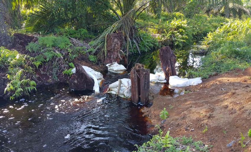
The Peat Restoration Agency Indonesia (BRG) Peat Restoration Agency (BRG) is a non structural agency under the auspices of and reports to the President BRG has the task of coordinating and facilitating the restoration of peatland in the provinces of Riau, Jambi, South Sumatra, West Kalimantan, Central Kalimantan, South Kalimantan and Papua BRG mandated to plan and implement the peat ecosystem restoration for a period of 5 (five) years of approximately 2,000,000 (two million) hectares of degraded peatland.
BRG Mission

a) Coordination and strengthening policy in the overall peatland restoration
   actions;
b) Develop policy, strategy and planning, provide direction and promote
   cooperation in peatland restoration activities;
c) Carry out peatland inventory and hydrological unit mapping on seven
   priority provinces;
d) Review and determine land use/zonation of peatland areas (based on
   protection and cultivation functions);
e) Provide guideline, standard and supervision on the construction, operation
   and maintenance of rewetting infrastructure and all its accessories;
f)   Review permits and licenses of peatland management or concession over
     peatlands which fail to control peatland degradation and/or fire;
g) socialization and education on sustainable management of peatland and
   its restoration;
h) Coordinate research and development for alternative economic activities
   for sustainable use of peatlands in the concession and community’s
   cultivation areas;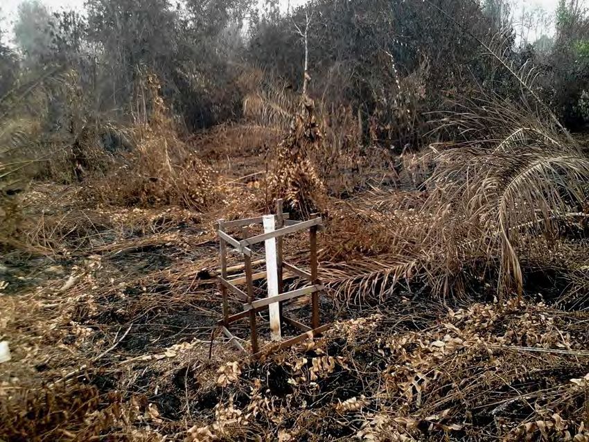
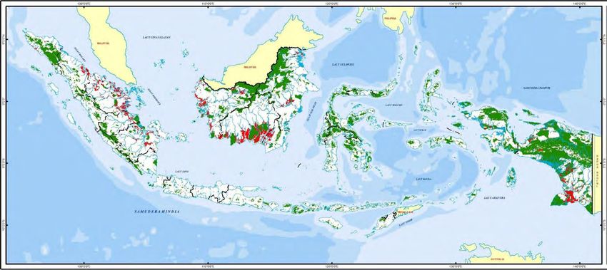
Peatland and Intact Forests
Map of Indonesia
Peatland Hydrological Unit (PHU),
                       Peatland and Peat-dome

                                                                 Peat-dome     Non-peat      Restoration
                                       PHU Area Peatland area
        Provinces           #PHU                                    area          area         priority
                                       (hectares) (hectares)
                                                                 (hectares)    (hectares)     (hectares)

Riau                           49       5,140,000    4,221,000     1,486,780       918,755       938,619
Jambi                          10       1,040,000     751,000        298,804       288,669       136,541
South Sumatera                 26       2,371,800    1,171,800       690,715     1,183,324       445,749
          Sumatera Total       85       8,551,800    6,143,800     2,476,299     2,390,747     1,520,909

West Kalimantan                91       3,040,400    1,840,400       698,653     1,183,917       324,285
Central Kalimantan             32       4,633,000    3,053,000     1,770,940     1,581,809       683,024
South Kalimantan                   4      340,814     160,214         93,946       180,561        68,734
        Kalimantan Total      127       8,014,214    5,053,614     2,563,539     2,946,286     1,076,043

Papua                         226       6,099,500    4,899,500       730,076     1,176,608        82,293

        Total 7 Provinces     438      22,665,514   16,096,914     5,769,914     6,513,641     2,679,245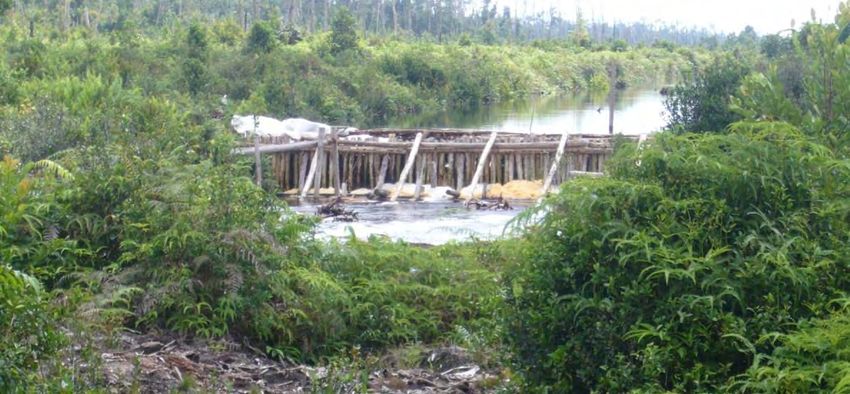
Peatland Hydrological Unit (PHU)
                               in 7 Provinces
                              (22.7 million ha)

                    Non Peat                        Peatland
                  (6.7 mio ha)                    (15.9 mio ha)

                      Cultivation Land           Unidentified/               Protected Areas
                       (12.9 mio ha)              water body                   (2.2 mio ha)
                                                 (0.74 mio ha)

Rehabilitation   Properly-    Restoration   Moratorium      Rehabilitation   Restoration     Properly-
(0.74 mio ha)    managed        Priority    (6.4 mio ha)    (0.25 mio ha)      Priority     managed
                 (3.3 mio    (2.4 mio ha)                                     (0.41 mio    (1.6 mio ha)
                    ha)                                                          ha)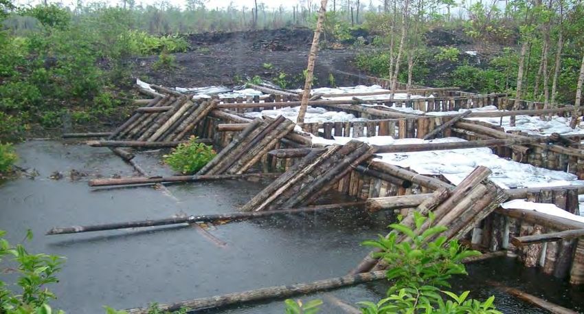
Restoration Priority Analysis
                                                                         2

                                                                     Peatland
                                             Protected areas     rehabilitation and
                                                                                              3
                                                                 law enforcement
                                1

    Peatland on                                                                        Reviewing/revoke
  hydrological unit                                              Moratorium and             permits
                        Indicative Maps of                         proposed to
                           Restoration                           protected status
                              priority

    Forest/land                                                                         Instruction for
  cover and land-                                                                        corporate led
     use status                                                                           restoration
                                                                   Concession

                                                                                          Support for
    Historical fire                                                                      participatory
     occurrence                                                                           restoration

                                             Cultivation areas

                                                                                      Economic security
 Over-drained                                                                         of local community
     peat by
extensive canal                                                  Open-access /
 (concessions,                                                    Community's           Cultivation over
  community's                                                    cultivated land         wet peatland
cultivated land)                                                                       (Paludiculture or
                                                                                          alternative
                                                                                         commodities)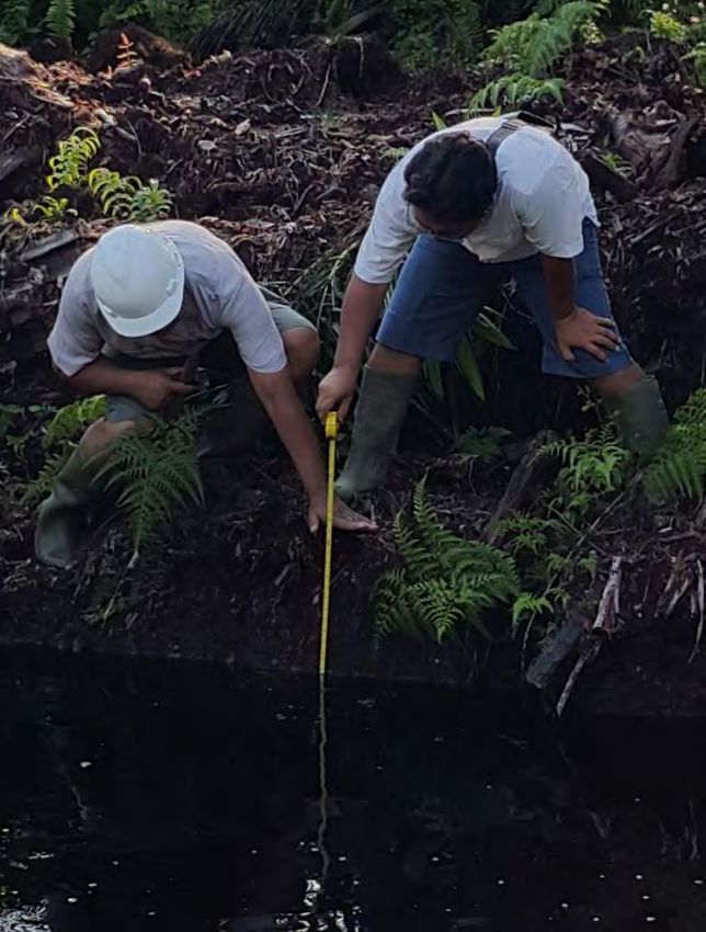
Planning and Restoration Action     Reclassification of land use
                                    for protected and cultivated
                                    functions (re-zonation)

Peatland mapping and inventory:
                                    Private sector partnership,
• Hydrology
                                    direction and promoting
• Land use and status of peatland
                                    cooperation in peatland
  (concession maps, land tenure,
                                    restoration
  protected areas)
• Conflict over land use and/or
                                    The construction and
  tenurial
                                    maintenance of peatland
• Biodiversity, habitat, species
                                    rewetting infrastructures
• Degradation degree (over drain
  for intensive canal, fire
                                    Conflict resolution over
  scars/historical fire)
                                    peatland tenurial and land-
                                    use, and the promotion of
                                    community based/
                                    participatory restoration
                                    actions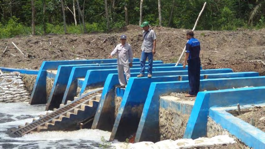
Restoration Implementation
              (for 2 million ha priority Target)
             Peatland mapping and                     Stock taking of existing programs,
             inventory overlaid with                    policy and activities related to
                    land-use                            peatland and their objectives

                 Agree on party responsible for restoration based on
                     land-use mapping and existing programs

              Establish necessary agreement with the responsible party,
             including at least feasibility study, cost analysis, design and
                 techniques, detailed map, community engagement

                            Restoration work starts, led by:
Concession holder          Local          Provincial Government      Technical
(Agriculture, pulp &       Community      (Forest Management         Operational Unit of
paper, or logging                         Unit or other)             National
                                                                     Government

                       Strengthening policy and enforcement of peat
                         land protection regulations at national and
                                       provincial level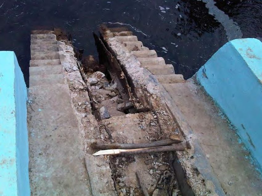
Roadmap of Peatland Restoration
2016 2017 2018 2020
Government as
Strategy 1 : Controlling peatland degradation L lead actor
and conversion
1. Moratorium for further expansion of cultivation Government as
L S S supporting actor
on peatland
2. Control and prevent forest and peatland fire
Corporate as
(Providing early warning system, monitoring, L S L lead actor
ensuring peatland wetness index to safe level)
Corporate as
3. Data and information on peatland S supporting actor
management (permits, plan, status) L S
available to the public through the NGO/Research
L as lead actor
development of Geospatial
Information Systems national NGO/Research as
regional
S supporting actor
4. Determine the protected
status of peatland as essential L S
ecosystem for life-support
systemRoadmap of Peatland Restoration
2016 2017 2018 2020
Strategy 2 : Assessment of peatland degradation Government as
impacts (costs/value) and determine L lead actor
options for future sustainable land use Government as
S supporting actor
1. Develop and designate National standard for
determining peatland degradation (criteria and L S S
Corporate as
indicator) for mapping, assessment and monitoring L lead actor
2. Assess and make public the condition and
distthousandtion of peatland both inside and outside L S S
Corporate as
the concession areas supporting actor
3. Commitments related to sustainable NGO/Research
peatland management plans in both L S L as lead actor
the concession (concession holder) NGO/Research as
and outside the concession (the S supporting actor
government)
4. Assessment of options and
recommendation for wet-peatland L S S
culture (timber/fiber silviculture,
plantation estate)Roadmap of Peatland Restoration
2016 2017 2018 2020
Strategy 3 : Implementing sustainable peatland
management at landscape level
(peatland hydrological unit/PHU)
1. Phasing-out drainage based agriculture/silviculture on peatland
2. Restoration of degraded peatland on concession as part of phasing L S
out drainage-based
3. Hydrological restoration
4. Vegetation restoration through natural and assisted revegetation L S
5. Identifying and piloting sustainable paludiculture options
6. Developing market for commodities suitable for wet peatland L S S
production/cultivation
7. Implementation of sustainable management practices L S SRoadmap of Peatland Restoration
2016 2017 2018 2020
Strategy 4 : Conserving peatland as essential
ecosystems (and its biodiversity) and
its Surrounding Areas/PHU
1. Conserving domes, wildlife corridors, wildlife sanctuary, habitat and sources of
wild relatives of food and agriculture resources
2. Monitoring biodiversity in corridors and habitats L S S
3. Protection of carbon storage and water management system L S SRoadmap of Peatland Restoration
2016 2017 2018 2020
Strategy 5 : Improve social conditions and resolve
conflict over resources
1. Fully comprehend the socio-economic dynamics of local communities
by using the principle of FPIC in the management of peatland, as well L S
as for restoration activities
2. Recognise the rights of local/indigenous communities and integrate mutually agreed
conflict resolution procedure into peatland land use planning and restoration L S
activities
3. Develop partnership to support and improve local community livelihood for
L S
sustainable peatland-based economic activities.
4. Improve capacity of local communities to increase sustainable management
practices in peatland areas L SRoadmap of Peatland Restoration
2016 2018 2020
2017
Strategy 6 : Enhance Good Governance for Forest
and Peatlands
1. Enhance transparency on peatlands management policy and
monitoring along with strict law enforcement L S
2. Budget available for incentives and disincentives mechanism towards sustainable
peatland management L
3. Assessment of rights over resources in policy formulation
4. Participatory and consultative process in decision making. L S
4. Accountability L S SOverview of issues Indonesia’s 15-20 mio ha of peatland was mostly undrained and forested until 20 years ago, used for productive selective logging; now mostly drained, deforested, burning, emitting carbon and often unproductive; any improvement relies on raising water levels – ‘rewetting’; this was always clear scientifically and is now recognized by GoI; an ambitious target was set to rewet millions of ha in a few years; this takes blocking of probably >10,000 km of canals (large & small); i.e. construction of probably >10,000 dams; QUESTION: what method(s) can produce hundreds of dams per month, for an affordable budget, that will last permanently?
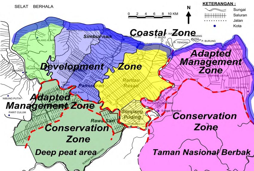
Separation of Conservation &
17   Development Zone
FLOW OF THINKING ON LOW-LAND
                    MACRO ZONATION
                                                           Conservation Zone
                                                           (with Conservation
                                                                Attribute*)

Hydrological unit is              Divided into 2 zones :
outer boundaries of               1. Development Zone                           Divided into 4 areas:
combined NWS                      2. Conservation Zone                          1. Conservation
lowland and PHU                                                Development          Management Area
                                                                   Zone         2. Adaptive Management
                                                             (No Conservation       Area
                                                                 Attribute)     3. Coastal Management
                                                                                    Area
*Conservation attributes are KSA, KPA, HL, Peat
                                                                                4. Development Area
dome, peatland> 3 m, peatland < 3 and area (30%
hydrological unit), HCVA
< 40 cm
Subsidence at KS-6 S. Buluh,Jambi (Small Scale Plantation)
23 June 2015
Fire Impact
Subsidence Pole Peak Elevation KS-6 4,22 m
Surface Elevation as of 29 July 2015 3,29 m Subside 17
3,12 m
cm
Surface Elevation as of 22 September 2015
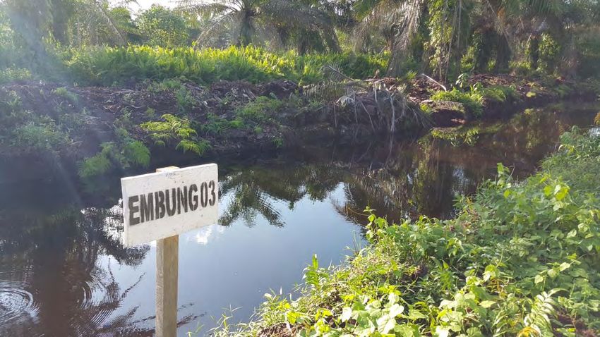
At locationWater Management Measures in Peatland Area Based on Hydrological Peatland Unit (PHU), Peat dome is treated as a natural water storage system in which its existence and water availability need to be maintained Water level control and water loss prevention Keep the land wet, especially in the dry season Water loss control and prevention (canal blocking construction, long storage serial, shallow retention pond, water gate, levelled compacted embankment)
CANAL
BLOCKING
OVERVIEW OF CANALS WITH MINIMUM BLOCKING AND VARIOUS
                     BLOCKING HEIGHTS

     •      Limited number of blocking and high peat-blocking: water surface will increase
            until it reaches peat surface but only within blocking area.
     •      Limited number of blocking and low peat-blocking: water surface will not reaches
            peat surface, the water from canal will overflow above canal blocking which will
                                                                                       23
            damage canal blocking infrastructure.
Dedi Mulyadi - Deltares
OVERVIEW OF NUMEROUS CANAL BLOCKING WITH VARIOUS
BLOCKING HEIGHTS
• Abundant canal blocking with lower peat-blocking than peat surface:
water surface will not reach peat surface, the water in canal will water
overflow above canal blocking
• Abundant canal blocking with high peak blocking: water will reach peat
surface (ideal condition)
Dedi Mulyadi - DeltaresPlant Trees over Canal Blocking
Structure
Upper layer is covered by plants
Vegetation over
Canal Blocking
Water Surface
Water Pipe Heights at Upstream
Water Surface
Compacted Peat
Heights at and Mineral Soil Direction of
Downstream Water Flow
Mineral Soil LayerCanal blocking options:
concrete structures
Blok A, Kalteng, Jan 2014 Boat access important co-objective
Structures of concrete and steel are very expensive at >50,000$ each,
take very long to build (months), and do not last long as they:
[i] are broken down by people and
[ii] sink into the soft peat / clay underground.Canal blocking options:
concrete structures [2]
Blok A, Kalteng, Jan 2014 Boat access important co-objective
Severe damage by Sep 2014 Concrete structures were also
built, and failed, in the MRP,
Kalteng, 1997...Canal blocking options: box
dams [1]
Blok A, Kalteng
Blok C, Kalteng
Box dams are made of wooden ‘boxes’ filled by sand bags or
peat, created by local community labour. These cost >5,000$
each, take weeks to build, and usually do not last long as they
are quickly eroded by water. Much maintenance required. A few
hundred have been created in Indonesia.Canal blocking options: box
dams [2]
Blok A, Kalteng Blok C, Kalteng
After some years….Canal blocking options: compacted peat dams [1] Plantation industry has long applied dams created of compacted peat. Peat, when compacted by an excavator, becomes a dense (*2) and strong material – that is lightweight (no sinking) and abundantly available. These dams are created quickly (6000 by APP alone in Sep 2015 – Jan 2016; > 1000 a month, using ~100 excavators).
Canal blocking options:
compacted peat dams [2]

              Dedi, other images of
              older dams?
Partial canal infilling –
demonstration [1]
Open canalPartial canal infilling –
demonstration [2]
Canal blocks constructedPartial canal infilling –
demonstration [3]
Partial infillingPartial canal infilling –
demonstration [4]
Nature takes over…Examples of peat dam
cascades – Brunei
Brunei, Badas peat dome, 2014, for Shell with Wetlands InternationalExamples of peat dam
cascades – Sumatra [1]
Sumatra & Kalimantan, plantation perimeter canals, 2015
https://www.deltares.nl/en/projects/reducing-impact-plantation-operations-peatlands-indonesia-2/Examples of peat dam
cascades – Sumatra [2]
Sumatra & Kalimantan, plantation perimeter canals, 2015, for APPPost 2015 fire restoration design: Tahura, Jambi [1] (TENTATIVE – IN DISCUSSION – MAY CHANGE)
Post 2015 fire restoration design: Tahura, Jambi [2]
      (TENTATIVE – IN DISCUSSION – MAY CHANGE)
207 dams tentatively planned in Tahura (~20,000 ha). To be implemented
in 1 year maximum (from approval). Dams designed based on LiDAR
derived land surface slope canal dimensions.

COST:
Peat dams & infilling:
$500,000 total;
= $2400 / dam
= $26 / ha

Peat dams only:
$250,000 total;
= $1200 / dam;
= $13 / ha
                                               Berbak N.P.
Box dams (est.):
$1,300,000 total;
= $6000 / dam;
= $65 / ha
Recommended canal blocking
options
We recommend the following applications of different
systems in different settings and for different
applications:
(1) For large-scale water management improvement in
industrial plantations, where water levels should be raised
but flooding prevented: compacted peat dams with
spillways.
(2) For large-scale rewetting in forest and degraded
peatlands where forest is to be restored: compacted
peat dams (no spillways) and partial canal infilling.
(3) For water management improvement in community
agriculture lands, where access must be maintained:
combination of measures that may also involve box dams
to ensure community support through involvement in
construction.Data requirements – LiDAR [1]
LiDAR elevation / slope data
may be used to determine
intervals between blocks.
However this should not be
too detailed; better to have
a few interval classes for
different slopes, e.g.:
(a) 1 m/km:Data requirements – LiDAR [2]
N
0 10km
3D version of Kampar Peninsula (Riau) DTM showing forest 2012
(green; as mapped by Margono et al., 2014), forest that was burnt or
partly burnt since 2012, as indicated by MODIS hotspots (red) and
canals + logging tracks (blue).
https://www.deltares.nl/en/projects/impact-assessments-for-pulp-and-oil-palm-plantations-in-the-kampar-peninsula-peatlands-riau-indonesia/“Sustainability issues in
peatlands comprise complex
sets of challenges that require
involvement and determination
of all stakeholder”
CALL FOR CLOSE AND
IMPACTFULL COLLABORATION
Thank You
Terima KasihYou can also read