BULLRUSH Walk KINGFISHER Walk - Ely Country Park Circular Walking Trails 1.5 miles (2.4km)
←
→
Page content transcription
If your browser does not render page correctly, please read the page content below
Ely Country Park
Circular Walking Trails
 BULLRUSH Walk
    1.5 miles (2.4km)
KINGFISHER Walk
     2 miles (3.2km)

        East Cambridgeshire
          District Council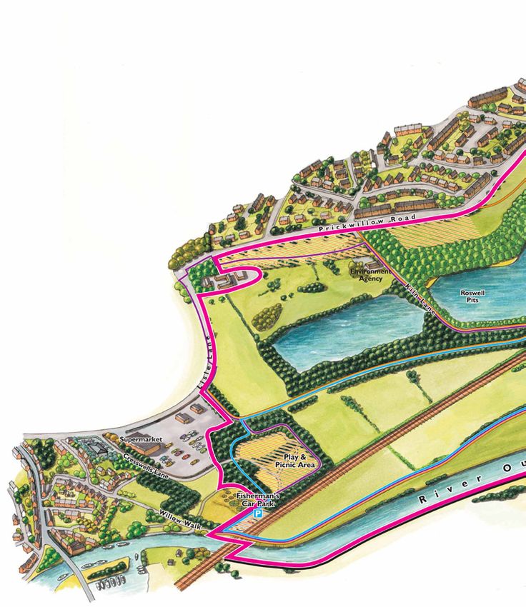
Bullrush Trail                         Continue on Springhead Lane
Distance: 1.5 miles (2.4km)            passing the kissing gate on your right
                                       hand side, until you reach the metal
                                       kissing gate at the end of Springhead
                                       Lane.
                                       Go through the metal kissing gate
                                       into the gravel car park, and head
From Fisherman’s Car Park, take        towards the road.
the hard path along Poplar Walk
into the Country Park.                   Springhead Lane meadow -
At the waymark on your left, turn        Point of Interest
left onto the bark path.                 This area of the Country Park
Continue straight ahead along the        supports bats, grasshopper
bark path for 130m until you reach       warblers, water rail and redwing
a hard path.                             and provides hunting grounds for
                                         barn owls.
1
At this point, to your left you will   At the road turn right up Kiln Lane
find a view of Ely Cathedral.          taking great care.
Cross over the hard path onto the
bark path directly ahead following
                                        3
                                       On your left is a lake known as
the waymark on your right.
                                       Roswell Pit.
Follow along the bark path, which
                                       Continue along Kiln Lane and take
veers around to the right for
                                       great care when crossing the railway
150m.
                                       line.
Bare left of the waymark on your
                                       After the railway crossing, stop at the
right hand side.
                                       metal field gate on your right hand
Turn left when you reach the sloped
                                       side; lapwings are known to nest in
bridge. Walk down the bridge.
                                       this field and you might see them in
 2                                     spring.
Turn right at the bottom of the         4
bridge onto Springhead Lane
                                       Continue along Kiln Lane.
(known locally as ‘Lover’s Lane’).
Springhead Lane forms part of the
Hereward Way promoted footpath.
At the 25mph speed sign on your left
hand side, turn right onto a narrow
tarmacked path which forms part of
the Fen Rivers Way.
Keep the car park on your left hand
side, passing underneath the power
lines.

At the end of the path turn right
through a metal kissing gate.
Continue along gravel path with the
river on your left hand side.

5
At the end of the gravel path, proceed
through the kissing gate.

6
Continue along the path underneath
the rail bridge turn right into
Fisherman’s Car Park.

1
ELY CATHEDRAL - Point of Interest
Ely Cathedral is known as ‘The Ship of the Fens’, as Ely was once an island surrounded by marsh and
swamp. After the Norman Conquest, where Ely saw some of last Saxon resistance lead by Hereward
the Wake, Abbot Simeon began the building of a new cathedral. It took centuries for the cathedral
to develop as we see it now. All the stone had to be brought by water, most of it from the quarries at
Barnack, near Peterborough. The river at Ely is manmade, diverting the original course, which ran at
the bottom of Stuntney’s Hill. In 1321 the central Norman tower collapsed and out of the disaster
Alan of Walsingham, the cathedral Sacrist, created the magnificent and unique octagonal lantern
tower, which is one of the glories of world architecture.

 2
HEREWARD WAY
- Point of Interest
Named after the legendary
Saxon leader, this is a long
distance footpath running from
Stamford in Lincolnshire, through
Peterborough, March, Ely and onto
Brandon and Thetford Forest. This
Springhead Lane section of the
walk is one of the oldest routes
into Ely, used from the time of
the earliest Saxon settlement. It
led to Turbotsey, the port for Ely,
before the river was diverted in
the twelfth century. The body of
Saint Withburga would have been
carried along this track after it
had been stolen by the monks of
Ely in the tenth century from the
church at Dereham in Norfolk .

                                                                   6
                                                                 THE CRESSWELLS - Point of Interest
This riverside path goes through an area known as the Cresswells, pronounced Creasels. This was
an area where the people of Ely grew water cress, but called it ‘water creases’. This is a popular
stretch of river for angling and around the turn of the twentieth century, Ely had a friendly invasion
of Sheffielders, who took their Wakes Weeks holiday for fishing in the Fens. The busy railway line
that now runs through this area was brought to Ely in 1845 by the great Victorian engineer, Samuel
Morton Peto, to connect London to his development plans for Lowestoft on the Suffolk coast.
3
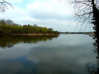
ROSWELL PIT - Point of Interest
The first pit you see was dug after the disastrous 1947 floods in the fens to provide clay or gault for
riverbanks. After the seventeenth century drainage of the fens, the rich peat soil that was revealed
shrank rapidly when exposed to the air and as the water was drained from it. This resulted in the
need to embank the rivers and then install pumps to keep the fens drained. Roswell Pits, originally
Roswell or Roslyn Hills, was excavated for the vast quantities of clay need.
Roswell Pit supports many breeding birds including the great crested
grebe and kingfisher and provides foraging and resting areas
during winter for other birds such as the bittern. With a wide
variety of habitats many other species are found here
including water voles, otters, a number of bat species,
nightingales, terns and many plants including the
bee orchid and giant horsetail. This area is also
nationally important for fossils, as the outcrop
of the Kimmeridge Clay has yielded a
diverse assemblage of fossil reptiles.
It is also a recreation facility, providing
access to private sailing and angling.
4
LAPWINGS NESTING
This meadow is
an important
breeding site for
lapwings, whose
numbers have declined
drastically in recent years.
Lapwings are vulnerable to
disturbance by walkers and
dogs, and to protect the site Ely
Wildspace/LCPRE volunteers in
co-operation with Natural England
and the farmer have restored the
hedge around the meadow. Please stay this
side of the fence and keep your dogs off the
meadow.
5
RIVER, EELS AND FLOOD MEADOWS - Point of Interest.
This is the Great Ouse, which has its origins in South Northamptonshire and at 143 miles long is the
fourth longest river in the country. At this point it is entirely manmade and the flow of water into
and out of it is controlled by sluices to prevent flooding of the surrounding farmland, which is below
the level of the river. This is a popular river for rowing with the Cambridge University crew training
here and the Isle of Ely Rowing Club. Because of the War in 1944 the University Boat Race between
Oxford and Cambridge was contested on the Ouse just north of here, the only occasion it has not
been held on the Thames. (Oxford won!)
Ely is very proud of its connection with eels and it is thought that the name Ely is derived from the
Isle of Eels when Ely was surrounded by water and marshland. Eels are still caught in the Great
River Ouse although only one commercial catcher still remains. Historically eels were part of the
local staple diet as well as a valuable source of income. Clients also came from London with the
popularity of jellied eels although today this is a dwindling market.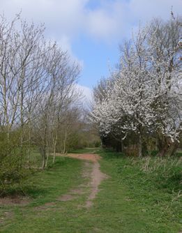
Kingfisher Trail                       Just before the grass path joins
Distance: 2 miles (3.2km)              the hard path, keep right of the
                                       waymarker and continue along the
                                       grass path.

                                       Once you reach a sloped wooden
                                       bridge, turn right onto the bridge.
From Fisherman’s Car Park, take
the hard path along Poplar Walk
                                       Walk down the bridge and turn left
Ignore the waymark on your left
                                       at the bottom, joining the hard,
and continue to go forth.
                                       gravel path, which forms part of The
Leave the hard path when you see
                                       Hereward Way on Springhead Lane
the waymark on your left hand side
                                       (known locally as ‘Lover’s Lane’)
and join the grass path straight
ahead.                                 2
Continue along the grass path with
                                       Follow the route as it bends round
trees and bushes either side of
                                       to the right.
you.
At the waymark on your left hand
                                       Head towards the kissing gate at the
side, take the route up the grass
                                       end of the gravel path, which joins
path up to the top of the mound
                                       Lisle Lane, you will find G&J Peck’s
Follow the path around as it bears
                                       on your left hand side.
left, continuing along the mound.

1                                      Pass through the kissing gate at the
                                       end of the path and turn right onto
From the raised mound you will find
                                       Lisle Lane, passing the Ely Country
wonderful views all around you, with
                                       Park entranceway sign on your left.
Ely Cathedral to the northwest, and
the River and Fenland landscape to     Carefully cross over Lisle Lane onto
the south. Benches can be found at     the pavement on the other side.
the top of the raised mound, this is
an ideal spot to enjoy a picnic.       Turn right and continue up Lisle
                                       Lane towards the mini roundabout,
Continue down the slope, and           passing a field of horses on your
straight ahead following the path      right hand side.
with trees either side of you.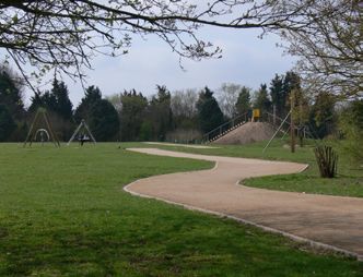
Meadow on Lisle Lane –                 Ely Common –
 Point of Interest                      Point of Interest
 Many of the dips and hollows           Known as ‘The Common’, it is
 in this area were created by           part owned by Thomas Parsons’
 Samuel Morton Peto, the                Charity, but accessible to the
 nineteenth century engineer,           public. This top part of the
 by excavating materials to             Common was once known as
 create the embankment for the          Milking Hill Common and is a
 railway line. This is a place of       beautiful wild flower meadow
 natural springs. The meadow is         with species such as Adders
 used for grazing and water cress       Tongue Fern and there are
 and buttercups can be found.           historical records of Green
                                        Winged Orchids.
                                        Pillbox - Point of Interest
                                        A reminder of the defences
At the top of Lisle Lane, cross
                                        erected around the country
over the road just before the mini
                                        early in the Second World War
roundabout.
                                        in the event of invasion. The pill
Follow the pavement onto
                                        box is being converted into a
Prickwillow Road.
                                        potential bat hibernaculum (bat
                                        roost)
When on Prickwillow Road,
immediately turn right onto the
driveway of Common Farm on the
                                       Turn right onto Kiln Lane.
corner.
                                       Take care along the road keeping
                                       to the right hand side, passing the
From the driveway, enter the kissing
                                       Environment Agency building on
gate on your left hand side into Ely
                                       your right.
Common.

Pass the Ely Country Park               3
entranceway sign on your left and      Along the road you will find an
proceed through the common until       amazing view of Roswell Pits lake
you reach the little bridge to join    and Ely Cathedral.
Kiln Lane.                             Cross the railway line (take care).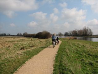
After the railway crossing, you will
find a metal field gate on your right
hand side; lapwings are known to
nest in this field and may be seen
in spring.

 4
At the 25mph speed sign on your
left hand side, turn right onto a
narrow tarmacked path named
Fen Rivers Way.
Keep the car park on your left
hand side, passing underneath the
power lines.
At the end of the path turn right
passing through the metal kissing
gate.
Continue along gravel path with
river located on your left hand
side.                                              Additional information
                                                   Please be aware that sections of
 5 6                                               the walks are located within an
                                                   ecological and geological Site of
At the end of the gravel path,                     Special Scientific Interest (SSSI).
proceed through the kissing gate.
Continue       along   the     path                Visitors are asked to respect the
underneath the rail bridge turn                    environment and keep dogs on
right into Fisherman’s Car Park.                   leads when walking near nesting
                                                   sites during the breeding session.
                                                   Please use the area responsibly
                                                   and with respect to other users.
                                                   Please dispose of litter using the
                                                   bins provided and dog walkers must
                                                   clean up after their dogs.
Access
Some sections of both routes may be                For other walks and trails, please
unsteady underfoot. Sections of the                visit www.visitely.org.uk or contact
Kingfisher Walk may be unsuitable for              Ely’s Tourist Information Centre
wheelchair and pushchair access.                   01353 662062.
         Leaflet produced by East Cambridgeshire District Council. Contact: 01353 665555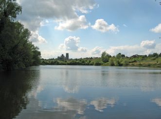
You can also read