CITY OF MADISON Comprehensive Plan - City of Madison, Wisconsin
←
→
Page content transcription
If your browser does not render page correctly, please read the page content below

CITY OF MADISON Comprehensive Plan
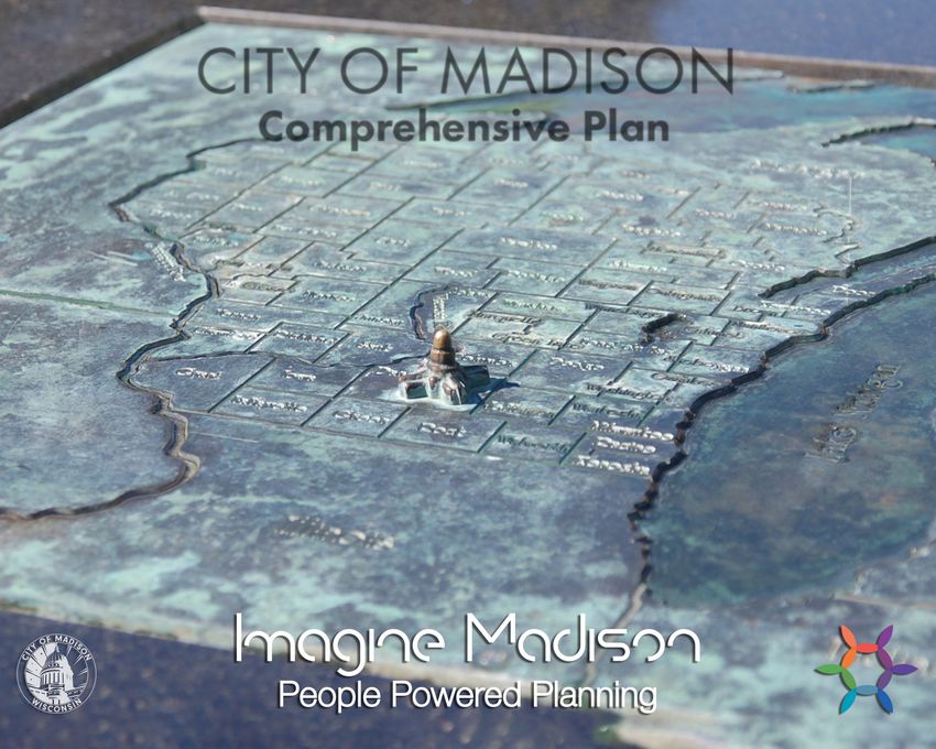

Table of Contents

 Introduction
 Background information on the Comprehensive Plan               1

 Engagement Process
 How Madisonians shaped the Plan                                9

 Growth Framework
 Generalized Future Land Use Map Growth Priority Areas          13

Six Elements
 Land Use and Transportation
 Compact Land Use Efficient Transportation                      29

 Neighborhoods and Housing
 Complete Neighborhoods | Housing Access                        45

 Economy and Opportunity
 Growing Economy | Equitable Education and Advancement          61   Appendices
                                                                     Appendix A: List of Strategies, Actions, and
                                                                                 Lead Agencies
                                                                                                                    113
 Culture and Character
 Cultural Vibrancy | Unique Character                           73   Appendix B: Land Use and Transportation
                                                                                 Supplement
                                                                                                                    121
                                                                     Appendix C: UrbanFootprint Analysis            131
 Green and Resilient
 Natural Resources | Parks and Recreation                       86   Appendix D: Reference Maps                     150
                                                                     Appendix E: Glossary of Terms                  175
 Effective Government
 Efficient Services Regional Cooperation Community Facilities   99
                                                                     Appendix F: Data References/Photo Credits      181
City of Madison
Comprehensive Plan
Adopted by the Common Council on August 7, 2018
Legistar File # 51349

Paul R. Soglin, Mayor

Prepared By:                                               Inter-Agency Staff Team:
Department of Planning, Community & Economic Development   Christy Bachmann
Natalie Erdman, Director                                   Amy Barrilleaux
Heather Stouder, Planning Division Director                Drew Beck
                                                           Kyle Bunnow
Imagine Madison Staff Team:                                Mike Cechvala
Ana Arellano Jimenez                                       Lisa Daniels
Savannah Ernzen                                            David Dryer
Patrick Empey                                              Philip Gritzmacher
Danya French Littlefield                                   Jeanne Hoffman
William Fruhling*                                          Bryan Johnson
Brian Grady, Project Manager*                              Dan Kennelly
Ryan Jonely                                                Lance Langer
Kirstie Laatsch*                                           Laura Larsen
Ruanda McFerren                                            Laura Laurenzi
Colin Punt*                                                Sarah Lerner
Rick Roll*                                                 Anne Monks
Ben Zellers*                                               Susan Morrison
                                                           Tom Otto
Madison Plan Commission:                                   George Reistad
Melissa M. Berger                                          Tariq Saqqaf
Bradley A. Cantrell                                        Janet Schmidt
Sheri Carter                                               Tom Snyder
Jason S. Hagenow                                           John Strange
Steve King                                                 Justin Svingen
James F. Oeth                                              Yang Tao
Ken Opin                                                   Matt Wachter
James E. Polewski
Michael W. Rewey
Maurice Sheppard
Andrew J. Statz
Ledell Zellers
                                                           Thank you to the many individuals and organizations who participated in shaping
*Primary Plan authors                                      this Plan. A special thank you to all who participated in the Resident Panel program.
INTRODUCTION

  MADISON COMPREHENSIVE PLAN   INTRODUCTION   1
WELCOME
Madison, Wisconsin is a growing and changing city with a
rich history behind us and a bright future ahead.

Together, over the last 18 months, we have collectively cre-
ated this Comprehensive Plan to prioritize our values and
map out our future. This Plan is a statement of where the
community wants to go and how it will get there.

During these 18 months, our Imagine Madison campaign
reached out to the community for guidance and had indi-
vidual contacts with over 15,000 people to gain insight on
their priorities, visions, and ideas for a future Madison. This
Plan reflects the primary issues identified through Imag-
ine Madison and reinforces the importance of input from
stakeholders representing many of the different communi-
ties within the city.

Some of the values, ideas, and issues were similar to those
identified in the City of Madison’s        Comprehensive
Plan. This includes concerns about balanced growth pat-
terns, jobs, economic opportunity, safety, and access to
transportation and daily needs. However, over the last
decade, many new issues have risen to the top of our col-
lective community conversation.

The issues at the forefront of our future focus on racial
equity, inclusion, resiliency, enhancing community, and
the ability of future generations to find success in a dra-
matically changing world.
                                                                  Wisconsin State Comprehensive Planning Law (Statute .          ) requires cities, counties, and other local units
This Plan will guide the City of Madison’s policies, budgets,     of government to enact a Comprehensive Plan to guide their physical, social, and economic development over a
growth, and direction for the next generation and beyond.            -year planning period. The law requires communities to engage residents in a transparent planning process to
                                                                  guide future growth and development as related to land use, housing, transportation, utilities, economic develop-
Welcome. This is (y)our Plan.                                     ment, agriculture, and intergovernmental relationships. Comprehensive Plans are to be updated every years to
                                                                  reflect the dynamic growth, demographics, and economic changes.

                                                                  The City of Madison adopted its first Comprehensive Plan under this state law in  . The     Plan anticipated and
                                                                  supported significant redevelopment in and near Madison’s Downtown. The Plan also emphasized sustainability,
                 – The Imagine Madison Team                       advocated for transit-oriented design, and encouraged compact and complete neighborhoods throughout the city.
                                                                  This      Comprehensive Plan update builds upon those themes and looks forward to emerging trends and issues.
                                                                  This Plan replaces the      Plan and become the City’s guide to decision making and investment.
Why does the City have a Comprehensive
Plan?

 2                                 INTRODUCTION                           MADISON COMPREHENSIVE PLAN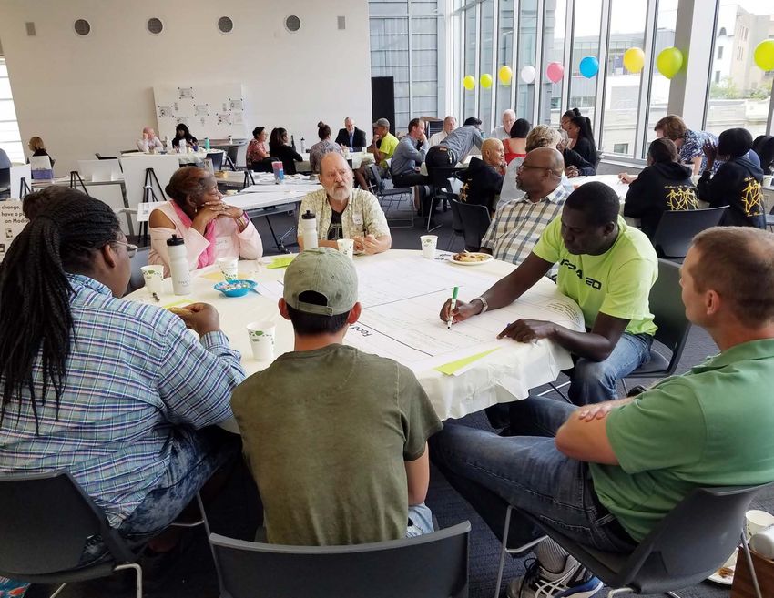
2006 Total Population
DATA SNAPSHOT 2040
77 %Population Forecasts1
This Plan uses data to illustrate Madison’s current state and projected future. Madison’s population, like the rest of
the nation, continues to become more diverse and culturally rich. Madison’s residents under the age of 18 are much + 70,000
7%
6%
6%
+ 40,000
new households by 2040
more diverse than the larger population, suggesting that the City’s plans and polices need to be updated to reflect 4 residents
new % by 2040
its changing demographics. For example, the number of people aged 60 and over has increased by 54 percent since
2000. However, the large increase in Millennials has driven the City’s median age down. Population forecasts indi- Household Income Distribution2
cate that Madison could gain 25% more residents between 2015 and 2040. This growth and changing demographics
< $25K $25K-$50K $50K-$75K $75K-$100K >$100K
highlight the importance of a forward looking Comprehensive Plan that focuses on policies to meet the needs of 2014 Total Population
our future residents. 23% 24% 18% 12% 23%
74 %
Population by Race or Ethnicity 7 % Age from 2006 to 20143
Median
6%
1 Dot = 1 Person
Asian
(
/
51 9%
Wisconsin
4% 37.6 39.2
Madison 32.3 30.8
(
/
151
Black or African American ÿ
Æ
113
§
¦
¨
90
¦
¨
§94
Hispanic or Latino ¦
¨
§ 39
2014 Total
2006 Population Under Age 18
Population
2006
Educational Total Population
Attainment 4
White
Other Race or Ethnicity 77
More %
56 than
% 4 out of 5
ÿ
Æ
113 777
15 %%
Data Source: US Census Bureau; City of Madison Planning Division
Madisonians
7 have at least
6%
Maple Bluff
10 %
Date Printed: 9/17/2018
some
6% college education
ÿ
Æ
30 6%
10
(
/12
Lake Mendota ¦
¨
§
94
6
49 %
%
(
/ (
/ Race%
4 and Ethnicity Trends5
14 151
§
¦
¨
90
White Black Hispanic or Latino Other
¦
¨
§39 Asian
Shorewood
Hills (
/ 51
2014 Total Population
2014 Total Population
Lake Monona
74 %
747 %
Monona
%
(
/ (
12
/ 14 7
6%
/ (
( / 12 18 6
9%%
9
4%
/ (
(
12/ (
/ (
/
14 18 151
(
/
51
§
¦
¨
90
4%
¦
¨
§ 39
(
/ 151
(
/
18
2014 Population Under Age 18
2014 Population Under Age 18
(
/
14
56 %
(
/
56
15 %
%
15
10 %
151
10
10 %
%
10
9%
9%
White Black Hispanic or Latino Asian Other
White Black Hispanic or Latino Asian Other
MADISON COMPREHENSIVE PLAN INTRODUCTION 3
WHAT IS A COMPREHENSIVE PLAN AND HOW
DOES IT WORK?
The Comprehensive Plan is the document that translates
                                                                                       ision
community input and ideas into policies and actions that                         year v
                                                                                -
affect City budgets, ordinances, and growth. The Plan looks                   20
   years into the future and seeks opportunities to address                   10-year focus
long term issues, but focuses on action steps to guide the
City’s near-term efforts.
                                                                    Madison                                           10                               20
While the Comprehensive Plan is a declaration of the City’s
                                                                     Today                                           Years                             Years
values, desires, and future, it is important to maintain the
realization that this Plan is only one part of a larger inter-
connected framework. It is a generalized, broad based plan
that relies on its connections with other plans, policy stud-
ies, ordinances, budgets, and other processes that bring
more clarity and specifics to everyday decisions.

The Plan’s recommendations are intended to:
  • Create a collective vision for a future Madison.
  • Establish priorities for public investment, including
     the City’s Operating Budget, Capital Budget, and five-      Community
     year Capital Improvement Program.                           Input
  • Inform policies that guide City decision-making.
  • Align the work of City Agencies around the issues
     that matter most to our residents and stakeholders.                                                                       “Before a place becomes what
  • Create a framework for topic-specific plans and ini-                                                                       any of us truly want, we have
     tiatives that will expand on the Comprehensive Plan’s                                                                     to imagine it.” — Neil Heinen
                                                                                                        City
     recommendations.                                                        Comprehensive                                     WISC Editor, For the Record Host
                                                                                                     Ordinances
  • Guide private development through the General-                               Plan
     ized Future Land Use Map and Growth Priority Areas
     map.
  • Foster partnerships with other entities to address
     shared goals.                                                                                                    City
                                                                                                                     Budget
Plan Limitations:
                                                                                 Other         Infrastructure
While forward looking, this Plan cannot foresee all even-
                                                                             Sub-Area and       and Facility
tualities. The Plan helps to prioritize Actions so Madison
                                                                              Policy Plans          Plans
can maintain a high quality of life and be financially resil-
ient through ever-changing economic circumstances. On
occasion, State law may preempt the City’s ability to carry                                                     Community
out several of the Plan’s recommended Actions. This Plan                                                        Partnerships
relies on the details and flexibility that other policy plans
can provide on a more timely basis.

                                  INTRODUCTION                           MADISON COMPREHENSIVE PLAN
PLAN ORGANIZATION
The Plan is organized by six Elements—major topic areas          6 Comprehensive Plan Elements
that influence the quality of life in the city. Within each
Element, the Plan is further defined by Goals, Strategies,
and Actions (see sidebar example). The Plan highlights sev-                LAND USE AND                                NEIGHBORHOODS                               ECONOMY AND
eral key Actions for each Strategy. These Actions represent               TRANSPORTATION                                AND HOUSING                                 OPPORTUNITY
possible implementation opportunities and can often be
linked to measurable data. However, these Actions do not          Compact Land Use | Efficient Transportation   Complete Neighborhoods | Housing Access
                                                                                                                Co                                         Growing Economy | Equitable Education
                                                                                                                                                                     and Advancement
represent everything the City and community is currently
doing, or could do in the future. More detailed plans and
policy studies bring nuance, and can go deeper into indi-                    CULTURE AND                                   GREEN AND                                 EFFECTIVE
vidual issues and recommendations. Each Element lists                        CHARACTER                                      RESILIENT                               GOVERNMENT
Strategies and Actions in a general sequence of priority.
                                                                     Cultural Vibrancy | Unique Character       Natural Resources | Parks and Recreation   Efficient Services | Community Facilities |
                                                                                                                                                                      Regional Cooperation

6 Elements
Major topic areas

12 Goals                                                         Plan Organizational Structure Example
Statements of what we want to achieve over the long-term
within each Element
                                                                   Element: Neighborhoods and Housing

50 Strategies                                                          Goal: Madison will have a full range of quality and affordable housing opportunities throughout the city.
General approaches to achieve the Goals
                                                                           Strategy: Increase the amount of available housing.
150+ Actions                                                                    Action: Take a proactive approach to finding and marketing housing development
Several implementation Actions for each Strategy                                        opportunities to development partners.

Appendix: The appendix contains a summary matrix with
all of the Goals, Strategies, and Actions in one location. The
matrix also indicates the anticipated lead City agency, or
agencies, for implementation of each Action.

Land Use and Transportation Supplement: The State
Comprehensive Planning Law requires that all land use
decisions be consistent with the Comprehensive Plan.               Implementation Example: Through land banking, affordable housing funds, tax credit coordination, housing assis-
Additional details and recommendations related to growth,          tance, and other support, the East Washington Avenue Capitol East District has a wide range of housing from high-end
development, and land use are included in a supplement             luxury apartments to three-bedroom affordable townhomes for some of the city’s lowest income households.
designed to more easily facilitate those decisions.

                                                                            MADISON COMPREHENSIVE PLAN                                       INTRODUCTION
GUIDING LENSES
                                                                                             Lenses Example
Early in the process of developing the Comprehensive Plan, four emphasis                     The Actions for Neighborhoods and Housing Strategy on page              provide an example
areas, or lenses, were identified as pertinent to the Plan. Issues related to each           of how the lenses are embedded within the Plan recommendations. The recommended
of the four lenses were highlighted throughout development of the Plan and                   Actions address:
are the driving force behind many of the Plan’s recommendations.                               • Equity through access to a range of housing and amenities throughout the city
                                                                                               • Sustainability through less reliance on the automobile for daily life
                                                                                               • Health through access to active forms of transportation such as walking, bicycling, and
                                                                                                 transit
                                                                                               • Adaptability through neighborhood design that can respond to a changing society and
                                                                                                 environment

                          Equity                                                                                  Sustainability
                          The inherent worth of each individual in Madison should                                 This Plan will help Madison manage resources to promote
                          be esteemed and fostered, enabling them to reach their full                             welfare and equity for current and future generations by
                          Equity                                Equity           Sustainability
                          potential. This Plan addresses some of the structural and
                                                                                                                  Sustainability
                                                                                                                  encouraging interconnected green space, a multi-modal
                          institutional inequities for our communities of color and                               transportation system, efficient mixed-use development,
                          other disadvantaged groups.                                                             and protected environmental resources.

    “For non-natives, they moved here because of the promise and                                                         “New housing must be sustainable and take
    reputation of Madison as a city of opportunity and growth, but                                                       up less area than old-style housing. Having
    many have not seen this materialize for themselves or others                                                         places for people to grow their own food is

                 +
    effort ut the are                                 +
    in the ways they expected, despite their hard work and best
                        not willing to gi e up. ll wantHealth
                       Health                          to e part o               Adaptability
                                                                                                                         important, too. Community garden space
                                                                                                                  Adaptability
                                                                                                                         should be available.”
    Madison’s promising future.” — Resident Panel participant                                                            — Community Meeting participant

                          Equity                             Equity
                                             “There’s a large amount of foodSustainability
                                                                              insecure indi-                      Sustainability
                                             viduals in Madison. The city has done work                                       “More integrated, dense neighborhoods will help
                                             to promote farmers’ markets and community                                        allow more opportunity for a naturally more
                                             gardens, but there is much more work to be                                       diverse economy that is accessible.”
                                             done!” — online participant                                                      — online participant

                          Health                                                                                  Adaptability

                 +                                    +
                          This Plan will impact the choices people have concern-                                  This Plan will help Madison prepare for fundamental changes
                          ing where to live and how to get around, access to health-                              to our way of life. This includes impacts due to climate
                          Health                               Health            Adaptability
                          ful foods, opportunities for physical activity, air and water                           Adaptability
                                                                                                                  change, automation in the workplace, and technological
                          quality, traffic safety, mental health, social interactions, and                        changes that affect the transportation system.
                          exposure to pollution.

                                INTRODUCTION                                 MADISON COMPREHENSIVE PLAN
THE PLAN IN ACTION
PLAN
IVE
Results Madison
The Comprehensive Plan was developed in tandem with
S
Results Madison, a performance management framework
HEN
RE
that is intended to align City services with the outcomes
that matter most to residents. The Comprehensive Plan’s
P
recommendations, developed through an intensive com-
M
munity outreach program, offer guidance to City agen-
CO
cies on services that should be provided and projects that
should be implemented to achieve desired outcomes in our
community. Results Madison’s in-depth look at City services
will strengthen implementation of the Comprehensive Plan.
Additionally, Results Madison’s monitoring of City perfor-
mance data will help identify issues for future Plan updates.
6 ELEMENTS
Related Plans
The City will continue to study policy issues and continue
sub-area planning under the larger Comprehensive Plan Land Use and Neighborhoods Economy and Culture and Green and Effective
umbrella. These related plans can provide detail and spe- Transportation and Housing Opportunity Character Resilient Government
cific implementation actions, fine tune larger concepts, and
react to rapidly developing issues, and provide in-depth
analysis not possible at a citywide level. •Neighborhood •CDBG Five-Year •Economic •Cultural Plan •Sustainabillity Plan •Water and Sewer
RELATED PLANS
Plans Plans Development Plan System Plans
•Historic •Park & Open
Annual Progress Update •Neighborhood •Affordable Housing •Tax Increment Preservation Plan Space Plan •Long Range
Development Studies, Reports, Financing (TIF) Plans Facilities Plan
An annual progress update will be prepared to track prog- Plans and Programs •Urban Design •Energy Plan
ress on implementation of the Comprehensive Plan’s Goals, •Redevelopment Plans Plans •Intergovernmental
•Special Area •Solid Waste Plan Agreements
Strategies, and Actions. The progress update will highlight Plans
City and community projects that advanced the Plan’s rec-
•Transportation
ommendations, with a focus on improvements that directly Plans
relate to feedback received through Imagine Madison.
Where feasible, the update will use data to measure prog-
ress. The report will be prepared in the first quarter of each
year and be a resource for preparation of the City’s capital
and operating budgets.
Process to Update the Plan
Wisconsin’s Comprehensive Planning law requires that
Comprehensive Plans be reviewed and updated not less
than once every ten years. The City adopted its first Com-
prehensive Plan under this State Statute in 2006. In 2012,
the City adopted an update to the Plan that focused on the
Generalized Future Land Use (GFLU) Map. Updates to the
GFLU Map may be undertaken over the next 10 years, with
another full-scale update of the Comprehensive Plan com-
mencing in 2028.
MADISON COMPREHENSIVE PLAN INTRODUCTION 7GOALS
The twelve Goals of the Comprehensive Plan are statements of what
the community wants to achieve over the long-term. Each of the Plan’s
Strategies and Actions are intended to contribute toward achieving the
Goals.
LAND USE AND TRANSPORTATION NEIGHBORHOODS AND HOUSING
Madison will be comprised of compact, interconnected Madison will be a safe and welcoming city of strong and
neighborhoods anchored by a network of mixed-use activity complete neighborhoods that meet the needs of all residents.
centers.
adison will ha e a ull range o ualit and afforda le
adison will ha e a sa e, efficient, and afforda le regional housing opportunities throughout the City.
transportation s ste that offers a ariet o choices a ong
transportation modes.
ECONOMY AND OPPORTUNITY CULTURE AND CHARACTER
adison will ha e a growing, di ersi ed econo that offers Madison will be a vibrant and creative city that values and
opportunity for businesses and residents to prosper. builds upon its cultural and historic assets.
Madison will have equitable education and advancement Madison will have a unique character and strong sense of
opportunities that meet the needs of each resident. place in its neighborhoods and the city as a whole.
GREEN AND RESILIENT EFFECTIVE GOVERNMENT
Madison will be a leader in stewardship of our land, air, and adison will ha e efficient and relia le pu lic utilities,
water resources. facilities, and services that support all residents.
Madison will have a model park and open space system that Madison will collaborate with other governmental and non-
preser es our signi cant natural eatures and offers spaces go ern ental entities to i pro e efficienc and achie e
for recreation and bringing residents together. shared goals.
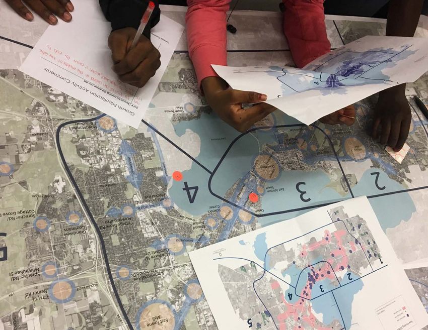
8 INTRODUCTION MADISON COMPREHENSIVE PLANENGAGEMENT PROCESS
MADISON COMPREHENSIVE PLAN ENGAGEMENT PROCESS 915,000+ people engaged through Imagine Madison
Website Planning Pop-ins
11,960 unique visitors 60 Pop-ins | 1,775 attendees
Hip Hop Architecture & Planning Camp
Cap Times Talk
UW-Madison PEOPLE Program
Community Meetings UW-Madison Classes
10 meetings | 371 participants
Resident Panels Inter-Agency Staff Team
231 participants 26 staff members | 17 departments
Markets and Festivals
Neighborhood Resource Teams
19 Events | 649 interactions
9 Teams | 118 attendees
Social Media
803 followers City Committees
18 Boards, Commissions, and Committees
=
Mini-Documentary
10 ENGAGEMENT PROCESS MADISON COMPREHENSIVE PLANPUBLIC ENGAGEMENT Public Engagement Events
Actively involving community stakeholders and the public Number of Attendees Event Type
51
in developing Madison’s Comprehensive Plan was the pri-
mary objective of Imagine Madison. Broad public engage- !
( Community Meeting 151
!
(
150 - 280
!
90
ment helps ensure that the Comprehensive Plan accurately !
( Pop-in 113
!
( !
( 1-10
!
(
94
39
reflects the vision, goals, and values of the community. Market or Festival
!
( Event
In June 2016, the Plan Commission and Common Council Data Source: City of Madison Planning Division
Date Printed: 9/27/2018
adopted the Public Engagement Plan for Imagine Madi- 113
son, which outlined a broad participation effort. The main Maple Bluff
objectives of the Public Engagement Plan were to ensure 30
community involvement was inclusive, relevant, transpar- 12
Lake Mendota 94
ent, flexible, and fun. Special emphasis was placed on find- 14 151
ing ways to encourage involvement by groups within the
community that are often underrepresented in planning 90
processes.
39
Shorewood 51
Hills
The demographics of participants were tracked through- Lake Monona
out the process to monitor how they matched that of Monona
the city population as a whole. Adjustments were made 12
as demographic gaps in engagement were identified.
14
12 18
Imagine Madison used many methods and marketing tech-
niques to inform and involve the community in the pro- 12 14 18 151 51 90
39
cess. The primary methods used are summarized below. 151
18
Community Meetings
Community meetings were held to provide background 14
information and gather input on key issues for each stage.
Meetings were held in highly accessible facilities and dis- 151
tributed geographically throughout the city to remove bar-
riers to participation. Food, childcare, and language trans- Resident Panels Resident Panels were created to remove as many barriers
lation services were provided at each meeting. Resident Panels were a significant part of the Public Engage- to participation as possible. The City provided funding
ment Plan for Imagine Madison. The Resident Panel ini- to the community parters to cover costs associated with
Imagine Madison Website tiative was a proactive approach to ensure that Imagine convening the Panels, such as meeting space rental, food,
The Imagine Madison project website (imaginemadisonwi. Madison engaged residents who have historically been childcare, and transportation.
com) served as the project’s hub for information and underrepresented in City planning processes. The City part-
engagement. The website had nearly 12,000 unique visi- nered with community-based organizations that have con- Pop-ins
tors throughout the project. In-depth surveys were avail- nections to Madison’s communities of color, lower income Project staff attended various events and meetings in the
able on the website during each phase, which provided an residents, and other residents whose voices are often miss- community, such as Neighborhood Association meetings,
opportunity for online participants to complete activities ing from community conversations. Selected community University of Wisconsin - Madison classes, and LaSup
similar to those at the community meetings and other ven- partners convened panels of approximately 10-15 residents (Latino Support Network of Dane County) meetings. Staff
ues. to discuss and provide feedback on the topics of the Com- provided information and received feedback at these Plan-
prehensive Plan. The Panels completed activities similar to ning Pop-ins.
Community Meeting attendees.
MADISON COMPREHENSIVE PLAN ENGAGEMENT PROCESS 11PROCESS
PHASE 1 PHASE 2 PHASE 3
Phase 1 Phase 2 Phase 3
1 4
2
3
1
1
60 DRAFT 2 REVISED AND
3
COMMUNITY STRATEGY
STRATEGIES FEEDBACK EXPANDED LIST PRIORITIZATION 2
4
ON DRAFT OF STRATEGIES
GOALS ORGANIZED 3
STRATEGIES
300 GOALS COMPILED INTO “ELEMENTS”
FROM RECENT PLANS
= REVISED GOALS
KEY ISSUES DRAFT GENERALIZED COMMUNITY REVISED GROWTH
FUTURE LAND USE FEEDBACK ON GFLU MAP PRIORITIZATION
(GFLU) MAP GFLU MAP
COMMUNITY FEEDBACK
DATA DRAFT ON DRAFT GOALS
GATHERING GOALS
Phase 1 Phase 2 Phase 3
The major objectives of Phase 1 were to: The major objectives of Phase 2 were to: The major objectives of Phase 3 were to:
• Describe what a Comprehensive Plan is and why it is • Identify Strategies that should be used to achieve the • Prioritize the Strategies identified in Phase 2;
important; Goals identified in Phase 1; • Suggest ideas for Action steps to implement the
• Summarize background information on key trends • Suggest changes to the Generalized Future Land Use Strategies;
that will affect Madison in the future; (GFLU) Map. • Prioritize where Madison should accommodate
• Engage residents about what should be improved in growth.
Madison. For Strategy identification, participants reviewed draft
Strategies and voted for the ones that they supported or For Strategy prioritization, the focus was to determine
Thirteen Draft Goals were presented and the community wrote in new Strategy ideas for others to see and vote on. which ideas were most important to ensure the Plan
was asked two questions about each Goal: is this Goal reflected community priorities. For growth prioritization,
important? And: is the community currently doing enough During this phase the community also provided feedback background information on recent housing and popula-
to achieve this Goal? Participants were also offered the on the GFLU Map. Staff then responded to those comments tion growth trends were provided for context. Participants
opportunity to provide ideas for issues and goals that were and created an updated Draft GFLU Map. The community could select locations in Madison where they felt future
missed. made additional comments on the map in April 2017, growth should be accommodated.
which were then reviewed by the Plan Commission.
Between Phase 1 and Phase 2, the Goals were revised Note: Because the people who engaged with the Compre-
based on community discussion and reorganized into six hensive Plan were self-selected and not randomly chosen
Elements, with each Element having two Goals. the results of surveys and questions are not the same as a
scientific survey. As such, the results of Plan engagement
would not likely be the same if the engagement process
were repeated and a different group of individuals partic-
ipated. Similarly, because the participants were self-se-
lected, the results may indicate other trends, biases, etc.
12 ENGAGEMENT PROCESS MADISON COMPREHENSIVE PLANGROWTH FRAMEWORK
MADISON COMPREHENSIVE PLAN GROWTH FRAMEWORK 13INTRODUCTION
This chapter establishes the overall framework for the
continued growth and development of the city over the
next two-plus decades. It maps the planned land use
outcomes that will result from implementation of many
of the Goals, Strategies, and Actions established within
the six Elements. For example, a Goal within the Land Use
and Transportation chapter states that “Madison will be
comprised of compact, interconnected neighborhoods
anchored by a network of mixed-use Activity Centers.” The
Growth Framework maps those Activity Centers, lending a
more specific, location-based view of a very general Goal.
While it may appear that the Growth Framework primarily
relates to the Land Use and Transportation Element, it is
directly related to the implementation of all the Elements.
The City cannot fulfill the Neighborhoods and Housing
Goals without first creating the land use framework that
helps establish complete neighborhoods and provides
opportunities for affordable housing construction. Simi-
larly, the Goals from all of this Plan’s Elements relate to the
form that the physical development of the city will take
over the next two decades.
The Growth Framework is split into three main compo-
nents:
1. The Growth Priority Areas section identifies where the
city should accommodate much of the anticipated
40,000 new housing units and 37,000 new jobs that it
will see by 2040.
2. The Generalized Future Land Use section assigns
general land use categories to all areas of the city and
all areas that may become part of the city over the
next twenty-plus years.
3. The Peripheral Planning Areas section looks further
into the future than the Generalized Future Land Use
section, describing areas that may eventually become
part of the city, but likely not for at least two decades.
Together these three sections establish the physical
framework for achieving the Goals, Strategies, and Actions
contained in the other Elements of this Plan.
14 GROWTH FRAMEWORK MADISON COMPREHENSIVE PLANGrowth Priority Areas include a variety of residential development and the public their current auto-oriented development to more transit-,
infrastructure to support it. That feedback informed the walk-, and bike-friendly styles of development.
The Growth Priority Areas Map on the following page shows high number of areas that have been identified as Transi-
Activity Centers and corridors prioritized for mixed-use tioning Activity Centers on the Growth Priority Areas map. Peripheral Growth Areas
infill development and redevelopment. It also shows prior- New peripheral growth should occur within priority areas,
itized peripheral growth areas and Activity Centers that are The City should continue to encourage context-sensitive as shown on the map on the following page. The City has
planned to become the cores of new neighborhoods (see redevelopment within Activity Centers and mixed-use an opportunity to capture the high regional demand for
page 36 for a definition of “Activity Center”). corridors through implementation of Strategies and Actions walkable living as part of newly developed Traditional
within this Plan, but will also need to undertake detailed Neighborhood Developments (TNDs) on the periphery.
Activity Centers planning to set the stage for some current commercial The smaller lots, gridded streets, and Activity Centers that
Activity Centers are broken down into Regional, Commu- and employment areas to transition to vibrant mixed-use are a part of TNDs not only aid in creating a strong sense of
nity, and Neighborhood Activity Centers, based on the Activity Centers. Such planning efforts should address place, but also create high-value development and allow
centers’ general size, position within the metro area, and the role of the City in facilitating transitions to mixed-use for more residents to be served with less infrastructure.
current or prospective ability to draw from the surrounding areas, especially with regard to parking. When combined with continuing redevelopment, which
area or region. Regional Activity Centers tend to be larger tends to generate even more property value and occurs
in size, along major streets and transit routes, and have the Some Transitioning and Future Centers may take 20 or in areas where infrastructure and services are already
capacity to serve as a relatively intense mixed-use center more years to become Established Centers. While creating present, the City’s growth priorities will help contribute to
for both the surrounding area and the city as a whole. more Established Activity Centers is a major focus of this long-term financial stability.
Community Activity Centers still tend to have access to Plan, there is no specific timetable for building out the
transit and major streets, but are expected to develop at various Transitioning and Future Activity Centers. Imple-
a lower intensity than regional centers and serve a smaller mentation of some Future Activity Centers will depend
area. Neighborhood centers tend to draw primarily from upon annexation of land into the city under existing
surrounding neighborhoods, generally have less transit boundary agreements.
access, and are sometimes located along less busy streets
or sections of streets. Corridors
The Growth Priority Areas Map also shows corridors that
Activity Centers are also broken into categories based have potential for a mix of uses along their length. These
on whether they are already established as a mixed-use corridors are broken down into two categories. Community
center, have existing commercial or employment devel- Corridors tend to be smaller arterial streets that serve the
opment that should transition to a mix of uses, or are surrounding neighborhood and City. Regional Corridors
currently undeveloped but planned for a future Activity are larger arterials that serve both the city and the region.
Center. Established Activity Centers have tended to attract The main considerations for designating a Community or
the majority of redevelopment since the last Compre- Regional Corridor were generally:
hensive Plan in 2006, as they have the walkability, transit • Good existing or planned transit service; and
service, destinations, and other amenities already in place • A mix of land uses along the length of the corridor, as
that residents demand. Established Activity Centers will shown in the Generalized Future Land Use (GFLU) Map.
continue to redevelop and evolve, but likely cannot absorb
a majority of the city’s projected growth. In order to accom- Some major streets in the city, like Whitney Way and North
modate growth in redeveloping areas, as was the prefer- Sherman Avenue, have planned BRT, but are primarily
ence expressed throughout the Imagine Madison process, lined with Low Residential land use in the GFLU Map and
the City will need to focus on transitioning underutilized are therefore not designated as corridors. Other major
areas already well-served by transit into vibrant, mixed-use streets, such as John Nolen Drive and Packers Avenue,
Activity Centers (see page 39 for further discussion). Public have some transit, but lack a diversity of existing or
input suggested that automobile-dominated commer- planned future land uses along the corridors. All corridors,
cial areas be redeveloped over time with a mix of uses to with the exception of Williamson Street and portions of the
Monroe/Regent corridor, are (or will be) transitioning from
MADISON COMPREHENSIVE PLAN GROWTH FRAMEWORK 15Growth Priority Areas
Neighborhood Activity Centers
Community Activity Centers
Regional Activity Centers
51
Established Centers
151
Transitioning Centers 90
113
94
Future Centers No 39
rth
por
tD
r
Community Corridor
Regional Corridor
Peripheral Growth Area
113
N Sherman Ave
e
Av
n
to 30
Lake Mendota ng
hi 94
12 as
EW Milwaukee St
14 151
90
St
Cottage Grove Rd
n
so
39
am
51
illi
Old Sauk Rd
W
University
Ave
Stoughton Rd
Monona Dr
Lake Monona
Mineral Point Rd
Park
Odana
Rd
St
12 14
Midvale Blvd
12 18
Pleasant View Rd
12 14 18 151 51 90
39
d
n dR
o 151
ym
Ra
18
McKee Rd F itc hburg
Lake Waubesa
14
151
V erona
Please see pages 78 and 79 for maps of the city’s historic districts.
16 GROWTH FRAMEWORK MADISON COMPREHENSIVE PLANGeneralized Future Land Use
The Generalized Future Land Use (GFLU) Map presents land
use and development intensity recommendations to guide
future city growth both in edge areas where new develop-
ment is planned and in areas where redevelopment may
occur. The Map applies the Goals, Strategies, and Actions
of this Plan to the City’s current and planned boundaries
and recommends a pattern of future uses and develop-
ment intensities that will guide the physical development
of the City for the next 20-plus years. The Map is a plan-
ning tool that recommends broadly-categorized land uses
for general areas. The Zoning Code and accompanying
Zoning District Map are more specific tools that implement
the recommendations of the Comprehensive Plan and
sub-area plans by regulating the specific building forms
and land uses for each individual property in Madison.
Rezoning of property must be consistent with the GFLU
Map.
While land uses are mapped to specific locations, the
recommendations presented in the GFLU Map are still rela-
tively broad, and the exact shape of many of the mapped
land use categories are necessarily somewhat general. is appropriate for a given parcel. It is not the intent of the mixed-use standards should generally fit within the land
In many instances, the recommended land use pattern is GFLU Map to encourage more intense development in all use standards shown in this Plan, they may have heights
refined in sub-area plans that may include more detailed MR, HR, and mixed-use areas without consideration for that exceed what is shown in this plan. When that is the
land use categories that generally fit within the broad cate- other adopted plans and regulations. Similarly, it is not the case, the sub-area plan standards should be applied, just
gories within this Plan, as well as design guidelines that intention of this Plan that any existing multifamily that may as they are applied when more restrictive building heights
respond to the specific surrounding context. be in the “Low Residential” district must be transitioned to are included. Refer to the appendix for further discussion
single-family or duplex development (see pages 36 and 38 on the relationship between this Plan and sub-area plans.
The GFLU Map is a major consideration when reviewing for more information regarding integration of redevelop-
the appropriateness of proposed development. However, ment). Generalized Future Land Use Map Categories
it is not the only consideration, and should not be used
outside of the context of the rest of this Plan or other The category descriptions in this chapter, along with the The list beginning on page 20, and the accompanying charts
adopted City plans and ordinances. For example, some accompanying charts for residential use and mixed-use, for residential and mixed-use land use categories, describe
residential and mixed-use areas planned for more intense summarize the GFLU Map categories. Building form cate- what is generally included within each land use category.
development within older parts of the city may have gories in the residential and mixed-use charts were drawn Sub-area plans often provide additional detail beyond
single-family, two- or three-unit homes, or small-scale from the zoning ordinance. The general density range is the broad land use categories within this Plan (see addi-
commercial/mixed-use buildings interspersed with other, intentionally broad for most categories because building tional discussion on page 124 regarding the relationship
more intense, multifamily residential and mixed-use devel- form, not density, should be the primary consideration between the Comprehensive Plan and sub-area plans).
opment. In such instances, it is important to refer to other when determining whether a building fits appropri-
Elements of this Plan and other city plans and ordinances ately within a given neighborhood, district, or corridor.
(such as adopted neighborhood plans, the historic pres- Sub-area plans frequently offer more detailed height and
ervation plan, historic preservation ordinance, and urban design standards, and should be referred to in addition
design districts), when considering whether development to this Plan. While adopted sub-area plan residential and
MADISON COMPREHENSIVE PLAN GROWTH FRAMEWORK 17Generalized Future Land Use Map
Low Residential (LR) Downtown Core (DC) !
17
Low-Medium Residential (LMR) General Commercial (GC)
Medium Residential (MR) Employment (E)
High Residential (HR) Industrial (I)
N Stoughton Rd
I 39
Neighborhood Mixed Use (NMU) Parks and Open Space (P)
Community Mixed Use (CMU) Special Institutional (SI) !
11
Regional Mixed Use (RMU) Airport (A)
!
No
16
Downtown Mixed Use (DMU) Neighborhood Planning Area (NPA)
rth
1
15
po
I 39
!
!
rt
Map Note
H
# Planned Street Network
US
!
D
10
r
Data Source: City of Madison DPCED, Planning Division
Date Printed: August 7, 2018 !6 !
13
N Stoughton Rd
Packers Ave
STH 30 Commercial Ave
Lake Mendota
!
I 94 20
!
15
S Sto
!
12 !
21
ught
!4 ve Rd
I 39
g e Gr o
on R
Cotta
! 18
d
B
!4
uc
k
!
ey
!5 7
!
19
e
E Buckeye Rd
R
d
!4 Lake Monona
Mineral Point Rd
!3
S Park St
!9
W
Be
!8 W Belt line Hwy
USH 12
& 18
USH
ltli 12 &
ne I3 18
H wy 9
US
H I3
14 9
!1 !
14
McKee Rd McKee Rd
Lake Waubesa
!2
Please see pages 78 and 79 for maps of the city’s historic districts.
18 GROWTH FRAMEWORK MADISON COMPREHENSIVE PLANMap Notes plan, multifamily residential and mixed-use develop- and views to the hill from surrounding properties and
1. There are significant natural glacial features along ment shall be considered appropriate, so long as the provides adequate vegetative buffers from the existing
this corridor which should be preserved and incorpo- scale, massing, and design of the building fits in with park property.
rated into an Ice Age National Scenic Trail connection the surrounding context, as determined by the Plan 12. The City may consider buildings taller than four stories
between University Ridge Golf Course and Mid Town Commission and City Council. in this contiguous NMU area for large parking lots/
Road at Shady Oak Lane. 6. This property is currently the site of the State of vacant areas.
2. While this parcel would ideally be retained as open Wisconsin Mendota Mental Health Institute. A detailed 13. It is not recommended that the mobile home park
space and/or farmland as part of a community sepa- development plan for the property should be prepared that currently occupies this area cease operations, but
ration area between Verona and Madison, it may be and adopted by the City prior to any redevelopment to employment is the most appropriate future use of the
developed as an employment use. new uses. Land along Lake Mendota is recommended property if the property owner does close the park.
for public park and open space.
3. West Towne Mall, the Odana Road corridor, and 14. Land in this area is part of the Town of Blooming Grove
Westgate Mall are shown as future mixed-use areas. 7. Refer to the Downtown Plan for the area bounded by and will be attached to the City before November 1,
However, redevelopment that includes substantial the lakes, Blair Street, Regent/Proudfit Streets, and 2027. This land should either continue in its current
residential components within the area that is gener- Park Street for viewshed preservation, mix of land uses, agricultural use or be incorporated into the adjacent
ally bounded by Whitney Way (east), Mineral Point building design standards (including heights and step- Capital Springs State Recreation Area.
Road (north), High Point Road (west) and Schroeder backs/setbacks), streetscape design, and other land
use and design elements. Note that residential uses 15. The City should work with the Town of Blooming
Road (south) should be preceded by adoption of a
shown in this area should be considered “primarily Grove, as outlined in the 2005 intergovernmental
detailed City plan. Such a plan should address connec-
residential,” as defined in the Downtown Plan. agreement, to prepare a special area plan for land
tivity improvements, more parks and open space,
generally bounded by Milwaukee Street, Starkweather
and other amenities and infrastructure necessary to 8. The Alliant Energy Center is shown as SI, but may Creek, the railroad tracks/Highway 30, and Regas Road
support residential development. include restaurant, entertainment, and hotel uses extended, prior to any development within the area.
4. The “house-like” residential character of this LMR area if a Master Plan for the area that includes those uses
is adopted by the City. Such a Plan may include land 16. Areas to the east and west of Eastpark Boulevard
should be retained, and any limited redevelopment
use changes to surrounding properties, such as the in this location may be appropriate for Community
should generally maintain the current single-family/
Employment-designated properties to the north. Mixed Use development if additional connectivity in
two-flat/three-flat development rhythm.
the street network is provided to break up the large
5. The University of Wisconsin-Madison Campus Master 9. The existing office and residential uses are recom- blocks and sufficient accessible parkland is dedicated
Plan provides detailed land use and development mended to continue until a future opportunity arises for residential dwelling units.
recommendations for the UW-Madison. That docu- to convert this area to public park and open space use.
The existing uses should not be expanded and the land 17. A portion of this area may have the potential for
ment was approved by the City in 2017 as part of the
should not be redeveloped. limited development as a conservation subdivision.
requirements for the UW-Madison’s Campus-Institu-
tional Zoning. All UW-Madison development within 10. This former sanitarium site is presently owned by Dane 18. The majority of this site is undeveloped - a detailed
the campus boundary must be consistent with the County and used as an office building. Adaptive reuse plan for any change in the site’s current use should
Campus Master Plan unless an exception or alteration of the existing buildings for employment, residential, be approved by the City prior to consideration of any
is approved by the City, consistent with applicable or mixed-uses is recommended if this site is redevel- rezoning request.
regulations, procedures, and standards. The Compre- oped. The open area south of the buildings should 19. If restoring the high ground east of Underdahl Road to
hensive Plan’s SI designation for the UW-Madison remain undeveloped and any reuse of the site should open space is not feasible this area should transition to
campus is primarily to address the UW’s use of prop- be designed to preserve and enhance the views from residential development.
erty. However, there are some privately owned prop- the site to Lake Mendota and the Isthmus. The wooded 20. An Interstate interchange in this general location
erties within the SI-designated areas. If such privately portion of the site north of the buildings should be would help implement higher intensity employment
owned parcels redevelop, their use and design should maintained as open space. and mixed use land uses planned for this area.
be consistent with adopted sub-area plans, the most
11. It is recommended that there be no additional devel- 21. Portions of this area should be considered for perma-
relevant of which, as of the adoption of this Plan,
opment on the top portion of this hill. Future develop- nent open space and agricultural land preservation as
is the Regent Street-South Campus Neighborhood
ment may be allowed around the lower portions of this part of a community separation agreement with the
Plan. In the rare case where private redevelopment is
hill only if such development is done with sensitivity to Village of Cottage Grove and Town of Cottage Grove.
proposed for an area that is not covered by a sub-area
the topography in a manner that preserves open space
MADISON COMPREHENSIVE PLAN GROWTH FRAMEWORK 19Residential Categories often serve as focal points for neighborhood activity, are
often relatively small, and therefore not always identified
The accompanying Residential Future Land Use Map at the scale of the GFLU Map. Nonresidential uses within
Categories chart summarizes which building forms are residential areas may include: parks and recreational facil-
associated with residential land use categories. Note that ities, community gardens, urban agriculture, elementary
the categories overlap when it comes to building form, and middle schools, day care centers, places of assembly
building height, and general density range. These over- and worship (if at a scale compatible with other existing or
lapping specifications are meant to provide flexibility planned uses), small civic facilities (such as libraries and
within each individual category. Categories do not address community centers), and small-scale commercial uses.
owner-occupied vs. renter-occupied housing or housing Small-scale commercial uses within residential catego-
affordability. Neighborhoods should be developed with ries should be limited to small establishments providing
a mixture of ownership and rental options, along with a convenience goods or services primarily to neighborhood
variety of price points, including housing affordable for residents, either as a freestanding business or within a
people or families who make less than the county median larger, predominantly residential building.
income. Multifamily residential development should
contain a mixture of unit sizes, including three bedroom Low Residential (LR) to multi-unit dwellings. Smaller two-, three-, and four-unit
(or larger) units. Low Residential (LR) areas are predominantly made up apartment buildings and rowhouses may be compatible
of single-family and two-unit structures. Some LR areas, with the LR designation, especially when specified within
A limited amount of nonresidential uses may also be particularly in older neighborhoods, may include “house- an adopted neighborhood or special area plan and when
located within residential categories. Such uses, which like” structures that were built as or have been converted constructed to fit within the general “house- like” context
LR areas. While more intense forms of multifamily or
mixed-use development may occur as mapped along
.$ )/$
'0/0-
) .
/ "*-$ . major corridors adjacent to, or running through, LR areas,
any infill or redevelopment that occurs within an LR area
*2 *2Ҋ $0( $0( $"#
should be compatible with established neighborhood
.$ )/$
'0$' $)"*-( .$ )/$
' .$ )/$
' .$ )/$
' .$ )/$
'
җ Ҙ җ Ҙ җҘ җ Ҙ
scale, and consistent with any relevant sub-area plan.
$)"' Ҋ
($'4 /
# 0$' $)" LR areas should be conducive to walking, and all housing
$1$
ҝ )./$/0/$*)
'0$' $)" and other uses should share an interconnected sidewalk
2*Ҋ
($'4Ѷ2*Ҋ)$/ and street system.
2*Ҋ
($'4–2$)
#- Ҋ)$/0$' $)" * LR areas should provide a range of housing choices for
$)"' Ҋ
($'4//
# * households with varying incomes, sizes, ages, and life-
(
''0'/$!
($'40$' $)" * ** styles. Newly developing LR areas should include at least
-" 0'/$!
($'40$' $)" ** two different residential building forms and include
*0-/4
- 0'/$!
($'40$' $)" ** both owner- and renter-occupied housing. Though not a
* $0(0$' $)" replacement for a diversity of other residential building
0(
-*!/*-$ . рҊ2’ рҊт сҊф уҊрсۡ
forms, accessory dwelling units (ADUs) are an additional
method of creating housing diversity within LR areas. ADUs
) -
' ).$/4
)" җҝ
- Ҙ ≤15 цҊтп спҊшп цп۔
are allowed on single-family lots in both existing and newly
* Permitted in select conditions at up to 30 DU/ac and three stories, generally along arterial streets or where these
developing LR areas, subject to zoning regulations and
types of buildings are already present or planned within an adopted sub-area plan as part of a pattern of mixed
approvals.
residential development.
** Permitted in select conditions at up to 70 DU/ac and four stories, generally along arterial streets.
~ Or taller, if specified by an approved sub-area plan or PD zoning.
’ Dormers or partial third floors are permitted.
20 GROWTH FRAMEWORK MADISON COMPREHENSIVE PLANLow-Medium Residential (LMR) Medium Residential (MR) High Residential (HR)
Low-Medium Residential (LMR) areas are made up of any or Medium Residential (MR) areas may include a variety of
all of the following types of housing: small-lot single-family relatively intense housing types, including rowhouses,
development, two-unit buildings, three-unit buildings, small multifamily buildings, and large multifamily build-
rowhouses, and small multifamily buildings. LMR areas are ings. The more intense end of the Missing Middle type of
largely characterized by what is sometimes referred to as housing discussed in the LMR section falls within the MR
the “Missing Middle” of housing development: the range designation. MR areas are generally located close to major
of multi-unit or clustered housing types that fall between streets, mixed-use areas, or commercial/employment
the extremes of detached single-family homes and large areas to provide convenient, walkable access to transit,
apartment buildings (see page 49 for more on Missing shopping, restaurants, and other amenities. MR areas
Middle housing). Building forms present within the LMR should be interconnected with surrounding development
category of housing are generally compatible in scale with as part of a complete neighborhood, and should be tran-
single-family homes, and may therefore be intermixed with sit-oriented, even if transit has not yet been extended to
small-lot single-family development or used as a transition a developing MR area. MR can provide both rental and
from more intense development to lower intensity areas owner-occupied housing, and ideally provides options for High Residential (HR) areas include large multifamily
comprised primarily of single-family development. people of all ages who wish to live within a neighborhood. buildings or complexes that are generally four to 12 stories
Special attention must be paid to design within MR areas (or taller, if recommended by an approved neighborhood
While some areas mapped as LMR are currently multi- where the use adjoins less intense residential development plan). Similar to MR areas, HR areas are located close to
family developments that are isolated from surrounding – architectural features such as a stepback may be needed major streets, mixed-use areas, or commercial/employ-
development, LMR areas should be characterized by a to transition MR development to less intense surrounding ment areas to provide convenient, walkable access to
walkable, connected street network. Existing, isolated development. transit, shopping, restaurants, and other amenities. HR
LMR areas should be better connected with their areas should be interconnected with surrounding develop-
surroundings when opportunities arise, and newly ment as part of a complete neighborhood and should be
developing LMR areas should be seamlessly integrated transit-oriented.
with surrounding development. LMR areas should help
meet the growing demand for walkable urban living.
MADISON COMPREHENSIVE PLAN GROWTH FRAMEWORK 21$3 Ҋ. 0/0-
) .
/ "*-$ .
Neighborhood Mixed-Use (NMU)
$"#
*-#** *((0)$/4 "$*)
' *2)/*2)
$3 Ҋ.
) *(( -
$
' *2)/*2)
$3 Ҋ. $3 Ҋ. $3 Ҋ. $3 Ҋ.
0$' $)"*-( *- җҘ
җҘ җҘ җҘ җҘ
*(( -
$
''*
&0$' $)"
$1$
*- )./$/0/$*)
'0$' $)"
.$ )/$
'Ҋ*(( -
$
'*)1 -.$*)
$1 Ҋ*-&0$' $)"
$)"' Ҋ
($'4//
# 0$' $)"
(
''0'/$!
($'40$' $)"
*0-/4
- 0'/$!
($'40$' $)"
-" 0'/$!
($'40$' $)"
-&$)"ҝ $) -0$' $)".
- Ҋ/
) $)"*(( -
$
'0$' $)"
* $0(0$' $)"
' 30$' $)"
The Neighborhood Mixed-Use (NMU) category includes
0(
-*!/*-$ . сҊу сҊхҡ сҊрсҡҡ *2)/*2)'
)Ѷ+
" тц relatively small existing and planned Activity Centers
) -
' .$ )/$
' ).$/4
)" ≤70 ≤130 ҊҊ ҊҊ ҊҊ that include residential uses, as well as retail, restaurant,
Note: Architectural features that create the appearance of an additional floor do not count towards the minimum service, institutional, and civic uses primarily serving
number of floors. nearby residents. Development and design within NMU
* One-story anchor retail is allowed as part of a larger, comprehensively planned mixed-use project or as part of a project areas should be compact and walkable, ideally adjacent
transitioning from a suburban car-oriented layout to a more urban, pedestrian-oriented layout. to existing or planned transit. NMU areas should be well
** Or taller, if specified by an approved sub-area plan or by PD/MXC zoning approval. One-story anchor retail is allowed connected and integrated into neighborhoods, and devel-
as part of a larger, comprehensively planned mixed-use project or as part of a project transitioning from a suburban car- opment should be transit-oriented, even in areas where
oriented layout to a more urban, pedestrian-oriented layout. transit service does not yet exist. Buildings in NMU areas
-- indicates that the residential density is governed by the building height limit. should be oriented towards streets, with buildings close
to public sidewalks. On-street parking is recommended
Mixed-Use Categories Mixed-use development must also be carefully designed
where practical, with private off-street parking placed
where the use adjoins less intense residential develop-
primarily behind buildings, underground, or shielded from
The various mixed-use categories are generally mapped ment. Additional setbacks and architectural features
public streets by liner buildings.
along transit corridors and in areas recommended for such as stepbacks may be needed to transition mixed-use
development of Activity Centers. The range of nonresiden- development to less intense surrounding development
Nonresidential uses in NMU areas typically focus on serving
tial uses and the development density of both residential (see Action b on page 36). The mixed-use chart summarizes
nearby residents, though some buildings may also include
and non-residential uses in mixed-use categories will vary the building forms that are generally appropriate for each
specialty businesses, services, or civic uses that attract
depending on the size of the district and the type and of the Generalized Future Land Use Map’s mixed-use cate-
customers from a wider area. An individual building should
intensity of the surrounding development. While both resi- gories. Integration of affordable housing into mixed-use
not include more than 10,000 square feet of commercial
dential and nonresidential uses are accommodated within areas is encouraged, especially along major transit corri-
space, except for buildings containing grocery stores and/
mixed-use districts, not every building in a mixed-use dors. Multifamily residential within the mixed-use category
or community facilities (such as libraries). When larger
district needs to include both residential and non-resi- should contain a mixture of unit sizes, including three
uses are present, the building should still be designed in a
dential uses. However, special attention should be paid to bedroom (or larger) units.
manner that integrates well with the surrounding context.
maintaining commercial street frontages along mixed-use Commercial spaces should be constructed in a range
streets without creating residential “gaps” along streets of sizes to add variety and encourage a mix of different
that otherwise have commercial tenants at ground level. commercial uses.
22 GROWTH FRAMEWORK MADISON COMPREHENSIVE PLANYou can also read


