Fire Management Plan - Department ...
←
→
Page content transcription
If your browser does not render page correctly, please read the page content below
Fire Management Plan
Cape Forbin Integrated Fire Management Plan

Incorporating Cape Torrens Wilderness Protection Area, Western River Wilderness Protection
Area, Crown Lands, Heritage Agreements, private forest plantations, rural residential and
agricultural land.

                                                                     Department
                                                                     for Environment
                                                                     and Heritage

                      Department for Environment
                      and Heritage
                      Kangaroo Island Natural                         PREPARE. ACT. SURVIVE.
                      Resources Management Board

                                                               www.environment.sa.gov.au
                                                                www.environment.sa.gov.au
This Fire Management Plan has been produced through a partnership between the
Kangaroo Island Council, Department for Environment and Heritage, Country Fire Service,
Kangaroo Island Natural Resources Management Board and the Kangaroo Island Bushfire
Prevention Committee.
The life of this Fire Management Plan has been extended and adopted to 31st December 2021.
The Native Vegetation Council has approved the extension of this Fire Management Plan. The
guidance, strategies, recommendations and ecological knowledge in this Fire Management
Plan is still relevant and legal for the period of this extension. Please note that Department of
Environment and Heritage (DEH) is now Department for Environment and Water.
For further information please contact:
Department for Environment and Heritage
Phone Information Line (08) 8204 1910, or
see SA White Pages for your local
Department for Environment and Heritage office.
This Fire Management Plan is also available from: www.dehfire.sa.gov.au
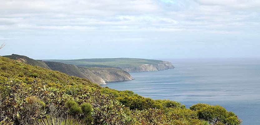
Front Cover: Cape Torrens by Robert Ellis
Permissive Licence
© State of South Australia through the Department for Environment and Heritage. Apart from fair
dealings and other uses permitted by the Copyright Act 1968 (Cth), no part of this publication may
be reproduced, published, communicated, transmitted, modified or commercialised without the
prior written approval of the Department for Environment and Heritage.
Written requests for permission should be addressed to:
Design and Production Manager
Department for Environment and Heritage
GPO Box 1047
Adelaide SA 5001
Disclaimer
While reasonable efforts have been made to ensure the contents of this publication are factually
correct, the Department of Environment and Heritage makes no representations and accepts no
responsibility for the accuracy, completeness or fitness for any particular purpose of the contents,
and shall not be liable for any loss or damage that may be occasioned directly or indirectly
through the use of or reliance on the contents of this publication.
Reference to any company, product or service in this publication should not be taken as a
Departmental endorsement of the company, product or service.
© Department for Environment and Heritage
September 2009EXECUTIVE SUMMARY
EXECUTIVE SUMMARY
This Integrated Fire Management Plan for the Cape Forbin area includes Cape Torrens and
Western River Wilderness Protection Areas; Crown lands, Heritage Agreements; private forest
plantations; rural residential and agricultural land. The plan has been developed as a
partnership between Kangaroo Island (KI) Council, KI Natural Resource Management (NRM)
Board, KI District Bushfire Prevention Committee (DBPC), Country Fire Service (CFS) and
Department for Environment and Heritage (DEH). The plan will provide direction for fire
management activities, including bushfire suppression in the area. The plan emphasises the
protection of life and property and provides direction for land managers in the protection
and enhancement of the natural and cultural heritage of the Cape Forbin Landscape
Planning Area. It is important to note there will be a transitional phase where the activities
and works proposed in the plan are implemented and implementation will be dependant
upon ongoing prioritisation of fire management and regional resources. Some degree of
flexibility will need to remain for fire suppression in the areas where there has only been partial
implementation of works.
The Landscape Planning Area was identified as a priority for fire management planning on
Kangaroo Island, to address the following issues.
• Protection of human life, property and the environment from the impact of unplanned
fires.
• Improving the success and safety of fire suppression operations.
• Identification of fuel hazards and fire related risks within the Landscape Planning Area
for protection of built assets and natural and cultural heritage values.
• Protection of natural, cultural and built values and maintenance of biodiversity.
• To ensure that sound conservation and land management principles are applied to fire
management activities where applicable.
• Management of fire and fire regimes to meet ecological requirements of species and
communities that may be at risk from inappropriate fire regimes and unplanned
bushfire, based on best available knowledge
• Prioritisation of monitoring and research of fire behaviour and the effects of fire regimes
within the Landscape Planning Area.
• Identifying the need for the preparation of a specific community preparedness,
awareness and education program in collaboration with the CFS Community Fire Safe
program.
• Contributing to the development of a model for community initiated prescribed
burning.
These issues are addressed by:
• applying a risk assessment process to identify life, property and environmental values
that may be threatened by bushfires
• applying DEH Fire Management zoning principles to guide the management of fuel in
Asset and Buffer zones and designating Conservation-Land Management zones
Cape Forbin Integrated Fire Management Plan iEXECUTIVE SUMMARY
• applying DEH Ecological Fire Management Guidelines to determine appropriate fire
regimes in Conservation-Land Management zones
• auditing tracks using the Government Agencies Fire Liaison Committee’s (GAFLC)
guidelines for fire breaks and fire access tracks in South Australia.
A number of actions as a result of applying the above processes are recommended,
including:
• fuel reduction:
in Asset and Buffer zones using a variety of methods including prescribed
burning and mechanical removal
in strategic areas within the Conservation-Land Management zone to provide
some landscape protection within native vegetation and increase patchiness
within the vegetation (to reduce the possibility of a large areas of native
vegetation burning in a single fire event)
in strategic areas in Conservation-Land Management zones to minimise the
spread of fire through the landscape and the loss and damage to assets in this
zone.
• alteration and/or upgrade of fire access points and track classifications to increase the:
safety of firefighting personnel involved in a fire suppression effort;
response time of fire suppression agencies; and
type of resources that can safely be deployed to assist in a fire suppression
effort.
• identification of suppression considerations that may assist bushfire operations and
contribute to improved fire management.
This draft plan was released for public comment for a period of four weeks. Comments were
evaluated and incorporated where considered appropriate. A major review of this plan will
occur after five years of implementation, or earlier if required.
ii Cape Forbin Integrated Fire Management PlanTABLE OF CONTENTS
TABLE OF CONTENTS
EXECUTIVE SUMMARY ...................................................................................................................... I
TABLE OF CONTENTS ...................................................................................................................... III
List of Figures..................................................................................................................................... iv
List of Tables...................................................................................................................................... iv
List of Maps....................................................................................................................................... iv
1 SCOPE AND PURPOSE ............................................................................................................... 1
1.1 Approach to Fire Management........................................................................................... 1
1.2 Aims and Objectives of this Fire Management Plan......................................................... 1
2 THE PLANNING FRAMEWORK ................................................................................................... 2
2.1 Legislation ................................................................................................................................ 2
2.2 State Context .......................................................................................................................... 3
2.3 Regional Context.................................................................................................................... 4
2.4 Consultation ............................................................................................................................ 9
2.5 Plan Review and Currency ................................................................................................... 9
3 BUSHFIRE ENVIRONMENT ........................................................................................................ 10
3.1 Location Description ............................................................................................................ 10
3.2 Climate................................................................................................................................... 10
3.3 Fuel.......................................................................................................................................... 11
3.4 Landform................................................................................................................................ 12
3.5 Extreme Fire Conditions ....................................................................................................... 12
4 VALUES AND ASSETS ............................................................................................................... 13
4.1 Biodiversity Values and Ecological Assets ........................................................................ 13
4.2 Community Values and Assets ........................................................................................... 17
5 RISK ASSESSMENT .................................................................................................................... 20
5.1 Fire History .............................................................................................................................. 20
5.2 Risk of Ignition ........................................................................................................................ 21
5.3 Fuel Hazard............................................................................................................................ 21
6 ECOLOGICAL FIRE MANAGEMENT ........................................................................................ 23
6.1 Context................................................................................................................................... 23
6.2 Development of Ecological Fire Management Guidelines........................................... 23
6.3 Interpreting Ecological Fire Management Guidelines ................................................... 24
7 BUSHFIRE MANAGEMENT OBJECTIVES AND STRATEGIES ...................................................... 28
7.1 Community Preparedness, Awareness and Education ................................................. 28
7.2 General Objectives for Fire Suppression ........................................................................... 29
7.3 Strategies and Actions to Achieve Objectives................................................................ 30
7.4 Suppression Considerations ................................................................................................ 30
7.5 Fire Access, Fire Breaks, and Control Lines ....................................................................... 33
7.6 Fire Management Utilities and Facilities............................................................................ 34
Cape Forbin Integrated Fire Management Plan iiiTABLE OF CONTENTS
8 FIRE MANAGEMENT ZONES AND BLOCKS ............................................................................. 35
8.1 Fire Management Blocks..................................................................................................... 35
8.2 Fire Management Zones ..................................................................................................... 35
8.3 Asset Zone (A-zone) ............................................................................................................. 35
8.4 Buffer Zone (B-zone) ............................................................................................................. 37
8.5 Conservation-Land Management Zone (CLM-zone) ..................................................... 39
8.6 Prescribed Burn Preparation ............................................................................................... 43
9 BIODIVERSITY WORKS – RECOVERY, RESEARCH AND MONITORING ................................... 45
9.1 Post-fire Rehabilitation and Recovery............................................................................... 45
9.2 Research and Monitoring.................................................................................................... 45
10 RECOMMENDATIONS ............................................................................................................. 46
10.1 Summary of Recommendations ........................................................................................ 46
10.2 Recommended Works ......................................................................................................... 50
11 REFERENCES............................................................................................................................. 52
12 APPENDICES ............................................................................................................................ 55
Appendix 1 – Ecological Fire Management Guidelines for Rated Flora ............................... 55
Appendix 2 – Ecological Fire Management Guidelines for Rated Fauna ............................ 61
Appendix 3 – Wilderness Code of Management ..................................................................... 65
Summary of Codes Used In Appendices.................................................................................... 66
13 GLOSSARY OF ACRONYMS AND FIRE MANAGEMENT TERMINOLOGY................................ 67
List of Figures
Figure 1 – Approach for Determining Ecological Fire Management Guidelines .................... 24
Figure 2 – Prescribed Burn Planning Process for Native Vegetation on All Lands.................... 44
List of Tables
Table 1 – Current Land Use By Property in the Planning Area .................................................... 17
Table 2 – Estimated Dwelling Occupancy By Property in the Planning Area .......................... 17
Table 3 – Tourism Assets within the Planning Area ........................................................................ 18
Table 4 – Likely Maximum Overall Fuel Hazard Rating for Primary Species Groups ................ 22
Table 5 – Ecological Fire Management Guidelines for Primary Species Groups ..................... 26
Table 6 – Probability of First Attack Success Based on FFDI and Overall Fuel Hazard ............ 31
Table 7 – Fire Management Zones By Tenure within the Planning Area ................................... 35
Table 8 – Table of Recommended Fire Access Works ................................................................. 50
List of Maps
Map 1 – Terrain, Tenure and Infrastructure
Map 2 – Vegetation and Significant Species
Map 3 – Fire History
Map 4 – Fire Management and Access
iv Cape Forbin Integrated Fire Management Plan1 SCOPE AND PURPOSE
1 SCOPE AND PURPOSE
The purpose of this plan is to provide a strategic framework for fire management activities
within the Cape Forbin Landscape Planning Area (27 193 ha) on the north-west of Kangaroo
Island (Map 1). The plan defines objectives for life and property protection and ecological
fire management and it outlines strategies and identifies priorities for works to meet these
objectives.
Fire prevention planning for land use outside DEH managed land is the responsibility of the KI
DBPC in accordance with the Fire and Emergency Services Act 2005. This unique integrated
landscape fire management plan is a partnership between the KI Council, DEH, CFS, KI NRM
Board and KI DBPC. Community linkages also include the KI CFS Group and an established
reference group within the Landscape Planning Area.
1.1 Approach to Fire Management
Fire is a natural, dynamic, landscape phenomenon that is pivotal in shaping Australian
landscapes and ecosystems. This plan takes an adaptive management approach where fire
management activities are used to gain an informed understanding that can be applied to
future activities. It is therefore important that management processes incorporate informed
fire management practices.
1.2 Aims and Objectives of this Fire Management Plan
The aim of this fire management plan is to develop a landscape scale, integrated fire
management plan, covering private and public lands, incorporating risk management
strategies for protection of life, property and biodiversity assets in an ecologically sustainable
manner.
The primary objectives of this plan are to protect human life, property and the environment
from the impact of unplanned fires. Additional objectives are as follows.
• To increase the success and safety of fire suppression operations.
• To identify fuel hazards and fire related risks within the Landscape Planning Area for
protection of built assets and natural and cultural heritage values.
• To protect natural, cultural and built values and maintenance of biodiversity.
• To ensure that sound conservation and land management principles are applied to fire
management activities where applicable.
• To manage fire and fire regimes to meet ecological requirements of species and
communities that may be at risk from inappropriate fire regimes.
• To prioritise the monitoring and research of fire behaviour and the effects of fire regimes
within the Landscape Planning Area.
• To initiate the preparation of a specific community preparedness, awareness and
education program in collaboration with the CFS Community Fire Safe program.
• To contribute to the development of a model for community initiated prescribed
burning to assist in the implementation of using fire as a land management tool.
Cape Forbin Integrated Fire Management Plan 12 THE PLANNING FRAMEWORK
2 THE PLANNING FRAMEWORK
2.1 Legislation
2.1.1 Commonwealth Legislation
The Environment Protection and Biodiversity Conservation Act 1999 (EPBC Act) aims to
protect biodiversity in Australia and integrate the management of important natural and
cultural places. This Act requires specific approval for any proposed actions, including
projects, developments, activities or alterations that are likely to have a significant impact on
‘matters of national environmental significance’ including threatened species and ecological
communities. There are several flora and fauna species in the Landscape Planning Area
(Appendix 1 and 2 respectively) which are afforded protection under this Act.
2.1.2 State Legislation
All landowners are obliged to comply with the Fire and Emergency Services Act 2005 which
outlines responsibilities for fire preparedness. Under this Act, the Chief Officer (CFS) must take
steps to have any relevant provisions of a management plan brought to the attention of
members of the CFS who might exercise powers under this section with respect to the reserve.
Following the adoption of this Plan by the Native Vegetation Council, any prescribed works or
activities that involve vegetation clearance or the use of fire is endorsed under the Native
Vegetation Act 1991. Works proposed for Heritage Agreement areas will require approval
from the Minister for Environment and Conservation.
Under the provisions of the National Parks and Wildlife Act 1972 (NPW Act) and the Wilderness
Protection Act 1992, DEH has responsibilities for fire management activities within reserves
constituted under these Acts. The Wilderness Protection Act 1992 provides for the protection
of wilderness and the restoration of land to its condition before European colonisation. The
Wilderness Code of Management (DEH, 2004) has been adopted by the Minister for
Environment and Conservation under Section 12 of the Wilderness Protection Act 1992. The
Code of Management details requirements for fire, emergency and essential management
operations in wilderness areas (see Appendix 3). This plan has taken the Wilderness Code of
Management into account in developing strategies for fire management of Western River
and Cape Torrens Wilderness Protection Areas.
The Natural Resources Management Act 2004 establishes the Natural Resources
Management (NRM) Council which has the responsibility to prepare and review the State
NRM Plan.
The Crown Lands Act 1925 is repealed by the Crown Lands Management Act 2009. Under
the Crown Lands Management Act 2009 Crown land is described as either:
• dedicated Crown land (land that has been dedicated as a reserve for a specified
purpose to a Minister, person or body (including the Kangaroo Island Council or
community groups)). Described as a ‘dedicated reserve’ in this fire management
plan.
• Crown leasehold land
2 Cape Forbin Integrated Fire Management Plan2 THE PLANNING FRAMEWORK
• Crown land owned by, or under the control of the Minister for Environment and
Conservation
• unalienated Crown land (land that has not been alienated from the Crown, not
including those as defined above).
Fire management responsibilities on Crown land falls with the Minister for Environment and
Conservation, except where Crown land has been leased or dedicated to another party.
The Development Act 1993 provides the Kangaroo Island Council with a legislative framework
for planning and development and prescribes the establishment of the Kangaroo Island
Council Development Plan including a periodic review. The planning strategies contained
within the Kangaroo Island Council Development Plan provide specific directions on bushfire
management and protection.
2.2 State Context
2.2.1 Local Government
Under Section 76 of the Fire and Emergency Services Act 2005 (SA) local government(s)
comprising a District Bushfire Prevention Committee is required to prepare bushfire prevention
plans. Kangaroo Island is considered a district for this purpose and the Council, through its
District Bushfire Prevention Committee, has identified the development of landscape scale
fire management plans, such as the Cape Forbin Integrated Fire Management Plan, as an
appropriate means to meet part of this legislative requirement.
2.2.2 Country Fire Service
Bushfire prevention in South Australia is currently supported through a three tier process: the
South Australian Bushfire Prevention Advisory Committee (BPAC), Regional Bushfire Prevention
Committees and District Bushfire Prevention Committees.
The CFS provides executive support to the State BPAC and the regional prevention
committees, and input into the district committees. State and regional bushfire prevention
plans are prepared by the CFS, with district plans prepared by Fire Prevention Officers within
local government. As a result of the recent Ministerial Review of Bushfire Management in
South Australia (Monterola, 2007) amendments to the Fire and Emergency Services Act 2005
have been recommended as well as changes in regards to bushfire prevention planning and
the management framework.
The main aim of the State Bushfire Prevention Plan is:
• To provide a framework for the protection of life and the reduction of bushfire impact
on property and the environment throughout South Australia (Miller, 2007).
The CFS is the lead combatant agency for fire suppression activities. This plan enables the
CFS, DEH and the Incident Management Team to provide recommendations and access
information in order to make timely and considered decisions which support fire suppression
activities. The remoteness of the Landscape Planning Area, the low resident population and
the separation from the mainland mean that the Kangaroo Island CFS Group are heavily
relied on for incident management and fire suppression activities for the first 24 hours,
particularly in an escalating incident. The co-operation, support and understanding between
Cape Forbin Integrated Fire Management Plan 32 THE PLANNING FRAMEWORK CFS and land management agencies such as DEH, private forestry companies and SA Water and the local community have been critical to successful fire suppression on Kangaroo Island, and will be vital to the success of this plan. 2.2.3 Department for Environment and Heritage DEH has a Fire Management Policy (DEH, 2008c) in place with the core objective of managing fire in the State’s reserve system to protect life, property and environmental assets, and to enhance the conservation of natural and cultural heritage. Fire management and fire operations on DEH land will be undertaken in accordance with the Fire Policy and Procedures Manual (DEH, 2008d). Under this policy direction, appropriate consideration is given in DEH fire management planning to achieve the dual aims of environmental protection as well as the protection of human life, property and assets. Property protection activities, where recognised as a priority, will be carried out in such a way as to reflect, where practicable, the importance of protecting the dynamics of natural systems. The State Government has also produced the No Species Loss – A Nature Conservation Strategy for South Australia 2007 – 2017 (DEH, 2007a). The strategy sets targets for conserving the State’s biodiversity, including managing threats such as inappropriate fire regimes. 2.2.4 Natural Resource Management The State NRM Plan 2006 (DWLBC, 2006) sets the strategic policy framework and resource condition targets for managing the State’s natural resources in an ecologically sustainable way by adopting a landscape scale approach, engaging the community and managing natural resources in an adaptive management framework. The actions identified in the Cape Forbin Integrated Fire Management Plan (IFMP) will contribute to achieving the targets in both the State NRM Plan and No Species Loss Strategy. 2.3 Regional Context 2.3.1 KI District Bushfire Prevention Plan Fire management planning for land outside of the DEH managed land is addressed through the Kangaroo Island District Bushfire Prevention Plan (KI DBPC, 2000) currently being prepared by the KI DBPC. Since the prevention plan was prepared there have been a number of changes to national and state policy and planning, changes to land use on Kangaroo Island (including land division), as well as reforms at the State Government level. These factors coupled with the heightened community concern as a result of the December 2007 fires on the Island provided a strategic opportunity to trial a unique and innovative approach to landscape planning using a model developed in New South Wales by the Rural Fire Service. The approach considers bushfire risk to life, property and the environment across the landscape, regardless of tenure or ownership and facilitates a risk assessment process to aid in the formulation and prioritisation of risk treatment strategies. The KI Bushfire Risk Management Plan (KI DBPC, In prep.) will ultimately build upon and replace the abovementioned prevention plan that was last updated eight years ago. DEH is working closely with the KI DPBC in order to ensure strategies, works and recommendations within this Fire Management Plan are reflected within the KI Bushfire Risk Management Plan, with the 4 Cape Forbin Integrated Fire Management Plan
2 THE PLANNING FRAMEWORK

interests of CFS and the KI DBPC being met through representation on the Cape Forbin
Planning Team.

2.3.2   KI Council Roadside Vegetation Management Plan

The Roadside Vegetation Management Plan (KI Council, 2007) is administered by Kangaroo
Island Council under delegation from the Native Vegetation Council. The plan has recently
been reviewed and the current version was approved for operation for five years from
January 2007.

The plan provides a framework for the routine maintenance of native vegetation, and
includes specific provisions for fire management, the objective of which is “to manage
roadside vegetation to minimise fire threat to life and property and for the conservation of
flora and fauna” (p.34). A range of specific actions which can be undertaken in roadside
vegetation are included in the plan. The inclusion of bushfire prevention works in roadside
vegetation within District Bushfire Prevention Plans is also contemplated.

2.3.3   Natural Resources Management Plan

The Draft NRM Plan for Kangaroo Island has been developed by the KI NRM Board (2008), as
a requirement under the Natural Resources Management Act 2004 (NRM Act), in consultation
with the community and stakeholders. The plan, which is linked to the State NRM Plan
(DWLBC, 2006), describes the condition of the region and the natural resources within the
region and identifies goals to improve NRM outcomes on KI. The plan identifies ‘inappropriate
fire regime’ as a key threat to terrestrial diversity and also recognises ‘increased fire
frequency’ as a potential future risk associated with a changing climate.

Landscape-scale fire management is specified as an objective within the NRM Plan for
achievement in the next 5 to 10 years. Landscape-scale fire management planning has
already begun on KI, with the initiation of the Kangaroo Island Bushfire Risk Management Plan
pilot project (see Section 2.3.1) by the DBPC after the December 2007 fires. DEH is
contributing to this process to ensure that strategies and actions within DEH fire management
planning are integrated into the Risk Management Plan.

The NRM Plan also advocates for the inclusion of biodiversity outcomes into fire management
planning.  DEH has incorporated biodiversity and ecological management into fire
management planning for a number of years (see Section 4.1).

2.3.4   Biodiversity Plan for Kangaroo Island

The Biodiversity Plan for Kangaroo Island states that the magnitude of fires compared to the
amount of remaining native vegetation is the greatest threat to the maintenance of
biodiversity on Kangaroo Island (Willoughby, et al., 2001).        It aims to improve fire
management for biodiversity, by establishing baseline information and a detailed monitoring
program for pre-fire and post-fire (both on and off reserve), and by using planned burns to
protect biodiversity and built assets.

Achieving the objectives of both the INRM Plan and the Kangaroo Island Biodiversity Plan is
dependent on the development and implementation of landscape scale fire management

Cape Forbin Integrated Fire Management Plan                                                5
2 THE PLANNING FRAMEWORK

plans. Consequently the Cape Forbin IFMP will make a significant contribution to achieving
the fire management objectives of the INRM Plan for Kangaroo Island.

2.3.5   Plans of Management

    Flinders Chase Fire Management Plan

    The Flinders Chase Fire Management Plan (DEH, 2009) was subject to internal review
    process in 2008, after it was identified that a revision of the existing plan (DEH, 2003b) was
    required due to the extensive bushfires in December 2007. The review provided the
    opportunity to consider and address altered risks to life, property and the environment
    using recently developed policies, procedures and standards for fire management
    planning.

    The Flinders Chase Fire Management Plan covers the area to the south of the Cape
    Forbin Landscape Planning Area, that is south of Playford Highway. The Flinders Chase
    Fire Management Plan incorporates Flinders Chase National Park, Ravine des Casoars
    Wilderness Protection Area, Cape Bouguer Wilderness Protection Area and Kelly Hill
    Conservation Park.

    DEH Reserve Management Plans

    Section 31 of the Wilderness Protection Act 1992 states that a management plan is
    required for each Wilderness Protection Area. Plans must, as far as practicable,
    implement the policies set out in the Wilderness Code of Management (DEH, 2004). DEH
    is responsible for the management of Wilderness Protection Areas through the Director of
    National Parks and Wildlife.

    The Cape Torrens and Western River Wilderness Protection Areas Management Plan (DEH,
    2006b) has the objective of “maintaining the wilderness and biodiversity values in the
    reserves through effective fire management”.

    Fire management planning is to:

        • be consistent with the Wilderness Code of Management (DEH, 2004)

        • identify natural and cultural heritage values and built assets

        • provide a framework for the management of bushfire suppression, including
          identification of strategic access and control lines

        • provide a framework for prescribed burning for ecological management and fuel
          reduction purposes

        • identify an appropriate fire regime to protect the integrity of mature Drooping
          Sheoak (Allocasuarina verticillata) and aged Sugar Gum (Eucalyptus cladocalyx)
          for the protection of Glossy Black-Cockatoo habitat.

    Heritage Agreements

    The prescribed use of fire within Heritage Agreements contained within this plan may be
    used for the following purposes.

        • Fuel reduction around or adjacent built assets (refer to 8.3 Asset Zones).

6                                                 Cape Forbin Integrated Fire Management Plan
2 THE PLANNING FRAMEWORK
• To provide landscape protection for populations and/or communities of
significant flora and fauna.
• Achieving specific ecological objectives such as weed management, threatened
species population management or habitat restoration.
Note: all proposed burns within Heritage Agreement areas require the consent of the
Minister for Environment and Conservation without an approved fire management plan.
To facilitate a consistent approach across the Landscape Planning Area and to ensure
that the objective of any prescribed action is aligned with the objectives stated within this
plan, any fire management actions prescribed and implemented on Heritage
Agreements are undertaken by individual landholders within the following constraints.
• Any prescribed action undertaken on private land will comply with the guidelines
stated within this plan and the relevant Policies and Acts listed.
• All prescribed burning planned for Heritage Agreement areas will be prepared in
accordance with the DEH Policy and Procedures for Prescribed Burning (DEH,
2008e) and the GAFLC South Australian Prescribed Burning Code of Practice
(GAFLC, 2004).
• All prescribed burning conducted within Heritage Agreement areas will be
completed only in conjunction with an adequate monitoring program (refer to
Section 9 and the GAFLC South Australian Prescribed Burning Code of Practice
(GAFLC, 2004)).
• The final decision to implement any prescribed action listed within the plan for a
specific Heritage Agreement, once Ministerial consent has been obtained, rests
with the landowners.
• DEH, through the relevant Bush Management Adviser or other relevant NRM
funded staff, may provide technical support and expertise in the preparation of
prescribed burn plans, environmental assessments and pre- and post-fire
monitoring. Funding for monitoring programs can be sought through the Native
Vegetation Council grants scheme.
• DEH will not contribute toward the implementation (either through resources or
financially) of any prescribed action on private land unless it is demonstrated that
there is a benefit or shared risk to public land.
Recommendation
Agreements
1. To assist in the implementation of prescribed burning and other pre-
Heritage
suppression works within Heritage Agreements it is recommended that
funding be sought through the Kangaroo Island NRM Board to assist in fire
management and monitoring on private land. These funds should be
managed through the Conservation Programs Unit (Kangaroo Island
Region).
Cape Forbin Integrated Fire Management Plan 72 THE PLANNING FRAMEWORK
2.3.6 Development Plans
Planning Strategy for Regional South Australia
The Planning Strategy for Regional SA (DTUP, 2003) makes mention of bushfire prevention
and management issues for regional South Australia, with the primary concerns being
that land should be managed in accordance with Bushfire and Fire Prevention Plans and
landholders should be aware of the need for development to be located and designed
in accordance with bushfire prevention policies that include fuel reduction (p.17).
Specific strategies within the Planning Strategy include:
• establishing guidelines for bushfire prevention measures associated with
development
• restricting development in bushfire prone areas
• ensuring that the nature and scale of development in areas of high conservation
value is of minimal impact to the environment.
Kangaroo Island Development Plan
There are two objectives listed in the Kangaroo Island Development Plan (Planning SA,
2003) that are related to bushfire protection.
• The protection of life and property from the effects of bushfire.
• To direct development away from sites and areas with an unacceptably high
level of bushfire hazard (p.19).
The plan includes principles regarding land division to minimise the likelihood of damage
to property resulting from bushfire, ensuring good fire access, provision of adequate water
supply, landscaping to minimise bushfire risk, design and construction of buildings to
minimise loss of life and property in a fire, and development in accordance with a fire
management plan for the property.
Most of the land within the Landscape Planning Area has been zoned as High Bushfire Risk
for planning assessment purposes, with a number of properties zoned Medium Bushfire Risk
(refer maps KI(BPA)5 and 6 in Planning SA, 2003). In addition to the requirements under
the Building Code, there are specific planning requirements for construction of dwellings
in these Bushfire Risk zones.
Plantation Management Guidelines
Standard guidelines for plantation design and layout incorporating fire management are
contained within the Kangaroo Island Development Plan (Planning SA, 2003), the Forest
Owners Conference Plantation Design Guidelines (FOC, 2003), and the CFS Guidelines for
Farm Forestry (CFS, 2006a). These guidelines are generally incorporated within the
conditions of development approval in applications for land use change for plantation
development.
In essence they require:
• 20 m perimeter fire breaks around all plantations of 100 ha or greater
8 Cape Forbin Integrated Fire Management Plan2 THE PLANNING FRAMEWORK
• internal tracks of a minimum of 7 m around compartments of no greater than 40
ha in size
• water point signs
• provision of straight through access at junctions
• avoidance of dead ends or provision of turn around areas where these cannot be
avoided.
2.4 Consultation
Kangaroo Island Council, DEH, the CFS, the KI NRM Board and the KIDBPC are committed to
close cooperation and involvement with local, State and Commonwealth organisations,
special interests groups, residents within the Landscape Planning Area and the broader
community to achieve the goals of protection of life and property and biodiversity
conservation. The KIDBPC, local CFS Group, landholders, conservation groups and ecologists
have been consulted during the development of this plan.
2.5 Plan Review and Currency
Following adoption, the currency of this plan is five years. A major review will be conducted
after this period, and will include the Cape Forbin Integrated and Flinders Chase Fire
Management Plans. It is intended that the review will incorporate both plans into a single
DEH fire management plan. It is anticipated that the off-reserve component of the Cape
Forbin Integrated Fire Management Plan will be addressed through the Kangaroo Island Risk
Management Plan (KI DBPC, In prep.). The review will include an evaluation of all sections of
the plan. A similar process of community consultation and public exhibition will be followed in
the preparation of the plan.
A review of this plan will occur following fire incidents as part of the adaptive management
process, and annually through the preparation of on-ground management works. The review
of the plan should also include a review of any changes to the risk assessment across the
landscape.
Cape Forbin Integrated Fire Management Plan 93 THE BUSHFIRE ENVIRONMENT 3 BUSHFIRE ENVIRONMENT 3.1 Location Description The Landscape Planning Area covers approximately 27 193 ha in the north-west of the Island (Map 1). It is bordered by Investigator Strait to the north and by the North Coast and Western River Roads to the east, the Playford Highway on the south, and by the tenure boundary of Ravine des Casoars Wilderness Protection Area to the west. Approximately 50% of the area is native vegetation, existing in a number of large blocks (Cape Torrens and Western River Wilderness Protection Areas) and smaller vegetation fragments. 3.1.1 Land Use History Initial clearance for primary production in the Landscape Planning Area was concentrated around two of the sheltered coves. The property known as ‘Snug Cove’ and the adjacent coastal land to the west of that property was initially leased by John Hirst in 1864, and the area around Western River Cove was first leased by Henry Snelling in the same year. By 1872 the Hirst family held land from Cape Borda to Seal Beach (Bell, 1997). Sugar Gums (Eucalyptus cladocalyx) covering these areas were ring-barked and the land then burnt. These areas were heavily grazed. In 1879 a sawmill was established at De Mole River and Sugar Gum timber was harvested and milled for shipment to the copper mines at Moonta and Wallaroo for pit props. The legacy of this early and thorough clearance is that the properties at Snug Cove (in particular) and Western River have relatively little retained native vegetation and probably minimal seed bed. The next wave of clearance commenced in the 1930s and 40s, and following the end of world War Two. A number of properties in the Landscape Planning Area, particularly those adjacent to Flinders Chase National Park (Gosselands) and the Ravine des Casoars Wilderness Protection Area, were only cleared in the 1960s and 1970s. A number of primary production properties in the Landscape Planning Area are therefore characterised by substantial and vigorous regrowth of native vegetation. The regrowth often features Yaccas (Xanthorrhoea semiplana ssp. tateana), but on some properties also include a range of understorey species and young eucalypts. The pasture on a number of properties is also very rough, due to the presence of rocks and stumps that have not been raked following clearance. Forestry plantings commenced in the Landscape Planning Area in 1982, with the Coleman’s Radiata Pine (Pinus radiata) plantation. Subsequent plantings of both softwood and hardwood species were undertaken each year between 2000 and 2002, and hardwood species each year between 2004 and 2006. The Western River and Cape Torrens Wilderness Protection Areas were gazetted as such in 1993, following the proclamation of the Wilderness Protection Act in 1992. Most of the Western River protected area was originally gazetted in 1971. 3.2 Climate Kangaroo Island has a cool, temperate climate (based on the Koppen classification system). It has relatively mild winters and summers due to the moderating influence of the surrounding 10 Cape Forbin Integrated Fire Management Plan
3 THE BUSHFIRE ENVIRONMENT

ocean and the low elevation of the Island. Rainfall is distinctly seasonal, with 42 - 49% of the
rain occurring in winter (Burrows, 1982).

The Landscape Planning Area has, on average, less variation in annual temperature range
than the eastern and central regions of the Island. The monthly mean temperature at Cape
Borda, 5 km to the west of the Landscape Planning Area, ranges from 8.90C in August, to
23.30C in February. The annual means range from 11.30C to 18.20C. Mean relative humidity
ranges from 65% in January to 79.7% in June (9 am measurements), and 54% in January to
74% in July (3 pm measurements) (BOM, 2007).

The annual mean rainfall in the Landscape Planning Area is 621.4 mm, which is substantially
higher than Kingscote in the east, due to the topographical effect of the main ridge that
occupies the western half of the Island. Rainfall is highest in June, with a mean maximum of
106.9 mm, while January is the lowest rainfall month with a mean of 15.4 mm (BOM, 2007). In
an Australian context, rainfall on the Island is relatively reliable although still subject to
considerable annual variation.

From October to December Kangaroo Island can experience severe weather conditions with
thunderstorm and associated lightning activity, often concentrated around the more
elevated areas of the Island on the Gosse and Seddon Plateaus. The hottest months are
January and February, which coincide with grass curing and low soil moisture.

During summer, frontal activity can rapidly change the moderate prevailing south easterly
wind direction to strong north to north westerly winds accompanied by high temperatures
and low humidity creating extreme fire weather conditions.

The dominant wind direction across Kangaroo Island during summer is from the south east,
and in winter from the west (Burrows, 1982). There is minimal variation in wind speed during
the day or during the year; the minimum average wind speed is 19.8 km/h (April) and the
maximum is 26.5 km/h (July and August).

3.3   Fuel

The majority of native vegetation communities within the Cape Forbin Landscape Planning
Area have an understorey dominated by shrubs within predominantly eucalypt woodlands.
These areas also correspond to areas of high fuel accumulation and consequently Very High
to Extreme overall fuel hazard in mature vegetation. Areas of low fuel accumulation, not
surprisingly, coincide with area of pasture or open grasslands.

During Very High to Extreme conditions spotting is a common feature of the native vegetation
both in woodlands and mallee, but in particular Messmate Stringybark (Eucalyptus obliqua)
and Brown Stringybark (E. baxteri) areas. Under these conditions spot fires caused by wind-
blown firebrands or embers can occur several kilometres from the fire front.

Within the Landscape Planning Area, grass is usually 100% cured by the end of November.
However, in the southern section grasses may not be fully cured until mid to late December
due to the relatively higher rainfall.

Cape Forbin Integrated Fire Management Plan                                                 11
3 THE BUSHFIRE ENVIRONMENT

3.4   Landform

Dissected bedrock hills form a band along the northern boundary of the Landscape Planning
Area, while the south-eastern corner and southern boundary are on the western edge of the
Gosse lateritic plateau (Willoughby, et al., 2001).

The plateau area is typically highly dissected by streams, leading to the formation of steeply-
sided, deep rocky gullies (KI NRM Board, 2003). These creek gullies continue into the steep,
hilly country of the bedrock hills and flow to the coast. The bedrock hills terminate on the
north with high cliffs along the coastline. Elevation is highest along the Playford Highway
(southern boundary) and slopes down to the coastal cliffs.

Topsoils on the plateau are a permeable loam or sand, overlying relatively impermeable
mottled clay. The north coast hills are predominately shallow grey-brown sand with deeper
soils along the rivers and drainage lines (Willoughby, et al., 2001).

3.5   Extreme Fire Conditions

Extreme fire conditions are those that lead to ‘extreme fire behaviour’ and includes high fuel
load, severe weather, steep terrain and low soil moisture (as defined by the Australasian Fire
Authorities Council (AFAC) (2007)).

Generally on the western end of Kangaroo Island between October and December there is
a high incidence of lightning strikes, in particular along the lateritic plateau, which extends
from Cape Borda to the west to Parndana to the east. During this period there is a dramatic
increase in the likelihood of large fires occurring where the weather conditions are severe, soil
moisture is low and there is high fuel accumulation, particularly in native vegetation.

Within the Landscape Planning Area there is predominantly Very High to Extreme fuel loads
within native vegetation and this is combined with some of the steepest terrain on Kangaroo
Island, particularly within the Western River Wilderness Protection Area, resulting in
environmental conditions that have the potential for very large fire events. Given the
concurrence of these environmental conditions, low soil moisture and severe weather of high
temperatures, low humidity and strong winds, the resulting bushfire is likely to be very large
with extreme fire behaviour and difficult to contain until weather conditions moderate.

12                                                Cape Forbin Integrated Fire Management Plan
4 VALUES AND ASSETS

4     VALUES AND ASSETS

4.1     Biodiversity Values and Ecological Assets

4.1.1    Vegetation

Records from the Biological Database of South Australia (BDBSA) indicate that 470 native
species of plants have been recorded in the Landscape Planning Area. Of these, 27 are
endemic to Kangaroo Island (Willoughby, et al., 2001). Each of these species responds in
different ways to the occurrence of fire and our current understanding of these responses is
limited (see Section 6 and Appendix 1). Therefore the management of fire in areas of native
vegetation needs to be undertaken cautiously, within an adaptive management framework,
with adequate pre- and post-fire monitoring of flora and fauna to inform future management
actions.

Floristic mapping (Map 2) for this plan uses a compilation of regional vegetation mapping
data that has been reclassified to comply with the National Vegetation Information System
(NVIS) classification for Australia. The Major Vegetation Sub-group (MVS) level of the NVIS
classification emphasises the structural and floristic composition of the dominant stratum but
with additional types identified according to typical shrub or ground layers occurring with a
dominant tree or shrub stratum. There are seven MVS within the plan area that have been
mapped by DEH.

The Major Vegetation Sub-groups represented in the plan area are:

    • Eucalyptus woodland                                          MVS No 8

    • Acacia tall open shrublands and shrublands                   MVS No 21

    • Casuarina and Allocasuarina forests and woodlands            MVS No 26

    • Mallee heath and shrublands                                  MVS No 29

    • Other shrublands                                             MVS No 32

    • Eucalyptus open woodlands with shrubby understorey           MVS No 47

    • Melaleuca shrublands and open shrublands                     MVS No 49

Analysis of fuel hazard and ecological fire management guidelines for this plan is based on
mapping and detailed analysis of vegetation communities on Kangaroo Island by Ball and
Carruthers (1998). Communities were identified using the tallest overstorey species, or Primary
Species Groups. Five Primary Species Groups were used to determine overall fuel hazard for
the Landscape Planning Area, and as the basis for the development of ecologically
sustainable fire regimes (Dowie, 2006).

There are five Primary Species Groups that occur within the Landscape Planning Area:

               1. Eucalyptus cosmophylla very open mallee (MVS No 29)
               2. Eucalyptus remota open low mallee (MVS No 29)
               3. Eucalyptus baxteri low woodland (MVS No 8, 47)
               4. Eucalyptus cladocalyx woodland (MVS No 8, 29, 47)

Cape Forbin Integrated Fire Management Plan                                                13
4 VALUES AND ASSETS
5. Allocasuarina verticillata low woodland (MVS No 26)
Note that MVS No 21, MVS No 32 and MVS No 49 are not included in the Primary Species
Groups because of their restricted spatial distribution (near the coast).
4.1.2 Fauna
The diversity of the vegetation composition and structure in the Landscape Planning Area
supports a diversity of fauna species including a range of small and large mammals, birds,
reptiles and insects. Records from the Biological Database of South Australia (BDBSA)
indicate that 112 native species of fauna have been recorded in the Landscape Planning
Area. Each of these species respond in different ways to fire and are affected by fire to
varying degrees, depending on their mobility and habitat preferences, and our current
understanding of these responses is limited (see Section 6 and Appendix 2). Therefore the
management of fire in areas of native vegetation needs to be undertaken cautiously, within
an adaptive management framework, with adequate monitoring to inform future
management actions.
4.1.3 Species of Conservation Significance
In this plan ‘of conservation significance’ is used to describe important or ‘rated’ populations
or species of flora and fauna. Species and communities may be:
• Nationally rated, that is, listed as Threatened (with a rating of Extinct, Critically
Endangered, Endangered, Vulnerable or Conservation Dependent) under the federal
EPBC Act.
• South Australian rated, listed as Threatened (with a rating of Endangered, Vulnerable or
Rare) under the NPW Act, Revised Schedules 7, 8 and 9.
The Environmental Database of South Australia has a total of 66 rated flora species and 17
listed fauna species recorded for the Landscape Planning Area. The Environmental
Database of South Australia contains records from several data sources including the
Threatened Plant Population Database, the Biological Survey of South Australia, Reserve
database and Opportunistic sightings of significant flora and fauna. Flora and fauna species
of conservation significance that have been recorded in the Landscape Planning Area are
listed in Appendices 1 and 2 respectively, and fire management guidelines are provided.
These guidelines are to be taken into consideration when preparing the environmental
assessment process for all prescribed burns (for more detail refer to Figure 2).
For the majority of these species there is limited data on their distribution as records are
derived from limited surveys and opportunistic observations and are recorded as point data
only. Records for highly mobile species, such as birds, provide little indication of their
distribution within the Landscape Planning Area. Due to the low level of survey effort within
the Landscape Planning Area the absence of records for a species in a particular area does
not necessarily mean that the species does not occur there.
Extensive surveying and observations over a number of years of the Glossy Black-Cockatoo
(Calyptorhyncus lathami halmaturinus) has made it possible to identify key areas that are
used for nesting and foraging (Map 2).
14 Cape Forbin Integrated Fire Management Plan4 VALUES AND ASSETS
4.1.4 Aquatic Ecosystems
The drainage in the Landscape Planning Area can be characterised as relatively steep and
partly confined, northerly flowing streams that are typically ephemeral, flowing following
winter rains. The main catchments are those of the De Mole and Western rivers, with a
number of smaller catchments located along the North Coast between Cape Forbin and the
mouth of Western River. Three species of native fish have been recorded in the Landscape
Planning Area (Common Galaxia (Galaxia maculatus), Climbing Galaxia (Galaxia
brevipinnis), and Bluespot Goby (Pseudogobis olorum)), as well as introduced marron (Cherax
tenuimanus) (Nilsen, 2006).
The majority of the watercourses have intact vegetation buffers. However, occasional
heavily cleared sub-catchments occur in some agricultural areas. In general less than 10% of
rainfall run-off is captured by farm dams, with small areas where up to 50% may be captured
(Nilsen, 2006). Water quality may be affected by nutrient and sediment rich run-off from
agricultural areas, particularly following heavy rainfall events.
4.1.5 Threats to Biodiversity
There are a number of threats to the biodiversity of the Landscape Planning Area that may
be either directly or indirectly attributable to fires. Inappropriate fire regimes, i.e., variations in
fire interval, frequency, season, intensity and scale can impact negatively on the response of
flora and fauna to fire events. The influence of fire regimes on biodiversity is addressed in
detail in Section 1.
Plant Pathogens
Phytophthora cinnamomi (Pc) is a soil-borne water mould that affects the root systems of
native plant species, resulting in extensive damage or the death of the plant. It is a major
threat to natural ecosystems and some agricultural crops in areas of high rainfall and acid
to neutral soils. Pc can spread either in water or infected soil, thriving in warm and moist
conditions, and there is no known method of eradicating it once an area has become
infected. Pc has been positively identified in a number of locations within and adjacent
to the Landscape Planning Area and there is a high potential for it to be spread by earth
moving equipment and vehicles during fire suppression activities.
Recommendations
2. Ensure the Standard Operating Procedure – Phytophthora Threat Management
(SOPP-002) (DEH, 2002) is adhered to in Pc risk areas.
Phytophthora
3. Ensure hygiene practices are implemented at all times during fire operations to
reduce the spread of Pc across the planning area. In Phytophthora free areas
consider the risks of machinery use and implement hygiene measures if
machinery and vehicle access is necessary. Refer to DEH Operating Procedure
– Phytophthora Vehicle Disinfection Units(DEH, 2003a).
4. Where possible, wash down stations should be established at appropriate points
as soon as possible during a fire incident. Refer to DEH Operating Procedure –
Phytophthora Vehicle Disinfection Units (DEH, 2003a).
Cape Forbin Integrated Fire Management Plan 15You can also read