PORT OF NEWCASTLE Port Master Plan 2040 - Our Strategic Development Opportunities to 2040
←
→
Page content transcription
If your browser does not render page correctly, please read the page content below

PORT OF NEWCASTLE
Port Master Plan 2040

 Our Strategic Development
 Opportunities to 2040
CONTENTS

                                                                  Foreword					3
                                                                  Executive Summary				4
                                                                  Introduction					7
                                                                  Overview of the Port of Newcastle		               11
                                                                  Strategic Context				19
                                                                  Our Stakeholders and Environment		                21
                                                                  Port Capacity					26
                                                                  Transport Connectivity			36
                                                                  Growing Trade				47
                                                                  New Facilities and Infrastructure		               66
                                                                  Protecting the Port				70
                                                                  Implementation 				77
                                                                  Glossary					81

                                                                 Ackowledgement

                                                                 The Port of Newcastle acknowledges the
                                                                 Traditional Custodians of the land and waters of
                                                                 Newcastle Harbour, the Awabakal People and pays
                                                                 respect to all Elders past, present and future.

Port of Newcastle | Port Master Plan 2040   Port of Newcastle | Port Master Plan 2040
                 2                                           3
FOREWORD
The Port of Newcastle is a proud This Port Master Plan outlines the key strategic
development opportunities for the Port and the broader
working port with a strong history. region, including:
The purpose of this long-term Port Master Plan is to • The Newcastle Container Terminal;
communicate our broad and strategic approach by • The Newcastle Bulk Terminal;
outlining both our current and future development and • An Automotive and Ro-Ro Hub;
trade opportunities to 2040. • The Maritime Precinct;
• The Newcastle Cruise Terminal; and
As a global gateway for New South Wales, the Port of • The continuation and growth of major bulk
Newcastle (PON) enjoys a significant competitive trades including coal, fuel, fertiliser, wheat and
advantage, with a major seaport and connectivity to a mineral concentrates.
world-class national rail and heavy vehicle road system.
With the shipping channel currently only operating at Our success depends on our ability to be an efficient
50% capacity, vacant portside land and market interest, global trade gateway, working in partnership with those
the opportunities are immense. who rely on our services, those who regulate our
activities, and those who are our neighbours.
The Port plays a significant role as an economic driver
and a catalyst for growth throughout our region, state We are dedicated to operating a safe, sustainable,
and nation. In the Lower Hunter alone, activity within environmentally and socially responsible business in
the Port of Newcastle contributes $1.6 billion and 9,000 partnership with our tenants, port users, community and
EXECUTIVE SUMMARY
jobs per annum. This does not include the significant Government agencies. The Port Master Plan 2040 is
contribution of associated industries such as mining and reflective of these values, and I commend it to our
agriculture, which contribute many billions more. stakeholders and partners.
The Port of Newcastle’s vision is to maintain Newcastle’s
position as one of the leading and most efficient
global-scale ports, and to facilitate continued growth Australia’s ports facilitate the movement of $1.2 billion worth of trade
and development of existing and new trades in a every day.1
sustainable manner. We recognise the responsibility
that comes with stewarding an iconic asset for the next
95 years. We are committed to driving collaboration The Port of Newcastle is the global gateway for the Container Terminal. We are the port ready to host the
with Government, communities and other stakeholders Hunter Region and New South Wales. It is the largest latest technologies, industry innovation and a step
to agree on the future and deliver the benefits of trade port on the East Coast, and Australia’s third largest port change in the way freight is moved in, out and through
growth. by trade volume. It is well-placed to support the New South Wales and Australia.
predicted doubling of Australian freight over the next 20
The Port of Newcastle has embarked on an ambitious years and beyond. Many Australian ports, including the Port of Newcastle,
diversification strategy. Whilst coal exports provide a now operate in a commercial environment, in which port
stable foundation for our growth, we are driven by the By 2040, the City of Newcastle will be home to 200,000 owners and managers are focused on utilising the full
need to grow and diversify our trade base to meet the Professor Roy Green Craig Carmody capacity of their assets to deliver greater efficiency and
people, with the population of the Hunter growing to
demands of our customers and the containerisation of Port of Newcastle Port of Newcastle shareholder value.
870,000 and New South Wales to over 10 million
some trades. Chairman Chief Executive Officer
people.2 The Port, through coal export trade, will
continue to provide a stable foundation for our region This Port Master Plan provides a broad and strategic
and state’s economy, and our business. Trade volumes approach, identifying future developments and
of fuels, and dry bulk such as wheat, grains and fertiliser, opportunities to 2040. The following goals underpin
will continue to grow. this approach:
Our trademark for the next twenty years, however, will • Promote the capacity of the Port and the supply
be our diversification. The Port of Newcastle has chain to support the economy.
abundant capacity to grow trade volumes and establish • Utilise the existing road and rail transport assets
new, efficient and cost-effective supply chains for buyers to improve freight efficiency.
and producers. A key driver of diversification and growth • Facilitate new trades and supply chains.
of business opportunities for Newcastle and the Hunter • Support the development of new facilities and
will be the development of the Newcastle enabling infrastructure.
• Protect the Port and transport corridors from
1 Ports Australia website 2018 urban encroachment.
2 NSW People and Places Dashboard, NSW Planning and Environment website 2017
Port of Newcastle | Port Master Plan 2040 Port of Newcastle | Port Master Plan 2040
3 4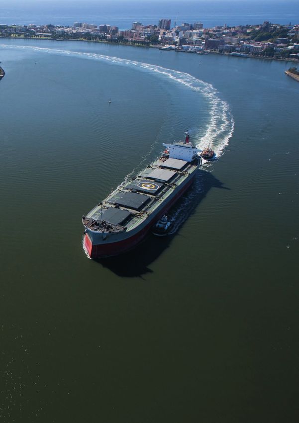
Our vision is for the Port of Newcastle to become Australia’s first-choice East                                              an efficient, sustainable, profitable and innovative manner. To achieve this vision,
Coast port, able to accommodate, attract and grow a diverse trade base in                                                    the Port of Newcastle has identified the following goals:

                                                                  The Port of Newcastle, with its central geographic         For every dollar spent in the Port of Newcastle, there is a flow-on benefit for the local, state and national economies of between
          PROMOTE THE                                             location on the eastern seaboard, existing capacity        $0.84 and $1.32. For every million dollars of output generated by the Port of Newcastle, 5.2 jobs are created.3
                                                                  and supply chain infrastructure, is well-placed to
          CAPACITY OF THE                                         support the New South Wales and Australian                 The Port handled over 167 million tonnes of trade and 4,700 ship movements in 2017. Modelling of the shipping channel has shown
          PORT AND THE SUPPLY                                     economies.                                                 that over 10,000 ship movements per year can be accommodated. This, together with planning approval for additional berths,
                                                                                                                             investment in new port infrastructure, and a significant quantity of available, serviced and zoned port land, provides for future
          CHAIN TO SUPPORT                                                                                                   growth.
          THE ECONOMY                                                                                                        3
                                                                                                                                 Port of Newcastle Economic Impact Report 2016/17 Econsearch

                                                                  Freight in Greater Sydney is expected to double over       Ensuring that existing road and rail transport infrastructure are being utilised and optimised to their full capacity is critical to
          UTILISE EXISTING                                        the next 40 years and increase by 25% in Regional          supporting and improving the efficiency of the New South Wales freight task.
                                                                  NSW over the same period.4 Ports outside of capital
          ROAD AND RAIL                                           cities, together with their road and rail supply chains    The Port of Newcastle has excellent access and connectivity to the national highway and rail networks that link to capital cities,
          TRANSPORT ASSETS                                        offer significant capacity to reduce congestion.           and the catchment. Both the immediate road network and the broader highway system has capacity to accommodate the
                                                                  Ensuring that existing road and rail transport             current and forecast vehicle growth without the need for major infrastructure upgrades. Similarly, the rail network have capacity to
          TO IMPROVE FREIGHT                                      infrastructure are being utilised and optimised to their   accommodate the contracted coal volume, as well as latent capacity to move non-coal trade, including bulk grain and containers,
          EFFICIENCY                                              full capacity is critical to supporting and improving      from regional New South Wales to Newcastle.
                                                                  the efficiency of the New South Wales freight task.        4
                                                                                                                                 Future Transport 2056 TfNSW 2018

                                                                  Growing, attracting and facilitating new trade             Facilitating infrastructure to support new trades and supply chains can address infrastructure bottlenecks and capacity constraints
                                                                  and new supply chains is a key focus for the Port          in capital city ports, and respond to changing technology such as automation, modal shifts and bulk containerisation.
          FACILITATE NEW                                          of Newcastle. The introduction of new import and
                                                                  export trades and new supply chains will be what           The Port Master Plan 2040 outlines the rationale for the development of a Newcastle Container Terminal, as well as identifying
          TRADES AND SUPPLY                                       drives innovation, efficiency and value for the Port,      other opportunities such as the establishment of a specialist Automotive and Ro-Ro Hub within the next twenty years.
          CHAINS                                                  its shareholders and the community.

                                                                  The Port Master Plan 2040 supports the                     This includes smaller enabling projects that can utilise, improve and enhance the existing road and rail networks for greater
          SUPPORT THE                                             development of new transport infrastructure and            efficiency, productivity and consequence.
          DEVELOPMENT OF                                          logistics facilities such as upcountry intermodals.
                                                                  These facilities can leverage on the proximity to          Major projects, such as the Inland Rail, will further enhance Newcastle’s connectivity, consolidating rail access to an extended
          NEW FACILITIES AND                                      existing and proposed transport corridors.                 area of New South Wales and potentially Southern Queensland and Northern Victoria. This modal shift will provide greater benefit
          ENABLING                                                                                                           to growers and producers and more efficient use of the transport network, as well as ensuring that the economic benefits are
                                                                                                                             retained in New South Wales.
          INFRASTRUCTURE

          PROTECT THE PORT                                        Urban encroachment is the potential conflict that          Protecting the Port and its transport corridors from urban encroachment to safeguard continuous and sustainable port operations,
                                                                  can arise between adjoining land uses and freight          as well as ensure appropriate amenity for nearby communities, is a key goal of this Port Master Plan. Managing the Port’s interface
          AND TRANSPORT                                           operations at the Port or along transport corridors.       with its surrounds focuses on both economic and environmental sustainability and forward planning for the benefit of the Port and
          CORRIDORS FROM                                          These operations are required to operate on a 24/7         community. As both the Port and the Greater Newcastle metropolitan areas grow, the identification and protection of future
                                                                  basis to ensure that freight is able to be moved           transport corridors will become increasingly important.
          URBAN                                                   economically, efficiently and sustainably. These
          ENCROACHMENT                                            activities may, however, have a range of amenity
                                                                  impacts on sensitive land uses and residents.

                             Port of Newcastle | Port Master Plan 2040                                                                                                                         Port of Newcastle | Port Master Plan 2040
                                              5                                                                                                                                                                 6
The Port of Newcastle Master Plan 2040 is a statement of our belief that
                                                                         the Port of Newcastle will be the first choice for Australia’s East Coast
                                                                         ports.
                                                                         By 2040 the Australian population will be over 31                                   Critical to our success will be effective communication
                                                                         million, with the corresponding demand for goods                                    and collaboration with our customers and stakeholders.
                                                                         driving the volume of freight to more than double
                                                                         within this timeframe.5                                                             The National Ports Strategy encourages clear
                                                                                                                                                             communication at a strategic level on how the
                                                                         The Port Master Plan focuses on demonstrating the                                   development and operation of the Port and the freight
                                                                         connectivity and capacity of the Port and its supporting                            corridors serving it will be integrated into the future
                                                                         transport networks to accommodate, attract and grow                                 development of the region or city in which the port is
                                                                         trade, and assist in addressing the freight task in an                              located.6
                                                                         efficient, sustainable, profitable and innovative manner.
                                                                                                                                                             Further, the Port Master Plan will open a clear line of
                                                                         Through examination of the existing assets in the                                   communication with the Government to articulate how
                                                                         shipping channel, portside land and connecting road                                 the capacity of the Port and the supply chains can
                                                                         and rail networks, the Port Master Plan builds the case                             support and build both the state and national
                                                                         for greater utilisation, optimisation and augmentation                              economies and help meet the needs of the future
                                                                         to facilitate new trade, establish new supply chains and                            freight task.
                                                                         develop new supporting facilities.
                                                                                                                                                             The purpose of the Port Master Plan is to inform the
                                                                         The Port Master Plan provides a broad and strategic                                 New South Wales Government, Government agencies
                                                                         approach identifying future development and                                         and the local community of PON’s development
                                                                         opportunities, including:                                                           objectives for the period to 2040.

                                                                                •      The Newcastle Container Terminal in Mayfield;
                                                                                •      The Newcastle Bulk Terminal in Walsh Point;
                                                                                •      A specialised Automotive and Ro-Ro Hub;
                                                                                •      Supporting the Maritime Precinct in Carrington;
                                                                                       and
                                                                                •      Construction of the Newcastle Cruise Terminal
                                                                                       in Carrington.

INTRODUCTION

                                                                         5
                                                                             Freight Report Card, TfNSW 2017
                                                                         6
 Pictured: Nobbys Headland                                                   National Ports Strategy, Infrastructure Australia, 2012.

                             Port of Newcastle | Port Master Plan 2040                                                                  Port of Newcastle | Port Master Plan 2040
                                              7                                                                                                          8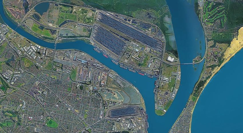
A NEW LONG-TERM PLAN
In December 2014, PON published its inaugural Port                       ACHIEVEMENTS OF THE
Development Plan (PDP). The purpose of the plan was
to help inform the New South Wales State                                PORT DEVELOPMENT PLAN
Government, Government agencies and the local
community of PON’s development objectives over the
                                                                              2015-2020
five-year period from 2015–2020.
                                                                                   THALES AUSTRALIA
Key developments anticipated by the PDP included the                               MARITIME PRECINCT
preparation of the former Forgacs site at Carrington for
future development, upgrades to existing berth                                     UNDER DEVELOPMENT
infrastructure to enhance operational, safety and
environmental performance, and the facilitation of berth
development by tenants.
                                                                                   NEWCASTLE CRUISE
                                                                                   TERMINAL
In July 2017, Thales Australia, together with the NSW
                                                                                   PLANNING COMMENCED
Government, announced major investment in a new
Maritime Precinct to be developed at the 10-hectare
Carrington site. The first phase will include the renewal                          MAYFIELD 7
of the Fitzroy Street shipyard to cater for vessels up to
55 metres long, creating 70 new jobs.                                              BULK LIQUIDS BERTH
                                                                                   NEARING COMPLETION
In 2018, Stolthaven will complete construction of a new
dedicated bulk liquids berth at Mayfield (M7) to support
the expanding bulk liquids precinct. The installation of                            K2 BERTH SHIP UNLOADER
new unloading infrastructure at K2 by PON will replace
ageing equipment and continue to improve
                                                                                    REPLACEMENT
environmental outcomes.                                                             COMMENCED
The PDP also highlighted the importance of cruise
shipping to the local tourism industry, citing PON’s
commitment to work with major stakeholders to                        Conversations with our customers and stakeholders
develop a concept for a permanent cruise terminal                    have accompanied the drafting of the Port Master Plan.
at the Channel Berth. The commitment of State and
Commonwealth funding for additional mooring facilities
                                                                     We are seeking to actively contribute to the overall
                                                                     supply chain management by expressing integration,
                                                                                                                              HISTORY OF THE PORT OF NEWCASTLE
and the planning for a permanent terminal facility has                                                                        Since its establishment, the City of Newcastle has been closely linked to its harbour, which provided trading
                                                                     and to ensure the delivery of core port and transport
seen this concept become reality. The Newcastle Cruise                                                                        opportunities, the creation of industries and employment and a place to establish a community. The first
                                                                     infrastructure, articulating what is needed, where and
Terminal is due for completion in 2019. The terminal                 when.                                                    commercial export of coal left Newcastle for Bengal, India, in the barque Hunter in 1799.
building will provide for day visits and home porting
facilities to strengthen Newcastle’s position as an                  Environmental protection through the                     Since the early years of the 19th century, the estuary of the Hunter River has been transformed from a series of
international cruise destination.                                    identification of environmental values, a focus on       mudflats and shallow channels to a major deepwater trading port.7
                                                                     current and future interface issues, and effective
In recognition of the potential limitations of a five-year           communication with the local community is also key.      Encouraged initially by the area’s large coal deposits and then by the establishment of BHP’s iron and steelworks
outlook and transformational projects that are currently                                                                      in 1911, the Government invested significant amounts of money in reshaping the harbour through dredging, which
being planned by PON, the need to prepare a                                                                                   commenced in 1859. Rock blasting and reclamation work continued to form the extensive Port land of the Dyke at
longer-term plan to outline the future planning and                                                                           Carrington, Kooragang Island and Walsh Point.
development of the Port was identified. Critical to this
was the desire to address the dynamics and detail of                          “If well-designed, the strategic                The principle of transformation and innovation to achieve ongoing improvement is one that PON continues to strive
PON’s business, rapid changes in technological and                                 planning process can help                  for today.
operating environments, the agility of supply chains
and the competitive environment in which the Port now                          to engage main stakeholders,                   7
                                                                                                                                  Harbour from a Creek, Melville, R. 2014.
operates.                                                                   strengthen links with clients and
Like the previous PDP, the Port Master Plan will                                       create local goodwill.”
articulate the Port’s vision and provide a licence to grow.
Central to a longer-term vision is the effort to create
economic value through increased industry and                                   Competitiveness of Port Cities
investment confidence by being visible and strategic.
                                                                                 Synthesis Report, OECD 2013

                                                Port of Newcastle | Port Master Plan 2040                                                                                    Port of Newcastle | Port Master Plan 2040
                                                                 9                                                                                                                            10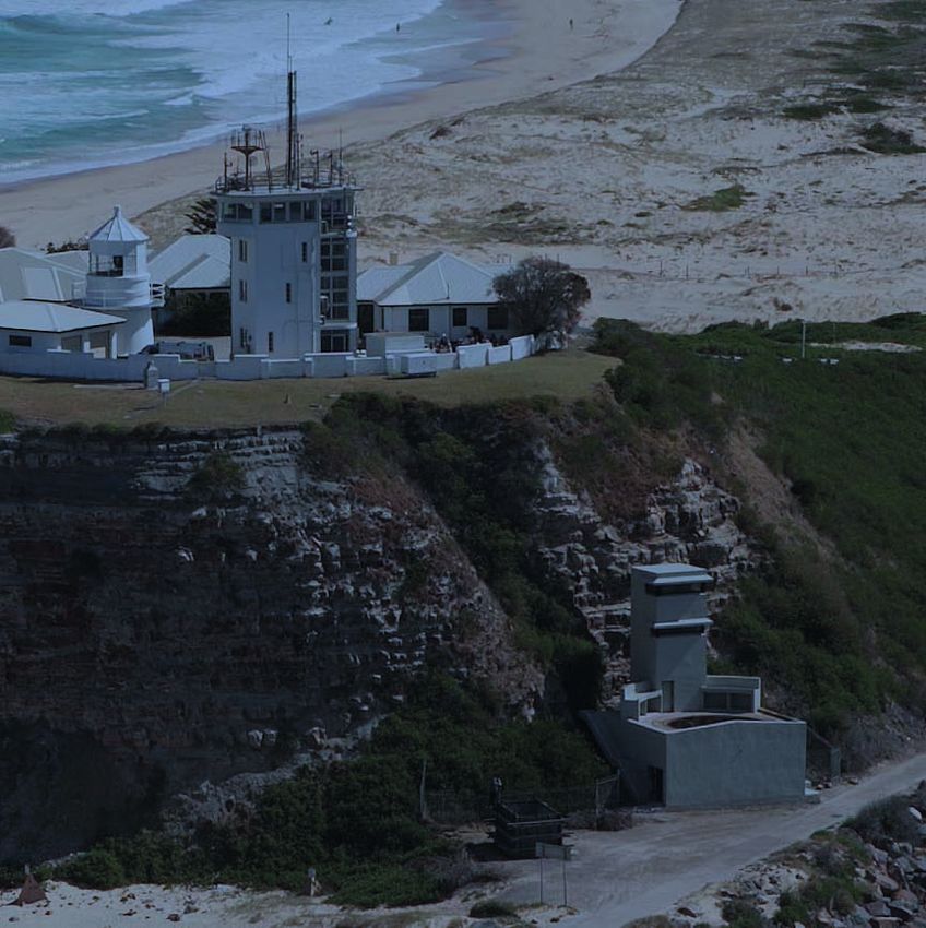
“Our vision is to maintain Newcastle’s position as one of the leading and most efficient
global scale ports and to facilitate continued growth and development of existing and
new trades in a sustainable manner.”
WHO WE ARE MISSION
Port of Newcastle (PON) is the commercial manager of Our mission is to promote and support the prosperity of
Newcastle Port and has a 98-year lease with the NSW the Hunter Region and New South Wales in a
Government, which commenced on 30th May 2014. sustainable manner.
A key objective of the lease is to maintain and enhance We will:
the Port as a major seaborne trade gateway for New
South Wales. y Provide efficient port infrastructure to facilitate
regional, state and national economic growth;
Our shareholders, The Infrastructure Fund (TIF) and y Maintain a safe and rewarding workplace for all
China Merchants Ports Holding Company Limited employees;
(CMPort), each own 50% and have a strong, global track y Promote and facilitate improvements to supply
record in managing large infrastructure assets, including chain performance;
ports. y Collaborate with stakeholders to deliver the
benefits of trade growth, including with
The Port is recognised as a major strategic asset for the surrounding communities;
New South Wales economy, and an important trading y Manage environmental impacts of port
gateway for Australia. In 2017 the Port of Newcastle y operations and development;
handled more than 167 million tonnes with an estimated y Deliver effective commercial outcomes for
value of $24 billion. customers; and
y Undertake sustainable investment and deliver
The Port of Newcastle generated direct and flow-on commercial returns for shareholders.
OVERVIEW OF THE
benefits of $1.8 billion to the NSW economy. The
estimated total impact on the Hunter economy alone
was $1.6 billion. This was equivalent to approximately VALUES
0.35 per cent of New South Wales’ gross state product, Our values are safety, teamwork, initiative, performance,
and nine per cent of gross regional product.8
PORT OF NEWCASTLE
customer service and delivering on our promises.
As a business, our core functions include:
y Trade and Port development
y Management of Port land;
y Wharf and berth services.
y Maintenance of major Port assets;
y Vessel scheduling; and
y Dredging and survey services.
8
Port of Newcastle Economic Impact Report 2016/17 Econsearch
THE PORT’S ECONOMIC IMPACT FOR NSW
JOB
2016/17
EVERY DOLLAR
$1.8 GENERATION 1.spent in the Port of Newcastle generates a
BILLION across NSW
FLOW-ON BENEFIT
for the state economy of
10,000
Contribution to Over the next five
years this is
$1
GROSS STATE forecast to increase
to 11,000 jobs.
PRODUCT
$1 BILLION CONTRIBUTION TO HOUSEHOLD INCOME IN NSW Source: Port of Newcastle Economic Impact Report
2016/17 Econsearch
Port of Newcastle | Port Master Plan 2040 Port of Newcastle | Port Master Plan 2040
11 12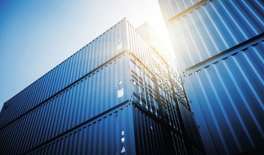
THE CHANNEL
                                                                                                                                                                         Newcastle Port is situated on the Hunter River with the
                                                               KOORAGANG PRECINCT                                                                                        entrance protected by two breakwalls, the northern
                                                               Kooragang 4, 5, 6, 7 Berths
                                                                                                                                                                         and southern, extending into the ocean at Nobbys
                                                                                                                                                                         Head.
                                                               Kooragang 8, 9, 10 Berths

                                                                                                                                                                         The Channel and berths are PON’s primary assets. They
                                                                                                                                                                         facilitate the import and export of cargo to the world,
                                                                                             KOORAGANG                                                                   define our core business and are a key attraction for the
                                                                                              PRECINCT                                                                   City of Newcastle.
                                                                                                                            WALSH POINT PRECINCT
                                                                                                                                                                         The design depth of the Channel is 15.2 metres,
                                                                                                                            Kooragang 2 Berth
                                                                                                                                                                         increasing towards the Channel entrance, which assists
                                                                                                                            Kooragang 3 Berth
                                                                                                                                                                         vessel passage for ocean swell conditions. The Channel
                                                                                                                                                                         depth is maintained through a continuous maintenance
                                                                                                                                                                         dredging program and has undergone continuous
                                                                                                                                                                         expansion since dredging first commenced in 1859.

                                                                                   MAYFIELD
                                                                                   PRECINCT
         MAYFIELD PRECINCT                                                                                        WALSH
         Mayfield 4 Berth      Mayfield 7 Berth                                                                   POINT
                                                                                                                 PRECINCT

                                                                                                    CARRINGTON
                                                                                                     PRECINCT

                    CARRINGTON PRECINCT
                    West Basin 3 Berth              Channel Berth
                                                1
                    West Basin 4 Berth              Dyke 1 Berth
                    East Basin 1 and 2 Berths       Dyke 2 Berth
                    Towage services                 Dyke 4 and 5 Berths

Port of Newcastle Boundary as per the State Environmental Planning Policy (Three Ports)
Arterial Road Access
Rail lines

                              Port of Newcastle | Port Master Plan 2040                                                                            Port of Newcastle | Port Master Plan 2040
                                                     13                                                                                                             14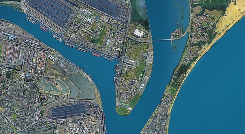
PORT LAND

                                                                                                                                                                                                       Stolthaven currently operates a Terminal and
Carrington Precinct                                                   Concentrated orange juice is imported to a refrigerated      Mayfield Precinct                                                   Distribution facility with approval for expansion of the
                                                                      storage facility, where it is packaged and distributed by
                                                                      road. West Basin 4 Berth (WB4) handles rolling stock as                                                                          tank farm and the import of a variety of fuels including
Carrington is one of the oldest parts of the Port that                                                                             The Mayfield Precinct is located between the South Arm
                                                                      well as a large range of other cargo.                                                                                            diesel, petroleum products, ethanol and aviation fuel.
is still in operation and includes 100 ha, of waterfront                                                                           of the Hunter River and Industrial Drive, bounded by
                                                                                                                                                                                                       Koppers Australia import and export
industrial land.                                                                                                                   Tourle Street in the west and Selwyn Street in the east.
                                                                      The Channel Berth services passenger vessels such as                                                                             high-temperature coal, tar and pitch products, which
                                                                                                                                   It contains large areas of freehold land developed for
                                                                      cruise ships and is the location of the Newcastle Cruise                                                                         are piped to processing plant located two kilometres to
The Carrington Coal Terminal (CCT) was established in                                                                              heavy industry, as well as the Port’s Mayfield Site.
                                                                      Terminal. The Carrington Precinct also encompasses                                                                               the west. Further land is available for the development
1968 at the northern end of the precinct and                                                                                                                                                           of other bulk liquids facilities.
incorporates the coal terminal and associated loading                 critical Port services including two Tug Bases and the       The Mayfield Site represents the largest vacant Port
berths Dyke 4 and Dyke 5 Berths (D4 and D5).                          Helicopter Base operated by the Port Authority of NSW.       land site on the eastern seaboard, with direct Channel
                                                                                                                                                                                                       Mayfield 4 Berth (M4) is a common user berth used as
                                                                                                                                   frontage and potential for deep water berthing,
                                                                      Ship building and maintenance activities have operated                                                                           a general cargo berth. A small general cargo handling
Newcastle’s two major grain terminals are in Carrington                                                                            providing a significant opportunity for growth within the
                                                                      at the southern end of Carrington for many years, with a                                                                         facility currently operates, providing storage for
and have a combined throughput capability of 4Mtpa.                                                                                Port. Current planning for the site includes the
                                                                      new Maritime Precinct being developed in the                                                                                     containers and general cargo.
Grain terminals are supported by road and rail receival                                                                            development of a Bulk Liquids Precinct, area dedicated
facilities and state-of-the art ship loader at Dyke 2 Berth           south-west of the Precinct fronting Throsby Creek.           to the storage and distribution for Project Cargo, known
                                                                                                                                                                                                       The Mayfield Precinct is serviced by road and rail
(D2) and West Basin 3 Berth (WB3).                                                                                                 as the Mayfield Cargo Storage Facility, with the remain-
                                                                      Carrington is well-serviced by road and rail                                                                                     infrastructure through direct access to Industrial Drive
                                                                                                                                   ing allocated for the development of container handling
                                                                      infrastructure, including a designated B-double heavy                                                                            and rail access via the Scholey Street Junction.
Mineral concentrates including zinc, lead and copper                                                                               facilities.
are railed to the Port, stockpiled within a closed storage            vehicle truck route designed to reduce the potential for
facility and then loaded through D2. Fuel is imported at              land use conflicts with the residential areas of             A dedicated Bulk Liquids Berth, Mayfield 7 Berth (M7),
the Dyke 1 Berth (D1), which is then piped to a nearby                Carrington. Rail access is provided via the Scholey Street   services the bulk liquids terminals and is designed to
Terminal facility. A range of general cargo and                       Junction.                                                    cater for long-range tanker vessels up to LR1 and LR2.
containers, as well as steel, aluminum and timber packs,
are handled at the East Basin Distribution Centre (EBDC),
using East Basin 1 and 2 Berths (EB1 and EB2).

                                                Port of Newcastle | Port Master Plan 2040                                                                                        Port of Newcastle | Port Master Plan 2040
                                                                 15                                                                                                                               16
PORT LAND

Kooragang Precinct                                                                                                          Walsh Point Precinct                                                 The centre of Walsh Point is occupied by heavy industry,
The Kooragang Precinct is located on Kooragang Island               The western half of the Kooragang Precinct was                                                                               including fertiliser manufacturer Incitec Pivot and mining
                                                                                                                            The Walsh Point Precinct is located on the eastern side
on the northern side of the Port. It is the primary coal            formerly used as a waste disposal area for heavy                                                                             industry chemical supplier Orica. These facilities are on
                                                                                                                            of the Port with frontage to both the South and North
precinct containing two coal terminals and associated                industry, known as the Kooragang Island Waste                                                                               freehold land and export products such as ammonia
                                                                                                                            Arms of the Hunter River. PON’s land is currently used
coal loading berths (K4–K10), which are operated by                 Emplacement Facility (KIWEF).                                                                                                through the Port.
                                                                                                                            for the import, export and storage of bulk products, as
two coal export companies, Port Waratah Coal Services
                                                                                                                            well as a variety of small-scale industrial uses such as
(PWCS) and Newcastle Coal Infrastructure Group (NCIG).              KIWEF is in the process of being remediated and                                                                              Rail access is via the Kooragang spur and a level
                                                                                                                            metal recycling. Kooragang 2 and Kooragang 3 Berths
                                                                    cannot be developed until appropriate environmental                                                                          crossing over Cormorant Road.
                                                                                                                            (K2 and K3) have the highest utilisation of all common
Land in the north-west of the precinct and the north                closure is complete. Adjoining the Kooragang Precinct
                                                                                                                            user berths within the Port. These berths also support
bank of the South Arm has been allocated to the                     to the north and west is the Hunter Wetlands National
                                                                                                                            customer and tenant distribution infrastructure, which
development of a fourth coal export terminal for the                Park and Ramsar Wetlands.
                                                                                                                            have been co-located within the precinct to facilitate
Port.
                                                                                                                            cargo handling.
The Kooragang Precinct is supported by rail access via
                                                                                                                            Products imported and exported across K2 and K3
the Kooragang spur line, with all coal transported to the
                                                                                                                            include dry bulk products such as cement, fertiliser,
terminals via rail. Road access to Kooragang Island is
                                                                                                                            petroleum coke, magnetite, sands, anhydrous ammonia,
provided via the Tourle Street and Stockton Bridges.
                                                                                                                            scrap metal, alumina, and bulk liquids including fuel,
                                                                                                                            acids and vegetable oil. The Precinct incorporates
                                                                                                                            significant back-up land for portside storage, particularly
                                                                                                                            on the eastern side of Walsh Point, which consists of
                                                                                                                            several undeveloped lots.

                                              Port of Newcastle | Port Master Plan 2040                                                                                    Port of Newcastle | Port Master Plan 2040
                                                               17                                                                                                                           18
There are a range of national and state strategies, policies and regulations that
deliver, plan and manage infrastructure, transport and land use planning. The Port
Master Plan has been prepared cognisant of these, but also reflective of the
commercial environment in which the Port now operates.
FUTURE
TRANSPORT
AUSTRALIAN
2056
INFRASTRUCTURE
NSW STATE PLAN
INFRASTRUCTURE
STRATEGY
FUTURE
PORT OF NEWCASTLE TRANSPORT COMMONWEALTH
Port Master Plan
2056 PLANS
NSW FREIGHT
AND PORTS
PLAN
NSW STATE NATIONAL
PLANS PORTS
STRATEGY
NSW
REGIONAL
Our Strategic Development
Opportunities to 2040 PLANS
GREATER
NEWCASTLE
METRO PLAN
STRATEGIC Infrastructure planning, funding and delivery by
Governments ensures that Australia continues to invest
There has been a growing emphasis on regional
planning across NSW to support long-term community
CONTEXT
in infrastructure to support its economic growth and needs. Given that the Port’s catchment area extends
prosperity for all citizens. Infrastructure Australia west to Parkes and north to Moree, taking in Dubbo,
independently assesses projects and initiatives for Tamworth, Armidale, Narromine and Walgett, critical
inclusion on the national Infrastructure Priority List. alignment with the Central West and Orana, New
The Infrastructure Plan and Priority List is a prioritised England North West and North Coast Regional Plans, as
list of nationally significant investments. It provides well as the Hunter Regional Plan, has been considered
decision-makers with advice and guidance on specific in the preparation of the Port Master Plan. These
infrastructure investments that will underpin Australia’s Regional Plans note the connectivity of the regions to
continued prosperity. the Port of Newcastle as the global gateway, and the
need to leverage these connections.
Similarly, the NSW State Infrastructure Strategy
facilitates and allocates resources for projects of state The Hunter Regional Plan and the Greater Newcastle
significance including Fixing Country Rail, Bridges for the Metropolitan Plan identify the Port as a global
Bush and Regional Road Freight Corridor improvements. gateway providing international freight connections and
a catalyst for the growth and diversification of trade and
In the context of a growing Australia and the need for a contribution to the economy.
freight system that boosts the nation’s prosperity and
meets community expectations for safety, security and The Port Master Plan provides for the commencement
environmental amenity, both the Commonwealth and of two-way dialogue with Government and will be
New South Wales Governments are developing a an important communication tool when working with
comprehensive suite of transport, freight and port agencies tasked with delivery of long-term plans and
strategies. Transport for New South Wales (TfNSW) is the infrastructure. It will help inform policy frameworks and
lead agency, preparing the Future Transport 2056 and establish infrastructure priorities for the benefit of New
NSW Freight and Ports Plan. South Wales and Australia, as well as ensuring that the
needs of PON, as the commercial operator of the Port,
are met.
Pictured: The Basin, Carrington
Port of Newcastle | Port Master Plan 2040 Port of Newcastle | Port Master Plan 2040
19 20Our stakeholders include our customers, our community, our partners and our people
working together within our unique Port environment.
OUR CUSTOMERS OUR PORT COMMUNITY
Central to the success of our business is the success of The Port is an iconic part of the City of Newcastle’s
our customers. Our customers include not only those identity. PON recognises the importance of the Port to
who have a direct dealing with PON, but also the the Newcastle community and strives to develop and
buyers and producers who interact with the entire maintain strong relationships with all our stakeholders.
supply chain. PON works closely with local
councils, business chambers and regional It is also acknowledged that there are a range of
development advisors that represent farmers, expectations and views within the community regarding
manufacturers and producers. the Port and its activities. Key to PON’s commitment
OUR STAKEHOLDERS Our focus is on knowing and understanding our
customers and the markets in which they operate.
Strategic alignment between our vision and long-term
is engagement and active communication. The PON
Community Liaison Group comprises representatives
of the community, business, industry and Government.
The Community Liaison Group is an opportunity for
AND ENVIRONMENT plans, and those of our customers, will strengthen
relations and ensure we are co-creating efficiencies.
Ongoing customer engagement will help to grow the
Port, facilitate trade and transform the economy.
the community to engage with the Port, learn about its
operations and provide feedback.
PON also partners with the community and industry to
assist local community groups that invest in our region’s
Planning for a 20-year vision is a challenging exercise, future and make a measurable difference to the lives
especially given rapid technological change and of its people. Since the Port Lease commenced in May
industry innovation. PON is intentional about speaking 2014, PON has awarded more than $500,000 to
with our customers, stakeholders and partners. Our community projects spanning education, the
customers have said that some of their greatest environment, youth leadership and development, and
concerns are the potential impact of urban community health and well-being.
encroachment and the redevelopment of land that
adjoins the Port in a way that may hinder their current or PON also contributes at least $1 million annually to the
future operations. Newcastle Port Community Contribution (NPCC) Fund.
The NPCC Fund supports suitable projects that
Another area highlighted by customers was ensuring enhance or maintain landside infrastructure and
that the delivery of Port services and Port infrastructure community amenity around the Port.
matches the anticipated growth in trade. The
utilisation and optimisation of the Port’s Channel, land
and transport corridors, and the corresponding increase
in the number of vessels, trucks and trains that service Port of Newcastle
the Port, is part of PON’s ongoing dialogue with service
providers. INVESTS
more than
Other customers identified the Port’s rail connectivity as a
future opportunity to reconfigure the current modal split
for the transport of cargo, providing the impetus to
investigate the greater use of rail for cargoes such as fuel.
$1.2 million
per annum in
As our trade base diversifies, we will foster new
relationships with a broader range of customers,
COMMUNITY
particularly those who import or export containerised
freight. These include the advanced manufacturing, food
SPONSORSHIPS
and agribusiness and alternative energy industries.
& GRANTS
in support of educational, environmental, welfare, and arts and
Conversations with existing and future customers will cultural projects.
shape how PON plans and develops the Port over the
next twenty-year horizon, with an emphasis on being
responsive, agile and customer-focused. These
conversations will also inform our future advocacy and
engagement with Governments and infrastructure
providers.
Pictured: Collaborative tree planting day 2017
Port of Newcastle | Port Master Plan 2040 Port of Newcastle | Port Master Plan 2040
1. 21 22OUR PARTNERS Transport South Wales Environment Protection Authority (EPA)
manages issues such as air emissions, water quality,
OUR PEOPLE
PON works with a number of Government agencies, The Commonwealth-owned Australian Rail Track noise, contaminated sites, transportation of dangerous We are a local team of diverse professionals led by an
regulators and enterprises that manage various Corporation (ARTC) manages, maintains and invests in the goods outside of the Port area, and waste. experienced executive team.
aspects of the freight supply chain and delivery of two networks that link the Port of Newcastle: the Hunter
Port services, including the management of shipping, Valley and Interstate Rail Networks. ARTC is an integral The Commonwealth Department for the Environment Our team tells us they work with great people who are
transport and land. partner in the success of the Port, providing connectivity manages matters of national significance, including knowledgeable and professional, and have a strong
and capacity to service the rail freight task. nationally significant threatened species and the belief in the organisation’s values and purpose. The
disposal of dredged material from the Channel. scale and diversity of the Port’s trade means our people
Transport for NSW (TfNSW) operates the Sydney
Shipping Metropolitan Rail Network, including the Main North Line
enjoy stimulating and challenging work in an
The NSW Department of Planning and Environment environment that drives innovation. We are committed
The Port Authority of New South Wales is a state-owned between Newcastle and Sydney. The focus of this network to performance and improvement as demonstrated
(DPE) is responsible for regional planning and the
corporation that manages the navigation and marine is to support growth in the passenger task, through our actions and behaviours, with safety as a
assessment of Port and state significant development.
safety needs of commercial shipping. The Harbour balanced with the need to move greater volumes of freight core value.
It is important that adequate resources and a high
Master is responsible for the safe navigation of the by rail within the Greater Sydney metropolitan area. standard of expertise are given to the task of supporting
harbour. The Port of Newcastle is a compulsory pilotage Through the delivery and implementation of the Port
planning for the Port.
port with a helicopter transfer service used to embark The above rail operators are also important Master Plan and the expertise of our people, PON will
and disembark pilots. stakeholders, as they are the purchasers of rail paths continue to collaborate with stakeholders to deliver the
The Port straddles the boundary between the local
from network operators. They influence the optimisation Government areas of Newcastle City Council and Port benefits of trade growth, both to Newcastle and to the
The Vessel Traffic Information Centre (VTIC), operated of rail by determining the length of trains, the number of surrounding communities.
Stephens. In developing their local planning strategies
by the Port Authority of New South Wales, provides a locomotives used and the introduction of new fleet with and in assessing development proposals, Councils can
single point of contact for emergency reporting within technological advancements. assist the Port through awareness of urban
the Port limits and ensures compliance with procedures
encroachment issues and by preventing poor
and regulations. Other functions include dangerous RMS, the National Heavy Vehicle Regulator (NHVR) and development outcomes.
goods regulation in the Port areas, and oil and pollution road transport and logistics companies are important
incident response management. stakeholders in the delivery of road infrastructure, The majority of PON’s land holdings are leased to a
transport, and the safe and efficient management of traffic range of third-party operators who own and manage
The Port is supported by towage and linesman services, and congestion. their own facilities, including the coal terminals, bulk fuel
including eight tugs provided by a private tug operator.
terminals, Maritime Precinct and bulk storage facilities.
The NSW Roads and Maritime Services (RMS) is the
These operators are responsible for their own logistics,
owner of the maritime areas of Newcastle Harbour and Land construction and management of their facilities.
provides access rights for PON to use, maintain and Commonwealth biosecurity and border control services
develop maritime facilities and the shipping channel. operate within the Port to ensure that Australia’s Port service providers are companies who access the
biophysical resources and security objectives are met Port for commercial purposes but do not lease land.
and protected. These include stevedores, transport companies,
shipping agents, provedores and marine services
Environmental regulators are responsible for regulating contractors.
a wide range of activities at the Port and monitoring
compliance with environmental legislation. The New
Port of Newcastle | Port Master Plan 2040 Port of Newcastle | Port Master Plan 2040
23 24Pictured: Hydraulic Engine House at Carrington Source: State Library of Victoria
OUR ENVIRONMENT Our systems and support
The Port of Newcastle is surrounded by important enable compliance,
ecological and cultural heritage sites. commerciality and efficiency
OUR SYSTEMS within a culture of mutual
Bounding the Port to the north is the Hunter Wetlands AND SUPPORT respect.
National Park. The park is the largest single-estuary
wetland reserve in New South Wales and contains the
internationally significant Ramsar Wetlands. This site
provides feeding and roosting sites for shorebirds and
transient migrant birds, as well as habitat for nationally We are proud to be the
threatened species, such as the green and golden bell custodian for the NSW
frog. Government and the people
COMMITTED of NSW.
The Port has a multi-faceted and extraordinarily rich STEWARDS
history. Within the Port, there are a number of heritage
items that have been recognised as being of
significance to both the local community and the State
of New South Wales. These include buildings such as
Carrington Hydraulic Engine House, shipwrecks, marine
We are committed to
structures and relics. PON actively manages these
managing our environmental
assets to support conservation outcomes within an
operational context. MANAGING OUR
ENVIRONMENTAL
FOOTPRINT
impacts and developing the
Port in a sustainable manner. PORT CAPACITY
PON recognises its responsibility to manage the Port in
a way that minimises its impacts on the local
PROMOTE THE CAPACITY OF THE PORT AND
environment and is committed to adopting sustainable SUPPLY CHAIN TO SUPPORT ECONOMY
practices. PON works hard to limit the impact of Port
operations on surrounding areas and has identified four We are supportors and
key themes guiding its approach: contributors to the
management of environmental
BEYOND OUR
BOUNDARIES initiatives beyond the Port.
Port of Newcastle | Port Master Plan 2040 Port of Newcastle | Port Master Plan 2040
25 26PORT CAPACITY
The connectivity and capacity of the Port and supporting supply chain “The more efficient the transport network, the better our economy
infrastructure means that the Port of Newcastle is well-placed to performs, allowing new businesses to reach new markets,
support Australia’s growing freight task and promote the regional and attracting new investment and catalysing new job and training
national economy. opportunities for our people.”
Future Transport 2056
A port is not a terminus, but part of a continuous linear
supply chain where connected transport networks
facilitate the efficient movement of goods.
In addition to articulating transport linkages, PON has
sought to:
• Quantify the capacity of the shipping channel in
HUNTER WETLANDS
terms of the spectrum of vessel types and the NATIONAL PARK
number of ship movements that can be
accommodated. Connected to global
• Understand and identify facilitating infrastructure shipping routes
for storage and product handling, and the supply Connected to the
catchment
of vacant developable land to accommodate
future Port growth.
The Australian Infrastructure Audit found that without
action, Australia’s productivity and quality of life will be
tested, with population and economic growth set to
cause increasing congestion and bottlenecks. The
Newcastle Container Terminal as a global gateway
for the import and export of containerised freight will
help meet the future logistic and freight task for NSW.
The connectivity and capacity of the Port can provide
a solution to potential congestion, as part of a broader
integrated system of ports and transport networks.
By 2056, the New South Wales government estimates
that the state’s population will grow to more than 11
million people, with freight volumes expected to double
in the Greater Sydney area and grow by a quarter in
regional New South Wales.9 The physical corridors of
road and rail infrastructure, and the transport operators Connected to Sydney
that use them, serve as the Port‘s arteries supplying
outbound freight, and in turn carry inbound freight to
distribution centres for dissemination to businesses and
consumers.
The connectivity and capacity of the transport assets
that support the Port of Newcastle and its road and rail
supply chains offer considerable value to New South
Wales.
The Port of Newcastle is a nationally significant global gateway.
9
Future Transport 2056, Transport for NSW 2018.
Port of Newcastle | Port Master Plan 2040 Port of Newcastle | Port Master Plan 2040
27 28PORT CAPACITY
The safe handling criteria for vessel movements is set
OUR CHANNEL AND BERTHS out in the Ship Handling Safety Guidelines. This
Future Channel Capacity accommodating future vessels, PON has undertaken
investigations to evaluate the infrastructure
guideline is published by the Port Authority of New PON has developed a Port Traffic Simulation Model to improvements required for future container vessels.
The Channel is 12 kilometres in length over two assess development scenarios that increase or alter the
South Wales, with the safety of vessel movements
sections. number and size of vessels using the Channel. Outputs
within the Port regulated by the Harbour Master. The investigations include:
from the model that are used to assess the impact of
The main Channel is nine kilometres from the Port changes to the Channel and terminal efficiency include
The configuration of the Channel, combined with local • Port Traffic Simulation Modelling to assess the
entrance to the most western berth (K10) and has a vessel time at berth, Port time, terminal throughput, Port
environmental factors, the receiving berth, the impact of increased vessel traffic from proposed
depth of 15.2 metres. A secondary section of the entry vessel queues and berth utilisation.
destination port and navigational constraints, can limit development scenarios against existing conditions;
Channel is three kilometres in length, providing access
the size of vessels entering and departing the Port. The • Simulations to identify the navigation and
to the Basin berths. It has a design depth of 12.8 metres. Other measures to be assessed with development
types of constraints to be considered include: manoeuvrability requirements for vessels
Supporting the Channel is a network of 20 berths, with proposals are ship interaction (forces and motions
nine berths used exclusively for coal and 11 provided as entering the Port, transiting the Channel and
• Under-keel clearance (distance between the resulting from ships passing berthed vessels), Channel passing berthed vessels;
common user berths for general and bulk cargoes. availability (tidal restrictions) for deep-drafted vessels,
lowest point of the ship’s hull and the Channel • Ship Interaction Studies to assess the safe
bottom); and operational resources, such as marine pilots, tugs passing speeds for vessels passing berthed ships;
The Port operates 24 hours a day, seven days a week and linespeople. The navigation aspects for development
• Channel clearance (distance from ship’s hull to and
and 365 days of the year. The navigation of vessels from proposals are assessed by the Harbour Master.
Channel boundary); • Physical Channel constraint analysis, to
the Channel entrance to a designated berth is
• Channel geometry; evaluate the Channel geometry and navigation
undertaken by pilots from the Port Authority of New An assessment undertaken to evaluate the capacity of
• Ship’s manoeuvrability when changes in direction infrastructure required to address the issues raised
South Wales. Tug services are available in the Port for the Port has demonstrated that the Channel can
are required; from simulations and studies.
ship assist and vessel berthing. Lines services are also accommodate the safe movement of over 10,000
• Navigation aids (pilot visibility of beacons, leads or
available for mooring activities. vessels per annum. The vessel movements in 2017
buoys from bridge of ship); A range of future vessel types that have potential to
• Ship interaction (speed limitations for vessels indicate that the Channel is currently operating at less service the Port is shown below. This is an aspirational
Currently, the Channel can facilitate a range of vessel than 50% of its capacity.
passing berthed ships); range to fully utilise the capacity of the Port. The
sizes and types, with 4,700 vessel movements
• Berth box (capability of berth box to accommo- simulations and studies to support the future vessels will
undertaken in 2017. The capacity of the Channel is The nature of global shipping is changing, with rapid
date vessel through environmental conditions); include the investigations mentioned above.
determined by the number and type of vessels that can growth in the size of vessels. Future trade opportunities
• Environmental factors; and Supplementary investigations may be required by the
be safely navigated between the Port entrance and a are also expected to result in an increased demand for
• The compatibility of the dimensions with the Port Harbour Master.
designated berth. larger loaded inbound vessels. In anticipation of
destination.
TYPE OF LOA LIMIT BEAM LIMIT TYPE OF LOA LIMIT BEAM LIMIT
CARGO CARGO
VESSEL (M) (M) VESSEL (M) (M)
Bulk
Bulk and General
Handymax
(coal, wheat, fertiliser) 300 50 Bulk and General
Panamax Bulk 330 55
Cape Class (coal, wheat, fertiliser)
Tanker Bulk liquids
Medium-Range and (fuel, vegetable oil) 245 43
Long-Range: LR1 and LR2 Container 18,000 TEU 400 60
Container 3,500 TEU 250 32
Liquefied
Tanker 345 54
Natural Gas
Passenger 4,000 320
50
passengers
Ro-Ro 4,000
265 35
vehicles plus machinery
Port of Newcastle | Port Master Plan 2040 Port of Newcastle | Port Master Plan 2040
29 30PORT CAPACITY
KOORAGANG
Port Boundary
Existing Channel
Boundary
Horseshoe Widening
Steelworks Channel Widening
Future Berths
Current Berths
New Port Beacons
MAYFIELD WALSH
POINT
New Starboard Beacons
New Reciprocal Lead
Towers
CARRINGTON
Pictured: Impression of 18,000 TEU Container vessel entering Newcastle Harbour
Future Berths
In addition to the existing berths, PON holds a planning Into the future, there will be growing landside
approval for the capital dredging of additional berth implications that challenge ports in discharging cargo,
pockets within the South Arm of the Hunter River. especially as vessels increase in size and greater
Approved berth pockets proposed alongside the efficiencies are demanded. Other ports around Australia
Mayfield Site would support the potential development are required to create additional land through land
of over 1500 metres of continuous quayline for the reclamation. These processes have significant
development of container terminals. economic costs and impacts on the environment. In
Future Channel Improvements development scenario analysis. For example, inbound contrast, PON has vacant portside land accessible by
tankers and container vessels will require escort tugs to deepwater channel. This means greater efficiencies in
Beyond the current available physical capacity of the Four berths are proposed on the South Arm to increase
increase the operational conditions for entry to the land use, lower costs for consumers and lower
Channel and berths, there is potential to undertake berthing capacity at Walsh Point. There is adjoining land
Channel. environmental impacts can be achieved.
capital improvements to provide for a greater diversity to support mooring and unloading infrastructure in this
of vessel types, sizes and level of service. These location.
PON will continue to work with the Harbour Master to
include Channel improvements, navigation aid
review the infrastructure required for the future vessel
upgrades and construction of additional berths. One berth is proposed in Carrington which could be
sizes. It is expected that marine pilot services and
developed as a standby berth to assist with vessel
navigational resources such as tugs and lines services
Channel improvements required to improve vessel movements, if required.
will keep pace with the rate of growth in vessel traffic
diversity include capital dredging and widening the
numbers and the changing nature of the vessels as the
Steelworks Channel, Horseshoe area and Channel
Port diversifies.
Entrance. These improvements would allow for longer
and wider vessels to safely enter and navigate the
Channel.
As the number and size of vessels increases, terminal
berthing, Channel widening, navigation aid upgrades
and navigation resources (i.e. marine pilots, tugs, lines
service) will need to be considered as part of any
Port of Newcastle | Port Master Plan 2040 Port of Newcastle | Port Master Plan 2040
31 32PORT CAPACITY
economic costs and impacts on the environment. In
OUR LAND contrast, PON has vacant portside land accessible by
PON is committed to setting a world-class benchmark and making a
The Port’s land footprint includes the berths, the Port’s deepwater channel. This means greater efficiencies in significant investment in the handling of cargo.
road network and rail sidings, land for Port facilities land use, lower costs for consumers and lower
such as terminals and storage facilities, as well as environmental impacts can be achieved. Ongoing renewal and replacement of Port infrastructure, as well as the repurposing of land from former
general industrial development. industrial uses to land ready for redevelopment, will meet the needs of our customers now and into the future.
PON’s transport networks include the Port access roads Planning in the Port
and various rail sidings operated by PON and private rail
The Port of Newcastle is recognised as a State
infrastructure managers. The PON Kooragang road
Significant Precinct due to its importance to the New
Newcastle Bulk Terminal
network is accessible by all businesses on the island, The Walsh Point Precinct facilitates the import, export
South Wales economy. This significance is
including freehold land owners. and storage of bulk cargo through the Newcastle Bulk
demonstrated through a separate land use planning and
approvals regime that applies to Port land and Terminal (K2 and K3 Berths). These berths are some of
The majority of Port land is used for Port facilities. These the busiest in the Port, with current demand from
supporting transport connections. The State
include coal terminals; fuel storage and distribution customers putting pressure on future growth. The
Environmental Planning Policy (Three Ports) 2013 (the
facilities; silos for the storage of wheat, grains, cement current unloading equipment has also reached the end
‘Ports SEPP’) ensures consistent planning controls
and alumina; storage facilities and sheds for loose of its working life.
protects the Port from incompatible land use, and
bulk cargo such as mineral concentrates, fertiliser and
stipulates zoning to accommodate a broad range of Port
magnetite; and open-air storage facilities for project and In response, PON are developing a new integrated bulk
uses that support diversification.
general cargo. Some of this land is leased for between cargo facility that combines highly efficient cargo
10 and 30 years, with the facilities owned and managed handling equipment with modern safety and
There are a range of approval pathways set out in the
by the operator. PON also has land available for both environmental standards. The vision for the Newcastle
Ports SEPP, with Port infrastructure able to access
short-term and long-term licences. Bulk Terminal is to operate the most efficient bulk
a streamlined approval process, to ensure the Port
can operate efficiently. Minor development for Port terminal on the Australian east coast. The project
Additionally, there is land allocated to general industrial involves the replacement of 50-year-old ship unloading
infrastructure is able to be undertaken or constructed
uses and the development of ancillary support services equipment at K2 and the centralisation of management
without planning approval.
such as service stations. and services. Along with safety and environmental
Port infrastructure that complies with predetermined improvements, the project will deliver greater efficiency
There is over 100 ha. of vacant portside land that is for customers, allowing them to grow their cargo
development standards can be assessed by private
zoned, serviced and ‘shovel ready’, offering substantial volumes.
certifiers, allowing development to proceed in a timely
opportunities to support the diversification of trade.
manner. This includes large-scale port-related buildings,
wharves and berthing infrastructure. PON has dedicated
There is no requirement for land reclamation within the
in-house resources to facilitate development and seek
Port to support future development or provide
the best outcome for all stakeholders.
additional land for Port facilities or infrastructure.
Into the future, there will be growing landside
implications that challenge ports in discharging cargo,
especially as vessels increase in size and greater
efficiencies are demanded. Other ports around Australia
are required to create additional land through land
reclamation. These processes have significant
Pictured: Kooragang 3 and 2 Berths at Newcastle Bulk Terminal
18 Ha. 532 Ha.
Operational Port 48 Ha.
Land Facilities Transport
Port of Newcastle | Port Master Plan 2040 Port of Newcastle | Port Master Plan 2040
33 34You can also read