DESTINATION DEVELOPMENT STRATEGY - HIGHWAY 1 CORRIDOR - Destination BC
←
→
Page content transcription
If your browser does not render page correctly, please read the page content below
HIGHWAY 1 CORRIDOR

DESTINATION
DEVELOPMENT
STRATEGY
SUN PEAKS RESORT
Photo: Ryan Creary

                     DESTINATION BC
                     Seppe Mommaerts
                     MANAGER, DESTINATION DEVELOPMENT

                     Jody Young
                     SENIOR PROJECT ADVISOR,
                     DESTINATION DEVELOPMENT
                     destinationdevelopment@destinationbc.ca

                     KOOTENAY ROCKIES TOURISM
                     Emilie Cayer-Huard
                     INDUSTRY AND DESTINATION
                     DEVELOPMENT SPECIALIST
                     250 427 4838 ext. 206
                     Emilie@KootenayRockies.com

                     THOMPSON OKANAGAN
                     TOURISM ASSOCIATION
                     Ellen Walker-Mathews
                     VICE PRESIDENT, DESTINATION &
                     INDUSTRY DEVELOPMENT
                     250 860 5999 ext. 215
                     industry@totabc.com

                     MINISTRY OF TOURISM,
                     ARTS AND CULTURE
                     Amber Mattock
                     DIRECTOR,
                     LEGISLATION AND
                     DESTINATION BC GOVERNANCE
                     250 356 1489
                     amber.mattock@gov.bc.ca

                     INDIGENOUS TOURISM
                     ASSOCIATION OF BC
                     604 921 1070
                     indigenous@totabc.com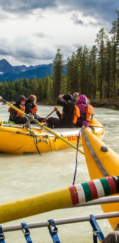
TABLE OF
    CONTENTS
I. EXECUTIVE SUMMARY......................................................................1               7. STRATEGICPRIORITIES.................................................................. 43

II. ACRONYMS..........................................................................................4   8. STRATEGICPRIORITIES..................................................................44
                                                                                                             Theme 1: Travel Quality and Safety
1. FOREWORD AND ACKNOWLEDGEMENTS...........................5
                                                                                                               Theme 2:            Attractive Business Climate
2. INTRODUCING THE STRATEGY....................................................7                               Theme 3:            Environmental Sustainability
   a. Program Vision and Goals                                                                                 Theme 4:            Community Sustainability
    b. Purpose of Strategy                                                                                     Theme 5:            Experiential Mix and Quality
    c. A Focus on the Supply and Experience                                                                    Theme 6:            Collaboration
    d. Methodology
                                                                                                          9. IMPLEMENTATION FRAMEWORK..............................................71
3. ALIGNMENT........................................................................................ 13      a. Catalyst Projects
4. SUCCESS NETWORK....................................................................... 16                   b. Provincial and Regional Priorities
                                                                                                               c. Funding Programs
5. A DISTINCTIVE DESTINATION..................................................... 19
   a. Geographic Description of the Area                                                                  10. MEASURING AND MONITORING SUCCESS....................... 83
	b.	Description of the Population Base, Communities included
      and First Nations                                                                                   APPENDIX................................................................................................. 85
                                                                                                            Appendix 1: Overview of Planning Process
    c. Description of Economy Base — Historical and Current
                                                                                                               Appendix 2: Planning Considerations
    d. Overview of Tourism Performance
                                                                                                               Appendix 3: Objectives by Priority and Implementation Timing
    e. Key Visitor Markets
                                                                                                               Appendix 4: Alignment Details — Plans reviewed
	f.	Overview of Tourism Assets, Infrastructure, and Unique
      Selling Propositions
    g. Specific Product Experiences
    h. Summary of Key Strengths, Challenges, and Opportunities
    i. Experience Potential

6. A DISTINCTIVE DIRECTION......................................................... 35
   a. Vision
    b. Goals
    c. Motivating Experiences
    d. Development Themes
    e.	Interaction of Development Themes and Motivating Experiences

FRONT COVER PHOTO: YOHO NATIONAL PARK, Albert Normandin.
(C) 2017 — Destination BC Corp. All rights reserved. No part of this guide may be reproduced in any form or by any means, electronic or mechanical,
without permission in writing from Destination BC. This guide is produced to provide information to assist tourism operators in British Columbia.
Destination BC does not endorse, recommend or assume any liability for any of the operations or organizations referenced in this document. Super,
Natural; Super, Natural British Columbia; HelloBC and Visitor Centre and all associated logos/ trade-marks are trade-marks or Official Marks belonging
to Destination BC Corp.
EXECUTIVE
SUMMARY
      DISTINCTIVE DESTINATION FOR THE
      HIGHWAY 1 CORRIDOR

      Arguably the premiere touring route through
      British Columbia, the Highway 1 Corridor
      offers travellers from around the world an
      experience that includes incredible scenery,
      diverse ecosystems, and a series of
      interesting communities.
      Stretching 550 kilometres from the           significant contributors, with a significant
      Alberta border in the east, to Kamloops      land base in the Agricultural Land
      and Savona in the west, this planning        Reserve (ALR) in the western portion
      area is home to approximately 185,000        of the planning area, and major rail lines
      residents, spread across two regional        and hubs found throughout. Sun Peaks
      districts and eight communities, and is      Mountain Resort Municipality differs
      within the traditional territories of the    from the rest of the planning area, with
      Ktunaxa Nation, the Secwepemc                its robust tourism-based economy.
      (Shuswap) peoples, and the Sinixt.
                                                   In the spring, summer, and fall, visitors
      Communities in the Highway 1 Corridor        are drawn to the possibilities provided
      typically enjoy diversified economies,       by the rich landscape of the Highway 1
      with contributions from tourism, forestry,   Corridor: from white water rafting,
      manufacturing, retail, services,             houseboating, fishing and rock climbing,
      government, education, and health            to championship golf courses, bird
      care. Agriculture and railways are also      watching in the Columbia Wetlands,

                                                                 HIGHWAY 1 CORRIDOR | 1
VISION          and the excellent camping, hiking, and      powder draws visitors to experience
                                  mountain biking opportunities afforded      it from a downhill resort (Kicking Horse
                The Highway 1     by the national (Yoho, Glacier, and         Mountain, Revelstoke Mountain,
                      Corridor    Mt. Revelstoke) and provincial parks        Sun Peaks), from one of many back-
invites travellers from near      within its boundaries. In the winter, a     country lodges, or via heli- or
     and far to explore their     well-deserved reputation for fantastic      cat-skiing operations.

world and themselves — to
       experience adventure       DISTINCTIVE DIRECTION FOR THE HIGHWAY
    however they choose to        1 CORRIDOR
   define it. It is both a safe
  and efficient route to one      The vision for the Highway 1 Corridor is not
   of the many outstanding
destinations along the way,       only aligned with existing community plans
  where visitor experiences       and planning frameworks, but is also tied to
    are woven together in a
       tapestry of unfolding
                                  the aspirations of its tourism partners as to
      stories of the land and     the type of destination they would like to be
       people, both past and      in 10 years.
   present. Travellers come
        to experience one of      Seven overarching destination               4. Enhance the overall visitor
 Canada’s most iconic road        development goals were identified to        experience of the Highway 1 Corridor
trips and its destinations in     support the 10-year vision for the          as a preferred destination, as indicated
                                  Highway 1 Corridor:                         by a Net Promoter Score ranked in the
         all seasons, enjoying                                                top five for Canadian touring routes.
                                  1. Improve actual and perceived quality
 remarkable experiences in
                                  and safety of the Highway 1 Corridor        5. Maintain or improve environmental
   a depth and density that       journey.                                    health and sustainability.
 simultaneously sates their
                                  2. Increase the total contribution of the
   passion, and leaves them       visitor economy, indicated by increasing
                                                                              6. Increase community resiliency
                                                                              as measured by resident quality of
           yearning for more.     visitor length of stay in each season       life indicators.
     Communities embrace          across the planning area collectively in
        tourism and support       each destination en route, and by           7. Increase the number and value
                                  increasing visitor spending.                of multi-community collaborative
   growth that is in keeping                                                  projects.
  with their values, working      3. Increase visitor intention to return
                                  and stay longer.
 collectively with visitors to
 preserve the health of the
incredible ecosystems that
               surround them.

                                                                                           HIGHWAY 1 CORRIDOR | 2
Destination development in the             Six themes, containing 38 development
Highway 1 Corridor will be guided by       objectives, are described within this
the imperatives to:                        strategy, along with their priority actions
• Support safe and reliable travel         and the success networks needed to realize
                                           implementation. The six themes are:
• Respect all living things, Indigenous
  rights and titles, community values,     1. Travel Quality and Safety: Create a
  and sense of place in each community     safe and enjoyable journey for travellers

• Support an emotional connection by       2. Business Climate: Create an
  visitors to place                        attractive business climate for new and
• Contribute to resident quality of life   expanding tourism businesses, including
  and overall community resiliency         a pool of year-round skilled staff,
                                           adequate affordable housing, locally
• Contribute to environmental              delivered service training programs and
  sustainability and promote stewardship   supportive communities and local
  by visitors and residents alike          governments
• Retain authenticity and celebrate
  that which is local                      3. Environmental Sustainability:
                                           Protect the natural environment and
• Seek to collaborate and recognize        manage tourism impacts
  both what is shared, and what is
  different amongst communities            4. Community and Social Resiliency:
                                           Maintain and enhance community
                                           character and resiliency

                                           5. Year-Round Experiential Quality and
                                           Variety: Maintain current experiential
                                           strengths and support the introduction
                                           of additional year-round memorable
                                           experiences

                                           6. Relationships and Collaboration:
                                           Work together collaboratively and
                                           effectively for mutual gain

                                                         HIGHWAY 1 CORRIDOR | 3
II. ACRONYMS

AEST	Ministry of           go2HR	The British              OCP	Official Community
      Advanced                     Columbia                        Plan
      Education, Skills            Human Resource
      & and Training               Organization             RDMO	Regional
                                   for Tourism                     Destination
AGRI	Ministry                                                     Management
      of Agriculture        ITAC	Indigenous                       Organization
                                   Tourism Association
CFD	Ministry of Children          of Canada                TAC	Ministry of Tourism,
      and Family                                                   Arts and Culture
      Development           IRR	Ministry of
                                   Indigenous Relations     TOTA 	Thompson
DMO	Destination                   and Reconciliation              Okanagan Tourism
      Marketing                                                    Association
      Organization          ITBC	Indigenous Tourism
                                   British Columbia         TIABC	Tourism Industry
DBC	Destination                                                   Association of
      British Columbia      JTT	Ministry of                       British Columbia
                                   Jobs, Trade and
DC    Destination Canada           Technology               TRAN	Ministry
                                                                   of Transportation
DDP	Destination            KRT	Kootenay Rockies                  and Infrastructure
      Development                  Tourism
      Program                                               WD	Western
                            LBR    Ministry of Labour              Diversification
FIN	Ministry
      of Finance            MAH	Ministry of                WTA	Wilderness Tourism
                                   Municipal Affairs               Association
FLNR	Ministry of                  and Housing
      Forests, Lands,
      Natural Resource      MRDT	Municipal and
      Operations, and              Regional District Tax
      Rural Development            (commonly referred
                                   to as the “Hotel Tax”)

                                                                     HIGHWAY 1 CORRIDOR | 4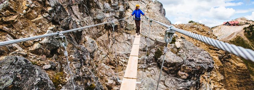
1
FOREWORD AND                                                                REVELSTOKE MOUNTAIN RESORT
                                                                                         Photo: Ryan Creary

ACKNOWLEDGEMENTS
    FOREWORD   This Destination Development Strategy
               is the final report resulting from an
               eighteen-month iterative process of gathering,
               synthesizing and validating information
               with stakeholders about the current status
               and future direction of tourism in the
               Highway 1 Corridor planning area.
               As one of 20 destination development        The Highway 1 Corridor planning area
               strategies that will be produced            includes portions of the Kootenay
               between 2016 and 2019, the Highway 1        Rockies Tourism Region and the
               Corridor strategy will contribute to the    Thompson Okanagan Tourism Region.
               tapestry of long-term regional and          In identifying development priorities for
               provincial planning that will support the   the Highway 1 Corridor, consideration
               development of British Columbia as a        was given to building on the Embracing
               world-class tourism destination,            Our Potential (November 2012)
               offering remarkable, authentic              strategic framework. Embracing Our
               experiences that exceed expectations        Potential is the Thompson Okanagan’s
               and align with the provincial brand.        ten-year regional tourism strategy.

               The participation of our partners
               throughout the process was invaluable,
               but it is important to note that no
               endorsement of this strategy or any
               action listed within was obtained.

                                                                        HIGHWAY 1 CORRIDOR | 5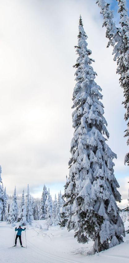
ACKNOWLEDGEMENTS   Destination British Columbia (DBC),         • Meghan Tabor, Tourism Revelstoke
                   Indigenous Tourism BC (ITBC),               • Alyssa Salloway, Parks Canada
                   Kootenay Rockies Tourism (KRT),
                   Thompson Okanagan Tourism                   • Rick Reynolds, Parks Canada
                   Association (TOTA), and the project         • Magi Scallion, Snowmobile Golden
                   facilitation team thank the stakeholders    • Kevin Manuel, Revelstoke Mountain
                   who contributed throughout the                Resort
                   process by:
                                                               • Veronika Stevenson, Sky Trek
                   • attending community meetings,               Adventure Park
                   • participating in surveys, stakeholder     • Arthur McClean
                     interviews, and follow-up conversations
                                                               • Brad Harrison, Backcountry Sector
                   • forwarding relevant documents that
                     provided the background information       • Treena Coney, Prestige Hotel
                     for the situation analysis                  Golden

                   The participation of our partners           • Nicole Fricot, Revelstoke Economic
                   throughout the process was invaluable,        Development
                   but it is important to note that no         • Jon Wilsgard, Town of Golden
                   endorsement of this strategy or any         • Laura Code, Ministry of Agriculture
                   action listed within was obtained.
                                                               • Toby Barrett, Kicking Horse Resort
                   We thank the Ktunaxa, Secwepemc,            • Monica Dickinson, Tourism Kamloops
                   and Sinixt First Nations on whose
                   traditional territories we gathered for     • John Hull, Thompson Rivers
                   our community meetings.                       University
                                                               Richard Toperczer and Gerri Brightwell,
                   Special thanks are offered to members       both Regional Managers with the
                   of the working group:                       Regional Economic Operations Branch
                   • Robin Cyr, Shuswap Economic               of the Ministry of Forests, Lands,
                     Development; Tourism Shuswap              Natural Resource Operations and Rural
                   • Phil McIntyre-Paul, Shuswap Trails        Development (FLNR), contributed as
                     Alliance                                  advisors to the discussions of the
                                                               working group.
                   • Rhys Laug, Quuaout Lodge
                   • Shelley Witzky, STS Lakes Division        Special thanks are offered to the
                                                               facilitator of the Highway 1 Corridor
                   • Joanne Sweeting, Tourism Golden           destination development process:
                   • Arlene Schieven, Tourism Sun Peaks        Suzanne Denbak, Cadence Strategies.
                   • Ian Tomm, Heli Sector

                                                                            HIGHWAY 1 CORRIDOR | 6
2
INTRODUCING
THE STRATEGY
                                                                                               KAMLOOPS
                                                                                       Photo: Tanya Goehring

               The Highway 1 Corridor Destination
               Development Strategy has been developed to
               enhance the competitiveness of the Highway 1
               Corridor planning area over the next 10 years
               and beyond. The strategy was developed as part
               of Destination BC’s Destination Development
               Program. The Program is a critical part of
               Destination BC’s corporate strategy and
               facilitates the collaboration of local, regional and
               provincial agencies, First Nations, destination
               marketing organizations (DMOs), tourism
               operators, and other community interests to
               guide the long-term growth of tourism along
               the Highway 1 Corridor.
 A. PROGRAM    The provincial vision for the Destination Development Program is as follows:

      VISION   • BC is a world-class tourism destination that offers remarkable products and
                 experiences that are authentic, driven by visitor demand, exceed expectations,
  AND GOALS      and align with BC’s brand.

                                                                        HIGHWAY 1 CORRIDOR | 7
KICKING HORSE MOUNTAIN RESORT
Photo: Ryan Creary
The provincial vision is supported by
three goals:
• Make BC the most highly
recommended destination in North
America.
• Create strategic 10-year plans for
tourism development and improve
return-on-investment for
government and private sector
investments in tourism assets.
• Elevate BC’s ability to compete
as a premium destination while
making the province more attractive
for investment.
• Destination development brings
together planning, policy, and
capacity building efforts to:
• Ensure that a destination is well
positioned to make future strategic
decisions.
• Address impediments to growth and
capitalize on opportunities.
• Outline key assets of a destination
including the main product themes
and experiences available.
• Outline key priorities for new
product, infrastructure, and amenity
development.
• Identify impediments to development
and tourism growth (e.g., potential
policy or capacity issues, available
funding, access to funding, etc.).
HIGHWAY 1 CORRIDOR | 8FIGURE 1: B. PURPOSE OF STRATEGY
Tourism Revenue This strategy not only provides underlying support for the goals of the provincial
Destination Development Program but also:
Drivers • Provides strategic direction for the serve as a guide for tourism partners
planning area and guidance for local as they proceed with implementation.
and regional planning. This document should be reviewed and
• Enhances the individual and updated as necessary to reflect
DEMAND collective ability of communities changing tourism objectives, priorities,
along the Highway 1 Corridor to and market conditions. Also, results
leverage their resources and programs. should be tracked regularly to ensure
MOTIVATING lessons learned help future
• Fosters joint action and inter-
INTEREST / implementation activities become
community dialogue. more effective in increasing economic,
PREFERENCE
The Highway 1 Corridor Destination social, and cultural benefits to the
Development Strategy is intended to entire Highway 1 Corridor.
+ C. A FOCUS ON THE SUPPLY AND
EXPERIENCE
Destination development is the Tourism has two primary revenue
SUPPLY mechanism whereby the natural life drivers — supply and demand.
cycle of tourism (e.g., development, Creative marketing efforts strive to
CREATING stagnation, decline, and rejuvenation) generate short-term demand for a
A COMPELLING is managed to ensure a destination destination and create immediate
evolves to remain desirable for the urgency for people to want to visit.
VISITOR ever-changing consumer and, hence, Destination development focuses
EXPERIENCE competitive in its target markets. on the supply side of tourism by
creating a compelling visitor experience
Destination development to attract new visitors and entice repeat
= happens when industry and
government plan and work
visitation. Arguably, in this age of near
instantaneous sharing of experiences
via social networks (e.g., Facebook,
Twitter) and third-party platforms
together to enhance the
RESULT allowing the traveller to “review” their
quality of visitors’ experiences experience (e.g., TripAdvisor), the
quality of the destination and the
INCREASED by ensuring tourism products, experiences it offers is now an essential
ECONOMIC services, amenities, and element of the marketing toolbox.
SOCIAL practices meet and exceed
+ CULTURAL
BENEFITS visitor expectations over
the long term.
HIGHWAY 1 CORRIDOR | 9There are multiple dimensions to supply that are considered in destination development planning to enhance the
visitor experience:
• the setting in which our experiences take place and how • visitor servicing programs that meets and exceeds
to access them guest expectations
• policies that establish and maintain opportunities and • capability, skills, and training our industry needs so that we
growth barriers all can excel at what we do
• the investment enhancement framework These dimensions are illustrated in Figure 2.
• products and experiences matched to consumer interests,
including infrastructure and amenities (which are all often
public in nature and used by residents as well as visitors)
FIGURE 2:
Five Dimensions of Supply — the Visitor Experience
1
SETTING,
ACCESS
+ POLICIES VISITOR EXPERIENCE
2 INVESTMENT
ENHANCEMENT
3
EXPERIENCE
+ PRODUCT
DEVELOPMENT
4 VISITOR
SERVICING
5 CAPABILITIES,
SKILLS +
TRAINING
HIGHWAY 1 CORRIDOR | 10D. METHODOLOGY
The Highway 1 Corridor Destination
Development Strategy was developed based
on an extensive, collaborative effort during
an eighteen-month process that culminated
in the creation of a situation analysis report
and this Destination Development Strategy.
The destination development planning were assessed and respected. A
approach was highly iterative and allowed volunteer working group contributed
multiple opportunities for stakeholder their expertise to reviewing and
input and validation (Figure 3). The discussing the key findings from the
process followed a semi-structured Highway 1 Corridor Situation Analysis
strategic approach, created by and helped develop the goals,
Destination BC, which allowed for supporting objectives, and actions
flexibility to ensure the unique contained in this strategy. See Appendix 1
considerations of each planning area for the full process outline.
FIGURE 3: ACTIVITY DATES
Key Project Project staging and document review
October –
November 2017
Timelines
October –
In-community consultations in Golden, Revelstoke, and Kamloops
December 2017
January –
Industry Survey #1 and Stakeholder Interviews
March 2018
December 2017 –
Draft Situation Analysis
March 2018
Priority setting and preliminary findings with the
Working Committee
February – March 2018
• Workshops in Golden and Chase
• Four follow up conference calls
Draft Destination Development Strategy March 2018
March –
Review and finalize the Destination Development Strategy
November 2018
May –
Strategy launch
June 2019
HIGHWAY 1 CORRIDOR | 11KICKING HORSE MOUNTAIN RESORT
Photo: Reuben Krabbe
The three key outputs of this planning
process are:
1. An asset inventory of
accommodations, tourism businesses
and attractions, tourism organizations,
food and beverage establishments,
parks and recreation sites, sports and
arts facilities, meeting facilities,
transportation, and visitor services.
2. A 185-page situation analysis that
provides foundational research related
to the Highway 1 Corridor, including
access and infrastructure, key tourism
assets, key markets, a destination
assessment, and priority Highway 1
Corridor planning considerations, all
of which were used to inform the
development of the Destination
Development Strategy.
3. This Destination Development
Strategy.
HIGHWAY 1 CORRIDOR | 123
ALIGNMENT EMERALD LAKE
Photo: Dave Heath
The destination development strategy for the Highway 1 Corridor is one of four that
will be prepared for the Kootenay Rockies tourism region, and one of 20 for the
province as a whole (Figure 4). The planning area also lies within the Thompson
Okanagan tourism region to the west and is one of six strategies for that region.
FIGURE 4:
Twenty Destination
Development
Planning Areas
HIGHWAY 1 CORRIDOR | 13The three other planning areas in the Kootenay Rockies Over the course of Destination BC’s Destination
region are: West Kootenays & Revelstoke, the Highway 3 Development Planning Program, each of the province’s
Corridor, and the Columbia Valley. The five other planning tourism regions will integrate the strategies in their region into
areas in the Thompson Okanagan region are: Interlakes, one Regional Destination Development Strategy which, in
Okanagan Valley, Shuswap North Okanagan, North turn, will be used to inform a single, over-arching Provincial
Thompson & Nicola Valleys, and the Highway 3 Corridor Destination Development Strategy (Figure 5.)
(Highway 3 similarly spans three regions). It is important to
recognize that visitors do not make travel decisions based on The destination development strategies
artificial boundaries created by governments and
organizations, and, as a result, planning areas span multiple themselves will be influenced by, and where
jurisdictions thus reinforcing the importance of an integrated appropriate, reflect and complement, other
approach, with a shared vision and prioritized investments.
planning initiatives.
MOUNT BURGESS, YOHO NATIONAL PARK
Photo: Paul Zizka
HIGHWAY 1 CORRIDOR | 14FIGURE 5:
Levels of Destination Development Planning
Highway 3 Corridor Shuswap-North Okanagan
Destination Development Destination Development
Strategy Strategy
Okanagan Valley Highway 1 Corridor
Destination Development Destination Development
Strategy Strategy
THOMPSON
OKANAGAN
Interlakes TOURISM North Thompson & Nicola Valleys
Destination Development ASSOCIATION Destination Development
Strategy
DESTINATION Strategy
DEVELOPMENT
STRATEGY
PROVINCIAL DESTINATION
DEVELOPMENT STRATEGY
FIGURE 6:
Levels of Destination Development Planning
Highway 3 Corridor Columbia Valley
Destination Development Destination Development
Strategy Strategy
KOOTENAY
West Kootenays & Revelstoke ROCKIES Highway 1 Corridor
Destination Development DESTINATION Destination Development
Strategy DEVELOPMENT Strategy
STRATEGY
PROVINCIAL DESTINATION
DEVELOPMENT STRATEGY
HIGHWAY 1 CORRIDOR | 154
SUCCESS NETWORK KICKING HORSE MOUNTAIN RESORT
Photo: Ryan Creary
Success networks represent the clusters of
businesses and organizations (private sector,
government, and not-for-profit) who are
encouraged to collaborate and work in harmony
to bring the opportunity to fruition. Successful
destination development implementation
recognizes that we all have a role to play.
The recommendations contained within It is important to note that the
this strategy form the foundation for development opportunities are not
additional focused and aligned discussions mutually exclusive. The stakeholders
regarding implementation locally, demonstrated a desire to work together
regionally, and provincially. Organizations throughout the community consultations.
identified within each tactical success The complexity of the tourism
network will be in a position to review, opportunity is understood along the
locally, regionally, and provincially, the Highway 1 Corridor. A number of
potential for growing tourism by leading tourism partners have already
or supporting implementation and articulated their desire to work
action. It does not imply the organizations cooperatively, as a unified Highway 1
have committed or endorsed the tactic. Corridor, on destination development
This strategy is intended to inform initiatives. Only by working
conversations that may lead to future collaboratively can the true potential of
investments and actions, or that will the Highway 1 Corridor be realized.
contribute to growing this planning area’s
and British Columbia’s visitor economy.
HIGHWAY 1 CORRIDOR | 16The following partners were identified collectively through the strategy development process as likely playing a role in moving a
potential objective or action forward:
FIGURE 7: Key Government and Management Organizations
FEDERAL FIRST NATIONS PROVINCIAL REGIONAL LOCAL
• Destination • Secwepemc • Destination BC • Columbia • Community
Canada First Nation • Indigenous Shuswap DMOs
• Indigenous • Ktunaxa First Tourism BC Regional • Chambers of
Tourism Nation District Commerce
• Sector based
Association • Sinixt First organizations • Thompson- • Community
of Canada Nation Nicola Economic
• Ministries and Regional
• Western Agencies: Development orgs
Economic District
Tourism, Arts, • Visitor Centres
Diversification • Kootenay
and Culture • Tourism Operators
• Parks Canada Rockies Tourism
Indigenous • Arts Culture,
• Canadian • Thompson
Relations and Heritage
Heritage Okanagan
Reconciliation Organizations
Tourism
• Public Transportation Association • Clubs and
Works and and Volunteer Groups
Government • Imagine
Infrastructure
Services Kootenay • Residents
Forests, Lands,
Canada • Shuswap
and Natural
Economic
Resource
Development
Operations,
• Thompson
including Rec
Rivers
Sites and Trails,
University
and Heritage
• College of
Environment
the Rockies
incuding
BC Parks
Agriculture
HIGHWAY 1 CORRIDOR | 17GLACIER NATIONAL PARK
Photo: David Gluns
This strategy is intended to inform
actions for the future, which over time
may be embedded in the local, regional,
and provincial decision making. The
result will be an integrated system of
priorities that will achieve better
development decisions, drive greater
tourism revenues, and realize benefits
for businesses and communities on the
Highway 1 Corridor. All this will
contribute to a thriving, vibrant, and
growing economy.
Joint strategy ownership among
all planning area tourism
partners is a critical component
of this program’s success. The
planning process identifies a
suggested success network of
tourism partners to champion
and move actions within each
objective forward.
However, during implementation, leads
and involved parties would need to be
verified. In many instances, executing
on an initiative may require sharing
responsibilities and entities listed will be
responsible to lead their own areas.
The regional representatives, Thompson
Okanagan Tourism Association (TOTA)
and Kootenay Rockies Tourism (KRT),
have important roles to play as regional
destination development champions.
As this planning process is not intended
to duplicate ongoing efforts or create
new organizational or administrative
structures, the implementation of this
strategy should first be executed through
existing organizations, where possible.
HIGHWAY 1 CORRIDOR | 185
A DISTINCTIVE
DESTINATION
SUN PEAKS RESORT
Photo: Ryan Creary
OVERVIEW A. GEOGRAPHIC DESCRIPTION OF THE AREA
OF HIGHWAY 1
The Highway 1 Corridor planning area
stretches from the Alberta border in the
east, to Kamloops and Savona in the west,
and includes Yoho National Park, Glacier
National Park, and Revelstoke National Park,
as well as numerous provincial parks.
This portion of the Trans-Canada Municipality. Two regional districts have
Highway extends some 550 kilometres governing authority in the planning area
and includes the Village of Field — Areas J, L, O, P of the Thompson
(unincorporated), the Town of Golden, Nicola Regional District, and all the
the City of Revelstoke, the District of electoral Areas (A–F) of the Columbia
Sicamous, the City of Salmon Arm, the Shuswap Regional District.
Village of Chase, the City of Kamloops,
and Sun Peaks Mountain Resort
HIGHWAY 1 CORRIDOR | 19The planning area embraces a wide range of biogeoclimactic moderately dry summers, and cold, moderately wet winters;
zones and their associated ecosystems, and this diversity itself ideal for both summer recreation and access to deep powder
contributes to the quality of the journey, offering visitors a snow in winter.
chance to experience high alpine meadows situated above the
tree line, grasslands, and an inland rainforest below. The planning area has some of the richest diversity of wildlife in
North America. Big game species include grizzly and black bear,
Kamloops and the Shuswap area have a semi-arid climate due elk, white-tailed and mule deer, caribou, cougar, moose, bighorn
to their location on the Interior Plateau, in the rain shadow of sheep, and mountain goat. It also contains key winter habitat and
the Coast Mountains. Winters are generally mild, with cold travel corridors for a number of species. The abundance of streams
snaps occurring when Arctic air crosses the Rockies and the and lakes in the planning area support a vibrant sport fishery and
Columbia Mountains, then flows to the Interior. Summers on serve as important spawning and rearing grounds for a range of
the Interior Plateau are sunny, hot, and dry. species. The prized angling species are salmon, rainbow trout, bull
trout, cutthroat trout, Rocky Mountain whitefish, and Kokanee
Communities located in the Columbia Mountains (Monashee, salmon. The Adams River salmon run in particular is world-
Selkirk, Purcell ranges) and the Rocky Mountain Range, such renowned for both fishing and viewing.
as Revelstoke, Golden, and Field experience warm and
USA
HIGHWAY 1 YK NW
CORRIDOR
Towns and Indigenous Communities
SK
Highways
1 BC
Lakes and Rivers AB
Provincial Parks and Protected Areas
1. Hamber Park
2. Cummins Lakes Park
3. Goosegrass Creek Ecological Reserve USA
4. Mount Griffin Park
5. Kingfisher Creek Park 2
6. Lac Du Bois Grasslands Protected Area
National Parks
3
1. Yoho National Park of Canada
2. Glacier National Park of Canada
3. Mount Revelstoke National Park of Canada
DESTINATION
BRITISH COLUMBIA
TM
1
Field
0 25 50
Km
23 Golden
2
95
3
1 Revelstoke
4
Little Shuswap Lake
Indian Band Sicamous
5
Adams Lake
Indian Band Chase
Tk'emlúps te
Secwepemc Neskonlith 97A
(Kamloops Indian Band
6 Indian Band)
Salmon 97B
Arm
Kamloops
5 5A 97SUN PEAKS RESORT
Photo: Reuben Krabbe
The planning area contains The Columbia Wetlands were recognized
under the Ramsar Convention on
important grasslands that Wetlands in 2005 as a “Wetland of
provide winter range for Significant Importance.” The wetlands
and Lake Windermere are part of the
ungulates, wildlife habitat, and Pacific Flyway, which extends from
feature endangered and unique Alaska to Mexico and South America,
providing critical habitat for migratory
plant species. The grasslands birds. They also provide habitat for the
provide habitat for several great blue heron, staging areas for
geese, ducks and other birds, and
provincially red and blue listed habitat for beavers and muskrats.
animal and bird species.
B. DESCRIPTION OF THE POPULATION
BASE, COMMUNITIES INCLUDED AND
FIRST NATIONS
The Highway 1 Corridor is within the
traditional territories of the Ktunaxa Nation,
the Secwepemc (Shuswap) peoples, and
the Sinixt.
The planning area includes the following municipalities and rural communities:
• Village of Field (unincorporated) Two regional districts have governing
• Town of Golden authority in the planning area — Areas
J, L, O, P of the Thompson Nicola
• City of Revelstoke Regional District, and all electoral
• District of Sicamous Areas (A–F) of the Columbia Shuswap
• City of Salmon Arm Regional District.
• Village of Chase In total, there are approximately
• City of Kamloops 185,468 people residing along the
Highway 1 Corridor, with Kamloops as
• Sun Peaks Mountain the major urban centre.1
Resort Municipality
1Source: BC Stats
HIGHWAY 1 CORRIDOR | 21COMMUNITY POPULATION 2016 POPULATION 2011 % CHANGE
Town of Golden 3,708 3,701 0.2%
City of Revelstoke 7,547 7,139 5.7%
District of Sicamous 2,429 2,441 -0.5%
City of Salmon Arm 17,706 17,464 1.4%
Village of Chase 2,286 2,495 -8.4%
City of Kamloops 90,280 85,678 5.4%
Sun Peaks 616 371 66%
TNRD – J 1,580 1,560 1.3%
TNRD – L 2,955 3,049 -3.1%
TNRD – O 1,323 1,335 -0.9%
TNRD – P 3,672 3,620 1.4%
CSRD Total CSRD Total 51,366 1.7%
CSRD – A CSRD – A 3,148 2.7%
CSRD – B CSRD – B 598 8.3%
CSRD – C CSRD – C 7,921 3.4%
CSRD – D CSRD – D 4,044 -0.1%
CSRD – E CSRD – E 1,184 -11.2%
CSRD – F CSRD – F 2,454 3.6%
HIGHWAY 1 CORRIDOR | 22BATTLE BLUFF
Photo: Andrew Strain
A brief description of each community can
be found in the situation analysis that
accompanies this strategy.
C. DESCRIPTION OF ECONOMY BASE —
HISTORICAL AND CURRENT
Apart from Sun Peaks Mountain
Resort Municipality, which is tourism
important role in most
focused, the economies of Highway 1 western Highway 1 Corridor
Corridor planning area communities are
communities, and there is a
diversified. Beyond tourism and the
visitor economy, the economies include significant land base in the
contributions from forestry activities
Agricultural Land Reserve
(both primary extraction and value-
added activities), transportation (road/ (ALR) around Salmon Arm,
rail), agriculture, manufacturing, retail, Chase, and Kamloops.
services, government, education, and
health care. Stakeholder interviews The national parks of Yoho, Glacier, and
identified that many of these communities Mount Revelstoke are significant
have a high proportion of self-employed factors in the eastern communities of
individuals and attract entrepreneurs Field, Golden, and Revelstoke. In many
who are seeking a recreation-based of these communities, the combination
lifestyle and can operate remotely from of ALR lands, and lands within national
their customers. This is particularly true parks, creates unique considerations
for the mountain communities of for future growth and development.
Golden and Revelstoke. While Shuswap
communities also attract these Across the planning area the role of rail
entrepreneurs, they tend to have transportation is noteworthy, with major
an older demographic of retirees in rail lines and/or rail hubs found along
their mix as well. Second homeowners the length of the planning area. Rail
are also drawn to the lifestyle and activity contributes to local economies,
climate offered. but also creates land use and access
restrictions. Canadian Pacific Railway’s
primary route through BC parallels
Kamloops, as the largest city
Highway 1.
in the planning area, has the
BC Hydro is also an economic force
greatest range of economic around Revelstoke, with the Revelstoke
activities, with businesses in Generating Station and Mica Generating
Station nearby.
most economic sectors.
Agriculture also plays an
HIGHWAY 1 CORRIDOR | 23D. OVERVIEW OF TOURISM PERFORMANCE
There are few indicators available to measure the performance of the tourism industry at a planning area level. The three
Resort Municipality Initiative (RMI) communities in the Highway 1 Corridor report the following direct, indirect, and induced
provincial impacts2:
COMMUNITY GOLDEN REVELSTOKE SUN PEAKS
Tourism Revenue $71.6 million $121.8 million $107.5 million
GDP (Value Added) $56.3 million $92.3 million $77.4 million
Labour Income $35.2 million $58.4 million $49.3 million
Employment 900 1,499 1,260
Taxes 21.6 million $33.8 million $29.6 million
ACCOMMODATION SEASONALIT Y
Room revenues by municipal jurisdiction, reported by BC Stats3, reveal summer and winter peaks in visitation with significant
opportunity to utilize capacity in both spring and fall. Stakeholders have identified the opportunity to grow both mid-week and
shoulder season visitation, as well as to encourage longer lengths of stay.
THOMPSON OKANAGAN JAN FEB MAR APR MAY JUN JUL AUG SEP OCT NOV DEC
Kamloops 1,423 2,085 3,240 4,557 6,383 6,053 8,761 8,496 6,922 4,074 3,055 2,597
Kelowna 2,641 3,949 5,957 6,434 9,342 9,584 15,765 16,250 12,309 7,301 4,630 3,892
Big White * * * * * * * * * * * -
Merritt - - - - - - - - - - - -
Osoyoos 205 448 602 824 1,649 2,089 5,120 5,663 3,176 878 388 329
Penticton 342 715 1,381 1,245 2,353 3,330 6,151 6,923 4,139 1,233 890 729
Sun Peaks * * 2,854 * * * * * 849 * * 3,078
Valemount 379 377 452 539 705 1,118 1,701 1,707 1,221 587 295 464
Vernon 1,044 1,774 2,069 2,369 1,986 3,896 5,622 5,611 4,308 2,638 2,054 2,076
Thompson/Nicola 128 165 270 240 624 1,130 1,634 1,750 1,379 515 214 457
2Resort Municipality Collaborative Impact Study, 2016 by Pacific Analytics and Cadence Strategies
3www.bcstats.gov.bc.ca/Files/c071216f-989d-42ea-9a8c-f68e885274ec/TourismRoomRevenue.xlsx
HIGHWAY 1 CORRIDOR | 24BC ROCKIES JAN FEB MAR APR MAY JUN JUL AUG SEP OCT NOV DEC
Columbia Shuswap-
1,212 2,156 2,302 1,155 1,453 2,021 5,145 5,320 4,186 1,525 853 1,904
Golden/K.H.
East Kootenay-Fernie 1,535 2,732 2,268 634 566 1,073 1,897 2,016 1,250 763 453 1,870
Kimberley * * 775 127 * 730 579 659 662 301 141 564
Revelstoke 3,156 4,286 3,762 1,296 1,579 1,848 4,563 4,652 3,083 1,867 1,197 3,197
Castlegar, Nelson, Rossland 1,868 2,431 2,398 1,517 1,892 2,107 2,965 3,428 3,085 1,786 1,324 2,006
Invermere, Radium 1,559 1,474 1,184 878 855 1,604 2,883 2,603 1,759 623 436 1,203
E. KEY VISITOR MARKETS
Key markets being pursued by the Community DMOs in the In addition to the markets drawn by the opportunity to relax
planning area include: and unwind, enjoy outdoor recreation, and the arts, culture,
• Ski and snowboard enthusiasts from BC, Alberta (AB), and heritage experiences available, there is also opportunity
Other Canada, Europe, Australia related to:
• Snowmobile enthusiasts from BC, AB, Other Canada, • Meetings and retreats sector, specifically during the
US markets off-seasons, with a goal to attract not only small to medium
sized corporate meetings and retreats to Highway 1
• Outdoor adventure seekers including campers, hikers, Corridor communities, but also to generate repeat leisure
mountain bikers, trail runners, white water rafters and visitations from meeting participants.
those that enjoy lake-based activities including paddling,
and angling • Sport tourism, with facilities for a range of summer and
winter events located throughout the planning area,
• Families and summer vacation travel from BC, AB and US including mountain-based activities in Golden, Revelstoke,
markets (WA, OR, CA) and Sun Peaks; sporting events requiring larger facilities in
• Touring travellers from all markets Kamloops; smaller regional tournaments utilizing
• Arts, culture, and heritage (including festivals and events) community fields and arenas in all communities; and
enthusiasts particularly to build shoulder seasons trail-based events in all communities.
• Destination weddings
• Golfers from BC, AB, and US markets (WA, OR, CA)
HIGHWAY 1 CORRIDOR | 25KAMLOOPS
Photo: Tanya Goehring
F. OVERVIEW OF TOURISM ASSETS,
INFRASTRUCTURE, AND UNIQUE SELLING
PROPOSITIONS
Arguably the Highway 1 Corridor is the
premiere touring route through British
Columbia, offering travellers from around
the world an experience that encompasses
incredible scenery, diverse ecosystems, and
a series of interesting communities, which
are destinations in their own right. The
eastern portion of the Highway 1 Corridor
planning area is more heavily dependent on
the Alberta market, while the entire planning
area experiences significant international
and domestic visitation.
To permit more organized planning mountain biking events that draw an
discussions, the planning area is described ever-growing number of enthusiasts.
as having four anchor communities and Road cycling is also popular both along
their surrounding areas: Highway 1 itself, and on the many
• Golden and Area quieter paved backroads around various
communities in the planning area.
• Revelstoke and Area
• the Shuswap Area (including All forms of water-based experiences
Sicamous, Salmon Arm, and Chase) can be enjoyed in the planning area,
including beginner to expert white
• Kamloops and Area (including Sun water rafting on several rivers, like the
Peaks Mountain Resort Municipality) Kicking Horse, Illecillewaet, and Adams
In spring, summer, and fall, the Rivers. There are also many opportunities
combination of national and provincial for calmer canoeing, kayaking, standup
parks and their associated trail systems paddle boarding, and river floats. Shuswap
offers excellent camping and hiking Lake is famous for its houseboats,
opportunities. Mountain biking has beaches, and all manner of water-based
grown in popularity in recent years with fun. There is a wide range of angling
Golden, Revelstoke, the Shuswap, and opportunities in the planning area’s
Kamloops developing trail networks and many lakes and rivers, including iconic
HIGHWAY 1 CORRIDOR | 26SUN PEAKS RESORT
Photo: Ryan Creary
spots such as the Thompson, Adams, around Golden and Revelstoke
and Columbia rivers. There are two hot (high elevation touring) as well as longer
pools along the Highway 1 Corridor touring routes in the Shuswap and
(Canyon Hot Springs and Crazy Creek), Kamloops area.
as well as easy access to the hot springs
in the Columbia Valley by travelling Scuba diving, paragliding, ice
south from Golden to Radium Hot
Springs, and Fairmont Hot Springs, and climbing, and rock climbing
by travelling south from Revelstoke enthusiasts can also sate their
to Halcyon Hot Springs, Nakusp Hot
Springs, and onwards to Ainsworth
appetites, with the planning
Hot Springs. area offering guided and
Wildlife viewing and bird watching can self-guided opportunities
be experienced roadside, or on tours of for each of these activities.
areas such as the Columbia Wetlands
— a Wetlands of International Significance. The planning area also benefits from
Visitors can also see guaranteed wildlife many talented artists, interesting heritage
sightings at the grizzly bear habitat at attractions, and numerous festivals and
Kicking Horse Mountain, the Northern events. Easily accessible roadside family-
Lights Centre near Golden, and the BC type attractions can also be visited
Wildlife Park near Kamloops. along the way (e.g., Enchanted Forest,
SkyTrek, picnic areas, easy hikes, etc).
Golfers can experience championship
courses in Golden, Revelstoke, and in In summary, the Highway 1 Corridor
the Shuswap and Kamloops areas. planning area offers visitor experiences
year-round, including:
Traditional major winter attractions for
the planning area revolve around its • Three national parks — Yoho, Glacier
access to “epic powder”, including and Mount Revelstoke, offering
downhill skiing and boarding at Kicking hiking and wildlife viewing experiences
Horse Mountain Resort, Revelstoke • Columbia Wetlands
Mountain Resort, and Sun Peaks • Provincial parks, including highly
Resort. The planning area is home to a visited parks like Roderick Haig-
significant number of BC’s cat-ski Brown Provincial Park, home of the
operations, and backcountry lodges Adams River salmon run; Marl Creek
offering heli-skiing and/or heli-access Provincial Park; Martha Creek
to backcountry touring. Many of these Provincial Park; Burges James Gadsden
lodges also offer summer hiking or Provincial Park; Shuswap Lake
heli-hiking programs. Each anchor Provincial Park; the Shuswap Marine
community along the route offers Parks; and Herald Provincial Park
excellent networks of trails for Nordic
skiing and snowshoeing. Yoho and • Countless lakes and rivers, including
Glacier National Parks in particular are waterways world-renowned for
renowned for their backcountry ski activities like white water rafting,
touring opportunities. Snowmobiling is angling, houseboating, paddling, and
also considered world-class in areas salmon-run viewing
HIGHWAY 1 CORRIDOR | 27LAC DU BOIS GRASSLANDS
Photo: Andrew Strain
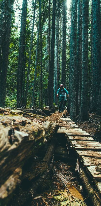
• Mountain biking networks drawing • Indigenous cultural experiences
multi-night stays in Golden, • Farmers markets — Golden,
Revelstoke, Shuswap, and Kamloops Revelstoke, Salmon Arm, North
• Road cycling and touring Shuswap, Chase, Enderby, Scotch
• Rock climbing and mountaineering Creek, Sorrento, and Kamloops
• Paragliding and skydiving • Championship golf courses located in
Golden, Revelstoke, Shuswap,
• Scuba diving Kamloops, and Tobiano
• Three major ski areas — Kicking • Extensive sport tourism and/or
Horse Mountain Resort, Revelstoke hosting facilities in larger
Mountain Resort, Sun Peaks Resort communities, like Kamloops,
all of which are now also offering and resorts
summer activities including the highly
popular Mountain Coaster ride at • Non-stop scenic vistas throughout
Revelstoke Mountain Resort the journey
• One smaller ski area — Harper The Highway 1 Corridor
Mountain
planning area is accessible
• A high density of cat-ski operations
and backcountry lodges offering by air (international airports
heli-accessed skiing and boarding, in Vancouver and Calgary;
and summer sightseeing and/or hiking
programs regional airports with service
• Snowmobiling experiences ranging from Vancouver to Kamloops
from high alpine bowls to cross- and Revelstoke) and by
country touring
• Nordic skiing and/or snowshoeing
road. RV touring is very popular
trails in the summer season
• Ice climbing (May to October).
• A variety of local shops, art galleries,
There are visitor centres in Field,
cafes, restaurants, pubs, and attractions
Golden, Revelstoke, South Shuswap
• Growing culinary and craft brewing (Info Kiosk), Sicamous, Salmon Arm,
and winery scene Enderby, Chase, and Kamloops that
• Numerous festivals and events in provide visitor information, assistance,
communities along the length of the and advice.
Highway 1 Corridor planning area
• Heritage experiences including
several national historical sites
(Rogers Pass, Last Spike) and several
museums
HIGHWAY 1 CORRIDOR | 28G. SPECIFIC PRODUCT EXPERIENCES
There are a number of specific product experiences that are, or have potential as, iconic products and/or experiences for growth:
ICONIC TODAY POTENTIALLY ICONIC
MOUNTAIN-BASED ARTS/CULTURE/HERITAGE
EXPERIENCES Heritage Tours within
Yoho, Glacier and Mount and between Communities
Revelstoke National Park Inidigenous Cultural Tourism
Heli/Cat-Skiing/Backcountry Lodge Art/Artisans Tours
Winter Experience within and between Communities
Hiking/Camping/Backcountry Lodge Agritourism and Field to Table
Summer Experiences Experiences including
Kicking Horse Mountain Resort Wineries/Craft Breweries
Golden Area Mountain Biking Festivals/Events
Revelstoke Mountain Resort
Revelstoke Area Snowmobiling
Sun Peaks Resort
WATER-BASED
EXPERIENCES
Columbia Wetlands
Shuswap Lake Houseboating
Beaches/Lake-based Activities
and Provinicial Parks
Angling
Salmon-run viewing
OTHER
EXPERIENCES
Sports Tourism (Kamloops)
Golf (selected courses)
HIGHWAY 1 CORRIDOR | 29H. SUMMARY OF KEY STRENGTHS, CHALLENGES, AND OPPORTUNITIES
From a tourism destination perspective, the Highway 1 tourism stakeholders have identified a number of key
Corridor benefits from a range of strengths, however, it is opportunities that formed the foundation of the Highway 1
also facing a number of destination development challenges, Corridor Destination Development Strategy. These key
some of which have the potential to impact the future growth strengths, challenges, and opportunities are summarized
and sustainability of the tourism sector. To build on these below in no particular order.
strengths and address these challenges, the planning area’s
FIGURE 8: Strengths, Weaknesses, and Opportunities
KEY STRENGTHS KEY CHALLENGES KEY OPPORTUNITIES
• Natural assets (Canadian • Actual and perceived • Improve actual and
Rockies, Columbia safety of travel on perceived safety of travel
Wetlands, Columbia Highway 1 on Highway 1
Mountain Ranges, warm • Infrastructure, services, • Build strong, collaborative
lakes, rolling hills, and amenities to support relationships
grasslands) travel quality • Improve quality of
• National and Provincial • Year-round staff Highway 1 journey
Parks constraints, incl. skillsets, • Improve business climate
• Established destinations affordable housing and policy framework
with own brand equity • Conflicts on the land for tourism operators
• High quality tourism and/or water base • Encourage launch of
infrastructure • Sustainable growth additional visitor experiences
• Growing depth of arts, • Dependency on summer in shoulder season
culture, heritage, and season and limited • Improve quality and
culinary experiences experiences and opening consistency of service
• Authentic mountain towns hours outside of peak • Recruiting, retaining,
with passionate residents seasons and training staff including
• Sophisticated tourism • Local support for tourism sufficient affordable
stakeholders housing
• Develop in a manner that
respects environmental
health and community
resiliency and values
HIGHWAY 1 CORRIDOR | 30SUN PEAKS RESORT
Photo: Ryan Creary
I. EXPERIENCE
POTENTIAL
Any destination, when considering its
potential and the many ways in which it
can develop in the future, needs to
consider the visitor perspective. The
visitor engages in a variety of destination
experiences, some of which are offered
by the private sector, and some
of which arise from the efforts of
community groups, various levels of
government, and non-governmental
organizations (NGOs). All of these
experiences occur within the natural
and cultural environment of the
destination. A policy box surrounds all
aspects of the destination experience.
These policies inform, support, limit, or
otherwise affect the natural and cultural
environment, and the ability of private
sector and community groups to deliver
experiences to the visitor.
Destination experience
potential identifies the current,
developing, and potential
destination strengths for
priority consideration in
destination development,
as well as the key assets
in the natural and cultural
environment that offer
points of leverage. Finally,
surrounding this, are the
policy considerations critical
to successful destination
development.
HIGHWAY 1 CORRIDOR | 31In the Highway 1 Corridor planning area, the experiences offered by the private, government, NGO, and community sectors are
categorized as follows:
CURRENT STRENGTH DEVELOPING STRENGTH POTENTIAL STRENGTH
Maintain Support Through Initiate Support as Part Consider Support as Part
Destination Development of Destination Development of Destination Development
PRIVATE Ski Resorts Restaurants and Dining Guided Tours
SECTOR Heli/Cat-ski Operations and Equipment Rentals
DELIVERED Retail Shops
Backcountry Lodges
Golf Courses
Houseboating
Rafting and Paddling
GOVERNMENT/ Snowmobiling Trail-based Activities
NGO/ (Hiking, Mountain Biking,
Backcountry Touring
COMMUNITY Nordic Skiing)
DELIVERED Camping and Hiking
Road Cycling
National and Provincial Parks
Arts, Culture, and Heritage,
Sport Tourism and Tournaments including Indigenous Culture and
Lakes and River Experiences Agri-tourism or Culinary
Festivals and Events
The key assets offering significant leverage for destination development in the Highway 1 Planning Area:
NATURAL ENVIRONMENT CULTURAL ENVIRONMENT
Assets to Leverage Assets to Leverage
in Destination Development in Destination Development
Scenic Vistas Indigenous Culture
Mountains Local Artists, Artisans, and Heritage
Grasslands Community Infrastructure
Lakes Community ‘Sense of Place’ and Authenticity
Rivers and Wetlands
Wildlife and Birdlife
Farmland
HIGHWAY 1 CORRIDOR | 32The key policy considerations for the planning area are:
Key LOCAL/REGIONAL Key PROVINCIAL AND FEDERAL
Policy Considerations of Primary Relevance Policy Considerations of Primary Relevance
to the Highway 1 Planning Area to the Highway 1 Planning Area
Local and regional collaboration Highway Safety and Maintenance
Nightly rental and sharing economy regulation and Highway Infrastructure and Signage
support for affordable housing
Land Use Planning and Management Process and Resources
Educate on the value of tourism, and embed
tourism values in local and regional planning Use of ALR
Resource Road Maintenance and Access
Labour Supply and Immigration Policy
Training and Education, and Employee Insurance
Ecosystem Integrity and Sustainability
Funding tools for Local Governments
The following figure summarizes the Highway 1 Corridor as a
destination today, from a visitor’s perspective. There are a range of
experiences currently offered, some of which are considered a current
strength, others with immediate potential to become strengths, and
still others that could eventually develop into experiential strengths
with support and investment.
This categorization serves to inform whether support for Both the nature of experiences available to visitors and the
these experiences should be maintained, initiated, or natural and cultural environment are influenced by policies at
considered over the 10-year timeframe of this strategy. the local, regional, provincial, and federal levels. Policies having
significant impact on destination success over the next 10
These experiences reside within a natural and cultural years, as identified by the working group, are indicated in bold.
environment or context within the planning area. This natural
and cultural context provides important points of leverage for
destination development that will serve to enhance competitive
advantages and distinctiveness.
HIGHWAY 1 CORRIDOR | 33You can also read