Geology of Michigan - Western ...
←
→
Page content transcription
If your browser does not render page correctly, please read the page content below
Western Michigan University
                                                                                        ScholarWorks at WMU
Michigan Geological Repository for Research and
                                                                                                                        Geosciences
Education

2016

Geology of Michigan
William B. Harrison III
Michigan Geological Repository for Research and Education

Follow this and additional works at: http://scholarworks.wmich.edu/michigangeologicalrepository
    Part of the Geology Commons

WMU ScholarWorks Citation
Harrison, William B. III, "Geology of Michigan" (2016). Michigan Geological Repository for Research and Education. 2.
http://scholarworks.wmich.edu/michigangeologicalrepository/2

This Presentation is brought to you for free and open access by the
Geosciences at ScholarWorks at WMU. It has been accepted for inclusion
in Michigan Geological Repository for Research and Education by an
authorized administrator of ScholarWorks at WMU. For more information,
please contact maira.bundza@wmich.edu.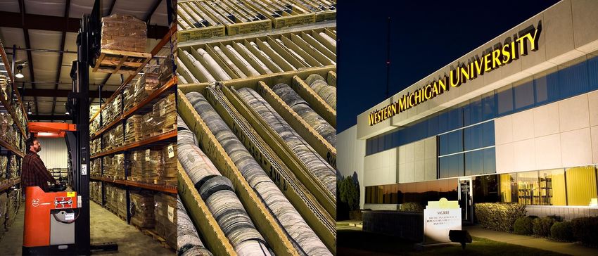
William B. Harrison, III,
Michigan Geological Repository for Research and Education
                               Department of Geosciences
                             Western Michigan University
                                     Kalamazoo, Michigan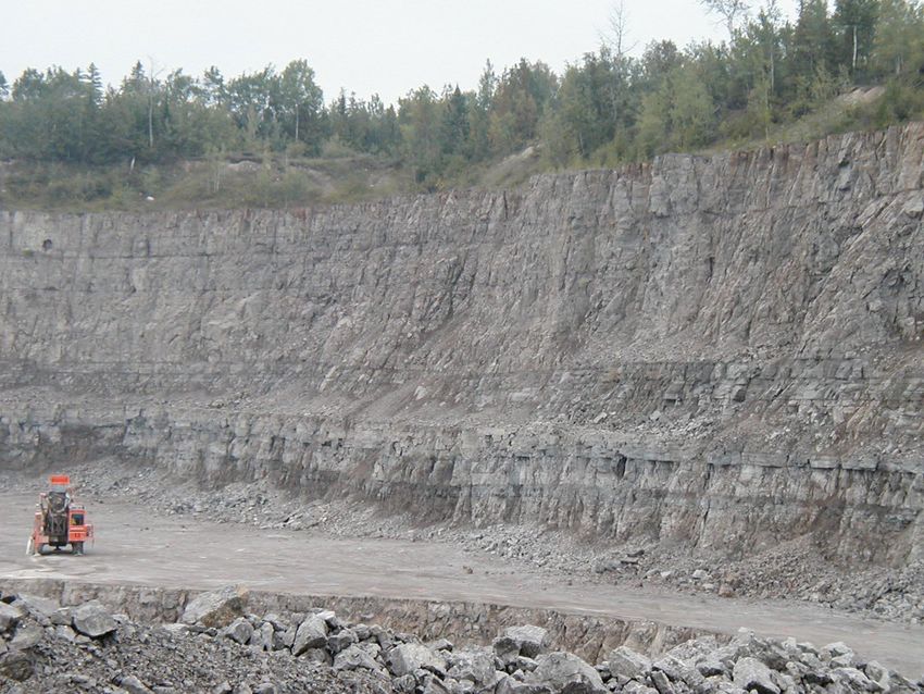
Geology – The Earth Beneath
Our Feet
Geology is the surface
of the Earth and the
soils, sands, gravels
and solid bedrock
deeper into the earth
Sometimes we are
interested in what is a
few hundred feet
down, sometimes
thousands of feet
down.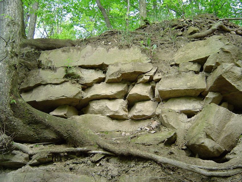
How Do We Describe Geologic
        Materials?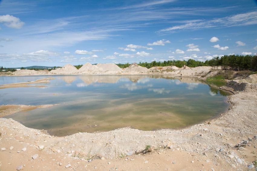
How do we know about the
Geology of Michigan?
We look around Michigan
and observe the landforms,
soils, beaches, etc. at the
surface and also look for
areas of solid bedrock,
mostly along the lake
shores, in river valleys and
in quarries that we dig.
Also we can sample rock
layers by drilling wells.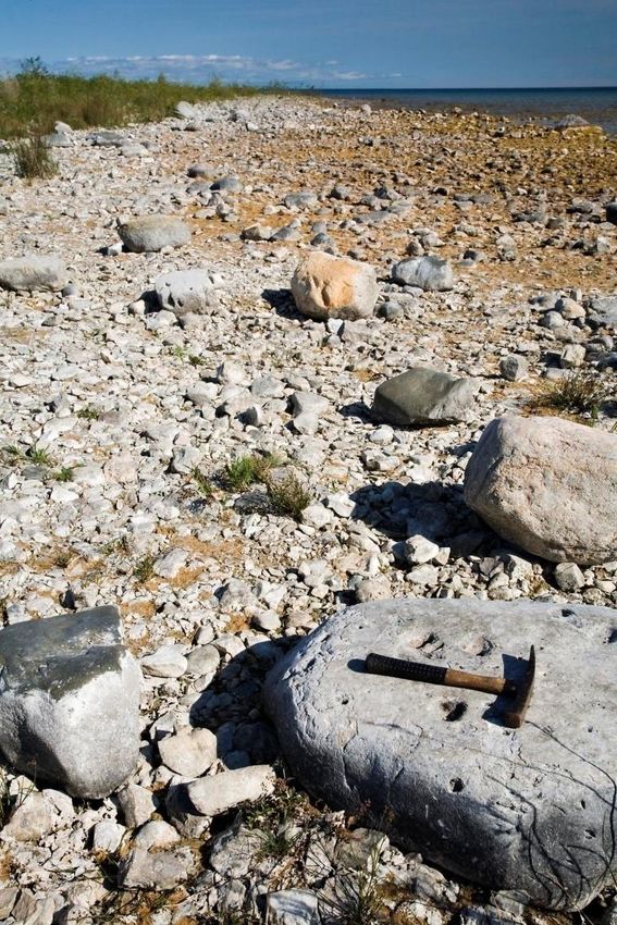
Michigan Stratigraphic Column
Decades of studies of
Michigan Geology has
produced a similar
diagram of the rock
layers
Thickness of this
entire column can be
up to 16,000 feet in the
center of the State
From Michigan Basin Geological
Society and Michigan Geological
Survey, 2000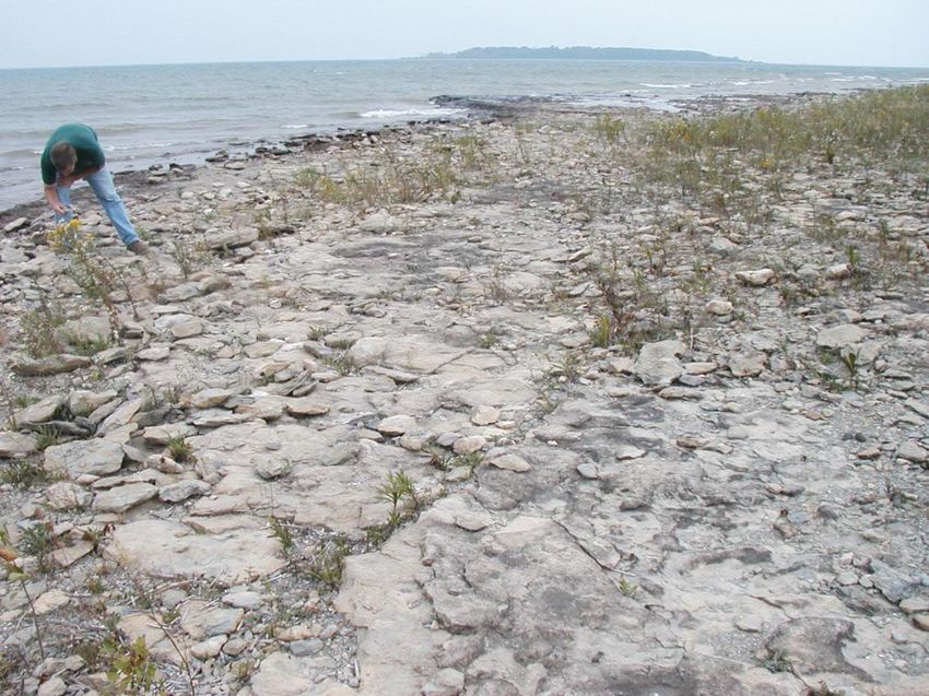
Variation in Geology around the
State
The thickness and types of geologic materials vary from
region to region in Michigan
The thickest column of these formations is in Central
Michigan and thinning occurs towards the edges
Surface geology may vary, especially in the Upper
Peninsula
Types of rocks deeper in the subsurface may change
around the State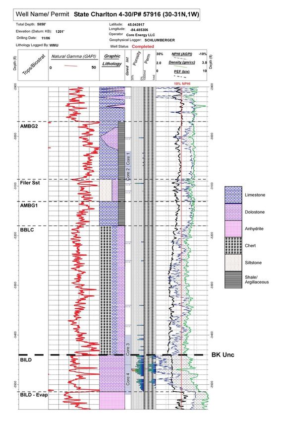
Geologic Cross Section of
Michigan

                       From Michigan Oil and Gas News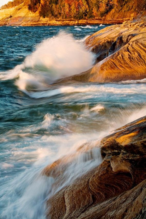
Introduction-Geology of
Michigan
Geologic data for most of Michigan is derived from
sparse natural outcrops, quarries and abundant well
data with logs, samples and cores
Surface geology of Michigan is dominated by
Pleistocene Glacial deposits and landforms
Subsurface geology is mostly the Paleozoic
sedimentary rocks of the Michigan Basin
Surface and subsurface geology of Western Upper
Peninsula is Pre-Cambrian crystalline igneous and
metamorphic with some sedimentary and
metasedimentary rocks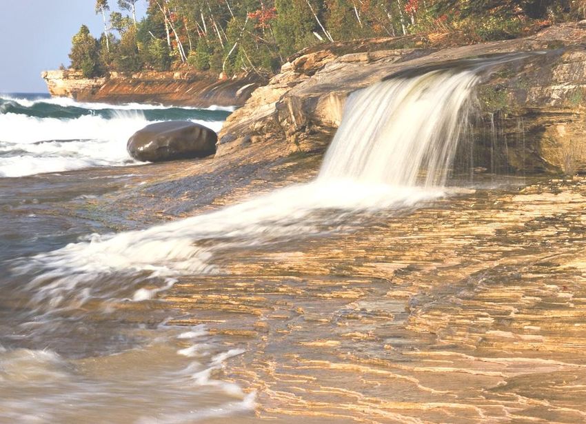
Glacial Geology in Michigan
                      Steve Wilson, 2006
                      http://www.deq.state.mi.us/documents/
                      deq-ogs-gimdl-GTLH_geo.pdf
Glacial Gravel Quarry, near Petoskey, MI
Bedrock Geology of Michigan
                     Steve Wilson, 2006
                     http://www.deq.state.mi.us/documents/
                     deq-ogs-gimdl-GTLH_geo.pdf
Geologic Setting of the Michigan Basin
Michigan Stratigraphic Column
Jurassic Subcrop
• Jurassic outcrops are     Steve Wilson, 2006
                            http://www.deq.state.mi.us/documents/
                            deq-ogs-gimdl-GTLH_geo.pdf
not found in Michigan,
strata is only known
from oil and gas drilling
samples that contain
fossil spores and pollen
of Jurassic age.
• Ionia Sandstone is only
known formation.
• Lithology is medium to
fine red sandstone
probably deposited in a
terrestrial setting.
Pennsylvanian Subcrop
• Isolated outcrops occur in Steve Wilson, 2006
Arenac, Branch, Calhoun, http://www.deq.state.mi.us/documents/
deq-ogs-gimdl-GTLH_geo.pdf
Clinton, Eaton, Huron, Ingham,
Ionia, Jackson, Ottawa, Saginaw
and Shiawassee counties.
• Major natural resources are
limestone, sandstone and coal.
• Several units are regional
bedrock aquifers and serve as an
important source of fresh water.
• Lithology is mixed sandstone,
shale, siltstone, coal and
limestone deposited in a fluvial-
deltaic setting.Pennsylvanian Sandstones at Grand
Ledge, MI
http://www.msstate.edu/dept/ge
osciences/CT/TIG/WEBSITES/L
OCAL/Summer2003/Fessenden_
Lisa/7day1.htmlMississippian Subcrop
• Largest area of subcrop for
Steve Wilson, 2006
any geological system in the http://www.deq.state.mi.us/documents/
deq-ogs-gimdl-GTLH_geo.pdf
Lower Peninsula.
• Major natural resources are
limestone and fine-grained
sandstone.
• Marshall Sandstone is major
regional bedrock aquifer and
serves as an important source
of fresh water.
• Lithology is mixed
sandstone, shale, siltstone,
coal and limestone deposited
in a shallow marine setting.Devonian Subcrop
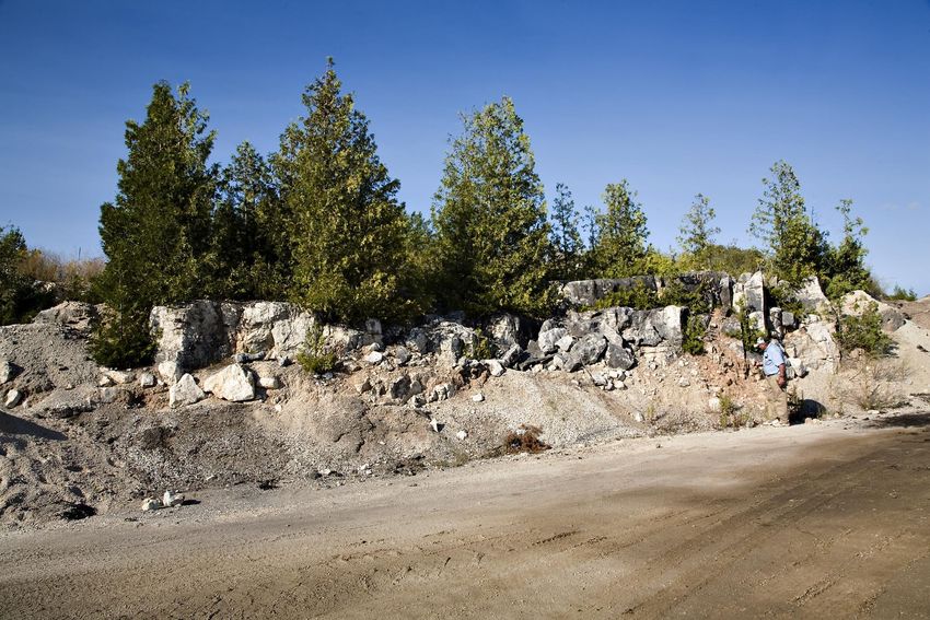
• Natural outcrops and quarries
Steve Wilson, 2006
are relatively abundant, http://www.deq.state.mi.us/documents/
deq-ogs-gimdl-GTLH_geo.pdf
especially near the Great Lakes
margins. Bedrock is commonly
near the surface, with thin
glacial veneer.
• Major natural resources are
limestone and a few clay shales.
• Fractured and karsted
Limestone are regional bedrock
aquifer in northern L.P.
• Lithology is mostly Limestone
and Dolomite with minor shale,
evaporites and sandstone.Middle Devonian Rocks in Michigan
Traverse
Dundee
Detroit River/
Richfield
Amherstberg
Middle Devonian reservoirs include Traverse
Limestone, Dundee Formation, Detroit River Group
and Amherstberg Fm. Subcrop of these rocks shown
From Michigan Geological Survey Presentation – “The Rock Cycle”Antrim Shale Localities near Norwood, MI and Kettle Point, ONT
Traverse Lime, near Charlevoix,MI
and Squaw Bay, near Alpena, MI
Rogers City and Dundee
Limestones, Near Rogers City, MI
Michigan Stratigraphic Column
Silurian Subcrop
• Natural outcrops and quarries are
                                        Steve Wilson, 2006
fairly common in southeastern U.P.      http://www.deq.state.mi.us/documents/
                                        deq-ogs-gimdl-GTLH_geo.pdf
Bedrock is commonly near the surface,
with thin glacial veneer.
• Major natural resources are
limestone and dolomite near surface
and salt in subsurface.
• Fractured and karsted Limestone
and dolomite are regional bedrock
aquifer in southeastern U.P.
• Lithology is mostly Limestone and
Dolomite with minor shale and
abundant basinal evaporites.
Silurian Engadine Fm. Northeast of St. Ignace, MI
Michigan Stratigraphic Column
Ordovician Subcrop
• Natural outcrops uncommon       Steve Wilson, 2006
                                  http://www.deq.state.mi.us/documents/
in central U.P. Bedrock is        deq-ogs-gimdl-GTLH_geo.pdf

commonly near the surface, with
thin glacial veneer.
• Major natural resources are
limestone and dolomite.
• Fractured and karsted
Limestone and dolomite are
regional bedrock aquifer in
central U.P.
• Lithology is mostly Limestone
and Dolomite with minor shale
and sandy dolomite.
Cambrian Subcrop
Steve Wilson, 2006
• Natural outcrops abundant http://www.deq.state.mi.us/documents/
deq-ogs-gimdl-GTLH_geo.pdf
along Lake Superior shoreline.
Bedrock is commonly near the
surface, with thin glacial veneer.
Major waterfall forming unit in
U.P.
• Major potential natural
resource is Sandstone.
• Sandstone is local bedrock
aquifer in northern U.P.
• Lithology is predominately
Sandstone.Munising Ss. Pictured Rocks National Lakeshore
Pre-Cambrian Subcrop
                                   Steve Wilson, 2006
• Natural outcrops and mines       http://www.deq.state.mi.us/documents/
                                   deq-ogs-gimdl-GTLH_geo.pdf

abundant in western U.P.
• Major source of metallic ores,
especially iron and copper.
• Generally poor local bedrock
aquifer.
• Lithology is varied, mostly
crystalline igneous and
metamorphic along with
sediments and metasediments.
Pre-Cambrian outcrops in Western U.P.
Glacial Polish on Mesnard Quartzite
Basalt Dikes through Granite
Republic Iron Mine Stromatolites in Kona DolomiteMGRRE at W.M.U. in Kalamazoo, MI Houses Michigan Subsurface Data
Michigan Subsurface Geology Geologic strata in the Michigan Basin range in age from Pleistocene glacial drift and the youngest Jurassic-aged bedrock through Cambrian to Pennsylvanian sedimentary bedrock that reaches a maximum thickness of about 16,000 feet in the basin center Strata thin and are eroded to progressively older units moving toward the basin margins Data from several hundred thousand shallow water wells and over 58,000 oil and gas and mineral wells Data includes logs, drill cuttings samples and cores, as well as limited seismic profiles and gravity and magnetic geophysical measurements
Locations of
Oil and Gas
wells drilled
throughout
Michigan
 Red – Natural Gas
 Green – Oil
 Black – Dry hole
Core Samples
Typical Log
 format for
 describing
 portion of a well
Red, Black, Blue and Green Lines are
electrical sensor logs

Lithologic column describes rock type
Lower Devonian-Upper Silurian
Regional Stratigraphic Cross Section

                Base Kaskaskia
                Unconformity

                                 Inset map Sylvania Sst Isopach (Landes, 1945)
                                 Sylvania Sst Picks from Driller’s Logs; shaded logs
                                 shows FDC-CNL cross-over
Isopach and structural contour maps on selected horizons using well data Compiled by Dr. D.A. Barnes, WMU
You can also read