GNSS ADOPTION FOR ROAD USER CHARGING IN EUROPE 2015 - European GNSS ...
←
→
Page content transcription
If your browser does not render page correctly, please read the page content below
GNSS ADOPTION FOR ROAD USER CHARGING IN EUROPE 2015
More information on the European Union is available on the Internet (http://europa.eu).
Luxembourg: Publications Office of the European Union, 2015
ISBN 978-92-9206-026-8
doi:10.2878/55987
Copyright © European GNSS Agency, 2015

Information contained in the document may be excerpted, copied, printed and provided to third
parties only under the condition that the source and copyright owner is clearly stated as follows:
“Source: GNSS Adoption in Road User Charging in Europe, Issue 1, copyright © European GNSS
Agency, 2015”.
For reproduction or use of photos and any other artistic material, permission must be sought
directly from the copyright holder. The designations employed, the presentation of the materials
and the views expressed by authors, editors, or expert groups do not necessarily represent the
opinions, decisions or the stated policy of neither GSA nor the European Commission. The mention
of specific companies or of certain manufacturers’ products does not imply that they are endorsed
or recommended by the GSA in preference to others of a similar nature that are not mentioned.
Errors and omissions excepted, the names of proprietary products and copyright holders are dis-
tinguished by initial capital letters. The present document is being distributed without warranty
of any kind, either express or implied in relation to its content and/or use. In no event shall the
GSA be liable for damages arising from the content and use of the present document.

This document and the information contained in it is subject to applicable copyright and other
intellectual property rights under the laws of the Czech Republic and other states.

No part of this document, including any part of the information contained therein, in whichever
format, whether digital or otherwise, may be altered, edited or changed without prior express and
written permission of the European GNSS Agency, to be requested via http://www.gsa.europa.eu/
contact-us, clearly stating the element (document and/or information) and term of use requested.
Should you become aware of any breach of the above terms of use, please notify the European
GNSS Agency immediately, through the above mentioned contact site.
Any breach of these terms of use may be made subject to legal proceedings, seeking monetary
damages and/or an injunction to stop the unlawful use of the document and/or any information
contained therein.
By downloading, forwarding, and/or copying this document or any parts thereof, in whichever
format, whether digital or otherwise, the user acknowledges and accepts the above terms of use
as applicable to him/her.

Cover photo © Thinkstock
GNSS ADOPTION FOR
ROAD USER CHARGING IN EUROPE
4         CONTENT

                                       GNSS OVERVIEW                                           5

                                       GNSS FOR ROAD USER CHARGING                            11

                                       THE EUROPEAN ELECTRONIC TOLL SERVICE                   16

                                       GNSS ROAD USER CHARGING FOR HEAVY GOODS VEHICLES       20
                                                 EXISTING AND PLANNED SCHEMES                 21
                                                 POTENTIAL SCHEMES                            34

                                       EMERGING APPLICATIONS                                  38
                                                 ROAD USER CHARGING AND CONGESTION CHARGING
                                                 FOR PASSENGER CARS AND LIGHT VEHICLES        39

                                       ANNEX                                                  42
                                                 ACRONYMS                                     42

GNSS Adoption in Road User Charging in Europe | 2015
5
GNSS OVERVIEW
GNSS Adoption in Road User Charging in Europe | 20156 GNSS OVERVIEW
WHAT IS GNSS? • Galileo: Europe’s GNSS, currently under development GLOBAL CONSTELLATIONS
as the only civil GNSS, is owned and managed by the
Global Navigation Satellite System (GNSS) is the infrastructure Global Constellations are systems of satellites that provide auton-
European Union.
that allows users with a compatible device to determine their omous geo-spatial positioning with global coverage, allowing
position, velocity and local time by processing signals from • BeiDou (COMPASS): The Chinese GNSS, set to super- receivers to determine their location (longitude, latitude, and
satellites in space. GNSS signals are provided by a variety of sede the COMPASS regional system operating since altitude/elevation) to high precision (within a few metres) using
satellite positioning systems, including global constellations 2000, is managed by the governmental China Satellite time signals transmitted via radio frequency from satellites. The
and Satellite-Based Augmentation Systems (SBAS). Navigation Office. signals allow the receivers to calculate the current local time to
high precision, which allows for time synchronisation.
• Global constellations: • Satellite-Based Augmentation Systems (SBAS), such as
EGNOS (Europe), WAAS (North America), GAGAN (India) and
• GPS: The first GNSS, fully operational since 1995, is man-
MSAS (Japan). SATELLITE-BASED AUGMENTATION
aged by the US Department of Defence.
SBAS is a method for improving the navigation system’s attrib-
• GLONASS: The Russian GNSS, completed in 1995 and
utes, such as accuracy, reliability and availability, through the
fully operational since 2011, is managed by the Russian
integration of external information, sent from geostationary or
Aerospace Defence Forces.
geosynchronous satellites, into the calculation process.
SDCM
EGNOS
WAAS
MSAS
GAGAN
GNSS Adoption in Road User Charging in Europe | 2015GNSS OVERVIEW 7
WHAT ASPECTS OF GNSS ARE IMPORTANT? from a satellite in space (thus enabling sensitive applications). professionals, consumers and citizens worldwide benefit from
their application across an array of sectors, from providing effi-
GNSS is used for many types of applications, covering the mass • Indoor penetration: Ability of a signal to penetrate inside
cient and safe transport networks to facilitating productive and
market and both professional and safety-critical applications, buildings, e.g. through windows.
sustainable agriculture, surveying, and critical infrastructures.
each requiring different service levels. Depending on user needs,
the important features of any GNSS include: In the case of Road User Charging (RUC), three of these features
At the regional level, the installed base in the mature regions
are key enablers for a robust and efficient tolling service based
• Availability: Percentage of time the minimum number of the EU28 and North America will grow steadily (8% p.a.)
on GNSS: availability, accuracy and robustness to spoofing and
of satellites are in view, allowing the user to compute the through 2023. The primary region of global market growth will
jamming.
position, navigation or timing solution requested. be Asia-Pacific, which is forecasted to grow 11% p.a., from 1.7
bln in 2014 to 4.2 bln devices in 2023 - more than the EU and
• Accuracy: Difference between true and computed position
North America combined. The Middle East and Africa will grow
(absolute positioning). GNSS GLOBAL USERS
at the fastest rate (19% p.a.), but starting from a low base.
• Continuity: Ability to provide the required performances GNSS is used around the globe, with 3.6 bln GNSS devices in
during an operation without interruption, once the oper- use in 2014. By 2019, this is forecasted to increase to over 7 bln, For the specific case of RUC in Europe, the GNSS market is com-
ation has started. for an average of one device per person on the planet. posed today of around 1.2 million OBUs in operation and the
installed base of GNSS-based RUC devices is expected to reach
• Integrity: Additional user information on the reliability of
Smartphones continue to dominate (3.08 bln in 2014), being 3.9 million by 2020. Further details by country can be found
the signal within the operational requirements.
the most popular platform to access Location-Based Services along the next chapters of this document.
• Robustness to spoofing and jamming: Authentication (LBS), followed by devices used for road applications (0.26 bln).
information provided to users that ensures the signal comes Other devices may be less numerous, but billions of passengers,
GNSS Adoption in Road User Charging in Europe | 20158 GNSS OVERVIEW EUROPEAN GNSS PROGRAMMES: EGNOS
EGNOS (European Geostationary Navigation Overlay
Service) is Europe’s first concrete venture into sat-
ellite navigation. Essentially a ‘pre-Galileo’ system,
EGNOS uses geostationary satellites, which transmit
radio signals over European territory and North 5
Africa. It is comprised of a network of ground stations
that receive, analyse and augment GPS and, in the 2.5
North Error (m)
next version, Galileo signals.
0
EGNOS makes existing satellite navigation signals
Source: ©RobChafer
suitable for safety-critical and payment related appli-
-2.5
cations. More so, it increases the accuracy of existing
satellite positioning signals while also providing a
-5
crucial ‘integrity message’, informing users in the -5 -2.5 0 2.5 5
event of problems with the signal. In addition, it East Error (m)
further transmits an extremely accurate universal time signal. GPS
5
EGNOS increases the accuracy of GPS positioning by reducing the influence of ionosphere
and system errors. It also provides the user with information on GPS’s reliability in Europe. 2.5
EGNOS provides three services: EGNOS MAKES A DIFFERENCE
North Error (m)
1. Open Service (OS): Available free to the public for mass-market receivers and such 0
common user applications as road tolling. Several R&D projects funded by the European
2. Safety of Life (SoL): For safety-critical transport applications, namely in civil aviation, Commission, using trials with real users driving -2.5
this service provides enhanced and guaranteed performance and features an integrity in real life situations, have demonstrated the
warning system. added value of EGNOS, when coupled with -5
-5 -2.5 0 2.5 5
3. EGNOS Data Access Service (EDAS): To cope with higher latitudes in Europe where GPS, as an efficient tolling technology. East Error (m)
the reception of radio signals from geostationary satellites is challenged, EGNOS GPS + EGNOS
broadcasts the augmentation information over the Internet. It is offered on a controlled
access basis to customers who require enhanced performance for professional use.
An EGNOS-enabled receiver can provide
location accuracy to within three metres,
compared to the 17-metre accuracy
provided by a standard GPS-only receiver.
Moreover, EGNOS provides extremely good
stability over time (higher precision).
GNSS Adoption in Road User Charging in Europe | 2015EUROPEAN GNSS PROGRAMMES: GALILEO GNSS OVERVIEW 9
Galileo is the European GNSS under civilian control, providing
standalone navigation, positioning and timing information
worldwide.
MULTI-CONSTELLATION
With its full complement of satellites – more than any of the
current GNSS systems – Galileo will allow positions to be deter- Galileo, in combination with other
mined more accurately. This is true even in high-rise cities, GNSS, provides improved accuracy
where buildings obscure signals from today’s satellites. Galileo and availability and allows for a faster
will also offer several signal enhancements, making the signal time-to-fix the first position.
easier to track and acquire and more resistant to interference
and reflections. Galileo will make possible a whole new and
virtually limitless range of ‘reliability-critical’ services, applica-
Enhancement
tions and business opportunities.
GALILEO AUTHENTICATION of currently
Galileo will provide four basic satellite-only services to world- offered
Galileo will provide authentication services
wide users: services
and data encryption solutions that enhance
• Open Service (OS): Free of charge for all users, featuring GNSS reliability and allow for the detection
excellent positioning and timing performance. of attempts to spoof the signal.
• Commercial Service (CS): Access to two additional
Development
encrypted and guaranteed signals, delivering a higher of new
data throughput rate and increased accuracy. value-added
• Public Regulated Service (PRS): Provides position and
applications
MULTIPATH RESISTANT
timing to specific users who require a high continuity of
service with controlled access. The strength of the Galileo signal,
together with an advanced code
• In addition, Galileo will be part of the Medium Earth Orbit More
Search and Rescue (MEOSAR) system, contributing to modulation, means Galileo is better
able to mitigate multipath effects. business
Cospas-Sarsat, the international satellite-based search
and rescue distress alert detection and information dis- opportunities
tribution system.
Galileo is fully interoperable with GPS and is implemented
in a step-wise approach. Twelve satellites have already been DATA-LESS SIGNAL OF GALILEO
launched, with the full constellation being progressively Galileo’s data-less signal means improved
deployed, with completion expected in 2020. However, it is not
performance in urban canyons, better
necessary to wait for the full deployment to take advantage
of the significant improvements already being offered in
performance in noise measurements and
terms of signal availability in urban canyon environments. improved sensitivity in A-GNSS mode.
GNSS Adoption in Road User Charging in Europe | 201510 GNSS OVERVIEW GALILEO: CONTRIBUTION TO MULTI-CONSTELLATION
With more satellites
in view, one reduces
the time needed to fix
the first position.
Signals Signals
available blocked
When buildings block
the signal and reduce
the number of visible
satellites, the availability
of more constellations
ensures a more accurate
With the robustness of
final position.
the position improved,
even if a satellite or
constellation is not
available or is providing
incorrect data, reasonable
accuracy will continue
to be provided.
GNSS Adoption in Road User Charging in Europe | 201511
GNSS FOR ROAD
USER CHARGING
GNSS Adoption in Road User Charging in Europe | 201512 GNSS FOR ROAD USER CHARGING
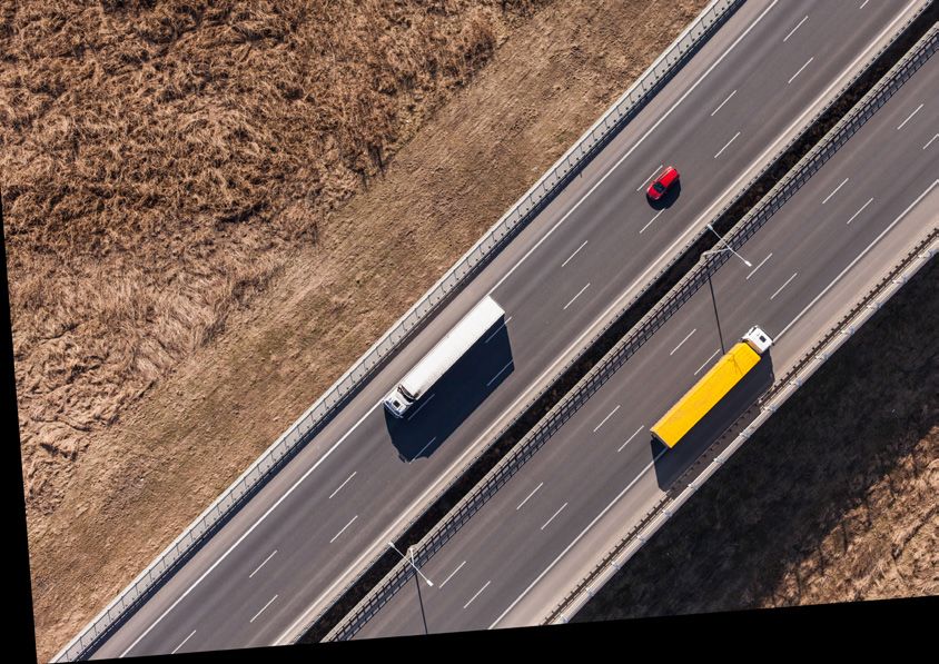
NO GNSS GNSS
Source: ©Vladislav Bezrukov
Source: ©KRoock74
GNSS is not used to toll roads. Instead, it tolls vehicles,
regardless of which type or class of roads they drive on.
NO GNSS GNSS
Source: ©Flamouroux
Source: ©JMK
GNSS Adoption in Road User Charging in Europe | 2015HOW DOES IT WORK? GNSS FOR ROAD USER CHARGING 13
LOCATION BASED CHARGING 2. Matching algorithms: Through these algorithms, the cor- 5. Transmission: The stored CDRs are periodically reported
rect road segment that the vehicle is transiting on or the by the vehicle’s OBU to the Toll Service Provider (TSP) via
The objective of using GNSS for Road User Charging is to charge
virtual gantry it is passing through are identified. To do so, a secure transmission through a Mobile Network Operator
a user (i.e., vehicle) based on its reported position. To accom-
the required digital map has previously been downloaded (MNO) (e.g. using GPRS, UMTS, etc.). The set of CDRs received
plish this, several requirements must be met. First, check point
to the OBU through an Over-The-Air (OTA) software update. from a particular vehicle is then processed for billing on the
crossing detection must be reliable in order to avoid the risk
Maps can be updated when necessary, without disruption to Back End or Central System.
that a user’s reported position triggers a charging event when
the service and with no effort from the user (i.e. the vehicle
it is actually in a free-of-charge position. Second, the service
owner does not have to take it to a toll service provider). Depending on the TSP and the configuration of the OBU, this
required to get user’s actual position, thus triggering a charging
process may vary. In the case a “thin client” approach is utilised,
event, must be available. 3. Toll detection: After the matching algorithms verify that
the matching, toll detection and rating is conducted by the cen-
the vehicle used a road segment or passed through a virtual
tral system and the coordinates (i.e. the vehicle’s position) are
To properly determine the charge to be applied to the user, a gantry, the toll detection process verifies whether they are
periodically and securely transmitted by the OBU to the GNSS
series of steps (shown as follows and schematized on the next part of a chargeable road network by searching on a toll
Proxy through the MNO. The central system then matches the
page) must be followed. These correspond to the workflow of object table. If the detected segment or virtual gantry are not
vehicle’s positions on a map, detects whether the segments or
a typical “intelligent client” approach, which can vary slightly part of a toll road network, all position data is immediately
virtual gantries the vehicle has crossed are subjected to toll and
depending on the solution vendor: deleted, thus protecting user privacy.
applies charges respectively.
1. Positioning: The On-Board Unit’s (OBU) integrated GNSS 4. Rating: If vehicles are driving on a chargeable road seg-
receiver provides information such as position, speed, ori- ment or passing through a virtual gantry, the toll charge
entation and degree of confidence periodically (e.g. on a is calculated based on tariff rules linked to the toll object.
second-by-second basis). This process is called ‘rating’ and it generates a Charge Data
Record (CDR). In this case, the position of the vehicle is not
transmitted. However, for potential legal process reasons, it
is stored in the OBU for a specified period of time.
GNSS Adoption in Road User Charging in Europe | 201514 GNSS FOR ROAD USER CHARGING HOW GNSS IS UTILISED FOR RUC?
POSITIONING MATCHING TOLL DETECTION RATING TRANSMISSION
ALGORITHMS
The OBU’s integrated The OBU detects whether Being on a chargeable A set of CDRs are securely
GNSS receiver provides The matching algorithms the road segment or segment or virtual transmitted to the central
information on position, identify the correct road virtual gantry are part of a gantry, the toll charge system for billing, from
speed, orientation and segment or virtual gantry chargeable road network. is calculated, creating a the vehicle to the TSP and
degree of confidence. on a digital map. charge data record (CDR). subsequently to the TC.
TOLL SERVICE TOLL
PROVIDER CHARGER
GNSS PROXY BACK END
GNSS Satellites
(Galileo, GPS, Mobile network operator
GLONASS, BeiDou) GNSS OBUs
GNSS Adoption in Road User Charging in Europe | 2015MAIN BENEFITS GNSS FOR ROAD USER CHARGING 15
There are diverse and substantial benefits to using GNSS for
electronic toll collection, the most important being:
• Flexibility: GNSS can be used to charge according to dif- FLEXIBILITY
ferent principles (time, distance, place, vehicle type, level
of emissions, etc.) and can be adapted to evolving needs Rapid changes can be implemented
rapidly and cost effectively.
• Extensibility: It is very simple to add new sections of roads
to the toll scheme, affecting only the back office system. EXTENSIBILITY
• Revenue potential: OBUs could be used as a platform for Example of a network extension in 3 months
additional applications (e.g. fleet management, real time
traffic information, etc.).
• Environment and cost: Gantries are not required for toll- REVENUE POTENTIAL
ing, only for enforcement. This allows for around 80% less
SP can include several VAS to their offer
roadside infrastructure, thus minimizing the programme’s
environmental impact and installation costs.
• Traffic management: Policy-makers and road infrastructure
ENVIRONMENT (AND COST)
Source: Siemens AG
operators could use the aggregated and anonymous data
to improve traffic policies. Around 80% less roadside infrastructure
• Low transaction costs: Can be considered a cost-efficient
solution in large and complex, new networks involving
different vehicle categories. Already the data traffic costs TRAFFIC MANAGEMENT
from the OBU to the central system is in the order of 2€/
Dynamically influence traffic behavior
month, and this is expected to be even lower in the short-
term. New European regulations on mobile roaming will
further ease the current barriers to operate abroad.
LOW TRANSACTION COSTS
Data traffic costs already @ approx. 2€/month
GNSS Adoption in Road User Charging in Europe | 201516
THE EUROPEAN
ELECTRONIC TOLL
SERVICE
GNSS Adoption in Road User Charging in Europe | 2015THE EUROPEAN ELECTRONIC TOLL SERVICE 17
Directive 2004/52/EC and the related Decision 2009/750/EC “ONE VEHICLE, ONE CONTRACT, • Continuous service: No in-vehicle human intervention is
aim to achieve the interoperability of all EU electronic road ONE ON-BOARD UNIT” required if the vehicle’s toll classification parameters do
toll systems. The Directives look to avoid the proliferation of not change.
The EETS will enable road users to pay tolls throughout the EU
incompatible systems, which may compromise both the smooth
with one subscription contract with one service provider and • No distraction: Drivers will not be distracted by multiple
operation of the internal market and the achievement of trans-
one OBU. The EETS will be available on all infrastructure with boxes on their dashboard and they will not have to know
port policy objectives.
electronic tolls. It will limit cash transactions at toll stations and the specificities of each electronic road toll system they
eliminate cumbersome procedures, thus improving traffic flow come across.
The directive therefore stipulates that a European Electronic
and reducing congestion.
Toll Service (EETS) will be set up. The EETS covers all EU road • No more queues at the toll booth: Traditional toll-related
networks and tolled infrastructures on which road usage is traffic disruptions will be avoided. As a result, users will enjoy,
EETS defines three main partners: the users, EETS providers and
declared electronically by means of a single OBU and defines to the benefit of the environment, more fluid and safer traffic
toll chargers. The EETS provider concludes contracts with users
the allowed technological solutions, namely: and, ultimately, quicker journeys.
and grants them access to the EETS throughout the entire EU.
• Direct Short Range Communications (DSRC) The toll charger levies tolls for the circulation of vehicles in an • New or enhanced location-based services: Satellite nav-
EETS domain. Tolling policies, however, are to be decided by the igation systems, eCall with accurate caller location, route
• Satellite positioning coupled with mobile communica-
Member States in compliance with EU legislation. information, traffic monitoring, etc.
tions (i.e. GNSS).
Source: European Commission
The directive does not set up EETS as such, but rather provides the
KEY BENEFITS OF EETS FOR ROAD USERS
framework for its establishment. Commission Decision 2009/750/
EC defines EETS, inter alia by setting out the essential require- • A single contract with a single EETS provider: This will
ments for interoperability, as well as procedural, contractual alleviate users’ administrative burden and simplify the move-
and legal aspects relating to EETS provision. ment of goods and people across the EU.
GNSS Adoption in Road User Charging in Europe | 201518 THE EUROPEAN ELECTRONIC TOLL SERVICE
WHAT DOES IT MEAN FOR EETS PROVIDERS? domains. An EETS provider meeting these requirements should The main objectives of REETS are to:
obtain access on a non-discriminatory basis, and their on-board
EETS providers, who act as an intermediary between users • Reduce barriers for EETS deployment by reducing business
equipment fulfilling the technical requirements will be accepted
and toll chargers for the payment of tolls, can also benefit from uncertainty for EETS Providers in order to prevent potential
by the toll charger with whom they conclude a contract.
providing additional location-based services that make use of market failure of European Electronic Toll Collection (ETC)
the EETS on-board equipment. services
In addition, toll chargers have to publish the list of all the EETS
providers operating on their domains and are responsible for • Create a basis for easing the bilateral negotiations between
They are entitled to approach any toll charger to obtain access
the application of the tolling policies. Toll Chargers and EETS-Providers
to the EETS domains under this toll charger’s responsibility, and
they must always keep their customers informed whether their • Develop a common understanding of the service compo-
EETS subscription is valid prior to entering an EETS domain. nents provided by the different roles
REGIONAL EUROPEAN ELECTRONIC
TOLL SERVICE • Demonstrate, in practice, how EETS can be deployed and
operated cross-border based on interfacing the different
WHAT DOES IT MEAN FOR TOLL CHARGERS? The objective of the REETS project is to support existing EU
environments onto the results of the work packages
legislation regarding the interoperability of electronic road toll
Toll chargers have no direct contact with EETS users, except for
collection. Within this framework, the project aims to deploy
enforcement where necessary. They therefore no longer have to
EETS compliant services in a cross-border regional area, including
perform detailed user management and can thus concentrate
the following seven Member States: Austria, Denmark, France,
on road and traffic management.
Germany, Italy, Poland and Spain, as well as Switzerland (the
latter without EU co-financing).
Toll chargers must publish an ‘EETS domain statement’ outlining
the general conditions for EETS providers to access their toll
GNSS Adoption in Road User Charging in Europe | 2015GNSS IN THE TOLL CHARGING ENVIRONMENT THE EUROPEAN ELECTRONIC TOLL SERVICE 19
1. DSRC charging transactions, real-time compliance checking transactions and localisation In GNSS-based tolling, the role of positioning systems is to provide the positioning services
augmentation (for GNSS-based tolling systems) required for toll calculation, i.e. to provide the necessary signals to determine the time/position
of a vehicle in relation to a toll domain. Thanks to the positioning systems, toll declarations can
2. Remote configuration of the OBU with contract or vehicle parameters, charging data, etc. For
be made, for instance, when a vehicle enters or leaves a road user charging zone or according to
GNSS-based toll systems, it is implemented through mobile communications.
the distance that vehicle travelled on a tolled road network.
3. Toll declaration data for submission and validation of claims for charges, invoicing/settlement,
EETS blacklists, Toll Context Data, etc. By using GNSS, virtual gantries defining toll sections are created without the need for roadside
infrastructure beyond what is required for enforcement purposes. To date, GNSS-based schemes,
4. Charging or enforcement data from RSE to back-office systems. No application standards are
in general, require gantries every 50 kilometres (enforcement only), whereas non-GNSS EETS-com-
currently foreseen for this interface.
patible solutions require gantries every 4 kilometres.
EETS Provider’s Positioning Financial Telecom
2 Authorities
OBU back-office Systems Systems System
systems
Standardisation Vehicle
1 3 TOLL CHARGING ENVIRONMENT
Bodies Sensors
Fixed or mobile 4 Toll Charger’s
roadside back-office Equipment Certification Other ITS Environmental
equipment systems Suppliers Bodies Systems Sensors
Source: European Commission
GNSS Adoption in Road User Charging in Europe | 201520
GNSS ROAD USER CHARGING
FOR HEAVY GOODS VEHICLES
GNSS Adoption in Road User Charging in Europe | 2015EXISTING AND PLANNED SCHEMES GNSS ROAD USER CHARGING FOR HEAVY GOODS VEHICLES 21
The advantages of using GNSS for tolling Heavy Goods Vehicles toll correspond to a GNSS scheme. From 1st April 2016, in turn,
(HGV) have already been demonstrated and understood in the share of GNSS will raise to c. 58% since around 4,000 km of
Europe, and the situation is quickly evolving. roads currently under the Eurovignette scheme in Belgium will
become EETS-compliant.
There are currently three European Member States (Germany,
Hungary and Slovakia), plus non-MS Switzerland and the Russian If the kilometres subject to toll from Switzerland and the Russian
Federation, that are using GNSS for their ETC schemes for HGV. Federation are also taken into account, from April 2016, the total
Moreover, another system is currently under development in length of road networks under an ETC scheme that makes use
Belgium, which will launch in April 2016. of GNSS reaches c. 165,000 km.
By analyzing only the EETS-compliant EU28 countries, i.e. those In the following sections, the five currently operational RUC
countries currently utilising DSRC (free-flow or with toll booths) schemes utilising GNSS, plus the in-development Belgian scheme,
and/or GNSS and excluding Eurovignette countries, before are defined with an overview of their key figures and most
April 2016, c. 56% of the kilometres (i.e. 39,200 km) subject to recent updates.
SHARE OF KM BY EETS TECHNOLOGY IN EU28 (FROM 2016Q2)
GNSS NO GNSS
58 % 42 %
2015
GNSS (also in conjunction with other technologies)
GNSS planned (currently under development)
GNSS Adoption in Road User Charging in Europe | 201522 GNSS ROAD USER CHARGING FOR HEAVY GOODS VEHICLES KEY FIGURES
START OF ACTIVITIES TARGET VEHICLES TOTAL KILOMETRES
GERMANY
1st January 2005 HGV > 7.5 ton 15,200 km
(from 2015 Q4) (from 2015 Q3)
TOTAL SEGMENTS REGISTERED VEHICLES TOTAL TRAFFIC
7,600 c. 900,000 28 bln VH-km/year
(from 2015 Q3) (with OBU, from 2015 Q4) (with OBU)
TOLLING INCOME ENFORCEMENT TOLL EFFICIENCY
4.1 bln €/year 1 gantry / 50 km 99.75%
(with OBU) 300 mobile units
GNSS Adoption in Road User Charging in Europe | 2015EXISTING AND PLANNED SCHEMES GNSS ROAD USER CHARGING FOR HEAVY GOODS VEHICLES 23
The German LKW-Maut system, managed by Toll Collect, is the On 1st July 2015, toll collection began on a further 1,100 km
world’s first all-GNSS truck tolling scheme, which went online in of federal trunk roads. The preparation period lasted six and a
the mid 2000’s. Through the course of its 10 years in operation, half months, during which the new route sections were digi-
it has proven outstanding reliability, allowing Toll Collect to tally recorded, modelled and checked in various testing stages.
expand its contract until August 2018. Starting at the end of May, following successful testing, the
additional sections of roads were transferred through a software
Moreover, it is the first GNSS system to provide interoperability update via mobile radio to approximately 850,000 OBU, which
with a DSRC-based scheme, with the Austrian ASFINAG. TOLL2GO automatically downloaded the information.
is a joint service provided by Toll Collect and ASFINAG, which
allows the truck toll to also be paid in Austria via the Toll Collect Moreover, on 1st October 2015, the LKW-Maut’s scope was
OBU. The service is especially convenient for freight transport extended to include trucks from 7.5 tonnes.
companies with vehicles frequently on the road between Austria
and Germany. Toll system customers who use the new TOLL2GO It is expected that the expansion of the tolled highway net-
service have the advantage of only needing one in-vehicle unit work will add another 500M € of annual revenue. More so, the
(i.e. the Toll Collect OBU) to pay toll charges in both countries. annexation of trucks from 7.5 tonnes will account for c. 80,000
ASFINAG and Toll Collect have recently extended their TOLL2GO more vehicles, adding another 200M € and rising the number
service until the end of August 2018, in line with Toll Collect’s con- of OBUs to c. 900,000.
tract extension. TOLL2GO counts c. 100,000 registered vehicles.
Currently, most of Toll Collect’s OBUs support EGNOS and from
2015, one of the OBU providers has included a Galileo-enabled
chipset for a more robust positioning determination.
Source: Toll Collect
GNSS Adoption in Road User Charging in Europe | 201524 GNSS ROAD USER CHARGING FOR HEAVY GOODS VEHICLES KEY FIGURES
START OF ACTIVITIES TARGET VEHICLES TOTAL KILOMETRES
HUNGARY
1st July 2013 HGV > 3.5 ton 6,500+ km
TOTAL SEGMENTS REGISTERED VEHICLES TOTAL TRAFFIC
N/A 380,000 2.47 bln VH-km/year
(86,000 with OBU)
TOLLING INCOME ENFORCEMENT TOLL EFFICIENCY
286 mln € 1 gantry/88 km N/A
(2015 H1) 100 mobile units
GNSS Adoption in Road User Charging in Europe | 2015EXISTING AND PLANNED SCHEMES GNSS ROAD USER CHARGING FOR HEAVY GOODS VEHICLES 25
The launch of the Hungarian HU-GO system, managed by that can install the OBU but whose devices cannot be used for
National Toll Payment Services PLC (NTPS), was an important the tolling scheme was 18. The conditions that TDOs have to
step towards open RUC schemes, which subsequently led to comply with, from the accuracy of declaration standpoint, are
innovative value-added services with respect to other GNSS- at least 94% accuracy within 15 minutes, 99,94% accuracy after
based RUC solutions present in the market (e.g. fine alert service five days and 100% accuracy after 25 days.
when non-compliance is detected, mobile application for ticket
purchasing and vehicle data update, etc.). Although relying solely on GPS, the results are satisfactory for
NTPS purposes and there have been only minor issues related
While in other countries it is only possible to use the automatic to inadequate tolling. However, an important provider of robust
tolling service through a single, central company, in Hungary GNSS-based OBUs tested its equipment and obtained an out-
small and medium enterprises (SME) and companies with fleets standing 99.8% accurate reporting within 15 minutes with an
of vehicles can use the system on a market basis and as reporting EGNSS-enabled OBU. Considering that 1000+ penalties are issued
contributors. In this sense, in 2015, the list of Audited Toll Dec- per month due to incorrect declarations, the company is now
laration Operators (TDO) showed 22, and the list of companies offering its OBU through an audited TDO.
OPEN SYSTEM VERY RAPID DEPLOYMENT THIN CLIENT APPROACH
Server side processing allows
Allows local and foreign Allowed for a 3-month return
for fast development of several
SMEs to participate on investment (ROI)
value-added services
GNSS Adoption in Road User Charging in Europe | 201526 GNSS ROAD USER CHARGING FOR HEAVY GOODS VEHICLES KEY FIGURES
START OF ACTIVITIES TARGET VEHICLES TOTAL KILOMETRES
SLOVAKIA
1st January 2010 HGV > 3.5 ton 17,763 km
TOTAL SEGMENTS REGISTERED VEHICLES TOTAL TRAFFIC
4,294 segments 246,900 35,000 daily
(with OBU) vehicles
TOLLING INCOME ENFORCEMENT TOLL EFFICIENCY
190 mln €/year 1 gantry/378 km 99.84 %
(38% 1st class roads) 30 mobile units (since first year of adoption)
GNSS Adoption in Road User Charging in Europe | 2015EXISTING AND PLANNED SCHEMES GNSS ROAD USER CHARGING FOR HEAVY GOODS VEHICLES 27
As of 1st January 2014, Slovakia’s Skytoll system added additional on these roads. This information is important for better planning
1st, 2nd and 3rd class roads to the charged network, expanding the next steps of charging and to better allocate resources for
the total chargeable road network to: the repair or construction of new roads based on accurate traffic
congestion data. This information, owned by SkyToll, may be
• 658 km of motorways and expressways, all charged with
used by other entities, such as customs officers to detect fake
“non-zero tariffs”
exports abroad and the related tax evasion.
• 3,625 km of 1st class roads, most (c. 2,600 km) charged
with “non-zero tariffs” Preparing the enlargement of road pricing (i.e. 15,000+ km) in
Slovakia lasted just three months and the actual start of the
• 13,479 km of 2 nd
and 3 class roads, all charged with
rd
extension only required a few hours to upgrade the OBU software
“zero tariffs”
(i.e. a new geomodel) using an over-the-air upgrade.
The decision to add 2nd and 3rd class roads to the toll system was
in response to a request from the National Motorway Company All of SkyToll’s OBUs support EGNOS and nearly 20% include a
to obtain information about the density of lorries over 3.5 tonnes Galileo-enabled chipset for a more robust positioning deter-
mination.
UNTIL 31/12/2013 FROM 01/02/2014
2,447 KM 17,763 KM
1,132 SEGMENTS 4,294 SEGMENTS
0 KM URBAN CHARGED 985 KM URBAN ROADS
Source: SkyToll Source: SkyToll
GNSS Adoption in Road User Charging in Europe | 201528 GNSS ROAD USER CHARGING FOR HEAVY GOODS VEHICLES KEY FIGURES
START OF ACTIVITIES TARGET VEHICLES TOTAL KILOMETRES
RUSSIAN FEDERATION
15th November 2015 HGV > 12 ton 50,774 km
TOTAL SEGMENTS REGISTERED VEHICLES TOTAL TRAFFIC
N/A 2 mln N/A
(with OBU, expected)
TOLLING INCOME ENFORCEMENT TOLL EFFICIENCY
0.9 bln €/year 1 gantry/105 km N/A
(expected) 100 mobile units
GNSS Adoption in Road User Charging in Europe | 2015EXISTING AND PLANNED SCHEMES GNSS ROAD USER CHARGING FOR HEAVY GOODS VEHICLES 29
The Russian Platon RUC system has been developed by “RT-in- While charges to vehicles weighing more than 3.5 tonnes relate
vest Transportation Systems”, a subsidiary of Rostec, which acts to future objectives, the Ministry of Transport, in conjunction
as sole concessionaire. It collects toll charges from HGV with with Rostec, are assessing the feasibility of tolling this category
the aim of offsetting the damage such vehicles cause to road of vehicles.
surfaces. The Russian Federal Budget then invest the revenues
to fund road maintenance and repairs, as well as general road MegaFon, one of the largest mobile operators in Russia, has
network improvements. been contracted to provide machine-to-machine (M2M) services
for RT-Invest Transport Systems by supplying up to two million
The project helps achieve the goals set out in the subpro- SIM cards for OBUs that will be installed in HGVs by 2017.
gramme “Roads” of the Russian Federal Transport System Action
Programme for 2010-2020. Not only will it ease the pressure on The OBU uses GLONASS and GPS to geo-locate the vehicle, with
public funds, but will also serve to further improve the state of the coordinates sent to the data processing centre through
Russian federal highways. GSM/GPRS mobile operators’ networks. The system is then
based on a thin client approach, where the matching algo-
rithms, toll detection and rating is conducted by the central
system.
1
Source: Platon.ru
1. RT-Invest – Transportation Systems
GNSS Adoption in Road User Charging in Europe | 201530 GNSS ROAD USER CHARGING FOR HEAVY GOODS VEHICLES KEY FIGURES
START OF ACTIVITIES TARGET VEHICLES TOTAL KILOMETRES
SWITZERLAND
1st January 2001 HGV > 3.5 ton 71,500 km
(c. 1,800 km of motorways)
TOTAL SEGMENTS REGISTERED VEHICLES TOTAL TRAFFIC
N/A 55,000 (domestic) N/A
3,000 (foreign)
TOLLING INCOME ENFORCEMENT TOLL EFFICIENCY
1.42 bln € 25 gantries (at borders), N/A
(in 2014) 100 mobile units
GNSS Adoption in Road User Charging in Europe | 2015EXISTING AND PLANNED SCHEMES GNSS ROAD USER CHARGING FOR HEAVY GOODS VEHICLES 31
Even if it is not GNSS-based, the Swiss RUC scheme was the first • The system works well and it has low operational costs
to use GNSS to monitor the recording of mileage performed by (5% of revenue)
the tachometer, as well as to determine whether the unit is in
• Truck traffic has been reduced, with a positive balance for
Switzerland or abroad.
the environment
For vehicles registered in Switzerland, it is mandatory to use • Road transport has become more efficient, with a fee
the OBU that determines the exact mileage based on the signal equal to about 20% of costs, but outbalanced by produc-
transmitted by the tachometer. Foreign vehicles use an ID card tivity gains (e.g. higher weight limit and less empty trips)
and a special terminal at each entry where they can personally
• The impact on the final customer price has been negli-
declare their mileage driven.
gible, with transport costs being, on average, only 1-2% of
the final price and the impact on inflation being only 0.11%
The rollout of a second generation of OBUs was concluded in
(according to Swiss Federal Office for Statistics)
2012. The Emotach has been installed in all HGV vehicles circu-
lating in Switzerland during regular workshop visits, with the • The railway system has maintained a high market share
cost covered by the operator. Emotach is compatible with the (40% overall and 65% in transalpine transport)
Austrian (ASFINAG) and Italian (Telepass) systems.
With the RUC scheme, the primary objective of reducing the
After more than a decade in use, the benefits of using a transit of HGV in the Swiss transalpine corridors has been
GNSS-supported system have been significant for Switzerland. achieved from the first year of operation, eliminating its ten-
During this time the RUC scheme has demonstrated that: dency to increase year-on-year.
Transalpine goods transport through HGV
Observed development and estimated development without RUC scheme
2,000
Development without HGV
679
1,800
603
657
597
601
toll scheme
571
Source: © Larag
506
560
551
Source: Federal Office for Spatial Development
1,600
395
64
1,400
Development of transalpine
1,251 169
1,404
1,380
1,318
goods transport 1,200
1,290
1,275
1,263
1,258
1,256
1,257
1,235
1,209
1,204
1,180
1,180
1,145
1,000
1,046
Shift target by 2018 800
(Swiss Confederation)
732
600
400
490
312
200
0
81
85
0
95
19 7
98
20 9
00
20 1
02
20 3
04
20 5
06
20 7
20 8
09
10
11
12
0
0
9
0
0
9
9
0
20
20
20
19
20
19
19
20
19
20
20
19
19
GNSS Adoption in Road User Charging in Europe | 201532 GNSS ROAD USER CHARGING FOR HEAVY GOODS VEHICLES KEY FIGURES
START OF ACTIVITIES TARGET VEHICLES TOTAL KILOMETRES
BELGIUM
1st April 2016 HGV > 3.5 ton 4,000 km
TOTAL SEGMENTS REGISTERED VEHICLES TOTAL TRAFFIC
N/A 700,000 N/A
(78% foreign, expected)
TOLLING INCOME ENFORCEMENT TOLL EFFICIENCY
800 mln € 1 gantry/64 km N/A
(expected) 40 mobile units
GNSS Adoption in Road User Charging in Europe | 2015EXISTING AND PLANNED SCHEMES GNSS ROAD USER CHARGING FOR HEAVY GOODS VEHICLES 33
The Belgian Viapass system is currently under development and The maps and tariffs are already published on the Viapass web-
will start operations on 1st April 2016. Managed by Satellic NV, site, and the system will be “EETS Ready” to allow other EETS
the programme will collect tolls on behalf of the Flemish, Wal- providers to offer their services in Viapass’ Toll Domains. In light
loon and Brussels-Capital regions. of this, Viapass has organised EETS update briefings to provide
information for the configuration of the infrastructure and
The toll will be levied on motorways and a number of regional OBU’s before the system goes live.
and municipal roads. The OBU must be switched on whenever
using a Belgian road. The system is based on the ‘user pays’ prin- In August 2015, with the publication of the decree and ordon-
ciple, meaning that everyone pays a fair contribution for using nance in the official Gazette, the Belgian kilometre charge has
the roads. been officially introduced in the three regions (i.e. Brussels, Flan-
ders and Wallonia).
Although the OBUs, which will be EGNSS-enabled from the
start, will be mandatory, they will not be paid for by the users. A remarkable aspect of the Belgian scheme is the political sup-
Instead, a guarantee deposit (i.e. 135 €) will be required, reim- port given by the three regions, essential to achieving public
bursable upon the return of the undamaged OBU. acceptance. One of the key messages to the user community
has been that revenues will actually enhance the country’s
transport conditions.
Source: © Satellic
GNSS Adoption in Road User Charging in Europe | 201534 GNSS ROAD USER CHARGING FOR HEAVY GOODS VEHICLES POTENTIAL SCHEMES
BULGARIA CZECH REPUBLIC
Bulgaria has plans to introduce a road tolling scheme in 2018 In 2014, the incoming Minister of Transport added the task of
and the Road Infrastructure Administration has contracted the choosing the next TSP contractor to the agenda. In December
World Bank to define a strategy for the implementation of an 2014, a political proposal was presented to lower the number
EETS-compatible system. of truck drivers tempted to avoid travelling on toll-subject seg-
ments by making them pay a fine of up to 730 € and docking
The World Bank1 has concluded that a GNSS-based system suits two points from their licence. As in the case of Bulgaria, for this
best the requirement to toll all motorways and certain 1st and latter requirement, a country-wide control is necessary, for
2nd class roads. The proposed method is similar to the one used which GNSS seems to be the only viable solution.
in Hungary for HU-GO, where existing GNSS technology such
as fleet management systems is used to report the position of More recently, the Minister of Transport has engaged the ser-
the vehicle to the TSP. More so, the system must be interoper- vices of an international consulting firm to prepare the tender
able, flexible to meet future needs and unimpeded upgrade, for a new, three year contract. The shorter duration is a result
user friendly to gain public acceptance and must assist Bulgaria of plans for an upgraded RUC scheme, potentially integrating
meet its security obligations and the fight against crime. new roads and GNSS based charging – topics currently in high-
level discussions.
2020
GNSS (also in conjunction with other technologies)
GNSS possible (currently under evaluation) 1. Bulgaria: Development of a comprehensive vision for the introduction of the
electronic system for provision of the EETS. The World Bank and Bulgaria Road
Infrastructure Agency, October 2015.
GNSS Adoption in Road User Charging in Europe | 2015POTENTIAL SCHEMES GNSS ROAD USER CHARGING FOR HEAVY GOODS VEHICLES 35
DENMARK ESTONIA FRANCE
Looking to obtain knowledge and experience in the use of The Estonian Road Administration is conducting studies on Although the Ecotaxe, the French HGV toll scheme, was com-
GNSS technology, Sund & Bælt, the state-owned limited com- the possible introduction of an ETC for trucks. As of 2015, an pletely cancelled at the end of 2014, some regional represent-
pany managing the Øresund motorway and the Storebælt international consulting firm has been supporting the govern- atives have asked for the utilisation of the already installed
bridge, is conducting a trial in the Greater Copenhagen Area. ment on the feasibility analysis, the results of which are not yet infrastructure in northern France, stating it would be a natural
The company notes that it is important to look towards both available. extension of the Belgian ETC system.
interoperability in Europe and to other possible RUC scenarios,
such as a toll ring or national road pricing. However, the national government seems to have no plans to
revive the Ecotaxe, as it is ready to launch an HGV vignette for
The tender on “Research and development services and related the entire national and county road network not currently con-
consultancy services” for these trials was published on 24 March ceded.
2015, and two companies were selected for the testing.
GNSS Adoption in Road User Charging in Europe | 201536 GNSS ROAD USER CHARGING FOR HEAVY GOODS VEHICLES POTENTIAL SCHEMES
LITHUANIA NORWAY POLAND
The Lithuanian Road Administration has contracted with an The National Public Road Administration (NPRA) has success- ViaTOLL has been analysing the possibility of extending the
important international consultancy company to conduct a fully introduced mandatory DSRC OBUs in HGV from 3.5 tons network of its current DSRC-based scheme to include lower
feasibility study on the implementation of an ETC system. Part onwards. This was accomplished thanks to significant support class roads.
of this study involves estimating investments and costs for serv- from the government and user community, both who aim to
ing c. 2,400 km of roads “of national significance” with DSRC- or give equal competitive conditions to transport companies in In support of this, in 2010 the National Automatic Toll Collection
GNSS-based solutions. Norway. System (NATCS) Pilot Project of the Motor Transport Institute
of Warsaw demonstrated the benefits of using an intelligent
Moreover, in May 2015, and in just 15 days time, SkyToll imple- Moreover, in March 2014, the NPRA selected an international hybrid DSRC-GNSS OBU. The project confirmed that although
mented an electronic toll collection solution on 353 kilometres information technology company to design, build and deliver such an OBU costs more than a DRSC-only tag, by investing
of motorways, national and regional roads with a total of 309 a new, centralised road toll system, “AutoPASS Grindgut”. This more in OBUs, considerable savings in the construction of road-
road sections. This project was within the framework of the Lith- system is expected to process more than 470 million vehicle side equipment and operational costs can be realised. More-
uanian Ministry of Transport and Communication and aimed to passages per year, accounting for approximately 1.8 bln € in over, GNSS technology permits complex tolling schemes and
showcase the benefits of using GNSS for RUC. road user charges. variable tariffs (based on road category, time of day, direction
of travel, etc.), giving the road authority the ability to influence
The system is also expected to integrate roadside traffic data traffic behaviour, hence optimising road networks.
with modern new user accounts and NPRA’s Customer Relation-
ship Management (CRM) system. In addition, a message-ori-
ented middleware, provided by the new system, will enable
GNSS-based tolling, as well as other types of roadside services,
if the NPRA decides to upgrade the current scheme.
GNSS Adoption in Road User Charging in Europe | 2015POTENTIAL SCHEMES GNSS ROAD USER CHARGING FOR HEAVY GOODS VEHICLES 37
SLOVENIA SPAIN SWEDEN
In mid-July 2015, the Motorway Company in the Republic of Slo- The Spanish motorway network is the largest in Europe and In May 2015, the Swedish government assigned a committee to
venia (DARS) published a call for tender for the “establishment third largest in the world by length, accounting for 16,583 km. make proposals on how a distance-based RUC scheme for HGV
and operation of a multi-lane electronic toll system in free traffic However, only c. 20% of the network is subject to tolls using can be designed. The objective of this committee is to require
on motorways and expressways”. The deadline for submissions DSRC and/or toll booths. HGV traffic to pay for its societal costs (i.e. road wear and pollu-
was 15 October 2015. tion). The tax will be applicable to Swedish and foreign trucks
After the economic crisis started in 2008, the delicate situation using Swedish roads. The study, through a report to be deliv-
The call for tender did not specify the technology to be used. of the highway concessionaires has slightly stabilised, with traf- ered in December 2016, is expected to propose a technical solu-
However, given that the corridor from-to the Koper port in fic on toll roads increasing in 2014 for the first time in eight tion and the necessary procedural rules, along with suggestions
Slovenia is one of the primal export corridors for Slovakia and years. However, the industry still sees unequal competition from for the design and scope of the tax and an impact assessment.
Hungary, both of who have a GNSS-based RUC system, using toll-free motorways. Moreover, both the country as a whole and
GNSS could prove very beneficial towards Slovenia achieving the individual regions struggle to maintain the non-conceded Sweden enjoys a sparse population, with relatively few vehicles
interoperability with these MS. motorways, which suffer from the wear and tear of HGV traffic. using its extensive road network and small share of motorways
and expressways. More so, secondary roads are often of good
Finally, HGV drivers frequently take advantage of alternative quality, offering almost the same average speed as motorways,
roads instead of using toll motorways. Among others, this situa- especially for trucks. For these reasons, a country-wide control is
tion has been the cause of numerous accidents in some regions necessary, for which GNSS looks to be the only viable solution.
of the country.
Finally, for nearly 10 years, the ARENA project has been support-
To remediate these issues, a GNSS-based HGV tolling on both ing the idea of introducing a RUC scheme. The project is sup-
highways and lower class roads would be highly beneficial. ported and funded by the Swedish Transport Administration,
Specifically, Spain could benefit from Slovakia’s model, where Swedish Transport Agency, Swedish Governmental Agency for
highways are tolled and traffic over parallel, lower class roads is Innovation Systems and Region of Blekinge.
also controlled by means of applying the same toll rates.
GNSS Adoption in Road User Charging in Europe | 201538
EMERGING
APPLICATIONS
GNSS Adoption in Road User Charging in Europe | 2015ROAD USER CHARGING AND CONGESTION CHARGING FOR PASSENGER CARS AND LIGHT VEHICLES EMERGING APPLICATIONS 39
There have been several studies and field tests on the use of Public support is key for successful CC or RUC initiatives. With-
GNSS as a means of implementing RUC and/or Congestion out public buy-in, it is difficult to obtain the necessary political
Charging (CC) schemes for Passenger Cars and Light Vehicles support to implement these initiatives. In general, acceptance
(PC/LV) in Europe. More so, field tests aimed at obtaining knowl- has been poor due to two main reasons:
edge and experience on the usage of GNSS technology and
1. In the case of RUC, unwillingness to pay for the kilometres
towards achieving interoperability and such other scenarios as
driven in a national road infrastructure
toll rings (CC) or national-level RUC are in the works.
2. In the case of both RUC and CC, privacy concerns. As a
Although none of the countries that conducted studies or field result of the low awareness on how localisation technolo-
tests in the past decided to implement a GNSS-based system gies work, this was once a more prominent concern. How-
for PC/LV, their reasoning was neither technical nor econom- ever, thanks to the acceptance of other In-Vehicle Systems
ical, but instead related to political resistance, legacy systems (IVS) based on position determination like eCall, the con-
already in place or lack of public support. cern over privacy has largely been overcome.
Field Tests with GNSS (private and/ or public initiatives)
S tudies to implement RUC and/ or CC with GNSS
(private and/ or public initiatives)
GNSS Adoption in Road User Charging in Europe | 201540 EMERGING APPLICATIONS ROAD USER CHARGING AND CONGESTION CHARGING FOR PASSENGER CARS AND LIGHT VEHICLES
BELGIUM DENMARK FINLAND
One thousand participants who live and work in the greater As per Sund & Bælt, the future technology for charging motor- The report on “Fair and Intelligent Transport”2 states that a kilo-
Brussels area have been selected for a trial of a km-based charg- ists for using toll roads, bridges and tunnels will increasingly be metre-based tax (GNSS-based RUC scheme) would be a more
ing scheme. Each participant received an OBU in their car for a based on satellite systems. As a result, the company wishes to flexible transport policy tool than the current tax system as it
one month base period and two months of real testing. A survey obtain knowledge and experience in the use of GNSS technol- can be adjusted depending on time, place and type of vehicle,
of participants found that 63% rejected the system, with only ogy and has decided to trial a new payment system that can within the bounds of equal treatment of citizens. Moreover, a
25% in favour. However, the trial reduced drivers’ mileage by replace or supplement the existing BroBizz, currently in use at tax model based exclusively on vehicle use, coupled with fuel
5.5% overall and by 8% in cities. More so, rush hour congestion its own facilities. tax, would better serve the achievement of transport and envi-
fell by a significant 3.6%. ronmental policy objectives than the existing tax regime.
The trial in the greater Copenhagen area is ongoing, encom-
Despite the negative feedback from participants, the applica- passing a number of vehicles driving pre-defined routes with Although the report states that a kilometre-based tax would
tion of the RUC system for PC/LV has not been discarded. How- GNSS OBUs from two different providers, allowing for a better require a more sophisticated and expensive system, the annual
ever, it will not take effect in the short-term. Viapass has stated it understanding of the possibilities and challenges of using GNSS savings to society in the way of reduced accident and emission
believes in the future of variable RUC in Europe, recommending in urban environments and to research if the same road charge costs would be equal to the costs of collecting it.
first to introduce it for HGV and then, possibly, for PC/LV. can be achieved for the same trip within the recommended
EETS business model. The trial, to run for two to three years, will Moreover, the Ministry-supported Traffic Lab initiative will make
help identify problems with data capture and control through it possible to test intelligent transport applications in Finland,
the use of GNSS and analyse the costs of charging via a GNSS- will help utilise the growth potential in Intelligent Transport
based system. Systems (ITS) and create a model that enables mobility service
markets.
Traffic Lab has studied the effects of kilometre-based tax on
mobility by looking into Finnish habits relating to mobility and
into the effects a kilometre-based tax would have on them. The
results have shown that 41% of the respondents would choose
the kilometre-based tax, with 30% opting to stay in the current
system. The respondents supporting kilometre-based taxation
particularly liked how the new payment system would support
the purchase of a new car and thus the abolition of the car tax.
2. Finland: Fair and Intelligent Transport. Working Group Final Report. The Min-
istry of Transport and Communications of Finland, February 2014
GNSS Adoption in Road User Charging in Europe | 2015You can also read