Graiguenamanagh-Tinnahinch Mobility Management Study 2021 - 2026 for Carlow & Kilkenny County Council - August 2021
←
→
Page content transcription
If your browser does not render page correctly, please read the page content below
20142-01-001

Graiguenamanagh-Tinnahinch
Mobility Management Study
2021 – 2026
for

Carlow & Kilkenny County Council

                                   7 Ormonde Road,
                                   Kilkenny, R95 N4FE.
                                   www.roadplan.ie
August 2021                        Tel: 056 7795800
                                   Email: info@roadplan.ie
Graiguenamanagh-Tinnahinch
Carlow-Kilkenny Co Co                                                                                                                            Roadplan
                                                                  Mobility Management Study

                                                             TABLE OF CONTENTS
  1         INTRODUCTION ........................................................................................................................ 4
      1.1           CONTEXT .......................................................................................................................... 4
      1.2           OBJECTIVES ..................................................................................................................... 5
      1.3           STUDY AREA .................................................................................................................... 5
      1.4           TEMPORAL RELEVANCE OF THE STUDY ...................................................................... 6
      1.5           STUDY METHODOLOGY .................................................................................................. 7
      1.6           STRUCTURE OF REPORT ............................................................................................... 7
  2         TRANSPORTATION CHARACTERISTICS OF THE STUDY AREA ......................................... 8
      2.1      ROADS INFRASTRUCTURE ............................................................................................ 8
      2.2      TOWN CENTRE................................................................................................................. 9
      2.3      PEDESTRIAN FACILITIES .............................................................................................. 12
      2.4      CYCLIST FACILITIES ...................................................................................................... 12
      2.5      PARKING FACILITIES ..................................................................................................... 12
          2.5.1 Off-street Car Parks ..................................................................................................... 12
      2.6      PUBLIC TRANSPORT PROVISIONS .............................................................................. 13
      2.7      TAXI RANKS .................................................................................................................... 13
      2.8      LOADING / DELIVERIES ................................................................................................. 13
      2.9      LAND USE ....................................................................................................................... 13
  3         POLICIES & PLANS ................................................................................................................. 16
      3.1           BACKGROUND ............................................................................................................... 16
      3.2           SMARTER TRAVEL – A SUSTAINABLE TRANSPORT FUTURE 2009 – 2020 .............. 16
      3.3           NATIONAL CYCLE POLICY FRAMEWORK 2009-2020 ................................................. 16
      3.4           NTA PERMEABILITY BEST PRACTICE GUIDE ............................................................. 17
      3.5           CARLOW COUNTY DEVELOPMENT PLAN (CDP) 2015 – 2021 ................................... 17
      3.6           KILKENNY COUNTY DEVELOPMENT PLAN (CDP) 2014 – 2020 ................................. 19
      3.7           KILKENNY CITY AND ENVIRONS DEVELOPMENT PLAN 2014 – 2020 ....................... 20
      3.8           KILKENNY AGE FRIENDLY COUNTY STRATEGY 2017 – 2022 ................................... 20
      3.9           GRAIGUENAMANAGH-TINNAHINCH DRAFT JOINT LOCAL AREA PLAN 2021 – 202720
  4         DATA REVIEW & TRANSPORT SURVEY .............................................................................. 24
      4.1           CSO DATA ....................................................................................................................... 24
      4.2           SITE VISITS ..................................................................................................................... 25
      4.4           SCHOOL TRAVEL MODE SURVEYS ............................................................................. 26
      4.5           ROAD COLLISIONS ........................................................................................................ 26
      4.6           PUBLIC REALM ............................................................................................................... 27
  5         PUBLIC CONSULTATION........................................................................................................ 28
      5.1           INTRODUCTION.............................................................................................................. 28
      5.2           PUBLIC CONSULTATION ............................................................................................... 28
      5.3           ISSUES RAISED IN THE PUBLIC CONSULTATION ...................................................... 28
      5.4           OVERVIEW OF THE EXISTING TRANSPORT SYSTEM ............................................... 29
  6         ASSESSMENT & SUGGESTIONS FOR CONSIDERATION .................................................. 30
      6.1      FOOTWAYS & CYCLEWAYS .......................................................................................... 30
            6.1.1Existing Situation ......................................................................................................... 30
            6.1.2Challenges & Opportunities ......................................................................................... 30
            6.1.3Suggested Projects & Initiatives to be Considered ..................................................... 30
      6.2      BUS ROUTES & STOPS .................................................................................................. 33
          6.2.1 Existing Situation ......................................................................................................... 33
          6.2.2 Suggestions for Potential Improvements to be Considered ........................................ 33
          6.2.3 Suggested Projects and Initiatives to be Considered .................................................. 33
      6.3      SCHOOLS........................................................................................................................ 34
          6.3.1 Existing Situation ......................................................................................................... 34
          6.3.3 Suggested Projects & Initiatives to be Considered ..................................................... 34
      6.4      SETTLEMENT CENTRE .................................................................................................. 35

20142-01-001 Draft 2                                                      August 2021                                                                      2
Graiguenamanagh-Tinnahinch
Carlow-Kilkenny Co Co                                                                                                                    Roadplan
                                                             Mobility Management Study

                                                        TABLE OF CONTENTS

       6.4.1  Existing Situation ......................................................................................................... 35
       6.4.2  Suggestions for Potential Improvements to be Considered ........................................ 35
       6.4.3  Suggested Projects & Initiatives to be Considered ..................................................... 35
   6.5      PARKING ......................................................................................................................... 38
       6.5.1 Existing situation .......................................................................................................... 38
       6.5.3 Suggested Projects & Initiatives to be Considered ..................................................... 38
   6.7      PHASING OF IMPLEMENTATION / ASSESSMENT OF SUGGESTED MEASURES .... 40

20142-01-001 Draft 2                                                August 2021                                                                    3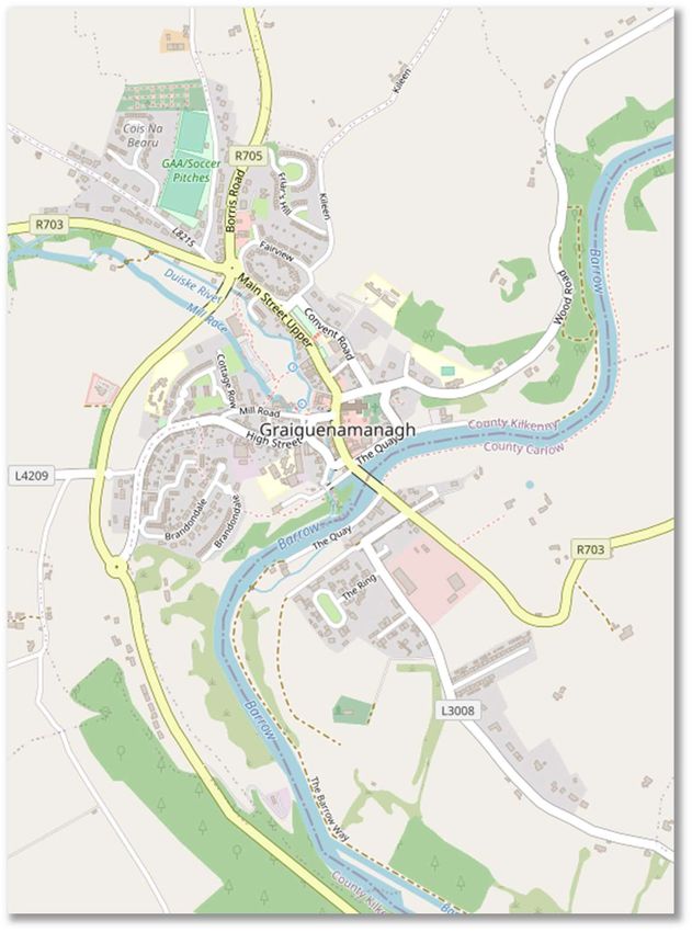
Graiguenamanagh-Tinnahinch
Carlow-Kilkenny Co Co                                                                          Roadplan
                                           Mobility Management Study

  1         Introduction
      1.1    CONTEXT
        Graiguenamanagh-Tinnahinch is a busy joint
        settlement with a population of approximately
        1,475      persons      living    within    the
        Graiguenamanagh-Tinnahinch district as shown
        on Figure 1.1 (source cso.ie: Census 2016).

        The joint settlement is located approximately 23
        km southeast of Kilkenny City and about 34 km
        northeast of Waterford, as shown in Figure 1.2
        below. Thomastown lies approximately 13
        kilometres      west    of    Graiguenamanagh-
        Tinnahinch.
                                                              Figure 1.1 - Graiguenamanagh-Tinnahinch
                                                                              Settlement

        Graiguenamanagh-Tinnahinch has historically been the convergence point of the regional road
        network comprising the following roads. The R703 connecting Thomastown with Ballymurphy and
        the R702 and the R705 connecting Leighlinbridge with The Rower via Bagnelstown and Borris.
        Although bypassed some years ago with the construction of the R705 Graiguenamanagh Relief
        Road, Graiguenamanagh is well-served by a strong network of radial roads extending from the
        joint settlement’s centre (i.e. Graiguenamanagh) in comparison to Tinnahinch.

                                                Castlecomer

                                               Kilkenny

                                      Callan
                                                                          Graiguenamanagh/
                                                                          Tinnahinch
                                                          Thomastown

                                                   M9

                                                           Waterford

                                 Figure 1.2 - Location within County Kilkenny

20142-01-001 Draft 2                             August 2021                                            4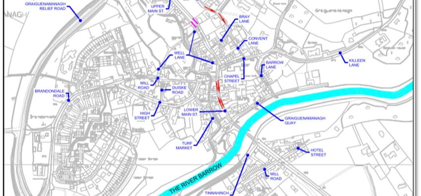
Graiguenamanagh-Tinnahinch
Carlow-Kilkenny Co Co Roadplan
Mobility Management Study
1.2 OBJECTIVES
Roadplan Consulting was appointed by Kilkenny County Council to compile a project/initiative
lead mobility management study for Graiguenamanagh-Tinnahinch and its environs considering
the following aims which are key and strategic objectives of the Graiguenamanagh-Tinnahinch
Local Area Plan:
“To improve the quality of the existing transport network in particular pedestrian connections in
the settlement to increase permeability and connectivity in order to provide universal access to
key land uses such as community facilities, including schools and sports clubs, and new and
existing development lands.”
“To support improvements to the road and street network in Graiguenamanagh and Tinnahinch in
order to provide connectivity and permeability throughout the settlement and to enable access for
all to and from new communities and to reduce through traffic in the town centre.”
“To manage the provision of parking both car and bicycle to provide for the needs of residents,
business and visitors to Graiguenamanagh and Tinnahinch.”
This Study therefore comprises of a review of the transportation network in and around the joint
settlement and an assessment of the associated travel demands, with the objective of suggesting
potential transport management improvements needed to cope with the expansion of the town.
The Study suggests actions that could be taken to secure the optimal and sustainable movement
of people, goods and vehicles and provides a set of mobility management objectives in respect
of the below hierarchy:
Exploring the feasibility of supporting improvements for pedestrians, cyclists and
vehicles mobility;
Exploring the feasibility of providing additional footway and cycleway links;
Exploring the feasibility of supporting improvements for increased safety and accessibility
of all modes of transport particularly public transport;
Exploring the feasibility of reducing traffic congestion through traffic management and
junction improvements;
Exploring the feasibility of supporting improvements to car parking facilities.
The suggestions provided in this Study are intended to inform responses to transport needs in
Graiguenamanagh-Tinnahinch. These suggestions do not define rules that must be compiled with
when administrative consent of projects is being granted. They are non-binding and advisory and
do not comprise public policy.
1.3 STUDY AREA
The study area of the Graiguenamanagh-Tinnahinch Mobility Management Study is exactly that
of the development boundary Graiguenamanagh-Tinnahinch Local Area Plan (LAP) as outlined
in Figure 1.3 below.
20142-01-001 Draft 2 August 2021 5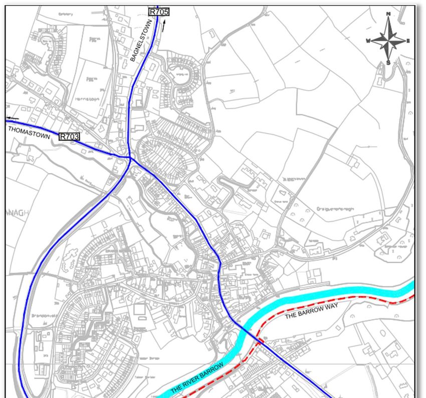
Graiguenamanagh-Tinnahinch
Carlow-Kilkenny Co Co                                                                                Roadplan
                                             Mobility Management Study

                                                             STUDY AREA
                                                             BOUNDARY

                                             Figure 1.3 - Study Area

     1.4    TEMPORAL RELEVANCE OF THE STUDY
       The Study reflects current conditions in Graiguenamanagh-Tinnahinch, in terms of land use and
       demand for travel, and it also reflects the conditions predicted to exist over the coming five years
       period. However, those conditions are very much influenced by external factors such as the state
       of the national economy, public health travel restrictions, the cost of travel etc., and is therefore a
       high level of uncertainty attaching to long-term predictions.
       For example, connected autonomous electric vehicles are predicted to cause significant changes
       in how personal travel is undertaken in the coming decades and the infrastructure needed to
       support such future travel may be quite different to that required today. For those reasons, it is
       considered that the study will be most relevant over the following five years. It is intended that the
       findings of this study will be taken into account in the implementation of the Graiguenamanagh-
       Tinnahinch Local Area Plan. Any variation of or review to the Graiguenamanagh-Tinnahinch Local
       Area Plan will have to be subject to its own screening for environmental assessment processes
       as relevant.
       Many of the suggested measures stated to be long-term are unlikely to be completed during the
       currency of the Study; however, the land required for their implementation could be retained free
       from development that could compromise future implementation of the measure, and the
       continuing relevance of the proposed measure should be re-assessed during the preparation of
       the next mobility management study for Graiguenamanagh-Tinnahinch and any review of the
       Local Area Plan for the joint settlement.

20142-01-001 Draft 2                               August 2021                                                   6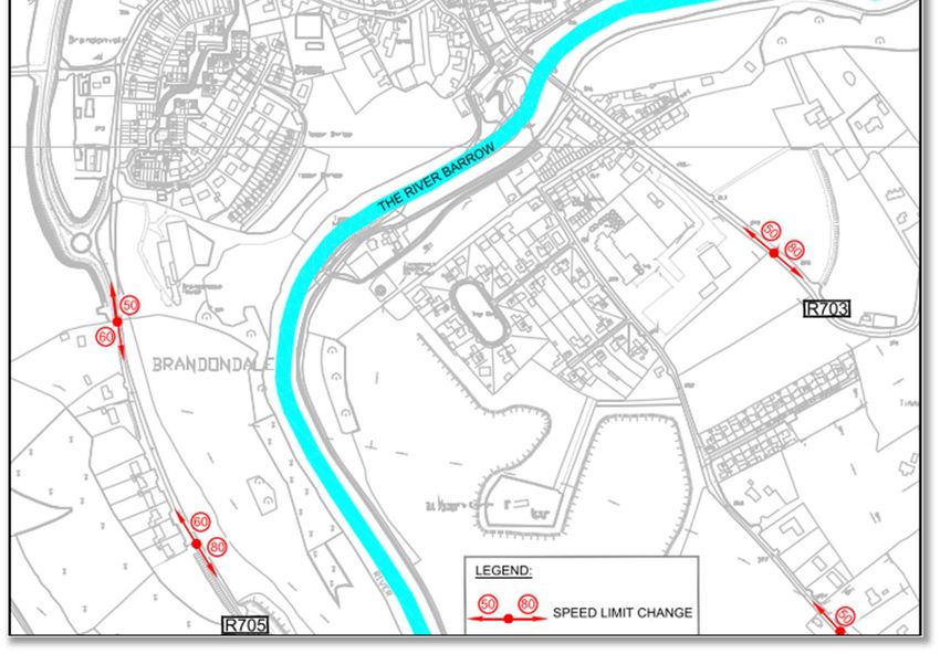
Graiguenamanagh-Tinnahinch
Carlow-Kilkenny Co Co Roadplan
Mobility Management Study
1.5 STUDY METHODOLOGY
The key steps in building an evidence-based approach to development of this Study were as
follows:
Data gathering:
Consultation with key stakeholders (i.e. schools etc);
Identification of existing transport conditions;
Framing of the policy context for the study;
Identification of suggestions:
Outlining a set of measures and predicted outcomes.
Stakeholder engagement was a vital component of the compilation of this Study. Those who live,
work and do business in the area have a keen understanding of current traffic and transportation
issues, and it was necessary for that knowledge to be reflected in the Study. In addition, the
suggestions identified by the Study would, if progressed, have the potential to impact upon the
urban environment and on the daily lives of the local population and it is therefore important that
the public is made aware of the reasons for the Study’s suggestions.
The staging and sequencing of the implementation methodology of the Study is outlined in Fig 1.4.
Stage 1: Data Collection & Analysis
Stage 2: First Draft of Study
Stage 3: Public Consultation
Stage 4: Second Draft of Study
Stage 5: Finalised Study
Figure 1.4 – Methodology
A functioning transport system consists of:
Transport modes (i.e. foot, cycle, bus, rail, road etc.);
Infrastructure provided for each mode (i.e.footway, cycleways, bus-stops, streets etc.);
Regulations (i.e. signs, road markings, traffic signals etc);
Users (i.e. pedestrians, cyclists, passenger, drivers etc.).
In that general context, and through the implementation of the methodology outlined above, the
following transportation aspects emerged as being of particular relevance to Graiguenamanagh-
Tinnahinch and have therefore been considered in this Study:
Pedestrian and cycle facilities;
Public transport;
School traffic;
Town centre traffic management;
Street and public realm enhancements;
Car parking.
1.6 STRUCTURE OF REPORT
This mobility management study is set out as follows:
Chapter 2 - Provides an overview of existing transport facilities in the settlement;
Chapter 3 - Outlines Policies and Plans applicable to study area;
Chapter 4 - Provides a summary of the data collected as part of this Study;
Chapter 5 - Provides a summary of the issues highlighted by public consultation;
Chapter 6 - Describes the suggested transport management improvements.
20142-01-001 Draft 2 August 2021 7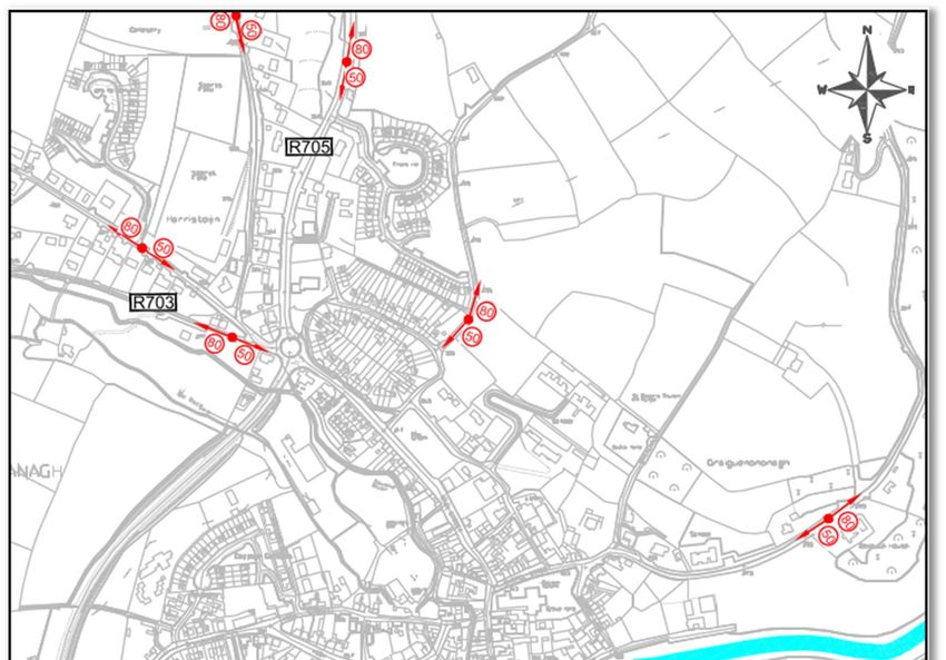
Graiguenamanagh-Tinnahinch
Carlow-Kilkenny Co Co                                                                             Roadplan
                                             Mobility Management Study

  2    Transportation Characteristics of the Study Area
      2.1   ROADS INFRASTRUCTURE
        Graiguenamanagh-Tinnahinch is linked to other neighbouring towns and villages by the
        intersection of two strategic regional roads the R703 & R705. These road corridors are key assets
        for the joint settlement of Graiguenamanagh-Tinnahinch and the greater county.
        The R705 regional road is located immediately west of the town and forms the Graiguenamanagh
        Relief Road which was completed in February 2008. As a result, significant volumes of through-
        traffic on the Leighlinbridge-New Ross route, particularly heavy goods vehicles, have been
        removed from Graiguenamanagh and Tinnahinch.
        The location of the joint settlement and its connecting road network is shown in Figure 2.1.
        The topography of Graiguenamanagh-Tinnahinch is varied. Ranging from being relatively flat in
        and along the River Barrow floodplain in which the settlement centre (i.e. Graiguenamagh-
        Tinnahinch Quays) is located. To being inclined and gradually rising in both a northerly and
        southerly direction away from the respective quays. The settlement is bisected by the River
        Barrow, with most of the settlement located north of the river (i.e. in Graiguenamanagh).

                           Figure 2.1 – Graiguenamanagh-Tinnahinch Road Network

20142-01-001 Draft 2                              August 2021                                               8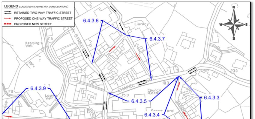
Graiguenamanagh-Tinnahinch
Carlow-Kilkenny Co Co Roadplan
Mobility Management Study
The two regional roads and a national/regional walking trail that insect in Graiguenamanagh-
Tinnahinch are as follows:
R703 – runs from Thomastown (West), Co. Kilkenny to Ballymurphy and the R702
(East), Co. Carlow;
R705 – runs from Leighlinbridge (North), Co. Carlow to The Stripe and the R705
(South), Co. Kilkenny;
The Barrow Way – the national/regional walking trail runs from Roberstown, Co. Kildare
to St. Mullins, Co. Carlow.
2.2 TOWN CENTRE
Figure 2.2 shows the detail of the principal traffic infrastructure in Graiguenamanagh-Tinnahinch
joint settlement.
Signalised shuttle traffic management system of Lower Main Street with approx.
perpendicular and parallel side streets consisting of:
- R703 Upper & Lower Main Street (Northeast & Southwest)
- R705 Borris Road (North) & R705 Graiguenamanagh Relief Road (West)
- Secondary perpendicular streets: The Quay (North), Main Street (North), High
Street (North), Mill Road (North), Bray Lane (North), Fairview (North), The Quay
(South) & Mill Road (South)
- Secondary parallel streets: Barrow Lane (East), Convent Lane (East), Fairview
(East), Turf Market (West) & Mill Road (West)
Current one-way only streets within the joint settlement are as follows:
- Fairview (Abbey/Community Hall Section)
There are no priority-yield streets within Graiguenamanagh-Tinnahinch.
Pedestrian crossings at various locations around the town and the majority are
uncontrolled crossings.
20142-01-001 Draft 2 August 2021 9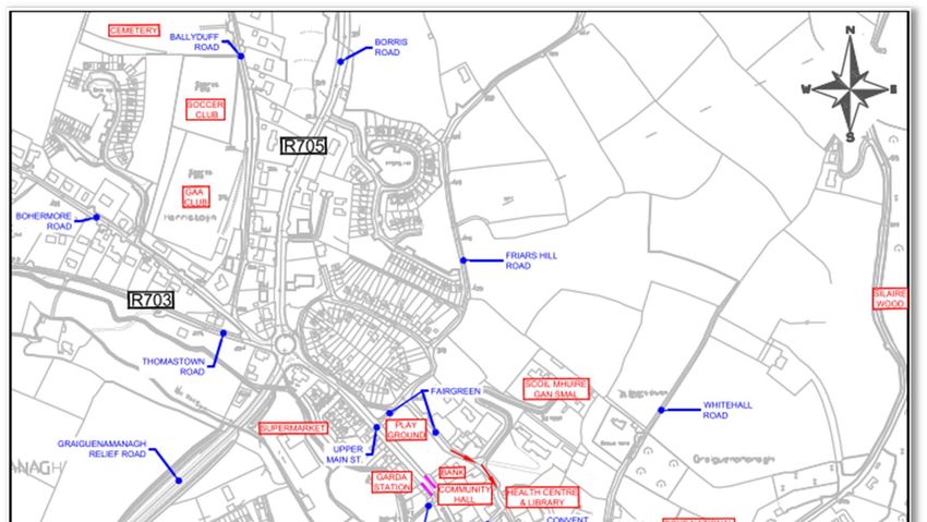
Graiguenamanagh-Tinnahinch
Carlow-Kilkenny Co Co                                                      Roadplan
                                    Mobility Management Study

                        Figure 2.2 - Existing Town Centre Street Network

20142-01-001 Draft 2                     August 2021                             10
Graiguenamanagh-Tinnahinch
Carlow-Kilkenny Co Co Roadplan
Mobility Management Study
The majority of the existing junctions within the joint settlement are priority-controlled junctions.
However, to the north and southwest of Graiguenamanagh town centre there are two roundabout
junctions at the extremities of R705 Graiguenamanagh Relief Road:
- R705/R703 Upper Main Street, Harristown Roundabout and
- R705/Brandondale Road, Brandondale Roundabout
The speed limit within the built-up area of the joint settlement is generally 50km/h with 60km/h
and 80km/h zones on the approaches. Figure 2.3 shows the locations of the existing speed limit
boundaries.
Figure 2.3 - Existing Speed Limits
20142-01-001 Draft 2 August 2021 11Graiguenamanagh-Tinnahinch
Carlow-Kilkenny Co Co Roadplan
Mobility Management Study
2.3 PEDESTRIAN FACILITIES
Throughout the settlement, the majority of streets are flanked by footways on both sides.
However, these are very narrow, in a poor state of repair and connected via inconsistent
pedestrian crossings some of which are listed below. The exception being Graiguenamanagh
Lower Main Street where the entire streetscape from its junction with Chapel Street/Upper Main
Street to The Quay was upgraded as part of town renewal scheme a few years ago.
On the regional and local road approaches to the town centre the existing footways are
discontinuous, narrow and lack accessible pedestrian crossing facilities.
Controlled pedestrian crossings are present at the following locations:
Upper Main Street, adjacent to Bank of Ireland (1 no. Zebra Crossing);
High Street, adjacent to Duiske College (1 no. Zebra Crossing);
Aldi Access (1 no. Zebra Crossing);
There is a high dependency on simple uncontrolled courtesy pedestrian crossings throughout
Graiguenamanagh and Tinnahinch where pedestrians do not have priority to cross.
2.4 CYCLIST FACILITIES
There are no existing dedicated cycle lanes in Graiguenamanagh-Tinnahinch and there is a
general absence of bicycle parking throughout the settlement. Some bicycle parking has been
provided as part of recent developments such as Aldi.
2.5 PARKING FACILITIES
2.5.1 Off-street Car Parks
The majority off-street parking is located in close proximity to the centre, the main retail and
commercial area of Graiguenamanagh-Tinnahinch.
In total there are approximately 231 parking spaces in the main off-street carparks. Details of
these existing carparks are contained in Table 2.1.
Accessible
Car Park Charge Spaces Additional Information
(Disabled)
1 Aldi, Off Upper Main Street Free 85 5 Private, Good Markings
2 Fair Green Free 50 3 Public, Worn Markings
3 Supervalu, Off The Quay Free 22 1 Private, Access Barrier
4 Turf Market Free 15 1 Public, New Markings
5 Market Square, Lwr Main St. Free 8 - Public, Worn Markings
6 The Quay Graiguenamagh Free 38 2 Public, New Layout
7 The Quay Tinnahinch Free 13 - Private, Worn Markings
TOTAL 231 12 -
Table 2.1 - Existing Off-street Carparks
Parking in Graiguenamanagh-Tinnahinch is free and parking time limits do not apply to any of the
on-street and off-street parking.
It is noted that informal on-street parking occurs along both/either sides of Chapel Street, Barrow
Lane, Bray Lane, Convent Lane, Graiguenamanagh Quay and Mill Road despite the narrowness
or residual width of those streets.
Consequently, there does not appear to be acute demand for on-street parking in the centre of
the joint settlement for the majority of the year. However, the key exception to that observation is
the fact that during the summer months the demand for all motorised vehicle parking becomes
critical due to the high annual influx of tourists and leisure activity patrons to Graiguenamanagh-
Tinnahinch and its environs.
This seasonal parking situation presents major road safety issues for all road users, businesses
and residents within Graiguenamanagh-Tinnahinch (e.g. obstructed/restricted emergency vehicle
access along Graiguenamanagh Quay). Therefore, this seasonal parking deficit needs to be
addressed temporarily in the short to medium term followed by a more permanent solution in the
longer term to mitigated against the road safety hazards its causes for the joint settlement.
20142-01-001 Draft 2 August 2021 12Graiguenamanagh-Tinnahinch
Carlow-Kilkenny Co Co Roadplan
Mobility Management Study
2.6 PUBLIC TRANSPORT PROVISIONS
The joint settlement of Graiguenamanagh-Tinnahinch is served by bus public transport only. The
number of services by type and route are listed in Table 2.3.
A dual informal bus stop for the respective bus services is located within Graiguenamanagh itself.
The both the northbound and southbound are respectively situated adjacent to the Garda Station
and Bank of Ireland on Upper Main Street. The Location of the subject informal dual bus stop is
shown in Figure 2.2.
Bus Route Service
Kilbride Coaches operates a return local bus service Monday to Saturday twice
881 daily from Graiguenamanagh to Kilkenny City (i.e. The Parade & MacDonagh
Junction) via Borris, Goresbridge, Gowran & Clara.
South Carlow to Carlow Town
Ring a Link operates a pre-booked door-to-door, demand-responsive Local
481 Bus Service on Mondays and Wednesdays and run once those days.
Graiguenamanagh – Ballymurphy – Borris– Goresbridge – Myshall – Kildavin
– Paulstown – Bagnelstown – Leighlinbridge – Fairgreen Carlow.
Borris to Bagenalstown
Ring a Link operates a pre-booked door-to-door, demand-responsive Local
486 Bus Service on Saturdays and run once that day. Corries –
Graiguenamanagh – Ballymurphy – Borris– Goresbridge – Paulstown –
Bagnelstown.
Graiguenamanagh-Tinnahinch to New Ross
-
School Bus Service operates Monday to Friday and run once daily.
Table 2.3 – Existing Bus Services/Routes
2.7 TAXI RANKS
There are no registered taxi services operating in Graiguenamanagh-Tinnahinch. Taxi services
in many district towns are on-call services in that they do not have a taxi rank and it is unlikely
there is a sufficient demand at any single location within the joint settlement to warrant provision
of a rank at present.
Local Authorities (in consultation with An Garda Síochána) are responsible for planning the
location of taxi ranks, deciding on their size, hours of operation and managing their use. The need
for a taxi rank or taxi parking should be kept under review in consultation with the town’s taxi
operators.
2.8 LOADING / DELIVERIES
There is one existing loading bay in Graiguenamanagh itself and this is located at the southern
end of Lower Main Street and caters for most of retail units in the vicinity of Main Street and it is
approximately 30m long.
2.9 LAND USE
Demand for transport arises because the various locations in which we live, work, shop and carry
out business and leisure activities are distant from each other. The distance and the directness
of the connections has a significant bearing on the demand for transport and on the mode of
transport used. In that context we have mapped, on Figure 2.4, the key generators of traffic within
the town.
It is noteworthy that:
There are more residential estates north and west of Graiguenamanagh. However,
there is one medium size housing estate south of the River Barrow in Tinnahinch;
Employment is distributed across the joint settlement with the majority of businesses
located in Graiguenamanagh
Tourist, leisure activity and hospitality business are generally located along both
guays/riverbanks
20142-01-001 Draft 2 August 2021 13Graiguenamanagh-Tinnahinch
Carlow-Kilkenny Co Co Roadplan
Mobility Management Study
Retail is located along Griaguenamanagh Main Street
Schools are one of the largest generators of peak-time vehicular traffic and all are
located in Graiguenamanagh
There are three schools catering for a total of 374 pupils. The locations of the schools are shown
Figure 2.4:
Boys National School, Whitehall, Graiguenamanagh – 74 pupil primary school
Scoil Mhuire Gan Smál, Convent Road, Graiguenamanagh – 154 pupil primary school.
Duiske College, High Street, Graiguenamanagh – 146 pupil secondary school.
20142-01-001 Draft 2 August 2021 14Graiguenamanagh-Tinnahinch
Carlow-Kilkenny Co Co Roadplan
Mobility Management Study
Figure 2.4 - Significant Traffic Generators
20142-01-001 Draft 2 August 2021 15Graiguenamanagh-Tinnahinch
Carlow-Kilkenny Co Co Roadplan
Mobility Management Study
3 Policies & Plans
3.1 BACKGROUND
The rationale for compiling a mobility study can be viewed in the context of national, regional and
local policies and requirements.
In undertaking this mobility management study, the following overarching policies and plans
relevant to Graiguenamanagh-Tinnahinch and its mobility management were consulted:
Project Ireland 2040
Smarter Travel – A Sustainable Transport Future 2009 – 2020
National Cycle Policy Framework 2009 – 2020,
NTA Permeability Best Practice Guide,
Design Manual for Urban Streets & Roads,
Traffic Management Guidelines,
Carlow County Development Plan 2015 – 2021,
Kilkenny County Development Plan 2014 – 2020,
Kilkenny City and Environs Development Plan 2014 – 2020,
Kilkenny Age Friendly County Strategy 2017 – 2022,
Graiguenamanagh-Tinnahinch Draft Joint Local Area Plan 2021 – 2027.
3.2 SMARTER TRAVEL – A SUSTAINABLE TRANSPORT FUTURE 2009 – 2020
In 2009 the Government published “Smarter Travel – A Sustainable Transport Future – A New
Transport Policy for Ireland 2009 – 2020” which has the five key goals, and these are as follows:
• Improve quality of life and accessibility to transport for all and, in particular, for people
with reduced mobility and those who may experience isolation due to lack of transport;
• Improve economic competitiveness through maximising the efficiency of the transport
system and alleviating congestion and infrastructural bottlenecks;
• Minimise the negative impacts of transport on the local and global environment through
reducing localised air pollutants and greenhouse gas emissions;
• Reduce overall travel demand and commuting distances travelled by the private car;
• Improve security of energy supply by reducing dependency on imported fossil fuels.
Similar to other Local Authorities, Carlow & Kilkenny County Council has fully adopted this
national policy and has stated that it will promote walking, cycling, public transport and other more
sustainable forms of transport as an alternative to the private car, together with the development
of the necessary infrastructure and promotion of the initiative contained within “Smarter Travel –
A Sustainable Transport Future – A New Transport Policy for Ireland 2009 – 2020”.
3.3 NATIONAL CYCLE POLICY FRAMEWORK 2009-2020
The backdrop to this policy is Smarter Travel - A Sustainable Transport Future. Irish transport
policy seeks to reduce private car dependence from 65% to 45% for commuting by 2020. It is
essential that Designers actively consider reducing traffic speed and volumes for all new traffic
management schemes. When determining the appropriate cycle facility required, consider the
possibility of providing for cyclists in a mixed traffic environment first. The National Cycle Policy
Framework, Department of Transport, summarises this approach.
It recommends that Designers consider the following steps in hierarchical order:
1) Traffic reduction;
2) Traffic Calming;
3) Junction treatment and traffic management;
4) Redistribution of carriageway;
5) Cycle lanes and cycle tracks;
6) Cycleway (public roads for the exclusive use of cyclists and pedestrians.
20142-01-001 Draft 2 August 2021 16Graiguenamanagh-Tinnahinch
Carlow-Kilkenny Co Co Roadplan
Mobility Management Study
This approach requires the cycle designer to fundamentally (re)assess the degree to which the
existing traffic is a ‘given’. While it is acknowledged that solutions at the upper tiers of the hierarchy
will not always be viable, under no circumstances should designers dismiss them out of hand at
the outset.
3.4 NTA PERMEABILITY BEST PRACTICE GUIDE
This policy guidance on how best to facilitate demand for walking and cycling in existing built-up
areas. This relates to the retention and creation of linkages within the urban environment for
people to walk and cycle from their homes to shops, schools, local services, places of work and
public transport stops and stations. In the latter case, by providing connections to existing public
transport services, access to these services will be improved and increased levels of use may be
expected. This in turn supports enhancement of these public transport services through increased
frequency and improved stop facilities and can also make a key difference in decisions about
service retentions.
People need to access services and workplaces on a daily basis. An approach to urban
development which creates choice in this regard is therefore required. This guidance note seeks
to provide a basis for the delivery of this choice in existing built-up areas by promoting permeability
for pedestrians and cyclists, thereby addressing the legacy of severance built-in to recent
expansions of Irish towns and cities.
3.5 CARLOW COUNTY DEVELOPMENT PLAN (CDP) 2015 – 2021
The current adopted development plan is the Carlow County Development Plan (CDP) 2015 –
2021. In summary, the plan provides the following:
A sustainable spatial development strategy to guide the location of development
Clear guidance on the future use of land and the pattern of development over the next
six years
A framework for the future investment in physical and social infrastructure;
A framework for developing the county’s economy
Management and control by indicating standards to be achieved in new developments
Ways to conserve and enhance the urban and rural environment and to protect the
diversity of the natural and cultural landscape
Guidance for public and private investors in relation to land use and development
A framework for developing tourism in the County Carlow
Relevant key policies within the plan are as follows:
Walking & Cycling Policy
Trans – Policy 8
Promote walking and cycling, subject to appropriate environmental assessments, including
Habitats Directive Assessment, as an alternative mode of transport for travelling to work and for
recreational purposes, to require the provision of cycle ways and walkways and associated
facilities as part of new development and to support safer walking and cycling routes to schools
under the Green Schools Initiative where feasible.
Consider the development of off-road routes, such as disused railway lines and bridle paths, for
both walking and cycling to improve access to rural tourist attractions and support the
development of the ‘Barrow Corridor’ in County Carlow in connection with adjoining Local
Authorities.
Introduce minimum cycle-parking standards for retail, commercial, residential and community
development and public transport stops and stations.
Implement the relevant policies of the Department of Transport’s National Cycle Policy
Framework and support the provision of a national cycle network.
20142-01-001 Draft 2 August 2021 17Graiguenamanagh-Tinnahinch
Carlow-Kilkenny Co Co Roadplan
Mobility Management Study
Provide appropriate facilities for pedestrians and for people with special mobility needs in line with
the aims of the European Charter of Pedestrian Rights.
Implement the relevant provisions of the Department of Transport’s Walking Policy Plan and make
provision for the safe and efficient movement of cyclists and pedestrians in and around built-up
areas Prohibit the intrusion of development along public walking routes and public rights of way,
particularly those in scenic areas and along inland waterways.
Protect the integrity of walking routes and potential routes and take the impact of proposed
development into account when considering planning applications.
Encourage walking to become the principal method for shorter journeys through arranging land
uses and by utilising good urban design.
Provide a comprehensive network of safe, well-lit and convenient footpaths (both road-side and
segregated) within new residential areas with links to schools, local neighbourhood centres, public
transport stops and workplaces which will encourage people to walk.
Support pedestrianisation in town and village centres where appropriate.
Establish new Walkways and cycle routes on a legal and permanent basis and ensure that
Walking/Cycle Routes are signposted/waymarked, where possible and appropriate.
Provide, improve and extend cycle and pedestrian routes on existing roads, proposed roads,
roads being upgraded and green corridors (including river corridors), where feasible and practical,
subject to compliance with Habitats Directive, to create a more convenient, pleasant and user-
friendly environment. The needs of walkers and cyclists will be given full consideration in
proposals to upgrade any road network.
Implement standards of Design Manual for Urban Roads and Streets for urban street
developments.
Ensure that all surfaces used by cyclists are maintained to a high standard and ensure the
provision of new cycle paths as part of development proposals by developers in urban or
suburban areas or as part of road development schemes in urban areas by the County. Where
possible these cycle lanes should be segregated from vehicular transport corridors and ensure
the upgrading of national roads will not impact negatively on the safety and perceived safety of
cyclists.
Promote the expansion of cycle facilities and liaise with Failte Ireland, the Sports Council, the
National Transportation Authority and other bodies in the development of cycle touring routes
throughout the county and adjoining counties, in particular in areas of high amenity.
Provide parking areas for bicycles in urban areas throughout County Carlow.
Public Transport Policy
Trans – Policy 9
Support the provision of public transport services by reserving land in suitable locations for public
transport infrastructure and ancillary facilities, such as park-and-ride.
Support local, community transport services in consultation with the local communities.
Continue to work with the service providers to reduce the need for car trips by improving the
availability, reliability and quality of public transport.
Work with the relevant organisations to develop and maintain bus stops, waiting areas, and up to
date travel information for the local population and tourists alike. The availability of such services
should be promoted
Bus Policy
Trans – Policy 11
Encourage the provision of shared bus stop facilities in appropriate locations in urban centres
such as Train Stations to facilitate public and private operators, as designated in the County
Settlement hierarchy.
20142-01-001 Draft 2 August 2021 18Graiguenamanagh-Tinnahinch
Carlow-Kilkenny Co Co Roadplan
Mobility Management Study
Work with Rural Transport Providers to research and promote sustainable options for rural
transport given the increased running costs with the rising cost of fuel.
Work with transport providers to develop an urban public bus service for the Greater Carlow and
Graiguecullen Urban Area
General Road Policy
Trans – Policy 5
Encourage and facilitate investment in the road network at National, Regional and Local level and
prioritise delivery to maximise the economic benefit to the County and ensure that any plan or
project associated with transportation (roads, rail or other forms) which has the potential to
significantly affect a Natura 2000 site is appropriately assessed in accordance with Article 6 of
the Habitats Directive in order to avoid adverse impacts on the integrity of the site.
Promote road and traffic safety measures in conjunction with relevant Government Departments
and other agencies through the provision of appropriate signage, minimising or removing existing
traffic hazards and preventing the creation of additional or new traffic hazards.
Provide, extend and maintain street lighting on the public road/footpath network throughout the
county in accordance with best international practice.
Facilitate the development of on-line or off-line ‘Motorway Services Areas’ within the County in
line with the NRA Policy on Motorway Services Areas (NRA Service Area Policy - August 2014)
and subject to appropriate assessment and assessment of all environmental issues.’
Regulate, control and improve signage throughout the County, in conjunction with the National
Roads Authority and other relevant agencies.
Ensure that flood risk management measures are incorporated into the provision of transport and
emergency planning infrastructure.
Require developers to provide a detailed Traffic Impact Assessment, as carried out by competent
professionals in this field, where new developments will have a significant effect on travel demand
and the capacity of surrounding transport links. Where a Traffic Impact Assessment identifies
necessary on and off-site improvements for the development to be able to proceed, the developer
will fund the improvements to the satisfaction of the Council.
Bring national roads up to appropriate standards, as resources become available, and continue
improvement works on non-national roads, so as to develop a safe and comprehensive road
system for the county.
When designing or inputting into road schemes, the importance of hedgerows and roadside
boundaries for wildlife and biodiversity shall be recognised. Retention of such features should be
incorporated into design and where this is not possible, replacement planting with native species
of indigenous provenance will be provided.
Seek to ensure access to the highest possible category of the road network hierarchy when
considering applications for quarries.
Improve deficiencies in pavement surface, riding quality and general alignment to protect the
heavy investment in existing facilities.
Ensure that necessary new entrances are located in such a manner as to provide effective
visibility for both users of the entrance and users of the public roads so that opportunities for
conflicting traffic movements are avoided, in the interests of public safety.
Support the upgrade of the N80 Enniscorthy – Carlow Road and improvements to linkages from
the South East Region and Midlands, in line with Regional Planning Guidelines for the South East
Region 2010 – 2022, Strategic Objective PPO 5.12
3.6 KILKENNY COUNTY DEVELOPMENT PLAN (CDP) 2014 – 2020
The current adopted development plan is the Kilkenny County Development Plan (CDP) 2014 –
2020, the review of the plan commenced in April 2018. The following six key issues to be
addressed by the CDP are:
20142-01-001 Draft 2 August 2021 19Graiguenamanagh-Tinnahinch
Carlow-Kilkenny Co Co Roadplan
Mobility Management Study
Economic recovery.
Settlement hierarchy within the county & compliance with regional planning guidelines.
Renewable energy strategy.
Continued protection of the natural and built heritage.
Planning frameworks for smaller towns and villages.
Identification of key infrastructure for the county to bolster its development.
In particular the CDP sets out measures that encourage redistribution and re-allocation of public
road space from the private car to other forms of transport in a manner that supports, sustains
and enhances the economic vitality of town centres whilst providing for a targeted modal shift,
achieve reductions in carbon emissions, enhance permeability in and around the town centres,
reduce traffic congestion and promote universal access arrangements to and from the town
centres for the mobility/visually impaired, cyclists, pedestrians and public transport operators.
The strategic aim with the CDP for transportation is to coordinate transport and land use planning,
reducing the demand for travel and the reliance on the private car in favour of public transport,
cycling and walking.
Walking and Cycling Objectives
7C - To develop a walking and cycling strategy within the life of this plan.
11B - The Council will implement the provisions of the National Cycle Policy Framework where
possible.
Bus Objectives
11C - To facilitate the provision of bus shelters as appropriate.
11D - To facilitate parking provision for tourist buses in towns and villages and at tourist
attractions.
Road Objectives
11G - To support the implementation of TII projects.
11N - To improve substandard sections of regional roads throughout the County, in particular
those most heavily trafficked, and those providing access to existing or proposed industrial,
residential or commercial developments.
3.7 KILKENNY CITY AND ENVIRONS DEVELOPMENT PLAN 2014 – 2020
Kilkenny City and Environs Development Plan 2014 – 2020 reiterates the planning objectives
previously stated in the County Development Plan in relation to Graiguenamanagh-Tinnahinch
and its hinterland.
3.8 KILKENNY AGE FRIENDLY COUNTY STRATEGY 2017 – 2022
The Kilkenny Age Friendly County Strategy 2017-2022 presents an excellent opportunity to
enhance the quality of life for older people in County Kilkenny including joint settlements like
Graiguenamanagh-Tinnahinch. This process has provided an opportunity to explore what the
issues existing for older people in the county and how they can be tackled together. Kilkenny
County Council have engaged with the various agencies and organisations which form the
Kilkenny Age Friendly Alliance which is the driving force for implementing the Kilkenny Age
Friendly County Strategy 2017-2022.
3.9 GRAIGUENAMANAGH-TINNAHINCH DRAFT JOINT LOCAL AREA PLAN 2021 – 2027
The Graiguenamanagh-Tinnahinch Local Area Plan (LAP) 2021-2027 has been prepared in
accordance with the requirements and provisions of the planning and development act, 2000 (as
amended). It sets out an overall strategy for the proper planning and sustainable development of
Graiguenamanagh-Tinnahinch in the context of the Carlow & Kilkenny County development
plans, the regional planning guidelines (RPGs) for the southeast region 2010 – 2022 (as
20142-01-001 Draft 2 August 2021 20Graiguenamanagh-Tinnahinch
Carlow-Kilkenny Co Co Roadplan
Mobility Management Study
amended) together with EU requirements regarding strategic environment assessment (SEA)
And Appropriate Assessment (AA). The 2021-2027 LAP has now been adopted and therefore
replaces the 2009 LAP (as amended/extended). The key objectives of the 2021-2027 LAP are:
“To improve the quality of the existing transport network in particular pedestrian
connections in the settlement to increase permeability and connectivity in order to
provide universal access to key land uses such as community facilities, including
schools and sports clubs, and new and existing development lands.”
“To support improvements to the road and street network in Graiguenamanagh and
Tinnahinch in order to provide connectivity and permeability throughout the settlement
and to enable access for all to and from new communities and to reduce through traffic
in the town centre.”
“To manage the provision of parking both car and bicycle to provide for the needs of
residents, business and visitors to Graiguenamanagh and Tinnahinch.”
The Graiguenamanagh-Tinnahinch Town Local Area Plan is a six-year plan for the joint
settlement that sets out Carlow and Kilkenny County Council's strategy for the proper planning
and sustainable development of the Graiguenamanagh-Tinnahinch and its hinterlands. The
Graiguenamanagh-Tinnahinch LAP has many objectives of direct relevance to this Mobility
Management Study, the most relevant of these are listed below;
Core Strategic Objectives
CSO1.1: To support and facilitate development on zoned lands at appropriate locations and
deliver at least 30% of all new homes within the existing built-up footprints in Graiguenamanagh
and Tinnahinch to satisfy the housing needs of the settlement over the period of the Plan.
CSO1.2: To provide for serviced sites with appropriate infrastructure in accordance with Objective
18(b) of the National Planning Framework (ca.3.52ha of land has been identified in the settlement
to facilitate such a proposal).
CSO1.3: To implement the zoning objectives set out in Appendix A of this Draft Joint LAP
CSO1.4: To manage the provision of one-off housing on lands zoned as ’Agriculture’. Limited
one-off housing will be permitted in accordance with the policy set out under Section 6.4 of
Kilkenny County Development Plan 2014-2020 and Section 2.7 of Carlow County Development
Plan 2015-2021 or as maybe amended in any subsequent reviews.
CSO1.5: It is an objective of this plan to review the housing allocation / requirement as provided
in this Joint LAP to the settlement of Graiguenamanagh-Tinnahinch following the adoption of the
Housing Demand Need Assessment and Core Strategies of the Kilkenny County Development
Plan 2021-2027 and Carlow County Development Plan 2022-2026. Where deemed necessary an
amendment to the Joint LAP will be commenced within one year following the adoption of the
Carlow County Development Plan 2022-2028 and Kilkenny County Development Plan 2021-
2027.
Town Centre Objectives
TCO1.1: To support the delivery of projects for town centre regeneration which comply with the
provisions of the relevant CDP and this Joint LAP submitted as funding applications to the Rural
Regeneration and Development Fund.
TCO1.3: To improve the accessibility of the town centre with particular emphasis on creating an
environment that is accessible to pedestrians and cyclists through improved parking and
pedestrian facilities.
TCO1.4: To facilitate enhancement and improvement of the physical fabric and environment of
the town centre through public realm initiatives including footpath and public lighting
improvements to assist in making the town centre a more pedestrian friendly place.
TCO1.5: To investigate traffic managements options for strengthening the pedestrian links across
the River Barrow to better integrate the town centres of Graiguenamanagh and Tinnahinch and
maximise access to local shops, schools and other amenities.
20142-01-001 Draft 2 August 2021 21Graiguenamanagh-Tinnahinch
Carlow-Kilkenny Co Co Roadplan
Mobility Management Study
Arts, Culture & the Creative Economy
ACCE1.3: To support the development of linkages between historical sites within and around
Graiguenamanagh-Tinnahinch and the amenity sites in its hinterland.
Tourism Objectives
TO2.4: To facilitate tourism activities such as waterways activities, eco-tourism, niche retailing,
food markets, local and other craft type activities so as to diversify the tourism product in
Graiguenamanagh-Tinnahinch, subject to relevant environmental assessments.
TO2.5: To support the development of linkages between historical sites within and around
Graiguenamanagh-Tinnahinch including pedestrian access to St. Michael’s Well in Tinnahinch.
Community & Housing Objectives
COM1.1: To support and facilitate improvements to existing educational, childcare and
community facilities within the Graiguenamanagh-Tinnahinch LAP area.
Green Infrastructure Objectives
GIO1.1: To carry out, as resources allow, Habitat and Green Infrastructure Mapping for
Graiguenamanagh-Tinnahinch in order to reduce and avoid fragmentation or deterioration of the
Green Infrastructure network and strengthen ecological links within Graiguenamanagh-
Tinnahinch and to the wider regional network.
GIO1.2: To preserve, protect and augment trees, groups of trees, woodlands and hedgerows
within the settlement by increasing, where appropriate, tree canopy coverage using locally native
species by incorporating them within design proposals and supporting their integration into the
existing Green Infrastructure network.
Open Spaces Objectives
OSO2.1: To support and facilitate the provision of open spaces with ecological and recreational
corridors to aid the movement of biodiversity and people, subject to appropriate environmental
assessment.
OSO2.2: To promote a network of paths and cycle tracks to enhance the use of the strategic open
spaces in the town, while ensuring that the design and operation of the routes responds to the
ecological protection needs of each site.
OSO2.3: New residential development is required to be consistent with standards set out in the
Kilkenny and Carlow County Development Plans where playable space is to be provided as an
integral part of each new development. This playable space can form part of the overall open
space provision of a development but must be dedicated to play and must be accessible in
accordance with the standards in the relevant County Development Plan.
Movement & Transport Policy Objectives
MTO1.1: To require all new developments to comply with the recommendations of the Design
Manual for Urban Roads and Streets (DMURS) and National Cycle Manual, or any subsequent
relevant publication.
MTO1.2: To undertake a Mobility Management Plan for Graiguenamanagh/Tinnahinch which will
include investigation of the appropriate interventions for the provision of upgrades to footpaths
and public lighting throughout the town. Particular consideration shall be given to the following
locations:
Approaches on both sides to and across the George Semple Bridge.
The Quay Graiguenamanagh and Tinnahinch.
MTO1.3: To improve the pedestrian and cyclist environment and promote ease of movement
within the settlement to include facilities for older people. Direct, attractive, well-lit and overlooked
linkages between community, education, retail and recreational facilities will encourage the
residents and visitors to the settlement to walk rather than using unsustainable modes of
transport.
20142-01-001 Draft 2 August 2021 22Graiguenamanagh-Tinnahinch
Carlow-Kilkenny Co Co Roadplan
Mobility Management Study
MTO1.4: To provide an enhanced pedestrian and cycle network in Graiguenamanagh-Tinnahinch
including the provision of footpath improvements to ensure ease of access to public transport, the
town centre, heritage sites and other recreational / community facilities.
MTO1.5: To require the co-location of pedestrian and cycle routes on all new infrastructure
connecting key destinations within the settlement, particularly between the schools, community
centre and heritage sites such as Duiske Abbey etc.
MTO1.6: To support the provision of age friendly bus shelters at appropriate locations in
Graiguenamanagh-Tinnahinch and to facilitate and support the provision of electric car charging
stations at appropriate locations across the Draft Joint LAP area.
MTO1.7: To ensure all footpaths in the settlement provide adequate access for persons with a
disability or who have impaired mobility.
MTO1.8: To undertake a mobility management plan that will consider the feasibility of all options
for improving pedestrian and cyclist mobility between Graiguenamangh and Tinnahinch and to
implement the recommendations of the plan.
MTO1.9: Dependent upon the success of other public realm projects the Draft LAP will provide
for a high-quality shared surface area along ‘The Quay’ Graiguenamanagh and Tinnahinch to
further facilitate recreational use of the River Barrow.
MTO1.10: To investigate and implement the best practise solution for the provision low level
lighting on the George Semple bridge
20142-01-001 Draft 2 August 2021 23Graiguenamanagh-Tinnahinch
Carlow-Kilkenny Co Co Roadplan
Mobility Management Study
4 Data Review & Transport Survey
4.1 CSO DATA
Central Statistics Office (CSO) data shows that the population of Graiguenamanagh-Tinnahinch
in 2016 was 1,475 persons. Data from 2011 show that Graiguenamanagh-Tinnahinch population
was 1,543. The population of Graiguenamanagh-Tinnahinch has declined by 4.4% in the period
between the 2011 and 2016 censuses whereas the national population grew by 3.8% in the same
period. That said the population of the settlement increases several fold in summertime due to a
large influx of tourists to the Graiguenamanagh-Tinnahinch area annually.
Table 4.1 below (source: CSO) shows the national trip distances (to school or work) and gives an
indication of the percentages of trips that may be susceptible to change to more sustainable
modes of travel.
DistanceGraiguenamanagh-Tinnahinch
Carlow-Kilkenny Co Co Roadplan
Mobility Management Study
The information in the Table 4.3 below relates to Graiguenamanagh-Tinnahinch and has been
abstracted from the CSO database for small areas, theme ‘Persons aged 5 years and over by
means of travel to work, school or college, 2016’.
Graiguenamanagh-
Persons at Work, School or College Tinnahinch
Persons Percentage
On foot 182 24%
Sustainable Bicycle 0 0%
31%
Transport Bus, minibus or coach 46 6%
Train 5 1%
Motorcycle or scooter 1 1%
Car Based Motor car: Driver 307 40%
62%
Transport Motor car: Passenger 125 16%
Other (incl. Lorry or van) 45 5%
Work mainly at or from home 21 3% 3%
Not stated 33 4% 4%
Total 756 100% 100%
Table 4.3 - Population aged 5 years and over by means of travel to work, school or college
Graiguenamanagh-Tinnahinch has a good number of trips on foot – 24%, while car-based trips
are 62%. The results show that driving is used less as a form of transport in Graiguenamanagh-
Tinnahinch than in other similar towns, by both workers and students which is a good starting
point for the subject Study. CSO data for Graiguenamanagh-Tinnahinch in relation to journey time
(trip duration) is provided in Table 4.4.
Journey Time Persons
Under 15 mins 315 42%
1/4 hour - under 1/2 hour 136 18%
1/2 hour - under 3/4 hour 115 16%
3/4 hour - under 1 hour 61 8%
1 hour - under 1 1/2 hours 36 5%
1 1/2 hours and over 18 2%
Not stated 63 9%
Total 744 100%
Table 4.4 - Average journey times for Graiguenamanagh-Tinnahinch
Graiguenamanagh-Tinnahinch has a very high percentage of short-distance local trips – 42 to
60%. There is a relatively low percentage of long-distance commuting – 7%. This presents a
significant opportunity for modal shift to active and more sustainable travel, in that it is likely to be
feasible for many of those who drive short distances at present to adopt walking or cycling if
current barriers to same are removed.
4.2 SITE VISITS
A series of site visits were undertaken comprising of the following observations:
Current traffic management arrangements;
The conditions experienced by each road user type: mobility impaired individuals,
pedestrians, cyclists, cars, taxi’s, buses, heavy goods vehicles;
Travel behaviour of people and how they respond to the existing transport network;
The streetscape, to evaluate the public realm;
Land-use and its influence on traffic and transport arrangements;
Junction arrangements including traffic lane definition, traffic signal arrangements,
junction type, access arrangement for schools; and
Road safety issues.
20142-01-001 Draft 2 August 2021 25You can also read


