Hamilton-Auckland Corridor Plan & Implementation Programme
←
→
Page content transcription
If your browser does not render page correctly, please read the page content below
Hei Awarua ki te Oranga
                      Corridor for Wellbeing

Hamilton-Auckland Corridor
  Plan & Implementation
       Programme

                                   November 2020

                      Not government policy or the view of any one organisation
  This document reflects an update to the Shared Spatial Intent for the H2A Corridor 21 February 2019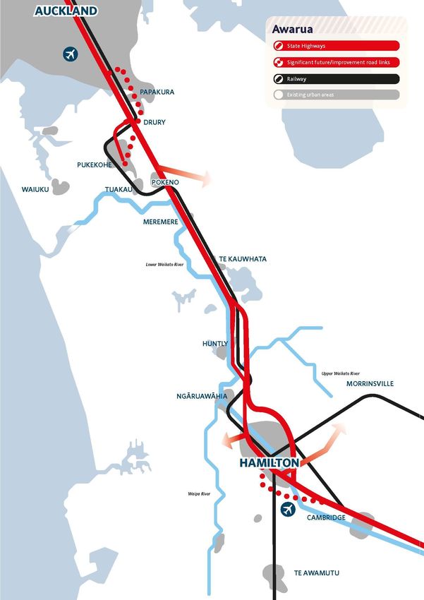
Table of Contents
Executive Summary ................................................................................................................................ 1
Background
           Context and purpose ................................................................................................................. 3
           The corridor ............................................................................................................................... 4
           Spatial planning framework & growth management objectives .............................................. 6
Spatial Intent
           Wāhi toitū & wāhi toiora .......................................................................................................... 7
           Awarua ...................................................................................................................................... 9
           Wāhi mahi & wāhi noho ......................................................................................................... 11
           Whakamana ............................................................................................................................ 13
Implementation Programme
           Overview ................................................................................................................................. 17
           Focus Area 1: waters ............................................................................................................... 18
           Focus Area 2: stronger corridor connections .......................................................................... 19
           Focus Area 3: Papakura-Pokeno area ..................................................................................... 21
           Focus Area 4: River communities area .................................................................................... 22
           Focus Area 5: Hamilton-Waikato metropolitan area .............................................................. 26
           Focus Area 6: implementation ................................................................................................ 28
Appendix 1: summary of key initiatives ............................................................................................. 29
Appendix 2: supporting documents ................................................................................................... 30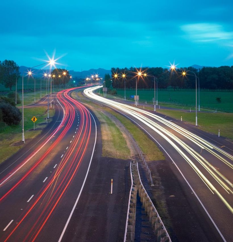
1

Executive Summary
    1. Wāhi toitū & wāhi toiora - critical areas to protect
Key finding: the corridor has enduring spatial limits to further urban growth.
The major spatial limits:
  • Flood prone areas
  • Significant ecological sites
  • Protected areas (including sites of significance to mana whenua)
  • Steep slopes, land subsidence
  • Highly productive prime soils
  • The Waikato River
Shared spatial intent: protect wāhi toitū (places with enduring presence) from development in
perpetuity, and only allow development on wāhi toiora (places sensitive to development) with
greatest care.
Key initiatives:
  1. Cross-regional blue-green open space and recreational network
  2. Environmental credit markets and biodiversity offsetting
  3. Tāngata whenua and marae aspirations

    2. Awarua - transport corridors
Key finding: the road network has become the dominant land use shaper – a more balanced
approach is needed.
The core networks:
  • Southern Motorway-Waikato Expressway
  • North Island Main Trunk Line and East Coast Main Trunk Line
  • Te Awa Cycleway
Shared spatial intent: use rapid transit awarua (corridors) to shape and guide future urban
growth towards more sustainable, resilient and affordable settlement patterns located in or near
public transport centres, and supported by well-connected arterial road and active mode
networks
Key initiatives:
  4. Rapid intercity rail service business case
  5. Start-up passenger rail service
  6. Improved public transport between southern Auckland and northern Waikato
  7. Introducing peak and more frequent off-peak bus services between towns
  8. Rapid and frequent public transport network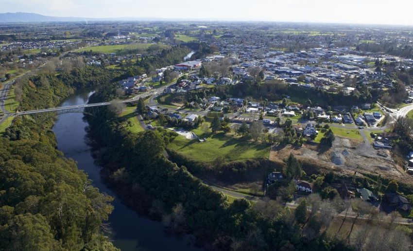
2

    3. Wāhi mahi & wāhi noho - priority development areas
Key finding: the corridor has significant but specific development potential.
Shared spatial intent: support and unlock the significant residential and employment
development potential in the southern Auckland-northern Waikato and Hamilton-Waikato
metropolitan areas, with a focus on creating well-functioning urban environments that are
integrated, strategic and responsive. Support community and mana whenua-led revitalisation
and targeted growth in the river communities that connect them.
Key initiatives and priority development areas:
  9. Hamilton-Waikato Metropolitan Spatial Plan
  10. Metropolitan economic corridor
  11. Drury (also part of Council-Crown Auckland housing and urban growth programme)
  12. Huntly
  13. Northern metro corridor – Rotokauri, Te Rapa, Horotiu, Ngāruawahia, Hopuhopu, Taupiri
  14. Central metro corridor – Frankton, Hamilton City centre, Hospital, University, Ruakura
  15. Southern metro corridor – Peacocke, Airport, Te Awamutu, Cambridge

    4. Whakamana - enabling infrastructure
Key finding: ongoing development in each section of the corridor will require significant
investment.
The major enablers:
  • Rail, motorway, arterial, active mode and public transport network and services
     improvements.
  • New comprehensive and long-term three waters management solutions.
  • Employment creation initiatives.
  • Social, housing and utility infrastructure and services improvements.
  • New partnerships.
  • Flood protection and drainage infrastructure and services
Shared spatial intent: support the realisation of full development potential of priority
development areas through utilising new and existing housing, social and network infrastructure
planning, funding and financing tools and options for local authorities, iwi, central government,
developers and land owners.
Key initiatives:
  16. Waikato sub-regional three waters study
  17. Waikato metro wastewater detailed business case project
  18. New funding, financing and delivery options
New transformative tools:
 • New growth management partnerships
 • Increased Crown involvement to support pace and scale e.g. Specified Development
      Projects through Kāinga Ora
 • Using Crown investment in social housing, health and education facilities to shape and
      guide urban development
 • Attracting investment from new sources
 • Potential new approaches to planning and three waters
3

Background: context & purpose
The government’s Urban Growth Agenda (UGA), introduced in 2018, is a shift in the approach to
urban development and infrastructure in New Zealand. The main objective of the UGA is to improve
housing affordability, underpinned by affordable urban land. This will be supported by wider
objectives to:
    • improve choices for the location and type of housing
    • improve access to employment, education and services
    • assist emission reductions and build climate resilience, and
    • enable quality built environments, while avoiding unnecessary urban sprawl.

One of the five interconnected pillars of the UGA is ‘spatial planning’ – to build a stronger
partnership with local government as a means of developing integrated spatial planning.
The UGA identified the Hamilton-Auckland (H2A) corridor as a priority area, acknowledging its role
as New Zealand’s most significant transport corridor. The corridor connects two of New Zealand’s
fastest growing cities through an area of high natural and cultural importance and value.

In June 2018 a group of Ministers, Mayors and Chairs requested joint officials to undertake an
enquiry into the H2A corridor, and to report back with:
     1. A summary of 100+ year shared spatial intent for future urban growth and development
        along this cross-boundary transport corridor, and
     2. A draft programme of possible key transformative projects.

The resulting ‘Plan’ for the H2A was completed in December 2018. The H2A Plan was presented to a
bespoke meeting of H2A leaders in February 2019 where it received (informal) endorsement. It was
made clear at the time, that this first version would need to be updated when the work programme
had progressed.

The H2A Corridor Plan outlines the agreed spatial intent for the corridor and a work programme of
six focus areas and 13 key initiatives. The purpose of the Plan is to develop an integrated spatial plan
and establish an ongoing growth management partnership for the corridor which:
     1. Accelerates identified transformational opportunities
     2. Outlines key housing, employment, social, environmental and network infrastructure
         priorities for the corridor over the next 30 years to successfully accommodate growth and
         also address levels of service, remedial or renewal needs
     3. Identifies planning, development, infrastructure, mitigation and restoration works required,
         and funding and legislative projects partners may take in the short term for implementation
         of a long term vision.

The UGA has also mandated a role for central government to partner with local government and iwi.
This has led to the creation of Urban Growth Partnerships – a process of formalising and maintaining
a long-term and enduring relationship between the Crown, local government, iwi and local
communities to deliver the UGA objectives.

Instead of establishing a new partnership for the H2A corridor, the Future Proof partnership was
expanded in 2019 to include central government, Auckland Council and Auckland iwi. The H2A
Corridor Plan is now being implemented by the Future Proof partnership.

This 2020 H2A Plan updates the 2018 Plan. The 2020 Plan reflects a targeted update of the 2018
version to ensure the document is current. This is a living document and will be regularly updated.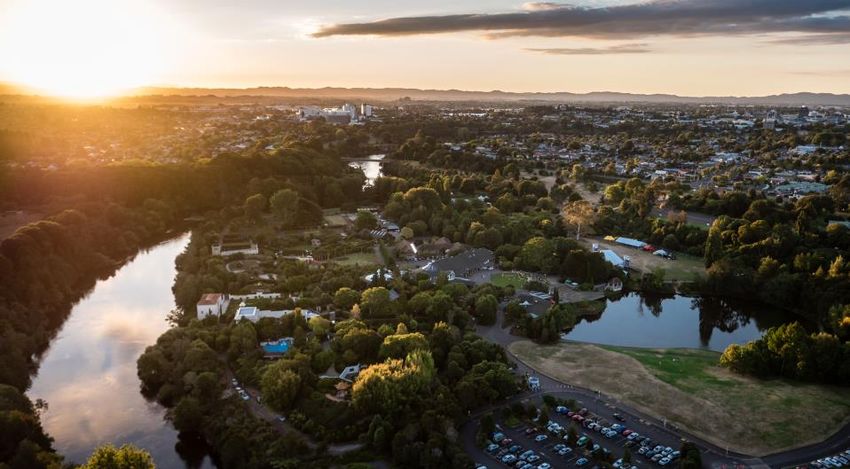
4

Background: the corridor
The corridor is a very special collection of green spaces, towns, marae and settlements that are
connected by the Waikato River and the parallel inter-city road and rail connections; no other
corridor contains such a valuable flow of water, people and goods.

It is a nationally significant corridor to protect and grow.

It’s significant and unique: In terms of size, volume and value, this is New Zealand’s most significant
water, road and rail corridor.

It’s dynamic: The corridor connects two of New Zealand’s largest and fastest growing urban areas
along a corridor with high natural and cultural importance and value. In one low-growth scenario
the population living along the corridor may increase by 100-130,000 over the next 25 years,
whereas in a high-growth scenario the increase doubles to more than 250,000.

It has significant potential: There is significant housing and employment growth potential in the
southern Auckland – northern Waikato cluster in the north, and in the greater Hamilton metro area
that stretches from Ngāruawāhia in the north to Cambridge, Te Awamutu and Hamilton airport in
the south.

… but also challenges: Existing corridor management issues - such as congestion on the Southern
motorway and water discharge quality - have wide-reaching impacts across the Upper North Island
and limit current and future potential unless addressed. There has also been a history of isolated
ribbon development along the corridor that is not well connected to community facilities or
employment.

It has the right leadership culture: Councils, government organisations and mana whenua along the
corridor have a history of being willing to collaborate on land use and infrastructure planning.

It cuts across territorial, iwi and government administrative boundaries, providing an opportunity
to create new shared insights, strategic thinking and frameworks to test current approaches build
new alliances and partnerships. The corridor traverses four territorial and two regional boundaries.
5

                                     Papakura-Pokeno area:
                                     includes southern Auckland-
                                     northern Waikato townships –
                                     Papakura, Drury, Pukekohe,
                                     Pokeno and Tuakau. These
                                     towns have strong relationships
                                     with one another through
                                     connections and services.

                                          River communites area:
                                          includes settlements along the
                                          Waikato River – Tuakau,
                                          Pokeno, Mercer, Meremere,
                                          Hampton Downs, Te
                                          Kauwhata, Ohinewai, Huntly
                                          and Taupiri. The whakapapa,
                                          tikanga, kawa of the tangata
                                          whenua, mana whenua and
                                          marae within the river
                                          communities is steeped in rich
                                          history, culture and values
                                          that have created the agile,
                                          resilient and innovative
                                          communities today.

Hamilton-Waikato
metropolitan area: includes
Taupiri, Ngaruawahia-
Hopuhopu, Horotiu, Hamilton
City, Te Awamutu, Cambridge
and the airport. A strong,
interconnected network of
urban and rural areas that
together make up a metro area
with Hamilton CBD at its core.
The metro area plays an
important role in the corridor. It
is strongly linked to Auckland,
Bay of Plenty and the wider
Waikato region and provides
significant economic functions.
6

Background: spatial planning framework
& growth management objectives
Layers               Meaning                               Growth management objectives
Critical areas to protect
 1. Wāhi toitū         The places with enduring presence   To manage growth in a manner that:
                       that should be protected from       • protects and enhances the quality of
                       development in perpetuity e.g.         the natural environments and cultural
                       rivers, places of significance to      heritage
                       mana whenua, conservation           • anticipates the transition to a low-
                       estate.                                carbon future and builds climate
2. Wāhi toiora         The places where change or             resilience
                       development should only occur       • avoids increasing the impacts and
                       with greatest care e.g. places         residual risks of natural hazards
                       subject to floods and hazards.
Transport corridors
3. Awarua           The movement corridors that bind       To strengthen corridor connections that:
                    places together e.g. railways and      • shape and guide future urban growth
                    motorways                                  towards sustainable, resilient and
                                                               affordable settlement patterns based
                                                               around public transport nodes, and
                                                           • improve access to housing,
                                                               employment, public services and
                                                               amenities through, along and within the
                                                               corridor
Future growth areas
4. Wāhi mahi        The places where we work and           To grow urban settlements and places that:
                    transact (and often live too).         • make efficient use of existing
                                                               infrastructure and resources,
                                                           • are transit-oriented and connected
                                                           • provide affordable housing choices that
5. Wāhi noho         The places where we live (and             respond to demand, including quality
                     often work too).                          intensification, and
                                                           • provide high quality live-work-play
                                                               settlements
Enablers
6. Whakamana         The elements that enable and          To support and underpin urban growth
                     support development e.g. schools,     through investments and initiatives that
                     health facilities, social housing,    are:
                     marae, potable water, wastewater       • responsive and timely, so that growth
                                                               and development does not result in a
                                                               reduction of services
                                                            • delivered at the required pace and scale
                                                               to fully realise development
                                                               opportunities
7

Spatial Intent: wāhi toitū & wāhi toiora
The corridor has enduring spatial limits to further urban growth.

A shared objective for the corridor is to manage growth in a manner that protects and enhances the
quality of the natural environments.

From a spatial perspective, wāhi toitū are the places with enduring presence that should be
protected from development in perpetuity e.g. rivers, places of significance to mana whenua and the
conservation estate.

 The H2A corridor is connected by the Waikato River, the awa which has provided physical and
 spiritual sustenance for Maaori for the past 800 years. Te Ture Whaimana o Te Awa o Waikato –
 Vision and Strategy for the Waikato River has a key role in shaping the future of the area, and that
 of the wider region. The vision for the river is a future where a healthy Waikato River sustains
 abundant life and prosperous communities.

Wāhi toiora are places where change or development should only occur with greatest care e.g.
places subject to floods and hazards.

The implications of the need to protect and nurture these places is that the central ‘river
communities’ section of the corridor has more limited urban growth potential than the northern and
southern ends.

Papakura-Pōkeno area: outstanding natural features and landscapes, sensitive marine
environments, flood prone areas, protected areas and highly productive soils are some of the
enduring environmental constraints that determine suitable areas for quality future growth and
well-functioning urban environments.

River communities area: overlapping constraints result in limited general potential for further urban
development, however there are available opportunities (and strong cultural, social and economic
imperatives) for targeted development in or around existing towns or some specific sites.

Hamilton-Waikato metropolitan area: there are fewer absolute limits on urban growth, but as in
the rest of corridor most development would require specific environmental and hazard mitigation.
AUCKLAND

                                                                       Wa-hi toitu-
                                                                          Flood prone areas

                                                                          Significant ecological areas
                    PAPAKURA
                                                                          Protected areas

                                                                          >15 Degree slope

                                                                          Elite soils

                                                                          Peat soil

                                                                          Existing urban areas
         PUKEKOHE
                        POKENO

WAIUKU

                    MEREMERE

                                                         TE KAUWHATA
                     Lower Waikato River

                                                HUNTLY

                                                                                                    MORRINSVILLE
                              NGĀRUAWĀHIA

                                                             HAMILTON

                                           Waipa River

                                                                                   CAMBRIDGE

                                                                                                           Waikato River

                                                                             TE AWAMUTU
9 Spatial Intent: awarua The road network has become the dominant land use shaper – a more balanced approach is needed. There is a lack of transport choice within the corridor. Significant investment in additional roading capacity in the Southern Motorway-Waikato Expressway has brought short term benefits such as temporarily faster travel times. However, in the absence of rapid transit along the corridor (or even basic public transport, in sections) this will further shift travel and land use patterns towards road- based travel options – unless there is a bold (re)introduction of public transport supported by concentrated development in centres. Papakura-Pōkeno area: the Southern Motorway (4-5 lanes from Papakura to Pōkeno), the Main Trunk Line (double tracked), SH22 Drury-Pukekohe and Great South Road are the key transport corridors. The roading network experiences capacity issues at peak times. The NZ Upgrade Programme (announced in January 2020), along with other Government funding initiatives, is a key investment package that strengthens the H2A Corridor and enables urban development at increased pace and scale in and around Drury. The Programme will invest $2.4bn to (1) extend electric metro rail services south to Drury (including the construction of two new stations) and Pukekohe, (2) construct the major Mill Road arterial from Manukau to Drury (as a new State highway) and (3) increase capacity on SH1 by building a third lane in each direction, upgrading the Drury interchange and widening three bridges to accommodate the extra traffic lanes. Investigations will be undertaken for opportunities for dedicated public transport lanes and/or for use by vehicles carrying multiple people. River communities area: when completed the four-lane Waikato Expressway will extend from Pōkeno to Cambridge, offering a high level of service to all settlements along the way. River communities are heavily reliant on the expressway for most travel as there is very limited public transport between Pōkeno-Huntly, and no cycling tracks. The Main Trunk Line is mainly double-track apart from short sections around Meremere and Taupiri. About $4m is being invested in the Huntly rail station as a key stop for the Hamilton-Auckland start-up passenger rail service. A park and ride facility is also being constructed adjacent to the station that will cater for private motor vehicles and buses. Hamilton-Waikato metropolitan area: the area has extensive roading, walking and cycling networks, and an extensive regional and urban public transport network that however has a low mode share. The Main Trunk and Eastern Trunk Lines cross each other in central Hamilton and service key inland freight hubs. Hamilton airport is just to the south. The Hamilton-Waikato Metro Spatial Plan has proposed a place-shaping integrated rapid public transport network to link the major growth centres along with a comprehensive active mode network. A freight and movement road network is also proposed in order to provide convenient and reliable access for the region’s economic activity hubs.
AUCKLAND
                                                                                             Awarua
                                                                                                  State Highways

                                                                                                  Significant future/improvement road links

                                                                                                  Railway
                             1
                                        PAPAKURA                                                  Existing urban areas

                                                    DRURY
                                   2

                   PUKEKOHE
                                                3
                                             POKENO
                                                                                            Rail
    WAIUKU                    TUAKAU                                                        Average annual daily rail flows
                                                                                            (2017, rounded)
                                         MEREMERE                                           Freight (Meremere)                   27

                                                                                            Passenger (Meremere)                 0.8

                                                                              TE KAUWHATA
                                          Lower Waikato River

                                                                     HUNTLY

                                                                                   4                                     MORRINSVILLE

                                                    NGĀRUAWĀHIA

Rapid rail along the corridor
is being investigated

                                                                                  HAMILTON
Road                                                                                         5
Average annual daily vehicle flows
                                                                Waipa River
(2018, both directions, rounded)
1   SH1 Papakura                       60,000
                                                                                                                 6
                                                                                                            CAMBRIDGE
2   SH1 Drury                          38,000

3   SH1 Pokeno                         28,000
4   SH1 Taupiri                        27,000
                                                                                                                                      Waikato River
5   SH1 Hamilton (Cobham Drive)        31,000
6   SH1 Tamahere                       31,000
                                                                                                     TE AWAMUTU
11 Spatial Intent: wāhi mahi & wāhi noho The corridor has significant but specific development potential. Within the frame presented by wāhi toitū and wāhi toiora – and underpinned by the significant transport networks – the corridor could accommodate significant housing and employment growth (in the short, medium and long term) at its northern and southern ends. Population growth scenarios (2018-54) (Statistics NZ) Papakura-Pōkeno area: these well-defined settlements, with established motorway connections as well as significant passenger rail links from Pukekohe north, have land zoned for future urban development. River communities area: these settlements have more limited population growth potential due to enduring natural constraints; however, all have potential and imperatives for revitalisation and more limited targeted development. Hamilton-Waikato metropolitan area: this emerging metropolitan area (which spans across three territorial authorities) has significant employment and population growth potential both in its core and periphery.
AUCKLAND

                                                                                                              Wa-hi mahi & Wa-hi noho
                                                                                                                       Potential future urban

                                                                                                                       Future urban zoned
                                                         PAPAKURA
                                         1                                                                             Existing urban areas
                                                         2
                                                                   DRURY

                                                3
                         PUKEKOHE
                                                             POKENO

     WAIUKU
                                                                                4
                                                TUAKAU

                                                         MEREMERE

                                                                                              TE KAUWHATA
                                                          Lower Waikato River

                                                                                                      5

                                                                                     HUNTLY

                                                                                              6

Main future housing                                                                                                                             MORRINSVILLE
                                                                   NGĀRUAWĀHIA
and employment
growth clusters                                                                                   7
1    Hingaia
2    Opaheke – Drury*
3    Paerata – Pukekohe                                                                                   8   9
     Tuakau – Pokeno – Meremere
                                                                                                          HAMILTON
4
5    Te Kauwhata
6    Huntly                                                                                                       10                     12
7    Taupiri – Hopuhopu
     – Ngaruawahia – Horotiu                                                    Waipa River

8    Te Rapa – Rotokauri
     Frankton – Hamilton city centre
                                                                                                              11
9                                                                                                                              CAMBRIDGE
     – Hospital – University – Ruakura
10   Peacocke
11   Airport
                                                                                                                                                       Waikato River
12   Cambridge West – Hautapu
13   Te Awamutu
     * Large scale housing/employment growth.                                                                 13         TE AWAMUTU
13
Spatial Intent: whakamana
Ongoing development in each section of the corridor will require significant investment.
The full realisation of development potential will require whakamana or enabling investments in
social and network infrastructure and services.
Water, wastewater, flood, drainage and a range of new regional, metropolitan and intercity public
transport service improvements will be key.
Some enablers would be spatially transformative and market-leading, whereas others are required
to support new development as, where and when it occurs.
Corridor-wide key future growth enablers
• New comprehensive and long-term three waters management solutions for Auckland and
the Waikato regions – including new allocation tools, efficiency gains and additional
treatment capacity.
• Selective rail network capacity improvements to accommodate increased freight and
passenger services in specific Auckland, Meremere, Huntly and Hamilton locations.
• Motorway, arterial, active mode and public transport network and services.
• Employment creation initiatives.
• Social, housing and utility infrastructure and services improvements.
• Place-making initiatives in key areas (eg public spaces, community facilities)
• New partnerships to facilitate the urgent need for local employment creation in southern
Auckland, within the River Communities and selected Hamilton-Waikato sites to balance
commuter flows and make the most of the corridor’s potential.AUCKLAND
Whakamana
Wastewater treatment plant
Water supply plant
PAPAKURA
Marae
DHB Main Site
Tertiary Institute
International Airport
Existing urban areas
PUKEKOHE
POKENO
WAIUKU
MEREMERE
TE KAUWHATA
Lower Waikato River
Key future urban growth enablers
1. Rail and bus capacity improvements, including HUNTLY
extension of rail electrification Papakura to Pukekohe
and three new stations at Drury and Paerata
2. SH1 Papakura to Drury South capacity improvements
for priority vehicles
3. Mill Road Corridor (Manukau to Drury) MORRINSVILLE
NGĀRUAWĀHIA
4. Te Tupu Ngatahi / Supporting Growth networks
5. Targeted water and wastewater capacity increases
6. Targeted flood management and stormwater
improvements
7. Improvements to Paerata – Pukekohe – Tuakau
– Pokeno road and cycling connections
8. Possible new hospital HAMILTON
9. New schools, health, emergency, parks and
other community facilities to support and service
growth areas. Waipa River
CAMBRIDGE
Waikato River
TE AWAMUTUAUCKLAND
Whakamana
Wastewater treatment plant
Water supply plant
PAPAKURA
Marae
DHB Main Site
Tertiary Institute
International Airport
Existing urban areas
PUKEKOHE
POKENO
WAIUKU
MEREMERE
TE KAUWHATA
Lower Waikato River
HUNTLY
MORRINSVILLE
NGĀRUAWĀHIA
Key future urban
development enablers
1. New and appropriate water
and wastewater solutions
2. Targeted SH1 and/or other solutions HAMILTON
to improve access to Pokeno,
Mercer, Meremere and Huntly
3. Targeted flood management Waipa River
and stormwater improvements
4. Redevelopment of schools, health CAMBRIDGE
emergency, parks, marae and other
community facilities to support
community revitalisation.
Waikato River
TE AWAMUTUAUCKLAND
Whakamana
Wastewater treatment plant
Water supply plant
PAPAKURA
Marae
DHB Main Site
Tertiary Institute
International Airport
Existing urban areas
PUKEKOHE
POKENO
WAIUKU
MEREMERE
TE KAUWHATA
Lower Waikato River
HUNTLY
Key future urban
development enablers
1. Rapid and frequent transport network
2. New and appropriate water
MORRINSVILLE
and wastewater solutions
NGĀRUAWĀHIA
3. Targeted flood management, drainage
and stormwater improvements
4. New schools, health, emergency,
parks and other community facilities
to support and service growth areas
5. Completion of the metropolitan
HAMILTON
roading network, including Southern
links, Eastern Ruakura arterials,
Northern River Crossing, and
Western Rotokauri arterials
Waipa River
CAMBRIDGE
Waikato River
TE AWAMUTU17 Implementation Programme: overview The work programme for the H2A Plan is broken into six focus areas. Each focus area has a number of key initiatives or implementation actions. The key initiatives will be a ‘step change’. While some projects are already underway, managing growth along the corridor will be a 100+ year journey. Focus Area 1: Waters Unlock future urban growth and protect and enhance the natural environment through joint planning, integrated growth management and key transformational projects. Focus Area 2: Stronger Corridor Connections Direct and (re)shape future urban growth along the corridor through significantly strengthened green open space and rapid transit networks. Focus Area 3: Papakura-Pokeno Area Supporting and unlocking, where appropriate, the significant residential and employment development potential and iwi aspirations for well-defined, rail-linked settlements through continued integrated growth management, funding and financing and key transformational projects. Focus Area 4: River Communities Area Supporting community and iwi-led revitalisation and targeted growth that will realise the full value of the natural, transport, marae and recreational networks that braid the area together as an asset for its people and many others who can visit and travel through. Focus Area 5: Hamilton-Waikato Metropolitan Area Supporting and unlocking the residential and employment development potential and iwi aspirations of this fast-developing metropolitan area through joint planning, integrated growth management and key transformational projects. Focus Area 6: Implementation Supporting the realisation of full development potential in the identified growth clusters through the application of new planning, funding and financing tools and options for local authorities, iwi, central government, developers and land owners.
18

Focus Area 1: waters
Unlock future urban growth and protect and enhance the natural environment through joint
planning, integrated growth management and key transformational projects.

 Key initiatives
 1 Waikato sub-regional three waters study: identify the most innovative, responsive and timely
      water, wastewater and stormwater solutions for the corridor necessary to achieve ‘best for
      river’ outcomes.
 2 Metro wastewater detailed business case project: consider strategic wastewater treatment
      solutions for the Hamilton-Waikato metro area.
 3 Cross-regional blue-green open space and recreational network: develop and implement a
      blue-green open space and recreational networks programme for the corridor that has
      restorative, protective, cultural and recreational aims. This would include new cycling and
      bridle trails along the river, possibly connecting Auckland and Hamilton.
19
Focus Area 2: stronger corridor
connections
Direct and (re)shape future urban growth along the corridor in key centres through significantly
strengthened green open space and public transport networks.
Key initiatives
Rail services between Auckland and Hamilton to integrate and strengthen the respective labour,
housing and business markets of south Auckland and the Hamilton-Waikato metro area
1 Rapid intercity rail service business case: investigate the introduction of a fast rail service
between Hamilton and Auckland, in stages, starting with an interim service. Add tracks and
improved alignment to achieve high speeds. Electrify the whole corridor.
2 Start-up passenger rail service: a start-up passenger rail service between Auckland and
Hamilton will be launched in 2020.
Other key enablers
• Extending Auckland metro rail services to Drury, Paerata, Pukekohe and Pōkeno.
• A new Hamilton-Waikato rapid and frequent transit network, possibly including metro rail.
• Public transport that connects all settlements along the corridor.
• Completing the respective metro arterial roading networks e.g. Mill Road and Ruakura Spine
Road.
• Te Awa cycleway extension.
• Corridor protection investigations (transport, other infrastructure and open space).AUCKLAND
Transport Connections
Intercity rail connection
Additional public transport services
Metro transit network
Extended transit network
PAPAKURA
Existing rail line
2
PUKEKOHE
POKENO
WAIUKU TUAKAU
MEREMERE
4
1
TE KAUWHATA
Lower Waikato River
HUNTLY
MORRINSVILLE
NGĀRUAWĀHIA
A possible
integrated bus-rail HAMILTON
transport solution ROTOKAURI
1 A new rapid intercity rail connection
that would complement the soon-to-be
completed Waikato Expressway
and Auckland Southern Motorway
capacity increases 3
Waipa River
2 Extend rapid transit from Papakura
to Pukekohe and Pokeno
CAMBRIDGE
3 Introduce a metro rapid transit network
that connect all the key growth nodes
of the metropolitan area
4 Additional public transport services
connecting Rotorkauri, Huntly, Waikato River
Te Kauwhata, Meremere, Mercer,
Pokeno and Drury.
TE AWAMUTU21
Focus Area 3: Papakura-Pōkeno area
Supporting and unlocking, where appropriate, the significant residential and employment
development potential and iwi aspirations for well-defined, rail-linked settlements through
continued integrated growth management, funding and financing and key transformational
projects.
Key initiatives
1 Priority development area – Drury: support the development of this significant and strategic
growth node through new partnerships and applying new tools. Possible site for major
regional facilities and centres.
2 Improved public transport between southern Auckland and northern Waikato: further
growth in Pōkeno and Tuakau requires the introduction of frequent public transport services
north to Auckland and south to Huntly & beyond to provide much-needed transport choice.
Other key enablers
• New Manukau-Drury-Pukekohe (SH22) arterial road corridor (underway)
• High frequency bus corridor from Manukau to Drury integrated with rail capacity
improvements
• SH1 Papakura-Drury capacity improvements, with possible capacity improvements to
Bombay-Pōkeno
• Targeted water and wastewater capacity increases
• Targeted flood management and stormwater improvements
• Improvements to Paerata-Pukekohe-Tuakau-Pōkeno road and cycling connections
• New schools, health, emergency, parks and other community facilities to support and
service growth areas.22
Focus Area 4: River Communities area
Supporting community and iwi-led revitalisation and targeted growth that will realise the full
value of the natural, transport, marae and recreational networks that braid the area together as
an asset for its people and many others who can visit and travel through.
Key initiatives
1 Tāngata whenua and marae aspirations: partner with tāngata whenua to support their social,
cultural, environmental and economic aspirations.
2 Improved public transport – introducing peak and more frequent off-peak bus services
between towns: investigate the introduction of regular bus services that connect all towns
between Hamilton and Papakura, with high-quality interchanges and metro and intercity
service integration.
3 Priority development area – Huntly: support the revitalisation of the town through a
comprehensive social housing upgrade and redevelopment, and potential employment, skills
and technology clusters.
Other key enablers
• Appropriate water and wastewater solutions.
• Targeted transport solutions to improve access to Pōkeno, Mercer, Meremere and Huntly.
• Targeted flood management and stormwater improvements.
• Redevelopment of schools, health, emergency, parks, social housing, marae and other
community facilities to support community revitalisation.
Waikato-Tainui and marae aspirations
Waikato is the significant iwi that settled in the river communities area and worked the land since
the arrival of the Tainui Waka almost 800 years ago. The area is home to some significant maaori
landmarks in New Zealand history such as the Tuurangawaewae Marae in Ngaurawahia.
Within the river communities area there are 32 maraes out of a total of 68 Waikato Tainui marae
that reside in the wider area. Marae continue to strive for mana motuhake – to enhance the
wellbeing of their marae whanau, including social, cultural, environmental and economic aspirations.
In 2013, Waikato-Tainui engaged with their tribal members and marae to discuss their aspirations
linked to the Raupatu settlement in 1995 and River settlement 2008. The collective aspirations were
documented in Whakatupuranga 2050 – a 50-year blueprint to build the capacity of iwi, hapuu and
marae. Whakatupuranga 2050 will be integral part of the planning and development within the river
communities area.
Waikato-Tainui has identified a number of aspirations within the river communities area for further
investigation, including:
• The redevelopment of the existing Meremere township.
• The development of land for industrial/commercial purposes to the west of the Waikato
Expressway and adjacent to Meremere (subject to a feasibility study).
• Long-term business and water storage opportunities in Huntly (Rotowaro).
• Long-term residential and industrial opportunities in Huntly (west).
• Enhancing the well-being of marae communities.23 Marae aspirations will require further investigation. For some marae, aspirations will relate to land utilisation for activities such as water storage, food security and renewable energy. Planning for growth in the River Communities area Waikato District Council has been shaping its approach to growth management through two guiding documents and a review of its District Plan. Waikato District has recently adopted ‘Waikato District and Local Area Blueprints’ and ‘Waikato District Council Growth and Economic Development Strategy’ (Waikato 2070). These documents were developed in consultation with the community and identify future growth areas across the district. The guiding documents have informed a review of the Waikato District Plan, which is currently at the hearings stage (decisions are expected in September 2021). The documents have identified growth in and around Tuakau, Pokeno, Meremere (industrial only), Te Kauwhata, Huntly, Taupiri, Ngaruawahia, Hopuhopu and Horotiu. There are also state housing re-development opportunities in Huntly which will be explored with Kāinga Ora. The growth in a number of these areas is still under consideration through the district plan process and will be referred to as ‘potential future growth’ in this document until the district plan process is complete. Ohinewai is another area identified by Waikato District Council for growth but is not identified on the maps in this document as it is pending the outcome of the district plan hearing. This Plan is a living document and will be updated when the district plan process is complete.
POKENO

  TUAKAU

                                                        MERCER

                                                                 MEREMERE
                                                                 Waikato Tainui
                                                                  residential
                                                                 and industrial
                                                                   aspiration

                                                                           HAMPTON
                                                                            DOWNS

River Communities
Pokeno to Hampton Downs                          Waikato River

   Marae

   State Highways

   Railway

   Green network

   Potential future development areas

   Existing urban areas                                                           RANGIRIRI

   Wa-hi Toitu-
TE KAUWHATA
River Communities
Te Kauwhata to Huntly
Marae
State Highways
Railway
Waikato River
Green network
Potential future development areas
Existing urban areas
Wa-hi Toitu-
Lake
Whangape Lake
Lake Waikare
Rotongaro
OHINEWAI
KEY TRANSPORT LINKS
Existing links:
1. SH1-Tainui Bridge Road-Rotowaro Road
2. Huntly-Rotowaro railway line
Potential future link:
3. Huntly west-east connection in the
vicinity of the Huntly Power Station
Waikato Tainui
long-term residential
aspiration HUNTLY
ROTOWARO
Waikato Tainui
business and water
storage aspiration
TAUPIRI
HOPUHOPU
Waikato Tainui
mixed use
aspiration26
Focus Area 5: Hamilton-Waikato
metropolitan area
Supporting and unlocking the residential and employment development potential and iwi
aspirations of this fast-developing metropolitan area through joint planning, integrated growth
management and key transformational projects.
Key initiatives
1 Hamilton-Waikato Metropolitan Spatial Plan: finalise and implement the joint Council-
Crown-Iwi spatial plan for the metropolitan area which sets out the desired urban form and
development priorities.
2 Rapid and frequent public transport network: the spatial plan will be underpinned by a new
rapid and frequent transport network.
3 Metropolitan economic corridor: investigate alternative planning/financing and economic
development frameworks to promote growth along the envisaged economic corridor from
Ruakura through the Central City to Te Rapa and Horotiu.
4 Priority development areas – northern corridor:
a. Ngāruawahia-Hopuhopu-Taupiri cluster: precinct planning to determine transit-
oriented development opportunities, urban structure layout and transport linkages
between Ngāruawahia, Hopuhopu and Taupiri.
b. Rotokauri-Te Rapa metro centre: completion of the railway station, park and ride
facilities and investigating alternative land use arrangements to support transit-
oriented development.
5 Priority development areas – central corridor:
a. Hamilton Central City area: deliver central City place-making initiatives to support
increased residential density and provide amenity.
b. Ruakura: progress the rezoning of the Tramway Block to provide for initial re-
purposing of industrial land for higher density residential development. Investigate
alternate land use arrangements for the long-term development of Ruakura, including
to the east of the Waikato Expressway.
6 Priority development areas – southern corridor:
a. Cambridge West-Hautapu: complete infrastructure provision for western growth cells
and Hautapu structure plans.
b. Airport: complete northern precinct structure plans.
Other key enablers
• Targeted flood management, drainage and stormwater improvements
• New schools, health, emergency, parks and other community facilities to support and
service growth areas
• Completion of the metropolitan roading network, including Southern links, Eastern Ruakura
arterials, Northern River Crossing, and Western Rotokauri arterials
• New and appropriate water and wastewater solutions
• Freight and movement road network to provide access for the region’s economic activity
hubs
• Active mode network
• Mode shift plan
• Waikato River blue-green networkTAUPIRI
NGĀRUAWĀHIA
/ HOPUHOPU
HOROTIU
ROTOTUNA
TE RAPA
CHARTWELL
ROTOKAURI
FAIRFIELD
HAMILTON RUAKURA
FRANKTON
PEACOCKE
Metropolitan Spatial Plan
Hamilton – Waikato
Metro area boundary
State Highways
CAMBRIDGE
Railway / HAUTAPU
Frequent Public Transport Network
Rapid Public Transport Network
Future Inter-regional Network
Key routes connecting to Hamilton City (RPTP)
Future urban areas
Existing urban areas
TE AWAMUTU
Indicative urban intensification areas
Awa: Lakes, rivers, wetlands
Proposed green areas
Existing green areas
Wa-hi Toitu-28
Focus Area 6: implementation
Supporting the realisation of full development potential in the identified growth clusters through
the application of new planning, funding and financing tools and options for local authorities, iwi,
central government, developers and land owners.
Key initiatives
1 New funding, financing and delivery options: pilot new funding and financing tools for
developers and councils through the Urban Growth Agenda, for example making use of the
Infrastructure Funding and Financing Act and the Urban Development Act.
2 Environmental credit markets and biodiversity offsetting: develop and pilot a coordinated
biodiversity off-setting and environmental credit market approach as a new growth
management concept that aims to achieve higher environmental outcomes if mitigation
measures are directed to priority areas.
Enablers that will make a big difference
• New growth management partnerships that strengthen collective ability to deliver
successful growth management.
• Utilise any new funding and financing tools for developers and councils through the Urban
Growth Agenda.
• Increased Crown involvement to support pace and scale, including KiwiBuild, Kāinga Ora and
the Three Waters review.
• Using the corridor spatial planning and partnerships to support, unlock and guide planned
Crown investment in transport, social housing, health and education facilities.
• Linking the corridor planning and partnership to the plans and initiatives of Te Waka and
Auckland Tourism, Events & Economic Development (ATEED) and exploring opportunities for
attracting investment from the Provincial Growth Fund and Covid19 recovery.
• Applying new approaches to planning and land use regulation as these become available
from the Urban Growth Agenda.
• New tools to enable ease of water transfer within the corridor to support community
growth.
• Innovative response to flood infrastructure and resilience to support community
sustainability.29
Appendix 1: summary of key initiatives
Key initiative
Focus Area 1: Waters
1 Waikato sub-regional three waters study and business case
2 Waikato metro wastewater detailed business case project
3 Cross-regional blue-green open space and recreational network
Focus Area 2: Stronger Corridor Connections
4 Rapid intercity rail service business case
5 Start-up passenger rail service
Focus Area 3: Papakura-Pōkeno Area
6 Priority development area: Drury
7 Improved public transport between southern Auckland and northern Waikato
Focus Area 4: River Communities Area
8 Tangata whenua and marae aspirations
9 Improved public transport: introducing peak and more frequent off-peak bus services
between towns
10 Priority development area: Huntly
Focus Area 5: Hamilton-Waikato Metro Area
11 Hamilton-Waikato Metropolitan Spatial Plan implementation
12 Rapid and frequent public transport network
13 Priority development area: northern corridor – Rotokauri, Te Rapa, Horotiu, Ngaruawahia,
Hopuhopu and Taupiri
14 Priority development area: central corridor – Frankton, Hamilton City centre, Hospital,
University and Ruakura
15 Priority development area: southern corridor – Peacocke, Airport, Te Awamutu and
Cambridge
16 Metropolitan economic corridor
Focus Area 6: New Tools and Options for Implementation
17 New funding, financing and delivery options
18 Environmental credit markets and biodiversity offsetting30 Appendix 2: supporting documents BERL (2020). Hamilton-Waikato Metropolitan Area – Role and function now and into the future. Future Proof Partners (2020). Hamilton-Waikato Metropolitan Spatial Plan. Future Proof Partners (2020). Summary of the Hamilton-Waikato Metropolitan Spatial Plan development methodology. Future Proof Partners (2020). Case for Change: Shaping the Future Hamilton – Waikato Metro Area. Future Proof Partners (2020). Industrial Land Study. GMD Consultants Ltd. Ministry of Transport (2020). Hamilton to Auckland Intercity Connectivity: Interim Indicative Business Case. WSP Ltd. Future Proof Partners (2019). Waikato sub-regional three waters strategic business case. Auckland Council (2019). Drury – Opāheke Structure Plan. Future Proof Partners (2017). Business Development Capacity Assessment 2017. Market Economics Future Proof Partners (2017). Future Proof Strategy – Planning for Growth. Cameron and Cochrane (2016). 2016 update of area unit population, household, and labour force projections for the Waikato Region, 2013-2061. National Institute of Demographic and Economic Analysis, University of Waikato Waikato-Tainui (2013). Waikato-Tainui Environmental Plan - Tai Tumu, Tai Pari, Tai Ao. Waikato River Authority (2010). Te Ture Whaimana o Te Awa o Waikato – the Vision and Strategy for the Waikato River.
You can also read