Managing the Chao Phraya River and Delta in Bangkok, Thailand: Flood Control, Navigation and Land Subsidence Mitigation
←
→
Page content transcription
If your browser does not render page correctly, please read the page content below
Open Journal of Soil Science, 2021, 11, 197-215
                                                                                             https://www.scirp.org/journal/ojss
                                                                                                          ISSN Online: 2162-5379
                                                                                                            ISSN Print: 2162-5360

Managing the Chao Phraya River and Delta in
Bangkok, Thailand: Flood Control, Navigation
and Land Subsidence Mitigation

Kenneth R. Olson1, William Kreznor2
1
 Department of Natural Resources and Environmental Sciences College of Agricultural, Consumer, and Environmental Sciences,
University of Illinois, Urbana, USA
2
 W.R. Kreznor & Associates, Inc., Woodstock, Illinois, USA

How to cite this paper: Olson, K.R. and       Abstract
Kreznor, W. (2021) Managing the Chao
Phraya River and Delta in Bangkok, Thail-     Land subsidence as a result of the groundwater withdrawals in the Chao
and: Flood Control, Navigation and Land       Phraya Delta in Thailand will be studied along with any successful remedia-
Subsidence Mitigation. Open Journal of        tion efforts. Most of the deltas of South East Asia are sinking for a variety of
Soil Science, 11, 197-215.
                                              reasons. Thailand has national concerns related to land subsidence as a result
https://doi.org/10.4236/ojss.2021.114011
                                              of sea level rise, climate change, flooding, storm surges, skyscrapers, compac-
Received: March 4, 2021                       tion, and groundwater extraction for rice paddies, shrimp ponds and the
Accepted: April 9, 2021                       drinking water and household needs of approximately 15 million people liv-
Published: April 12, 2021                     ing on the Chao Phraya Delta. The Chao Phraya River shoreline line is erod-
Copyright © 2021 by author(s) and
                                              ing and significant land areas and wetlands are being lost and becoming open
Scientific Research Publishing Inc.           water. Urban areas are periodically flooded and require earthen levees or
This work is licensed under the Creative      floodwalls. The objective is to assess and mitigate land subsidence as a result
Commons Attribution International             of groundwater withdrawals for rice paddies, aquaculture, shrimp ponds, in-
License (CC BY 4.0).
                                              dustry, drinking water and household needs of 15 million people living on
http://creativecommons.org/licenses/by/4.0/
                                              Chao Phraya Delta in Bangkok. The impact of groundwater extraction and
               Open Access
                                              reduced sedimentation on land subsidence in the Chao Phraya Delta will be
                                              assessed and mitigation methods recommended. Lessons learned and suc-
                                              cessful remediation efforts in one Southeast Asia delta may or may not be ap-
                                              plicable to other South East Asia deltas. There need to be mitigation methods
                                              identified to add sediment to existing Chao Phraya Delta wetlands. River wa-
                                              ter also needs to be injected deep into the underlying alluvial sediments in the
                                              delta. Navigation in the canal systems could be adversely affected by proposed
                                              massive Chao Phraya River water injections into the Chao Phraya Delta al-
                                              luvial sediments underlying Bangkok.

                                              Keywords
                                              Ayutthaya, Port of Bangkok, Shore Erosion, Gulf of Thailand, Rice, Shrimp

DOI: 10.4236/ojss.2021.114011 Apr. 12, 2021                     197                                  Open Journal of Soil Science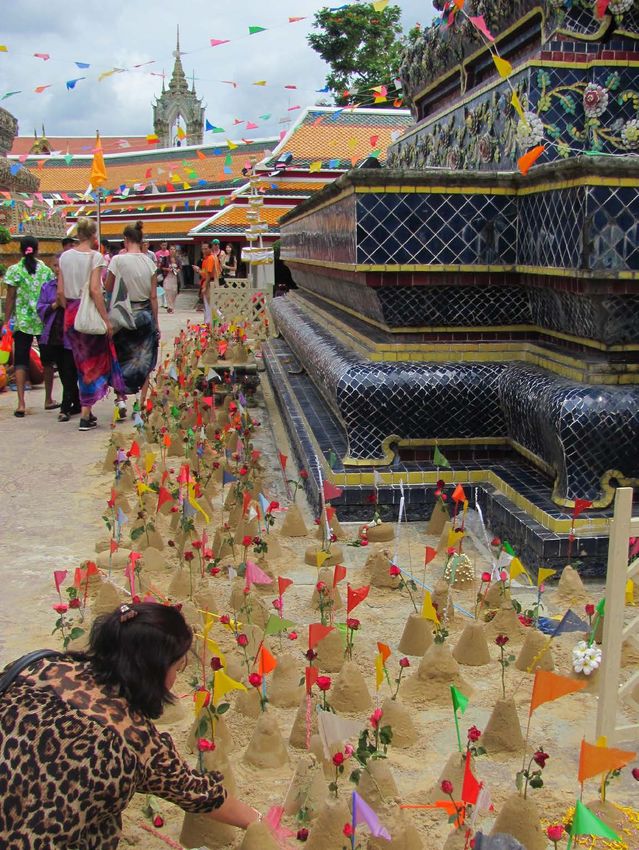
K. R. Olson, W. Kreznor

                                1. Introduction
                                The capital of Thailand, Bangkok is the home of 15 million people and is si-
                                tuated on the Chao Phraya River and Delta. The city is located 28 km north of
                                the Gulf of Thailand. It is known as “The Venice of the East” with dozens of
                                large canals (Klongs) which drain into the Chao Phraya River [1]. The water ta-
                                ble is at or near the surface throughout the Bangkok area (Chao Phraya Delta).
                                During the monsoon season many areas in Bangkok flood. The city has been
                                subsiding at the rate as high as 10 to 12 cm per year and some areas have already
                                subsided 150 cm or more. Parts of the city are now below sea level and require
                                floodwalls (Figure 1) or to be on stilts (Figure 2) especially in the south-eastern
                                metropolitan area where the floodwaters reside there for a much longer time pe-
                                riod and drainage has become less efficient as a result of reduced gradients in
                                storm drains and canals. Bangkok is on a nearly level marine-deltaic plain only
                                0.5 to 1.5 m above mean sea level. The past 50 years the groundwater pumping
                                in Bangkok metropolitan had resulted in a reduction in pore pressure, compres-
                                sion of surficial deposits and silt, dramatic lowering of piezometric levels, and
                                total ground subsidence of more than 0.5 m. Artificial recharge is needed to re-
                                store piezometric heads of the multi-aquafer system.

                                Figure 1. Floodwall protecting the Bangkok temples. In the foreground are tourist tour
                                boats. Photograph taken by Pam Olson.

                                Figure 2. Homes on stills along the Chao Phraya River. Photograph taken by Pam Olson.

DOI: 10.4236/ojss.2021.114011                        198                                   Open Journal of Soil Science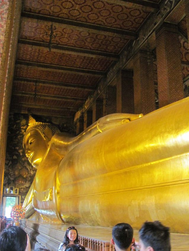
K. R. Olson, W. Kreznor

                                  The objective is to assess and mitigate land subsidence as a result of ground-
                                water withdrawal for rice paddies, aquaculture, shrimp ponds, industry, and the
                                drinking water and household needs of 15 million people living in Bangkok on
                                Chao Phraya Delta.

                                2. Location
                                2.1. Geomorphology and Geology
                                About 8 million years ago the Mekong River flowed south and to the west of
                                Khorat Plateau, confluence with local ancient rivers that became the current
                                Chao Phraya River which runs through Bangkok. During the late Cretaceous
                                and early Tertiary uplifting cause block or plate faulting in northern Thailand
                                resulting in flat basins and steep mountain ranges. Apparently the subsidence in
                                the Tonle Sap basin of Cambodia [2], perhaps within the last 12,000 years, drew
                                the Mekong River eastward and away from its former Chao Phraya River con-
                                nection to the Tonle Sap basin [3]. During Tertiary time period, fault block tec-
                                tonics created the north-south structural depression where Central Plain and
                                Gulf of Thailand are located. West of this huge depression is north-south trend-
                                ing Paleozoic fold belts. The eastern boundary of depression is rimmed by Kho-
                                rat Plateau. The Khrok Phra Arch at Naknon Sawan borders to the north of the
                                basin. The depression extends through the Gulf of Thailand to South China Sea.
                                The lower Central Plain is underlain by basement arches, pluton, faults and
                                flexture zones [4]. Wells drilled to bedrock revealed the alluvial and marine se-
                                diment thickness to be between 350 and 1800 m.

                                2.2. Subsoils
                                The first attempt to delineate the subsurface strata in Bangkok [5] was for con-
                                struction and design activities. Expansion of Bangkok in 1970s brought addi-
                                tional soil investigations which created a better understanding of surface condi-
                                tions. The typical surface profiles are restricted to 30 m. Piyasen [6] created two
                                generalized profiles where the soft Bangkok clay has an average thickness of 14
                                m which is almost half of the typical 30 m profile below central Bangkok.

                                2.3. Early Settlement and Channel Alignment Modifications
                                In 1538 Thailand river modification and engineering was directed by the King
                                Chairachathirat. A 3 km long canal was dug. It shortened the shipping route
                                from Ayutthaya to the Gulf of Siam (Thailand) by 13 - 14 km. Today the channel
                                is identified as Khlong Bangkok Noi. In 1542, a 2 km canal, is now known as
                                Khlong Bangkok Yai, shorten by 14 km the river route. In 1608 a 7 km long can-
                                al called Khlong Bay Phrao was finished. It reduced the Chao Phraya River trip
                                by 18 km. In 1636 the Khong lat Mueang Nonthaburi canal was completed. In
                                1977, the 2 km Kret Noi was completed to shorten the river by 7 km.

                                2.4. Chao Phraya Delta
                                With the weight of people and skyscrapers (Figure 3 and Figure 4) contributing

DOI: 10.4236/ojss.2021.114011                        199                                 Open Journal of Soil Science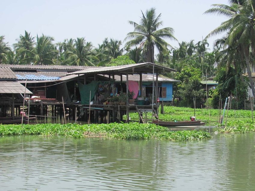
K. R. Olson, W. Kreznor

                                Figure 3. A view with many skyscrapers of Bangkok.

                                Figure 4. The heavy skyscrapers of Bangkok.

                                to the cities slow descent into the water, Bangkok has become a victim of its own
                                successful urban development. Bangkok was built on the Chao Phraya Delta a
                                once marshy land about 1.5 m above the sea level. The tarmac at the Don Muang
                                airport was flooded in 2011. As temperatures increased, abnormal weather pat-
                                terns with more erratic rainfall, more cyclones and increased floods (Figure 5)
                                and droughts are predicted over time adding pressure on the Thailand govern-
                                ment to address the potential climate change with greater frequency of extremes.
                                Bangkok is projected to be one of the world’s hardest hit urban areas along with
                                Jakarta, Ho Chi Minh City and Manila. Bangkok is sinking one to two cm a year
                                with the risk of massive flooding in the next few years. The Gulf of Thailand is
                                rising by 4 mm/yr which is above the global sea rise average.

DOI: 10.4236/ojss.2021.114011                        200                               Open Journal of Soil Science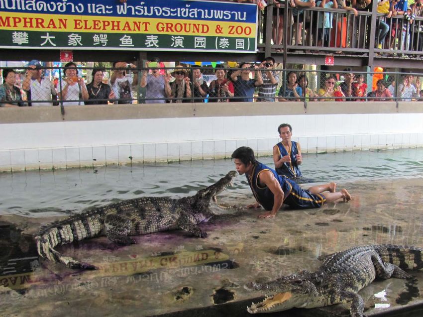
K. R. Olson, W. Kreznor

                                Figure 5. House on stilts during a flooding event along the Chao Phraya River in Bang-
                                kok. Photograph taken by Pam Olson.

                                  In 2011, the monsoon season brought the worst flooding in decades, a fifth of
                                the city was underwater (Figure 5). The business district was spared thanks to
                                hastily constructed levees and dikes. The rest of the Thailand was not so lucky,
                                approximately 500 people lost their life by the end of the 2011 monsoon season.
                                Sections of Bangkok are already partially below sea level.

                                2.5. Increased Flooding Disasters in Bangkok
                                In 1985 with floundering infrastructure, worsening floods, and rapidly rising
                                costs of pumping storm water into the Gulf of Thailand, the government raised
                                taxes. Groundwater use decline resulted in the subsidence rate being reduced by
                                1 - 2 cm per year [7]. To make up for groundwater declines, Bangkok shifted to
                                using treated surface water from Chao Phraya River.
                                  The Chao Phraya River in Thailand confluences of the Ping, Wang, Yom and
                                Nan rivers (Figure 6) which are located in the mountains of Northern Thailand.
                                The Chao Phraya River is the main stem river of Thailand. It flows 365 km into
                                the Gulf of Thailand. The river falls less than 24 m in its voyage to the sea. The
                                Chao Phraya watershed has 160,080 km2 with several major irrigation projects.
                                The Chao Phraya River basin is a filled in arm of the Gulf of Thailand (Figure
                                6). The delta plain surrounding Bangkok is no more than 2 m above sea level.
                                Annual flooding brings rich alluvial sediment to the rice fields. In the delta, the
                                Chao Phraya, the Mae Kong (to the west) and the Bang Pakong (to the east) are
                                linked by a network of canals (Figure 7).
                                  Thailand’s capitals, both Ayutthaya (past) and Bangkok (present) were located on
                                its banks as have many other cities been situated on its tributaries and distributaries.

DOI: 10.4236/ojss.2021.114011                         201                                   Open Journal of Soil Science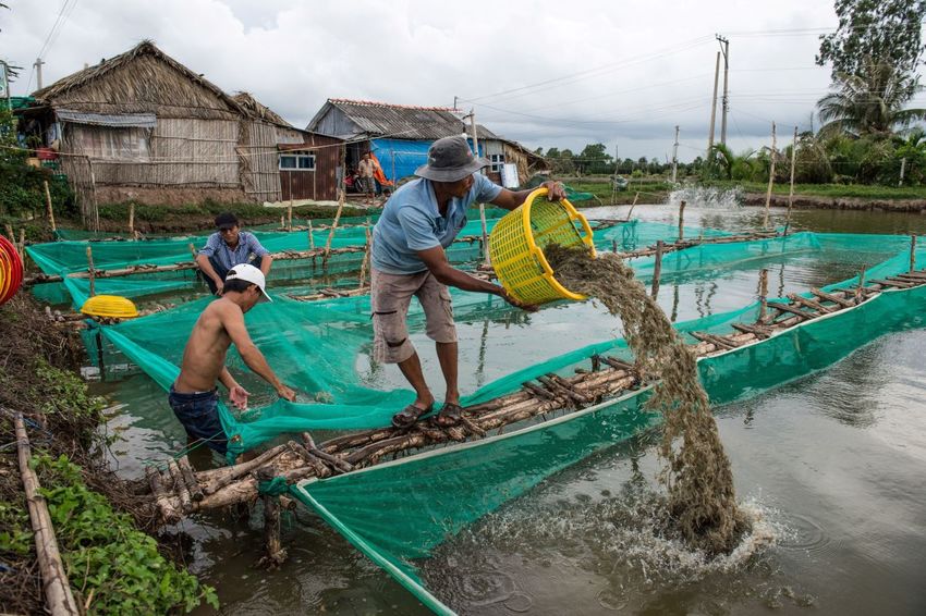
K. R. Olson, W. Kreznor

                                     Figure 6. Map of rivers in Thailand. Map created by Mic Greenberg.

                                Figure 7. Transportation of tourists by boat on the Chao Phraya River. Photograph taken
                                by Pam Olson.

DOI: 10.4236/ojss.2021.114011                         202                                  Open Journal of Soil Science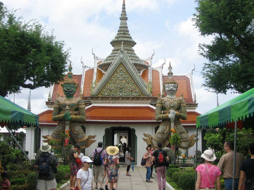
K. R. Olson, W. Kreznor

                                Figure 8. Alligators and handlers at an Elephant Zoo during a show. Photograph taken by
                                Pam Olson.

                                Chao Phraya River is a tidal river between Ayutthaya and the Gulf of Thailand.
                                The river (Figure 7) serves as the export pathway for teak and rice. The Thai
                                people have made use of the Chao Phraya and its canal system for fishing,
                                recreation (Figures 8-16), drainage and as the source of water. The Chai Phraya
                                River flows past Chai Nat the home of a government dam and a large irrigation
                                system. The Tha Chin River is the major distributary of the Chao Phraya River
                                (Figure 6). These rivers are interconnected and serve both for irrigation and for
                                transportation.
                                  Bangkok occupies an area of about 1540 km2 near the southern margin of a
                                low-lying flat, marine-plain termed the Central Lowlands. The upper central
                                Plain begins (Figure 6) where the Ping, Wang, Yom and Bam rivers join. These
                                four rivers combine to form the Chao Phraya River near Nokhon Sawan 240 km
                                north of Bangkok. The modern Chao Phraya River has developed a 10 km wide
                                meander belt in the Lower Central Plain. Its levees are poorly connected and low
                                (Figure 17 and Figure 18) and cannot prevent flooding large bottomland area
                                north of Bangkok (Figure 19) especially during monsoon flows.
                                  The Chao Phraya is the river of kings and the city of Bangkok was designed to
                                be seen by the people from the water. The Thai are river people (Figure 20) and
                                the more congested the road traffic becomes, the more the people of Bangkok
                                dream of returning to their river. Bangkok, a city with more than 15,000,000
                                people can be seen from the river. Older inhabitants in shadow of new concrete
                                and glass high rises (Figures 21-23), are still living waterborne lives in stilt-houses
                                (Figure 5), and on barges, dependent on the brown river for their washing,
                                fishing and transportation (Figure 20). People living on barges, near Krung

DOI: 10.4236/ojss.2021.114011                         203                                  Open Journal of Soil Science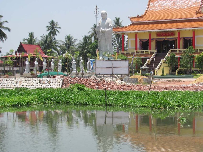
K. R. Olson, W. Kreznor

                                Figure 9. Elephants at the Elephant Zoo. Photograph taken by Pam Olson.

                                Figure 10. Budda lying down in a Bangkok temple. Photograph taken by Pam Olson.

DOI: 10.4236/ojss.2021.114011                        204                                  Open Journal of Soil Science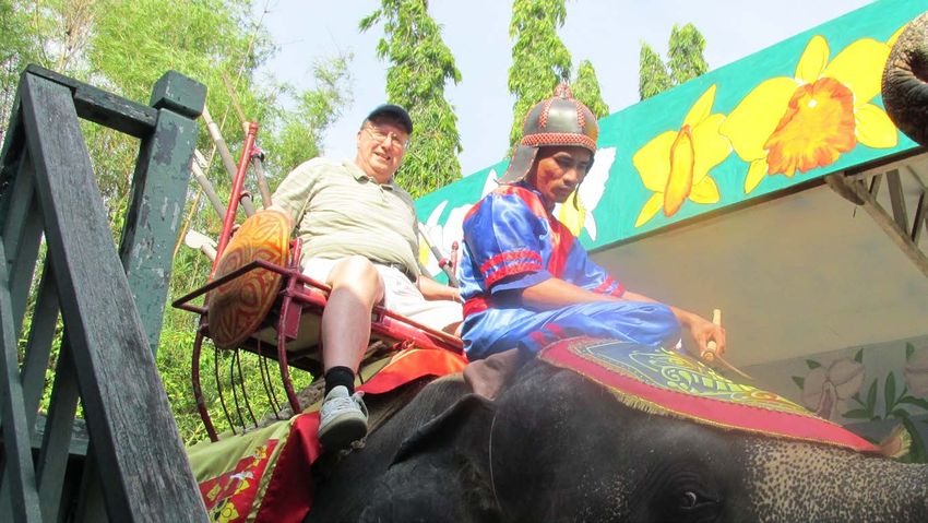
K. R. Olson, W. Kreznor
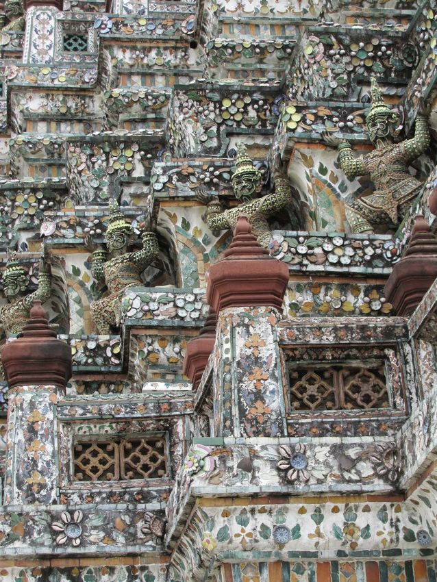
Figure 11. Temple decorations on a Bangkok temple. Photograph taken by Pam Olson.
Figure 12. Tourist riding an elephant. Photograph taken by Pam Olson.
DOI: 10.4236/ojss.2021.114011 205 Open Journal of Soil Science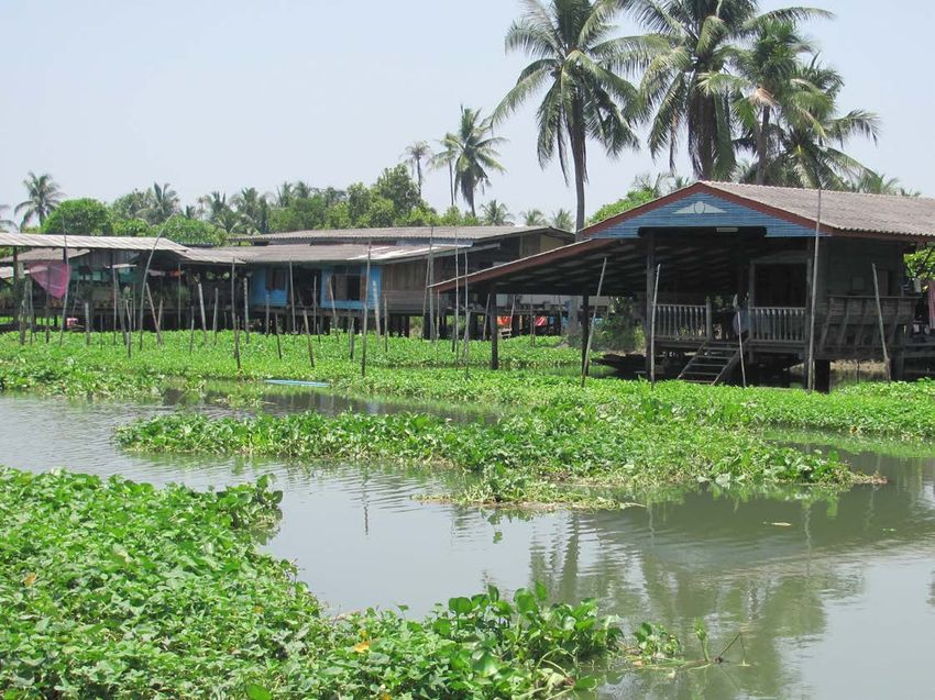
K. R. Olson, W. Kreznor

                                Figure 13. Dining at Oriental hotel along the river. Photograph taken by Pam Olson.

                                   Figure 14. Elephant playing soccer. Photograph taken by Pam Olson.

                                   Figure 15. Guarded temple with tourists. Photograph taken by Pam Olson.

DOI: 10.4236/ojss.2021.114011                     206                                   Open Journal of Soil Science
K. R. Olson, W. Kreznor
Figure 16. Temples with sand castles in honor of former family members. Photograph
taken by Pam Olson.
Figure 17. Floodwall repair in front of a Buddist temple. Photograph taken by Pam Ol-
son.
DOI: 10.4236/ojss.2021.114011 207 Open Journal of Soil ScienceK. R. Olson, W. Kreznor
Figure 18. Low floodwall in residential area. Photograph taken by Pam Olson.
Figure 19. Wetlands and flooding under homes on stilts. Photograph taken by Pam Ol-
son.
Figure 20. View of blue Chao Phraya River and shoreline can be seen by tourists.
DOI: 10.4236/ojss.2021.114011 208 Open Journal of Soil ScienceK. R. Olson, W. Kreznor
Figure 21. Large skyscrapers along the muddy Chao Phraya River.
Figure 22. Bangkok and the Chao Phraya River with skyscrapers on both sides of river.
Figure 23. Oriental Hotel which attracts international tourists. Photograph taken by Pam
Olson.
DOI: 10.4236/ojss.2021.114011 209 Open Journal of Soil ScienceK. R. Olson, W. Kreznor
Thep Bridge, trade-in charcoal and others work in rice houses. The loggers and
teak traders market their goods around Krung Thon Bridge before it is milled
and exported. South of Klong Doei the Chao Phraya River increases in width
and banks are covered with greenery (Figure 24). The River banks between
Bangkok and Pak Nam are used for commerce. Pak Nam, where many trawlers
anchor, has important fish factories, a renowned wat and some good fish restau-
rants. Klong Doei (Klong Toey) is Bangkok’s international port (Figure 25 and
Figure 26) where freighters load exports from Thailand. Pak Nam “River
Mouth” of the Chao Phraya River is where it flows into the Gulf of Thailand.
The 40 km river channel south of Bangkok is lined with harbor installations
(Figure 26). The mouth of the channel requires frequent dredging and vessels
are limited to 10,000 tons.
Figure 24. Boat traffic on the canals linked to the Chao Phraya River. Photograph taken
by Pam Olson.
Figure 25. Port of Bangkok with a ship being loaded.
DOI: 10.4236/ojss.2021.114011 210 Open Journal of Soil ScienceK. R. Olson, W. Kreznor
Figure 26. Loaded ship at the Port of Bangkok with City of Bangkok in background.
Land subsidence in Bangkok, Thailand is primarily caused by well pumping
and has affected Bangkok for the past 50 years. The impact of the pumping is
critical due to the flat low-lying topography and presence of a thick soft lacu-
strine clay layer which creates foundational engineering problems. Pumping has
lowered the water table by as much as 65 m. In the 1980s the subsidence rate
subsidence at a rate as high as 12 cm/yr. Bangkok is sinking and could be un-
derwater in 15 years and there is concern that any action taken will be too late.
In 2011, 800 people were killed by flooding and 12 million others were adversely
affected. Bangkok was underwater for months and the economy suffered a US $41
billion loss. Bangkok is facing multiple challenges. The mean sea level is predicted
to rise 1 m according to the Intergovernmental Panel on Climate Change.
As waters rise the city is sinking and accelerating the process of disappearing
living space. Currently Bangkok is 0.5 to 2.0 m above the water. The metropoli-
tan area is sitting on marshland and resting on a layer of soft highly compressi-
ble clay. In addition to natural land subsidence, 5 decades of excessive ground-
water pumping and rapid urban development have put pressure on the alluvial
and lacustrine foundation. The 5000 tall building (Figure 3 and Figure 4), 9
million vehicles, roads and rail systems have contributed to the pressure.
Subsidence of Bangkok clay due to deep well pumping can be reduced or con-
trolled through artificial recharge [5]. Metropolis, a flood-resistant community
could provide the blueprint on how to keep the city above water. Low lying-
communities could be elevated 5 m above water to reduce the problems of flood-
ing, rising sea levels and land subsidence. Restored mangrove forests could filter
water, absorb carbon dioxide, and provide residents with an elevated community
without fear of being flooded or being submerged and green open space.
Experts suggest that unchecked urbanization and eroding shorelines will leave
Bangkok residents in a critical situation. With the weight of people and infra-
structure contributing to the cities gradual descent into the water, Bangkok has
become a casualty of its own successful development. Making the situation
DOI: 10.4236/ojss.2021.114011 211 Open Journal of Soil ScienceK. R. Olson, W. Kreznor
worse is the canals that are used to traverse the city have been replaced by a
network of roads and bridges. The canals (Figure 27 and Figure 28) had con-
tributed to a natural drainage system of waterway pathways. Shrimp farms
(Figure 29) and other aqua-cultural development have replaced the shore stabi-
lizing mangrove forests.
2.6. Ecology and Pollution
The lowland areas of the Chao Phraya basin in central Thailand are freshwater
swamp forest, a subtropical and tropical moist broadleaf forest. The area is 400 km
north to south and 180 km wide and is in the Chao Phraya River basin (Figure
6). The original swamp forest was converted to rice paddies, other agriculture
and urban areas such as Bangkok. Most of the original wildlife is gone, including
the birds and fish [8]. Without urban development the area would probably con-
sist of freshwater swamps inland and salty mangroves on the coast and river
Figure 27. Tourist boats on the Chao Phraya River. Photograph taken by Pam Olson.
Figure 28. Floating markets on canals. Photograph taken by Pam Olson.
DOI: 10.4236/ojss.2021.114011 212 Open Journal of Soil ScienceK. R. Olson, W. Kreznor
estuaries. The primary remaining relic of that original landscape is Khao Sam
Roi Yot National Park. The Chao Phraya basin has 280 species of fish. The main
stem of the Chao Phraya River alone has 190 native fish species. Extensive habi-
tat destruction (pollution, dams, irrigation and drainage) has occurred. Over-
fishing has also been a historic problem. In the past decade, the Thai Pollution
Control Department (PCD) has reported that the Chao Phraya River and tribu-
tary water quality have deteriorated. The river system contains bacteria and nu-
trients (phosphates, phosphorus and nitrogen) pollution. Nutrient pollution ac-
celerates algae growth which harms water quality, marine habitats and food re-
sources for aquatic animals [8]. It also decreases oxygen needed for fish survival.
The PCD findings rate water quality very poor and large amounts of wastewater
were discharged into the rivers from agriculture, industry (Figure 30) and
households.
Figure 29. Shrimp farming in Chao Phraya Delta.
Figure 30. Industry along the Chao Phraya River. Photograph taken by Pam Olson.
DOI: 10.4236/ojss.2021.114011 213 Open Journal of Soil ScienceK. R. Olson, W. Kreznor
3. Summary and Conclusions
The wetlands and land masses are subsiding as a result of the sediment deposi-
tion reduction, groundwater extraction, saltwater intrusion, consolidations, re-
duced sediment loads in the lower Chao Phraya River and reduction in the cur-
rent plumes into the Gulf of Thailand which takes the fresh water and sediment
out into the sea. More intense storms could occur in this region in the future.
Bangkok could be trapped by flooding from the seas to the south and monsoonal
flooding from the north. The cities weakness is a result of small tunnels and hy-
per-development of neighborhoods. These small tunnels used to act as water
storage basins. The government is scrambling to mitigate the effects of potential
climate change, constructing a municipal canal network up to 2600 km with
pumping stations and eight underground tunnels to evacuate water if disaster
strikes. In 2017 Chulalongkorn University built a 4 ha park that was designed to
drain several million liters of rainwater and redirects it so surrounding neigh-
borhoods are not flooded. These fixes may not be enough.
Acknowledgements
It is published with funding support from USDA, NIFA, Water Division and
Department of Natural Resources and Environmental Sciences and with the
approval of the Director of the Illinois Office of Research, College of Agricul-
tural, Consumer, and Environmental Science, University of Illinois, Urbana,
Illinois.
Conflicts of Interest
The authors declare no conflicts of interest regarding the publication of this pa-
per.
References
[1] Warren, W. and Lloyd, R.I. (2012) Bangkok Waterways. Asia Books, Bangkok,
Thailand.
[2] Olson, K.R. and Morton, L.W. (2018) Tonle Sap Lake and River and Confluence
with the Mekong River in Cambodia. Journal of Soil and Water Conservation, 73,
60A-66A. https://doi.org/10.2489/jswc.73.3.60A
[3] Olson, K.R. and Morton, L.W. (2018) Polders, Dikes, Canals, Rice and Aquacul-
ture in the Mekong Delta. Journal of Soil and Water Conservation, 73, 83A-89A.
https://doi.org/10.2489/jswc.73.4.83A
[4] Achalabhuti, C. (1974) Petroleum Geology of the Gulf of Thailand. Conf. Cir-
cum-Pacific Energy and Mineral Resources. Honolulu, Hawaii.
[5] Muktabhant, C., Teerawong, P. and Tengamanuary, V. (1966) Engineering Prop-
erties of Bangkok Subsoils. Chulaongkorn University, Bangkok.
[6] Piyasen, W. (1982) Rehabilitation of Depleted Aquifer System through Artificial
Recharge—An Application to Bangkok. Doctoral Dissertation, No. GT-82-1,
Asian Institute of Technology, Bangkok, Thailand.
[7] Nutalaya, P., Young, R.N. Chumnankat, T. and Buapeng, S. (1996) Land Subsi-
DOI: 10.4236/ojss.2021.114011 214 Open Journal of Soil ScienceK. R. Olson, W. Kreznor
dence in Bangkok during 1978-1988. In: Millim, J.D. and Hag, B.U., Eds., Sea-Level
Rise and Coastal Subsidence, Springer, Dordrecht, 105-130.
https://doi.org/10.1007/978-94-015-8719-8_6
[8] Samorn, M.S. and Sales, C.L. (1994) Water Quality Management of the Chao
Phraya River. FishBase: Fish Species of the Chao Phraya River. Environmental
Technology, 15, 501-516.
DOI: 10.4236/ojss.2021.114011 215 Open Journal of Soil ScienceYou can also read