Hamilton to Auckland Corridor Study - Future Proof
←
→
Page content transcription
If your browser does not render page correctly, please read the page content below
Hamilton to Auckland Corridor
            Study

           December 2012
Contents
1.     Summary                                                1
2.     Introduction                                           4
     2.1.   Purpose                                           4
     2.2.   Study Aims                                        5
     2.3.   The Hamilton to Auckland Corridor                 6
     2.4.   Background Work                                   6
     2.5.   Document Relationships                            7
3.     Context                                                9
     3.1.   National Framework                                9
     3.2.   Upper North Island                                14
     3.3.   Regional Framework                                15
     3.4.   Future Proof                                      20
     3.5.   Local Strategies                                  21
     3.6.   Relevant Auckland Documents                       24
     3.7.   Labour Markets                                    25
     3.8.   Integration and Funding                           26
4.     Land Use                                               27
     4.1.   Future Proof Data and Targets                     27
     4.2.   Towns                                             29
     4.3.   Structure Planning for Towns                      31
     4.4.   Rural Villages                                    31
     4.5.   Rural                                             32
     4.6.   Impact of the Proposed RPS                        32
     4.7.   The Influence of Auckland                         33
5.     Transport                                              34
     5.1.   Strategic Direction                               34
     5.2.   Hamilton to Auckland Corridor Transport Network   34
     5.3.   Rail                                              35
     5.4.   Public Transport                                  36
6.     Hamilton to Auckland Corridor Issues and Objectives    38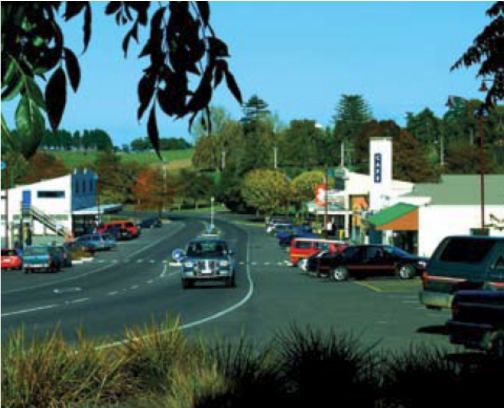
6.1.   Issues                38
     6.2.   Objectives            38
7.     Actions and Agency Roles   40
     7.1.   Actions               40
     7.2.   Agency Roles          42
1. Summary

Introduction

The Hamilton to Auckland Corridor Study is intended to provide an integrated land use and transport
picture for this area. It also aims to set out a framework for the future direction of this corridor, in
particular how land use and transport is managed. This work will provide a strategic context for when
the Future Proof Strategy is reviewed. It also supports the case for extending the Future Proof northern
boundary to align with the new Waikato District Council 2010 boundary.

The high-level priority outcomes that have been identified for this Study are as follows:

         The need for a complementary land use pattern between Auckland and the Waikato.
         Defining the role of the freight hubs in both Auckland and the Waikato.
         Protecting productive rural land in the northern Waikato given its role as a food basket for the
          Upper North Island.
         The role of an expanded Pukekohe in relation to other nearby settlements in the Waikato
          District, namely Tuakau and Pokeno.
         The need for the Waikato to be “consent ready” for the development opportunities that may
          arise as business struggles to overcome Auckland’s infrastructure deficiencies and potential land
          shortages and high cost.

For the purposes of this study the corridor stretches along State Highway 1 from Ngaruawahia in the
south to the Waikato District’s boundary with Auckland in the north. The main focus is on the central
and northern areas of the Waikato District. The components of the Hamilton to Auckland Corridor are as
follows:

         The towns of Ngaruawahia, Huntly, Te Kauwhata, Pokeno, Tuakau
         Rural Villages
         Industrial land at Horotiu, Huntly, Pokeno and Tuakau
         Rural land
         The Waikato Expressway and State highway 1
         The North Island Main Trunk rail line

Context

There are a number of national, regional and local strategies that have an influence on this Corridor
Study. The Waikato Regional Land Transport Strategy, Regional Policy Statement (RPS), Future Proof and
the Waikato Expressway Network Plan are all key documents for this corridor. The North and Central
Waikato Scoping Study also feeds into this work and provides a good overview of development
opportunities and constraints.

Land Use

The land use pattern for the corridor is set by the RPS and the Future Proof Strategy. Development is to
be concentrated in the main towns of Huntly, Ngaruawahia, Te Kauwhata, Tuakau and Pokeno, with a

                                                                                                           1
Hamilton to Auckland Corridor Study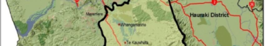
small amount in rural villages. The population of the corridor is expected to grow by around 11,600
people between 2011 and 2031. Industrial land is provided for at Horotiu, Huntly, Tuakau and Pokeno.
All of these towns are facing different challenges. Some are coming under increasing development
pressure as a result of being close to the boundary with Auckland, lifestyle opportunities, cheaper land
and better access as a result of the Waikato Expressway.

Transport

The Waikato Expressway is the main shaper of this corridor. It is a significant transport project for the
region and the nation. The Expressway is expected to be completed by 2019 and has the following
objectives:

        Enhancing connections between Waikato and the Auckland market;
        Encouraging economic development opportunities in the Waikato region by supporting
         industrial growth areas and providing better supply routes for industry, freight and tourism; and
        Improving access to Hamilton International Airport and the major ports in Auckland, Tauranga
         and Hamilton.

The Hamilton to Auckland Corridor Study aims to ensure that these objectives are not compromised by
land use pressures.

Other key transport features of the corridor include the North Island Main Trunk rail line and the local
transport network.

Hamilton to Auckland Corridor Issues and Objectives

This Study sets out the following issues for the Corridor:

        Significant freight movement between the Waikato and Auckland which is expected to double
         by 2031.
        Growth in aggregates, forestry and dairy industries is putting pressure on the transport network.
        Protecting productive rural land in the northern Waikato given its role as a food basket for the
         Upper North Island.
        The influence of Auckland, in particular the major greenfield developments planned in the
         southern part of Auckland which could put pressure on the Waikato District. Land use pressures
         (residential and employment growth) in the northern Waikato area and the potential impacts of
         these on the future functioning of the Expressway.
        The network of small towns and villages in the area are experiencing mixed fortunes. Some are
         thriving and growing while others are struggling and declining.
        Managing Pokeno as a development hotspot.
        Ensuring bypassed sections of State Highway 1 continue to respond to local transport
         requirements following the completion of the Waikato Expressway.
        Anticipating the likely effect that the completion of the Waikato Expressway and the growth of
         Auckland and Hamilton will have on the towns and rural villages in the corridor.
        The effect on the towns of Huntly and Ngaruawahia once the bypasses are complete.
        The effect of shorter travel times as a result of a completed Waikato Expressway.

                                                                                                            2
Hamilton to Auckland Corridor Study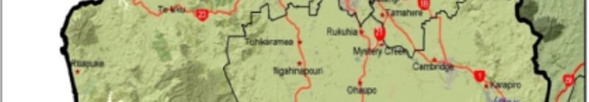
The following objectives for the Corridor have been identified:

         Supporting Upper North Island growth.
         Supporting the thriving and diverse agricultural economy of the Waikato.
         Facilitating economic growth and productivity.
         Facilitating increased integration of economic activity between Auckland and the Waikato.
         The efficient movement of people and goods.
         Ensuring good access to the Ports (Auckland and Tauranga as well as the inland ports).
         Supporting the Waikato’s role as a significant freight and logistics hub for the Upper North
          Island.
         Ensuring that the logistics hubs in the Waikato and Auckland work efficiently in order to support
          the Ports.
         Supporting the objectives for the Waikato Expressway. Encouraging a mutually beneficial land
          use pattern between Auckland and the Waikato.
         Ensuring that the Waikato is in a position to support increased business and economic growth,
          particularly if there are spill-over effects from Auckland. Managing growth and development in
          the corridor in an effective manner.
         Supporting towns and villages that are struggling or declining.

Actions

This Study sets out several key actions that need to be completed in order to implement the Hamilton to
Auckland Corridor Study.

                                                                                                         3
Hamilton to Auckland Corridor Study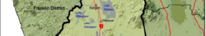
2. Introduction
2.1. Purpose
The Hamilton to Auckland Corridor Study is intended to provide an integrated land use and transport
picture for this area and to set out a
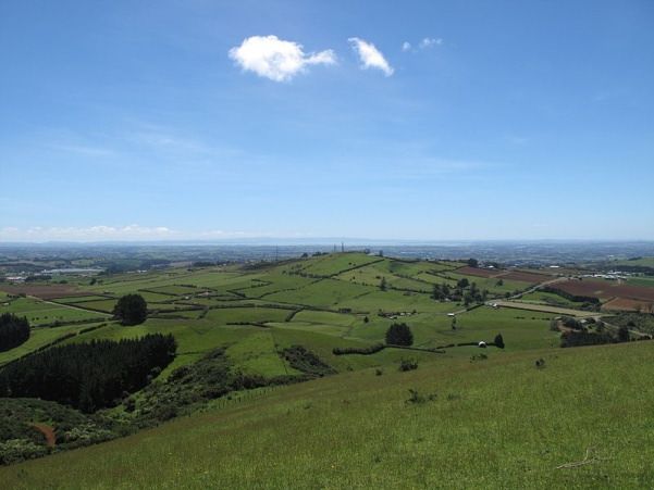
framework for the future direction of Figure 1: Future Proof Sub-Regional Growth Strategy Area
this corridor and how land use and
transport is managed.
The development of the Upper North
Island Strategic Alliance and associated
agreement presents a unique
opportunity for enhancing inter-
regional linkages. This Corridor Study is
part of that process.
The purpose of this study is to:
Provide a strategic basis for
incorporating the Northern
Waikato into the wider Future
Proof area and into the subsequent
Future Proof review process.
Establish a framework which can
be used to influence future land
use and infrastructure planning in
the corridor between Hamilton and
Auckland.
Ensure that the Future Proof
partnership has additional tools to
assess the impact of any proposed
development on existing strategies
and aspirations.
The study is a Future Proof initiative.
Future Proof is the growth management strategy for the Future Proof ‘sub-region’; an area which
incorporates Hamilton City, the Waipa District, the Waikato District, and the associated administrative
area of the Waikato Regional Council as shown in Figure 1. This Study takes into account and aims to be
consistent with the following Future Proof Strategy principles:
Encourage development to locate adjacent to existing urban settlements and nodes in both the
Waikato and Waipa Districts and that rural-residential development occurs in a sustainable way to
ensure it will not compromise the Future Proof settlement pattern or create demand for the
provision of urban services.
4
Hamilton to Auckland Corridor Study
      Ensure commercial and industrial development is located in selected sub-regional areas and that it
       is not located where it undermines the areas of influence of the Hamilton CityHeart, Cambridge, Te
       Awamutu, Ngaruawahia, Raglan and Huntly.
      Maintain and enhance the cultural and heritage values of the sub-region.
      Ensure that the settlement pattern generally avoids sensitive natural environments (streams,
       wetlands, lakes, rivers, and important landscapes) unless there is potential for significant
       environmental gain.
      Restore the health and well-being of the Waikato River, including adopting an integrated
       management approach.
      Encourage development in existing settlements to support existing infrastructure.
      Protect existing and future infrastructure and transport corridors, including the Waikato
       Expressway, Southern Links and rail corridors, from development that could constrain or
       compromise the efficiency of infrastructure and transport corridor operation.
      Recognise the need for stronger links between land-use and transport in respect of the settlement
       pattern and ensure capacity is matched with development potential.
      Protect versatile and quality farmland for productive purposes through the provision of limited
       rural lifestyle development around existing towns and villages and encouraging a more compact
       urban footprint.
      Ensure that planning for the future use of water maintains water quality and promotes efficient
       use.

This Study will provide a strategic context for the review of the Future Proof Strategy by providing a
framework for land use and transport in the corridor.

2.2.       Study Aims

The aims of this study are:

           To influence cross-boundary planning issues given the limitations of the RMA 1991 in this area.
           To provide an opportunity to have informed dialogue between the Auckland Council, Waikato
            District Council, NZTA, and the balance of the Future Proof partnership.
           To influence the Auckland Council Unitary Plan which is being prepared during 2012 and 2013.
            In particular how the unallocated residential and industrial lands from the Auckland Plan will be
            implemented.
           To be able to make informed/key decisions in the Waikato district and the Waikato region on
            land use and infrastructure matters, for example industrial land sizes and location and key road
            connections.
           To support the role of the Upper North Island Growth Area of which the Future Proof sub-region
            (including the Waikato District) is a core part.
           To acknowledge the district and region’s inter-regional connections and relationships with
            Auckland (eg through significant roads, rail and ports - air and sea).
           To support inter-regional collaboration, especially given the Upper North Island Strategic
            Alliance (UNISA) and the associated agreement. The Waikato Regional Council and Hamilton City
            Council are parties to this.
           To support existing and proposed inter-regional/inter-district transport connections, in
            particular SH1, Waikato Expressway.
           To affirm the Waikato region as a significant freight storage and distribution hub.

                                                                                                           5
Hamilton to Auckland Corridor Study
    To be able to remain informed and be a key player in relevant Auckland initiatives eg ‘the
            Southern Initiative’ which could have implications for the Waikato district and region as this is
            about encouraging social and economic activity towards the south.

2.3.       The Hamilton to Auckland Corridor

The Future Proof sub-region is an area of rapid population and development growth. The Waikato
region is the 4th largest in New Zealand and it is projected that the Future Proof sub-region will contain
96% of the entire region’s population growth out to 2026.

The Hamilton to Auckland Corridor is a substantial growth area for the sub-region. The population of the
corridor is expected to grow by around 11,600 people between 2011 and 2031. It is also an area that is
under significant development pressure given that it is a gateway into Auckland, contains a road of
national significance in the Waikato Expressway as well as a key rail route, and has a number of
residential and industrial developments planned for particular growth areas.

For the purposes of this study the corridor stretches along State Highway 1 from Ngaruawahia in the
south to Waikato District’s boundary with Auckland in the north.

The corridor follows the Waikato River which is of utmost significance to Waikato-Tainui. The Waikato-
Tainui Raupatu Claims (Waikato River) Settlement Act 2010 and the Vision and Strategy for the Waikato
River are key documents for protecting the health and well-being of the River. Waikato District Council
and Waikato-Tainui entered into a Joint Management Agreement on 23 March 2010 as part of
implementing the Settlement Act. The Agreement sets out the relationship between the parties, guiding
principles and objectives and duties. This Study will need to take into account any effects on the River of
land use and transport change in the corridor.

The main focus is on the central and northern areas of the Waikato District. The components of the
Hamilton to Auckland Corridor are as follows:

           The towns of Ngaruawahia, Huntly, Te Kauwhata, Pokeno, Tuakau
           Rural Villages
           Industrial land at Horotiu, Huntly, Pokeno and Tuakau
           Rural land
           The Waikato Expressway and State highway 1
           The North Island Main Trunk rail line

The southern part of the former Franklin District became part of the Waikato District in November 2010
as a result of the Auckland boundary changes. The Waikato District now includes the towns of Tuakau,
Pokeno and Mercer.

2.4.       Background Work

Work undertaken to date on the Hamilton to Auckland Corridor includes:

           North and Central Waikato Scoping Study (2012)

                                                                                                             6
Hamilton to Auckland Corridor Study
    Pokeno Structure Plan (2008)
           Te Kauwhata Structure Plan (2009)
           Waikato District Growth Strategy (2009)
           Waikato Expressway Network Plan (2012)
           Waikato Expressway Strategic Evaluation (2007)
           Waikato Integrated Land Transport Strategy Scoping Report (2012)

The Waikato District Council is in the process of preparing an Integrated Land Transport Strategy. The
Strategy will aim to further develop and manage transportation in the District over the next 30 years.
This work will inform the Hamilton to Auckland Corridor Study and some of the key issues and objectives
of the Corridor Study can be used to shape aspects of the Transport Strategy. The Waikato District
Council is also undertaking an integrated District Growth Strategy in 2013.

2.5.       Document Relationships

The following diagram illustrates the relationship between high level strategic documents, the Hamilton
to Auckland Corridor Study and implementation documents such as District Plans, the Regional Land
Transport Programme and Long Term Plans.

                                                                                                      7
Hamilton to Auckland Corridor Study
Figure 2: Relationships between Key Documents
Regional Policy Statement Regional Land Transport Strategy
Strategic Documents
Future Proof Strategy
Waikato District Growth
Strategy
Hamilton to Auckland Waikato Integrated
Corridor Study Transport Strategy
North and Central
Waikato Scoping Study
Implementation
Documents
District Plans Regional Land Transport Programme Long Term Plans
8
Hamilton to Auckland Corridor Study3. Context
3.1. National Framework
The Land Transport Management Act
The Land Transport Management Act 2003 (“LTMA”) governs the way the New Zealand land transport
system is developed, managed and funded. The purpose of the Act is to contribute to the aim of
achieving an affordable, integrated, safe, responsive, and sustainable land transport system.
Central aspects of the LTMA are the five criteria that permeate through the Act:
Assisting economic development
Assisting safety and personal security
Improving access and mobility
Protecting and promoting public health
Ensuring environmental sustainability
The 2008 amendments to the LTMA include changes to the preparation, requirements and processes for
regional land transport strategies. The main changes are:
Government Policy Statement on Land Transport Funding
The Government Policy Statement on land transport funding (“GPS”) is a requirement of the LTMA. The
current GPS covers the period 20012/13 to 2021/22. It details the government’s outcomes and priorities
for the land transport sector. The GPS is intended to guide the National
Land Transport Programme.
The government’s overarching goal for transport is: an effective, efficient,
safe, secure, accessible and resilient transport system that supports the
growth of our country’s economy in order to deliver greater prosperity,
security and opportunities for all New Zealanders.
The government has three focus areas that are the priorities for this GPS:
economic growth and productivity
value for money
road safety
The 2012–2015 National Land Transport Programme and corresponding
regional land transport programmes are expected to prioritise activities that advance this strategic
direction including the GPS’s priorities of economic growth and productivity, value for money and road
safety. In doing so, the following impacts should be achieved through the allocation of funding from the
National Land Transport Fund:
9
Hamilton to Auckland Corridor StudyShort to medium term impacts
Improvements in the provision of infrastructure and services that enhance transport efficiency
and lower the cost of transportation through:
- improvements in journey time reliability
- easing of severe congestion
- more efficient freight supply chains
- better use of existing transport capacity.
Better access to markets, employment and areas that contribute to economic growth.
Reductions in deaths and serious injuries as a result of road crashes.
More transport choices, particularly for those with limited access to a car.
A secure and resilient transport network.
Reductions in adverse environmental effects from land transport.
Contributions to positive health outcomes.
Part of the economic growth and productivity objective is continuing the progress the Roads of National
Significance (“RONS”) programme. The Waikato Expressway is one of the RONS.
Integrated planning is also identified as being important. In particular, the GPS sets out that land use and
transport planning processes should ensure:
opportunities are created for better integration within and between different modes of
transport
the transport needs of future growth are considered in planning and developing the
transport system
existing and future transport corridors are safeguarded from other development
new commercial and residential developments meet the cost of their infrastructural impact
on the wider transport network
urban planning principles are applied.
The GPS states that integrated planning is a particular priority in areas where the land use and transport
context is subject to change, where solutions are likely to be complex and require substantial integration
and where there are synergies or economies of scale that can be realised, for example integrated
planning done on an inter-regional scale.
National Land Transport Programme
The National Land Transport Programme for 2012-2015 (NLTP) was released in August 2012. Key issues
identified in the NLTP include population dynamics and demographic changes, economic performance
and transport funding dynamics. Investment over the next three years will be targeted to:
Achieve more efficient freight supply chains through integrated land use and transport planning
across the Upper North Island in particular, and the rest of the country
Reduce the number of deaths and serious injuries through the creation of a safe road system
Ease severe congestion, and improve journey time reliability in our main urban centres
Ensure that existing capacity is maximised to deliver value for money solutions to transport issues
10
Hamilton to Auckland Corridor Study Offer more transport mode choices through multi-modal transport planning, including more
effective public transport, and walking and cycling
Realise the full benefits from investment in major network packages, including roads of national
significance, through effective linking with the wider network.
The NLTP outlines that over the next three years approximately $1-$1.3 billion from the National Land
Transport Fund will be invested in the Waikato region's transport system. The main project is the
Waikato Expressway given that it is a Road of National Significance.
The National State Highway Strategy1
The Strategy sets out how the state highway network will be managed and developed. The eight
principles contained in the strategy are: safety; operating the network; asset management; managing
demand; environment and communities; integrated planning; education; and continual improvement.
The Strategy also introduces the concept of state highway categories. The categories are national state
highways, regional state highways, sub-regional state highways. A 30 year concept of the state highway
network is also set out which shows proposed carriageway standards.
National Infrastructure Plan
The National Infrastructure Plan 2011 sets out seven specific goals for transport infrastructure. These
goals are to have:
A long term strategic approach to transport planning which maximises the potential synergies
between regional planning and central government strategies.
A flexible and resilient transport system that offers greater accessibility and can respond to
changing patterns in demand by maintaining and developing the capacity of the network.
Improved operational management practice and the use of demand management tools
especially in urban areas experiencing significant growth.
A network of priority roads that will improve journey time and reliability, and ease severe
congestion, boosting the growth potential of key economic areas and improving transport
efficiency, road safety and access to markets.
A continued reduction in deaths and serious injuries that occur on the network.
A public transport system that is robust and effective and offers a range of user options that will
attract a greater percentage of long term users.
A rail system that enables the efficient movement of freight and complements other modes of
passenger transport and freight movement.
Sea and air ports that are linked to the overall transport network to support efficient nationwide
movement of passengers, domestic goods and exports and imports and are able to respond to
technological changes and changing international safety and security standards.
National Freight Demands Study2
1
New Zealand Transport Agency, National State Highway Strategy, 2007
2
Ministry of Transport, Ministry of Economic Development & Land Transport NZ (now the NZTA), National Freight
Demands Study, 2008
11
Hamilton to Auckland Corridor StudyThe National Freight Demands Study considers current and the likely future volumes and distribution of
freight movements in New Zealand. It also looks at significant modal, national, regional and industry
trends.
One of the key findings of the Study is that the freight task in New Zealand is projected to double over
the next 20 years. Freight traffic that either originates or passes through the Waikato region is
estimated at around 55.3 million tonnes. This represents about a quarter of all of New Zealand’s freight
tonnage movements. Between 18 and 24% of this freight is carried by rail.
The forecast growth in freight traffic generated in the Waikato region is expected to increase from
around 26 million tonnes in 2006/07 to just under 50 million tonnes in 2031. This represents a
substantial increase for the region, reflecting growth primarily in aggregates as well as forestry and
dairy.
The map in Figure 3 below shows the forecasted freight flows between the Waikato and neighbouring
regions. There is significant freight movement between the Waikato and Auckland. The Hamilton to
Auckland Corridor is the main facilitator of this freight movement.
12
Hamilton to Auckland Corridor StudyFigure 3: Waikato Forecasted Volume of Freight
13
Hamilton to Auckland Corridor StudyOther Strategies and Documents:
Roads of National Significance – Economic Assessments Review (2010)3
KiwiRail Turnaround Plan (2010) – note that this prioritises the North Island Main Trunk line, the
East Coast Main Trunk (Auckland-Hamilton-Tauranga) is also a key route.
Freight Futures: Long Term Sea Freight Scenarios (NZIER, September 2010)
Upper North Island Ports Supply and Demand Study (Auckland Council – to be completed)
NZ Shippers’ Council Report – ‘The Question of Bigger Ships’ (August 2010)
3.2. Upper North Island
The growth triangle of Auckland, Waikato and the Bay of Plenty is becoming increasingly important from
a national perspective. The significance of this growth area is evidenced by the following:
The three regions of Auckland, the Waikato and the Bay of Plenty are expected to grow at a
greater rate than the rest of the country and by 2031 it is expected that together they will
account for 53% of New Zealand’s population.
The three regions are responsible for the production and attraction of over half of all road and
rail freight in New Zealand. The forecast growth in freight traffic generated in the Waikato
region is expected to double by 2031. The majority of this freight traffic is between the Waikato
and Auckland.
Auckland, Waikato, and the Bay of Plenty currently generate over 45% of the nation’s gross
domestic product, this will continue to grow and is projected to account for half of New
Zealand’s total economic activity by 2025.
The significant role played by the Port of Tauranga, the Ports of Auckland and their associated
freight hubs, including the Crawford Street inland port in Hamilton.
There is high growth forecast in retail trade for the Auckland, Waikato and Bay of Plenty regions.
The integration of economic activity between Auckland and Hamilton is likely to increase as
transport corridor improvements are completed and travel times reduced.
UNISA Agreement
The Upper North Island Strategic Alliance (“UNISA”) signed an agreement in 2011 to establish a long-
term collaboration between the Auckland Council,, Bay of Plenty Regional Council, Northland Regional
Council, Waikato Regional Council, Hamilton City Council, Tauranga City Council and Whangarei District
Council for responding to and managing a range of inter-regional and inter-metropolitan issues.
The first order issues are identified as being:
Economic development linkages
3
Completed by Saha for the New Zealand Transport Agency
14
Hamilton to Auckland Corridor Study Transport, including rail, roads, freight
Ports, including inland ports
Tourism
Emergency preparedness
Waste
Water
Population and settlement patterns, liveability
Commercial and industrial land development
International connectivity and competitiveness – air, sea, broadband
Energy security
Climate change, including greenhouse gas emission reductions
Upper North Island Freight Story
The NZTA in conjunction with the Regional Councils of the Upper North Island are currently developing
an Upper North Island Freight Story. Workshops have been held in the Waikato in order to inform this
work. The following have been the main findings to date:
Key economic strengths for the region: primary commodities and the ability to grow food; central
location in the Upper North Island, locality to neighboring regions and connectivity; availability of
natural resources including electivity generation and transmission; availability and readiness of industrial
and greenfield land and hubs for development; university / tertiary training.
Emerging economic strengths: manufacturing services; aquaculture in the Coromandel; wood
manufacturing.
Key infrastructure strengths: strategic transport corridors; availability / readiness of industrial areas in
Hamilton (north Waikato is noted as having an emerging economic strength in this area); electricity
generation and transmission; processing plans serviced by rail and road.
Key issues: local government and central government funding structures; future strategic function of the
Upper North Island Ports; utilisation of business land consented, serviced and ready to go; quality of
roading to get raw materials to processing plants and hubs; better certainty of planning and investment.
Other key issues of relevance to the Hamilton to Auckland Corridor include:
Capacity of rail freight route through Auckland to and from the Waikato
Conflict between development of land and protection of versatile land / natural resources
Optimising infrastructure, hubs and land use
3.3. Regional Framework
Waikato Regional Policy Statement
15
Hamilton to Auckland Corridor StudyThe Proposed Waikato Regional Policy Statement (“Proposed RPS”) was notified in 2010 and is a
comprehensive review of the operative RPS. The Proposed RPS implements key aspects of the Future
Proof Strategy, including:
Implementing the Future Proof settlement pattern
Putting in place urban limits
Identifying key residential growth areas
Identifying strategic industrial nodes
Sequencing and staging of development
Restricting inappropriate rural residential development
Waikato Regional Land Transport Strategy and Programme
The Waikato Regional Land Transport Strategy 2011-2041 (“RLTS”) is the key document for setting the
strategic direction for transport in the Waikato region. The RLTS sets out the following outcomes that it
wants to achieve:
An integrated transport system that supports economic activity and provides for the efficient
movement of people and goods within and through the region.
A transport system that provides safety and security across all modes of
travel.
A people focused transport system that provides inclusive, accessible
and affordable multi-modal journeys to enable people to live, work, and
play.
A transport system that connects communities, protects active modes
and enables positive public health outcomes.
An environmentally sustainable and energy efficient transport system
that is holistic and adaptable, meets regional and local needs, and is
resilient to long term global influences.
An integrated multi-modal transport system supported by land use planning and enabled by
collaborative planning and partnerships.
The RLTS also identifies high priority regional challenges. These are:
Inter-regional freight growth and doubling of freight from within the Waikato region.
Future population growth and demographic change.
Improving road safety in the region.
Promoting opportunities to optimise the investment in the Waikato Expressway.
Addressing the need for better access to services for isolated rural communities.
Improving urban design and layout to provide for accessible journeys.
Progressing energy efficiency initiatives and resilience to security of energy supply.
The need to integrate planning of urban form, infrastructure and funding.
A number of these challenges are highly relevant to the Hamilton to Auckland corridor.
The RLTS is underpinned by a strategic approach based on strategic corridors, road safety and travel
demand management and alternative mode interventions.
16
Hamilton to Auckland Corridor StudyThe RLTS was developed alongside the Proposed RPS in order to ensure that the two documents were
consistent. The region’s land use policies and sub-regional growth management strategies are an
integral part of the RLTS. The RLTS relies on the Proposed RPS and the Future Proof Strategy for the land
use pattern for the Future Proof sub-region.
The Waikato Regional Land Transport Programme 2012-2015 (“RLTP”) implements the RLTS. It includes
a prioritised list of transport activities for the region. The Waikato region’s top transport priorities are:
maintenance, operations and renewal of the existing regional land transport system (local road
and state highway assets and public transport services)
completing the Waikato Expressway
associated state highway and local road projects that will optimise the Waikato Expressway
investment (Waikato Expressway Network Plan)
safety improvement projects activities
enhancing State Highway 1 passing opportunities south of Tirau to enhance route efficiency and
safety
The Waikato Expressway is the highest priority transport package within the region and has been for the
last 15 years.
Waikato Expressway Network Plan 2010
The purpose of the Waikato Expressway Network Plan is to support ongoing integrated planning and
decision making for the Waikato Expressway and the associated sub-regional network.
The objectives of the Network Plan and the Waikato Expressway project are to:
Enhance inter regional and national economic growth and
productivity;
Improve journey time reliability and relieve congestion through
the main urban centres along SH1;
Improve safety and reduce crashes on regional arterials including
SH1;
Focus freight movement onto SH1 rather than upgrade
alternative routes; and
Provide improved local network operation and opportunities for
improved urban design, travel choice and community
connectivity within the major urban areas bypassed by the
expressway.
The Network Plan divides the Waikato Expressway corridor into three sections:
Northern: The Northern sector extends from the commencement of the Waikato Expressway at the
Bombay Hills in the Franklin District to the interchange of Gordonton Road near Taupiri, Waikato
District. This sector is predominantly rural in nature, and bypasses a number of rural towns and villages.
17
Hamilton to Auckland Corridor StudyCentral: Beginning at Taupiri in Waikato District and extending to the Tamahere Interchange south of
Hamilton, this sector encompasses the majority of the urban areas affected by the Expressway, including
Ngaruawahia and Hamilton.
Southern: south of the existing Tamahere interchange, this sector is located mainly within Waipa
District, and includes the remainder of the Waikato Expressway RoNS to south of Cambridge.
The Northern Sector is the relevant area for the purposes of this Study. The Network Plan identifies the
following critical issues for the Northern Sector:
Land use pressures (residential and employment growth) for the Waikato District in the North
Waikato area, Ngaruawahia and Huntly and the potential impacts of these pressures on the
future functioning of the Expressway.
Delays in planning of the future form and function of the state highway sections identified for
revocation within the Northern Sector, specifically within Huntly, Rangiriri and Ngaruawahia.
Figure 4 provides a map of the Northern Sector from the Network Plan which shows the issues and
opportunities for this corridor as well as the expected population growth. Note that the northern sector
in the Waikato Expressway Network Plan is a slightly smaller area than what is covered in this study as
the Network Plan northern sector does not include Ngaruawahia.
18
Hamilton to Auckland Corridor StudyFigure 4: Northern Sector – Waikato Expressway Network Plan
19
Hamilton to Auckland Corridor Study3.4. Future Proof
The Future Proof Strategy is a 50-year vision and implementation plan developed by Strategy partners
the Waikato RC, Hamilton City Council (“HCC”), Waipa District Council (“Waipa DC”), Waikato District
Council (“Waikato DC “) and Tāngata Whenua, with assistance from the New Zealand Transport Agency
(“NZTA”).
Future Proof was adopted by the Strategy partners on 30 June 2009 and
is currently in the implementation phase.
The need for the Future Proof Strategy emerged as a result of:
Community concerns about the lack of collaboration and leadership in
the management of growth across territorial boundaries in the sub-
region.
Land Transport New Zealand (now, the NZTA) concerns about the lack
of integrated land use and transport planning in this area.
An awareness of the need to inform the RPS and the RLTS documents.
An increasing recognition of the Waikato region’s role in the ‘Upper
North Island economy’ alongside the Auckland and Bay of Plenty regions.
Future Proof was also developed in response to the significant growth rates occurring in the sub-region
with its population set to increase from 223,500 in 2006 to an anticipated 437,700 by 2061. Households
are expected to increase by 85,400 over the same period.
In terms of its scope, the Strategy seeks to:
Discourage dispersed ad hoc development;
Encourage and implement tighter controls over rural residential development;
Implement specific boundaries between urban and rural environments;
Focus on the sub-region having a compact/concentrated urban form;
Ensure strong integration between land use and transport;
Improve public transport options; and
Have well-planned management of transport corridors.
Future Proof takes a strategic, integrated approach to long term planning and growth management.
Specifically the Strategy identifies 50 year land supply needs in the sub-region and sequences its release
and development according to its ability to be serviced by appropriate infrastructure and equitable
funding. This is set out in the Future Proof settlement pattern which is attached as Appendix 1.
Future Proof supports a fundamental shift in growth management from focusing largely on
accommodating low-density suburban residential development to supporting a more compact urban
form. The strategic approach underpinning Future Proof is a blend of compact settlement and
concentrated growth. This is the basis for the sub-regional settlement pattern contained in the Strategy.
The majority of growth is to be concentrated in Hamilton City which will contain 67% by 2061 with about
21% allocated to larger rural townships. This is the basis for the sub-regional settlement pattern
20
Hamilton to Auckland Corridor Studycontained in the Future Proof Strategy. This pattern of settlement represents a shift towards a more
concentrated nodal form. Dispersed rural development will reduce from 17% to 12% of total
settlement.
For Hamilton City, approximately 50% of growth will be through
regeneration of existing parts of the city (it is currently at around
40%). This will focus in and around key nodes including the CityHeart,
transport hubs, town centres, suburban centres and areas of high
public amenity such as parks and the river.
For the Waikato District, approximately 82% of growth will be in the
identified areas of Te Kauwhata, Huntly, Ngaruawahia, Raglan and
Whaingaroa and various rural villages.
In the Waipa District, approximately 80% of growth will be within
urban areas with 40% in Cambridge, 30% in Te Awamutu / Kihikihi, 10% in rural villages and 20% in the
rural environment.
The Future Proof partners are currently implementing this settlement pattern through the Proposed
Waikato Regional Policy Statement, District Plan reviews and plan changes and the new Waikato
Regional Land Transport Strategy.
3.5. Local Strategies
Waikato District Growth Strategy
The Waikato Growth Strategy seeks to grow and revitalise the district’s towns by consolidating the
majority of the district’s growth around existing towns, whilst recognising the importance of providing
choice in housing options. The importance of protecting the productive potential of rural land is
recognised and tighter controls around countryside living is proposed.
The strategy identifies four key issues that will influence population and economic growth in the district
which are:
The increasing growth pressure from outside the district
Continued improvements to transport corridors
The economic influence of the ‘Golden Triangle’ (Auckland, Hamilton, Tauranga)
The strength of key national assets in the north-south corridor
The Northern State Highway 1 Corridor which is made up of Meremere, Te Kauwhata, Hampton Downs
and Huntly is one of four growth areas identified in the Strategy. The Growth Strategy sets out the
following in terms of current and future development for this corridor:
The development of Te Kauwhata as the principal service centre
Development opportunities for the Te Kauwhata / Hampton Downs area – short travel times to
and from South Auckland, proximity to road and rail. Some development has already occurred
21
Hamilton to Auckland Corridor Studyhere such as the Springhill corrections facility, the equestrian centre and the Hampton Downs
Motorsports Park. Potential for this to become an employment node.
Residential development at Te Kauwhata.
Planned expansion of Pokeno.
Huntly to continue focus on mineral extraction and power generation as well as providing
tourism and recreation opportunities associated with the river, lakes and Hakarimata ranges.
Potential for the development of new industrial activities to increase employment opportunities
and support Huntly’s role as a service centre for the wider rural community.
Waikato Integrated Transport Strategy
Waikato District Council is currently in the process of completing an Integrated Transport Strategy. A
Scoping Report has been prepared which sets the framework for the development of the Strategy. The
action areas and proposed objectives for the Strategy have been identified as follows:
Action Areas Proposed Objectives
1. Planning for growth Ensure the integration and coordination of
transport and land use in key settlements and
across the district
2. Improving Road safety Adopt a ‘Safe System’ approach to reduce death
and serious injury on Waikato District Council
Roads.
3. Managing the Transport Network Manage the transport network to ensure that the
assets (bridges, road surfacing and structures) are
well maintained to accommodate the required
levels of service on the transport network.
4. Supporting Freight Transport Ensure producers can deliver their goods to
market economically, efficiently and safely.
5. Supporting Rail Transport Support increased opportunities for rail transport
as a mode choice for passengers and freight
within and through the district.
6. Promoting Bus transport Promote and support bus transport opportunities
between key towns, Hamilton and Pukekohe (as
appropriate).
7. Encouraging Walking and cycling (including Encourage walking and cycling as healthy and
travel planning) sustainable modes of transport.
This Study will aim to be consistent with these actions areas and objectives.
22
Hamilton to Auckland Corridor StudyNorth and Central Waikato Scoping Study
The North and Central Waikato Scoping Study was prepared by Waikato District Council to provide a
good understanding of the development opportunities and constraints of the north and central Waikato.
The key observations of the Study are:4
The study area is subject to a multitude of factors (economic, environmental, social and
infrastructure-related). In addition there are a number of role-players (Waikato District Council,
Auckland Council, Waikato Regional Council, New Zealand Transport Agency, business
associations, developers and community organisations) who either have a vested interest in the
area or whose operations have implications for the area.
Land use and development in the study area orientates externally (largely to Auckland in the
northern part and to Hamilton in the southern part).
The study area has a thriving and diverse agricultural economy.
Although many tourists in New Zealand travel through the area, tourism is not currently a
significant economic sector in the area. The bulk of car and coach based tourists heading south
from Auckland travel through the area to reach destinations to the south and east. Nonetheless,
there are a few niche tourist attractions of note such as Port Waikato, Nikau Cave and Café, the
Rangariri battlefield as well as Miranda and Zealong tea estate which are just outside the area.
The Meremere and Huntly state highway related refuelling and fast food retail facilities are also
well used by through travellers.
The network of small towns and villages in the area are experiencing mixed fortunes. Some are
thriving and growing while others are struggling and declining.
Two macro level strategic developments will have a direct and major impact on the study area in
the next 10 years. The first is the proposal in the Auckland Plan for major greenfield
development in the Auckland south area. The second is the phased development of the Waikato
Expressway and the completion Ngaruawahia and Huntly by-passes.
Franklin District Growth Strategy
The Franklin District Growth Strategy was adopted in 2007 and sets out a 50 year blueprint for the
district which identifies growth areas and puts in place a staging plan. Tuakau and Pokeno are identified
growth areas in the Strategy. These are now part of the Waikato District as a result of the Auckland
boundary changes which took effect on 1 November 2010 under the Local Government (Auckland
Council) Amendment Act 2010.
The towns of Tuakau and Pokeno are projected to grow quite significantly over where they currently are
now. Pokeno is expected to grow to a village of just over 5,000 people by 2051. Tuakau is identified in
the Strategy as a rural service centre and is projected to grow to close to 6,000 people by 2051 (a
doubling of the 2004 population). Residential and business / industrial development has been provided
for in both areas. The Strategy notes that Tuakau and Pokeno are attractive areas for people and
businesses because of the rural town or village environment, proximity to Auckland, Hamilton and
Tauranga, large areas of potential business land, ease of access to State highways, located on the
4
North & Central Waikato Scoping Study, 2012, Waikato District Council
23
Hamilton to Auckland Corridor StudyHamilton to Auckland rail line, relatively low property values and opportunities for development and re-
development.
The Franklin District Growth Strategy provides very clear development principles and locations for both
Tuakau and Pokeno.
3.6. Relevant Auckland Documents
The Auckland Plan
The Auckland Plan was adopted by the Auckland Council on 29 March 2012. The document is a spatial
plan as mandated under section 79 of the Local Government (Auckland Council) Act 2009. The Plan
covers a period of 30 years in which time Auckland will be home to an additional 1 million people and
will need 400,000 new dwellings.
The Draft Auckland Plan initially proposed that there would be around a 75:25 split between
intensification and greenfields development. However, the final Auckland Plan now indicates that the
split will more likely be 60% intensification and 40% greenfields. 60-70% of all new dwellings will be
inside the 2010 Metropolitan Urban Limit and around 30-40% will be outside the limit in new greenfields
areas, satellite towns and in rural and coastal areas. The implication of this is that a much greater
amount of greenfields land will need to be sourced in order to accommodate Auckland’s growth.
The following is the development strategy map for the southern part of Auckland. It includes significant
greenfields areas which are earmarked for further investigation.
5
Figure 5: Auckland Development Strategy Map – Area to the South
5
Map D.1: Development Strategy Map (Auckland-wide), Auckland Plan, 2012
24
Hamilton to Auckland Corridor StudyOf particular significance to the Waikato is that Pukekohe is identified as a satellite town which will
provide an employment and service hub for considerable population growth. Pukekohe is expected to
grow to a town of 50,000 by 2041. It is also one of nine priority areas for public investment to support
growth and development.
The Auckland Plan also contains the Southern Initiative which is a prime focus for the Council. This
initiative aims to plan and deliver a long-term programme of coordinated investment and actions to
bring about social, economic and physical change to the south of Auckland. In particular the southern
area is targeted as an international gateway and destination area, for economic development and jobs
and significant housing developments.
Auckland Unitary Plan
The Auckland Unitary Plan is currently being developed. The Plan will replace all existing regional and
district plans for Auckland and bring the resource management issues for the area into one document.
The Unitary Plan will aim to implement the Auckland Plan. A draft discussion document is expected by
March 2013 with the Proposed Plan expected to be publically notified in September 2013.
Memorandum of Understanding between the Waikato District and Auckland
The Waikato District Council and the Auckland Council have signed a memorandum of understanding
and alliance in order to establish a long-term collaborative working relationship with regard to cross-
boundary issues of mutual interest.
The memorandum covers planning, development, transport and economic growth.
3.7. Labour Markets
Of significance to the Hamilton to Auckland Corridor is work completed on labour markets in the
Waikato region.6
In 1991 the Waikato region had 31 distinct labour market areas. By 2006, the number of labour market
areas in the Waikato region had declined to 14, with each labour market centred on a relatively large
urban area or significant industry. The Greater Hamilton labour market area dominates the region,
covering the largest land area and having the largest population. The change in labour market areas
between 1991 and 2006 reflects changes in commuting patterns, with workers in rural areas increasingly
commuting further and into urban areas for work. This change in the number of labour market areas has
resulted from a range of factors including decreased costs of commuting, lifestyle choice, relaxed rural
subdivision policies and relative differences in house prices between large urban centres and smaller
rural towns – that is, it has become less expensive for urban workers to live outside of town and
commute to the urban centre for work each day. This has changed the nature of the people living in
rural areas, from farmers and those working in support roles and their families, progressively to urban
workers seeking the lifestyle or lower costs associated with living in rural areas.
6
Barrett, Cameron, Cochrane & McNeill, 2009, Labour Market Areas in the Waikato Region, University of Waikato
25
Hamilton to Auckland Corridor StudyThere has been growth in the number of people living outside of Hamilton and Auckland but having a
workplace address within these cities.
These labour market changes will have an impact on the Hamilton to Auckland Corridor in terms of
travel patterns and where people choose to live and work.
3.8. Integration and Funding
Integrating land use with infrastructure, especially transport is a central tenet of the Future Proof
Strategy and critical to how the built environment and infrastructure are managed. The interactions
between spatial planning, and the design and operation of the transport network are important.
The provision of infrastructure will affect land use patterns and vice versa. Infrastructure can influence
the timing and pattern of settlements, and development will influence when and where infrastructure
will be required.
The Waikato Expressway is a road of national significance and represents significant opportunities for
the Waikato region. In order to take advantage of this investment and to ensure its sustainability there
is a need to carefully plan for the settlements along the Corridor.
The ability to fund infrastructure and services is fundamental to successful growth management. For the
Hamilton to Auckland corridor it is imperative that growth occurs in a manner that supports the efficient
use of infrastructure (eg development should occur in areas that are already serviced or where
infrastructure is planned). Land use should also support the significant funding investment in the
Waikato Expressway, not undermine it through ad-hoc or ribbon development.
26
Hamilton to Auckland Corridor Study4. Land Use
4.1. Future Proof Data and Targets
Population
The population data relevant to the Hamilton to Auckland Corridor is set out below. The table below
uses data from the Waikato District Population Model.
Settlement Location Population
Type
2011 2016 2021 2026 2031 Change
2011-2031
Towns Huntly 6944 6967 7119 7267 7446 502
Ngaruawahia 5259 5366 5573 5782 6034 775
Pokeno 986 2195 3432 4652 5198 4212
Te Kauwhata 1276 1566 2093 2756 3328 2052
Tuakau 4139 4754 5463 6201 7089 2950
Waikato Towns 18604 20848 23680 26658 29095 10491
(North) total
Rural Villages Glen Massey 267 287 313 328 322 55
Glen Afton 163 175 191 200 197 34
Horotiu 634 670 718 768 828 194
Mangatangi 40 42 45 47 50 10
Maramarua 65 70 76 82 90 25
Mercer 143 149 158 168 179 36
Meremere 571 608 657 707 768 197
Pukemiro 267 287 313 328 322 55
Renown 122 131 143 150 148 26
Taupiri 452 455 466 477 490 38
Waikato Rural 2724 2874 3080 3255 3394 670
Villages (North)
total
Waikato Rural 3337 3508 3681 3840 3985 648
7
(North) total
Waikato 24665 27230 30441 33753 36474 11809
(North) total
Residential Density
The targets for residential density as contained in the Future Proof Strategy and now the Proposed RPS
that are relevant to the Hamilton to Auckland Corridor are as follows:
Residential Area Density Target
Hamilton CityHeart 50 households per hectare
7
Note that the rural population for the Hamilton to Auckland Corridor is likely to be an underestimate given the
difficulties in disaggregating the data.
27
Hamilton to Auckland Corridor StudyHamilton Intensification Areas 30 households per hectare
Hamilton Greenfields 16 households per hectare
Waikato Greenfields – Large Townships: 12 – 15 households per hectare
Huntly
Ngaruawahia
Te Kauwhata
Waikato Greenfields – Rural Villages: 8 – 10 households per hectare (assuming reticulated
Taupiri services)
Maramarua
Meremere
Horotiu
Both Pokeno and Tuakau have targets of 10 dwellings per hectare to be achieved over time as set out in
the Franklin District Growth Strategy.
Industrial Land8
The following sets out the industrial land provision for the Hamilton to Auckland Corridor as identified in
the Proposed RPS.
Strategic Industrial Nodes Industrial land allocation and timing (ha) Total Allocation
(based on gross developable 2010-2061 (ha)
area)
2010 to 2021 2021 to 2041 2041 to 2061
Horotiu 56 84 10 150
Huntly and Rotowaro 8 8 7 23
Tuakau 116 0 0 116
Pokeno 92 0 0 92
TOTAL HA 272 92 17 381
8
Derived from the Staff Report Back version of Proposed RPS, June 2012
28
Hamilton to Auckland Corridor StudyHamilton to Auckland Corridor Land Use Summary
The following table provides a summary of the population growth and industrial land provision for the
Hamilton to Auckland Corridor out to 2061.
Area Additional Population by 2031 Industrial Land
Horotiu 194 150 ha by 2061
Huntly 502 23 ha by 2061
Ngaruawahia 775
Pokeno 4,212 92 ha pre 2021
Te Kauwhata 2,052
Tuakau 2,950 116 ha pre 2021
Rural Villages 476
Rural 648
Total 11,615 381 ha
4.2. Towns
Horotiu: Horotiu is a village located within the Waikato District. It has been included in this section as it
has a significant amount of industrial land allocated to it. Part of the Horotiu area has been transferred
into Hamilton City in a boundary readjustment with Waikato
District. Horotiu has a population of 634 and is expected to
grow to around 830 residents by 2031. Horotiu has been
earmarked for an Industrial Park and provision has been made
for this in the Future Proof Strategy and the Proposed RPS. The
Industrial Park has been the subject of recent Environment
Court processes. A consent order was agreed by the parties and
approved by the Court in April 2011 which provides for the staged released of industrial land at Horotiu
in the Waikato District Plan. This has now been reflected in the Proposed RPS. The Industrial Park is
expected to become an employment hub with likely activities focusing on the dairy industry, logistics,
warehousing and meat processing. The area has access to rail and arterial roads.
Huntly: The Future Proof Strategy has allocated growth of 5,360 people over the
next 50 years to Huntly. Both Future Proof and the Proposed RPS have allocated
industrial land at Huntly. Huntly is considered to be a satellite commuter town
Waikato District Council has outlined that the role and function of Huntly is for it
to continue with its focus on mineral extraction and power generation as well as
providing tourism and recreation opportunities associated with the river, lakes
and Hakarimata ranges. Huntly has a role as a service centre for the wider rural
community. No major residential developments are planned for Huntly at this stage.
29
Hamilton to Auckland Corridor StudyYou can also read