High Point YachtFest 2020 - British Virgin Islands - 7th to 14th March High Point - High Point Yachting
←
→
Page content transcription
If your browser does not render page correctly, please read the page content below
High Point YachtFest 2020
British Virgin Islands - 7th to 14th March           High
                                                     Point
Log Book

                                             British Virgin Islands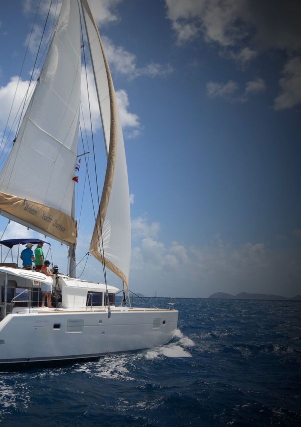
Table of Contents
Introduction                                                                        2
About High Point                                                                    3
Sailing Information                                                                 3
    Safety                                                                           3
    2020 Fleet and Results Table                                                     4
    Skippers’ Briefings                                                              4
    Navigation                                                                       4
    Anchors / Spinnakers                                                             4
    Start Procedure                                                                  5
    Finishing Procedure                                                              5
    Time Correction Factors                                                          6
    Penalties and Protests                                                           6
    Position Coordinates                                                             6
    Buoyage                                                                          6
    VHF Radio                                                                        7
    Weather and Sea State                                                            8
    National Park Buoys and Flags                                                    8

Sponsors                                                                            8
    BVI GIN                                                                          8

Daily Schedule                                                                      9
    Saturday, 7th March - Scrub Island Marina                                        9
    Sunday, 8th March - Scrub Island Marina to Monkey Point - 13.6NM                 9
    Monday, 9th March - Monkey Point to Great Harbour (JVD) - 15.3 NM                9
    Tuesday, 10th March Jost van Dyke to Cane Garden Bay - 9.6 NM                   10
    Wednesday, 11th March - Cane Garden Bay to Soper’s Hole - 14.0 NM               10
    Thursday, 12th March – Soper’s Hole to Manchioneel Bay - 9.0 NM                 10
    Friday, 13th March - Manchioneel Bay to VGYH or Bitter End – 11.6 NM            11
    Saturday, 14th March - Return to Scrub Island                                   11

Local Information                                                                  12
    Road Town, Tortola                                                              12
    Scrub Island Marina, Scrub Island                                               13
    Monkey Point, Guana Island                                                      13
    Jost van Dyke (White Bay and Great Harbour)                                     13
    Cane Garden Bay                                                                 14
    Soper’s Hole                                                                    15
    Manchioneel Bay, Cooper Island                                                  15
    Virgin Gorda                                                                    15
    The Baths                                                                       16
    Virgin Gorda Yacht Harbour                                                      16
    Bitter End Yacht Club                                                           16

2019 Memories                                                                      17

HIGH POINT YACHTFEST 2020           BRITISH VIRGIN ISLANDS                 PAGE 1 OF 19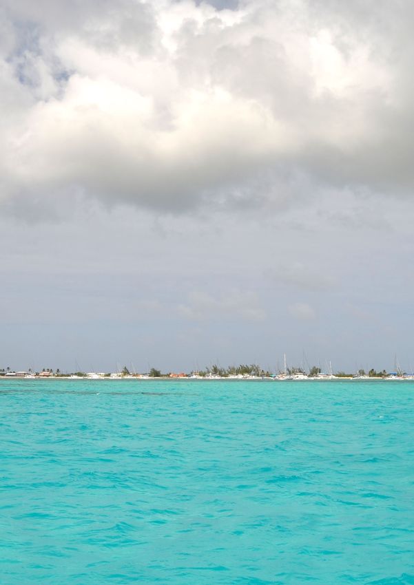
Introduction
Dear High Pointers,
Welcome to our second BVI event. It was fantastic to explore this beautiful area last year
and we had an amazing time. For 2020, we are planning a similar event and will revisit
some of last year’s destination as well as introducing some exciting new ones.
The route for 2020 will start and finish at the Scrub Island Marina and we will make
overnight stops at Monkey Bay on Guana Island, Great Harbour on Jost van Dyke, Cane
Garden Bay on Tortola, Soper’s Hole on Tortola, Manchioneel Bay on Cooper Island and
either Virgin Gorda Yacht Harbor or Bitter End Yacht Club on Virgin Gorda. As ever, we
will make time for some snorkelling and dining ashore as well as the Gourmet night in
Manchioneel Bay on Cooper Island.
We have yet to firm up the plans for Welcome and Prize-giving events and to fix the fleet
composition, but this first edition of the Log Book should give you a flavour of next year’s
High Point treat!
Sasha and I work together on this event, each covering different aspects. Sasha organises
the boats, the Welcome and Prize-giving evenings, sponsors, travel logistics and pretty
much everything else except the sailing and racing, which is my contribution. I will be
your Race Officer for the week, and look after the sailing aspects including preparing this
Log Book and managing the handicaps and results.
This Log Book is best used on a tablet so that you can click any page number in the Table
of Contents to go to that page or on links in this format to visit the associated website.

Bon voyage and best wishes, John & Sasha

HIGH POINT YACHTFEST 2020         BRITISH VIRGIN ISLANDS                        PAGE 2 OF 19
About High Point
Sasha and I had so enjoyed staging the 70 yacht regatta, Engineering Challenge Cup, in
Göcek, Turkey in 2007 that we started our own regatta series the very next year. Based
around the principles of courteous racing (to suit all levels of experience), affordability,
friendship and enjoying local culture, High Point YachtFest was born as a Mediterranean
event.
High Point YachtFest has now been staged in Göcek (2008, 2014, 2018), Trogir (2009, 2013,
2017), Sardinia (20010, 2011, 2016, 2019), Sicily (2012) and Athens (2015). 2019 was our 11th
anniversary and our 12th event.
2019 was our first venture to the Caribbean and our first using catamarans. It was a great
success and our target is to raise the bar even further in 2020. 2019 results were as below:

Sailing Information
Safety
This is our precious holiday and we are here to enjoy every second of it. An accident can
ruin it in an instant, so please put safety first at all times.
Please remember that each boat is entirely responsible for its own safety and nothing in
this document or anywhere else, reduces this responsibility.
It is for the boat to decide whether it is fit to sail in the conditions in which it will find
itself. By going to sea, the boat confirms that it is fit for these conditions and that its crew
is competent to sail in them.
We recommend that skippers give a safety briefing to their crews tailored to the skills and
experience on board. Consider reminding your crew about gas safety, MOB procedures,
IALA B buoyage scheme, boom awareness, winch operation and lifejacket allocation/
fitting. Everyone should know how to start the engine, lower the sails, use the emergency
steering, find Lat/Long coordinates and call a Mayday or Pan-Pan by VHF. Also it is
worth checking all personal VHF sets are set to use USA VHF channels (not the same as we
use in Europe).
Before leaving base, check you have the contact details for your Charter company and that
your crew know where to find them (without your help).
In case of a sailing emergency, use VHF CH16 to call Mayday or Pan-Pan, as applicable.
Inform us on VHF CH71 and your charter company at the first safe opportunity.

HIGH POINT YACHTFEST 2020           BRITISH VIRGIN ISLANDS                          PAGE 3 OF 19
You can call Police on 999 (or 911), Fire and Ambulance on 999 or Virgin Islands Search and
Rescue (VISAR) on 767.
Each participant should make sure the skipper is aware of any relevant medical conditions,
such as diabetes, epilepsy or heart condition. Prescription medicines are not easily
available during the week so we all need to bring what we need with us.
2020 Fleet and Results Table

Model      Team                             R1 R2 R3 R4 R5 R6 R7               Σ     -      =   Pos
           To follow

The table above lists the teams and can be filled in during the week to record the daily
results. All teams are sailing in Lagoon catamarans, either 42ft or 45 ft. The overall
ranking (“Pos”) is based on the sum of each team’s daily positions (“Σ”), minus the worst
result (“-“) (unless fewer than four races are completed). If there are tied overall positions,
the ranking is further refined by considering each team’s results in order of best to worst
until the tie is broken. If there is still a tie, it will be decided by the performance in the last
race.
Skippers’ Briefings
There will be a skippers’ briefing each morning at 9am to share coffee, the conditions
forecast, the day’s course, berthing arrangements and any planned events.
Skippers’ briefings are also your opportunity to give us feedback so we can maximise what
you like and minimise what you don’t. That applies as much to the courses as it does to
timing and how you want each day to be structured (lunch, swimming, sightseeing, etc.).
Navigation
Please don’t be tempted to navigate using any chartlets from this Log Book! The courses
shown are not (and are not intended to be) safe sailing routes - they are there to show what
has to be rounded and navigation is required between and around all course marks.
Beware of rocks near islands, headlands or anything else used as course marks. Also note
that today’s BVI charts are based on very old survey data, so keep an eye on your depth.
Anchors / Spinnakers
Anchors should be kept at the bows, ready for mooring. Handling an anchor on deck in a
swell is like standing on one leg blindfolded after several Painkiller cocktails. Spinnakers,
cruising chutes, jib poles and boat-hooks are not to be used for racing.

HIGH POINT YACHTFEST 2020            BRITISH VIRGIN ISLANDS                              PAGE 4 OF 19
Start Procedure
The race is started by each yacht in turn crossing on starboard close behind the Rabbit
sailing close-hauled on a steady port tack.
Windward
Each start will be followed by rounding an upwind
Mark
mark usually 1 or 2 NM upwind. Listen for
instructions on VHF and position yourself so that you
are no closer to the Rabbit than downwind of the
windward mark and at least 10 degrees upwind of the
Rabbit. At the time I announce the start, ideal
positions will be as marked “A” in the diagram. All
yachts’ elapsed times start when the first boat
crosses the Rabbit’s centreline (marked “B” in
the diagram). The fleet should approach Wind
the Rabbit on a close reach,
hardening up to close-hauled as C
they pass astern.
C B C
2nd star
B ter
1st starter
B A
A
A = Positions at start of Procedure
t
bi
ab
B = Elapsed time starts for all when the first boat starts
R
A C = Second boat makes his/her start
Engines may be used to get into a good position (but make sure all extra speed has gone
before actually starting).
Ideally the fastest catamaran will start first and the slowest last with ample boat lengths
between each. This will help to keep the starts clean, allowing each yacht plenty of space
to get a perfect start and to be able to put in an early tack if they wish. All boats must start
before the Rabbit tacks towards the windward mark and any boat that has not done so
must start by passing behind the Rabbit as soon as possible (on either tack) and will be
penalised one minute, plus further time if deemed to have gained an advantage by starting
late. It’s a harsh world!
Finishing Procedure
The finishing line will be a bearing to a conspicuous mark and, unless the Rabbit is there
taking finishing times, you must record your own finishing time (including seconds) using
an automatically time-synched device such as your mobile phone or GPS. You finish
HIGH POINT YACHTFEST 2020 BRITISH VIRGIN ISLANDS PAGE 5 OF 19when either bow crosses the line. You should use a handheld marine compass to get an accurate bearing to the finish mark. It may also be a good idea to put the coordinates of the finish mark into your GPS as a “go-to” position to see the bearing approaching the value specified in the course instructions. The time recorded should be based on the compass reading (not the GPS bearing, due to potential chart or datum errors). Please write down your boat name and finish time as well as the name and approximate finish times of the nearest boats crossing the line in front of and behind you and hand it to one of us on the Rabbit when convenient. Normally results will be based on declarations by WhatsApp or VHF but I may need to use the written papers to check. By default the time limit for each leg will be 18:00, except on Friday when it will be 17:00. Time Correction Factors TCFs are in accordance with the MOCRA Rating Rule which includes the formula: TCF = (RatedLength0.315 x RatedSailArea0.3546/RatedWeight0.3124). PF. AF. CMF. MCF. AA. HCF Using MOCRA certificates I have for similar boats, adjusted to reflect differences in the actual boat measurements and adjusted to include approximate crew weight (at 80kg/ head) and age of boat (excluding crew!). TCFs have then been factored so that, for the first race, the maximum TCF is 1.000. TCFs will be adjusted each day, based on the previous day’s performance (on the water!). I will use the World Sailing Empirical Handicap Scheme for Yachts, except that the first Performed Indicator (PI) multiplier will be 50% rather than the World Sailing’s 100% figure. The daily results sheet will show the new TCFs for the next day and the PI multipliers that will be applied each day. If you have any TCF queries, let me know in good time so they can be resolved before the first race. Penalties and Protests The normal penalties for breaking a rule will be a minute added to elapsed time for most infringements (including right-of-way rules) and disqualification for passing a course mark on the wrong side. If you have infringed a rule, please do the sporting thing and announce it on VHF fleet channel, thereby avoiding the need to be protested. Given the small fleet size, any protests should be resolved by the parties concerned. Position Coordinates Position coordinates are given in the format N dd° mm.mmm’ W dd° mm.mmm’ and use WGS 84 datum. Buoyage The BVI is an IALA B region. The only difference from IALA A (as used in Europe) is that the red and green colours (not shapes) of port and starboard hand marks are reversed as shown below. All other marks are the same in both systems. So, a Starboard Hand Mark (SHM) looks like this and Port Hand Mark (PHM) like this . HIGH POINT YACHTFEST 2020 BRITISH VIRGIN ISLANDS PAGE 6 OF 19
VHF Radio
In the BVI the VHF channels used are US channels, not European. The VHF equipment on
board will be correct, but if you bring your own VHF you will almost certainly need to re-
set the channel group from “International” to “USA”.
We will use these channels:-

Channel      Purpose

CH16         Emergency channel and calling channel to initiate communications (outside
             of High Point).
             Use to call marinas and they will let you know if they use a different one as
             most monitor CH16.
             CH16 also announces weather forecasts at 08:00, 14:00 and 22:00 daily, and
             tells you to switch to CH18 or CH85 to hear the forecast.
CH67         Virgin Islands Search & Rescue (working frequency following CH16 call).

CH71         High Point Working channel for all fleet communications. Please monitor
             this channel when under way or separated from the rest of the fleet.
CH72         Alternative High Point working channel for all fleet communications if
             CH71 is unavailable or over-crowded.

CH74         Scrub Island Marina
CH02         May be useful for weather but out of range beyond Virgin Gorda Island

On Sunday morning we will have our first and only planned VHF radio check. You can
always ask for another on the fleet instructions channel. Transmissions addressed to the

HIGH POINT YACHTFEST 2020          BRITISH VIRGIN ISLANDS                       PAGE 7 OF 19
race officer within 5 minutes of the day’s start may get poor response - multi-tasking is not my forte! Weather and Sea State The BVI weather in March brings trade winds of 15-20 knots from the east every day. Average daytime temperatures are 25° to 28°, 21° at night and a gorgeous 26° in the sea. There are occasional brief rain showers and an average of 9 hours of sunshine per day. You can ignore tidal range as it is less than 0.5m. Current is minimal but swell can sometimes be an issue on northern shores. These internet weather websites provide a range of useful information:- Windfinder, NOAA, Windguru, BVI Tourism, Weather City, Sailonline, Weather Atlas National Park Buoys and Flags In the national Parks, mooring buoys are colour-coded - Red = Snorkelling and day use, Yellow = Commercial and dive boats, Blue = Dinghies only. The flag meanings are Yellow = Caution, Red = Danger and Purple = Jelly Fish. Sponsors BVI GIN You will remember the opening evening in 2019 atop the roller-coaster ride at the Gin distillery. We are delighted that BVI GIN will be sponsoring again…..more on this to follow in subsequent Log Book updates…… HIGH POINT YACHTFEST 2020 BRITISH VIRGIN ISLANDS PAGE 8 OF 19
Daily Schedule
Saturday, 7th March - Scrub Island Marina
Arrangements for arrival, boat provisioning, check-in and the Welcome Party will follow
in later versions of this Log Book as they are put in place.
The daily courses below will be provided in more detail in the final version of this log book
and are shown here so that you can get a taste for the route overall.
Sunday, 8th March - Scrub Island Marina to Monkey Point - 13.6NM

Monkey
point                            Scrub Island Marina

Monday, 9th March - Monkey Point to Great Harbour (JVD) - 15.3 NM

                                                                      Monkey point

  Great
  Harbour

HIGH POINT YACHTFEST 2020         BRITISH VIRGIN ISLANDS                        PAGE 9 OF 19
Tuesday, 10th March Jost van Dyke to Cane Garden Bay - 9.6 NM
Great Cane
Harbour Garden
Bay
Wednesday, 11th March - Cane Garden Bay to Soper’s Hole - 14.0 NM
Cane
Garden
Bay
Soper’s Hole
Thursday, 12th March – Soper’s Hole to Manchioneel Bay - 9.0 NM
An upwind day before enjoying Gourmet night in Manchioneel Bay, facing the sunset.
Manchioneel
Bay
Soper’s
Hole
HIGH POINT YACHTFEST 2020 BRITISH VIRGIN ISLANDS PAGE 10 OF 19Friday, 13th March - Manchioneel Bay to VGYH or Bitter End – 11.6 NM
Prize-giving evening will be at a restaurant near Virgin Gorda Yacht Harbour or at the
Bitter End Yacht Club. Arrangements will be published nearer the time.
Bitter End Yacht
Club
Virgin Gorda
Yacht Harbor
Manchioneel
Bay
Saturday, 14th March - Return to Scrub Island
Leave at 08:00 am for 09:00 arrival to Scrub Island Marina for checkout.
HIGH POINT YACHTFEST 2020 BRITISH VIRGIN ISLANDS PAGE 11 OF 19Local Information Road Town, Tortola Tortola's main town, Road Town (N 18° 25.364’ W 64° 36.896’), is the former haunt of pirates, the Dutch and the English. Within reach of numerous attractions, it is the place to be if you have time before or after High Point week. It is also the best place to shop for the week’s provisions as it has proper supermarkets with the best prices. From there you can take a taxi to Trellis Bay (N 18° 26.753’ W 64° 32.076’) near the airport and it’s a five minute water taxi ride to our base, Scrub Island Marina (N 18° 27.984’ W 64° 31.450’). Click on the links below to decide which of these great attractions to visit: JR O’Neal Botanic Gardens, Sunny Caribbee Spice Shop, 1780 Lower Estate Sugar Works Museum, Pusser’s Pub, Tortola Pier Park and so many others at Lonely Planet. HIGH POINT YACHTFEST 2020 BRITISH VIRGIN ISLANDS PAGE 12 OF 19
Scrub Island Marina, Scrub Island
Scrub Island Marina (N 18° 27.984’ W 64° 31.450’) is our start and
finish point. It is an attractive resort with all the usual marina
facilities and you can also restock provisions here. It is not far to
some wonderful snorkelling, although that seems to be the case
wherever you are in the BVI.
The Scrub Island Marina website says “Naturally, being located in
the sailing capital of the world means Scrub Island’s own marina
is a jewel in the sparkling Caribbean Sea, illuminated by the sun,
the moon and the stars above… and glittery lights below” and
“Centrally located at the heart of the resort, the Scrub Island
Marina is in the midst of all the restaurants and shops in Marina
Village—featuring Cardamom & Co, Donovan’s Reef, Antilia
Boutique, the Fitness Center, Dive BVI, Offshore Sailing School,
Gourmet Market & Café and our Marina Showers—and provides
a scenic vista from almost anywhere around the resort.”
Monkey Point, Guana Island
Monkey Point is at the southern tip of Guana Island. Here
we will pick up National Park mooring buoys (orange with
yellow floating line) on the western side at N 18° 27.919’ W
64° 34.300’. Anchoring is not allowed but there should be
enough balls for us. This is a snorkelling paradise and one
of the best sites in the BVI for swimming in shoals of
colourful fish. We can also use the beach which is
beautiful. The island is private so we are not allowed to go
inland of the beach. If there is too much swell, we may
have to overnight back at the Scrub Island Marina.
Jost van Dyke (White Bay and Great Harbour)
Jost Van Dyke Island, lies 4 miles (6 km) west of Tortola and adjoins Little Jost Van Dyke
Island on the east. According to tradition, it was named after a Dutch pirate who lived on
the island. Jost Van Dyke Island is roughly tadpole-shaped and the terrain is rugged and
elevated, reaching 1,054 feet (321 metres). The chief settlement is Great Harbour, on the
southern coast. Probably
discovered and settled by
the Dutch, the island was
British after 1672. Tourism
is important to the
economy. Area 3.5 square
miles (9 square km). Pop.
(2001) 244; (2010) 298.

HIGH POINT YACHTFEST 2020          BRITISH VIRGIN ISLANDS                     PAGE 13 OF 19
White Bay
There’s the funky Ivan's No Stress Bar
located in the middle of the eastern beach
(N 18° 26.586’ W 64° 45.636’). Seashell-
covered walls, open atmosphere, and a cash
jar on the bar to pay for drinks makes this
place truly stress-free. Not sure if they have
food. Another equally fun joint is the Soggy
Dollar Bar on the western beach. This is the
somewhat contested home of the notorious
"Painkiller" cocktail, and the bar gets its
name from sailors swimming in to partake,
paying with wet currency. If Seddy is in at
his One Love bar at the far western end of
the beach, we could try to coax him into a
magic show. Apparently this guy is unreal
and you will fall off your bar stool in
astonishment. Equal parts entertainment and sheer dumbfoundedness. Just like the fine
cocktails you can find all along the beach here.
White Bay is not considered by the charter company as acceptable for overnight due to
swell so we will overnight in Great Harbour and take a taxi to White Bay.
Great Harbour
In recent years, Great Harbour (N 18° 26.551’ W 64° 45.103’) has been growing in leaps and
bounds. However, some things never change and Jost Van Dyke is still a world apart from
all the other British Virgin Islands.
Aside from all the bars and restaurants here, there are also a couple of grocery stores, a
bakery, an ice house, a few gift shops a beach volleyball court and of course famous Foxy’s
(N 18° 26.664’ W 64° 44.920’) which is highly recommended and was our dinner venue in
2019.
Tucked in behind the main strip, Bun Road is to the right and beside Customs &
Immigration centrally located along the beach. If you’re after some bread and groceries,
this little road will take you directly to Nature's Basket Grocery Store and Christine's
Bakery.
Cane Garden Bay
Cane Garden Bay is a gorgeous sheltered
bay where we can pick up balls or anchor at
N 18° 25.651’ W 64° 39.542’. It’s just 5km NE
of Long Bay where Franz and Henriette got
married in 2009! As well as strolling
barefoot along the beach, floating in the
water or soaking up the vibe while enjoying

HIGH POINT YACHTFEST 2020         BRITISH VIRGIN ISLANDS                      PAGE 14 OF 19
a cocktail in a beach bar, we will probably also be blessed with a gorgeous sunset to cap it
all.
Follow this link for lots more information.
Soper’s Hole
Near the western tip of Tortola,
Soper’s Hole is a delightful cove in
the shadow of lush green mountains
with an idyllic tropical feel. There
are plenty of shops, markets and
restaurants ashore as well as
numerous marina options, the most
comprehensive being Soper’s Hole
Marina. We can anchor just north of
the marina at N 18° 23.227’ W 64°
42.130’. Take care with current in the
cove - it can be quite strong,
apparently.
Maybe we can dine at the Jolly Roger Inn or have a night on the town with live reggae or
rock from local and imported bands. Pusser’s Landing (N 18° 23.089 W 64° 42.096’) is also
an option if you like waterside dining, live entertainment and an outdoor bar. There are
many other enticing possibilities - have a look here.
Manchioneel Bay, Cooper Island
Another fabulous destination! Easy to
moor (pick up balls at N 18° 22.995’ W
64° 30.886’), great beach, superb
snorkelling and a lively beach club
bar and restaurant (bookable by VHF
on CH16). Bar tables in the sea too!
There’s also a souvenir shop for the
must-have Cooper Island T-shirts for
loved ones back home. Another great spot to
watch the sunset, Painkiller in hand!
Virgin Gorda
The dramatic shape of the BVI’s third largest
island, Virgin Gorda, reminded Christopher
Columbus of a reclining woman, or “Fat
Virgin,” inspiring its name. Measuring 8 ½
square miles, Virgin Gorda entices travellers
with its yacht clubs, quiet coves, safe
anchorages and luxury resorts and villas.

HIGH POINT YACHTFEST 2020         BRITISH VIRGIN ISLANDS                       PAGE 15 OF 19
The Baths
The Baths at N 18° 25.733’ W 64° 26.746’ is a major attraction, where you can explore the
rock formations tunnels, pools, and caves. They are as pristine as ever, including the
famous pathway leading through the giant boulders to Devil’s Bay. Top of the Baths
Restaurant is open with its delightful panoramic views. If we opt to overnight at or near
Virgin Gorda Yacht Harbour, we can visit. If we go to Bitter End it will not be possible.
Virgin Gorda Yacht Harbour
The nearby Virgin Gorda Yacht Harbour (N
18° 26.971’ W 64° 26.241’) offers Wi-Fi, fuel,
water and ice and could be an option for us.
We may take a mooring ball outside the
harbour and dinghy in. The grocery store is
a short walk, and there are also some
restaurants open nearby that can be accessed
by dinghy or taxi, including the all new
Snapper's Bar & Grill, and CocoMaya which
is where we had our Prize-giving in 2019.
Bitter End Yacht Club
The other possibility we can consider is to go
through the narrow passage south of
Mosquito Island, across Leverick Bay and
visit Bitter End Yacht Club in the east part.
The remoteness makes this an idyllic location
and the origin of its name. Utterly
devestated by Irma, renovation is still
underway and progress will be checked
nearer our dates to compare to the Virgin
Gorda Yacht Harbour option.

HIGH POINT YACHTFEST 2020         BRITISH VIRGIN ISLANDS                      PAGE 16 OF 19
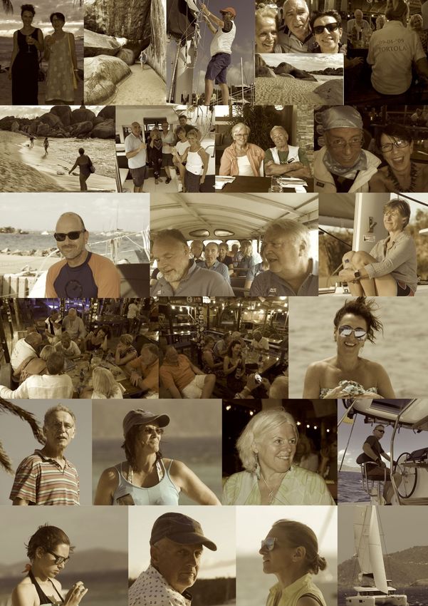
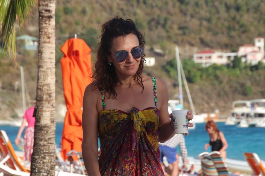
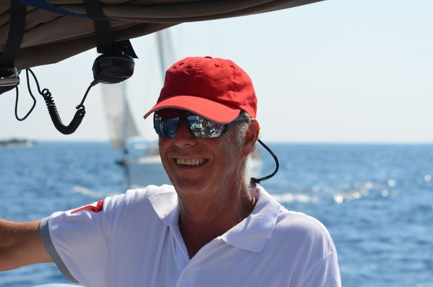
2019 Memories

HIGH POINT YACHTFEST 2020   BRITISH VIRGIN ISLANDS   PAGE 17 OF 19
HIGH POINT YACHTFEST 2020 BRITISH VIRGIN ISLANDS PAGE 18 OF 19
HIGH POINT YACHTFEST 2020 BRITISH VIRGIN ISLANDS PAGE 19 OF 19
You can also read